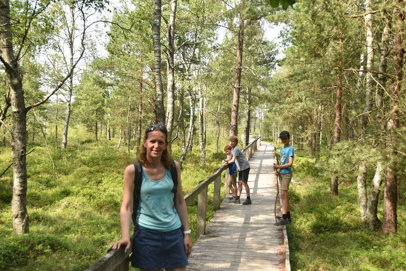
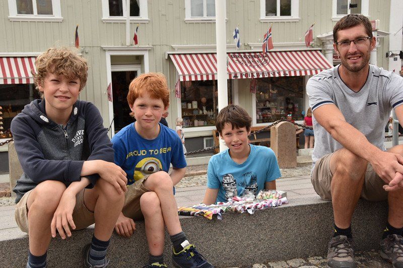
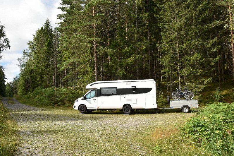
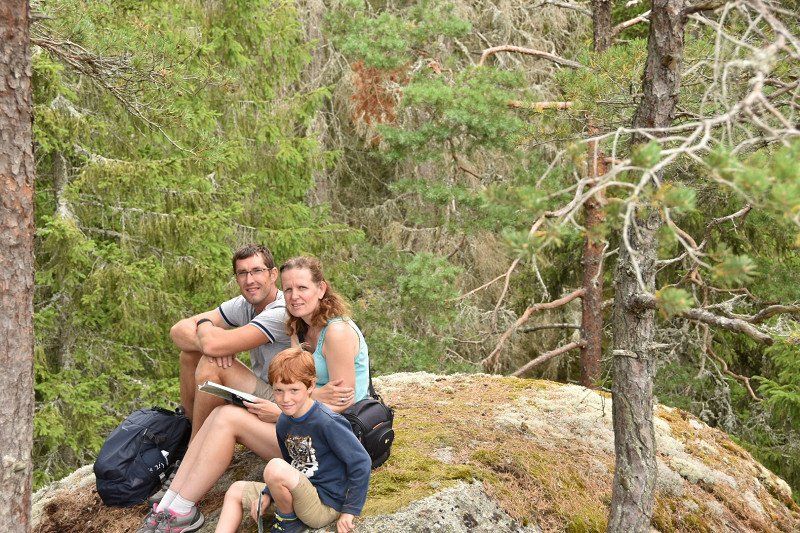
On the way through Sweden with 3 kids. 7,10 and 13 years.
Really amazing
The tour will be adapted to what we have done and what not.
Day
Pittem, België
8740 Pittem, België
50° 59' 35.3" N 3° 15' 59.5" E
50.9931453 3.2665389
• Head toward Verbieststraat on Tieltstraat (N35). Go for 894 m.
• Continue on Vijfstraat (N35). Go for 116 m.
• Turn left onto Ringlaan R. Depaepe (N37). Go for 4.6 km.
• Turn left onto Ruiseleedsesteenweg (N37) toward E40/Ruiselede/Industriezone Tielt-Noord. Go for 11.3 km.
• Take the 3rd exit from roundabout onto E40 toward Gent. Go for 20.9 km.
• Take the exit toward Antwerpen onto E17. Go for 52.6 km.
• Continue on E34 (Ring Antwerpen 2). Go for 8.6 km.
• Continue on E19 (Ring Antwerpen 2) toward Ring 2/Breda/Haven. Go for 41.0 km.
• Continue on A16. Go for 4.1 km.
• Take the exit toward E312/Tilburg/Utrecht/Breda-Oost onto A58. Go for 7.1 km.
• Take the exit toward Amsterdam/Utrecht/Oosterhout/Breda onto A27. Go for 57.6 km.
• Take exit 27 toward Hagestein/Vianen. Go for 610 m.
• Take the 1st exit from roundabout onto Hagenweg toward Centrum/Hagestein. Go for 195 m.
• Keep right toward Hagestein/Centrum/Industrieterrein Gaasperwaard/Industrieterrein De Biezen/Industrieterrein De Hagen. Go for 30 m.
• Take the 2nd exit from roundabout onto Hagenweg toward Centrum/Hagestein/Industrieterrein De Biezen/Industrieterrein Gaasperwaard. Go for 432 m.
• Arrive at Hagenweg.
☍
210,2 km
(2 hrs. 9 min.)
Vianen, Nederland
51° 59' 25" N 5° 6' 10.9" E
51.9902756 5.1030332
• Head toward Willem van Duvenvoordestraat on Hagenweg. Go for 2 m.
• Turn left onto Stuartweg toward Industrieterrein Gaasperwaard/Bedrijventerrein de Hagen/Industrieterrein de Biezen/Hagestein/Everdingen. Go for 130 m.
• Turn left toward Hagenweg. Go for 303 m.
• Turn right onto Hagenweg. Go for 200 m.
• Keep right toward Utrecht/A27. Go for 39 m.
• Take the 2nd exit from roundabout onto Hagenweg toward Utrecht/A27. Go for 214 m.
• Keep right toward Utrecht. Go for 31 m.
• Take the 3rd exit from roundabout onto A27 toward Utrecht. Go for 10.5 km.
• Keep right onto E30 (Knooppunt Rijnsweerd) toward Groningen/Hengelo/Amersfoort/Utrecht-de Uithof/A28. Go for 2.5 km.
• Continue on A28. Go for 20.4 km.
• Take the exit toward Apeldoorn/Hengelo onto A1. Go for 91.7 km.
• Take the exit toward Osnabrück/Enschede/Hengelo onto A1/A35. Go for 3.9 km.
• Continue on A1 toward Osnabrück/Hengelo/Borne. Go for 23.4 km.
• Continue on A30. Go for 64.0 km.
• Take exit 14 toward Bremen/Osnabrück-Hafen onto A1 (Hansalinie). Go for 202 km.
• Take exit 43 toward Flensburg/Kiel/Hamburg-West/Tötensen/Flughafen onto A261 (Buchholzer Dreieck). Go for 10.3 km.
• Continue on A7. Go for 11.6 km.
• Keep left onto A7. Go for 159 km.
• Continue on E45 (Sønderjyske Motorvej). Go for 15.4 km.
• Take the exit toward Tønder/Rømø/Ribe/Kliplev. Go for 461 m.
• Turn left onto Bjerndrupvej (8/175/179/481). Go for 1.5 km.
• Take the 1st exit from roundabout onto Hellevad-Bovvej (175/179) toward Rømø/Ribe. Go for 4.8 km.
• Take the 2nd exit from roundabout onto Hellevad-Bovvej (175/179) toward Rømø/Ribe. Go for 3.8 km.
• Pass 5 roundabouts and continue on Bovvej (175/179). Go for 25.6 km.
• Take the 3rd exit from roundabout onto Ribevej (179/449) toward Ribe/Gram. Go for 3.3 km.
• Continue on Ribevej (179). Go for 6.3 km.
• Take the 2nd exit from roundabout onto Skærbækvej (179). Go for 14.6 km.
• Turn left onto Haderslevvej (24). Go for 2.2 km.
• Take the 1st exit from roundabout onto Haulundvej toward Ribe. Go for 138 m.
• Take the 1st exit from roundabout onto Haulundvej. Go for 241 m.
• Continue on Hundegade. Go for 263 m.
• Continue on Brorsonsvej. Go for 194 m.
• Continue on Kurveholmen. Go for 243 m.
• Turn right onto Dagmarsgade. Go for 156 m.
• Take the 2nd exit from roundabout onto Rosen Alle. Go for 98 m.
• Turn right onto Tangevej. Go for 417 m.
• Turn right onto Bøge Alle. Go for 175 m.
• Turn right onto Bøge Alle. Go for 99 m.
• Turn right onto Kastanie Alle. Go for 54 m.
• Arrive at Kastanie Alle. Your destination is on the left.
☍
680,4 km
(6 hrs. 33 min.)
Day
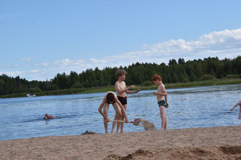
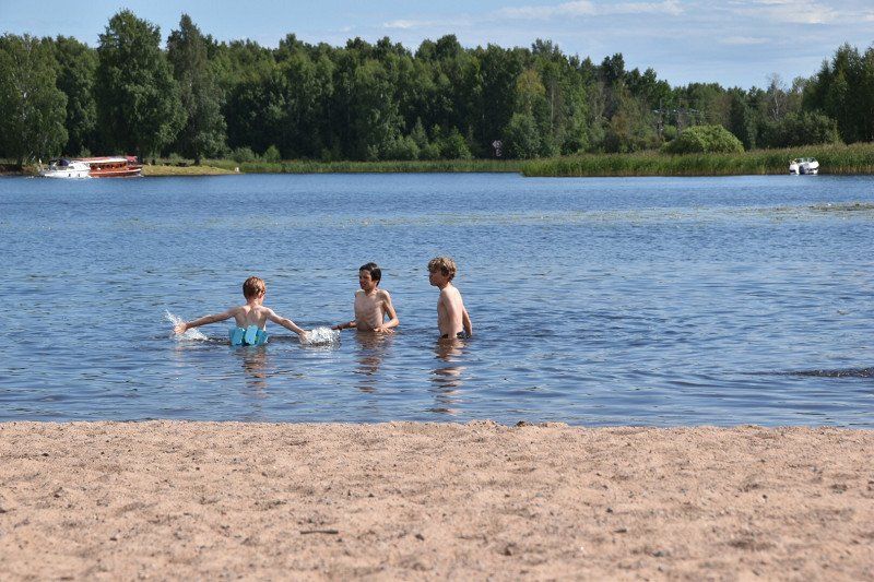
Ribe, Denemarken
6760 Ribe, Denemarken
55° 19' 37" N 8° 46' 28.8" E
55.3269360 8.7746650
• Head toward Bøge Alle on Kastanie Alle. Go for 229 m.
• Turn right onto Kastanie Alle. Go for 112 m.
• Turn right onto Kastanie Alle. Go for 175 m.
• Turn left onto Tangevej. Go for 133 m.
• Turn right onto Rosen Alle. Go for 249 m.
• Turn right toward Rosen Alle. Go for 50 m.
• Turn left onto Rosen Alle. Go for 36 m.
• Arrive at Rosen Alle. Your destination is on the right.
☍
1,0 km
( 3 min.)
Gratis overnachten
found through camp4nicht
Seminarievej 16
55° 19' 50.5" N 8° 46' 17.8" E
55.3307024 8.7716025
• Head south on Rosen Alle. Go for 36 m.
• Turn right toward Rosen Alle. Go for 50 m.
• Turn left onto Rosen Alle. Go for 249 m.
• Turn left onto Tangevej. Go for 417 m.
• Turn right onto Bøge Alle. Go for 175 m.
• Turn right onto Bøge Alle. Go for 99 m.
• Turn right onto Kastanie Alle. Go for 54 m.
• Arrive at Kastanie Alle. Your destination is on the left.
☍
1,1 km
( 2 min.)
Day
Ribe, Denemarken
there is a walk with the night watchman, in Danish and English. Makes stops, narrates, sings and shouts verses of the watchman's song on the route. It starts at 8 pm at the cathedral at the front door of Weiss Stue at hotel Dagmar. takes about an hour
www.vadehavskysten.dk/ribe-esb...
6760 Ribe, Denemarken
55° 19' 37" N 8° 46' 28.8" E
55.3269360 8.7746650
• Head toward Bøge Alle on Kastanie Alle. Go for 229 m.
• Turn right onto Kastanie Alle. Go for 112 m.
• Turn right onto Kastanie Alle. Go for 175 m.
• Turn left onto Tangevej. Go for 133 m.
• Turn right onto Rosen Alle. Go for 330 m.
• Continue on Nørremarksvej. Go for 151 m.
• Take the 3rd exit from roundabout onto Plantagevej. Go for 319 m.
• Keep right toward Varde/Esbjerg. Go for 238 m.
• Continue on Ringvejen (11/24). Go for 1.9 km.
• Take the 1st exit from roundabout onto Koldingvej (32) toward Kolding. Go for 232 m.
• Take the 3rd exit from roundabout onto Koldingvej (32) toward Kolding. Go for 7.9 km.
• Turn left onto Villebølvej (425) toward Lufthavn Billund/Grindsted/Holsted. Go for 6.1 km.
• Turn left onto Ribevej (425). Go for 8.0 km.
• Turn left onto Overgade (425). Go for 246 m.
• Turn right onto Bindeleddet (425). Go for 114 m.
• Turn left onto Esbjergvej (191/425). Go for 1.2 km.
• Take the 1st exit from roundabout onto Grindstedvej (425). Go for 1.1 km.
• Take the 2nd exit from roundabout onto Grindstedvej (425) toward Grindsted/Billund/Lufthavn. Go for 473 m.
• Take the 3rd exit from roundabout onto Grindstedvej (425). Go for 20.7 km.
• Turn right onto Bredgade (469). Go for 1.2 km.
• Turn left onto Billundvej (425). Go for 4.8 km.
• Continue on Hejnsvigvej (425). Go for 3.2 km.
• Take the 2nd exit from roundabout onto Grindstedvej. Go for 901 m.
• Take the 3rd exit from roundabout onto Granvej. Go for 450 m.
• Turn right onto Solsortvej. Go for 592 m.
• Continue on Hans Jensensvej. Go for 140 m.
• Turn left onto Åstvej. Go for 409 m.
• Turn left onto Åstvej. Go for 129 m.
• Turn right onto Åstvej. Go for 220 m.
• Arrive at Åstvej.
☍
61,8 km
( 57 min.)
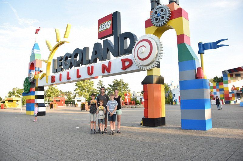
Day
LEGOLAND, Nordmarksvej, Billund, Denemarken
full day Legoland
Nordmarksvej 9, 7190 Billund, Denemarken
55° 44' 7.8" N 9° 7' 36.5" E
55.7355109 9.1268046
• Head southwest on Åstvej. Go for 220 m.
• Turn left onto Åstvej. Go for 129 m.
• Turn left onto Åstvej. Go for 650 m.
• Turn right onto Nordmarksvej. Go for 943 m.
• Take the 3rd exit from roundabout onto Vejlevej. Go for 1.7 km.
• Continue on Grindstedvej. Go for 2.9 km.
• Take the 2nd exit from roundabout onto Grindstedvej. Go for 1.2 km.
• Take the 2nd exit from roundabout onto Vandelvej (28) toward Vejle. Go for 10.2 km.
• Take the 2nd exit from roundabout onto Bredstenvej (28). Go for 6.4 km.
• Turn right onto Buldalen. Go for 224 m.
• Turn slightly right. Go for 61 m.
• Arrive at your destination on the left.
☍
24,6 km
( 21 min.)
Gratis overnachten
Found through camp 4 cousin
Buldalen
55° 42' 24.1" N 9° 28' 22.2" E
55.7067050 9.4728328
• Head toward Buldalen. Go for 61 m.
• Turn slightly left onto Buldalen. Go for 224 m.
• Turn right onto Motortrafikvejen-Bredsten (28). Go for 1.6 km.
• Turn right toward Motortrafikvejen-Bredsten/28. Go for 292 m.
• Continue on Motortrafikvejen-Bredsten (28). Go for 5.2 km.
• Turn right and take ramp onto E45 (Østjyske Motorvej) toward Kolding/E20/Odense/Fredericia. Go for 9.2 km.
• Keep left onto E20 (Skærup) toward Odense/Fredericia. Go for 210 km.
• Continue on E20 (Avedøre) toward Malmø/Lufthavn/København C. Go for 8.0 km.
• Take exit 20 toward København C/O2. Go for 2.2 km.
• Keep left toward Centrum/O2. Go for 158 m.
• Continue on Centrumforbindelsen. Go for 1.3 km.
• Continue on Sydhavnsgade. Go for 507 m.
• Keep right onto Scandiagade toward Centrum/O2. Go for 363 m.
• Continue on Vasbygade (O2) toward Centrum. Go for 2.6 km.
• Turn left onto Bernstorffsgade toward Centrum. Go for 471 m.
• Turn right onto Tietgensgade. Go for 359 m.
• Turn left onto H. C. Andersens Boulevard. Go for 383 m.
• Arrive at Rådhuspladsen. Your destination is on the right.
☍
242,5 km
(2 hrs. 22 min.)
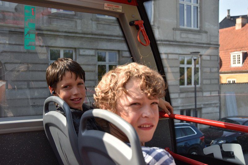
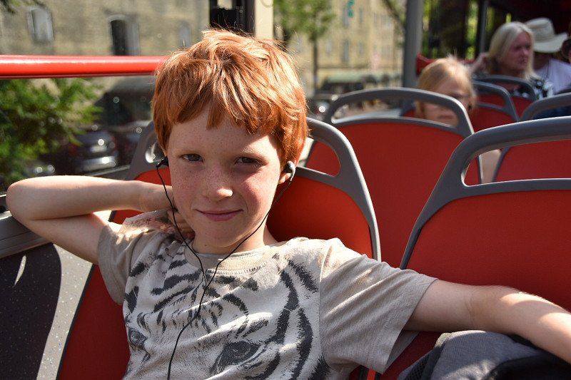
Day
Bus + boot
Hop on hop or bus + boat
79 euros for 2 adults + 3 kids
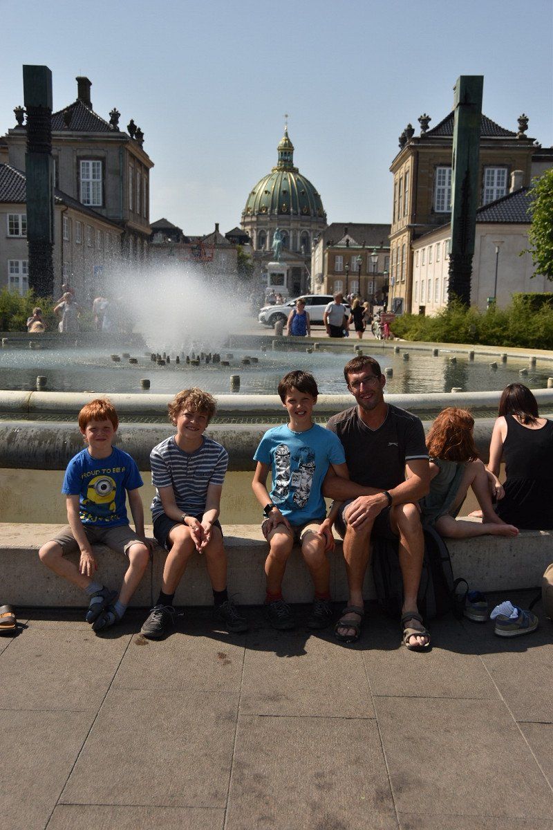
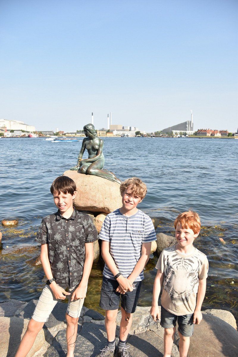
Kopenhagen, Denemarken
The capital of Denmark has a lot to offer. Copenhagen is the largest city in the country and is full of sights. The port city is best known for its colorful harbor buildings, static palaces, green parks and interesting museums. In Copenhagen, history and modernity go hand in hand. We have put together a list for you with the most beautiful sights in Copenhagen, so you don't miss anything during your visit!
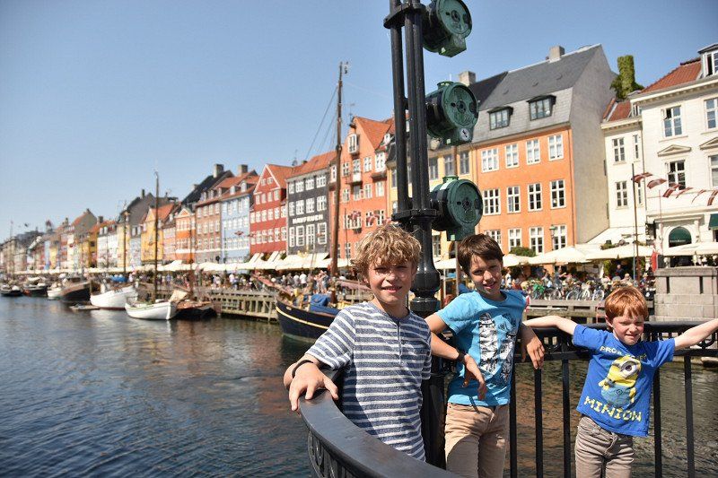
1. The colorful houses of Nyhavn
2. Tivoli Park
3. The image of the Little Mermaid
4. Kastellet, the old citadel
5.Churchill Park
6. The Amalienborg palace complex
7. The old Rosenborg Palace
8. Christiansborg and the Danish Parliament
9. The garden of the Royal Library
10. The National History Museum at Frederiksborg Palace
11. Botanical Have
12. The Special Rundetårn
13. The Strøget shopping area
14. The National Museum
15. The hippie district of Christiania
16. Vor Frelsers Kirke
17. Visit Carlsberg Brewery
18. The Cemetery Assistens Kirkegård
19. Street food at its best in Reffen
20. Dyrehavsbakken, the oldest amusement park in Europe
21. Hans Christian Andersen Fairytale House
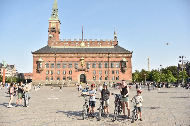
22. Copenhagen City Hall
23. Circle Brown (The Circle Bridge)
24. Ny Carlsberg Glyptotek
25.Copenhagen Opera House
26. Food & Drink in Copenhagen
27. Cycling in Copenhagen
link: 26 x sights in Copenhagen: What to visit? Info & tips (reisroutes.be)
55° 40' 33.9" N 12° 34' 6" E
55.6760968 12.5683371
• Head toward Studiestræde on Rådhuspladsen. Go for 329 m.
• Make a U-Turn at Jarmers Plads onto H. C. Andersens Boulevard. Go for 1.0 km.
• Turn right onto Rysensteensgade toward Lufthavn/E20/O2/21/Bella Center. Go for 72 m.
• Turn left onto Puggaardsgade toward 21/O2/Lufthavn/E20/Bella Center. Go for 139 m.
• Turn right onto Kalvebod Brygge (O2). Go for 3.0 km.
• Turn right onto Sydhavns Plads (O2) toward 16/19/21. Go for 1.5 km.
• Turn left onto Spontinisvej. Go for 502 m.
• Turn right onto Hammelstrupvej. Go for 106 m.
• Turn slightly right onto Hammelstrupvej. Go for 220 m.
• Arrive at Hammelstrupvej. Your destination is on the left.
☍
6,8 km
( 11 min.)
Gratis overnachten
Found through camp 4 cousin
Hammelstrupvej 41, 2450 København, Denemarken
55° 38' 40.9" N 12° 31' 11.1" E
55.6446974 12.5197601
• Head east on Hammelstrupvej. Go for 598 m.
• Turn slightly right onto Mozartsvej. Go for 108 m.
• Turn left onto Sjælør Boulevard. Go for 197 m.
• Turn left onto Sjælør Boulevard. Go for 53 m.
• Turn right onto O2. Go for 998 m.
• Turn left onto Vasbygade (O2) toward Centrum. Go for 2.6 km.
• Turn left onto Bernstorffsgade toward Centrum. Go for 471 m.
• Turn right onto Tietgensgade. Go for 359 m.
• Turn left onto H. C. Andersens Boulevard. Go for 383 m.
• Arrive at Rådhuspladsen. Your destination is on the right.
☍
5,8 km
( 10 min.)
Day
Kopenhagen, Denemarken
55° 40' 33.9" N 12° 34' 6" E
55.6760968 12.5683371
• Head toward Studiestræde on Rådhuspladsen. Go for 329 m.
• Make a U-Turn at Jarmers Plads onto H. C. Andersens Boulevard. Go for 1.2 km.
• Continue on Langebro. Go for 259 m.
• Continue on Amager Boulevard. Go for 982 m.
• Turn right onto Amagerfælledvej toward Lufthavn/Kastrup/E20. Go for 1.3 km.
• Continue on Røde Mellemvej. Go for 1.4 km.
• Turn left onto Vejlands Allé toward Malmø/E20/Lufthavn/Kastrup. Go for 444 m.
• Turn right onto Englandsvej toward Malmø/E20/Lufthavn Kastrup. Go for 1.0 km.
• Turn right onto Englandsvej. Go for 380 m.
• Turn left and take ramp onto E20 (Øresundsmotorvejen) toward Malmø/Lufthavn. Go for 14.9 km.
• Continue on E20 (Öresundsbron). Go for 9.8 km.
• Take the exit toward Malmö V/Limhamn. Go for 760 m.
• Continue on Lorensborgsgatan. Go for 387 m.
• Take the 3rd exit from roundabout onto Gottorpsvägen toward Bunkeflostrand/Ollebo. Go for 637 m.
• Pass 3 roundabouts and continue on Gottorpsvägen. Go for 1.9 km.
• Take the 1st exit from roundabout onto Klagshamnsvägen. Go for 1.3 km.
• Turn left onto Utsiktsvägen. Go for 1.6 km.
• Arrive at Utsiktsvägen. Your destination is on the right.
☍
38,5 km
( 38 min.)
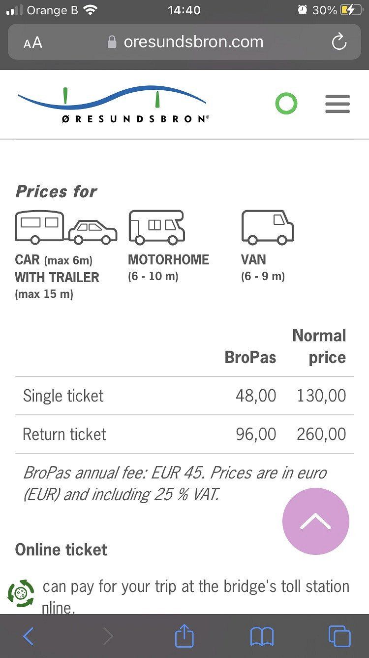
Brug Denemarken Zweden
motorhome with trailer
Bro only 43.36 euros
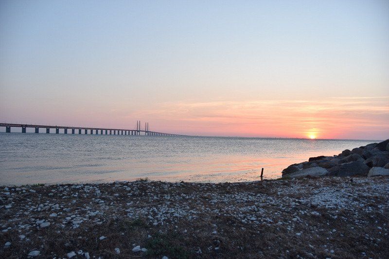
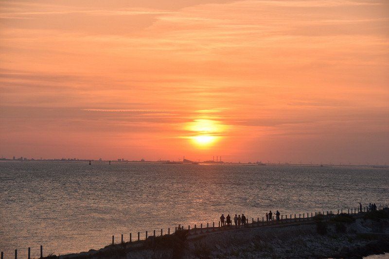
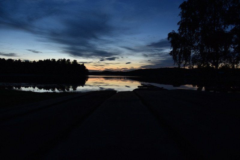
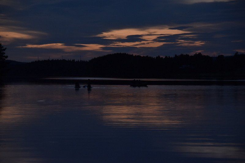
uitkijkpunt op brug + gratis overnachten
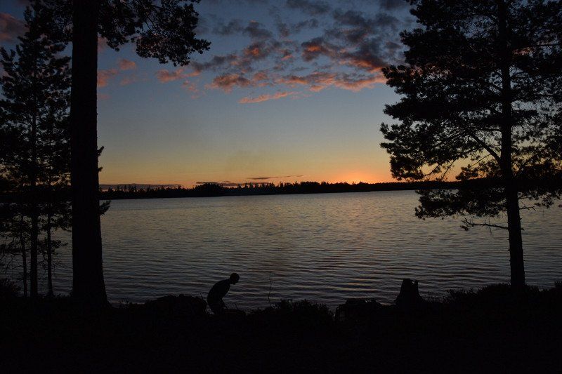
Nice view of bridge and nice sunset
Utsiktsvägen 10, 216 30 Limhamn, Zweden
55° 34' 12.3" N 12° 53' 52.6" E
55.5700707 12.8979509
• Head southwest on Utsiktsvägen. Go for 9 m.
• Turn slightly right onto Utsiktsvägen. Go for 1.6 km.
• Turn right onto Kalkbrottsgatan. Go for 1.3 km.
• Take the 2nd exit from roundabout onto Gottorpsvägen. Go for 663 m.
• Take the 2nd exit from roundabout onto Gottorpsvägen. Go for 631 m.
• Pass 2 roundabouts and continue on Gottorpsvägen. Go for 1.1 km.
• Take the 1st exit from roundabout onto Lorensborgsgatan toward E6/E20/E22/E65. Go for 636 m.
• Take ramp onto E20 (Yttre Ringvägen). Go for 18.2 km.
• Take exit 18 toward Kalmar/Lund onto E22. Go for 20.2 km.
• Take exit 23 toward Eslöv. Go for 469 m.
• Take the 3rd exit from roundabout onto 113 toward Eslöv. Go for 8.3 km.
• Take the 2nd exit from roundabout onto 17/113 toward Landskrona/Svalöv/Röstånga. Go for 2.1 km.
• Take the 1st exit from roundabout onto 113 toward Röstånga. Go for 10.9 km.
• Turn left onto Hasslebro (13). Go for 4.7 km.
• Take the 2nd exit from roundabout onto Röstångavägen (13). Go for 10.4 km.
• Arrive at 13/108. Your destination is on the left.
☍
81,3 km
(1 hrs. 3 min.)
Landschap Skåne
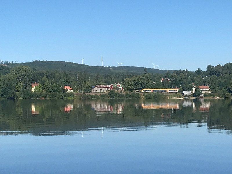
Skåne – a coastal region with a rich history
The Skåne region in the south of Sweden has it all: beautiful nature, golden beaches, a fascinating history and a vibrant city life thanks to Malmö, Sweden's third largest city.
Is a so-called landscape in the extreme south of the southern Swedish part of Götaland. Geographically, it coincides almost entirely with the province of Skåne län. The landscape borders the Halland and Småland landscapes in the north and the Blekinge landscape and the Baltic Sea in the east.
https://visitsweden.nl/bestemm...
https://www.bijzonderplekje.nl...
Day
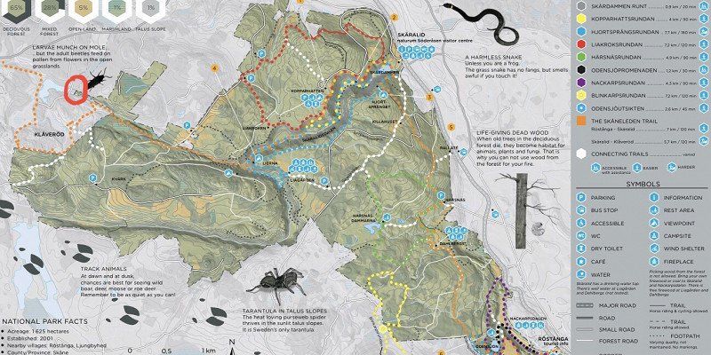
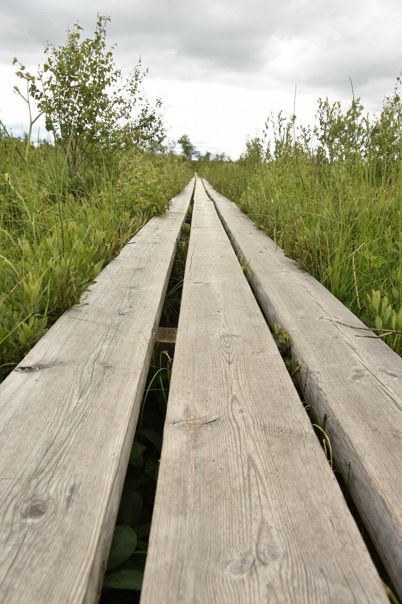
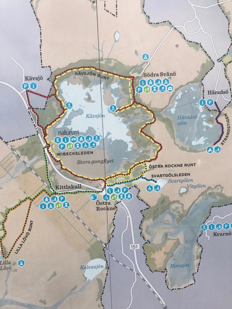
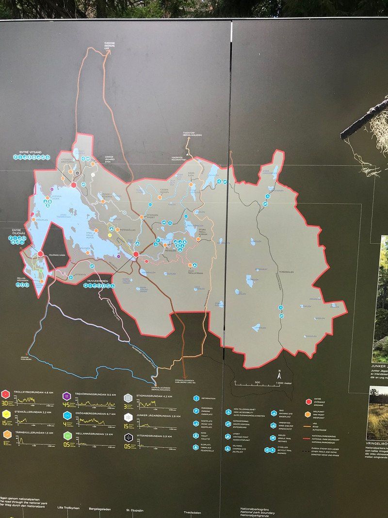
Söderåsens Nationalpark
map: https://www.nationalparksofsweden.se/globalassets/soderasen/filer/soderasen-nationalpark-mittuppslag-en.pdf
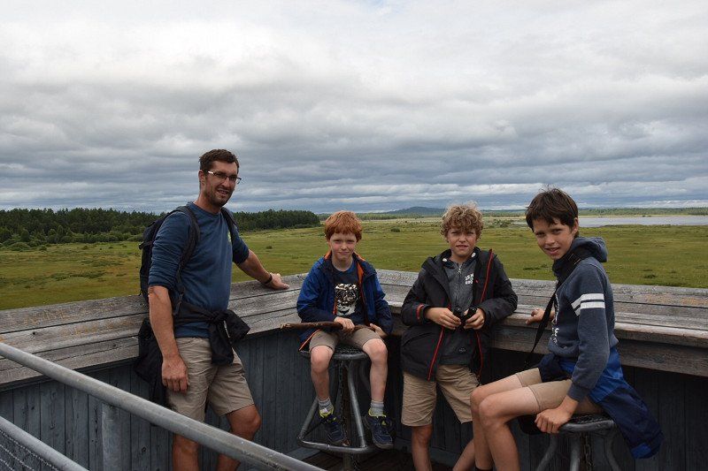
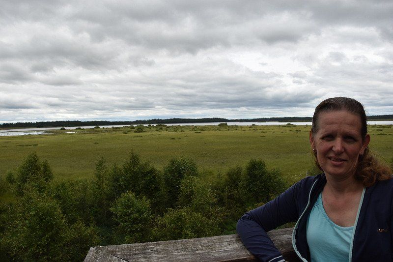
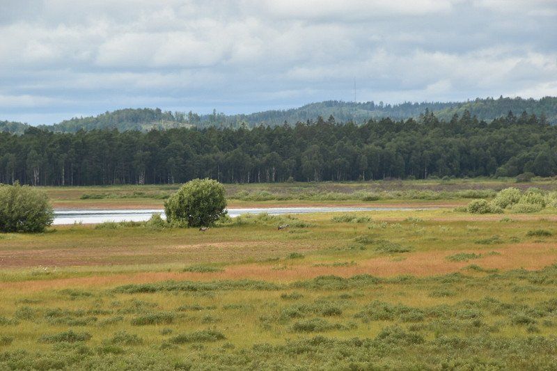
We were just outside, see red circle on photo
264 53 Skäralid, Zweden
56° 2' 17.8" N 13° 15' 17.3" E
56.0382825 13.2548064
• Head northwest on 13/108. Go for 1.9 km.
• Turn left toward V Sönnarslöv/Ljungbyhed. Go for 319 m.
• Continue on Svenstorp. Go for 1.7 km.
• Turn left onto Brandeborg toward Stenestad. Go for 135 m.
• Continue toward Skolgatan. Go for 16 m.
• Continue on Bonnarp. Go for 809 m.
• Continue on Svenstorp. Go for 214 m.
• Continue on Slättåkra. Go for 757 m.
• Continue on Ljungby. Go for 2.0 km.
• Continue on Klåveröd. Go for 520 m.
• Turn left. Go for 760 m.
• Arrive at your destination on the left.
☍
9,1 km
( 9 min.)
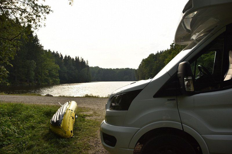
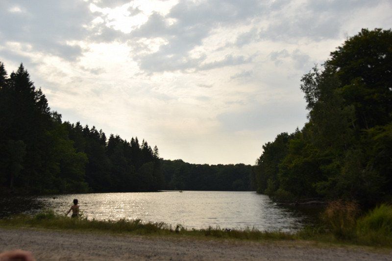
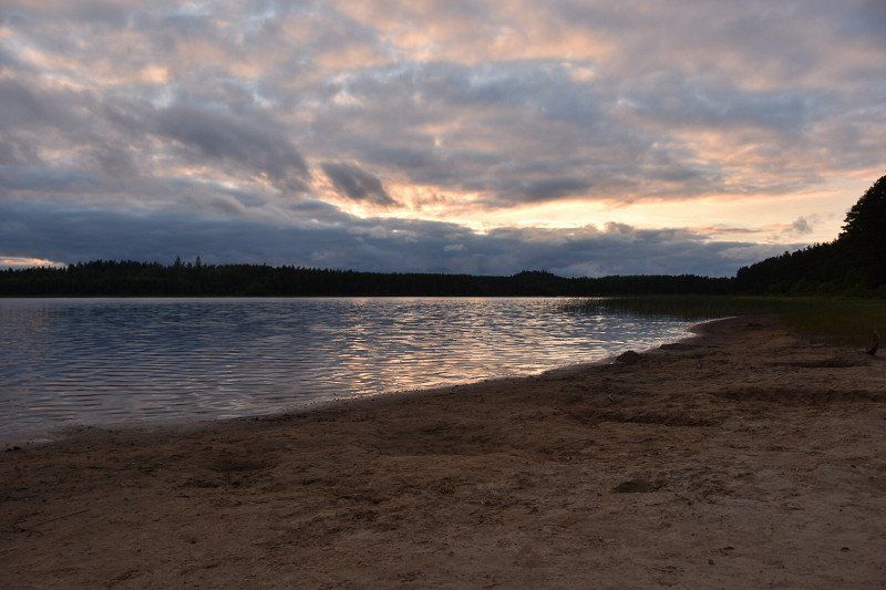
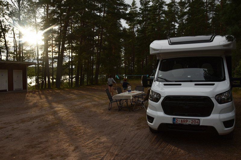
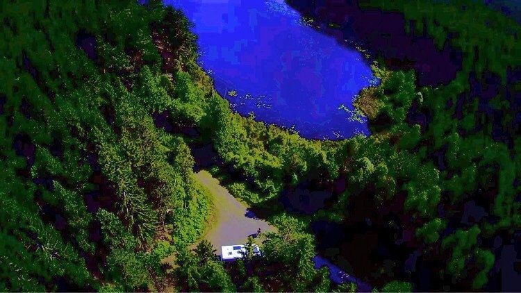
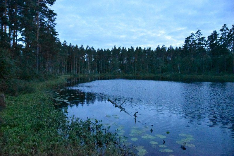
Overnachten aan het water
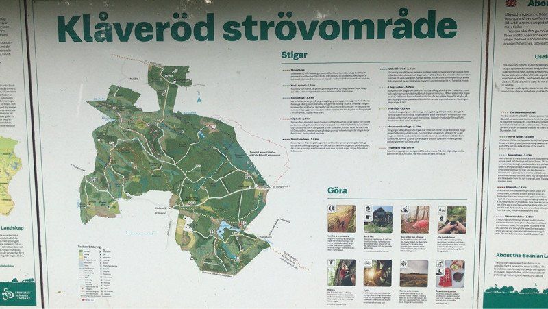
Visited nature reserve next to Soderasen
268 76
56° 2' 3.4" N 13° 10' 53.1" E
56.0342878 13.1814176
• Head north. Go for 760 m.
• Turn right onto Klåveröd. Go for 1.2 km.
• Continue on Slättåkra. Go for 1.7 km.
• Continue on Ljungby. Go for 412 m.
• Continue on Svenstorp. Go for 723 m.
• Continue on Brandeborg. Go for 300 m.
• Continue toward Skolgatan. Go for 16 m.
• Continue on Brandeborg. Go for 135 m.
• Continue on Skolgatan. Go for 802 m.
• Turn right onto Storgatan. Go for 1.8 km.
• Turn left onto Spången (13/108). Go for 496 m.
• Continue on Spången (108). Go for 6.8 km.
• Turn right onto 21. Go for 293 m.
• Turn left. Go for 129 m.
• Keep right toward Blekemossa. Go for 490 m.
• Continue on Blekemossa. Go for 1.2 km.
• Continue on Ebbarp. Go for 525 m.
• Continue on Ebbarp. Go for 1.4 km.
• Continue on Troedsberga. Go for 1.6 km.
• Continue on Troedsberga. Go for 536 m.
• Continue on Harholma. Go for 779 m.
• Turn left onto 108 toward Örkelljunga/Oderljunga. Go for 10.0 km.
• Turn left onto 24/108 toward Örkelljunga. Go for 4.2 km.
• Take the 1st exit from roundabout onto E4 toward Stockholm. Go for 24.9 km.
• Take exit 74 toward 117/Hässleholm/Markaryd S. Go for 324 m.
• Take the 1st exit from roundabout onto Hässleholmsvägen (117) toward Helsingborg/Centrum. Go for 292 m.
• Take the 2nd exit from roundabout onto Hässleholmsvägen toward Centrum. Go for 1.0 km.
• Take the 2nd exit from roundabout onto Drottninggatan. Go for 616 m.
• Arrive at Drottninggatan. Your destination is on the right.
☍
63,3 km
( 52 min.)
Day
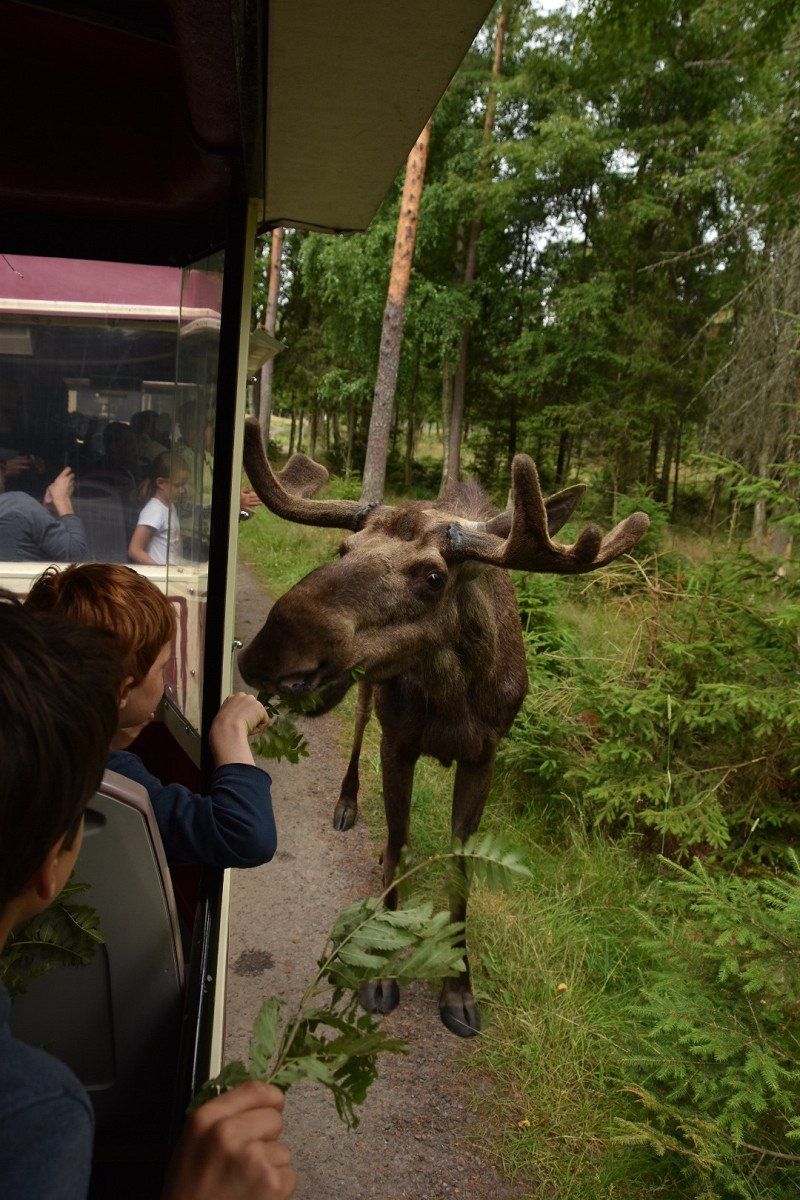
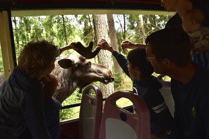
Elandenpark Smalandet - Markaryd, - elandenpark met eigen auto of treintje
Elk Park Smalandet
price with train
adults :190SEK
3-12 years: 130 SEK
open from 10am-6pm
train departure times 10.30, 11.00, 11.30, 12.00, 12.30, 13.00, 13.30, 14.00, 14.30, 15.00, 15.30, 16.00
https://www.smalandet.se/
Markaryd, Zweden
56° 27' 42.4" N 13° 35' 46.6" E
56.4617744 13.5962744
• Head toward Torget on Drottninggatan. Go for 40 m.
• Take the 2nd exit from roundabout onto Drottninggatan. Go for 1.6 km.
• Take the 1st exit from roundabout onto 15. Go for 1.6 km.
• Pass 2 roundabouts and continue on 15. Go for 378 m.
• Take the 2nd exit from roundabout onto E4 toward Stockholm/Ljungby. Go for 61.5 km.
• Take exit 82 toward Toftaholm/Dörarp. Go for 213 m.
• Turn left toward Toftaholm/Dörarp. Go for 3.1 km.
• Turn left onto Sjöängsvägen. Go for 385 m.
• Turn left onto Färsjövägen. Go for 833 m.
• Continue on Sundetvägen. Go for 250 m.
• Continue on Dörarp Sommarhemmet Sundet. Go for 660 m.
• Arrive at Sundet. Your destination is on the left.
☍
70,6 km
( 46 min.)
Overnachten aan water
Found through camp 4 cousin
Sundetvägen 1, 341 55 Vittaryd, Zweden
56° 58' 46" N 13° 59' 16.1" E
56.9794526 13.9878073
• Head northeast on Sundet. Go for 660 m.
• Continue on Sundetvägen. Go for 250 m.
• Continue on Färsjövägen. Go for 833 m.
• Turn right onto Sjöängsvägen. Go for 385 m.
• Turn left toward Dörarp Abrahamsgård. Go for 784 m.
• Continue on Dörarp Abrahamsgård. Go for 1.6 km.
• Continue on Dörarp. Go for 913 m.
• Continue on Toftaholm Toftaled. Go for 2.7 km.
• Continue on Toftaholm. Go for 1.0 km.
• Turn right toward E4. Go for 512 m.
• Take ramp onto E4. Go for 18.3 km.
• Take exit 85 toward Vetlanda/151/Hestra/Gnosjö/Värnamo N. Go for 428 m.
• Turn left onto E4.17 toward Hestra/Värnamo. Go for 1.3 km.
• Take the 1st exit from roundabout onto 151. Go for 2.3 km.
• Take the 2nd exit from roundabout onto 151. Go for 13.1 km.
• Turn right onto Store Mosse nationalpark Naturum. Go for 29 m.
• Turn slightly left. Go for 38 m.
• Turn right. Go for 55 m.
• Arrive at your destination on the left.
☍
45,3 km
( 31 min.)
Day
Store Mosse nationalpark, Hillerstorp, - nationaal park
Store Mosse National Park - The National Parks of Sweden | Choose national park | Sweden's national parks (sverigesnationalparker.se)
Map:
https://www.nationalparksofsweden.se/globalassets/store-mosse/filer/store-mosse-nationalpark-karta-2017-eng.pdf
Store Mosse nationalpark, 330 33 Hillerstorp, Zweden
57° 17' 60" N 13° 55' 47.4" E
57.2999982 13.9298207
• Head southwest. Go for 36 m.
• Turn right onto Store Mosse nationalpark Naturum. Go for 24 m.
• Turn left onto Store Mosse nationalpark Naturum. Go for 29 m.
• Turn right onto 151. Go for 2.2 km.
• Take the 1st exit from roundabout onto 152. Go for 10.3 km.
• Turn right onto Åker. Go for 307 m.
• Continue on Åker skolan. Go for 184 m.
• Turn slightly right toward Sjöbovägen. Go for 123 m.
• Turn slightly right onto Sjöbovägen. Go for 624 m.
• Turn right. Go for 344 m.
• Arrive at your destination on the left.
☍
14,2 km
( 12 min.)
Overnachten aan het water
Åker 1
57° 22' 26.3" N 13° 59' 14.6" E
57.3739714 13.9873980
• Head toward Sjöbovägen. Go for 344 m.
• Turn left onto Sjöbovägen. Go for 624 m.
• Turn slightly left toward Åker skolan. Go for 123 m.
• Continue on Åker skolan. Go for 184 m.
• Continue on Åker. Go for 307 m.
• Turn right onto 152. Go for 7.6 km.
• Turn right onto 152. Go for 260 m.
• Take the 2nd exit from roundabout onto E4 toward Stockholm/Jönköping. Go for 39.1 km.
• Take exit 95A toward Stockholm/31/40 Ö/47 Ö/Elmia onto E4. Go for 35.0 km.
• Take exit 103 toward Gränna/Omberg/Tåkern/Gyllene Uttern. Go for 364 m.
• Turn right toward Gyllene Uttern. Go for 224 m.
• Continue on Gyllene Uttern. Go for 676 m.
• Turn sharp left onto Ravelsmark. Go for 560 m.
• Continue on Röttle by. Go for 359 m.
• Turn right onto Röttle by. Go for 276 m.
• Arrive at Röttle by. Your destination is on the right.
☍
86,0 km
( 57 min.)
Day
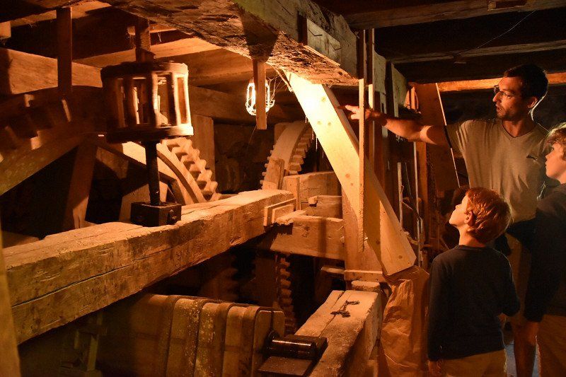
Waterval en watermolen
Röttle by 13
57° 59' 55.1" N 14° 25' 55.2" E
57.9986338 14.4319993
• Head south on Röttle by. Go for 276 m.
• Turn left onto Röttle by. Go for 359 m.
• Continue on Ravelsmark. Go for 1.1 km.
• Take the 3rd exit from roundabout onto Jönköpingsvägen. Go for 2.8 km.
• Arrive at Brahegatan.
☍
4,5 km
( 8 min.)
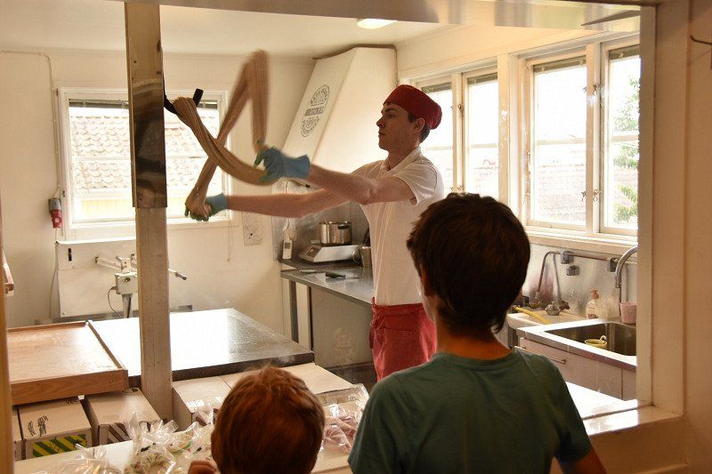
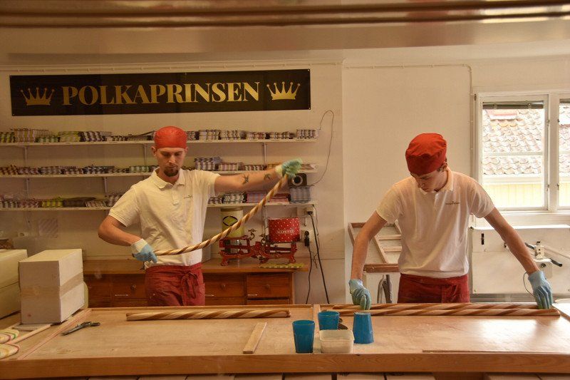
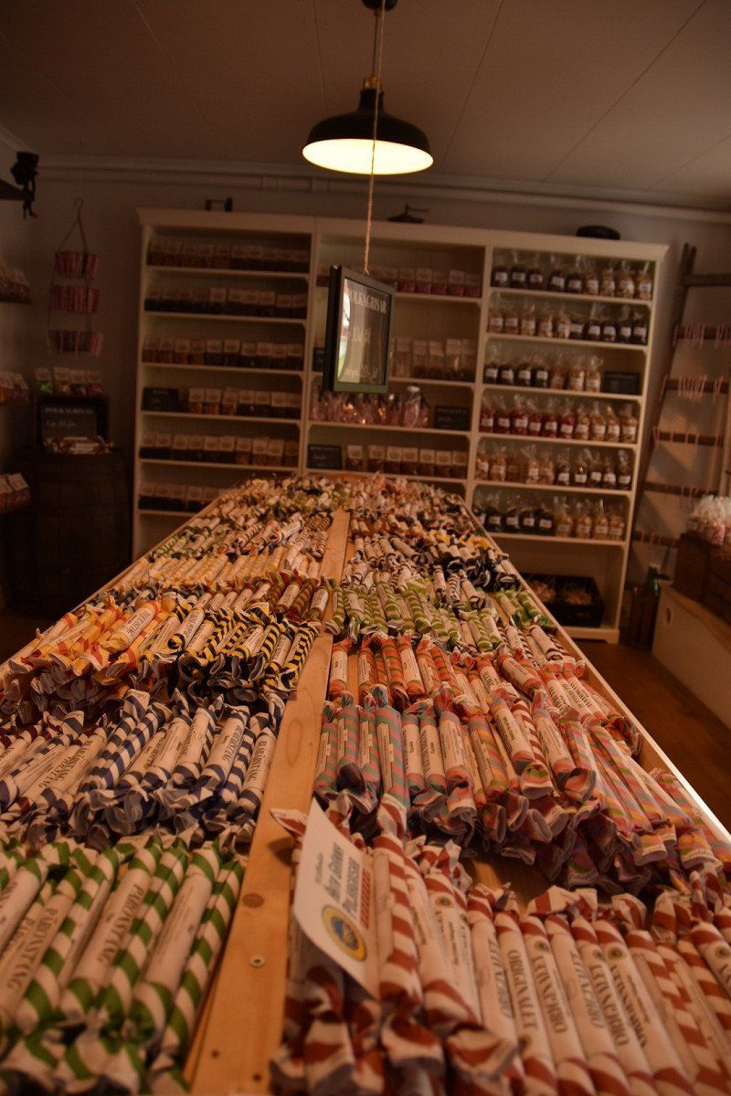
Gränna, Zweden - zuurstokken
A village that is all about candy canes. This is where the famous white-red candy canes are made that are on sale every year at Christmas. But they make more special flavors. Demonstrations are given in every sweet shop and you can see the long sweet strings being expertly processed. If you are lucky you get to taste such a fresh, warm and sticky candy.
563 32 Gränna, Zweden
58° 1' 30.1" N 14° 28' 12.3" E
58.0250234 14.4700948
• Head toward Postgränd on Brahegatan. Go for 2.7 km.
• Take the 2nd exit from roundabout onto 133. Go for 404 m.
• Turn left and take ramp onto E4 toward Stockholm/Örebro. Go for 6.2 km.
• Take the exit. Go for 390 m.
• Turn right. Go for 44 m.
• Turn right toward Brahehus. Go for 144 m.
• Continue on Brahehus. Go for 47 m.
• Arrive at Brahehus. Your destination is on the left.
☍
9,9 km
( 10 min.)
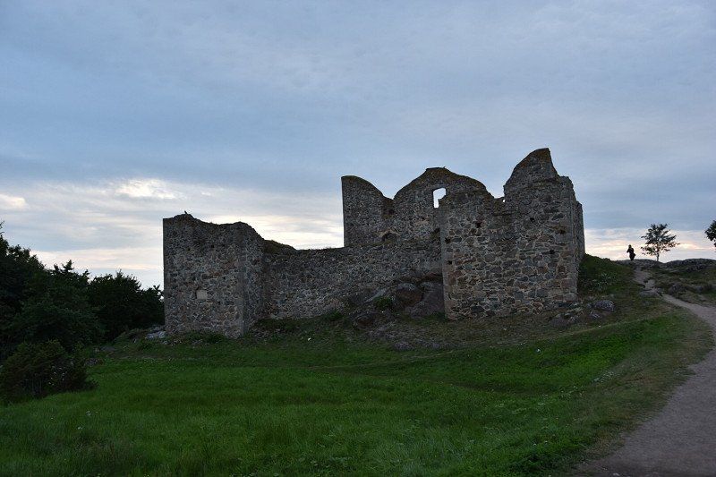
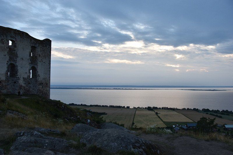
Brahehus slot ruïne
Brahehus 1
58° 3' 10.3" N 14° 30' 18.6" E
58.0528636 14.5051596
• Head southeast on Brahehus. Go for 191 m.
• Turn left. Go for 196 m.
• Turn left toward E4. Go for 134 m.
• Continue on E4. Go for 21.8 km.
• Take exit 106 toward Vadstena/Ödeshög/Östgötaporten. Go for 347 m.
• Take the 3rd exit from Trafikplats Ödeshög roundabout onto Bergslagsdiagonalen. Go for 778 m.
• Take the 2nd exit from roundabout onto Bergslagsdiagonalen toward Örebro. Go for 6.2 km.
• Turn left toward Alvastra. Go for 92 m.
• Continue on Hästholmen Gärstorp. Go for 1.1 km.
• Turn left onto Ombergs Turisthotell. Go for 68 m.
• Continue on Alvastra Axels Stuga. Go for 287 m.
• Continue on Alvastra Västeräng. Go for 187 m.
• Arrive at Alvastra Västeräng. Your destination is on the left.
☍
31,4 km
( 22 min.)
Slaapplek met fantastisch zicht
Found with camp 4 cousin
Södra Sjövägen
58° 17' 43.4" N 14° 38' 38.6" E
58.2953999 14.6440576
• Head east on Alvastra Västeräng. Go for 239 m.
• Continue on Alvastra Axels Stuga. Go for 235 m.
• Continue on Ombergs Turisthotell. Go for 68 m.
• Turn left onto Alvastra kloster. Go for 515 m.
• Continue on Alvastra kloster. Go for 872 m.
• Turn left onto Bergslagsdiagonalen. Go for 20.3 km.
• Take the 2nd exit from roundabout onto Ödeshögsvägen toward Vadstena S C/Kronoängen/Kungs Starby. Go for 922 m.
• Continue on Södra vägen. Go for 389 m.
• Turn right onto Kungsvallavägen. Go for 116 m.
• Turn left onto Svelviksvägen. Go for 44 m.
• Turn right onto Svelviksvägen. Go for 58 m.
• Arrive at Svelviksvägen. Your destination is on the right.
☍
23,8 km
( 22 min.)
Day
Gratis parking
Svelviksvägen 6
58° 26' 33" N 14° 53' 18.4" E
58.4424871 14.8884479
• Head north on Svelviksvägen. Go for 58 m.
• Turn left onto Svelviksvägen. Go for 44 m.
• Turn right onto Kungsvallavägen. Go for 116 m.
• Turn right onto Södra vägen. Go for 203 m.
• Turn left onto Slottsgatan. Go for 230 m.
• Turn right onto Knivsmedsgatan. Go for 180 m.
• Arrive at Knivsmedsgatan. Your destination is on the left.
☍
0,8 km
( 2 min.)
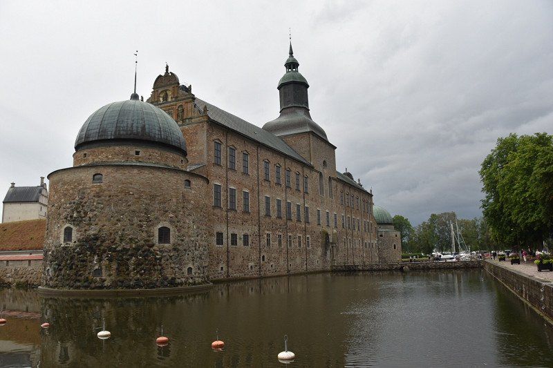
Vadstena
Steamboat Trafik was not there, only on specific dates, a pity.
Today a rainy day, visited castle and church
a medieval town with breathtaking views of Lake Vättern. In the town you will find a well-preserved Renaissance castle and a beautiful monastery, the St. Birgitta. For centuries this has been the cultural and commercial center and traded glassware and handmade lace. These crafts can still be found in local boutiques. Besides the historical highlights, there is a lot of nature around Vadstena. In the area you will find two large lakes with long sandy beaches, rolling cornfields and wild animals.
Vadstena, Zweden
58° 26' 51.4" N 14° 53' 24.8" E
58.4476022 14.8902335
• Head northeast on Knivsmedsgatan. Go for 58 m.
• Continue on Fyllagatan. Go for 93 m.
• Turn left onto Strågatan. Go for 56 m.
• Turn right onto Storgatan. Go for 93 m.
• Continue on Motalagatan. Go for 853 m.
• Turn right onto Birgittas väg. Go for 369 m.
• Turn left onto Skänningevägen (206) toward Linköping/Skänninge/Kvarnbacken. Go for 1.1 km.
• Pass 2 roundabouts and continue on 206. Go for 13.5 km.
• Take the 3rd exit from roundabout onto 206. Go for 13.1 km.
• Continue on Viby Södergård. Go for 66 m.
• Continue on Viby Vibytorp. Go for 178 m.
• Continue on Viby Kullen. Go for 279 m.
• Continue on Viby Vägstorp. Go for 520 m.
• Continue on Viby Postgård. Go for 895 m.
• Continue on Sjögestad Motell. Go for 370 m.
• Continue on Sjögestad Sandstugan. Go for 1.2 km.
• Continue on Sjögestad Bro Åviken. Go for 453 m.
• Continue on Sjögestad Bro Solmark. Go for 471 m.
• Continue on Sjögestad Karlslund. Go for 876 m.
• Continue on Alorp Bergsätra. Go for 383 m.
• Continue on Rundelen Björkhamra. Go for 1.2 km.
• Continue on Åstorpsgatan. Go for 642 m.
• Take the 3rd exit from roundabout onto Bankebergsvägen. Go for 354 m.
• Turn right onto Bankebergsvägen. Go for 1.1 km.
• Continue on Nybble Lilla Haninge. Go for 386 m.
• Continue on Nybble Hasselbacken. Go for 403 m.
• Continue on Ånestadlund Nysätter. Go for 269 m.
• Continue on Ånestadlund Bergsätter. Go for 1.9 km.
• Continue on Frössle Sofielund. Go for 676 m.
• Continue on Södermalmsvägen. Go for 1.2 km.
• Continue on Lagerlundavägen. Go for 95 m.
• Continue on Lägergatan. Go for 289 m.
• Continue on Carl Cederströms gata. Go for 338 m.
• Turn left. Go for 20 m.
• Turn left. Go for 16 m.
• Arrive at your destination on the right.
☍
43,8 km
( 39 min.)
Overnachten aan vliegtuigmuseum
Carl Cederströms gata
58° 24' 39.4" N 15° 31' 26.4" E
58.4109350 15.5239907
• Head east. Go for 16 m.
• Turn right toward Carl Cederströms gata. Go for 20 m.
• Turn right onto Carl Cederströms gata. Go for 51 m.
• Turn left. Go for 45 m.
• Arrive at your destination on the left.
☍
0,1 km
( )
Day
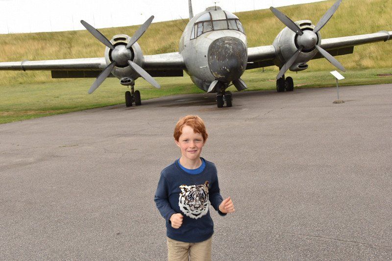
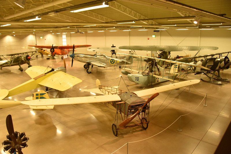
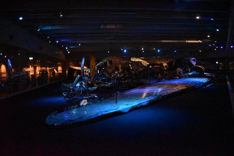
Flygvapenmuseum, Carl Cederströms gata, Linköping, - vliegtuigmuseum
The Aircraft Museum, the Flygvapenmuseum, focuses on Sweden's military flying force. It is a modern and cultural history museum that takes you back in time when Sweden was still active with its air force in the 20th century. The highlight is the extensive collection of aircraft that you can admire up close.
Free entrance
https://flygvapenmuseum.se
Carl Cederströms gata 2, 586 63 Linköping, Zweden
58° 24' 36.9" N 15° 31' 26.9" E
58.4102462 15.5241310
• Head toward Carl Cederströms gata. Go for 45 m.
• Turn right onto Carl Cederströms gata. Go for 518 m.
• Turn right onto Kärnavägen. Go for 825 m.
• Take ramp onto E4.4 (Malmslättsvägen). Go for 2.4 km.
• Take the 3rd exit from Vallarondellen roundabout onto Malmslättsvägen (E4.4) toward Centrum/Gottfridsberg S/Valla. Go for 603 m.
• Turn right onto Majgatan. Go for 25 m.
• Turn right onto Gästgivaregatan. Go for 150 m.
• Arrive at Gästgivaregatan. Your destination is on the left.
☍
4,6 km
( 5 min.)
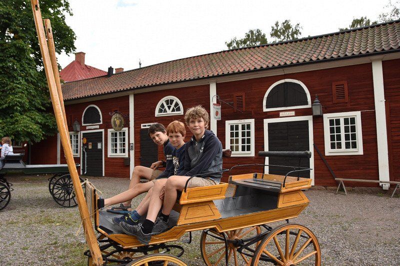
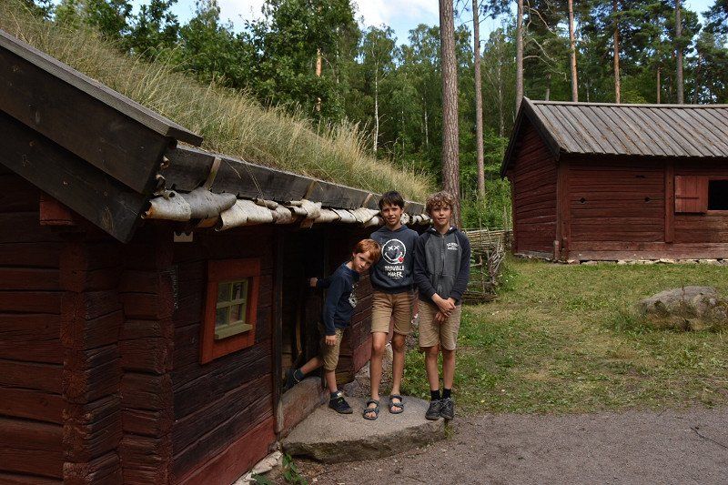
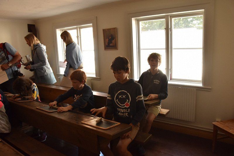
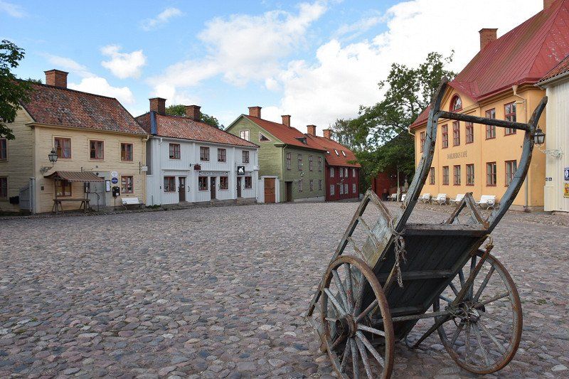
Gamla Linköping, Tunnbindaregatan, Linköping, openluchtmuseum
A glimpse into the Sweden of the past is possible in Linköping's extensive open-air museum. You almost literally step back in time. You walk on the small cobblestones between the red wooden houses. You will find various beautiful gardens, cute see-through alleys and various museums, shops and cafes. A short walk through the Vallaskogen Natural Park leads to the Valla farm. Here you will find museums about the history of rural life, farm animals, a playground and other children's activities.
Free
https://gamlalinkoping.se/
Tunnbindaregatan 1, 582 46 Linköping, Zweden
58° 24' 23.8" N 15° 35' 17.1" E
58.4066067 15.5880854
• Head toward Majgatan on Gästgivaregatan. Go for 150 m.
• Turn left onto Majgatan. Go for 25 m.
• Turn left onto Malmslättsvägen (E4.4). Go for 388 m.
• Take the 1st exit from Vallarondellen roundabout onto Industrigatan toward Västerviks flygplats/Glyttinge/35. Go for 1.8 km.
• Take the 3rd exit from Bergsrondellen roundabout onto Bergsvägen (E4.5) toward E4/Berg. Go for 1.4 km.
• Pass 3 roundabouts and continue on Bergsvägen (1136). Go for 7.0 km.
• Continue on Stjärnorpsvägen. Go for 456 m.
• Turn right onto Bergs Slussar. Go for 57 m.
• Continue on Bergs Slussar Kanalvillan. Go for 58 m.
• Turn slightly left. Go for 165 m.
• Turn left. Go for 27 m.
• Arrive at your destination on the left.
☍
11,6 km
( 14 min.)
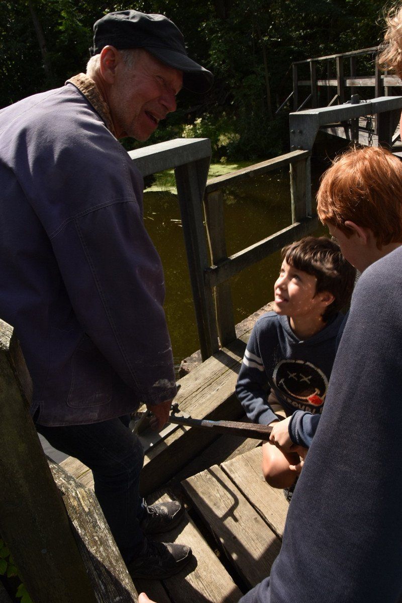
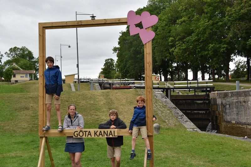
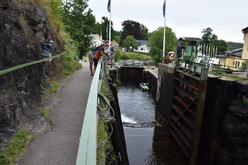
Het Götakanaal
The Göta Canal is one of the largest construction projects in Swedish history. The 190 kilometer long canal runs right through Sweden and is well worth a visit.
The Göta Canal runs from Sjötorp on Lake Vänern to Mem, Slätbaken, is 190 kilometers long and has 58 locks. The famous engineer Baltzar von Platen built it between 1810 and 1832.
Activities along the canal
The canal is navigable part of the year. Rent a boat, get on one of the many tour boats or experience the canal from the mainland. There are various walking and cycling routes along the canal. There are also two museums about the Göta Canal. To learn more about the canal's history, visit the Göta Canal exhibition in Motala, and for information about shipping through the canal, visit the Sjötorp Canal Museum.
Highlights along the way
Take a look at the locks at Berg. Here are seven of them: they are right behind each other and are interconnected. Boats are raised over a height difference of 18 meters from Lake Roxen.
Choose one of the many locations along the canal for a short break or a multi-day stop. Moor your boat and relax in one of the 21 marinas. Mooring in the marinas does not cost anything extra, but is part of the entrance fee you pay to navigate the canal.
On foot, by bike or by boat
You can rent boats, canoes and kayaks at many places along the canal. Tours can also be booked, for example from Linköping and Norrköping. The old tow road along the canal is one of Sweden's most popular cycling routes and there are also many beautiful hiking trails along this route. The canal is an excellent place for sailing.
https://www.gotakanal.se/en/
Sluizen gotakanaal
Also take a look at the locks at Berg. Here are seven of them: they are right behind each other and are interconnected. Boats are raised over a height difference of 18 meters from Lake Roxen.
Oscars Slussar 2
58° 29' 8.9" N 15° 31' 51.7" E
58.4858065 15.5310357
• Head west. Go for 27 m.
• Turn right toward Bergs Slussar Kanalvillan. Go for 165 m.
• Turn slightly right onto Bergs Slussar Kanalvillan. Go for 58 m.
• Continue on Bergs Slussar. Go for 57 m.
• Turn left onto Stjärnorpsvägen. Go for 456 m.
• Turn right toward Vreta kloster. Go for 68 m.
• Continue on Vreta kloster. Go for 662 m.
• Continue on Heda Östergård. Go for 943 m.
• Take the 2nd exit from roundabout. Go for 487 m.
• Continue on Stora Sjögestad Järngården. Go for 869 m.
• Continue on Gullberg Tingshuset. Go for 401 m.
• Turn right and take ramp onto 34 toward Motala. Go for 30.0 km.
• Turn right onto Evertsbyvägen toward Askersund. Go for 1.9 km.
• Continue on Kartorp. Go for 2.9 km.
• Continue on Stora Ängesby. Go for 795 m.
• Turn right onto Bergslagsdiagonalen (50). Go for 35.9 km.
• Take the 3rd exit from roundabout onto 205 toward Karlskoga/Laxå. Go for 5.1 km.
• Turn left toward Dohnafors. Go for 1.5 km.
• Continue on Dohnafors. Go for 10.3 km.
• Continue on Sörbytorp. Go for 2.6 km.
• Turn left toward Bosjön. Go for 336 m.
• Continue on Bosjön. Go for 254 m.
• Continue on Stensjön. Go for 163 m.
• Arrive at Stensjön.
☍
95,9 km
(1 hrs. 16 min.)
Overnachten
Found through camp 4 cousin
695 96 Tived, Zweden
58° 47' 33.6" N 14° 37' 8.6" E
58.7926771 14.6190621
• Head north on Stensjön. Go for 163 m.
• Continue on Bosjön. Go for 254 m.
• Continue straight ahead. Go for 336 m.
• Turn left. Go for 2.3 km.
• Turn left toward Trösslingstorp. Go for 1.0 km.
• Continue on Trösslingstorp. Go for 8.7 km.
• Turn right. Go for 53 m.
• Turn right. Go for 95 m.
• Arrive at your destination.
☍
12,9 km
( 28 min.)
Day
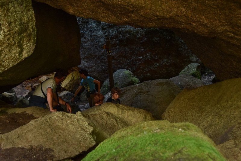
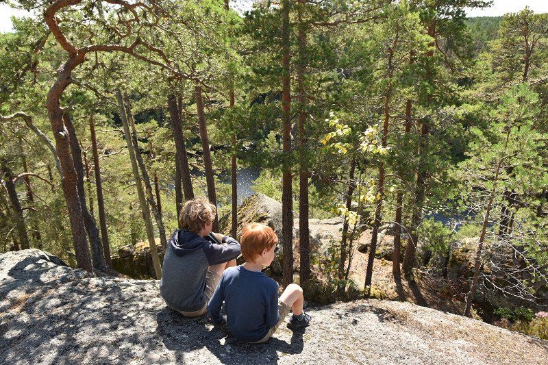
Tivedens nationalpark, Zweden
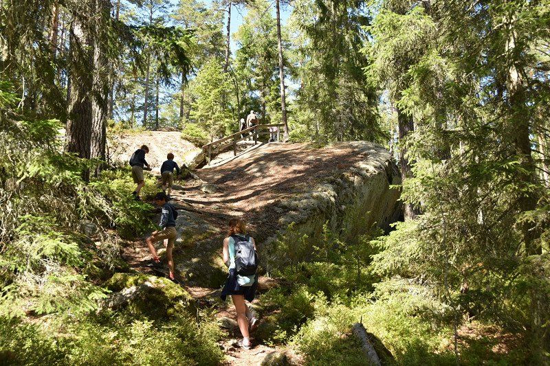
Several walks depart from the information point. There are two starting points, we did bits of purple and then grey. this was not walking but scrambling. The kids loved it.
Tivedens Nationalpark, Tived, Zweden
58° 43' 1.6" N 14° 36' 23.4" E
58.7171092 14.6065028
• Head toward Kvarnsjöbacken. Go for 95 m.
• Turn left. Go for 53 m.
• Turn right toward Kojvägen. Go for 150 m.
• Turn right onto Kojvägen. Go for 2.5 km.
• Turn left. Go for 2.0 km.
• Turn right toward Svanhult Lekemon. Go for 1.1 km.
• Continue on Svanhult Lekemon. Go for 491 m.
• Turn right toward Svanhult. Go for 2.3 km.
• Turn right onto Svanhult. Go for 1.8 km.
• Continue on Kopparhult. Go for 2.0 km.
• Continue on Perstorp. Go for 267 m.
• Continue on Kungsbacken Hagalund. Go for 228 m.
• Continue on Kungsbacken. Go for 1.4 km.
• Continue on Kungsbacken Granhamnen. Go for 472 m.
• Continue on Sannerud. Go for 545 m.
• Continue on Sannerud Björkhagen. Go for 327 m.
• Continue on Sanneruds bygata. Go for 18.5 km.
• Continue on Finnerödja Byggeshagen. Go for 484 m.
• Continue on Paradisbygget Solliden. Go for 327 m.
• Continue on Rynningskärren. Go for 2.2 km.
• Continue toward Skagersholm Storängen. Go for 2.5 km.
• Continue on Skagersholm Storängen. Go for 715 m.
• Continue on Backerud. Go for 629 m.
• Continue on Kvarntorp. Go for 1.3 km.
• Continue on Kvarntorp. Go for 368 m.
• Continue on Torpaskoga Kvarnås. Go for 768 m.
• Continue on Sandbackafall. Go for 1.8 km.
• Continue on Torpaskoga Nolåsen. Go for 1.4 km.
• Continue on Julön. Go for 1.8 km.
• Continue on Lämås. Go for 651 m.
• Continue on Rustorp. Go for 1.1 km.
• Continue on Deldenäs. Go for 1.4 km.
• Continue on Gökhult. Go for 1.6 km.
• Continue on Sinnerud. Go for 2.1 km.
• Continue on Slättåsen. Go for 272 m.
• Continue on Slättåsen. Go for 452 m.
• Continue on Sirbo. Go for 1.8 km.
• Continue on Sirbo. Go for 583 m.
• Continue on Stensäng. Go for 766 m.
• Continue on Sund. Go for 1.2 km.
• Turn left onto 204. Go for 205 m.
• Turn right onto Lidetorpsvägen. Go for 668 m.
• Continue on Hagvägen. Go for 161 m.
• Continue on Lidetorpsvägen. Go for 373 m.
• Continue on Billinge. Go for 2.4 km.
• Turn right onto 243. Go for 4.7 km.
• Turn left toward Håkanbol. Go for 1.0 km.
• Continue on Håkanbol. Go for 355 m.
• Continue on Håkanbol. Go for 1.4 km.
• Continue on Håkanbol. Go for 3.8 km.
• Turn left. Go for 684 m.
• Turn left. Go for 1.7 km.
• Arrive at your destination on the right.
☍
77,7 km
(1 hrs. 29 min.)
Overnachten
Free via camp4 niece
Anilsvägen
59° 12' 44.1" N 14° 17' 48.7" E
59.2122522 14.2968554
• Head toward Björnåsvägen. Go for 1.7 km.
• Turn left toward Visnum södra Myren. Go for 3.3 km.
• Continue on Visnum södra Myren. Go for 505 m.
• Continue on Degerforsvägen. Go for 664 m.
• Take the 2nd exit from roundabout onto Degerforsvägen. Go for 303 m.
• Continue on Kristinehamnsvägen. Go for 2.2 km.
• Continue on Hultet. Go for 2.3 km.
• Turn right onto 26. Go for 5.7 km.
• Take the 2nd exit from roundabout onto Skaraborgsvägen toward Centrum. Go for 1.6 km.
• Take the 3rd exit from roundabout onto Södra Staketgatan. Go for 124 m.
• Turn right onto Västerlånggatan. Go for 318 m.
• Turn right onto Södra torget. Go for 125 m.
• Continue on Nya Kyrkogatan. Go for 51 m.
• Arrive at Nya Kyrkogatan. Your destination is on the left.
☍
18,8 km
( 21 min.)
Day
Landschap Småland
The real Sweden' is the official slogan of the Småland region in southeastern Sweden. And that slogan fits the bill perfectly, because you will find it all here: a rich culture, unspoiled nature and many traditions that originate in this region. Småland is the birthplace of IKEA and the famous children's book author Astrid Lindgren, just to name a few. It soon becomes clear when you travel around Småland: you won't find it much more Swedish.
Småland is a so-called landscape in the southern Swedish region of Götaland. It includes Kronobergs län county, most of Jönköpings län and mainland Kalmar län.
Småland consists mainly of rolling hills dotted with lakes and forests. The well-known Swedish writer Astrid Lindgren, author of Pippi Longstocking and Michiel van de Hazelhoeve, among others, comes from this region.
Some well-known cities are Växjö, Jönköping and Kalmar.
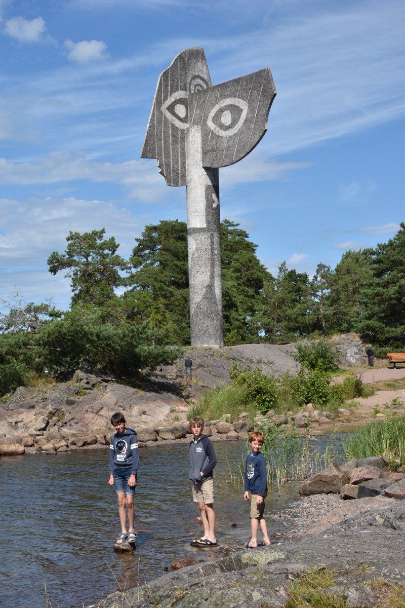
Kristinehamn, Zweden
This gigantic statue of Picasso fits perfectly into its surroundings. Nature in Sweden is beautiful anyway and this image only reinforces that. It's on the lake. A small beach offers the opportunity for a swim or a picnic. If you have a little more time, Kristinehamn is also worth a visit. The center is not big, but has a park on the water. There is a large loppis shop (Swedish vintage stuff) in the park.
59° 18' 36.2" N 14° 6' 32.1" E
59.3100677 14.1089192
• Head toward Kungsgatan on Nya Kyrkogatan. Go for 51 m.
• Continue on Södra torget. Go for 125 m.
• Turn right onto Södra torget. Go for 65 m.
• Continue on Vågbron. Go for 29 m.
• Continue on Norra torget. Go for 31 m.
• Continue on Västerlånggatan. Go for 500 m.
• Turn left onto Karlstadsvägen. Go for 782 m.
• Take the 2nd exit from roundabout onto Karlstadsvägen. Go for 810 m.
• Take the 2nd exit from roundabout onto Stenstavägen. Go for 598 m.
• Take ramp toward Karlstad. Go for 157 m.
• Turn right onto E18. Go for 36.8 km.
• Take the exit toward Färjestad/Rud/Sundsta/Löfbergs Arena. Go for 380 m.
• Turn right onto Blönduosgatan. Go for 230 m.
• Take the 2nd exit from roundabout onto Norra infarten. Go for 562 m.
• Turn left onto Skoghemsgatan. Go for 75 m.
• Arrive at Skoghemsgatan.
☍
41,2 km
( 32 min.)
Karlstad, Zweden
59° 24' 7.9" N 13° 30' 41.4" E
59.4021806 13.5114977
• Head toward Karlslundsgatan on Skoghemsgatan. Go for 75 m.
• Turn right onto Norra infarten. Go for 512 m.
• Take the 1st exit from roundabout onto Blönduosgatan. Go for 257 m.
• Turn right and take ramp onto E18 toward Oslo/E45/61/62. Go for 5.8 km.
• Take the exit toward Kongsvinger/Arvika/Trysil/Hagfors/Sunne/E45/Flygplats onto 61/62. Go for 5.6 km.
• Keep left onto 61. Go for 15.8 km.
• Take ramp onto E45 toward Mora/Sunne/Fagerås. Go for 29.4 km.
• Turn right onto Sånebytorp. Go for 952 m.
• Continue toward Södra Såneby. Go for 135 m.
• Continue on Södra Såneby. Go for 376 m.
• Continue toward Södra Såneby. Go for 12 m.
• Turn right onto Södra Såneby. Go for 241 m.
• Turn right toward Södra Såneby. Go for 14 m.
• Continue on Södra Såneby. Go for 70 m.
• Continue straight ahead. Go for 72 m.
• Turn right. Go for 10 m.
• Turn slightly left. Go for 122 m.
• Arrive at your destination on the right.
☍
59,5 km
( 46 min.)
Overnachten
Free through camp 4 cousin
Södra Såneby 126
59° 46' 17.7" N 13° 7' 23.3" E
59.7715733 13.1231373
• Head toward Södra Såneby. Go for 132 m.
• Turn left toward Södra Såneby. Go for 72 m.
• Continue on Södra Såneby. Go for 70 m.
• Continue straight ahead. Go for 14 m.
• Turn left toward Södra Såneby. Go for 17 m.
• Keep right onto Södra Såneby. Go for 931 m.
• Continue on Södra Såneby. Go for 694 m.
• Turn right onto E45. Go for 6.3 km.
• Turn right onto Ekebyvägen toward Kolsnäs. Go for 208 m.
• Turn right onto Kolsnäsvägen. Go for 356 m.
• Turn left onto Kolsnäsvägen. Go for 85 m.
• Arrive at Kolsnäsvägen. Your destination is on the right.
☍
8,9 km
( 10 min.)
Day
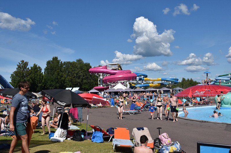
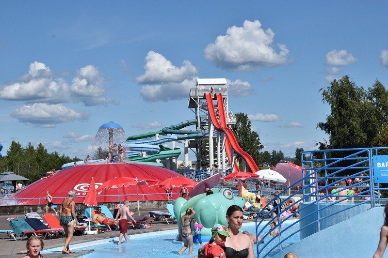
Sunne Sommarland, Kolsnäsvägen, Sunne, - themapark met verschillende zwembaden en attracties
oe to water fun for the whole family? Then go to Sunne Sommarland for a day. There are several swimming pools and attractions in this theme park. There are special areas for smaller children and for those who want to enjoy a quiet time. For the daredevils there is plenty to do with a free fall slide and an obstacle course. The water is always 25 degrees, so even in less weather, you can stay here. If you still want to warm up a little further, you can go to the hot springs and the sauna. When the weather is nice, you can swim and play in the Frykenmeer and take on the course on the wipe-out track.
https://www.sunnesommarland.se...
Kolsnäsvagen 6
686 35, Sunne
Price from 1 m (under 1 m free)
1 day 290 Kr
2 days 480 Kr
Kolsnäsvägen 6, 686 35 Sunne, Zweden
59° 49' 31.6" N 13° 8' 33.3" E
59.8254334 13.1425717
• Head southwest on Kolsnäsvägen. Go for 85 m.
• Turn right onto Kolsnäsvägen. Go for 356 m.
• Turn left onto Ekebyvägen. Go for 208 m.
• Turn left onto E45. Go for 6.3 km.
• Turn left onto Södra Såneby toward S Såneby. Go for 694 m.
• Continue toward Södra Såneby. Go for 137 m.
• Continue on Södra Såneby. Go for 811 m.
• Turn right toward Södra Såneby. Go for 14 m.
• Continue on Södra Såneby. Go for 70 m.
• Continue straight ahead. Go for 72 m.
• Turn right. Go for 10 m.
• Turn slightly left. Go for 118 m.
• Arrive at your destination on the left.
☍
8,8 km
( 10 min.)
Overnachten
Free via camp4nicht
Södra Såneby 126
59° 46' 18.1" N 13° 7' 23.3" E
59.7716831 13.1231318
• Head toward Södra Såneby. Go for 128 m.
• Turn left toward Södra Såneby. Go for 72 m.
• Continue on Södra Såneby. Go for 70 m.
• Continue straight ahead. Go for 14 m.
• Turn left toward Södra Såneby. Go for 17 m.
• Keep right onto Södra Såneby. Go for 931 m.
• Continue on Södra Såneby. Go for 694 m.
• Turn right onto E45. Go for 6.3 km.
• Turn right onto Ekebyvägen toward Kolsnäs. Go for 1.4 km.
• Turn right onto Kvarngatan. Go for 158 m.
• Arrive at Kvarngatan. Your destination is on the right.
☍
9,7 km
( 11 min.)
Day
Sunne, Zweden
Expected more, once walked through.
59° 50' 11.6" N 13° 8' 38.6" E
59.8365575 13.1440464
• Head west on Kvarngatan. Go for 158 m.
• Turn left onto Ekebyvägen. Go for 1.4 km.
• Turn left onto E45. Go for 11.3 km.
• Turn right onto 238 toward Arvika. Go for 10.4 km.
• Turn left toward Renstad. Go for 99 m.
• Continue on Skog Sjöhaget. Go for 894 m.
• Continue on Östra Takene Mella. Go for 835 m.
• Continue on Östra Takene Bomossen. Go for 1.9 km.
• Continue on Nordsjö Bäcken. Go for 404 m.
• Continue on Nordsjö Skräddarbråten. Go for 515 m.
• Continue on Nordsjö Södervik. Go for 1.5 km.
• Continue on Nordsjö Nystugan. Go for 288 m.
• Continue on Nordsjö Lillåsen. Go for 429 m.
• Continue on Nordsjö Smeåsen. Go for 63 m.
• Continue on Renstad Fridhemsro. Go for 462 m.
• Continue on Renstad Skolbacka. Go for 70 m.
• Continue on Renstad Där Nere. Go for 212 m.
• Continue on Renstad Bråten. Go for 146 m.
• Continue on Renstad Ängbacken. Go for 181 m.
• Continue on Renstad Hagaberg. Go for 442 m.
• Turn right onto Renstad Lillhagen. Go for 104 m.
• Continue on Renstad Lillängen. Go for 127 m.
• Continue on Renstad Ängen. Go for 22 m.
• Arrive at Renstad Ängen. Your destination is on the left.
☍
31,9 km
( 34 min.)
Overnachten
Found for free through camp 4 cousin
With sauna
Fantastic place
Rinnforsen Renstad
59° 36' 25.4" N 13° 3' 45" E
59.6070629 13.0625006
• Head northeast on Renstad Ängen. Go for 22 m.
• Continue on Renstad Lillängen. Go for 127 m.
• Continue on Renstad Lillhagen. Go for 104 m.
• Turn left toward Renstad Hagaberg. Go for 282 m.
• Continue on Renstad Hagaberg. Go for 166 m.
• Turn left onto Renstad Ängbacken. Go for 175 m.
• Continue on Renstad Bråten. Go for 146 m.
• Continue on Renstad Där Nere. Go for 172 m.
• Arrive at Renstad Där Nere. Your destination is on the right.
☍
1,2 km
( 2 min.)
Day
Wandeling 5km naar uitkijktoren
Bodavägen
59° 36' 57.5" N 13° 4' 3.6" E
59.6159815 13.0676672
• Head toward Renstad Bråtvägen on Renstad Där Nere. Go for 172 m.
• Continue on Renstad Bråten. Go for 146 m.
• Continue on Renstad Ängbacken. Go for 181 m.
• Continue on Renstad Hagaberg. Go for 442 m.
• Continue on Renstad Annedal. Go for 132 m.
• Continue on Renstad Lillstugan. Go for 150 m.
• Continue on Renstad Kapellet. Go for 3.7 km.
• Continue on Smedserud Hagen. Go for 25 m.
• Continue on Norra Boda Marieberg. Go for 701 m.
• Continue on Boda Berget. Go for 282 m.
• Continue on Boda Framgården. Go for 149 m.
• Continue on Bodavägen. Go for 317 m.
• Continue on Boda backen. Go for 141 m.
• Continue on Bodavägen. Go for 1.5 km.
• Turn left onto 61. Go for 4.0 km.
• Turn right toward Grönlund. Go for 2.5 km.
• Continue on Säldebråten Lövåsen. Go for 274 m.
• Continue on Säldebråten Ängarna. Go for 918 m.
• Continue on Tomta Hallera. Go for 2.3 km.
• Continue on Långviken Febrobacken. Go for 753 m.
• Turn left toward Lång Åsen. Go for 2.9 km.
• Continue on Lång Åsen. Go for 2.6 km.
• Continue on Lång Karlslund. Go for 149 m.
• Continue on Lång västra Sandviken. Go for 664 m.
• Continue on Hasseldalen. Go for 1.4 km.
• Continue on Östra Malsjö Hasselviken. Go for 311 m.
• Continue on Malsjö kvarn. Go for 1.9 km.
• Turn right onto Malsjö. Go for 4.7 km.
• Continue on Norra Borgvik Möllers Smia. Go for 818 m.
• Continue on Norra Borgvik Nolängen. Go for 315 m.
• Continue on Norra Borgvik Nordhagen. Go for 241 m.
• Keep right onto Norra Borgvik Lindbacken. Go for 86 m.
• Continue on Norra Borgvik Höglunda. Go for 7.3 km.
• Continue on Gårdsjö Bottenviken. Go for 1.9 km.
• Continue on Galtebol Starrmyren. Go for 1.6 km.
• Continue on Galtebol Nolstugan. Go for 240 m.
• Continue on Galtebol Sörstugan. Go for 2.4 km.
• Continue on Granbäck Nolängen. Go for 746 m.
• Continue on Granbäck Granängen. Go for 1.1 km.
• Continue on Norra Kik. Go for 470 m.
• Continue on Byälvsvägen. Go for 759 m.
• Turn left onto Gillbergavägen (175). Go for 1.5 km.
• Turn right onto 175. Go for 221 m.
• Turn right onto E18. Go for 21.4 km.
• Turn right onto Myrås. Go for 87 m.
• Turn left toward Grinsbyn. Go for 1.4 km.
• Continue on Grinsbyn. Go for 127 m.
• Keep right. Go for 125 m.
• Arrive at your destination on the right.
☍
76,3 km
(1 hrs. 10 min.)
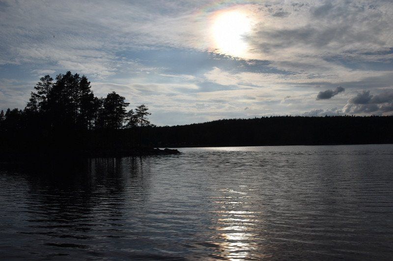
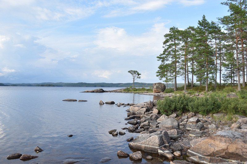
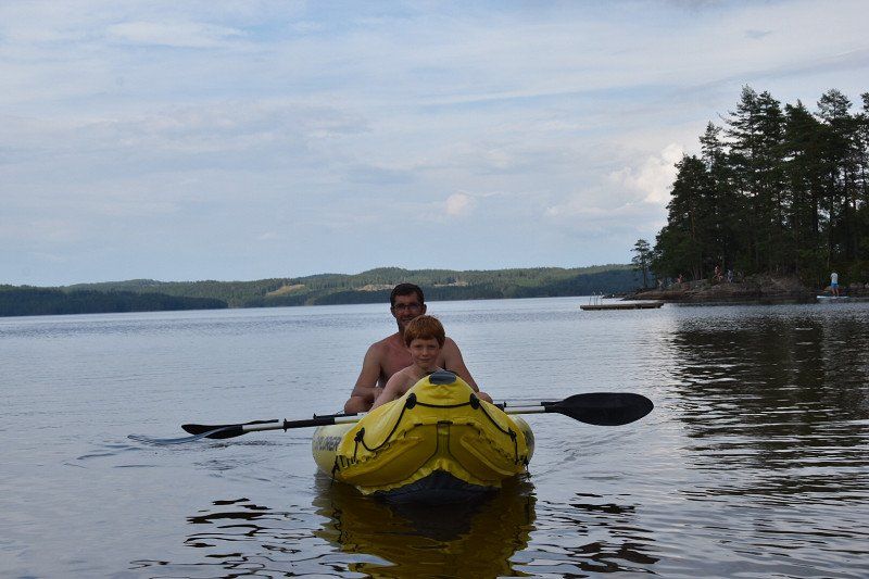
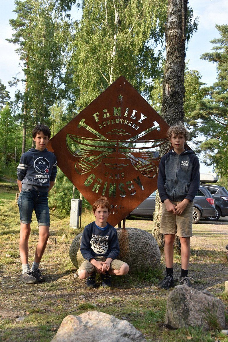
Camp Grinsby
Arrival 31/08/22 14h
departure 1/08/22
booked on 29/01/2022
385 SEK and 96.25 SEK advance
Grinsbyn 100, 67295, Årjäng, Zweden
59° 18' 13.2" N 12° 26' 44.8" E
59.3036700 12.4457900
• Head southwest. Go for 162 m.
• Turn sharp left toward Norane Camp Grinsby. Go for 51 m.
• Turn right onto Norane Camp Grinsby. Go for 42 m.
• Arrive at Grinsbyn. Your destination is on the left.
☍
0,3 km
( 1 min.)
Day
Camp Grinsby, Årjäng, Zweden
Grinsbyn 100, 672 95 Årjäng, Zweden
59° 18' 10.4" N 12° 26' 41.9" E
59.3028776 12.4449684
• Head northeast on Grinsbyn. Go for 73 m.
• Turn right toward Grinsbyn. Go for 51 m.
• Turn slightly left onto Grinsbyn. Go for 90 m.
• Continue toward Myrås. Go for 1.4 km.
• Turn right onto Myrås. Go for 87 m.
• Turn left onto E18. Go for 8.8 km.
• Turn right toward Åmål/Svaneholm. Go for 643 m.
• Continue on Kettilsbyn Hagbacken. Go for 4.2 km.
• Continue on Hallanda Stationen. Go for 2.0 km.
• Continue on Strand Solhem. Go for 731 m.
• Continue on Strandvägen. Go for 609 m.
• Turn right onto Storgatan. Go for 2.8 km.
• Continue on Södra Skarbol Svanvik. Go for 4.7 km.
• Continue on Mo Kroken. Go for 1.3 km.
• Continue on Mo Kroken. Go for 1.1 km.
• Continue on Persbyn. Go for 780 m.
• Continue on Persbyn. Go for 839 m.
• Continue on Mo Byn. Go for 1.3 km.
• Turn right onto Mo Stom. Go for 1.7 km.
• Continue on Forsbacka. Go for 1.4 km.
• Turn right onto 164. Go for 8.1 km.
• Turn left toward Fengersfors. Go for 1.1 km.
• Continue on Bräcke. Go for 90 m.
• Turn left toward Käppenäs. Go for 376 m.
• Continue on Käppenäs. Go for 907 m.
• Continue on Grättve. Go for 4.1 km.
• Continue on Humletorp. Go for 446 m.
• Continue on Sannerud. Go for 413 m.
• Continue on Fengersforsvägen. Go for 625 m.
• Continue on Fengersforsvägen. Go for 1.4 km.
• Turn right toward Fröskogs Hensbyn. Go for 770 m.
• Continue on Fröskogs Hensbyn. Go for 9.9 km.
• Continue on Gullungebyn. Go for 503 m.
• Turn left toward Häljebol. Go for 38 m.
• Continue on Häljebol. Go for 701 m.
• Continue on Högsbyn Gärdet. Go for 668 m.
• Continue on Högsbyn Hagen. Go for 262 m.
• Continue on Högsbyn. Go for 478 m.
• Continue on Högsbyn Bräckorna. Go for 5.4 km.
• Continue on Glyckshult. Go for 1.4 km.
• Continue on Glyckshult. Go for 1.4 km.
• Continue on Brudfjällsvägen. Go for 655 m.
• Turn left onto Upperudsvägen. Go for 497 m.
• Arrive at Upperudsvägen.
☍
74,9 km
(1 hrs. 15 min.)
Day
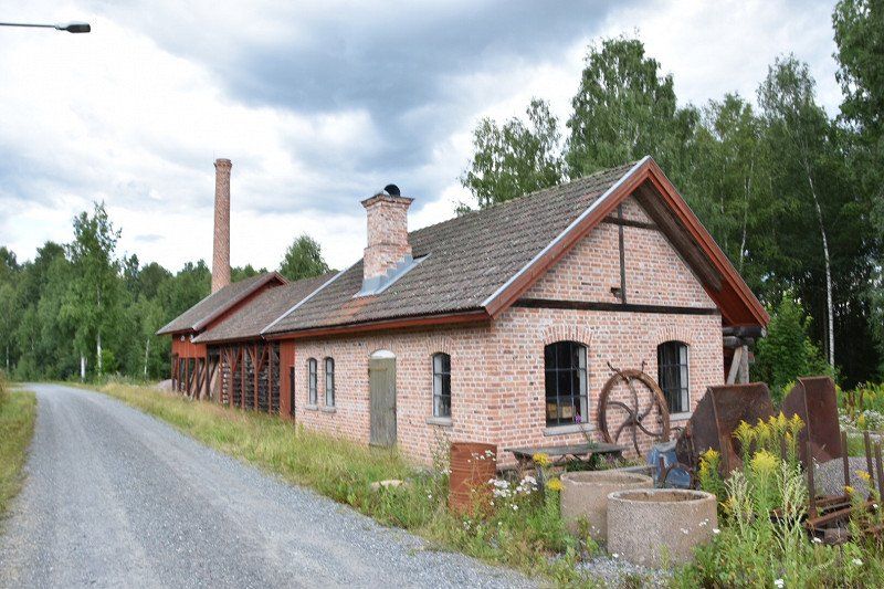
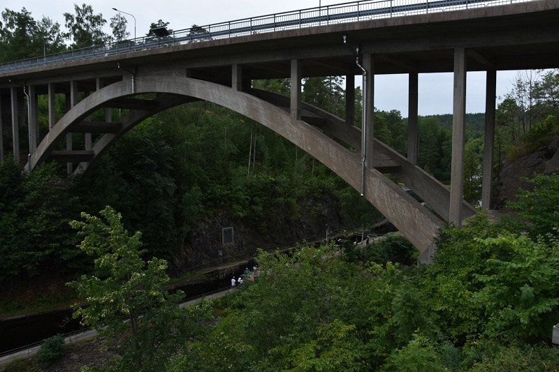
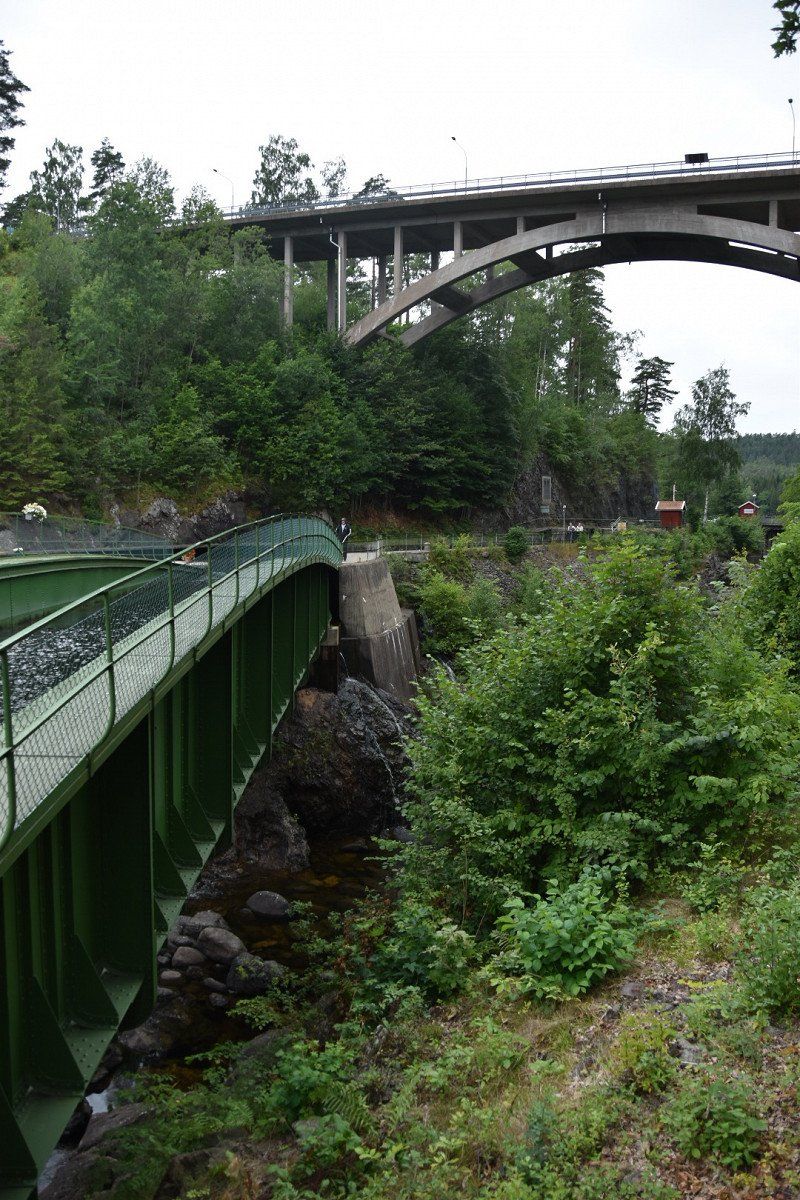
Håverud, Zweden - speciale 3 bruggen boven elkaar
A viaduct, railway viaduct, aqueduct, lock and river that cross each other in a very small area: that is Haverud. If you are here at the beginning of the afternoon you will find exactly the tour boats that pass this junction. You don't have to rush, because both boats take almost an hour to get from one side to the other. They have to wait for each other, so the whole process around the locks takes about 2 hours. Here you see a fine piece of engineering work that our children also appreciated
464 72 Håverud, Zweden
58° 49' 18.9" N 12° 25' 3.4" E
58.8219084 12.4176052
• Head toward Ekedalsvägen on Upperudsvägen. Go for 386 m.
• Continue on Bäcken. Go for 572 m.
• Continue on Linddalen. Go for 863 m.
• Continue on Upperud. Go for 580 m.
• Continue on Upperuds Herrgård. Go for 292 m.
• Continue on Upperud. Go for 544 m.
• Continue on Upperud. Go for 683 m.
• Turn left toward Norra Bränna. Go for 42 m.
• Continue on Norra Bränna. Go for 136 m.
• Continue on Björkliden. Go for 1.0 km.
• Continue on Södra Bränna. Go for 246 m.
• Continue on Skållerud Eriksbyn. Go for 381 m.
• Continue on Skållerud Eriksbyn. Go for 725 m.
• Continue on Skållerud Eriksdal. Go for 858 m.
• Turn right toward Mölnerud. Go for 24 m.
• Continue on Mölnerud. Go for 394 m.
• Continue on Anolfsbyn. Go for 609 m.
• Continue on Anolfsbyn Berget. Go for 544 m.
• Continue on Anolfsbyn Vattenverket. Go for 395 m.
• Continue on Heden. Go for 2.0 km.
• Continue on Tegen. Go for 555 m.
• Turn left onto Tegen. Go for 330 m.
• Keep right onto Tegen. Go for 1.9 km.
• Turn right onto 166. Go for 15.6 km.
• Turn left onto 166. Go for 13.7 km.
• Turn left onto 164/166. Go for 31.8 km.
• Turn left onto 165 toward 163/Hällevadsholm/Tanumshede. Go for 3.1 km.
• Turn right onto 163. Go for 14.3 km.
• Take the 2nd exit from roundabout onto Bullarevägen. Go for 1.1 km.
• Turn right onto Riksvägen. Go for 99 m.
• Turn left onto Kvillevägen. Go for 883 m.
• Continue on Västerby. Go for 1.6 km.
• Continue on Tuvene gård. Go for 622 m.
• Continue on Tegneby. Go for 1.3 km.
• Continue on Bro. Go for 146 m.
• Continue on Orrekläpp. Go for 1.4 km.
• Continue on Berg. Go for 779 m.
• Continue on Stora Anrås. Go for 863 m.
• Continue toward Stora Anrås. Go for 1.1 km.
• Continue on Stora Anrås. Go for 803 m.
• Continue on Stora Anrås. Go for 1.0 km.
• Continue on Krokbräcke. Go for 745 m.
• Turn right onto Skistad. Go for 932 m.
• Continue on Karlslund Gripetorpet. Go for 602 m.
• Continue on Nordby. Go for 491 m.
• Continue on Nordby. Go for 606 m.
• Continue toward Norra Ödsmål. Go for 515 m.
• Continue on Norra Ödsmål. Go for 1.0 km.
• Turn right onto Ekelidsvägen. Go for 42 m.
• Arrive at Ekelidsvägen. Your destination is on the right.
☍
109,5 km
(1 hrs. 32 min.)
Overnachten op parking
Tanumsvägen
58° 36' 6.3" N 11° 17' 46.4" E
58.6017615 11.2962138
• Head south on Ekelidsvägen. Go for 42 m.
• Turn right toward Gamla Stämmenvägen. Go for 68 m.
• Continue on Gamla Stämmenvägen. Go for 44 m.
• Continue on Tanumsvägen. Go for 368 m.
• Arrive at Tanumsvägen. Your destination is on the right.
☍
0,5 km
( )
Day
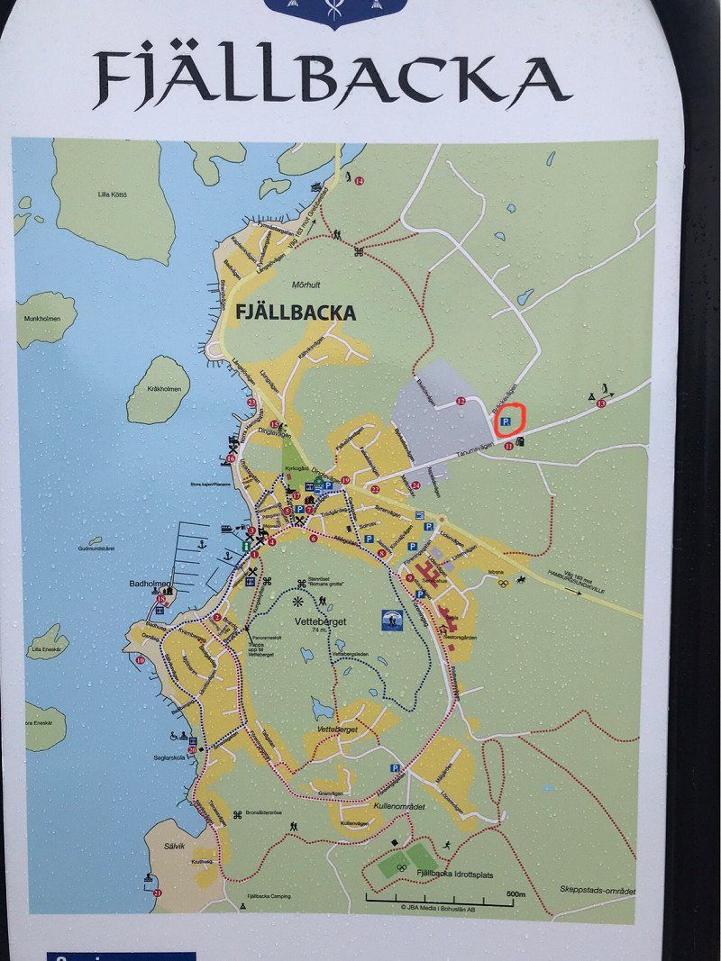
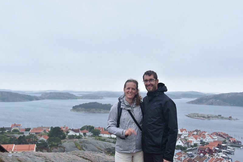
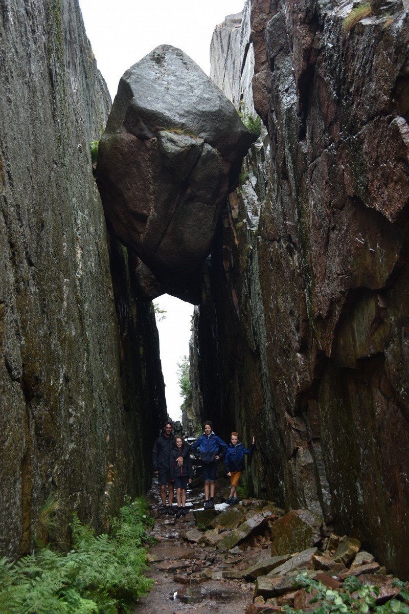
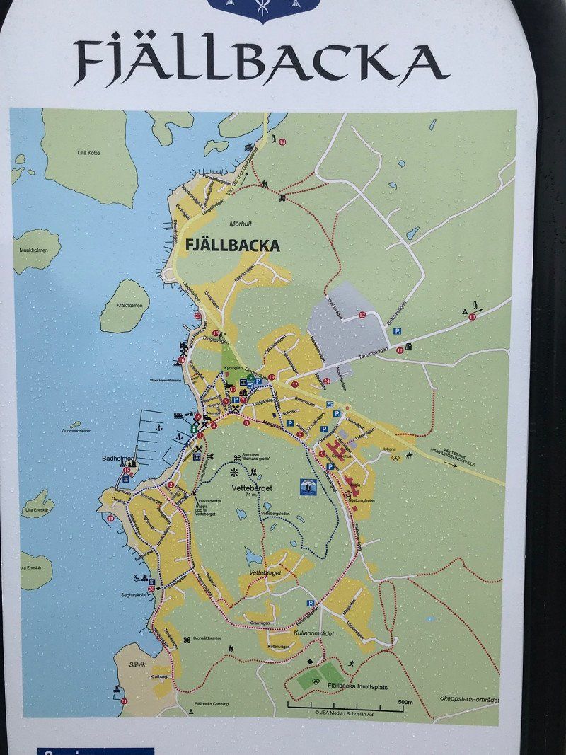
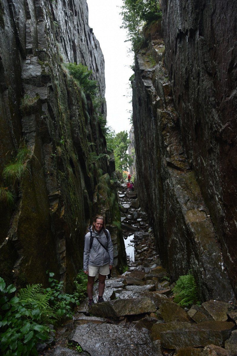
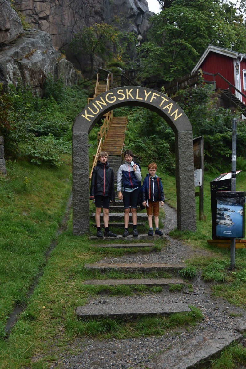
Fjällbacka, Zweden
457 40 Fjällbacka, Zweden
58° 35' 59.2" N 11° 17' 17.6" E
58.5997756 11.2882238
• Head south on Tanumsvägen.
• Turn left onto Dinglevägen (163). Go for 267 m.
• Take the 2nd exit from roundabout onto Dinglevägen (163). Go for 1.5 km.
• Turn left onto 163. Go for 13.0 km.
• Turn right and take ramp onto E6 toward Göteborg/Uddevalla. Go for 111 km.
• Keep left onto E6 (Olskroksmotet). Go for 128 m.
• Continue on E20 (Olskroksmotet). Go for 136 km.
• Take exit 44 toward Kalmar. Go for 485 m.
• Take the 2nd exit from roundabout onto Växjövägen (E6.5) toward Kalmar/Växjö. Go for 363 m.
• Pass 2 roundabouts and continue on Växjövägen (25). Go for 14.9 km.
• Turn right onto Tönnersjövägen toward Tönnesjö. Go for 593 m.
• Turn left toward Eriksköp. Go for 709 m.
• Turn left onto Eriksköp. Go for 231 m.
• Arrive at Eriksköp. Your destination is on the right.
☍
278,9 km
(3 hrs. 2 min.)
Overnachten
Found through camp 4 cousin right on hike to waterfall
Blue walk 2.6km
ERIKSKÖP 594, 310 38 Simlångsdalen, Zweden
56° 42' 31.8" N 13° 7' 35.8" E
56.7088467 13.1266091
• Head northwest on Eriksköp. Go for 208 m.
• Arrive at Eriksköp.
☍
0,2 km
( )
Day
provincie Halland
Halland is an idyllic province on Sweden's west coast with a rich foodie culture and a wealth of outdoor activities. You can enjoy fantastic cycling here, but also surfing. With a perfect mix of sandy beaches and lush forests - with towering sand dunes and waterfalls - this coastal area is more than worth a visit.
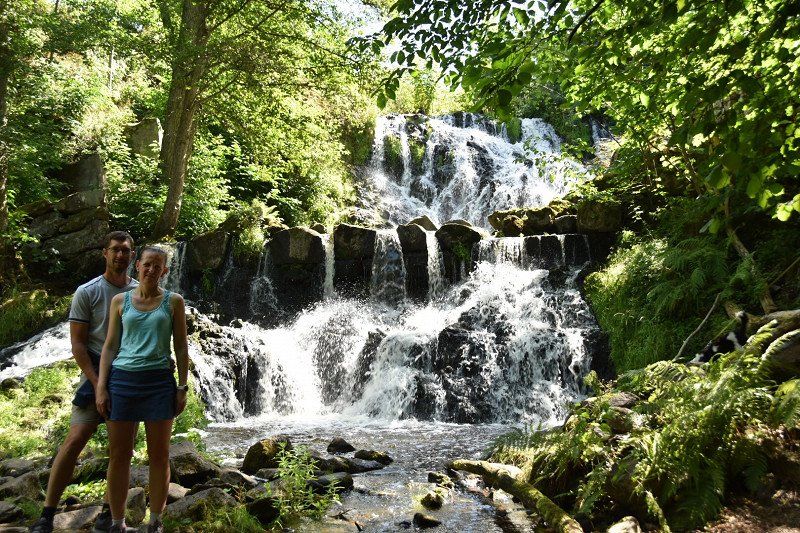
Danska Fall, Simlångsdalen - waterval
waterfall
walk 2.6 km (blue)
310 38 Simlångsdalen, Zweden
56° 42' 33.3" N 13° 7' 24.6" E
56.7092421 13.1235123
• Head west on Eriksköp. Go for 24 m.
• Turn left. Go for 6.2 km.
• Turn right. Go for 150 m.
• Turn left toward Tönnersjö Skogstorp. Go for 2.3 km.
• Continue on Tönnersjö Skogstorp. Go for 647 m.
• Continue on Tönnersjö Hultabo. Go for 276 m.
• Continue on Tönnersjö. Go for 425 m.
• Turn right toward Tönnersjö Sjögård. Go for 188 m.
• Continue on Tönnersjö Sjögård. Go for 357 m.
• Continue on Tönnersjö. Go for 386 m.
• Continue on Tönnersjö Villa Sjöholma. Go for 325 m.
• Continue on Tönnersjö Annelund. Go for 101 m.
• Continue on Tönnersjö Dalabygget. Go for 81 m.
• Continue on Tönnersjögården. Go for 811 m.
• Continue on Perstorp Skogstomten. Go for 982 m.
• Continue on Perstorp. Go for 2.1 km.
• Continue on Eldsberga Lugnet. Go for 103 m.
• Continue on Eldsberga. Go for 1.6 km.
• Continue on Eldsbergavägen. Go for 430 m.
• Turn left onto Halmstadvägen (15). Go for 1.3 km.
• Turn right onto Tönnersa. Go for 1.5 km.
• Continue on Tönnersa. Go for 297 m.
• Continue on Tönnersa. Go for 563 m.
• Continue on Tönnersa Skogslyckan. Go for 2.8 km.
• Turn right toward E6/E20. Go for 662 m.
• Take ramp onto E6/E20. Go for 40.2 km.
• Take exit 33 toward Höganäs/Åstorp/21/Ängelholm S. Go for 394 m.
• Turn right onto Åstorpsvägen (112) toward Höganäs/Ängelholm. Go for 328 m.
• Take the 2nd exit from roundabout onto Höganäsvägen (112). Go for 12.1 km.
• Turn right onto Norra Kustvägen toward Mölle/Arild/Jonstorp. Go for 10.0 km.
• Turn right onto Bränneslyckevägen. Go for 2.8 km.
• Continue on Kullabergsvägen (111). Go for 2.9 km.
• Continue on Kullabergsvägen (111). Go for 423 m.
• Continue on Italienska vägen (111). Go for 3.3 km.
• Turn slightly right onto Italienska vägen. Go for 113 m.
• Arrive at Italienska vägen. Your destination is on the left.
☍
97,2 km
(1 hrs. 27 min.)
Naturum Kullaberg
Nice walk
56° 18' 4.6" N 12° 27' 7.6" E
56.3012881 12.4520979
• Head north on Italienska vägen. Go for 13 m.
• Arrive at Italienska vägen.
☍
0,0 km
( )
Vuurtoren
Italienska vägen 323, 263 77 Mölle, Zweden
56° 18' 5.1" N 12° 27' 7.3" E
56.3014079 12.4520349
• Head north on Italienska vägen. Go for 3.3 km.
• Turn slightly right toward Italienska vägen/111. Go for 80 m.
• Turn slightly right onto Italienska vägen (111). Go for 26 m.
• Continue on Kullabergsvägen (111). Go for 3.3 km.
• Turn right onto Krapperupsvägen (111) toward Höganäs. Go for 5.0 km.
• Continue on Kullagatan (111). Go for 2.3 km.
• Turn right onto Bruksgatan toward Industriområde Höganäs. Go for 657 m.
• Turn right onto Smedjegatan. Go for 373 m.
• Turn right onto Frihamnsgatan. Go for 34 m.
• Turn slightly left onto Öresundsgatan. Go for 110 m.
• Arrive at Öresundsgatan. Your destination is on the right.
☍
15,2 km
( 24 min.)
gratis overnachten
Kaptensgatan 17, 263 39 Höganäs, Sweden
56° 12' 2.1" N 12° 32' 41" E
56.2005900 12.5447331
• Head toward Kaptensgatan on Öresundsgatan. Go for 29 m.
• Turn left onto Kaptensgatan. Go for 175 m.
• Turn slightly left onto Småbåtshamnen. Go for 60 m.
• Continue on Strandgatan. Go for 149 m.
• Turn right onto Strandgatan. Go for 265 m.
• Turn left onto Storgatan. Go for 149 m.
• Turn right onto Långarödsvägen. Go for 624 m.
• Turn right onto Höganäsvägen (111). Go for 500 m.
• Take the 2nd exit from roundabout onto Höganäsvägen (111). Go for 2.2 km.
• Take the 3rd exit from roundabout onto 111 toward Helsingborg. Go for 4.9 km.
• Pass 2 roundabouts and continue on Österleden (111). Go for 18.9 km.
• Take the 1st exit from roundabout onto Rusthållsgatan toward E4/E6/E20. Go for 277 m.
• Take the 1st exit from roundabout onto E4 (Malmöleden) toward E6/E20. Go for 855 m.
• Continue on Trafikplats Helsingborg S toward Malmö/E6/E20. Go for 331 m.
• Take the exit onto E6/E20 (Trafikplats Helsingborg S). Go for 64.0 km.
• Continue on E20 (Yttre Ringvägen) toward Flygplats/Köpenhamn/Limhamn. Go for 13.7 km.
• Continue on E20 (Øresundsbroen). Go for 53.5 km.
• Keep left onto E20 (Køge Vest) toward Odense. Go for 79.1 km.
• Arrive at Storebæltsbroen (E20).
☍
239,8 km
(2 hrs. 20 min.)
Sprogø, Slagelse Kommune, Seeland, Denemarken
55° 20' 36.2" N 10° 59' 21.7" E
55.3433877 10.9893473
• Head west on E20 (Storebæltsbroen). Go for 95.2 km.
• Keep left onto E20 (Fredericia) toward Esbjerg/E45s/Kolding/Flensborg. Go for 15.5 km.
• Continue on E45 (Sønderjyske Motorvej) toward Flensborg. Go for 83.2 km.
• Continue on A7. Go for 156 km.
• Keep left onto A7. Go for 14.7 km.
• Keep right onto A261 (Autobahndreieck Hamburg-Südwest) toward Bremen/Tötensen. Go for 9.0 km.
• Take exit 4 toward Osnabrück/Bremen/Rade onto A1. Go for 60.3 km.
• Take exit 51 toward Posthausen. Go for 286 m.
• Turn left onto Wümmingen (L155) toward Verden/Posthausen/Dodenhof. Go for 2.2 km.
• Arrive at Mitteldorf (L155). Your destination is on the right.
☍
436,2 km
(3 hrs. 53 min.)
Day
gratis overnachten met gratis elektriciteit.
close to shops like Aldi.
Posthausen 17, 28870 Ottersberg, Germany
53° 3' 52" N 9° 10' 16.8" E
53.0644380 9.1713216
• Head north on Mitteldorf (L155). Go for 2.1 km.
• Take ramp onto A1 toward Bremen. Go for 191 km.
• Take exit 78 toward Recklinghausen/Dülmen onto A43. Go for 41.8 km.
• Take exit 9 toward Gladbeck/Gelsenkirchen-Buer/Marl onto A52. Go for 23.5 km.
• Take ramp onto A2 toward Oberhausen/Emden. Go for 10.3 km.
• Take exit 1 toward Oberhausen onto A516. Go for 6.1 km.
• Continue on B223. Go for 591 m.
• Take ramp onto A42 (Emscherschnellweg) toward Köln/A3/Kamp-Lintfort. Go for 21.5 km.
• Take the exit onto A57. Go for 5.8 km.
• Take exit 10 toward Venlo onto A40. Go for 28.6 km.
• Continue on A67 (Europaweg). Go for 52.1 km.
• Continue on A2 (Randweg Eindhoven). Go for 3.2 km.
• Take the exit toward Antwerpen/Eersel onto A67. Go for 19.4 km.
• Continue on E34. Go for 57.6 km.
• Continue on E34 (Antwerpen-Oost) toward Ring Antwerpen 1/Brugge/Gent/Haven 1000-2000/Brussel/Ring Antwerpen 2/Breda/Haven 1-999. Go for 1.8 km.
• Continue on E19 (Ring Antwerpen 1). Go for 2.5 km.
• Continue on E34 (Kleine Ring) toward Brugge/Gent/Haven 1000-2000. Go for 5.2 km.
• Continue on E17. Go for 49.5 km.
• Take the exit toward Brussel/Oostende onto E40. Go for 22.9 km.
• Take exit 11 toward Knokke-Heist/Haven Zeebrugge Oost/Tielt/Aalter. Go for 335 m.
• Take the 2nd exit from roundabout onto Tieltsesteenweg (N37) toward Tielt/Deinze/N409. Go for 356 m.
• Take the 2nd exit from roundabout onto Tieltsesteenweg (N37) toward Tielt. Go for 11.4 km.
• Turn right onto Ringlaan (N37) toward Pittem/Industriezone Huffesele. Go for 4.6 km.
• Turn right onto Vijfstraat (N35) toward Centrum. Go for 116 m.
• Continue on Tieltstraat (N35). Go for 894 m.
• Arrive at Tieltstraat (N35).
☍
563,0 km
(5 hrs. 48 min.)
Day
Pittem, België
8740 Pittem, België
50° 59' 35.3" N 3° 15' 59.5" E
50.9931453 3.2665389