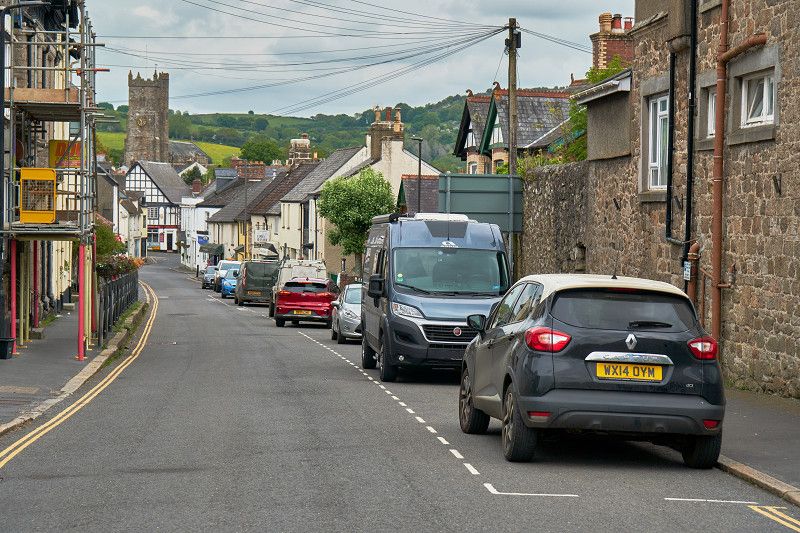
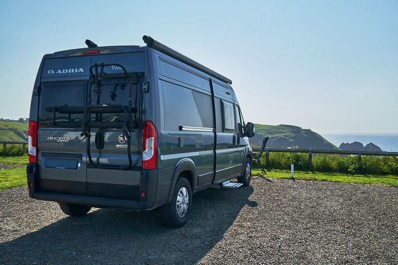
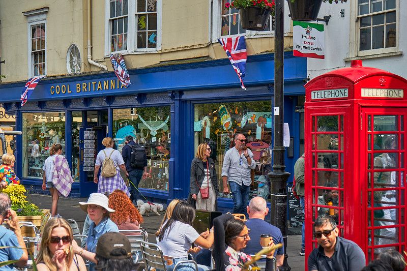
In mid-May 2023 we 🙋♀️🙋♂️ went on an expectant road trip in the 🚐💨 box van through 🇬🇧 southern England. In total it was 2,174 KM in 16 days and our trip became one of our most beautiful road trips.
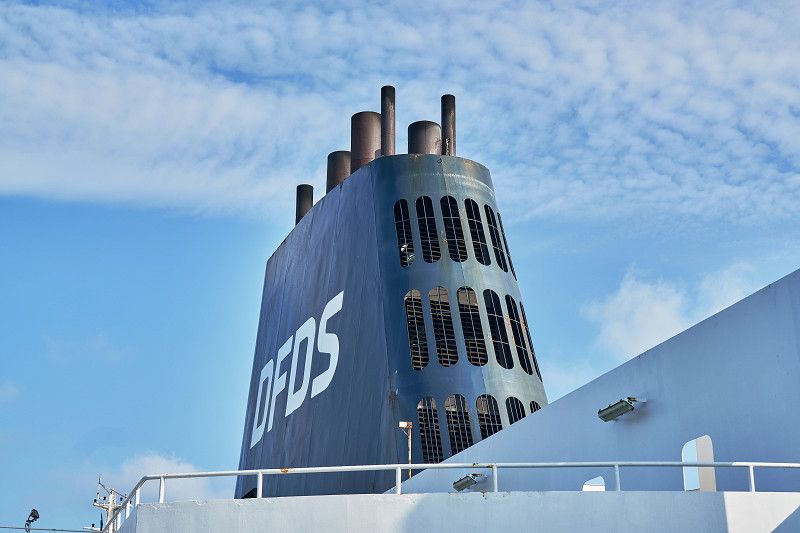
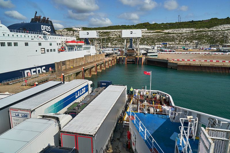
We spent the night after arrival in front of the ferry port in Dunkerque and so our journey begins with the ⛴️ ferry crossing at 8am to Dover.
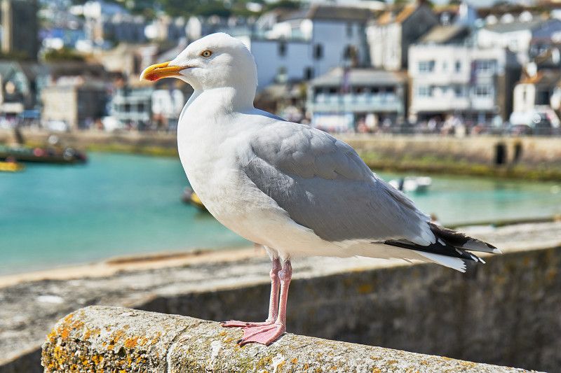
On our road trip along the southern English cliffs, we visit the two contrasting seaside resorts of Eastbourne and Brighton, discover the Garden of Eden in Cornwall and a lot of new things in the West. We climb the gentle Beachy Head above Eastbounes and the rugged cliffs above Merlin's Cave at Tintagel Castle, where the legendary King Arthur was once born.
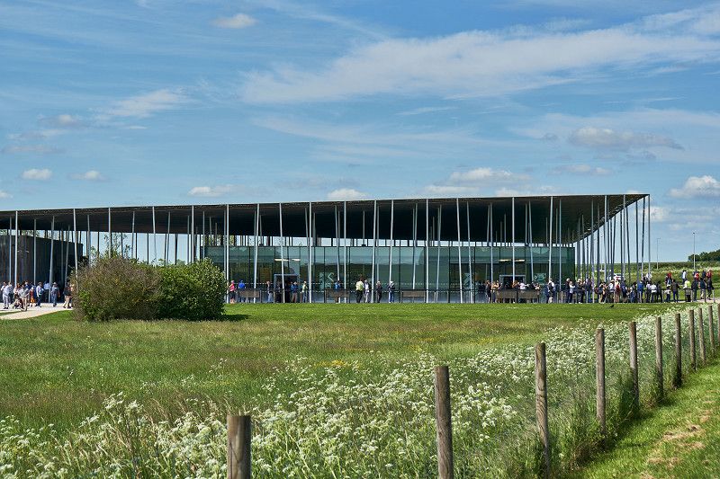
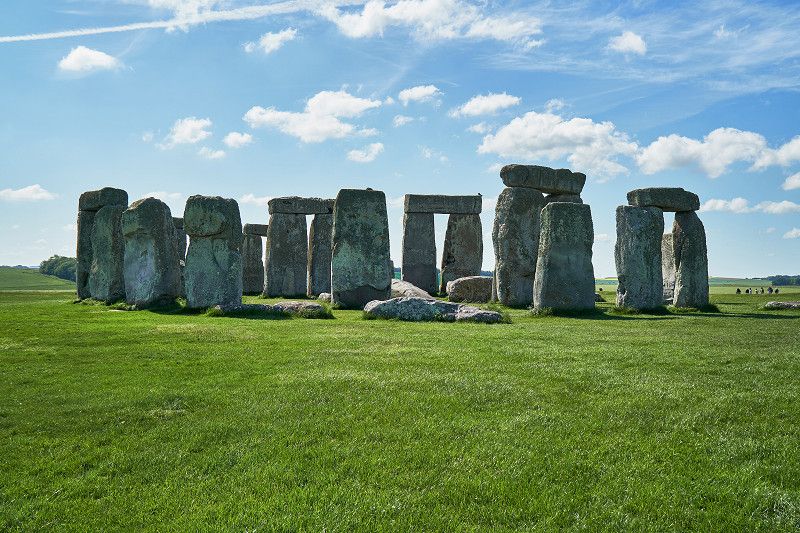
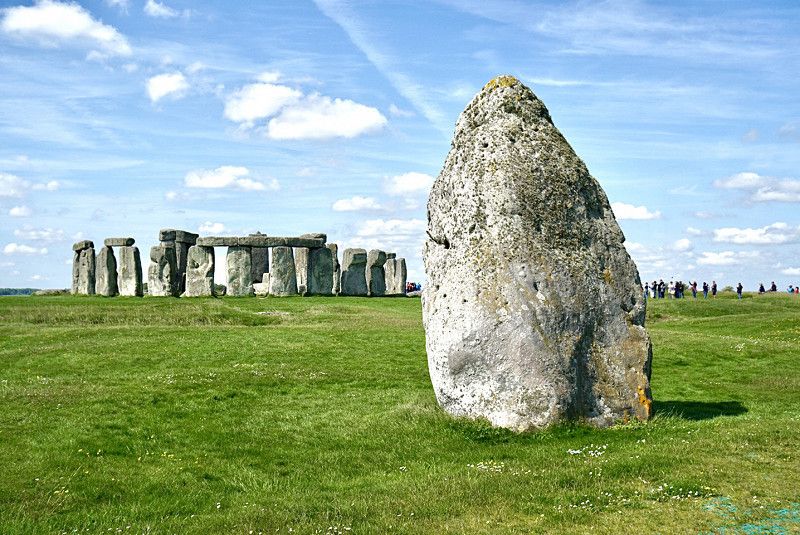
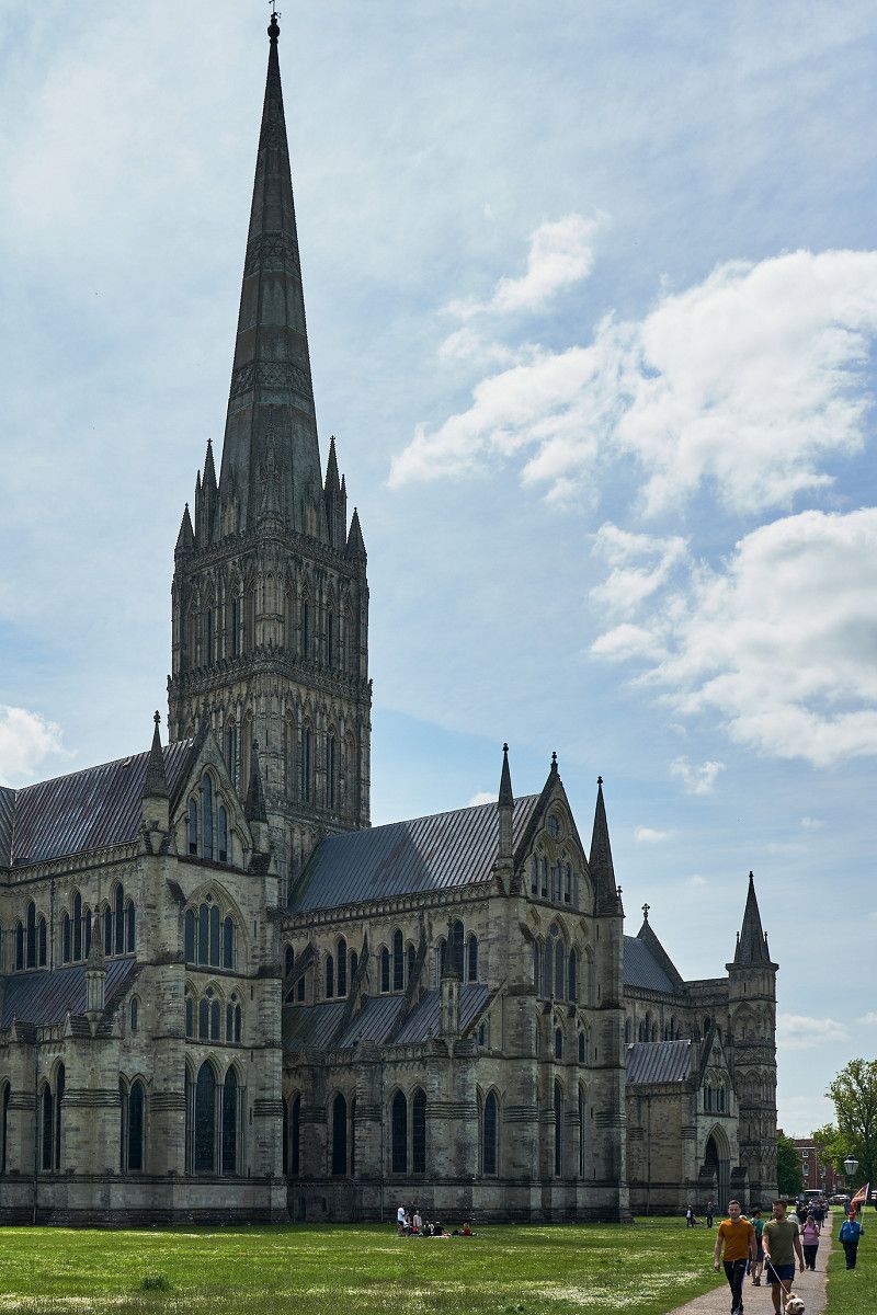
The Neolithic left behind monumental stone circles further inland, which included, for example, the position of the sun at the midsummer solstice. The World Heritage Site Stonehenge with its impressive visitor center near the city of Salisbury and the largest stone circle in Avebury are visited on our trip. We also visit one of the four surviving editions of the Magna Carta in Salisbury Cathedral.
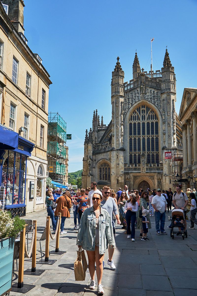
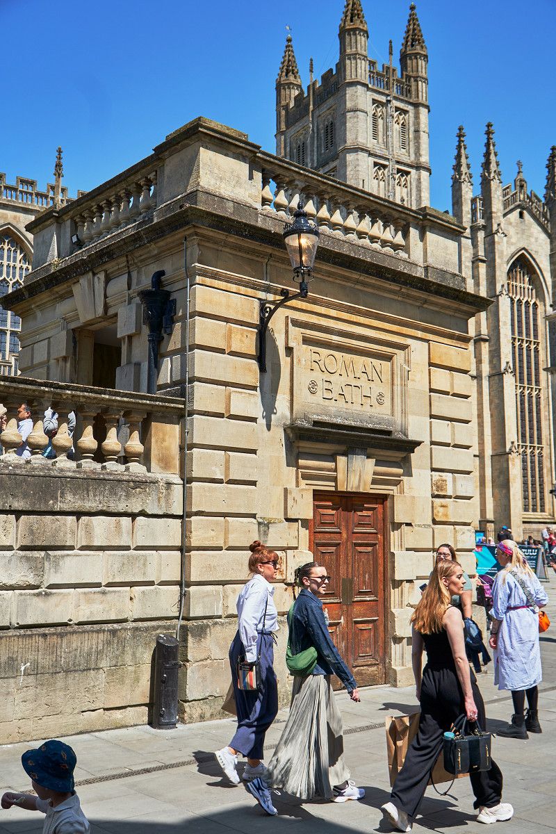
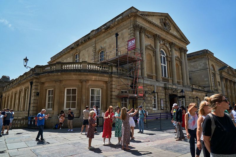
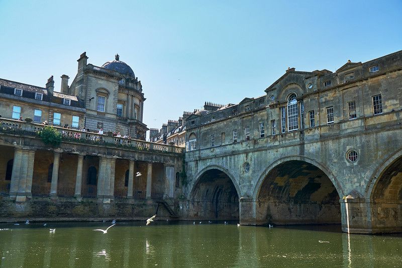
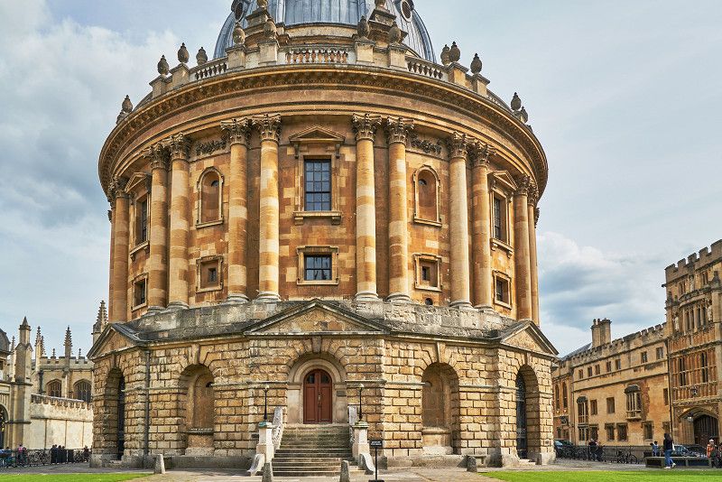
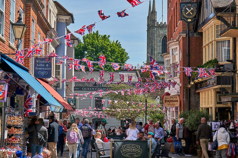
And we travel further on famous ground: The lively Bath with its Roman bath not only serves as a film set for Netflix. In Oxford we visit the elite of British colleges and one of the most famous universities in the world, where Harry Potter was filmed. And then venture into the British monarchy with Windsor, which ends far too quickly at Buckingham Palace with a brief look at the king.
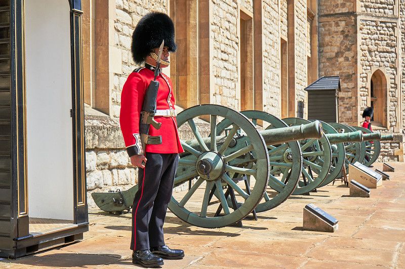
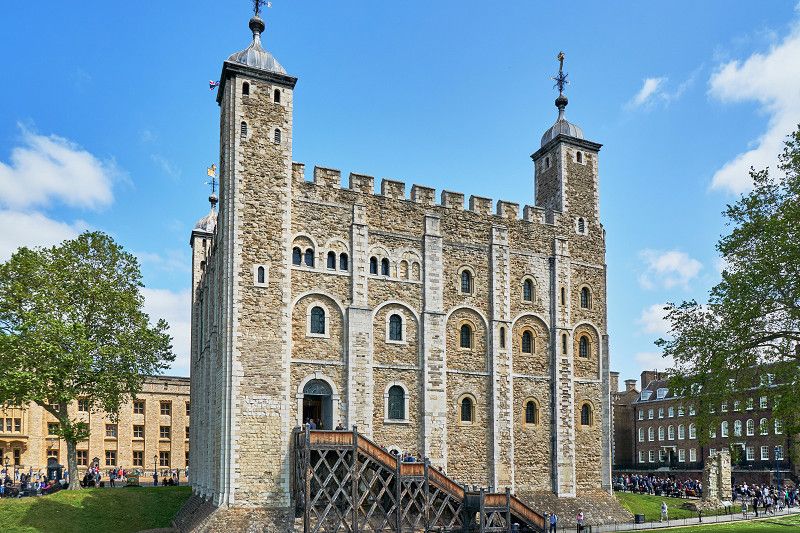
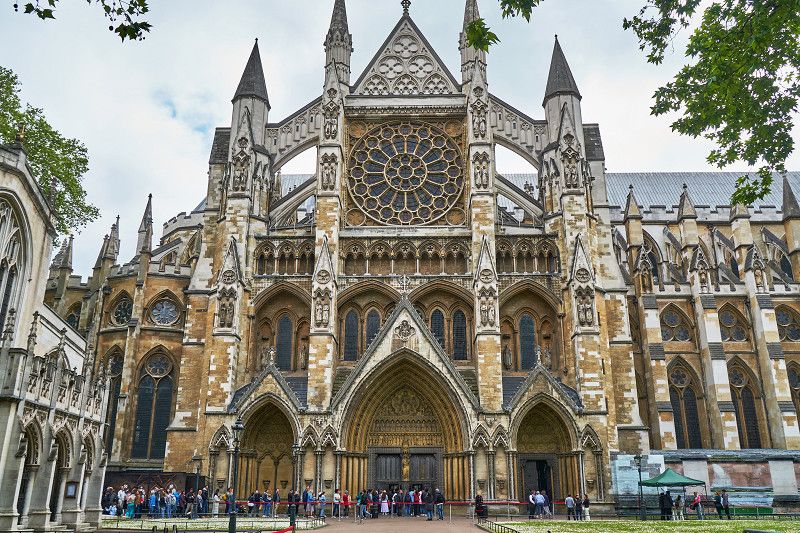
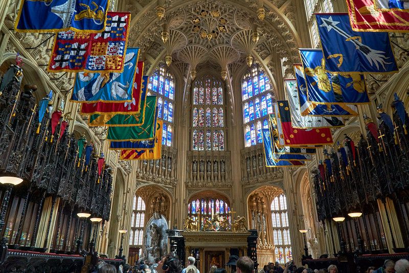
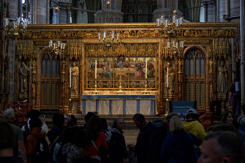
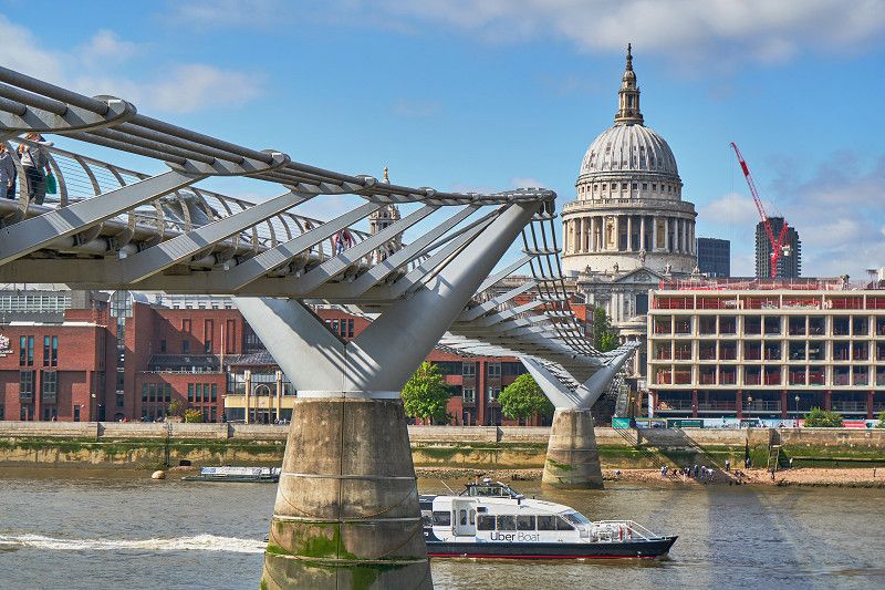
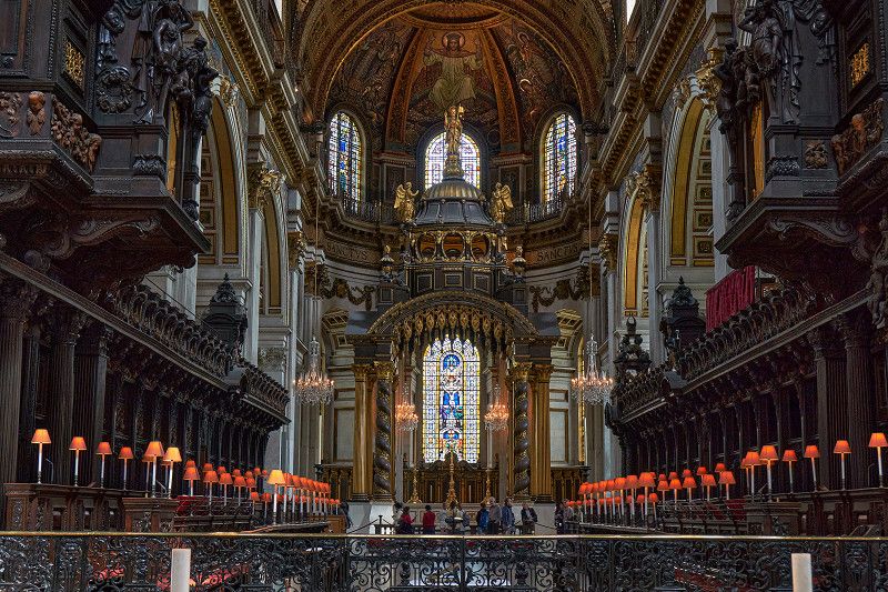
Highlights of our two days in London are visiting the Tower of London and climbing the inside of Tower Bridge, our walk through the government district in Westminster with Big Ben, the Houses of Parliament and No. Downing Street. 10, the visit of the cathedrals ⛪ Westminster Abbey and St. Pauls as well as our trip with an Uber boat across the Thames.
You will soon find our travel report on our 🎥 YouTube channel (https://tinyurl.com/ErstmalDurchEuropa).
Day
Fährüberfahrt Dunkerque nach Dover
We took the approximately two-hour ferry between Dunkerque and Dover for our journey.
Day
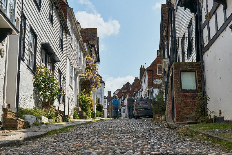
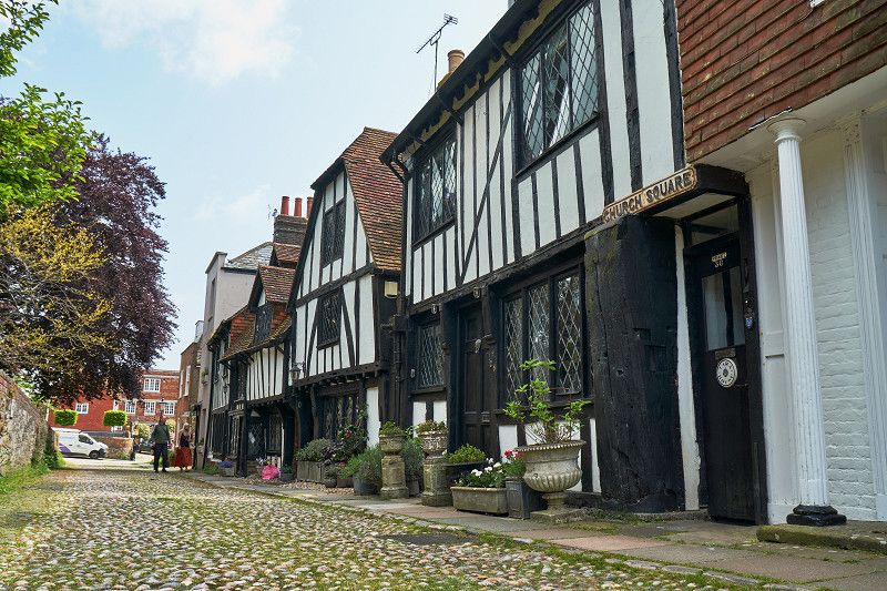
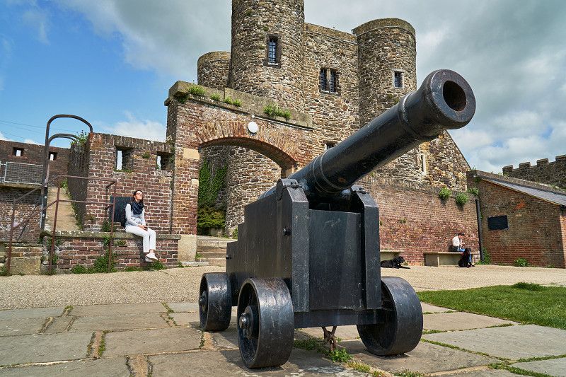
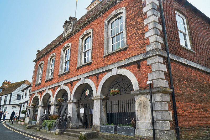
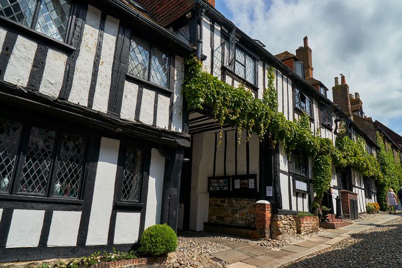
Rye: Schmugglernest und südenglische Kulinarik
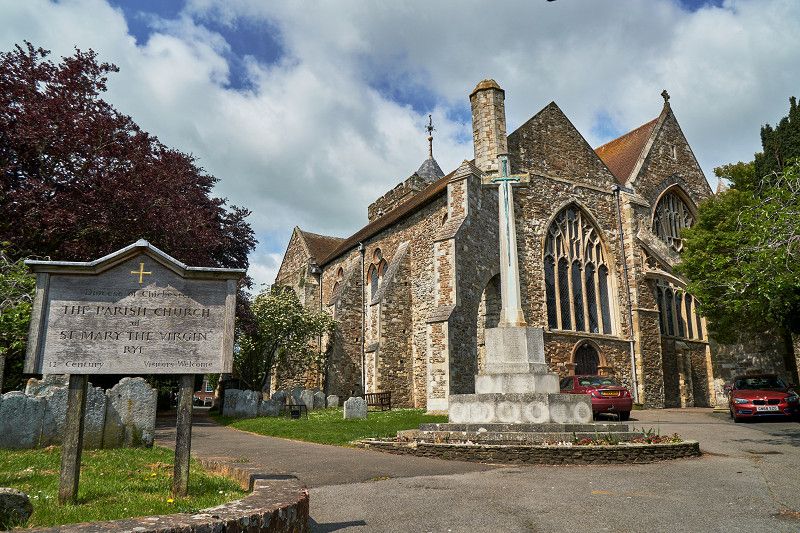
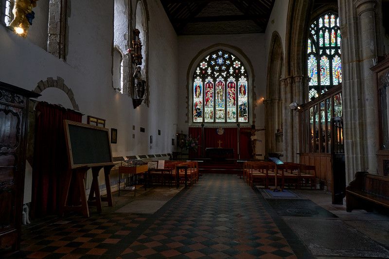
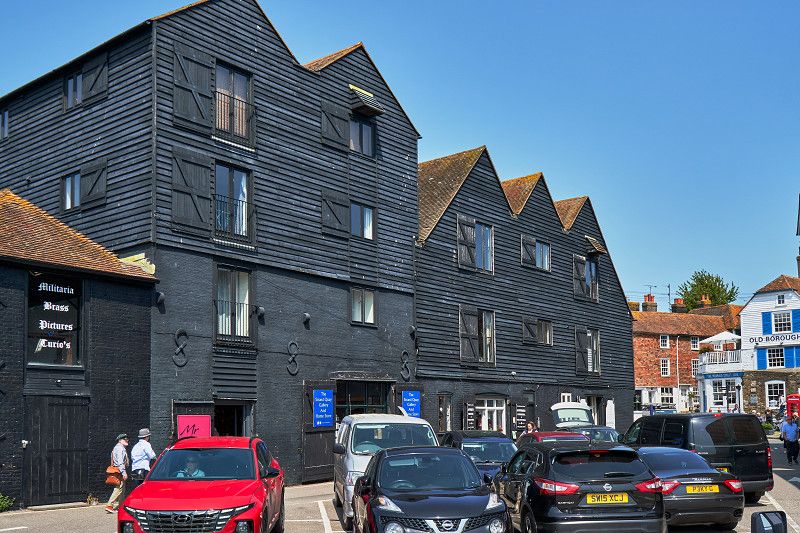
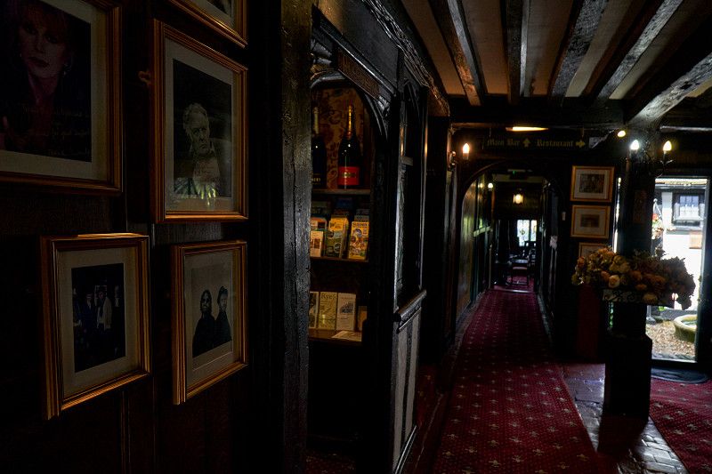
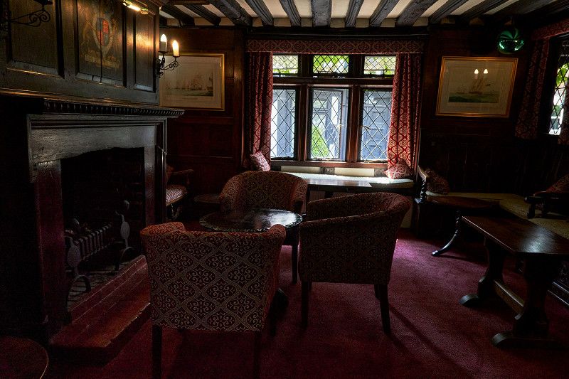
Rye is a former smugglers' town and today a historic harbor town with lots of charm. We walk up the hill along the cobblestone Mermaid Street and visit the small fort with its Gun Garden. We ate at the Mermaid Inn - excellent, like Queen Mother or other personalities from film and television (including Johnny Depp and Michael Cane). St Mary's Church, also known as East Sussex Cathedral, is famous for having one of the oldest working church clocks in the world. Our city walk is followed by the warehouses in the old town and the town hall of Rye.
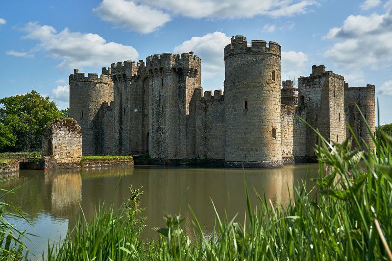
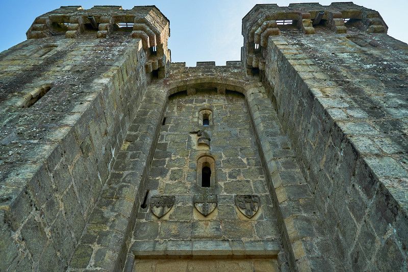
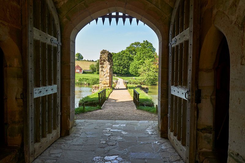
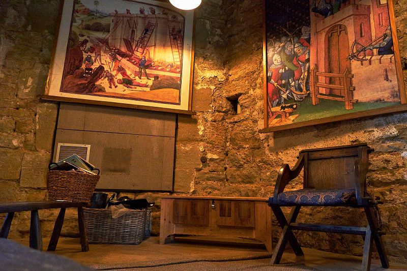
Bodiam: Romantische Ritterburg
With the Bodiam Castle we visit THE blueprint for medieval castles and fortresses. Once built for a knight for his brave service, today only the foundation walls and the outer defenses have been preserved. You can move around freely and if you are lucky you will find a unicorn hidden in the old stones.
Battle Normanhurst Court Caravan Club Site
In the middle of an old park to a long-forgotten manor house we spend the night in a much more historic place. This is where the Normans came from Hastings harbor in the 17th century and fought the British.
Stevens Crouch, TN33 9LR, Battle, United Kingdom
50° 54' 32.3" N 0° 25' 49.6" E
50.9089787 0.4304334
• Head southwest on A271. Go for 4.6 km.
• Turn right onto Boreham Hill (A271). Go for 5.0 km.
• Pass 3 roundabouts and continue on Upper Horsebridge Road (A271). Go for 7.3 km.
• Take the 2nd exit from Boship Roundabout roundabout onto A22 toward London/E. Grinstead/Tun. Wells/Lewes/(B2124)/Lower Dicker/Uckfield. Go for 4.1 km.
• Turn left onto Lewes Road (B2124) toward Lewes/Laughton. Go for 1.1 km.
• Continue on B2124. Go for 2.3 km.
• Continue on Laughton Road (B2124). Go for 4.5 km.
• Take the 1st exit from roundabout onto Lewes Road (B2192). Go for 1.7 km.
• Take the 1st exit from roundabout onto Lewes Road (B2192). Go for 503 m.
• Continue on B2192. Go for 1.9 km.
• Continue on Malling Down (A26). Go for 1.1 km.
• Take the 1st exit from roundabout onto Cuilfail Tunnel (A26). Go for 1.3 km.
• Take the 2nd exit from Southerham Roundabout roundabout onto A27 toward Brighton/London. Go for 3.4 km.
• Take the 2nd exit from Ashcombe Roundabout roundabout onto Brighton Road (A27) toward Brighton/London/(A23)/Falmer. Go for 3.9 km.
• Take ramp toward Falmer/Rottingden. Go for 286 m.
• Take the 1st exit from roundabout onto The Drove (B2123). Go for 1.1 km.
• Continue on Falmer Road (B2123). Go for 2.0 km.
• Turn right onto Warren Road. Go for 1.9 km.
• Turn left onto Wilson Avenue. Go for 2.0 km.
• Turn left onto Rebecca Close. Go for 656 m.
• Turn slightly left onto Sheepcote Valley. Go for 54 m.
• Arrive at Sheepcote Valley. Your destination is on the left.
☍
50,7 km
( 48 min.)
Day
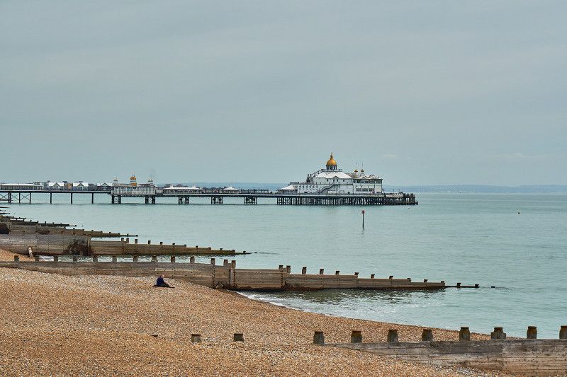
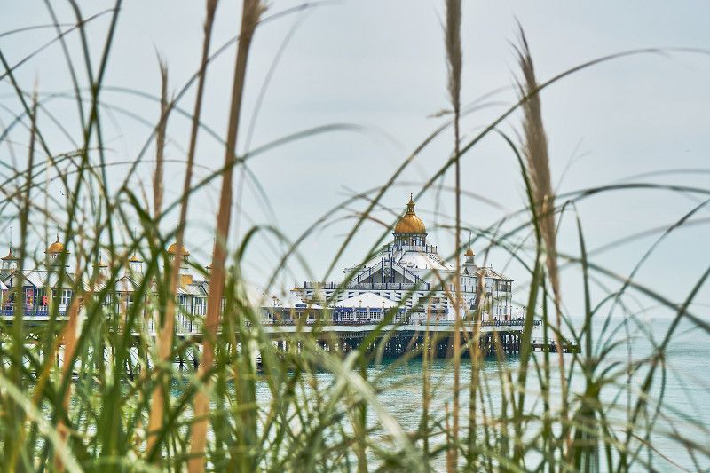
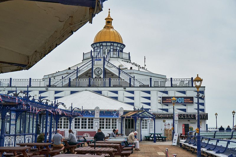
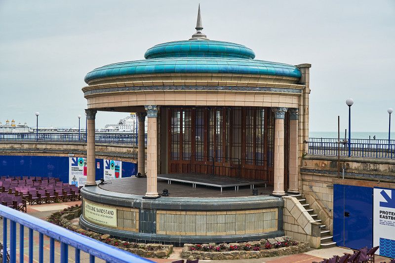
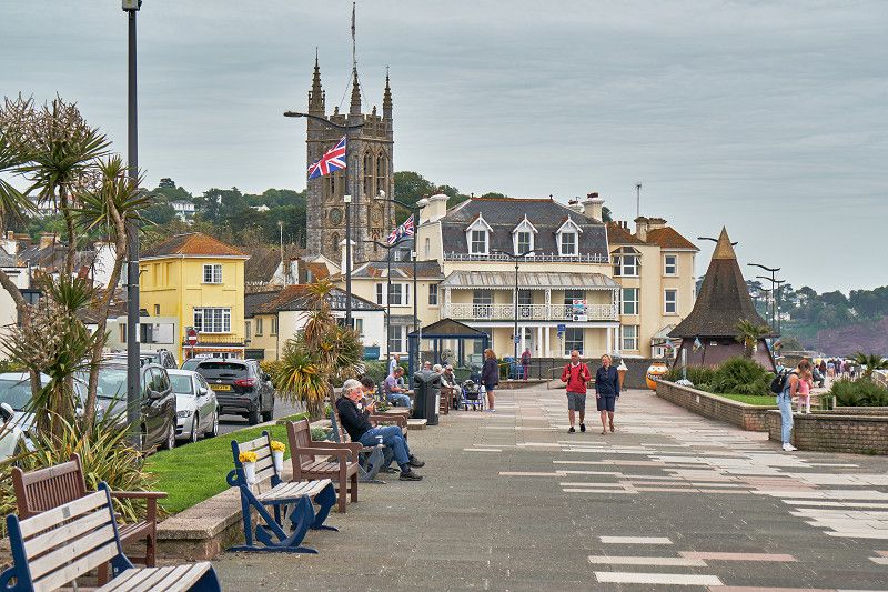
Eastbourne: Mondänes Seebad
The beautiful promenade with plenty of parking and a Ferris wheel is just minutes from the Victorian Pier. It doesn't remind much of the glory of the old days, when members of the royal family used to enjoy their summer holidays here. Concerts are now held almost daily at the Bandstand - mainly tributes to "British Stars" concerts such as Elton John.
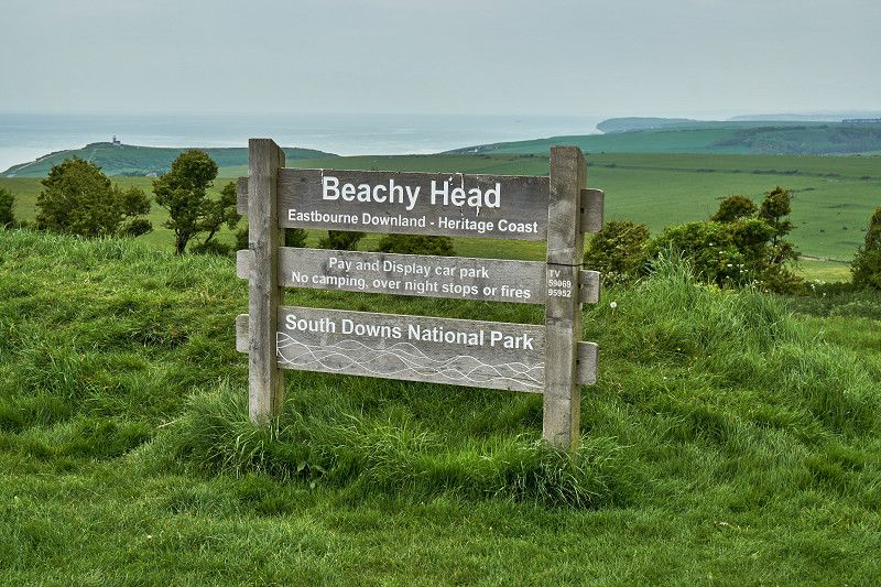
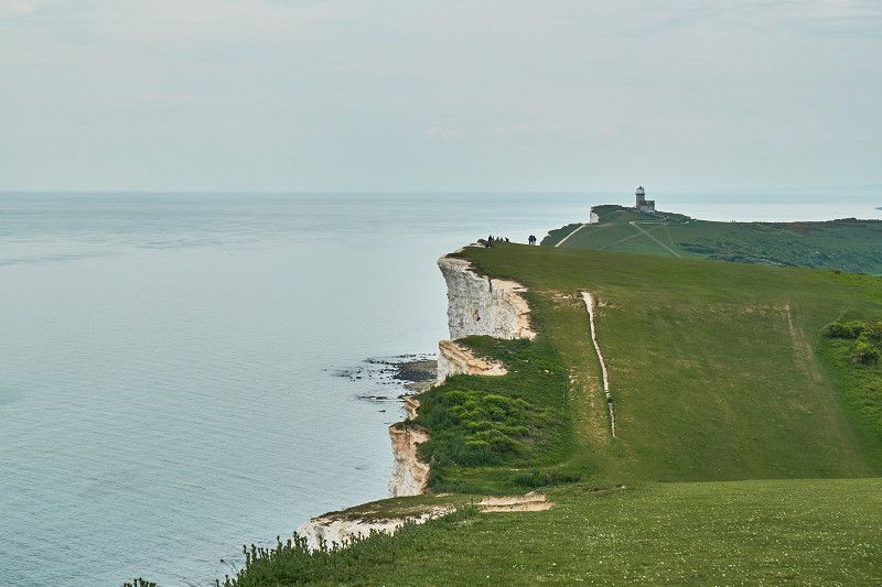
Beachy Head: Wanderung entlang der Steilküste
Just a stone's throw from fashionable Eastbourne and perched high above is Beachy Head. The name derives from the French for beautiful hill. Up here we hiked with a view of the lighthouse below and were able to look back at Eastbourne.
Brighton Caravan Club Site
East Brighton Park, BN2 5TS, Brighton, United Kingdom
50° 49' 16.7" N 0° 5' 53.3" W
50.8213000 -0.0981400
• Head south on Sheepcote Valley. Go for 136 m.
• Turn slightly left onto Rebecca Close. Go for 574 m.
• Turn right onto Wilson Avenue. Go for 2.0 km.
• Turn right onto Warren Road. Go for 1.9 km.
• Turn left onto Falmer Road (B2123). Go for 2.0 km.
• Continue on The Drove (B2123). Go for 1.1 km.
• Take the 2nd exit from roundabout onto Falmer Hill (A27). Go for 1.1 km.
• Keep right onto A27 toward Worthing/London/A23. Go for 2.3 km.
• Take ramp toward Hollingbury Industrial Estate/Ditchling. Go for 256 m.
• Take the 3rd exit from roundabout onto A27 toward Worthing/London/(A23)/Hove. Go for 1.8 km.
• Keep right onto A27 toward Worthing/Hove. Go for 2.0 km.
• Keep right onto A27 toward Worthing/Shoreham/(A293). Go for 9.0 km.
• Keep right onto Shoreham By-pass (A27) toward Worthing/Lancing/Airport. Go for 1.3 km.
• Take the 2nd exit from roundabout onto Old Shoreham Road (A27) toward Worthing/Portsmouth/London/Horsham/(A24). Go for 1.2 km.
• Take the 2nd exit from roundabout onto Upper Brighton Road (A27) toward Portsmouth/Worthing/Sompting/London/(A24)/Horsham. Go for 4.6 km.
• Take the 2nd exit from Grove Lodge Roundabout roundabout onto Warren Road (A27) toward Portsmouth/London/Horsham/(A24). Go for 1.2 km.
• Take the 3rd exit from roundabout onto Crockhurst Hill (A27) toward Chichester/Portsmouth. Go for 10.7 km.
• Take the 2nd exit from roundabout onto Lyminster Road (A27) toward Chichester/Portsmouth/London/Dorking/(A284). Go for 1.2 km.
• Pass 2 roundabouts and continue on Chichester Road (A27). Go for 7.0 km.
• Take the 1st exit from roundabout onto A27 toward Barnham/Goodwood. Go for 646 m.
• Take the 3rd exit from roundabout onto Arundel Road (A27) toward Chichester/Portsmouth/Tangmere/Goodwood. Go for 4.4 km.
• Take the 2nd exit from roundabout onto A27 toward Goodwood. Go for 3.5 km.
• Take the 2nd exit from Portfield Roundabout roundabout onto Portfield Way (A285) toward Chichester/Hospital. Go for 361 m.
• Take the 1st exit from roundabout onto Westhampnett Road (A285) toward Chichester/Midhurst. Go for 111 m.
• Pass 3 roundabouts and continue on St Pancras (A285). Go for 1.1 km.
• Keep right onto The Hornet (A286) toward Ring Road/Soutgate/Witterings/Portsmouth/(A27). Go for 162 m.
• Keep left onto Market Road (A286) toward Southgate/Witterings/Portsmouth/(A27). Go for 703 m.
• Keep right onto A286 toward Witterings. Go for 51 m.
• Keep left onto Stockbridge Road (A286) toward Witterings. Go for 583 m.
• Take the 3rd exit from Stockbridge Roundabout roundabout onto Chichester By-pass (A27) toward Portsmouth. Go for 1.2 km.
• Take the 2nd exit from Fishbourne Roundabout roundabout onto A27 toward Portsmouth/Havant. Go for 18.5 km.
• Take ramp toward Portsmouth (E)/Central Southsea/P'Mouth(E)/Southsea/Milton/Hilsea. Go for 617 m.
• Take the 1st exit from Eastern Road Roundabout roundabout onto Eastern Road (A2030) toward P'Mouth(E)/Southsea/Milton/Hilsea. Go for 4.8 km.
• Turn left onto Milton Road (A288) toward Eastney/Milton/Seafront. Go for 549 m.
• Take the 1st exit from roundabout onto Locksway Road. Go for 1.2 km.
• Turn right onto Milton Locks. Go for 70 m.
• Arrive at Milton Locks. Your destination is on the right.
☍
89,9 km
(1 hrs. 13 min.)
Day
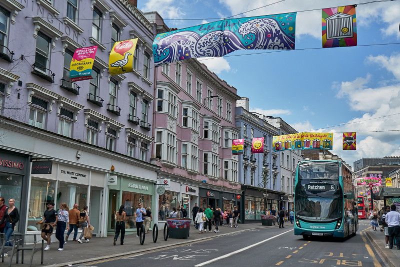
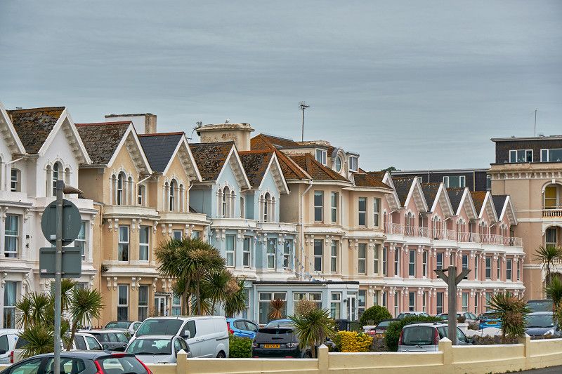
Brighton: Kosmopolitisches Seebad
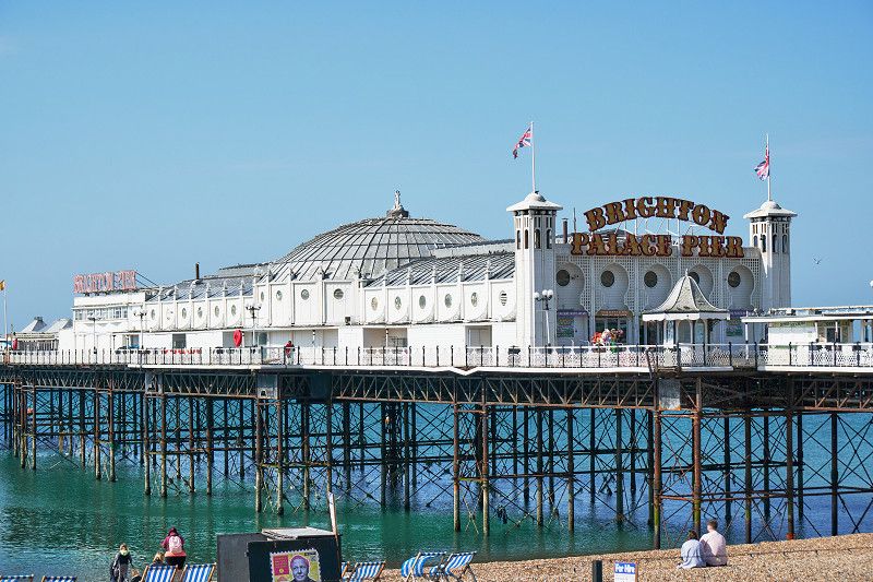
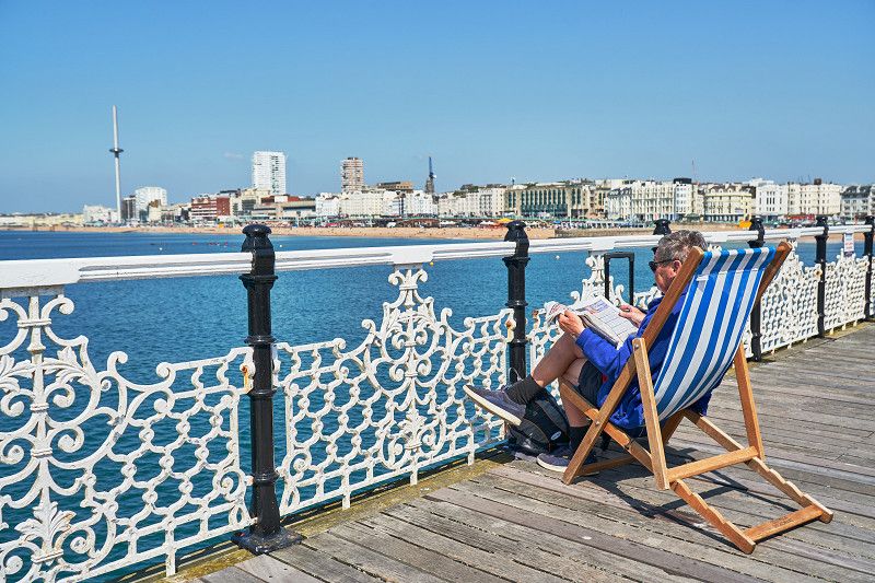
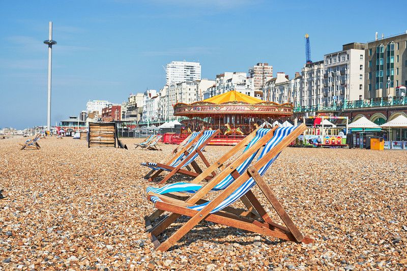
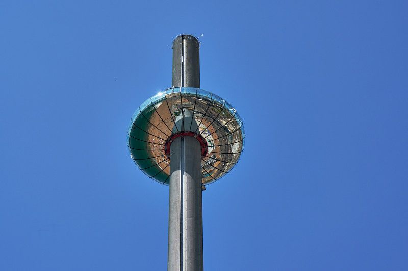
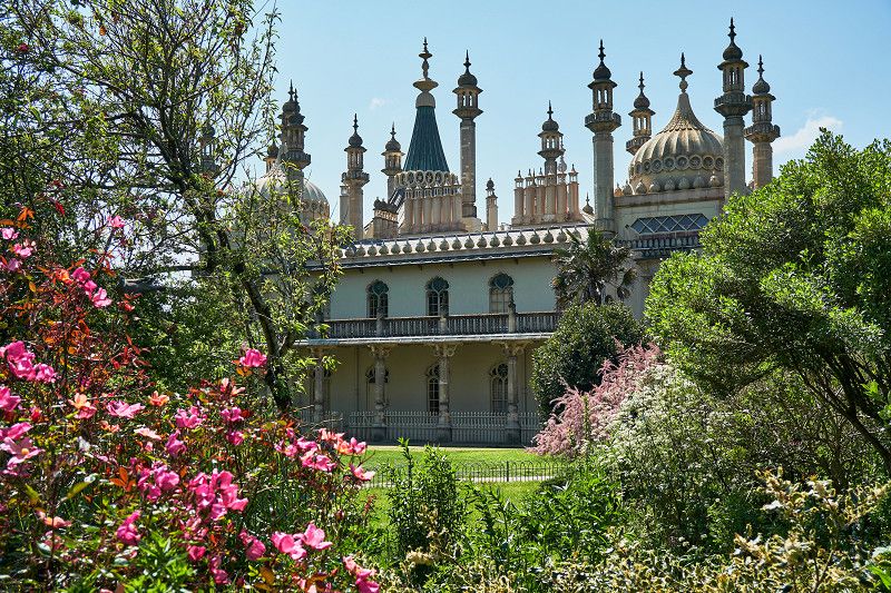
In Brighton we experience the sheer liveliness of a cosmopolitan city and experience exuberant English people on their weekends, a contrast to the sophisticated Eastbourne. A Las Vegas by the beach, the pier invites visitors to waste money with its gambling den and rides. Locals can use the free beach chairs to leaf through the daily newspaper with a view of the city. The British Airways i360 Tower dominates the Brighton skyline. Its viewing platform is raised and lowered hydraulically to accommodate visitors. In the park in front of the Royal Pavilion, inspired by the Indian model, we have a typically British picnic with lots of people in the warm spring sun.
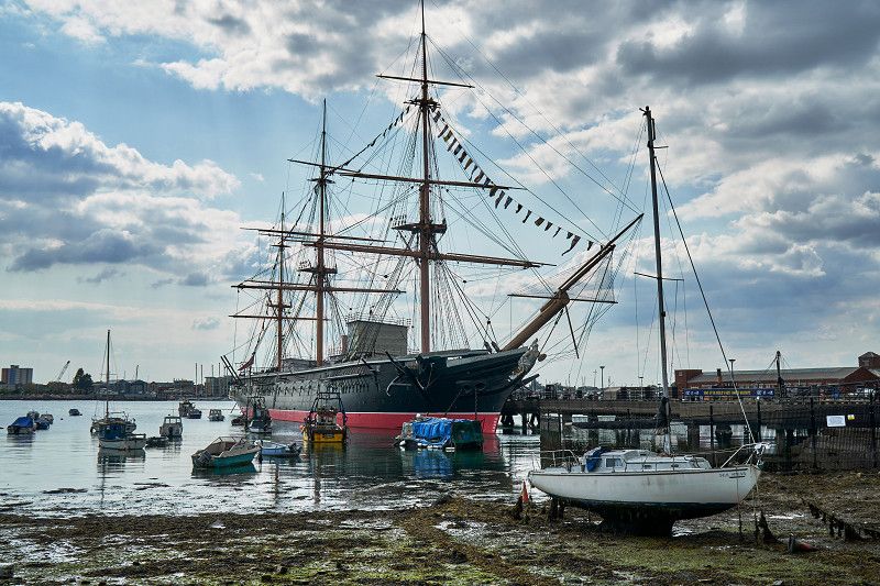
Maritimes Portsmouth
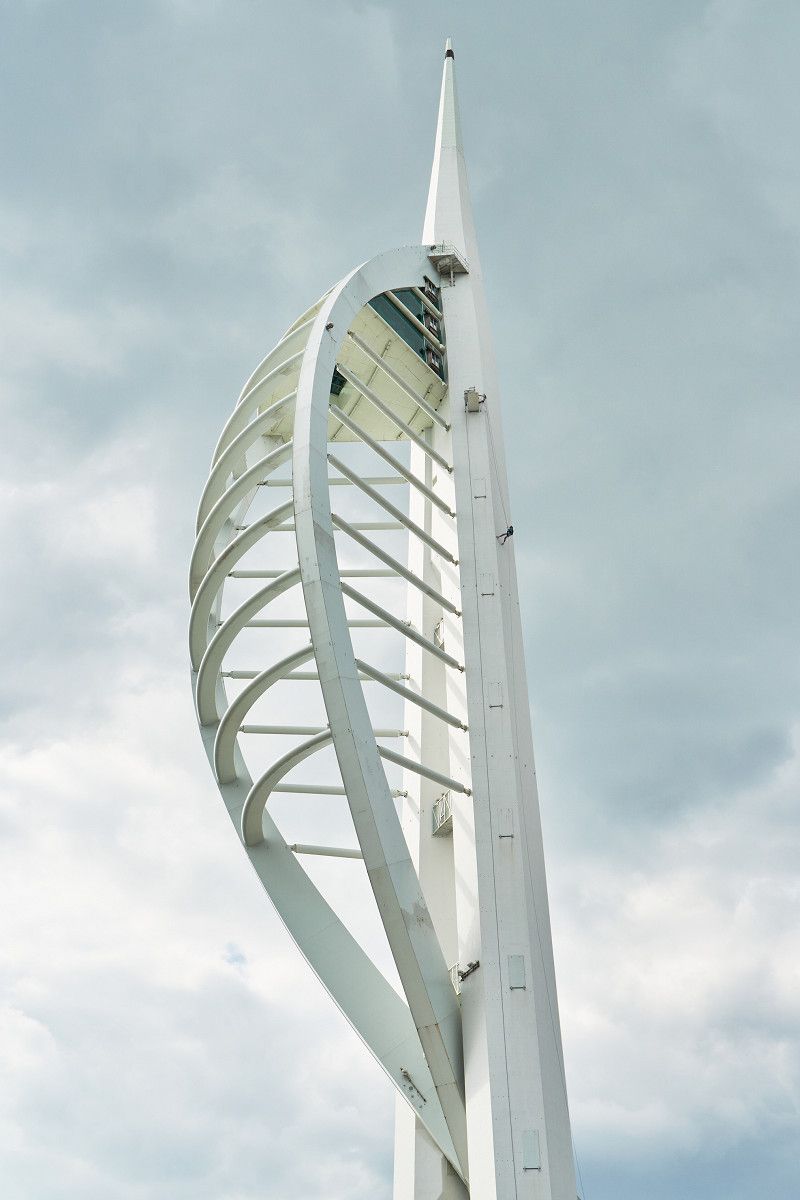
The seat of the British Navy with its museum ships largely determines the city with the longest coastline in Britain. The port is also the hub for the canal link with the Isle of Wight. The Spinnaker Tower, inspired by a canvas, is Portsmouth's new landmark at 170 meters and houses 3 viewing platforms. The city is setting off for new shores with an inviting shopping world near the harbor and is trying to replace the otherwise prevailing sadness.
Thatched House (Portsmouth)
Portsmouth, United Kingdom
50° 47' 39.4" N 1° 2' 24.5" W
50.7942699 -1.0401449
• Head toward Longshore Way on Milton Locks. Go for 70 m.
• Turn left onto Locksway Road. Go for 1.2 km.
• Take the 2nd exit from roundabout onto Milton Road (A288). Go for 560 m.
• Turn right onto Velder Avenue toward (A27)/(A3(M))/Cosham/Farlington/Drayton. Go for 4.7 km.
• Take the 1st exit from Eastern Road Roundabout roundabout onto A27 toward Southsea/(M275). Go for 1.5 km.
• Keep right onto M27 toward The West/Southampton/Fareham/Portsmouth/(M275). Go for 35.6 km.
• Take exit 3 toward M271(S)&(N)/Southampton/The Docks/Romsey. Go for 398 m.
• Take the 3rd exit from roundabout onto M271 toward Romsey. Go for 1.3 km.
• Take the 2nd exit from roundabout onto A3057 toward Romsey/Ramsey/North Baddesley. Go for 2.5 km.
• Take the 1st exit from Ashfield Roundabout roundabout onto A27 toward Romsey/Salisbury. Go for 1.6 km.
• Take the 2nd exit from roundabout onto Southampton Road (A3090) toward Winchester/Stockbridge/(A3057). Go for 238 m.
• Take the 1st exit from roundabout onto Winchester Road (A3057) toward (A3057). Go for 161 m.
• Turn right onto Alma Road (A3057). Go for 197 m.
• Take the 2nd exit from roundabout onto Alma Road (A3057). Go for 426 m.
• Turn right onto Duttons Road (A3057) toward Stockbridge/(A3057). Go for 255 m.
• Pass 2 roundabouts and continue on Greatbridge Road (A3057). Go for 1.4 km.
• Turn left onto Old Salisbury Lane (B3084) toward Broughton/Dunbridge/Lockerley/Awbridge. Go for 580 m.
• Continue on Stanbridge Lane (B3084) toward Broughton/Dunbridge/Lockerley/Awbridge. Go for 1.1 km.
• Continue on Awbridge Hill (B3084). Go for 1.1 km.
• Continue on Dunbridge Lane (B3084). Go for 1.5 km.
• Continue on Barley Hill (B3084). Go for 1.2 km.
• Turn right onto Hatt Hill (B3084) toward Broughton/Mottisfont. Go for 869 m.
• Continue on Spearywell Road (B3084). Go for 1.7 km.
• Continue on Jerrem's Hill (B3084). Go for 2.9 km.
• Continue on Romsey Road (B3084). Go for 1.5 km.
• Continue on Salisbury Road (B3084). Go for 2.4 km.
• Turn left onto A30 toward Salisbury. Go for 4.9 km.
• Turn right onto A343 toward Andover/The Wallops. Go for 891 m.
• Arrive at A343.
☍
72,8 km
(1 hrs. )
Day
Stonehenge: Bekanntester Steinkreis der Welt
We visit the World Heritage Site of Stonehenge and hike the 3 kilometers up and down the rolling hills from its imposing visitor center until we reach the place of worship. Stonehenge is located in a Neolithic area with numerous excavation sites and archaeological finds dating back to the Bronze Age. You can walk around the stone circle at a distance and get a good photographic view of each one.
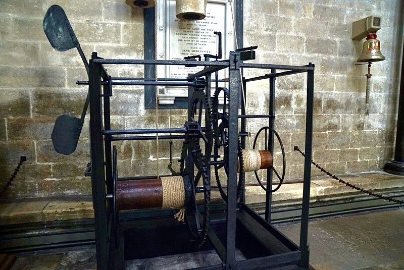
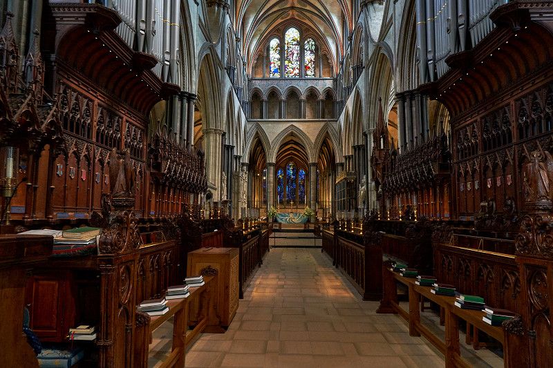
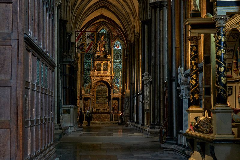
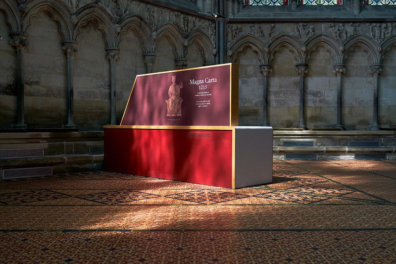
Salisbury Cathedral: Heimat der Magna Carta
Salisbury Cathedral itself is well worth seeing, but the chapter house houses one of the four surviving editions of the Magne Carta, which is the real aim of our visit. The oldest mechanical clock in the world - from the Middle Ages - can also be admired here. The Magna Carta was signed by the 40 barons in 1215 to put the then tyrannical monarch in his place. This instrument also had a significant impact on the fundamental rights of the USA, Canada, New Zealand and Australia.
Salisbury Hillside Club Site
A343, Nether Wallop, Over Wallop, Test Valley, Hampshire, England, SP5 1BY, United Kingdom
51° 7' 17.9" N 1° 38' 5" W
51.1216269 -1.6347313
• Head southwest on A343. Go for 891 m.
• Continue on A30 toward Salisbury. Go for 1.9 km.
• Continue on A30 toward Pitton/Firsdown. Go for 7.3 km.
• Pass 3 roundabouts and continue on London Road (A30). Go for 2.3 km.
• Take the 4th exit from St Mark's Roundabout roundabout onto Churchill Way (A36) toward Ring Road/Warminster. Go for 860 m.
• Pass 3 roundabouts and continue on King Street (A36). Go for 17.4 km.
• Take ramp toward Honiton/Exeter/Wylye/Mere. Go for 781 m.
• Take ramp onto A303. Go for 52.0 km.
• Take the 2nd exit from Podimore Roundabout roundabout onto A303 toward Exeter/Yeovil/(A37)/Taunton/(A358). Go for 8.6 km.
• Take the 2nd exit from Cartgate Roundabout roundabout onto A303 toward (M5)/Exeter/Taunton/(A358). Go for 5.3 km.
• Take the 3rd exit from roundabout onto A303 toward (M5)/Exeter/Honiton/Taunton/(A358). Go for 10.3 km.
• Take the 2nd exit from Southfields Roundabout roundabout onto A303 toward Exeter/Honiton. Go for 16.3 km.
• Continue on A30. Go for 30.5 km.
• Keep left toward Plymouth/Torquay/Okehampton/M5(S). Go for 206 m.
• Take ramp onto M5. Go for 7.8 km.
• Continue on A38. Go for 3.9 km.
• Keep right onto A38 toward Plymouth. Go for 1.7 km.
• Turn left and take ramp toward Exeter Racecourse/Dunchideock. Go for 72 m.
• Take the 2nd exit from roundabout. Go for 97 m.
• Turn left. Go for 153 m.
• Turn left. Go for 52 m.
• Turn right. Go for 185 m.
• Arrive at your destination on the left.
☍
168,5 km
(1 hrs. 57 min.)
Day
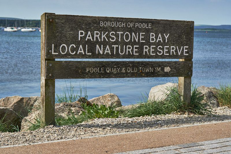
Poole: Größter Naturhafen Großbritanniens
Poole boasts the largest natural harbor in Great Britain. In the old town, the Poole Arms is the oldest pub in town. We walk along the bay at Parkstone Bay Nature Reserve and watch dozens of dog walkers go about their morning routine. England is the most dog-friendly country we have ever traveled to.
Exeter Racecourse Club Site
We spend the night at the Caravan and Motorhome Club (CAMC) campsite in the middle of Exeter Racecourse. This is only operated between October and April, in between the area serves as a campsite.
Devon Expressway , Exeter, Vereinigtes Königreich
50° 38' 26.7" N 3° 33' 40.8" W
50.6407490 -3.5613332
• Head northeast. Go for 185 m.
• Turn left. Go for 52 m.
• Turn right. Go for 153 m.
• Turn right toward A38. Go for 66 m.
• Take the 1st exit from roundabout onto A38. Go for 49.1 km.
• Take ramp toward Brixton/Sparkwell/Langage Business Park/Hemerdon/Plympton. Go for 589 m.
• Turn left onto Deep Lane. Go for 1.8 km.
• Continue on Hercules Road. Go for 1.6 km.
• Turn left onto Haye Road. Go for 446 m.
• Turn left onto Elburton Road (A379). Go for 298 m.
• Take the 3rd exit from roundabout onto Springfield Road. Go for 735 m.
• Turn left onto Reservoir Road. Go for 180 m.
• Continue on Wembury Road. Go for 561 m.
• Turn right onto Staddiscombe Road. Go for 850 m.
• Turn left onto Staddiscombe Road. Go for 614 m.
• Continue on Bovisand Road. Go for 171 m.
• Continue on Barney Corner. Go for 744 m.
• Turn right onto Rack Corner. Go for 730 m.
• Turn slightly right onto Bovisand Lane. Go for 156 m.
• Arrive at Bovisand Lane. Your destination is on the right.
☍
59,1 km
( 45 min.)
Day
Plymouth Sound Club Campsite
Plymouth Sound, Bovisand Lane, Gabber, Wembury, Down Thomas, South Hams, Devon, England, PL9 0AE, United Kingdom
50° 20' 3.4" N 4° 6' 22.1" W
50.3342716 -4.1061401
• Head toward Renney Road on Bovisand Lane. Go for 156 m.
• Turn slightly left toward Rack Corner. Go for 688 m.
• Continue on Rack Corner. Go for 42 m.
• Turn left toward Barney Corner. Go for 710 m.
• Continue on Barney Corner. Go for 34 m.
• Continue on Bovisand Road. Go for 171 m.
• Continue on Staddiscombe Road. Go for 614 m.
• Continue on Goosewell Road. Go for 652 m.
• Pass 3 roundabouts and continue on Goosewell Road. Go for 471 m.
• Turn left onto Furzehatt Road. Go for 285 m.
• Continue on Dean Hill. Go for 484 m.
• Turn right onto Dean Cross Road. Go for 316 m.
• Turn left onto Pomphlett Road. Go for 888 m.
• Take the 3rd exit from roundabout onto Pomphlett Road. Go for 111 m.
• Take the 1st exit from roundabout onto Billacombe Road (A379). Go for 1.0 km.
• Turn right onto Heles Terrace (A374). Go for 151 m.
• Turn right onto Embankment Road (A374). Go for 2.9 km.
• Turn left onto The Parkway. Go for 860 m.
• Keep left toward The Parkway/A38. Go for 167 m.
• Take ramp onto The Parkway (A38). Go for 5.7 km.
• Keep right onto The Parkway (A38) toward Saltash/Liskeard/Cornwall. Go for 2.0 km.
• Take the 2nd exit from roundabout onto A38 toward Liskeard/Saltash/(B3271). Go for 860 m.
• Take ramp toward Saltash/Town centre. Go for 117 m.
• Turn right onto B3271. Go for 60 m.
• Continue on North Road (B3271). Go for 439 m.
• Continue on New Road (B3271). Go for 1.3 km.
• Continue on Liskeard Road (B3271). Go for 255 m.
• Take the 2nd exit from roundabout. Go for 25 m.
• Pass 2 roundabouts and continue on Liskeard Road (B3271). Go for 9.4 km.
• Take the 3rd exit from Trerulefoot Roundabout roundabout onto A38 toward Liskeard. Go for 14.8 km.
• Take the 3rd exit from Twelvewoods roundabout onto A38 toward Bodmin. Go for 13.1 km.
• Take the 2nd exit from roundabout onto A38 toward Redruth/A30 West/Newquay/(A392)/Bodmin/(A389)/Launceston/(A30 East). Go for 122 m.
• Take ramp onto A30 toward Redruth/Newquay/(A392). Go for 48.1 km.
• Take ramp toward Redruth/Porthtowan. Go for 305 m.
• Take the 1st exit from roundabout onto A30. Go for 50 m.
• Take the 4th exit from roundabout onto A3047. Go for 651 m.
• Take the 1st exit from roundabout onto A3047. Go for 861 m.
• Take the 2nd exit from roundabout onto Barncoose Terrace (A3047) toward Camborne/Pool & Barncoose Industrial Estates/Hospital. Go for 264 m.
• Keep right onto Barncoose Terrace (A3047). Go for 523 m.
• Continue on Agar Road. Go for 995 m.
• Continue on Fore Street. Go for 200 m.
• Take the 2nd exit from roundabout. Go for 22 m.
• Take the 1st exit from roundabout onto Fore Street toward Camborne/Cornwall College. Go for 106 m.
• Continue on Trevenson Road. Go for 433 m.
• Take the 2nd exit from roundabout onto Trevenson Road. Go for 149 m.
• Continue on East Hill. Go for 316 m.
• Continue on Pendarves Street. Go for 157 m.
• Turn right onto North Roskear Road. Go for 874 m.
• Take the 1st exit from roundabout onto Eastern Lane. Go for 23 m.
• Take the 2nd exit from roundabout onto Eastern Lane. Go for 612 m.
• Turn right onto Tehidy Road. Go for 61 m.
• Take the 1st exit from roundabout onto Weeth Road. Go for 1.1 km.
• Take the 2nd exit from roundabout onto Treswithian Road (A3047). Go for 265 m.
• Take the 2nd exit from roundabout onto A3047. Go for 129 m.
• Take ramp onto A30. Go for 6.2 km.
• Take the 3rd exit from Loggans Moor roundabout onto A30 toward Penzance/St Ives/(A3074). Go for 4.7 km.
• Take the 1st exit from roundabout onto A30 toward Penzance. Go for 5.9 km.
• Take the 4th exit from Newtown Roundabout roundabout onto A30 toward Penzance. Go for 1.7 km.
• Pass 6 roundabouts and continue on A30. Go for 6.8 km.
• Continue on Drift (A30). Go for 170 m.
• Continue on A30. Go for 165 m.
• Continue on Higher Drift (A30). Go for 160 m.
• Continue on A30. Go for 721 m.
• Continue on Catchall (A30). Go for 187 m.
• Continue on A30. Go for 3.5 km.
• Continue on Crows-an-Wra (A30). Go for 90 m.
• Continue on A30. Go for 3.5 km.
• Continue on Sea View Terrace (A30). Go for 127 m.
• Continue on A30. Go for 2.1 km.
• Turn sharp left onto B3315. Go for 237 m.
• Arrive at B3315. Your destination is on the left.
☍
151,2 km
(2 hrs. 26 min.)
Day
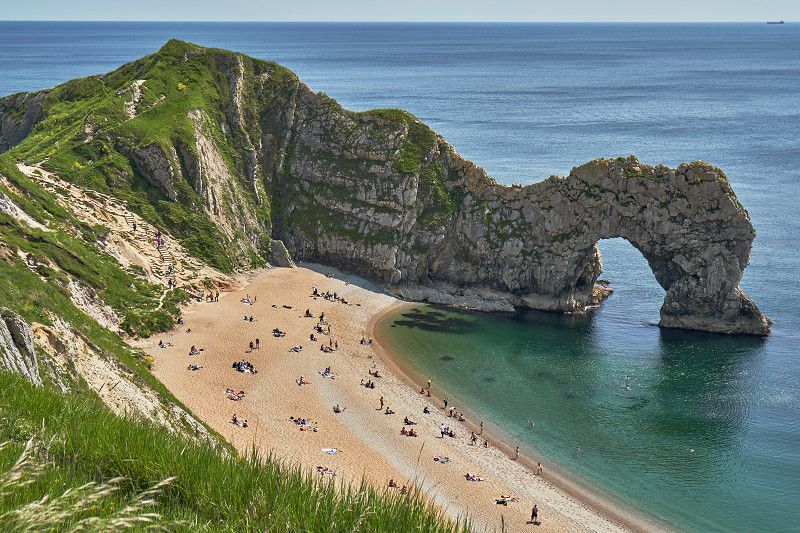
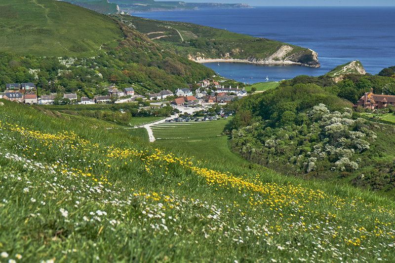
Durdle Door: Karibisches Flair im Alpenlook
Near Dorchester we drive along the cliffs to the Durdle Door rock formation, which is well worth seeing. The sheltered bathing beach behind offers Caribbean flair even in spring, only the sea is still ice-cold. On the coastal path hiking trail we continue to the picturesque Lulworth Cove.
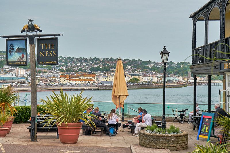
Küstenstädtchen am Teign: Teignmouth
The place on the Teign is one of the most beautiful coastal towns in Britain. The local ferry service to Shaldon uses the oldest ferry boat in the country.
Day
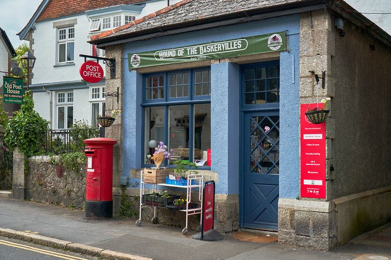
Im Dartmoor Nationalpark: Moretonhamostead
On our way through Dartmoor National Park we come to the picturesque Moretonhampstead and make a small stop near the post office with its advertising banner "Hound of the Baskervilles" to take a closer look at this gem with its St. Andrews Church, which is well worth seeing.
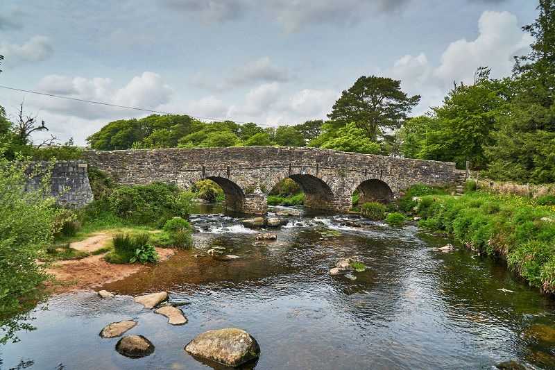
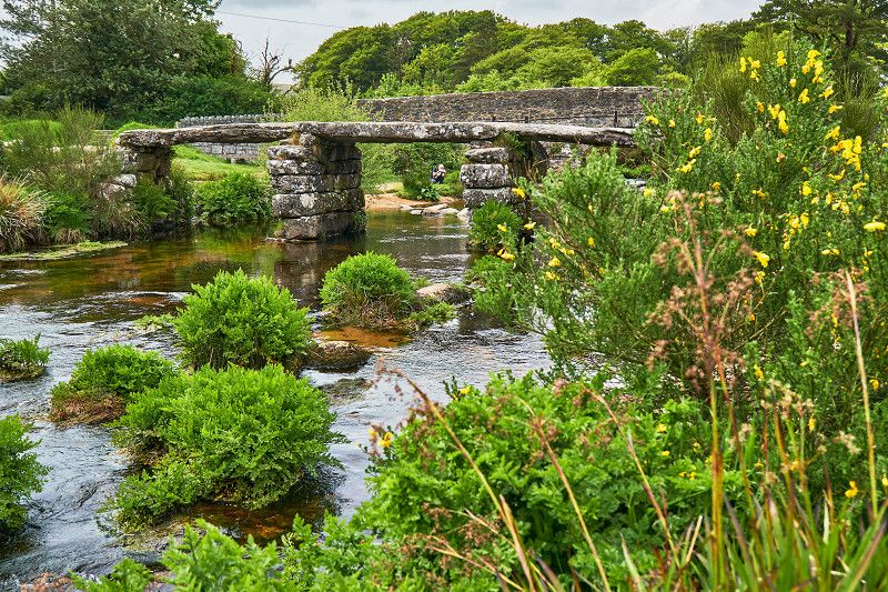
Postbridge: Wandern im Dartmoor Nationalpark
In Dartmoor National Park we drive to the visitor center and walk for a while.
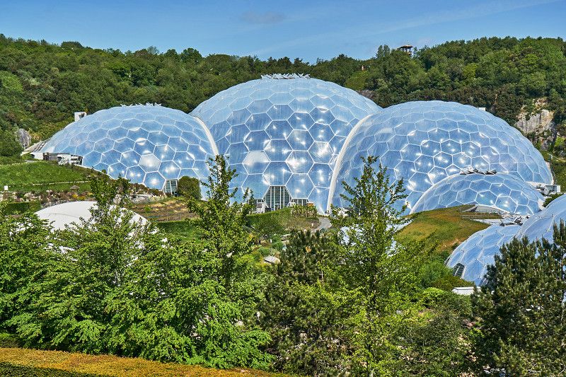
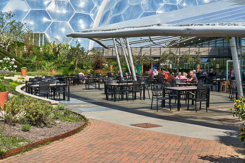
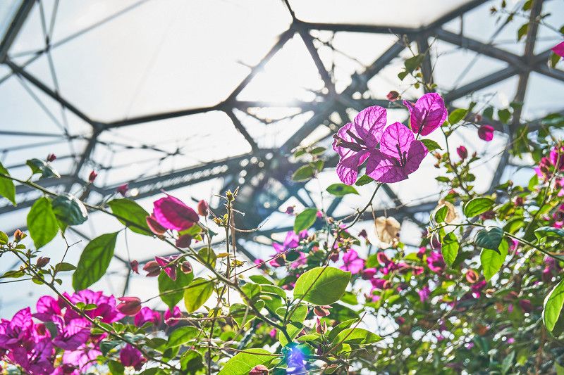
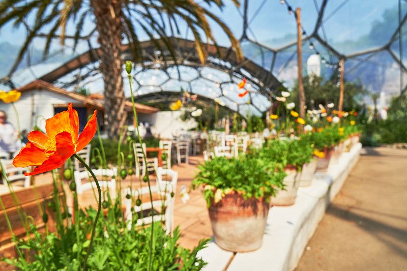
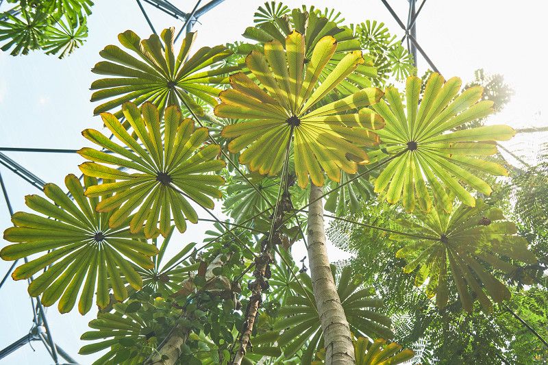
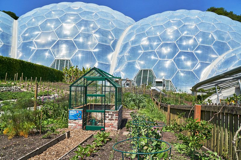
Cornwall: Im Garten Eden angekommen
One of the most fascinating projects of our time is probably the Eden Project. Here in Cornwall there are biomes on the themes of the Mediterranean regions of our earth and the tropical rainforests of South America and Asia, each with their wide range of flora and fauna - because some animals live in this biblically beautiful garden.
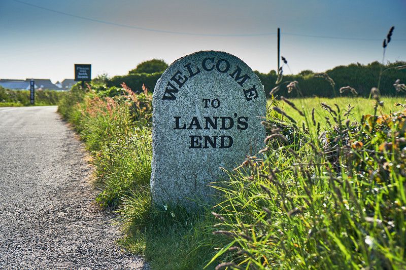
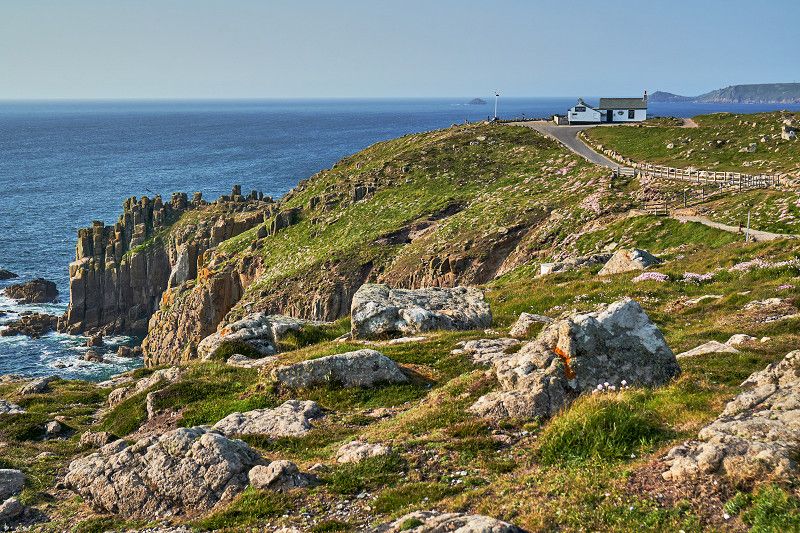
Im Westen viel neues: Land‘s End
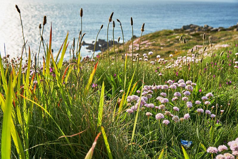
We reach the westernmost point of the British Isles - Land's End. A strong wind whistles out here, so that the evening sun is just enough to warm us. We watch the waves in the surf and look out over the expanse to Newfoundland.
Land's End Camping and Glamping
Lands End Camping And Glamping, Trevescan Farm Equestrian Center, Penzance TR19 7AQ, B3315, Trevescan, Mayon, Cornwall, England, TR19 7AQ, United Kingdom
50° 3' 55.4" N 5° 41' 52.6" W
50.0653763 -5.6979346
• Head southeast on B3315. Go for 194 m.
• Turn left toward A30. Go for 238 m.
• Turn right onto A30. Go for 1.7 km.
• Continue on Sea View Terrace (A30). Go for 127 m.
• Continue on A30. Go for 3.5 km.
• Continue on Crows-an-Wra (A30). Go for 90 m.
• Continue on A30. Go for 3.5 km.
• Continue on Catchall (A30). Go for 187 m.
• Continue on A30. Go for 721 m.
• Continue on Higher Drift (A30). Go for 160 m.
• Continue on A30. Go for 165 m.
• Continue on Drift (A30). Go for 170 m.
• Continue on A30. Go for 2.3 km.
• Take the 2nd exit from Mount Misery roundabout onto A30. Go for 1.4 km.
• Take the 3rd exit from roundabout onto A30. Go for 756 m.
• Pass 2 roundabouts and continue on Eastern Green (A30). Go for 2.0 km.
• Take the 2nd exit from roundabout onto Eastern Green (A30). Go for 304 m.
• Take the 2nd exit from Chy-an-Mor roundabout onto A30. Go for 1.7 km.
• Take the 1st exit from Newtown Roundabout roundabout onto A30 toward Redruth/St Ives/A3047/Hayle. Go for 5.8 km.
• Take the 3rd exit from roundabout onto A30 toward Redruth. Go for 4.8 km.
• Take the 2nd exit from Loggans Moor roundabout onto A30 toward Redruth. Go for 41.5 km.
• Take ramp toward Wadebridge/Newquay/(A392)/Airport. Go for 672 m.
• Take the 1st exit from roundabout onto A39 toward Wadebridge/Newquay/(A392)/St Columb Road/St Columb Major/Airport. Go for 1.4 km.
• Take the 3rd exit from Halloon roundabout onto A39 toward Wadebridge/Padstow/St Columb Major/Airport. Go for 2.8 km.
• Take the 3rd exit from Trekenning roundabout onto A39 toward Wadebridge. Go for 4.3 km.
• Pass 3 roundabouts and continue on A39. Go for 26.1 km.
• Turn left onto Valley Truckle (B3266) toward Boscastle/Tintagel/Delabole. Go for 78 m.
• Continue on B3266. Go for 286 m.
• Continue on Sportsmans Road (B3266). Go for 557 m.
• Continue on B3266. Go for 13 m.
• Continue on Sportsmans (B3266). Go for 61 m.
• Continue on B3266. Go for 2.0 km.
• Continue on Camelford Station (B3266). Go for 15 m.
• Continue on B3266. Go for 6.1 km.
• Continue on Doctors Hill (B3266). Go for 88 m.
• Turn left onto Doctors Hill (B3263). Go for 114 m.
• Continue on Barnpark Road (B3263). Go for 279 m.
• Continue on Tintagel Road (B3263). Go for 447 m.
• Continue on B3263. Go for 1.6 km.
• Turn right. Go for 432 m.
• Arrive at your destination on the left.
☍
118,6 km
(1 hrs. 46 min.)
Day
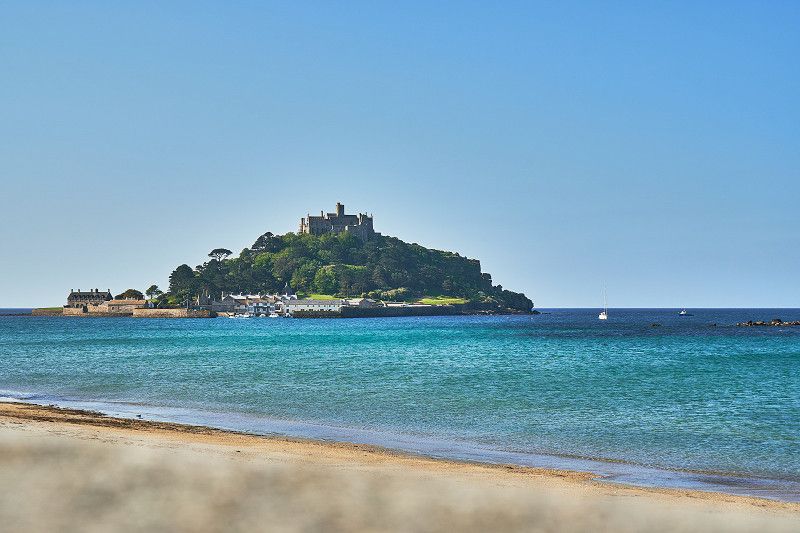
Erzengel Michael im Cornwall gesichtet
We didn't get lost in France. Here on the Cornish coast, as in Normandy, the Archangel Gabriel once appeared. As a result, a monastery complex was also built here on St. Michael's Mount.
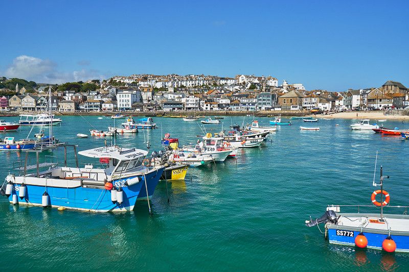
Südfranzösisches Flair in St. Ives
The picturesque St. Ives is located on the coast line in Cornwall and offers many places to stop around the lively waterfront. Behind it, in the small streets, there are many galleries, as well as a branch of the Tate Gallery.
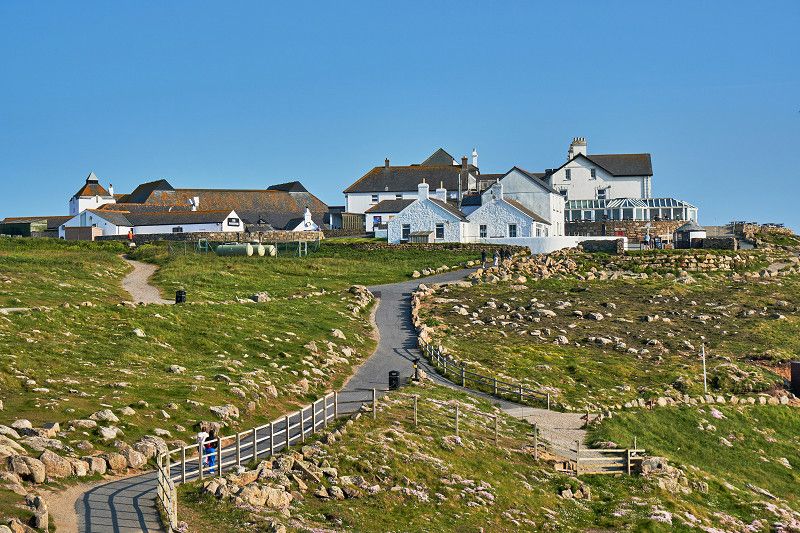
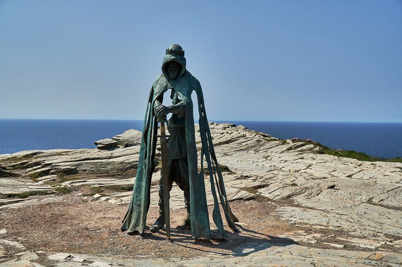
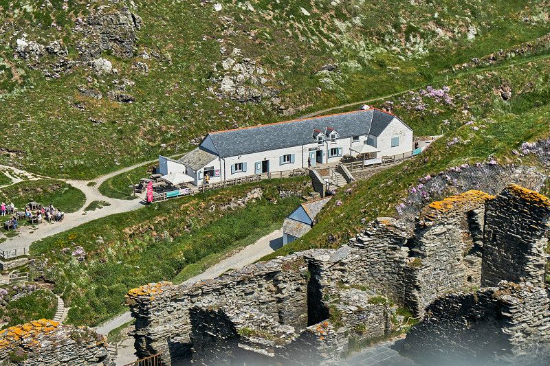
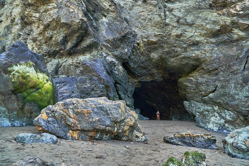
Tintagel: Geburtsort einer Sage
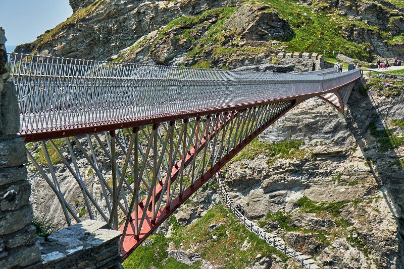
The King Arthur saga originated out here in Tintagel. Above the cave of the famous Merlin lies the cradle of the Round Table. A modern steel bridge connects the historical rock in the sea surf, which was settled in the early days, with the mainland. The ruins of the same name were built much later, in 1233. Nevertheless, the area is historically connected to it.
Trewethett Farm Caravan Club Site
Not far from Tintagle Castle we stay overnight at the Trewethett Farm Caravan Club Site, which is part of the Caravan and Motorhome Club (CAMC). The view of the Celtic Sea up here is breathtakingly beautiful.
Trethevy, PL34 0BQ, Tintagel, United Kingdom
50° 40' 26.4" N 4° 43' 38" W
50.6739900 -4.7272300
• Head southeast. Go for 432 m.
• Turn left onto B3263. Go for 1.6 km.
• Turn right onto Tintagel Road (B3263). Go for 447 m.
• Continue on Barnpark Road (B3263). Go for 279 m.
• Continue on Doctors Hill (B3263). Go for 114 m.
• Turn right onto Doctors Hill (B3266). Go for 88 m.
• Continue on B3266. Go for 6.1 km.
• Continue on Camelford Station (B3266). Go for 15 m.
• Turn left onto B3314. Go for 392 m.
• Continue on Camelot View (B3314). Go for 35 m.
• Continue on B3314. Go for 1.9 km.
• Turn left onto A39. Go for 2.2 km.
• Turn right onto A395 toward Hallworthy/Launceston/(A30). Go for 16.9 km.
• Take the 2nd exit from roundabout onto A30. Go for 70.8 km.
• Take ramp onto M5 toward Taunton/Honiton/Exmouth. Go for 81.7 km.
• Take exit 22 toward Weston-S-Mare/Burnham-on-Sea/Bristol (South)/Airport onto M5. Go for 569 m.
• Take the 3rd exit from Edithmead Roundabout roundabout onto Bristol Road (A38) toward Bristol/Airport/Cheddar/(A371)/Weston-Super-Mare/(A370). Go for 2.7 km.
• Take the 2nd exit from East Brent Roundabout roundabout onto Bristol Road (A38) toward Cheddar/(A371). Go for 8.1 km.
• Turn right onto Cross Lane (A371) toward Axbridge/Cheddar/Wells. Go for 702 m.
• Keep left onto A371. Go for 4.7 km.
• Turn right. Go for 151 m.
• Turn left. Go for 164 m.
• Turn right. Go for 48 m.
• Arrive at your destination on the left.
☍
200,2 km
(2 hrs. 24 min.)
Day
Wandertag in Englands größter Schlucht
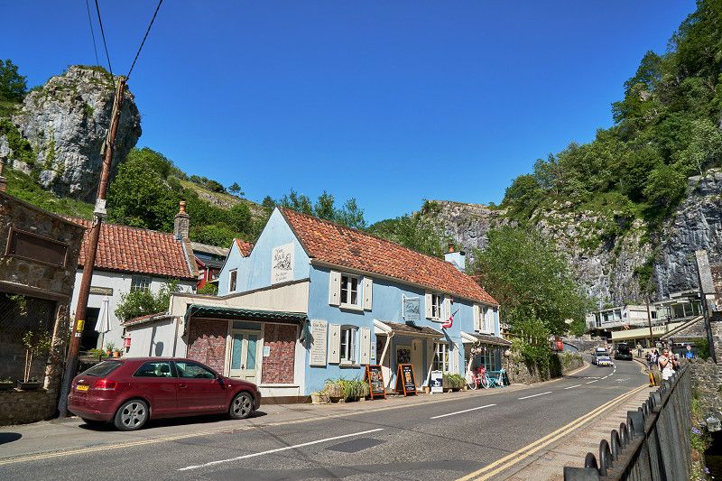
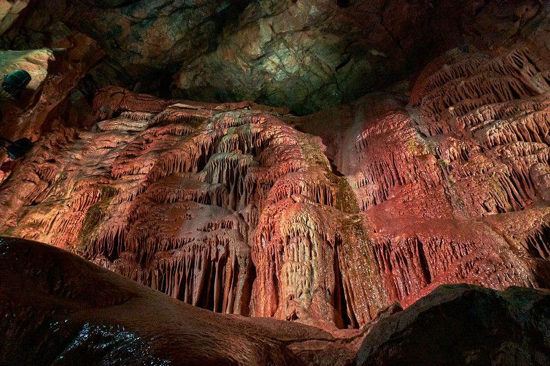
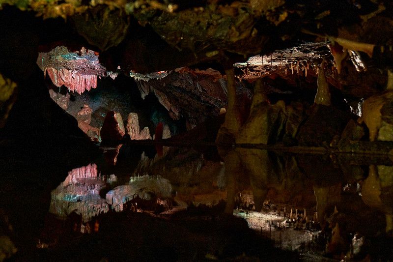
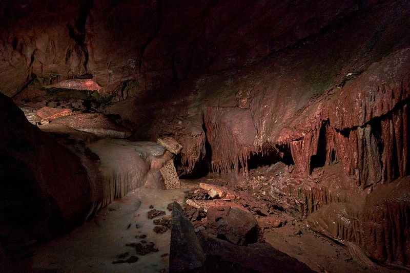
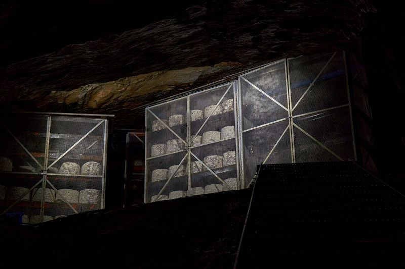
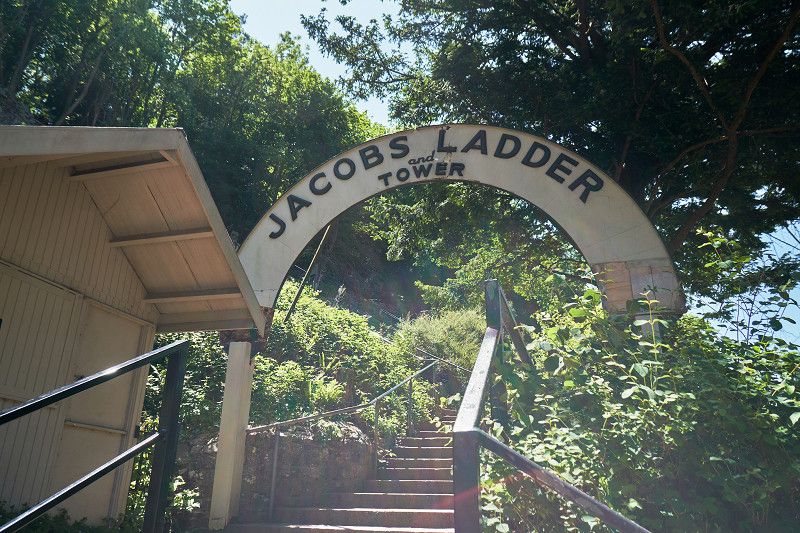
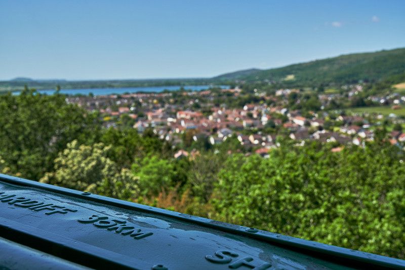
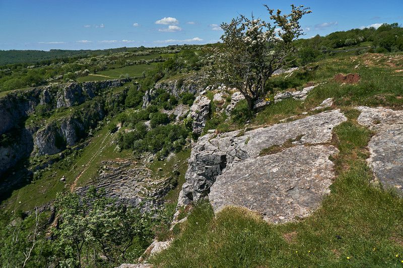
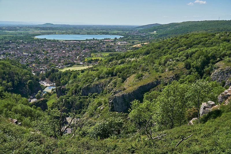
We arrive in Somerset and visit Cheddar Gorge, a private amusement park for walkers and naturalists and a place for good English cheese. The natural stalactite cave Gough's Cave once housed the Cheddar Man, a human skeleton around 9000 years old, which was discovered here in 1903 and is now on display in the Natural History Museum in London. Here we climb Jacob's ladder and hike about 100 meters on a steep rocky path high above the gorge.
Cheddar Club Site
Gas House Lane, Draycott Road , Cheddar, Vereinigtes Königreich
51° 16' 16.6" N 2° 46' 32.2" W
51.2712809 -2.7756183
• Head north. Go for 75 m.
• Turn right. Go for 28 m.
• Turn left. Go for 6 m.
• Turn right toward Draycott Road/A371. Go for 124 m.
• Continue on Draycott Road (A371). Go for 326 m.
• Turn right onto Union Street (B3135). Go for 151 m.
• Continue on Cliff Street (B3135). Go for 375 m.
• Take the 2nd exit from roundabout onto Cliff Street (B3135). Go for 93 m.
• Continue on The Cliffs (B3135). Go for 528 m.
• Continue on Cliff Road (B3135). Go for 4.8 km.
• Turn right onto B3135. Go for 3.0 km.
• Continue on Plummers Lane (B3135). Go for 1.7 km.
• Continue on B3135. Go for 5.2 km.
• Continue on Green Ore Crossroads (B3135). Go for 215 m.
• Continue on B3135. Go for 1.5 km.
• Continue on Wells Hill Bottom (B3135). Go for 134 m.
• Continue on B3135. Go for 602 m.
• Turn left onto Bath Road (B3139). Go for 1.6 km.
• Continue on B3139. Go for 1.4 km.
• Continue on Ponds View (B3139) toward Emborough. Go for 101 m.
• Continue on B3139. Go for 857 m.
• Turn right onto Old Down (A37). Go for 62 m.
• Turn left onto B3139. Go for 781 m.
• Continue on Lynch Hill (B3139). Go for 518 m.
• Continue on Broadway (B3139). Go for 759 m.
• Keep left onto B3139. Go for 156 m.
• Continue on Wells Road (B3139) toward Trowbridge/Radstock/(A367). Go for 2.4 km.
• Take the 2nd exit from White Post roundabout onto B3139 toward Trowbridge/Kilmersdon. Go for 1.9 km.
• Continue on Charlton (B3139). Go for 130 m.
• Turn slightly left onto B3139. Go for 668 m.
• Continue on Kilmersdon Hill (B3139). Go for 551 m.
• Continue on B3139. Go for 2.9 km.
• Continue on Terry Hill Crossroads (B3139) toward Trowbridge. Go for 76 m.
• Continue on Terry Hill Crossroads (A366) toward Trowbridge. Go for 6.9 km.
• Turn left onto Bath Road (A366). Go for 7 m.
• Turn right onto Farleigh Road (A366). Go for 1.6 km.
• Turn left onto A36 toward Bath. Go for 10.6 km.
• Turn right onto Down Lane. Go for 401 m.
• Turn right onto High Street. Go for 249 m.
• Continue on Church Close. Go for 55 m.
• Turn left onto Mill Lane. Go for 122 m.
• Turn left. Go for 19 m.
• Arrive at your destination on the left.
☍
53,9 km
(1 hrs. 5 min.)
Day
Badetag auch für Nicht-Römer
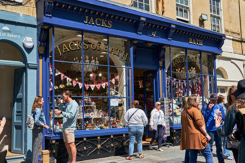
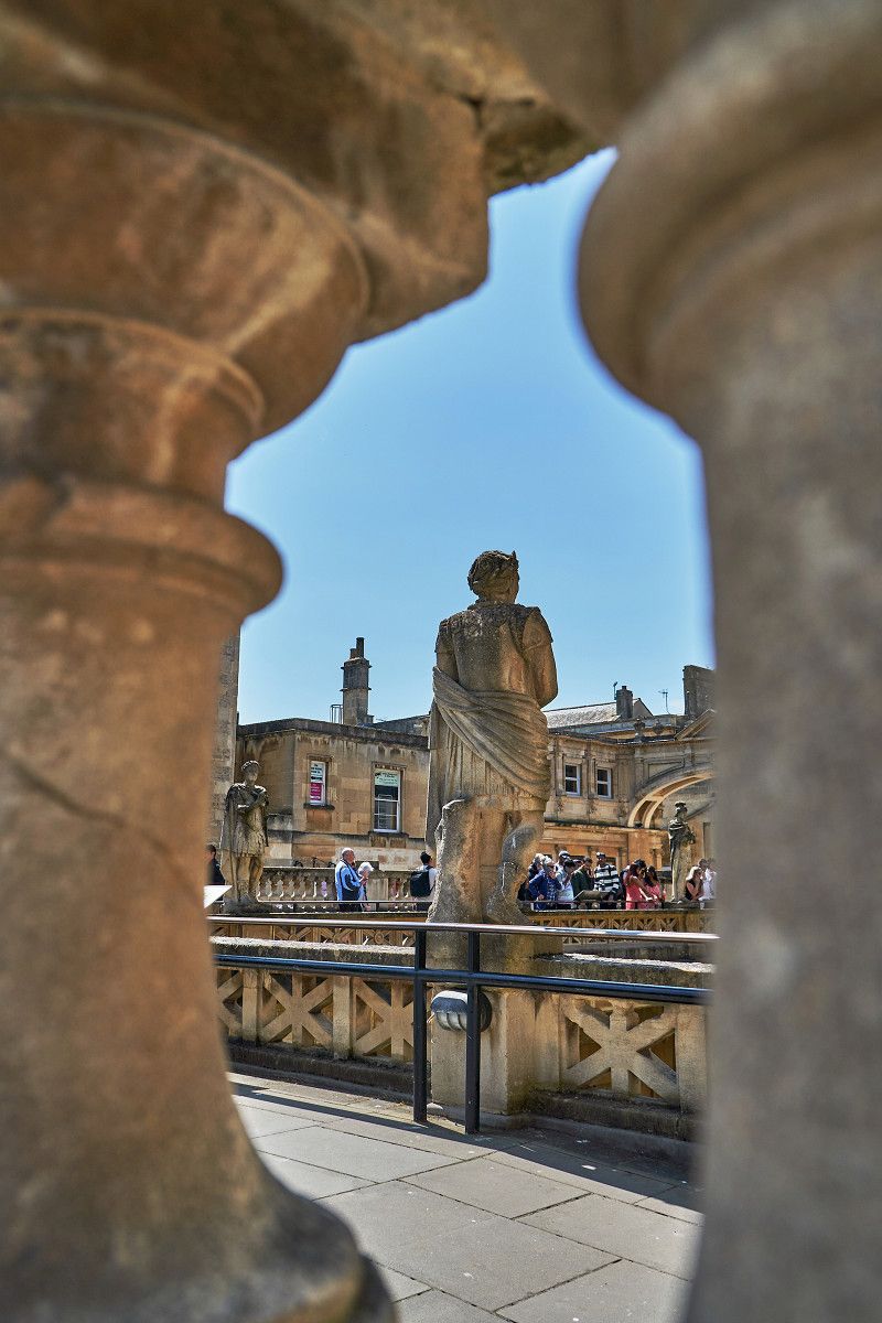
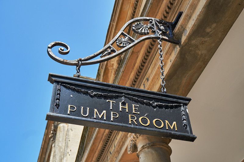
We visit Bath with its Roman baths on the Bank Holidays weekend. Pre-order tickets! The park on the Avon promises a cool down and near the circus hundreds of students have a picnic on the large green sunbathing area. The city is now known as a film set for Netflix.
George Inn (Bathampton)
After lively Bath, we head out to tranquil Bathampton. We stop for a night in the oldest pub.
Mill Lane , Bathampton, Vereinigtes Königreich
51° 23' 49.7" N 2° 19' 21.3" W
51.3971310 -2.3225880
• Head toward Mill Lane. Go for 19 m.
• Turn left onto Mill Lane. Go for 487 m.
• Continue on Toll Bridge Road. Go for 259 m.
• Take the 1st exit from roundabout onto London Road West. Go for 707 m.
• Take the 3rd exit from roundabout onto A46 toward Stroud/(M4). Go for 7.0 km.
• Take the 2nd exit from Cold Ashton roundabout onto A46 toward Yate/Pennsylvania/(M4)/Stroud. Go for 5.7 km.
• Take the 3rd exit from Tormarton Interchange roundabout onto M4 toward London/Swindon. Go for 95.7 km.
• Take exit 12. Go for 436 m.
• Take the 1st exit from roundabout onto Bath Road (A4) toward Reading. Go for 700 m.
• Pass 4 roundabouts and continue on Bath Road (A4). Go for 4.5 km.
• Continue on Bath Road (A4155). Go for 1.1 km.
• Take the 1st exit from roundabout onto A329. Go for 281 m.
• Keep right onto A329 toward Caversham/Henley. Go for 837 m.
• Pass 2 roundabouts and continue on Caversham Road (A4155). Go for 656 m.
• Keep right onto Church Street (A4155) toward Henley/Peppard/(B481). Go for 298 m.
• Pass 5 roundabouts and continue on Reading Road (A4155). Go for 11.4 km.
• Continue on Bell Street (A4130). Go for 391 m.
• Take the 2nd exit from roundabout onto Northfield End (A4130). Go for 46 m.
• Take the 2nd exit from roundabout onto Marlow Road (A4155). Go for 508 m.
• Arrive at Marlow Road (A4155). Your destination is on the left.
☍
131,1 km
(1 hrs. 43 min.)
Day
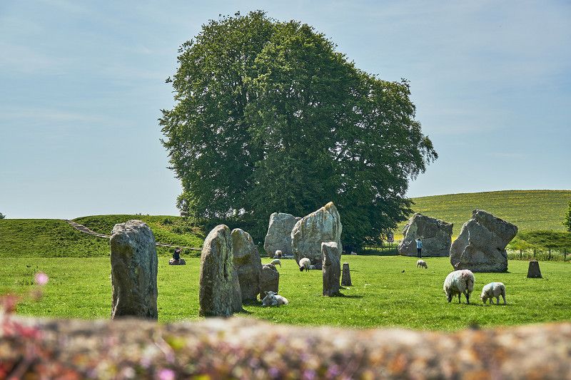
Größter neolithischer Steinkreis Großbritanniens: Avebury
On our way to Oxford we pass Avebury and visit the largest Neolithic stone circle in Britain. Picturesque Avebury is worth seeing in itself. The partially destroyed or removed stones of this "Henge" were replaced with concrete elements after the excavations by Alexander Keiler in the 1920s, so that the imaginary stone circle can be viewed from the higher rampart. The center is aligned with the midsummer-summer solstice.
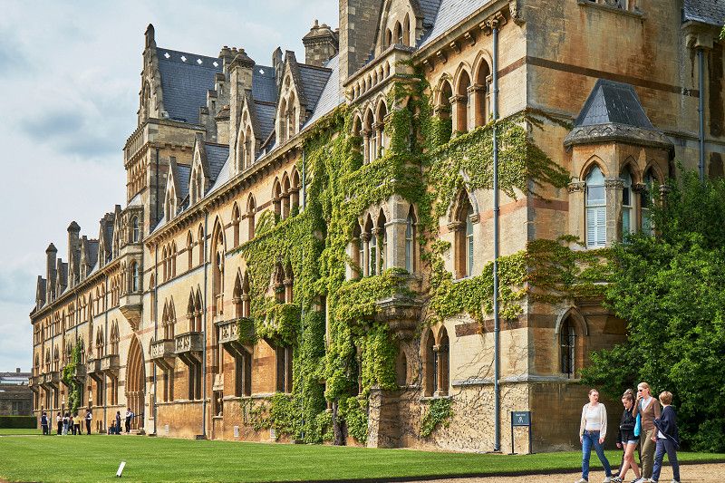
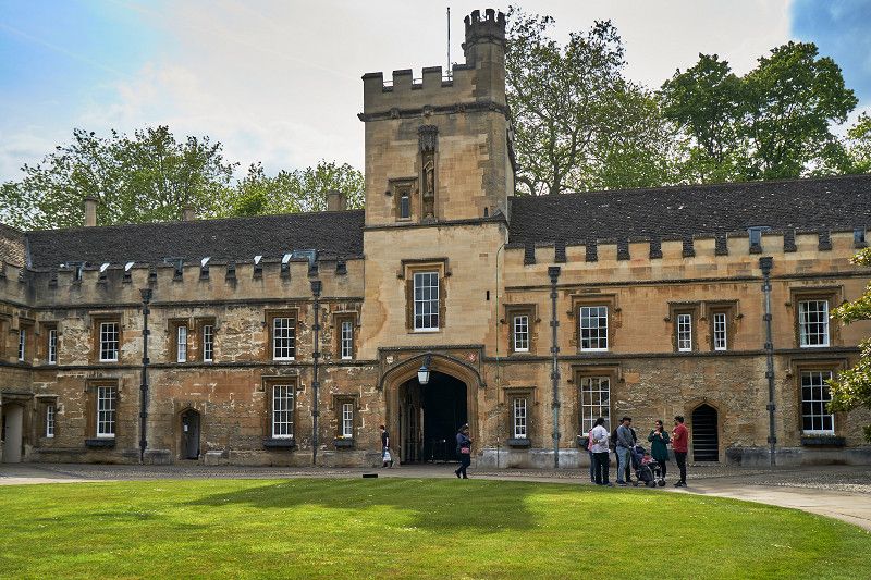
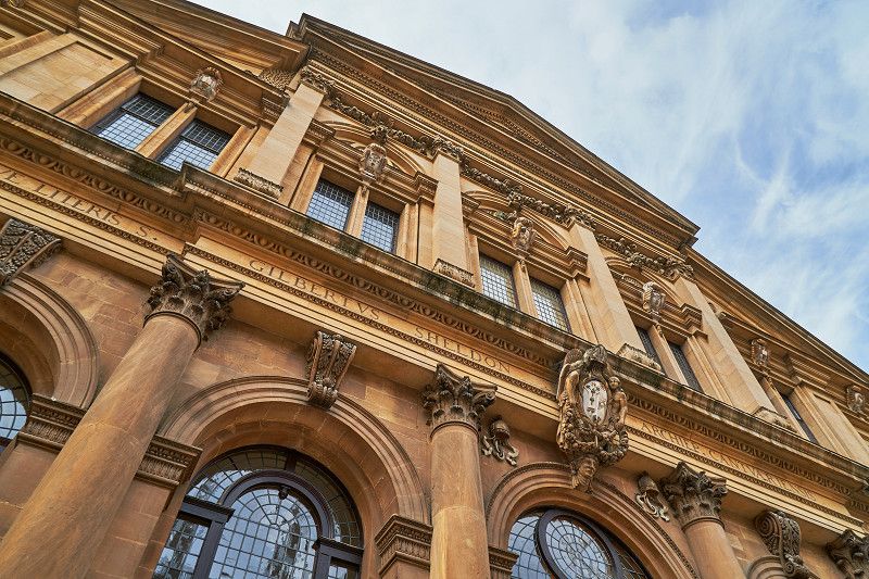
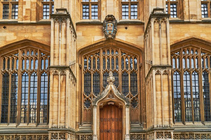
Oxford: Elite britischer Colleges
Oxford is THE epitome of British colleges and is one of the best universities in the world. With our city walk we visit well-known colleges such as St. John's, where Tony Blair studied and come to Study Hall with the Rotunda, where Harry Potter was once filmed. It's lively on Banks Holiday and many young people enjoy the particularly warm spring.
Henley Four Oaks Club Site
Marlow Road , South Oxfordshire, Vereinigtes Königreich
51° 32' 44.2" N 0° 54' 13" W
51.5456115 -0.9036027
• Head south on Marlow Road (A4155). Go for 479 m.
• Take the 2nd exit from roundabout onto Northfield End (A4130). Go for 44 m.
• Take the 1st exit from roundabout onto Northfield End (A4130). Go for 198 m.
• Turn left onto New Street (A4130). Go for 383 m.
• Turn left onto Hart Street (A4130). Go for 8.5 km.
• Take the 2nd exit from Burchetts Green Roundabout roundabout onto Henley Road toward (M4)/A404/Maidenhead/Reading/(A4)/Pinkneys Gr./Stubbings. Go for 491 m.
• Take ramp onto A404 toward (M4)/Reading/Maidenhead/(A4). Go for 1.5 km.
• Keep right onto A404(M) (Maidenhead Bypass) toward Reading/Slough/Windsor/(M4). Go for 4.0 km.
• Take the 2nd exit from roundabout onto M4 toward London. Go for 16.6 km.
• Take exit 4B toward (M3)/Gatwick Airport onto M25. Go for 87.0 km.
• Take exit 2 toward Bexleyheath onto A2. Go for 6.5 km.
• Take ramp onto Southwold Road (A223) toward Crayford/Bexley/(A223)/Bexleyh'th/Town centre/(A220). Go for 346 m.
• Take the 1st exit from roundabout onto Bourne Road (A220) toward Erith/Crayford/A223. Go for 401 m.
• Pass 2 roundabouts and continue on Gravel Hill (A207). Go for 951 m.
• Take the 2nd exit from roundabout onto Erith Road (A220). Go for 661 m.
• Take the 1st exit from roundabout onto Long Lane. Go for 1.1 km.
• Pass 4 roundabouts and continue on Brampton Road. Go for 2.2 km.
• Continue on Knee Hill (A2041). Go for 653 m.
• Turn left onto Federation Road. Go for 150 m.
• Arrive at Federation Road. Your destination is on the left.
☍
132,3 km
(1 hrs. 41 min.)
Day
Königlicher Familiensitz Windsor
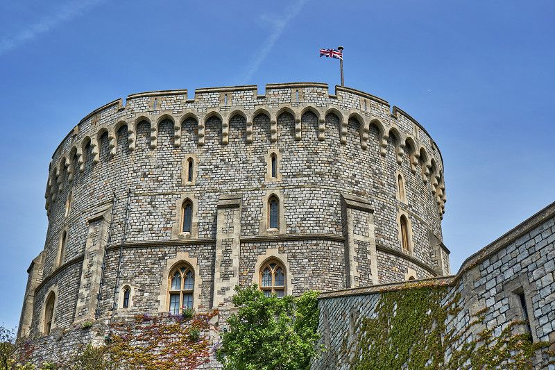
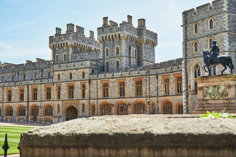
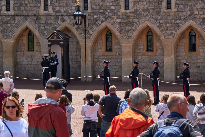
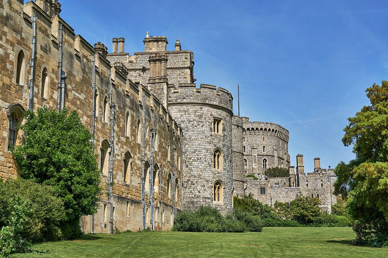
The largest inhabited castle in the world and seat of the Windsor family of the same name. We are guests at Königs and visit this magnificent facility. The state apartments of Charles II and his queen, who once had this castle expanded. Also on display is the Queen Mary's Dollhouse, the world's largest dollhouse. The changing of the guard and a visit to St. George's Chapel complete our visit to Windsor.
Abbey Wood Caravan Club Site
Federation Road, SE2 0LS, London, United Kingdom
51° 29' 13.4" N 0° 7' 9.7" E
51.4870443 0.1193645
Day
Europas größte Metropole: London
Puhhh - this lively metropolis demands a lot from us at the end of our southern England trip. Our odyssey through London's sights begins with the Tower . We explore the underworld at the London Bridge Experience and climb Tower Bridge . In Westminster we explore with Big Ben, the Houses of Parliament and Downing Street No. 10 the government district and King Charles III. caught a glimpse of leaving Buckingham Palace . In the evening we are on The Shard and admire the panorama from the 68th floor. Kensington Palace and the two cathedrals Westminster Abbey and St. Paul's complete our stay here in London.