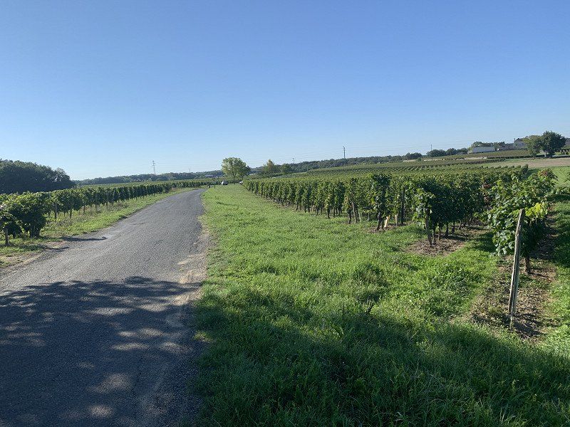
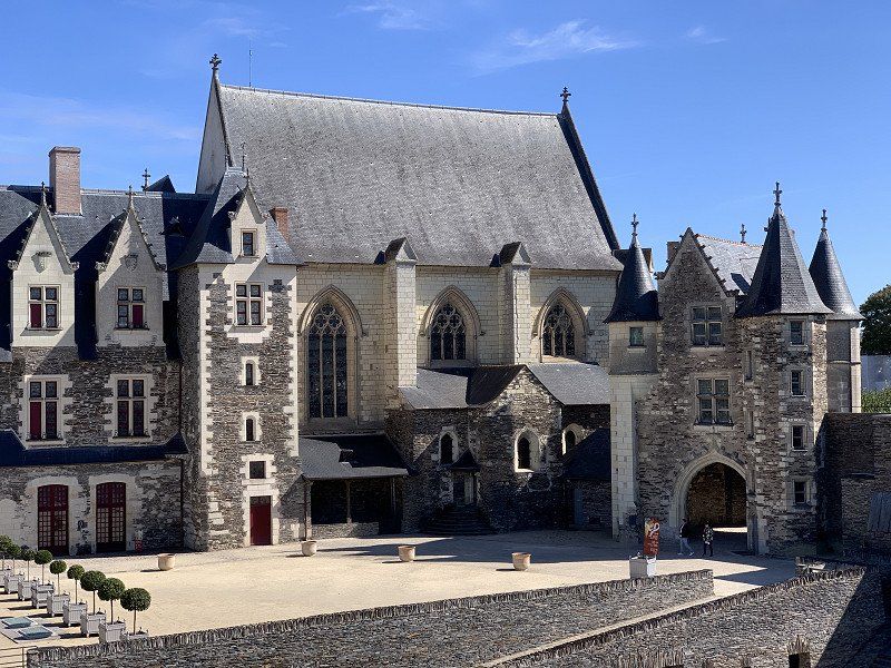
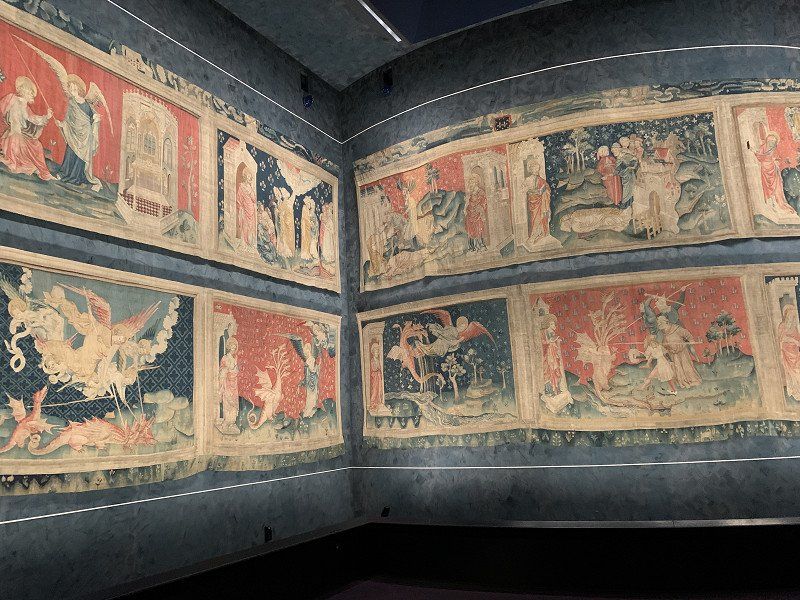
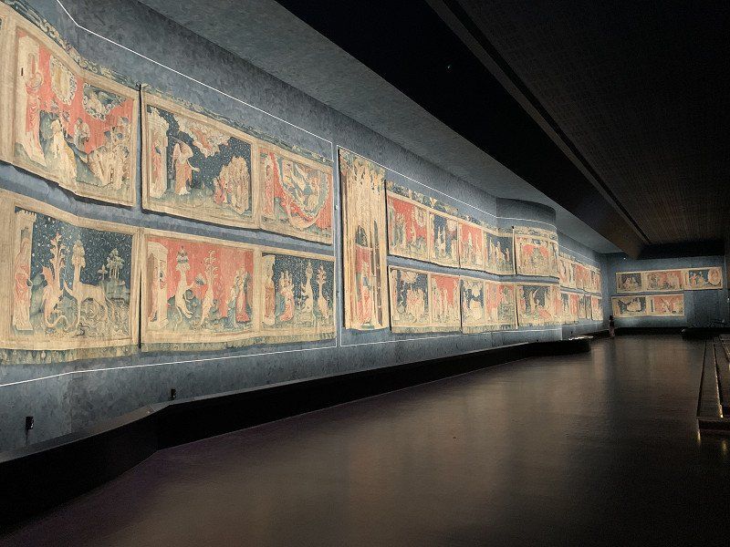
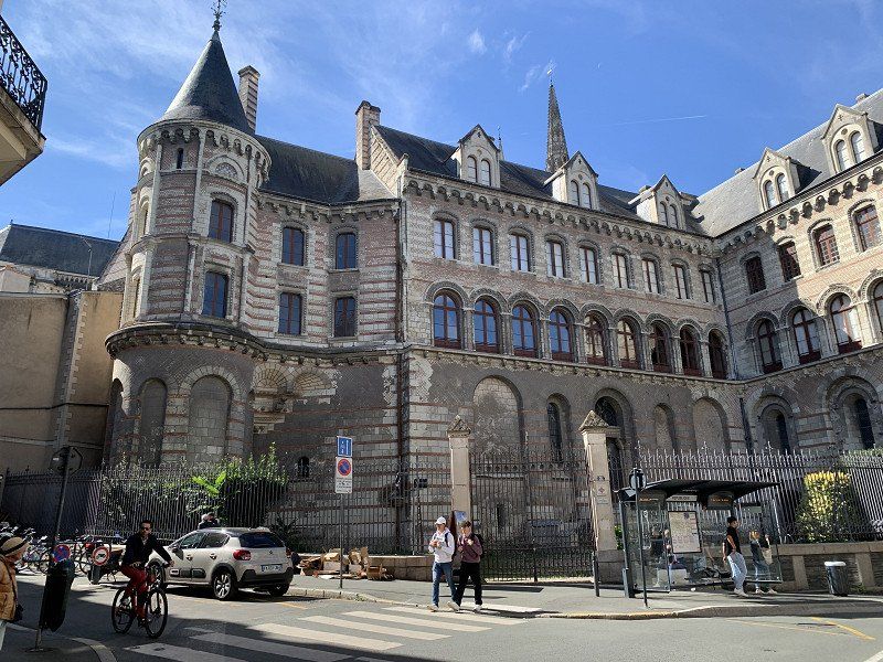
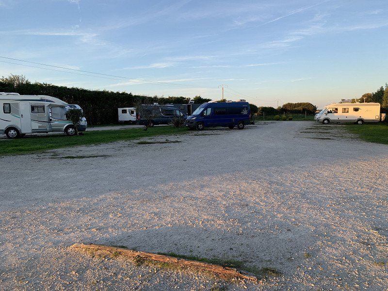
Carrying out my planned tour of France with many bike rides and castles. I saved Orléans and Nantes for a follow-up tour. I mostly drove toll-free.
Freiburg im Breisgau, Deutschland
Hagelstauden 71C, 79115 Freiburg im Breisgau, Deutschland
47° 59' 1.8" N 7° 48' 4.9" E
47.9838200 7.8013700
• Head southwest on Hagelstauden. Go for 35 m.
• Turn slightly right onto Alice-Salomon-Straße. Go for 86 m.
• Take the 2nd exit from roundabout onto Gebhard-Kromer-Straße. Go for 163 m.
• Turn left onto Basler Landstraße. Go for 663 m.
• Take the 2nd exit from roundabout onto Basler Landstraße toward Stadtmitte. Go for 123 m.
• Take ramp onto Guildfordallee (B3/B31) toward Stadtmitte. Go for 2.0 km.
• Continue on Basler Straße. Go for 738 m.
• Turn right onto Lessingstraße (B31) toward Donaueschingen/Titisee-Neustadt/Schauinslandbahn. Go for 24.5 km.
• Keep left onto B31 toward Villingen-Schwenningen/Donaueschingen/Titisee-Neustadt/B500. Go for 46.5 km.
• Take the 2nd exit from roundabout onto B31 toward Ulm/Tuttlingen/Immendingen. Go for 636 m.
• Take ramp onto A81 toward Singen/Lindau/Konstanz. Go for 22.7 km.
• Take exit 41 toward Singen onto L191. Go for 2.8 km.
• Take the 1st exit from roundabout onto L191 toward Singen. Go for 1.8 km.
• Turn right onto Schaffhauser Straße (B34) toward Schaffhausen/Waldshut/Hohentwiel. Go for 406 m.
• Arrive at Schaffhauser Straße (B34). Your destination is on the left.
☍
103,2 km
(1 hrs. 24 min.)
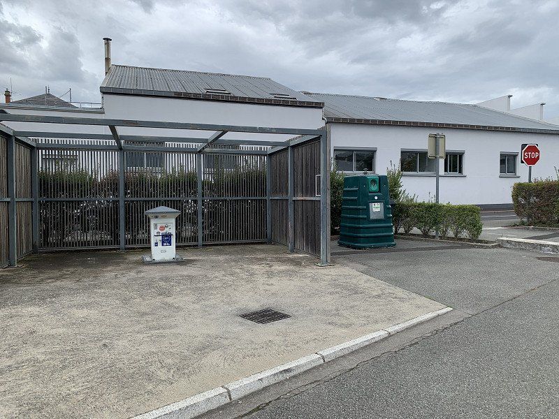
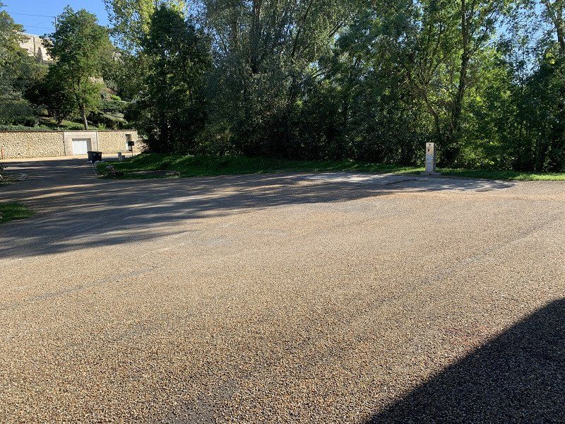
Singen, Stellplatz Schaffhauser Straße
Parking space was ok for one night before going to Switzerland. Free supply and disposal, overnight fee 5 €. Singing as a travel destination was rather questionable.
Schaffhauser Straße, 78224, Singen, Germany
47° 45' 42" N 8° 49' 45" E
47.7616667 8.8291667
• Head southwest on Schaffhauser Straße (B34). Go for 1.1 km.
• Turn right onto Hilzinger Straße (B314) toward Schweiz/Waldshut-Tiengen/Tengen/Hilzingen. Go for 1.4 km.
• Take the 2nd exit from roundabout onto B314. Go for 582 m.
• Take ramp onto A81 toward Schaffhausen. Go for 5.4 km.
• Keep left onto A81 toward Schaffhausen/Bietingen. Go for 64 m.
• Take the 1st exit from roundabout onto B34 toward Schaffhausen/Bietingen. Go for 2.0 km.
• Continue on E41/E54. Go for 992 m.
• Continue on A4 toward SH-Herblingen. Go for 7.1 km.
• Take ramp toward Schaffhausen-Nord/Zentrum. Go for 783 m.
• Turn right onto Fulachstrasse (4/15). Go for 1.3 km.
• Arrive at Bachstrasse (4/15). Your destination is on the right.
☍
20,8 km
( 21 min.)
Day
Day
Schaffhausen, Schweiz
I drove to Schaffhausen to avoid tolls. Okay with a panel van under 3.5 tons, but not recommended for larger campers.
47° 41' 45.2" N 8° 38' 17" E
47.6958897 8.6380488
• Head toward Moserstrasse on Bachstrasse (4/15). Go for 122 m.
• Turn right onto Rheinuferstrasse (4/13/14). Go for 1.3 km.
• Continue toward Basel/E54/13/Bülach/Flughafen/Neuhausen-West. Go for 58 m.
• Take ramp onto Galgenbucktunnel. Go for 1.3 km.
• Keep right toward Basel/E54. Go for 120 m.
• Continue on Klettgauerstrasse (E54). Go for 136 m.
• Pass 3 roundabouts and continue on Zollstrasse (E54). Go for 14.8 km.
• Continue on Hauptstraße (B34). Go for 11.5 km.
• Continue on A98 toward Basel/Waldshut-Tiengen. Go for 5.8 km.
• Take ramp toward Basel/WT-Waldshut/Industriegebiet Kaitle. Go for 510 m.
• Turn right onto B34 toward Basel/WT-Waldshut/Industriegebiet Kaitle. Go for 1.5 km.
• Take the 2nd exit from roundabout onto Konstanzer Straße (B34) toward Basel. Go for 1.5 km.
• Turn left onto Rheinbrückenstraße. Go for 225 m.
• Continue on Rheinbrückerstrasse. Go for 61 m.
• Turn right onto Zollplatz. Go for 135 m.
• Continue on Bahnhofstrasse (7). Go for 69 m.
• Take the 1st exit from roundabout onto Bahnhofstrasse (7) toward Aarau/5/Basel/Zürich. Go for 304 m.
• Keep right onto 7 toward Basel/Leibstadt. Go for 11.8 km.
• Pass 2 roundabouts and continue on Winterthurerstrasse (7). Go for 8.2 km.
• Take the 2nd exit from roundabout onto 7 toward Basel/Stein/Säckingen/Eiken. Go for 2.8 km.
• Take the 2nd exit from roundabout onto A3 toward Basel/Bern. Go for 32.7 km.
• Keep right onto A3 (Basel-Kleinhüningen) toward Mulhouse/EuroAirport/Basel-Kleinhüningen/Lörrach/Weil am Rhein. Go for 3.8 km.
• Continue on A35. Go for 25.5 km.
• Take the left exit toward Strasbourg/Colmar/Freiburg onto A36 (La Comtoise). Go for 187 km.
• Take the exit toward Lyon/Lons le S./Dole/Choisey onto A39 (Autoroute Verte). Go for 89.5 km.
• Take exit 10 toward St Trivier de C./Coligny/St Amour. Go for 653 m.
• Turn right. Go for 66 m.
• Turn right toward Giratoire du Biolay. Go for 57 m.
• Continue toward D56. Go for 42 m.
• Take the 2nd exit from Giratoire du Biolay roundabout onto D56 toward Cormoz/St Trivier de C./Varennes-St S./Montrevel en B. Go for 2.9 km.
• Take the 3rd exit from roundabout onto D996 toward Bourg en B./Montrevel en B./Marboz. Go for 1.7 km.
• Turn right onto Lieu-dit Le Petit Ronjon. Go for 67 m.
• Continue on Chemin du Petit Ronjon. Go for 178 m.
• Continue toward Chemin du Petit Ronjon. Go for 445 m.
• Continue on Chemin du Petit Ronjon. Go for 176 m.
• Turn right onto Route de la Verne. Go for 409 m.
• Arrive at Route de la Verne. Your destination is on the left.
☍
407,1 km
(4 hrs. 10 min.)
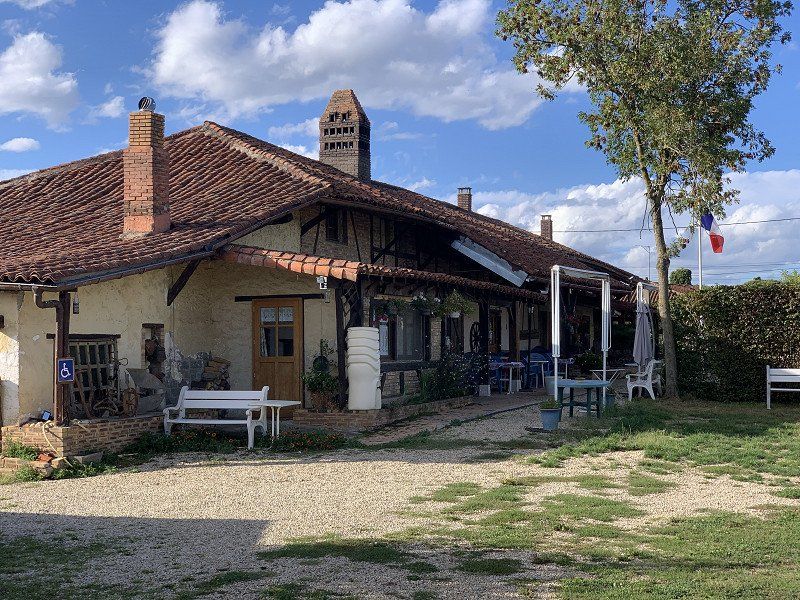
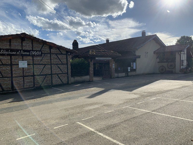
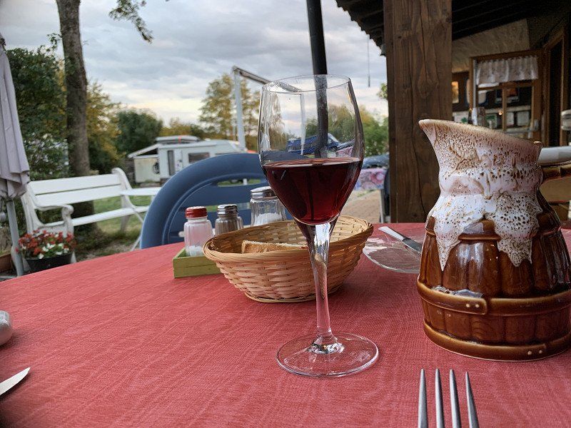
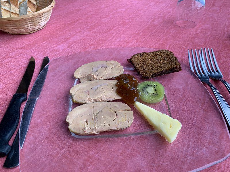
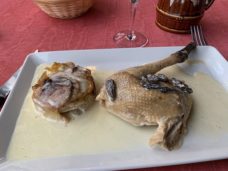
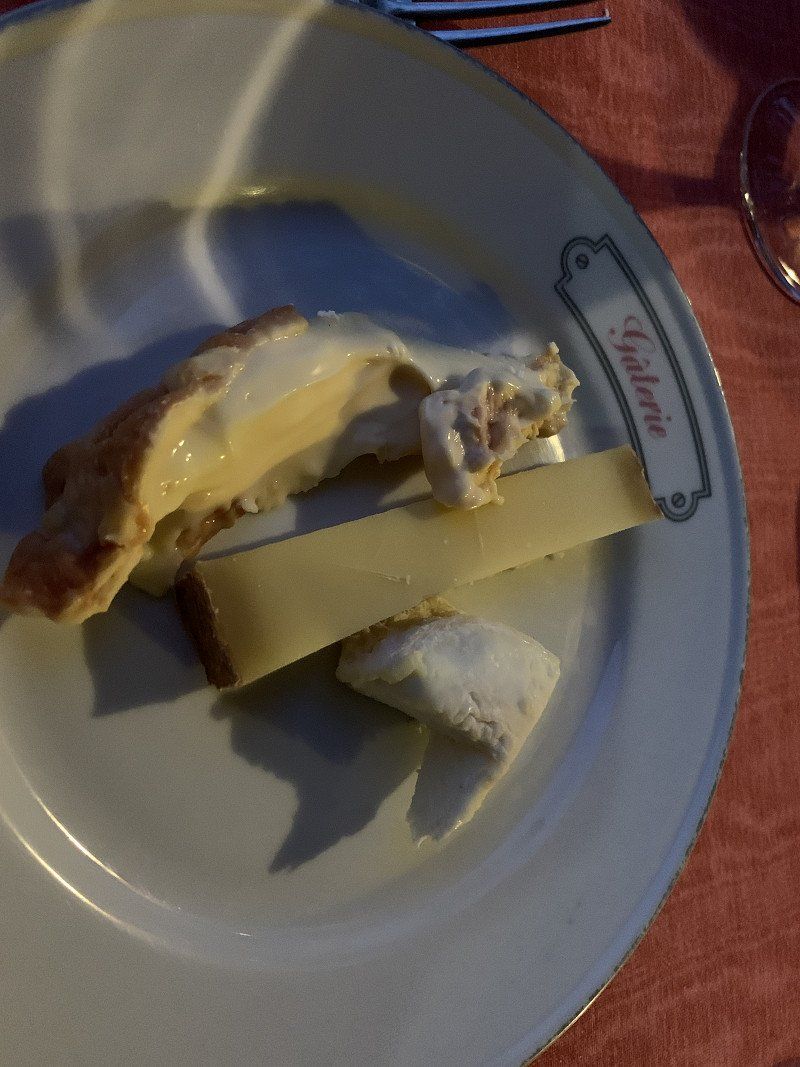
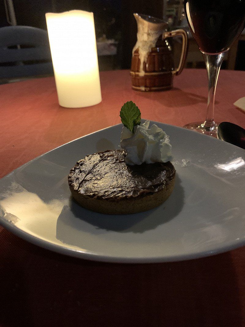
Auberge du Grand Ronjon, Route de la Verne, Cormoz, Frankreich
The food was again very tasty and the service very friendly. You should reserve in advance, as everything is freshly prepared.
2561 Route de la Verne, 01560 Cormoz, Frankreich
46° 25' 52" N 5° 13' 18.3" E
46.4311079 5.2217407
• Head west on Route de la Verne. Go for 285 m.
• Turn right onto Voie de Cormoz à Foissiat. Go for 1.1 km.
• Turn right onto Lieu-dit Les Montets. Go for 580 m.
• Continue on Lieu-dit La Culée. Go for 84 m.
• Turn left onto D996. Go for 645 m.
• Take the 1st exit from roundabout onto D56 toward A39/St Amour. Go for 2.9 km.
• Take the 3rd exit from Giratoire du Biolay roundabout toward A39/Lyon/Bourg en B./Strasbourg/Lons le S. Go for 165 m.
• Continue straight ahead. Go for 105 m.
• Turn slightly right toward A39. Go for 86 m.
• Take ramp onto A39 (Autoroute Verte) toward Lyon/Bourg en B. Go for 23.6 km.
• Continue on A40. Go for 22.4 km.
• Continue on A42 toward Grenoble/Chambéry/Lyon/Aéroport Saint-Exupéry. Go for 40.0 km.
• Take the exit toward Marseille/Grenoble/St Étienne/Aéroport Saint-Exupéry onto A432. Go for 22.5 km.
• Take the exit toward E70/Turin/Milan/Grenoble/Chambéry/L'Isle d'Abeau onto A43. Go for 27.8 km.
• Take the exit toward Valence/Grenoble onto A48. Go for 25.4 km.
• Take exit 9 toward La Côte-St André/Rives/Aéroport Grenoble-Isère. Go for 811 m.
• Take the 4th exit from roundabout onto D50 F toward Apprieu/Colombe/Lac de Paladru. Go for 458 m.
• Take the 3rd exit from roundabout onto D50 F. Go for 1.0 km.
• Take the 2nd exit from roundabout onto D50 F. Go for 908 m.
• Continue on Route de Rives. Go for 47 m.
• Take the 3rd exit from roundabout onto Route de Lyon (D520). Go for 1.1 km.
• Arrive at Route de Lyon (D520).
☍
172,0 km
(1 hrs. 34 min.)
Day
CF58+C9 Apprieu, Frankreich
45° 24' 30.6" N 5° 27' 57.6" E
45.4085080 5.4659872
• Head south on Route de Lyon (D520). Go for 964 m.
• Take the 3rd exit from roundabout onto Route de Rives (D50 F). Go for 943 m.
• Pass 2 roundabouts and continue on D50 F. Go for 1.4 km.
• Take the 1st exit from roundabout onto A48 toward Valence/Grenoble. Go for 26.9 km.
• Continue on A480 toward Turin/Milan/Sisteron/Grenoble-Centre. Go for 13.1 km.
• Continue on A51. Go for 25.5 km.
• Take the 2nd exit from roundabout onto D1075 toward Sisteron/Aix en Pce/Nice/Clelles/Col de la Croix Hte. Go for 60.0 km.
• Pass 4 roundabouts and continue on Avenue de Provence (D1075). Go for 29.9 km.
• Continue on D4075. Go for 3.9 km.
• Pass 2 roundabouts and continue on Route de Laragne (D4075). Go for 6.8 km.
• Take the 2nd exit from roundabout onto E712 toward Digne les Bains/A51/Aix en Pce/Marseille/Nice/Gap/Briançon/Barcelonnette. Go for 409 m.
• Take ramp onto A51 (Autoroute du Val de Durance) toward E712/Nice/Marseille/Aix en Pce/Digne les Bains. Go for 38.4 km.
• Take exit 19 toward Forcalquier/Oraison. Go for 635 m.
• Turn right onto D4 B toward Oraison. Go for 1.4 km.
• Pass 2 roundabouts and continue on D4. Go for 5.7 km.
• Turn left onto D15. Go for 3.3 km.
• Continue on Lieu-dit La Calèche (D15). Go for 106 m.
• Continue on D15. Go for 3.1 km.
• Continue on Lieu-dit Seguin (D15). Go for 101 m.
• Continue on D15. Go for 3.2 km.
• Continue on Route d'Oraison (D15). Go for 1.5 km.
• Continue on Rue de Digne (D8). Go for 337 m.
• Continue on Rue du 19 Mars 1962 (D8). Go for 234 m.
• Take the 2nd exit from roundabout onto Rue du Faubourg de l'Hôpital (D6). Go for 13.0 km.
• Turn right onto Rue René Cassin (D953). Go for 207 m.
• Turn left onto Place Émile Bouteuil. Go for 43 m.
• Continue on Rue du Faubourg Saint-Sébastien. Go for 304 m.
• Arrive at Rue du Faubourg Saint-Sébastien. Your destination is on the left.
☍
241,3 km
(3 hrs. 15 min.)
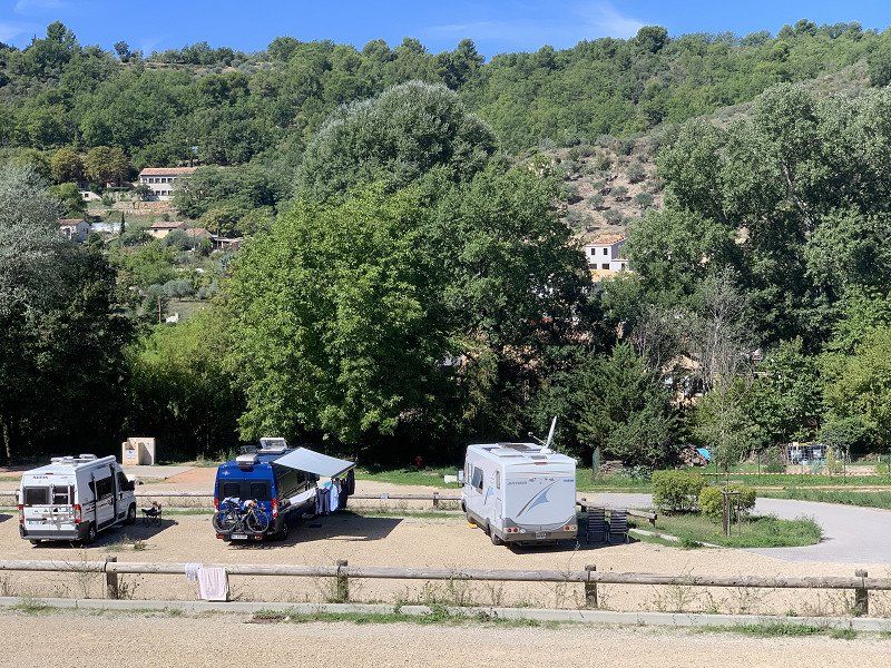
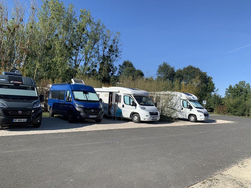
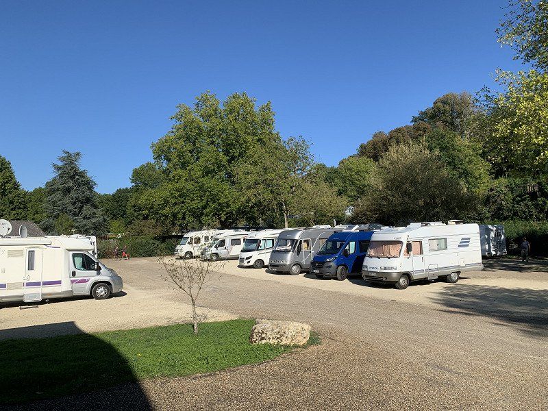
Reiz, Aire Municipale pour Camping-cars
Small place near the Verdon Gorge. Parking space costs €6.60 per night including supply and disposal. There is no electricity on site! There is a market on Wednesdays and Saturdays. Pitch is ok and I will stay here rather than go to the campsite.
Rue du Faubourg Saint-Sébastien‎, 04500, Riez, France
43° 49' 17" N 6° 5' 33" E
43.8213889 6.0925000
• Head northeast on Rue du Faubourg Saint-Sébastien.
• Arrive at Rue du Faubourg Saint-Sébastien. Your destination is on the left.
☍
Distance not available
(Duration not available)
Day
Reiz Aire Municipale pour Camping-cars
Did a nice bike ride with a local friend.
Rue du Faubourg Saint-Sébastien‎, 04500, Riez, France
43° 49' 17" N 6° 5' 33" E
43.8213889 6.0925000
• Head toward Faubourg Saint-Sébastien on Rue du Faubourg Saint-Sébastien. Go for 315 m.
• Continue on Place Émile Bouteuil. Go for 32 m.
• Turn left onto Avenue de Verdun (D953). Go for 71 m.
• Continue on Avenue Frédéric Mistral (D952). Go for 244 m.
• Take the 1st exit from roundabout onto Route de Marseille (D952). Go for 7.8 km.
• Turn right onto Rue Félix Arnoux (D952). Go for 11.2 km.
• Take the 3rd exit from roundabout onto Avenue des Alpes (D952). Go for 7.8 km.
• Take the 2nd exit from roundabout onto Rue Saint-André (D554). Go for 421 m.
• Pass 4 roundabouts and continue on D952. Go for 7.1 km.
• Take the 2nd exit from roundabout onto A51 (Autoroute du Val de Durance) toward Aix en Pce/Pertuis. Go for 38.5 km.
• Keep left onto Rocade Ouest (N296) toward Aix-Jas de Bouffan/Aix-Encagnane. Go for 2.0 km.
• Take the exit toward Lyon/Avignon/Salon de Pce onto A8 (La Provençale). Go for 18.5 km.
• Continue on A7 (Autoroute du Soleil). Go for 10.6 km.
• Take the exit toward Salon de Pce/Arles/Nîmes/Barcelone onto A54. Go for 24.8 km.
• Continue on N113. Go for 24.0 km.
• Keep left onto A54 toward Garons/Nîmes/Montpellier. Go for 23.4 km.
• Take the exit onto A9 (La Languedocienne). Go for 31.9 km.
• Keep right onto A709 toward A75/Clermont-Ferrand/Montpellier/Aéroport. Go for 16.2 km.
• Take exit 31 toward Montpellier-Ouest/Croix d'Argent/Mosson. Go for 685 m.
• Take the 3rd exit from Rond-Point Paul-Louis Bret roundabout onto Avenue d'El Alamein (M65) toward Croix d'Argent/Mosson/Hôpitaux-Facultés/Garosud. Go for 2.1 km.
• Take the 3rd exit from Place Flandres-Dunkerque roundabout onto Avenue de Toulouse (M613) toward Barcelone/A9/Béziers/Sète/Millau/St Jean de Védas. Go for 1.2 km.
• Take the 1st exit from Rond-Point de Rieucoulon roundabout onto M132 E2 toward Millau/Montpellier-Mosson/Lavérune/Juvignac. Go for 2.7 km.
• Take the 4th exit from Rond-Point Maurice Gennevaux roundabout onto Avenue Léon Jouhaux (M132) toward Millau/Montpellier-Mosson/Juvignac. Go for 1.6 km.
• Keep left toward Millau/Juvignac/St Georges d'Orques. Go for 330 m.
• Take ramp onto N109. Go for 6.3 km.
• Keep left onto A750. Go for 26.5 km.
• Take the exit onto A75 (La Méridienne). Go for 108 km.
• Take exit 41 toward St Geniez d'Olt/Campagnac. Go for 294 m.
• Turn left. Go for 123 m.
• Continue toward D37. Go for 37 m.
• Take the 2nd exit from roundabout onto D37 toward Campagnac/St Géniez d'Olt. Go for 5.2 km.
• Continue on Route de Sévérac (D37). Go for 302 m.
• Turn left onto Rue du Fraysse (D202). Go for 184 m.
• Continue on Rue de la Marie (D202). Go for 76 m.
• Continue on D202. Go for 1.2 km.
• Continue on Lieu-dit Moulineau (D202). Go for 130 m.
• Continue on D202. Go for 1.5 km.
• Continue on Lieu-dit Les Landes (D202). Go for 97 m.
• Continue on D202. Go for 390 m.
• Turn left onto D45. Go for 8.3 km.
• Turn right onto D95. Go for 5.1 km.
• Turn sharp left onto Avenue d'Espalion (D988). Go for 586 m.
• Continue on D19 E. Go for 360 m.
• Continue on Route de Prades (D19). Go for 297 m.
• Continue on D19. Go for 288 m.
• Continue on Lieu-dit La Falque (D19). Go for 172 m.
• Continue on D19. Go for 692 m.
• Continue on Route de Prades (D19). Go for 5.1 km.
• Continue on Lieu-dit Cantaloube (D19). Go for 337 m.
• Continue on D19. Go for 558 m.
• Continue on Lieu-dit La Peyronie (D19). Go for 106 m.
• Continue on D19. Go for 6.0 km.
• Continue on Route de l'Aubrac (D19). Go for 2.2 km.
• Continue on D19. Go for 479 m.
• Continue on Lieu-dit La Jonquière (D19). Go for 79 m.
• Continue on D19. Go for 155 m.
• Continue on Route de l'Aubrac (D19). Go for 158 m.
• Continue on D19. Go for 154 m.
• Continue on Route de l'Aubrac (D19). Go for 755 m.
• Continue on D19. Go for 3.6 km.
• Turn right onto D219. Go for 1.7 km.
• Arrive at D219.
☍
420,7 km
(4 hrs. 37 min.)
HX6Q+PV Prades-d’Aubrac, Frankreich
44° 33' 42.6" N 2° 59' 22.7" E
44.5618357 2.9896425
• Head north on D219. Go for 10.2 km.
• Turn right onto Col d'Aubrac (D987). Go for 28.8 km.
• Continue on Avenue de Peyre (D809). Go for 1.5 km.
• Take ramp onto A75 (La Méridienne) toward St Chély d'Apcher/St Flour/Clermont-Fd. Go for 135 km.
• Continue on A71. Go for 3.4 km.
• Take exit 15 toward Limoges/Riom/Clermont-Fd-Nord onto A710. Go for 1.8 km.
• Keep left toward Boulevard Edgar Quinet. Go for 665 m.
• Continue on Boulevard Edgar Quinet. Go for 512 m.
• Take the 2nd exit from roundabout onto Boulevard Edgar Quinet toward Chamalières/Royat/Le Puy de Dôme. Go for 714 m.
• Turn sharp left onto Boulevard Léon Jouhaux (D2009) toward Le Mont-Dore/La Bourboule/Montferrand. Go for 316 m.
• Turn right onto Rue de la Fontaine de la Ratte toward L'Aventure Michelin/Montferrand. Go for 31 m.
• Arrive at Rue de la Fontaine de la Ratte.
☍
183,1 km
(1 hrs. 58 min.)
Day
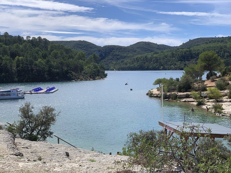
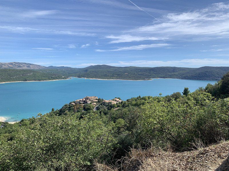
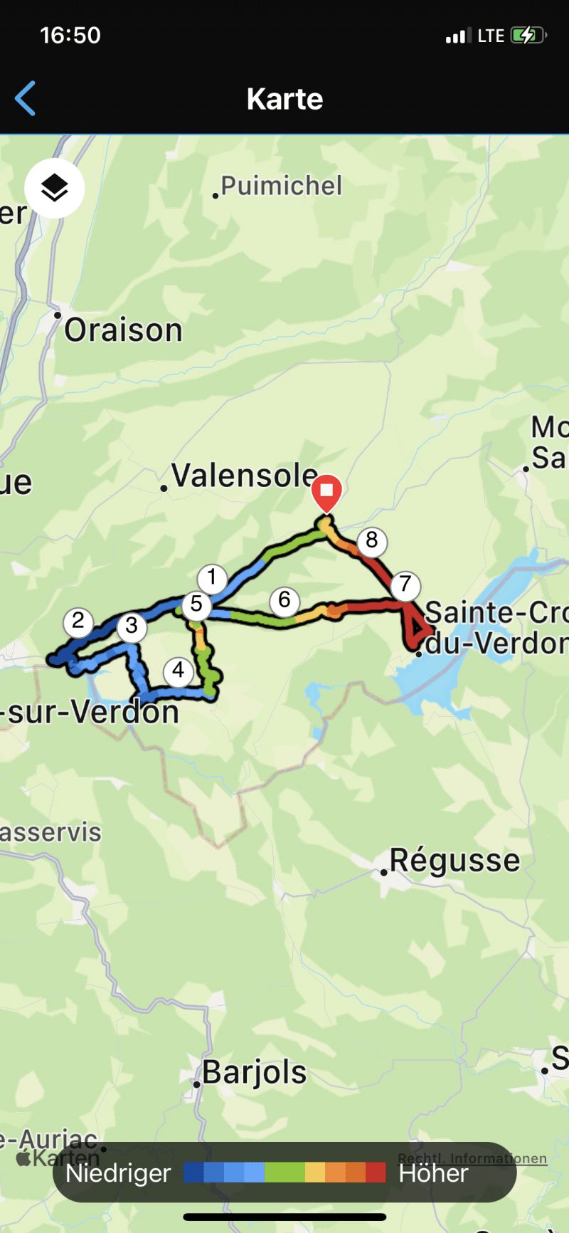
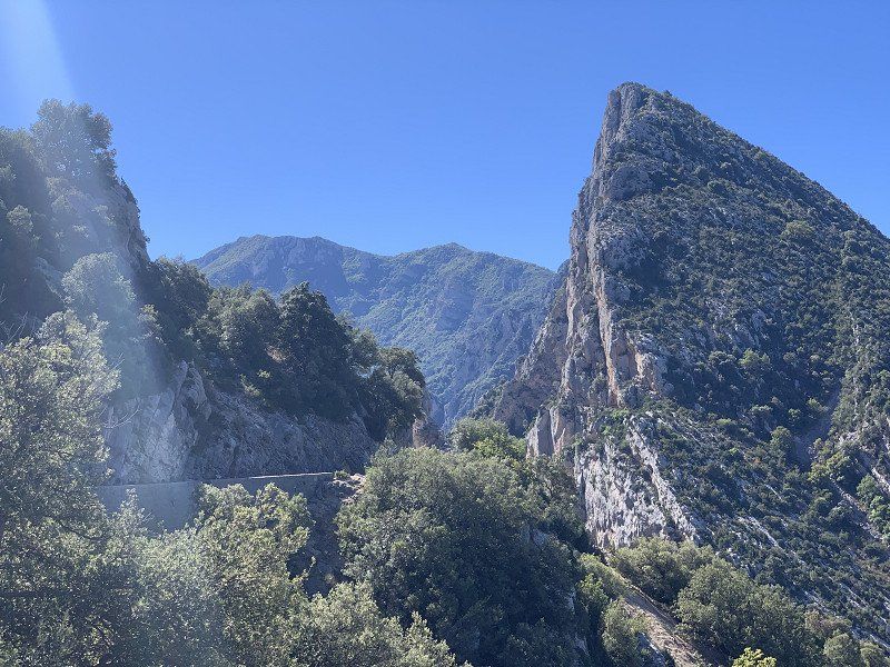
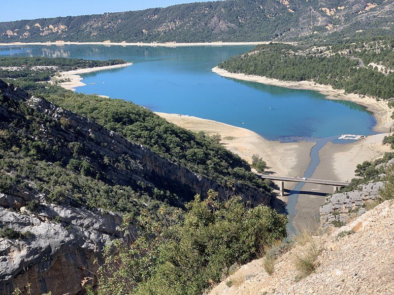
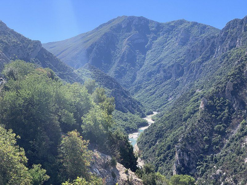
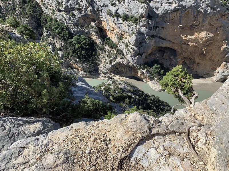
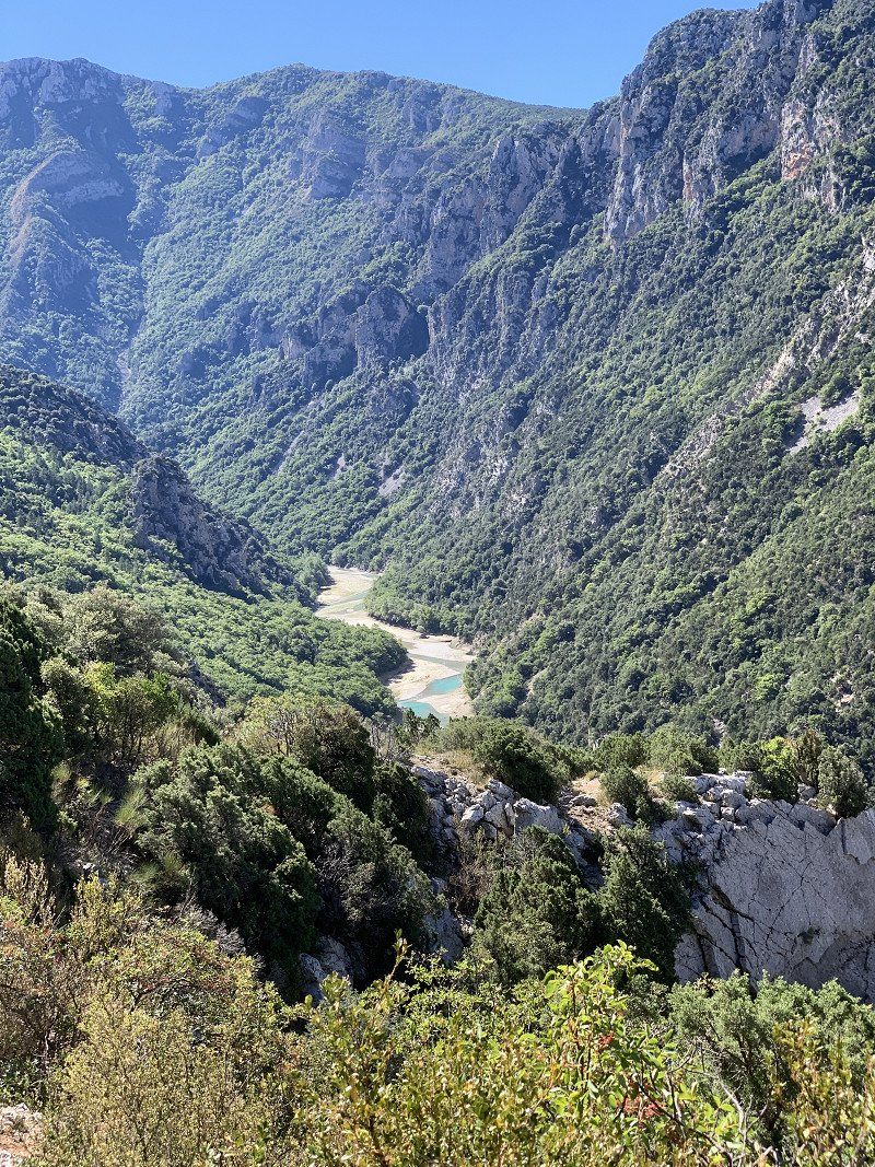
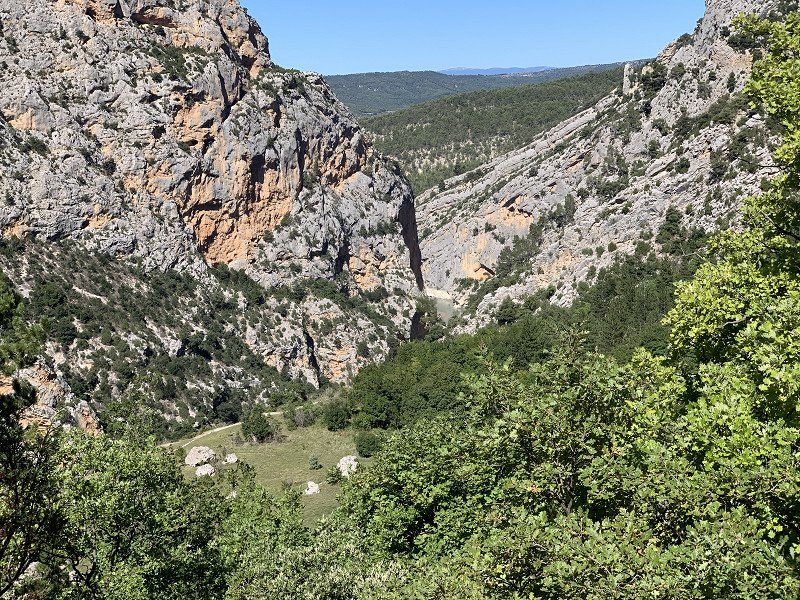
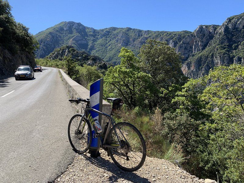
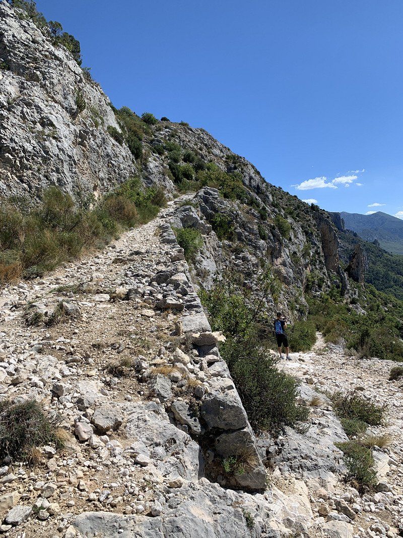
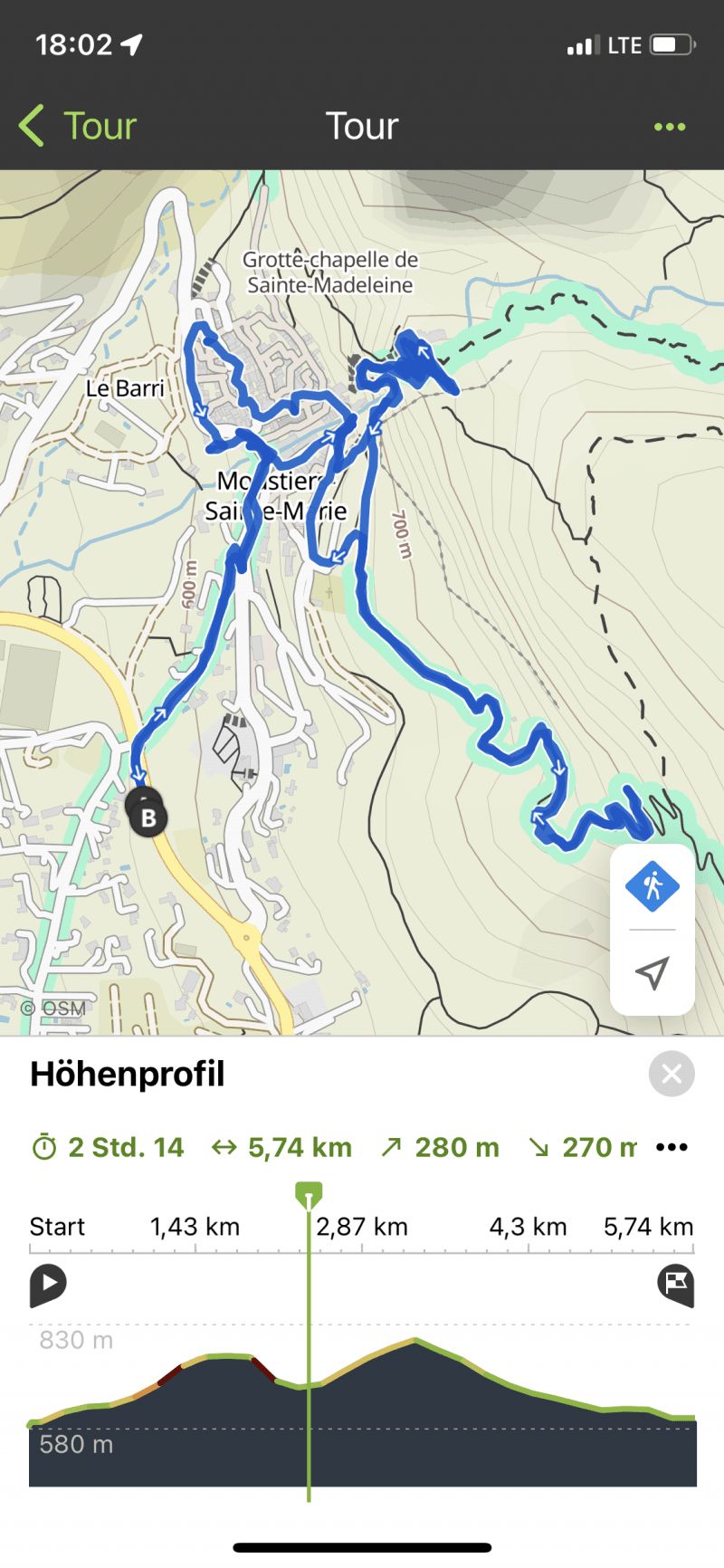
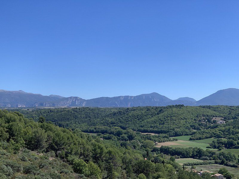
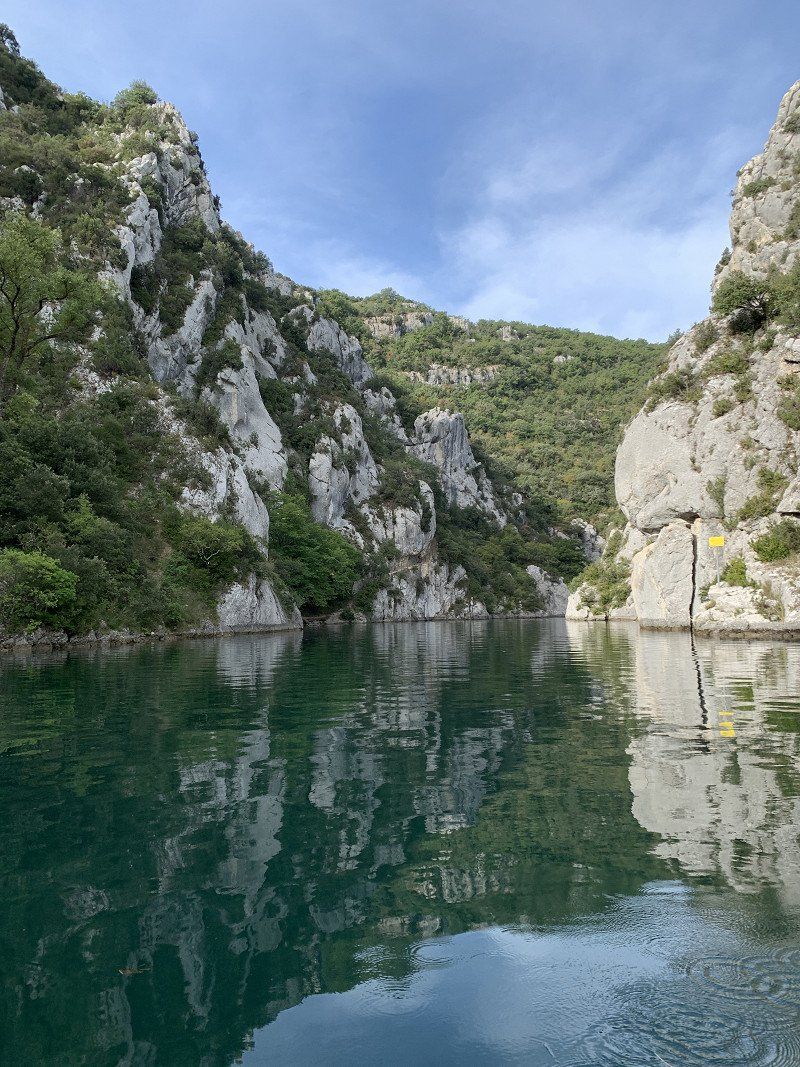
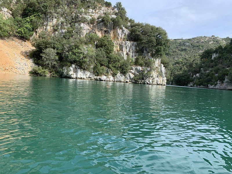
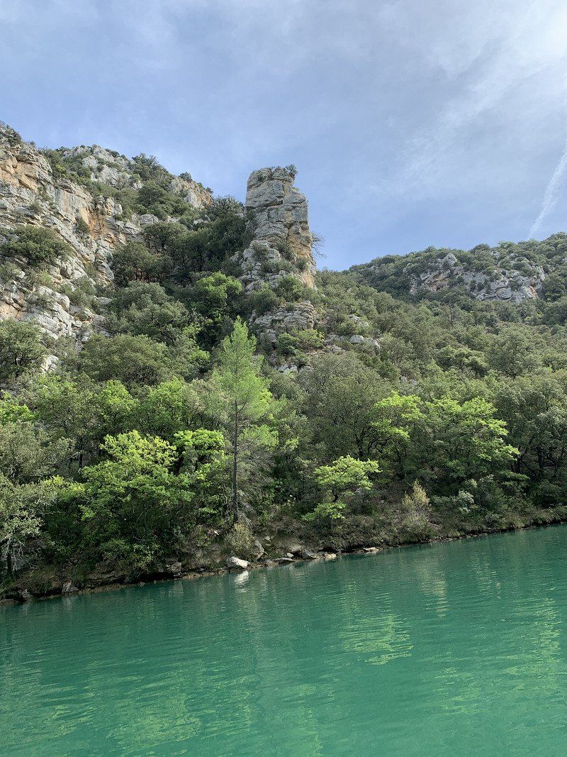
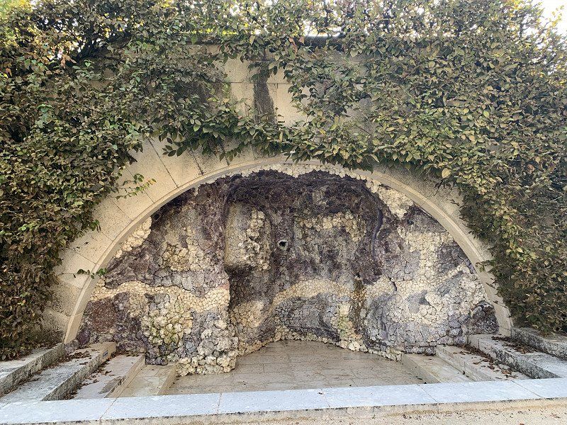
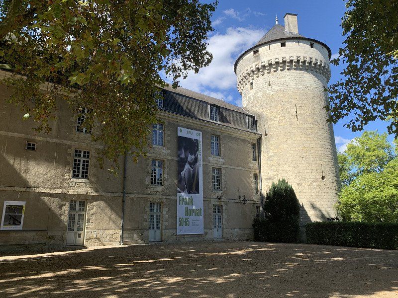
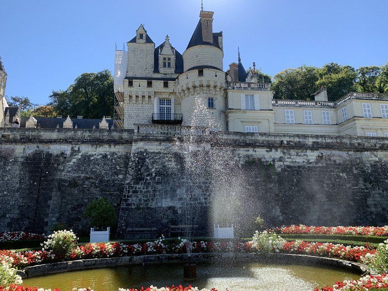
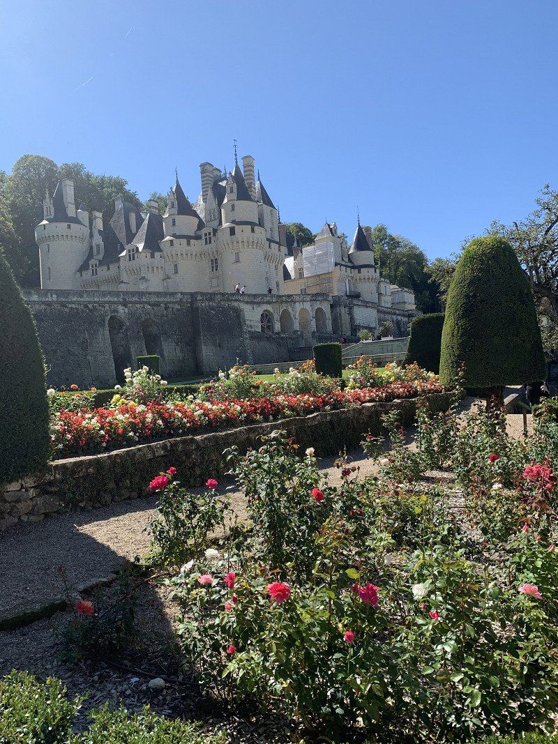
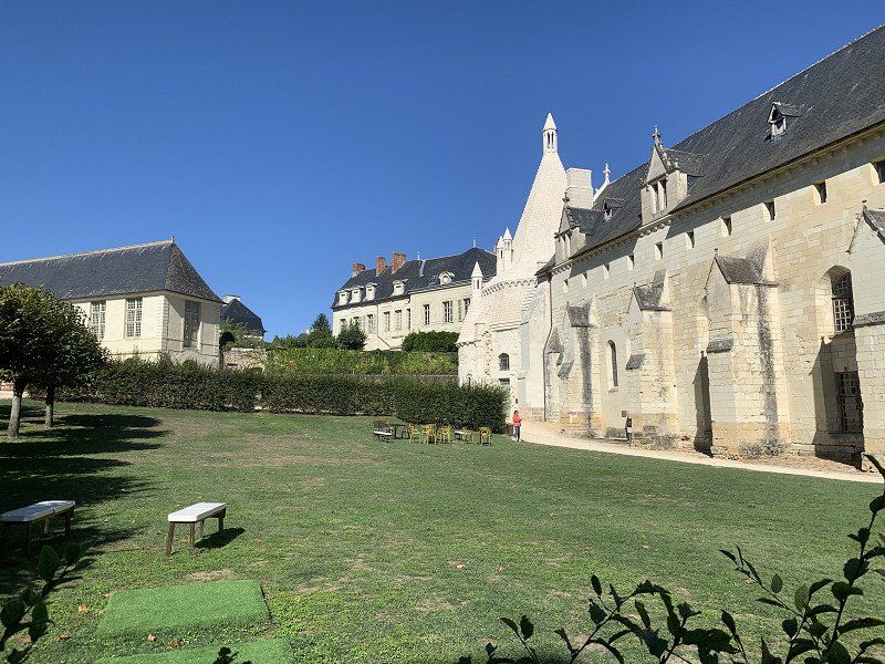
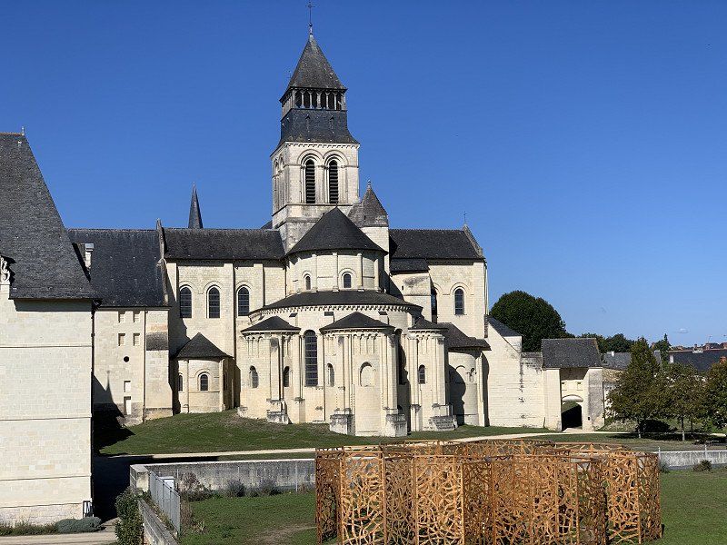
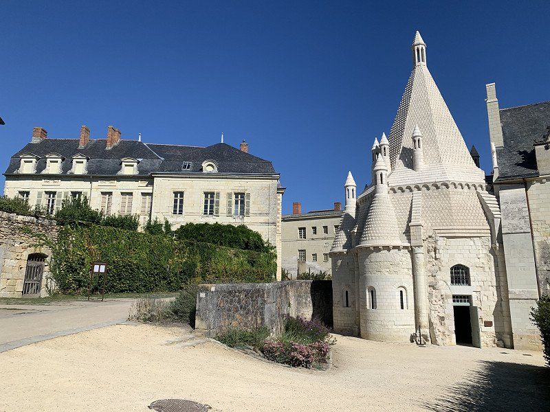
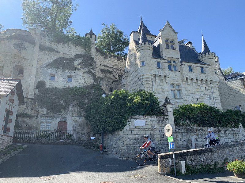
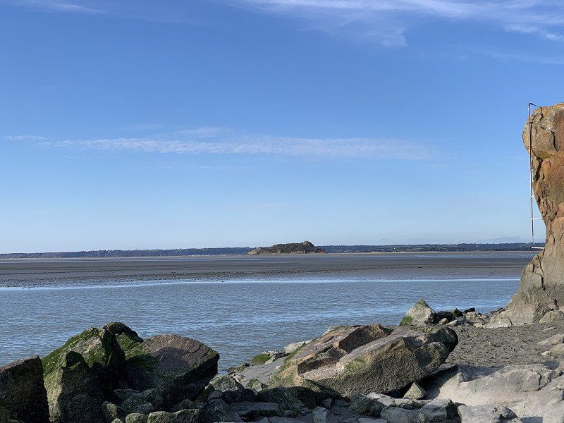
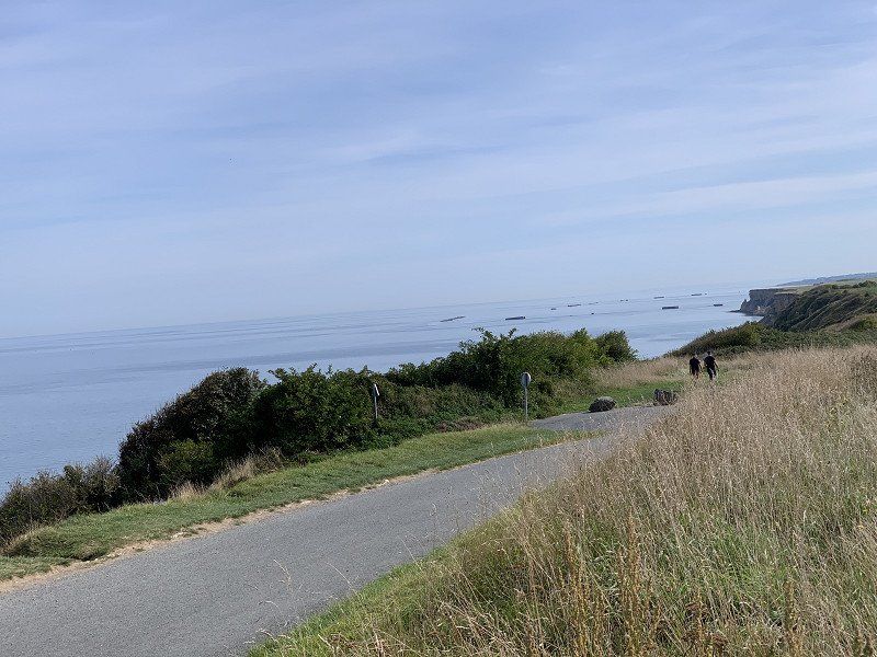
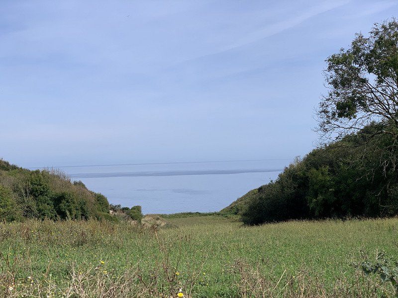
Gorges du Verdon (Verdonschlucht)
Took a camper van from Reiz to Moustiers and then cycled to Gorges du Verdon. Then explored the city on foot and hiked a Roman trail.
Day
Ausruhtag
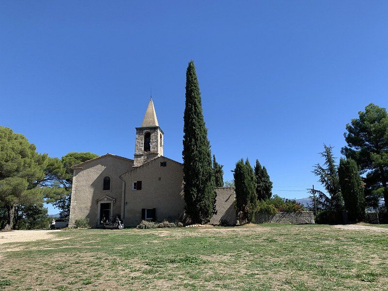
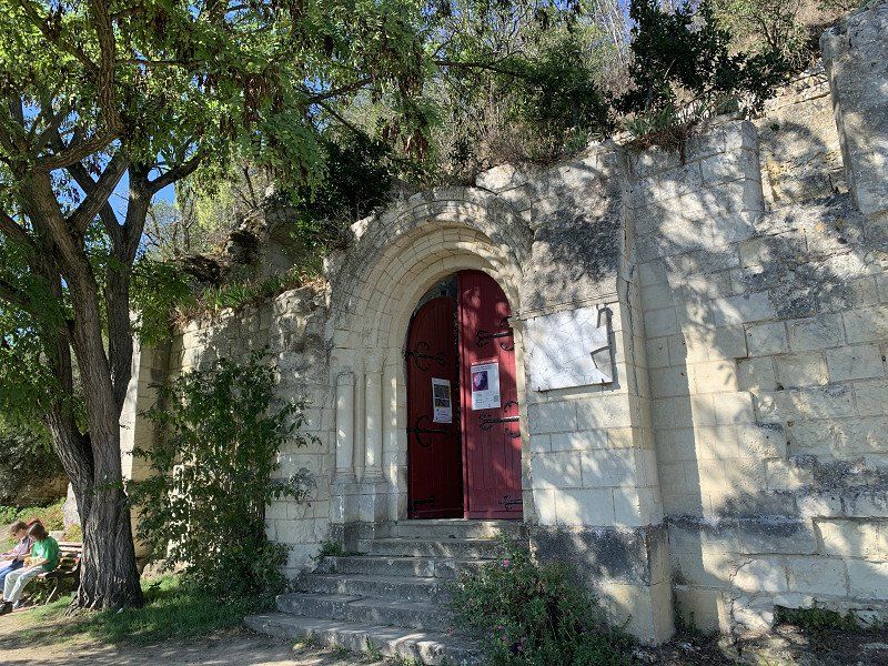
Short walk to the local chapel, otherwise a service day (washing clothes, shopping)
Day
Clermont-Ferrand: Parking Clermont-Ferrand Les Pistes - EFFIA, Rue de la Fontaine de la Ratte, Clermont-Ferrand, Frankreich
In the morning still on the way with the canoe and then to Clermont-Ferrand via toll roads. The parking lot is not nice and very noisy. 8€ plus 0.45 per person council tax. Unfortunately I had to spend 2 nights here for various reasons.
349 Rue de la Font de la Ratte, 63100 Clermont-Ferrand, Frankreich
45° 47' 54" N 3° 6' 50.4" E
45.7983414 3.1139883
• Head toward Boulevard Léon Jouhaux on Rue de la Fontaine de la Ratte. Go for 31 m.
• Turn left onto Boulevard Léon Jouhaux (D2009). Go for 194 m.
• Turn right onto Boulevard Edgar Quinet toward A71-A75/A89/Paris/Riom/Vichy/Montluçon. Go for 696 m.
• Take the 2nd exit from roundabout onto Boulevard Edgar Quinet toward A71-A75/A89/Gerzat/Les Gravanches/Vergnes. Go for 497 m.
• Keep left toward A710. Go for 780 m.
• Continue on A710. Go for 1.7 km.
• Take the exit toward Paris/Riom/Bordeaux onto A71/A89. Go for 20.4 km.
• Continue on A71 toward Paris/Montluçon/Vichy. Go for 193 km.
• Take the exit toward Nantes/Tours/Blois onto A85. Go for 21.9 km.
• Take exit 14 toward Blois. Go for 1.1 km.
• Pass 2 roundabouts and continue on D922. Go for 2.0 km.
• Take the 2nd exit from roundabout onto Rue de l'Étang Barbin (D765) toward Blois/Tours/Orléans. Go for 1.7 km.
• Take the 3rd exit from roundabout onto D765 toward Blois/Orléans. Go for 586 m.
• Pass 2 roundabouts and continue on Lieu-dit Le Patureau de la Grange (D765). Go for 2.3 km.
• Continue toward Blois/Mur de Sologne. Go for 40 m.
• Take the 4th exit from roundabout onto Route de Blois (D765) toward Blois/Mur de Sologne. Go for 9.5 km.
• Turn right onto Rue Camille Masson (D63) toward Courmemin/Veilleins. Go for 11 m.
• Turn left onto Rue de Chambord (D20). Go for 1.1 km.
• Continue on D20. Go for 243 m.
• Continue on Lieu-dit La Meule (D20). Go for 56 m.
• Continue on D20. Go for 2.8 km.
• Continue on Lieu-dit La Moutinière (D20). Go for 128 m.
• Continue on D20. Go for 1.4 km.
• Continue on Lieu-dit Les Corbelières (D20). Go for 74 m.
• Continue on Lieu-dit Les Cobrières (D20). Go for 110 m.
• Continue on D20. Go for 2.3 km.
• Continue on Lieu-dit Les Pluies (D20). Go for 59 m.
• Continue on D20. Go for 586 m.
• Continue on Lieu-dit Le Bois (D20). Go for 70 m.
• Continue on D20. Go for 318 m.
• Continue on Lieu-dit La Croix du Bois (D20). Go for 74 m.
• Continue on D20. Go for 1.2 km.
• Turn right onto Route de l'Arche (D119). Go for 1.6 km.
• Turn left onto Place de l'Église (D120). Go for 4.1 km.
• Turn right onto Avenue de Cheverny (D102). Go for 567 m.
• Turn right onto Rue de la Mairie (D60). Go for 155 m.
• Turn left onto Place de l'Hôtel de Ville. Go for 105 m.
• Turn left onto Place de l'Hôtel de Ville (D923). Go for 147 m.
• Turn right onto Rue Roger Brun (D923). Go for 218 m.
• Take the 2nd exit from roundabout onto Rue Roger Brun (D923). Go for 274 m.
• Take the 2nd exit from roundabout onto Route de Chambord (D112). Go for 6.8 km.
• Continue on Route de la Commission (D33). Go for 177 m.
• Turn sharp right onto Rue de la Grange aux Dîmes. Go for 113 m.
• Arrive at Rue de la Grange aux Dîmes. Your destination is on the left.
☍
281,1 km
(2 hrs. 33 min.)
Day
Day
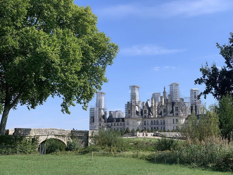
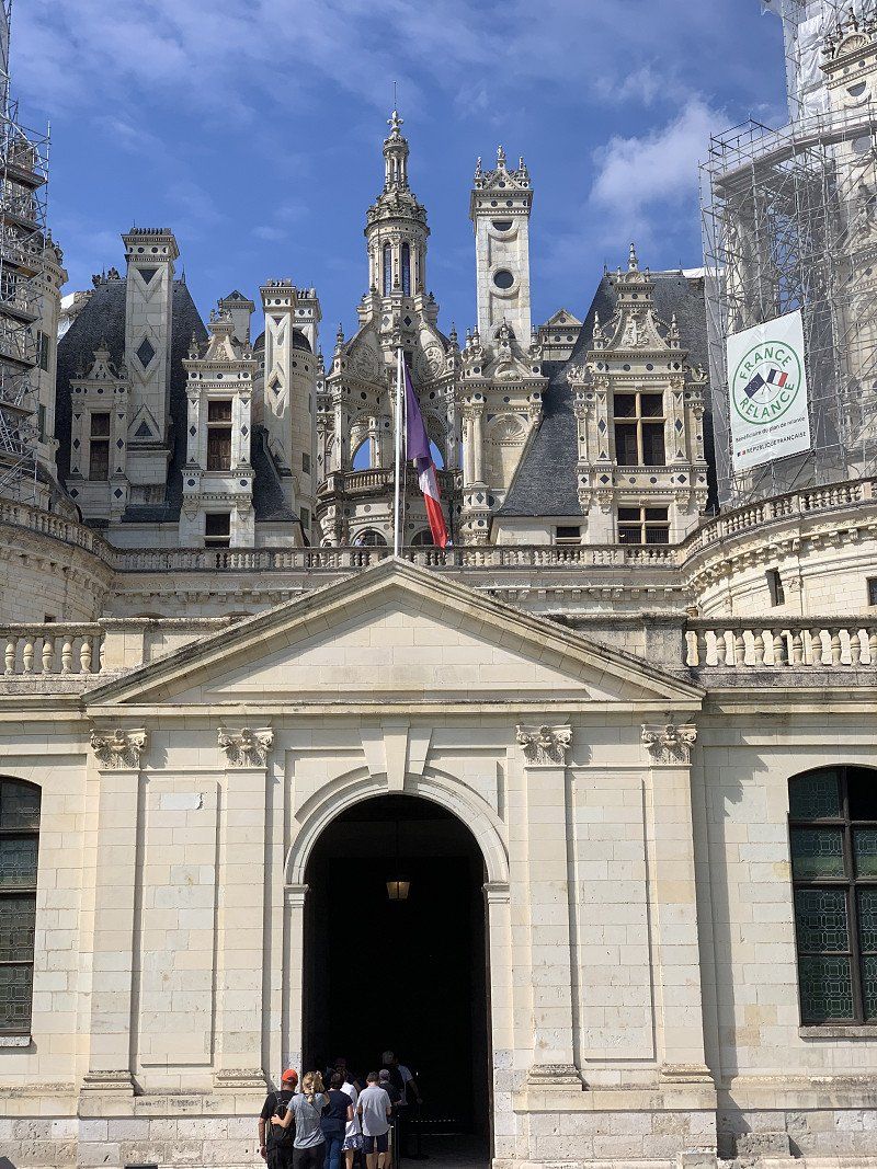
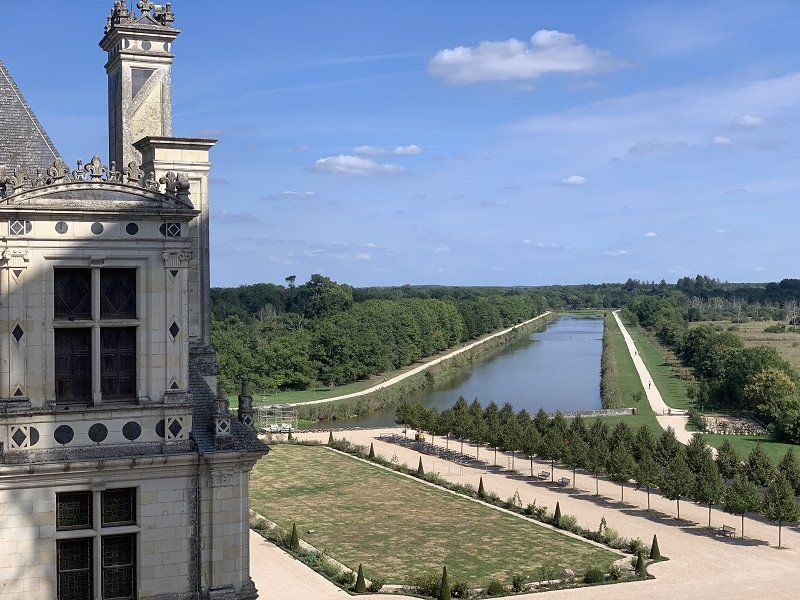
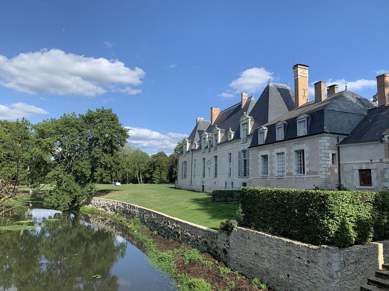
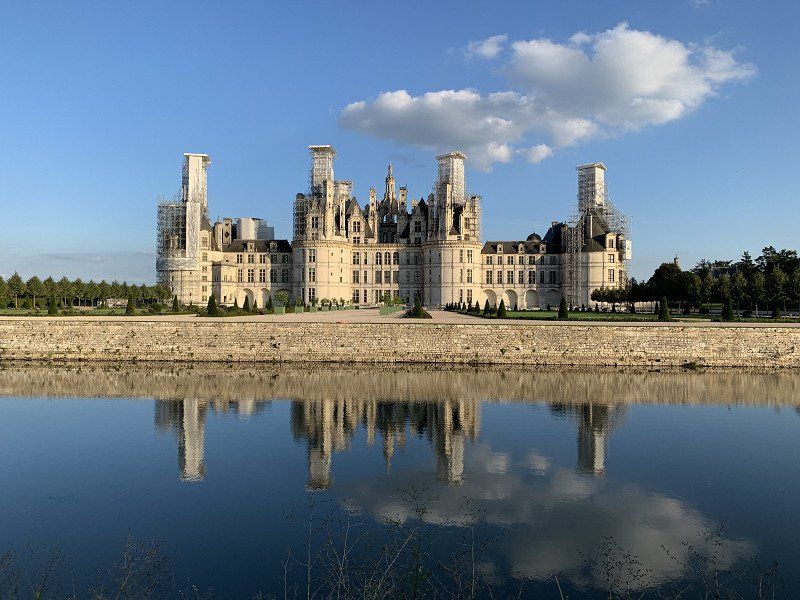
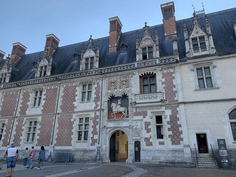
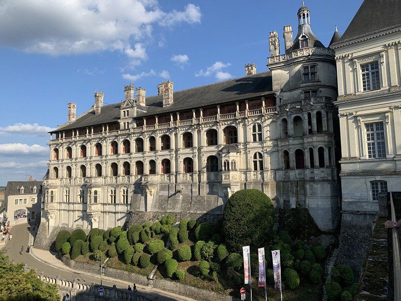
Chambord, Frankreich
Toll-free from Clemont-Ferrand to Chambord. Chambord car park costs €11 for up to 24 hours. I cycled to Blois (about 18 km).
41250 Chambord, Frankreich
47° 36' 51" N 1° 31' 0.8" E
47.6141580 1.5168780
• Head toward Route de la Commission on Rue de la Grange aux Dîmes. Go for 113 m.
• Turn right onto Route de la Commission (D33). Go for 5.8 km.
• Turn right onto Rue du Pont (D72). Go for 179 m.
• Take the 2nd exit from roundabout onto Rue de Biou. Go for 689 m.
• Take the 1st exit from roundabout onto Rue de Biou. Go for 1.7 km.
• Continue on Rue du Petit Chambord. Go for 2.5 km.
• Continue on Avenue des Noëls (D72). Go for 396 m.
• Continue on D72. Go for 2.0 km.
• Take the 2nd exit from roundabout onto D951 toward Tours/Châteauroux/Vierzon/Amboise/Chaumont S/L./Blois-Sud. Go for 235 m.
• Pass 2 roundabouts and continue on Levée de Saint-Dyé (D951). Go for 667 m.
• Continue on Quai Henri Chavigny (D951). Go for 647 m.
• Continue on Quai Amédée Contant (D951). Go for 244 m.
• Continue on Carrefour de la Libération (D951). Go for 23 m.
• Turn right onto Carrefour de la Libération (D956 B). Go for 332 m.
• Arrive at Place de la Résistance (D956 B). Your destination is on the left.
☍
15,5 km
( 17 min.)
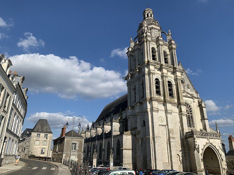
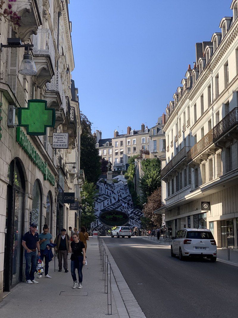
Blois, Frankreich
41000 Blois, Frankreich
47° 35' 9.9" N 1° 20' 9.4" E
47.5860921 1.3359475
• Head toward Rue Henri Drussy on Place de la Résistance (D956 B). Go for 11 m.
• Turn left onto Rue Émile Laurens. Go for 18 m.
• Turn right onto Place de la Résistance. Go for 21 m.
• Turn right onto Place de la Résistance (D956 B). Go for 40 m.
• Turn right onto Quai de la Saussaye (D952). Go for 9.6 km.
• Take the 2nd exit from roundabout onto D952 toward Onzain/Amboise. Go for 6.8 km.
• Take the 3rd exit from roundabout onto D1 toward Chaumont S/Loire/Chaumont S/L. Go for 678 m.
• Turn right onto Rue du Maréchal Leclerc (D114). Go for 302 m.
• Continue on Rue du Maréchal de Lattre de Tassigny (D751). Go for 734 m.
• Turn left onto Rue de l'Aumône. Go for 23 m.
• Turn slightly left onto Rampe du Château. Go for 123 m.
• Arrive at Rampe du Château. Your destination is on the left.
☍
18,3 km
( 17 min.)
Day
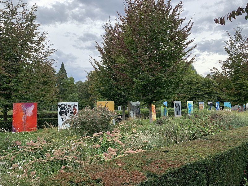
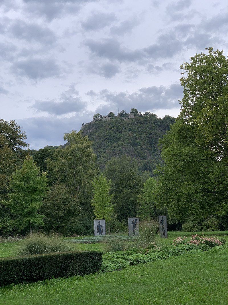
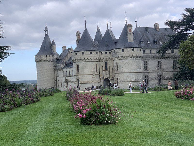
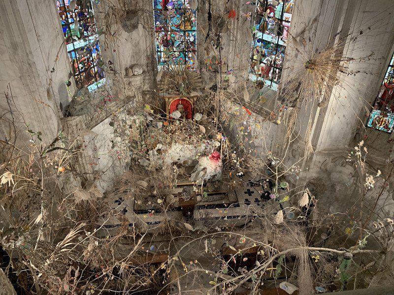
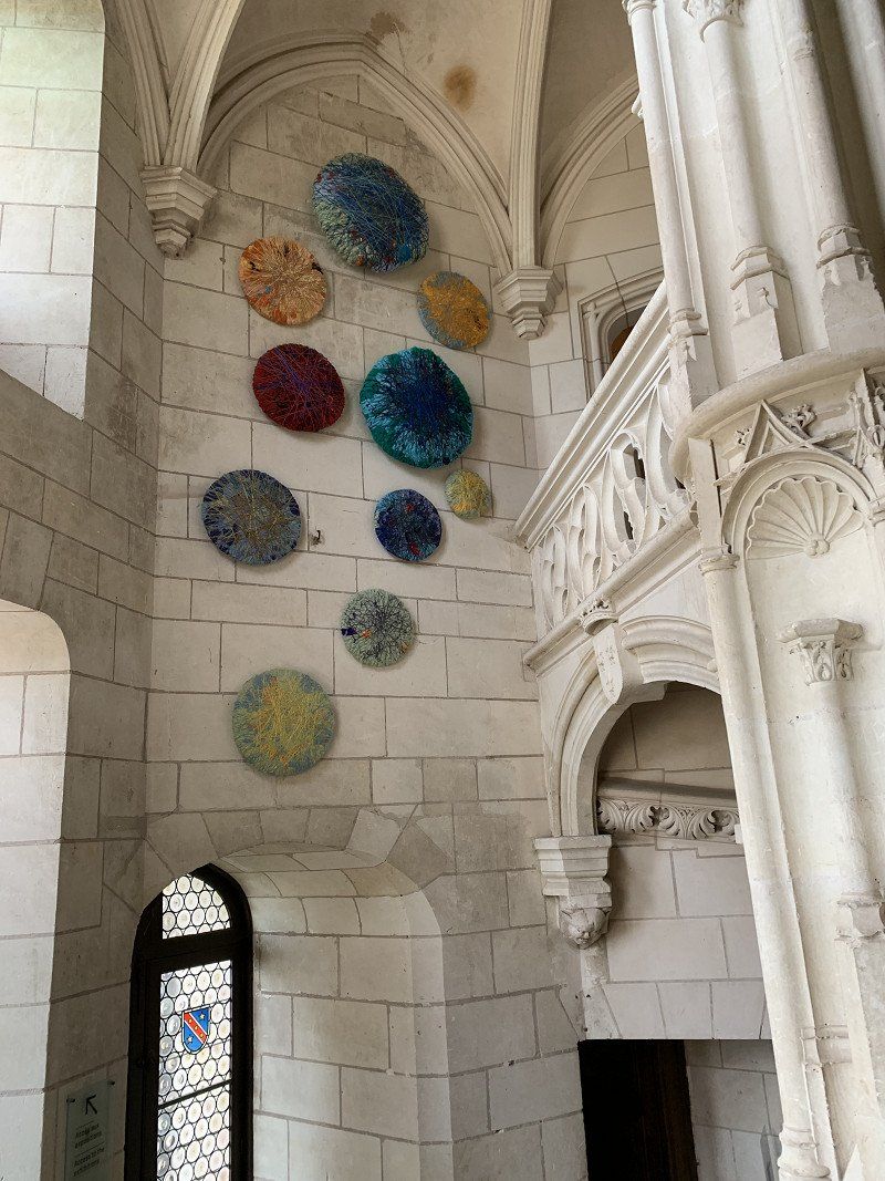
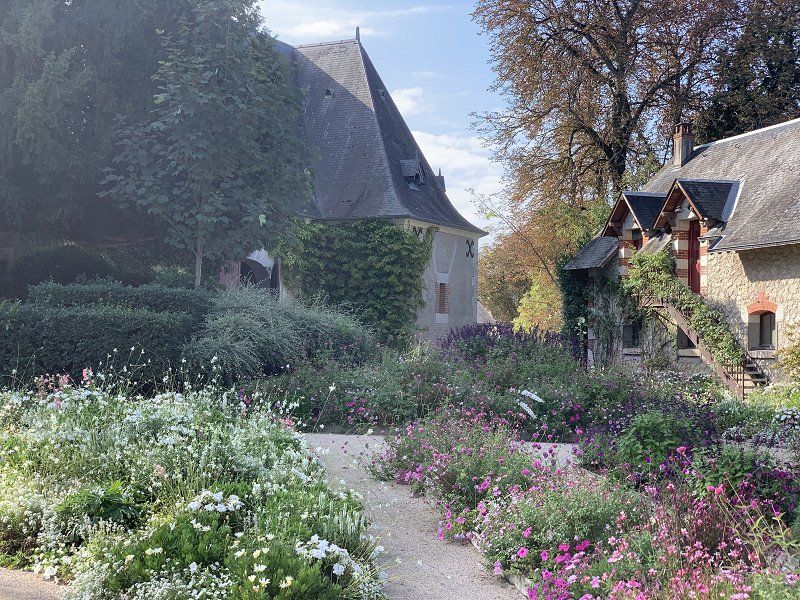
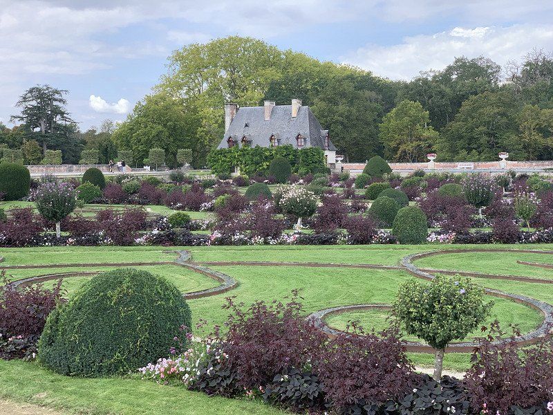
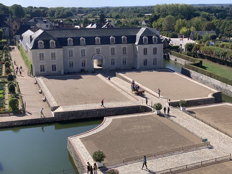
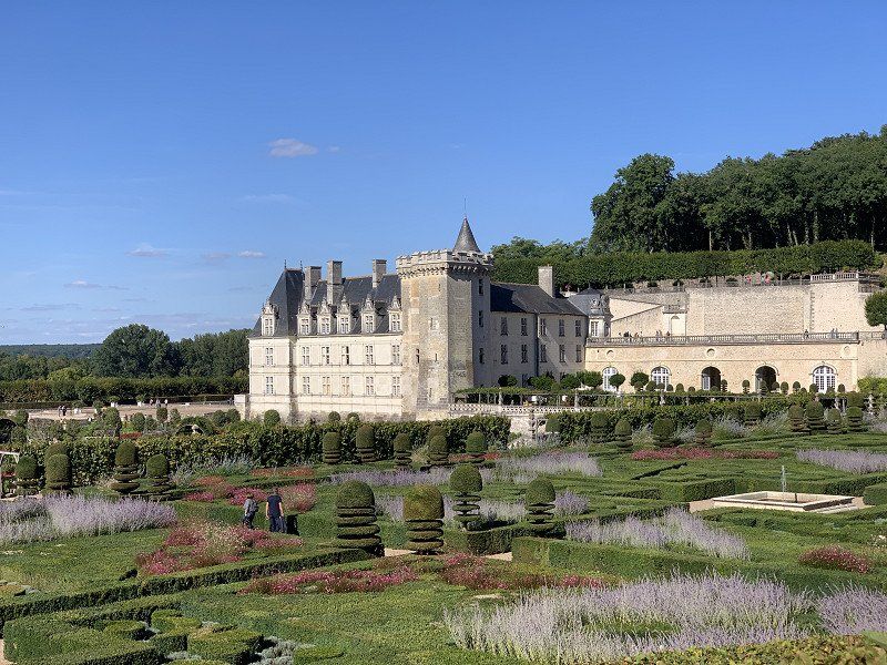
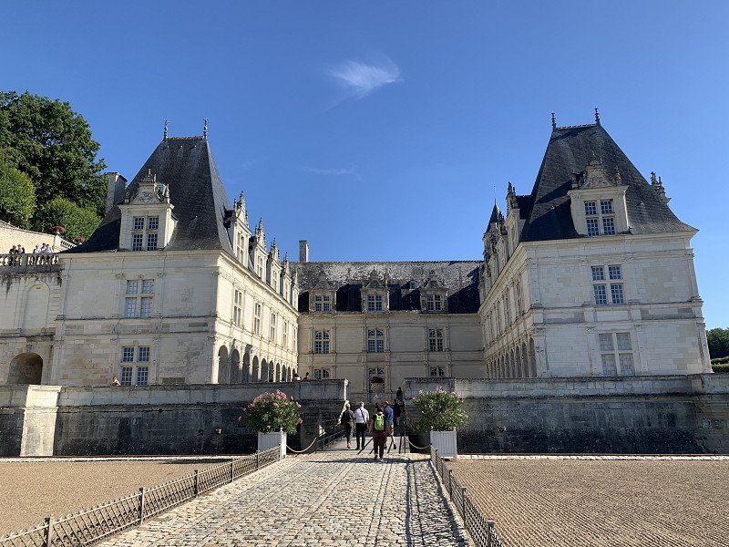
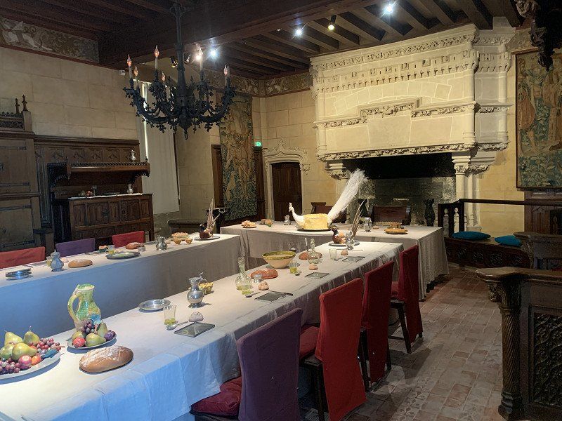
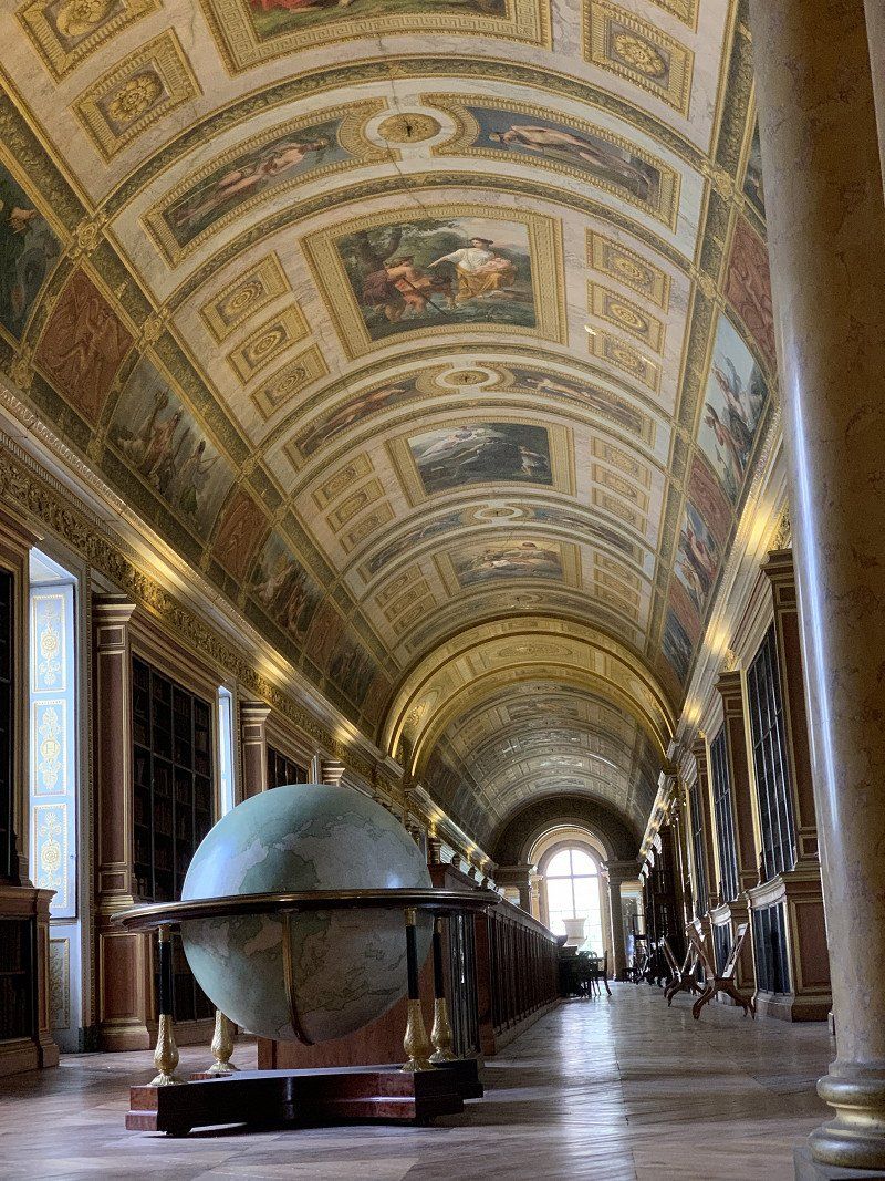
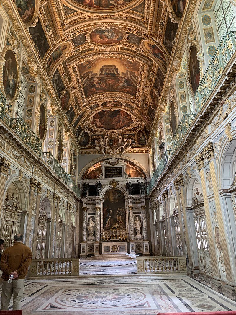
Château de Chaumont-sur-Loire, Chaumont-sur-Loire, Frankreich
So far the most interesting castle of the trip. Very beautiful gardens, art exhibition and castle buildings have contributed to this. The entrance fee of €19 was worth it to me.
41150 Chaumont-sur-Loire, Frankreich
47° 28' 44.5" N 1° 10' 55.3" E
47.4790208 1.1820328
• Head toward Rue des Argillons on Rampe du Château. Go for 280 m.
• Turn left onto Rue des Argillons. Go for 513 m.
• Turn slightly right onto Rue des Argillons. Go for 80 m.
• Take the 2nd exit from roundabout onto Rue du Village Neuf (D114). Go for 278 m.
• Turn right onto Route de la Cochetière (D27). Go for 940 m.
• Continue on D27. Go for 3.5 km.
• Continue on Lieu-dit La Fumardière (D27). Go for 60 m.
• Continue on D27. Go for 498 m.
• Continue on Route de Chaumont (D27). Go for 1.4 km.
• Continue on Route de Chaumont (D27). Go for 683 m.
• Take the 2nd exit from roundabout onto Avenue de Verdun (D27). Go for 262 m.
• Continue on Place de l'Église (D27/D30). Go for 37 m.
• Turn right onto Route d'Amboise (D30). Go for 897 m.
• Continue on D30. Go for 1.7 km.
• Continue on Lieu-dit La Rochette (D30). Go for 763 m.
• Continue on Lieu-dit La Rocherie (D23). Go for 108 m.
• Continue on Lieu-dit Tourne Bride (D23). Go for 869 m.
• Continue on Rue Nationale (D23). Go for 257 m.
• Take the 2nd exit from roundabout onto Rue Ronsard (D80). Go for 718 m.
• Continue on D80. Go for 498 m.
• Continue on Lieu-dit Les Petites Croix (D80). Go for 377 m.
• Continue on D80. Go for 951 m.
• Continue on Lieu-dit Le Plessis (D80). Go for 119 m.
• Continue on D80. Go for 1.2 km.
• Continue on Lieu-dit La Bertinière (D80). Go for 120 m.
• Continue on D80. Go for 3.3 km.
• Continue on Lieu-dit La Drolinière (D80). Go for 399 m.
• Continue on Lieu-dit Le Patouilleau (D80). Go for 134 m.
• Continue on D80. Go for 144 m.
• Continue on Lieu-dit La Bécasserie (D80). Go for 627 m.
• Continue on Rue de la Forêt (D80). Go for 1.4 km.
• Turn right onto Rue Nationale (D40). Go for 1.8 km.
• Arrive at Rue Bretonneau (D40). Your destination is on the right.
☍
24,8 km
( 24 min.)
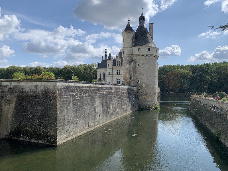
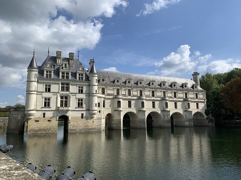
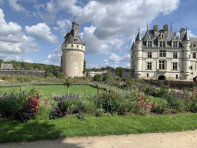
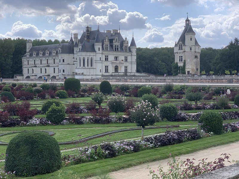
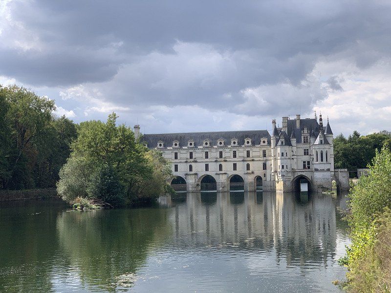
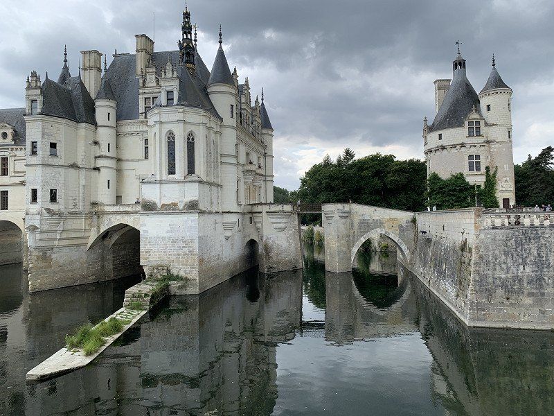
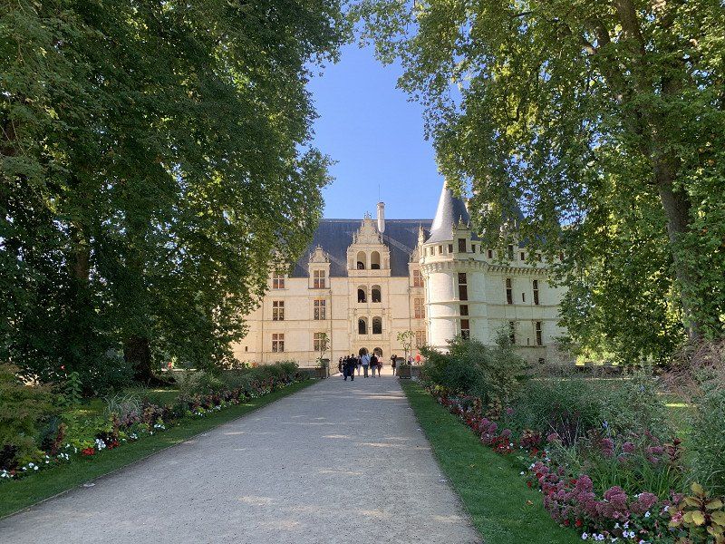
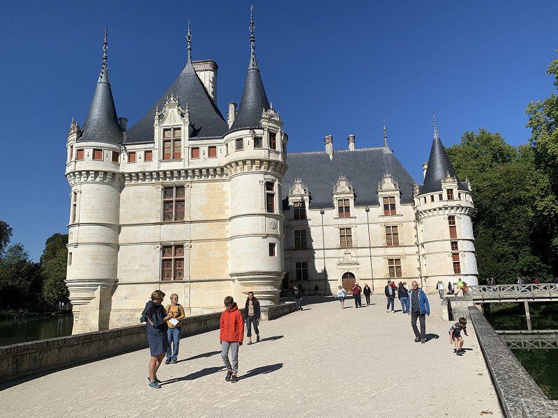
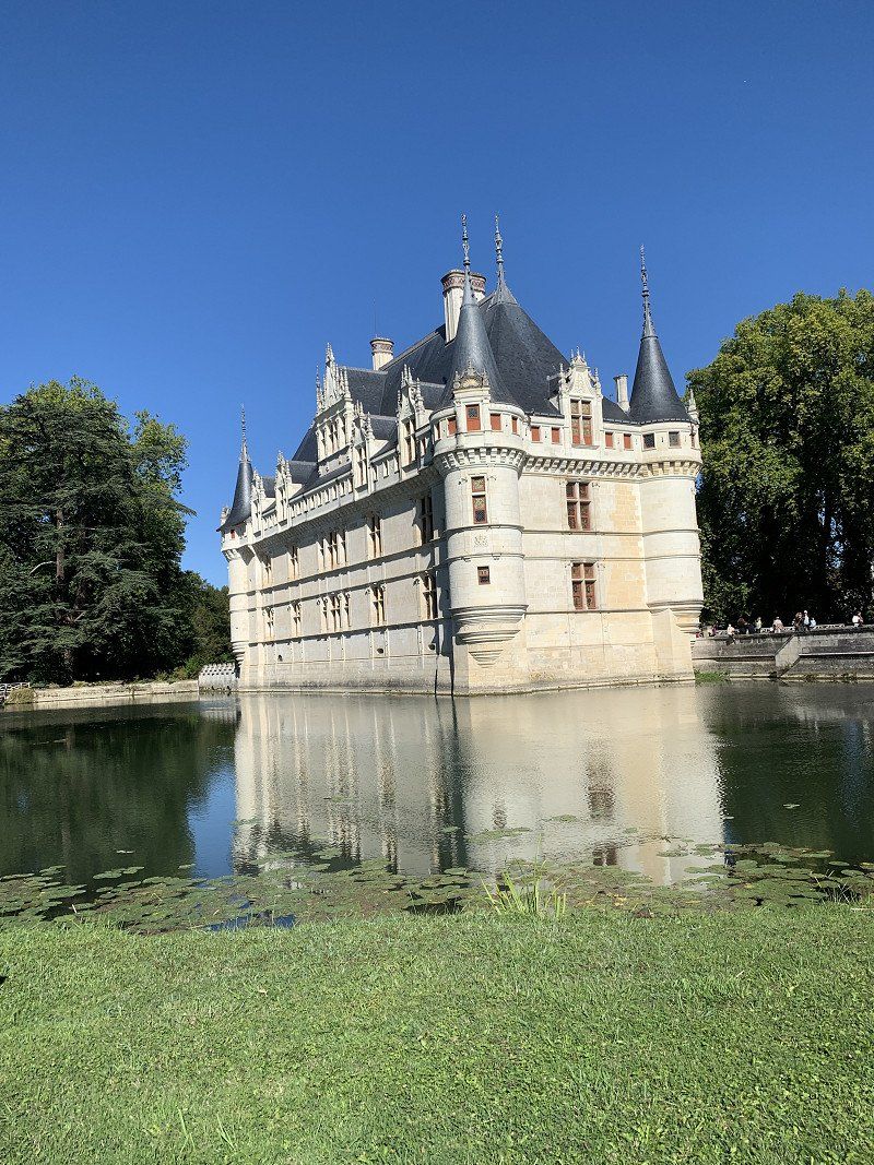
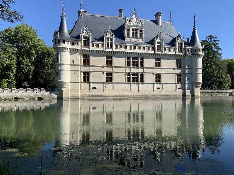
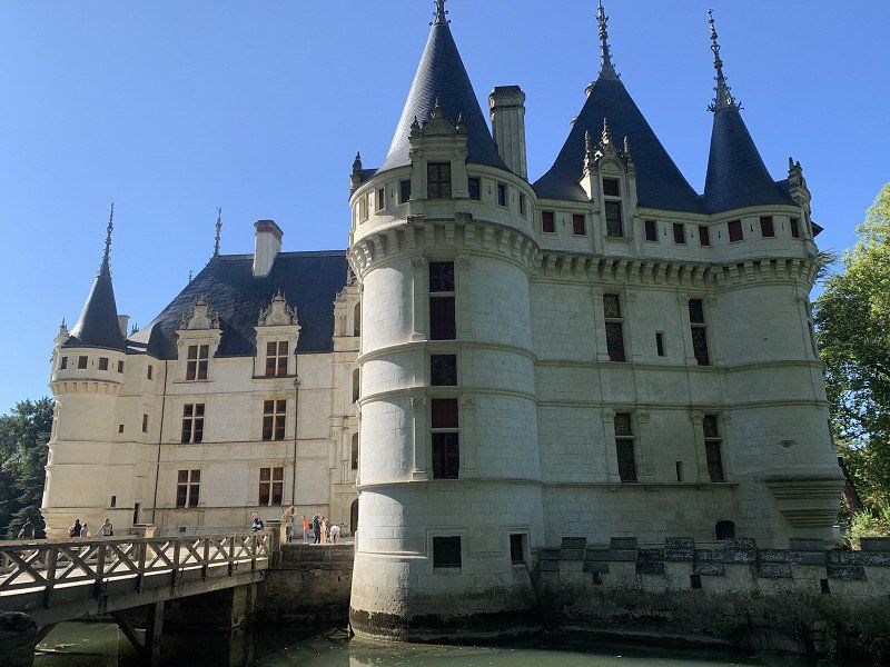
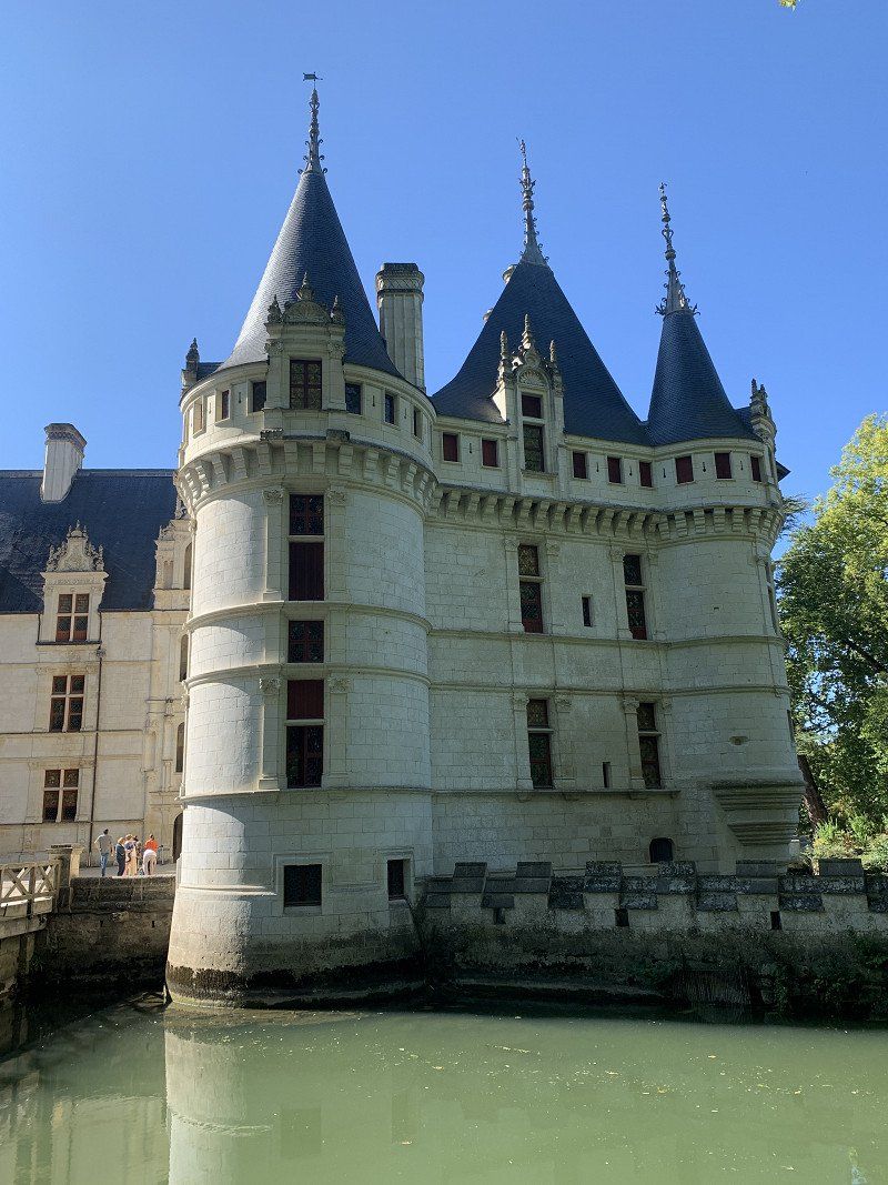
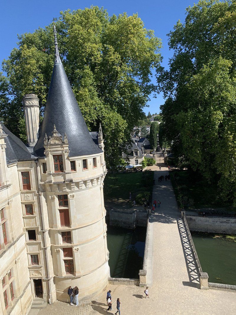
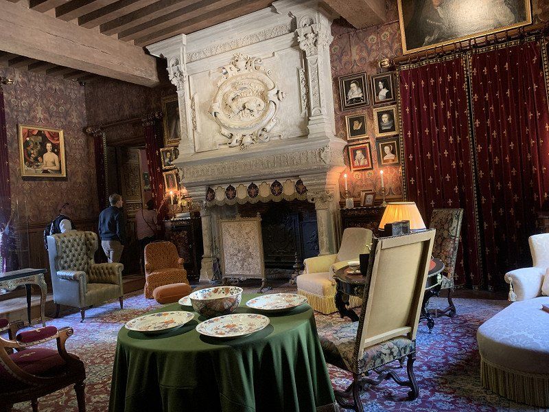
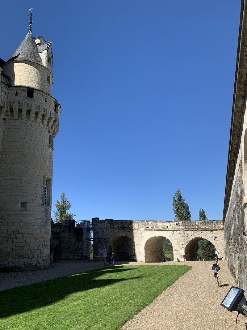
Château Chenonceaux, Frankreich
Beautiful castle with an interesting history. Campers can park for free right in front of the castle. I couldn't understand the two Park4Night suggestions.
37150 Chenonceaux, Frankreich
47° 19' 54.1" N 1° 4' 3.1" E
47.3316810 1.0675260
• Head toward Rue du Château on Rue Bretonneau (D40). Go for 1.5 km.
• Turn right onto Rue d'Amboise (D81). Go for 165 m.
• Take the 1st exit from roundabout onto Rue de Bellevue (D81). Go for 40 m.
• Continue on Rue d'Amboise (D81). Go for 2.8 km.
• Continue on D81. Go for 947 m.
• Continue on Route de Civray-de-Touraine (D81). Go for 4.0 km.
• Turn right onto Boulevard Saint-Denis Hors (D31) toward Château-Renault/Château Gaillard/Château du Clos Lucé. Go for 1.9 km.
• Take the 3rd exit from roundabout onto Avenue Léonard de Vinci (D61) toward Amboise-Centre/Château du Clos Lucé. Go for 138 m.
• Pass 2 roundabouts and continue on Avenue Léonard de Vinci (D61). Go for 1.9 km.
• Turn right onto Rue du Clos Lucé. Go for 159 m.
• Arrive at Rue du Clos Lucé.
☍
13,5 km
( 13 min.)
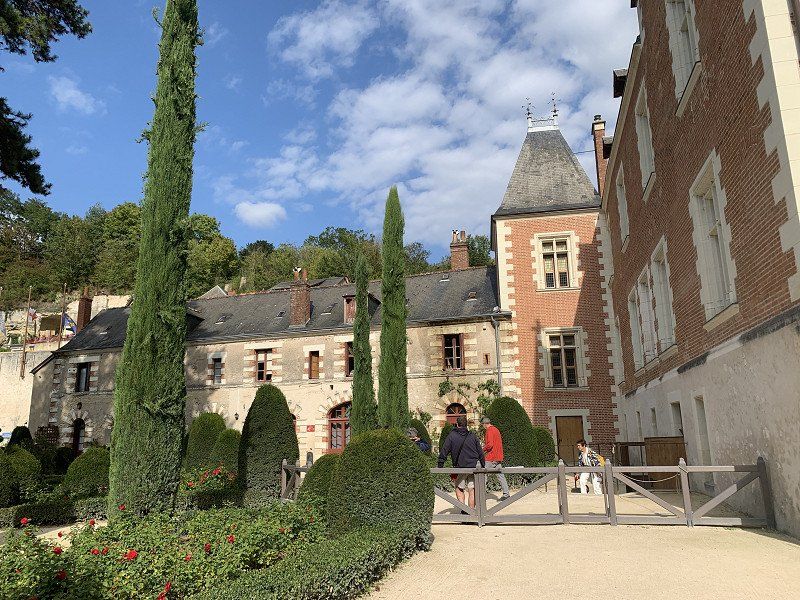
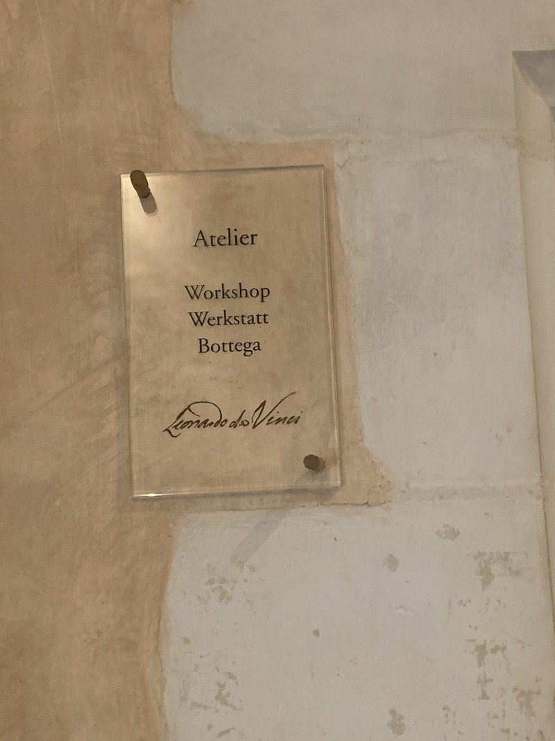
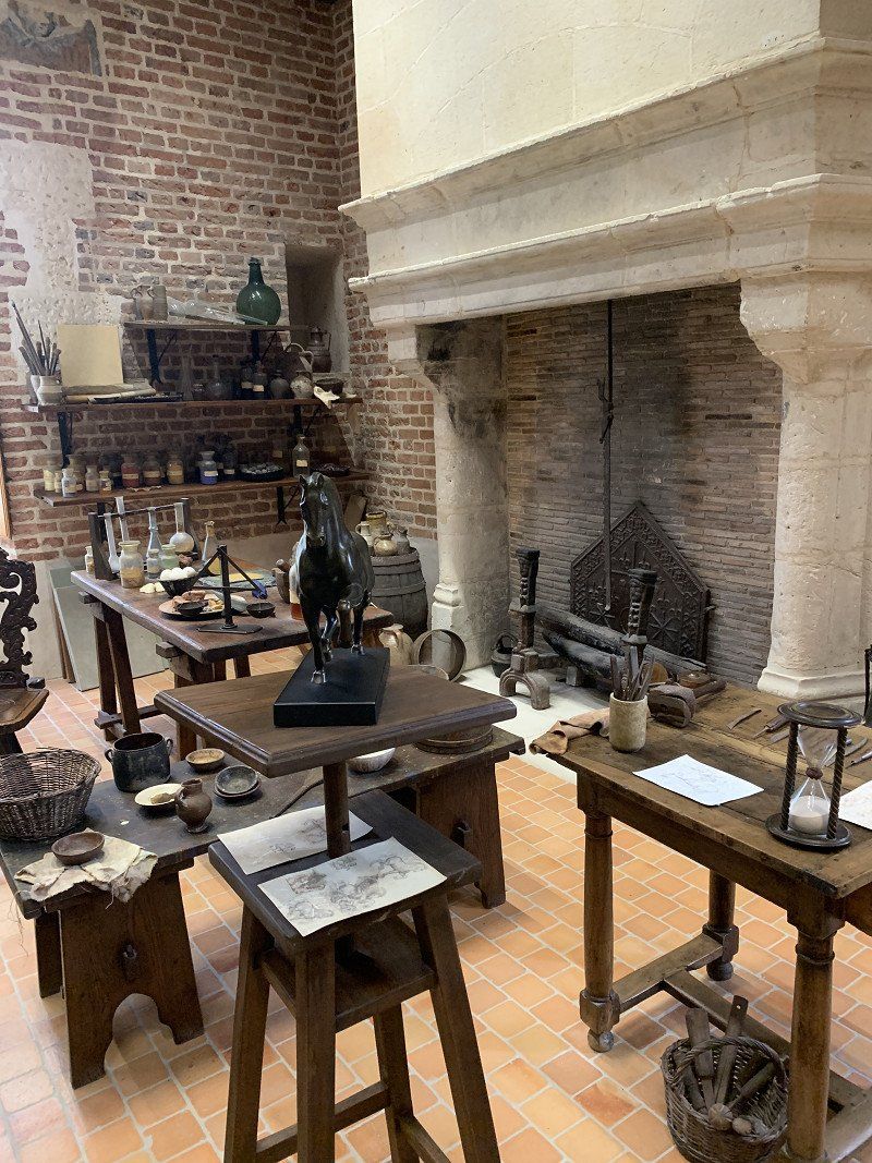
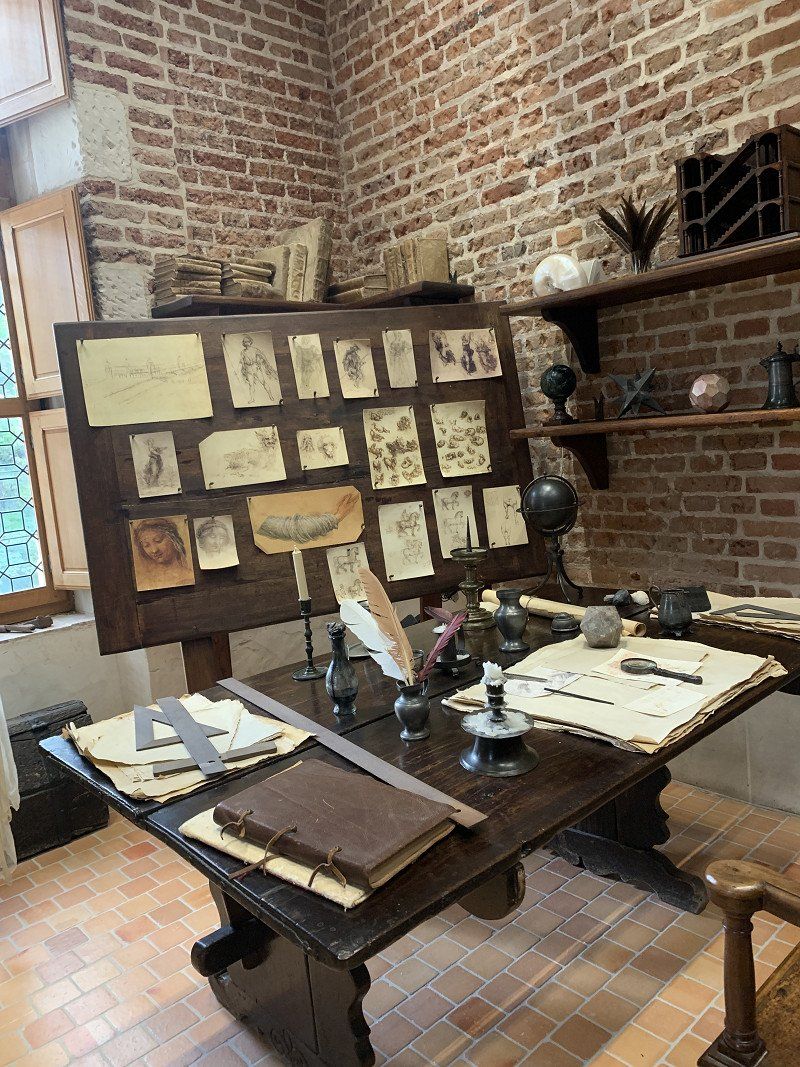
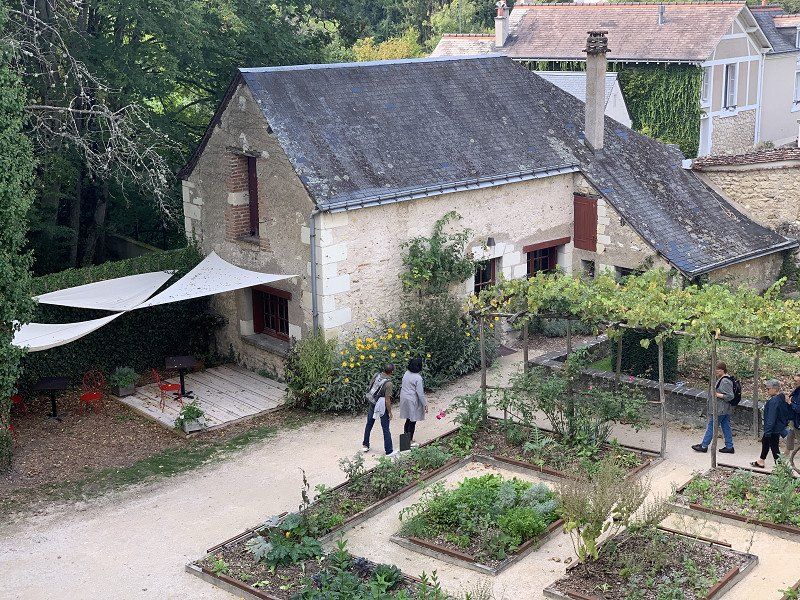
Château du Clos Lucé
Leonardo DaVinci stayed here for a few years. I walked here from the parking space, about 2o minutes.
Rue du Clos Luce, 37400, Amboise, France
47° 24' 30" N 0° 59' 39" E
47.4083333 0.9941667
• Head south on Rue du Clos Lucé. Go for 159 m.
• Turn right onto Avenue Léonard de Vinci (D61). Go for 671 m.
• Continue on Place Richelieu (D61). Go for 48 m.
• Turn right onto Place Richelieu. Go for 37 m.
• Continue on Rue du Général Foy. Go for 162 m.
• Continue on Rue de la Tour. Go for 33 m.
• Turn right onto Rue de la Tour. Go for 49 m.
• Arrive at Rue de la Tour. Your destination is on the right.
☍
1,2 km
( 2 min.)
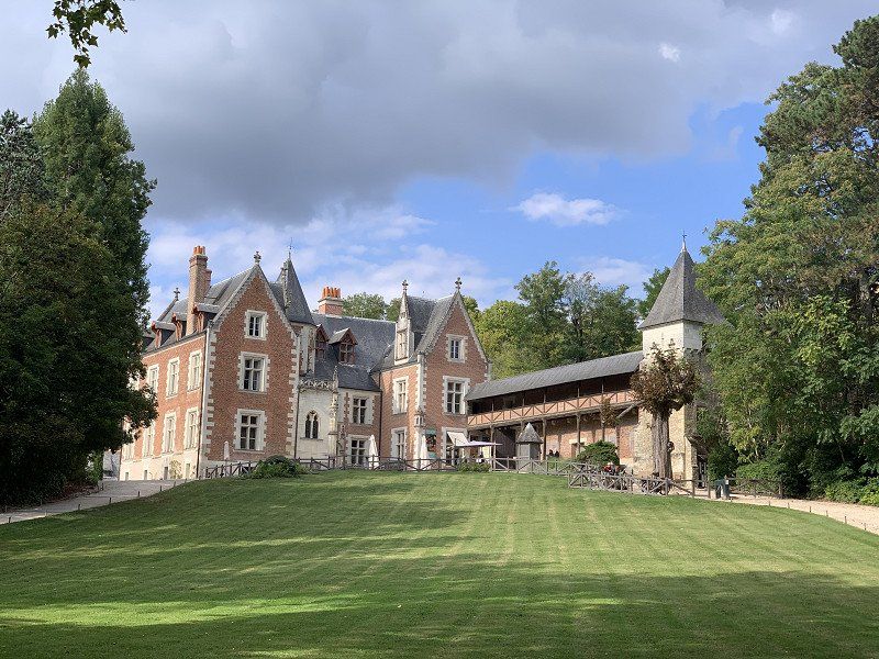
Schloss Amboise, Montée de l'Emir Abd el Kader, Amboise, Frankreich
Is on the way to the Clos Lucé. I only looked at it from the outside, because from the inside it looked like the others. The city itself is very attractive and has many beautiful corners.
Mnt de l'Emir Abd el Kader, 37400 Amboise, Frankreich
47° 24' 48.1" N 0° 59' 13.3" E
47.4133609 0.9870190
• Head toward Rue Mirabeau on Rue de la Tour. Go for 49 m.
• Turn left onto Rue de la Tour. Go for 33 m.
• Continue on Rue du Général Foy. Go for 162 m.
• Turn right onto Place Richelieu. Go for 83 m.
• Turn right onto Rue Joyeuse (D61). Go for 155 m.
• Continue on Rue d'Orange (D61). Go for 80 m.
• Continue on Rue Jean-Jacques Rousseau (D61). Go for 109 m.
• Turn right onto Quai du Général de Gaulle (D751). Go for 38 m.
• Keep left onto Quai du Général de Gaulle (D431). Go for 382 m.
• Turn right onto Quai du Maréchal Foch. Go for 254 m.
• Take the 3rd exit from Place Émile Gounin roundabout onto Allée de la Chapelle Saint-Jean. Go for 184 m.
• Arrive at Allée de la Chapelle Saint-Jean. Your destination is on the right.
☍
1,5 km
( 4 min.)
Übernachtung: Aire Camping-Car Park, Allée de la Chapelle Saint-Jean, Amboise, Frankreich
All. de la Chapelle Saint-Jean, 37400 Amboise, Frankreich
47° 25' 2.9" N 0° 59' 14.8" E
47.4174770 0.9874320
• Head toward Allée des Mariniers on Allée de la Chapelle Saint-Jean. Go for 138 m.
• Take the 1st exit from Place Émile Gounin roundabout onto Quai du Maréchal Foch. Go for 273 m.
• Turn right onto Pont Général Leclerc (D431). Go for 204 m.
• Take the 2nd exit from Rue de Blois roundabout onto Rue de Blois (D952). Go for 14.0 km.
• Take the 2nd exit from roundabout onto Pont Charles de Gaulle (D142) toward Montlouis S/Loire/Tours-Sud. Go for 1.5 km.
• Take the 3rd exit from roundabout onto D751. Go for 1.9 km.
• Take the 2nd exit from roundabout onto Lieu-dit La Boisselière (D751). Go for 5.2 km.
• Take the 2nd exit from Carrefour des Français Libres roundabout onto Avenue Georges Pompidou toward A10/A85/Tours-Sud/C.H.U. Trousseau/St Pierre des Corps. Go for 327 m.
• Take the 2nd exit from roundabout onto Avenue Georges Pompidou toward A10-A85/Tours-Sud. Go for 106 m.
• Take ramp onto A10 (L'Aquitaine) toward A85/Poitiers/Châteauroux/Vierzon/Tours-Sud. Go for 3.0 km.
• Take exit 22 toward Tours-Sud. Go for 466 m.
• Continue on Route de Saint-Avertin (D976). Go for 940 m.
• Take the 1st exit from Carrefour de l'Alouette roundabout onto Avenue de Grammont (D910) toward Centre Ville/Villandry. Go for 539 m.
• Turn right onto Avenue du Général Niessel. Go for 340 m.
• Turn right. Go for 28 m.
• Turn sharp left. Go for 22 m.
• Arrive at your destination on the left.
☍
28,9 km
( 27 min.)
Day
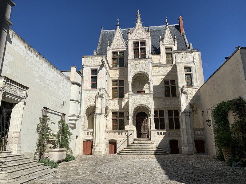
Tours, Frankreich
Originally planned for the whole day, but the city wasn't as beautiful as I expected and I was able to see the sights faster than I thought. So keep going. I probably wouldn't have slept in the stables either, as it would probably be very noisy.
9P82+Q3F Tours, Frankreich
47° 22' 1" N 0° 42' 0.6" E
47.3669487 0.7001615
• Head southeast. Go for 185 m.
• Turn right onto Avenue du Général Niessel. Go for 557 m.
• Continue on Rue de l'Auberdière. Go for 512 m.
• Take the 1st exit from Rond-Point de l'Auberdière roundabout onto Avenue Marcel Dassault. Go for 518 m.
• Pass 2 roundabouts and continue on Avenue Marcel Dassault. Go for 784 m.
• Take the 2nd exit from Rond-Point Marcel Dassault roundabout onto Avenue de Pont Cher (D86). Go for 594 m.
• Take the 3rd exit from Rond-Point Jacques Monod roundabout onto Route de Savonnières (D7). Go for 1.8 km.
• Pass 5 roundabouts and continue on Route de Tours (D7). Go for 8.5 km.
• Take the 1st exit from roundabout onto Rue Principale (D7). Go for 448 m.
• Take the 2nd exit from roundabout onto Route des Grottes Pétrifiantes (D7). Go for 2.9 km.
• Enter the roundabout. Go for 12 m.
• Arrive at your destination on the right.
☍
16,8 km
( 19 min.)
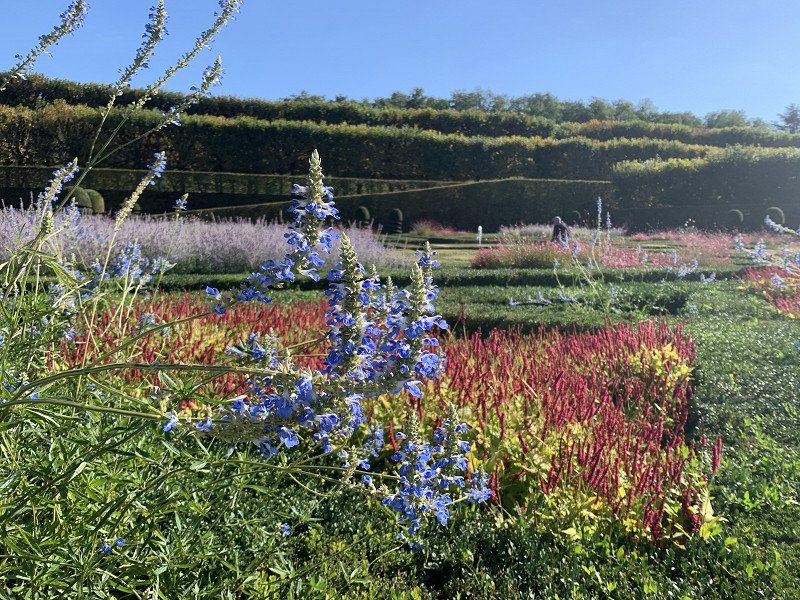
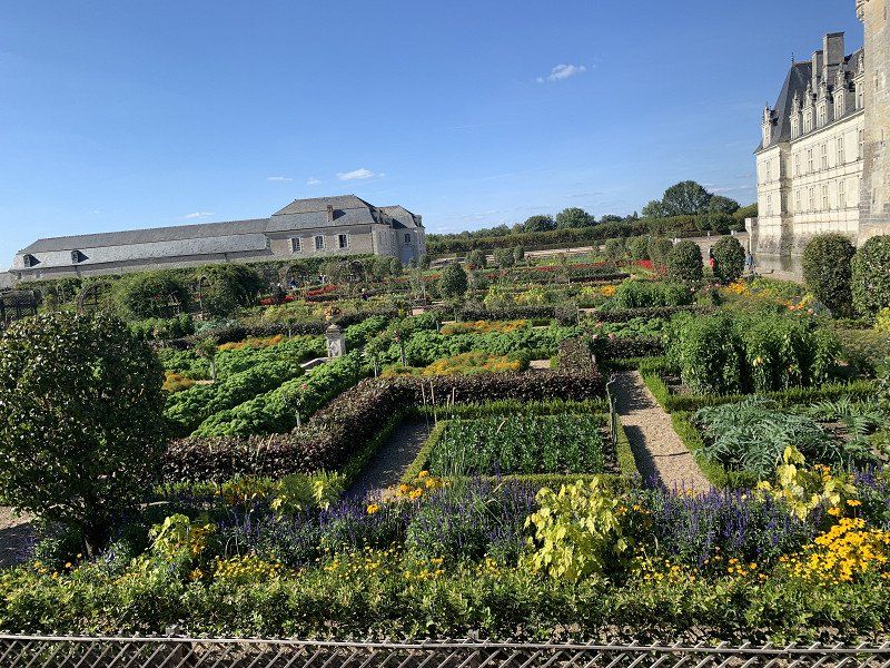
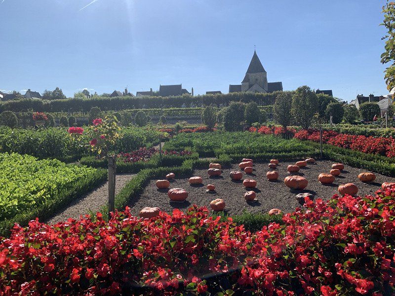
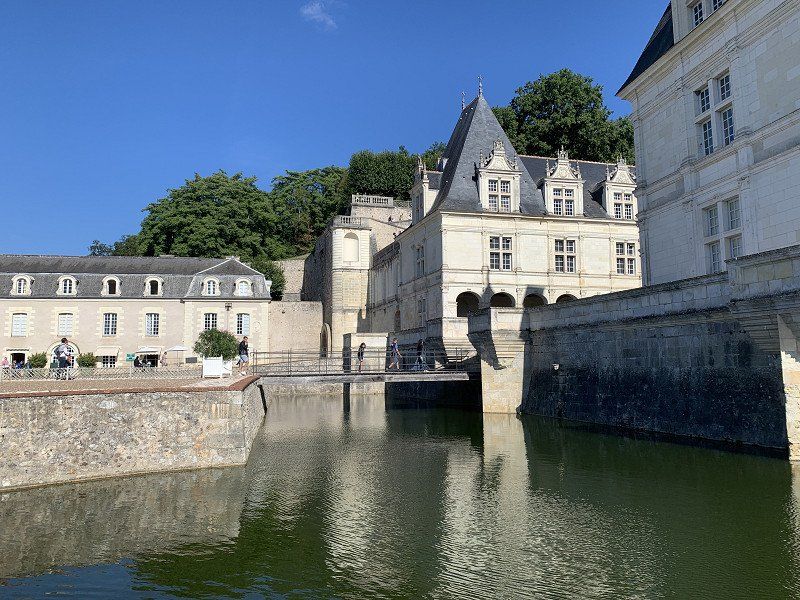
Villandry: Aire du Camping-Cars Villandry
Very nice gardens and you could have parked right in front of the castle and stayed overnight if necessary. I had decided to spend the night at the Camping Car Park facility for a fee.
Rue Principale, 37510, Villandry, France
47° 20' 21.4" N 0° 30' 26.6" E
47.3392910 0.5074000
• Follow the roundabout. Go for 10 m.
• Take the 2nd exit from roundabout onto Rue Principale (D7). Go for 2.6 km.
• Turn right and take ramp onto A85 toward Angers/Saumur. Go for 2.3 km.
• Take exit 7 toward Saumur/Langeais. Go for 992 m.
• Take the 1st exit from roundabout onto D952 toward Saumur/Langeais. Go for 1.8 km.
• Take the 1st exit from roundabout toward Château-la-Vallière. Go for 618 m.
• Take the 4th exit from roundabout onto Rue de Tours (D953). Go for 1.0 km.
• Take the 2nd exit from roundabout onto Rue Thiers (D953). Go for 142 m.
• Turn right onto Rue Gambetta (D953). Go for 132 m.
• Turn left onto Place Pierre de Brosse (D953). Go for 16 m.
• Arrive at Place Pierre de Brosse (D953). Your destination is on the right.
☍
9,6 km
( 9 min.)
Day
Patrimoinie Wochenende (17./18. Sept. 2022)
I had learned the day before that the 3rd September weekend is the "Patrimoinie weekend". Admission to all state institutions was free and there are discounts to non-state cultural institutions. That's why I overdid it a bit that day.
Chateau Langeais, Place Pierre de Brosse, Langeais, Frankreich
Place Pierre de Brosse, 37130 Langeais, Frankreich
47° 19' 29" N 0° 24' 22.3" E
47.3247194 0.4061820
• Head toward Allée des 3 Rois on Place Pierre de Brosse (D953). Go for 616 m.
• Take the 2nd exit from roundabout onto Rue Honoré de Balzac (D952) toward A85/Tours/Centre-Ville/Le Château/Azay le Rideau/Villandry. Go for 264 m.
• Take the 1st exit from roundabout onto D57 toward Azay le Rideau/Lignières/Bréhémont/La Chapelle aux Naux/Château de Rigny-Ussé. Go for 7.7 km.
• Take the 1st exit from roundabout onto Avenue de la Gare (D57). Go for 1.3 km.
• Turn right onto Rue de l'Abreuvoir. Go for 124 m.
• Continue on Rue du Moulin. Go for 67 m.
• Turn right onto Rue Nationale (D57). Go for 171 m.
• Arrive at D57. Your destination is on the left.
☍
10,3 km
( 11 min.)
Château d'Azay-le-Rideau, Rue Balzac, Azay-le-Rideau, Frankreich
19 Rue Balzac, 37190 Azay-le-Rideau, Frankreich
47° 15' 32.5" N 0° 27' 56.6" E
47.2590231 0.4657361
• Head toward Chemin de la Prairie on D57. Go for 551 m.
• Continue on Rue de Chinon (D57). Go for 45 m.
• Turn right onto Rue du Vieux Chêne (D17). Go for 7.6 km.
• Turn left onto D7. Go for 1.1 km.
• Take the 2nd exit from roundabout onto Rue des Moriers (D7). Go for 3.7 km.
• Turn left onto Rue de Lionnière. Go for 181 m.
• Turn slightly left onto Rue de Lionnière. Go for 361 m.
• Turn slightly right onto Rue de Saint-Benoît. Go for 876 m.
• Turn right onto Rue du Pin. Go for 942 m.
• Turn slightly right toward Lieu-dit Le Belvédère. Go for 320 m.
• Turn left onto Lieu-dit Le Belvédère. Go for 59 m.
• Turn right. Go for 995 m.
• Turn right. Go for 134 m.
• Arrive at your destination on the right.
☍
17,0 km
( 22 min.)
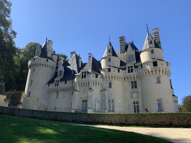
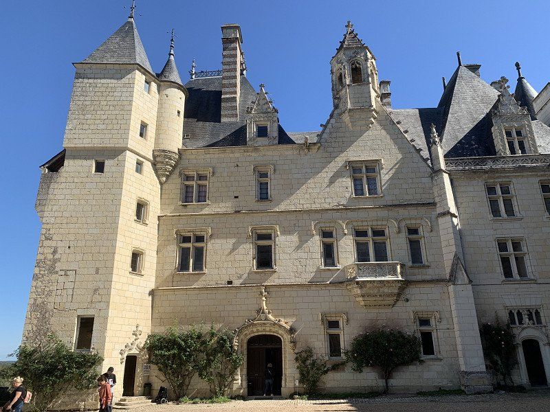
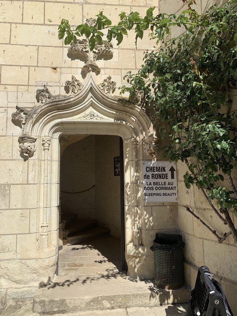
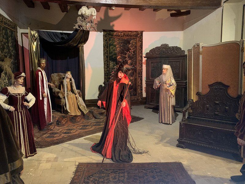
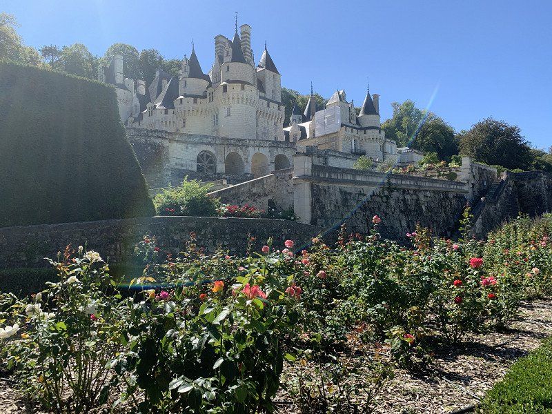
Schloss Ussé, 37420 Rigny-Ussé, Frankreich
There were some free parking spaces for campers in front of the castle. Each castle has different themes. Here there was a "Snow White" story in 2 towers.
37420 Rigny-Ussé, Frankreich
47° 15' 0" N 0° 17' 28.8" E
47.2500053 0.2913219
• Head southwest. Go for 134 m.
• Turn left. Go for 467 m.
• Turn slightly left toward Lieu-dit Le Belvédère. Go for 528 m.
• Turn left onto Lieu-dit Le Belvédère. Go for 59 m.
• Turn right toward Rue du Pin. Go for 320 m.
• Turn slightly left onto Rue du Pin. Go for 942 m.
• Turn right onto Rue de Saint-Benoît. Go for 413 m.
• Continue on Rue de Saint-Benoît. Go for 169 m.
• Turn left onto Rue de Saint-Benoît. Go for 559 m.
• Continue on Lieu-dit Les Fougères. Go for 106 m.
• Turn slightly right. Go for 311 m.
• Turn left toward Rue Forestière de Duras. Go for 443 m.
• Turn slightly left onto Rue Forestière de Duras. Go for 713 m.
• Turn right onto D139. Go for 819 m.
• Continue on Lieu-dit La Métairie aux Moines (D139). Go for 200 m.
• Continue on Lieu-dit La Charlottiere (D139). Go for 63 m.
• Continue on D139. Go for 128 m.
• Continue on Lieu-dit Le Bourg (D139). Go for 247 m.
• Take the 1st exit from roundabout onto Lieu-dit La Croix Potevin (D139). Go for 183 m.
• Continue on Lieu-dit Le Pressoir (D139). Go for 317 m.
• Continue on Lieu-dit Le Brosseau (D139). Go for 613 m.
• Continue on D139. Go for 2.6 km.
• Turn right onto Route de Tours (D751). Go for 2.0 km.
• Take the 2nd exit from roundabout onto Route de Tours (D751). Go for 940 m.
• Take the 3rd exit from roundabout onto Avenue François Mitterrand. Go for 1.1 km.
• Pass 2 roundabouts and continue on Avenue François Mitterrand. Go for 1.7 km.
• Take the 2nd exit from roundabout onto Quai Charles VII (D749). Go for 366 m.
• Take the 2nd exit from roundabout onto Quai Jeanne d'Arc (D8). Go for 141 m.
• Take the 2nd exit from roundabout onto Rue Neuve de l'Hôtel de Ville. Go for 71 m.
• Continue on Place du Général de Gaulle. Go for 41 m.
• Turn right onto Place du Général de Gaulle. Go for 113 m.
• Arrive at Place du Général de Gaulle. Your destination is on the right.
☍
16,8 km
( 24 min.)
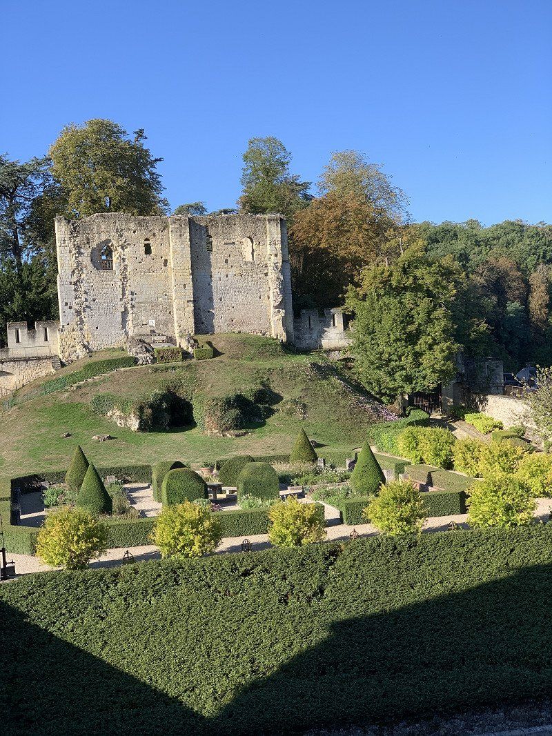
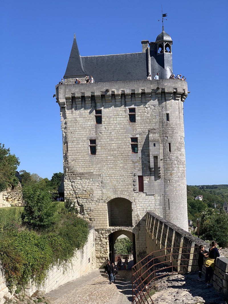
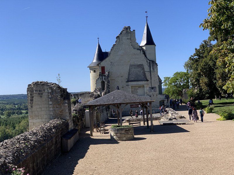
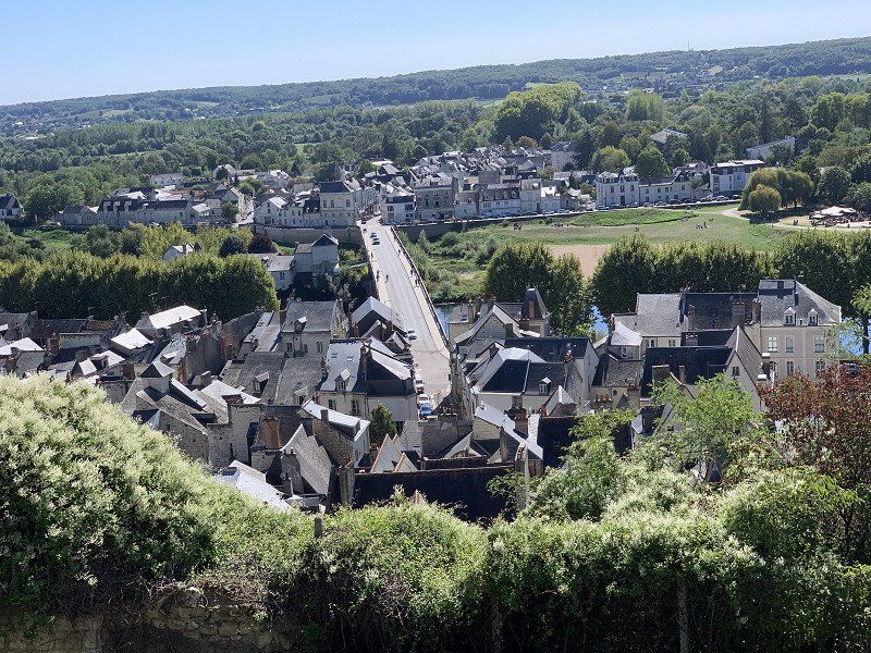
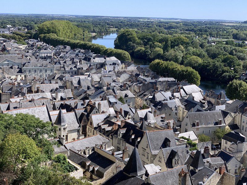
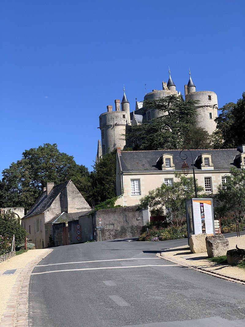
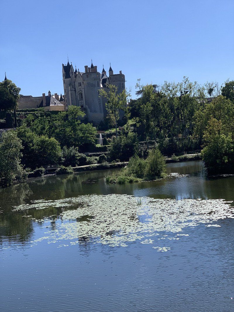
Chinon Stadt/Burgruine Chinon
A real defensive castle ruin linked to Jean d'Arc. The city itself is also worth seeing. You could park at the top of the mountain. There was an elevator down town. There was an exhibition of the Hollywood depiction of knight gear compared to historical reality.
37500 Chinon, Frankreich
47° 10' 2.3" N 0° 14' 25.4" E
47.1672960 0.2403850
• Head north on Place du Général de Gaulle.
• Turn left onto Place du Général de Gaulle. Go for 148 m.
• Continue on Rue Neuve de l'Hôtel de Ville. Go for 39 m.
• Take the 1st exit from roundabout onto Quai Jeanne d'Arc (D8). Go for 124 m.
• Take the 3rd exit from roundabout onto D749. Go for 1.8 km.
• Take the 1st exit from roundabout onto Rue de Saumur (D751 E) toward A85/Saumur/Chinon/La Roche-Clermault/Candes St Martin/Bourgueil/Loudun/La Devinière. Go for 2.8 km.
• Take the 2nd exit from roundabout onto Lieu-dit Guenest (D751) toward Saumur. Go for 10.5 km.
• Turn right onto D7 toward D751/Candes St Martin/Écomusée du Véron/Bourgueil. Go for 640 m.
• Take the 2nd exit from roundabout onto Lieu-dit Les Basses Vignes (D7). Go for 361 m.
• Turn left onto Rue du Bac. Go for 94 m.
• Continue on Route de Compostelle. Go for 889 m.
• Take the 1st exit from roundabout onto Route de Compostelle. Go for 87 m.
• Continue on Quai Alexandre Dumas (D751 A). Go for 796 m.
• Continue on Avenue de la Loire (D947). Go for 938 m.
• Take the 1st exit from roundabout onto D952 A toward Villebernier/Varennes S/Loire/Chouzé S/Loire. Go for 882 m.
• Take the 3rd exit from roundabout onto Rue Nationale des Redouets (D952) toward Saumur. Go for 10.3 km.
• Take the 3rd exit from Rond-Point Noëlla Rouget roundabout onto Pont des Cadets de Saumur (D947) toward Centre Ville/Les Ponts. Go for 261 m.
• Take the 4th exit from roundabout onto Quai du Roi René. Go for 332 m.
• Continue on Rue de Verden. Go for 309 m.
• Arrive at Rue de Verden. Your destination is on the left.
☍
31,3 km
( 30 min.)
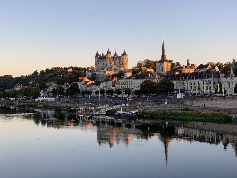
Saumur Aire Camping-Car Park, Rue de Verden, , Frankreich
I stayed here because I have a Camping Car Park card. Pitch is quiet and with many shady places.
Rue de Verden, 49400 Saumur, Frankreich
47° 15' 40.8" N 0° 4' 0.1" W
47.2613432 -0.0666879
• Head northwest on Rue de Verden. Go for 39 m.
• Turn slightly left onto Rue des Aulnes. Go for 252 m.
• Turn right onto Rue des Capucins-d'Offard. Go for 45 m.
• Turn left onto Rue des Capucins-d'Offard. Go for 67 m.
• Continue on Rue Paul Bert. Go for 239 m.
• Take the 2nd exit from roundabout onto Avenue du Général de Gaulle (D947). Go for 408 m.
• Take the 2nd exit from roundabout onto Quai Lucien Gautier (D947). Go for 423 m.
• Take the 3rd exit from roundabout onto Quai Mayaud (D947). Go for 135 m.
• Turn right onto Place Saint-Michel. Go for 16 m.
• Continue on Petite Rue Saint-Michel. Go for 77 m.
• Turn left onto Rue Jean Jaurès. Go for 14 m.
• Arrive at Rue Jean Jaurès. Your destination is on the right.
☍
1,7 km
( 4 min.)
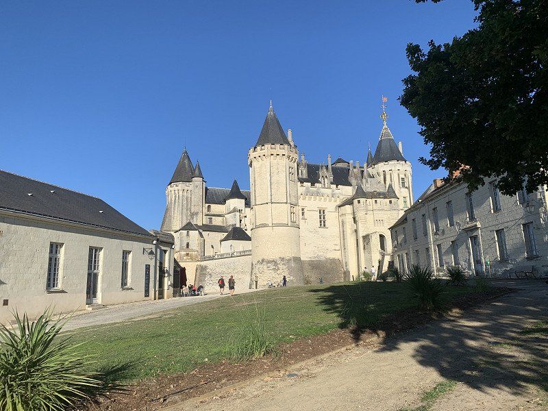
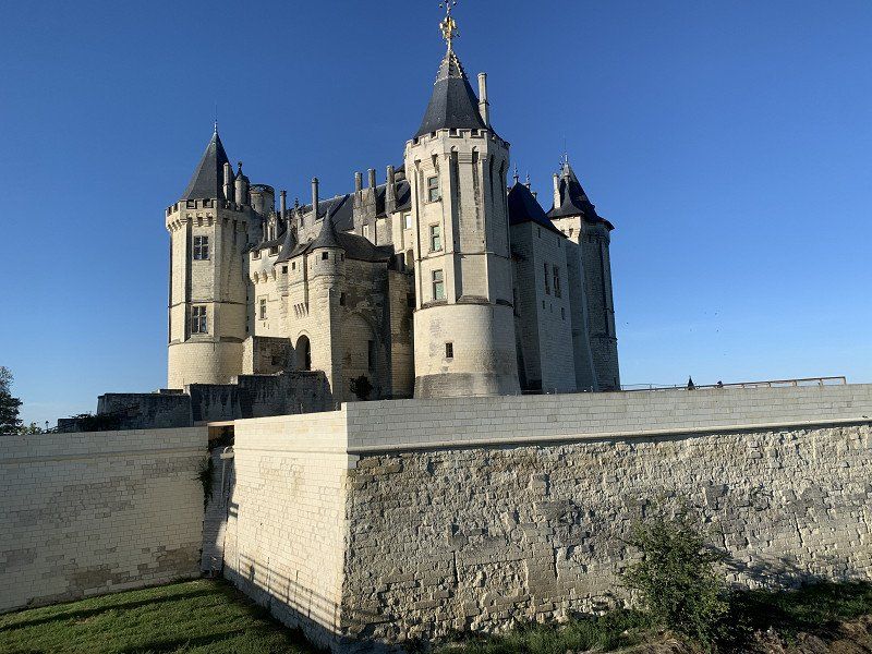
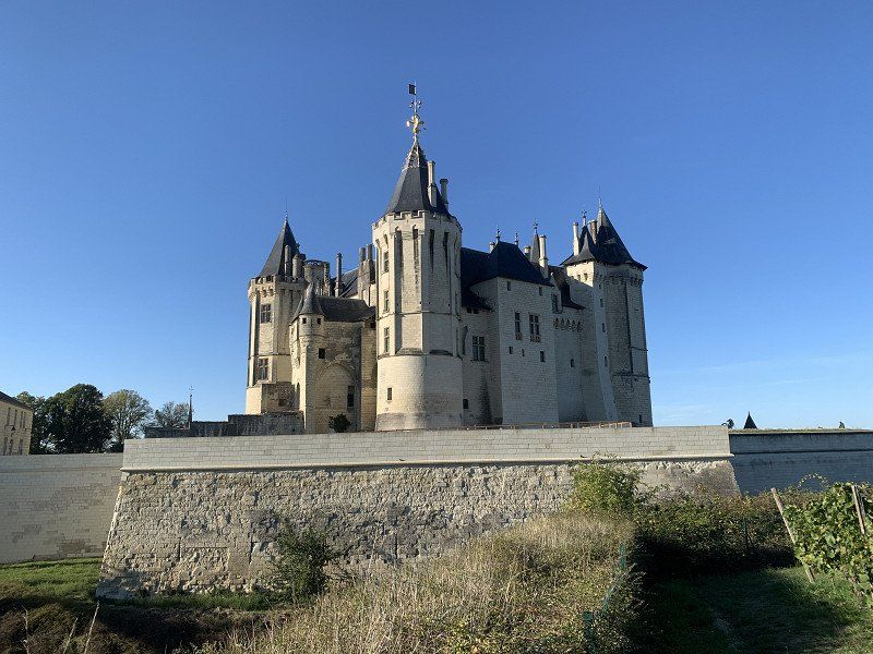
Château de Saumur, 49400 Saumur, Frankreich
Arrived in the late afternoon and the castle was already closed. Have viewed from the outside. Was enough for me.
49400 Saumur, Frankreich
47° 15' 25.4" N 0° 4' 20.6" W
47.2570635 -0.0724003
• Head east on Rue Jean Jaurès. Go for 48 m.
• Turn left onto Rue Raspail. Go for 95 m.
• Turn slightly right onto Place Saint-Michel. Go for 16 m.
• Turn left onto Quai Mayaud (D947). Go for 105 m.
• Take the 1st exit from roundabout onto Quai Lucien Gautier (D947). Go for 398 m.
• Take the 2nd exit from roundabout onto Quai Carnot. Go for 297 m.
• Continue on Quai Carnot. Go for 180 m.
• Continue on Boulevard Henri Dunant. Go for 583 m.
• Continue on Boulevard du Maréchal Juin. Go for 500 m.
• Continue on Boulevard du Général Weygand. Go for 61 m.
• Take the 2nd exit from Rond-Point du Général Weygand roundabout onto Rue du Carrousel. Go for 252 m.
• Take the 3rd exit from Rond-Point du Carrousel roundabout onto D347 toward Poitiers/Niort/Châtellerault/Cholet. Go for 3.7 km.
• Keep left onto D347 toward Niort/Poitiers/Châtellerault/Montreuil-Bellay/Distré. Go for 70 m.
• Pass 2 roundabouts and continue on D347. Go for 11.4 km.
• Take the 3rd exit from roundabout onto Rue de Doué toward Montreuil-Bellay/Château. Go for 481 m.
• Continue on Avenue du Pont Napoléon. Go for 277 m.
• Turn right onto Rue du Boëlle. Go for 287 m.
• Turn left onto Rue du Boëlle. Go for 22 m.
• Turn right onto Rue du Boëlle. Go for 64 m.
• Continue toward Rue Georges Girouy. Go for 22 m.
• Continue on Rue Georges Girouy. Go for 206 m.
• Turn right. Go for 176 m.
• Turn left. Go for 19 m.
• Turn right. Go for 89 m.
• Arrive at your destination on the left.
☍
19,3 km
( 19 min.)
Day
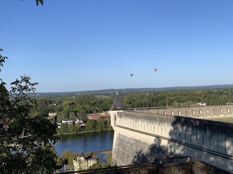
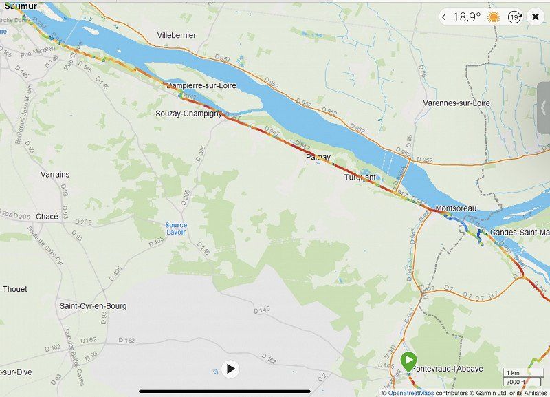
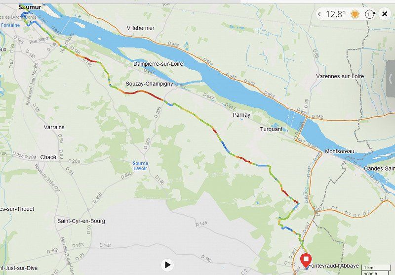
Radtour nach Abtei Royale de Fontevraud, Château de Montsoreau
Was time to do something for the condition again. Since I "won" a day, I chose the Abbey Royale de Fontevraud as my new destination. On the route to Saumur, I was impressed by the buildings built into the mountain wall and I wanted to take a closer look at them. I also drove past the Château de Montsoreau.
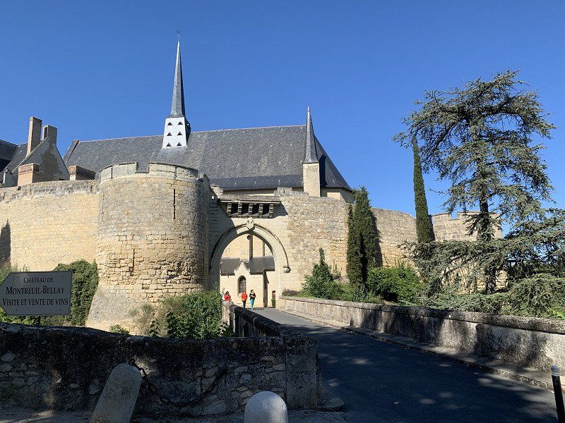
Montreuil-Bellay: Stellplatz neben der Piscine les Nobis, Rue Georges Girouy, Montreuil-Bellay, Frankreich
Free parking space next to a swimming pool. Quiet and well located for visiting the château. Supply and disposal possible. It was time for a free overnight stay again ;-)
Rue Georges Girouy, 49260 Montreuil-Bellay, Frankreich
47° 7' 53.1" N 0° 9' 40.2" W
47.1314109 -0.1611542
• Head southwest. Go for 325 m.
• Turn left onto Rue Georges Girouy. Go for 206 m.
• Turn right onto Place Saint-Pierre. Go for 148 m.
• Turn left onto Rue du Marché. Go for 113 m.
• Continue on Place des Ormeaux. Go for 27 m.
• Turn left onto Place des Ormeaux. Go for 48 m.
• Turn left onto Lieu-dit Le Château. Go for 35 m.
• Arrive at Lieu-dit Le Château. Your destination is on the left.
☍
0,9 km
( 3 min.)
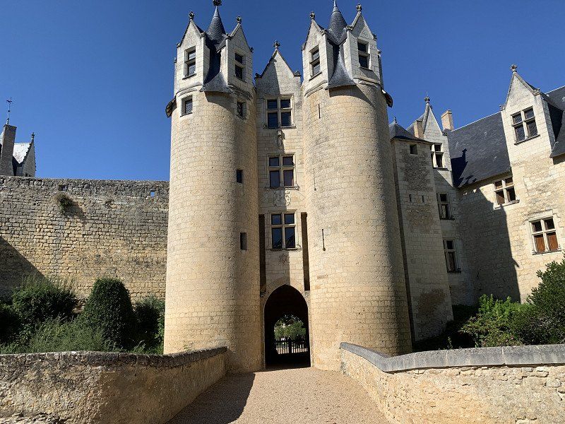
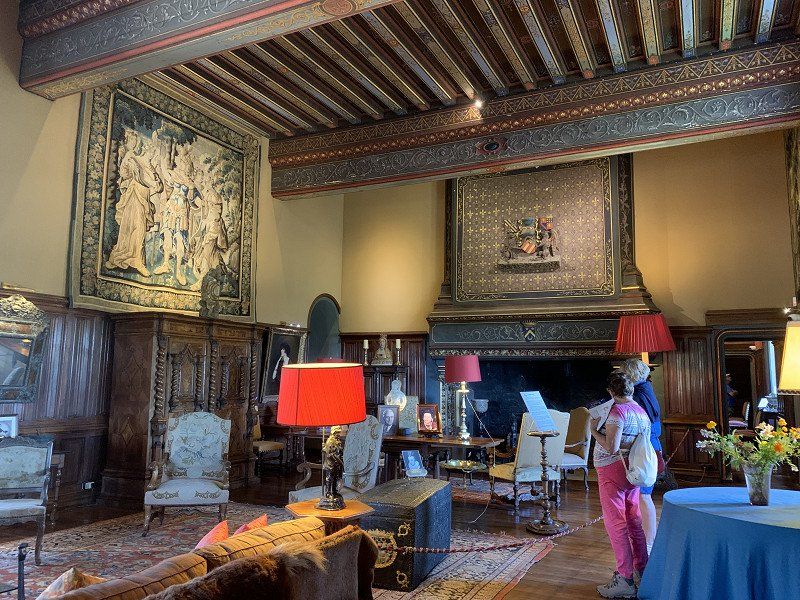
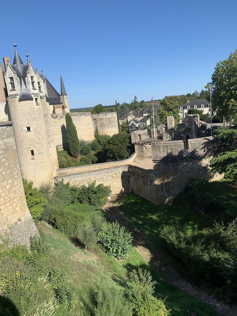
Château de Montreuil-Bellay, Place des Ormeaux, Montreuil-Bellay, Frankreich
More of a castle than a château. There was also a free wine tasting. The wine and crémand were amazingly dry.
Pl. des Ormeaux, 49260 Montreuil-Bellay, Frankreich
47° 7' 59.1" N 0° 9' 15.4" W
47.1330696 -0.1542868
• Head toward Place des Ormeaux on Lieu-dit Le Château. Go for 35 m.
• Turn right onto Place des Ormeaux. Go for 48 m.
• Turn left onto Rue des Douves. Go for 228 m.
• Turn left onto Avenue du Pont Napoléon. Go for 390 m.
• Continue on Rue de Doué. Go for 306 m.
• Take the 2nd exit from roundabout onto D761 toward Angers/Doué La Fontaine. Go for 8.3 km.
• Take the 5th exit from roundabout onto Rue André-Marie Ampère (D960) toward Angers/Cholet/Le Puy Notre Dame/Les Verchers S/Layon. Go for 4.6 km.
• Take the 3rd exit from roundabout onto D761 toward Angers. Go for 3.7 km.
• Take the 2nd exit from roundabout onto D761 toward Angers/Louresse-Rochemenier. Go for 18.9 km.
• Take the 3rd exit from roundabout onto Rue Louis Moron (D761) toward Brissac-Quincé. Go for 510 m.
• Pass 2 roundabouts and continue on Rue Louis Moron (D761). Go for 1.1 km.
• Turn left onto Rue de la Briqueterie (D55). Go for 99 m.
• Arrive at Rue de la Briqueterie (D55). Your destination is on the left.
☍
38,2 km
( 30 min.)
Day
Château de Brissac, RUE JEANNE SAY, Brissac-Loire-Aubance, Frankreich
Unfortunately closed on Tuesdays. Was on my way to Angers so I stopped by anyway.
1 RUE JEANNE SAY, 49320 Brissac-Loire-Aubance, Frankreich
47° 21' 10.1" N 0° 26' 59.5" W
47.3527948 -0.4498681
• Head west on Rue de la Briqueterie (D55). Go for 243 m.
• Take the 3rd exit from roundabout onto D130. Go for 234 m.
• Continue on Lieu-dit La Varière (D130). Go for 109 m.
• Continue on D130. Go for 305 m.
• Continue on Lieu-dit Ségrairie (D130). Go for 134 m.
• Continue on D130. Go for 2.0 km.
• Continue on Rue des Charbotières (D130). Go for 461 m.
• Continue on Lieu-dit Les Charbotières (D130). Go for 329 m.
• Continue on D130. Go for 1.3 km.
• Continue on Lieu-dit Le Grand Ducé (D130). Go for 68 m.
• Continue on D130. Go for 721 m.
• Continue on Lieu-dit La Basse Marzelle (D130). Go for 197 m.
• Continue on Lieu-dit La Basse Marzelle (D120). Go for 336 m.
• Continue on Lieu-dit La Basse Marzelle (D130). Go for 342 m.
• Continue on D130. Go for 1.3 km.
• Continue on Lieu-dit L'Aire (D130). Go for 65 m.
• Continue on Lieu-dit Le Pré (D130). Go for 79 m.
• Continue on Lieu-dit Le Petit Pré (D130). Go for 95 m.
• Continue on D130. Go for 389 m.
• Continue on Rue des Prés (D124). Go for 141 m.
• Continue on Rue du 22 Juillet 1793 (D123). Go for 336 m.
• Continue on Rue du Bocage (D123). Go for 683 m.
• Continue on Lieu-dit La Fresnaye (D123). Go for 128 m.
• Continue on D123. Go for 222 m.
• Take the 2nd exit from roundabout onto D123 toward Denée/Z.A. le Landreau/Z.A. le Bocage. Go for 1.5 km.
• Continue on Lieu-dit Cram (D123). Go for 89 m.
• Continue on D123. Go for 1.3 km.
• Continue on Route de Mozé (D123). Go for 908 m.
• Continue on Place Muller (D123). Go for 33 m.
• Turn left onto Rue du Huit Mai (D751). Go for 4.4 km.
• Turn right onto Grand Rue (D106). Go for 193 m.
• Continue on Route de Savennières (D106). Go for 120 m.
• Keep right onto D106. Go for 1.1 km.
• Continue on Lieu-dit La Maison Cassée (D106). Go for 114 m.
• Continue on D106. Go for 1.5 km.
• Continue on Rue de la Motte (D106). Go for 34 m.
• Turn right onto Rue du Canal (D111). Go for 397 m.
• Turn right onto D106. Go for 43 m.
• Continue on Rue Duboys d'Angers (D106). Go for 98 m.
• Turn left onto Rue Beau Soleil (D106). Go for 163 m.
• Turn left onto Rue de la Pierre de Coulaine (D311). Go for 906 m.
• Continue on Route de Savennières (D311). Go for 445 m.
• Continue on D311. Go for 57 m.
• Continue on Route de Savennières (D311). Go for 203 m.
• Continue on Lieu-dit Chabeil (D311). Go for 47 m.
• Continue on Lieu-dit La Belle Fontaine (D311). Go for 71 m.
• Continue on Route de Savennières (D311). Go for 97 m.
• Continue on Lieu-dit Le Clos de la Petite Lande (D311). Go for 89 m.
• Continue on Route de Savennières (D311). Go for 2.3 km.
• Continue on D311. Go for 886 m.
• Continue on Lieu-dit La Michaudière (D311). Go for 130 m.
• Continue on D311. Go for 652 m.
• Continue on Lieu-dit Les Vineaux (D311). Go for 80 m.
• Continue on Route de Savennières (D311). Go for 470 m.
• Continue on Lieu-dit Le Champ de la Prée (D311). Go for 62 m.
• Continue on Route de Savennières (D311). Go for 354 m.
• Continue on Lieu-dit Le Petit Boju (D311). Go for 75 m.
• Continue on Lieu-dit La Noë (D311). Go for 115 m.
• Continue on Route de Savennières (D311). Go for 504 m.
• Continue on Rue de Savennières (D311). Go for 50 m.
• Turn right onto D961. Go for 1.2 km.
• Take the 1st exit from roundabout onto D723 toward Angers/St Jean de Linières. Go for 811 m.
• Turn right. Go for 303 m.
• Arrive at your destination on the right.
☍
32,0 km
( 31 min.)
Château de Serrant, Saint-Georges-sur-Loire, Frankreich
Should be instead of Château Brissac and according to Google on Tuesdays. Unfortunately since mid-September Wednesdays to Sundays.
RD 723, 49170 Saint-Georges-sur-Loire, Frankreich
47° 24' 54.1" N 0° 44' 38.8" W
47.4150249 -0.7440977
• Head southwest. Go for 303 m.
• Turn right onto D723. Go for 2.4 km.
• Take the 2nd exit from roundabout onto D723 toward Angers. Go for 2.1 km.
• Take the 1st exit from roundabout toward Savennières/St Martin du Fouilloux/Z.A. de la Petite Perrière. Go for 257 m.
• Continue on Passage des Lauriers. Go for 170 m.
• Continue on Rue du Petit Anjou. Go for 292 m.
• Continue on Lieu-dit La Croix (D126). Go for 49 m.
• Continue on D126. Go for 34 m.
• Continue on Lieu-dit Les Magnolias (D126). Go for 22 m.
• Continue on Lieu-dit Le Prieuré (D126). Go for 26 m.
• Continue on Lieu-dit Les Meuniers (D126). Go for 56 m.
• Continue on Lieu-dit Les Érables (D126). Go for 72 m.
• Continue on D126. Go for 68 m.
• Continue on Lieu-dit Le Pré des Souches (D126). Go for 65 m.
• Continue on D126. Go for 70 m.
• Continue on Lieu-dit Le Petit Coreau (D126). Go for 83 m.
• Continue on D126. Go for 79 m.
• Continue on Lieu-dit Arcadie (D126). Go for 71 m.
• Continue on D126. Go for 29 m.
• Continue on Lieu-dit La Fouassière (D126). Go for 43 m.
• Continue on Lieu-dit Bonneterie (D126). Go for 46 m.
• Continue on D126. Go for 140 m.
• Continue on Lieu-dit L'Écobue (D126). Go for 95 m.
• Continue on D126. Go for 133 m.
• Continue on Lieu-dit La Bricauderie (D126). Go for 85 m.
• Continue on D126. Go for 1.0 km.
• Continue on Lieu-dit Carrefour des Tables (D126). Go for 75 m.
• Continue on D126. Go for 1.8 km.
• Continue on Lieu-dit Le Pont de l'Arche (D126). Go for 53 m.
• Continue on D126. Go for 2.1 km.
• Continue on Rue des Pastels de Loire (D126). Go for 200 m.
• Take the 3rd exit from roundabout onto D111. Go for 656 m.
• Continue on Rue des Saulniers (D111). Go for 292 m.
• Continue on Rue des Frères Gasnier (D111). Go for 548 m.
• Continue on Rue Chevrière (D111). Go for 589 m.
• Take the 1st exit from roundabout onto D112. Go for 331 m.
• Pass 2 roundabouts and continue on D112. Go for 1.9 km.
• Take the 3rd exit from roundabout onto D112. Go for 1.5 km.
• Take the 1st exit from roundabout onto Rue du Stade Municipal. Go for 304 m.
• Take the 3rd exit from roundabout onto Route de Bouchemaine. Go for 440 m.
• Take the 2nd exit from roundabout onto Rue du Cormier. Go for 320 m.
• Turn right onto Place du Calvaire. Go for 15 m.
• Take the 2nd exit from roundabout onto Rue de l'Authion. Go for 135 m.
• Continue on Levée de l'Authion. Go for 281 m.
• Arrive at Levée de l'Authion. Your destination is on the right.
☍
19,3 km
( 20 min.)
Angers: Camping Municipal Le Grand Jard
About 15 minutes walk to the castle and old town. Supply and disposal is also free. For a city visit ok
49130, Ste Gemmes Sur Loire, France
47° 25' 25.2" N 0° 32' 56.1" W
47.4236800 -0.5489100
• Head southwest on Levée de l'Authion. Go for 281 m.
• Continue on Rue de l'Authion. Go for 94 m.
• Turn right onto Place du Calvaire. Go for 24 m.
• Turn left onto Rue du Cormier. Go for 293 m.
• Take the 2nd exit from roundabout onto Route d'Angers. Go for 237 m.
• Continue on Route du Hutreau (D312). Go for 2.6 km.
• Turn left onto Boulevard Eugène Chaumin. Go for 418 m.
• Take the 1st exit from roundabout onto Boulevard Jacques Portet toward Nantes/Centre Ville. Go for 638 m.
• Continue on Boulevard de l'Abbé Édouard Chauvat. Go for 206 m.
• Continue on Boulevard Charles Barangé. Go for 1.2 km.
• Take ramp onto D323. Go for 700 m.
• Take ramp onto Quai du Roi de Pologne toward Château/Gare. Go for 280 m.
• Turn right onto Boulevard du Général de Gaulle. Go for 266 m.
• Turn left onto Place du Président Kennedy. Go for 73 m.
• Turn left onto Place du Président Kennedy. Go for 118 m.
• Continue on Promenade du Bout du Monde. Go for 81 m.
• Arrive at Promenade du Bout du Monde.
☍
7,6 km
( 12 min.)
Château d'Angers
Since the morning program was canceled, I have enough time to see the sights and could then continue in the late afternoon.
2 Prom. du Bout du Monde, 49100 Angers, Frankreich
47° 28' 12" N 0° 33' 36" W
47.4700000 -0.5600000
• Head toward Rue Saint-Aignan on Promenade du Bout du Monde. Go for 81 m.
• Continue on Place du Président Kennedy. Go for 118 m.
• Turn right onto Place du Président Kennedy. Go for 73 m.
• Turn right onto Boulevard du Général de Gaulle. Go for 327 m.
• Turn left and take ramp onto D323 toward Nantes/Laval/Rennes/La Roseraie/Angers-Technopole. Go for 4.0 km.
• Keep left onto D323 toward Paris/Rennes/Laval/Avrillé. Go for 2.7 km.
• Keep left onto D775. Go for 10.4 km.
• Pass 3 roundabouts and continue on D775. Go for 9.4 km.
• Take the 5th exit from roundabout onto D775 toward Rennes/Segré. Go for 12.3 km.
• Take the 2nd exit from Rond-Point de l'Europe roundabout onto D775 toward Craon/Château-Gontier/Pouancé. Go for 1.8 km.
• Take the 3rd exit from roundabout onto D775 toward Rennes/Pouancé. Go for 5.8 km.
• Take the 2nd exit from roundabout onto D775 toward Rennes/Pouancé. Go for 18.1 km.
• Take the 4th exit from Rond-Point de Laval roundabout onto D775 toward Rennes/St Nazaire/Martigne-Faud/Châteaubriant. Go for 4.1 km.
• Take the 1st exit from Rond-Point de Rennes roundabout onto D775. Go for 3.8 km.
• Continue on D173. Go for 43.6 km.
• Pass 3 roundabouts and continue on D173. Go for 5.0 km.
• Take the 2nd exit from roundabout toward Rocade Est/Le Mans/Caen. Go for 209 m.
• Take ramp onto Rocade Sud (N136). Go for 5.4 km.
• Keep left onto Rocade Sud (N136). Go for 913 m.
• Take ramp onto Rocade Est (N136) toward Caen/Cherbourg. Go for 4.8 km.
• Take ramp onto A84 toward Porte de Normandie/Fougères/Mt St Michel/Caen/Cherbourg/Liffré. Go for 54.1 km.
• Take exit 32 toward St James/Pontorson. Go for 342 m.
• Take the 3rd exit from roundabout onto D30 toward Pontorson/La Croix-Avranchin. Go for 271 m.
• Take the 1st exit from roundabout onto D30 toward La Croix-Avranchin/Pontorson. Go for 5.4 km.
• Turn right onto D80. Go for 111 m.
• Continue on Lieu-dit Le Poteau (D80). Go for 98 m.
• Continue on D80. Go for 1.1 km.
• Continue on Lieu-dit La Butte (D80). Go for 60 m.
• Continue on D80. Go for 184 m.
• Continue on Lieu-dit Les Briaudais (D80). Go for 797 m.
• Continue on D80. Go for 64 m.
• Continue on Lieu-dit Les Chaliers (D80). Go for 524 m.
• Continue on D80. Go for 267 m.
• Continue on Rue de la Plaine (D80). Go for 95 m.
• Continue on D80. Go for 26 m.
• Continue on Rue de la Plaine (D80). Go for 990 m.
• Turn slightly right onto Rue de la Saint-Côme (D80). Go for 189 m.
• Take the 2nd exit from roundabout onto Rue de la Saint-Côme (D80). Go for 90 m.
• Take the 1st exit from roundabout onto Rue de la Saint-Côme (D80). Go for 990 m.
• Continue on D80. Go for 991 m.
• Continue on Rue de la Forge (D80). Go for 325 m.
• Continue on Rue de Beau Seuil (D80). Go for 216 m.
• Continue on Rue de Beau Seuil les Pas (D80). Go for 987 m.
• Continue on D80. Go for 587 m.
• Continue on Rue de Grandelle (D80). Go for 427 m.
• Continue on Rue d'Astériac (D80). Go for 648 m.
• Turn right onto Route du Mont-Saint-Michel (D776). Go for 1.2 km.
• Turn left onto Route du Mont-Saint-Michel. Go for 256 m.
• Turn right. Go for 144 m.
• Turn left toward Lieu-dit Le Bas Pays. Go for 190 m.
• Turn left onto Lieu-dit Le Bas Pays. Go for 165 m.
• Turn right onto Route du Mont-Saint-Michel. Go for 195 m.
• Turn right onto Lieu-dit Le Bas Pays. Go for 59 m.
• Turn left. Go for 40 m.
• Arrive at your destination on the left.
☍
205,1 km
(2 hrs. 17 min.)
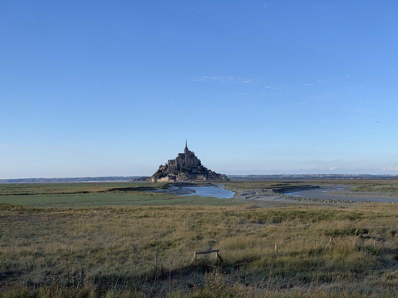
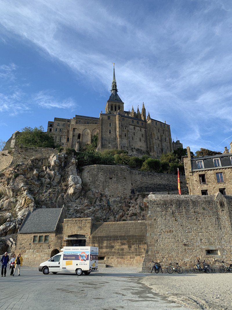
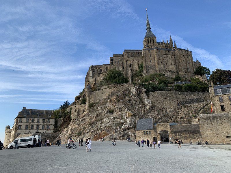
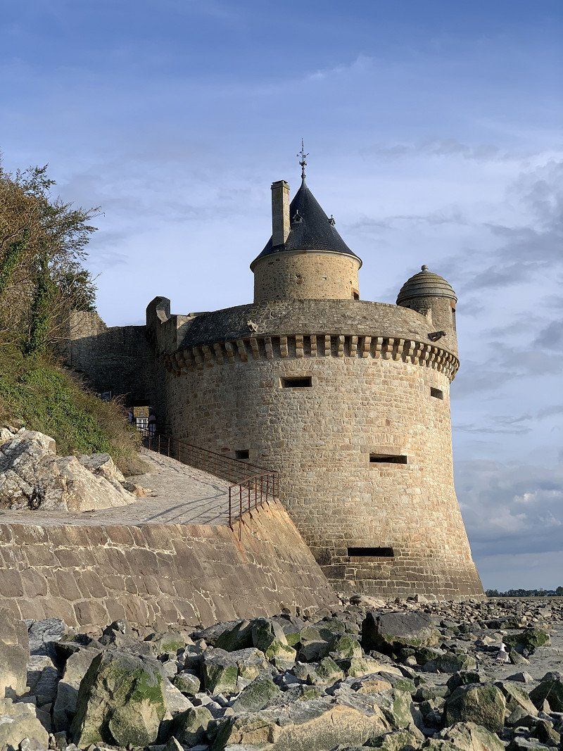
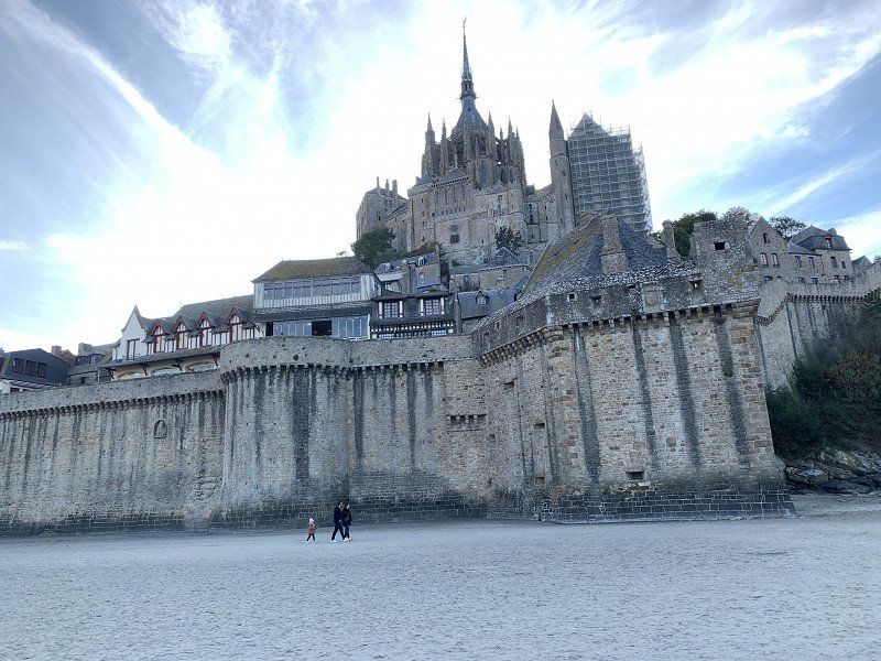
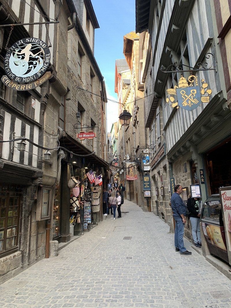
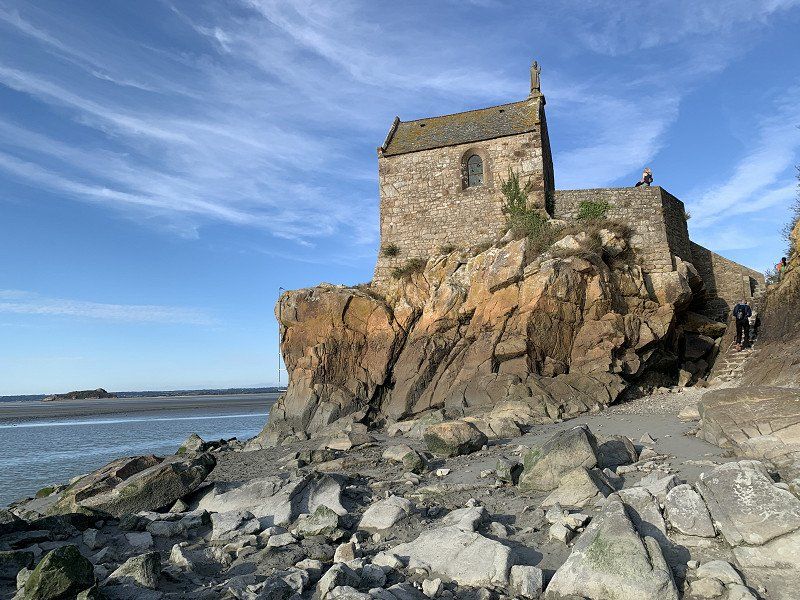
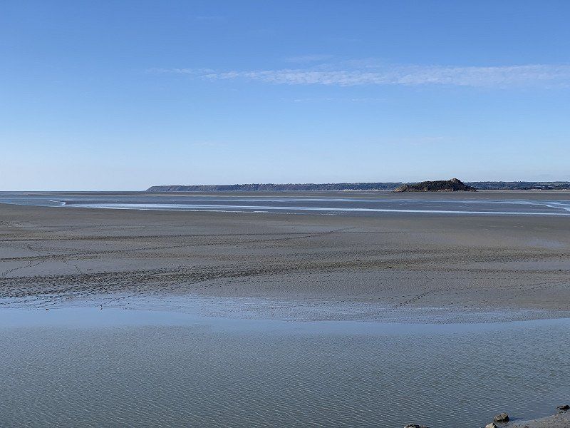
Mont Saint Michel, Parkplatz für Wohnmobile, Parkplätze Mont Saint Michel
There is a larger parking area for RVs. The overnight stay cost about €19, without everything. Not cheap, but location is everything.
50170, Le Mont Saint Michel, France
48° 36' 50.4" N 1° 30' 34.9" W
48.6140000 -1.5097000
• Head east. Go for 21 m.
• Turn slightly right toward Lieu-dit Le Bas Pays. Go for 19 m.
• Turn right onto Lieu-dit Le Bas Pays. Go for 59 m.
• Turn left onto Route du Mont-Saint-Michel. Go for 218 m.
• Turn left onto Lieu-dit Le Bas Pays. Go for 178 m.
• Turn sharp right toward D776. Go for 443 m.
• Turn left onto D776. Go for 806 m.
• Take the 1st exit from roundabout onto D275. Go for 4.6 km.
• Continue on Rue du Mont Saint-Michel (D75). Go for 6.9 km.
• Take left ramp onto N175 toward Saint-Lô/Caen/Cherbourg/Avranches. Go for 1.8 km.
• Take ramp onto N175. Go for 11.3 km.
• Keep left onto A84 toward Cherbourg/Caen/Saint-Lô/Villedieu-les-Poêles. Go for 44.2 km.
• Take exit 40 toward Cherbourg. Go for 486 m.
• Take the 4th exit from roundabout onto N174 toward Cherbourg/Saint Lô/Z.A. de la Détourbe. Go for 48.7 km.
• Take ramp onto N13. Go for 2.7 km.
• Take ramp toward St Hilaire-Petitville/Carentan. Go for 178 m.
• Take the 2nd exit from roundabout onto D974. Go for 715 m.
• Continue on Rue de la Fourchette (D974). Go for 437 m.
• Turn right onto Parc d'Activités de la Fourchette. Go for 233 m.
• Turn slightly left. Go for 76 m.
• Arrive at your destination on the left.
☍
124,1 km
(1 hrs. 20 min.)
Day
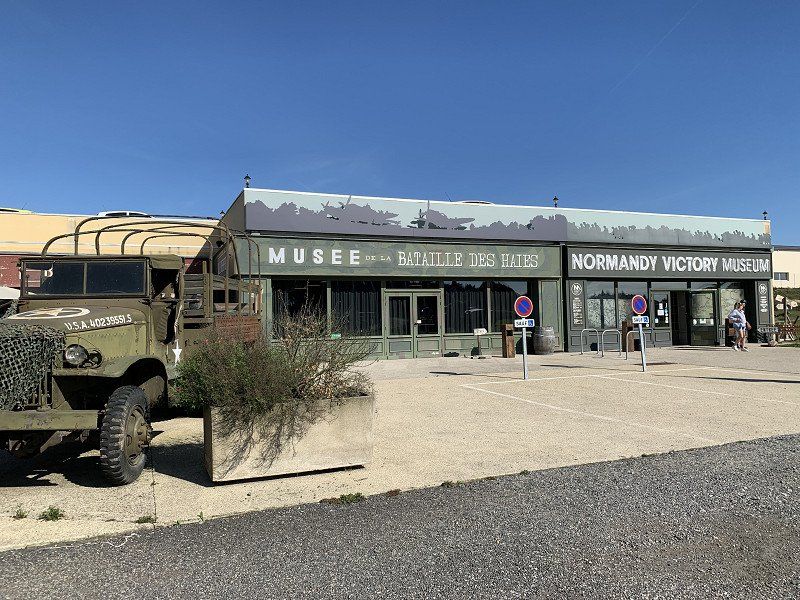
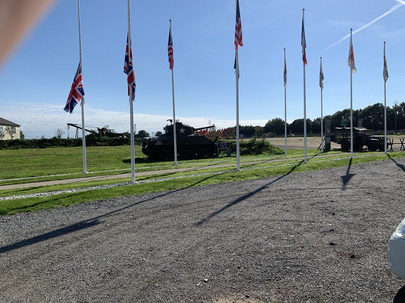
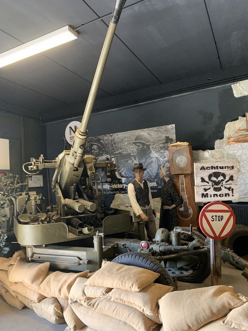
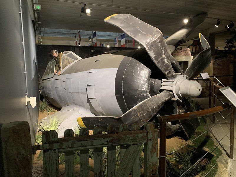
Normandy Victory Museum - Musée de la bataille des haies, La Fourchette, Carentan, Frankreich
Admission €9. Was made interesting, but not necessarily worth seeing.
Parc d’Activités, La Fourchette, 50500 Carentan, Frankreich
49° 18' 16.4" N 1° 11' 34.4" W
49.3045602 -1.1928893
• Head southeast. Go for 161 m.
• Turn right toward Parc d'Activités de la Fourchette. Go for 76 m.
• Continue on Parc d'Activités de la Fourchette. Go for 202 m.
• Turn left onto Rue de la Fourchette (D974). Go for 437 m.
• Continue on D974. Go for 651 m.
• Take the 1st exit from roundabout onto N13 toward Cherbourg/Ste Mère-Église/Valognes. Go for 5.1 km.
• Take ramp toward St Côme du Mt/Ste Marie du Mt. Go for 241 m.
• Turn right onto D913. Go for 8.7 km.
• Continue on Rue de Calais (D913). Go for 380 m.
• Continue on D913. Go for 2.4 km.
• Turn left onto D421. Go for 664 m.
• Turn left. Go for 130 m.
• Arrive at your destination on the left.
☍
19,1 km
( 18 min.)
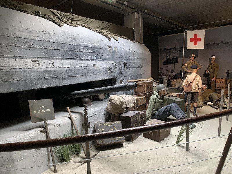
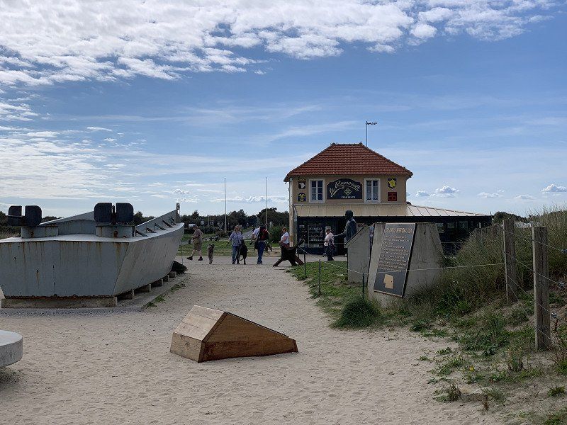
Normandie Utah Beach: Camping Car Park UTAH-BEACH
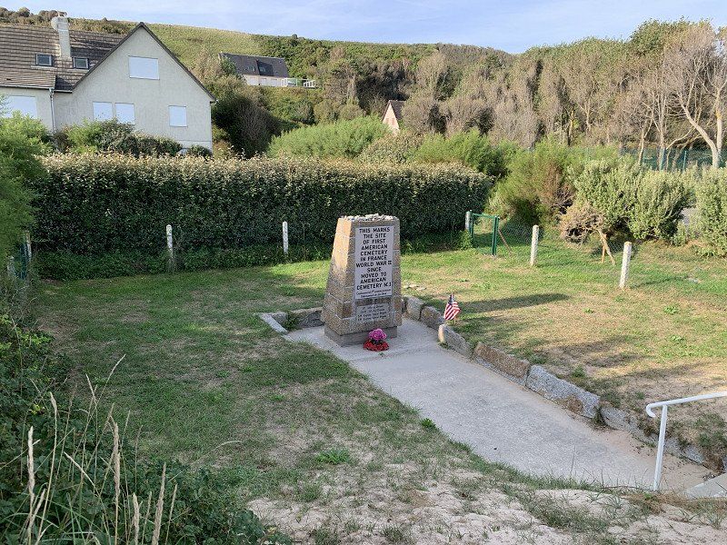
11€ with electricity, supply and disposal. I then rode my bike to Utah Beach and various bunker systems
la Madeleine, 50480, Sainte Marie Du Mont, France
49° 25' 10.3" N 1° 10' 53.6" W
49.4195333 -1.1815671
• Head northeast. Go for 130 m.
• Turn right onto D421. Go for 664 m.
• Turn right onto D913. Go for 2.4 km.
• Continue on Rue de Calais (D913). Go for 380 m.
• Continue on D913. Go for 8.9 km.
• Turn left and take ramp onto N13 toward Caen/Isigny S/M. Go for 29.9 km.
• Take ramp toward Formigny/Trévières/St Laurent S/M./Colleville S/M./Vierville S/M./Omaha Beach. Go for 214 m.
• Turn left onto D30. Go for 159 m.
• Continue on Lieu-dit Formigny (D517). Go for 3.4 km.
• Take the 2nd exit from roundabout onto Avenue de la Libération (D517). Go for 1.3 km.
• Take the 3rd exit from Avenue de la Libération roundabout onto Avenue de la Libération (D517). Go for 131 m.
• Arrive at Avenue de la Libération (D517). Your destination is on the right.
☍
47,5 km
( 38 min.)
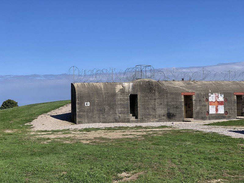
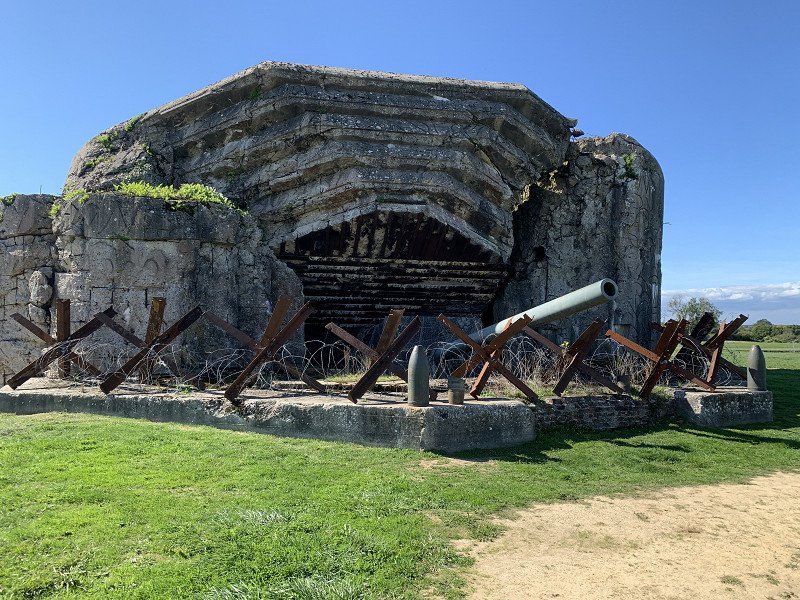
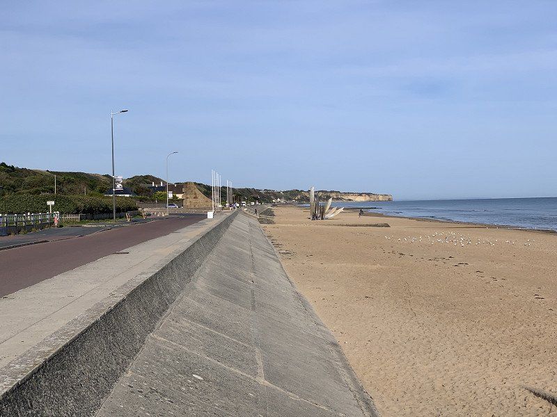
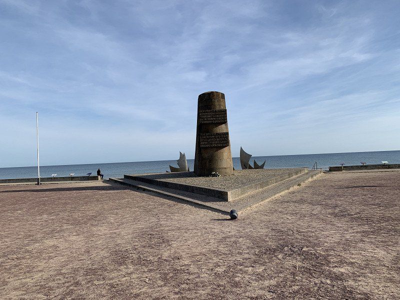
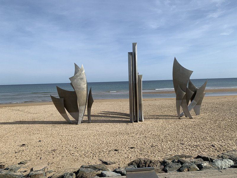
Radtour Utah Beach Quineville und zurück
Also visited the Batterie de Crisbecq and Batterie d'Azeville. I went into the Crisbecq system (€ 11.50) and just looked at the others.
Omaha Beach Memorial, Avenue de la Libération, Saint-Laurent-sur-Mer, Frankreich
Av. de la Libération, 14710 Saint-Laurent-sur-Mer, Frankreich
49° 22' 14.6" N 0° 52' 46.8" W
49.3707219 -0.8796767
• Head toward Rue du 116ème Régiment U.S.A. on Avenue de la Libération (D517). Go for 83 m.
• Take the 3rd exit from Avenue de la Libération roundabout onto Rue Bernard Anquetil. Go for 728 m.
• Arrive at Rue Bernard Anquetil.
☍
0,8 km
( 2 min.)
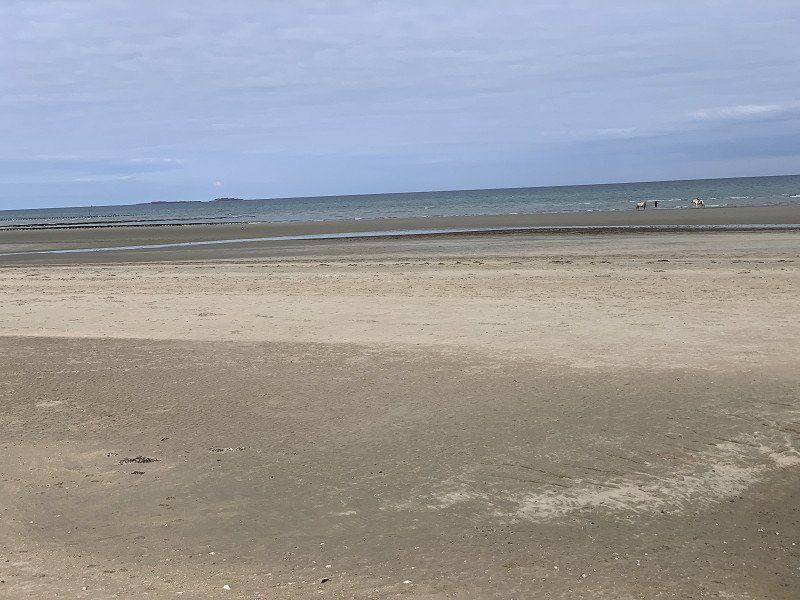
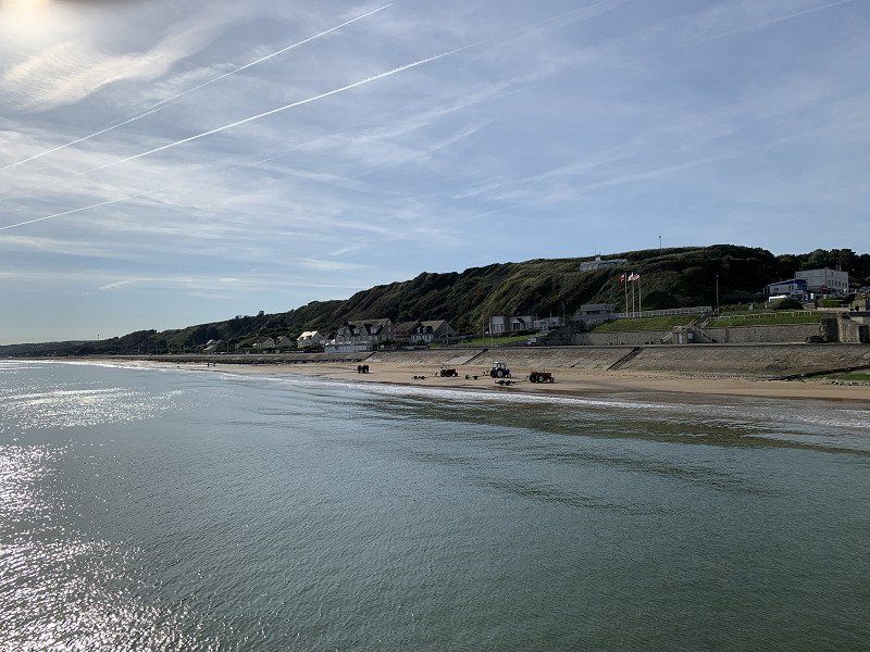
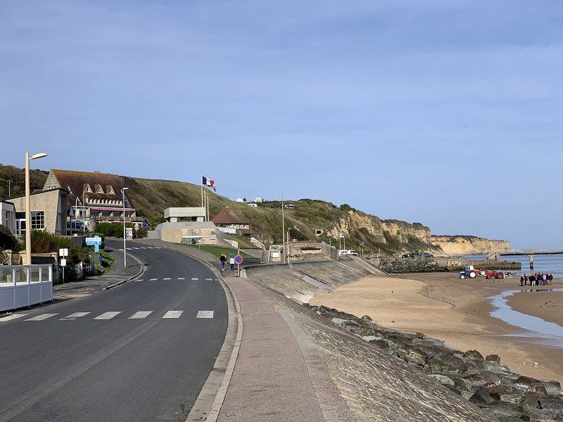
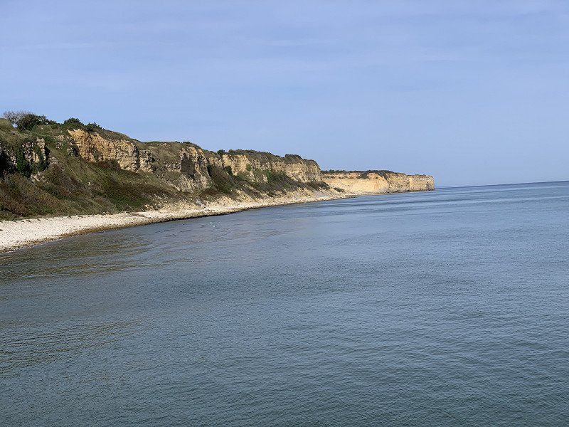
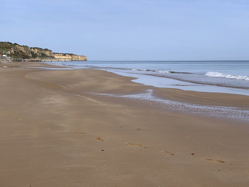
Omaha Beach, Frankreich
Impressive what happened back then. Had a nice walk on the beach.
49° 22' 10.9" N 0° 52' 15.9" W
49.3696815 -0.8710842
• Head toward Rue des Costils on Rue Bernard Anquetil. Go for 663 m.
• Take the 2nd exit from Avenue de la Libération roundabout onto Avenue de la Libération (D517). Go for 1.3 km.
• Take the 3rd exit from roundabout onto Route de Port-en-Bessin (D514). Go for 2.4 km.
• Pass 2 roundabouts and continue on Avenue du 47ème Commando (D514). Go for 12.9 km.
• Turn left onto Rue de la Mer (D104). Go for 809 m.
• Continue on D104. Go for 118 m.
• Turn left. Go for 274 m.
• Arrive at your destination on the right.
☍
18,5 km
( 28 min.)
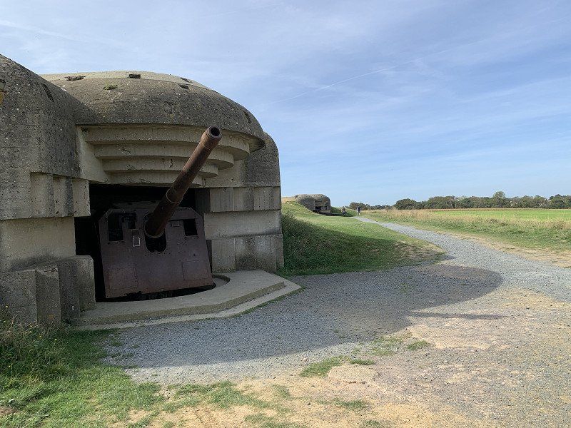
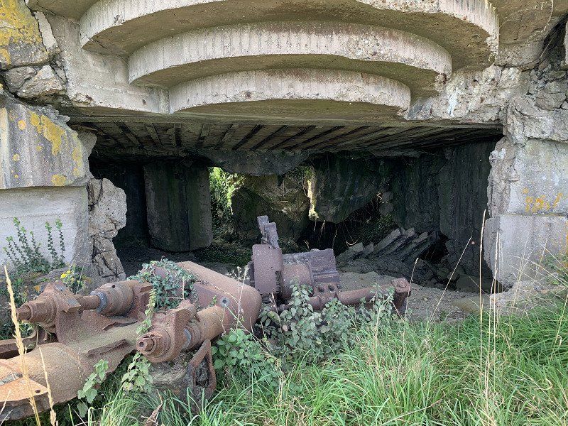
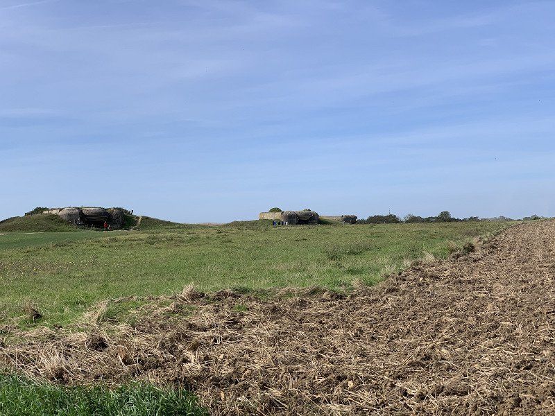
Batterie de Longues-sur-Mer, Rue de la Mer, Longues-sur-Mer, Frankreich
Google Maps was again creative in the route guidance. Must be more careful when entering the destination. The old bunker was also impressive.
39 Rue de la Mer, 14400 Longues-sur-Mer, Frankreich
49° 20' 35.8" N 0° 41' 41.4" W
49.3432768 -0.6948401
• Head toward Lieu-dit Les Parcs. Go for 332 m.
• Turn left toward Rue Sainte-Mary de Jersey. Go for 537 m.
• Turn left onto Rue Sainte-Mary de Jersey. Go for 282 m.
• Turn right onto Rue Jean-Pierre Savary. Go for 114 m.
• Turn left onto Rue de l'École (D514). Go for 71 m.
• Turn right onto Rue de l'Abbaye (D104). Go for 223 m.
• Continue on D104. Go for 61 m.
• Continue on Route de Bayeux (D104). Go for 1.3 km.
• Continue on Lieu-dit Fumichon (D104). Go for 744 m.
• Continue on Route de Longues-sur-Mer (D104). Go for 420 m.
• Continue on D104. Go for 856 m.
• Continue on Lieu-dit L'Entretenant (D104). Go for 113 m.
• Continue on Lieu-dit Le Parc (D104). Go for 219 m.
• Turn left onto Lieu-dit Hameau le Hutrel (D153). Go for 305 m.
• Turn left onto D153. Go for 1.1 km.
• Turn right onto Route d'Arromanches (D516). Go for 1.7 km.
• Take the 3rd exit from roundabout onto Boulevard Winston Churchill (D613). Go for 438 m.
• Pass 4 roundabouts and continue on Boulevard Winston Churchill (D613). Go for 1.5 km.
• Take the 3rd exit from Rond-Point Eisenhower roundabout onto Rue de Caen (D613). Go for 3.6 km.
• Take the 2nd exit from roundabout onto D33. Go for 350 m.
• Take the 2nd exit from roundabout onto D33. Go for 283 m.
• Take the 3rd exit from roundabout onto N13 toward Caen. Go for 28.9 km.
• Take ramp toward Deauville/Trouville/Rouen. Go for 456 m.
• Keep left onto A13 (Autoroute de Normandie) toward Deauville/Trouville/Le Havre/Rouen/Paris/Troarn/Dozulé. Go for 40.9 km.
• Take the exit toward Pont l'Évêque onto D162. Go for 806 m.
• Take the 1st exit from roundabout onto Rue Georges Clemenceau (D579) toward Le Havre/Pont l'Évêque. Go for 830 m.
• Take the 3rd exit from Place Saint-Mélaine roundabout onto Rue de Launay (D675) toward Centre Ville. Go for 513 m.
• Take the 2nd exit from Place Henri Fequet roundabout onto Place Jean Bureau (D675) toward Vaucelles. Go for 380 m.
• Arrive at Rue Saint-Michel (D675). Your destination is on the right.
☍
87,3 km
(1 hrs. 5 min.)
Pont-l'Évêque, Frankreich
I continued towards Étretat "toll-free". Driving through the city was so beautiful that I took a break here. There was sufficient parking space for campers.
14130 Pont-l'Évêque, Frankreich
49° 17' 5.9" N 0° 10' 58" E
49.2849820 0.1827660
• Head toward Rue de Geôle on Rue Saint-Michel (D675). Go for 363 m.
• Take the 2nd exit from Place Henri Fequet roundabout onto Rue Hamelin (D675) toward St Melaine. Go for 498 m.
• Take the 3rd exit from Place Saint-Mélaine roundabout onto Rue Sainte-Mélaine (D677) toward Deauville/Trouville. Go for 448 m.
• Turn right onto Route de Honfleur (D579) toward Caen/Paris/Deauville/Trouville/Le Havre/Tourville en Auge/Honfleur/Aéroport Deauville-Normandie/Pont de Normandie/A13/A132. Go for 563 m.
• Continue toward Deauville/Trouville/Le Havre/Honfleur. Go for 31 m.
• Take the 2nd exit from roundabout onto Route de Honfleur (D579) toward Deauville/Trouville/Le Havre. Go for 169 m.
• Take the 2nd exit from roundabout onto Route de Honfleur (D579) toward Le Havre/Honfleur. Go for 8.7 km.
• Continue on D144 toward D579/A29(A13). Go for 1.4 km.
• Take the 3rd exit from roundabout onto D144 toward Gonneville S/Honfleur. Go for 3.6 km.
• Take the 1st exit from roundabout onto A29 toward Le Havre/Pont de Normandie. Go for 4.1 km.
• Continue on N1029. Go for 7.1 km.
• Continue on A29. Go for 9.9 km.
• Take exit 6 toward St Romain de Colbosc/Étretat. Go for 1.2 km.
• Take the 2nd exit from roundabout onto Hameau de Berville (D39) toward Épretot/Étainhus/Sainneville/Montivilliers/Étretat. Go for 957 m.
• Take the 2nd exit from roundabout onto D39. Go for 128 m.
• Continue on Route d'Étretat (D39). Go for 4.4 km.
• Continue on Chemin d'Étretat à Tancarville (D39). Go for 85 m.
• Take the 1st exit from roundabout onto Chemin d'Étretat à Tancarville (D39). Go for 135 m.
• Continue on Rue des Écoles (D39). Go for 776 m.
• Turn left onto Rue de l'Europe (D39). Go for 79 m.
• Continue on Rue de l'Europe (D39). Go for 64 m.
• Turn right onto Rue des Hautes Falaises (D39). Go for 623 m.
• Continue on Route du Colombier (D39). Go for 1.1 km.
• Turn right onto D925. Go for 1.2 km.
• Turn left onto Route du Carreau (D39) toward Étretat/Criquetot l'Esneval/Vergetot. Go for 3.9 km.
• Continue on Route de Vergetot (D39). Go for 257 m.
• Turn left onto Place du Général Leclerc (D139). Go for 40 m.
• Turn right onto Rue de la Victoire (D39). Go for 2.2 km.
• Take the 2nd exit from roundabout onto Route d'Étretat (D39). Go for 5.8 km.
• Turn right. Go for 34 m.
• Arrive at your destination on the right.
☍
59,8 km
( 57 min.)
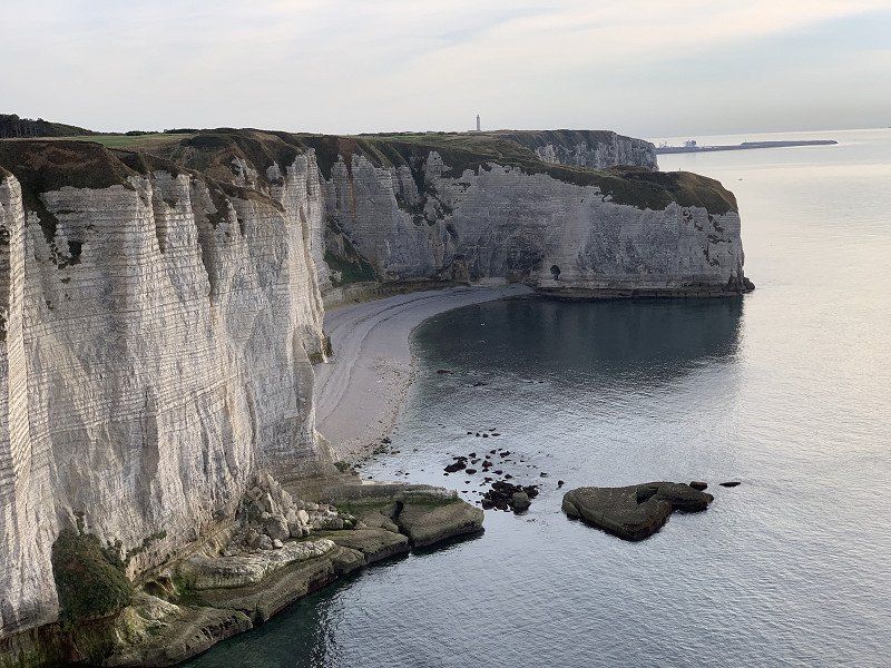
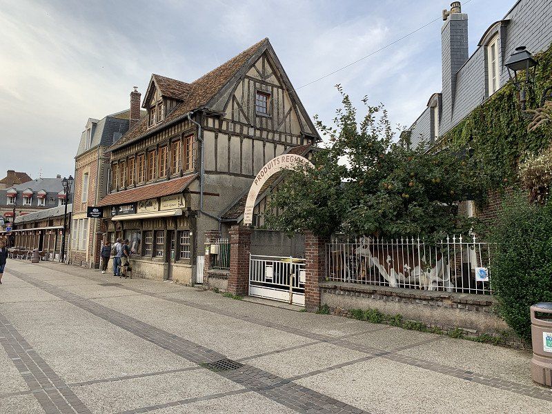
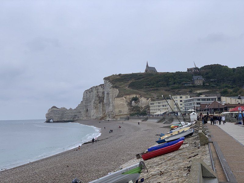
Etretat, Stellplatz Municipal d'Étretat
Decided to pay the toll because I didn't want to arrive too late in Ètretat. Arrived at 4 p.m. and found another place on the pitch (the campsite was already full). There weren't really any alternatives and "camping car" prohibition signs were everywhere. There was really something going on in the city. The pitch costs 11€ without electricity.
76790, Etretat, France
49° 42' 2.2" N 0° 12' 57" E
49.7006000 0.2158200
• Head toward Rue Guy de Maupassant. Go for 34 m.
• Turn left onto Rue Guy de Maupassant (D39). Go for 5.8 km.
• Take the 2nd exit from roundabout onto Chemin de Grande (D39). Go for 2.3 km.
• Continue on Place du Général Leclerc (D139). Go for 6.5 km.
• Take the 1st exit from roundabout onto D925 toward A29/Le Havre/St Romain de Colbosc/Bolbec/Montivilliers. Go for 987 m.
• Take the 3rd exit from roundabout onto D910 toward Bolbec/Pont de Tancarville. Go for 912 m.
• Take the 2nd exit from roundabout onto D910. Go for 1.2 km.
• Take the 1st exit from roundabout onto D910. Go for 5.4 km.
• Take the 1st exit from roundabout onto Route de Goderville (D910). Go for 3.1 km.
• Take the 1st exit from roundabout onto A29 toward Rouen/Amiens. Go for 26.4 km.
• Keep left onto A150 toward Rouen/Barentin/Pavilly. Go for 32.2 km.
• Keep right toward Rouen-Centre/Déville/Zone Portuaire Rive Droite. Go for 377 m.
• Continue on Rue Nansen (D6015). Go for 1.8 km.
• Turn left onto D938 toward Amiens/Boulogne. Go for 657 m.
• Turn right onto Rue Jean Lecanuet. Go for 909 m.
• Turn left onto Place du Général de Gaulle. Go for 91 m.
• Turn slightly right onto Place du Général de Gaulle. Go for 85 m.
• Arrive at Place du Général de Gaulle. Your destination is on the left.
☍
88,7 km
(1 hrs. 9 min.)
Day
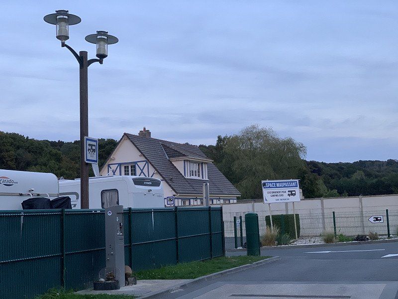
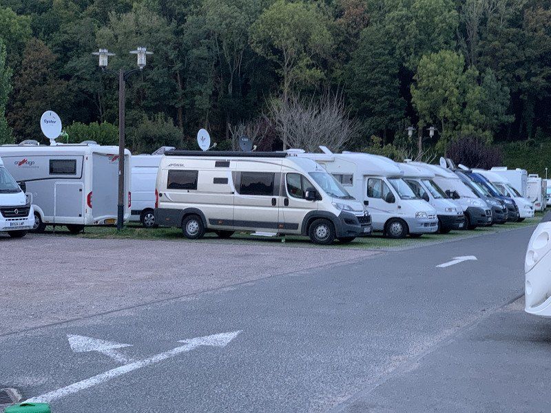
Étretat, Camping Municipal, Étretat
I moved from the pitch to the campsite next door. I would have to put in a household chore again and the campsite has washing machines and a dryer. Been shopping and eating out in town too. The weather now seems to be getting a little wetter for the rest of the trip. Cost 12.20 without electricity. Electricity would have been €5 more.
Day
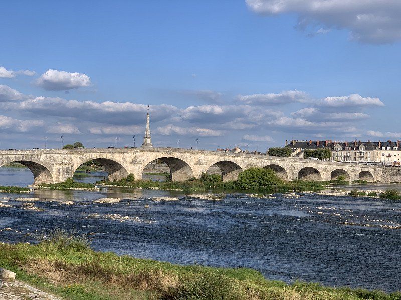
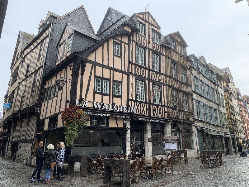
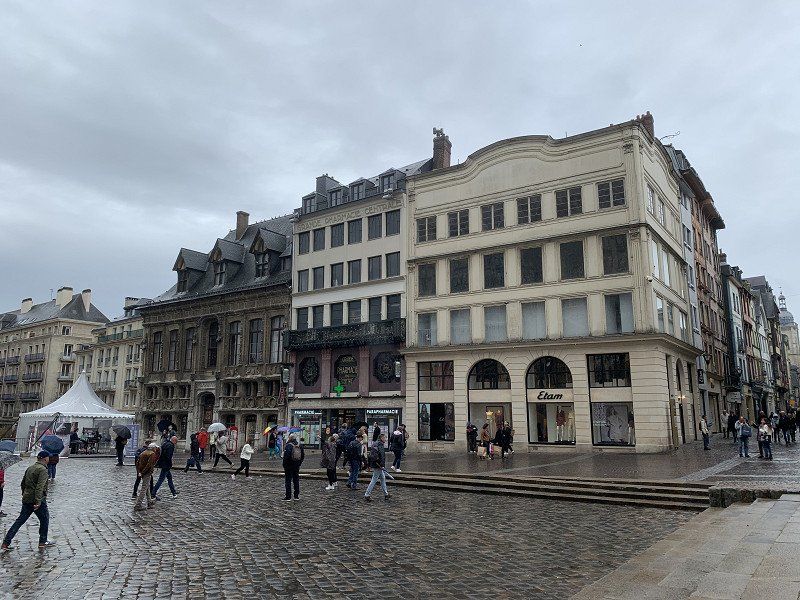
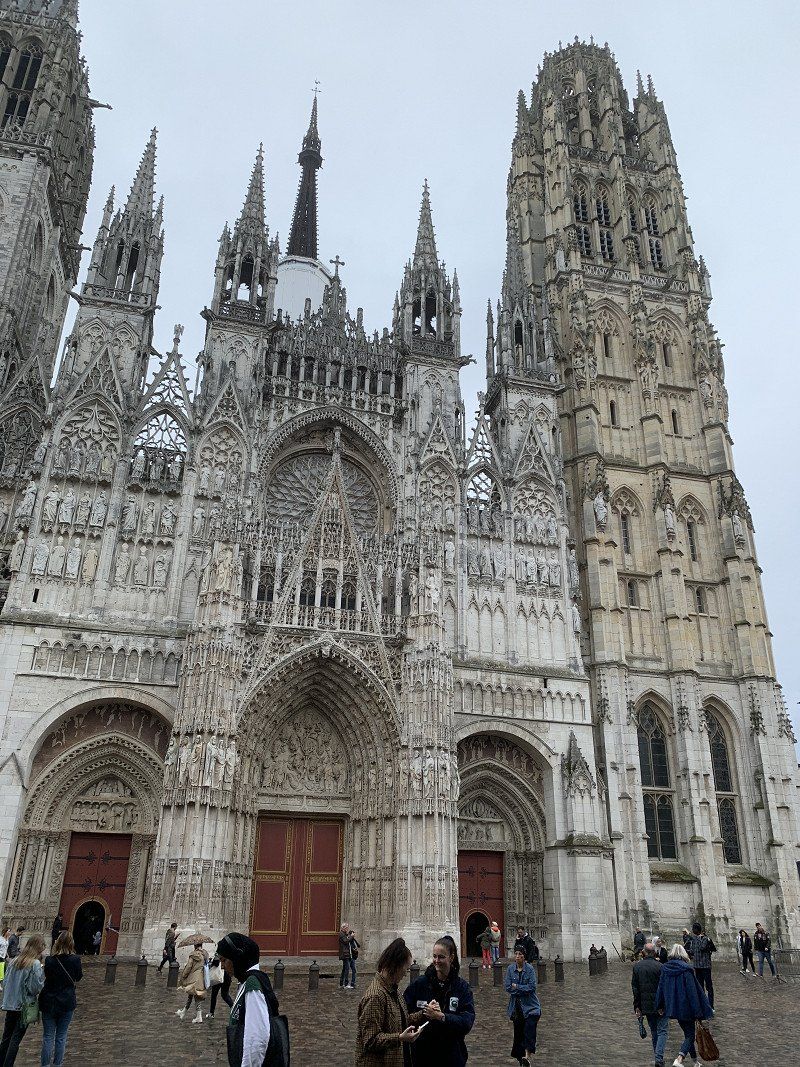
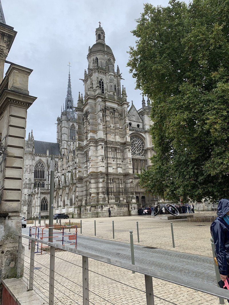
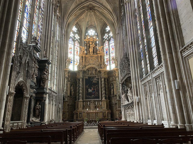
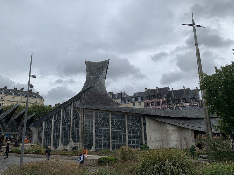
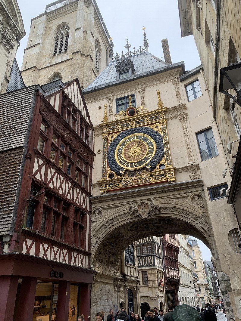
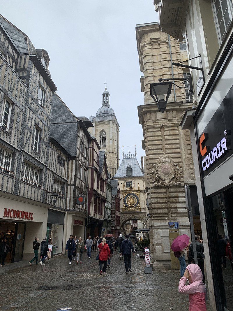
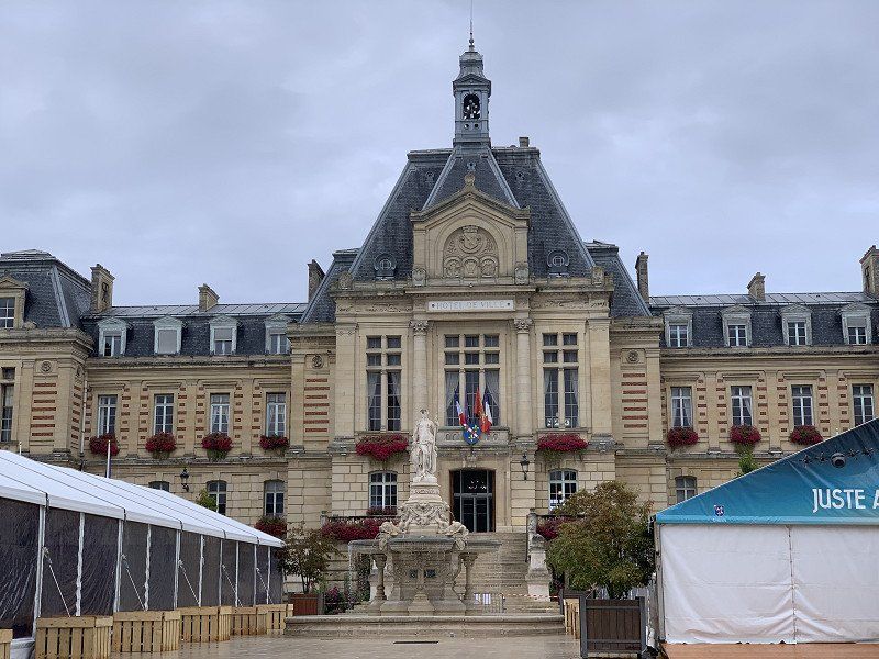
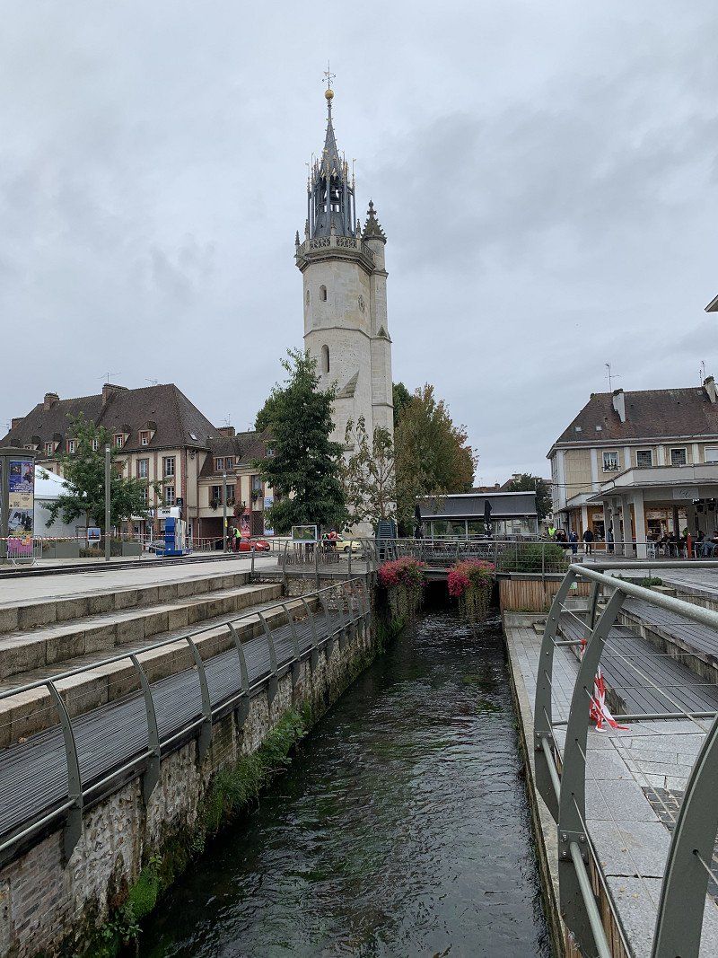
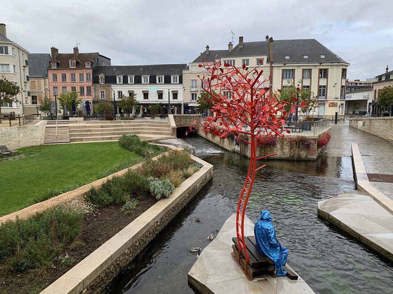
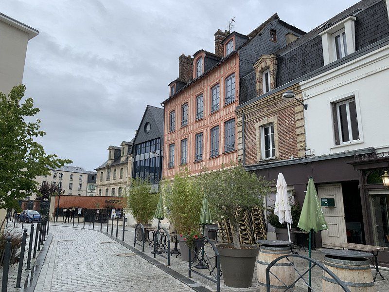
Rouen, Frankreich
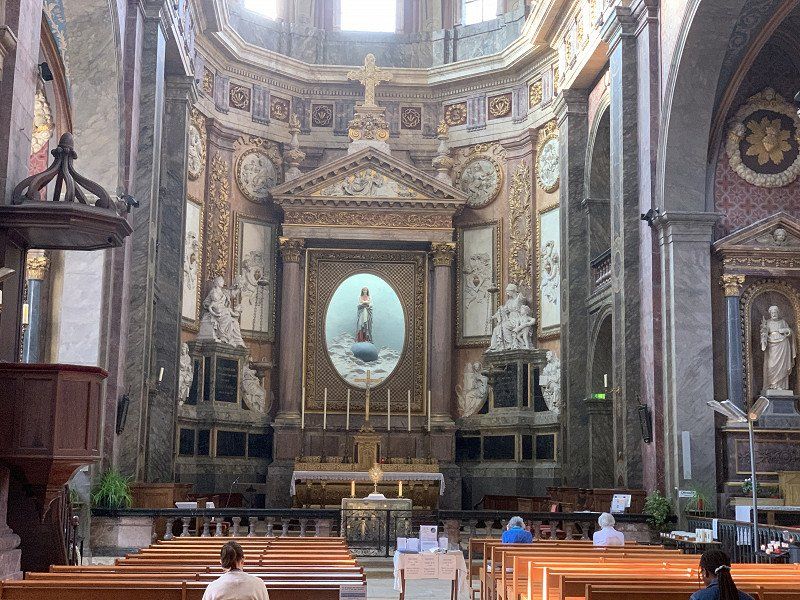
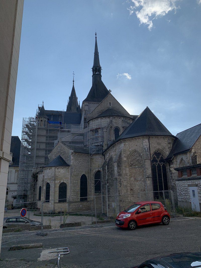
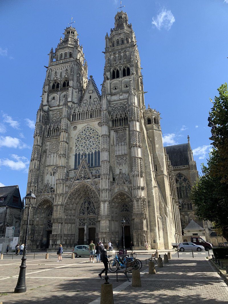
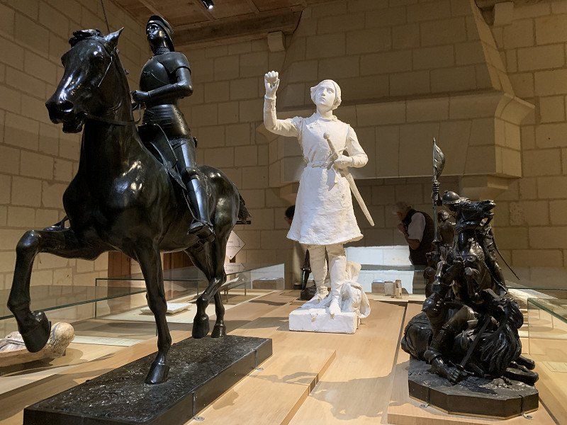
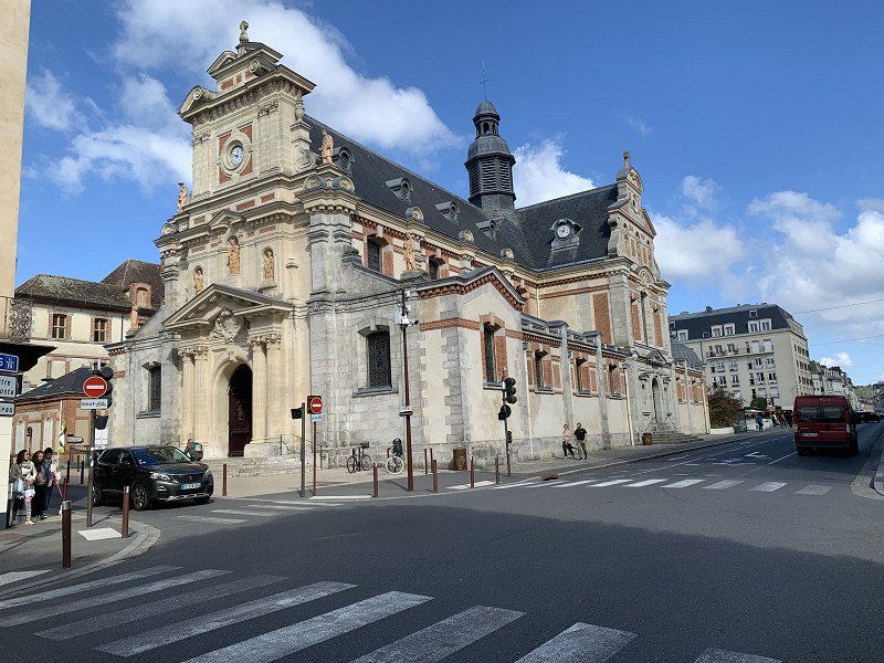
Went too fast and am a day ahead of my original plan. Since I'm meeting a friend in Nancy in three days, I've added the 2 cities. Since the weather tends to be bad, I opted for city visits over nature. Rouen was very beautiful, even with the bad weather. I learned a lot about Joan of Arc. Didn't know it ended here. The main church was the most impressive of the trip so far.
49° 26' 35.6" N 1° 5' 59.9" E
49.4432320 1.0999710
• Head north on Place du Général de Gaulle. Go for 85 m.
• Turn slightly left onto Place du Général de Gaulle. Go for 91 m.
• Turn right onto Rue Jean Lecanuet. Go for 286 m.
• Continue on Rue Jean Lecanuet. Go for 482 m.
• Turn right onto Rue de Lemery. Go for 88 m.
• Turn left onto Boulevard de la Marne (D938). Go for 543 m.
• Turn right onto Rue Duguay-Trouin. Go for 110 m.
• Continue toward Pont Guillaume le Conquérant/N138. Go for 105 m.
• Continue on Pont Guillaume le Conquérant (N138). Go for 795 m.
• Turn right onto Rue de la Motte (N2338). Go for 134 m.
• Keep right onto Rue de la Motte (N2338) toward A150. Go for 229 m.
• Take the 3rd exit from Rond-Point de la Motte roundabout onto Voie Sud III (N338) toward A13/Le Mans/Elbeuf/Grand-Quevilly/Petit-Quevilly-Centre. Go for 5.1 km.
• Keep left onto Voie Sud III (N338) toward A13/A28/Elbeuf/Le Mans. Go for 3.3 km.
• Continue on N138. Go for 1.6 km.
• Keep left onto A139 toward A13(Paris)/Évreux/Oissel. Go for 3.3 km.
• Continue on A13 (Autoroute de Normandie). Go for 14.3 km.
• Take the exit toward Évreux/Orléans/Val de Reuil/Louviers onto A154. Go for 8.3 km.
• Continue on N154. Go for 18.8 km.
• Take ramp onto N13 toward Évreux-Centre/Paris/Vernon/Parc d'Activités-le Long Buisson. Go for 525 m.
• Take the 3rd exit from roundabout onto N13 toward Évreux-Centre/Évreux-la Madeleine. Go for 904 m.
• Keep left onto Rue Pierre Semard (N13). Go for 1.2 km.
• Keep right onto Rue des Fusillés. Go for 323 m.
• Keep left onto Rue des Déportés (N13). Go for 128 m.
• Keep left onto Rue de la Résistance (N13). Go for 1.1 km.
• Turn right onto Boulevard de la Buffardière. Go for 530 m.
• Turn left onto Avenue du Maréchal Foch (N13). Go for 169 m.
• Arrive at Avenue du Maréchal Foch (N13). Your destination is on the right.
☍
62,5 km
( 52 min.)
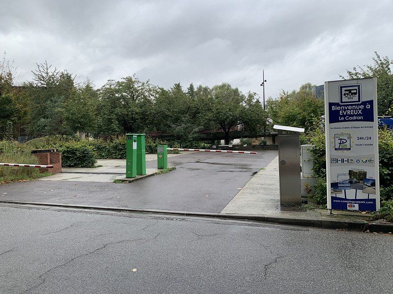
Évreux, Frankreich
A medium sized city on the way to Paris. Good for an afternoon stop. Again a camping car park. 11 € including electricity and disposal and supply. WiFi was also available.
12 Av. du Maréchal Foch, 27000 Évreux, Frankreich
49° 1' 24.3" N 1° 8' 17.9" E
49.0234195 1.1383136
• Head west on Avenue du Maréchal Foch (N13). Go for 130 m.
• Take the 3rd exit from roundabout onto Boulevard de Normandie (D613) toward Paris/Dreux/Rouen/La Madeleine. Go for 829 m.
• Continue on Boulevard Gambetta (N13). Go for 853 m.
• Turn right onto Pont Eiffel (N13). Go for 102 m.
• Continue on Rue Pierre Semard (N13). Go for 521 m.
• Keep left onto Rue Pierre Semard (N13). Go for 1.9 km.
• Take the 2nd exit from roundabout onto N13. Go for 514 m.
• Take the 1st exit from roundabout onto N1013 toward Mantes/Paris/Vernon/Pacy. Go for 769 m.
• Continue on N13. Go for 2.7 km.
• Take the 2nd exit from roundabout onto N13 toward Paris. Go for 19.5 km.
• Take ramp onto A13 (Autoroute de Normandie) toward Mantes/Paris. Go for 56.9 km.
• Take the exit toward Créteil onto A86 (Duplex A86). Go for 6.9 km.
• Take the exit toward Versailles/D53/Vélizy. Go for 1.1 km.
• Keep right toward D53/Jouy en Josas/Z.A. L. Bréguet. Go for 156 m.
• Turn left onto Rue Étienne de Jouy. Go for 512 m.
• Continue on Route de Chaville à Bièvres (D53). Go for 174 m.
• Take the 2nd exit from roundabout onto Route de Chaville à Bièvres (D53). Go for 2.6 km.
• Continue on Rue Léon Mignotte (D53). Go for 1.6 km.
• Take the 2nd exit from Rue de Paris roundabout onto Rue du Petit Bièvres (D53). Go for 313 m.
• Take the 1st exit from roundabout onto Rue du Petit Bièvres (D53). Go for 337 m.
• Take the 3rd exit from roundabout onto Route de Corbeil (D117) toward A10 (Paris)/A6/Palaiseau/Igny. Go for 3.9 km.
• Keep left onto D444 toward A10/Lyon/A6/Paris/Villebon sur Yvette. Go for 472 m.
• Continue on A126. Go for 810 m.
• Keep left onto A126 toward A10/E05/E50/Lille/Metz/Nancy/Paris/Lyon. Go for 628 m.
• Take ramp onto A10. Go for 1.3 km.
• Continue on A126 toward A6/Lyon/Évry/Chilly-Mazarin. Go for 1.8 km.
• Take the exit onto A6 (Autoroute du Soleil). Go for 30.6 km.
• Take the exit toward N7/Fontainebleau onto D637. Go for 9.6 km.
• Pass 2 roundabouts and continue on D607. Go for 6.7 km.
• Turn right onto Carrefour de la Libération toward Fontainebleau/Champagne S/Seine./Avon. Go for 153 m.
• Turn right onto Boulevard André Maginot (D417) toward Fontainebleau-Centre. Go for 544 m.
• Continue on Rue Royale (D417). Go for 486 m.
• Turn left onto Place du Général de Gaulle. Go for 26 m.
• Continue on Rue Dénecourt. Go for 255 m.
• Continue on Rue Grande. Go for 24 m.
• Turn right onto Rue de la Chancellerie. Go for 111 m.
• Turn slightly left onto Place d'Armes. Go for 42 m.
• Continue on Rue du Château. Go for 79 m.
• Arrive at Rue du Château. Your destination is on the left.
☍
155,9 km
(2 hrs. 15 min.)
Day
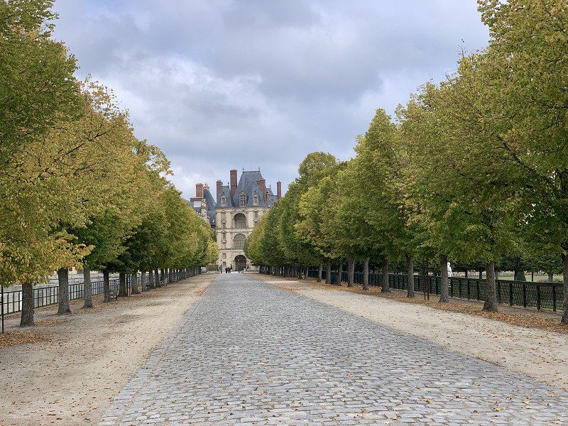
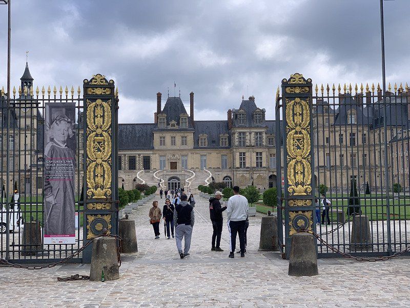
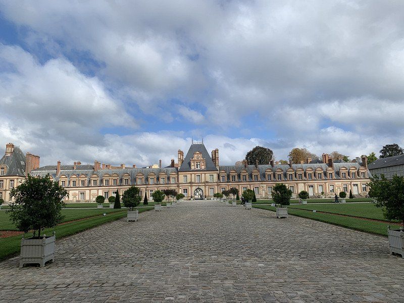
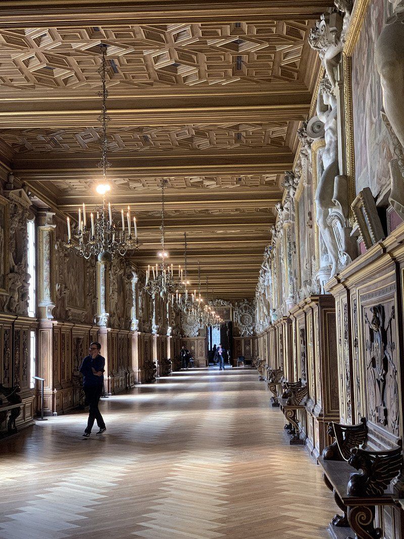
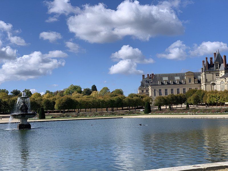
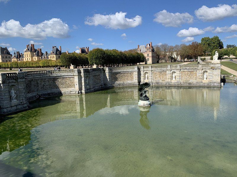
Fontainebleau, Frankreich
Napoleon's Versailles. Park4Night and Google Maps don't understand each other again today and I couldn't find the planned parking lot. I just parked outside the castle grounds. No problem with a campervan. The castle was very impressive and the workmanship of the fireplaces and ceilings was remarkable. Entry €13, parking was free.
The city and the surrounding area offers a lot and you could stay here longer than half a day.
77300 Fontainebleau, Frankreich
48° 24' 16.8" N 2° 42' 5.8" E
48.4046760 2.7016200
• Head toward Rue Paul Séramy on Rue du Château. Go for 28 m.
• Turn left onto Rue Paul Séramy. Go for 73 m.
• Turn right onto Rue Grande. Go for 967 m.
• Continue on Boulevard du Maréchal Foch (D606). Go for 1.1 km.
• Take ramp onto D116 toward Bois le Roi/Samois sur S./Fontaine le Port/Le Châtelet en B. Go for 2.5 km.
• Take the 2nd exit from Carrefour de la Croix de Toulouse roundabout onto Route de Bourgogne (D138) toward Samois-Bas. Go for 2.0 km.
• Take the 2nd exit from roundabout onto Route de Bourgogne (D138) toward Samoreau/Champagne S/S./Samois-Bas. Go for 488 m.
• Continue toward Champagne S/S./Vulaines S/S./Samoreau. Go for 45 m.
• Take the 2nd exit from Rond-Point de la Liberté roundabout onto D210 toward Samoreau. Go for 630 m.
• Take the 2nd exit from roundabout onto Rue Royale (D210). Go for 425 m.
• Turn left onto Rue du Haut Samoreau (D39 E). Go for 287 m.
• Continue on Voie de la Liberté. Go for 352 m.
• Continue on Avenue de la Libération (D227). Go for 3.5 km.
• Keep right onto D227 toward Machault/Mormant/Nangis. Go for 6.5 km.
• Continue on D40 toward D12/Mormant/Nangis/Les Écrennes/La Chapelle-Gauthier/La Chapelle-Rablais. Go for 76 m.
• Continue on D227. Go for 322 m.
• Continue on D12. Go for 13.4 km.
• Turn right onto D201 toward Montereau Fault Y./Donnemarie-Dtilly. Go for 1.4 km.
• Turn left onto Route de Montereau (D56) toward Nangis. Go for 556 m.
• Take the 2nd exit from roundabout onto Rue des Écoles (D56) toward La Mare au Curé. Go for 375 m.
• Turn right onto Boulevard du Tivoli. Go for 355 m.
• Take the 2nd exit from Rond-Point de Valmy roundabout onto Avenue de Verdun (D419). Go for 95 m.
• Pass 2 roundabouts and continue on D619. Go for 19.2 km.
• Take the 3rd exit from roundabout onto Avenue du Général de Gaulle (D231 A) toward Provins-Centre. Go for 270 m.
• Turn left onto Chemin de Villecran. Go for 312 m.
• Turn left. Go for 169 m.
• Arrive at your destination on the left.
☍
55,4 km
( 54 min.)
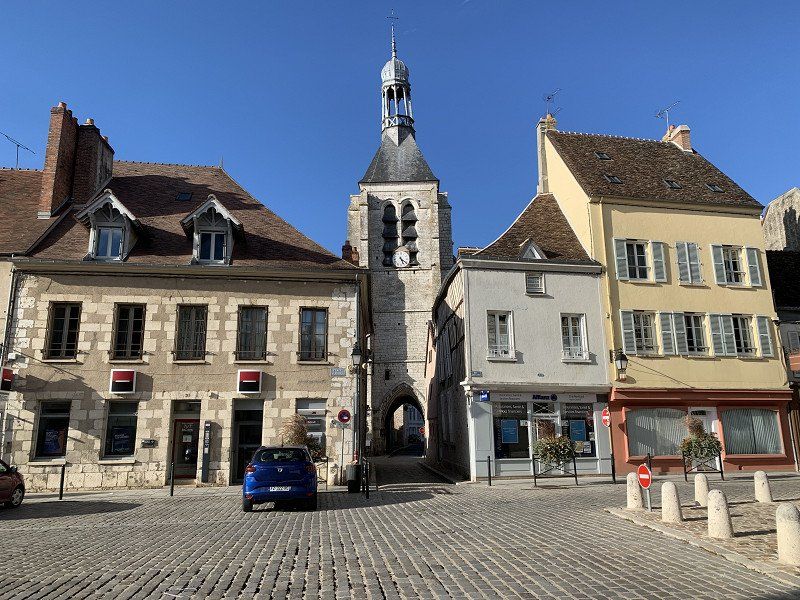
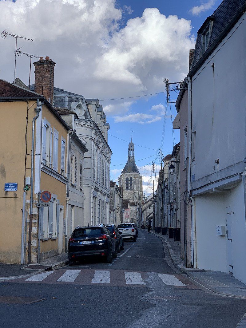
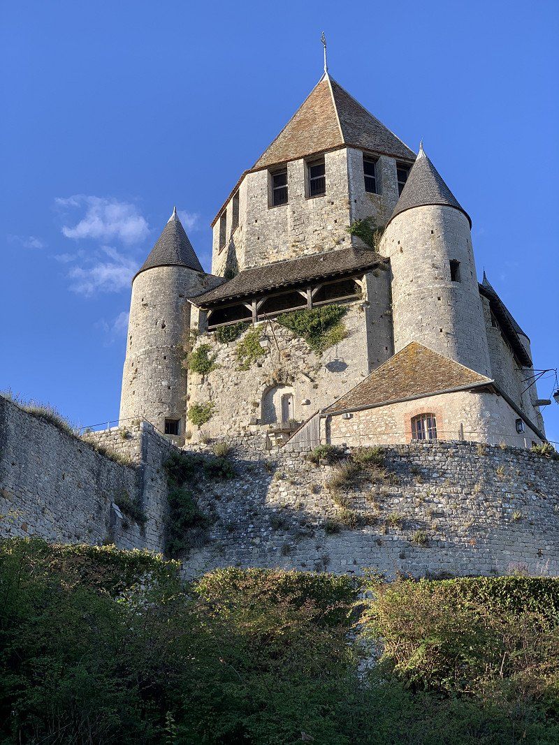
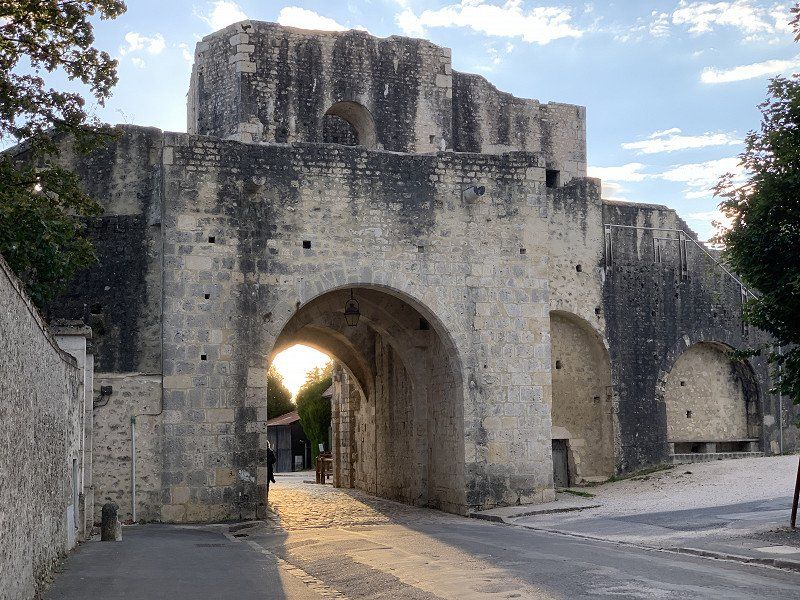
Provins, Aire municipal pour Camping-cars
The parking space location is very good for a city tour. 8 € with supply and disposal is more than fair. The city had pleasantly surprised me. The 8 lines in the Baedecker were not enough; definitely worth a visit!
Chemin de Villecran, 77160, Provins, France
48° 33' 43" N 3° 16' 48" E
48.5619444 3.2800000
• Head northwest. Go for 163 m.
• Turn right onto Vieux Chemin de Paris. Go for 82 m.
• Turn left. Go for 12 m.
• Turn right toward Chemin de Villecran. Go for 161 m.
• Turn right onto Chemin de Villecran. Go for 142 m.
• Continue on Avenue du Général de Gaulle (D231 A). Go for 136 m.
• Take the 4th exit from roundabout onto D619 toward Épernay/Troyes/Provins/Sourdun. Go for 2.9 km.
• Take the 2nd exit from roundabout onto D619 toward Vitry le F./Châlons en Ch./Troyes/Sourdun. Go for 841 m.
• Take the 2nd exit from roundabout onto D74 A. Go for 1.3 km.
• Turn right onto Rue du Pont d'Argent (D403 A) toward D403 A1/Vitry le F./Chalons en Ch./Épernay/La Ferté-Gaucher/Villiers St G./St Brice. Go for 1.9 km.
• Turn right onto D403 toward Épernay/Chalons en C./Vitry le F./Villiers St Georges/Montmirail/Sézanne. Go for 11.5 km.
• Take the 3rd exit from Rue de la Gare roundabout onto Rue de Montceaux (D403) toward Montceaux les Provins/Esternay. Go for 527 m.
• Take the 2nd exit from roundabout onto D403 toward Châlons sur Marne/Vitry le François/Epernay/Montmirail/Sézanne/Montceaux les Provins/Esternay. Go for 4.7 km.
• Turn right onto Route de Paris (D1004) toward Épernay/Châlons S/Marne/Vitry le François/Courgivaux/Esternay/Montmirail/Sézanne. Go for 2.5 km.
• Continue on Avenue de l'Europe (N4). Go for 11.5 km.
• Continue on Rue Nationale (N4). Go for 71.3 km.
• Take the 2nd exit from roundabout onto Route de Paris (N4) toward Vitry le F./Nancy. Go for 2.1 km.
• Take the 3rd exit from roundabout onto Avenue du Quai des Fontaines (D982) toward Reims/Châlons en Ch./La Haute Borne/Le Grand Parc/Le Hamois. Go for 742 m.
• Take the 4th exit from Place du Maréchal Leclerc roundabout onto Avenue du Général de Gaulle (N44) toward Reims/St Dizier/Nancy. Go for 1.4 km.
• Take the 1st exit from roundabout onto N4 toward St Dizier/Nancy/Brienne le Ch./Vitry le P. Go for 104 km.
• Take left ramp onto A31 toward Nancy/Toul-Croix de Metz. Go for 19.0 km.
• Take the left exit toward Pont-à-Mousson/Metz/Luxembourg/Nancy-Centre/Laxou onto D400 (Avenue de la Résistance). Go for 1.2 km.
• Keep left onto Avenue de la Résistance (D400) toward Metz/Maxéville/Nancy. Go for 551 m.
• Keep right onto Avenue de Boufflers toward Beauregard. Go for 2.4 km.
• Continue on Rue de Saint-Lambert. Go for 261 m.
• Turn left onto Place de la Commanderie. Go for 44 m.
• Continue on Avenue Foch. Go for 297 m.
• Turn right onto Rue Jeanne d'Arc. Go for 507 m.
• Turn left onto Rue de Mon-Désert toward Sarreguemines/Tomblaine/St Max/Nancy-Centre/Mon Désert/Quartier Stanislas/Quartier Charles. Go for 486 m.
• Continue on Pont des Fusillés. Go for 152 m.
• Continue on Rue Charles III toward Tomblaine/St Max. Go for 92 m.
• Keep right onto Rue de l'Abbé Didelot. Go for 8 m.
• Continue on Rue Charles III. Go for 918 m.
• Turn left onto Boulevard Lobau (D570) toward St Max. Go for 302 m.
• Arrive at Boulevard du 21ème Régiment d'Aviation (D570). Your destination is on the right.
☍
244,2 km
(3 hrs. )
Day
Nancy, Aire de Camping-cars Port St. Georges
The parking space is not well signposted, but very central. €16.50 for a parking space with supply and disposal is steep, but the location is good, albeit quite noisy. Showers and electricity are available but cost extra. Tomorrow we're going home, so Nancy is the last destination on the tour.
Boulevard du 21 Régiment d'Avation, 54000, Nancy, France
48° 41' 32" N 6° 11' 35" E
48.6922222 6.1930556
• Head north on Boulevard du 21ème Régiment d'Aviation (D570). Go for 387 m.
• Turn left onto Rue de l'Île de Corse. Go for 301 m.
• Continue on Place de la Division de Fer. Go for 23 m.
• Continue on Place de la Division de Fer toward Jarville/Quartier Charles III. Go for 253 m.
• Turn slightly right onto Boulevard Lobau (D570) toward Jarville. Go for 1.4 km.
• Continue toward Boulevard Lobau. Go for 107 m.
• Continue on Boulevard Lobau. Go for 40 m.
• Take ramp onto M674 toward Vandoeuvre/Parc des Expositions. Go for 2.1 km.
• Continue on A330. Go for 3.5 km.
• Take the exit toward Strasbourg/Colmar/Lunéville/Z.I. Fléville/Lyon/Paris/Metz/Nancy-Brabois onto A33. Go for 17.2 km.
• Continue on N333. Go for 38.3 km.
• Take the 2nd exit from roundabout onto N4 toward Strasbourg/Sarrebourg/St Georges. Go for 36.5 km.
• Take the 2nd exit from roundabout toward Saverne/Strasbourg/Saarbrucken/Metz/Paris/Z.I. Maisons Rouges. Go for 427 m.
• Take ramp onto A4 (Autoroute de l'Est) toward Saverne/Strasbourg/E25. Go for 43.7 km.
• Take the exit toward Karlsruhe/Lauterbourg/Hoerdt onto A35. Go for 33.3 km.
• Take exit 56 toward Forstfeld/Karlsruhe/Bâle/Rastatt/Baden-Baden/Roppenheim/Beinheim onto D504. Go for 1.2 km.
• Pass 2 roundabouts and continue on D504. Go for 3.8 km.
• Continue on B500. Go for 6.4 km.
• Take ramp onto A5 toward Karlsruhe. Go for 25.6 km.
• Take exit 48 toward Karlsruhe-Süd/Rheinstetten/Messe KA/Landau (Pfalz)/Ettlingen Gewerbegebiet. Go for 395 m.
• Turn right onto B3 toward Ettlingen-Zentrum. Go for 473 m.
• Turn right onto Bulacher Straße. Go for 1.4 km.
• Take the 3rd exit from roundabout onto Rheinstraße. Go for 425 m.
• Turn right onto Karl-Friedrich-Straße. Go for 169 m.
• Turn left onto Zehntwiesenstraße. Go for 30 m.
• Arrive at Zehntwiesenstraße. Your destination is on the right.
☍
217,4 km
(2 hrs. 8 min.)
Day
Ettlingen, Deutschland
76275 Ettlingen, Deutschland
48° 56' 35.5" N 8° 23' 52.9" E
48.9432080 8.3980172