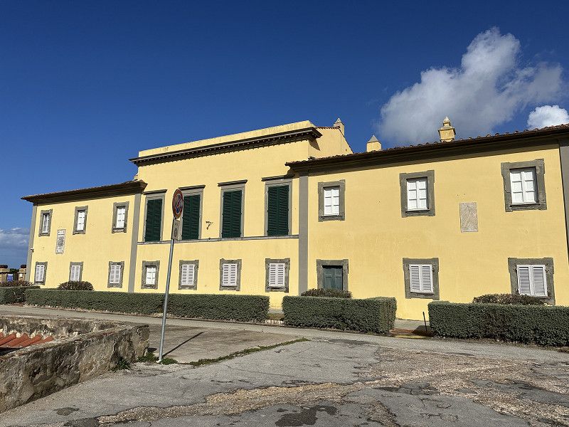
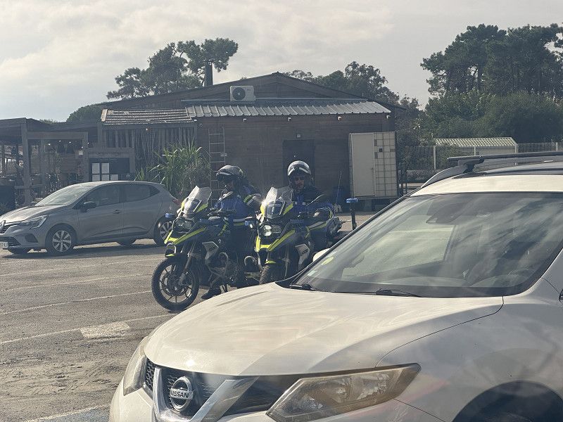
Autumn 2024 (Oct.-Nov.) Travel to a small and a large island in the Mediterranean and back via France to replenish my wine supplies with the wines I tried and liked this year and to visit my favorite restaurant again.
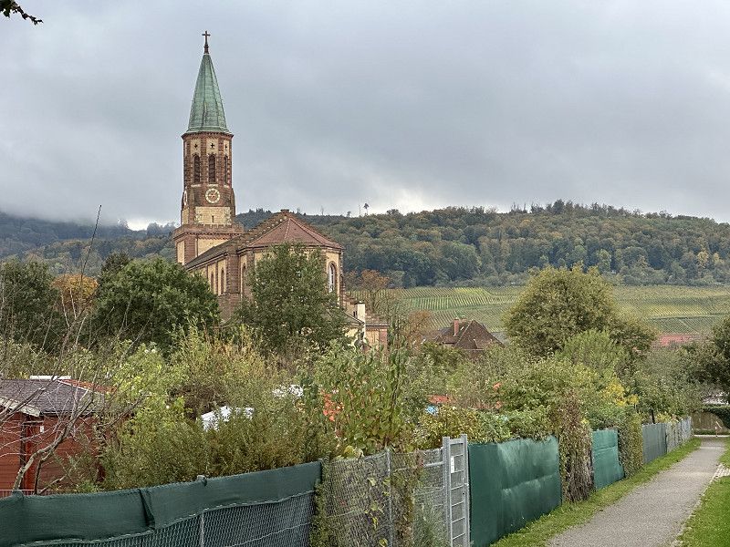
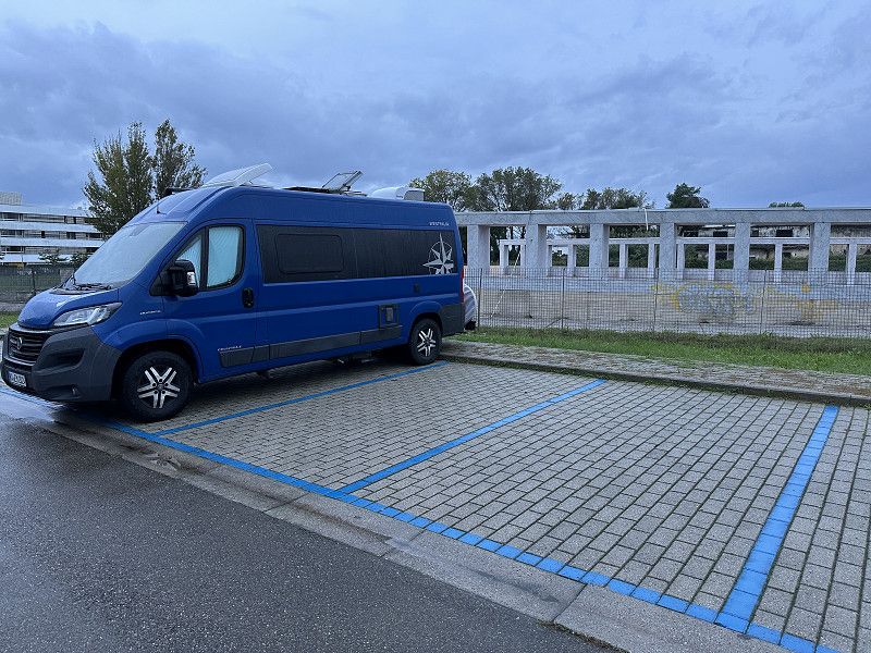
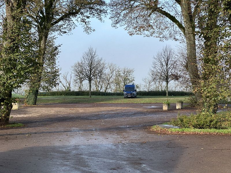
Stellplatz am Albgau-Freibad
Schöllbronner Straße, 76275, Ettlingen, Germany
48° 56' 9" N 8° 25' 2" E
48.9358333 8.4172222
• Head northeast. Go for 33 m.
• Turn left toward Wattkopfweg. Go for 58 m.
• Turn right onto Wattkopfweg. Go for 11 m.
• Turn left onto Schöllbronner Straße (L613). Go for 218 m.
• Turn right onto Luisenstraße (L613). Go for 243 m.
• Turn right onto Pforzheimer Straße (L613). Go for 1.3 km.
• Keep left toward Pforzheimer Straße/L613. Go for 28 m.
• Turn left onto L562. Go for 2.3 km.
• Continue on B3. Go for 1.1 km.
• Turn right onto Karlsruher Straße (L561) toward KA-Rüppurr. Go for 256 m.
• Take ramp onto A5 toward Basel. Go for 123 km.
• Take exit 62 toward Freiburg/B31 onto B31A. Go for 2.8 km.
• Take ramp onto Tel-Aviv-Yafo-Allee toward Fr-St. Georgen/Fr-Rieselfeld/Gewerbegebiet Fr-Haid. Go for 1.6 km.
• Continue on Besançonallee toward Lörrach/St. Georgen/Gewerbegebiet Haid-Ost/Gewerbegebiet Haid-Süd. Go for 1.2 km.
• Continue on Besançonallee (K9863) toward St. Georgen. Go for 163 m.
• Take the 1st exit from roundabout onto Besançonallee (K9863). Go for 292 m.
• Continue on Malteserordensstraße. Go for 85 m.
• Turn left onto Hartkirchweg. Go for 593 m.
• Turn left onto Ittnerstraße. Go for 126 m.
• Arrive at Ittnerstraße. Your destination is on the right.
☍
136,0 km
(1 hrs. 23 min.)
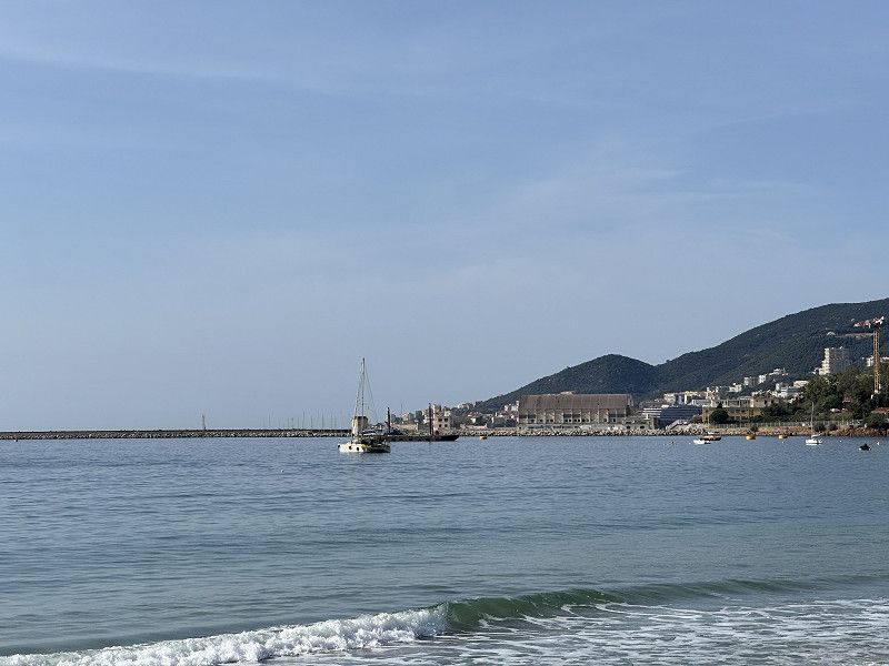
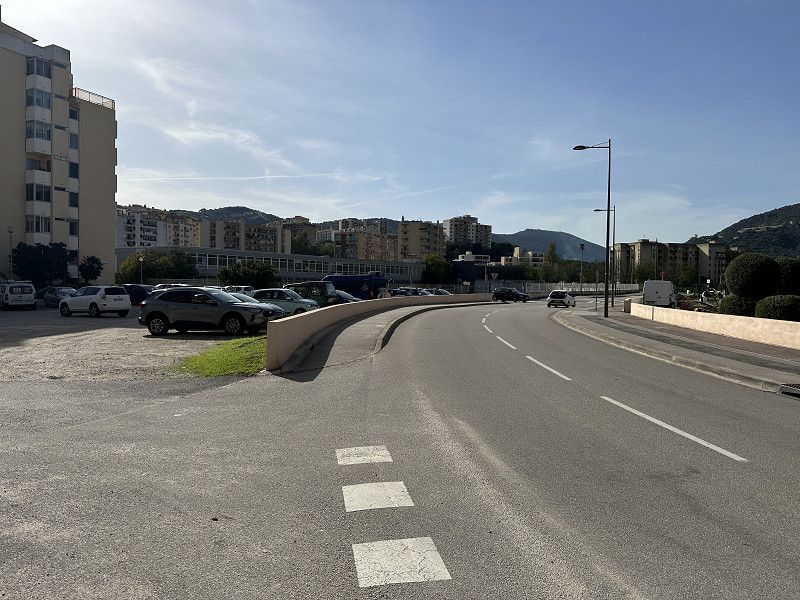
Sankt Georgen
On the way on vacation the grandchildren are looked after ;.).
Baden-Württemberg, Deutschland
47° 58' 52.9" N 7° 48' 7.5" E
47.9813688 7.8020860
• Head toward Hartkirchweg on Ittnerstraße. Go for 126 m.
• Turn right onto Hartkirchweg. Go for 88 m.
• Turn right onto Schulstraße. Go for 283 m.
• Turn left onto Basler Landstraße. Go for 619 m.
• Continue on Tiengener Straße. Go for 1.2 km.
• Take the 2nd exit from roundabout onto Tiengener Straße (B31) toward Mulhouse/Colmar/Breisach/Fr-Tiengen/Keidel-Mineral-Thermalbad. Go for 3.3 km.
• Take ramp onto A5 toward Basel. Go for 6.3 km.
• Take exit 64A toward Bad Krozingen/Staufen/Münstertal/Colmar/Breisach. Go for 216 m.
• Turn right onto B31 toward Bad Krozingen/Münstertal/Staufen/Ehrenkirchen. Go for 234 m.
• Continue on L120 toward Bad Krozingen/Staufen. Go for 2.9 km.
• Turn right onto K4939 toward Tunsel/Schlatt. Go for 712 m.
• Take the 3rd exit from roundabout onto Thermenallee. Go for 1.3 km.
• Turn left toward Thürachstraße. Go for 139 m.
• Continue on Thürachstraße. Go for 62 m.
• Arrive at Thürachstraße. Your destination is on the right.
☍
17,5 km
( 17 min.)
Day
Day
Vita-Classica-Therme
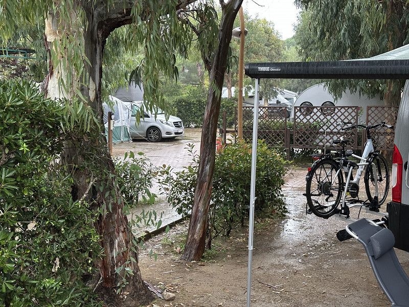
Now things really get going with a small start (12 km). The travel friends come from Cologne and the parking spot is a good meeting point near the motorway. Of course, you could also have spent time in the thermal baths. The parking spot is OK, slightly downhill.
Thürachstraße, Bad Krozingen, Landkreis Breisgau-Hochschwarzwald, Baden-Württemberg, Deutschland
47° 55' 7.3" N 7° 41' 22.8" E
47.9186947 7.6896751
• Head southwest on Thürachstraße. Go for 62 m.
• Continue toward Thermenallee. Go for 139 m.
• Turn right onto Thermenallee. Go for 1.2 km.
• Take the 1st exit from roundabout onto K4939. Go for 721 m.
• Turn left onto L120. Go for 2.9 km.
• Continue on B31. Go for 234 m.
• Turn left and take ramp onto A5 toward Basel. Go for 47.9 km.
• Continue on A2. Go for 14.1 km.
• Keep right onto A2 (Verzweigung Augst) toward Chiasso/Gotthard/Luzern/Bern/Arisdorf. Go for 28.2 km.
• Take the left exit toward Chiasso/Gotthard/Luzern/Zürich/Rothrist onto A1/A2. Go for 8.8 km.
• Take exit 47 toward Chiasso/Gotthard/Luzern/Reiden onto A2 (Verzweigung Wiggertal). Go for 108 km.
• Take exit 39 toward Wassen/Interlaken/Sustenpass. Go for 172 m.
• Turn right onto Gotthardstrasse (2) toward Lugano/Gotthard/Wassen/Sustenpass/Interlaken. Go for 835 m.
• Continue on Gotthardstrasse (2). Go for 4.1 km.
• Take the 1st exit from roundabout toward Lugano/Gotthard/Zürich/Luzern. Go for 184 m.
• Take ramp onto A2 toward Gotthard/Lugano/Airolo. Go for 96.6 km.
• Take exit 49 toward Ponte Tresa/Aeroporto. Go for 2.3 km.
• Turn left onto Via Cantonale (398). Go for 1.4 km.
• Keep right onto Strada Regina (398). Go for 619 m.
• Take the 2nd exit from roundabout onto Strada Regina (398). Go for 2.1 km.
• Turn left onto Piazza Colonnello Vicari (399). Go for 541 m.
• Take the 1st exit from roundabout onto Via Lugano (399). Go for 69 m.
• Turn right onto Via Molinazzo. Go for 259 m.
• Continue straight ahead. Go for 79 m.
• Make a U-Turn. Go for 79 m.
• Turn right. Go for 95 m.
• Turn left. Go for 15 m.
• Arrive at your destination on the left.
☍
321,3 km
(3 hrs. 28 min.)
Day
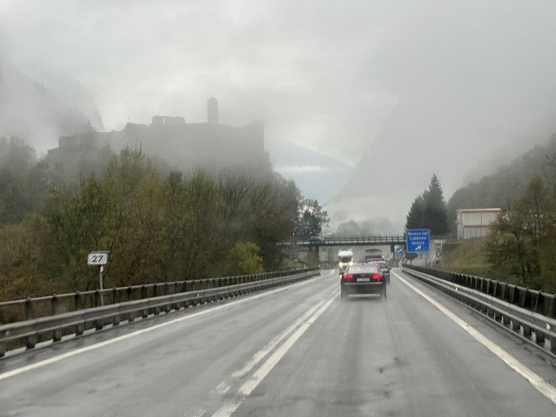
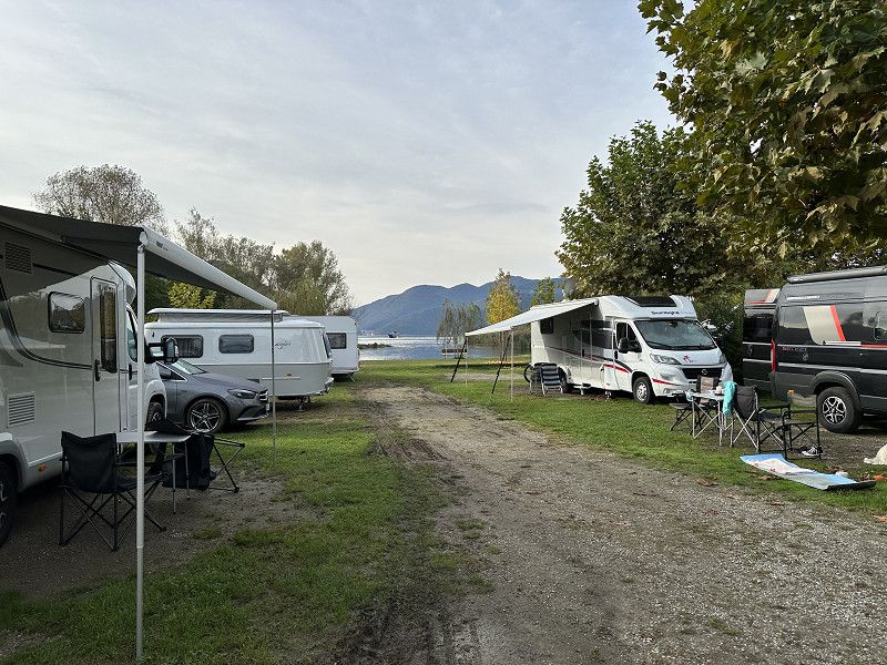
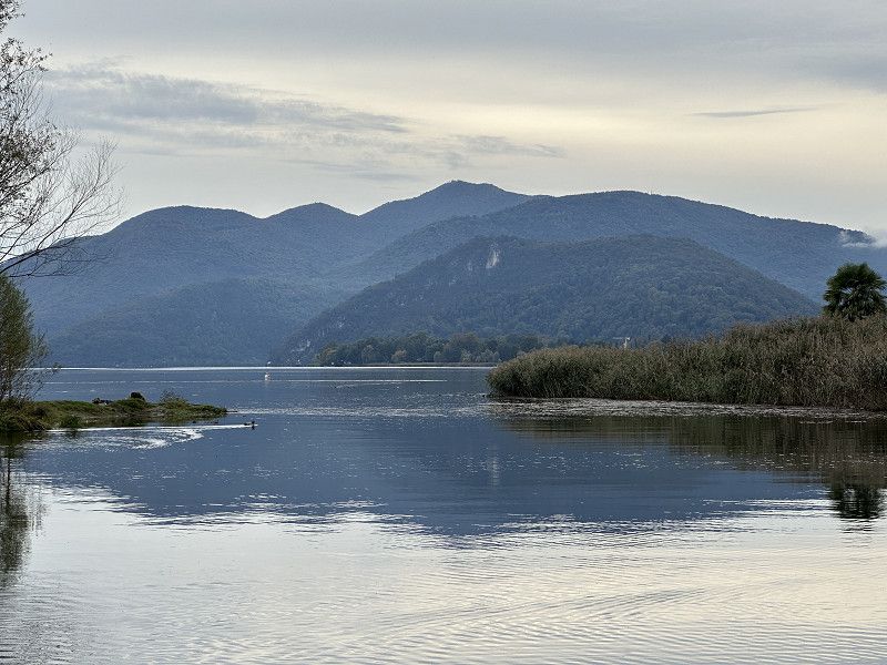
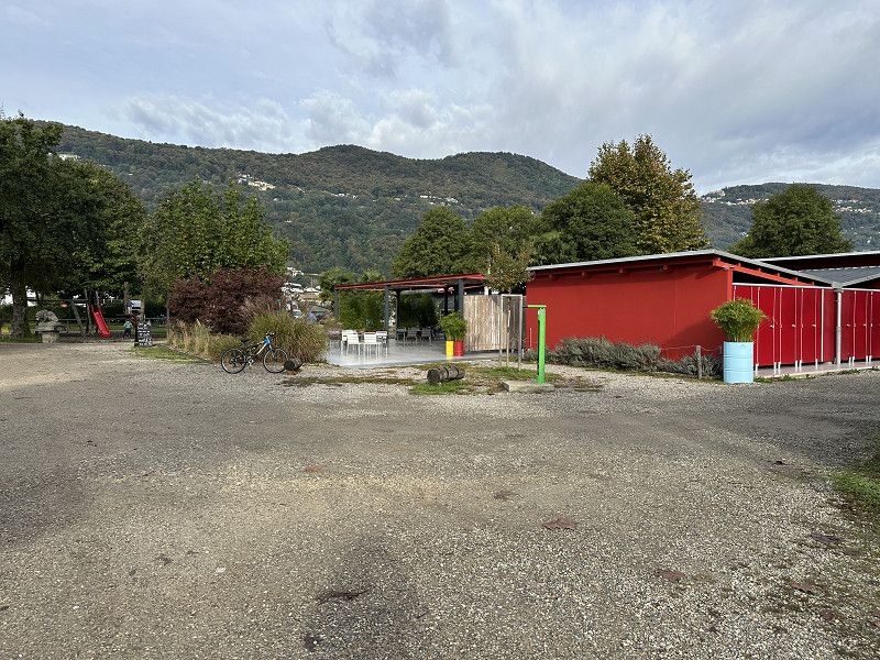
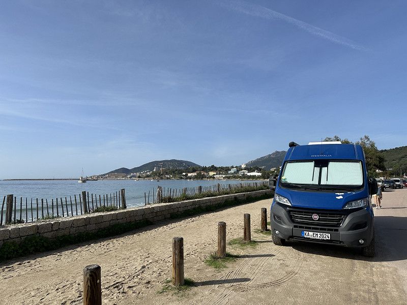
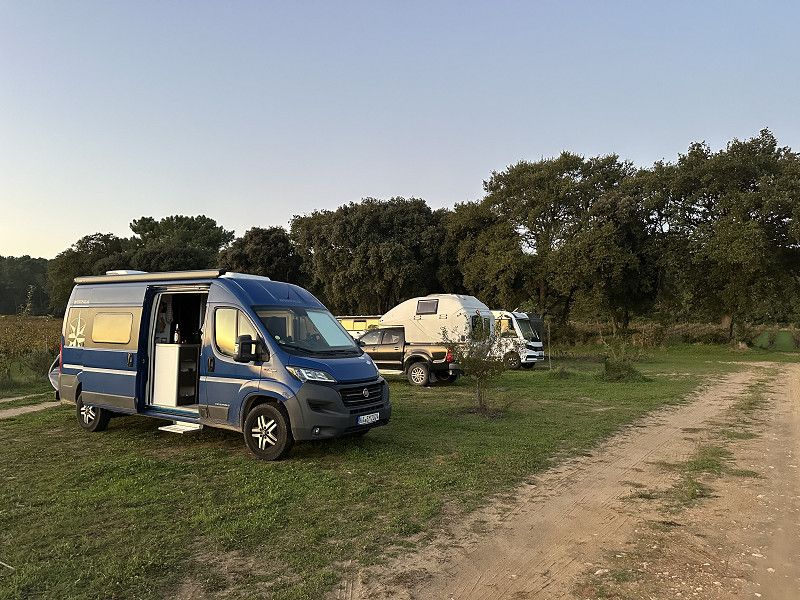
Camping Lugano Lake
One of many campsites on Lake Lugano. Not cheap, but all in the area cost the same. Sanitary facilities etc. were OK. In the suburb there was an Aldi and 3-4 restaurants. The steak restaurant was very good, but not cheap (SFR)
Via Molinazzo 9, 6982, Agno, Switzerland
45° 59' 44.7" N 8° 54' 24.6" E
45.9957600 8.9068300
• Head south. Go for 15 m.
• Turn right. Go for 95 m.
• Turn left. Go for 79 m.
• Make a U-Turn. Go for 79 m.
• Continue on Via Molinazzo. Go for 259 m.
• Turn right onto Via Lugano (399). Go for 1.7 km.
• Take the 2nd exit from roundabout onto Via al Laghetto (399). Go for 1.1 km.
• Turn right onto Via Paradiso (399). Go for 1.1 km.
• Turn right onto Via Clemente Maraini (2). Go for 283 m.
• Turn right toward Lugano Sud. Go for 594 m.
• Continue on Lugano Sud toward Milano/Chiasso. Go for 25 m.
• Keep right toward Milano/Chiasso. Go for 82 m.
• Continue on Lugano Sud. Go for 95 m.
• Keep left onto Lugano Sud toward Milano/Chiasso. Go for 173 m.
• Continue on Lugano Sud. Go for 169 m.
• Take ramp onto A2 toward Milano/Chiasso. Go for 22.7 km.
• Continue on A9 (Autostrada dei Laghi). Go for 31.0 km.
• Take the left exit onto A8 (Autostrada dei Laghi). Go for 5.1 km.
• Take the exit toward E64/Torino/A4/Genova/A7/Bologna/A1 onto A50 (Tangenziale Ovest). Go for 32.1 km.
• Continue on A1 (Autostrada del Sole). Go for 96.2 km.
• Take the exit toward Parma Ovest/La Spezia onto A15 (Autostrada della Cisa). Go for 100 km.
• Take the exit toward Firenze/A11/E76/Livorno onto A12 (Autostrada Azzurra). Go for 116 km.
• Continue on Strada Statale Aurelia (SS1). Go for 26.8 km.
• Take ramp toward S.Vincenzo Nord/Piombino/S. Vincenzo. Go for 326 m.
• Turn left onto Via Aurelia Nord (SP39) toward Piombino/S. Vincenzo. Go for 873 m.
• Pass 3 roundabouts and continue on Via Giacomo Matteotti (SP39). Go for 1.3 km.
• Take the 1st exit from roundabout onto Via Roma. Go for 184 m.
• Continue toward Via della Principessa/SP23. Go for 29 m.
• Take the 2nd exit from Largo Berlese roundabout. Go for 76 m.
• Continue on Via della Principessa (SP23). Go for 7.2 km.
• Take the 1st exit from roundabout onto Strada Provinciale della Principessa (SP23). Go for 1.7 km.
• Turn left onto Località Sant'Albinia. Go for 14 m.
• Turn left onto Località Sant'Albinia. Go for 278 m.
• Arrive at Località Sant'Albinia. Your destination is on the left.
☍
448,1 km
(4 hrs. 22 min.)
Day
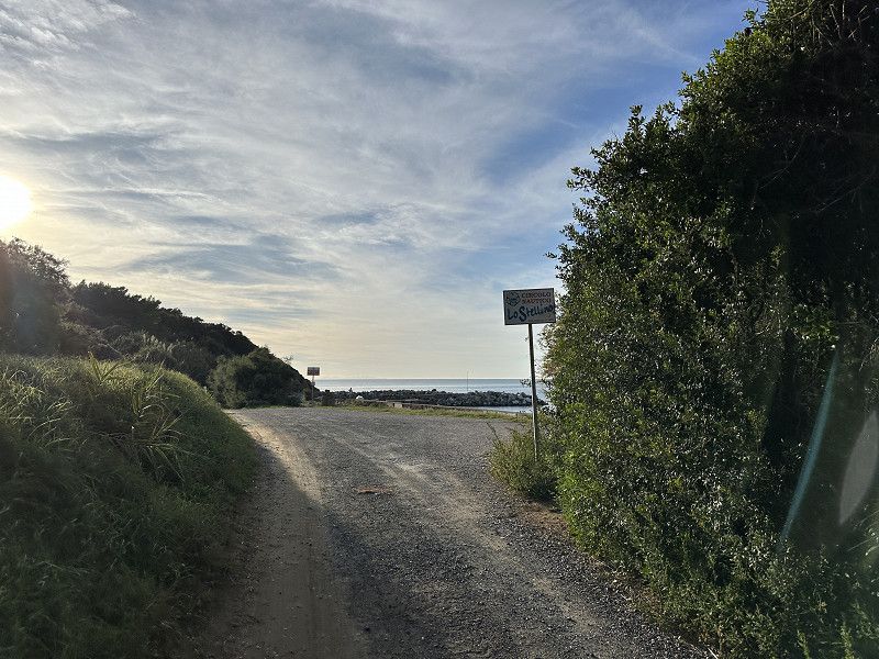
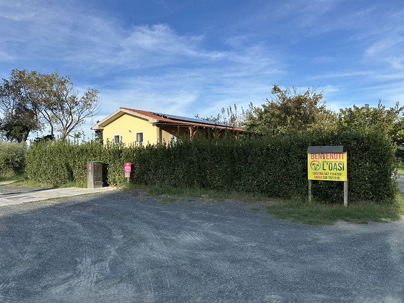
Agricampeggio Oasi
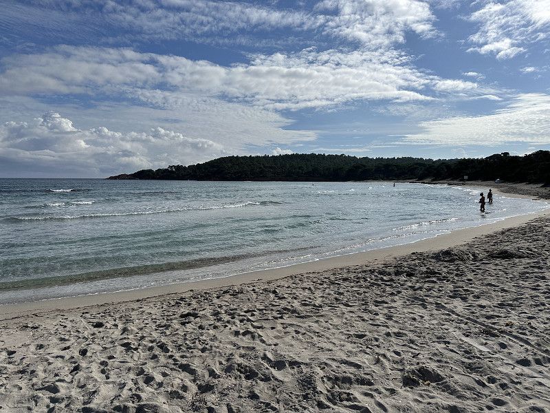
Nice campsite on the way to Elba. Beach about 10 minutes walk away. Nice shady spots with electricity. Ferry to Elba is also about 15 minutes away.
Localita Sant Albinia 11, Piombino, Livorno, Toskana, Italien
43° 0' 56.8" N 10° 31' 31.5" E
43.0157698 10.5254109
• Head toward Località Le Scope on Località Sant'Albinia. Go for 278 m.
• Turn right onto Località Sant'Albinia. Go for 14 m.
• Turn left onto Località Torrenuova (SP23). Go for 1.8 km.
• Take the 2nd exit from roundabout onto Via della Principessa (SP23). Go for 4.5 km.
• Keep right onto Località Asca (SP23). Go for 1.0 km.
• Take the 2nd exit from roundabout onto Località Gagno (SP23). Go for 994 m.
• Continue on Viale dell'Unità d'Italia. Go for 365 m.
• Pass 2 roundabouts and continue on Viale dell'Unità d'Italia. Go for 1.8 km.
• Continue on Viale dell'Unità d'Italia. Go for 82 m.
• Continue on Viale della Repubblica. Go for 408 m.
• Continue on Via Niccolò Copernico. Go for 202 m.
• Turn left onto Via Leonardo da Vinci. Go for 93 m.
• Turn slightly left onto Piazza Thomas Alva Edison. Go for 62 m.
• Turn right onto Piazza Giuseppe Verdi. Go for 29 m.
• Turn right onto Piazza Licurgo Cappelletti. Go for 38 m.
• Turn slightly right onto Piazza Licurgo Cappelletti. Go for 9 m.
• Turn slightly left onto Corso Vittorio Emanuele II. Go for 37 m.
• Turn right onto Via Giuseppe Garibaldi. Go for 22 m.
• Arrive at Via Giuseppe Garibaldi. Your destination is on the right.
☍
11,7 km
( 14 min.)
Day
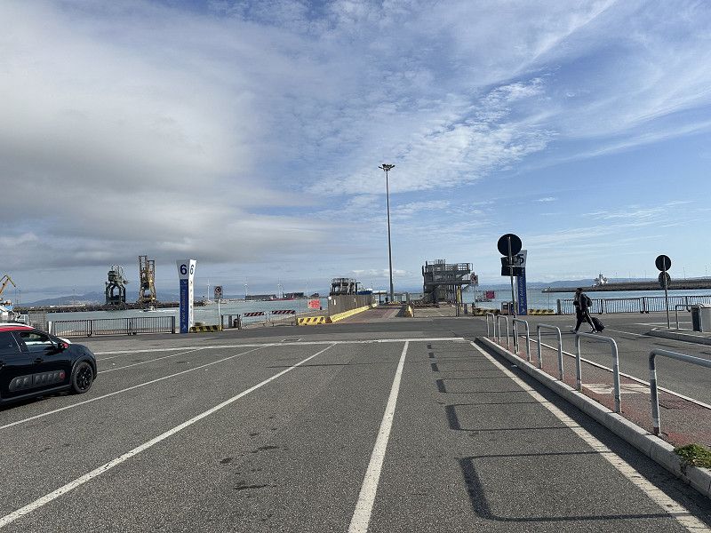
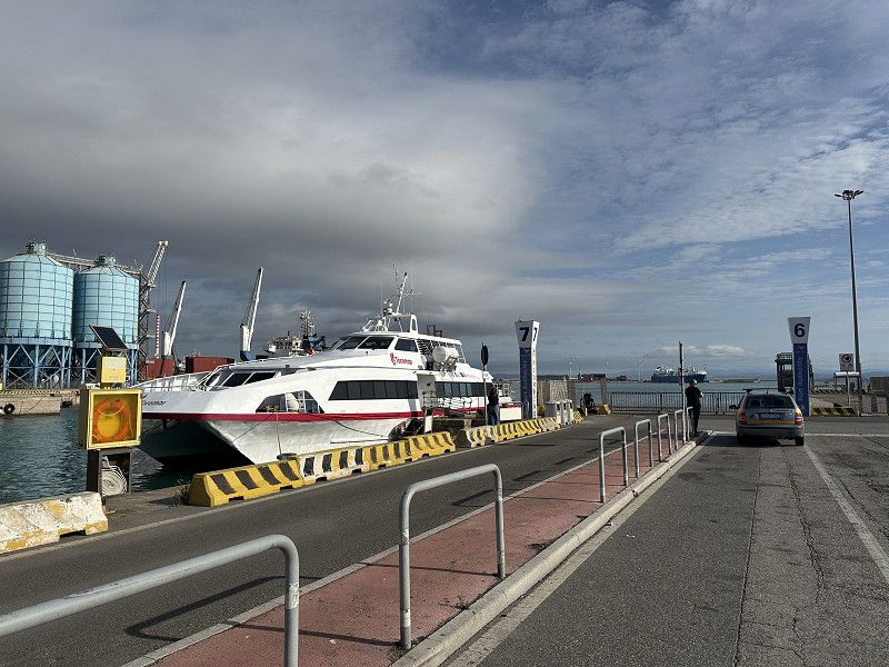
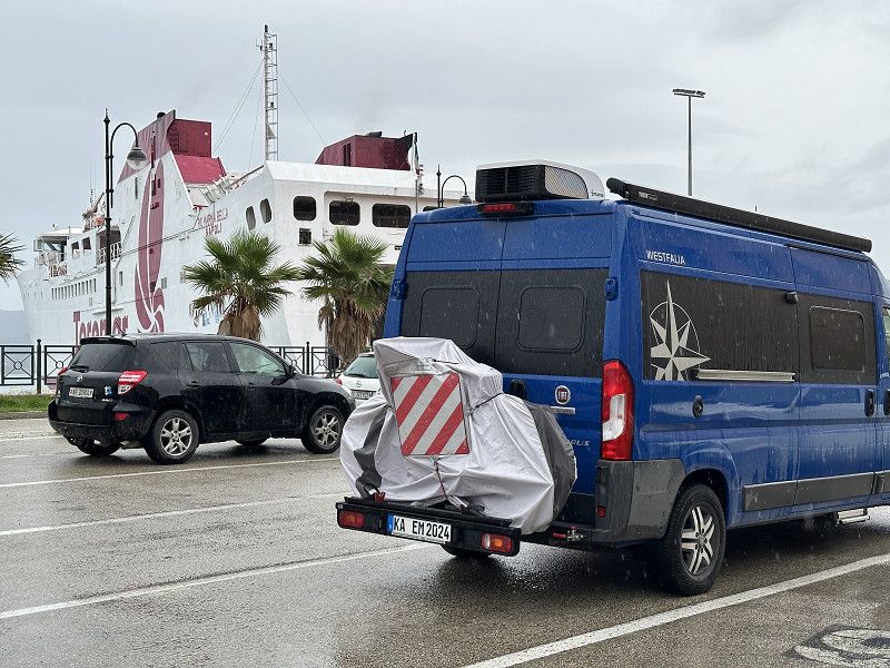
Departure port: Piombino
Livorno, Toskana, Italien
42.9231662 10.5268192
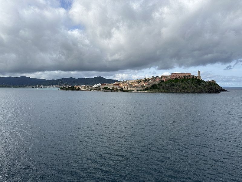
Arrival port: Portoferraio
Livorno, Toskana, Italien
42.813627610.319152
• Head toward Piazzale P. Harris on Via P. del Buono. Go for 146 m.
• Continue on Via P. del Buono. Go for 154 m.
• Turn right onto Viale T. Tesei (SP24). Go for 269 m.
• Take the 3rd exit from roundabout onto Via Cementiera (SP24). Go for 524 m.
• Take the 2nd exit from roundabout onto Strada Provinciale Portoferraio Bivio Boni (SP24). Go for 836 m.
• Take the 2nd exit from roundabout onto Strada Provinciale Bivio Boni Cavo (SP26). Go for 997 m.
• Turn right onto Via Casa del Duca. Go for 463 m.
• Turn right onto Via Colle Reciso. Go for 4.6 km.
• Take the 2nd exit from roundabout onto Via Capo ai Pini. Go for 330 m.
• Take the 1st exit from roundabout onto Via del Margidore (SP30). Go for 1.7 km.
• Turn left onto Via del Mare. Go for 92 m.
• Turn left onto Via del Mare. Go for 19 m.
• Arrive at Via del Mare. Your destination is on the right.
☍
Distance not available
(Duration not available)
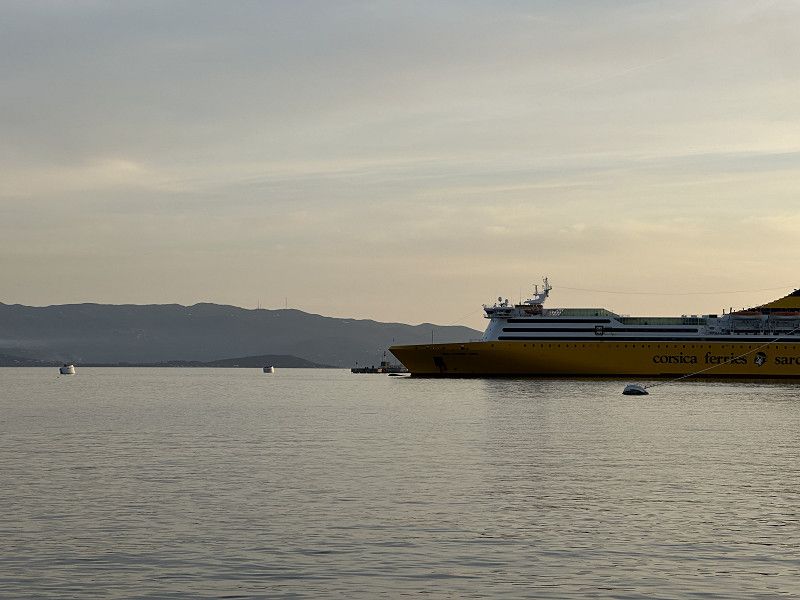
Fährfahrt
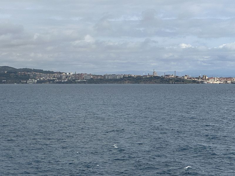
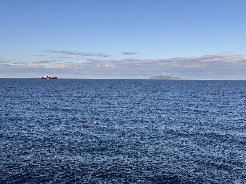
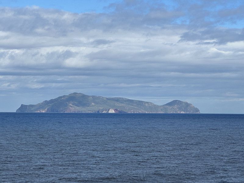
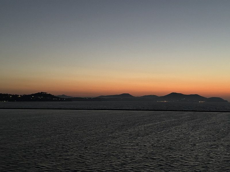
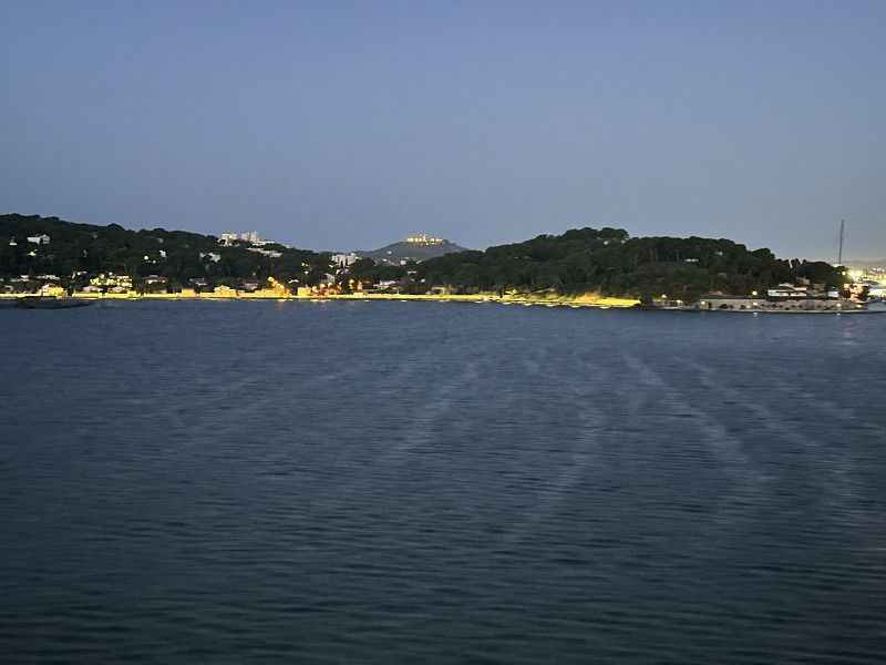
The ferry from Piombino to Portoferraio takes about 1 hour and offers a beautiful view of the north side of the island
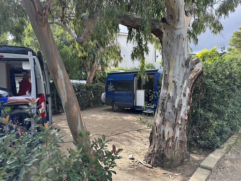
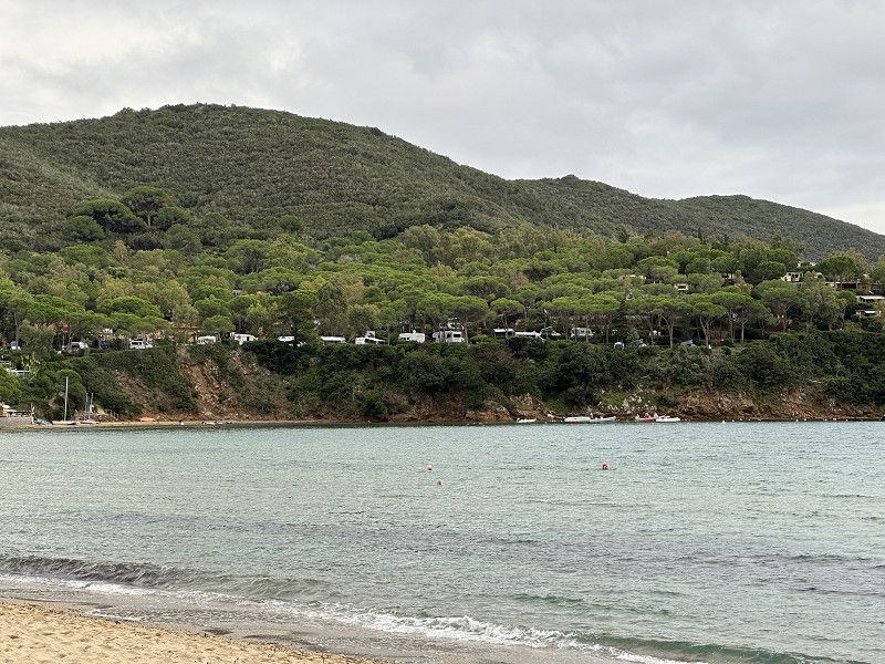
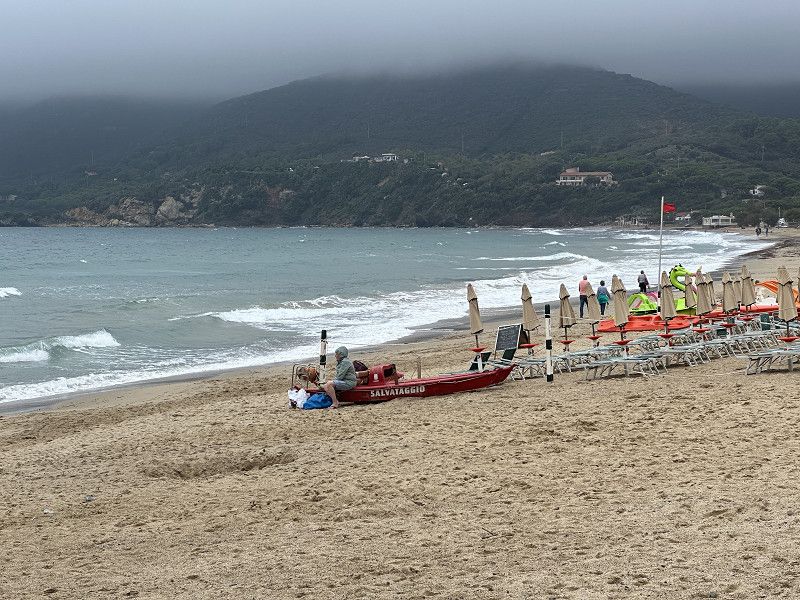
Camping Valle Santa Maria
Nice campsite right on the beach. 90% Swiss, 10% German, 1 family from Italy. Autumn holidays. The prices in the restaurants were OK, campsite quite expensive.
Via Del Mare 91 D, Capoliveri, Livorno, Italien
42° 45' 39.1" N 10° 18' 7.5" E
42.7608677 10.3020962
• Head west on Via del Mare. Go for 19 m.
• Turn right onto Via del Mare. Go for 92 m.
• Turn right onto Viale dei Golfi (SP30). Go for 1.7 km.
• Take the 3rd exit from roundabout onto Via Capo ai Pini. Go for 331 m.
• Take the 1st exit from roundabout onto Via Colle Reciso. Go for 4.6 km.
• Turn left onto Via Casa del Duca. Go for 463 m.
• Turn left onto Strada Provinciale Bivio Boni Cavo (SP26). Go for 915 m.
• Take the 1st exit from roundabout onto Strada Provinciale Portoferraio Bivio Boni (SP24). Go for 780 m.
• Pass 2 roundabouts and continue on Viale T. Tesei (SP24). Go for 814 m.
• Turn left onto Via P. del Buono. Go for 217 m.
• Continue on Via P. del Buono. Go for 83 m.
• Arrive at Via P. del Buono. Your destination is on the left.
☍
10,0 km
( 16 min.)
Day
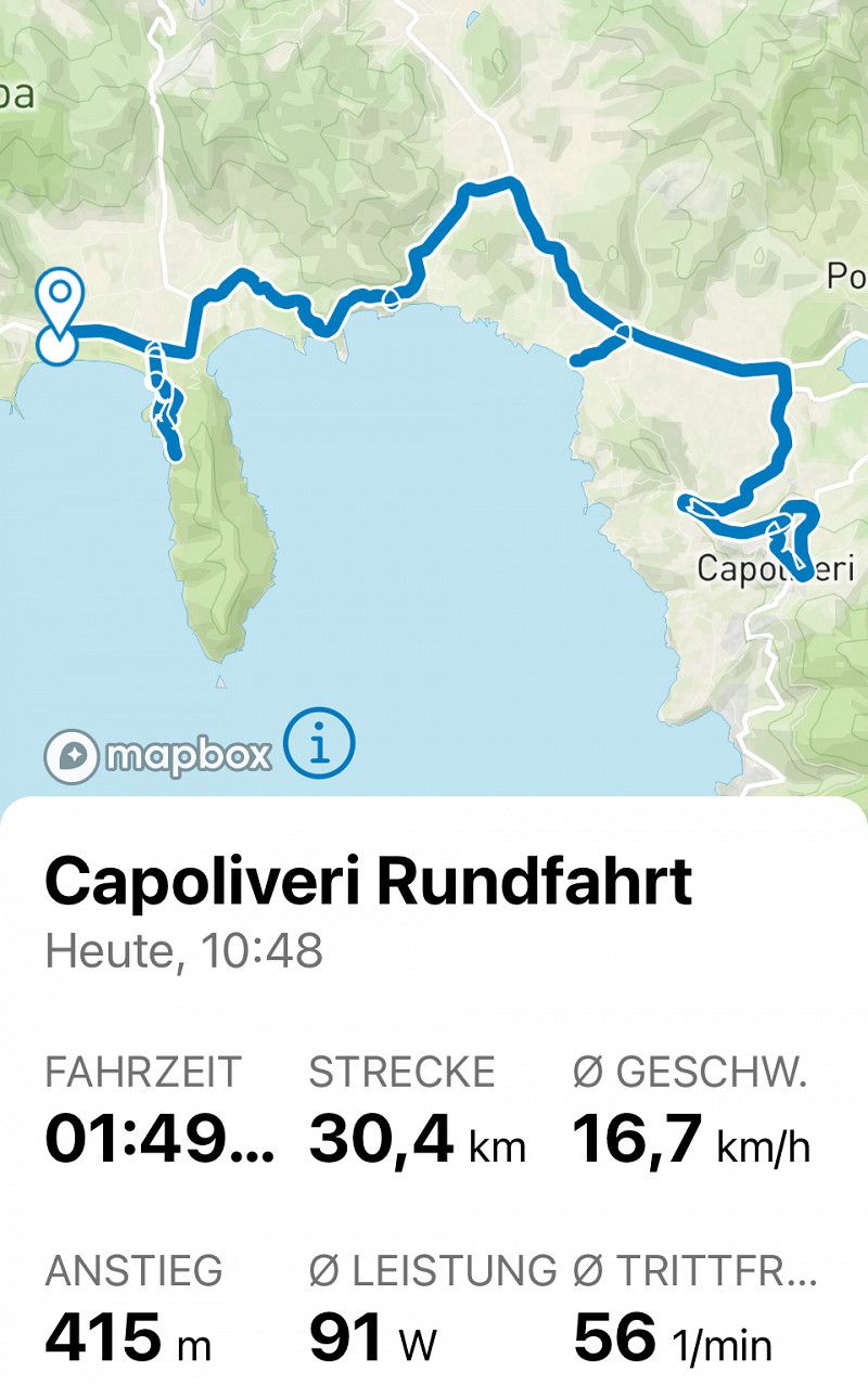
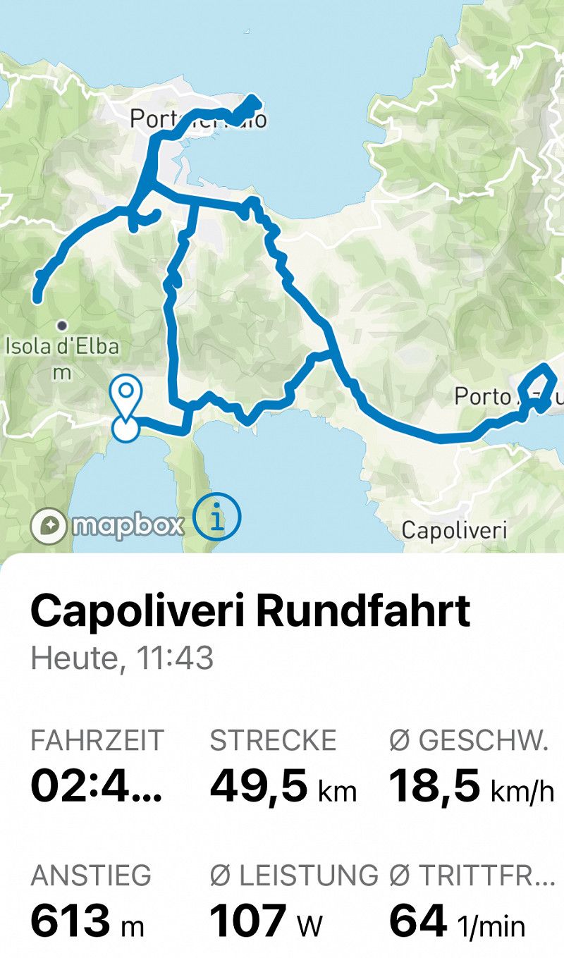
E-Bike Tour
I initially chose a mountain bike tour in Komoot that was supposed to be "moderately difficult". But it was too narrow and had a drop. I went to Campolieveri instead.
Day
Regentag
Time used to re-plan something
Day
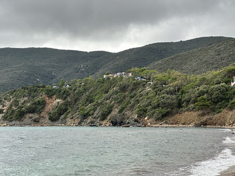
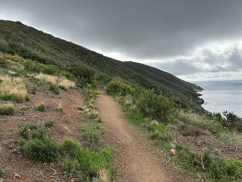
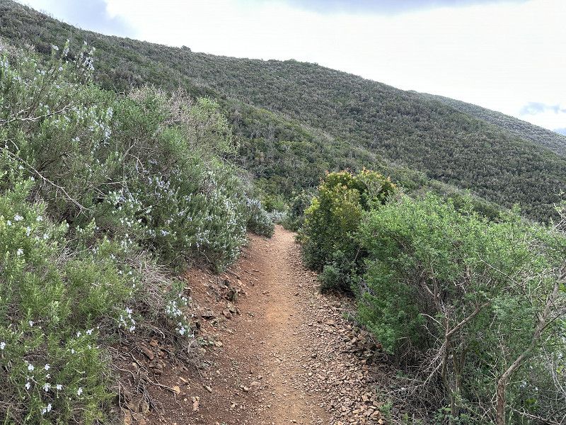
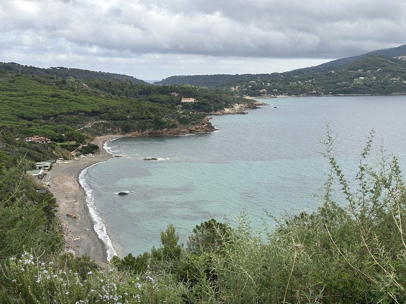
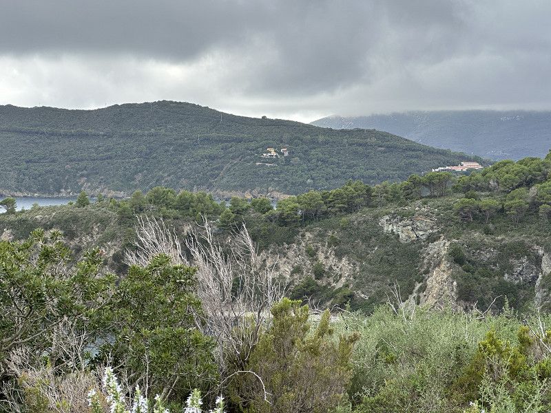
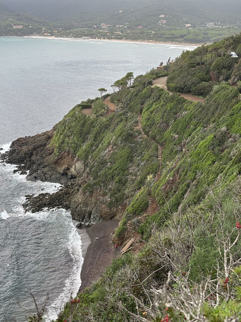
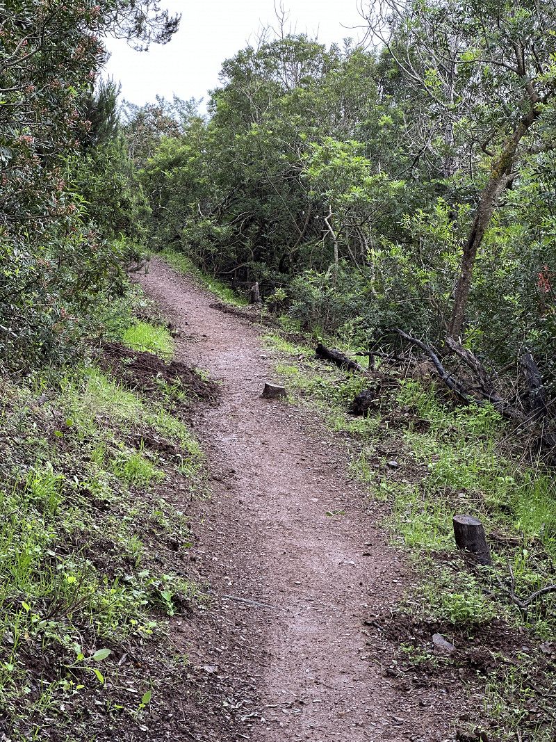
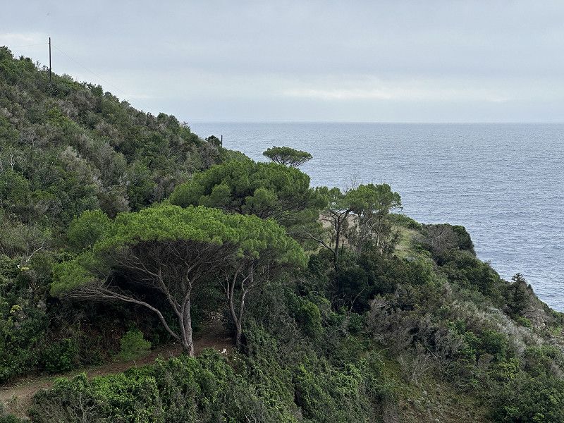
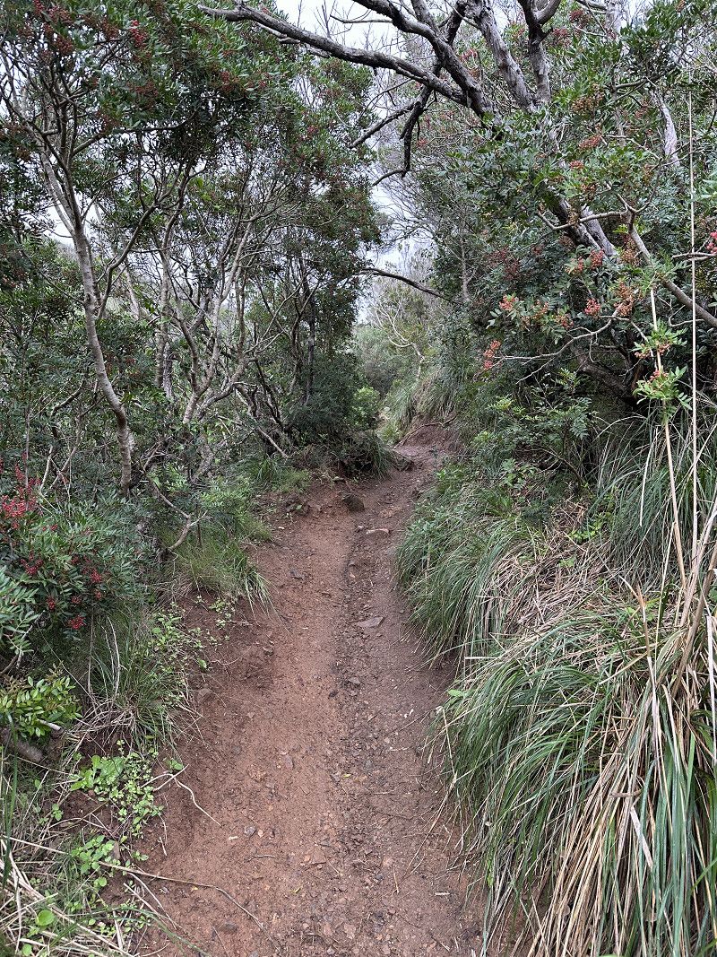
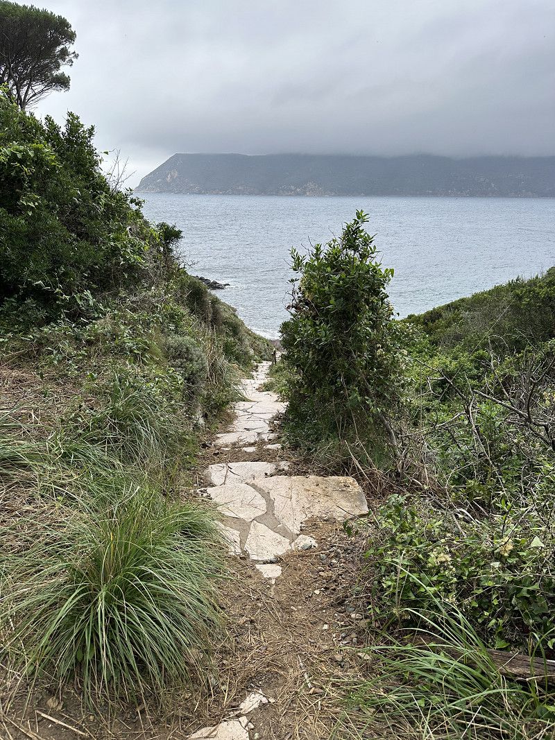
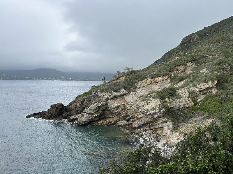
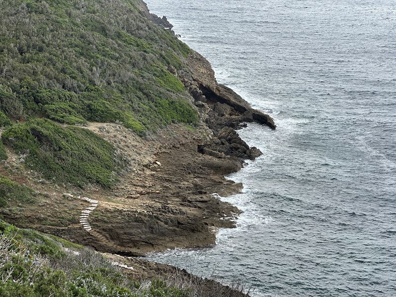
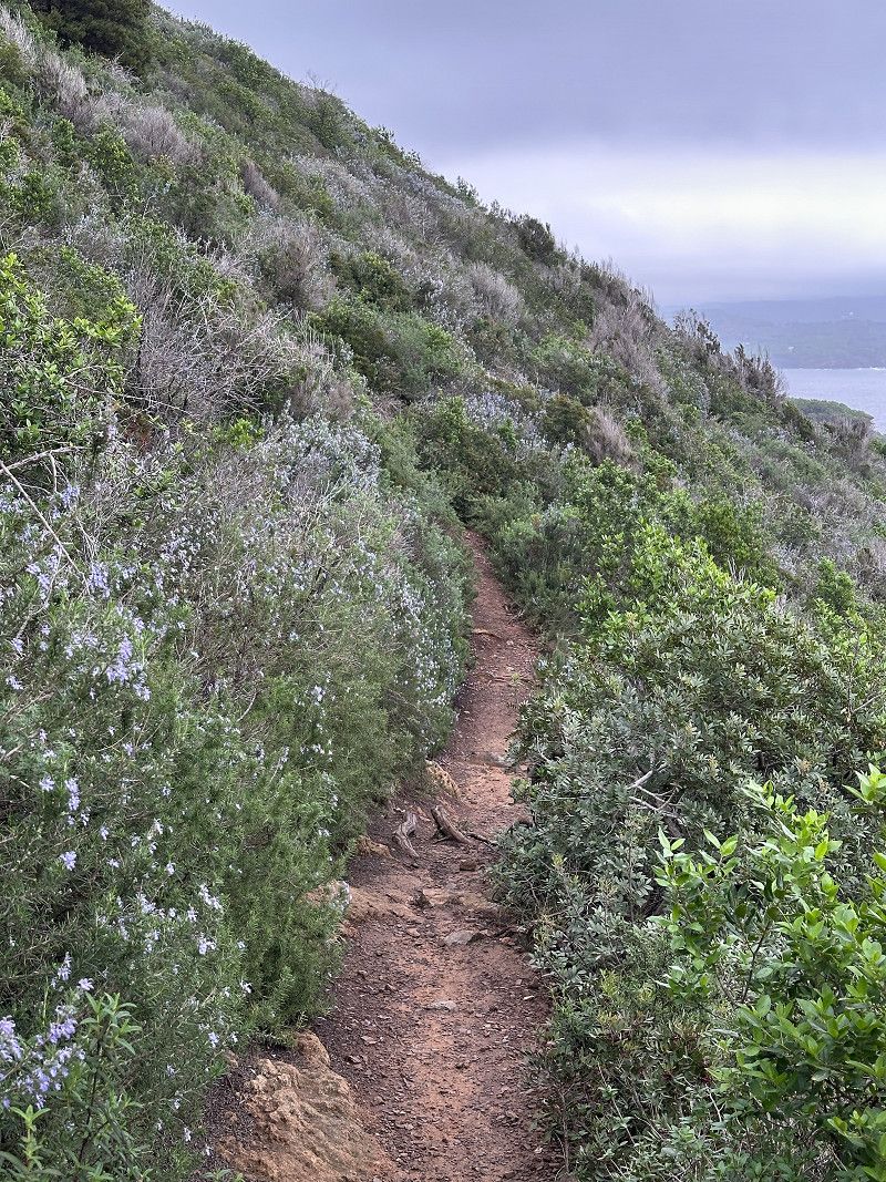
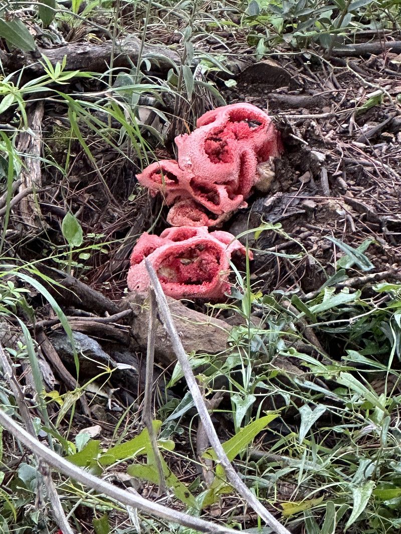
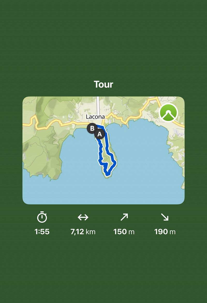
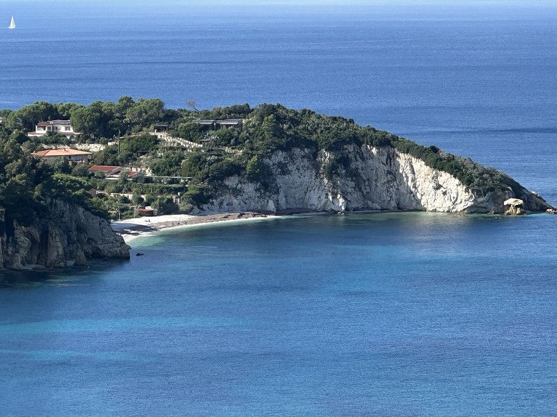
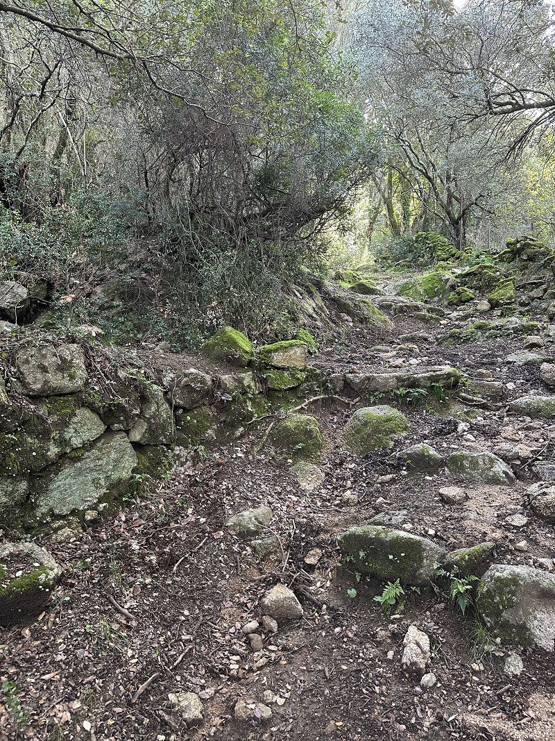
Wanderung zur Capo di Stella
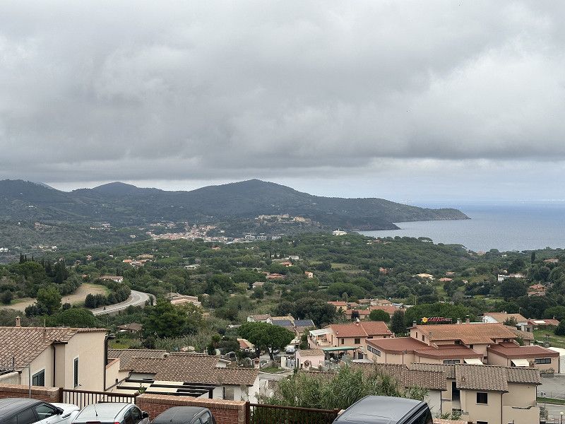
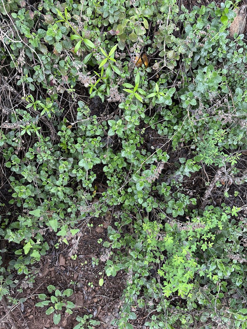
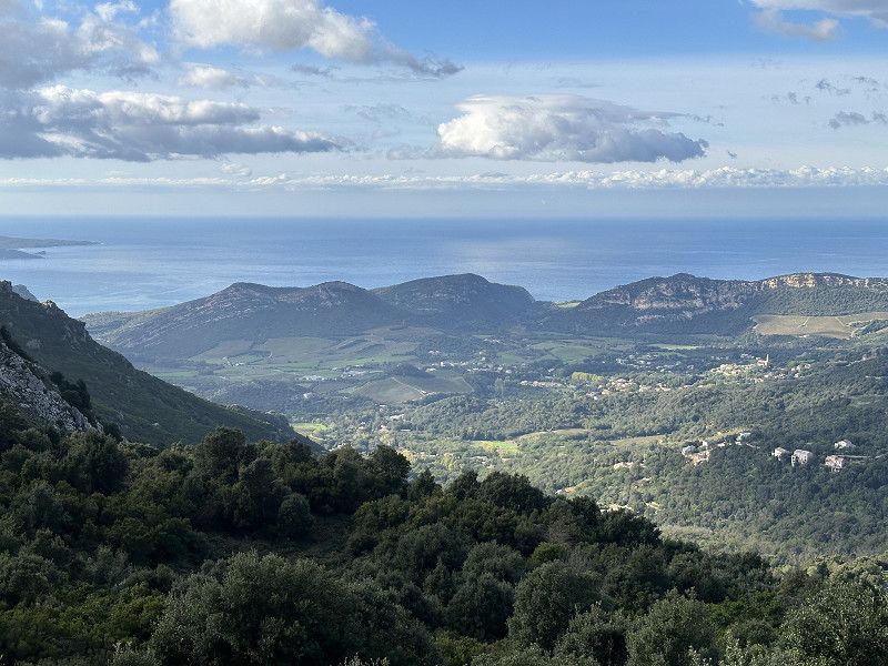
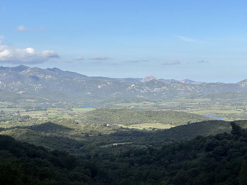
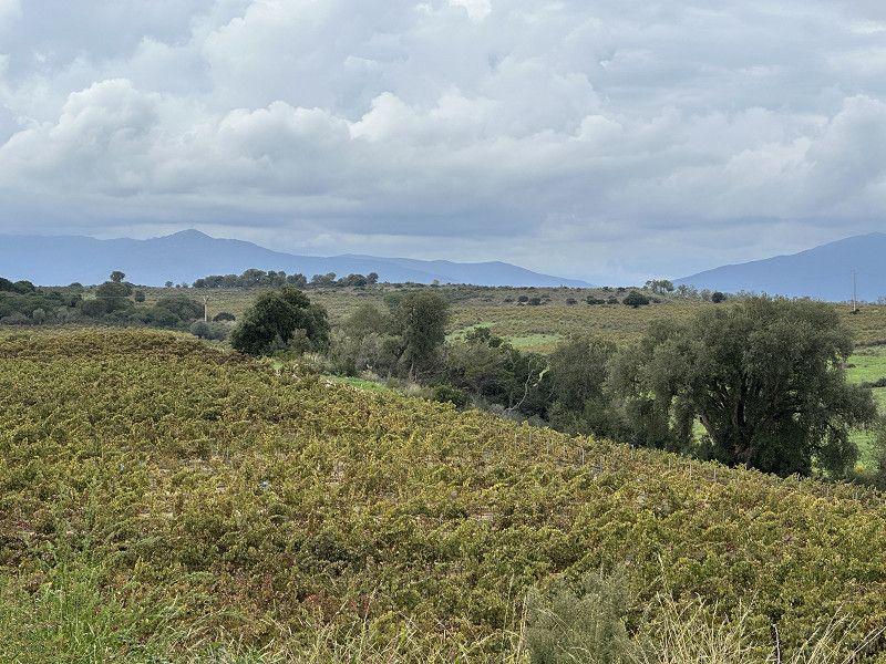
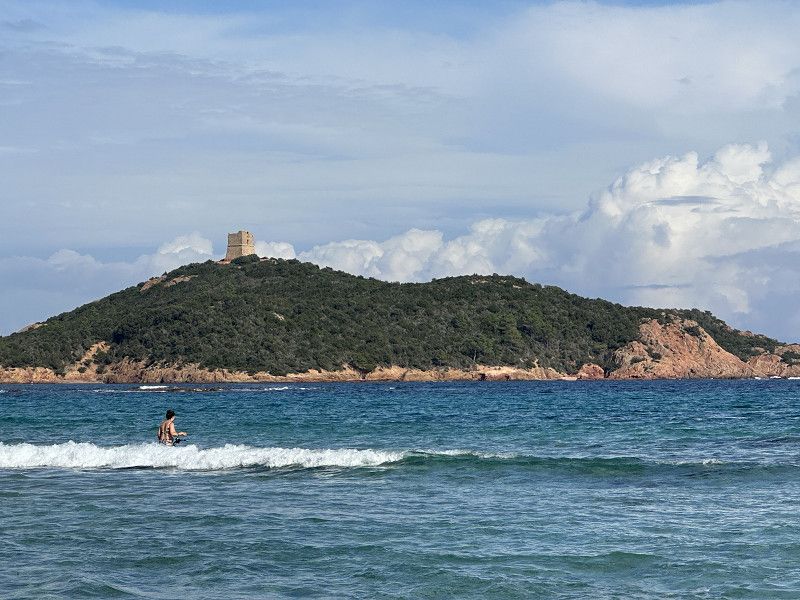
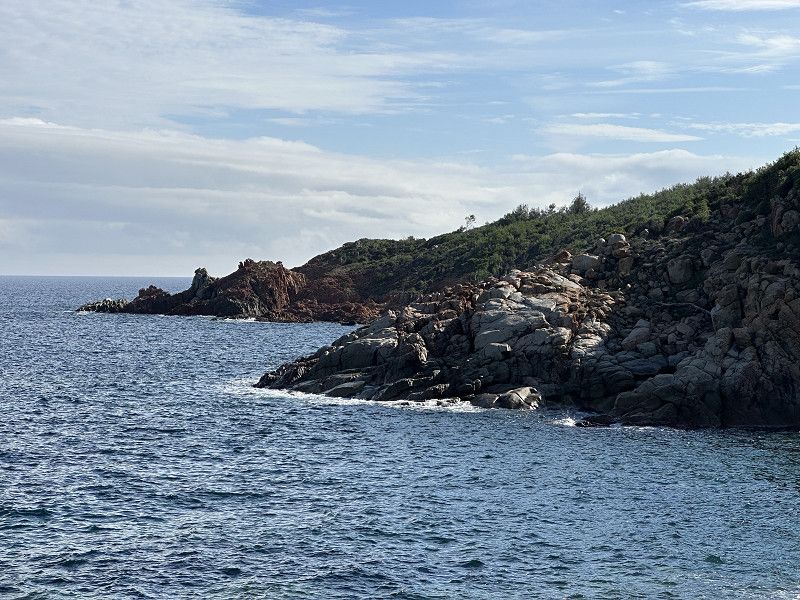
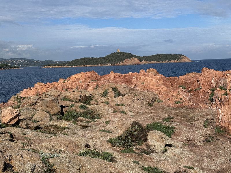
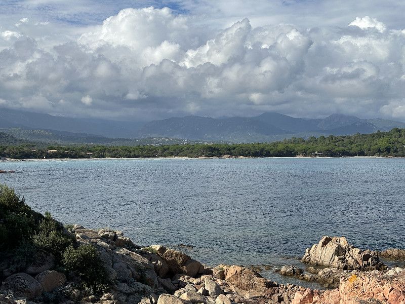
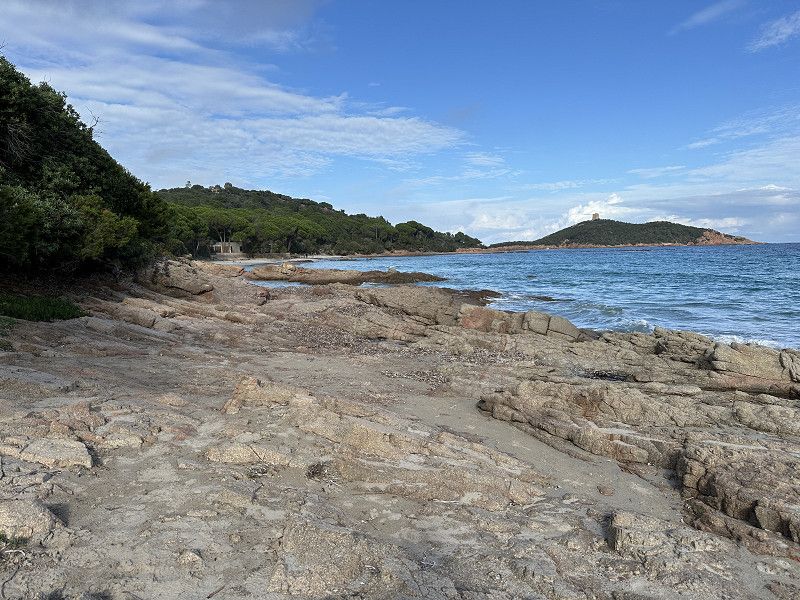
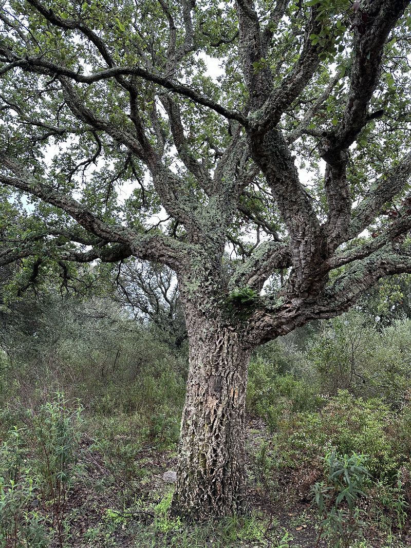
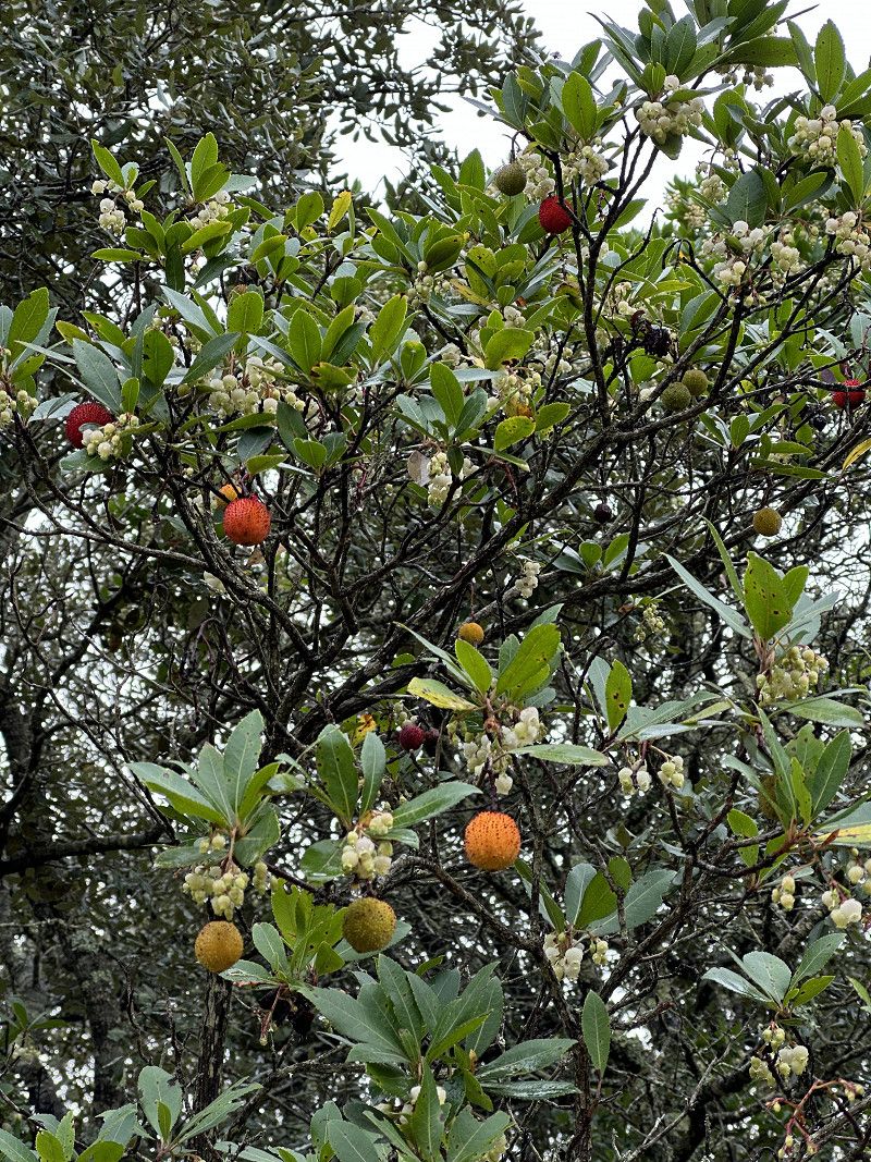
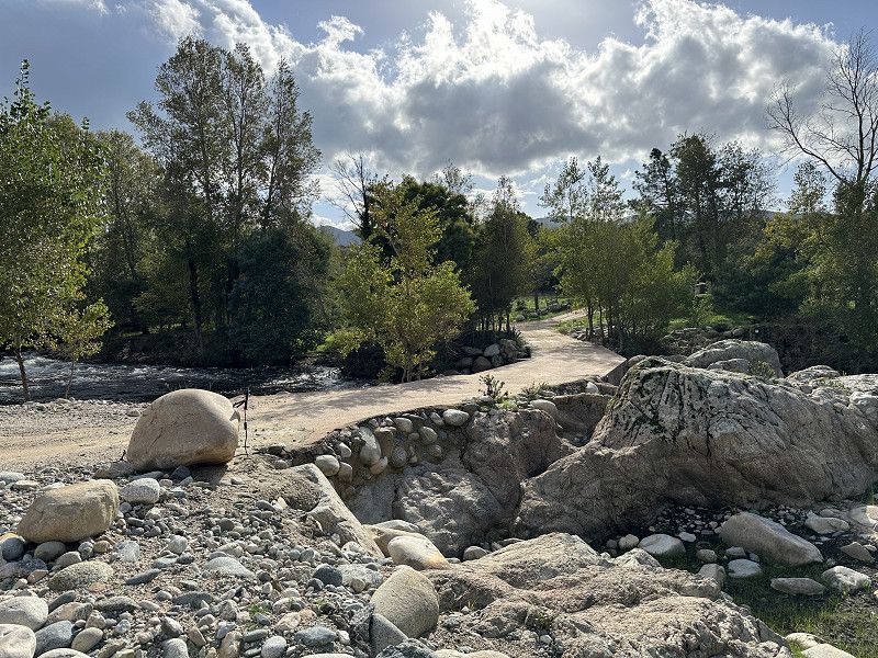
Tried it the day before yesterday as a mountain bike tour, but it was much better than a hiking trail. Very beautiful views and lots of flora. You could collect oregano, rosemary, allspice, sage and other fresh herbs. The weather held until the evening.
Allgemein
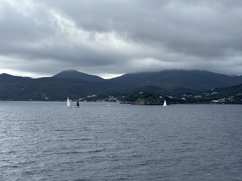
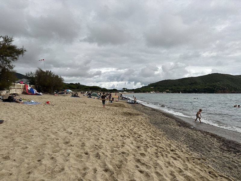
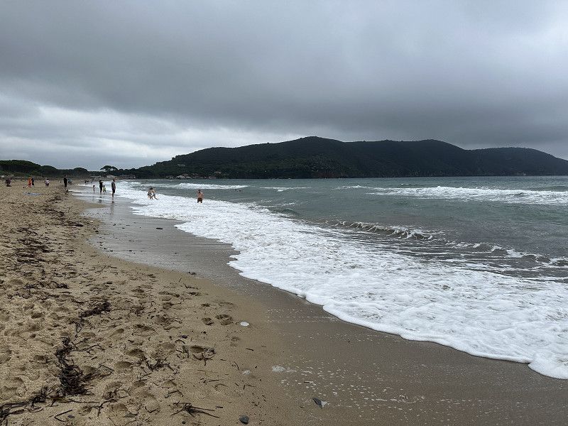
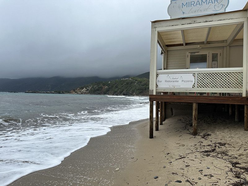
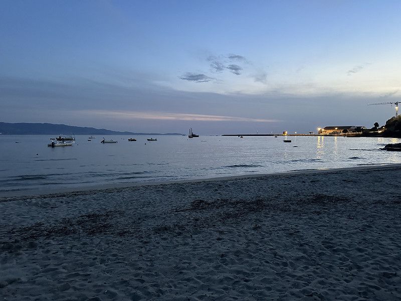
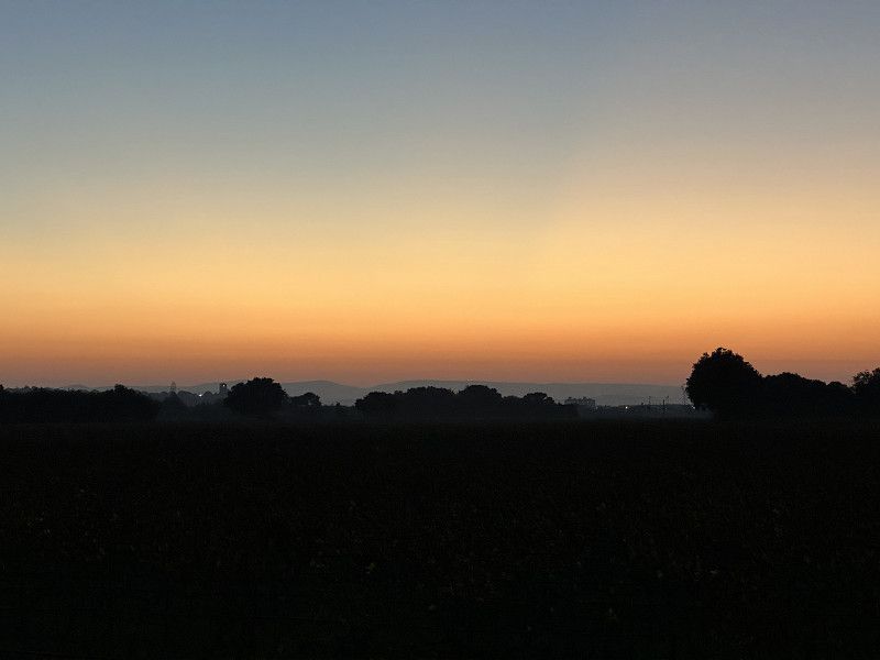
October 17th. The first campsites are closing. Due to the weather forecast, many Swiss people have left in the last few days. It was already cloudy, but still 22 degrees. Many people were still in the water, but the locals everywhere are getting ready to roll up the sidewalks soon ;-).
Day
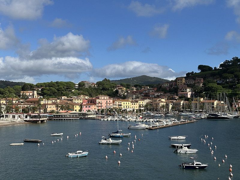
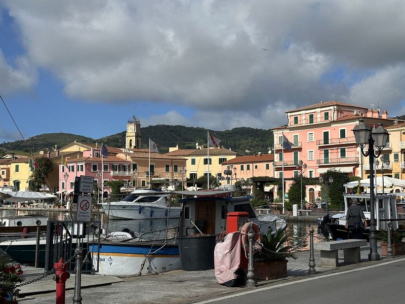
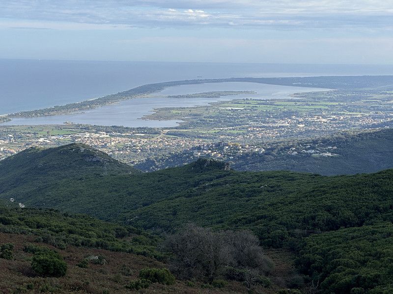
E-Bike Tour Porto Azzuro/Portoferraio
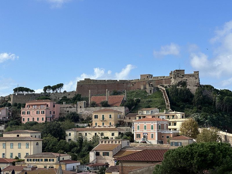
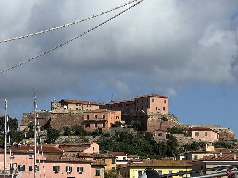
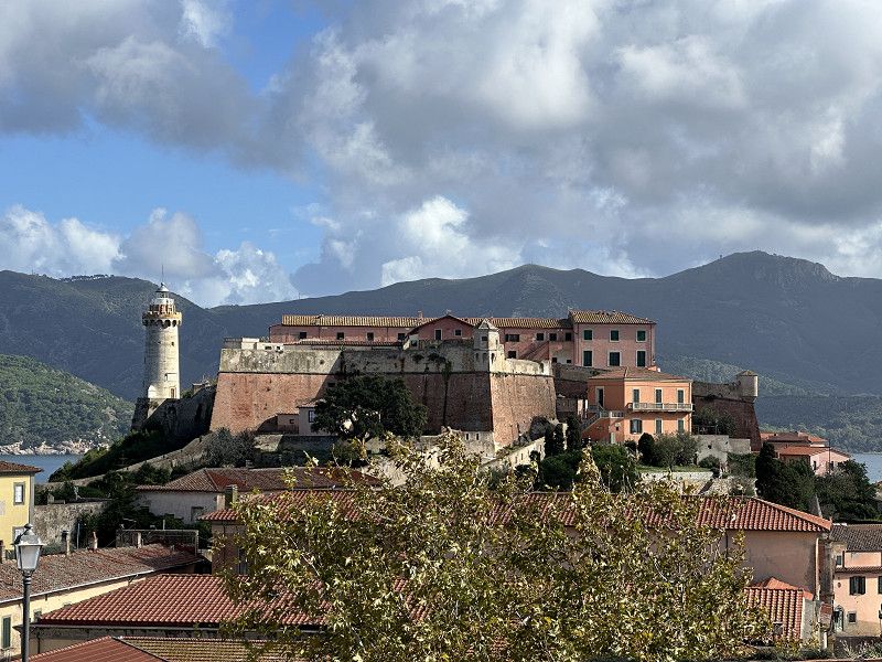
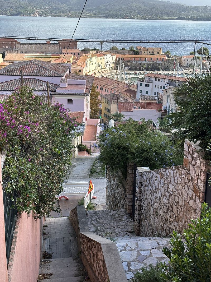
The weather was nice again. So I took the opportunity and cycled to Porto Azzuro and Portoferraio. Unfortunately, when I arrived, Napoleon's villa was already closed (9am-1.30pm). My app tried to guide me on a sometimes adventurous return route, but I arrived safely.
Day
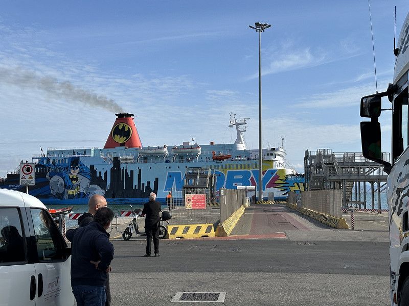
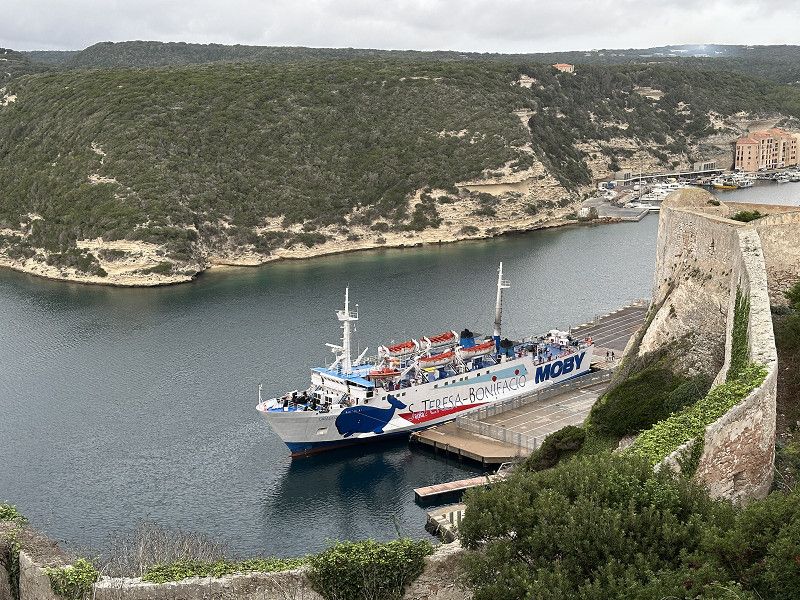
Moby Line
Departure port: Portoferraio
Livorno, Toskana, Italien
42.8136276 10.3191520
Arrival port: Piombino
Livorno, Toskana, Italien
42.923166210.5268192
• Head toward Corso Vittorio Emanuele II on Via Giuseppe Garibaldi. Go for 22 m.
• Turn left onto Corso Vittorio Emanuele II. Go for 37 m.
• Turn slightly right onto Piazza Licurgo Cappelletti. Go for 9 m.
• Turn slightly left onto Piazza Licurgo Cappelletti. Go for 38 m.
• Turn right onto Via Giordano Bruno. Go for 123 m.
• Turn left onto Via Eugenio Pavolini. Go for 79 m.
• Turn right onto Via Francisco Ferrer. Go for 20 m.
• Turn left onto Via Antonio Pacinotti. Go for 129 m.
• Take the 2nd exit from roundabout onto Via Giosuè Carducci. Go for 175 m.
• Turn right onto Via Carlo Pisacane. Go for 367 m.
• Take the 2nd exit from roundabout onto Via Felice Cavallotti. Go for 193 m.
• Continue on Viale della Resistenza. Go for 323 m.
• Turn right onto Viale dell'Unità d'Italia. Go for 850 m.
• Pass 2 roundabouts and continue on Viale dell'Unità d'Italia. Go for 1.3 km.
• Continue on Strada Provinciale della Principessa (SP23). Go for 951 m.
• Take the 2nd exit from roundabout onto Località Gagno (SP23). Go for 1.2 km.
• Keep right onto Strada Provinciale Fiorentina-Montegemoli (SP23bis) toward Venturina/S.G.C. Roma-Livorno. Go for 1.6 km.
• Turn left and take ramp onto Strada Statale della Val di Cornia (SS398) toward Venturina/Livorno/SS1/Roma. Go for 6.5 km.
• Take ramp onto Strada Statale Aurelia (SS1) toward Livorno. Go for 40.1 km.
• Continue on A12 (Autostrada Azzurra). Go for 39.2 km.
• Take the exit toward Livorno onto A12 (Autostrada Azzurra). Go for 4.1 km.
• Take the exit toward Firenze-Pisa-Livorno/E80/Collesalvetti/A12/Grosseto. Go for 677 m.
• Continue on Viadotto Stagno. Go for 1.3 km.
• Take left ramp onto Strada di Grande Comunicazione Fi-Pi-Li. Go for 4.4 km.
• Take ramp onto Via Ettore Quaglierini (SP224) toward Livorno Centro/Via Jacoponi/Tirrenia. Go for 1.2 km.
• Keep right onto Strada Provinciale di Marina di Pisa (SP224). Go for 1.2 km.
• Turn right onto Via delle Mimose. Go for 131 m.
• Turn left onto Via Fabrizio De Andrè. Go for 164 m.
• Arrive at Via Fabrizio De Andrè. Your destination is on the left.
☍
Distance not available
(Duration not available)
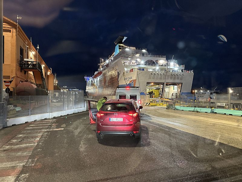
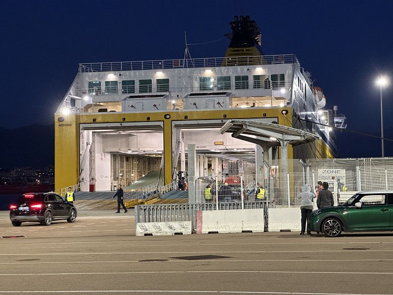
Fähre nach Piombino
I found out that Moby Lines and Toremar are the same. I booked Moby Lines and spent a long time looking for the right berth 😬. I also had to drive backwards onto it.
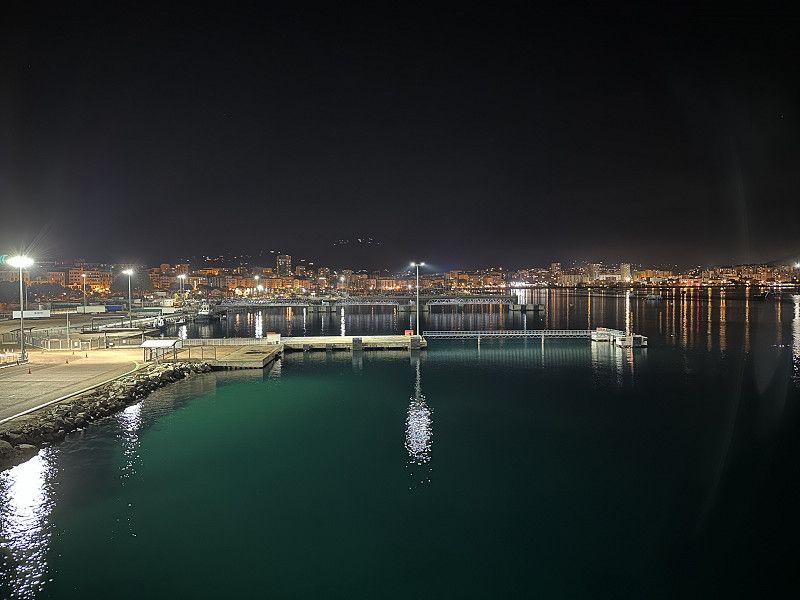
Überfahrt
The weather was very modest, but the lake was quite calm.
Livorno, Park4Night PP nah am Fährhafen
Currently free, from June to September 15th there is a fee. I'm still alone, but there are lots of people walking their dogs. It's quiet and only 15 minutes from the harbor.
Via Fabrizio de Andrè, Pisa, Pisa, Italien
43° 35' 33" N 10° 17' 56.7" E
43.5924994 10.2990972
• Head south on Via Fabrizio De Andrè. Go for 107 m.
• Turn right onto Via delle Genziane. Go for 138 m.
• Turn left onto Strada Provinciale di Marina di Pisa (SP224). Go for 1.9 km.
• Turn right onto Via Vasco Natale Jacoponi. Go for 42 m.
• Turn left onto Via Leonardo da Vinci. Go for 642 m.
• Take ramp onto Via Leonardo da Vinci (SP224) toward Livorno Centro/Porto Mediceo/Stazione Marittima/Varco Valessini. Go for 1.9 km.
• Keep right onto Piazzale Zara toward Via S. Orlando-Varco/Centro. Go for 201 m.
• Continue on Via Salvatore Orlando. Go for 1.5 km.
• Turn right onto Via della Cinta Esterna. Go for 719 m.
• Keep left onto Via della Cinta Esterna. Go for 291 m.
• Continue on Piazza del Pamiglione. Go for 40 m.
• Take the 2nd exit from roundabout onto Via San Giovanni. Go for 323 m.
• Continue on Piazza del Municipio. Go for 15 m.
• Take the 1st exit from roundabout onto Piazza del Municipio. Go for 44 m.
• Continue on Via Claudio Cogorano. Go for 76 m.
• Continue on Piazza Grande. Go for 51 m.
• Turn left onto Piazza Grande. Go for 31 m.
• Arrive at Piazza Grande. Your destination is on the left.
☍
8,0 km
( 12 min.)
Day
Moby Lines
Departure port: Livorno
Livorno, Toskana, Italien
43.5507317 10.3091256
Arrival port: P3
Haute-Corse, Korsika, Frankreich
42.7054289.4549341
• Head north.
• Arrive at your destination on the right.
☍
Distance not available
(Duration not available)
Day
P3
Haute-Corse, Korsika, Frankreich
42° 42' 19.5" N 9° 27' 17.8" E
42.7054280 9.4549341
• Head north. Go for 120 m.
• Turn left toward Avenue Émile Sari. Go for 127 m.
• Take the 5th exit from roundabout onto Avenue Émile Sari toward Centre Ville. Go for 572 m.
• Take the 1st exit from Rond-Point Novelty roundabout onto Avenue Pierre Guidicelli toward St Florent. Go for 50 m.
• Continue on Avenue Maréchal Sébastiani. Go for 173 m.
• Take the 2nd exit from Rond-Point Maréchal Leclerc roundabout onto Avenue Jean Zuccarelli toward Ville di Pietrabugno/St Florent. Go for 130 m.
• Turn left onto Avenue Jean Zuccarelli. Go for 86 m.
• Arrive at Avenue Jean Zuccarelli. Your destination is on the left.
☍
1,3 km
( 4 min.)
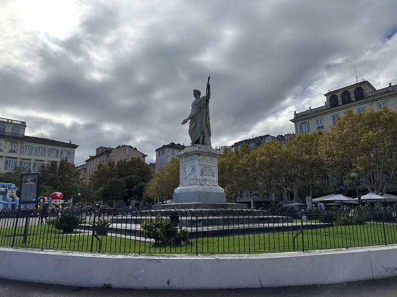
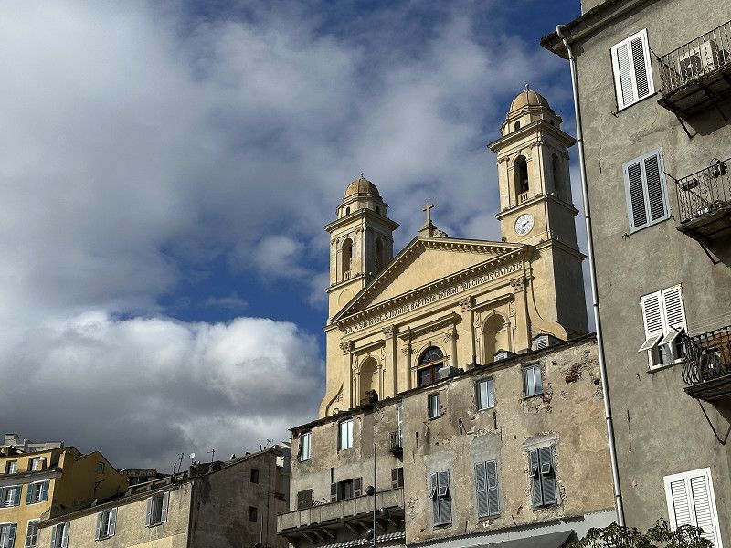
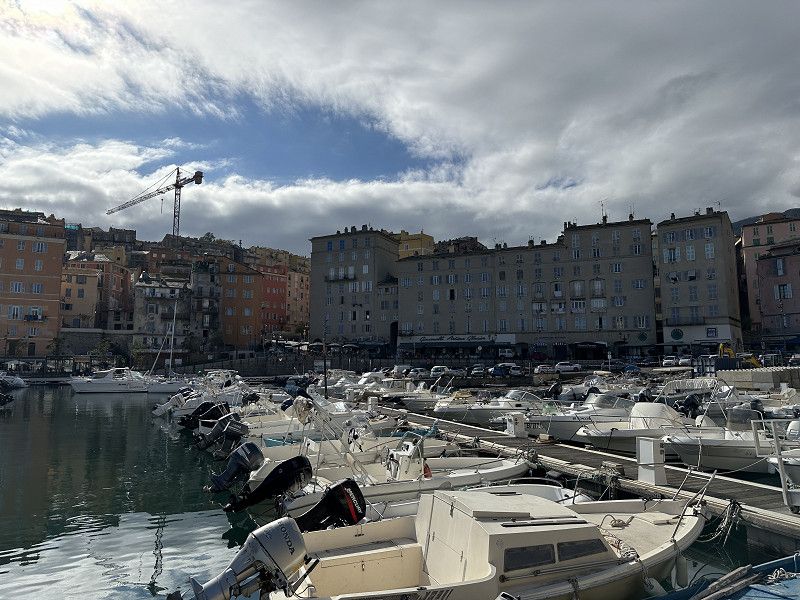
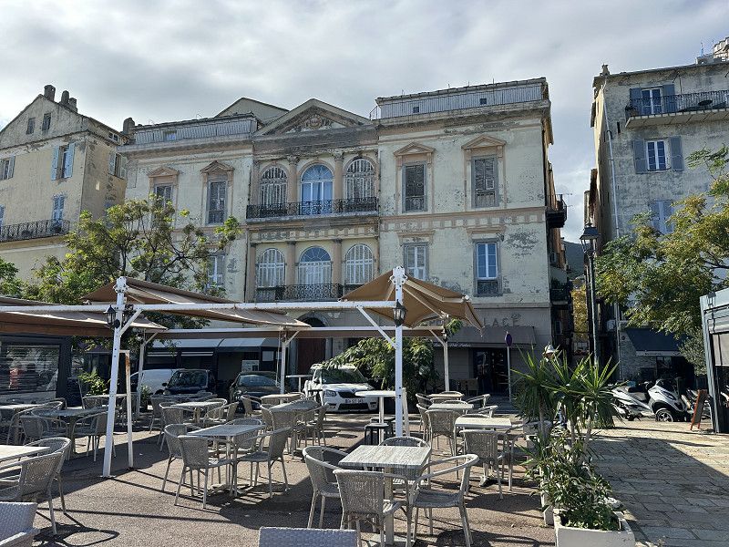
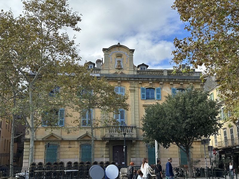
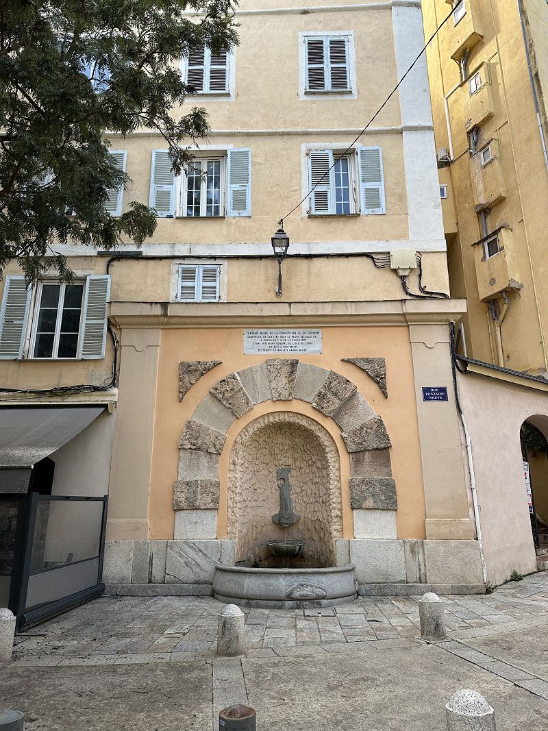
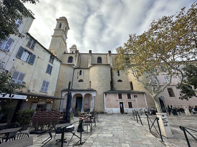
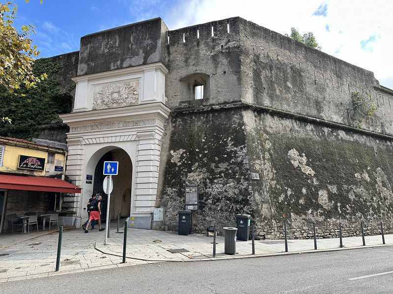
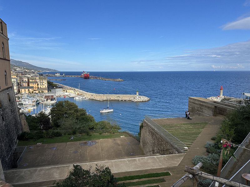
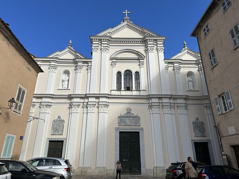
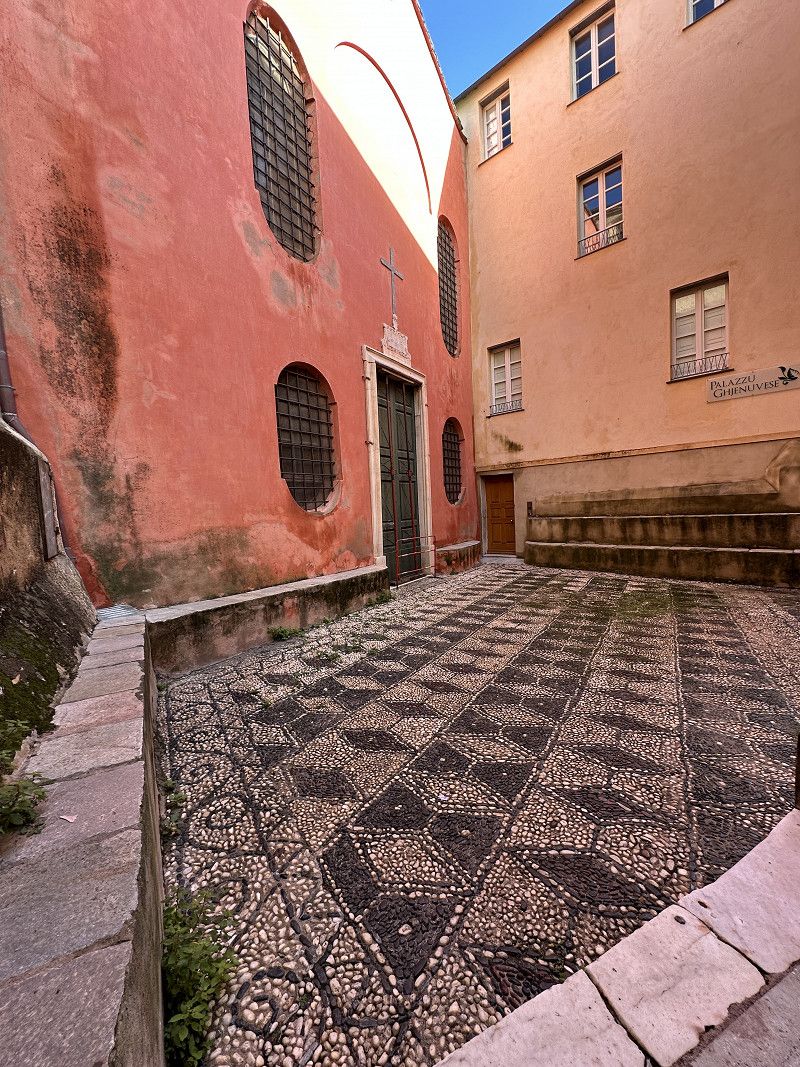
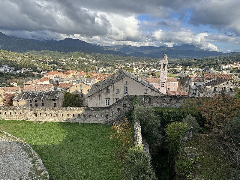
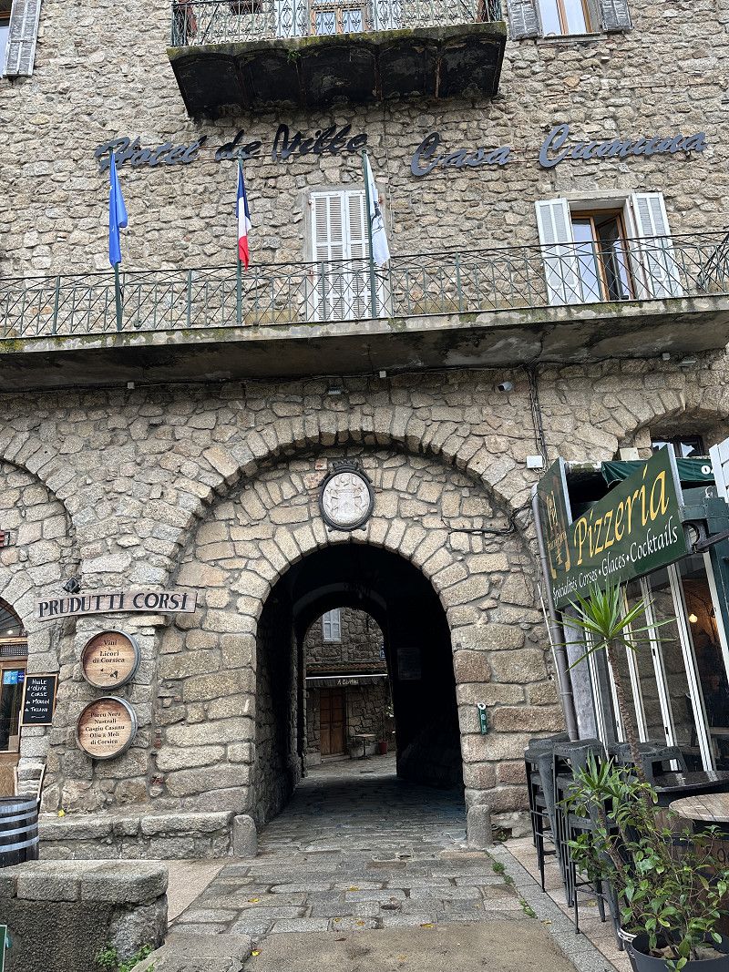
Parkplatz in Bastia
Large parking lot behind the train station. Free on Sundays. Did a quick sightseeing tour of the city and then drove the beautiful, winding road to Patrimonio.
Rue Marcel Paul, Bastia, Haute-Corse, Korsika, Frankreich
42° 42' 7.3" N 9° 26' 51.2" E
42.7020235 9.4475649
• Head north on Avenue Jean Zuccarelli. Go for 77 m.
• Turn left onto Avenue Jean Zuccarelli. Go for 64 m.
• Take the 2nd exit from roundabout onto Avenue Jean Zuccarelli. Go for 371 m.
• Take the 3rd exit from roundabout onto Avenue Jean Zuccarelli toward St Florent. Go for 145 m.
• Take the 2nd exit from roundabout onto Bretelle de Montépiano toward St Florent. Go for 548 m.
• Take the 2nd exit from roundabout onto Boulevard Benoîte Danesi (D81) toward St Antoine/St Florent. Go for 2.8 km.
• Turn left onto Route de Pietra Rossa. Go for 1.1 km.
• Turn right onto Lieu-dit Suerta (D264). Go for 637 m.
• Continue on D264. Go for 1.3 km.
• Take the 2nd exit from roundabout onto D81 toward Barbaggio/Patrimonio/Oletta/St Florent. Go for 10.6 km.
• Arrive at D81. Your destination is on the right.
☍
17,6 km
( 27 min.)
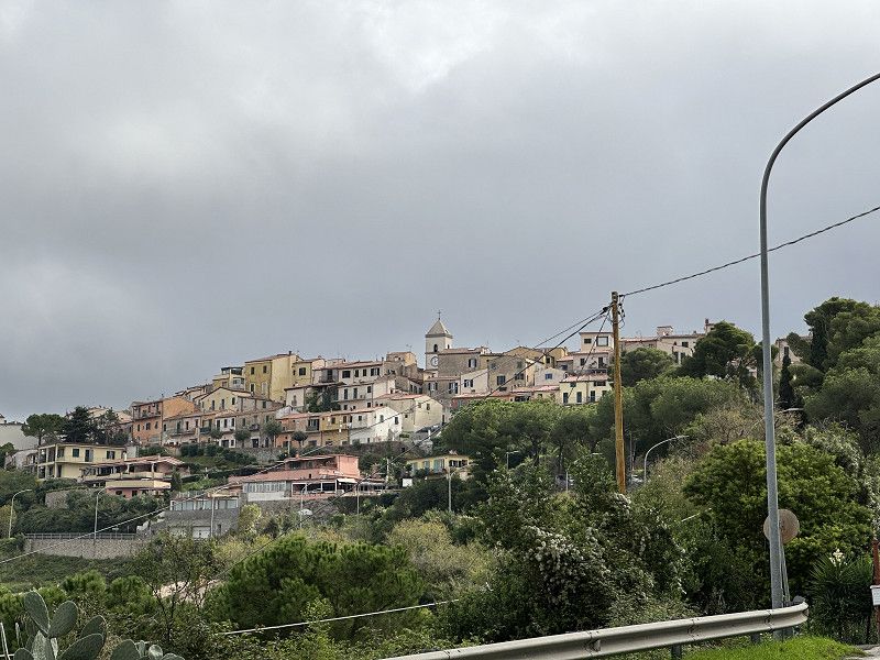
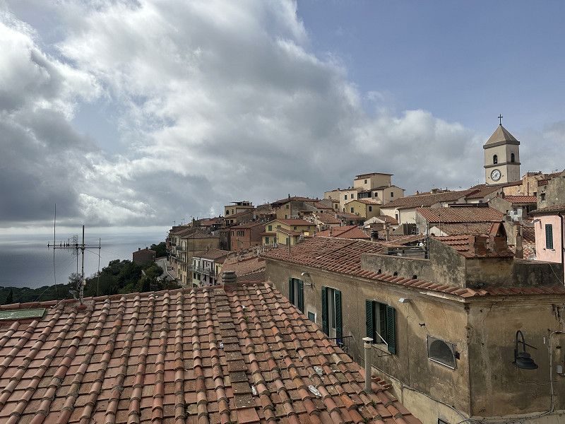
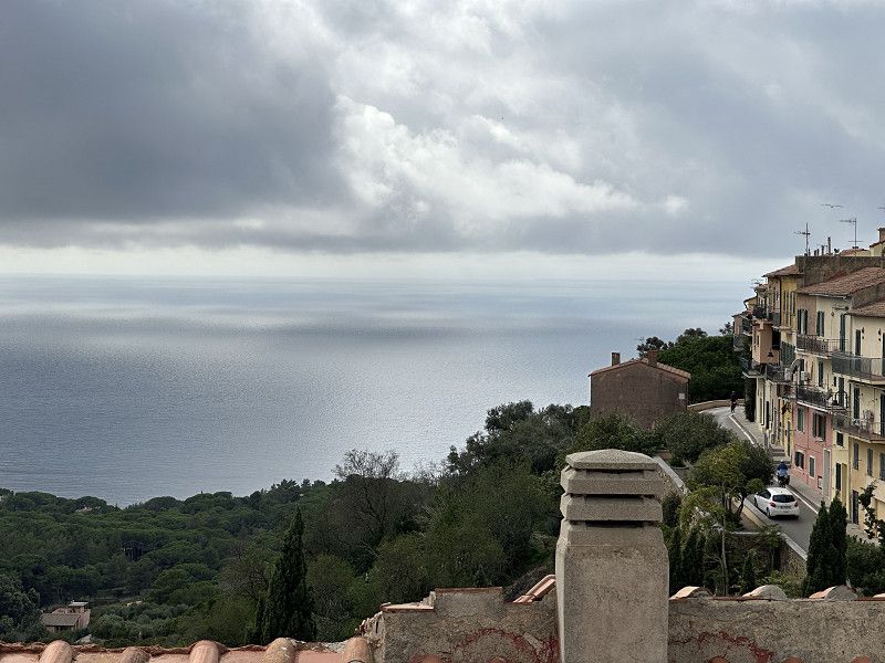
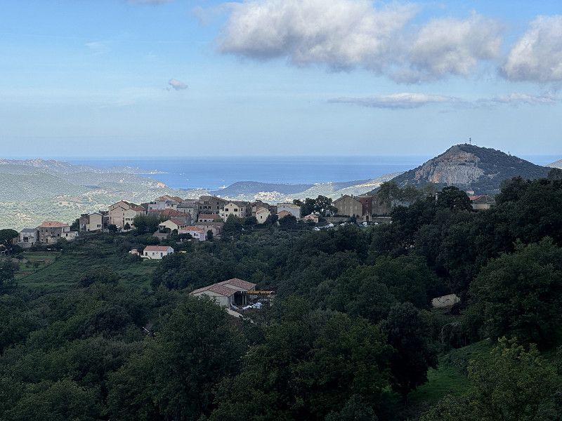
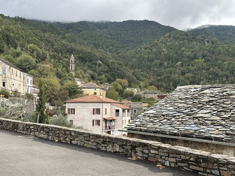
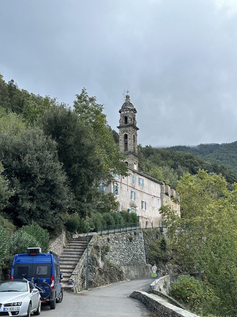
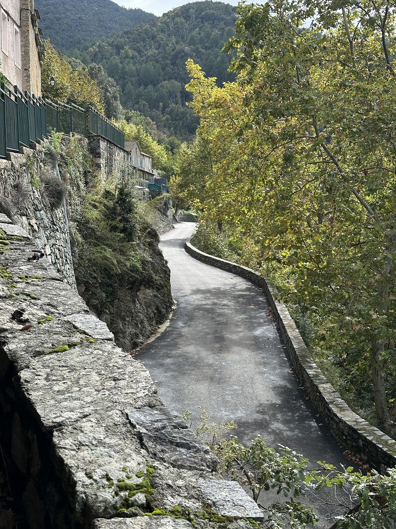
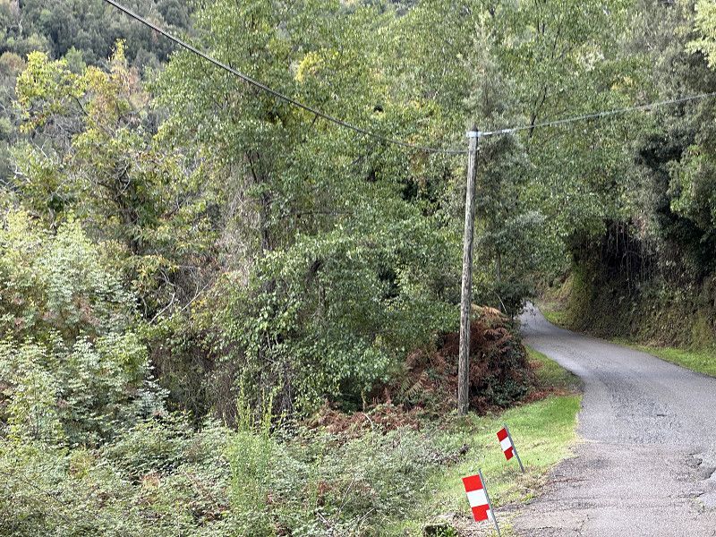
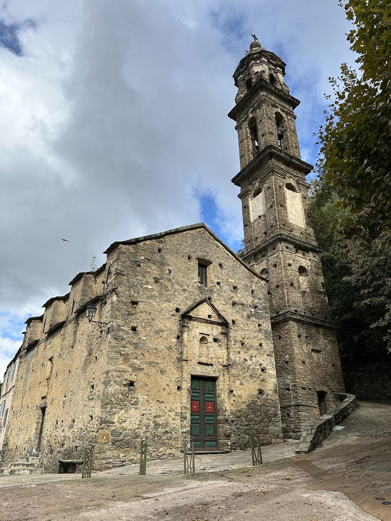
Patrimonio
FP parking space, fairly simple restaurant. The views on the drive there were beautiful though. There was also a rally of old Ferraris on the way.
D 81, Patrimonio, Haute-Corse, Korsika, Frankreich
42° 41' 54.4" N 9° 21' 14" E
42.6984330 9.3538947
• Head toward Lieu-dit Morta Majo on D81. Go for 235 m.
• Take the 2nd exit from roundabout onto D81 toward Saint-Florent/Île-Rousse. Go for 2.8 km.
• Take the 2nd exit from roundabout onto D81. Go for 2.1 km.
• Arrive at D81. Your destination is on the right.
☍
5,0 km
( 6 min.)
Day
Saint-Florent
Nice little place, I just drove through.
Rue Principale 17, Saint-Florent, Oletta, Département Haute-Corse, Frankreich
42° 40' 52.7" N 9° 18' 9" E
42.6812950 9.3024991
• Head toward Place des Portes on D81. Go for 63 m.
• Turn left onto Rue Agostino Giustiniani (D238). Go for 55 m.
• Continue on Chemin de la Cathédrale (D238). Go for 745 m.
• Continue on D238. Go for 7.4 km.
• Continue on D38. Go for 3.0 km.
• Turn left onto D82. Go for 4.5 km.
• Take the 3rd exit from Col de San Stefano roundabout onto D82. Go for 9.8 km.
• Take the 1st exit from roundabout onto T11 toward Ajaccio/Bonifacio/Calvi/Borgo/Aéroport Poretta. Go for 7.1 km.
• Take ramp toward Ajaccio/Calvi/Lucciana-Casamozza. Go for 259 m.
• Take the 2nd exit from roundabout onto T20 toward Ajaccio/Calvi/Lucciana-Casamozza. Go for 1.6 km.
• Take the 2nd exit from roundabout onto Corsu Lucciana (T20) toward Ajaccio/Calvi/Casamozza. Go for 1.4 km.
• Take the 1st exit from roundabout onto T20 toward Ajaccio/Calvi/Ponte Leccia/Barchetta. Go for 17.2 km.
• Turn left onto Lieu-dit Ponte Novu (D115) toward Bisinchi/Castello di Rostino. Go for 21 m.
• Continue on D115. Go for 3.7 km.
• Turn right onto Lieu-dit Fornu. Go for 19 m.
• Arrive at Lieu-dit Fornu. Your destination is on the right.
☍
56,8 km
(1 hrs. 7 min.)
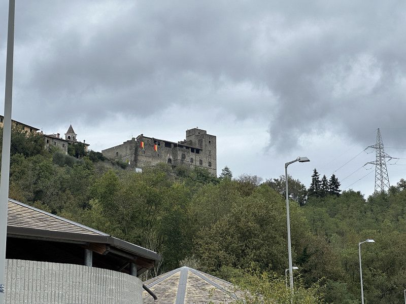
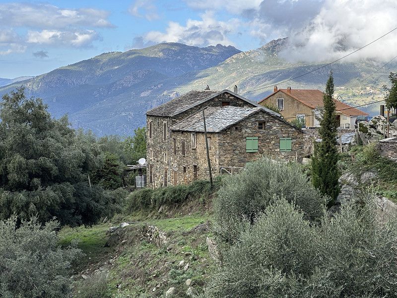
Bisinchi
Only one via waypoint.
Haute-Corse, Korsika, Frankreich
42° 28' 56.1" N 9° 18' 46.7" E
42.4822374 9.3129640
• Head northeast on Lieu-dit Fornu. Go for 19 m.
• Turn right onto D115. Go for 4.0 km.
• Turn right onto D15 B. Go for 1.5 km.
• Continue on Route de Bisinchi (D15 B). Go for 1.3 km.
• Keep left onto D15 B. Go for 170 m.
• Continue on Lieu-dit Pastureccia (D15 B). Go for 397 m.
• Arrive at Lieu-dit Pastureccia (D15 B). Your destination is on the right.
☍
7,4 km
( 14 min.)
Castello-di-Rostino
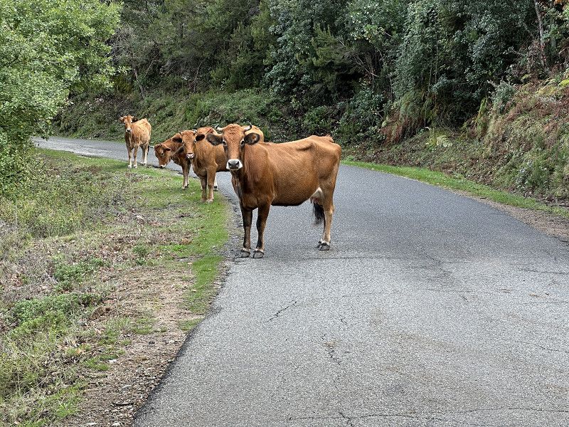
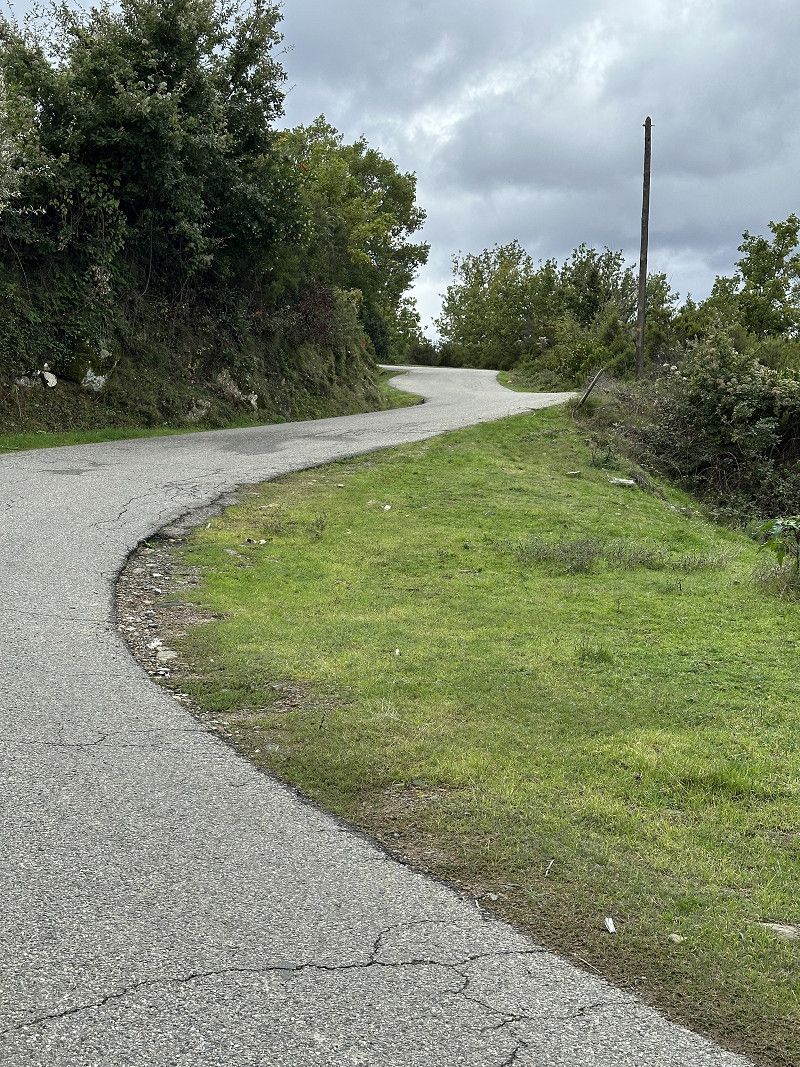
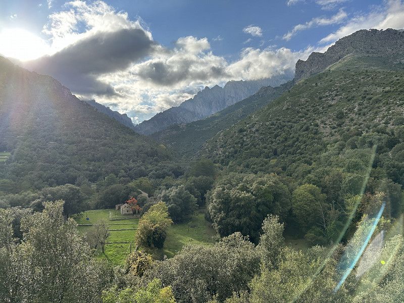
My satnav had sent me on a bit of a rogue journey. I was very happy that only 2-3 cars came towards me. With a larger motorhome it would have been a nightmare! But the view was really great.
D 15b, Castello-di-Rostino, Haute-Corse, Korsika, Frankreich
42° 27' 48.5" N 9° 18' 53.6" E
42.4634800 9.3148900
• Head northwest on Lieu-dit Pastureccia (D15 B). Go for 397 m.
• Continue on D15 B. Go for 170 m.
• Turn left onto D15 A. Go for 761 m.
• Continue on Lieu-dit Pianu (D15 A). Go for 411 m.
• Continue on D15 A. Go for 1.1 km.
• Turn right onto Lieu-dit Poggiola (D15 A). Go for 71 m.
• Continue on D15 A. Go for 187 m.
• Continue on Lieu-dit Frasso (D15 A). Go for 158 m.
• Continue on D15 A. Go for 173 m.
• Continue on Lieu-dit Bughjola (D15 A). Go for 214 m.
• Continue on D15 A. Go for 3.0 km.
• Turn left. Go for 90 m.
• Arrive at your destination on the right.
☍
6,8 km
( 13 min.)
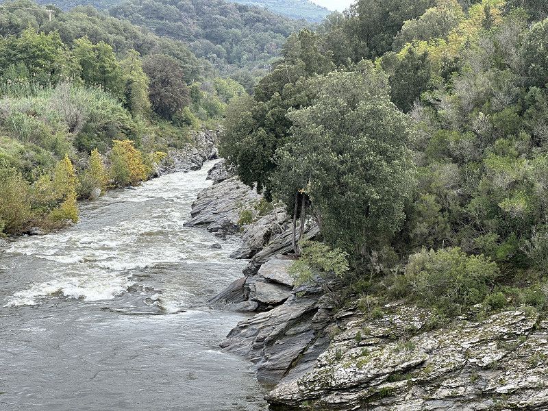
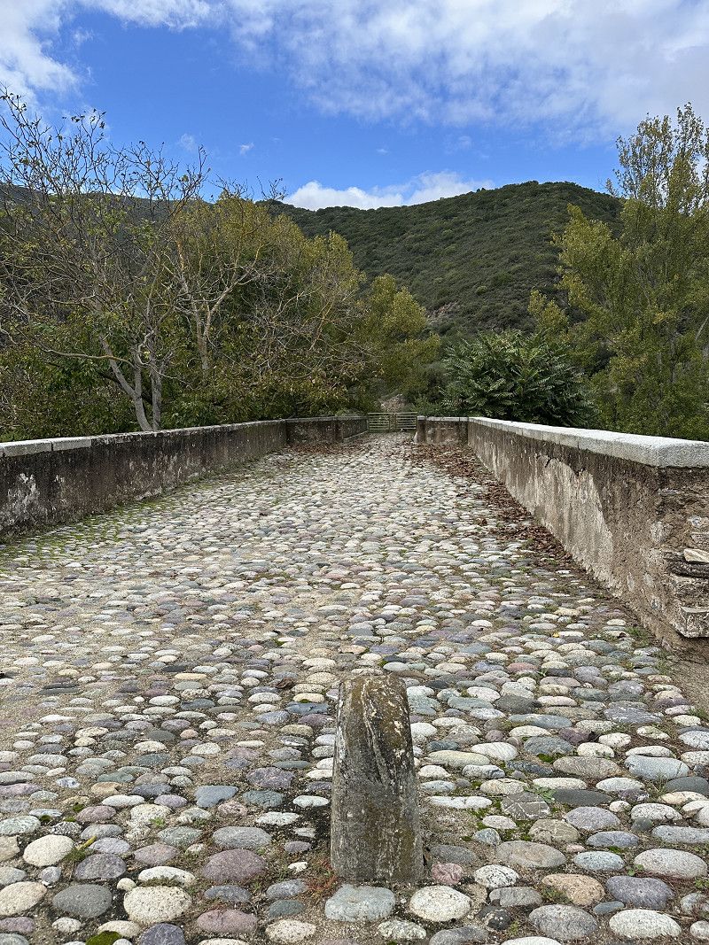
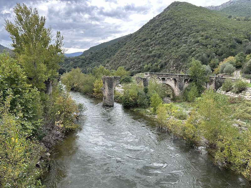
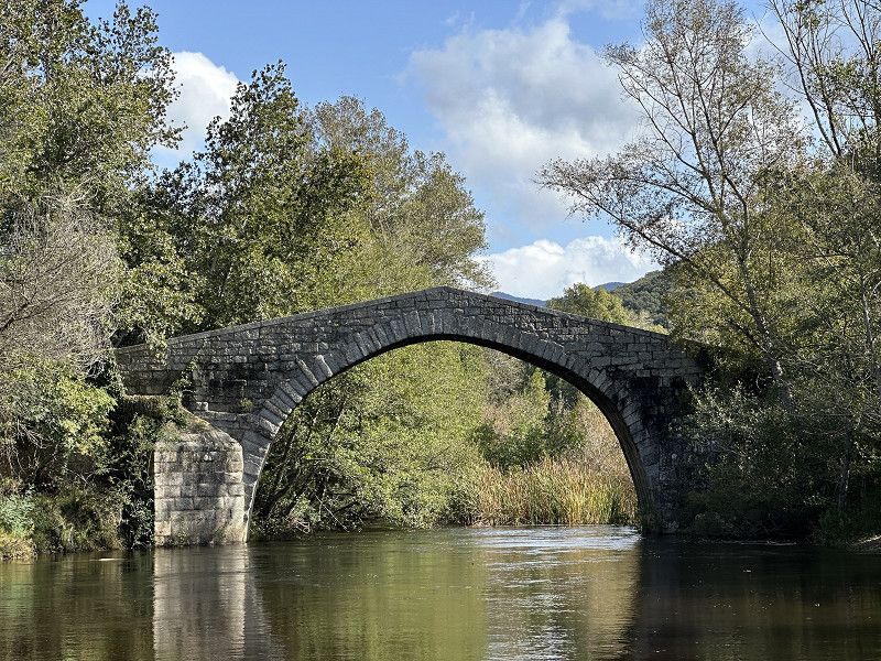
Ponte-Novu
It was a bit difficult to find with the satnav/Google Maps, as the bridge has a different name than the town. I wandered around for a long time and took a very exciting detour before I found this attraction. It should have been just to the right of the T20 before the river.
T 20, Ponte-Novo, Haute-Corse, Korsika, Frankreich
42° 28' 50.4" N 9° 16' 49.2" E
42.4806789 9.2803439
• Head northeast. Go for 90 m.
• Turn left onto D15 A. Go for 321 m.
• Turn left onto T20 toward Bastia. Go for 7.4 km.
• Take the 4th exit from roundabout onto T20 toward Corte/Ajaccio. Go for 21.0 km.
• Turn right onto Avenue Jean Nicoli (D39). Go for 338 m.
• Turn left onto Rue Docteur Gambini. Go for 81 m.
• Continue on Place Saint-Marcel. Go for 51 m.
• Continue on Place Paoli. Go for 27 m.
• Turn right. Go for 12 m.
• Arrive at your destination on the left.
☍
29,3 km
( 27 min.)
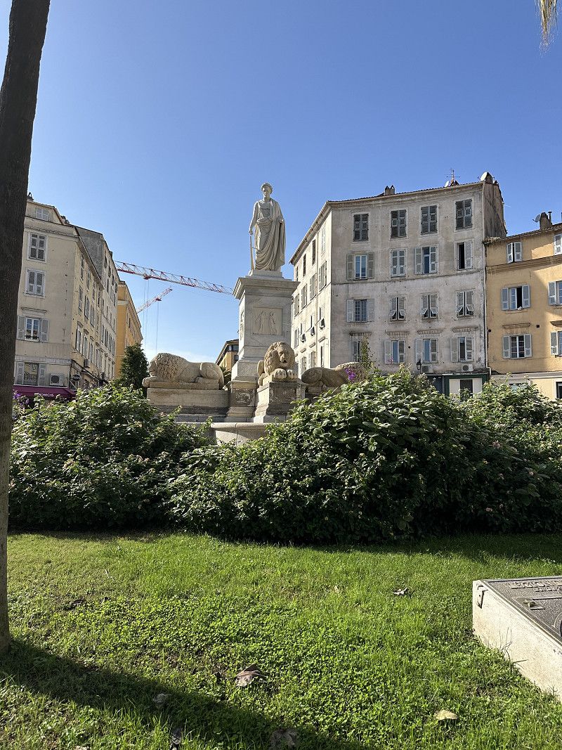
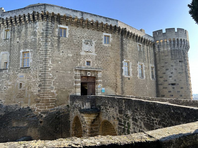
Corte
Interesting, lively town in the center of Corsica. Spent the night at a quaint campsite close to the town.
Haute-Corse, Korsika, Frankreich
42° 18' 19" N 9° 9' 4.3" E
42.3052904 9.1511935
• Head west.
• Turn right onto Cours Paoli. Go for 12 m.
• Turn right onto Cours Paoli. Go for 54 m.
• Turn right onto Avenue Xavier Luciani. Go for 26 m.
• Turn left onto Rampe Pozza. Go for 103 m.
• Turn right onto Avenue Jean Nicoli (D39). Go for 372 m.
• Turn right onto T20. Go for 344 m.
• Take the 1st exit from roundabout onto T50. Go for 941 m.
• Pass 2 roundabouts and continue on T50. Go for 43.9 km.
• Turn left toward T50. Go for 14 m.
• Continue on Route du Roi Théodore. Go for 3.2 km.
• Arrive at Lieu-dit Padulone. Your destination is on the right.
☍
49,0 km
( 47 min.)
Day
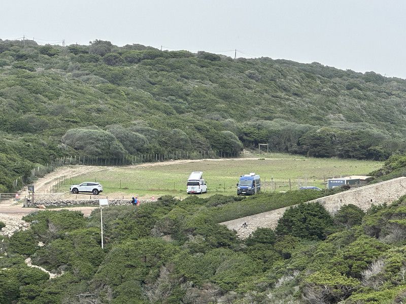
Aléria (Park4Night Übernachtungsplatz)
In Aléria the campsites are already closed and so is the beach bar. I have a direct view of the sea. The police weren't interested in me. Great place. In the evening there were 5-6 other motorhomes on the site. In the town there is an E.Leclerc where you can also buy Corsican specialties. Unfortunately the surrounding wineries also seemed to be closed.
Strada di u Re Teodoru, Aléria, Haute-Corse, Korsika, Frankreich
42° 6' 42.6" N 9° 33' 5.5" E
42.1118293 9.5515232
• Head south on Lieu-dit Padulone. Go for 325 m.
• Continue on Route du Roi Théodore. Go for 2.9 km.
• Turn left onto Route de Bonifacio (T10). Go for 15.1 km.
• Pass 5 roundabouts and continue on T10. Go for 41.6 km.
• Turn left onto D168 A toward Pinarello. Go for 75 m.
• Take the 1st exit from roundabout onto D168 A. Go for 449 m.
• Continue on Lieu-dit Grazzosu (D168 A). Go for 117 m.
• Continue on D168 A. Go for 3.0 km.
• Turn right onto D468. Go for 801 m.
• Turn left toward Lieu-dit California. Go for 1.6 km.
• Turn right onto Lieu-dit California. Go for 46 m.
• Arrive at Lieu-dit California. Your destination is on the right.
☍
65,9 km
(1 hrs. 12 min.)
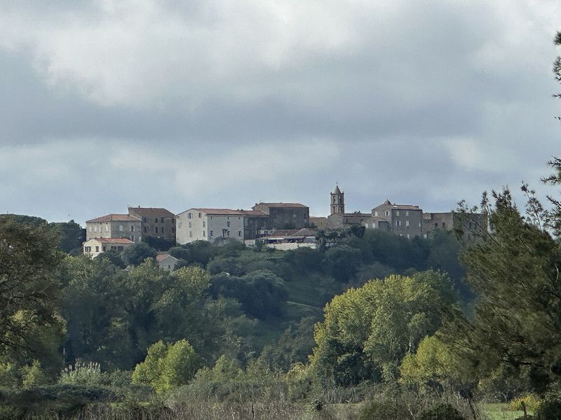
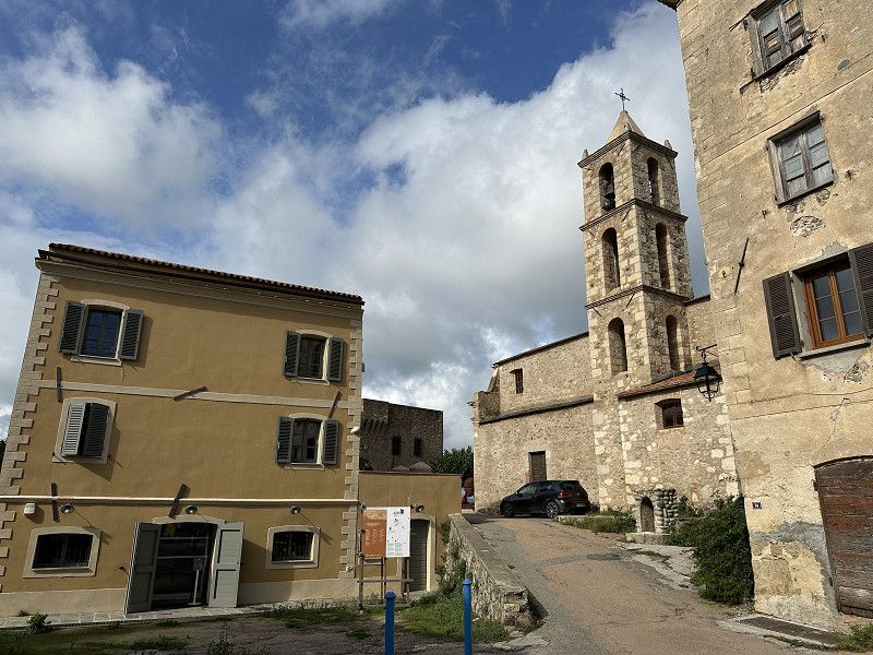
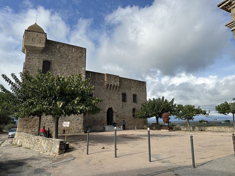
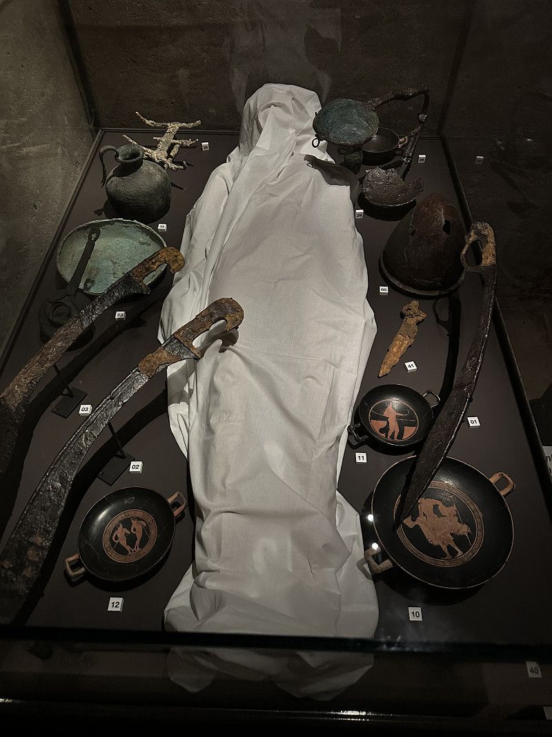
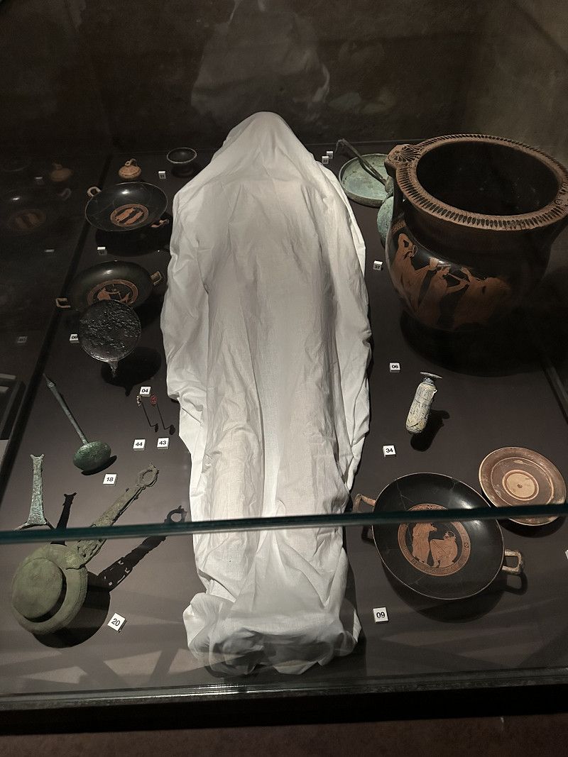
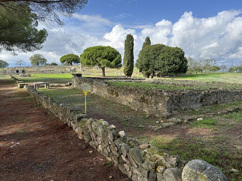
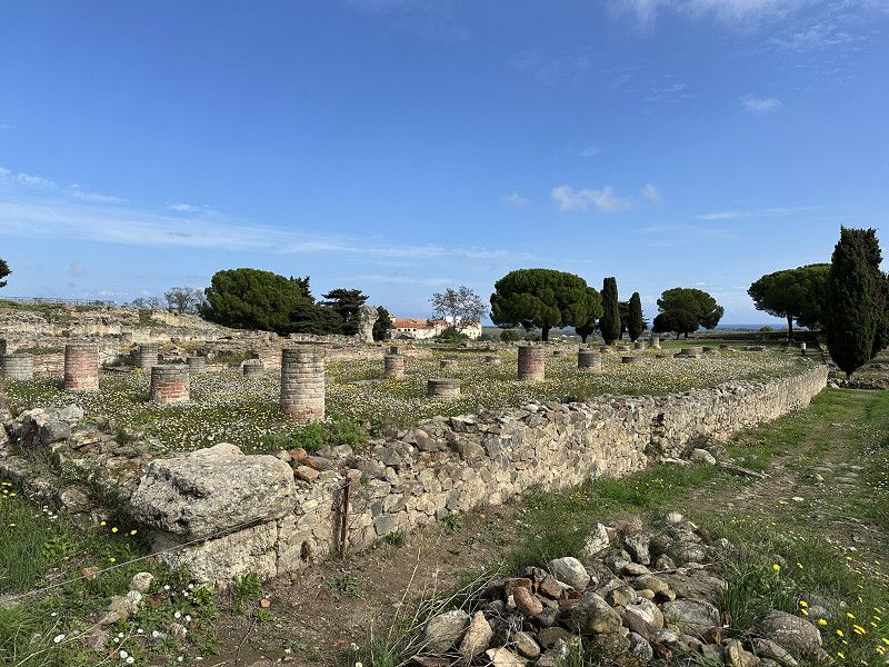
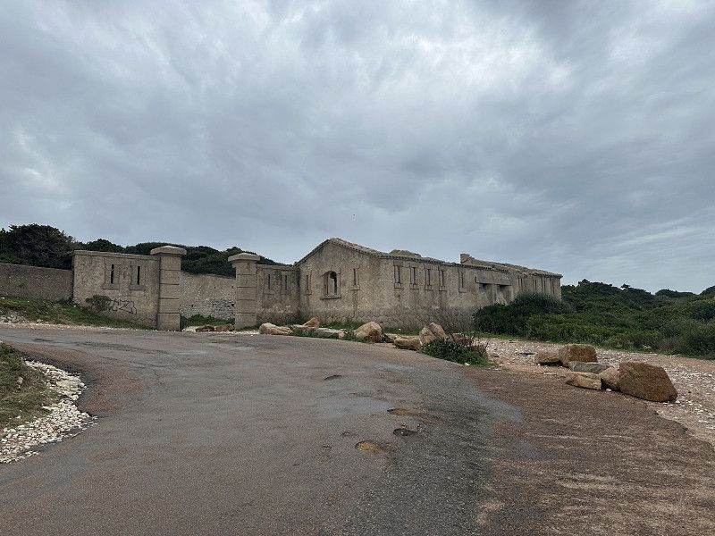
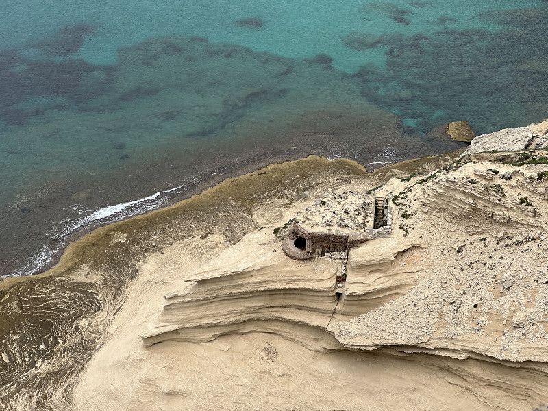
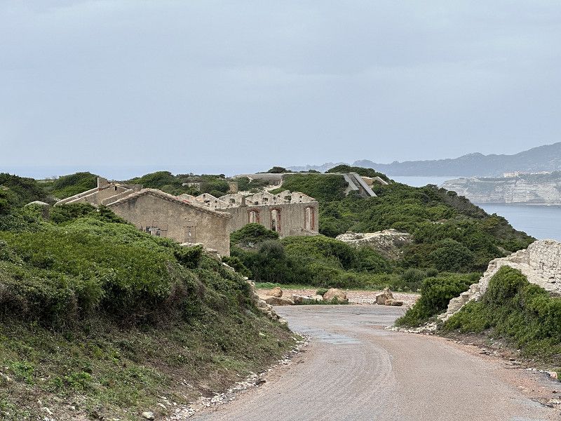
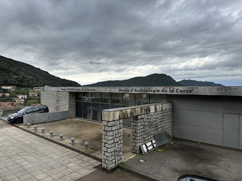
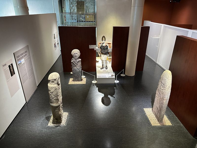
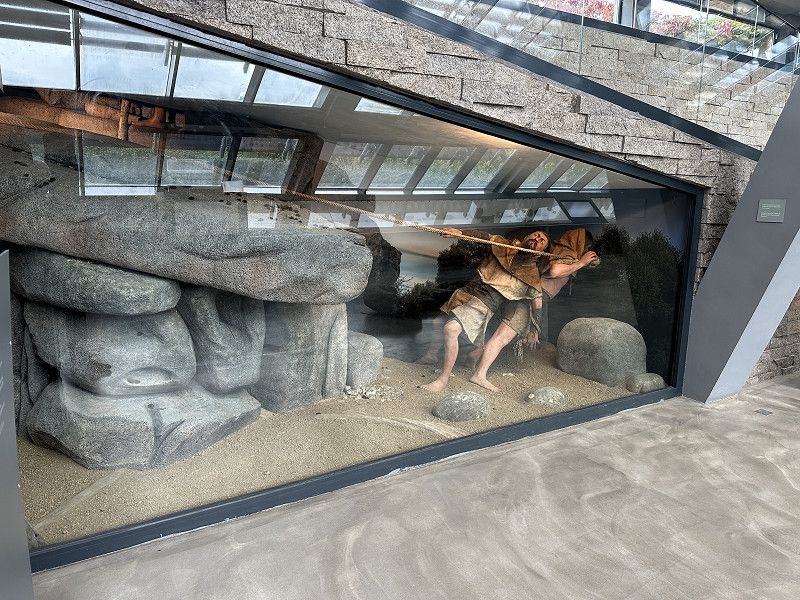
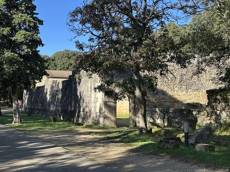
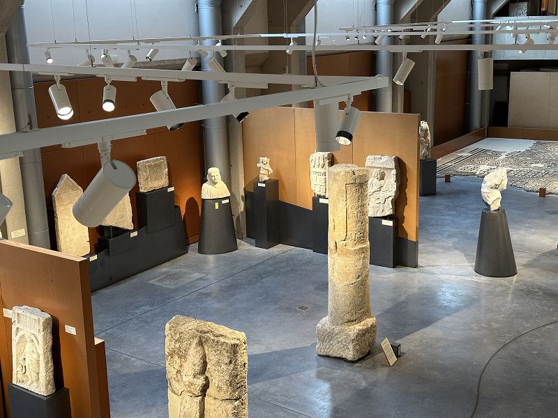
Aléria Ausgrabungen
Lots of old stones and an interesting museum. Here you can learn about the long history of Corsica. I rode there from the parking lot on my e-bike
Day
Camping California vor Porte Vecchio
The restaurant on site was supposed to be very good. Unfortunately it was already closed. The site was quite empty and some of the toilet blocks were already closed. Beautiful bays and clear water.
Caminu Di Capo Di Fora 1550, Zonza, Levie, Département Corse-du-Sud, Frankreich
41° 39' 59.4" N 9° 22' 47.4" E
41.6665010 9.3798219
• Head northeast on Lieu-dit California. Go for 46 m.
• Turn left toward D468. Go for 1.6 km.
• Turn left onto D468. Go for 169 m.
• Continue on Lieu-dit Vitriccia (D468). Go for 80 m.
• Continue on D468. Go for 899 m.
• Continue on Lieu-dit Bacca (D468). Go for 515 m.
• Continue on D468. Go for 364 m.
• Continue on Lieu-dit Teghine (D468). Go for 169 m.
• Continue on D468. Go for 109 m.
• Continue on Lieu-dit Fiori (D468). Go for 208 m.
• Continue on D468. Go for 19 m.
• Continue on Lieu-dit Pascialella (D468). Go for 97 m.
• Continue on D468. Go for 168 m.
• Continue on Lieu-dit Foce (D468). Go for 144 m.
• Continue on D468. Go for 577 m.
• Continue on Lieu-dit Ferrulaghjolu (D468). Go for 158 m.
• Continue on Lieu-dit Ferrulajolo (D468). Go for 183 m.
• Continue on D468. Go for 238 m.
• Continue on Lieu-dit Baca (D468). Go for 189 m.
• Continue on D468. Go for 1.4 km.
• Take the 2nd exit from roundabout onto D468. Go for 535 m.
• Continue on Résidence U Re d'Alzetu (D468). Go for 302 m.
• Take the 2nd exit from roundabout onto D468. Go for 194 m.
• Continue on Route d'Alzetu (D468). Go for 503 m.
• Continue on Route du Stagnolu (D468). Go for 2.2 km.
• Take the 1st exit from roundabout onto D468. Go for 116 m.
• Continue on Route de Cala Rossa (D468). Go for 231 m.
• Continue on D468. Go for 657 m.
• Take the 4th exit from roundabout onto Rue Pierre Andreani (T10) toward Bonifacio/Porto Vecchio. Go for 2.5 km.
• Pass 2 roundabouts and continue on T10. Go for 1.3 km.
• Take the 2nd exit from roundabout onto T10 toward Ajaccio/Bonifacio/Aéroport Figari. Go for 680 m.
• Take the 3rd exit from roundabout onto T10 toward Ajaccio/Bonifacio/Aéroport Figari. Go for 1.2 km.
• Pass 2 roundabouts and continue on T10. Go for 998 m.
• Turn right onto T10 toward Ajaccio/Bonifacio/Aéroport Figari. Go for 624 m.
• Pass 4 roundabouts and continue on T10. Go for 22.5 km.
• Take the 3rd exit from roundabout onto Avenue Sylver Bohn (T40) toward Bonifacio/Centre-Ville. Go for 1.6 km.
• Turn left onto Rue Paul Nicolai (D58). Go for 185 m.
• Continue on Rue Paul Nicolai (D58). Go for 238 m.
• Turn right onto Lieu-dit A Culaia di U Sgavarun (D260). Go for 95 m.
• Turn slightly left onto D260. Go for 1.3 km.
• Turn slightly right onto D260. Go for 253 m.
• Arrive at D260. Your destination is on the left.
☍
45,4 km
( 53 min.)
Day
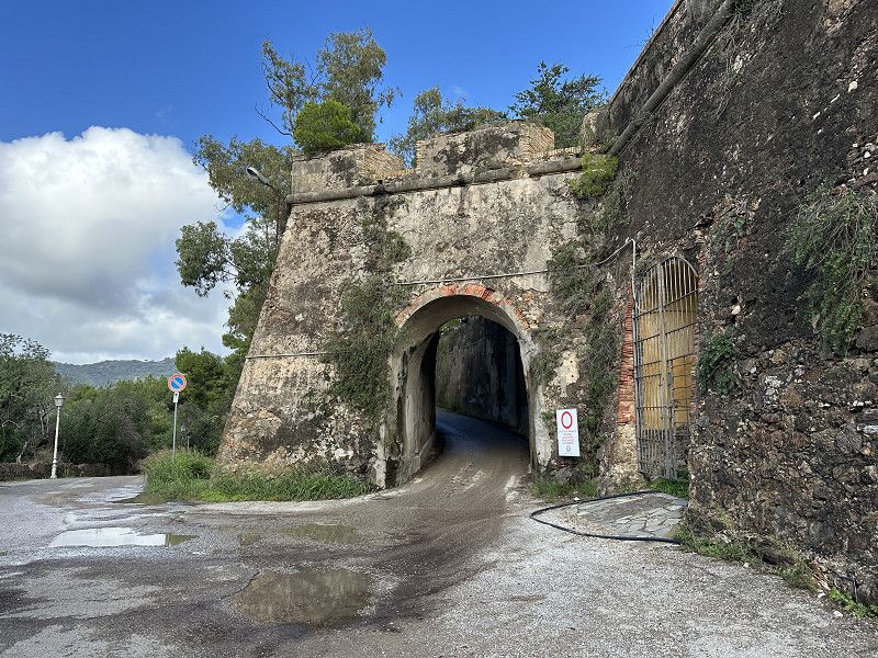
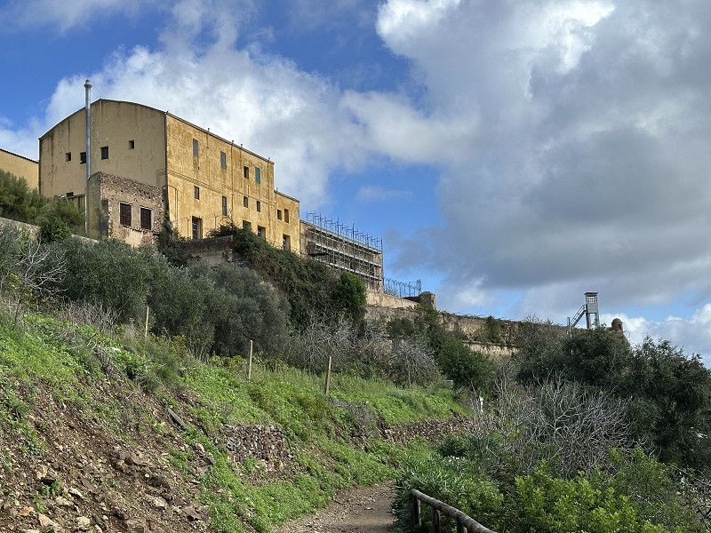
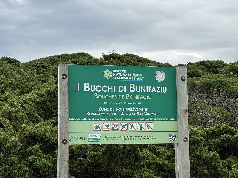
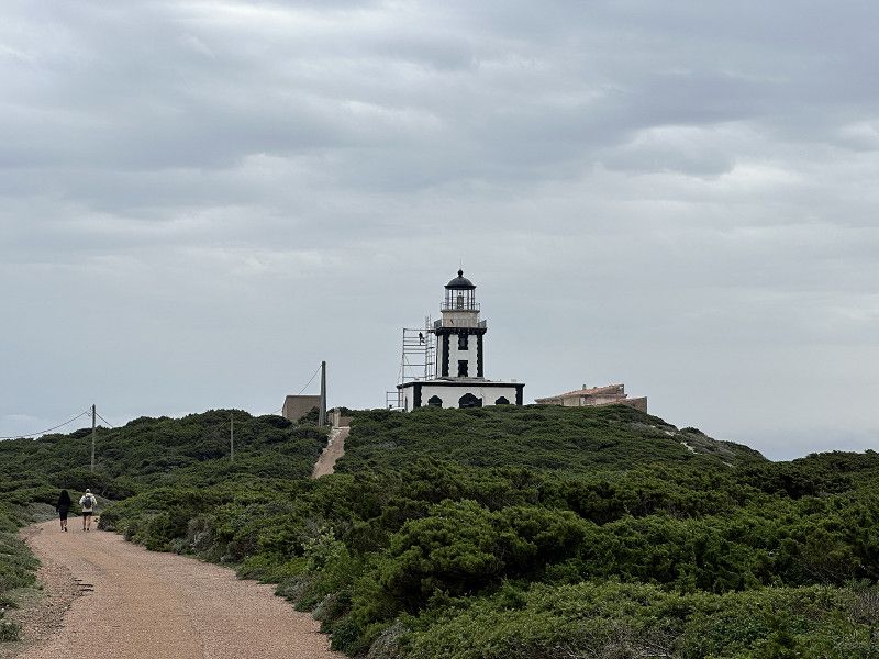
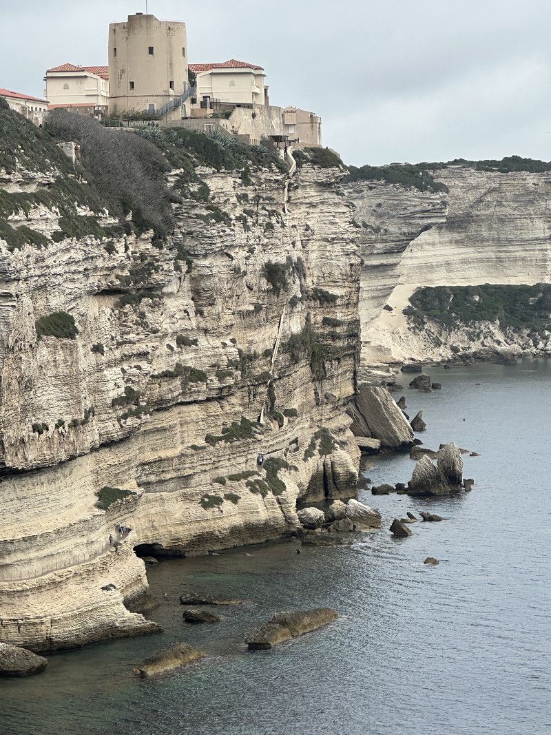
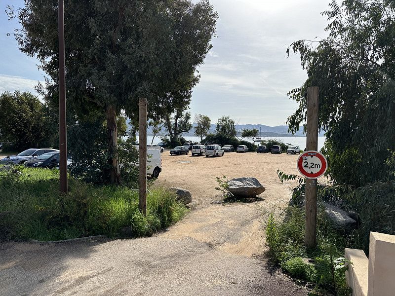
Park4Night Platz Oberhalb von Bonifacio
I was a bit late and skipped Porto-Vecchio because according to ADAC and Google Maps there wasn't really anything worth seeing there. The free parking spot was a great, quiet, free spot. But you should eat a burger and drink a couple of beers, which wasn't difficult for me. From here you can go hiking and visit the city by e-bike.
D 260, Bonifacio / Bunifaziu, Südkorsika, Korsika, Frankreich
41° 22' 39" N 9° 10' 42.8" E
41.3774951 9.1785464
• Head north on D260. Go for 1.6 km.
• Turn slightly right onto Lieu-dit A Culaia di U Sgavarun (D260). Go for 95 m.
• Turn left onto Rue Paul Nicolai (D58). Go for 238 m.
• Turn right toward Avenue Sylvère Bohn/T40. Go for 315 m.
• Turn right onto Avenue Sylvère Bohn (T40) toward Ajaccio/Bastia/Porto Vecchio. Go for 1.4 km.
• Take the 2nd exit from roundabout onto T40 toward Sartène/Propriano/Ajaccio. Go for 46.2 km.
• Turn left onto Lieu-dit Zirulina (D48) toward Tizzano/Grossa/Bilia. Go for 301 m.
• Continue on D48. Go for 938 m.
• Turn left onto D48. Go for 765 m.
• Continue on Lieu-dit Navara (D48). Go for 96 m.
• Continue on D48. Go for 4.3 km.
• Continue on Lieu-dit Avalle (D48). Go for 109 m.
• Continue on D48. Go for 1.5 km.
• Continue on Lieu-dit Nargo (D48). Go for 137 m.
• Continue on D48. Go for 258 m.
• Continue on Lieu-dit Ariale (D48). Go for 182 m.
• Turn slightly left onto D48. Go for 651 m.
• Continue on Lieu-dit Campu Tondu (D48). Go for 115 m.
• Continue on D48. Go for 2.2 km.
• Continue on Lieu-dit Apazzu (D48). Go for 90 m.
• Continue on D48. Go for 725 m.
• Turn left toward Lieu-dit Canniccia. Go for 917 m.
• Continue on Lieu-dit Canniccia. Go for 60 m.
• Turn slightly right. Go for 55 m.
• Keep right. Go for 245 m.
• Arrive at your destination on the right.
☍
63,4 km
(1 hrs. 17 min.)
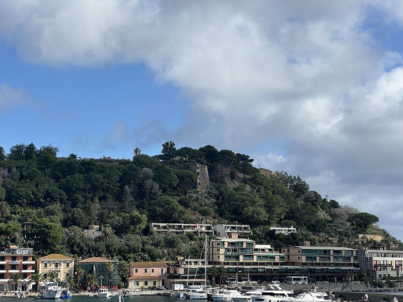
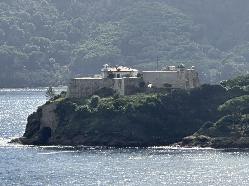
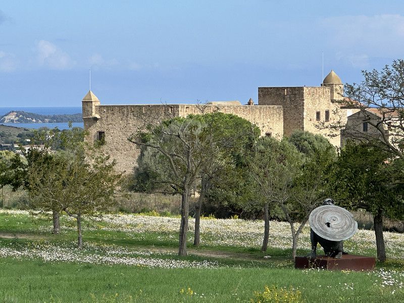
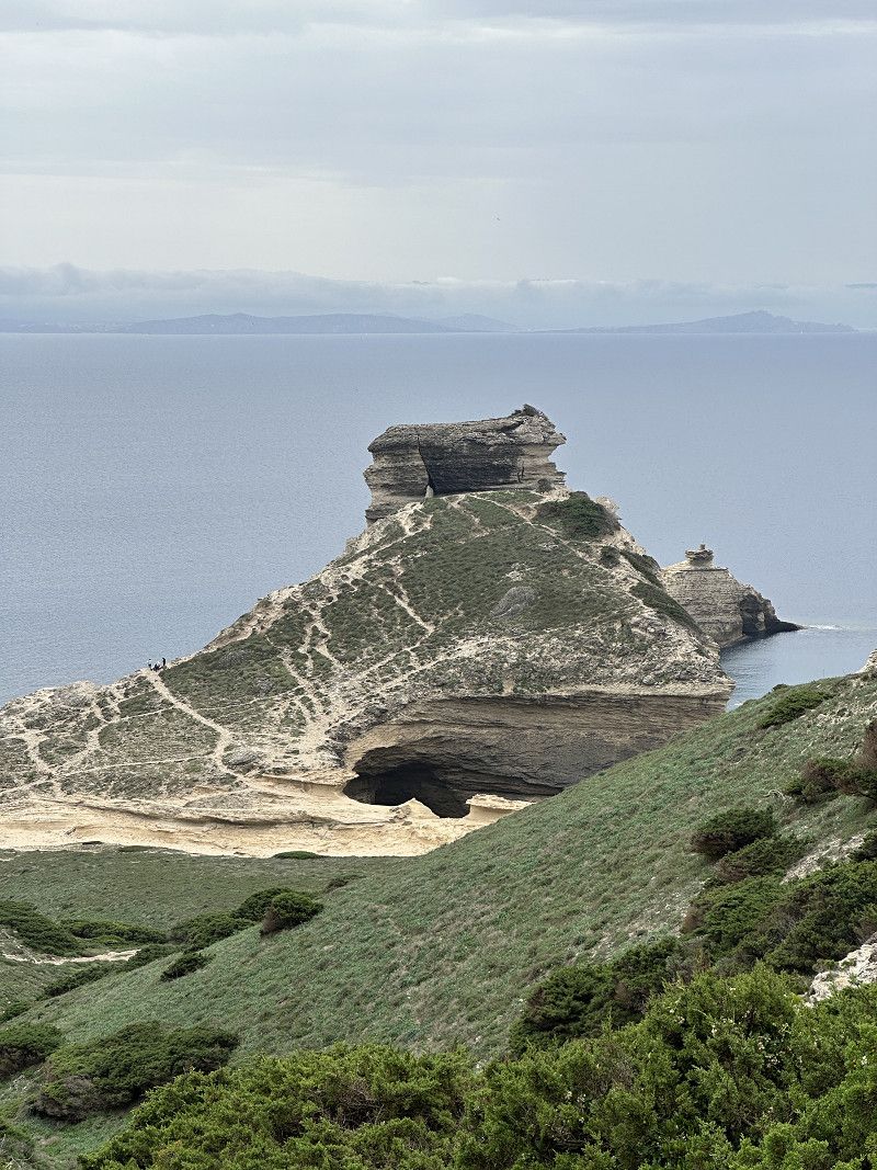
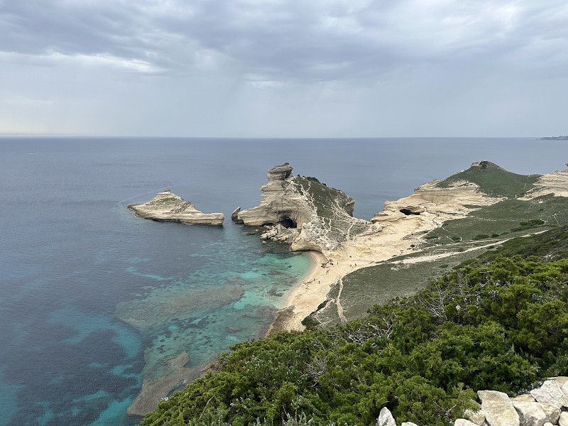
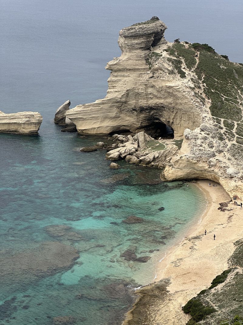
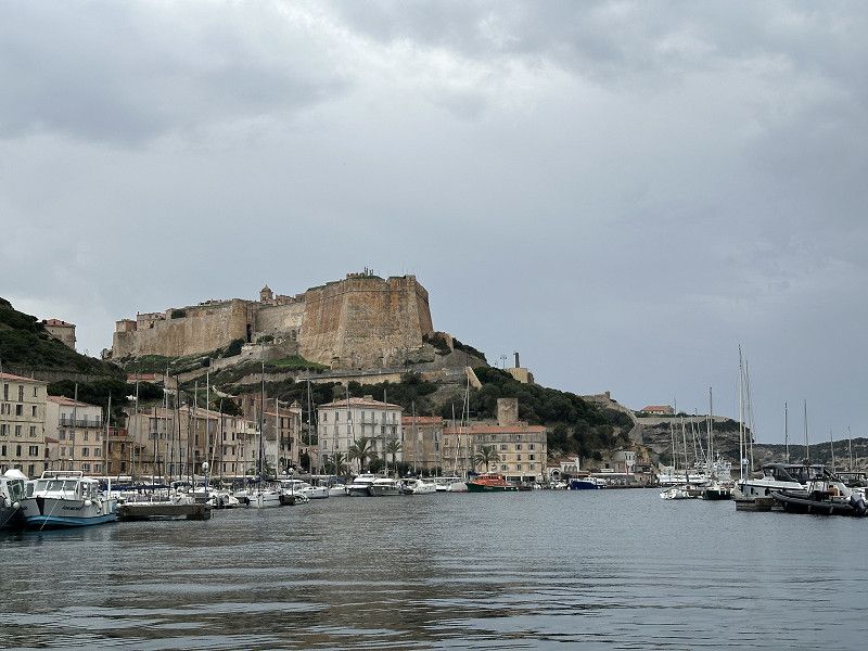
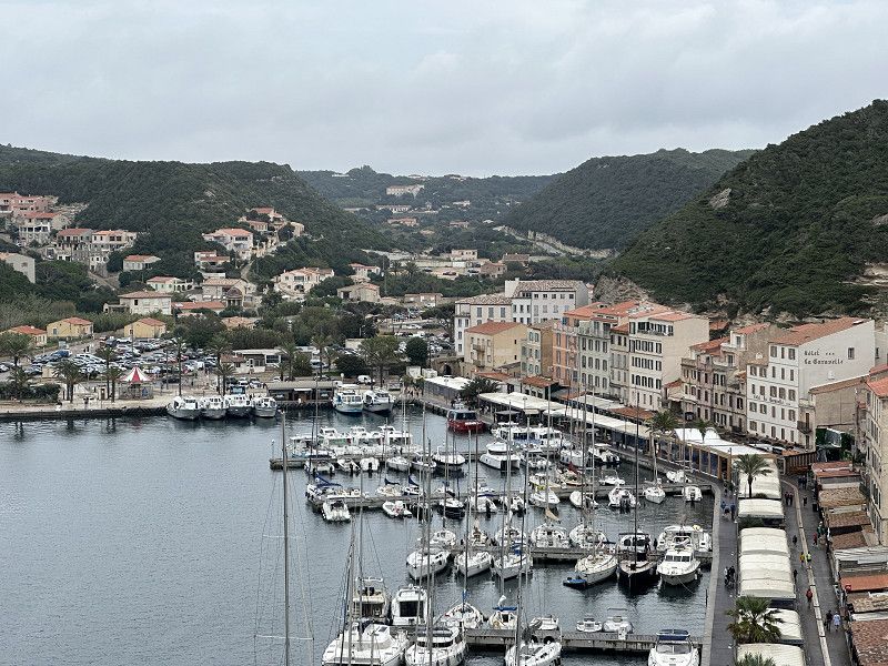
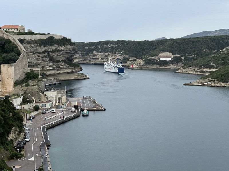
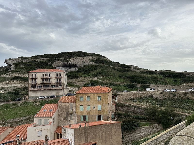
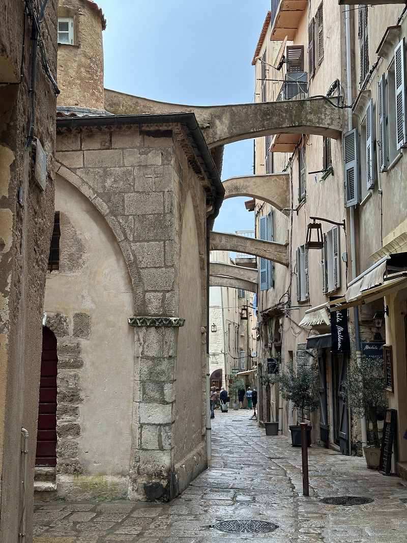
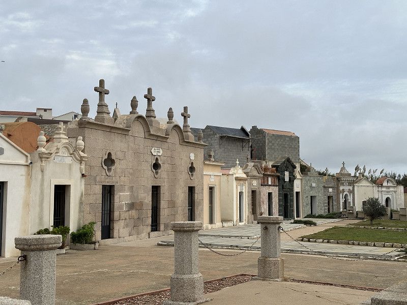
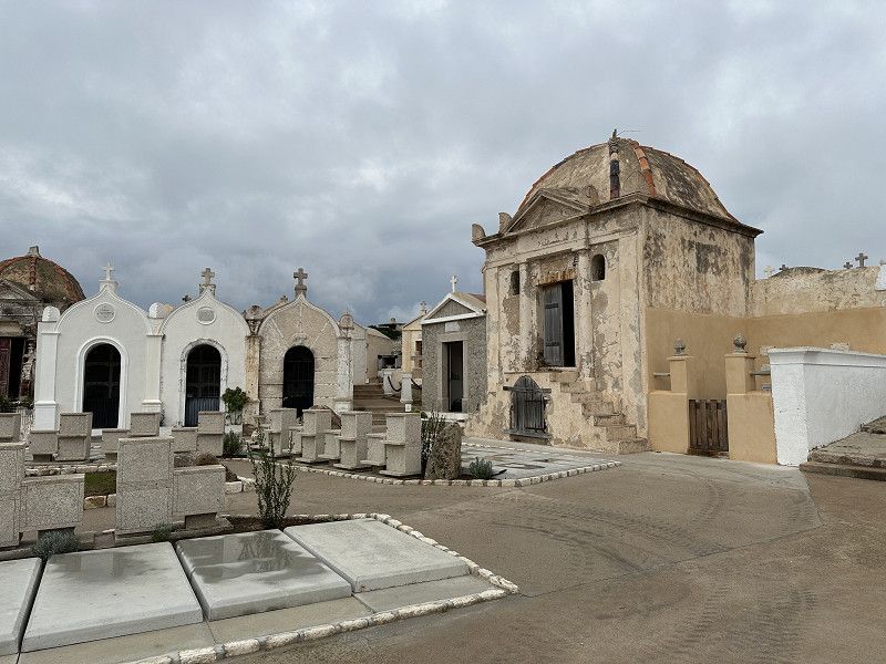
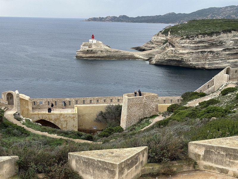
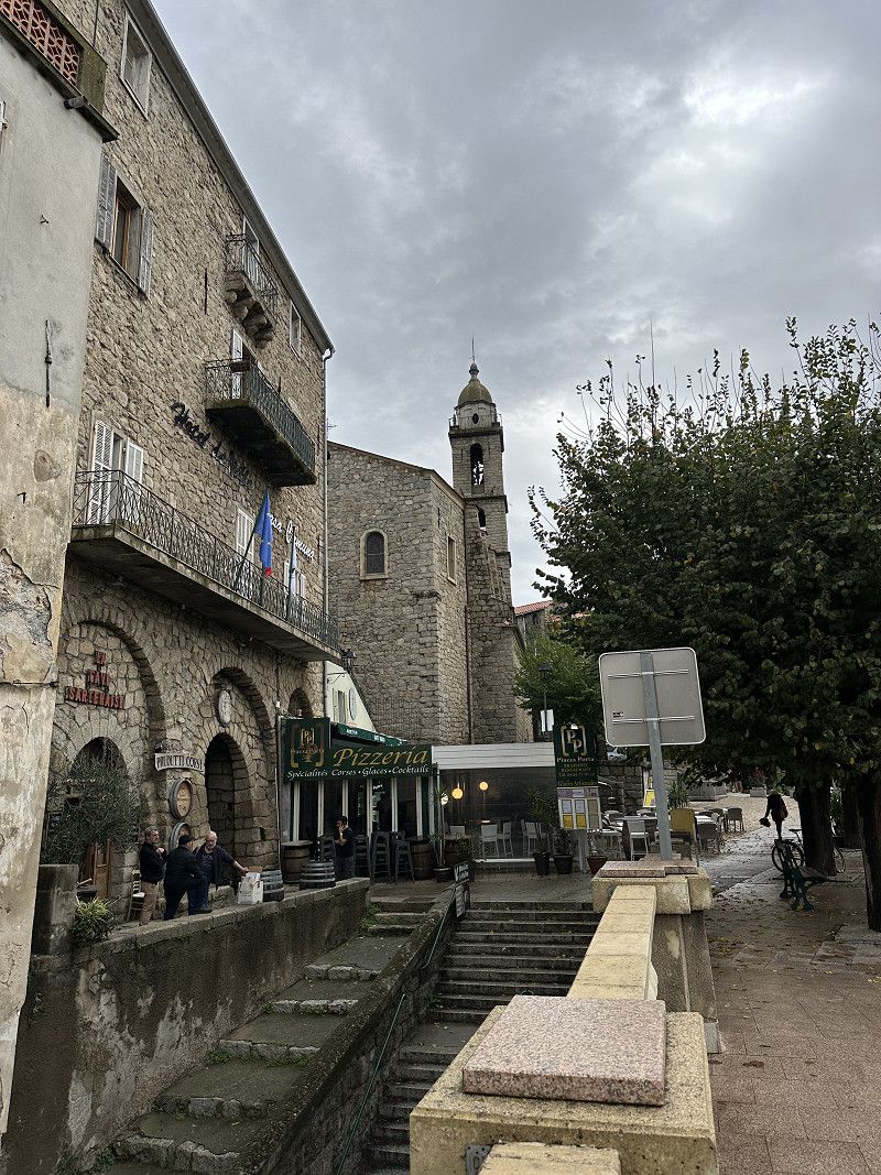
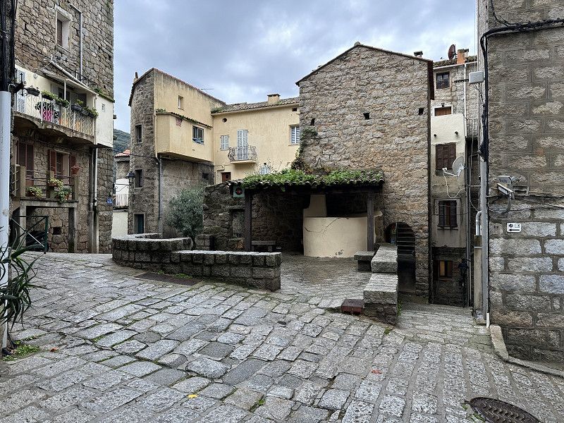
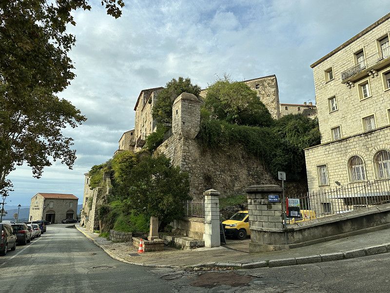
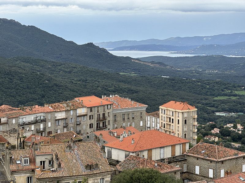
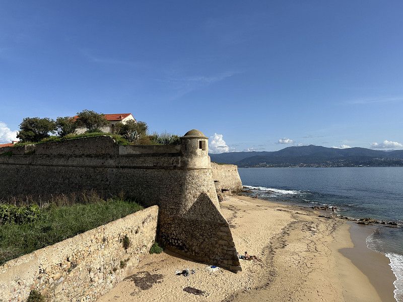
Bonifacio Stadt
I “drove down” on my e-bike. I really liked the city. Well worth seeing: lively, lots of cafes, a castle, restaurants, winding streets and interesting buildings. Everything I like
Day
Campéole l'Avena
Originally wanted to stay here, but had overlooked the fact that they have been closed since mid-September.
Tizzano, Sartène, Südkorsika, Korsika, Frankreich
41° 32' 7.3" N 8° 51' 50.2" E
41.5353662 8.8639377
• Head northeast. Go for 300 m.
• Turn slightly left onto Lieu-dit Canniccia. Go for 977 m.
• Turn right onto D48. Go for 725 m.
• Continue on Lieu-dit Apazzu (D48). Go for 90 m.
• Keep right onto D48. Go for 2.2 km.
• Continue on Lieu-dit Campu Tondu (D48). Go for 115 m.
• Continue on D48. Go for 651 m.
• Turn slightly right onto Lieu-dit Ariale (D48). Go for 182 m.
• Continue on D48. Go for 258 m.
• Continue on Lieu-dit Nargo (D48). Go for 114 m.
• Continue on Lieu-dit Nargo (D48). Go for 23 m.
• Continue on D48. Go for 568 m.
• Turn right onto D48 A. Go for 835 m.
• Continue on Lieu-dit Tijarella (D48 A). Go for 145 m.
• Continue on Lieu-dit Sapera Ventosa (D48 A). Go for 113 m.
• Turn slightly left onto Lieu-dit L'Arjola (D48 A). Go for 63 m.
• Continue on Lieu-dit Sapera Ventosa (D48 A). Go for 399 m.
• Turn slightly right onto D48 A. Go for 318 m.
• Continue on Lieu-dit Sapara Ventosa (D48 A). Go for 165 m.
• Continue on D48 A. Go for 963 m.
• Continue on Lieu-dit Manzavinu (D48 A). Go for 109 m.
• Continue on D48 A. Go for 838 m.
• Continue on Lieu-dit Sapera Buona (D48 A). Go for 96 m.
• Continue on D48 A. Go for 332 m.
• Arrive at D48 A. Your destination is on the right.
☍
10,6 km
( 24 min.)
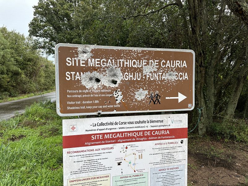
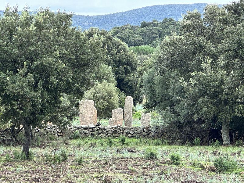
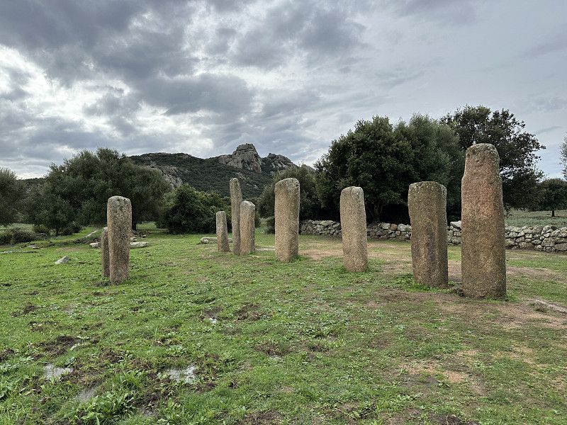
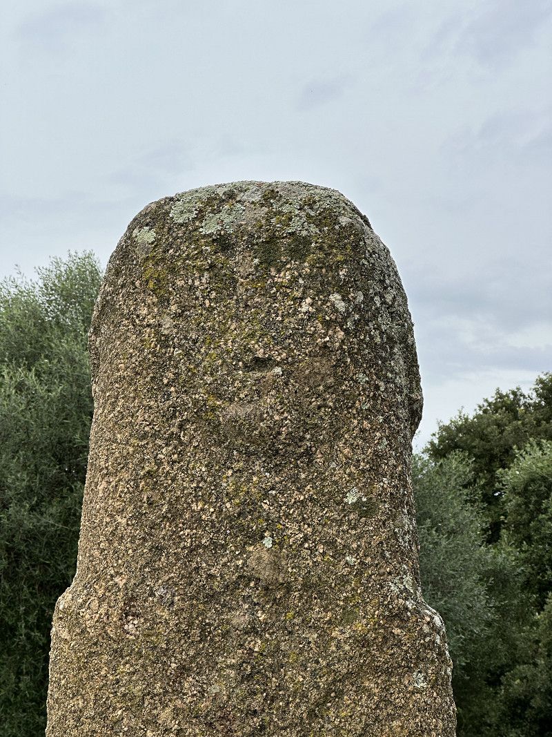
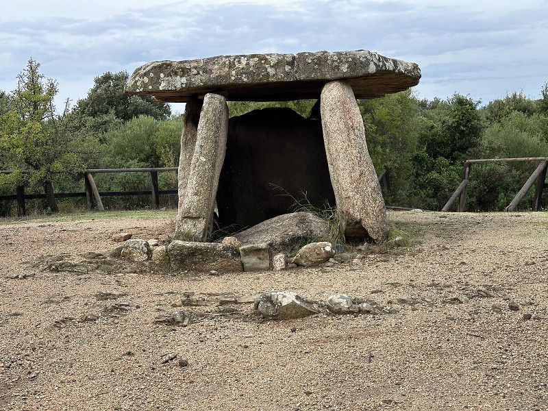
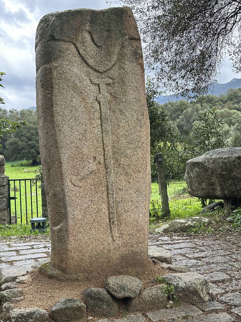
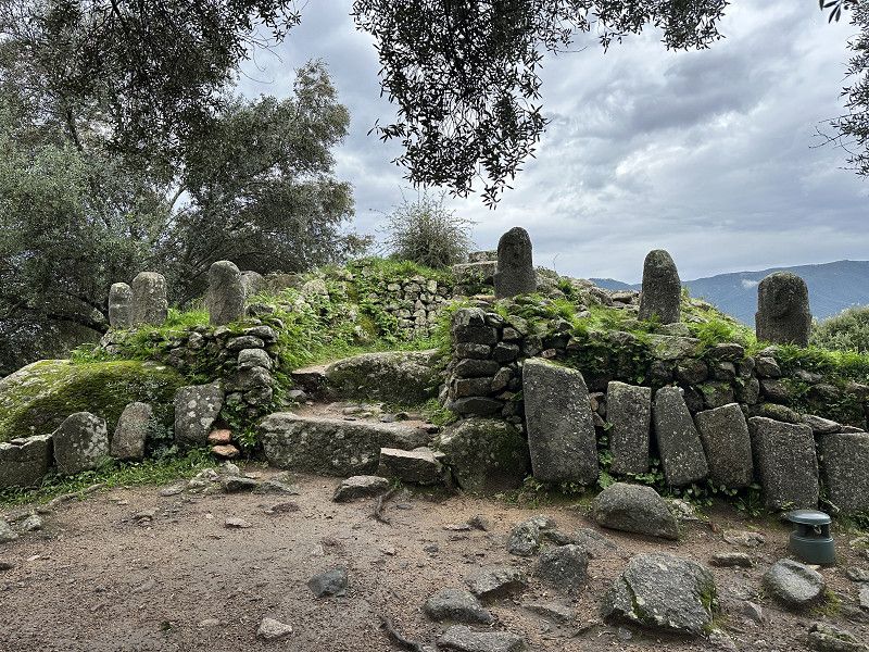
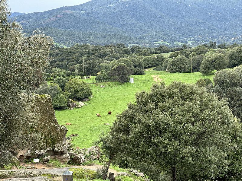
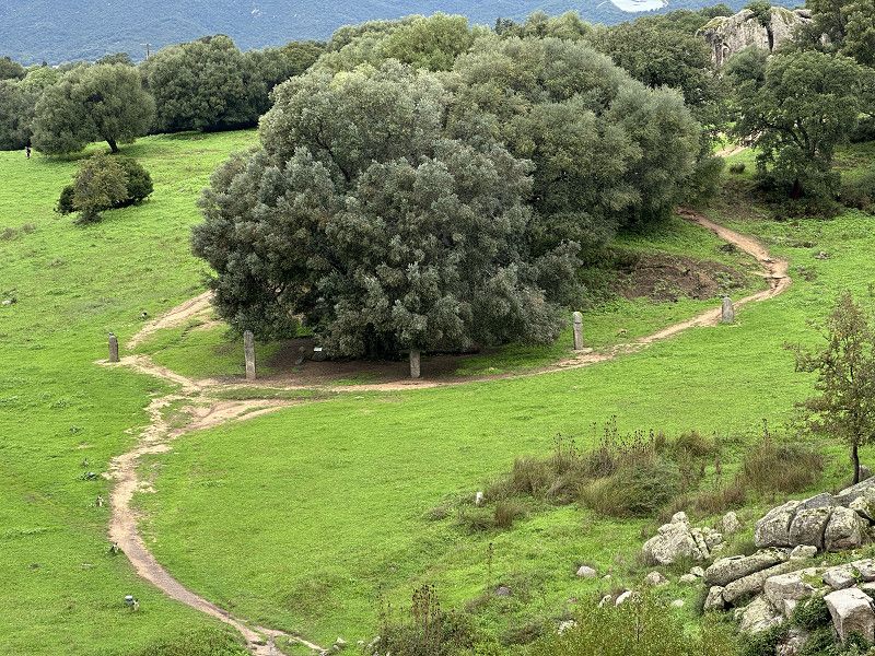
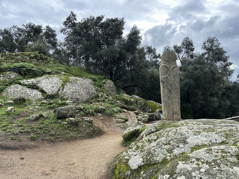
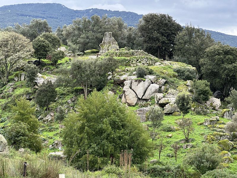
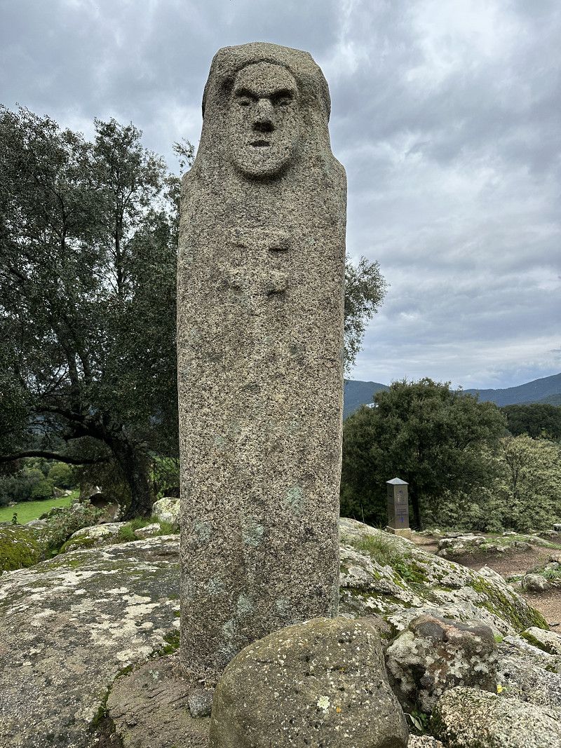
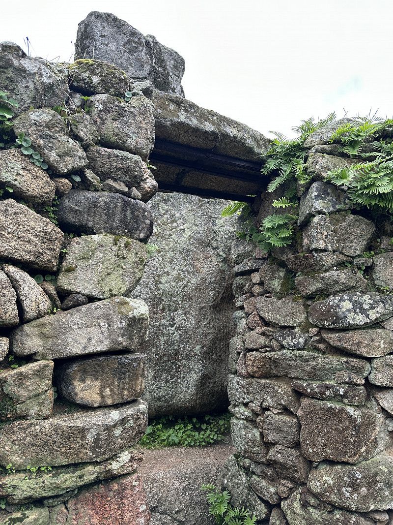
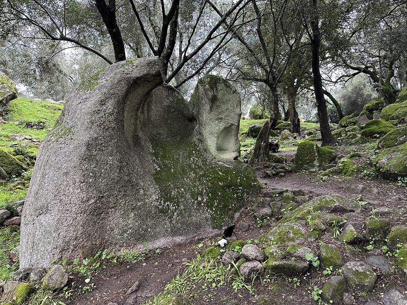
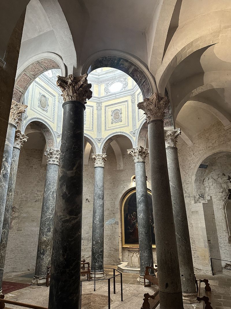
Site archéologique de Cauria: I stantari, Rinaiu, dolmen de Funtanaccia
Three prehistoric stone piles, one would have to ask oneself how people back then managed to place a 15 ton stone in one pile.
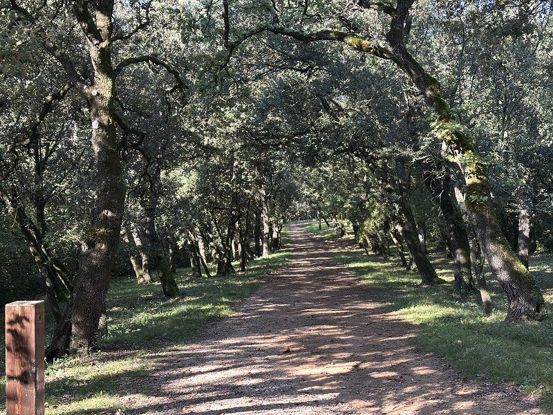
The 2-3 km tour was scenic but not particularly physically demanding.
I had considered spending the night at the parking lot, but I drove on because it was quite early in the day.
D 48a, Sartène, Südkorsika, Korsika, Frankreich
41° 32' 6.8" N 8° 54' 57.6" E
41.5352305 8.9159967
• Head west on D48 A. Go for 332 m.
• Continue on Lieu-dit Sapera Buona (D48 A). Go for 96 m.
• Continue on D48 A. Go for 838 m.
• Continue on Lieu-dit Manzavinu (D48 A). Go for 109 m.
• Continue on D48 A. Go for 963 m.
• Continue on Lieu-dit Sapara Ventosa (D48 A). Go for 165 m.
• Continue on D48 A. Go for 312 m.
• Continue on D48 A. Go for 6 m.
• Turn slightly left onto Lieu-dit Sapera Ventosa (D48 A). Go for 399 m.
• Continue on Lieu-dit L'Arjola (D48 A). Go for 63 m.
• Turn slightly right onto Lieu-dit Sapera Ventosa (D48 A). Go for 113 m.
• Continue on Lieu-dit Tijarella (D48 A). Go for 145 m.
• Continue on D48 A. Go for 835 m.
• Turn right onto D48. Go for 891 m.
• Continue on Lieu-dit Avalle (D48). Go for 109 m.
• Continue on D48. Go for 4.3 km.
• Continue on Lieu-dit Navara (D48). Go for 96 m.
• Continue on D48. Go for 1.7 km.
• Continue on Lieu-dit Zirulina (D48). Go for 301 m.
• Turn left onto Lieu-dit Bocca Albitrina (T40). Go for 2.2 km.
• Turn right onto Rue Jean Nicoli. Go for 36 m.
• Turn slightly right. Go for 9 m.
• Arrive at your destination on the right.
☍
14,1 km
( 24 min.)
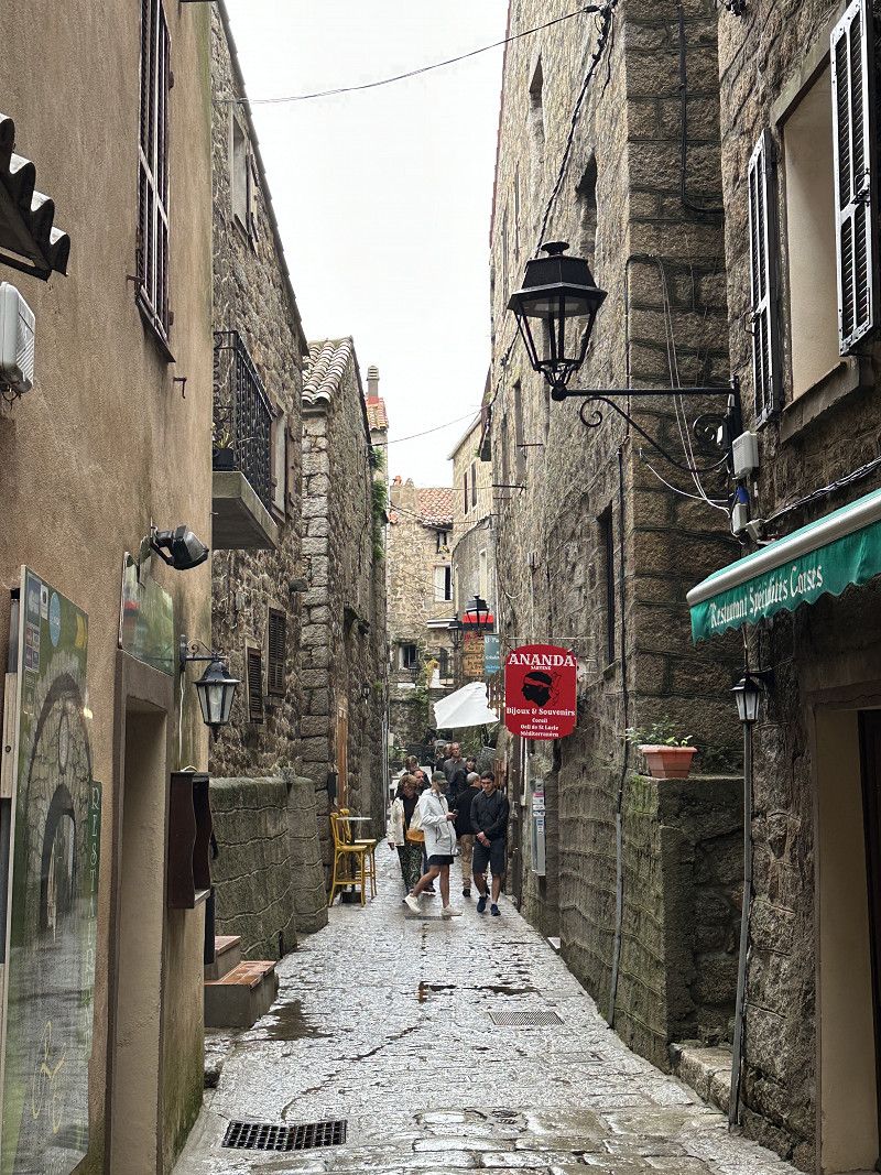
Sartène
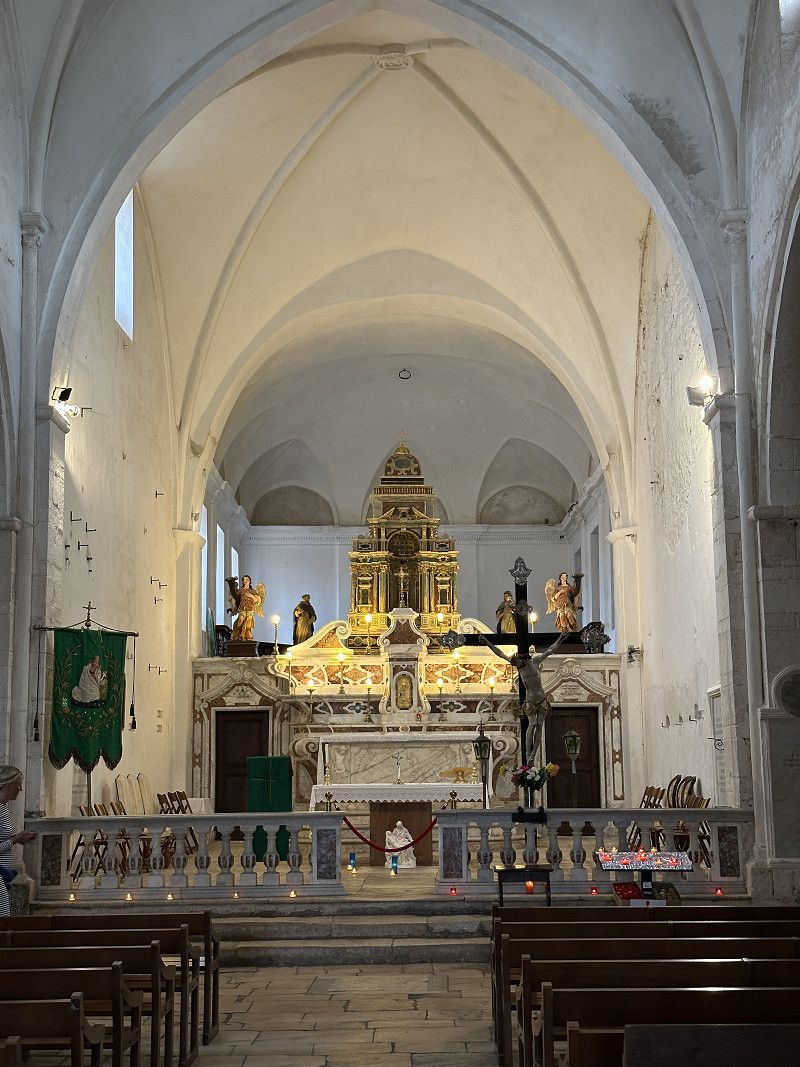
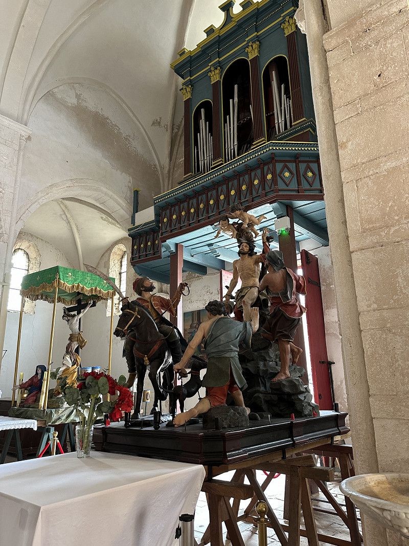
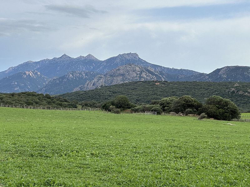
The archaeological museum revealed a lot about the long history of Corsica. Unfortunately, the explanations were only in Corsican or French. Google Translate helped. The town itself was quite grey until the sun came out. Very nice views of the mountains and sea.
Rue Jean Nicoli 1, Sartène, Sartène, Département Corse-du-Sud, Frankreich
41° 37' 3.9" N 8° 58' 24.8" E
41.6177588 8.9735641
• Head south. Go for 43 m.
• Turn left toward Rue Jean Nicoli. Go for 60 m.
• Continue on Rue Jean Nicoli. Go for 36 m.
• Turn right onto Avenue Jean Nicoli (T40). Go for 18 m.
• Take the 2nd exit from roundabout onto Cours Gabriel Péri (T40). Go for 397 m.
• Turn left onto Avenue Jean Jaurès (T40). Go for 5.2 km.
• Turn right onto D268 toward Ste Lucie de Tallano/Levie/Zonza/Aullène. Go for 2.6 km.
• Turn sharp left toward Lieu-dit U Ponte. Go for 658 m.
• Continue on Lieu-dit U Ponte. Go for 1.7 km.
• Arrive at your destination.
☍
10,7 km
( 16 min.)
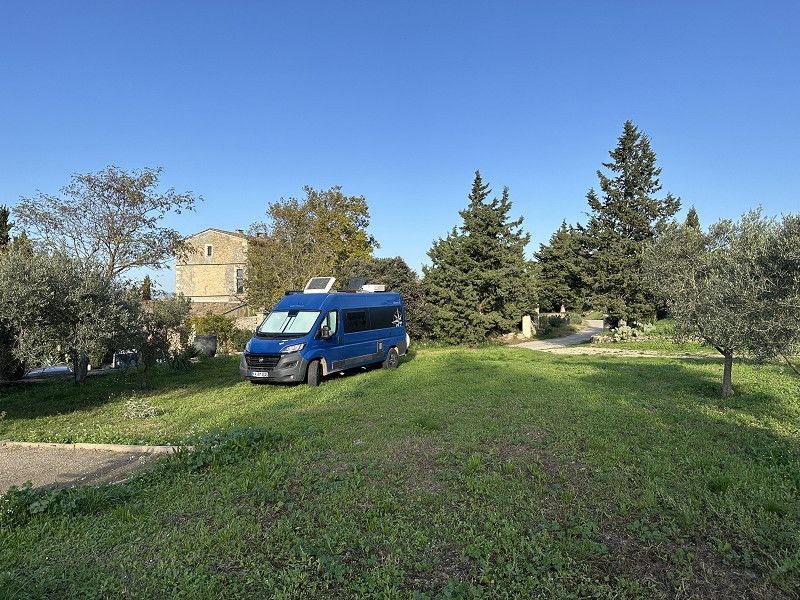
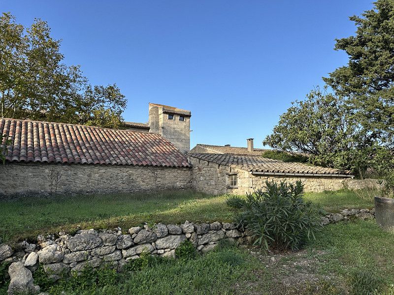
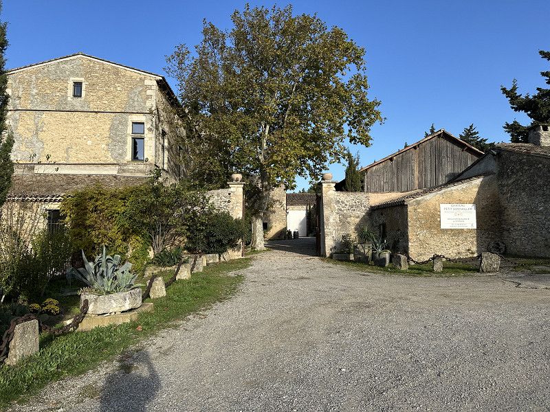
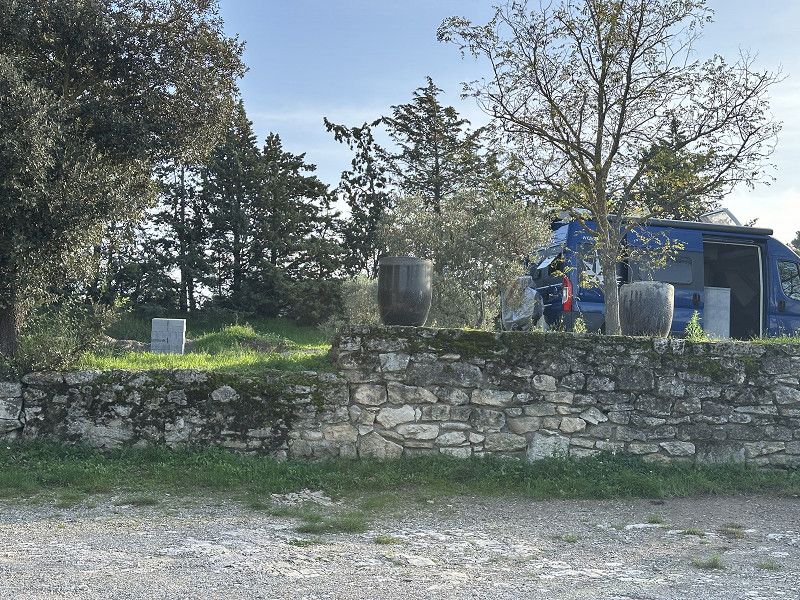
Camping à la ferme "La Rivière"
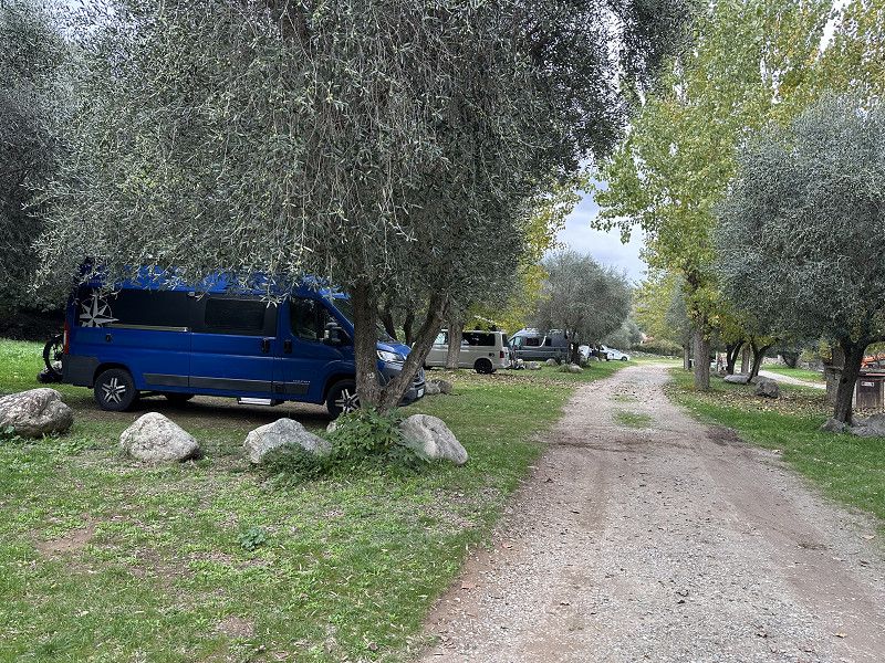
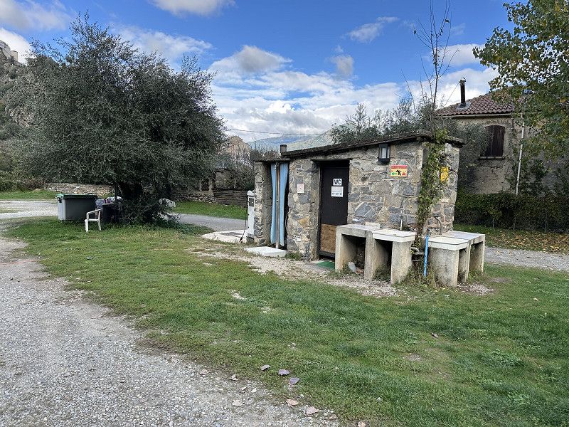
With France Passion, the first night was free. I then decided to take a "rest day" here and do some hiking in the area, as I've been driving quite a lot up to now.
The area is very spacious. Due to the time of year, I was pretty much alone (2-3 other campervans, space for > 100) and ate and slept well...
Route de Levie, Sartène, Südkorsika, Korsika, Frankreich
41° 39' 46.9" N 8° 59' 35.8" E
41.6630192 8.9932728
• Head southwest. Go for 1.6 km.
• Continue on Lieu-dit U Ponte. Go for 764 m.
• Turn sharp right onto D268. Go for 2.6 km.
• Turn right onto T40. Go for 5.2 km.
• Take the 1st exit from roundabout onto T40 toward Ajaccio/Olmeto. Go for 2.5 km.
• Take the 2nd exit from roundabout onto T40 toward Ajaccio. Go for 3.1 km.
• Turn left onto D157 toward Porto Pollo/Pila Canale/Serra di Ferro/Filitosa. Go for 6.5 km.
• Take the 2nd exit from roundabout onto Lieu-dit Abbartello (D157). Go for 3.1 km.
• Turn right onto D57. Go for 1.3 km.
• Continue on Lieu-dit Petrajo (D57). Go for 114 m.
• Continue on D57. Go for 232 m.
• Continue on Lieu-dit Isula (D57). Go for 92 m.
• Continue on D57. Go for 723 m.
• Continue on Lieu-dit Bujo (D57). Go for 73 m.
• Continue on D57. Go for 797 m.
• Continue on Lieu-dit Campu Stefanu (D57). Go for 114 m.
• Continue on D57. Go for 789 m.
• Continue on Lieu-dit Filitosa (D57). Go for 394 m.
• Arrive at Lieu-dit Filitosa (D57). Your destination is on the left.
☍
30,0 km
( 37 min.)
Day
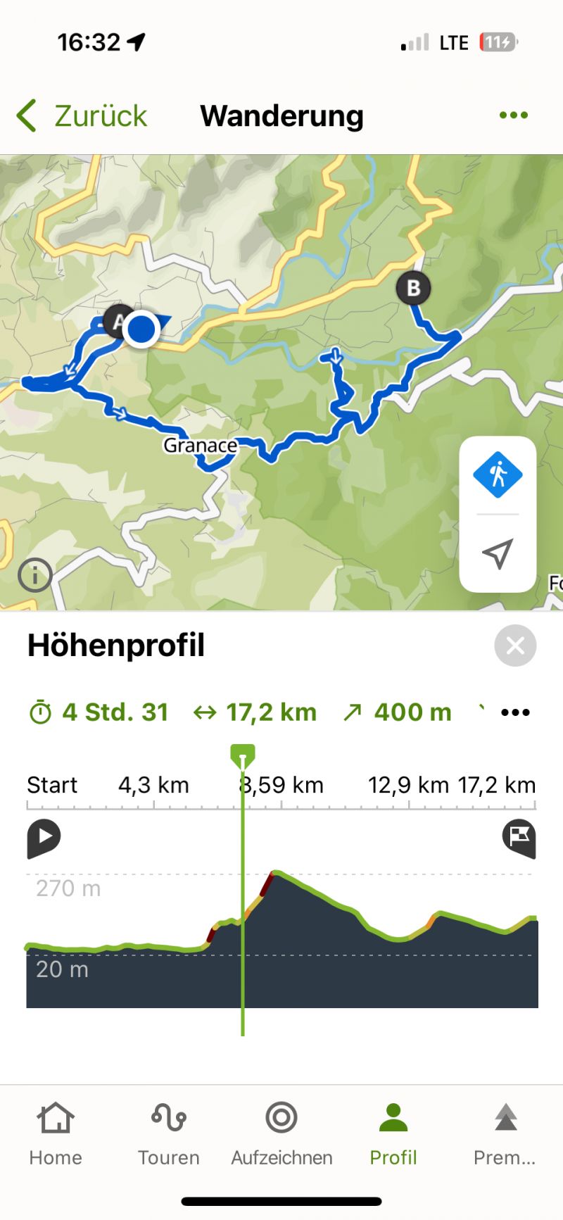
Wandertag
Since the weather and the surroundings were nice, I stayed another day. I went on a very long hike. Unfortunately, it was too long. A nice Corsican drove me the last 6 km back to the campsite. Since I walked over 17 km, I rewarded myself with a meal in a restaurant instead of cooking myself.
Day
Nasser Tagesanfang
There was a severe thunderstorm with heavy rain early in the morning.
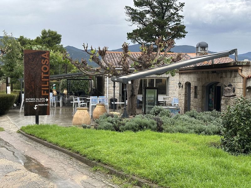
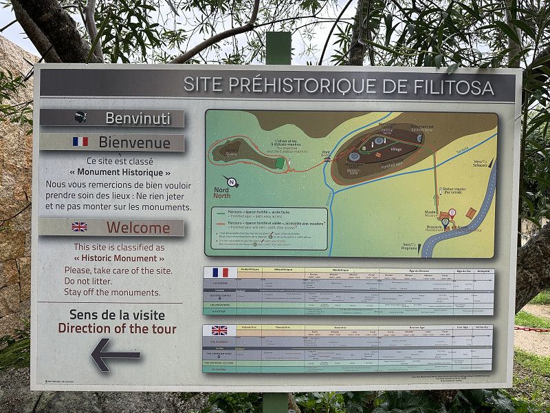
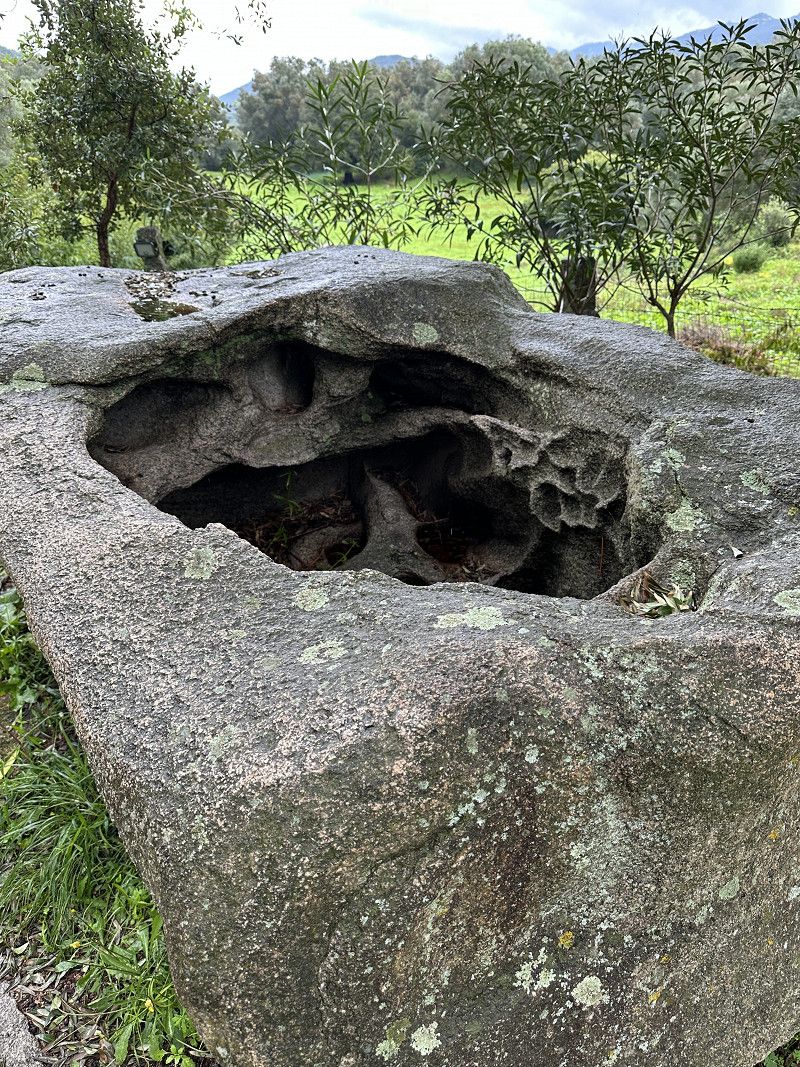
Filitosa
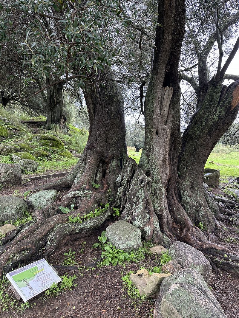
Further historical excavations. The 1200 year old olive tree was interesting.
Südkorsika, Korsika, Frankreich
41° 44' 39.9" N 8° 52' 15.4" E
41.7444035 8.8709371
• Head toward Résidence Le Torreen on Lieu-dit Filitosa (D57). Go for 394 m.
• Continue on D57. Go for 198 m.
• Turn right onto D457. Go for 903 m.
• Continue on Lieu-dit Tappa (D457). Go for 105 m.
• Continue on D457. Go for 997 m.
• Continue on Lieu-dit Casone (D457). Go for 120 m.
• Continue on D457. Go for 572 m.
• Continue on Lieu-dit Piattone (D457). Go for 106 m.
• Continue on D457. Go for 1.7 km.
• Turn left onto D302. Go for 839 m.
• Continue on Lieu-dit Chiesale (D302). Go for 97 m.
• Continue on D302. Go for 964 m.
• Turn right onto D757. Go for 1.2 km.
• Arrive at D757. Your destination is on the right.
☍
8,1 km
( 13 min.)
FP Stellplatz
Olive oil producer. Unfortunately everything was already sold out and there was nothing to try, but I was allowed to stand there for free. Very quiet and a great night sky.
D 757, Pila-Canale, Südkorsika, Korsika, Frankreich
41° 46' 51.6" N 8° 55' 0.8" E
41.7810109 8.9168851
• Head east on D757. Go for 8.3 km.
• Take the 3rd exit from roundabout onto T40 toward Ajaccio/Grosseto-Prugna. Go for 24.7 km.
• Pass 2 roundabouts and continue on Lieu-dit Barraccone (T40). Go for 8.8 km.
• Turn right onto T40 toward Ajaccio/Bastia/Calvi. Go for 211 m.
• Take the 2nd exit from roundabout onto T40 toward Ajaccio/Bastia/Calvi/Bastelicaccia. Go for 3.3 km.
• Turn left toward Ajaccio. Go for 458 m.
• Continue on T21. Go for 454 m.
• Pass 4 roundabouts and continue on T21. Go for 5.0 km.
• Turn right toward D61/Alata/Villanova. Go for 26 m.
• Turn right onto Rue Paulin Colonna d'Istria. Go for 533 m.
• Continue on Résidence Laetitia Ramolino (D61). Go for 26 m.
• Continue on Résidence Pauline Bonaparte (D61). Go for 66 m.
• Continue on D61. Go for 11 m.
• Continue on Chemin de la Croix d'Alexandre (D61). Go for 163 m.
• Take the 2nd exit from roundabout onto Route d'Alata (D61). Go for 92 m.
• Turn left onto Chemin de la Croix d'Alexandre. Go for 123 m.
• Turn left onto Route de Carosaccia. Go for 90 m.
• Turn slightly left onto Route de Carosaccia. Go for 634 m.
• Turn left. Go for 43 m.
• Turn slightly right. Go for 63 m.
• Turn left. Go for 10 m.
• Arrive at your destination on the left.
☍
53,1 km
( 57 min.)
Day
Camping Les Mimosas
Actually wanted to spend the night at the campsite. Unfortunately it was closed despite information to the contrary.
Chemin de la Carosaccia, Ajaccio, Südkorsika, Korsika, Frankreich
41° 56' 13.8" N 8° 43' 39.3" E
41.9371652 8.7275766
• Head east. Go for 10 m.
• Turn right toward Route de Carosaccia. Go for 106 m.
• Turn right onto Route de Carosaccia. Go for 724 m.
• Turn right onto Chemin de la Croix d'Alexandre. Go for 123 m.
• Turn right onto Route d'Alata (D61). Go for 44 m.
• Take the 2nd exit from roundabout onto Chemin de la Croix d'Alexandre (D61). Go for 208 m.
• Continue on D61. Go for 11 m.
• Continue on Résidence Pauline Bonaparte (D61). Go for 66 m.
• Continue on Résidence Laetitia Ramolino (D61). Go for 26 m.
• Continue on Rue Colonel et Commandant Biancamaria (D61). Go for 174 m.
• Continue on Montée Saint-Jean (D61). Go for 329 m.
• Turn left onto T21. Go for 101 m.
• Turn right toward Route du Bord de Mer. Go for 26 m.
• Turn left onto Route du Bord de Mer. Go for 953 m.
• Continue on Cours du Prince Impérial (T21). Go for 767 m.
• Take the 2nd exit from roundabout onto Route d'Aspretto (T21) toward Calvi/Bastia/Bonifacio/Sartène/Aéroport Napoléon Bonaparte/Z.I. du Vazzio. Go for 371 m.
• Take the 2nd exit from roundabout onto Route du Ricanto (T21) toward Calvi/Bastia/Bonifacio/Sartène/Aéroport Napoléon Bonaparte. Go for 1.5 km.
• Take the 1st exit from roundabout onto Route de Campo Dell'Oro toward Aéroport Napoléon Bonaparte/Plage du Ricanto. Go for 100 m.
• Turn right. Go for 196 m.
• Arrive at your destination on the left.
☍
5,8 km
( 10 min.)
Ajaccio Parkplatz
Parking bay on the beach from Park4Night. The night wasn't very quiet, but I slept well anyway. The next day we took the ferry to Toulon, so the journey home began.
Südkorsika, Korsika, Frankreich
41° 55' 37" N 8° 46' 35.4" E
41.9269441 8.7764925
• Head toward Route de Campo Dell'Oro. Go for 196 m.
• Turn left onto Route de Campo Dell'Oro. Go for 78 m.
• Take the 3rd exit from roundabout onto Route du Ricanto (T21) toward Ajaccio/Aspretto. Go for 1.6 km.
• Pass 2 roundabouts and continue on T21. Go for 2.1 km.
• Continue on Cours Napoléon (T21) toward St Jean/Octroi Ste Lucie. Go for 693 m.
• Turn right onto Avenue Beverini-Vico. Go for 60 m.
• Arrive at Avenue Beverini-Vico. Your destination is on the left.
☍
4,7 km
( 7 min.)
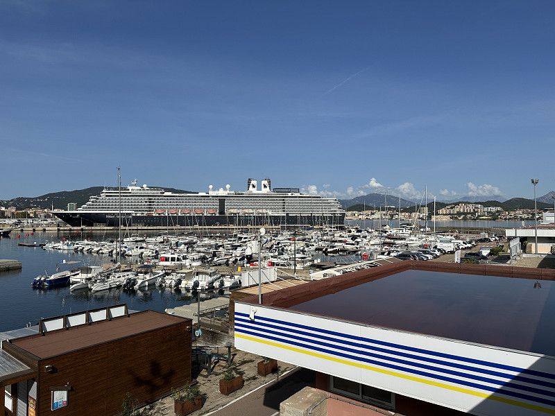
Ajaccio
I just remembered that Napoleon was born in Corsica. You can visit his parents' house, but it was closed on Mondays, of course. But there is a lot to see. I cycled into town on my e-bike from the car park. In addition to the ferry, Ajaccio is also a port for cruise ships.
Day
Faule Tag am Strand vom Ajaccio
Yesterday I visited pretty much all the sights in Ajaccio. I wasn't interested in seeing the inside of Napoleon's birthplace. I did some "office work" and planned the rest of my week of travel in a little more detail.
I decided to use the day for a bit of practical work. After 3 weeks there was some laundry to do, etc.
Corsica Ferries
Departure port: Ajaccio
Südkorsika, Korsika, Frankreich
41.9263991 8.7376029
Arrival port: Toulon
Var, Provence-Alpes-Côte d'Azur, Frankreich
43.12573115.9304919
• Head toward Rue Dumont d'Urville on Boulevard de Strasbourg (N8). Go for 851 m.
• Keep left onto Carrefour Villevieille. Go for 141 m.
• Continue on Avenue Lieutenant Estienne d'Orves. Go for 545 m.
• Take left ramp onto A50 toward Marseille/Aix en Pce/La Seyne S/Mer/Toulon-Ouest. Go for 43.0 km.
• Keep right onto A52 toward Lyon/Nice/Aix en Pce/Aubagne. Go for 25.0 km.
• Take the left exit toward Lyon/Aix en Pce onto A8 (La Provençale). Go for 9.3 km.
• Take exit 31 toward Aix-Val St André. Go for 391 m.
• Take the 1st exit from roundabout onto Avenue Henri Mauriat toward Fréjus/St Raphaël/Aubagne/Centre Ville/Le Tholonet. Go for 158 m.
• Take the 2nd exit from roundabout onto Avenue Henri Malacrida (D7 N) toward St Jérôme/La Torse. Go for 753 m.
• Turn right onto Avenue des Déportés de la Résistance Aixoise. Go for 259 m.
• Take the 2nd exit from roundabout onto Avenue des Déportés de la Résistance Aixoise. Go for 195 m.
• Arrive at Avenue des Déportés de la Résistance Aixoise.
☍
Distance not available
(Duration not available)
Day
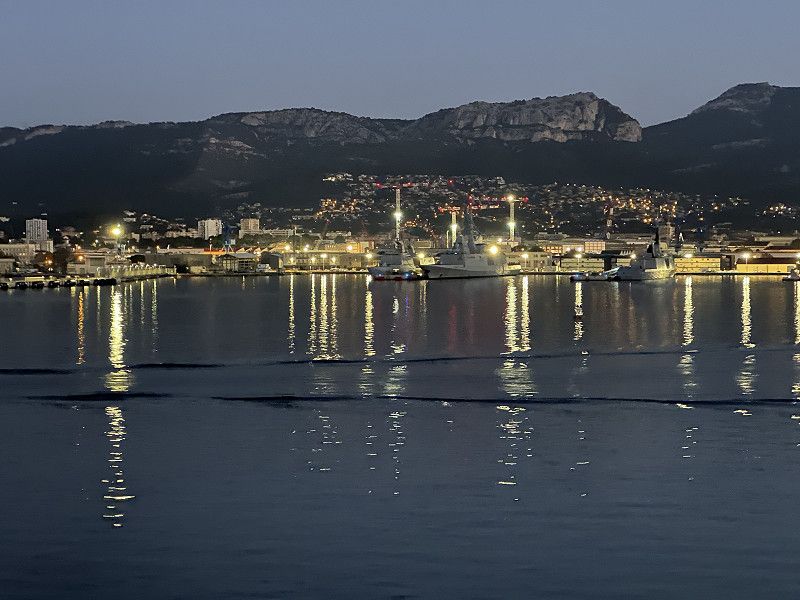
Ankunft in Toulon
In Toulon I filled up "cheaply" (about €0.10 cheaper than on Corsica and Elba.
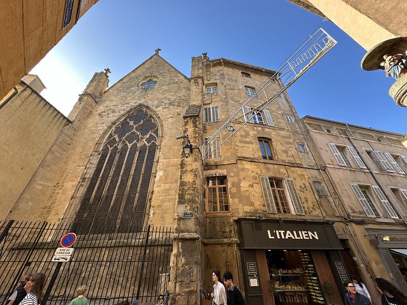
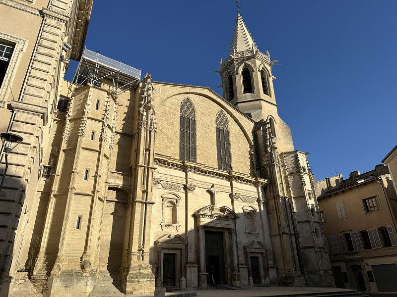
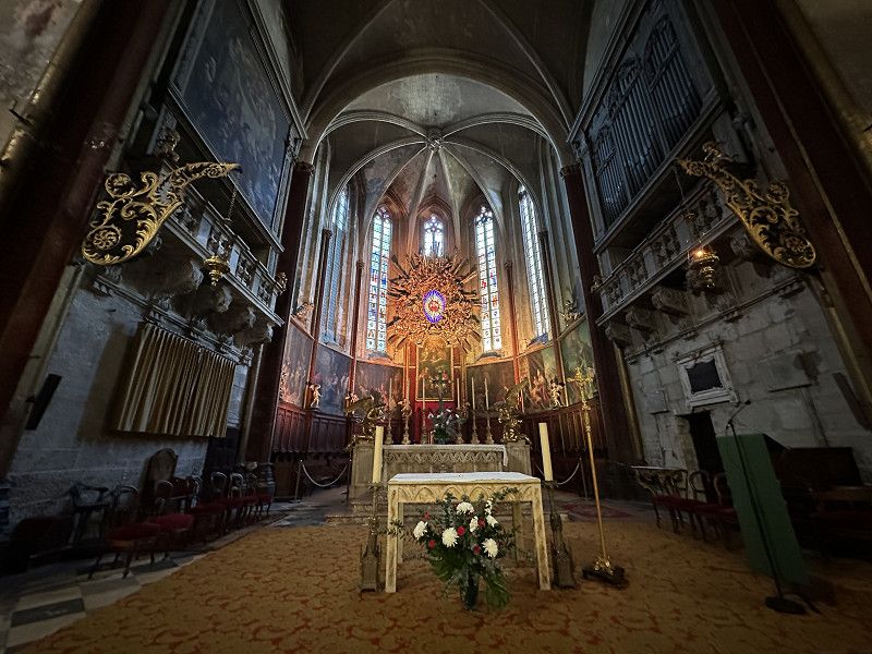
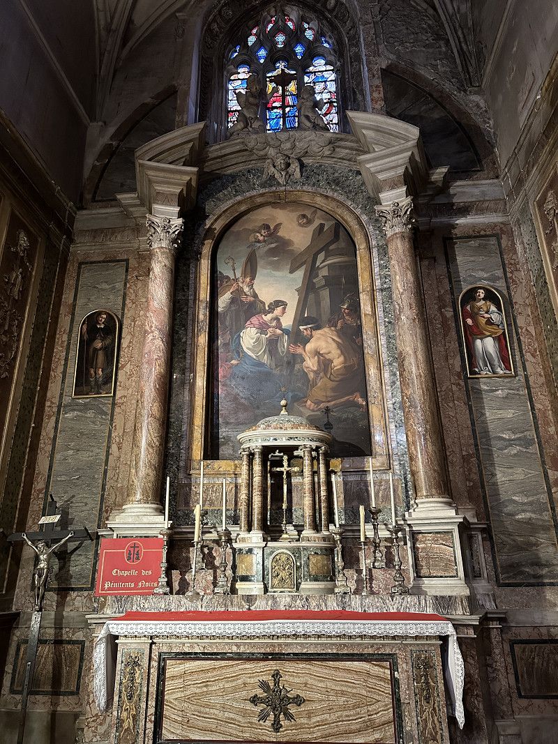
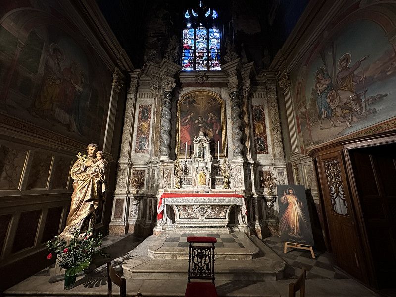
Aix-en-Provence
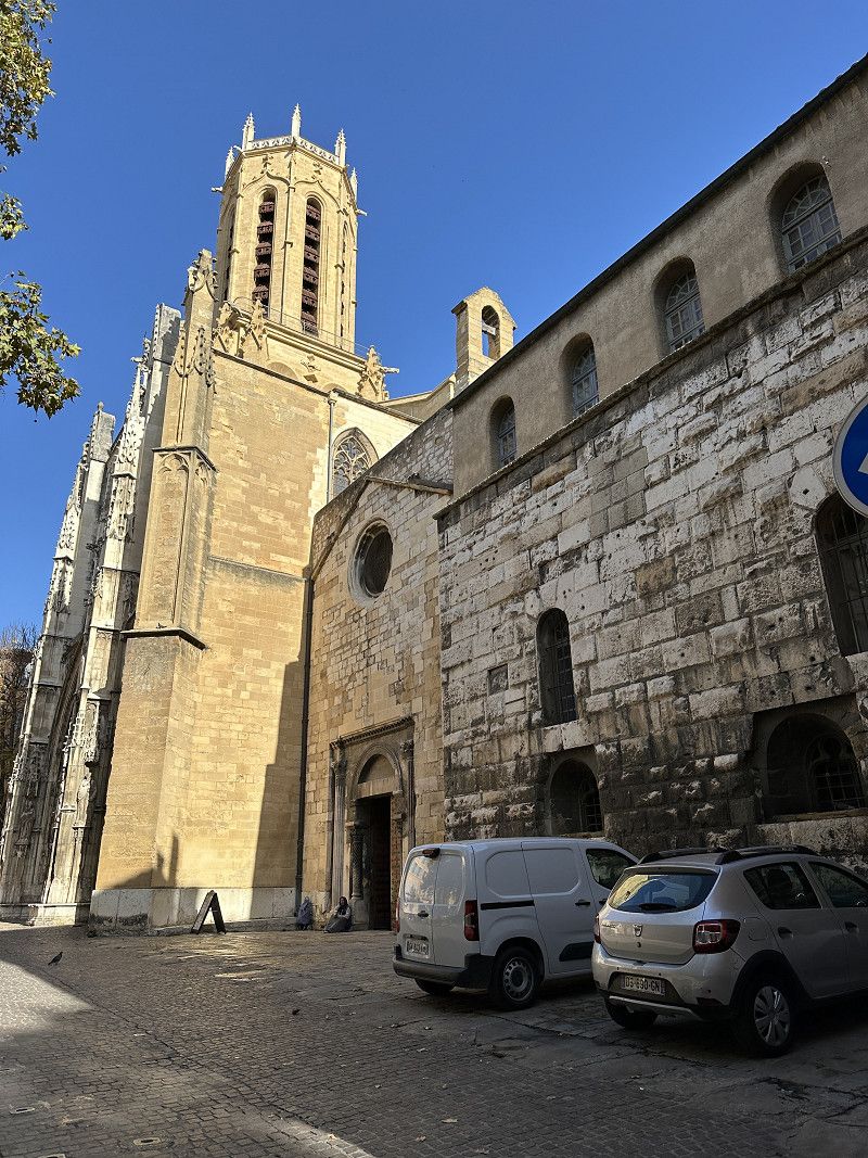
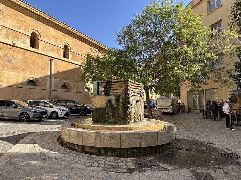
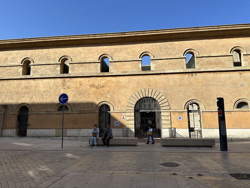
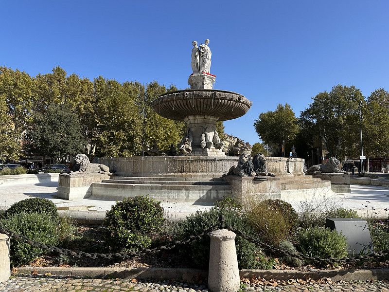
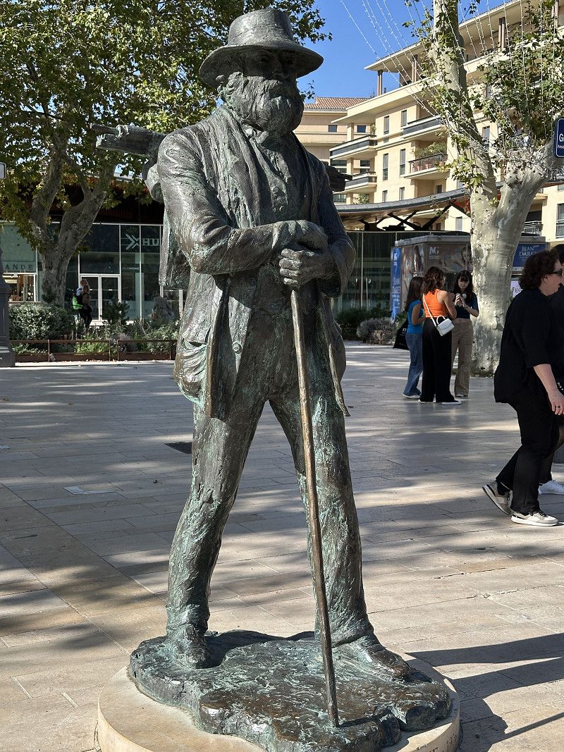
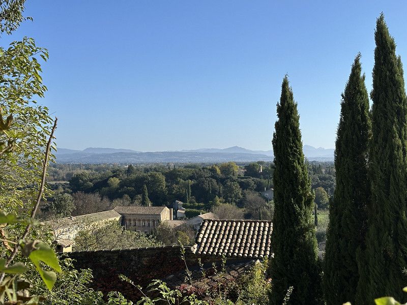
A very interesting city! Unfortunately some of the sights were closed for renovations. But it was still beautiful. The Musée Granet alone is worth a visit.
Avenue Des Déportés De La Résistance Aixoise 10, Aix-en-Provence, Aix-en-Provence, Bouches-du-Rhône, Frankreich
43° 31' 27.3" N 5° 27' 37.4" E
43.5242458 5.4603947
• Head north on Avenue des Déportés de la Résistance Aixoise. Go for 275 m.
• Take the 1st exit from roundabout onto Avenue des Écoles Militaires (D17). Go for 915 m.
• Take the 1st exit from Place Charles Tillon roundabout onto Avenue René Cassin. Go for 280 m.
• Take the 2nd exit from roundabout onto Avenue René Cassin. Go for 533 m.
• Turn left onto Avenue Henri Malacrida (D7 N). Go for 269 m.
• Take the 1st exit from roundabout onto Avenue Henri Mauriat toward A9/Nice/Lyon/A51/Sisteron/Fréjus/St Raphaël/Aubagne/Toulon. Go for 151 m.
• Take the 2nd exit from roundabout toward Gap/Avignon/Marseille/Fréjus/St Raphaël/Aubagne/Toulon. Go for 169 m.
• Take ramp onto A8 (La Provençale) toward Marseille/Sisteron/Avignon/Gap. Go for 20.5 km.
• Take the exit onto A7 (Échangeur de la Croix de Coudoux). Go for 11.9 km.
• Take the exit toward Salon de Pce/Arles/Nîmes/Barcelone onto A54. Go for 1.7 km.
• Take exit 15 toward Salon-Centre/Pélissanne. Go for 791 m.
• Take the 4th exit from Rond-Point de l'École de l'Air roundabout onto D572 toward A54/A7/Arles/Centre Ville. Go for 328 m.
• Take the 1st exit from roundabout onto Avenue de la Patrouille de France (N538) toward Parc d'Activités de la Gandonne. Go for 221 m.
• Keep right onto Carrefour de l'Arceau toward Salon-Nord/Salon-Est/Salon-Ouest/Parc d'Activités de la Gandonne. Go for 236 m.
• Take the 3rd exit from Square Notre-Dame de Bon Voyage roundabout onto Boulevard Georges Pompidou. Go for 633 m.
• Continue on Avenue Léon Blum. Go for 230 m.
• Continue on Avenue Julien Fabre. Go for 360 m.
• Turn right onto Avenue Roger Donnadieu (D17) toward Aurons. Go for 296 m.
• Take the 2nd exit from roundabout onto Chemin de l'Abbé Ranchier (D16). Go for 335 m.
• Continue on Route du Val-de-Cuech (D16). Go for 4.3 km.
• Continue on Lieu-dit Les Costes (D16). Go for 235 m.
• Continue on D16. Go for 2.9 km.
• Turn left. Go for 584 m.
• Turn slightly left toward Lieu-dit Petit Sonnailler. Go for 248 m.
• Continue on Lieu-dit Petit Sonnailler. Go for 54 m.
• Arrive at Lieu-dit Petit Sonnailler. Your destination is on the right.
☍
48,5 km
( 46 min.)
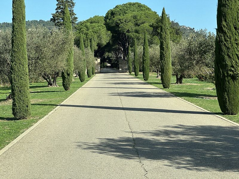
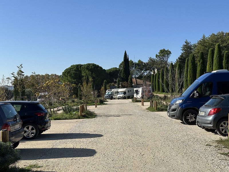
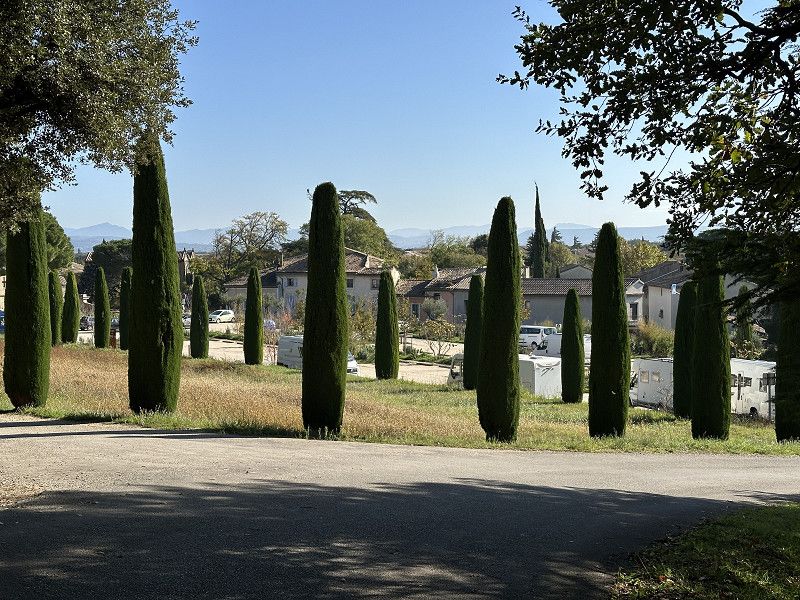
Château Petit Sonnailier
Both campsites in Aix-en-Provence were closed. I could have stayed in the car park, but it would have been very noisy, so I decided to move to a nearby FP parking space.
The journey was beautiful, but led through several roads where > 3.5t were prohibited. The wine was very tasty....
Bouches-du-Rhône, Provence-Alpes-Côte d'Azur, Frankreich
43° 40' 50.9" N 5° 8' 27" E
43.6808046 5.1408221
• Head northeast on Lieu-dit Petit Sonnailler. Go for 886 m.
• Turn right onto D16. Go for 2.9 km.
• Continue on Lieu-dit Les Costes (D16). Go for 235 m.
• Continue on Route du Val-de-Cuech (D16). Go for 4.3 km.
• Continue on Avenue de l'Abbé Ranchier (D16). Go for 304 m.
• Take the 1st exit from roundabout onto Avenue Roger Donnadieu (D17). Go for 314 m.
• Turn left onto Avenue Julien Fabre. Go for 360 m.
• Continue on Avenue Léon Blum. Go for 230 m.
• Continue on Boulevard Georges Pompidou. Go for 556 m.
• Take the 2nd exit from Square Notre-Dame de Bon Voyage roundabout onto Carrefour de l'Arceau toward A54/A7/Pélissanne/Lurian. Go for 514 m.
• Take the 1st exit from roundabout onto Avenue de la Patrouille de France (D538) toward A54/A7/Avignon/Aix en Pce/Marseille/Aéroport de Marignane/Arles/Lançon de Pce. Go for 255 m.
• Take the 3rd exit from roundabout onto Avenue de la Patrouille de France (D538) toward A54 (Nîmes)/Aéroport Marseille Marignane/Arles/La Fare les O./Lançon de Pce. Go for 1.0 km.
• Take the 1st exit from roundabout onto D113 toward A54/Nîmes/Arles/Salon de Pce-Ouest. Go for 940 m.
• Take the 3rd exit from roundabout toward E80/A54/Arles/Nîmes/Aix en Pce/Aéroport Marignane Marseille/Avignon. Go for 189 m.
• Take ramp onto A54 toward Arles/Nîmes/St Martin de Crau. Go for 20.7 km.
• Take exit 12 toward St Martin de Crau. Go for 804 m.
• Take the 2nd exit from roundabout onto Avenue de Manerbio (D24 E). Go for 1.2 km.
• Take the 2nd exit from roundabout onto Avenue de Céret (D24). Go for 1.4 km.
• Take the 1st exit from roundabout onto Avenue des Alpilles (D27). Go for 359 m.
• Continue on Route de Craponne (D27). Go for 3.4 km.
• Continue on Chemin de Saint-Martin-de-Crau (D27). Go for 2.4 km.
• Continue on D27. Go for 250 m.
• Continue on Lieu-dit Roubine de Saint-Jean (D27). Go for 295 m.
• Continue on D27. Go for 232 m.
• Turn left onto Chemin de Faubraguette (D78 D). Go for 2.2 km.
• Turn left onto Avenue de la Vallée des Baux (D17). Go for 4.2 km.
• Turn right onto Chemin de la Barjolle (D33 A). Go for 580 m.
• Turn right onto Chemin d'Auge (CR1). Go for 250 m.
• Turn right. Go for 616 m.
• Arrive at your destination on the left.
☍
51,8 km
( 49 min.)
Day
Unterwegs
On the national roads you always see many great places and great views that are not mentioned in the travel guide.
Fontvieille
Noble olive oil mill that supposedly produces the best olive oil in the world. Had to pick up olive oil for a good friend.
Route de Maussane, Fontvieille, Arrondissement Arles, Bouches-du-Rhône, Frankreich
43° 44' 8.2" N 4° 44' 32.1" E
43.7355997 4.7422560
• Head southwest. Go for 616 m.
• Turn left onto Chemin d'Auge (CR1). Go for 250 m.
• Turn right onto Chemin de la Barjolle (D33 A). Go for 3.4 km.
• Continue on Route de Fontvieille (D33). Go for 2.0 km.
• Continue on D32. Go for 221 m.
• Take the 1st exit from roundabout onto D570 N toward Avignon/Châteaurenard/Maillane/St Rémy de Pce. Go for 3.1 km.
• Take the 3rd exit from roundabout onto D570 N toward Avignon/Maillane/Graveson/Châteaurenard. Go for 7.0 km.
• Take the 1st exit from roundabout onto Chemin Saunier (D570 N) toward Avignon/Rognonas/Graveson/Châteaurenard/Maillane. Go for 996 m.
• Take the 3rd exit from roundabout onto Route d'Avignon (D570 N) toward Avignon/Rognonas/Pôle d'Activités du Sagnon. Go for 644 m.
• Pass 2 roundabouts and continue on Route de Tarascon (D570 N). Go for 5.0 km.
• Take the 3rd exit from Giratoire de l'Escapade roundabout onto D570 N toward Avignon. Go for 1.5 km.
• Take the 2nd exit from Giratoire du Mas du Temple roundabout onto Route de la Montagnette (D35) toward Orange/Châteaurenard/Rognonas/Avignon-Sud. Go for 1.1 km.
• Take the 2nd exit from roundabout onto Avenue Général de Gaulle (D570 N) toward Orange/Avignon/Châteaurenard/Z.A. de la Horsière. Go for 624 m.
• Pass 2 roundabouts and continue on Avenue de Tarascon (N570). Go for 2.0 km.
• Turn right onto Rocade Charles de Gaulle toward A7/La Rocade/Aéroport Avignon. Go for 7.3 km.
• Keep left onto D225. Go for 17.6 km.
• Take the 1st exit from roundabout onto D942 toward Carpentras/Cavaillon/L'Isle sur la Sorgue/Apt/Pernes Les Fontaines/Fontaine de Vaucluse. Go for 419 m.
• Turn right toward D235/Carpentras-Centre/Pôle Santé/Quartier Charpaud. Go for 200 m.
• Take the 1st exit from roundabout onto Route de Monteux toward Carpentras-Centre/Hôpital Pôle Santé. Go for 103 m.
• Take the 3rd exit from Rond-Point de l'Amitié roundabout onto D942 toward Carpentras-Centre. Go for 131 m.
• Keep right onto D942 toward Carpentras Centre. Go for 90 m.
• Continue on Avenue Frédéric Mistral (D942). Go for 1.2 km.
• Turn right onto Avenue de la Gare toward Cavaillon/Pernes Les Fontaines/Isle sur la Sorgue. Go for 307 m.
• Continue on Boulevard Pasteur (D49). Go for 292 m.
• Turn right. Go for 20 m.
• Turn left. Go for 24 m.
• Arrive at your destination on the right.
☍
56,0 km
( 52 min.)
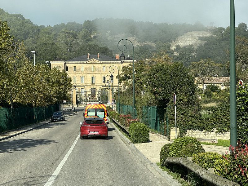
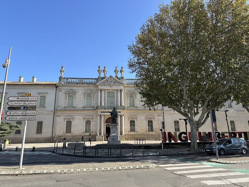
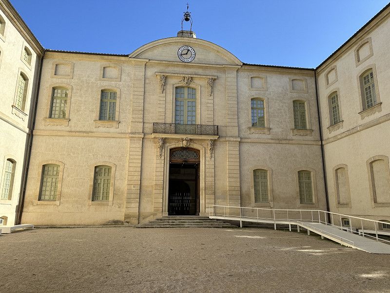
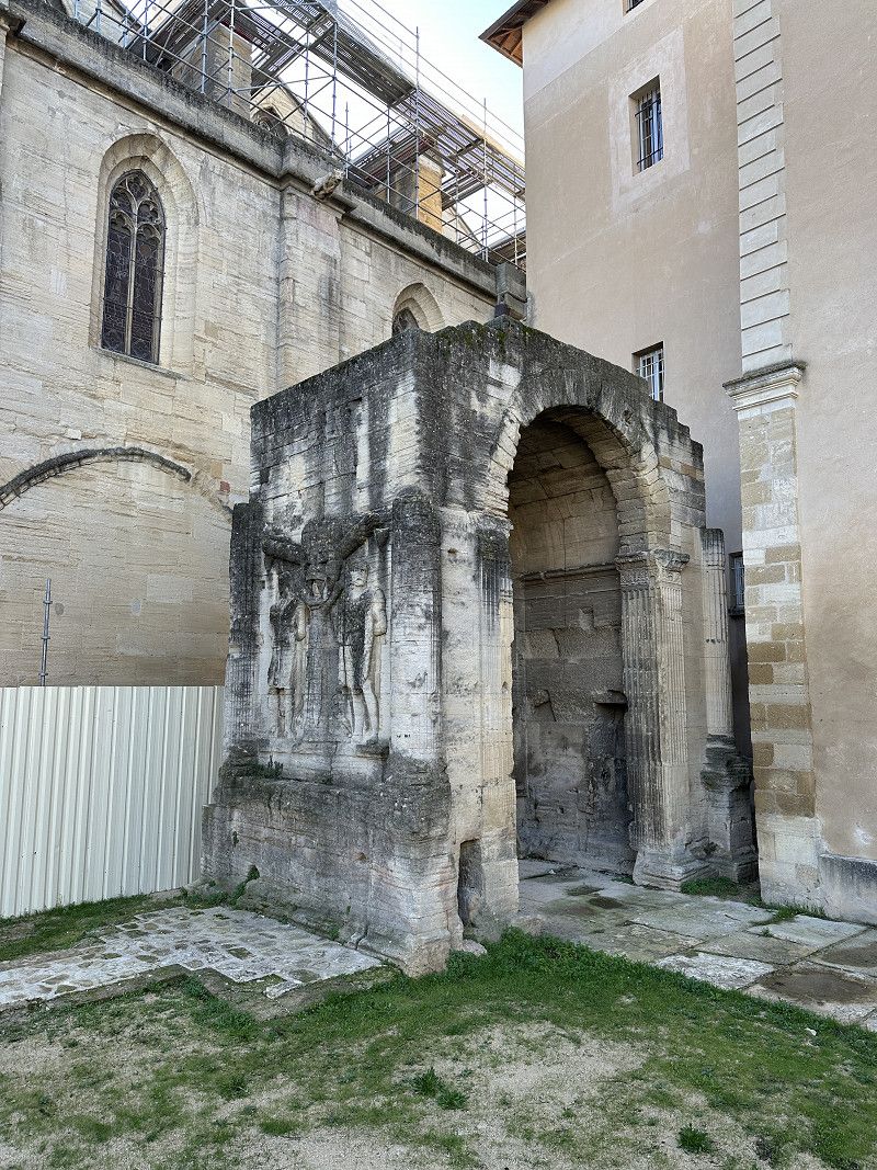
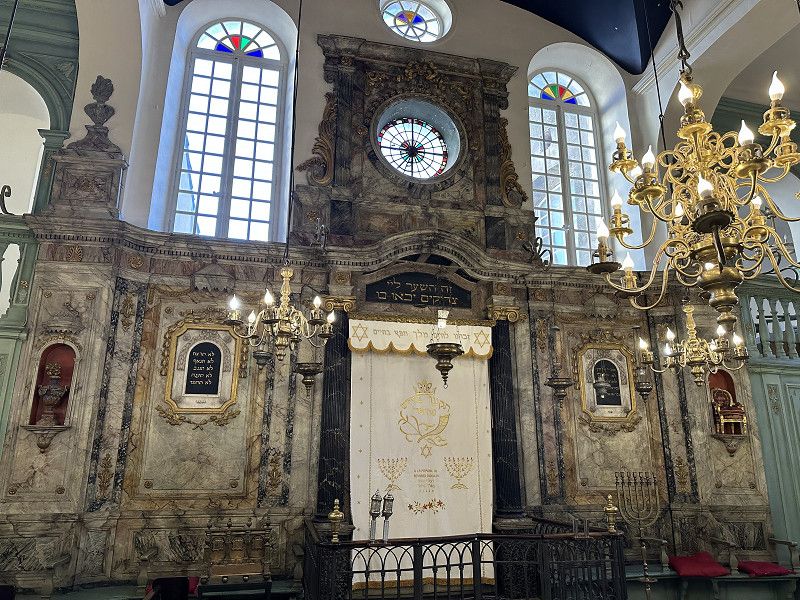
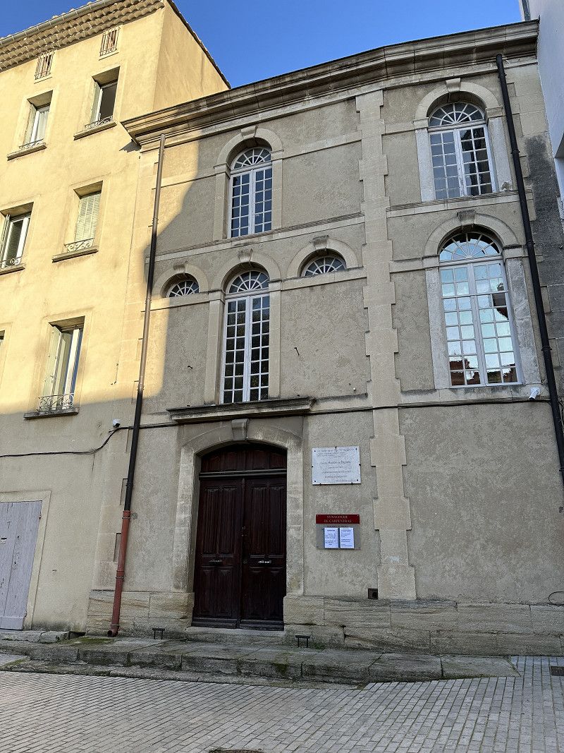
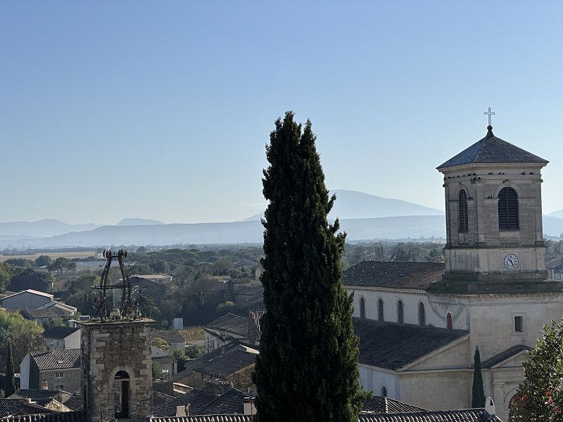
Carpentras
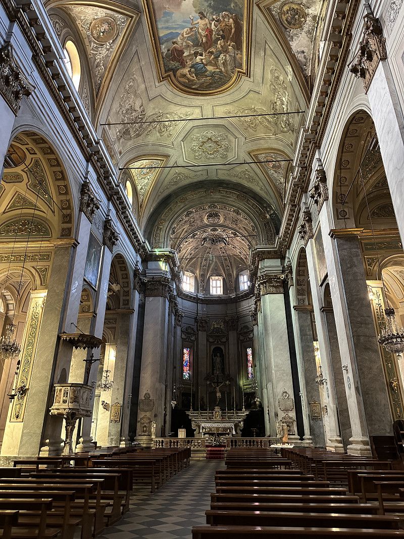
Interesting little town. I wanted to find a place to visit on the way to the next parking spot. It was worth it. The synagogue is the oldest active synagogue in France; since 1354. Apart from the restaurants, pretty much everything was closed at lunchtime, so I had lunch here. The church was also impressive...
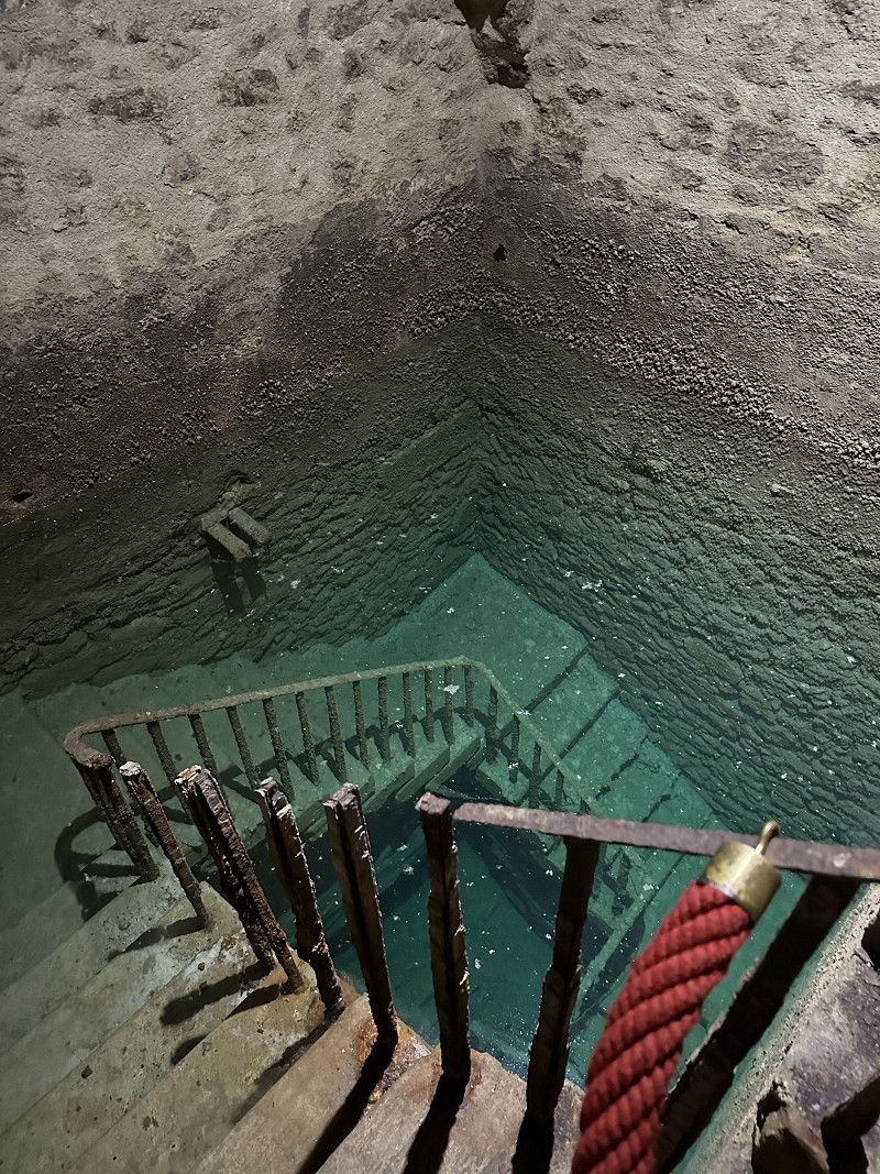
There was also a free public toilet at the train station parking lot where I could empty my toilet (urine container).
Boulevard Pasteur 301bis, Carpentras, Carpentras, Département Vaucluse, Frankreich
44° 2' 45.9" N 5° 2' 45.4" E
44.0460945 5.0459424
• Head north. Go for 24 m.
• Turn right toward Boulevard Pasteur/D49. Go for 20 m.
• Turn right onto Boulevard Pasteur (D49). Go for 294 m.
• Turn right onto Avenue des Marchés (D49). Go for 463 m.
• Take the 2nd exit from roundabout onto Avenue des Marchés (D49). Go for 948 m.
• Take the 1st exit from roundabout onto Route de Velleron à Carpentras (D235) toward A7/Avignon/Monteux/Z.A. Villenfranche-Kennedy/Pôle Santé. Go for 482 m.
• Take the 2nd exit from roundabout onto D235 toward A7/Avignon/Monteux/Z.A. Villefranche-Kenndy/Pôle Santé. Go for 749 m.
• Take the 2nd exit from roundabout onto D942 toward D235/A7/Avignon/Monteux. Go for 934 m.
• Take the 2nd exit from roundabout onto D942 toward (Marseille)/Avignon/Monteux. Go for 14.7 km.
• Take ramp toward Valence/Marseille. Go for 260 m.
• Take the 5th exit from roundabout toward A7/Cavaillon/Marseille. Go for 286 m.
• Take ramp onto A7 (Autoroute du Soleil) toward Orange/Valence/Lyon. Go for 42.8 km.
• Take exit 19 toward Pierrelatte/Bollène. Go for 1.1 km.
• Take the 6th exit from Rond-Point des Portes de Provence roundabout onto Avenue Salvador Allende (D8) toward Vaison la Romaine/Carpentras/Suze la Rousse/Rochegude/Nyons. Go for 1.3 km.
• Turn left onto Rue Alphonse Daudet toward Lembisque. Go for 474 m.
• Take the 1st exit from Rond-Point Gaspard Rispaud roundabout onto Route de l'Embisque. Go for 1.8 km.
• Turn left onto Route de l'Embisque. Go for 48 m.
• Arrive at Route de l'Embisque. Your destination is on the left.
☍
66,6 km
( 47 min.)
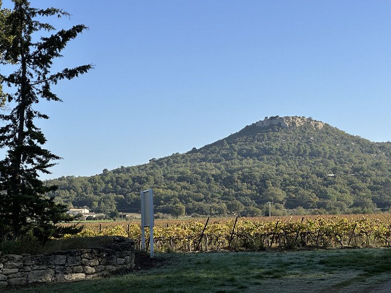
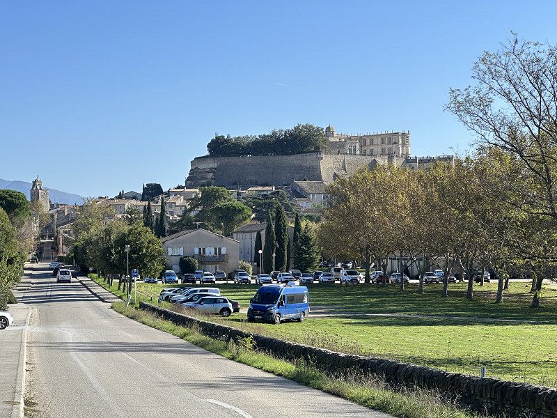
Bolléne: Domaine Julien de l‘Embisque
FP parking space with very good organic wines. I was here in May and have now picked up more.
Route De l’Embisque 1791, Bollène, Saint-Paul-Trois-Châteaux, Drôme, Frankreich
44° 17' 14" N 4° 47' 10.9" E
44.2872103 4.7863576
• Head south on Route de l'Embisque. Go for 48 m.
• Turn left onto Route de l'Embisque. Go for 1.6 km.
• Continue on Route de Bigary. Go for 233 m.
• Continue on Route de Bigary. Go for 712 m.
• Turn slightly right onto Route de Bigary. Go for 1.8 km.
• Turn right onto Route de Saint-Paul (D59). Go for 550 m.
• Take the 1st exit from roundabout onto Avenue des Côtes du Rhône (D94). Go for 152 m.
• Arrive at Avenue des Côtes du Rhône (D94). Your destination is on the right.
☍
5,1 km
( 10 min.)
Day
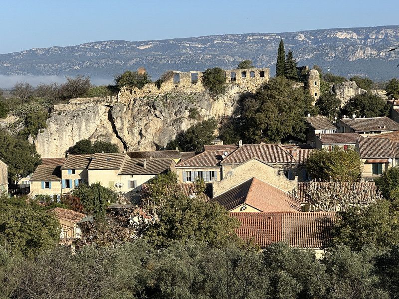
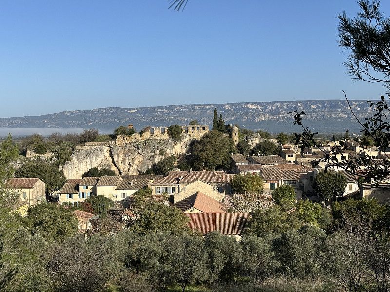
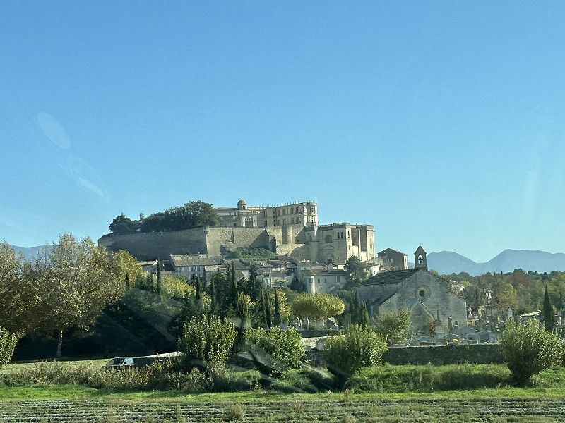
Suze-la-Rousse
Drove past the day before on the way to the overnight spot and took a photo today as a stopover. You could have also spent the night here in the parking lot.
The winegrowers' college in Burg is very well known in France.
Avenue des Côtes du Rhône, Suze-la-Rousse, Drôme, Auvergne-Rhone-Alpen, Frankreich
44° 17' 18.6" N 4° 50' 17.2" E
44.2885021 4.8381150
• Head southwest on Avenue des Côtes du Rhône (D94). Go for 316 m.
• Continue on Route de Rochegude (D117). Go for 100 m.
• Take the 1st exit from roundabout onto D94. Go for 2.8 km.
• Continue on D994. Go for 3.6 km.
• Take the 1st exit from roundabout onto Avenue Salvador Allende (D8) toward A7/Pierrelatte/St Paul/Pont St Esprit. Go for 1.7 km.
• Take the 2nd exit from Rond-Point des Portes de Provence roundabout toward Lyon/Montélimar/Marseille/Nîmes/Orange. Go for 164 m.
• Take ramp onto A7 (Autoroute du Soleil) toward Montélimar/Valence/Lyon. Go for 72.9 km.
• Take exit 15 toward Genève/Chambéry/Grenoble/Romans/Valence onto E713 (Échangeur de Valence-Sud). Go for 708 m.
• Continue on N7. Go for 9.7 km.
• Continue on E713. Go for 168 m.
• Continue on N532. Go for 10.6 km.
• Keep left onto A49 toward Genève/Chambéry/Grenoble/Romans-Centre. Go for 60.6 km.
• Take the exit toward Voiron/Lyon/Chambéry/Genève onto A48. Go for 3.3 km.
• Take exit 11 toward Voiron-Centre/Moirans/Centr'Alp. Go for 457 m.
• Turn right onto Chemin de Pré Chapelle (D121). Go for 106 m.
• Take the 1st exit from roundabout onto D121 toward Bourg en B./Voiron-Centre/Coublevie/La Buisse. Go for 1.1 km.
• Take the 2nd exit from roundabout onto Chemin de Pré Chapelle (D121) toward Voiron/Bourg en B. Go for 917 m.
• Take the 2nd exit from roundabout onto Route de Voiron (D1075) toward Voiron/Bourg en B./Coublevie. Go for 4.0 km.
• Take the 1st exit from roundabout onto Boulevard Edgar Kofler (D1075). Go for 80 m.
• Arrive at Boulevard Edgar Kofler (D1075). Your destination is on the left.
☍
173,2 km
(1 hrs. 43 min.)
Schöne Aussichten entlang der Route
As already mentioned, I was always surprised by ruins, castles and fortresses along the winding roads.
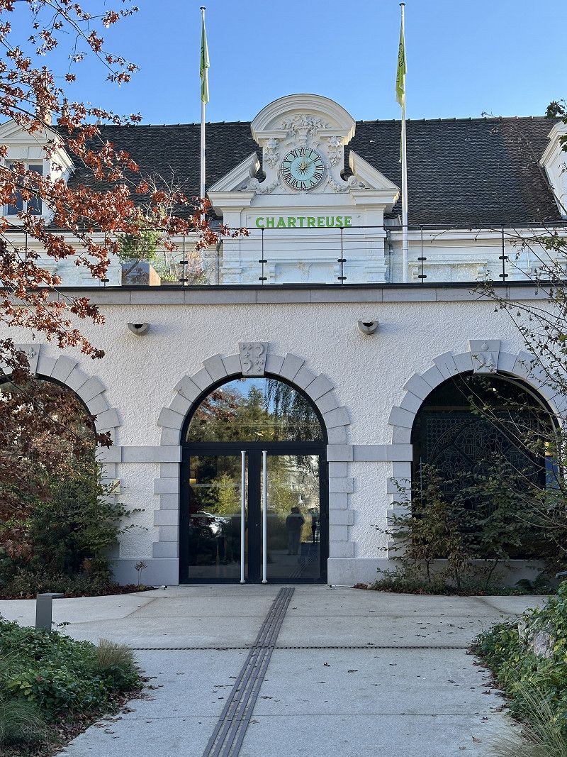
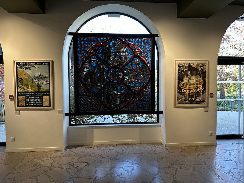
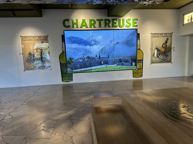
Chartreuse Destille, Voiron
This herbal liqueur has been distilled by monks for centuries.
Boulevard Edgar Kofler 10, Voiron, Isère, Auvergne-Rhone-Alpen, Frankreich
45° 21' 42.2" N 5° 35' 54.6" E
45.3617300 5.5985010
• Head toward Rue Jean-Baptiste Guimet on Boulevard Edgar Kofler (D1075). Go for 218 m.
• Turn left onto Avenue Léon et Joanny Tardy (D1075). Go for 399 m.
• Continue on Avenue Georges Frier (D1075). Go for 148 m.
• Turn right onto Cours Senozan (D1075) toward Bourg en B./Chambéry. Go for 792 m.
• Turn left onto Rue Victor Hugo toward Rives. Go for 258 m.
• Turn right onto Avenue Jean Jaurès (D12) toward A48. Go for 1.3 km.
• Take the 2nd exit from roundabout onto Avenue de la Croix Morin (D12). Go for 278 m.
• Take the 4th exit from roundabout onto D1076 toward Grenoble/Valence/Lyon/P.A. Champfeuillet. Go for 1.2 km.
• Take the 2nd exit from roundabout toward Grenoble/Valence/Marseille/Lyon/Chambéry/Aéroport Grenoble-Isère. Go for 176 m.
• Take ramp onto A48 toward Lyon/Aéroport Grenoble-Isère. Go for 34.4 km.
• Take the left exit onto A43. Go for 26.6 km.
• Take the exit toward Paris/Strasbourg/Clermont-Fd/Bourg en B./Aéroport Saint-Exupéry onto A432. Go for 21.4 km.
• Take the exit toward Strasbourg/Genève/Bourg en B. onto A42. Go for 41.2 km.
• Continue on A40. Go for 23.0 km.
• Keep left onto A39 (Autoroute Verte) toward Strasbourg/Lille/Paris Par A5/Dijon/Lons le S. Go for 22.9 km.
• Take exit 10 toward St Trivier de C./Coligny/St Amour. Go for 910 m.
• Turn right. Go for 66 m.
• Turn right toward Giratoire du Biolay. Go for 57 m.
• Continue toward D56. Go for 42 m.
• Take the 2nd exit from Giratoire du Biolay roundabout onto D56 toward Cormoz/St Trivier de C./Varennes-St S./Montrevel en B. Go for 2.9 km.
• Take the 3rd exit from roundabout onto D996 toward Bourg en B./Montrevel en B./Marboz. Go for 1.7 km.
• Turn right onto Lieu-dit Le Petit Ronjon. Go for 67 m.
• Continue on Chemin du Petit Ronjon. Go for 178 m.
• Continue toward Chemin du Petit Ronjon. Go for 445 m.
• Continue on Chemin du Petit Ronjon. Go for 176 m.
• Turn right onto Route de la Verne. Go for 424 m.
• Arrive at Route de la Verne. Your destination is on the right.
☍
181,3 km
(1 hrs. 41 min.)
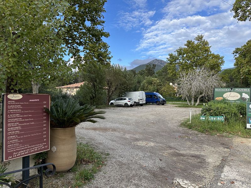
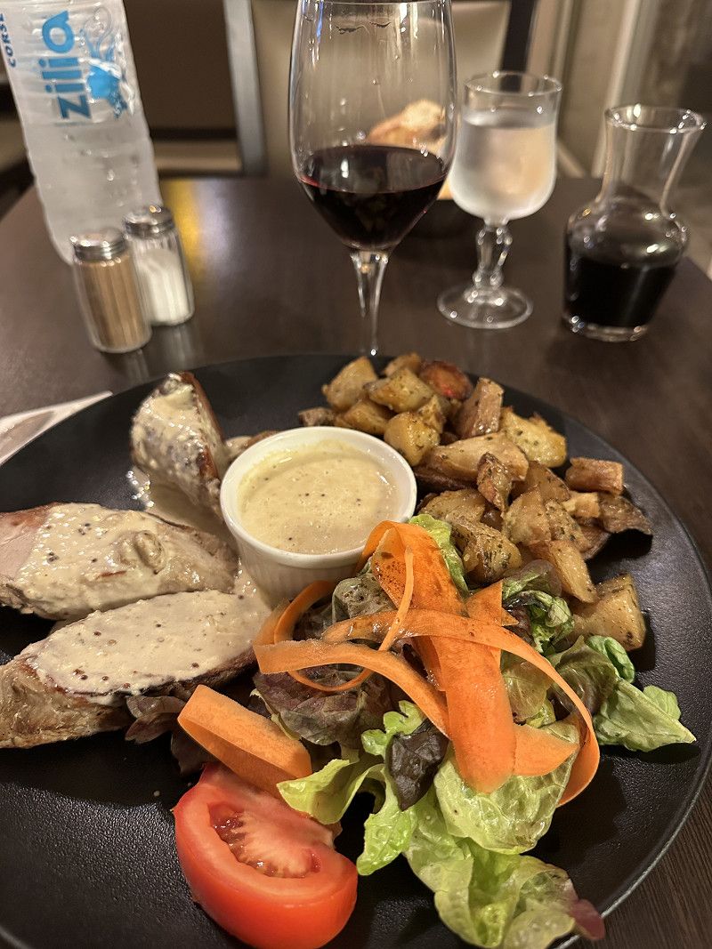
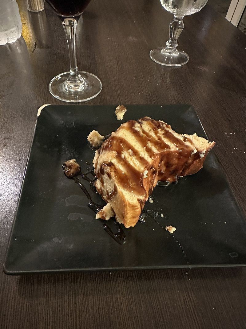
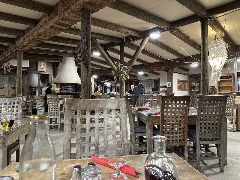
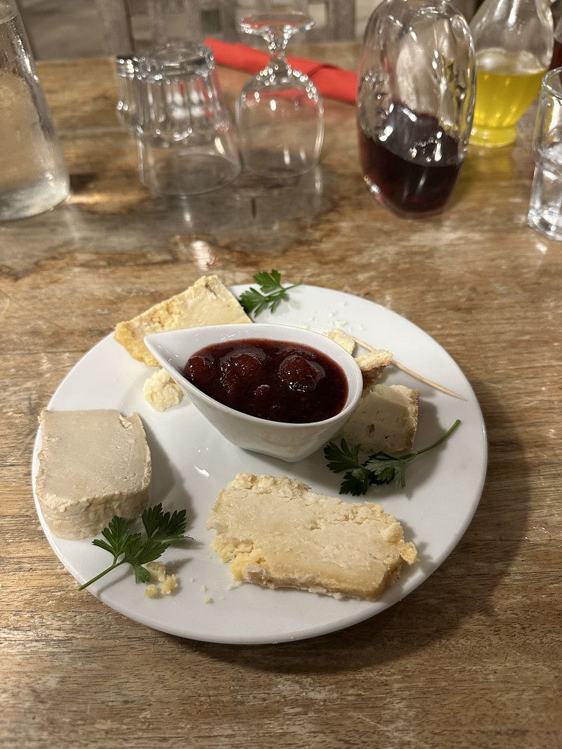
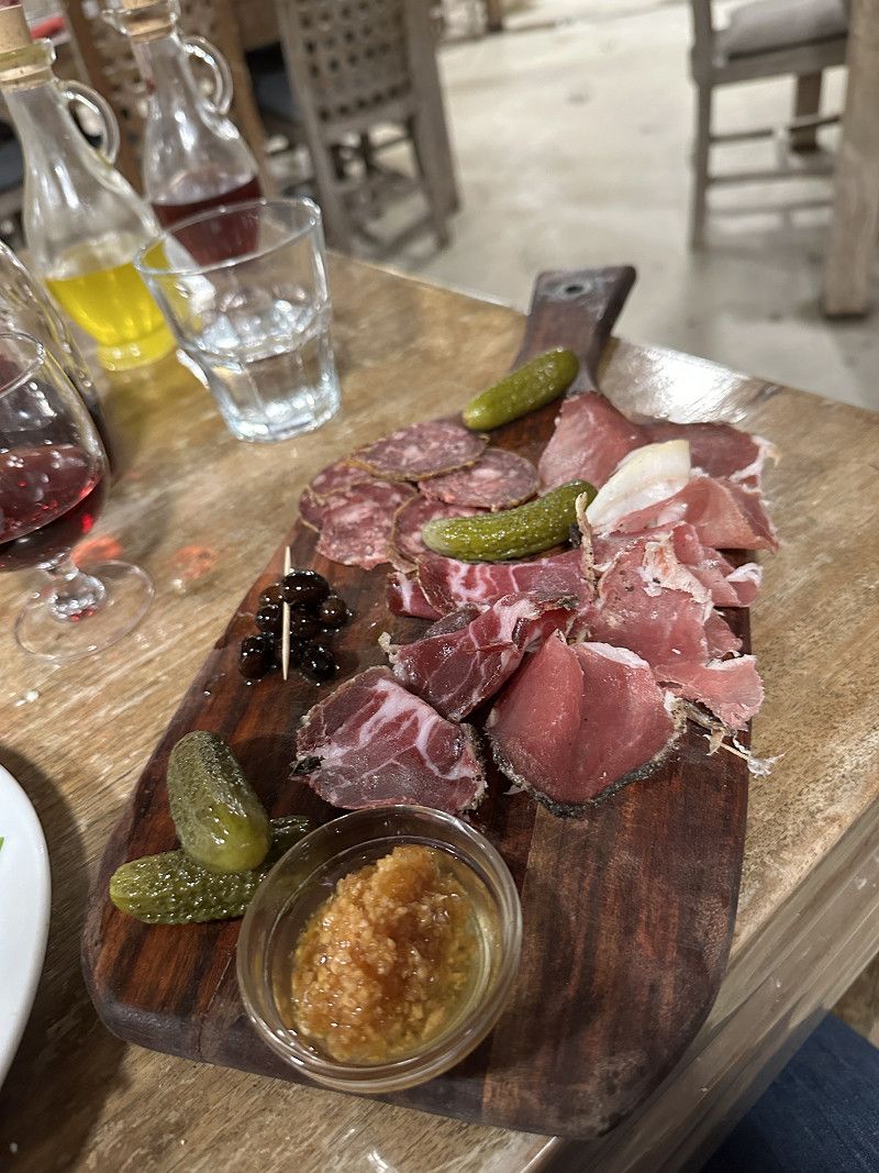
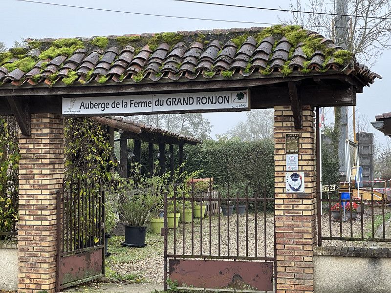
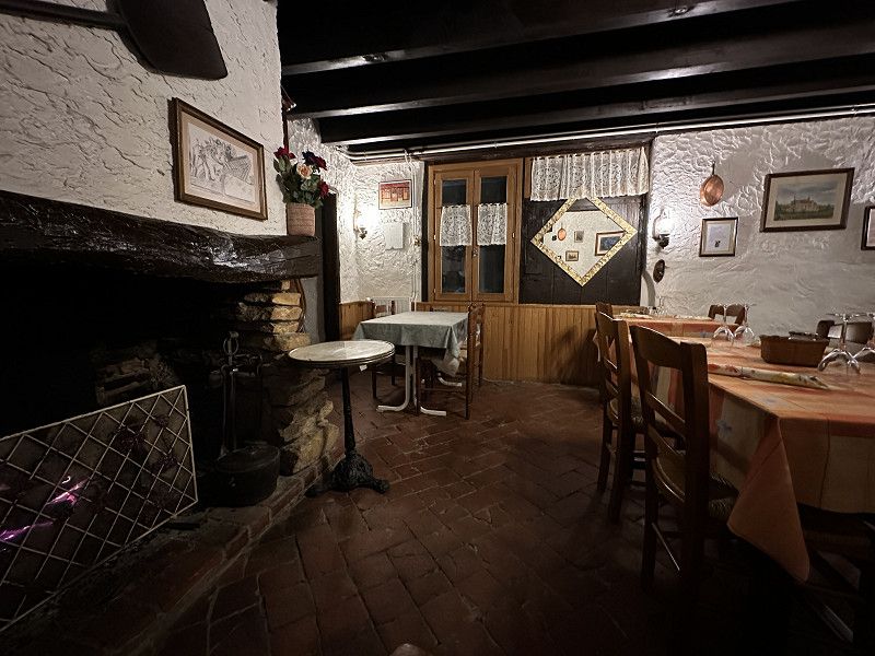
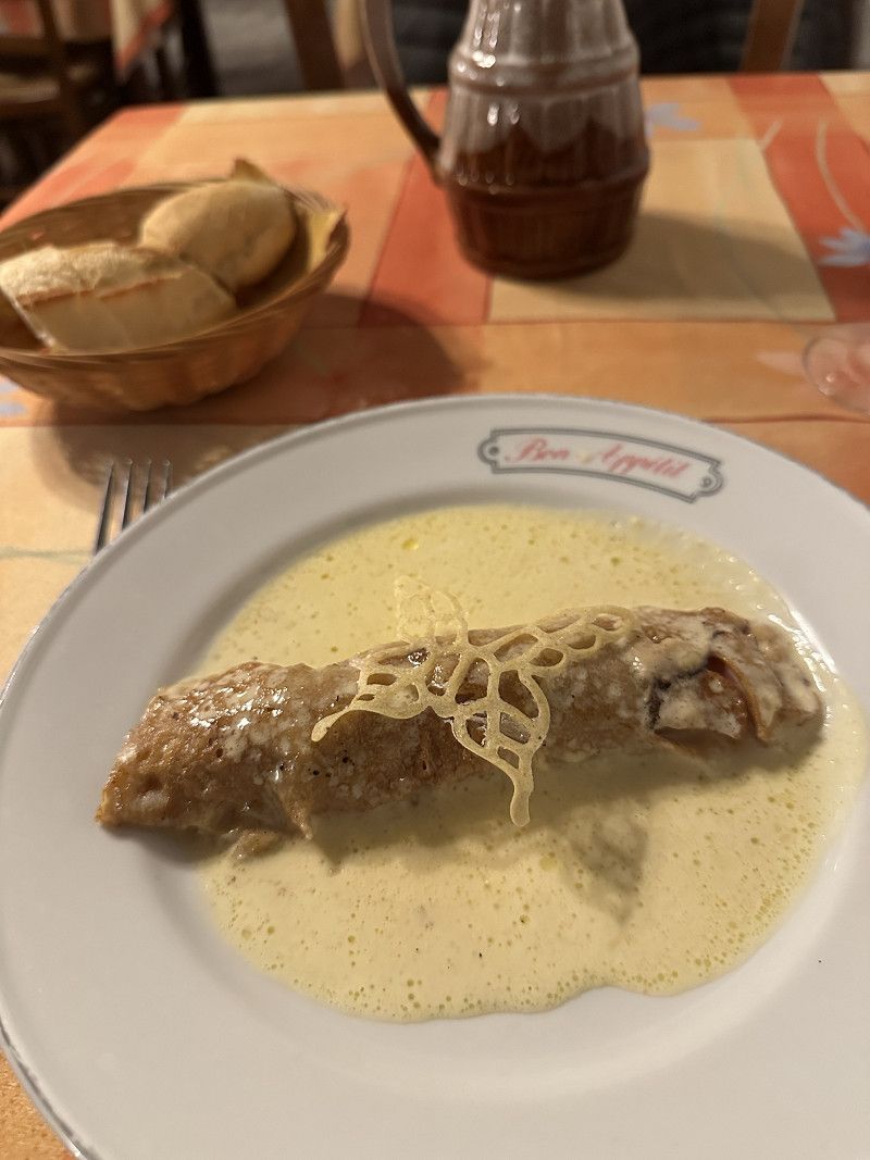
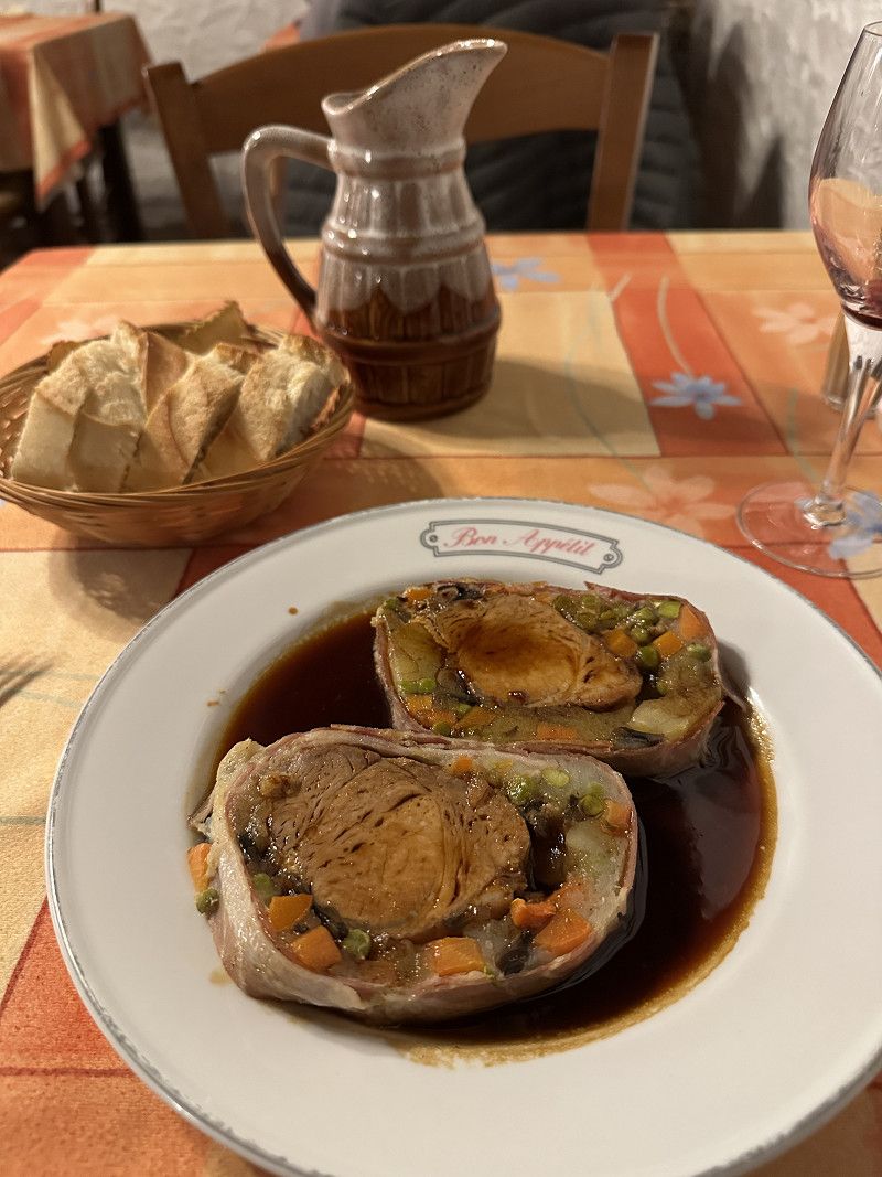
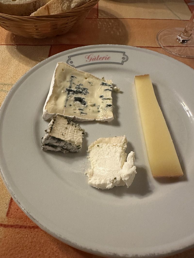
Auberge du Grand Ronjon
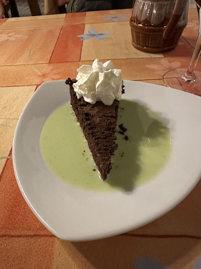
My favorite restaurant. I try to include it on every trip to France.
Route de la Verne 2561, Cormoz, Ain, Auvergne-Rhone-Alpen, Frankreich
46° 25' 53.3" N 5° 13' 17.9" E
46.4314820 5.2216520
• Head west on Route de la Verne. Go for 270 m.
• Turn right onto Voie de Cormoz à Foissiat. Go for 1.1 km.
• Turn right onto Lieu-dit Les Montets. Go for 580 m.
• Continue on Lieu-dit La Culée. Go for 84 m.
• Turn left onto D996. Go for 645 m.
• Take the 2nd exit from roundabout onto D996 toward Louhans/Varennes St S. Go for 5.1 km.
• Continue on Route des Charmettes (D996). Go for 12.9 km.
• Take the 3rd exit from roundabout onto Route de Cuiseaux (D996). Go for 3.7 km.
• Take the 2nd exit from roundabout onto Rue des Bordes (D996). Go for 638 m.
• Turn left onto Place Aristide Briand (D678). Go for 119 m.
• Take the 3rd exit from roundabout onto Rue de Bram (D971). Go for 509 m.
• Turn right onto Rue du Port. Go for 114 m.
• Turn right onto Rue du Port. Go for 110 m.
• Turn left onto Rue du Port. Go for 139 m.
• Continue on Chemin de Halage. Go for 48 m.
• Turn left. Go for 47 m.
• Arrive at your destination on the right.
☍
26,1 km
( 26 min.)
Day
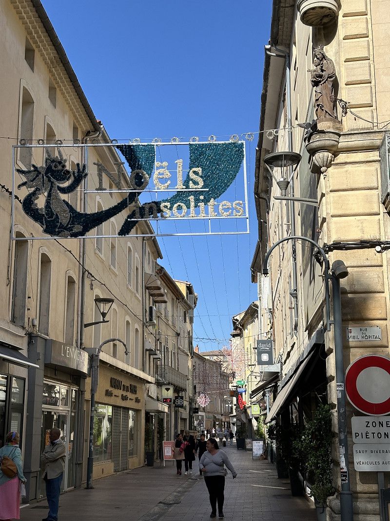
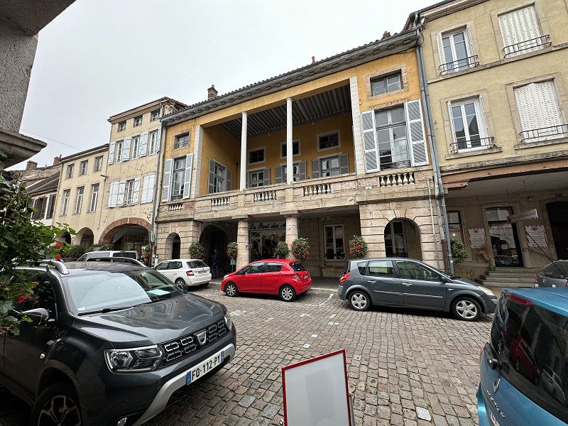
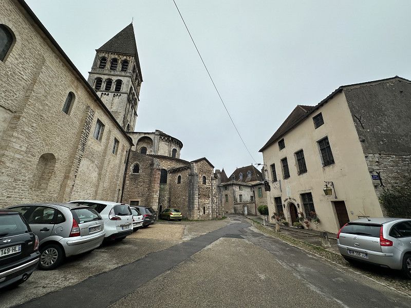
Louhans
I have adjusted my travel plans a little. I postponed Dijon until tomorrow and instead visited some of the many medieval towns in Burgundy.
Rue du Port, Louhans, Saône-et-Loire, Burgund und Freigrafschaft, Frankreich
46° 37' 46.6" N 5° 12' 47.6" E
46.6296112 5.2132358
• Head toward Chemin de Halage. Go for 47 m.
• Turn right onto Chemin de Halage. Go for 48 m.
• Turn right onto Allée des Sorbiers. Go for 117 m.
• Turn right onto Avenue des Tilleuls. Go for 138 m.
• Turn left onto Allée des Acacias. Go for 300 m.
• Turn right onto Rue du Bas de Rédy (D971). Go for 17.5 km.
• Turn right onto Rue du Bas de Brienne (D975). Go for 7.1 km.
• Turn right onto Route de Tournus (D44) toward D37/L'Abergement de Cuisery/Tournus. Go for 316 m.
• Continue on Avenue des Alpes (D37). Go for 1.2 km.
• Continue on D37. Go for 136 m.
• Continue on Rue Jean Jaurès (D37). Go for 18 m.
• Turn right onto Quai du Nord. Go for 333 m.
• Turn right onto Quai de la Marine. Go for 56 m.
• Arrive at Quai de la Marine. Your destination is on the left.
☍
27,3 km
( 25 min.)
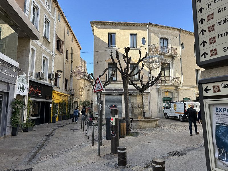
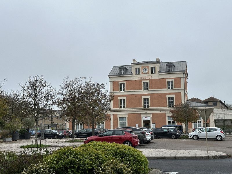
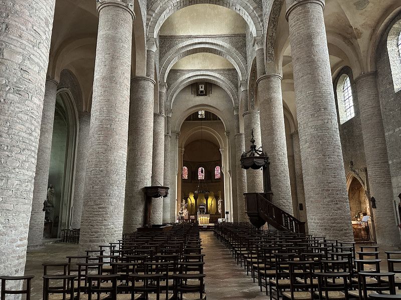
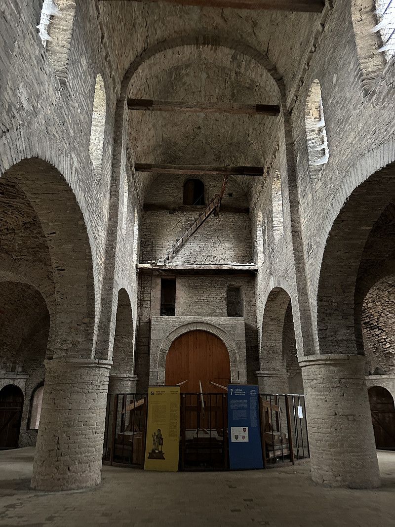
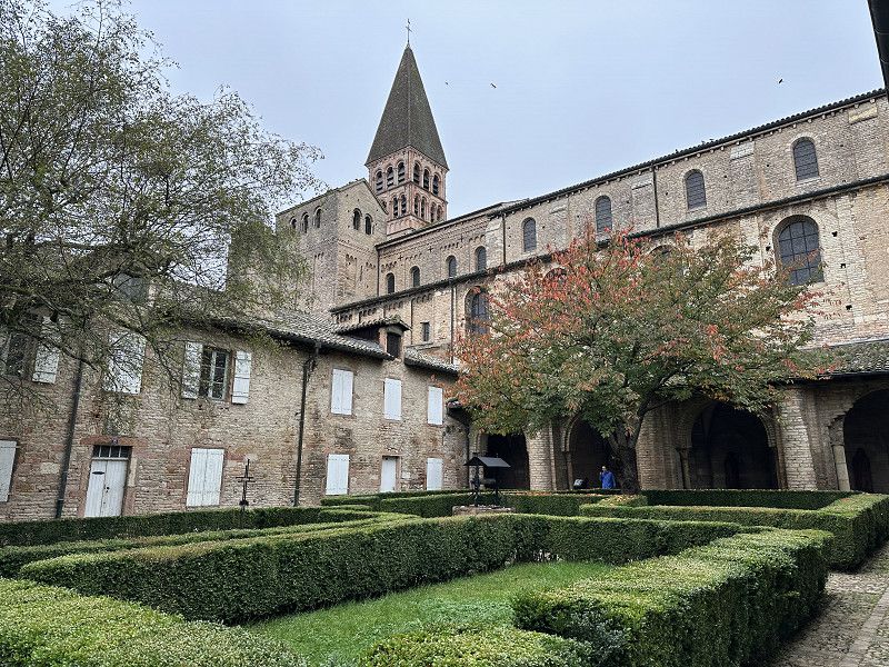
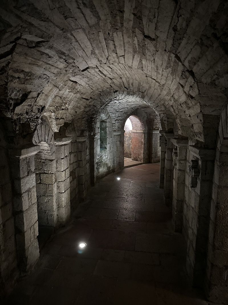
Tournus
Next place…
Quai de la Marine, Tournus, Saône-et-Loire, Burgund und Freigrafschaft, Frankreich
46° 34' 2.2" N 4° 54' 39.7" E
46.5672755 4.9110309
• Head toward Quai du Nord on Quai de la Marine. Go for 56 m.
• Turn right onto Quai du Nord. Go for 67 m.
• Turn left onto Rue Saint-Laurent. Go for 240 m.
• Take the 1st exit from roundabout onto Avenue Gambetta (D906). Go for 8.2 km.
• Pass 2 roundabouts and continue on Route de Lyon (D906). Go for 14.1 km.
• Take the 3rd exit from roundabout onto Route de Lyon (D906) toward A6/Chalon S/S. Go for 622 m.
• Pass 3 roundabouts and continue on Route de Lyon (D906). Go for 2.5 km.
• Continue on Quai Gambetta (D5). Go for 333 m.
• Continue on Place du Port Villiers (D5). Go for 33 m.
• Continue on Quai des Messageries (D5). Go for 266 m.
• Turn right onto Pont Saint-Laurent. Go for 126 m.
• Turn right onto Quai de l'Hôpital. Go for 181 m.
• Continue on Quai Jules Chambion. Go for 110 m.
• Arrive at Quai Jules Chambion. Your destination is on the right.
☍
26,9 km
( 27 min.)
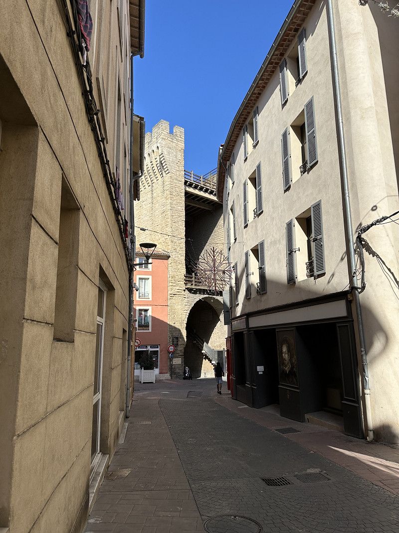
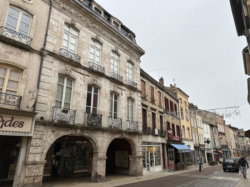
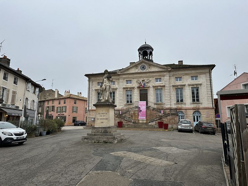
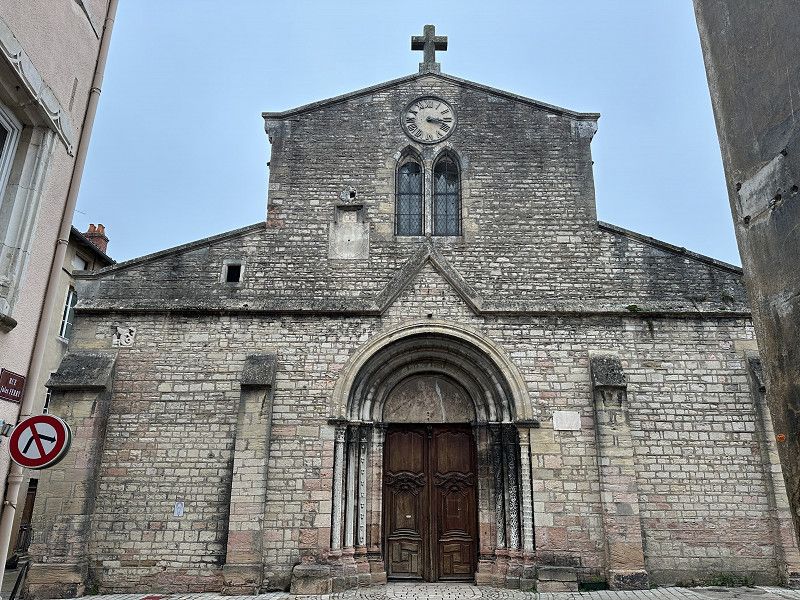
Chalon-sur-Saône
And the next…
Quai Jules Chambion, Chalon-sur-Saône, Saône-et-Loire, Burgund und Freigrafschaft, Frankreich
46° 46' 42.4" N 4° 51' 28.8" E
46.7784480 4.8579886
• Head toward Rue d'Uxelles on Quai Jules Chambion. Go for 177 m.
• Continue on Rempart Saint-Laurent. Go for 288 m.
• Turn left onto Quai de la Monnaie. Go for 314 m.
• Turn right onto Pont Saint-Laurent. Go for 126 m.
• Turn left onto Quai des Messageries (D5). Go for 266 m.
• Continue on Place du Port Villiers (D5). Go for 33 m.
• Continue on Quai Gambetta (D5). Go for 355 m.
• Turn right onto Avenue Nicéphore Niépce (D906) toward Beaune/Auxerre/Autun/Nevers. Go for 670 m.
• Keep right onto Rue Jean Moulin (D906) toward Les Aubépins/Châtenoy le Royal. Go for 2.2 km.
• Take the 1st exit from roundabout onto D906 toward Beaune/Chagny/Champforgeuil. Go for 517 m.
• Take the 4th exit from Rond-Point des Pellerets roundabout onto D906 toward Auxerre/Dijon/Beaune/Chagny. Go for 2.9 km.
• Take the 3rd exit from roundabout onto Route de Wettolsheim (D906) toward Auxerre/Dijon/Beaune/Chagny/Aéroport Aérodrome. Go for 587 m.
• Take the 2nd exit from roundabout onto Route de Wettolsheim (D906) toward Auxerre/Dijon/Beaune/Chagny. Go for 11.4 km.
• Turn right onto Route d'Ébaty (D113). Go for 918 m.
• Continue on D113. Go for 1.1 km.
• Continue on Rue des Grandes Terres (D113). Go for 1.1 km.
• Continue on Rue Anne Masson (D113). Go for 237 m.
• Continue on Route de Corcelles (D113). Go for 255 m.
• Continue on D113. Go for 1.6 km.
• Continue on Chemin des Grandes Vignes (D113). Go for 534 m.
• Continue on Rue du Lavoir (D113). Go for 220 m.
• Take the 3rd exit from roundabout onto Rue du Lavoir (D113). Go for 66 m.
• Turn right onto Rue de la Garenne. Go for 108 m.
• Arrive at Rue de la Garenne.
☍
26,0 km
( 27 min.)
FP Stellplatz JL Bonin, Corcelles les Arts
Also very tasty wines.
Côte-d'Or, Burgund und Freigrafschaft, Frankreich
46° 57' 8.2" N 4° 47' 46.1" E
46.9522705 4.7961387
• Head toward Place des Marronniers on Rue de la Garenne. Go for 108 m.
• Turn right onto Rue des Goueys (D113). Go for 706 m.
• Continue on D113. Go for 1.2 km.
• Turn right onto D23. Go for 840 m.
• Take the 3rd exit from roundabout onto D18. Go for 5.0 km.
• Take the 1st exit from roundabout onto Avenue André Boisseaux (D1074) toward A6-A31-A36/Dijon/Seurre/Ste Marie la Blanche/Montagny lès Beaune. Go for 1.1 km.
• Take the 2nd exit from roundabout onto Avenue André Boisseaux (D1074) toward Seurre/Ste Marie la Blanche. Go for 843 m.
• Take the 2nd exit from Rond-Point Philippe le Bon roundabout onto Avenue du Général de Gaulle (D470) toward Dijon. Go for 347 m.
• Take the 1st exit from roundabout onto Avenue du Général de Gaulle (D470). Go for 156 m.
• Continue on Avenue du Général de Gaulle. Go for 139 m.
• Take ramp onto A6 (Autoroute du Soleil) toward Lille/Paris/Besançon/Dijon. Go for 3.0 km.
• Continue on A31. Go for 27.9 km.
• Keep right onto A311 toward Dijon. Go for 3.9 km.
• Take exit 47 toward M122 R/Marsannay la C./Chenôve/Dijon-Sud/Longvic/Aéroport Dijon-Bourgogne. Go for 575 m.
• Take the 3rd exit from roundabout onto D122 A toward Marsannay la Côte/Chenôve/Dijon-Sud. Go for 222 m.
• Take the 2nd exit from roundabout onto D122 A toward Beaune/Marsannay la Côte/Chenôve/Dijon-Sud. Go for 1.8 km.
• Keep right toward Dijon/Les Portes du Sud-Z.A.E de Chenove. Go for 167 m.
• Continue on Boulevard Bernard Palissy (D123). Go for 381 m.
• Take the 2nd exit from Rond-Point de la Solidarité roundabout onto Boulevard Bernard Palissy (D123). Go for 1.7 km.
• Continue on Boulevard des Diables Bleus (D123). Go for 131 m.
• Take the 1st exit from roundabout onto Boulevard des Diables Bleus (D123). Go for 274 m.
• Turn left onto Boulevard Edmé-Nicolas Machureau. Go for 195 m.
• Continue on Boulevard des Peyvets. Go for 131 m.
• Continue on Boulevard des Bourroches. Go for 1.1 km.
• Turn right onto Avenue Gustave Eiffel (D108 G) toward Centre Ville. Go for 807 m.
• Arrive at Avenue Gustave Eiffel (D108 G). Your destination is on the right.
☍
52,7 km
( 39 min.)
Day
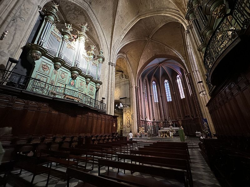
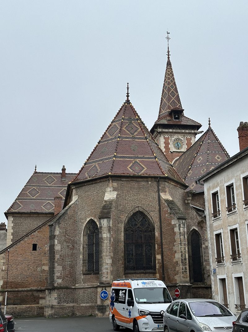
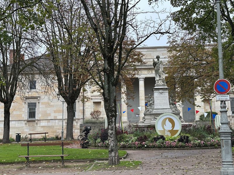
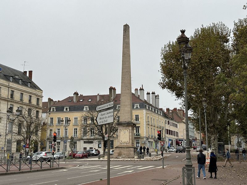
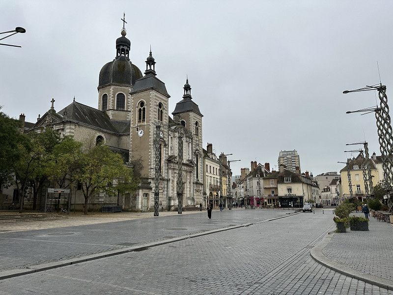
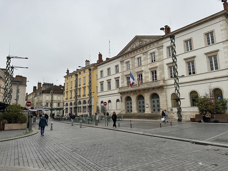
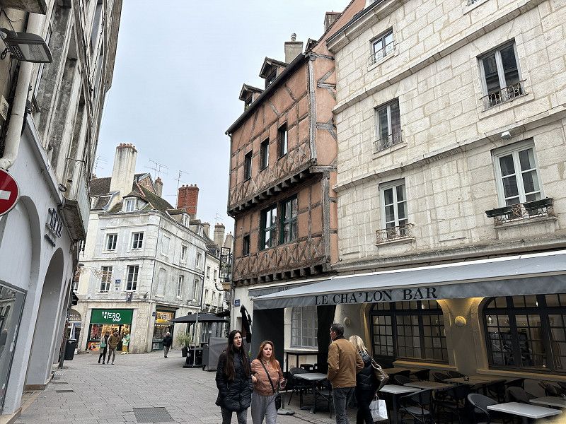
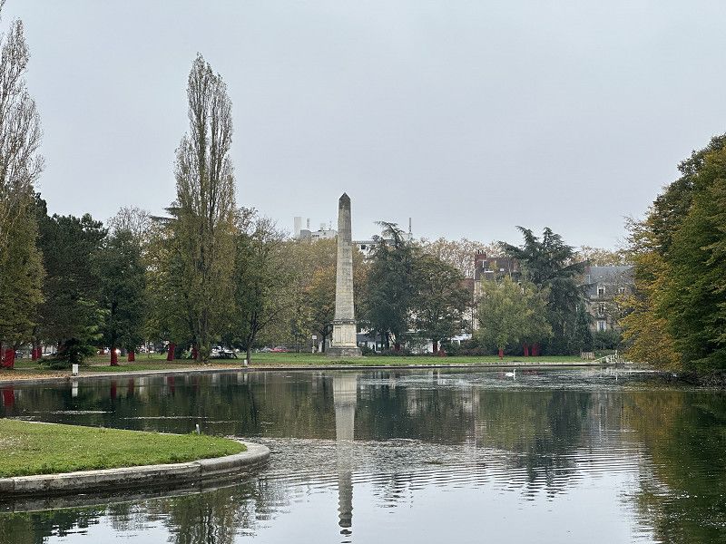
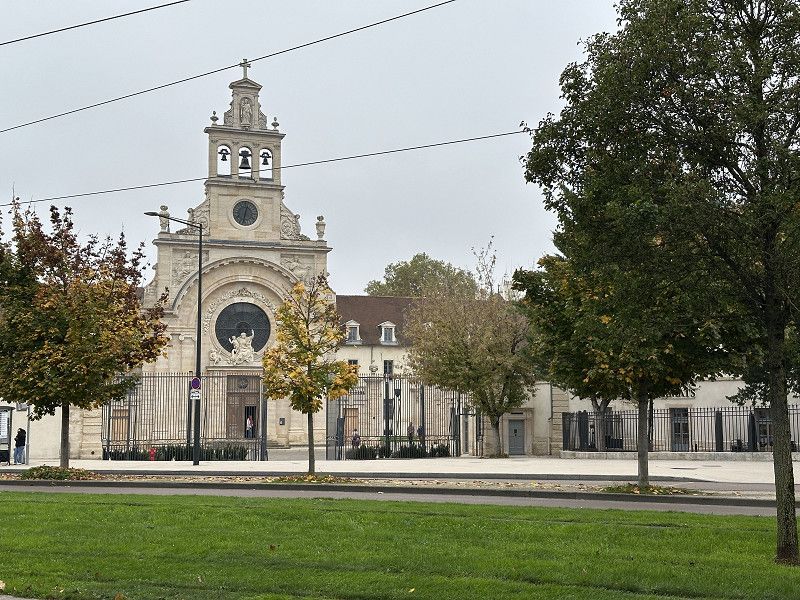
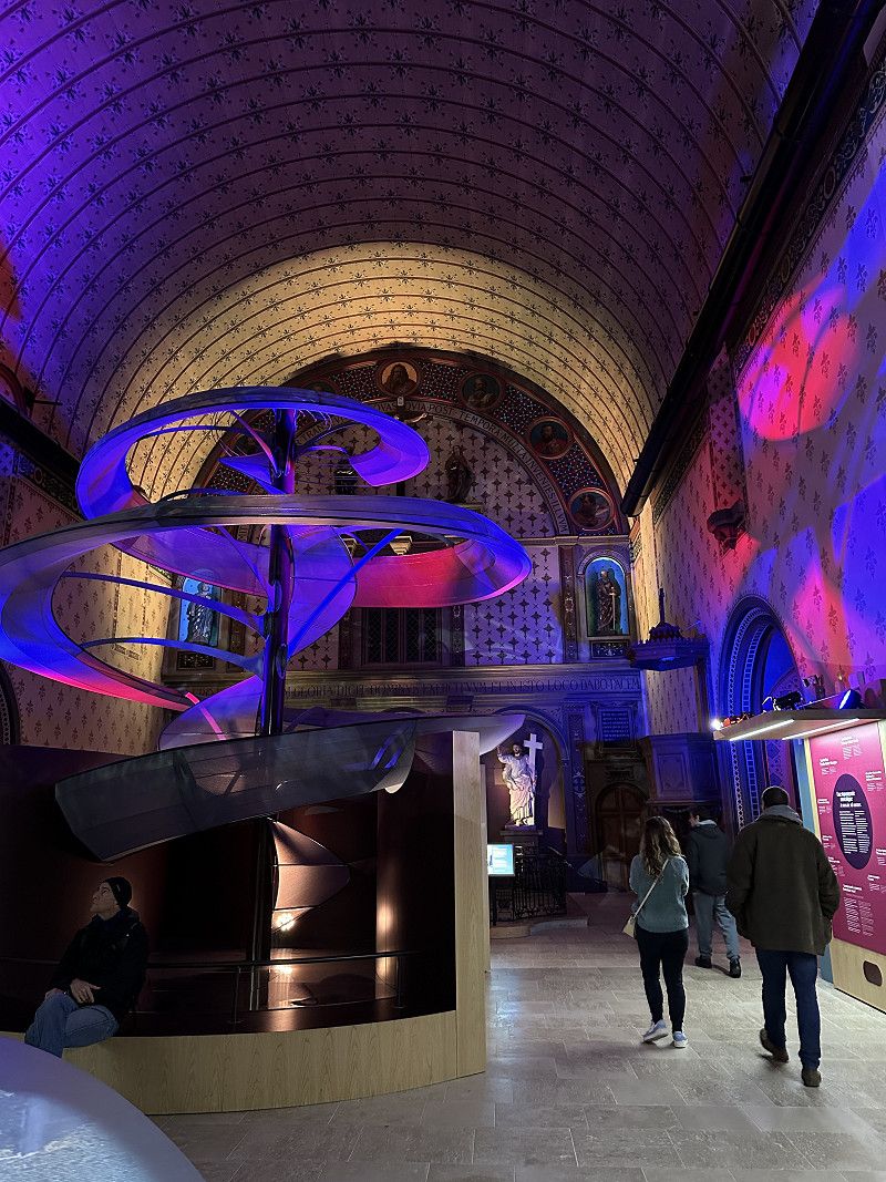
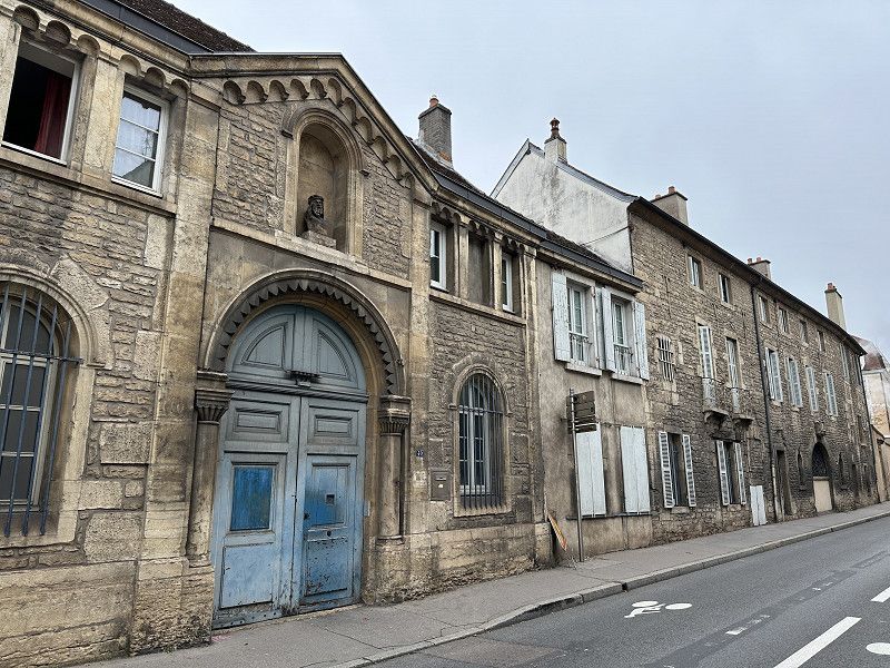
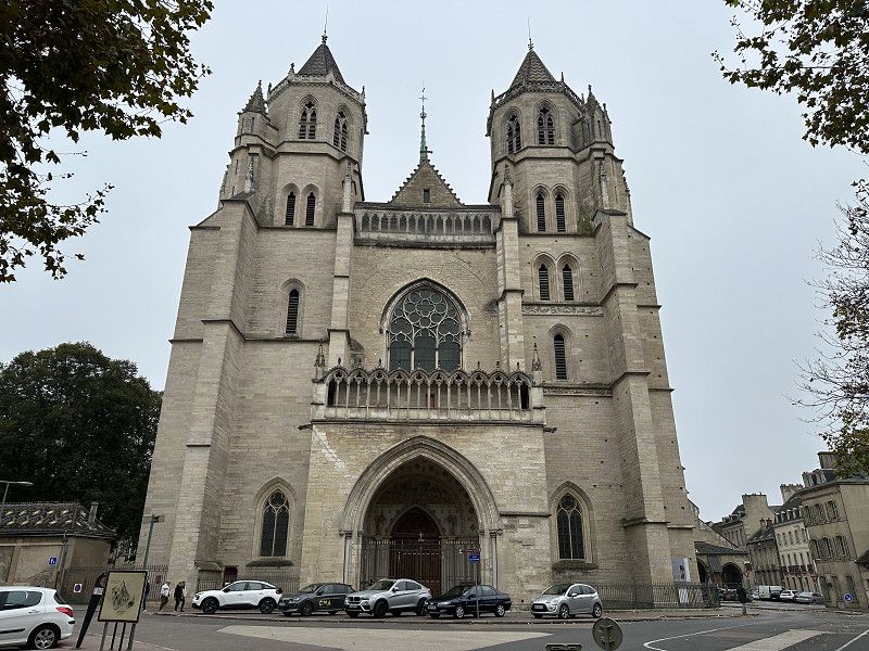
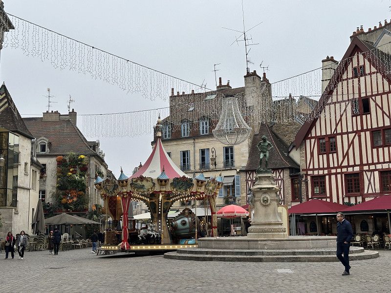
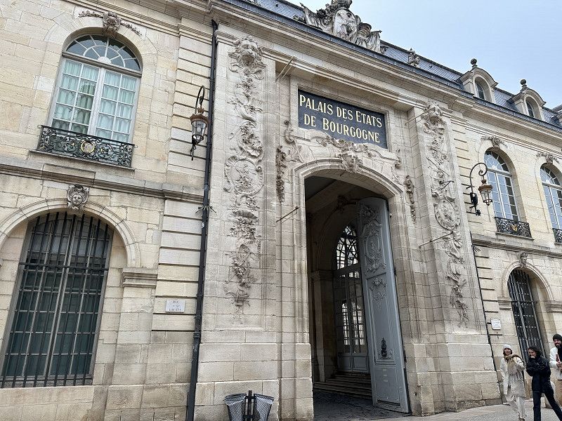
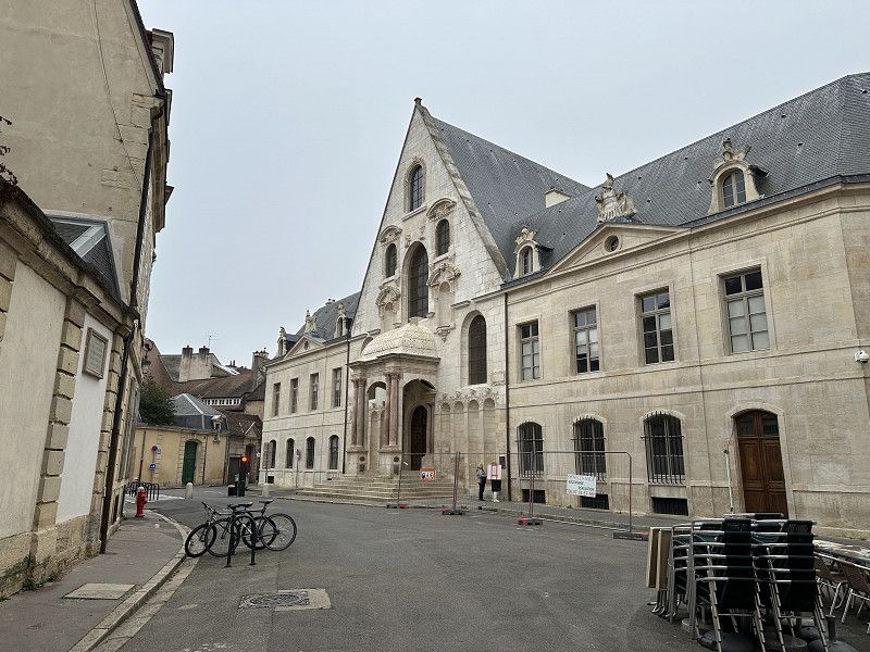
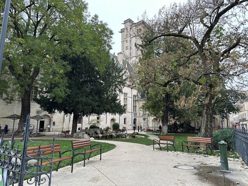
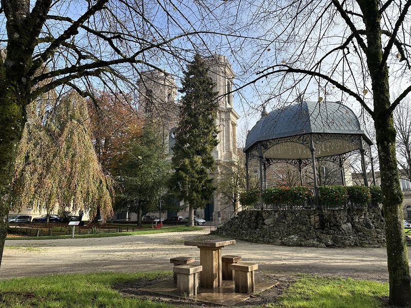
Dijon
The Park4Night car park was a good starting point for sightseeing in the city, but I didn't feel comfortable staying there overnight. Instead, I drove a little further and stopped at a nearby camping car park.
Dijon was very impressive and, although it was a very hazy day, very beautiful. It would certainly be beautiful around Christmas time too.
Avenue Gustave Eiffel 13, Dijon, Côte-d'Or, Burgund und Freigrafschaft, Frankreich
47° 18' 55.7" N 5° 1' 26.5" E
47.3154724 5.0240355
• Head toward Rue de Larrey on Avenue Gustave Eiffel (D108 G). Go for 73 m.
• Keep right onto Avenue Gustave Eiffel. Go for 156 m.
• Continue on Quai Nicolas Rolin (D108 G). Go for 201 m.
• Keep left onto Quai Nicolas Rolin (D108 G). Go for 52 m.
• Turn left onto Place du 1er Mai (D974). Go for 807 m.
• Keep right onto Boulevard de Sévigné (D905). Go for 97 m.
• Continue on Rue Mariotte. Go for 68 m.
• Turn left onto Rue Millotet toward Place de la République. Go for 221 m.
• Turn left onto Rue des Perrières. Go for 18 m.
• Turn right onto Rue du Rosoir. Go for 96 m.
• Continue on Place du Rosoir. Go for 41 m.
• Turn left onto Avenue Victor Hugo (D971). Go for 280 m.
• Turn right onto Rue de Fontaine (D107). Go for 533 m.
• Continue on Rue de Fontaine-lès-Dijon (D107). Go for 205 m.
• Continue on Rue de Dijon (D107). Go for 225 m.
• Turn right onto Boulevard des Allobroges. Go for 1.1 km.
• Continue on Boulevard Maréchal Gallieni. Go for 434 m.
• Turn left onto Avenue du Drapeau (D974). Go for 824 m.
• Take the 3rd exit from Rond-Point de la Nation roundabout onto Avenue de Langres (D974) toward Rocade. Go for 1.4 km.
• Take the 3rd exit from Rond-Point Georges Pompidou roundabout onto Route d'Is-sur-Tille (D903) toward Troyes. Go for 2.7 km.
• Continue on D3. Go for 4.2 km.
• Continue on D903 BIS. Go for 8.4 km.
• Continue on D3. Go for 4.0 km.
• Take the 1st exit from roundabout onto Route de Gémeaux (D112). Go for 270 m.
• Arrive at Route de Gémeaux (D112). Your destination is on the right.
☍
26,4 km
( 27 min.)
Is-sur-Tille, Camping Car Park
Good starting position for tomorrow.
Route de Gemeaux, Is-sur-Tille, Côte-d'Or, Burgund und Freigrafschaft, Frankreich
47° 30' 48.4" N 5° 6' 45.7" E
47.5134502 5.1126983
• Head toward Rue Jean-Jacques Rousseau on Route de Gémeaux (D112). Go for 253 m.
• Take the 1st exit from roundabout onto Route de Dijon (D3). Go for 554 m.
• Turn right onto Place Villeneuve Moret toward A31/Marcilly S/T. Go for 309 m.
• Continue on Place Général Leclerc. Go for 28 m.
• Continue on Rue du Général Chabronnel. Go for 199 m.
• Continue on Avenue Carnot (D959) toward A31/Marcilly S/Tille/Mirebeau. Go for 5.1 km.
• Take the 3rd exit from roundabout onto Route de Langres (D974) toward A31/Chaumont/Nancy/Langres/Orville/Aérodrome til-Châtel. Go for 2.8 km.
• Turn right toward E21/E17/A31/Dijon/Lyon/Chaumont/Nancy/Troyes/Langres. Go for 660 m.
• Take left ramp onto A31 toward Metz/Nancy/Troyes/Chaumont. Go for 30.6 km.
• Take exit 6 toward Langres-Sud/Besancon/Langres/Gray. Go for 829 m.
• Take the 1st exit from roundabout onto D428 toward Gray/Langres. Go for 8.5 km.
• Take ramp onto D974 toward Chaumont/Nancy/Langres. Go for 2.4 km.
• Pass 2 roundabouts and continue on Route de Dijon (D974). Go for 1.5 km.
• Continue on Place des États-Unis (N74) toward Chaumont/Épinal/Nancy. Go for 114 m.
• Turn slightly right onto Place Bel Air. Go for 15 m.
• Turn right onto Place Bel Air. Go for 32 m.
• Turn slightly left toward Rue des Chavannes. Go for 90 m.
• Turn right onto Rue des Chavannes. Go for 65 m.
• Turn left onto Boulevard Maréchal de Lattre de Tassigny. Go for 184 m.
• Arrive at Boulevard Maréchal de Lattre de Tassigny. Your destination is on the right.
☍
54,1 km
( 40 min.)
Day
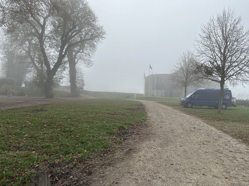
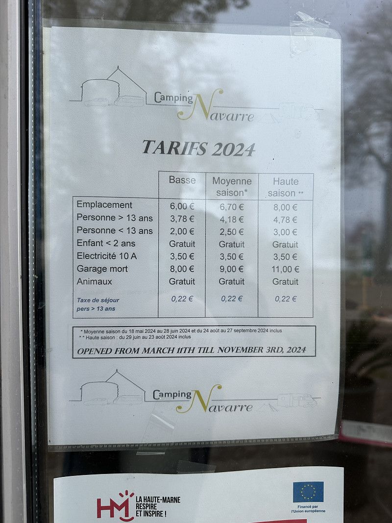
Lengres CP Navarre
The campsite closed yesterday until next year. But I called and was allowed to stay overnight for free. I didn't look for other pitches because the campsite is very central.
52200, Langres, France
47° 51' 37.8" N 5° 19' 49.4" E
47.8605000 5.3304000
• Head toward Impasse du Champ de Navarre on Boulevard Maréchal de Lattre de Tassigny. Go for 136 m.
• Turn right onto Rue du 8 Mai 1945. Go for 156 m.
• Turn left onto Avenue Jean-Ernest Darbot (N19). Go for 183 m.
• Keep right onto Place des États-Unis (N74) toward D974/Dijon/Besançon. Go for 48 m.
• Continue on Avenue Turenne (D974). Go for 230 m.
• Turn right onto Avenue Turenne toward Quartier Turenne. Go for 65 m.
• Turn left onto Avenue Turenne (D974) toward Quartier Turenne. Go for 64 m.
• Turn right onto Rue Gaston Bachelard toward Quartier Turenne. Go for 142 m.
• Turn left onto Rue Gaston Bachelard. Go for 75 m.
• Turn right onto Rue Jean Favre. Go for 125 m.
• Arrive at Rue Jean Favre. Your destination is on the left.
☍
1,2 km
( 3 min.)
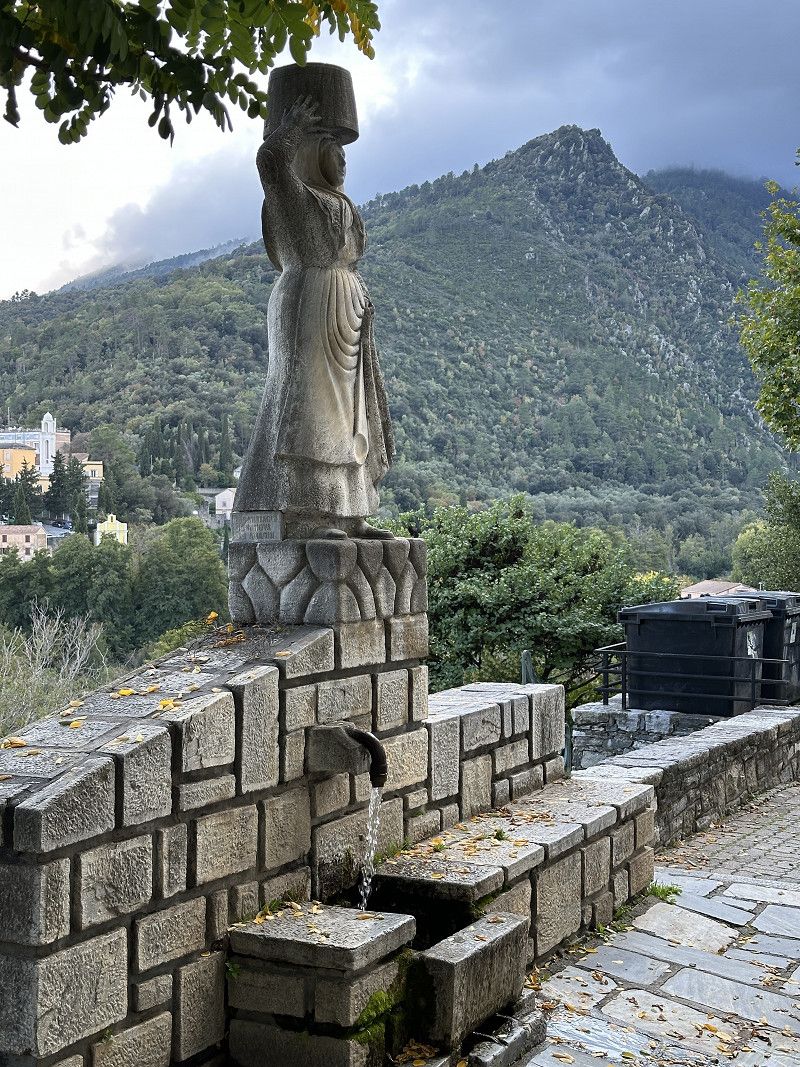
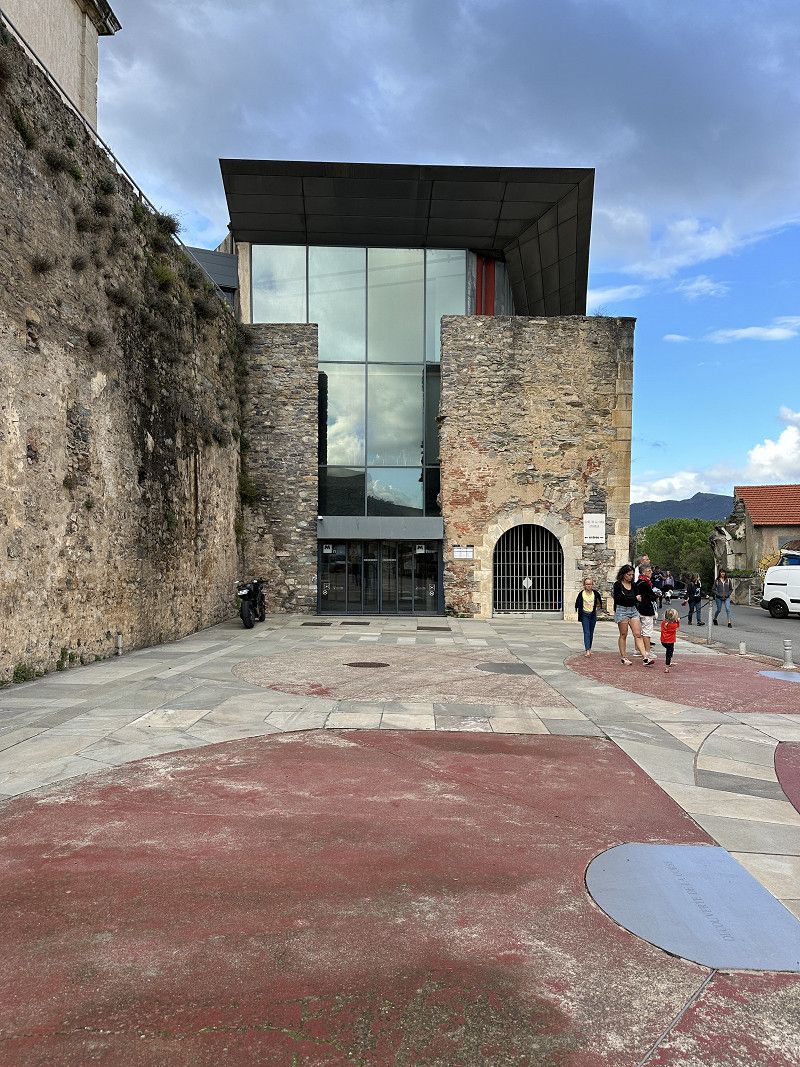
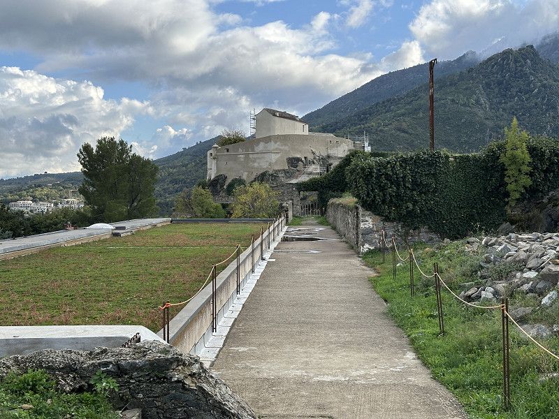
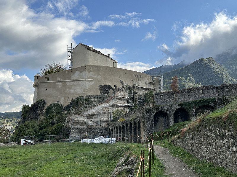
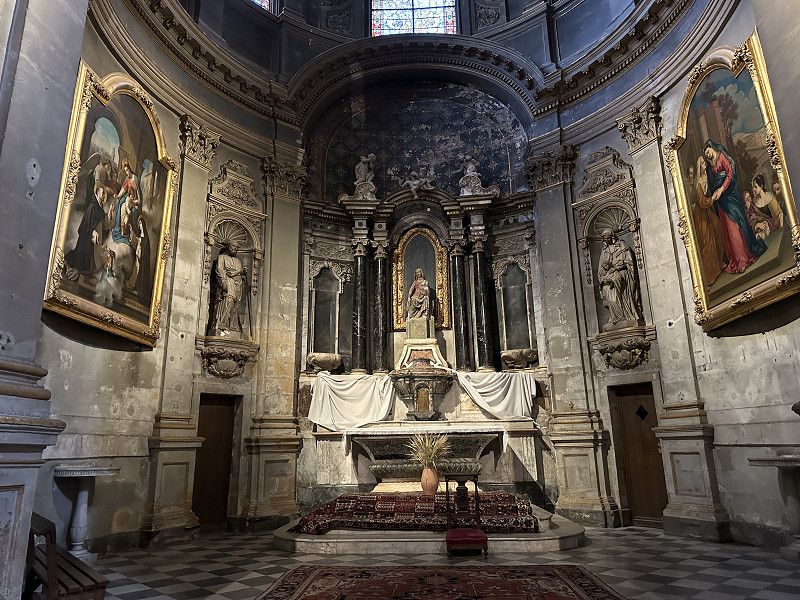
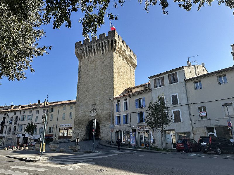
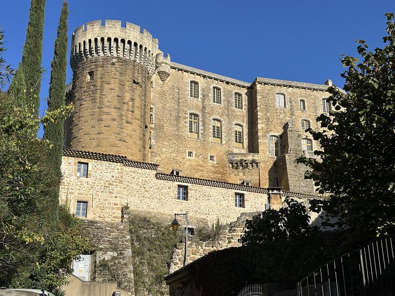
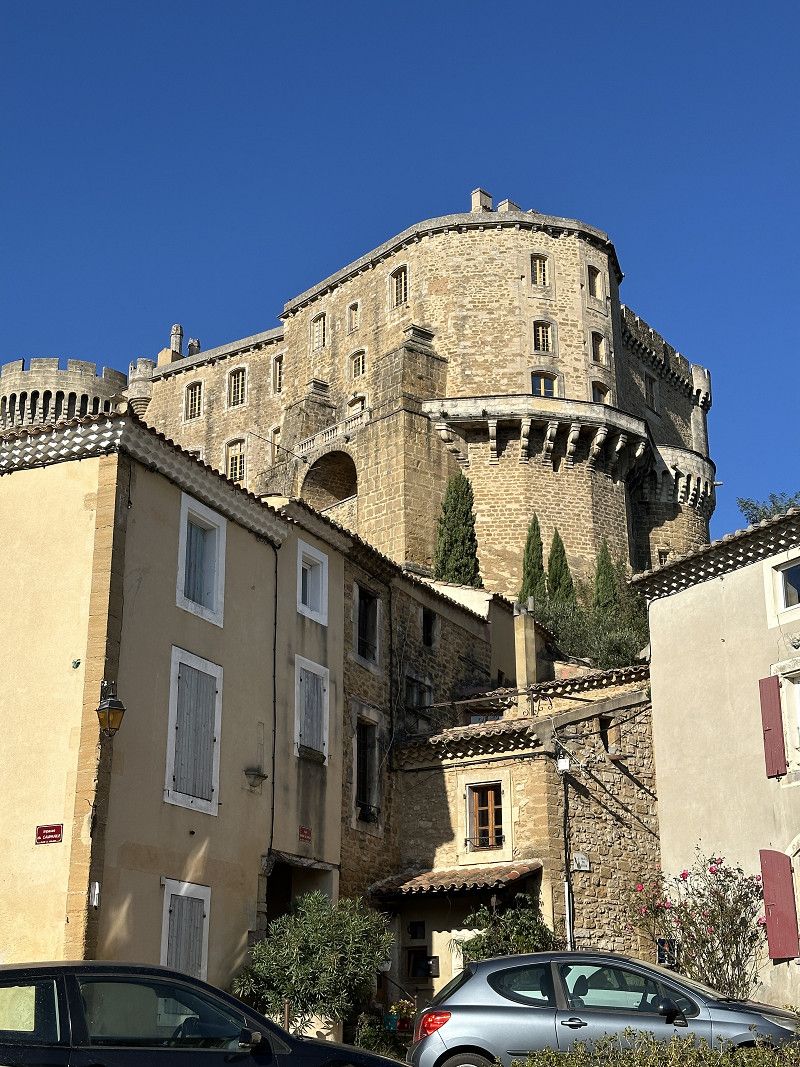
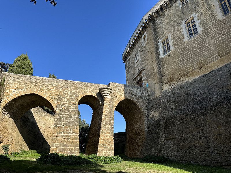
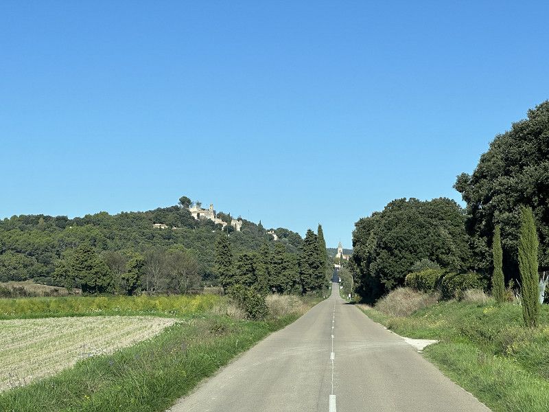
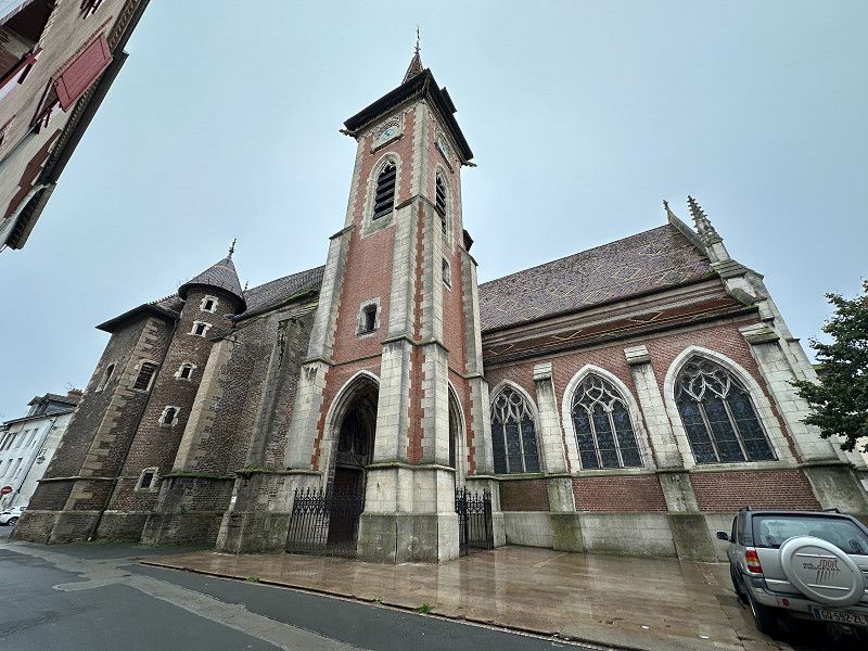
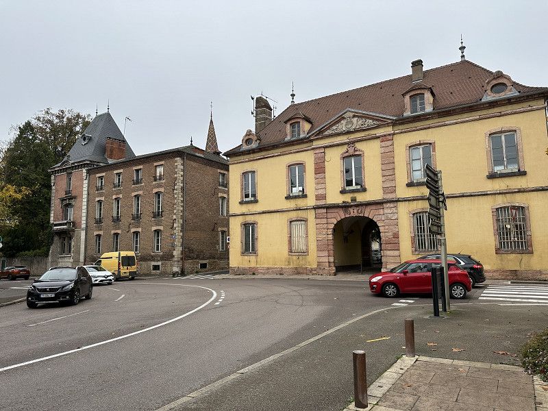
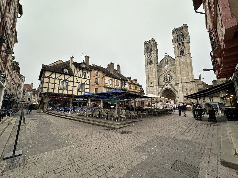
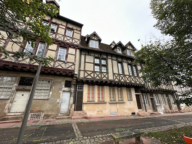
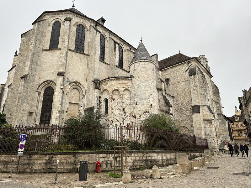
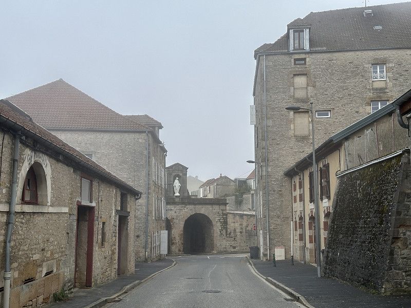
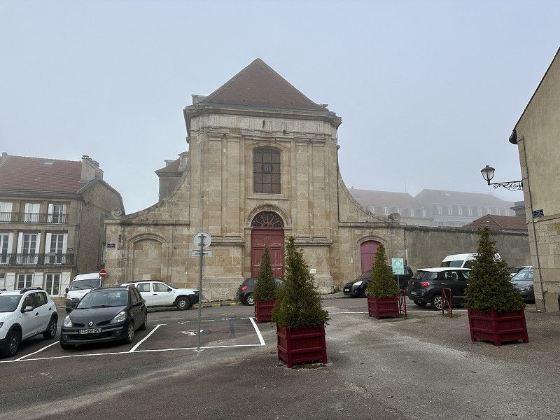
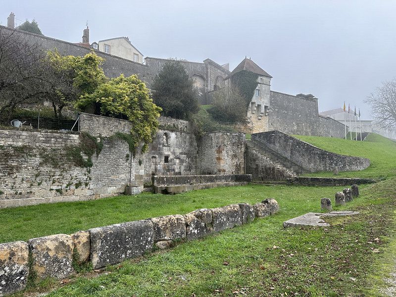
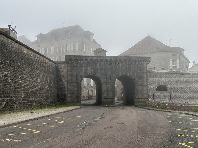
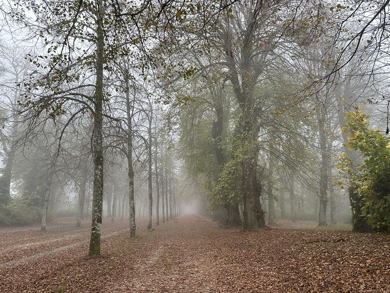
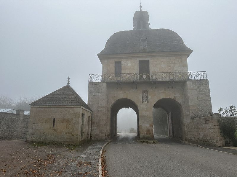
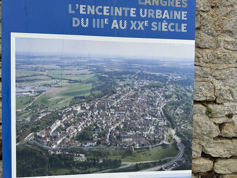
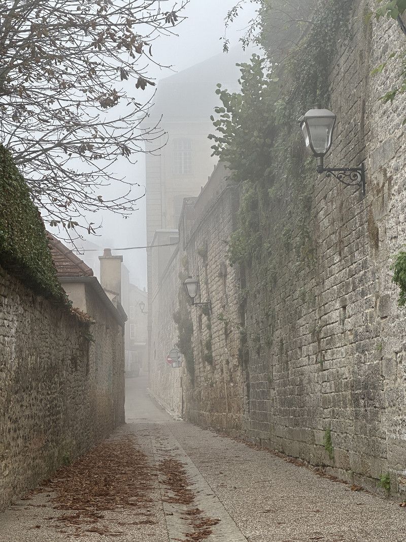
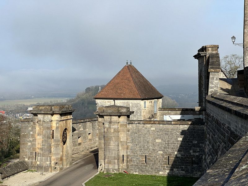
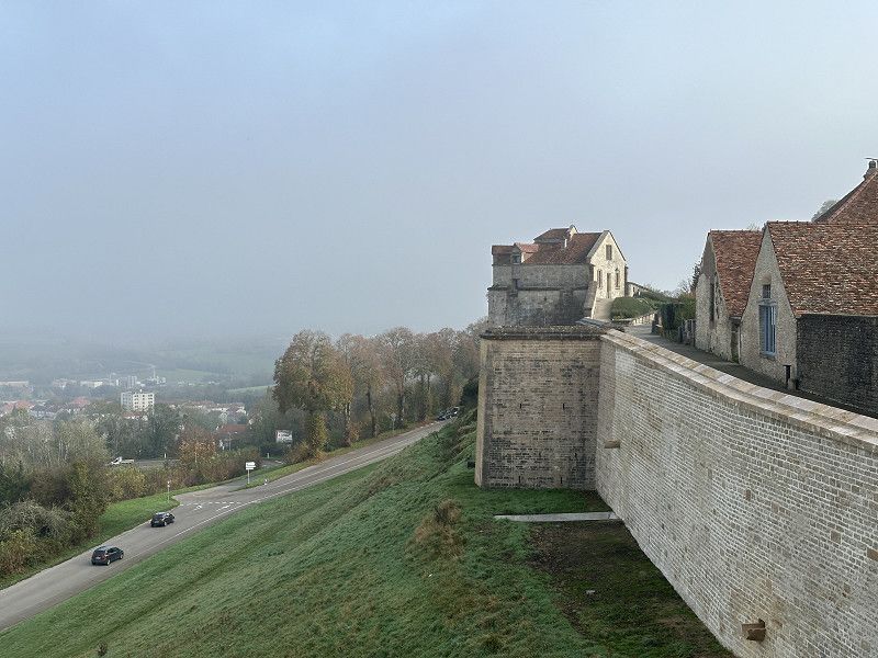
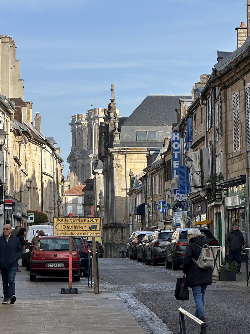
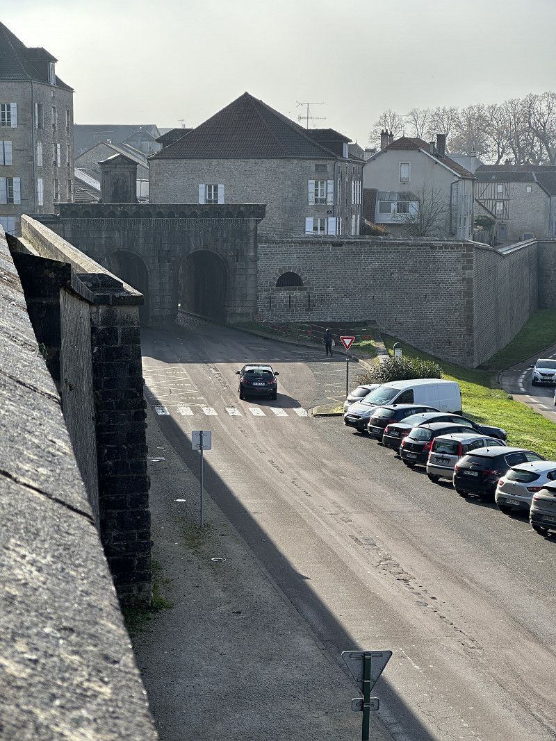
Lengres Stadtbesuch
Great medieval castle town, almost comparable to Carcassonne. Unfortunately the weather wasn't that great. I could get a positive impression, but not an optimal one.
Day
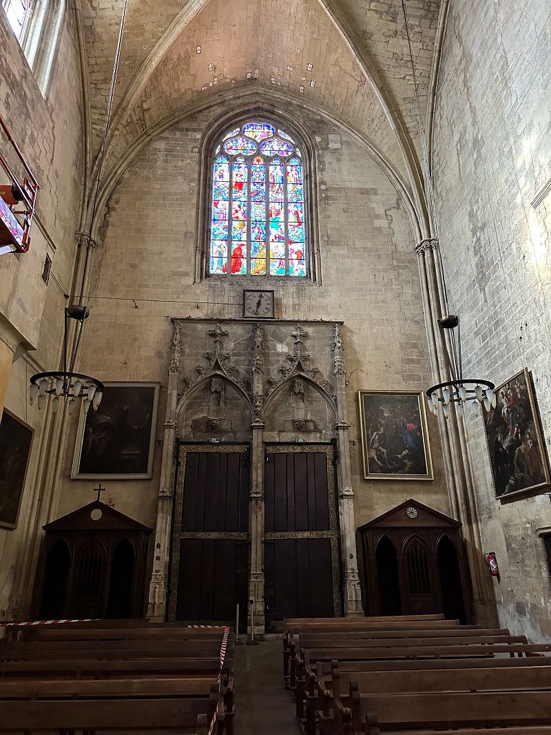
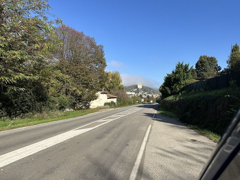
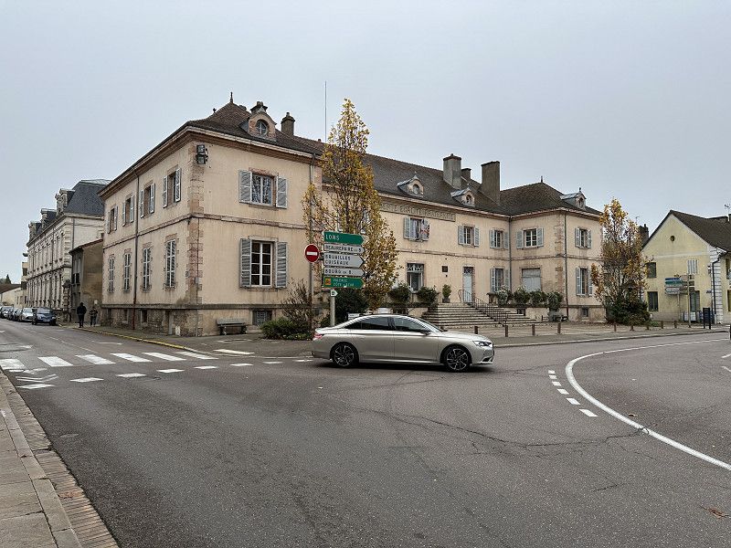
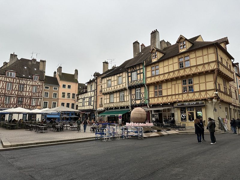
Lengres heute bei Sonne!
After it was hazy and overcast all day yesterday, I woke up to sunshine today! Did a quick walk around again.
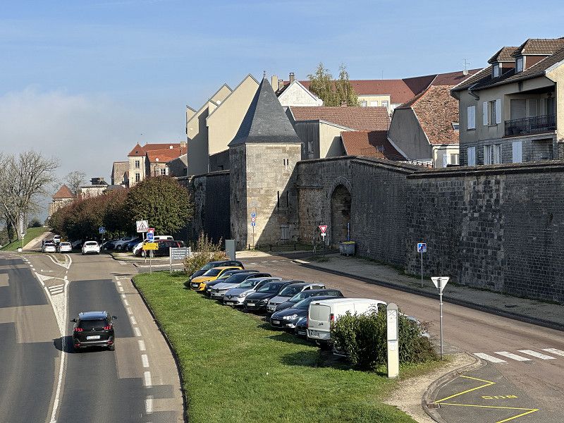
Langres Stellplatz
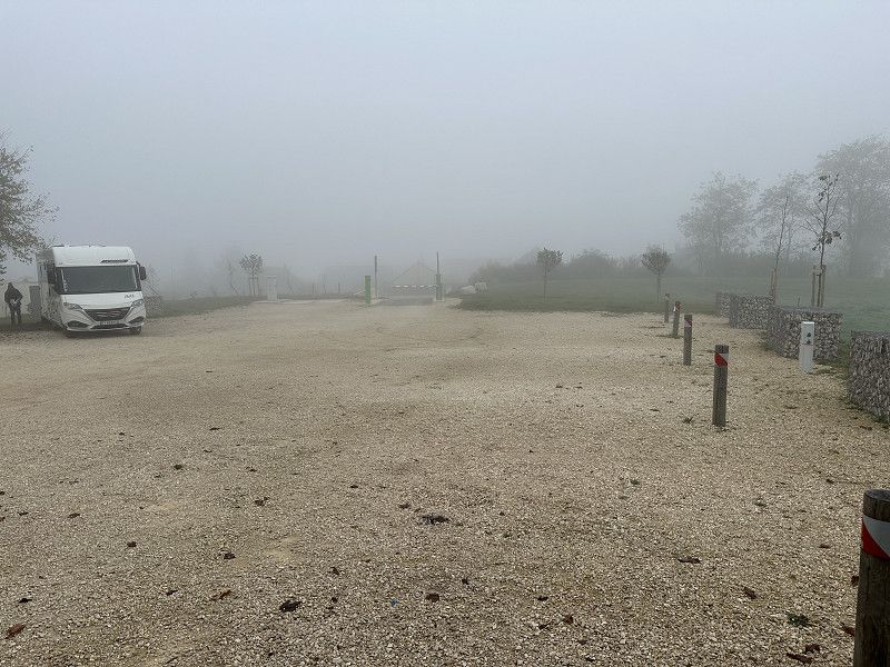
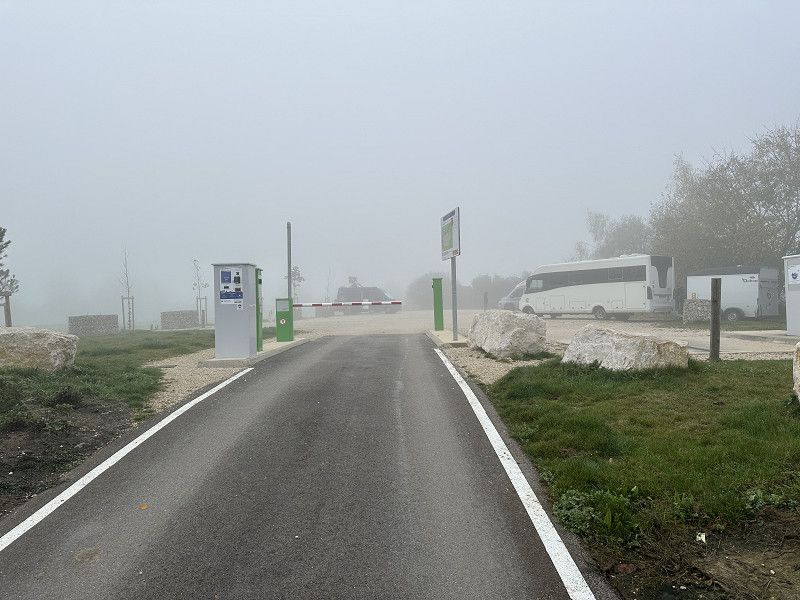
There was no disposal point at the closed campsite. On my walk around I saw a disposal point sign. When I drove there I discovered a nice parking spot. It would have been OK and not far from the city center. It's actually also in Park4Night...
Rue Jean Favre, Langres, Haute-Marne, Grand Est, Frankreich
47° 51' 18.1" N 5° 20' 6.7" E
47.8550243 5.3351912
• Head north on Rue Jean Favre. Go for 125 m.
• Turn left onto Rue Gaston Bachelard. Go for 75 m.
• Turn right onto Rue Gaston Bachelard. Go for 142 m.
• Turn right onto Avenue Turenne (D974). Go for 206 m.
• Continue on Place des États-Unis (N74) toward Vesoul. Go for 47 m.
• Turn slightly right onto Rue des Auges (N19) toward Vesoul. Go for 1.4 km.
• Take the 2nd exit from roundabout onto Rue de Vesoul (N19) toward Vesoul/Mulhouse/Fayl-Billot. Go for 58.4 km.
• Take the 2nd exit from roundabout onto N19 toward Mulhouse/Vesoul/Port S/ Saône-Centre. Go for 38.1 km.
• Take the 2nd exit from roundabout onto N19 toward Mulhouse/Belfort/Montbéliard/Luxeuil-les B./Lure. Go for 38.6 km.
• Take ramp onto A36 (La Comtoise) toward E54/Paris/Lyon/Montbéliard/Mulhouse/Belfort. Go for 61.1 km.
• Continue on A5/A36. Go for 87 m.
• Continue on A5. Go for 104 m.
• Take the exit toward Basel/Lörrach onto A5. Go for 11.9 km.
• Take exit 67 toward Efringen-Kirchen/Kandern. Go for 441 m.
• Continue on L137. Go for 161 m.
• Turn right onto L137 toward Kandern/Efringen-Kirchen/Istein. Go for 4.5 km.
• Turn left onto K6323. Go for 40 m.
• Continue on Bahnhofstraße (K6323). Go for 404 m.
• Continue on K6323. Go for 721 m.
• Turn right onto B3. Go for 531 m.
• Take the 2nd exit from roundabout onto B3. Go for 2.1 km.
• Turn left onto K6325 toward Fischingen. Go for 1.2 km.
• Continue on Eimeldinger Straße (K6325). Go for 178 m.
• Turn right onto Dorfstraße. Go for 73 m.
• Turn right onto Dorfstraße. Go for 101 m.
• Continue on Binzener Straße. Go for 185 m.
• Turn left. Go for 247 m.
• Arrive at your destination on the left.
☍
221,1 km
(2 hrs. 25 min.)
Fünfschilling-Hof
Landvergnügen organic farm/restaurant. After the many France Passion pitches, now a Landvergnügen pitch 😀 . Tomorrow we'll go shopping and then babysit in Freiburg again.
Binzener Straße 1, Fischingen, Landkreis Lörrach, Baden-Württemberg, Deutschland
47° 38' 50.6" N 7° 36' 6.4" E
47.6473862 7.6017806
• Head northeast. Go for 247 m.
• Turn right onto Binzener Straße. Go for 185 m.
• Continue on Dorfstraße. Go for 101 m.
• Turn left onto Dorfstraße. Go for 73 m.
• Turn left onto Eimeldinger Straße (K6325). Go for 178 m.
• Continue on K6325. Go for 1.2 km.
• Turn right onto B3. Go for 2.0 km.
• Take the 2nd exit from roundabout onto B3. Go for 601 m.
• Turn left onto K6323 toward Efringen-Kirchen. Go for 721 m.
• Continue on Bahnhofstraße (K6323). Go for 404 m.
• Continue on K6323. Go for 40 m.
• Turn right onto L137. Go for 4.5 km.
• Turn left onto L137 toward Basel-Karlsruhe. Go for 161 m.
• Turn right and take ramp onto A5 toward Karlsruhe. Go for 41.2 km.
• Take exit 63 toward Freiburg-Süd/FR-Tiengen. Go for 358 m.
• Turn right onto Freiburger Landstraße (B31) toward Freiburg. Go for 3.1 km.
• Take the 1st exit from roundabout onto Tiengener Straße (B31) toward Freiburg. Go for 1.3 km.
• Continue on Basler Landstraße (K9863). Go for 203 m.
• Continue on Basler Landstraße. Go for 416 m.
• Turn right onto Schulstraße. Go for 21 m.
• Continue on Schulstraße. Go for 262 m.
• Turn left onto Hartkirchweg. Go for 88 m.
• Turn left onto Ittnerstraße. Go for 126 m.
• Arrive at Ittnerstraße. Your destination is on the right.
☍
57,4 km
( 39 min.)
Day
Freiburg im Breisgau
A babysitter is also needed on the way back.
Basler Landstraße 49a, Freiburg im Breisgau, Baden-Württemberg, Deutschland
47° 58' 52.9" N 7° 48' 7.5" E
47.9813688 7.8020860
• Head toward Hartkirchweg on Ittnerstraße. Go for 126 m.
• Turn right onto Hartkirchweg. Go for 593 m.
• Turn right onto Malteserordensstraße. Go for 85 m.
• Continue on Besançonallee (K9863). Go for 268 m.
• Take the 3rd exit from roundabout onto Besançonallee (K9863). Go for 1.3 km.
• Continue on Tel-Aviv-Yafo-Allee toward Karlsruhe/Offenburg/Industriegebiet Nord/Gewerbegebiet Hochdorf/Messe/Uni-Kliniken. Go for 1.5 km.
• Take ramp onto Autobahnzubringer Mitte (B31A) toward Karlsruhe-Basel/Umkirch/Mundenhof. Go for 2.2 km.
• Take ramp onto A5 toward Karlsruhe. Go for 124 km.
• Take exit 47 toward Ettlingen/Bad Herrenalb. Go for 302 m.
• Turn left onto Karlsruher Straße (L561) toward Ettlingen/Bad Herrenalb. Go for 123 m.
• Continue on Karlsruher Straße toward Ettlingen-Zentrum. Go for 1.0 km.
• Pass 2 roundabouts and continue on Karlsruher Straße. Go for 701 m.
• Take the 3rd exit from roundabout onto Pforzheimer Straße. Go for 844 m.
• Turn right onto Luisenstraße (L613). Go for 243 m.
• Turn left onto Schöllbronner Straße (L613). Go for 218 m.