The long-planned tour with our son to Sweden including a detour to Oslo. Without the women 😉.
Day
Wersterholz, Bad Oeynhausen, Deutschland
August 4, 2023
Departure promptly at 1:30 p.m. Because of the heavy traffic on the A2 and A7, we drive comfortably overland to Soltau. We also take the obligatory traffic jam in front of the Elbe tunnel and are at the motorhome parking lot at Citti Park in Flensburg around 7:30 p.m.
Holzmark 23, 32549 Bad Oeynhausen, Deutschland
52° 13' 43.6" N 8° 45' 37.3" E
52.2287663 8.7603682
• Head toward Frankenweg on Holzmark. Go for 24 m.
• Turn right onto Frankenweg. Go for 242 m.
• Turn sharp right onto Bergkirchener Straße (K29). Go for 812 m.
• Continue on K29. Go for 15 m.
• Continue on Bergkirchener Straße (K29). Go for 838 m.
• Continue on Ringstraße (K29). Go for 213 m.
• Continue on Kirchbreite (K8). Go for 1.3 km.
• Take the 2nd exit from roundabout onto Hahnenkampstraße (K29) toward Minden/Dehme. Go for 233 m.
• Turn left onto Wiekriede (K29). Go for 149 m.
• Continue on Im Keiten (K29). Go for 73 m.
• Continue on Alter Postweg (K29). Go for 1.2 km.
• Continue on K29. Go for 122 m.
• Turn right and take ramp onto A30. Go for 3.1 km.
• Take the exit toward Berlin/Hannover onto A2 (Weser-Brücke). Go for 67.4 km.
• Keep right onto A352 (Autobahndreieck Hannover-West) toward Hamburg/Flughafen. Go for 17.7 km.
• Take the exit toward Hamburg/Bremen/Berkhof onto A7. Go for 129 km.
• Keep left onto A7. Go for 155 km.
• Take exit 2 toward Flensburg/Harrislee/Handewitt/Niebüll/Leck. Go for 332 m.
• Turn left onto B199. Go for 3.2 km.
• Turn right onto Lilienthalstraße (K19) toward Gewerbegebiet FL-Weiche/CITTI-PARK P+R. Go for 423 m.
• Turn right onto Lilienthalstraße. Go for 63 m.
• Arrive at Lilienthalstraße.
☍
381,9 km
(3 hrs. 32 min.)
Citti-Park Flensburg
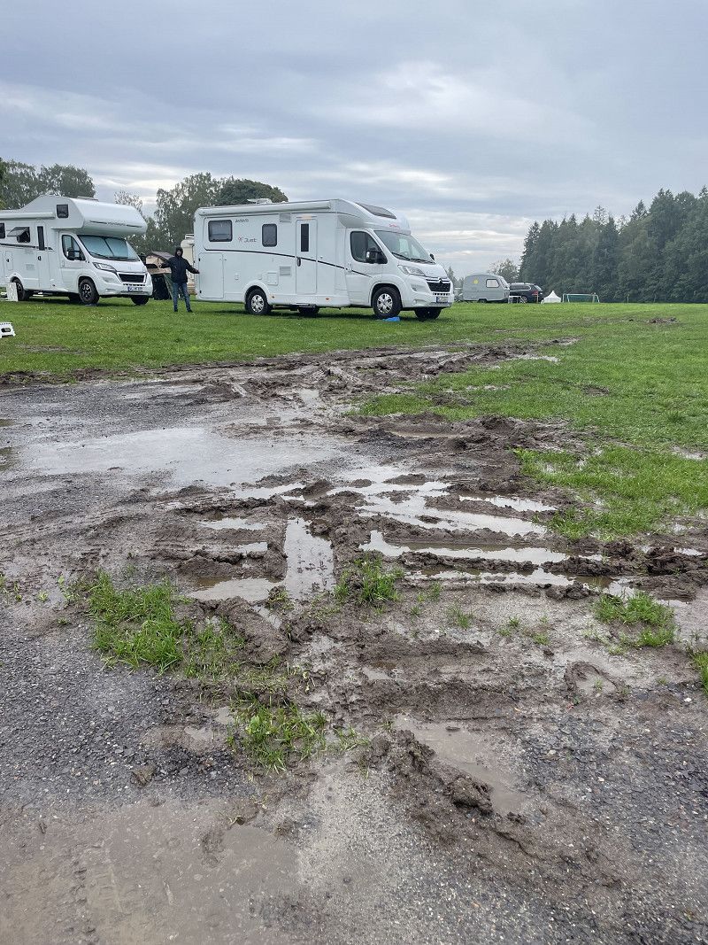
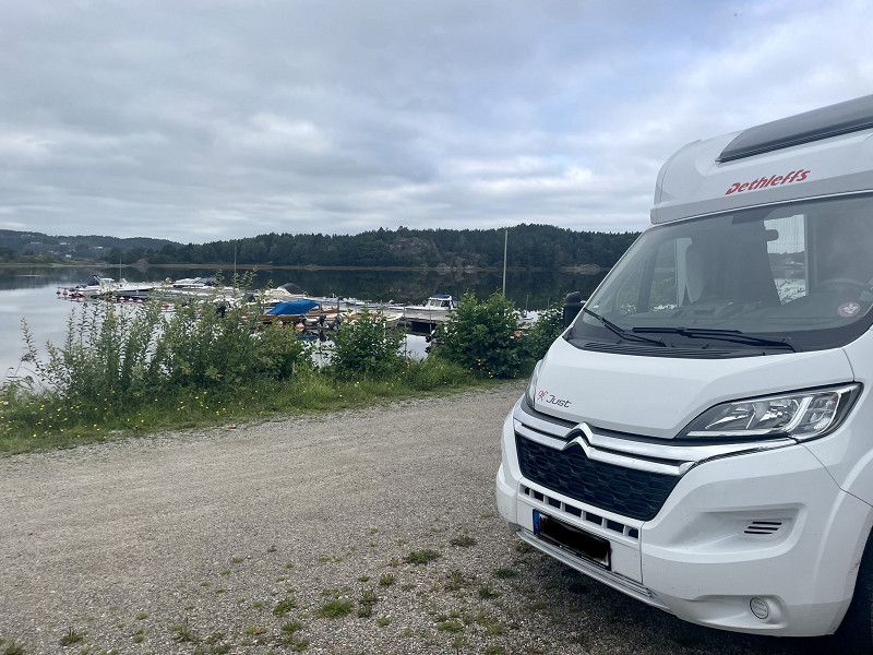
The place is completely overcrowded, but we still find a space in the car area. Not the nice way, but we want to move on tomorrow morning anyway. For dinner we went to the Taverna Omiros, within walking distance and the food was very tasty.
Schleswig-Holstein, Deutschland
54° 46' 16.7" N 9° 23' 42.7" E
54.7712963 9.3951867
• Head west on Lilienthalstraße.
• Arrive at Lilienthalstraße.
☍
Distance not available
(Duration not available)
Day
Citing-Park Flensburg
Schleswig-Holstein, Deutschland
54° 46' 16.7" N 9° 23' 42.7" E
54.7712963 9.3951867
• Head east on Lilienthalstraße. Go for 63 m.
• Turn left onto Lilienthalstraße (K19). Go for 423 m.
• Turn left onto Lecker Chaussee (B199). Go for 3.1 km.
• Take ramp onto A7 toward Kolding. Go for 4.0 km.
• Continue on E45 (Sønderjyske Motorvej). Go for 89.5 km.
• Keep left onto E45 (Kolding) toward Århus/Vejle. Go for 90.7 km.
• Take the exit toward Lufthavn/Grenaa/180/Århus N/21/Ebeltoft onto 15 (Djurslandmotorvejen). Go for 3.0 km.
• Keep left onto 15 (Djurslandmotorvejen) toward Lufthavn Grenaa/Ebeltoft/21. Go for 33.1 km.
• Continue on Grenåvej (15) toward Grenaa/Færge. Go for 24.5 km.
• Turn right onto Ringvejen (16) toward 15/Grenna Ø/Færge/Havn. Go for 3.1 km.
• Keep left onto Færgevej. Go for 81 m.
• Arrive at Færgevej. Your destination is on the right.
☍
251,6 km
(2 hrs. 34 min.)
Samstag, 05.08.2023
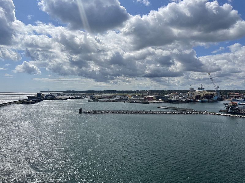
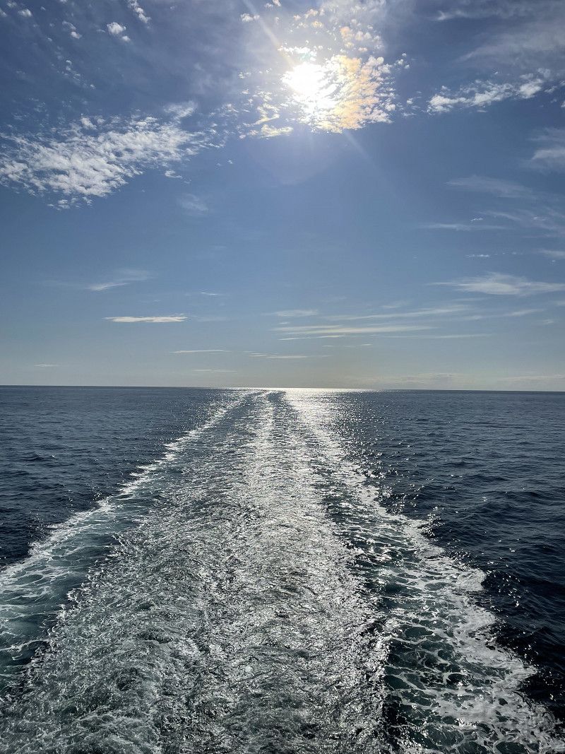
Filled up before the Danish border and then via Kolding and Aarhus to Grenaa. With little traffic, we made quick progress and arrived at the ferry on time despite a long breakfast break. The weather also cooperates and we have a sunny crossing to Halmstad. The ferry is on time and after a good 2.5 hour journey we are at our first parking space on the northern bank of the Säven.
Grenå-Halmstad, Færgevej, Grenaa, Dänemark
Færgevej 1, 8500 Grenå, Dänemark
56° 24' 25.8" N 10° 55' 25.9" E
56.4071544 10.9238655
• Head east on Færgevej. Go for 117 m.
• Turn right onto Færgevej (16). Go for 220 m.
• Take the Grenaa-Halmstad Ferry. Stay on for 124 km.
• Head toward Oceanvägen on Turbingatan. Go for 487 m.
• Turn left onto Turbingatan. Go for 650 m.
• Turn left onto Turbingatan. Go for 361 m.
• Arrive at Turbingatan.
☍
125,8 km
(3 hrs. 40 min.)
Halmstad Hamn, Halmstad, Schweden
Halmstad Hamn, 302 50 Halmstad, Schweden
56° 39' 14.2" N 12° 51' 21.4" E
56.6539366 12.8559510
• Head toward Stationsgatan on Turbingatan. Go for 433 m.
• Turn left onto Stationsgatan. Go for 201 m.
• Turn right onto Stationsgatan. Go for 1.6 km.
• Continue on Gamletullsgatan. Go for 882 m.
• Turn left onto Wrangelsgatan. Go for 747 m.
• Turn right onto Norra Infartsleden toward E6/Jönköping/26/Kärleken. Go for 1.2 km.
• Pass 2 roundabouts and continue on Norra Infartsleden (E6.6). Go for 2.5 km.
• Take the 2nd exit from roundabout onto 26 toward Jönköping. Go for 11.7 km.
• Pass 2 roundabouts and continue on 26. Go for 20.5 km.
• Take the 3rd exit from roundabout onto Gamla Nissastigen (150) toward Falkenberg/Torup. Go for 478 m.
• Turn right onto Bosgårdsvägen (150). Go for 201 m.
• Turn right onto Prästgårdsvägen. Go for 996 m.
• Turn left toward Härhult. Go for 130 m.
• Continue on Härhult. Go for 1.1 km.
• Continue on Härhult. Go for 1.2 km.
• Continue on Fagerhult. Go for 896 m.
• Continue on Mjöhult. Go for 1.4 km.
• Continue on Gohult. Go for 2.8 km.
• Continue on Galtabo Torbjörnsgård. Go for 1.1 km.
• Continue on Klockarevägen. Go for 299 m.
• Continue on Hålsjövägen. Go for 533 m.
• Continue on Drängsered Fridhem. Go for 5.9 km.
• Continue on Krogsered. Go for 299 m.
• Continue on Krogsered. Go for 536 m.
• Continue on Krogsered. Go for 508 m.
• Continue on Torbjörnhult. Go for 3.1 km.
• Continue on Esered. Go for 104 m.
• Continue on Esered. Go for 64 m.
• Continue on Esered Ådalen. Go for 141 m.
• Continue on Esered. Go for 602 m.
• Continue on Esered Granered. Go for 106 m.
• Continue on Esered. Go for 510 m.
• Arrive at Halmstadvägen. Your destination is on the right.
☍
62,7 km
( 53 min.)
Ätran, Schweden
311 51 Ätran, Schweden
57° 7' 14.9" N 12° 56' 53.1" E
57.1207920 12.9480862
• Head northwest on Halmstadvägen.
• Continue on Svenljungavägen. Go for 1.7 km.
• Continue on Esered Ängsbo. Go for 869 m.
• Continue on Tokalynga. Go for 579 m.
• Continue on Gunnarp. Go for 438 m.
• Continue on Gunnarp. Go for 96 m.
• Turn right onto Gunnarp Stomgård. Go for 76 m.
• Continue on Gunnarp. Go for 1.0 km.
• Continue on Trädgården. Go for 965 m.
• Continue on Gunnarp. Go for 1.8 km.
• Continue on Skåpanäs Bäckäng. Go for 525 m.
• Continue on Skåpanäs Nybo. Go for 1.7 km.
• Continue on Skeppshult Sandhem. Go for 437 m.
• Continue on Skeppshult Åkroken. Go for 4.6 km.
• Continue on Vallbrogatan. Go for 492 m.
• Turn right onto Alnäsleden. Go for 562 m.
• Continue on Klevs Övre. Go for 287 m.
• Continue on Mårdaklevs hembygdsgård Klev. Go for 2.1 km.
• Continue on Hyndarp Stora. Go for 513 m.
• Continue on Hyndarp Strömsåsen. Go for 1.1 km.
• Continue on Hålabäckstorp Lillhagen. Go for 1.3 km.
• Continue on Hålabäckstorp Riskulla. Go for 1.2 km.
• Continue on Ällebäckstorp Ängalund. Go for 715 m.
• Continue on Ellebäckstorp Torpa. Go for 332 m.
• Continue on Ällebäckstorp Ulfshed. Go for 2.5 km.
• Continue on Falkenbergsvägen. Go for 3.8 km.
• Continue on Hid Nydal. Go for 639 m.
• Continue on Yttre Hid. Go for 301 m.
• Turn right onto Yttre Hid. Go for 654 m.
• Continue on Hid Björkhem. Go for 174 m.
• Continue on Hid Almedal. Go for 557 m.
• Continue on Hid Slättvik. Go for 314 m.
• Continue on Hid Sjöbacken. Go for 153 m.
• Continue on Hid Lilla Heden. Go for 1.2 km.
• Continue on Axelfors Vallen Fridhem. Go for 1.8 km.
• Continue on Boda Björksäter. Go for 2.8 km.
• Continue on 154. Go for 8.1 km.
• Take the 2nd exit from roundabout onto Nya Boråsvägen (154). Go for 13.3 km.
• Take the 3rd exit from roundabout onto 27. Go for 14.8 km.
• Take the 2nd exit from roundabout onto 27 toward Göteborg/Borås. Go for 208 m.
• Take ramp onto 41 toward Borås C. Go for 2.3 km.
• Pass 3 roundabouts and continue on Söderleden (41). Go for 2.1 km.
• Keep right onto Arlagatan (42) toward 180/Centrum/Knalleland. Go for 1.6 km.
• Take the 1st exit from roundabout onto Norrby Långgata (42) toward Knalleland. Go for 484 m.
• Pass 5 roundabouts and continue on 42. Go for 12.0 km.
• Take the 3rd exit from roundabout onto Vängavägen (42) toward Trollhättan. Go for 10.5 km.
• Arrive at Tämta Deragården (42). Your destination is on the left.
☍
103,5 km
(1 hrs. 25 min.)
Tämta, Schweden
August 5th, 2023 evening
513 93 Tämta, Schweden
57° 53' 48.9" N 12° 55' 12.1" E
57.8969233 12.9200314
• Head toward Tämta Lindängen on Tämta Deragården (42). Go for 5.0 km.
• Turn left toward Ljur Sävsjöos. Go for 15 m.
• Turn slightly left onto Ljur Sävsjöos. Go for 131 m.
• Arrive at your destination on the right.
☍
5,1 km
( 4 min.)
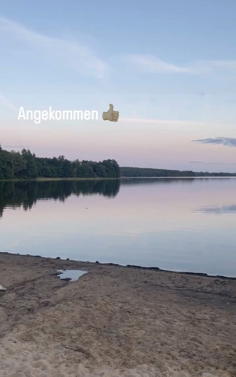
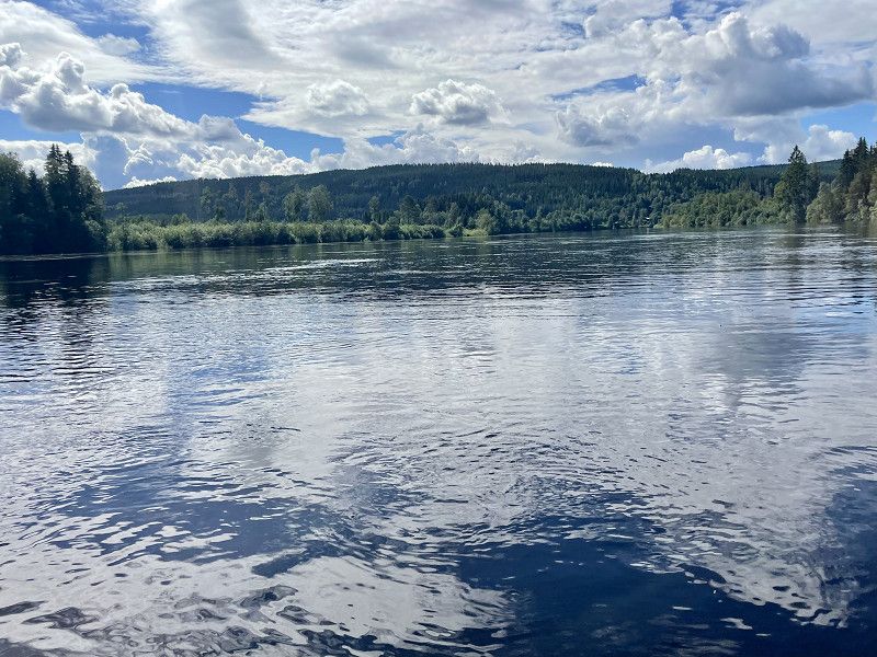
Sävens badplats
Good pitch (from park4night) for one or two nights. Fairly clean dry toilet. Staying overnight is ok, camping is not recommended. But not necessary, there are plenty of benches and tables.
Provinz Västra Götaland, Schweden
57° 55' 32.4" N 12° 51' 30.9" E
57.9256676 12.8585804
• Head east. Go for 25 m.
• Arrive at your destination on the left.
☍
0,0 km
( )
Day
Radeln und Angeln
06/06/2023
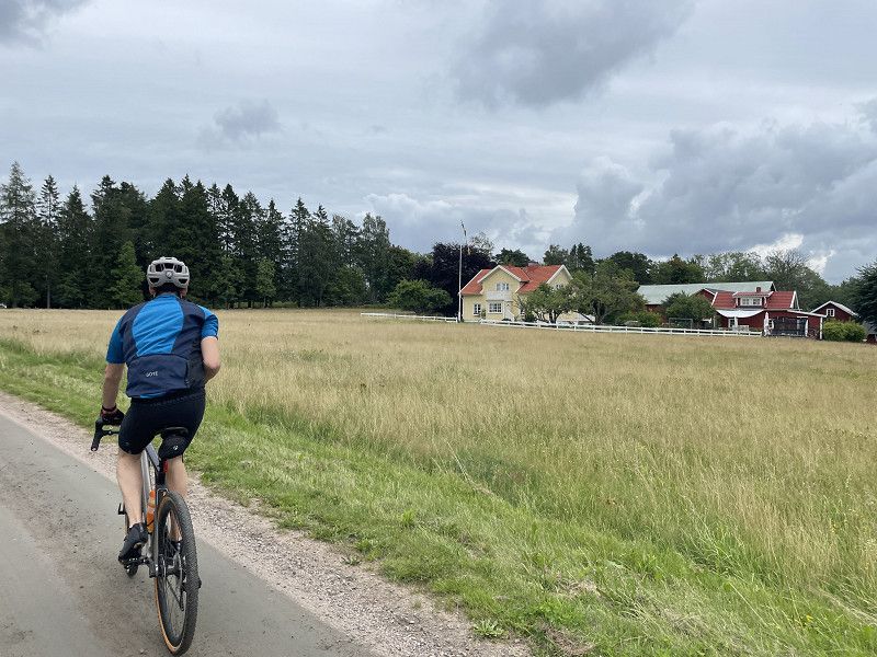
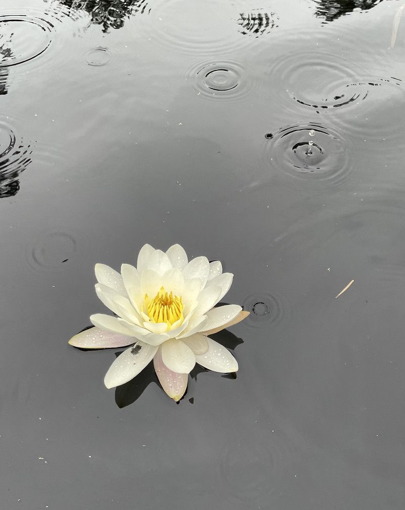
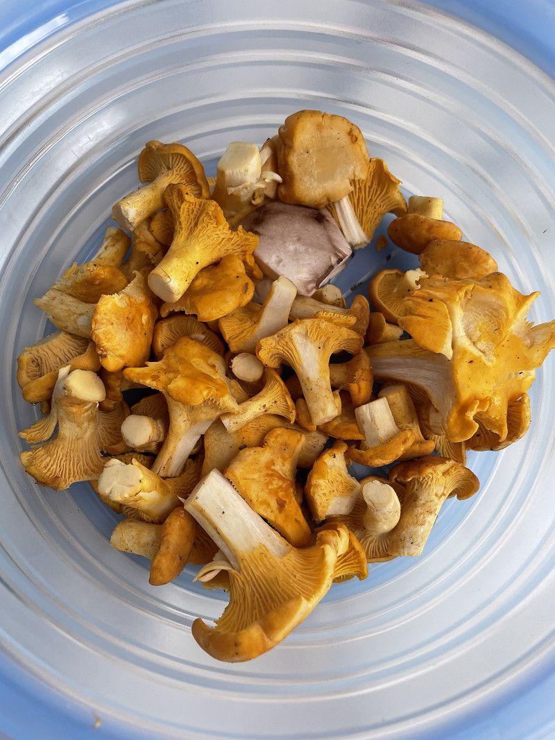
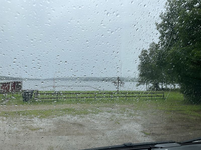
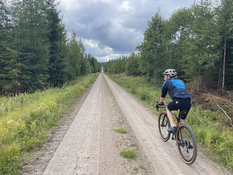
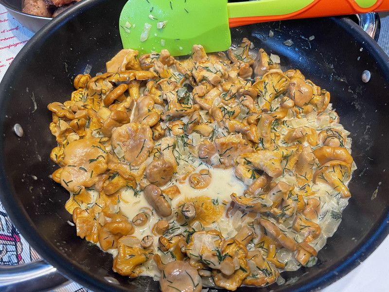
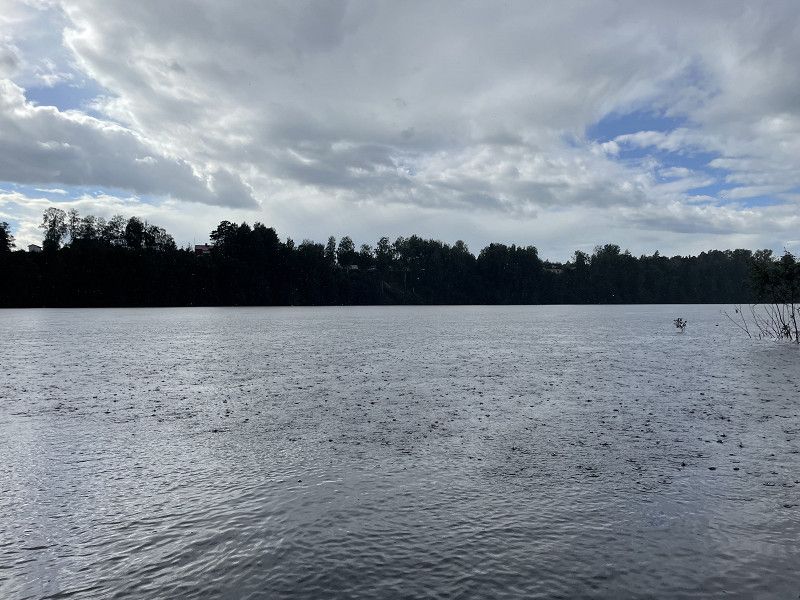
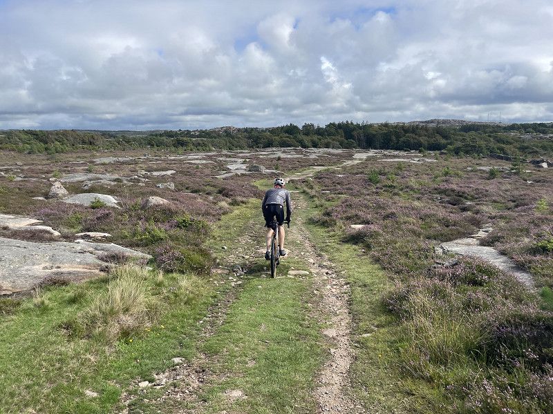
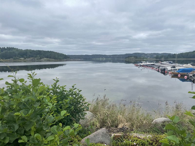
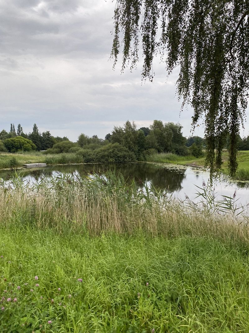
After the first night in Sweden we are exploring the area today. I was already at Säven a good 30 years ago, so I have a bit of local knowledge. We then ride our gravel bikes through the forest to Sandsjön, where we want to go fishing later. Everything still looks the same as before. So go back to the mobile and collect a few chanterelles along the way. Unfortunately, the fishing was not successful. But whatever, it was still fun. We are back at the pitch in time for the rain, from now on it will be continuous rain until the next morning.
Day
Sävens badplats
August 7, 2023
After a rainy night we leave this beautiful place early. In Vårgårda we go to an ICA supermarket to replenish our supplies.
Provinz Västra Götaland, Schweden
57° 55' 32.7" N 12° 51' 32.3" E
57.9257531 12.8589615
• Head east.
• Continue on Ljur Sävsjöos. Go for 106 m.
• Turn slightly right toward Ljur Sävsjöos/42. Go for 15 m.
• Turn left onto Ljur Sävsjöos (42). Go for 14.0 km.
• Turn right onto 42. Go for 32 m.
• Take ramp onto E20 toward Stockholm/Trollhättan. Go for 81.0 km.
• Take the exit toward Uddevalla/Lidköping/Timmersdala/Götene onto Trafikplats Kinnekulle. Go for 577 m.
• Take the 2nd exit from roundabout toward Uddevalla/Lidköping/Götene. Go for 353 m.
• Take the 2nd exit from roundabout onto 44 toward Uddevalla/Lidköping/Kinnekulle/Götene N. Go for 749 m.
• Turn right toward Hällekis/Kinnekulle. Go for 1.2 km.
• Continue on Kinne-Vedum Målaregården. Go for 782 m.
• Continue on Kinne-Vedum Storegården. Go for 93 m.
• Continue on Kinne-Vedum Brogården. Go for 241 m.
• Continue on Kinne-Vedum Arvidsgården. Go for 137 m.
• Continue on Kinne-Vedum Nolebo. Go for 1.4 km.
• Continue on Fullösa Hagaberg. Go for 3.1 km.
• Continue on Fullösa Brokvarn. Go for 80 m.
• Continue on Forshem Solhaga. Go for 4.3 km.
• Continue on Sjöråsvägen. Go for 1.3 km.
• Continue on Hönsätersvägen. Go for 246 m.
• Turn right onto Strandvägen. Go for 493 m.
• Continue toward Kinnekulle camping. Go for 3.0 km.
• Continue on Kinnekulle camping. Go for 208 m.
• Arrive at Kinnekulle camping. Your destination is on the right.
☍
113,5 km
(1 hrs. 23 min.)
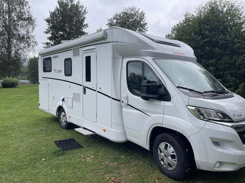
Kinnekulle Camping & Stugby
August 7th, 2023 afternoon
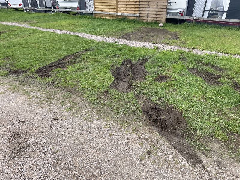
A very friendly greeting at reception. We are given various places to choose from, but unfortunately we almost get stuck on the sodden ground in the most beautiful place right by the sea.
53394, Hällekis, Schweden
58° 37' 27" N 13° 22' 58" E
58.6241700 13.3827800
• Head west on Kinnekulle camping.
• Arrive at Kinnekulle camping. Your destination is on the right.
☍
Distance not available
(Duration not available)
Day
Kinnekulle Camping & Stugby
August 8, 2023
53394, Hällekis, Schweden
58° 37' 27" N 13° 22' 58" E
58.6241700 13.3827800
• Head west on Kinnekulle camping.
• Arrive at Kinnekulle camping. Your destination is on the right.
☍
Distance not available
(Duration not available)
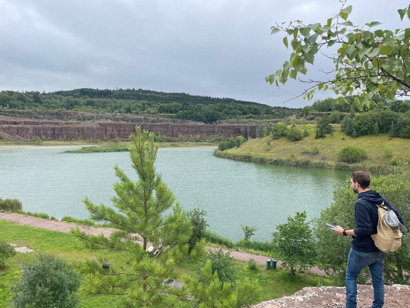
Wanderung zum Kinnekulle Aussichtsturm
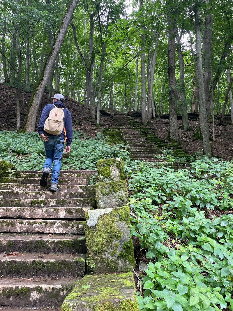
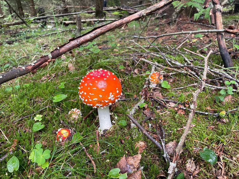
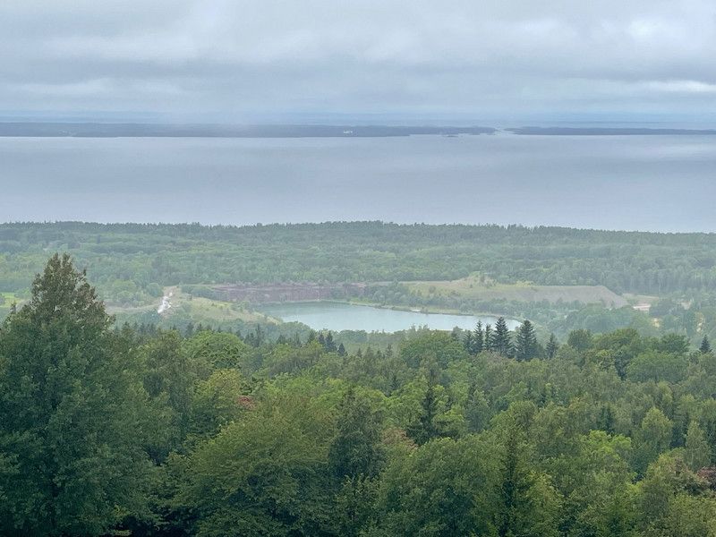
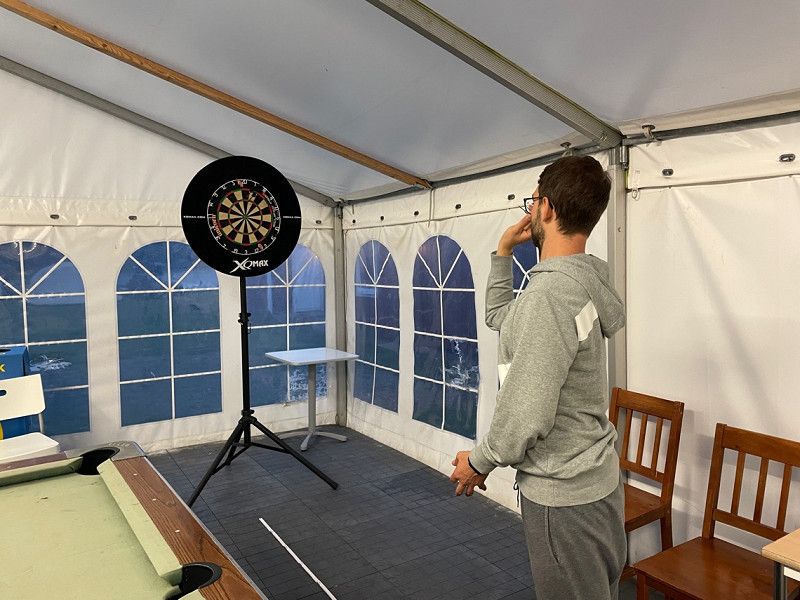
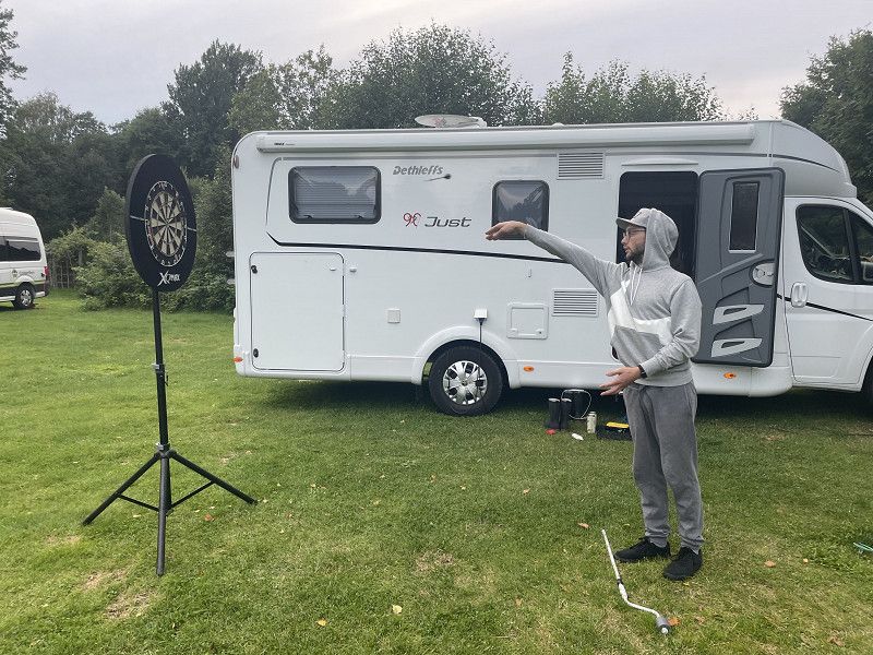
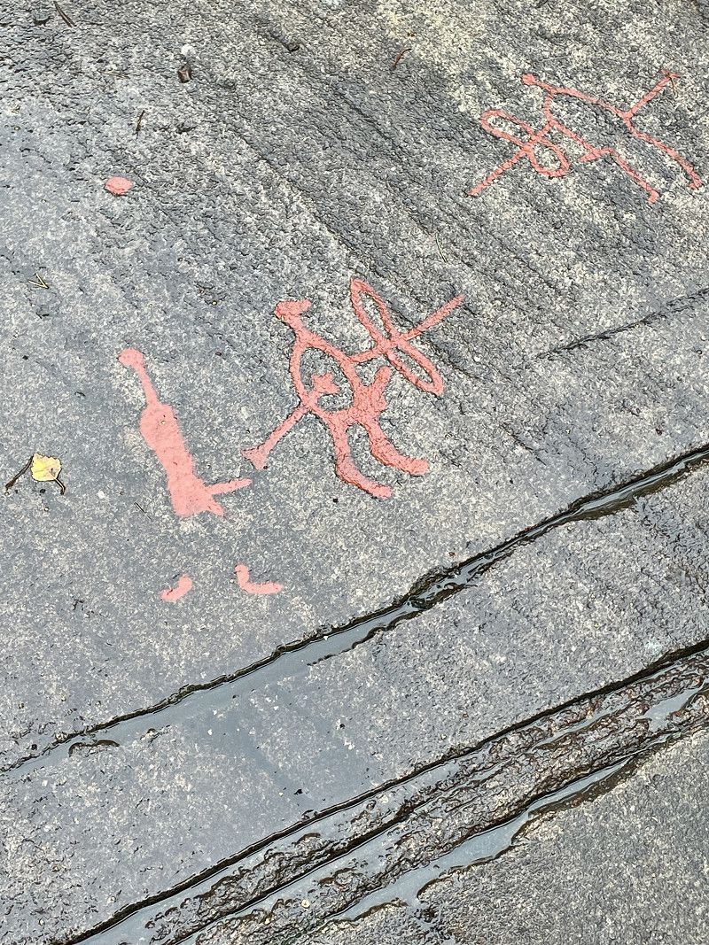
It rained heavily again during the night. Some of the places have water standing on them, some of them look as if there had been a pack of wild boars there. In the meantime it is dry from above and we are sticking to our plan to hike to the observation tower on Kinekulle. An old stone staircase leads into the forest past an old quarry. There are lots of mushrooms 🍄 on the side of the road, unfortunately no chanterelles yet. After a good two hours we arrived at the tower and took a break. Very reasonable prices in the small cafe, 150 kr for a cup of coffee which is very good 👍🏻. Then up to the tower, unfortunately it's already getting dark again and the view of Vänern is worse than good. At least Läckö Castle can be seen. On the “descent” the first chanterelles appear, with plenty more to come. We hike through the woods and at some point the rain catches up with us. The wind makes it really uncomfortable. After almost 4 hours we are back at the motorhome and the water is running out of my hiking boots. Still a very nice tour. In the evening the specially made holder for the dartboard is tested. Functions.
Day
Kinnekulle Camping & Stugby
Aug 9, 2023
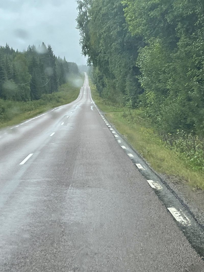
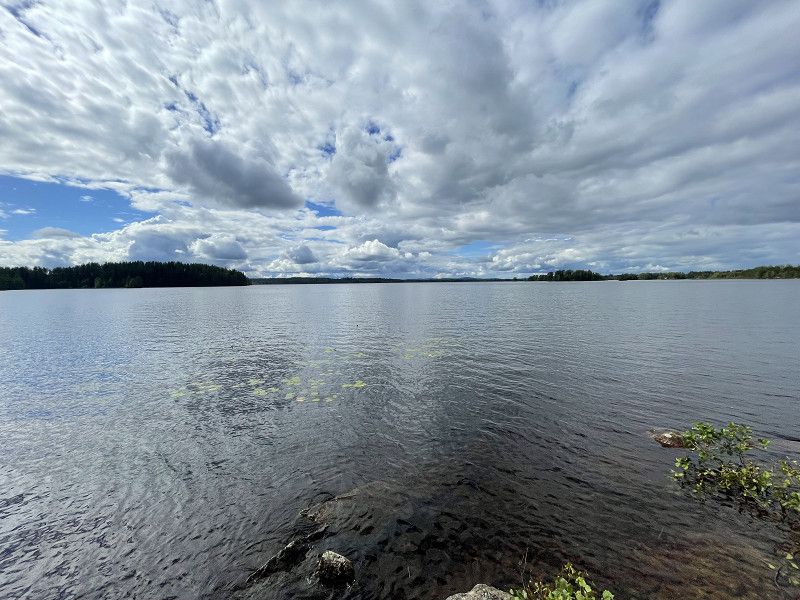
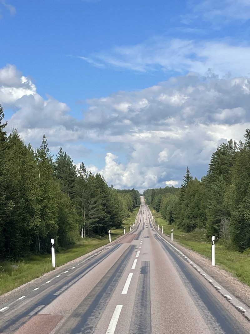
The rain has let up a bit and the things are packed up quickly. With a short stopover for shopping in Mariestad, we travel through a beautiful landscape with many lakes to Värmland. The population decreases significantly, forest and water dominate the journey.
53394, Hällekis, Schweden
58° 37' 27" N 13° 22' 58" E
58.6241700 13.3827800
• Head east on Kinnekulle camping. Go for 208 m.
• Continue toward Strandvägen. Go for 3.0 km.
• Continue on Strandvägen. Go for 493 m.
• Turn left onto Hönsätersvägen. Go for 246 m.
• Continue on Sjöråsvägen. Go for 2.9 km.
• Turn left toward Forshems Forshemsvägen. Go for 592 m.
• Continue on Forshems Forshemsvägen. Go for 661 m.
• Continue on Forshem Anneberg. Go for 100 m.
• Continue on Forshem Anneberg. Go for 28 m.
• Continue on Forshem Solhyddan. Go for 867 m.
• Continue on Forshem Hasselbacken. Go for 2.8 km.
• Continue on Österäng Årnäsvägen. Go for 290 m.
• Continue on Österäng Österängsvägen. Go for 484 m.
• Continue on Österäng Hästhagen. Go for 904 m.
• Continue on Österäng Myggebacken. Go for 880 m.
• Continue on Österäng Alebäck. Go for 1.3 km.
• Continue on Äskekärr. Go for 209 m.
• Continue on Äskekärr Dunderbacken. Go for 340 m.
• Continue on Äskekärr Svanerödjan. Go for 184 m.
• Continue on Äskekärr Sandhaga. Go for 151 m.
• Continue on Äskekärr Kyrketorp. Go for 72 m.
• Continue on Äskekärr Kyrkbacken. Go for 233 m.
• Continue on Äskekärr Banelund. Go for 63 m.
• Continue on Äskekärr. Go for 13 m.
• Continue on Äskekärr Fridhem. Go for 41 m.
• Continue on Äskekärr Kyrkbacken. Go for 128 m.
• Continue on Äskekärr. Go for 880 m.
• Continue on Bredsäter Västermark. Go for 1.1 km.
• Continue on Bredsäter. Go for 12 m.
• Continue on Bredsäter Snickaregården. Go for 242 m.
• Continue on Bredsäter. Go for 864 m.
• Continue on Bredsäter Myrbacken. Go for 421 m.
• Continue on Bredsäter. Go for 383 m.
• Continue on Bredsäter Hammarskogen. Go for 355 m.
• Continue on Bredsäter Solsäter. Go for 73 m.
• Continue on Kinnekullevägen. Go for 828 m.
• Turn right onto Björsätersvägen. Go for 282 m.
• Turn left onto E20 toward Skara. Go for 19.2 km.
• Turn left onto 26 toward Mora/Kristinehamn/Gullspång. Go for 65.2 km.
• Turn right onto Varnumsleden (26) toward E18/Oslo/Stockholm/Filipstad. Go for 3.1 km.
• Turn right and take ramp onto E18. Go for 19.8 km.
• Take ramp toward Hagfors/Molkom/Väse. Go for 393 m.
• Turn right onto Karsvalla (240). Go for 3.6 km.
• Turn right onto Ve (240). Go for 22.5 km.
• Turn right onto 63/240 toward Ludvika/Hagfors/Filipstad. Go for 873 m.
• Turn left onto 240. Go for 37.2 km.
• Turn left toward Nore Norestugan. Go for 475 m.
• Continue on Nore Norestugan. Go for 458 m.
• Continue on Nore. Go for 1.1 km.
• Continue on Prästbol Håkanbol. Go for 271 m.
• Continue on Prästbol Åsen. Go for 332 m.
• Continue on Prästbol. Go for 1.8 km.
• Continue on Prästbol Källan. Go for 847 m.
• Continue on Ås täppa. Go for 2.9 km.
• Continue on Rissäter. Go for 1.6 km.
• Turn right onto 62. Go for 21.7 km.
• Turn right toward Byn. Go for 768 m.
• Continue on Byn. Go for 233 m.
• Continue on Byn. Go for 49 m.
• Continue on Byn Nybo. Go for 54 m.
• Turn right onto Byn. Go for 216 m.
• Continue on Byn. Go for 88 m.
• Arrive at Byn. Your destination is on the right.
☍
227,3 km
(3 hrs. 3 min.)
Byns Camping
Aug 9, 2023
A very nice place, clean sanitary facilities and very friendly operators 👍🏻.
68050, Ekshärad, Schweden
60° 10' 33" N 13° 30' 34.8" E
60.1758200 13.5096700
• Head southwest on Byn.
• Arrive at Byn. Your destination is on the right.
☍
Distance not available
(Duration not available)
Day
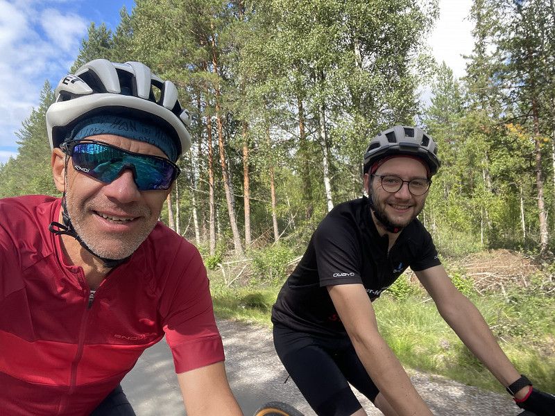
Radtour mit Elch
More or less dry weather today. We want to explore the area on bikes and ride through the forests towards the east. Shortly before we get back on the main road, there is a cow moose on the path, but she quickly disappears into the bushes. No matter, saw the moose 🫎, everything was fine. Then we continue via Gustav Adolf towards the main road to Hagfors. We still find plenty of chanterelles, unfortunately we don't have a proper bag to take all the mushrooms with us. No matter, there are already enough for the two of us. In the evening we test the dart stand 🎯 outside for the first time. Works well here too, the mosquitoes 🦟 are a bit annoying.
Day
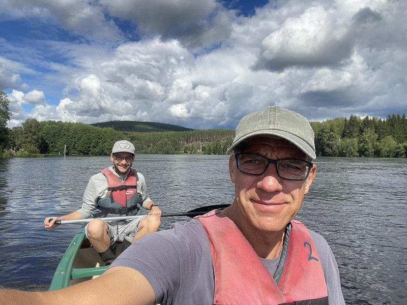
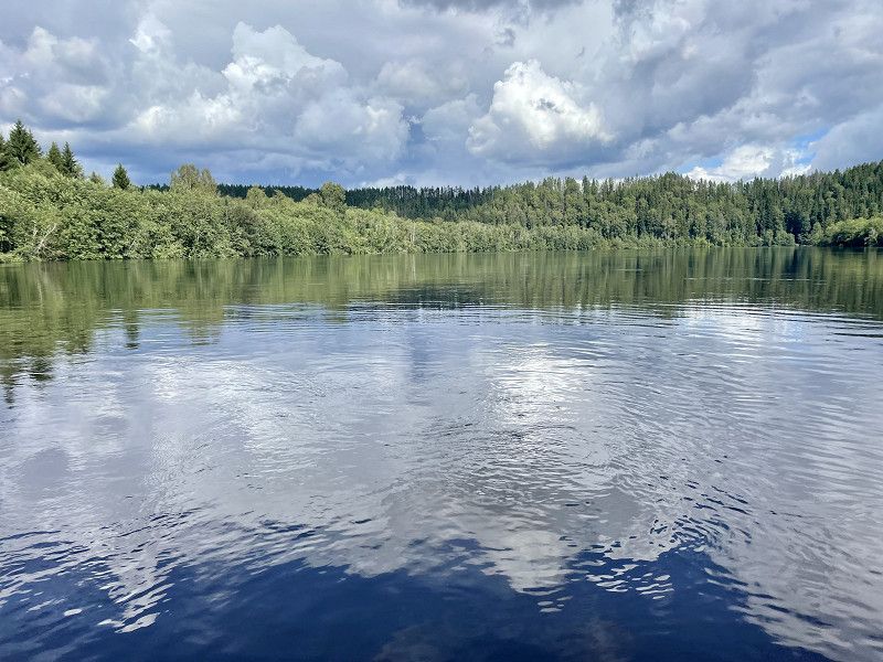
Kanutour Klarälven
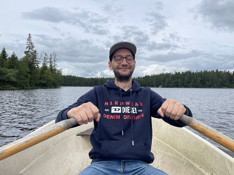
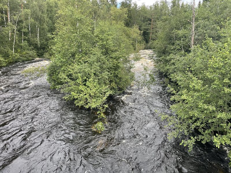
Sunshine is forecast for today and we have booked a canoe tour on the Klarälven. Shortly after 11:00 a.m. we are taken from the campsite to Fastnäs and from there we return by canoe. Unfortunately, due to all the rain in the previous days, the river has a lot of water, so you can't see all the sandbanks and jetties. But do we even want to invest? A quick stop at the edge of the forest and immediately the mosquitoes 🦟 are back. So quickly get back to the middle of the river. We let ourselves drift along, paddled along a bit, and were back at the campsite after a good three hours. Of course not without taking a rain shower 🌧️ shortly before the finish 😂. All in all, a successful day.
Day
Angeln und Elch 🫎 - Park
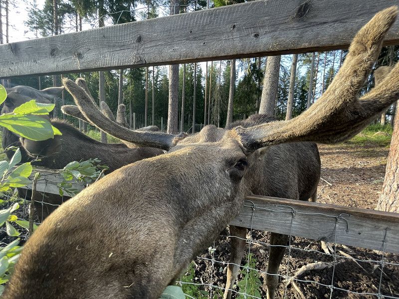
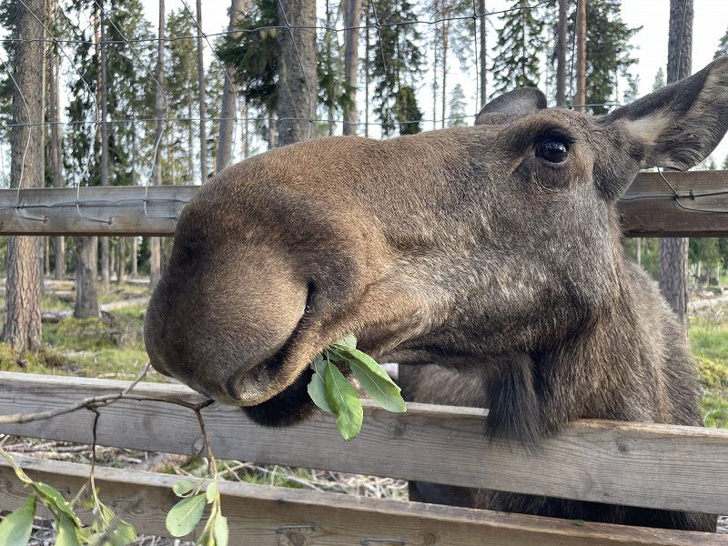
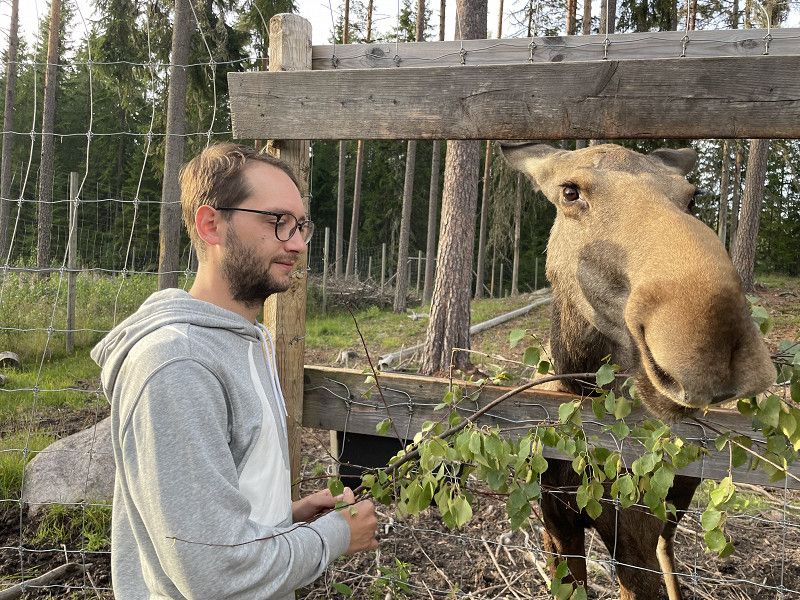
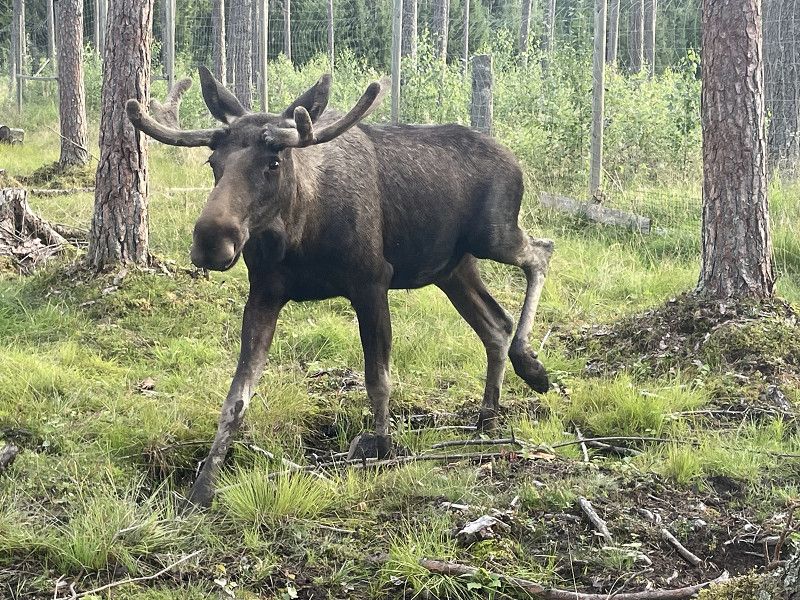
Since we had no luck on our first attempt at fishing on Säven, we want to go again today. We use the iFiske app to look for a lake that is easy to reach with a motorhome. Bought the “Fiskekort” online and off you go. We fished from land with spinners and spoons, but this time we had no success. Be that as it may, the focus is on fun. On the way back we go to Värmland Moose Park. We imagined it to be a little different (basically a small zoo with moose), but it's still a great experience. We learn a lot about these beautiful animals and are also allowed to feed them with willow and birch branches. The social behavior of the animals is also very interesting; with a few movements of the ears and head, the cow elk dominates the bull. Almost like in real life 😂. Our time in Byns-Camping ends with a game of darts; tomorrow we head to Oslo.
Day
Byns Camping 13.08.2023
Today we continue to Oslo. Due to the storms in Norway, some roads are closed and we are not making any progress as quickly. We refuel shortly behind the border. Because the Norwegian krone exchange rate is favorable for us, diesel is even cheaper than in Germany.
68050, Ekshärad, Schweden
60° 10' 33" N 13° 30' 34.8" E
60.1758200 13.5096700
• Head toward Byn Björkås on Byn. Go for 88 m.
• Continue on Byn. Go for 216 m.
• Turn left onto Byn Nybo. Go for 54 m.
• Continue on Byn. Go for 49 m.
• Continue on Byn Byggninga. Go for 1.0 km.
• Continue on Torsbyvägen. Go for 1.2 km.
• Continue on Mossberg Källtorp. Go for 489 m.
• Continue on Mossberg. Go for 676 m.
• Continue on Mossberg Fall. Go for 117 m.
• Continue on Mossberg. Go for 262 m.
• Continue on Mossberg Nybo. Go for 562 m.
• Continue on Framnäs. Go for 397 m.
• Continue on Västanberg Svanheden. Go for 1.0 km.
• Continue on Västanberg Lindåsa. Go for 1.4 km.
• Continue on Månsän. Go for 1.9 km.
• Continue on Solberg Bönehus. Go for 610 m.
• Continue on Solberg Grinna. Go for 4.3 km.
• Continue on Mossberg Flanken. Go for 4.6 km.
• Continue on Knappåsen. Go for 823 m.
• Continue on Knappåsen Sjövillan. Go for 7.7 km.
• Continue on Rinn. Go for 9.3 km.
• Continue on Vitsandsvägen. Go for 438 m.
• Turn left onto Inlandsvägen (E16/E45) toward Göteborg/Kongsvinger. Go for 3.2 km.
• Take the 1st exit from roundabout onto Toria Center (E16) toward Kongsvinger. Go for 34.2 km.
• Continue on Torsbyvegen (E16). Go for 5.4 km.
• Turn left onto Finnskogvegen (E16). Go for 16.2 km.
• Continue on Finnskogvegen (202). Go for 5.3 km.
• Take the 2nd exit from roundabout onto Møllevegen (202). Go for 12.4 km.
• Arrive at Brødbølvegen (202).
☍
113,7 km
(1 hrs. 35 min.)
Brødbølvegen, Innlandet, Norwegen
60° 0' 51.9" N 12° 21' 49.3" E
60.0144066 12.3636929
• Head south on Brødbølvegen (202). Go for 14.6 km.
• Turn right onto Grensevegen (202). Go for 5.5 km.
• Take ramp toward Kongsvinger/2. Go for 178 m.
• Turn right onto Arko-vegen (2). Go for 423 m.
• Arrive at Arko-vegen (2).
☍
20,7 km
( 20 min.)
Skotterud
Arko-vegen, Skotterud, Innlandet, Norwegen
59° 58' 58.2" N 12° 6' 42.1" E
59.9828437 12.1117065
• Head northwest on Arko-vegen (2). Go for 23.3 km.
• Pass 2 roundabouts and continue on Arko-vegen (2). Go for 2.0 km.
• Take the 2nd exit from roundabout onto E16 toward Oslo. Go for 1.1 km.
• Pass 3 roundabouts and continue on E16. Go for 11.3 km.
• Take ramp toward Sander. Go for 265 m.
• Take the 3rd exit from roundabout onto Odals Verk-vegen (1952). Go for 168 m.
• Take the 2nd exit from roundabout onto E16 toward Kongsvinger. Go for 547 m.
• Arrive at E16. Your destination is on the right.
☍
38,7 km
( 31 min.)
Sander
E 16, Sander, Innlandet, Norwegen
60° 14' 0.9" N 11° 49' 45.3" E
60.2335848 11.8292376
• Head east on E16. Go for 4.3 km.
• Take ramp toward Galterud. Go for 261 m.
• Take the 4th exit from roundabout onto 198. Go for 180 m.
• Take the 2nd exit from roundabout onto E16 toward Oslo. Go for 13.9 km.
• Pass 8 roundabouts and continue on Kongsvingervegen (E16). Go for 37.9 km.
• Take the 1st exit from roundabout onto E6 toward Oslo. Go for 27.3 km.
• Continue on 190 toward Sentrum/Kristiansand/E18. Go for 4.0 km.
• Take ramp toward Ring 2/C Berners pl/Lodalen/Gøteborg/E6. Go for 90 m.
• Take the 2nd exit from roundabout toward Ring 3/Ryen/E6/Gøteborg. Go for 150 m.
• Continue on Konows gate toward Ring 3/Ryen/Gøteborg/E6. Go for 137 m.
• Take the 2nd exit from roundabout onto Konows gate toward Ekeberg. Go for 444 m.
• Turn right onto Valhallveien toward Ryen. Go for 142 m.
• Turn right onto Valhallveien. Go for 1.1 km.
• Turn right onto Kongsveien. Go for 184 m.
• Turn left. Go for 73 m.
• Turn slightly left toward Ekebergveien. Go for 236 m.
• Continue on Ekebergveien. Go for 56 m.
• Arrive at Ekebergveien.
☍
90,5 km
(1 hrs. 15 min.)
Ekeberg Camping
Getting to the campsite through Oslo and checking in at the campsite are easy. The place is quite soft due to all the rain, luckily we get a fairly straight place in the upper area. The sanitary building works like this. The showers are pretty dirty and the smell is reminiscent of a large motorway service station.
Ekebergv. 65, 0757, Oslo, Norwegen
59° 53' 54" N 10° 46' 26" E
59.8983300 10.7738900
• Head east on Ekebergveien.
• Arrive at Ekebergveien.
☍
Distance not available
(Duration not available)
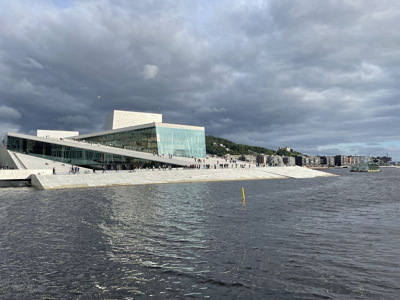
Zu Fuß in die Stadt
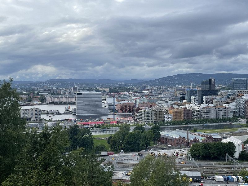
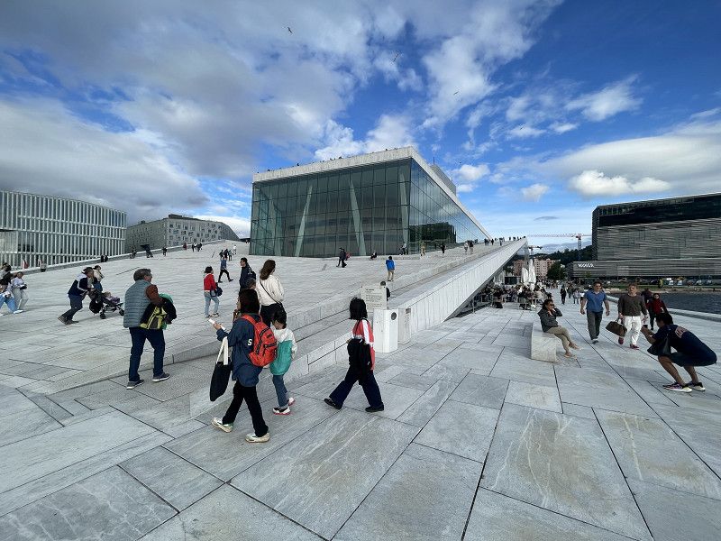
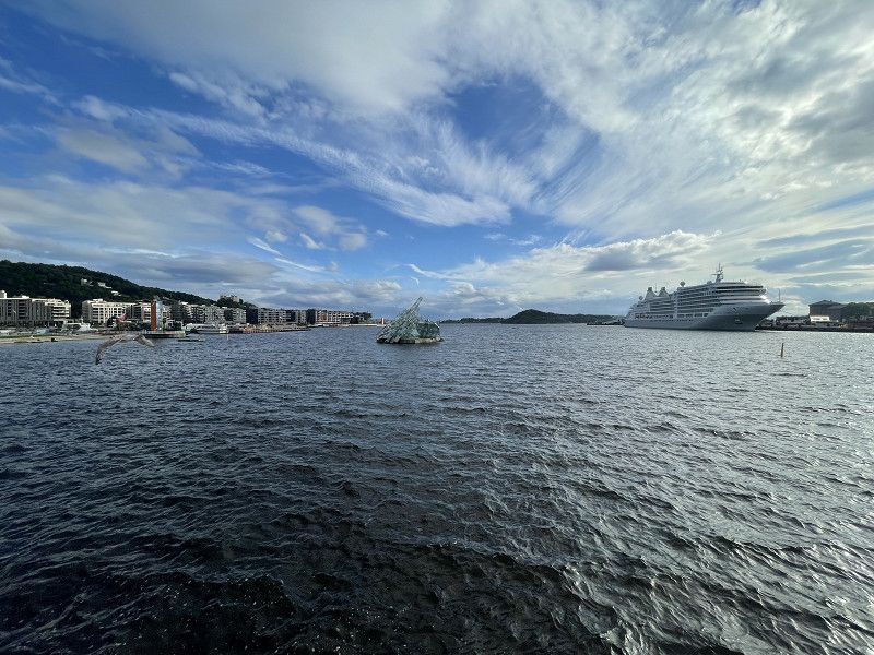
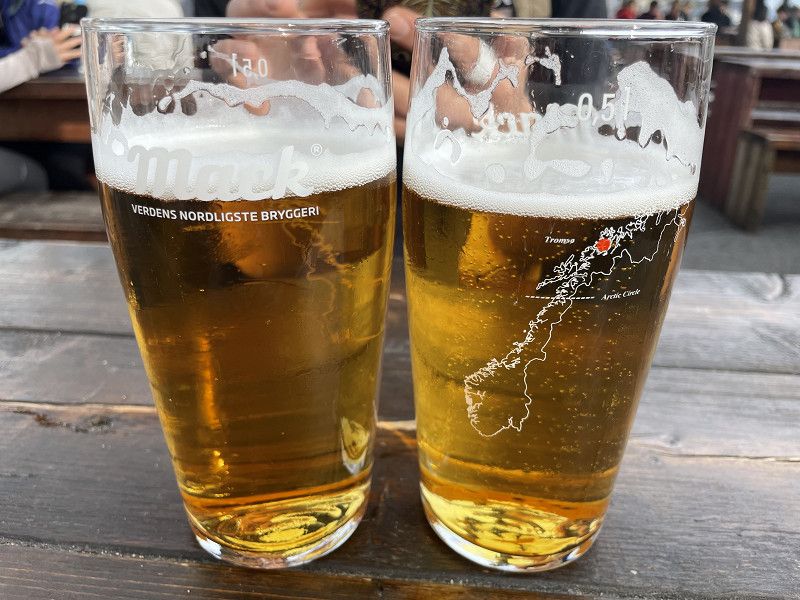
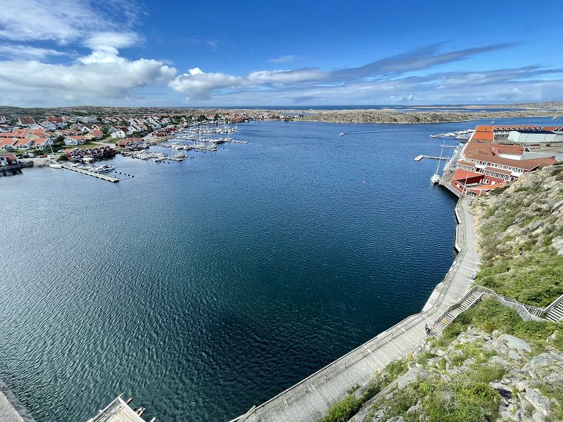
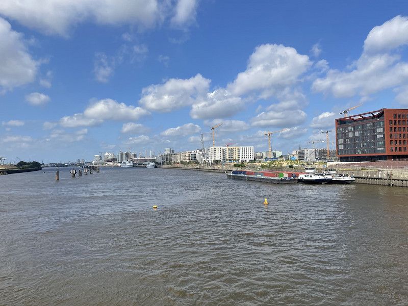
After the day in the car we want to get some exercise. The rain is gone and the sun is even coming out now and then. You can walk into the city through the Ekeberg Sculpture Park. The architecture in the city is impressive. Most comparable to the Hafencity in Hamburg. The opera is the first goal, we don't get much further than that. We are impressed by the many floating saunas, which are very well attended. Cooling off directly in the harbor basin 😂. We treat ourselves to another beer (€9.75) from Norway's northernmost brewery and trudge back to the motorhome before the next rain.
Day
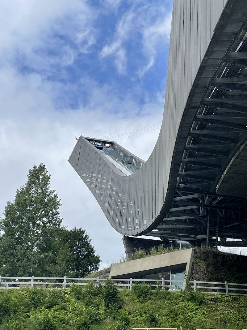
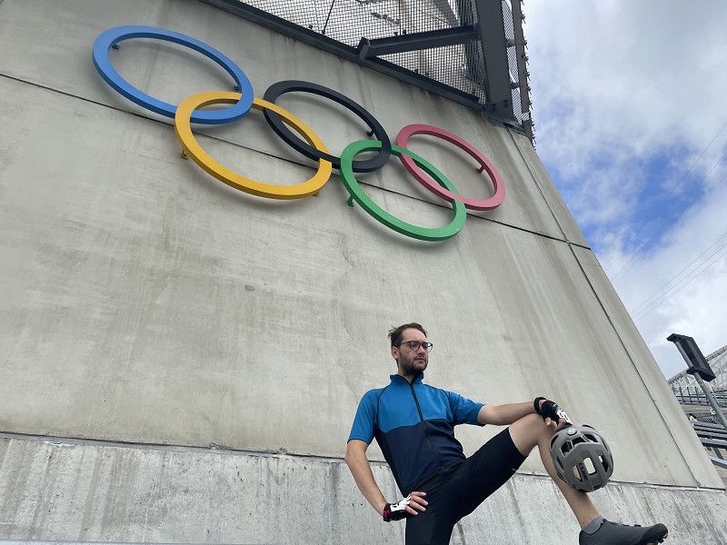
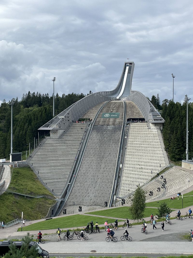
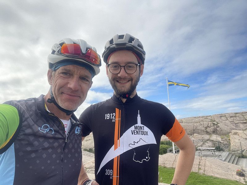
14.08.2023 Oslo mit dem Rad erkunden
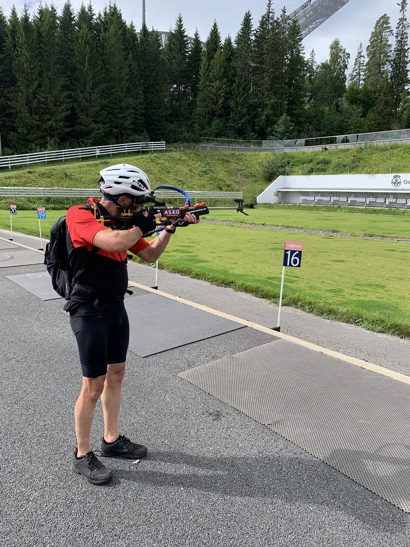
After our tour on foot yesterday, we want to cycle through Oslo today. The first destination is Holmenkollen, the mecca of ski jumping in Norway. The journey there goes steadily uphill after the descent from Ekeberg and after two final bends we find ourselves in front of the large ski jump. Absolutely impressive 😳. We skipped the opportunity to rush down the jump on a ZIP line due to the waiting time of over an hour. Instead we look at the biathlon stadium. I get to look through a biathlon rifle and notice that the targets are much smaller than they appear on television. A lot of respect for the athletes who are completely exhausted and clear the targets. We drive to the museum peninsula to get a different view of the city. Unfortunately, time doesn't allow a visit to the museum. This leaves a destination for the next visit to Oslo, especially since the Viking Museum is currently being renovated. With the first raindrops we arrived back at the campsite and didn't really leave our shell that evening.
Day
15.08.2023 Ekeberg Camping
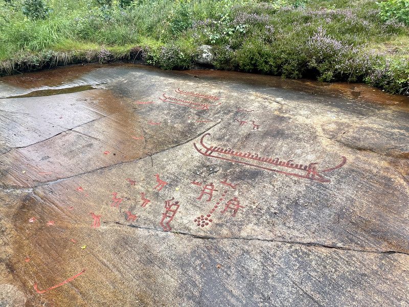
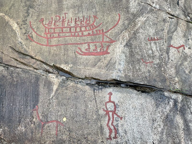
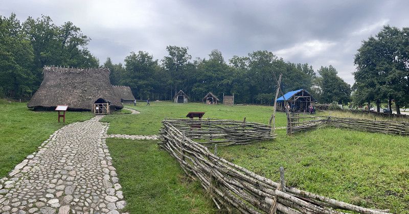
Our short trip to Norway ends today and we head to the western archipelago coast of Sweden. On the way to our destination in Hunnebostrand we visit the Vitlycke Museum in Tanumshede (vitlyckemuseum.se) with the rock carvings from the Bronze Age and a small open-air museum. As I do on every tour, I buy a tea towel in the museum shop 😂. The country road takes you to Hunnebostrand.
Ekebergv. 65, 0757, Oslo, Norwegen
59° 53' 54" N 10° 46' 26" E
59.8983300 10.7738900
• Head east on Ekebergveien. Go for 105 m.
• Turn right onto Ekebergveien. Go for 1.3 km.
• Turn left onto Erlandstuveien. Go for 493 m.
• Continue on Sandstuveien. Go for 867 m.
• Turn left and take ramp onto E6 toward Gøteborg. Go for 18.2 km.
• Continue on E6 toward Gøteborg. Go for 91.5 km.
• Continue on E6 (Svinesundsbron). Go for 65.4 km.
• Take exit 103 toward Fjällbacka/Hamburgsund/Hällevadsholm/165. Go for 324 m.
• Turn left onto Humlekärr (163) toward Fjällbacka/Hamburgsund. Go for 3.8 km.
• Turn left toward Yllene. Go for 67 m.
• Continue on Yllene. Go for 858 m.
• Continue on Yllene. Go for 1.6 km.
• Continue on Yllene Sörgård. Go for 133 m.
• Continue on Yllene Hed. Go for 527 m.
• Continue on Skogbyhed. Go for 4.2 km.
• Continue on Gerlesborg Bräcke. Go for 75 m.
• Turn left toward Skärholmen Kvarnen. Go for 543 m.
• Continue on Skärholmen Kvarnen. Go for 405 m.
• Continue on Arslätt. Go for 186 m.
• Turn right onto Brygge (174). Go for 7.6 km.
• Turn left onto Valarne. Go for 39 m.
• Arrive at Valarne. Your destination is on the left.
☍
198,2 km
(2 hrs. 18 min.)
Hunnebostrand Camping & Stugor
On the way I get a message about paying for the campsite. Everything is problem-free and, above all, cashless 👍🏻. We initially get stuck on the square, which also suffered from all the rain, and only get free again with a lot of difficulty. We are moving to a gravelled area and can get electricity from a Stuga. Another quick exploration of the town and then this day is over.
Hjämetorpet, 45046, Hunnebostrand, Schweden
58° 26' 36.2" N 11° 18' 51.3" E
58.4433900 11.3142400
• Head toward Svenseröd Kroken on Valarne. Go for 39 m.
• Turn left onto Dinglevägen (174). Go for 2.9 km.
• Take the 1st exit from roundabout onto 174. Go for 6.8 km.
• Take the 1st exit from roundabout onto Smögenbron. Go for 645 m.
• Continue on Storgatan. Go for 1.6 km.
• Continue on Sillgatan. Go for 64 m.
• Turn left onto Fiskaregatan. Go for 78 m.
• Arrive at Fiskaregatan. Your destination is on the right.
☍
12,1 km
( 15 min.)
Day
Smögen, Schweden
August 16, 2023
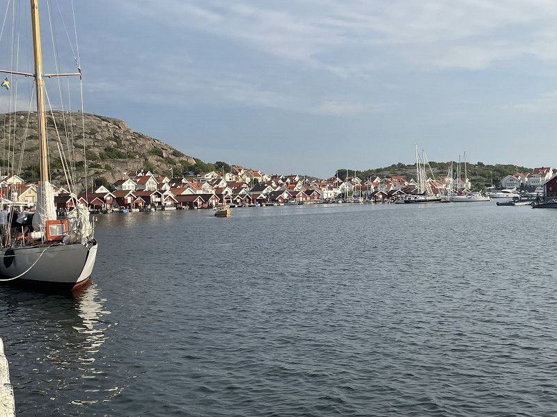
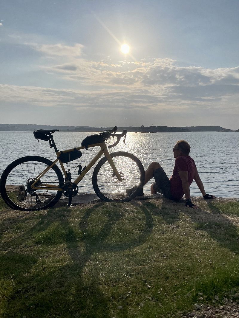
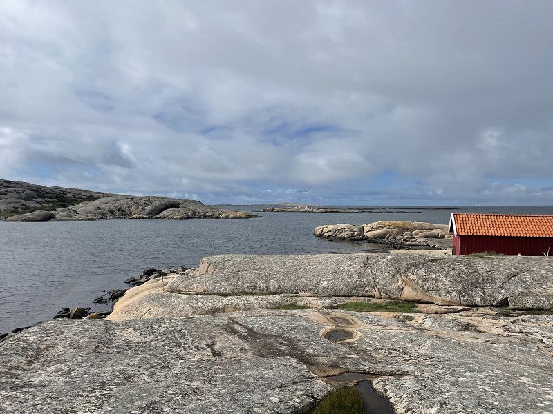
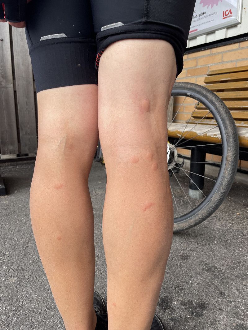
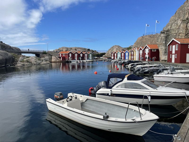
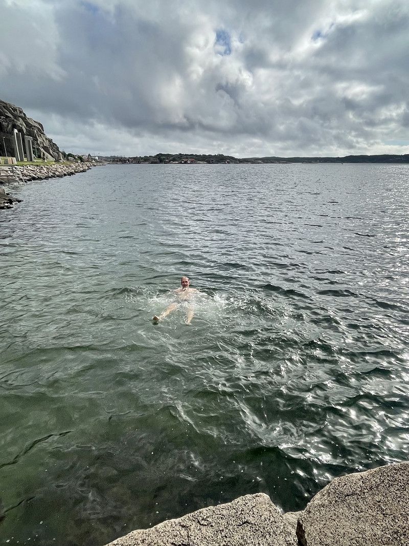
Since we didn't have any luck with our fishing attempts, but want to eat fish at least once on our tour, we get salmon, smoked fish and a quiche with crabs from the local fishmonger (fiskaffaren.one) in the morning. Afterwards, a tour with the gravel bikes to Smögen is on the agenda. At first the sky is still overcast, but the later it gets, the more the sun comes out. First it goes along gravel paths to the coast, then along the main road to Smögen. A short stop (30 seconds) in the forest for orientation results in eight mosquito bites. Smögen itself is a very beautiful place, but also has a much more touristy feel than other places. We then head back along the coast to Hunnebostrand, of course not without picking up the chanterelles along the way. A delicious appetizer to go with the also very tasty fish. And what would a vacation by the sea be without jumping in at least once?
Smögen, 45651, Schweden
58° 21' 13.1" N 11° 13' 34" E
58.3536447 11.2261188
• Head toward Madenvägen on Fiskaregatan. Go for 55 m.
• Turn left onto Madenvägen. Go for 43 m.
• Turn left onto Fiskhamnsgatan. Go for 176 m.
• Turn right onto Storgatan. Go for 1.6 km.
• Continue on Smögenbron. Go for 601 m.
• Take the 2nd exit from roundabout onto Dinglevägen (174). Go for 6.8 km.
• Take the 2nd exit from roundabout onto Kungshamnsvägen (174). Go for 3.0 km.
• Turn right onto Valarne. Go for 39 m.
• Arrive at Valarne. Your destination is on the left.
☍
12,2 km
( 16 min.)
Day
Hunnebostrand Camping & Stugor
August 17, 2023
The last full day in Sweden 😢. We don't have any plans for today and we're packing our things in peace. A coffee before departure and then we head towards Halmstad. The motorway in front of Gothenburg is closed and so we drive towards the coast again, deviating from the actual detour. We find a nice place for a late breakfast and enjoy the peace and quiet. The rest of the journey to Halmstad goes smoothly.
Hjämetorpet, 45046, Hunnebostrand, Schweden
58° 26' 36.2" N 11° 18' 51.3" E
58.4433900 11.3142400
• Head toward Dinglevägen on Valarne. Go for 39 m.
• Turn right onto Svenseröd Kroken (174). Go for 20.0 km.
• Turn right and take ramp onto E6 toward Göteborg/Uddevalla. Go for 104 km.
• Keep right onto E6 (Olskroksmotet). Go for 139 km.
• Take exit 43 toward Karlshamn/Halmstad S. Go for 423 m.
• Take the 1st exit from roundabout onto Laholmsvägen (E6.4) toward Centrum. Go for 880 m.
• Turn left onto Västervallvägen toward Östra Stranden. Go for 1.6 km.
• Turn left onto Västervallvägen. Go for 1.2 km.
• Continue on Västervallvägen. Go for 875 m.
• Arrive at Västervallvägen.
☍
267,7 km
(2 hrs. 58 min.)
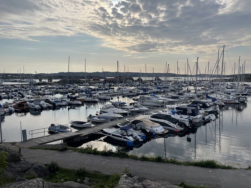
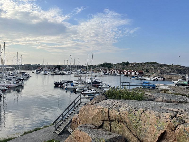
Halmstad
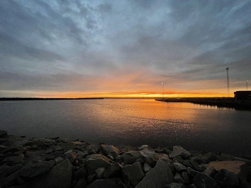
Since the ferry leaves at 8:00 a.m. the next day, we park very close to the ferry pier in the harbor. There are also numerous anglers here and there are no prohibition signs. And so we enjoy the last evening in Sweden with a beautiful sunset.
Vågbrytargatan, Halmstad, Provinz Halland, Schweden
56° 38' 56" N 12° 50' 49.6" E
56.6488782 12.8471199
• Head east on Västervallvägen. Go for 875 m.
• Turn left onto Oceanvägen. Go for 336 m.
• Turn right onto Turbingatan. Go for 650 m.
• Turn left onto Turbingatan. Go for 361 m.
• Arrive at Turbingatan.
☍
2,2 km
( 5 min.)
Day
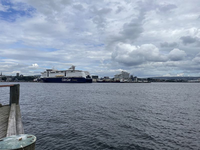
18.08.2023 Halmstad Hamn, Schweden
Boarding at 7:00 a.m. goes quickly, no problems. There is a bit of stress with a Swede who, in Mallorca style, reserved an entire table with his jacket and spent two hours for breakfast. But we are relaxed and somehow it works. After a good four and a half hours we are in Grenå.
Halmstad Hamn, 302 50 Halmstad, Schweden
56° 39' 14.2" N 12° 51' 21.4" E
56.6539366 12.8559510
• Head southeast on Turbingatan. Go for 361 m.
• Turn right onto Turbingatan. Go for 650 m.
• Turn right onto Turbingatan. Go for 487 m.
• Take the Halmstad-Grenå Ferry. Stay on for 124 km.
• Head toward Ringvejen on Færgevej (16). Go for 436 m.
• Make a U-Turn at Ringvejen onto Færgevej (16). Go for 88 m.
• Keep left onto Færgevej. Go for 81 m.
• Arrive at Færgevej. Your destination is on the right.
☍
126,1 km
(3 hrs. 41 min.)
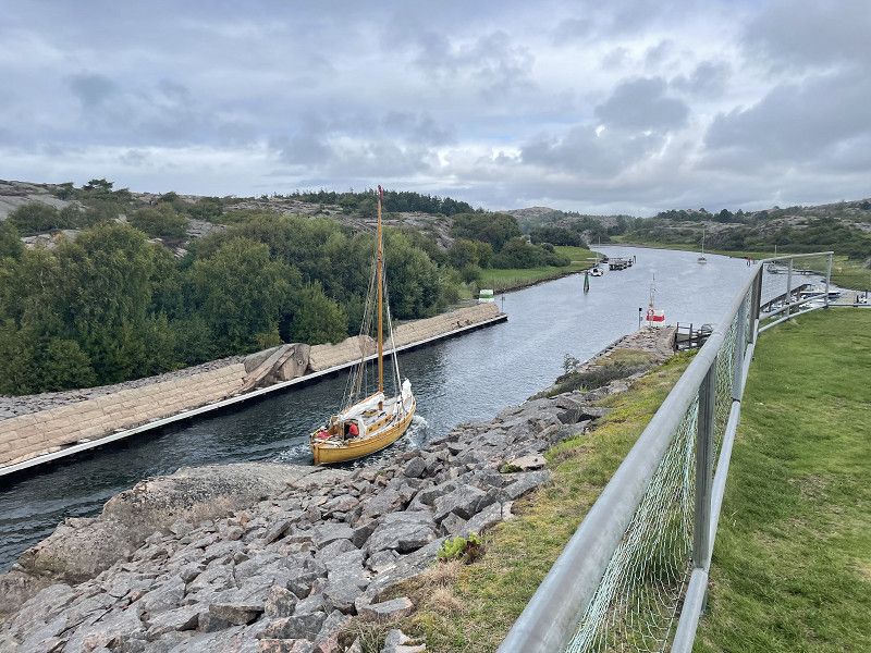
Grenå-Halmstad, Færgevej, Grenaa, Dänemark
The journey through Denmark is not so relaxed. Many construction sites and a lot of traffic do not allow for smooth driving. Only in Germany it is becoming less. We dispose of waste again in Bad Bramstedt at a very good supply and disposal station and refill the water supply. After all, we'll be free in Hamburg for the next two nights and then we'll be with four people 😍.
Færgevej 1, 8500 Grenå, Dänemark
56° 24' 25.8" N 10° 55' 25.9" E
56.4071544 10.9238655
• Head east on Færgevej. Go for 117 m.
• Turn left onto Færgevej (16). Go for 3.2 km.
• Turn left onto Århusvej (15) toward Lufthavn/Århus. Go for 59.9 km.
• Take ramp onto E45 (Østjyske Motorvej). Go for 98.5 km.
• Continue on E45 (Sønderjyske Motorvej) toward Flensborg. Go for 83.2 km.
• Continue on A7. Go for 151 km.
• Take exit 26 toward HH-Stellingen/Hagenbecks Tierpark. Go for 408 m.
• Turn right onto Kieler Straße (B4/B5) toward A1/Elbbrücken/Centrum/Altona/Hagenbecks Tierpark/Stadion Arena. Go for 3.0 km.
• Turn left onto Eimsbütteler Marktplatz (B5) toward Centrum/City-Nord/Eppendorf/Messe/CCH. Go for 1.1 km.
• Continue on Fruchtallee. Go for 507 m.
• Continue on Schäferkampsallee. Go for 506 m.
• Continue on Schröderstiftstraße. Go for 588 m.
• Continue on An der Verbindungsbahn. Go for 318 m.
• Continue on Bundesstraße. Go for 157 m.
• Turn right onto Edmund-Siemers-Allee. Go for 379 m.
• Continue on Theodor-Heuss-Platz. Go for 194 m.
• Continue on Alsterglacis. Go for 205 m.
• Keep right onto Neuer Jungfernstieg toward Centrum. Go for 155 m.
• Turn left toward Neuer Jungfernstieg. Go for 29 m.
• Turn left onto Lombardsbrücke. Go for 595 m.
• Keep left onto Ring 1. Go for 907 m.
• Keep left onto Deichtorplatz toward Elbbrücken/B4/Bergedorf/Harburg. Go for 269 m.
• Keep right onto Recha-Lübke-Damm toward Bremen/A1/Hannover/Elbbrücken/B4/Harburg. Go for 64 m.
• Turn left onto Amsinckstraße. Go for 143 m.
• Turn slightly right onto Amsinckstraße (B4). Go for 3.0 km.
• Take ramp onto Veddeler Marktplatz toward Peute. Go for 463 m.
• Turn left onto Peutestraße toward Peute/Gewerbegebiet Obergeorgswerder/B1/B5. Go for 1.4 km.
• Turn left onto Peuter Elbdeich. Go for 73 m.
• Turn slightly left onto Peuter Elbdeich. Go for 257 m.
• Arrive at Peuter Elbdeich. Your destination is on the left.
☍
410,3 km
(4 hrs. 5 min.)
Peuter Elbdeich, Hamburg, Deutschland
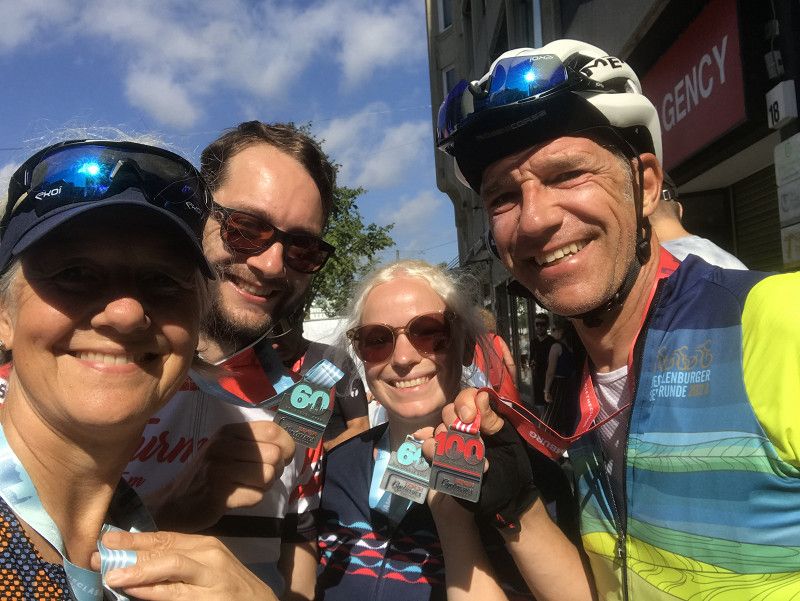
August 18, 2023
Goodbye! Luca's girlfriend and my wife are in Hamburg almost at the same time as us. We were here last year for the Hamburg Cyclassics, in which we are all taking part this time.
Peuter Elbdeich, 20539 Hamburg, Deutschland
53° 31' 27.3" N 10° 2' 30.8" E
53.5242539 10.0418831
• Head northwest on Peuter Elbdeich. Go for 573 m.
• Arrive at Peuter Elbdeich. Your destination is on the left.
☍
0,6 km
( 1 min.)
Day
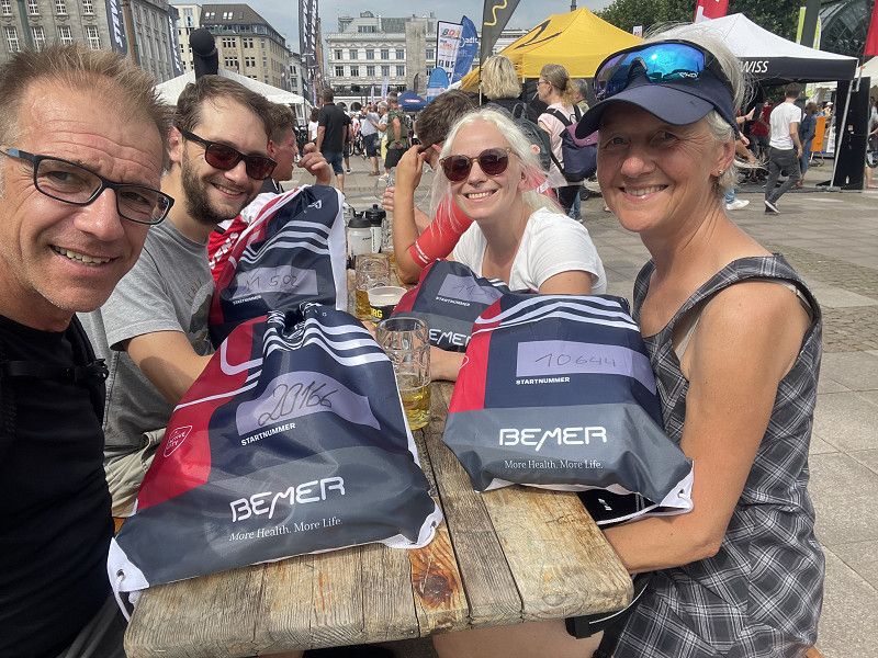
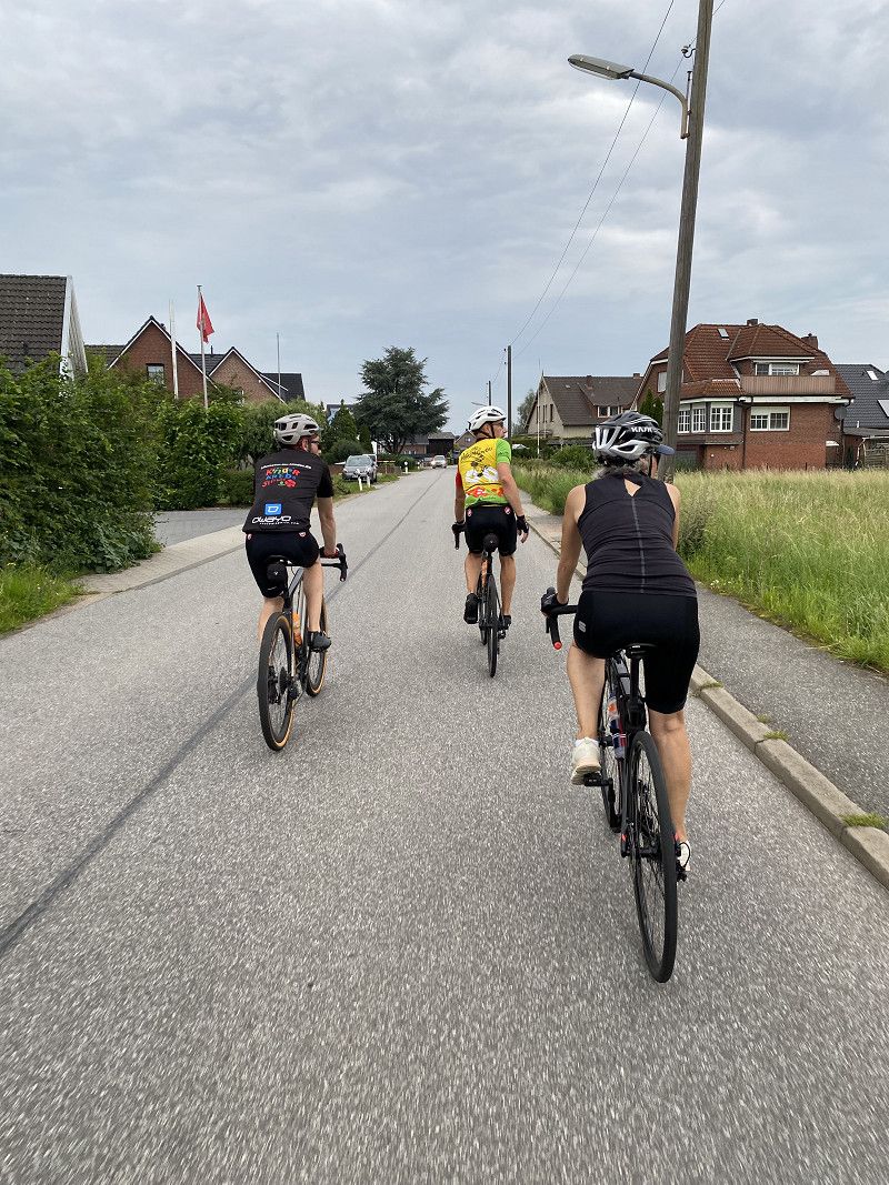
19.08.2023 Hamburg
There's not much on the agenda today. Collect your starting documents, wander around the city for a bit and take a leisurely ride through the hinterland of Hamburg.
Day
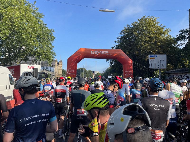
20.08.2023 Race-Day und Heimfahrt Peuter Elbdeich
I take the three of them to their start of the 60 km route at 7:30 a.m. The 100 km starts at 8:45 a.m. and after a good two and a quarter hours the finish in Mönkebergstrasse is reached. A quick race, it was a lot of fun again. Of course, the obligatory return trip through Hafencity (what has happened here again) shouldn't be missed either. Another quick shower in the motorhome and then off to home. The A7 is packed and we head home via Bremen and Sulingen.
Deutschland
53° 31' 37.3" N 10° 2' 5.6" E
53.5270365 10.0349027
• Head south on Peuter Elbdeich. Go for 903 m.
• Turn right onto Peutestraße. Go for 1.4 km.
• Turn right onto Veddeler Marktplatz. Go for 284 m.
• Turn left and take ramp onto A255. Go for 3.6 km.
• Continue on A1. Go for 13.3 km.
• Continue on Horster Dreieck toward Hannover/Seevetal-Ramelsloh/A7. Go for 1.7 km.
• Continue on A7. Go for 106 km.
• Keep right onto A352 (Dreieck Hannover-Nord) toward Dortmund/Flughafen/Hannover-Nord. Go for 18.1 km.
• Continue on A2. Go for 66.4 km.
• Take exit 32 toward Amsterdam/Osnabrück/Bad Oeynhausen onto A30. Go for 3.8 km.
• Take exit 33 toward Dehme/Minden/Eidinghausen. Go for 244 m.
• Turn right onto B61. Go for 279 m.
• Continue on K29 toward Eidinghausen. Go for 122 m.
• Continue on Alter Postweg (K29). Go for 1.2 km.
• Continue on Im Keiten (K29). Go for 73 m.
• Continue on Wiekriede (K29). Go for 149 m.
• Turn right onto Hahnenkampstraße (K29). Go for 192 m.
• Take the 2nd exit from roundabout onto Kirchbreite (K8) toward Wulferdingsen/Werste. Go for 1.4 km.
• Continue on Ringstraße (K29). Go for 213 m.
• Continue on Bergkirchener Straße (K29). Go for 838 m.
• Continue on K29. Go for 15 m.
• Continue on Bergkirchener Straße (K29). Go for 812 m.
• Turn right onto Hedingsener Masch. Go for 65 m.
• Turn right onto Wersterholz. Go for 216 m.
• Arrive at Wersterholz. Your destination is on the left.
☍
221,3 km
(2 hrs. 3 min.)
Wersterholz
That was it! After a good 2,600 km we are back home. A nice tour to Scandinavia, even if the weather could have been a little better. But definitely worth repeating, with new goals of course.
Kreis Minden-Lübbecke, Nordrhein-Westfalen, Deutschland
52° 13' 53.7" N 8° 45' 46.9" E
52.2315794 8.7630163