Luxembourg really surprised us. We actually had no real idea what to expect there and what it looks like. The decision to go to Luxembourg was made rather spontaneously. We have 3 weeks and the distance is not too far from us. It's July and the main holiday season. However, we do not reserve anything in advance and only have a rough plan. There are numerous castles, palaces and nature to see. At least that's what we know. You can also find our trip on youtube https://www.youtube.com/c/UnterwegsmitdenBeckers/playlists
Day
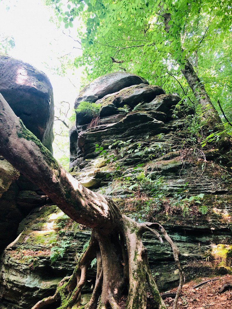
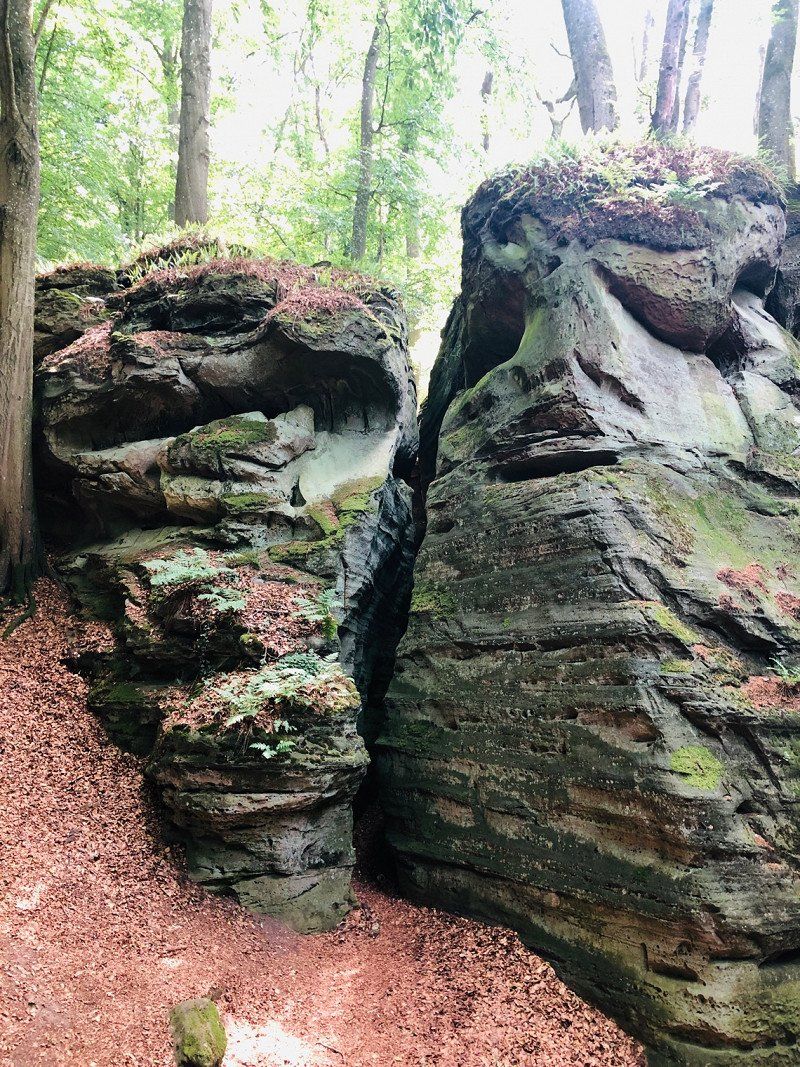
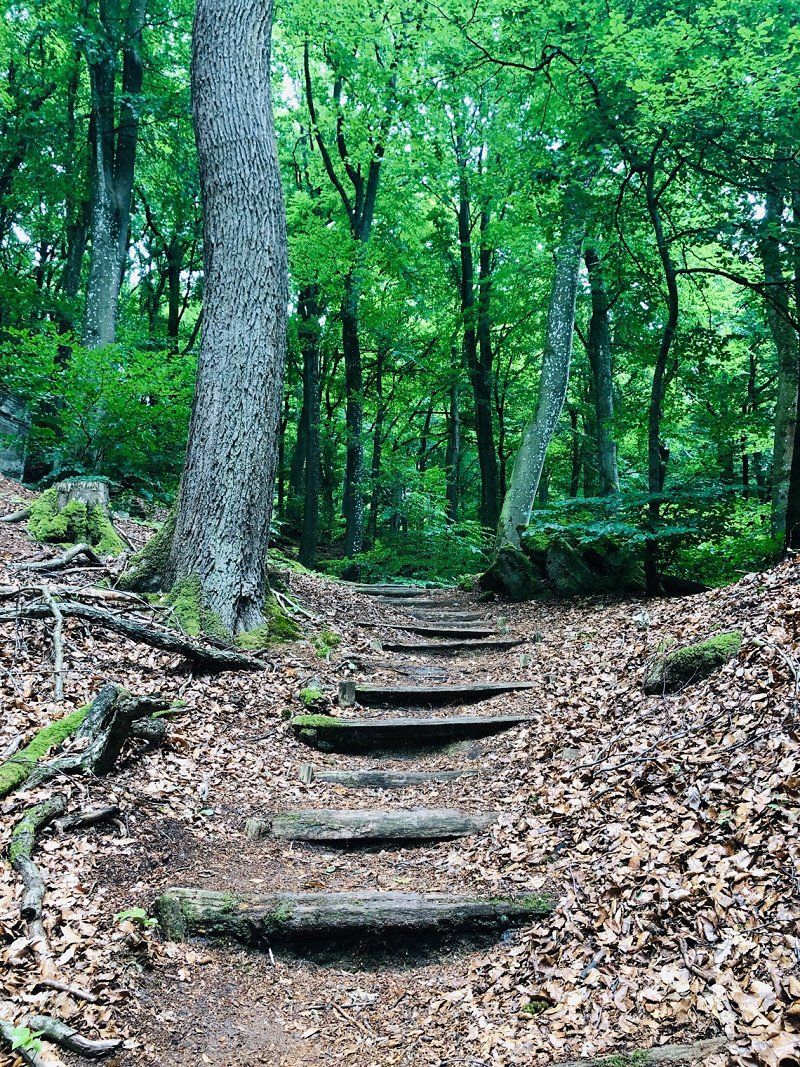
Müllerthal, Waldbillig, Luxemburg
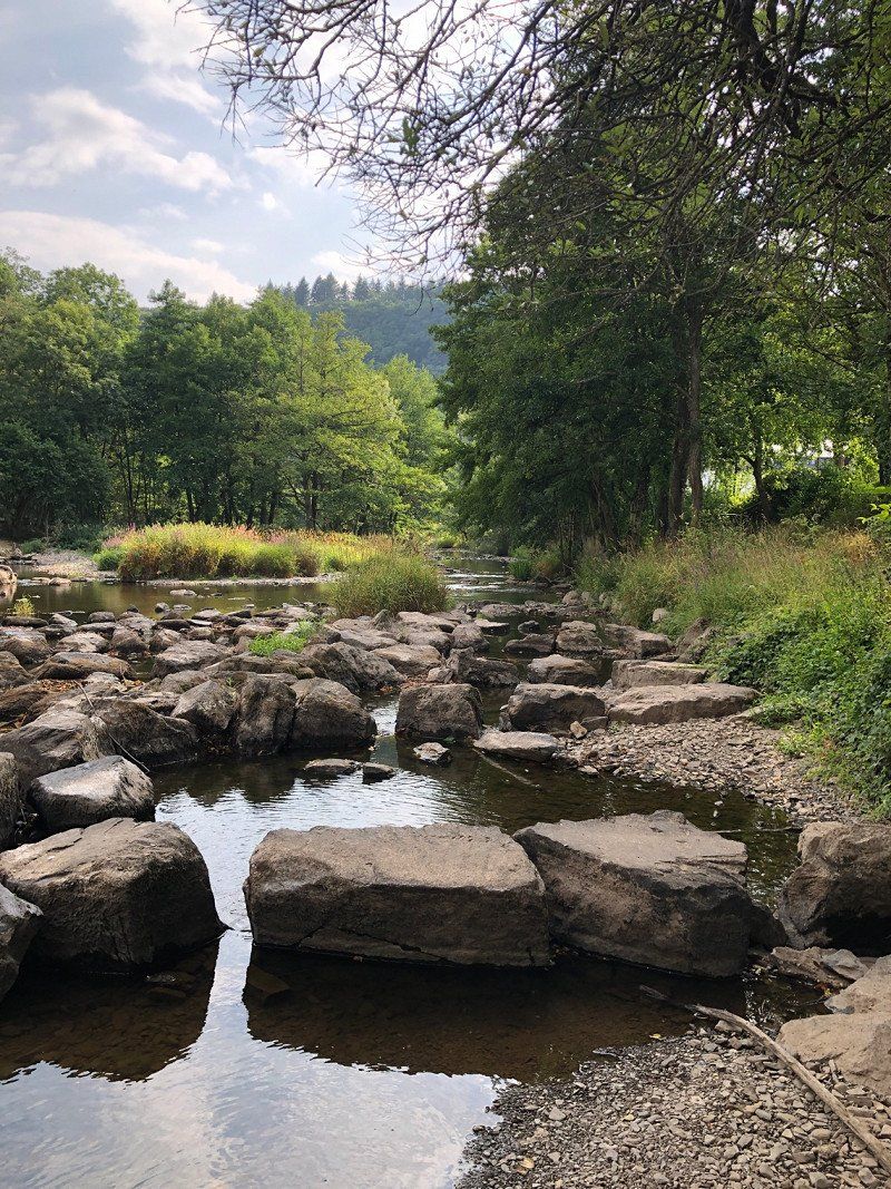
Luxembourg is the destination and the first place to go is Mullerthal. We didn't expect it to look like this there. A paradise for hikers.
Here is the video about it
https://youtu.be/tSSsG0fHS94
49° 47' 25.3" N 6° 18' 26.9" E
49.7903622 6.3074713
• Head south on Rue des Rochers (CR121). Go for 138 m.
• Continue on CR121. Go for 752 m.
• Arrive at CR121. Your destination is on the right.
☍
0,9 km
( 1 min.)
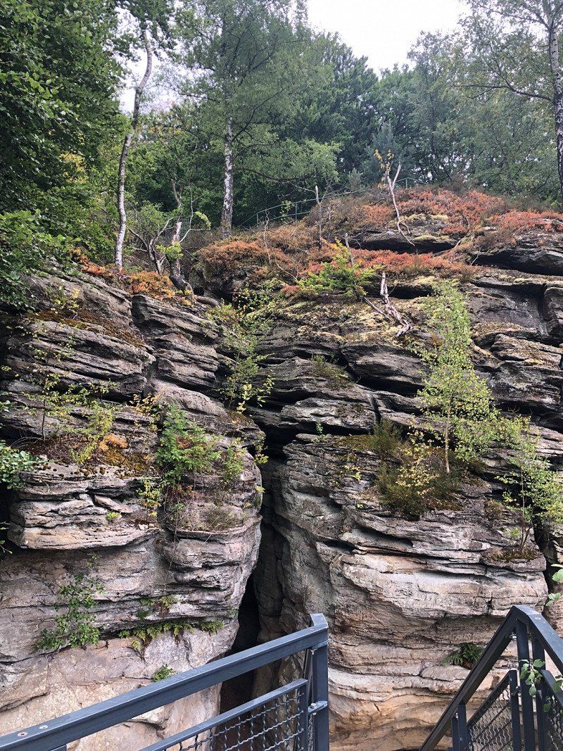
Schiessentümpel, Waldbillig, Luxemburg
CR121, 6245 Waldbillig, Luxemburg
49° 47' 8" N 6° 17' 57.8" E
49.7855500 6.2994000
• Head toward Rue de la Montagne on CR121. Go for 752 m.
• Continue on Rue des Rochers (CR121). Go for 138 m.
• Turn right onto Rue de l'Ernz Noire (CR121). Go for 165 m.
• Continue on CR121. Go for 4.6 km.
• Continue on Route de Beaufort (CR121). Go for 912 m.
• Turn left onto N10. Go for 3.3 km.
• Continue on Route de Diekirch (N19). Go for 3.3 km.
• Turn right onto Grenzwee (CR358A). Go for 126 m.
• Continue on L6. Go for 74 m.
• Turn left onto Sauertalstraße (K5). Go for 235 m.
• Continue on Ourtalstraße (K5). Go for 826 m.
• Continue on K5. Go for 2.0 km.
• Continue on Dorfstraße (K5). Go for 337 m.
• Turn left onto Dorfstraße (K5). Go for 152 m.
• Continue on K5. Go for 1.9 km.
• Continue on Ourtalstraße (K5). Go for 316 m.
• Continue on Dorfstraße (K5). Go for 42 m.
• Continue on K5. Go for 1.3 km.
• Continue on Sonnenhof (K5). Go for 110 m.
• Continue on K5. Go for 221 m.
• Continue on Gipsmühle (K5). Go for 163 m.
• Continue on K5. Go for 213 m.
• Continue on Ourtalstraße (K5). Go for 547 m.
• Turn left onto An der Ourbrücke (L6). Go for 124 m.
• Continue on Ourbrücke (L6). Go for 15 m.
• Continue on Ponte d'Our. Go for 57 m.
• Turn right onto N10. Go for 2.7 km.
• Arrive at Rue de la Gare (N10). Your destination is on the left.
☍
24,5 km
( 24 min.)
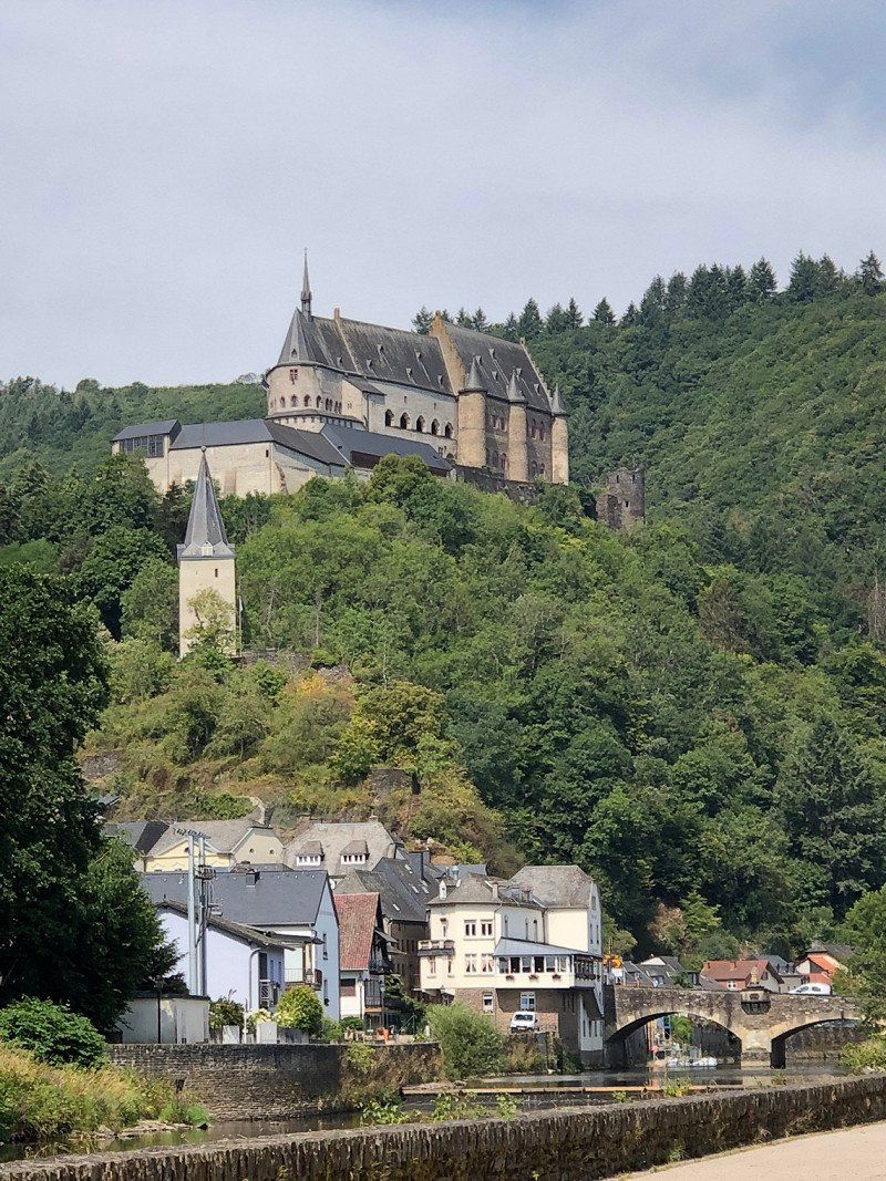
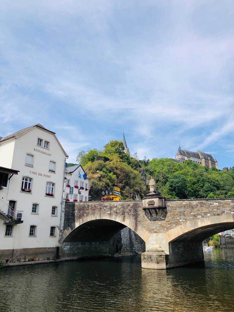
Vianden, Luxemburg
We drove on and found our next parking space in Vianden. The Camperpark du Moulin used to be a campsite, but after the lockdown due to the corona crisis, it is no longer operated in its old form. The day costs 15€, all inclusive. The city is within walking distance, there are hiking and biking trails all around and a bus stop right in front of the door. You can find our video about Vianden here https://youtu.be/P_hWMKdbBfw
49° 56' 2.3" N 6° 12' 27.7" E
49.9339748 6.2076994
• Head southwest on Rue de la Gare (N10). Go for 47 m.
• Turn right onto Rue du Vieux Marché (N10). Go for 6.2 km.
• Turn left onto Rue de Puetscheid (CR320). Go for 252 m.
• Continue on CR320. Go for 1.7 km.
• Continue on Haaptstrooss (CR320). Go for 442 m.
• Continue on CR320. Go for 584 m.
• Turn right onto CR320. Go for 105 m.
• Turn left onto CR320. Go for 241 m.
• Turn right onto CR320. Go for 59 m.
• Continue on Rue Principale (CR320). Go for 423 m.
• Continue on CR320. Go for 1.7 km.
• Continue on Rue de Weiler (CR320). Go for 215 m.
• Turn right onto Rue de Gralingen (CR320). Go for 17 m.
• Continue on Rue de Hoscheid (CR320). Go for 160 m.
• Continue on CR320. Go for 2.2 km.
• Continue on Merschterwee (CR320). Go for 189 m.
• Turn left onto Haaptstrooss (CR320). Go for 550 m.
• Continue on Maarkebaach (CR320). Go for 634 m.
• Keep right onto CR320. Go for 3.3 km.
• Continue on N27. Go for 973 m.
• Continue on Auf Hoschteraal (N27). Go for 1.0 km.
• Continue on N27. Go for 9 m.
• Continue on Rue de la Gare (N27). Go for 441 m.
• Continue on N27. Go for 282 m.
• Continue on Op der Gare (N27). Go for 140 m.
• Continue on N27. Go for 3.7 km.
• Continue on Op der Millen (N27). Go for 78 m.
• Continue on N27. Go for 5.8 km.
• Turn right onto N15. Go for 518 m.
• Turn left onto N27 toward Esch/Sûre/Lultzhausen/Insenborn. Go for 1.6 km.
• Continue on Rue de Lultzhausen (N27) toward Arsdorf/Insenborn. Go for 751 m.
• Continue on N27. Go for 425 m.
• Turn right onto N27C. Go for 721 m.
• Continue on CR316. Go for 2.6 km.
• Continue on Um Knupp (CR316). Go for 289 m.
• Continue on An der Hielt (CR316). Go for 278 m.
• Turn right onto Am Enneschtduerf (CR316). Go for 481 m.
• Continue on Um Schoss (CR316). Go for 37 m.
• Turn left onto CR318. Go for 2.8 km.
• Arrive at CR318. Your destination is on the left.
☍
42,0 km
( 39 min.)
Camping Liefrange, Haaptstrooss, Stauseegemeinde, Luxemburg
Camping Liefrange, 800m from the reservoir €19 HS, €14 NS including everything We had hoped to swim in the reservoir with the dogs and "inaugurate" the SUP. However, the local conditions were (for us) not so ideal.
Our video about it https://youtu.be/yzbgT2c-ZM
14A Haaptstrooss, 9665 Stauséigemeng, Luxemburg
49° 54' 42.5" N 5° 52' 26.5" E
49.9118144 5.8740348
• Head northwest on CR318. Go for 2.8 km.
• Turn right onto Um Schoss (CR316). Go for 37 m.
• Continue on Am Enneschtduerf (CR316). Go for 481 m.
• Turn left onto An der Hielt (CR316). Go for 278 m.
• Continue on Um Knupp (CR316). Go for 289 m.
• Continue on CR316. Go for 2.6 km.
• Turn left onto CR316. Go for 276 m.
• Continue on Rue de Kaundorf (CR316). Go for 447 m.
• Arrive at Rue de Kaundorf (CR316). Your destination is on the right.
☍
7,2 km
( 6 min.)
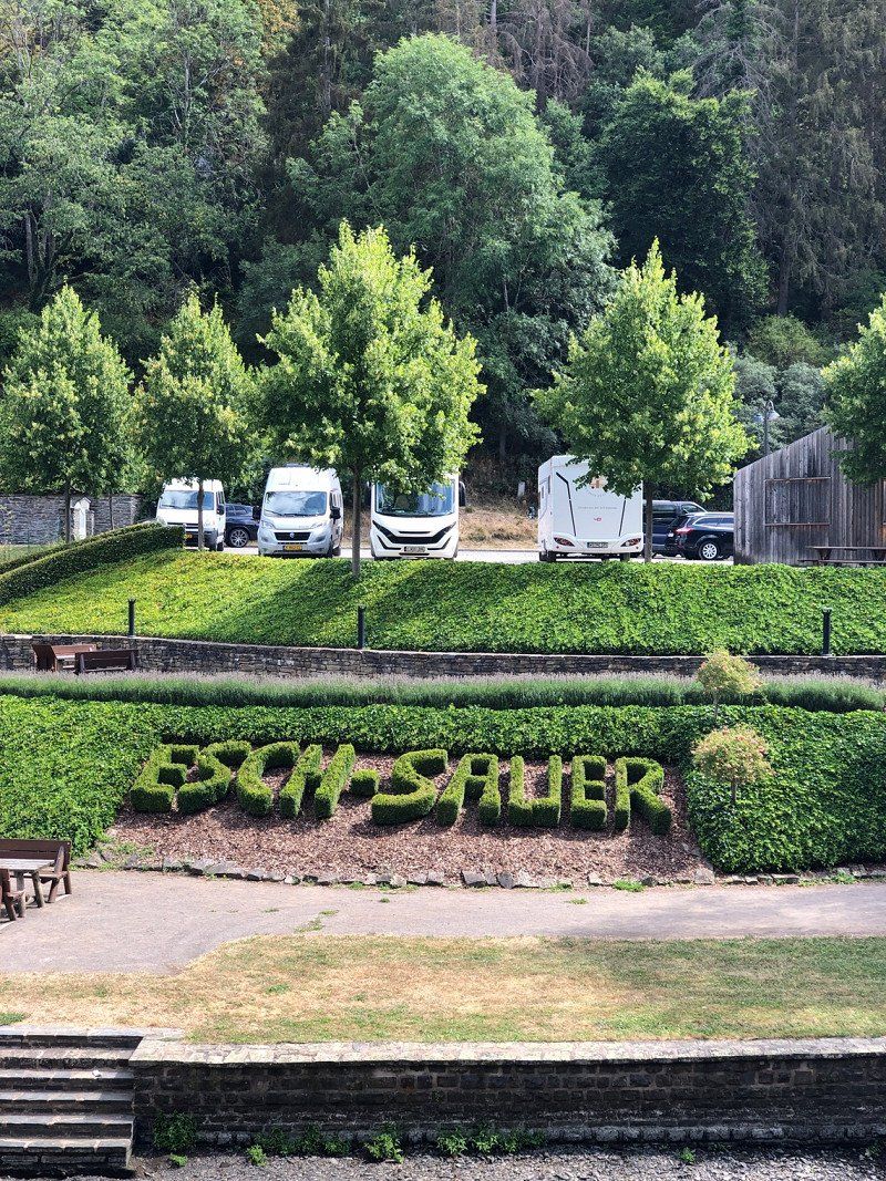
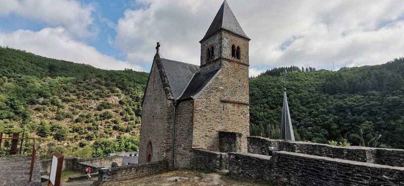
Esch-sur-Sûre, Luxemburg
A sweet little town with an old castle and a fantastic view.
Esch-Sauer, Luxemburg
49° 54' 41.4" N 5° 56' 1" E
49.9115069 5.9336192