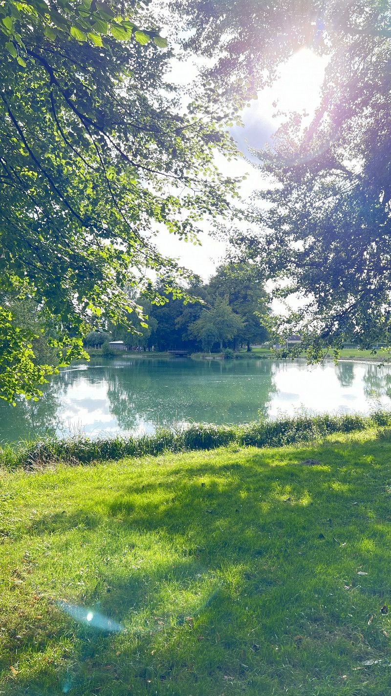
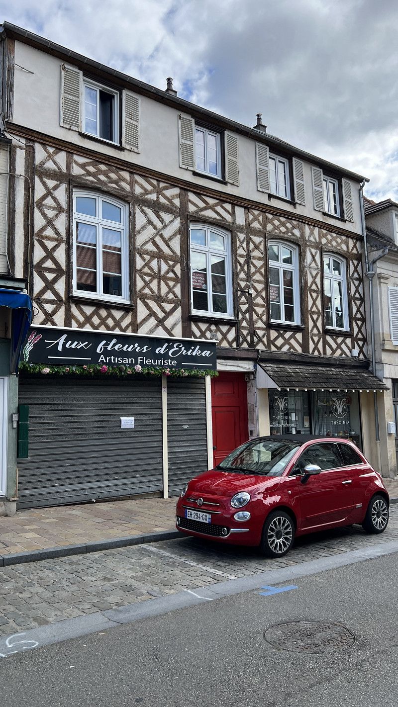
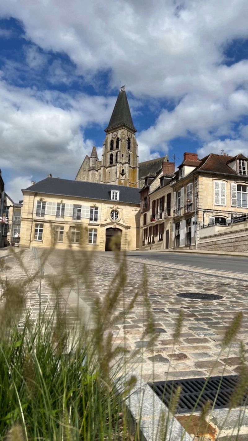
We travel in/through Normandy for 45 days and experience cliffs, steep coasts, sandy beaches, beautiful villages, old walls, Gothic churches and make a detour to the landing beaches. We travel with a dog, avoid mass tourism and prefer nature and idyllic villages. Normandy was well visited during our trip in September 2024 and the pitches were actually always full or very well occupied.
For the sake of simplicity, the tour is shown without a length of stay, even if we stay in this place for a longer period. After all, you are ultimately interested in our route and less in our length of stay. If you are also interested in our travel reports, please take a look at YouTube or our website www.unterwegsmitdenbeckers.de
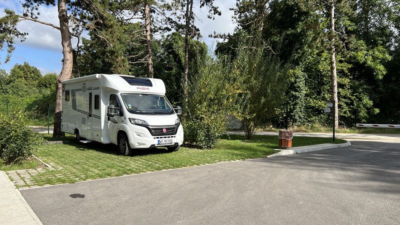
Worms
We are going on an autumn tour to France. From mid-August to September we will be traveling to Normandy.
If you want to follow our journey, you will find a travel video every Sunday at 10 a.m. on our YouTube channel.
Rheinland-Pfalz, Deutschland
49° 37' 48.9" N 8° 21' 43.5" E
49.6302618 8.3620898
• Head toward Kämmererstraße on Marktplatz. Go for 33 m.
• Continue on Stephansgasse. Go for 209 m.
• Take the 3rd exit from roundabout onto Lutherring. Go for 279 m.
• Take the 2nd exit from roundabout onto Willy-Brandt-Ring (K1) toward Krankenhaus Hochstift. Go for 239 m.
• Continue on Neusatz (K17). Go for 76 m.
• Turn right onto Sophienplatz (K17) toward A61/Monsheim/Hochschule. Go for 543 m.
• Take the 2nd exit from roundabout onto Kolpingstraße (K17) toward A61/Monsheim/B47/Wo.-Horchheim. Go for 983 m.
• Take ramp onto B47 toward A61/Koblenz/Ludwigshafen/Kaiserslautern/Monsheim/Wo.-Pfeddersheim. Go for 2.6 km.
• Take ramp onto A61 toward Ludwigshafen/Kaiserslautern. Go for 8.7 km.
• Take exit 59 toward Saarbrücken/Kaiserslautern onto A6. Go for 114 km.
• Continue on A320. Go for 13.5 km.
• Continue on E50 (Échangeur de Freyming). Go for 259 m.
• Take the exit toward Farébersviller/Strasbourg onto A4 (Autoroute de l'Est). Go for 5.8 km.
• Take exit 39 toward Farébersviller. Go for 537 m.
• Take the 1st exit from roundabout onto D29 toward Henriville. Go for 4.9 km.
• Turn left onto Rue Nationale (D656). Go for 2.3 km.
• Turn right onto Rue du Bourg (D156 B). Go for 248 m.
• Arrive at Rue du Bourg (D156 B). Your destination is on the right.
☍
155,2 km
(1 hrs. 27 min.)
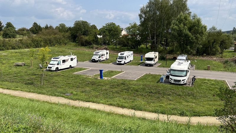
Hoste
Free parking space for 8 mobile homes. Parking area approximately 7x4 meters. Additional green space between the mobile homes. Even with 7.50m we fit in well, as you can use the overhang to drive into the green. Ideal stopover spot with good opportunities for walking the dog and cycling.
49° 4' 4.1" N 6° 52' 43.4" E
49° 4' 4.1" N 6° 52' 43.4" E
49.0678056 6.8787222
• Head toward Rue Nationale on Rue du Bourg (D156 B). Go for 248 m.
• Turn left onto Rue Nationale (D656). Go for 2.3 km.
• Turn right onto Rue de la Libération (D29) toward A4/Henriville/Forbach. Go for 4.9 km.
• Take the 1st exit from roundabout onto D29 toward Paris/Metz/Sarrebruck/Sarreguemines Par RD/Farébersviller. Go for 267 m.
• Take the 3rd exit from roundabout onto A4 (Autoroute de l'Est) toward Paris/Metz/Sarrebruck. Go for 47.0 km.
• Keep left onto A314 toward Metz/Nancy. Go for 1.5 km.
• Take the left exit toward Nancy/Aéroport Régional/Technopole/Actipole onto A315. Go for 1.2 km.
• Continue on N431. Go for 14.5 km.
• Take the 2nd exit from roundabout toward Nancy/Pagny S/M./Fey. Go for 178 m.
• Take the 2nd exit from roundabout onto A31 toward Nancy. Go for 43.0 km.
• Take the exit toward Lyon/Paris/Dijon/Toul onto A31. Go for 19.2 km.
• Take exit 12 toward Paris/Reims/Troyes Par RN/Bar le Duc onto N4. Go for 75.2 km.
• Take ramp toward Troyes/Wassy/Lac du der-Chantecoq. Go for 307 m.
• Take the 1st exit from roundabout onto D2 toward Chaumont/Troyes/Nancy. Go for 236 m.
• Take the 2nd exit from roundabout onto Avenue du Général Giraud (D2) toward Troyes/Montier en der/Lac du der. Go for 781 m.
• Take the 2nd exit from roundabout onto Route de Moeslains (D384) toward Troyes/Montier en der/Wassy/Lac du der. Go for 869 m.
• Take the 3rd exit from roundabout onto D384 toward Troyes/Wassy/Montier-en-der/Éclaron/Lac du der. Go for 1.6 km.
• Take the 2nd exit from roundabout onto D384 toward Troyes/Montier-en-der/Éclaron. Go for 3.1 km.
• Take the 2nd exit from roundabout onto D384 toward Troyes/Montier-en-der. Go for 2.9 km.
• Continue toward Troyes/Montier-en-der/Braucourt/Giffaumont. Go for 41 m.
• Take the 2nd exit from roundabout onto Route du Der (D384) toward Troyes/Montier-en-der/Braucourt/Giffaumont. Go for 7.4 km.
• Turn right onto D153 A toward Giffaumont/Vitry le F. Go for 1.7 km.
• Continue on D55. Go for 2.8 km.
• Take the 2nd exit from roundabout onto D55. Go for 151 m.
• Continue on Rue de Champaubert (D55). Go for 865 m.
• Continue on D55. Go for 85 m.
• Take the 2nd exit from roundabout onto D55. Go for 104 m.
• Continue on Rue de Champaubert (D55). Go for 364 m.
• Turn right onto Rue du Lac. Go for 134 m.
• Turn left. Go for 9 m.
• Turn slightly right. Go for 44 m.
• Arrive at your destination on the left.
☍
232,9 km
(2 hrs. 20 min.)
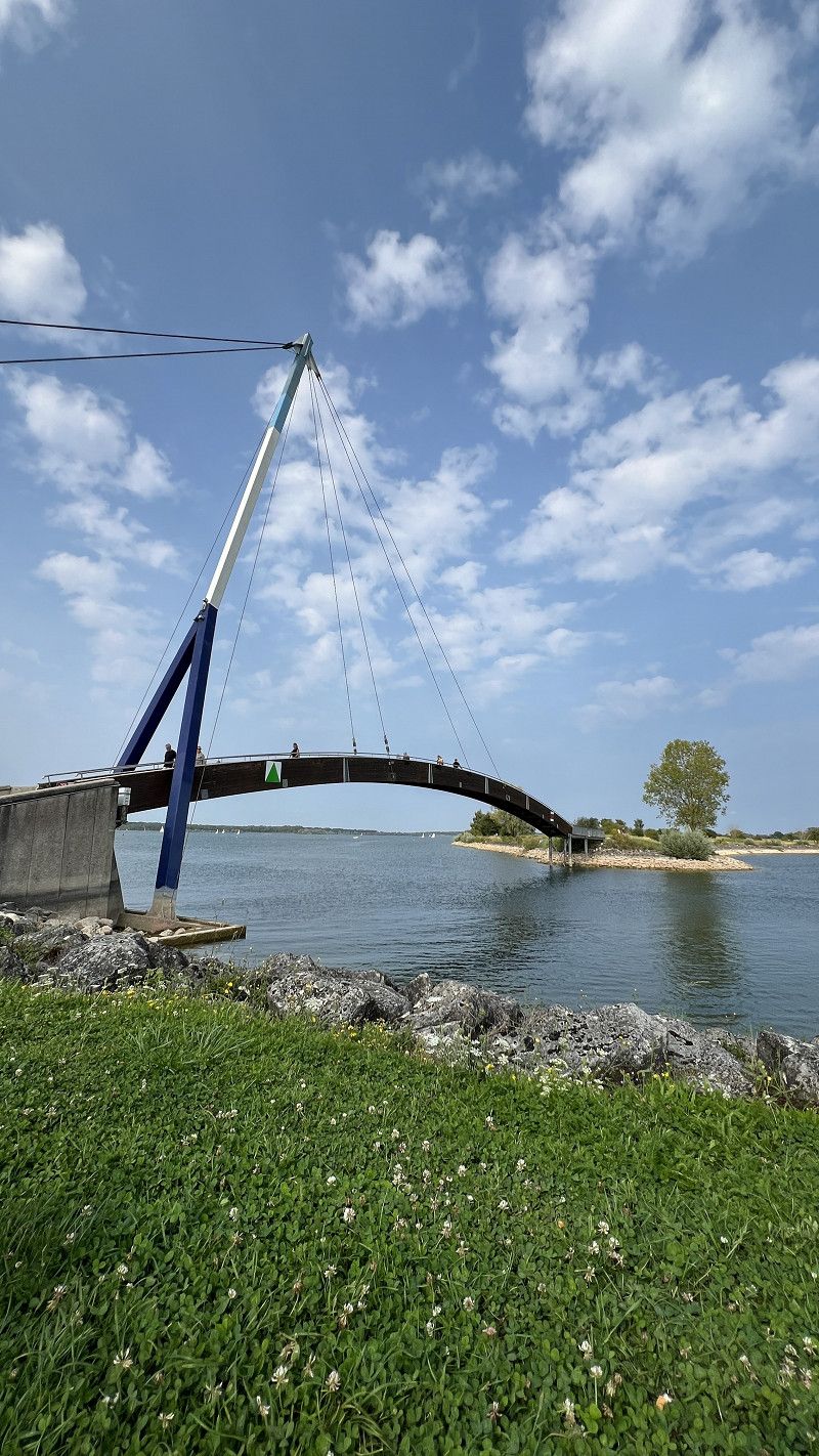
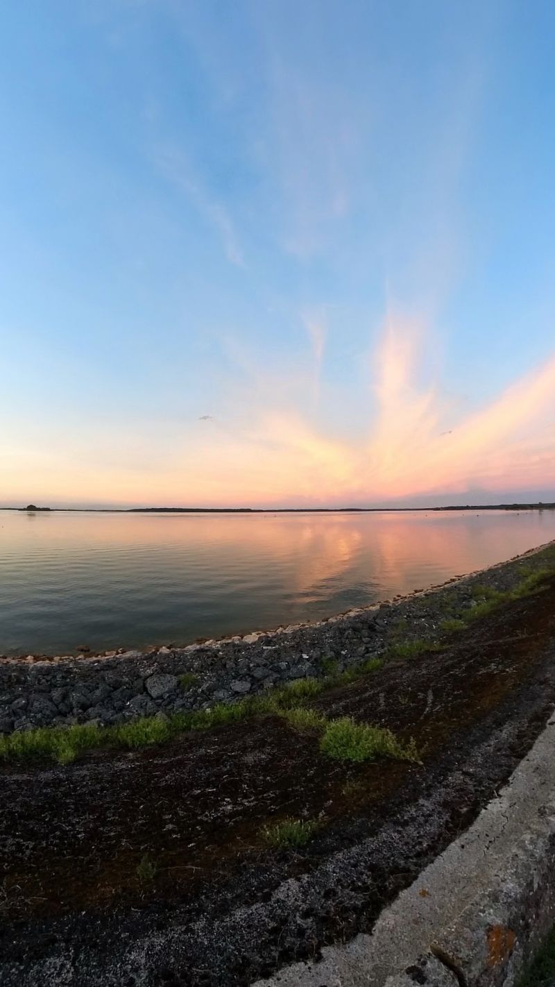
Giffaumont-Champaubert
Lac du Der is the largest artificial lake in Europe. Swimming, fishing and water sports are possible in the lake. From October onwards, 20,000 cranes overwinter here.
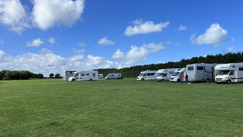
There are 3 camping car parks at Lac du Der. All are close to nature and have electricity, V/E included. 15.20€/ high season
Casino: 48 spaces, relatively narrow, officially for vehicles up to 9m, we didn't really have much space with 7.50m
Marina: 59 spaces, here you park one behind the other. This place is closer to the beach.
Chantecoq: 59 spaces, also narrow. Located about 5km outside. Not lit at night and you can hear the country road. No direct access to the lake, ideal starting point for cycling
Lac du Der travel video
https://youtu.be/FA1z7NlEJfs
pitches CAMPING CAR PARK
https://youtu.be/_UqFoOLnn-Q
Marne, Grand Est, Frankreich
48° 33' 16.1" N 4° 45' 8.6" E
48.5544617 4.7523947
• Head toward Place de l'Église. Go for 23 m.
• Turn right toward Rue du Lac. Go for 12 m.
• Turn right onto Rue du Lac. Go for 205 m.
• Turn right onto Rue du Grand der (D13). Go for 1.1 km.
• Turn left onto Rue de Châtillon (D55). Go for 1.3 km.
• Continue on Rue de Giffaumont (D55). Go for 1.6 km.
• Continue on Place de l'Église (D55). Go for 79 m.
• Turn right onto Rue d'Outines (D55). Go for 928 m.
• Continue on D55. Go for 2.7 km.
• Continue on Rue de Beaufort (D55). Go for 567 m.
• Continue on Place de l'Église (D55). Go for 101 m.
• Turn right onto Rue du Lavoir (D55). Go for 283 m.
• Continue on D55. Go for 696 m.
• Continue on Rue du Haut Jard (D55). Go for 2.7 km.
• Turn right onto Rue du Château (D55). Go for 361 m.
• Continue on Rue des Forêts (D55). Go for 2.0 km.
• Continue on D55. Go for 1.5 km.
• Continue on Rue de la Gare (D55). Go for 288 m.
• Continue on D55. Go for 1.2 km.
• Continue on Rue du Haut Montier (D55). Go for 577 m.
• Continue on Place Général Michel. Go for 142 m.
• Turn right onto Rue du Haut Montier (D55). Go for 156 m.
• Continue on Grande Rue (D55). Go for 336 m.
• Continue on D55. Go for 644 m.
• Continue on Lieu-dit Petit Paris (D55). Go for 52 m.
• Continue on D55. Go for 2.5 km.
• Continue on Rue de Bas (D55). Go for 282 m.
• Continue on Grande Rue (D55). Go for 427 m.
• Continue on Grande Rue (D78). Go for 247 m.
• Continue on D78. Go for 6.7 km.
• Turn right onto Route du Meix Tiercelin (D412). Go for 311 m.
• Continue on D412. Go for 1.1 km.
• Continue on D12. Go for 1.9 km.
• Continue on Grande Rue (D12). Go for 766 m.
• Continue on D12. Go for 1.0 km.
• Continue on Grande Rue (D12). Go for 728 m.
• Turn left onto Grande Rue (D12). Go for 457 m.
• Continue on D12. Go for 3.0 km.
• Continue on Rue d'Humbauville (D12). Go for 478 m.
• Take the 2nd exit from roundabout onto Rue de l'Église (D12). Go for 304 m.
• Take the 2nd exit from roundabout onto Rue du Pont de Soudé (D12). Go for 1.3 km.
• Continue on D12. Go for 6.4 km.
• Turn left onto N4. Go for 18.8 km.
• Turn left onto Route d'Euvy. Go for 2.3 km.
• Continue on Rue Haute. Go for 1.6 km.
• Take the 3rd exit from roundabout onto Rue Neuve (D43). Go for 3.7 km.
• Turn right onto Rue Saint-Maurice (D253). Go for 2.7 km.
• Continue on D253. Go for 2.4 km.
• Continue on Rue des Coudriers (D253). Go for 1.4 km.
• Turn right onto D305. Go for 2.5 km.
• Continue on Rue Saint-Caprais (D305). Go for 338 m.
• Take the 1st exit from roundabout onto Rue du 8 Mai 1945 (D305). Go for 435 m.
• Turn left onto Rue du Pont de Pierre (D305). Go for 81 m.
• Continue on Rue des Menues Dîmes (D305). Go for 311 m.
• Turn right onto Rue de la Gare. Go for 526 m.
• Turn right. Go for 69 m.
• Arrive at your destination on the left.
☍
84,4 km
(1 hrs. 11 min.)
Connantre
Former Camping Municipal, now Camping-Car Park, 13,50€ including food and electricity
Parking space for 23 vehicles under tall trees. Next door is the natural swimming pool. The N4 country road is within sight and hearing distance.
Good paths for the dog
Picardy 🇫🇷 Connantre, Clermont, Beauvais | On the road in Northern France. Motorhome travel report 2024
https://youtu.be/W2aogOtJ0pQ
51230, Connantre, Frankreich
48° 43' 54.8" N 3° 55' 48.4" E
48.7319000 3.9301000
• Head east. Go for 69 m.
• Turn left toward Rue de la Gare. Go for 319 m.
• Continue on Rue de la Gare. Go for 207 m.
• Turn left onto Rue des Menues Dîmes (D305). Go for 311 m.
• Continue on Rue du Pont de Pierre (D305). Go for 81 m.
• Turn right onto Rue du 8 Mai 1945 (D305). Go for 409 m.
• Take the 2nd exit from roundabout onto Grande Rue (D305 A). Go for 581 m.
• Continue on Rue de la Libération (D305 A). Go for 672 m.
• Continue on D305 A. Go for 259 m.
• Turn right onto D5. Go for 1.5 km.
• Keep left toward D39. Go for 7.0 km.
• Turn left onto D39. Go for 402 m.
• Turn slightly right onto D44. Go for 532 m.
• Continue on Rue du Petit Morin (D44). Go for 1.6 km.
• Continue on Rue du Frêne (D44). Go for 245 m.
• Continue on Rue du Moulin à Vent (D44). Go for 474 m.
• Continue on D44. Go for 1.1 km.
• Continue on Rue de la Liberté (D44). Go for 377 m.
• Keep right onto Rue de la Liberté (D44). Go for 192 m.
• Continue on D44. Go for 770 m.
• Continue on Rue de la Champagne (D44). Go for 681 m.
• Continue on D44. Go for 4.1 km.
• Continue on Rue des Barrés (D44). Go for 3.2 km.
• Continue on D44. Go for 105 m.
• Continue on Lieu-dit Moulin des Culots (D44). Go for 130 m.
• Continue on D44. Go for 418 m.
• Continue on Rue Haute des Meuliers (D44). Go for 800 m.
• Continue on Lieu-dit La Grande Fontaine (D43). Go for 77 m.
• Continue on Rue Haute des Meuliers (D43). Go for 334 m.
• Continue on Rue de la Gare (D43). Go for 2.1 km.
• Continue on Lieu-dit Les Aulneaux (D43). Go for 400 m.
• Continue on D43. Go for 1.3 km.
• Continue on Rue de l'Église (D43). Go for 246 m.
• Continue on Rue de la Gare (D43). Go for 559 m.
• Continue on D43. Go for 1.9 km.
• Keep left onto Rue des Bordes (D43). Go for 2.2 km.
• Continue on D43. Go for 148 m.
• Continue on Rue des Roises (D43). Go for 1.6 km.
• Continue on D43. Go for 729 m.
• Continue on Rue Georges Guyot (D43). Go for 664 m.
• Turn right onto D373. Go for 1.6 km.
• Take the 3rd exit from roundabout onto Rue du Petit Saint-Lazare (D933) toward Soissons/Château-Thierry/Meaux. Go for 1.6 km.
• Take the 2nd exit from roundabout onto Rue du Faubourg de Paris (D933) toward Meaux/Soissons/Château-Thierry. Go for 13.8 km.
• Continue on D407. Go for 4.9 km.
• Take the 2nd exit from roundabout onto D407 toward Meaux. Go for 13.9 km.
• Take the 2nd exit from roundabout onto Avenue Franklin Roosevelt (D402) toward A4/Meaux/Jouarre/Coulommiers/Lizy S/Ourcq. Go for 316 m.
• Take the 1st exit from roundabout onto Place du Mémorial (D603) toward A4 (Metz-Nancy)/Château-Thierry/Lizy S/Ourcq/Chamigny/Centre Ville. Go for 738 m.
• Turn left onto Rue Pierre Marx (D3) toward Ussy S/Marne/Lizy S/Ourcq. Go for 11.6 km.
• Take the 2nd exit from roundabout onto D401. Go for 868 m.
• Take the 1st exit from Place de Verdun roundabout onto Route d'Échampeu (D147 A). Go for 233 m.
• Continue on Avenue du Chemin Noir toward D401/Meaux/Dammartin en Goële. Go for 433 m.
• Turn right onto Route de May-en-Multien à Lizy (D147). Go for 101 m.
• Turn left onto Route du Plessis-Placy (D146 A3). Go for 738 m.
• Continue on D146 A3. Go for 2.2 km.
• Continue on D146 A3. Go for 6.5 km.
• Turn right onto D38. Go for 867 m.
• Continue on Rue de la Râperie (D51). Go for 1.7 km.
• Turn left onto Rue du Moulin (C2). Go for 208 m.
• Continue on C2. Go for 954 m.
• Continue on C. Go for 1.2 km.
• Turn right onto Route de Brégy (D99). Go for 298 m.
• Continue on Rue Fromentelle (D99). Go for 580 m.
• Turn left onto D19. Go for 100 m.
• Continue on Route de Nanteuil (D19). Go for 544 m.
• Continue on D19. Go for 3.9 km.
• Continue on Rue des Roches (D19). Go for 876 m.
• Continue on D19. Go for 2.3 km.
• Continue on Rue de Sennevières (D19). Go for 502 m.
• Continue on Rue Jules Dubrulle (D19). Go for 506 m.
• Turn left onto Rue Charles Lemaire (D148). Go for 577 m.
• Take the 2nd exit from Rond-Point des Taxis de la Marne roundabout onto D148. Go for 329 m.
• Take the 2nd exit from roundabout onto D148. Go for 581 m.
• Take the 2nd exit from roundabout onto Rue de la Croix Verte (D148). Go for 305 m.
• Turn left onto D922. Go for 197 m.
• Continue on D330 A. Go for 10.8 km.
• Take the 2nd exit from roundabout onto D330 A. Go for 2.8 km.
• Take the 1st exit from roundabout onto N330 toward A1/Senlis/Compiègne/Zones d'Activités de Senlis. Go for 2.2 km.
• Take the 3rd exit from roundabout onto D1324 toward (Paris)/A1/Senlis/Creil/Compiègne. Go for 1.0 km.
• Take ramp onto D1330. Go for 1.9 km.
• Keep left onto D1330 toward Chantilly/Creil/Verneuil en H./Pont Ste M./Apremont. Go for 2.9 km.
• Keep right onto D1330 toward Creil/Chantilly/Aumont en H./Apremont/Verneuil en H./Pont Ste M. Go for 4.5 km.
• Take ramp toward Creil-Centre Ville-Rive Gauche/Beauvais/Amiens. Go for 436 m.
• Pass 2 roundabouts. Go for 1.6 km.
• Take ramp onto D1016. Go for 4.0 km.
• Keep left onto D1016 toward A16/Amiens/Beauvais/Liancourt/Clermont. Go for 9.7 km.
• Take ramp toward Clermont/Breuil le Vert. Go for 259 m.
• Take the 4th exit from roundabout onto Rue du Grand-Air (C1). Go for 155 m.
• Take the 1st exit from roundabout onto Rue de Paris (D916). Go for 418 m.
• Take the 1st exit from roundabout onto Rue de Paris (D916). Go for 1.5 km.
• Turn right onto Rue de la République. Go for 222 m.
• Turn left onto Place Jean Corroyer. Go for 67 m.
• Turn left onto Rue Grévin. Go for 18 m.
• Arrive at Rue Grévin. Your destination is on the right.
☍
159,2 km
(2 hrs. 23 min.)
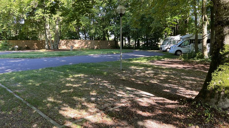
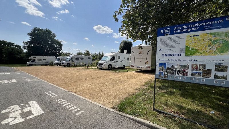
Clermont
Free parking for 5 vehicles. No service. Located a little out of the way, quiet and next to a park. City center 5 minutes walk away. Good opportunities for walking dogs.
Picardy 🇫🇷 Connantre, Clermont, Beauvais | On the road in Northern France. Motorhome travel report 2024
https://youtu.be/W2aogOtJ0pQ
Oise, Nordfrankreich, Frankreich
49° 22' 41.1" N 2° 24' 51.1" E
49.3780921 2.4141907
• Head toward Rue du Général de Gaulle on Rue Grévin. Go for 110 m.
• Turn sharp right onto Rue du Général de Gaulle (D916). Go for 752 m.
• Pass 3 roundabouts and continue on Rue de Saint-Just (D916). Go for 615 m.
• Turn left and take ramp onto N31 toward A16/Beauvais/Agnetz/Étouy. Go for 22.8 km.
• Take the 4th exit from roundabout onto D931 toward Rouen/Allonne/Z.A. de Ther/Z.I. du Pont d'Arcole. Go for 410 m.
• Take the 3rd exit from roundabout onto Rue Jean-Michel Schillé (D931) toward Marissel. Go for 398 m.
• Take the 2nd exit from roundabout onto Rue de Clermont (D931). Go for 738 m.
• Turn left onto Avenue Corot. Go for 440 m.
• Take the 2nd exit from Giratoire du Wagé roundabout onto Avenue Corot. Go for 288 m.
• Take the 1st exit from Giratoire John Fitzgerald Kennedy roundabout onto Avenue du Président John F. Kennedy (D1001). Go for 869 m.
• Turn left onto Boulevard du Général de Gaulle. Go for 53 m.
• Turn right onto Rue Chantereine. Go for 33 m.
• Turn left onto Boulevard du Général de Gaulle. Go for 337 m.
• Continue on Boulevard Jules Brière. Go for 262 m.
• Turn left onto Rue du Thérain. Go for 149 m.
• Turn left onto Rue du Faubourg Saint-Jacques. Go for 118 m.
• Turn slightly right onto Square Georges Dumézil. Go for 49 m.
• Continue on Rue Binet. Go for 174 m.
• Turn right onto Rue Aldebert Bellier. Go for 207 m.
• Arrive at Rue Aldebert Bellier. Your destination is on the left.
☍
28,8 km
( 25 min.)
Parking Camping-cars
Free parking space including V/E, Max 48 hours,
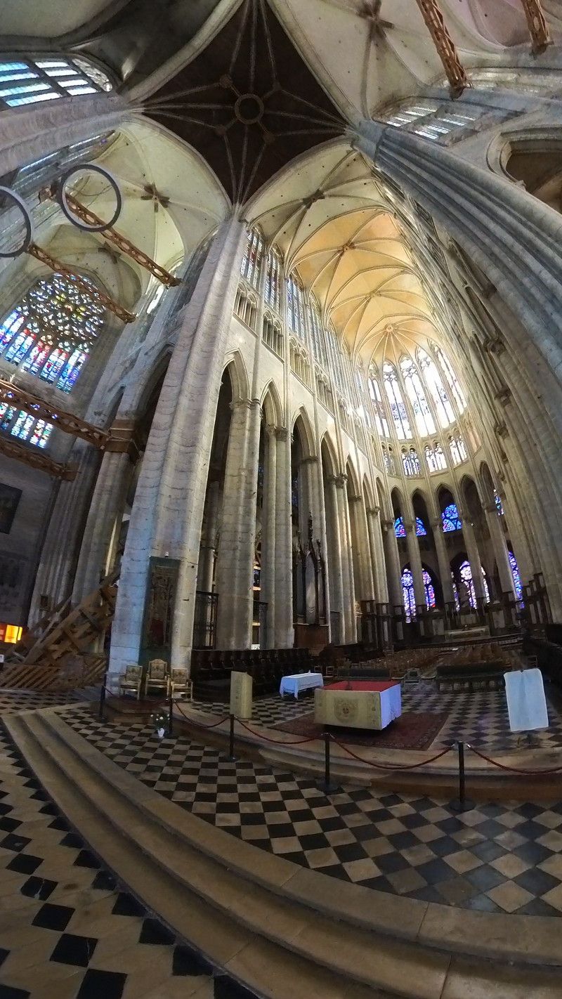
Beauvais is home to the cathedral with the highest vault in the world.
The four-flower city is worth a stop.
Picardy 🇫🇷 Connantre, Clermont, Beauvais | On the road in Northern France. Motorhome travel report 2024
https://youtu.be/W2aogOtJ0pQ
Rue Aldebert Bellier, 60000, Beauvais, France
49° 25' 27" N 2° 4' 49" E
49.4241667 2.0802778
• Head toward Rue Arthur Rimbaud on Rue Aldebert Bellier. Go for 207 m.
• Turn left onto Rue Binet. Go for 169 m.
• Turn right onto Avenue Winston Churchill (D139). Go for 17 m.
• Turn right onto Rue de Pontoise. Go for 95 m.
• Turn left onto Rue de Pontoise (D93). Go for 18 m.
• Turn left onto Avenue Winston Churchill (D139). Go for 90 m.
• Continue on Square Georges Dumézil (D139). Go for 72 m.
• Continue on Boulevard de l'Île-de-France (D139). Go for 184 m.
• Take the 3rd exit from roundabout onto Boulevard de Normandie (D139). Go for 388 m.
• Continue on Rue de Bretagne (D139). Go for 23 m.
• Turn right onto Rue Desgroux. Go for 88 m.
• Turn left onto Boulevard Saint-Jean. Go for 566 m.
• Continue on Boulevard Antoine Loisel. Go for 270 m.
• Turn left onto Rue du Maréchal Leclerc. Go for 22 m.
• Turn right onto Boulevard Amyot-d'Inville. Go for 489 m.
• Keep left onto Rue Antoine Caron. Go for 140 m.
• Turn left onto Rue de Calais (D901 E). Go for 2.0 km.
• Turn right onto Route de Crèvecoeur (D149). Go for 476 m.
• Take the 3rd exit from roundabout onto D901 E. Go for 5.0 km.
• Take the 3rd exit from roundabout toward D133/Formerie/Songeons/Milly S/Th./Herchies. Go for 789 m.
• Take the 1st exit from roundabout onto D133. Go for 8.1 km.
• Turn left onto Rue du Maréchal de Boufflers (D133). Go for 6.2 km.
• Continue on Rue du Maréchal de Boufflers (D107). Go for 57 m.
• Continue on Place de la Halle (D107). Go for 52 m.
• Turn right onto Place de la Halle. Go for 24 m.
• Turn right onto Place de la Halle. Go for 13 m.
• Arrive at Place de la Halle. Your destination is on the left.
☍
25,5 km
( 31 min.)
Songeons
Free parking space. Songeons has a good infrastructure from pharmacy to supermarket, butcher, shoe shop, café. There is a market twice a week.
Gerberoy is 2 km away, easily accessible via a path through the forest. Worth seeing.
https://youtu.be/zU_zI8VFh_0
Place de la Halle 13 a, Songeons, Oise, Nordfrankreich, Frankreich
49° 32' 58.4" N 1° 51' 13.7" E
49.5495555 1.8538004
• Head southeast on Place de la Halle. Go for 18 m.
• Turn right onto Place de la Halle (D119). Go for 23 m.
• Turn left onto Place de la Halle (D107). Go for 18 m.
• Continue on Rue du Maréchal de Boufflers (D107). Go for 57 m.
• Turn right onto Rue Jean Touchard (D133). Go for 285 m.
• Continue on Rue Jean Touchard (D143). Go for 228 m.
• Continue on Route de Caumont (D143). Go for 85 m.
• Keep right onto Route de Caumont (D143). Go for 2.2 km.
• Continue on D143. Go for 39 m.
• Continue on Rue de la Briqueterie (D143). Go for 555 m.
• Continue on Lieu-dit Renicourt (D143). Go for 893 m.
• Continue on D143. Go for 2.9 km.
• Continue on Lieu-dit Les Avoines (D143). Go for 239 m.
• Continue on D143. Go for 1.1 km.
• Continue on Route de Songeons (D145). Go for 2.6 km.
• Turn right onto D930. Go for 864 m.
• Take the 2nd exit from roundabout onto D930. Go for 504 m.
• Take the 3rd exit from roundabout onto Avenue de l'Europe (D930). Go for 348 m.
• Turn right onto Boulevard de Verdun (N31). Go for 166 m.
• Turn left onto Rue de l'Abreuvoir. Go for 383 m.
• Continue on Place Nationale. Go for 189 m.
• Continue on Place de la Libération. Go for 71 m.
• Continue on Rue Legrand Baudu. Go for 45 m.
• Turn left onto Rue Legrand Baudu (D915). Go for 102 m.
• Turn slightly left onto Avenue de la 1ère Armée Française (D915) toward Paris/Neufmarché/Sérifontaine/Gisors. Go for 16.7 km.
• Pass 2 roundabouts and continue on Route Nationale 15 Paris Dieppe (D915). Go for 6.2 km.
• Continue on Rue de Dieppe (D15 B). Go for 980 m.
• Turn right onto Avenue de Verdun (D15 E) toward Le Fossé Vert/Les Bornes/Les Mathurins/Le Mont de l'Aigle/Centre Ville. Go for 427 m.
• Turn left onto Rue des Argillières. Go for 235 m.
• Turn left onto Rue Cappeville. Go for 49 m.
• Turn right onto Rue Balechoux. Go for 137 m.
• Turn right onto Rue Boullenger. Go for 114 m.
• Continue on Rue de l'Annonciade. Go for 32 m.
• Arrive at Rue de l'Annonciade. Your destination is on the right.
☍
38,8 km
( 42 min.)
Gisors
The parish church, which resembles a cathedral, is well worth seeing. According to legend, the treasure of the Knights Templar is buried in the castle.
Parking space 2km outside. 11.80€ including food and electricity. Unfortunately no footpath into the city and no dog walking paths
https://youtu.be/zU_zI8VFh_0
Eure, Normandie, Frankreich
49° 16' 44.2" N 1° 46' 40.2" E
49.2789504 1.7778260
• Head southwest on Rue de l'Annonciade. Go for 87 m.
• Turn right onto Rue de Paris. Go for 50 m.
• Turn right onto Quai du Fossé aux Tanneurs. Go for 191 m.
• Take the 1st exit from roundabout onto Rue Cappeville. Go for 304 m.
• Continue on Rue du Faubourg Cappeville. Go for 133 m.
• Turn left onto Rue de Dieppe (D15 B). Go for 1.2 km.
• Continue on Route Nationale 15 Paris Dieppe (D915). Go for 287 m.
• Pass 2 roundabouts and continue on Rue Pierre-Eugène Boyer (D915). Go for 23.2 km.
• Turn left onto Avenue du Général Leclerc (D915) toward Rouen/Dieppe. Go for 409 m.
• Turn left onto Avenue du Général Leclerc (N31) toward Rouen/Dieppe/Forges les E./La Feuillie. Go for 1.1 km.
• Continue on Côte de Saint-Aubin (D915) toward Dieppe/Elbeuf en Bray/Argueil/Forges les Eaux. Go for 7.9 km.
• Turn right onto D156 toward Ménerval/Gaillefontaine. Go for 607 m.
• Continue on Lieu-dit Les Agaches (D156). Go for 187 m.
• Continue on D156. Go for 3.4 km.
• Continue on Route de Gaillefontaine (D156). Go for 6.3 km.
• Continue on Route de Gournay (D156). Go for 1.8 km.
• Turn left onto Route de Grumesnil (D135). Go for 898 m.
• Continue on Route de Rouen à Lilles (D919). Go for 368 m.
• Continue on Place de la Mairie (D135). Go for 11.0 km.
• Turn right onto Route de Neufchatel (D1314). Go for 4.4 km.
• Take the 4th exit from roundabout onto Rue des Fontaines (D1314). Go for 357 m.
• Continue on Rue Denoyelle (D1314). Go for 177 m.
• Take the 2nd exit from roundabout onto Rue Baron d'Haussez (D1314). Go for 155 m.
• Continue on Rue Cauchoise (D1314). Go for 148 m.
• Continue on Route de Londinières (D1314). Go for 395 m.
• Continue on Route de Londinières (D1314). Go for 13.9 km.
• Turn left onto Rue Maréchal Leclerc (D1314). Go for 491 m.
• Turn right onto Route de Fresnoy (D1314). Go for 25.3 km.
• Turn left onto Place du Général de Gaulle (D925). Go for 34 m.
• Take the 2nd exit from Place du Général de Gaulle roundabout onto Place du Général de Gaulle (D1314). Go for 720 m.
• Turn left onto Rue Jean Duhornay (D1915). Go for 1.3 km.
• Continue toward Route du Tréport/D1915. Go for 50 m.
• Take the 2nd exit from roundabout onto Route du Tréport (D1915). Go for 996 m.
• Take the 3rd exit from Place Pierre Mendès France roundabout onto Avenue Paul Parray (D1915). Go for 1.7 km.
• Turn right onto Boulevard du Calvaire (D126 E). Go for 638 m.
• Continue on D126 E. Go for 243 m.
• Arrive at D126 E. Your destination is on the left.
☍
110,3 km
(1 hrs. 46 min.)
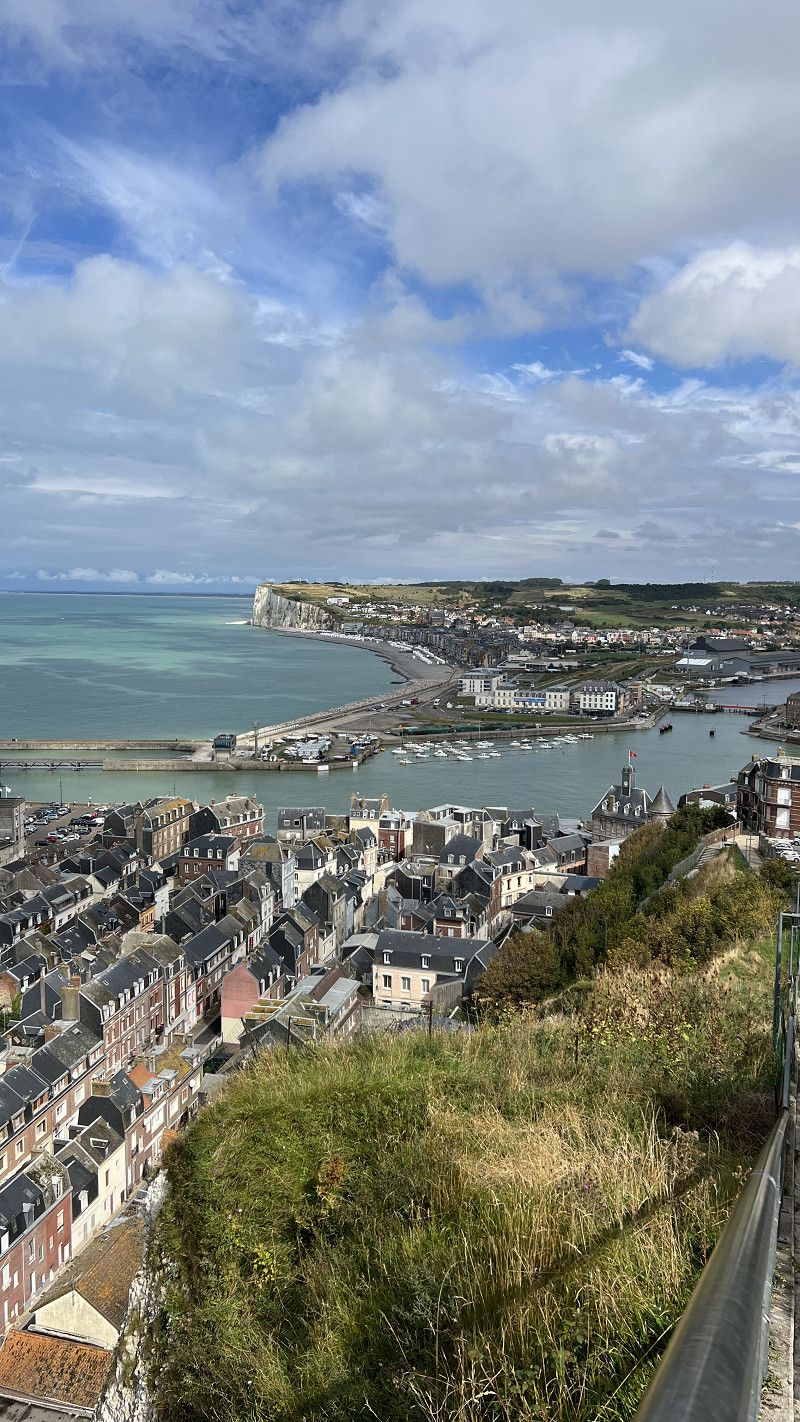
Aire de Services Camping-cars du Funiculaire
Parking space on the meadow at the top station of the funicular directly on the cliffs. 8€/24h.
The parking space was fully occupied every evening, even when it was raining.
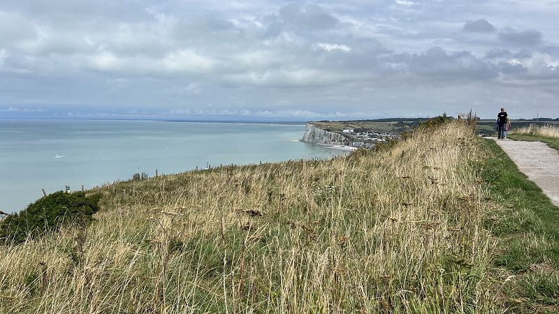
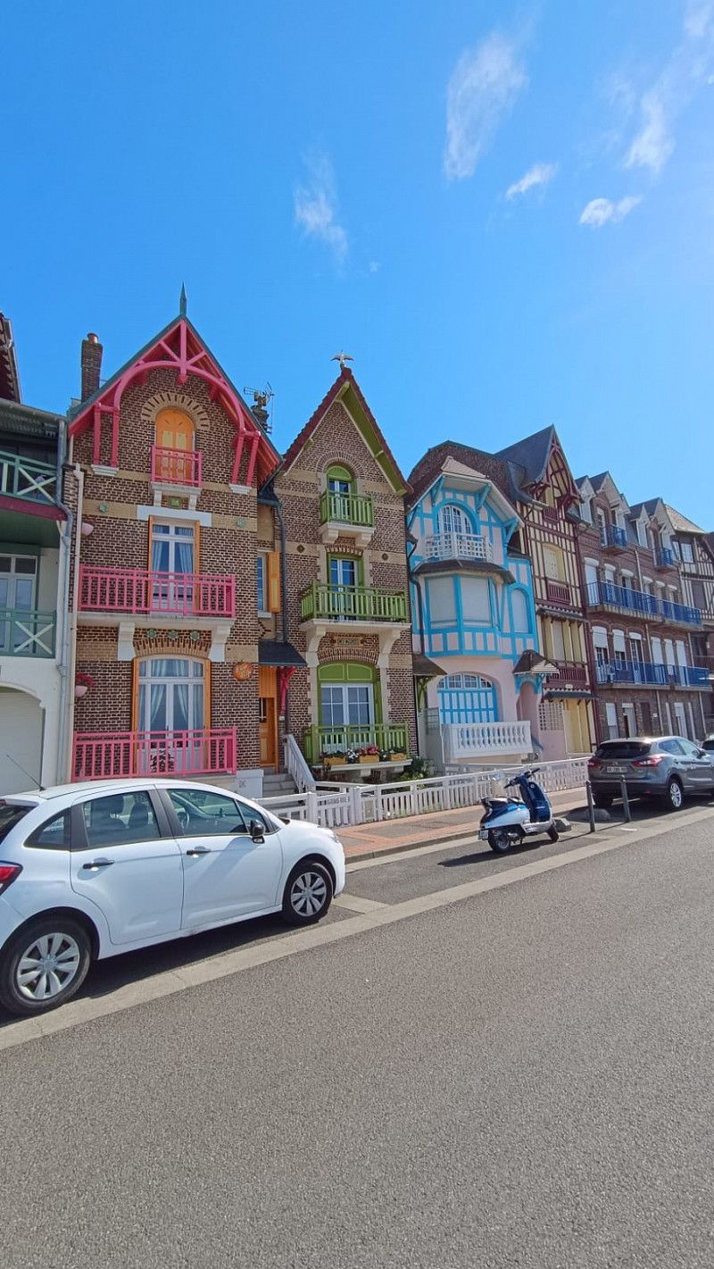
Le Tréport and Mers-les-Bains are worth seeing
Alabaster Coast 🇫🇷 By motorhome to Le Tréport & Mers- es Bains | Travel report Normandy 2024
https://youtu.be/iZUui8B0_jQ
Route Touristique, 76470, Le Tréport, France
50° 3' 29" N 1° 21' 49" E
50.0580556 1.3636111
• Head toward Rue du Télécabine on D126 E. Go for 243 m.
• Continue on Boulevard du Calvaire (D126 E). Go for 638 m.
• Turn right onto Route de Dieppe (D940). Go for 870 m.
• Take the 3rd exit from roundabout onto Avenue des Canadiens (D940). Go for 1.0 km.
• Take the 1st exit from roundabout onto Place des Tilleuls (D940). Go for 2.1 km.
• Turn right onto D925. Go for 1.6 km.
• Pass 5 roundabouts and continue on D925. Go for 19.2 km.
• Continue on D925 toward Dieppe. Go for 120 m.
• Take the 3rd exit from roundabout onto D925 toward Dieppe. Go for 919 m.
• Take the 2nd exit from roundabout onto D485 toward (Rouen)/Paris/Rouen/Dieppe. Go for 2.2 km.
• Take the 2nd exit from roundabout onto D154 E toward Fécamp/Dieppe/Rouxmesnil-Bouteilles. Go for 1.4 km.
• Take the 4th exit from roundabout onto Avenue de Bréauté (D927) toward Fécamp/Rouen/Le Havre. Go for 1.5 km.
• Take the 2nd exit from Rond-Point des Canadiens roundabout onto Rocade de Janval (D925) toward Fécamp/St Valery en Cx. Go for 4.9 km.
• Pass 5 roundabouts and continue on Voie Communale Charles de Gaulle (D925). Go for 18.0 km.
• Take the 1st exit from roundabout onto Rue Docteur Pierre Girard (D142). Go for 397 m.
• Turn left onto Rue Jean Maret. Go for 103 m.
• Turn left onto Avenue du Docteur Michel. Go for 129 m.
• Arrive at Avenue du Docteur Michel. Your destination is on the left.
☍
55,3 km
( 54 min.)
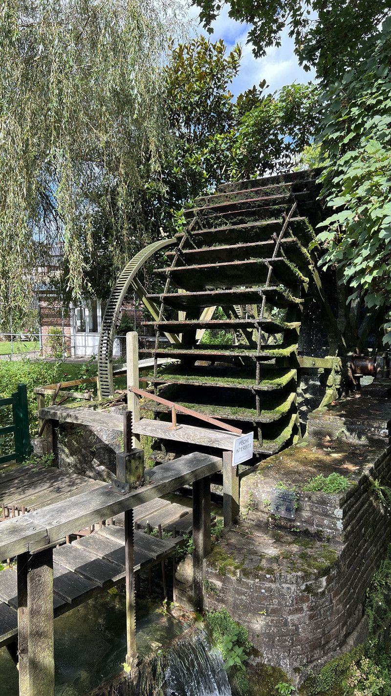
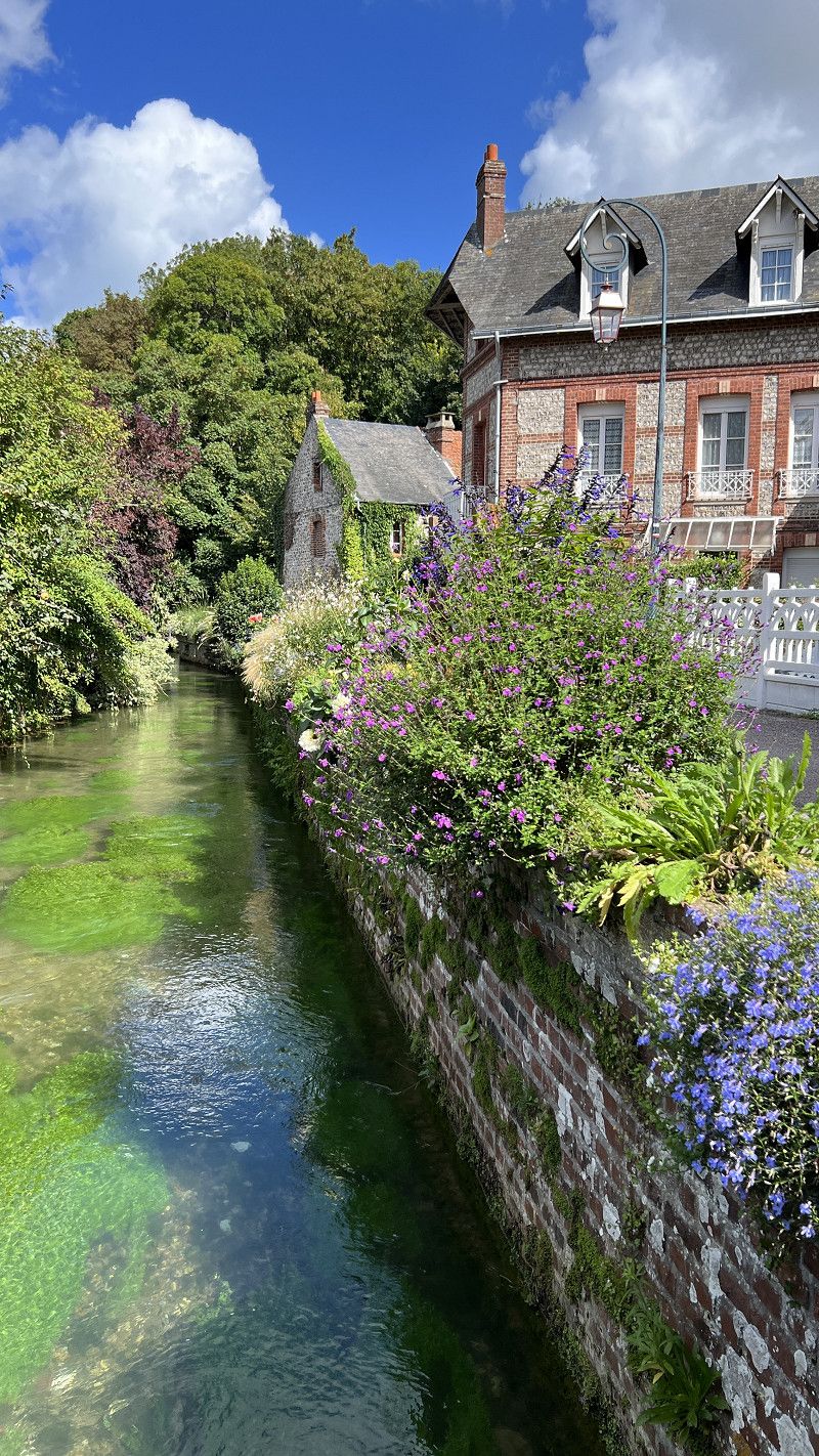
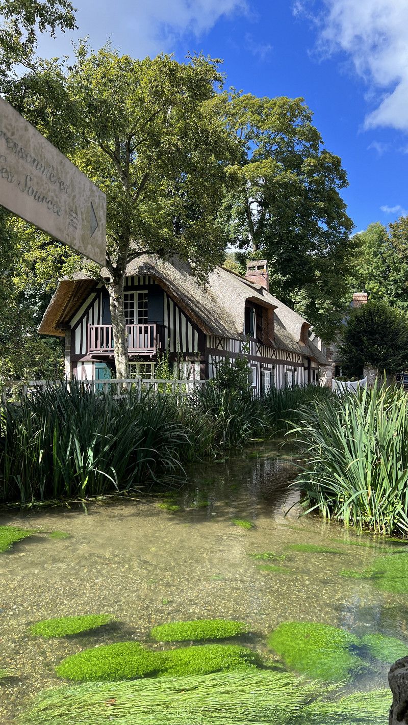
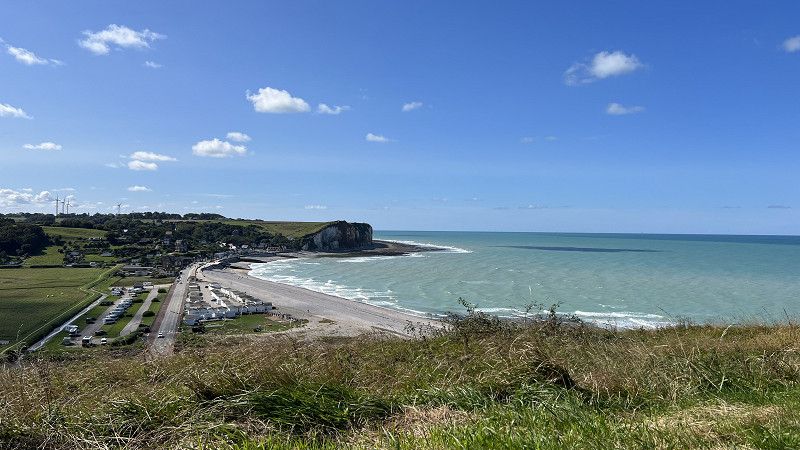
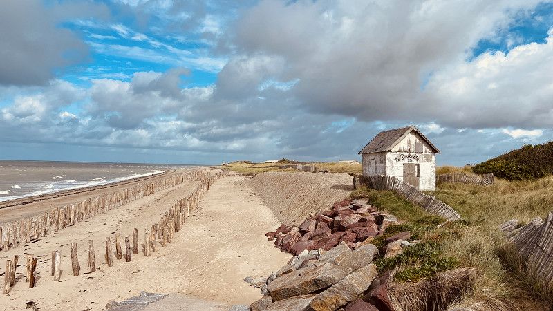
Veules-les-Roses
Association of the most beautiful villages in France.
Unfortunately you are not allowed to spend the night in the car park (8am-11pm) - alternatively there is the local campsite.
Normandy 🇫🇷 Veules les Roses & Veulettes sur Mer with parking spot tip | Motorhome travel report 2024
https://youtu.be/vDzMlHIFnUk
Seine-Maritime, Normandie, Frankreich
49° 52' 19.9" N 0° 47' 56.6" E
49.8722029 0.7990652
• Head northeast on Avenue du Docteur Michel. Go for 58 m.
• Turn right onto Avenue du Docteur Michel. Go for 85 m.
• Turn left onto Rue Jean Maret. Go for 177 m.
• Continue on Rue Camille Marchand. Go for 104 m.
• Turn left onto Chemin du Crucifix (C3). Go for 1.3 km.
• Turn right onto D925. Go for 3.5 km.
• Take the 3rd exit from roundabout onto D925 toward Fécamp/Cany-Barville/St Valery en C. Go for 1.6 km.
• Take the 3rd exit from roundabout onto D925 toward A29/Le Havre/Fécamp/Cany-Barville/Z.A. du Plateau-Ouest. Go for 3.2 km.
• Take the 1st exit from roundabout onto D925 B toward Veulettes sur Mer/Z.A. du Plateau Ouest/St Valery en Cx. Go for 637 m.
• Take the 2nd exit from roundabout onto C12. Go for 597 m.
• Continue on D79. Go for 1.7 km.
• Continue on Route de Paluel (D79). Go for 470 m.
• Continue on D79. Go for 731 m.
• Continue on Route de Saint-Valéry (D79). Go for 3.7 km.
• Turn right onto Route de Saint-Valéry (D10). Go for 80 m.
• Continue on Digue Jean Corruble (D10). Go for 28 m.
• Turn left. Go for 19 m.
• Arrive at your destination on the right.
☍
17,9 km
( 19 min.)
Parking de la Plage
Communal parking space. 8€ plus tax including disposal. No electricity, water 4€.
Located between the beach promenade and the Durdent wetland/estuary.
Well-preserved bunker complex Memoire d'Albatre not far away.
Normandy 🇫🇷 Veules les Roses & Veulettes sur Mer with parking spot tip | Motorhome travel report 2024
https://youtu.be/vDzMlHIFnUk
Rue du Pont Rouge, 76450, Veulettes-sur-Mer, France
49° 51' 18" N 0° 36' 27" E
49.8550000 0.6075000
• Head toward Digue Jean Corruble. Go for 19 m.
• Turn right onto Digue Jean Corruble (D10). Go for 28 m.
• Continue on Route de Saint-Valéry (D10). Go for 80 m.
• Turn right onto Route de Veulettes (D10). Go for 4.5 km.
• Turn left onto Rue de Saint-Riquier (D69). Go for 972 m.
• Continue on D69. Go for 459 m.
• Keep right onto Route de Vittefleur (D69). Go for 1.2 km.
• Continue on D69. Go for 63 m.
• Turn right onto D925. Go for 3.8 km.
• Turn left onto D50 toward Amiens/A29. Go for 8.8 km.
• Take the 1st exit from roundabout onto D20. Go for 4.2 km.
• Take the 2nd exit from roundabout onto Rue du Colonel Cerceau (D20). Go for 564 m.
• Turn right onto Rue Augustin Lemercier (D37). Go for 1.7 km.
• Continue on D37. Go for 285 m.
• Continue on Route de Doudeville (D37). Go for 3.2 km.
• Turn left onto Route d'Hautot (D37) toward Veauville-lès-Baons/Yvetot/Centre Bourg. Go for 43 m.
• Continue on Rue de la Mairie (D37). Go for 198 m.
• Continue on Rue du Prieuré (D53) toward Yvecrique/Grémonville. Go for 137 m.
• Turn left onto Rue de la Bruyère. Go for 81 m.
• Arrive at Rue de la Bruyère. Your destination is on the left.
☍
30,3 km
( 30 min.)
Étoutteville
Free parking for 6 vehicles, max 48h.
Only one restaurant in the village, otherwise no infrastructure
Seine-Maritime, Normandie, Frankreich
49° 40' 35.5" N 0° 47' 7.6" E
49.6765378 0.7854339
• Head toward Rue du Prieuré on Rue de la Bruyère. Go for 81 m.
• Turn left onto Rue du Prieuré (D53). Go for 866 m.
• Continue on D53. Go for 939 m.
• Continue on Lieu-dit Gournay (D53). Go for 892 m.
• Turn right onto Route de Rouen (D20). Go for 583 m.
• Pass 4 roundabouts and continue on Rue de la Clairière (D20). Go for 8.2 km.
• Continue on Route de Motteville. Go for 51 m.
• Take the 3rd exit from roundabout onto Route de Fréville (D20). Go for 4.8 km.
• Continue on Rue de Duclair (D5). Go for 2.5 km.
• Take the 1st exit from roundabout onto Route du Manoir (D5). Go for 8.3 km.
• Turn right onto Rue Georges Clemenceau. Go for 172 m.
• Turn left onto Rue du 19 Mars 1962. Go for 110 m.
• Turn right onto Rue de Verdun (D143). Go for 183 m.
• Turn right onto Quai de la Libération (D982). Go for 4.1 km.
• Turn left onto D143. Go for 285 m.
• Continue on Rue Pasteur (D143). Go for 215 m.
• Continue on Rue Coty (D143). Go for 285 m.
• Take the 2nd exit from roundabout onto Rue du Général Leclerc (D143). Go for 769 m.
• Continue on Route de Yainville (D143). Go for 188 m.
• Continue on Lieu-dit La Motte (D143). Go for 109 m.
• Continue on Route de Yainville (D143). Go for 898 m.
• Turn left onto Rue du Quesney (VC2). Go for 214 m.
• Turn left onto Rue Mainberte (VC9). Go for 570 m.
• Turn right onto Rue Pihan. Go for 171 m.
• Arrive at Rue Pihan.
☍
35,5 km
( 41 min.)
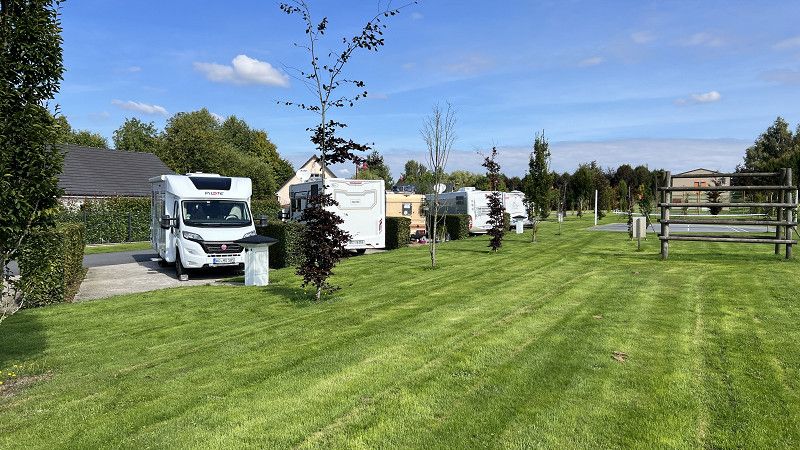
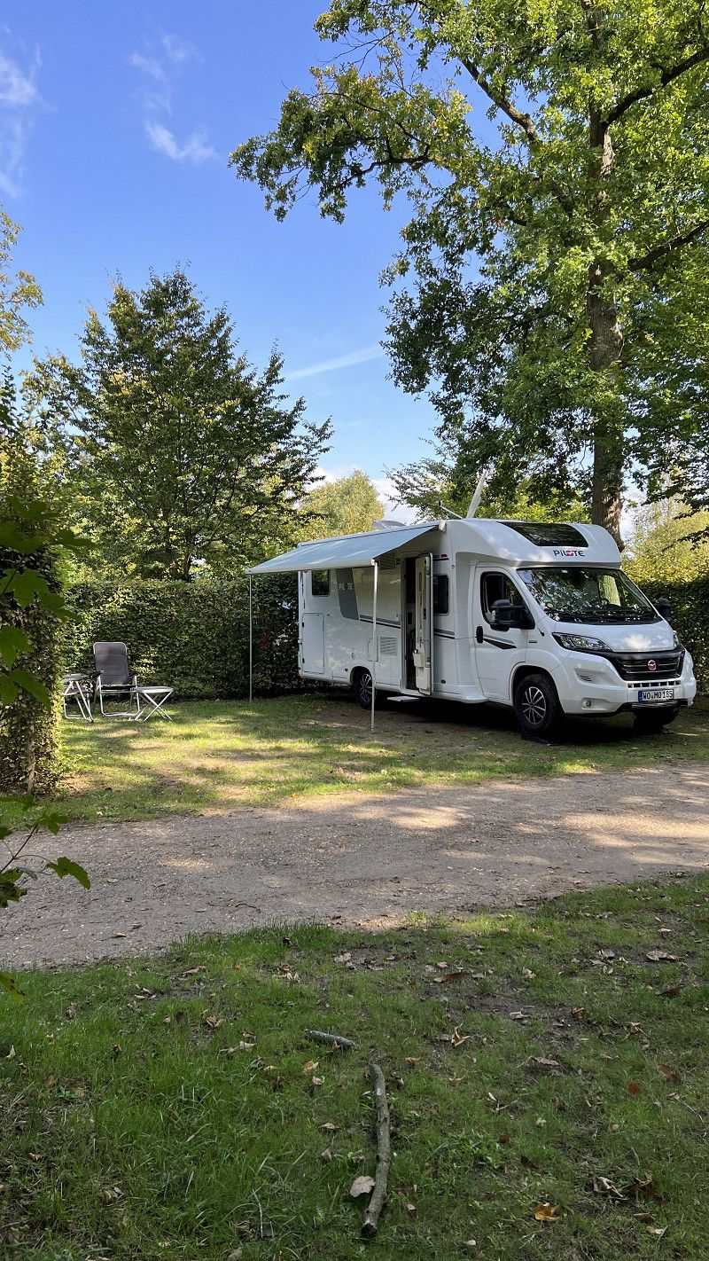
Camping de la Forêt
ACSI pitch. 21€. Large plots, very quiet at night. Town a few hundred metres away.
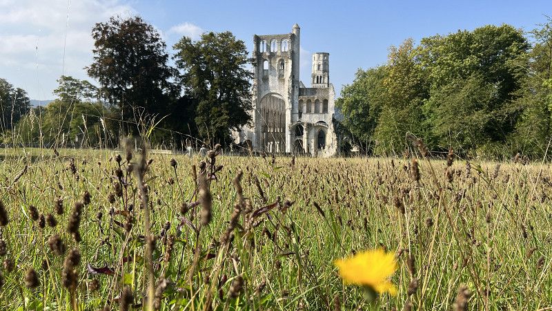
The Abbey of Jumièges is said to be the most beautiful monastery ruin in France.
You can cycle/walk along the Seine.
More in the video https://youtu.be/1kQIhnZcgyI
Rue Mainberte, 76480, Jumièges, France
49° 26' 2" N 0° 49' 45.6" E
49.4338900 0.8293200
• Head toward Rue Mainberte on Rue Pihan. Go for 171 m.
• Turn left onto Rue Mainberte (VC9). Go for 570 m.
• Turn right onto Rue du Quesney (VC2). Go for 214 m.
• Turn right onto Rue Guillaume le Conquérant (D143). Go for 887 m.
• Continue on Lieu-dit La Motte (D143). Go for 109 m.
• Continue on Route de Yainville (D143). Go for 188 m.
• Continue on Rue du Général Leclerc (D143). Go for 753 m.
• Take the 2nd exit from roundabout onto Rue Coty (D143). Go for 298 m.
• Continue on Rue Pasteur (D143). Go for 215 m.
• Continue on D143. Go for 278 m.
• Turn left onto Route du Havre (D982). Go for 3.5 km.
• Take the 2nd exit from roundabout onto Route de Rouen au Havre (D982). Go for 447 m.
• Take the 3rd exit from roundabout onto Rue Raymond Brétéché (D982). Go for 1.3 km.
• Take the 1st exit from roundabout onto Rue Georges Clemenceau (D982). Go for 4.6 km.
• Turn left. Go for 24 m.
• Turn right. Go for 60 m.
• Turn slightly right toward Pont de Brotonne/D490. Go for 110 m.
• Turn right onto Pont de Brotonne (D490). Go for 393 m.
• Take the 3rd exit from roundabout onto D490. Go for 1.9 km.
• Take the 2nd exit from roundabout onto D490. Go for 4.2 km.
• Take the 1st exit from roundabout onto D131. Go for 11.0 km.
• Continue on D139 E. Go for 3.2 km.
• Continue on Route d'Aizier (D139). Go for 1.1 km.
• Continue on Place de la Mairie (D89). Go for 1.3 km.
• Take the 3rd exit from roundabout onto A13 (Autoroute de Normandie) toward Caen/Le Havre/Pt de Tancarville. Go for 78.5 km.
• Take the exit onto N814 (Périphérique). Go for 10.5 km.
• Keep left onto N13 toward Bessin/Cherbourg/Bayeux/Aéroport Carpiquet. Go for 18.3 km.
• Take ramp onto D33 toward Bayeux/Arromanches/Port en Bessin/Zone d'Activités-Bayeux Intercom. Go for 640 m.
• Take the 5th exit from roundabout onto D613. Go for 3.7 km.
• Take the 1st exit from Rond-Point Eisenhower roundabout onto Boulevard Winston Churchill (D613). Go for 140 m.
• Take the 3rd exit from Carrefour Saint-Exupère roundabout onto Boulevard Winston Churchill (D613). Go for 132 m.
• Pass 3 roundabouts and continue on Boulevard Winston Churchill (D613). Go for 1.6 km.
• Take the 2nd exit from roundabout onto Route d'Arromanches (D516). Go for 7.2 km.
• Take the 2nd exit from roundabout onto D514. Go for 671 m.
• Turn right onto Rue Marie-Rose Thonnard (D87). Go for 585 m.
• Turn right onto Rue de Ryes (D87). Go for 47 m.
• Arrive at Rue de Ryes (D87). Your destination is on the left.
☍
158,7 km
(1 hrs. 50 min.)
Arromanches-les-Bains
Parking space on the cliffs near the 360° cinema. 11€/24 hours. Very narrow parking bays.
Important Place D-Day
Calvados, Normandie, Frankreich
49° 20' 13.1" N 0° 37' 19.7" W
49.3369603 -0.6221294
• Head toward Route de Ryes on Rue de Ryes (D87). Go for 180 m.
• Turn left onto Route de Ryes (D87). Go for 499 m.
• Continue on D87. Go for 237 m.
• Continue on Lieu-dit Le Petit Fontaine (D87). Go for 521 m.
• Continue on D87. Go for 938 m.
• Turn right onto D127. Go for 498 m.
• Continue on Lieu-dit La Ferme Neuve (D127). Go for 87 m.
• Continue on D127. Go for 989 m.
• Turn left onto Route de Bayeux (D516). Go for 5.5 km.
• Take the 1st exit from roundabout onto Boulevard Winston Churchill (D613). Go for 819 m.
• Pass 2 roundabouts and continue on Route de Cherbourg (D613). Go for 4.1 km.
• Take the 2nd exit from roundabout. Go for 205 m.
• Take ramp onto N13 toward Cherbourg/Trévières/Grandcamp-Maisy/Isigny S/Mer. Go for 26.7 km.
• Turn right toward Isigny S/Mer-le Port. Go for 120 m.
• Take the 2nd exit from roundabout onto D197 A. Go for 252 m.
• Continue on Rue Docteur Boutrois (D197 A). Go for 417 m.
• Continue on Rue Émile Demagny (D197 A). Go for 97 m.
• Arrive at Rue Émile Demagny (D197 A). Your destination is on the right.
☍
42,1 km
( 33 min.)
Isigny-sur-Mer
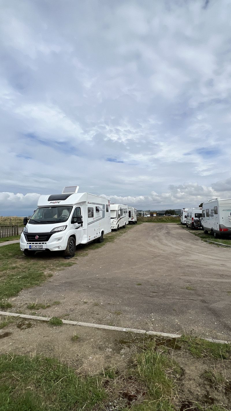
Free parking for 8 mobile homes. Very busy at weekends (42 mobile homes on site)
Adjacent park and bike path. Supermarket and city center a few hundred meters away.
Calvados, Normandie, Frankreich
49° 19' 10" N 1° 6' 2.9" W
49.3194311 -1.1008065
• Head toward Rue Lazare Carnot on Rue Émile Demagny (D197 A). Go for 141 m.
• Turn left onto Avenue de Versailles. Go for 135 m.
• Continue on Rue du Brésil. Go for 177 m.
• Continue on Rue de Littry (D5). Go for 434 m.
• Take the 2nd exit from roundabout. Go for 291 m.
• Continue on N13. Go for 10.9 km.
• Take ramp toward Barneville-Carteret/Z.I. de Carentan. Go for 187 m.
• Turn left onto D971. Go for 1.5 km.
• Take the 2nd exit from roundabout onto Route Américaine (D971). Go for 522 m.
• Take the 2nd exit from roundabout onto Route Américaine (D971). Go for 998 m.
• Take the 3rd exit from roundabout onto D971. Go for 460 m.
• Take the 3rd exit from roundabout onto D971. Go for 977 m.
• Pass 5 roundabouts and continue on Boulevard du 8 Juin 1944 (D971). Go for 16.4 km.
• Take the 2nd exit from Rond-Point de Bastogne roundabout onto Route de Coutances (D971). Go for 399 m.
• Turn right onto D68. Go for 713 m.
• Continue on Lieu-dit La Lande (D68). Go for 146 m.
• Continue on Route de Montsurvent (D68). Go for 554 m.
• Continue on Rue des Landes (D68). Go for 635 m.
• Continue on D68. Go for 2.1 km.
• Continue on Lieu-dit La Hurie (D68). Go for 113 m.
• Continue on D68. Go for 104 m.
• Continue on Lieu-dit La Bretonnière (D68). Go for 84 m.
• Continue on D68. Go for 5.5 km.
• Continue on Lieu-dit Le Haut de Montsurvent (D68). Go for 97 m.
• Continue on D68. Go for 14 m.
• Turn left onto D2. Go for 567 m.
• Turn right onto D68. Go for 1.2 km.
• Continue on Village Ganne (D68). Go for 1.3 km.
• Continue on D68. Go for 2.7 km.
• Continue on D68. Go for 324 m.
• Turn right onto Rue de Bordes de Folligny (D244). Go for 1.2 km.
• Continue on Lieu-dit La Journeauserie (D244). Go for 76 m.
• Continue on D244. Go for 201 m.
• Continue on Lieu-dit L'Hôtel au Loup (D244). Go for 118 m.
• Continue on D244. Go for 1.2 km.
• Continue on Lieu-dit La Liette (D244). Go for 180 m.
• Continue on D244. Go for 74 m.
• Continue on Route de la Louverie (D244). Go for 326 m.
• Take the 2nd exit from roundabout onto Route de la Louverie (D244). Go for 588 m.
• Continue on Place de Zimmerbach (D244). Go for 57 m.
• Turn left onto D72. Go for 14 m.
• Continue on Rue d'Agon (D72). Go for 693 m.
• Continue on Lieu-dit La Jeannerie (D72). Go for 939 m.
• Turn right onto Rue du Tertre. Go for 181 m.
• Turn right onto Rue des Martyrs. Go for 102 m.
• Turn left onto Boulevard Louis Lebel Jehenne (D361). Go for 18 m.
• Turn right. Go for 11 m.
• Arrive at your destination on the right.
☍
55,6 km
( 50 min.)
Camping Le Marais
Pitch in front of a municipal campsite (open July-August). Large plots on grass, €9.50 including electricity and supplies. Found at airereservationpark.com
Quiet location next to golf course and stadium, supermarket 500m, beach promenade 1 km.
The video will be available soon https://youtu.be/K3iua97KulU
50230, Agon Coutainville, France
49° 3' 5.4" N 1° 35' 29" W
49.0515000 -1.5914000
• Head toward Boulevard Louis Lebel Jehenne. Go for 11 m.
• Turn left onto Boulevard Louis Lebel Jehenne (D361). Go for 18 m.
• Turn right onto Rue des Martyrs. Go for 102 m.
• Turn left onto Rue du Tertre. Go for 181 m.
• Turn left onto Rue de Blainville (D72). Go for 939 m.
• Continue on Rue d'Agon (D72). Go for 693 m.
• Continue on D72. Go for 14 m.
• Continue on Rue de Bas (D72). Go for 1.1 km.
• Continue on D72. Go for 58 m.
• Turn left onto D650. Go for 2.7 km.
• Pass 5 roundabouts and continue on D650. Go for 33.5 km.
• Keep left onto D650. Go for 1.9 km.
• Take the 2nd exit from roundabout onto D650. Go for 2.2 km.
• Continue toward D903. Go for 70 m.
• Continue on D650. Go for 7.6 km.
• Continue on D904. Go for 1.6 km.
• Continue on D650. Go for 9.0 km.
• Pass 3 roundabouts and continue on Route de Cherbourg (D904). Go for 4.1 km.
• Take the 4th exit from roundabout onto D37. Go for 2.4 km.
• Take the 2nd exit from roundabout onto D37. Go for 12.5 km.
• Turn left and take ramp onto D901. Go for 3.6 km.
• Take the 2nd exit from roundabout onto D901. Go for 4.7 km.
• Take the 2nd exit from roundabout onto Rue de l'Église de Jobourg (D901). Go for 459 m.
• Continue on Rue de l'Église de Jobourg (D901). Go for 705 m.
• Continue on D901. Go for 2.5 km.
• Continue on Lieu-dit La Croix (D901). Go for 307 m.
• Continue on Rue de l'Église Saint-Gilles (D901). Go for 336 m.
• Continue on Rue du Presbytère (D901). Go for 119 m.
• Continue on Rue de la Fouedre (D901). Go for 168 m.
• Turn right onto D401. Go for 1.5 km.
• Arrive at D401.
☍
95,0 km
(1 hrs. 19 min.)
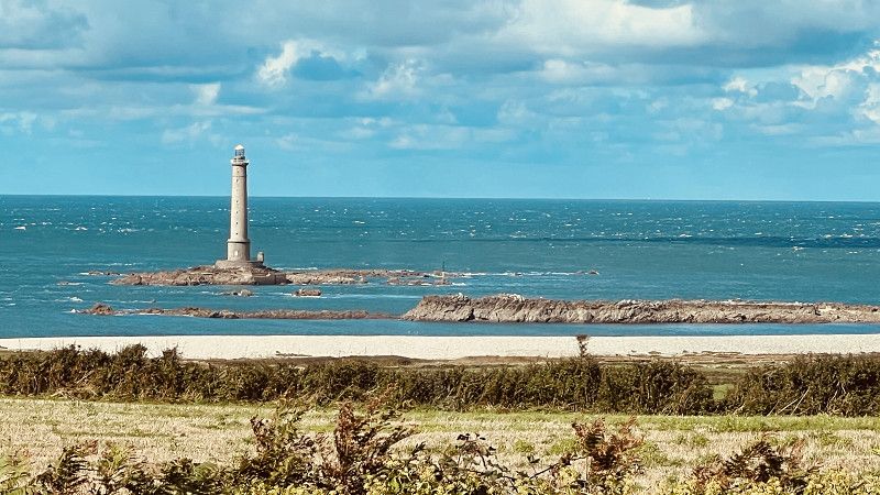
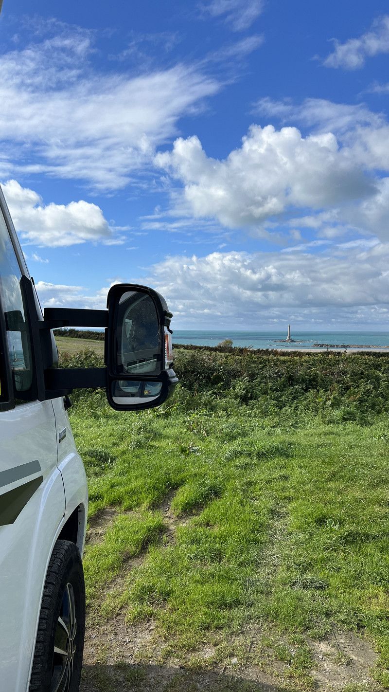
Cap de la Hague
Finistere Normand. The end of the world.
Designated sites for motorhomes just before Goury. There are coastal footpaths and you can drive along the Route de Caps.
The video will be available shortly. https://youtu.be/K3iua97KulU
Frankreich
49° 43' 34" N 1° 56' 32.3" W
49.7261210 -1.9423110
• Head south on D401. Go for 1.5 km.
• Turn left onto Rue de la Fouedre (D901). Go for 168 m.
• Continue on Rue du Presbytère (D901). Go for 119 m.
• Continue on Rue de l'Église Saint-Gilles (D901). Go for 336 m.
• Continue on Rue de la Croix (D901). Go for 307 m.
• Continue on D901. Go for 2.5 km.
• Continue on Rue de l'Église de Jobourg (D901). Go for 1.1 km.
• Take the 2nd exit from roundabout onto D901. Go for 4.6 km.
• Take the 2nd exit from roundabout onto D901. Go for 2.5 km.
• Take ramp toward D901 E/Gréville-H. Go for 185 m.
• Turn left onto D237. Go for 196 m.
• Take the 1st exit from roundabout onto D237. Go for 1.7 km.
• Turn right onto D45. Go for 372 m.
• Continue on Route de la Pointe (D45). Go for 443 m.
• Continue on Route des Falaises (D45). Go for 511 m.
• Continue on D45. Go for 162 m.
• Continue on Lieu-dit Bienvenu (D45). Go for 771 m.
• Continue on Lieu-dit La Quiesce (D45). Go for 354 m.
• Continue on D45. Go for 565 m.
• Continue on Lieu-dit Landemer-Gréville-Hague (D45). Go for 130 m.
• Continue on D45. Go for 963 m.
• Continue on Rue des Douanes (D45). Go for 63 m.
• Continue on D45. Go for 276 m.
• Continue on Lieu-dit Manoir de Dur Écu (D45). Go for 166 m.
• Continue on D45. Go for 156 m.
• Continue on Rue Saint-Martin (D45). Go for 855 m.
• Continue on Rue Saint-Laurent (D45). Go for 864 m.
• Take the 2nd exit from roundabout onto Rue Saint-Laurent (D45). Go for 315 m.
• Continue on Lieu-dit Le Manoir-Urville-Nacqueville (D45). Go for 102 m.
• Continue on Lieu-dit La Housserie (D45). Go for 667 m.
• Continue on D45. Go for 7 m.
• Continue on Lieu-dit La Rivière (D45). Go for 507 m.
• Continue on D45. Go for 334 m.
• Continue on Boulevard de la Hague (D45). Go for 1.5 km.
• Continue on Rue René Fouquet (D45). Go for 512 m.
• Take the 3rd exit from roundabout onto Boulevard de la Mer. Go for 1.2 km.
• Take the 4th exit from Rond-Point de Capel roundabout onto Boulevard de la Saline. Go for 2.4 km.
• Keep left onto Boulevard de la Saline. Go for 186 m.
• Continue on Rue de l'Abbaye (D901). Go for 319 m.
• Turn right onto Boulevard Guillaume le Conquérant. Go for 1.2 km.
• Continue on Boulevard Mendès France. Go for 684 m.
• Continue on Avenue Jean François Millet. Go for 97 m.
• Keep right onto Avenue Jean François Millet. Go for 518 m.
• Pass 2 roundabouts and continue on Boulevard de l'Est (N132). Go for 1.8 km.
• Take the 3rd exit from roundabout onto Boulevard de l'Est (N132). Go for 549 m.
• Take the 2nd exit from roundabout onto Boulevard de l'Est (N132). Go for 595 m.
• Keep left onto Boulevard de l'Est (N132) toward Tourlaville/St Pierre-Église/Quettehou/Maupertus. Go for 39 m.
• Take the 2nd exit from Rue de Penesme roundabout onto Boulevard de l'Est (N13) toward E46/E03/St Pierre-Église/Aéroport Maupertus. Go for 1.8 km.
• Take ramp toward Digosville/St Pierre-Église/Aéroport Maupertus. Go for 291 m.
• Take the 1st exit from roundabout onto Rue du Val Canu (D901). Go for 11.7 km.
• Turn right onto Rue du Général de Gaulle (D901). Go for 10.3 km.
• Turn left onto Rue Saint-Thomas Becket (D901). Go for 153 m.
• Turn left onto Rue Varengue. Go for 53 m.
• Arrive at Rue Varengue. Your destination is on the left.
☍
59,7 km
(1 hrs. 1 min.)
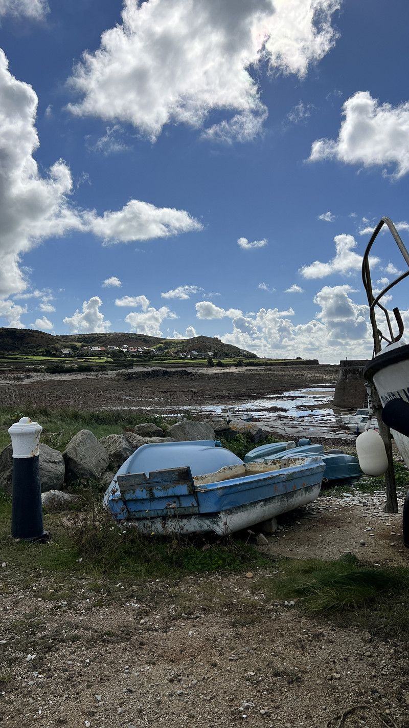
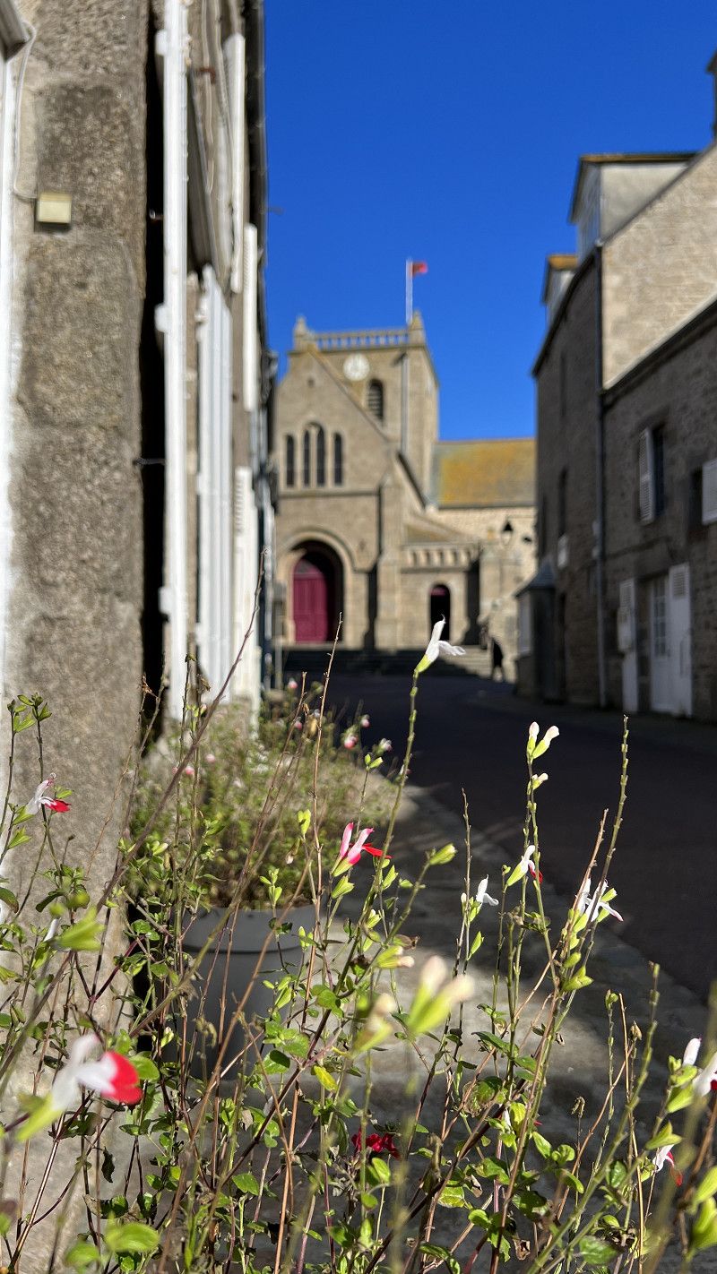
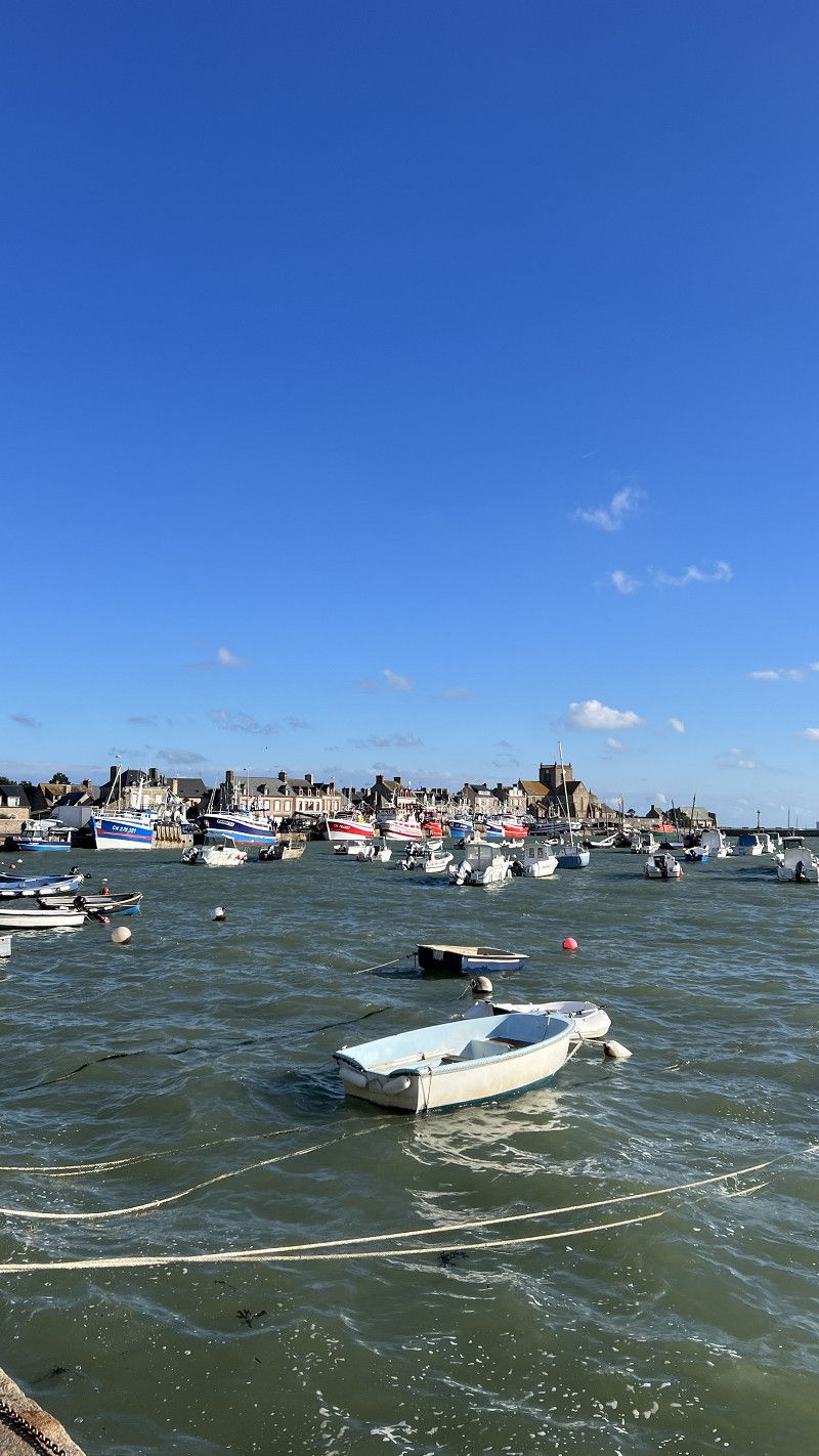
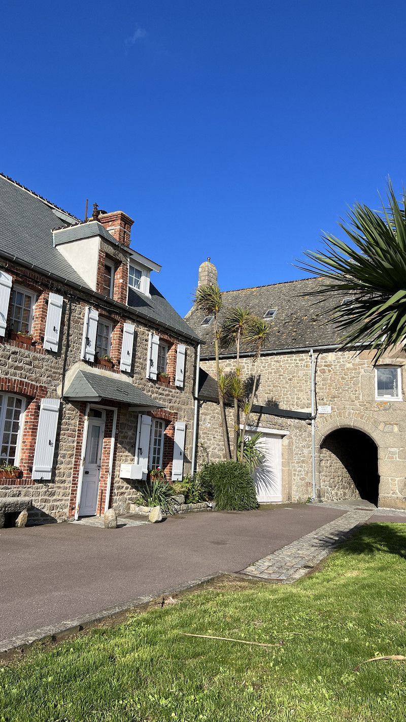
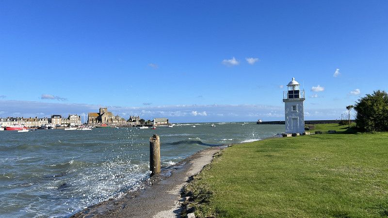
Barfleur
Barfleur is part of the association of the most beautiful villages in France.
The small fishing village is characterized by dark granite houses and an old harbor.
There is a campsite and parking facilities on the outskirts of the village.
Manche, Normandie, Frankreich
49° 40' 14.5" N 1° 15' 51.9" W
49.6706815 -1.2644272