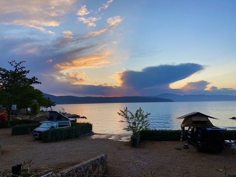
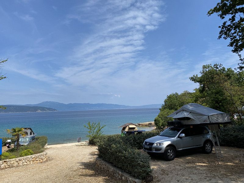
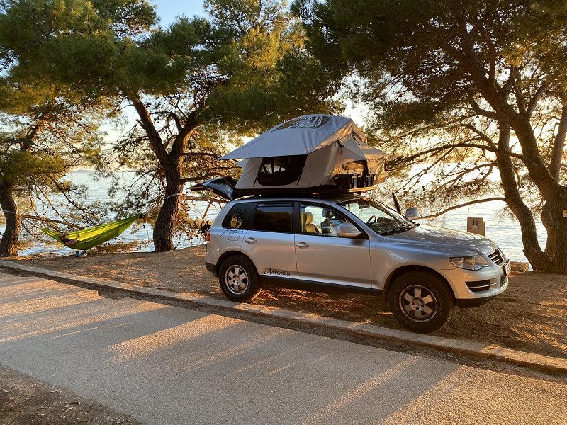
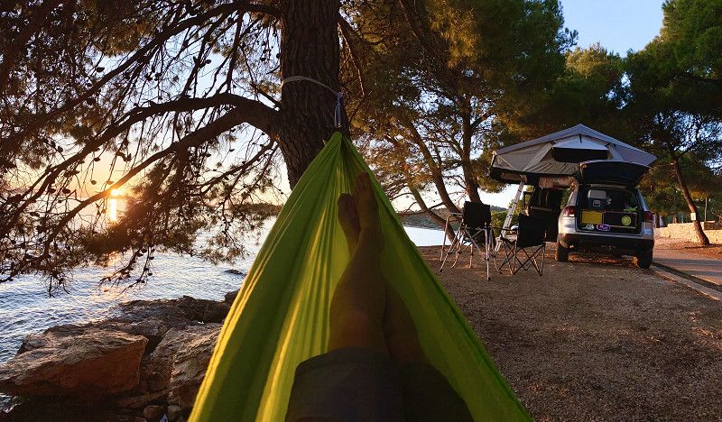
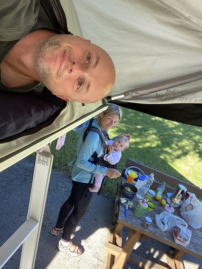
I have taken numerous short trips to Croatia with friends in the past. Whether it was a weekend trip or part of our Southern Europe Rally, Croatia always fascinated us. However, our accommodations have always been hotels or Airbnbs. This time my family and I wanted to explore the Balkan country in a different way. Equipped with a Campwerk roof tent on our modified VW Touareg, we set off on a three-week adventure trip through Croatia.
You can find the complete, more detailed travel guide on my travel blog:
https://www.christian-fiedler-wildlife.de/on-tour/roadtrips/dachzeltreise-mit-der-familie-in-kroatien/
Augsburg
Bayern, Deutschland
48° 22' 0.5" N 10° 53' 55.3" E
48.3668041 10.8986971
• Head toward Apothekergäßchen on Maximilianstraße. Go for 231 m.
• Turn left onto Heilig-Grab-Gasse. Go for 83 m.
• Turn right onto Predigerberg. Go for 144 m.
• Continue on Am Schwall. Go for 188 m.
• Turn left onto Forsterstraße. Go for 67 m.
• Turn right onto Willy-Brandt-Platz. Go for 842 m.
• Continue on Jakobertorplatz toward A8/B2/B17/B300. Go for 78 m.
• Continue on Lechhauser Straße. Go for 749 m.
• Continue on Neuburger Straße. Go for 62 m.
• Turn left onto Schillstraße. Go for 1.1 km.
• Turn right onto Hans-Böckler-Straße (B2). Go for 2.7 km.
• Take ramp onto A8 toward München. Go for 42.9 km.
• Keep right onto A99 (Autobahndreieck München/Eschenried) toward Salzburg/A8/München-Ost/Messe/ICM/Deggendorf/A92/Flughafen M/Nürnberg/A9. Go for 47.2 km.
• Take exit 21 toward Salzburg/Innsbruck onto A8. Go for 117 km.
• Continue on A1 (West Autobahn). Go for 2.1 km.
• Take the exit toward Ljubljana/Villach/Salzburg-Süd onto A10 (Tauern Autobahn). Go for 182 km.
• Continue on A11 (Karawanken Autobahn). Go for 21.7 km.
• Continue on Predor Karavanke (A2). Go for 71.0 km.
• Take exit 36 toward Trst/Trieste/Koper/Postojna/Reka/Rijeka onto A1. Go for 44.3 km.
• Take exit 41 toward Reka/Rijeka/Ilirska Bistrica. Go for 414 m.
• Turn left onto Reška cesta (6). Go for 9.0 km.
• Take the 3rd exit from roundabout onto Postojnska cesta (6). Go for 340 m.
• Turn left onto Snežniška cesta (404) toward Knežak. Go for 1.2 km.
• Continue on 404. Go for 798 m.
• Continue on Parje (404). Go for 1.3 km.
• Continue on Drskovče (404). Go for 897 m.
• Continue on Zagorje (404). Go for 2.4 km.
• Continue on Knežak (404). Go for 3.6 km.
• Continue on Šembije (404). Go for 2.8 km.
• Continue on Topolc (404). Go for 580 m.
• Continue on Podstenje (404). Go for 109 m.
• Continue on Topolc (404). Go for 1.5 km.
• Continue on Šercerjeva cesta (404). Go for 861 m.
• Take the 2nd exit from roundabout onto Šercerjeva cesta (404). Go for 867 m.
• Take the 3rd exit from roundabout onto Gregorčičeva cesta (915) toward Reka/Rijeka. Go for 226 m.
• Continue on Gregorčičeva cesta. Go for 408 m.
• Take the 3rd exit from roundabout onto Bazoviška cesta. Go for 484 m.
• Take the 1st exit from roundabout onto Bazoviška cesta. Go for 230 m.
• Take the 2nd exit from roundabout onto Bazoviška cesta (6) toward Reka/Rijeka/Jelšane. Go for 9.9 km.
• Continue on 202. Go for 256 m.
• Continue on Autocesta Rupa-Rijeka (A7). Go for 28.2 km.
• Keep left onto Orehovica (A7) toward Crikvenica/8/Otok Krk Zračna luka/Rijeka istok. Go for 15.3 km.
• Keep left onto A7 toward Split/Crikvenica/Otok Krk/8/102. Go for 280 m.
• Continue on E65. Go for 589 m.
• Keep right toward Otok Lošinj/Otok Cres/Otok Krk. Go for 20 m.
• Take the 2nd exit from roundabout onto 102. Go for 6.1 km.
• Take the 3rd exit from roundabout onto 102 toward Krk/Cres-Lošinj/Njivice. Go for 11.2 km.
• Pass 2 roundabouts and continue on 102. Go for 3.5 km.
• Turn right onto 104 toward Otok Rab/Otok Lošinj/Otok Cres/Valbiska/Malinska. Go for 3.8 km.
• Continue on Nenadić (104) toward Valbiska/Trajekt/Cres-Lošinj. Go for 414 m.
• Continue on 104. Go for 2.3 km.
• Turn right onto 58086 toward Glavotok/Milohnići. Go for 660 m.
• Continue on Žgaljići (58086). Go for 380 m.
• Continue on 58086. Go for 1.1 km.
• Continue on Linardići (58086). Go for 829 m.
• Turn right onto 58086. Go for 424 m.
• Continue on Milohnići (58086). Go for 150 m.
• Turn left onto Milohnići (58085). Go for 484 m.
• Continue on Brzac (58085). Go for 214 m.
• Turn right onto Brzac. Go for 79 m.
• Turn right onto Brzac. Go for 1.9 km.
• Turn right onto Glavotok. Go for 487 m.
• Turn slightly right onto Glavotok. Go for 107 m.
• Turn left toward Glavotok. Go for 65 m.
• Turn left onto Glavotok. Go for 118 m.
• Arrive at Glavotok. Your destination is on the right.
☍
651,0 km
(7 hrs. 12 min.)
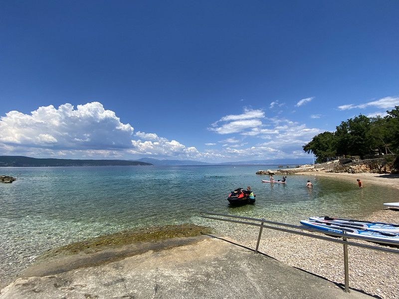
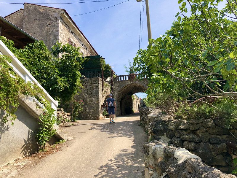
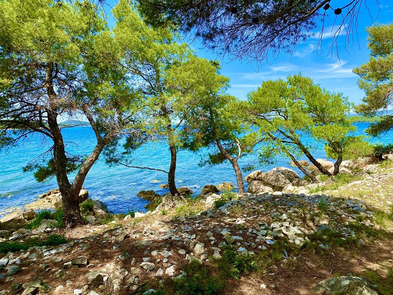
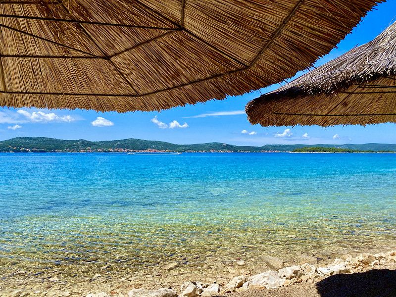
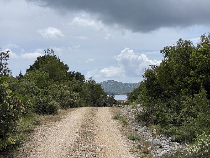
Camping Glavotok - Insel Krk
This campsite is wonderful. Modern and located directly by the sea. Here you can spend a few wonderful days by the sea. No matter whether you are traveling with a roof tent or a motorhome, there are many beautiful pitches here with a view of the sea. A few hikes along the sea or to neighboring towns can be started from here.
Glavotok 4, 51500, Krk, Croatia
45° 5' 43.1" N 14° 26' 27.6" E
45.0953165 14.4409899
• Head west on Glavotok. Go for 596 m.
• Turn left toward Brzac. Go for 1.4 km.
• Continue on Brzac. Go for 558 m.
• Turn slightly right onto Brzac. Go for 35 m.
• Turn left onto Brzac. Go for 79 m.
• Turn left onto Brzac (58085). Go for 214 m.
• Continue on Milohnići (58085). Go for 476 m.
• Arrive at Milohnići (58085). Your destination is on the right.
☍
3,3 km
( 8 min.)
Day
Wanderung am Meer entlang
From the campsite there is a hiking trail to the right along the sea. Here you come along wonderful bathing bays. You can easily combine the tour with a visit to the Konoba pud Brest restaurant in Milohnići.
Day
Milohnići
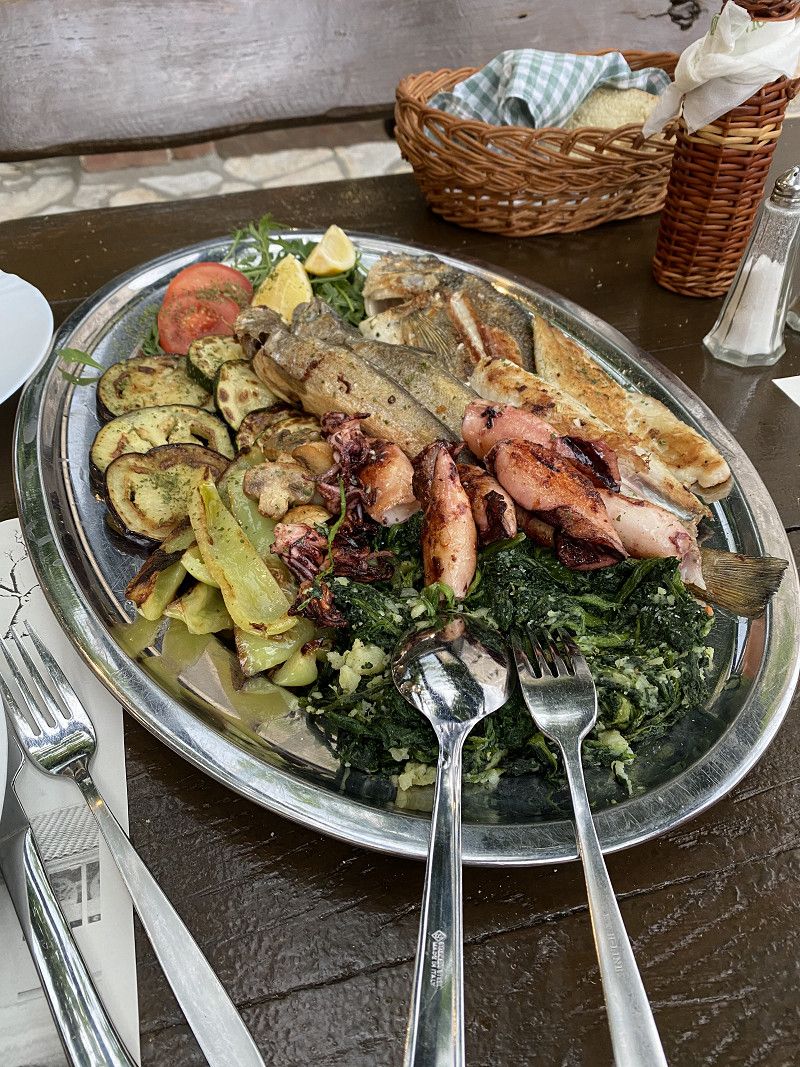
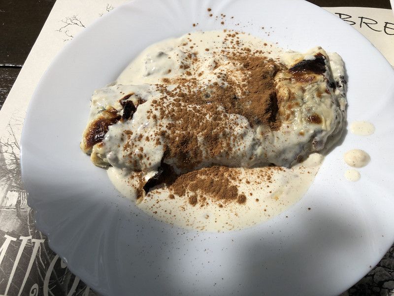
There is a delicious Croatian restaurant “Konoba pud Brest” in town. We can highly recommend this. :-)
58085, Milohnići, Gespanschaft Küstenland-Bergland, Kroatien
45° 4' 49.3" N 14° 27' 26.4" E
45.0803477 14.4573334
• Head east on Milohnići (58085). Go for 8 m.
• Turn right onto Milohnići (58086). Go for 150 m.
• Continue on 58086. Go for 424 m.
• Turn left onto Linardići (58086). Go for 829 m.
• Continue on 58086. Go for 1.1 km.
• Continue on Žgaljići (58086). Go for 380 m.
• Continue on 58086. Go for 656 m.
• Turn left onto 104. Go for 2.3 km.
• Continue on Nenadić (104). Go for 414 m.
• Continue on 104 toward Rijeka/Malinska. Go for 3.8 km.
• Turn left onto 102 toward Rijeka/Omišalj. Go for 2.0 km.
• Pass 3 roundabouts and continue on 102. Go for 18.6 km.
• Take ramp onto 8 toward Split/Crikvenica. Go for 22.0 km.
• Pass 2 roundabouts and continue on Stara cesta (8). Go for 22.2 km.
• Turn left onto Stara cesta (23). Go for 23.4 km.
• Turn left onto Žuta lokva (23) toward Zagreb/Split/Brinje. Go for 305 m.
• Turn right and take ramp toward Zagreb/Split. Go for 1.4 km.
• Continue on Čvor Žuta lokva. Go for 767 m.
• Take the left exit toward Split/Gospić onto A1 (Autocesta Bosiljevo-Split-Dubrov.). Go for 185 km.
• Take exit 22 toward N.P. Krka/Skradin/56/Plastovo/Pamučari. Go for 4.4 km.
• Continue on Pamučari. Go for 2.5 km.
• Continue on 6074 toward N.P. KRKA/Roški Slap/Ićevo/Rupe. Go for 448 m.
• Continue on Dobrote-Vulinovići (6074). Go for 684 m.
• Take the 1st exit from roundabout onto Dobrote-Vulinovići toward NP Krka/RZ Kosa/Ićevo. Go for 2.3 km.
• Continue on Ićevo. Go for 128 m.
• Continue on Ićevo. Go for 224 m.
• Continue on Dujići. Go for 798 m.
• Continue on Silovi I toward Roški Slap/Manastir Krka/Laškovica. Go for 261 m.
• Continue on Kakavice. Go for 155 m.
• Continue on Tepići. Go for 861 m.
• Turn right onto 6246 toward Roški slap/Drniš. Go for 1.3 km.
• Turn left onto Barišići toward Verovići. Go for 1.2 km.
• Keep right onto Barišići. Go for 633 m.
• Continue on Verovići. Go for 596 m.
• Arrive at Verovići.
☍
302,0 km
(3 hrs. 44 min.)
Day
Day
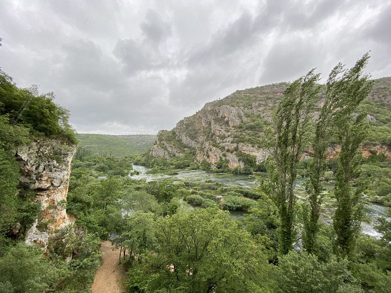
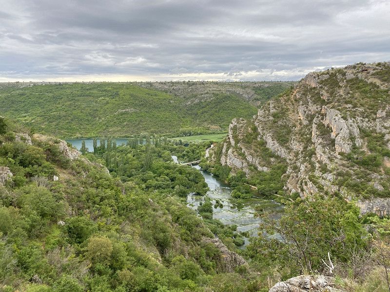
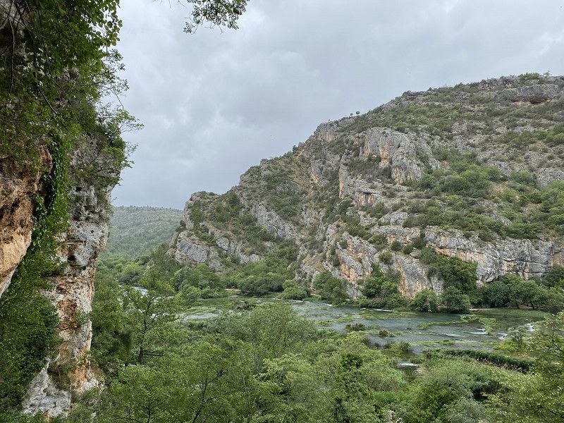
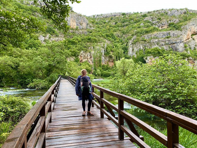
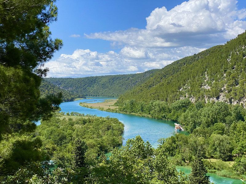
Nationalpark Krka
Kroatien
43° 55' 8.1" N 15° 58' 47.9" E
43.9189188 15.9799689
• Head north on Verovići. Go for 596 m.
• Continue on Barišići. Go for 1.9 km.
• Turn left onto 6246. Go for 2.5 km.
• Continue on Roški Slap (6246). Go for 204 m.
• Continue on 6246. Go for 206 m.
• Continue on Roški Slap (6246). Go for 247 m.
• Turn right onto Roški Slap. Go for 14 m.
• Arrive at Roški Slap.
☍
5,6 km
( 10 min.)
Day
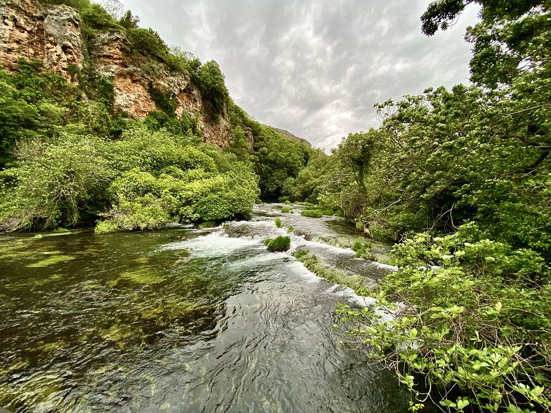
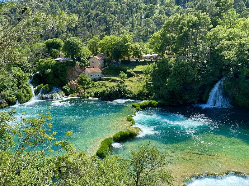
Kaskaden Roški slap
Beautiful cascades Roški slap.
Kroatien
43° 54' 13.5" N 15° 58' 30.2" E
43.9037450 15.9750672
• Head northeast on Roški Slap. Go for 14 m.
• Turn sharp right onto Roški Slap (6246). Go for 27 m.
• Continue on 6246. Go for 4.2 km.
• Turn left toward Miljevački Bogatići. Go for 2.3 km.
• Continue on Kod škole. Go for 161 m.
• Turn left. Go for 639 m.
• Turn left. Go for 776 m.
• Arrive at your destination on the left.
☍
8,1 km
( 14 min.)
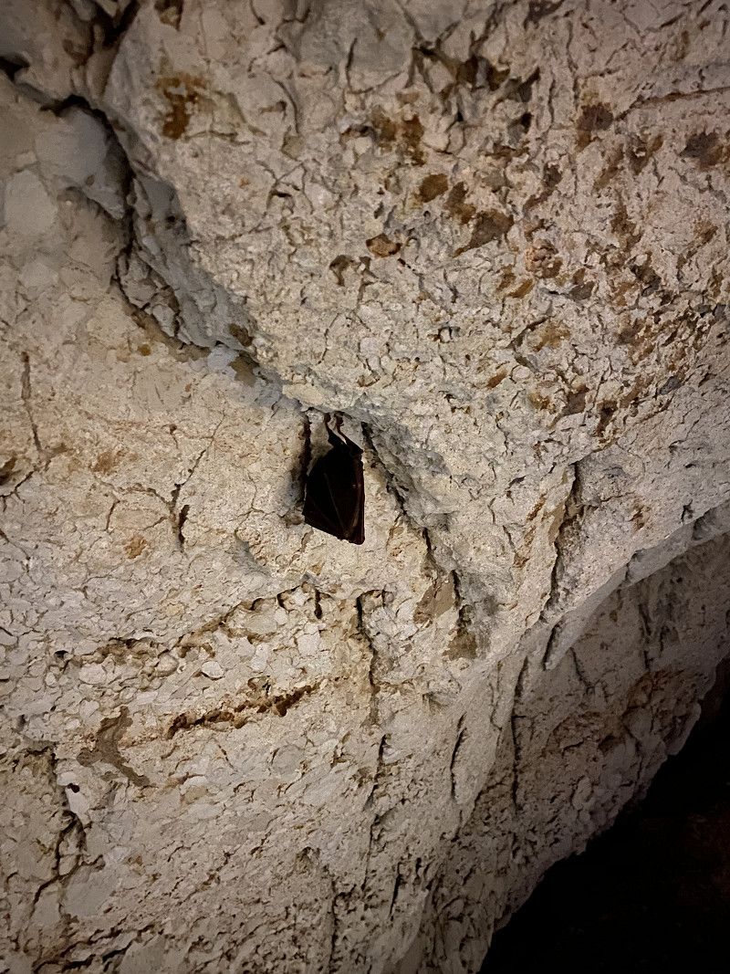
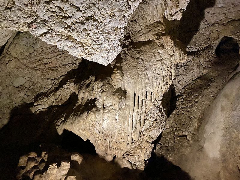
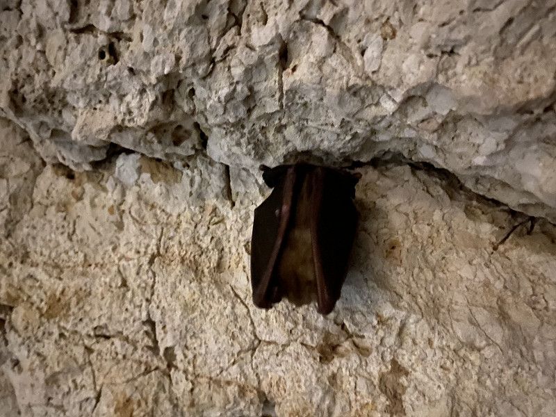
Fledermaushöhle Oziđana pećina
A visit to the bat cave is absolutely worth it. But it only works with leadership.
Niz ploču, Bogatić, Gespanschaft Šibenik-Knin, Kroatien
43° 54' 27.7" N 15° 58' 50" E
43.9076872 15.9805548
• Head southeast. Go for 1.4 km.
• Turn right onto Kod škole. Go for 161 m.
• Continue toward 6246. Go for 2.3 km.
• Turn right onto 6246. Go for 4.2 km.
• Continue on Roški Slap (6246). Go for 274 m.
• Continue on 6246. Go for 206 m.
• Continue on Roški Slap (6246). Go for 204 m.
• Continue on 6246. Go for 3.8 km.
• Turn left toward Zagreb/A1/Split/Skradin/Ićevo. Go for 690 m.
• Continue on Tepići. Go for 171 m.
• Continue on Kakavice. Go for 199 m.
• Continue on Silovi I. Go for 729 m.
• Continue on Dujići. Go for 2.8 km.
• Continue on Dobrote-Vulinovići toward Šibenik/Skradin/A1. Go for 182 m.
• Take the 3rd exit from roundabout onto Dobrote-Vulinovići (6074) toward Skradin/A1/Šibenik. Go for 736 m.
• Continue on 6074. Go for 448 m.
• Turn right toward Plastovo. Go for 2.0 km.
• Continue on Pamučari. Go for 3.0 km.
• Turn left onto 56 toward Skradin/N.P. Krka. Go for 3.5 km.
• Turn right onto Aleja Skrad. Svilara. Go for 67 m.
• Turn right toward Šibenska ulica. Go for 40 m.
• Turn left onto Šibenska ulica. Go for 34 m.
• Turn right onto Ulica biskupa A. Becića. Go for 28 m.
• Arrive at Ulica biskupa A. Becića. Your destination is on the right.
☍
27,2 km
( 34 min.)
Day
Day
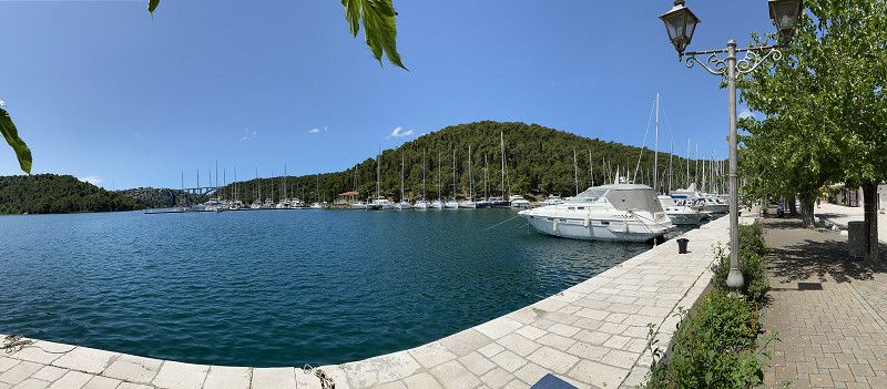
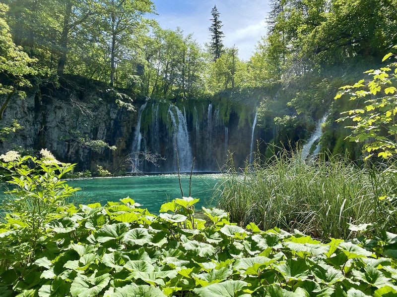
Grad Skradin
From Skradin there are boat tours to the Skradinski Buk waterfalls in the Krka National Park. The boat trip and the waterfalls are absolutely worth seeing and at least as beautiful as the Plitvice Lakes.
Trg Male Gospe, Grad Skradin, Gespanschaft Šibenik-Knin, Kroatien
43° 49' 3.5" N 15° 55' 24.4" E
43.8176481 15.9234494
• Head northwest on Ulica biskupa A. Becića. Go for 29 m.
• Turn slightly right onto Trg Male Gospe. Go for 37 m.
• Continue on Ulica fra Luje Maruna. Go for 31 m.
• Turn right onto Ulica dr. Grge Vatavuka. Go for 99 m.
• Turn right onto Aleja Skrad. Svilara (56). Go for 7.8 km.
• Turn sharp left onto 6090 toward NP Krka/Lozovac. Go for 1.0 km.
• Continue on Lozovac (6090). Go for 451 m.
• Turn slightly left onto 6090. Go for 2.8 km.
• Continue on Slapovi Krke (6090). Go for 309 m.
• Arrive at Slapovi Krke (6090). Your destination is on the right.
☍
12,6 km
( 17 min.)
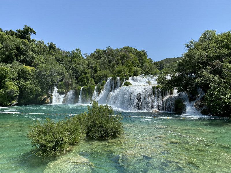
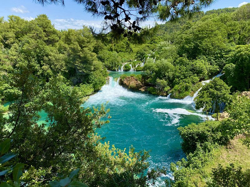
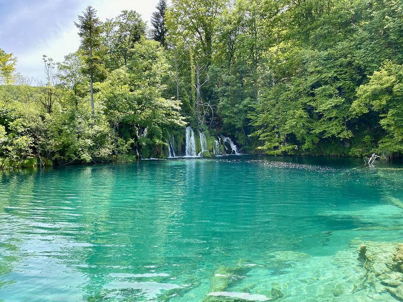
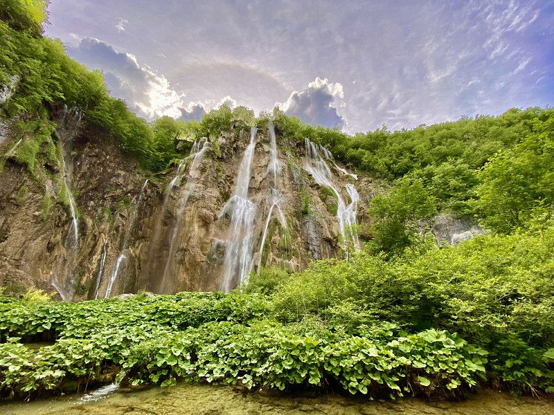
Wasserfälle Skradinski Buk
You have to see the waterfalls and the turquoise water. Especially at the beginning of June, in the off-season, when there isn't a lot going on but nature is already wonderfully green again.
Gespanschaft Šibenik-Knin, Kroatien
43° 48' 6.7" N 15° 57' 53.7" E
43.8018526 15.9649258
• Head southeast on Slapovi Krke (6090). Go for 309 m.
• Continue on 6090. Go for 2.8 km.
• Turn slightly right onto Lozovac (6090). Go for 451 m.
• Continue on 6090. Go for 1.0 km.
• Turn left onto Gulini (56). Go for 598 m.
• Turn right onto Tromilja (33) toward Šibenik/A1. Go for 1.4 km.
• Turn right onto 33. Go for 3.4 km.
• Continue on Lugovići-Slavice (33). Go for 321 m.
• Continue on Lugovići (33). Go for 131 m.
• Continue on 33. Go for 1.4 km.
• Continue on Novo naselje (33) toward Šibenik. Go for 268 m.
• Continue on 33. Go for 60 m.
• Continue on Ulica 113. šibenske brigade HV-A (33). Go for 2.0 km.
• Keep left onto Ulica 113. šibenske brigade HV-A (33) toward Split/Zadar. Go for 24 m.
• Take the 2nd exit from roundabout toward Zadar. Go for 113 m.
• Take ramp onto Ulica spec. jedinice policije Jastrebovi (8). Go for 11.0 km.
• Continue on 8 toward Zagreb/Zadar. Go for 7.0 km.
• Take the 3rd exit from roundabout onto 121 toward Murter. Go for 5.2 km.
• Continue on Ulica Stjepana Radića (121). Go for 445 m.
• Continue on Istočna Gomilica (121). Go for 312 m.
• Continue on 121. Go for 58 m.
• Continue on Trg dr. Šime Vlašića (121). Go for 17 m.
• Turn right onto Put Brošćice (121). Go for 709 m.
• Continue on 121. Go for 4.4 km.
• Turn left onto 121. Go for 647 m.
• Continue on Put Čigrađe (121). Go for 770 m.
• Continue on Ulica podvrtaje (121). Go for 648 m.
• Turn left onto Put Slanice. Go for 1.0 km.
• Turn left onto Podvrške. Go for 321 m.
• Arrive at Podvrške. Your destination is on the right.
☍
46,8 km
( 49 min.)
Day
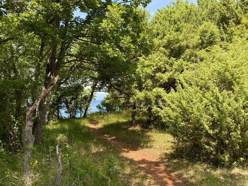
Insel Murter
The island of Murter also has its own charm.
Day
Camping Slanica / Insel Murter
Simple but nice campsite with places by the sea.
Jurja Dalmatinca 17, 22243, Murter, Kroatien
43° 49' 0.9" N 15° 34' 36.7" E
43.8169200 15.5768700
• Head toward Put Slanice on Podvrške. Go for 321 m.
• Turn right onto Put Slanice. Go for 258 m.
• Keep right onto Put Slanice. Go for 750 m.
• Turn right onto Ulica podvrtaje (121). Go for 648 m.
• Continue on Put Čigrađe (121). Go for 770 m.
• Continue on 121. Go for 5.1 km.
• Continue on Put Brošćice (121). Go for 709 m.
• Turn left onto Trg dr. Šime Vlašića (121). Go for 17 m.
• Continue on 121. Go for 58 m.
• Continue on Istočna Gomilica (121) toward Zagreb/Split/Zadar/Šibenik. Go for 312 m.
• Continue on Ulica Stjepana Radića (121). Go for 445 m.
• Continue on 121. Go for 3.1 km.
• Turn left onto 121. Go for 2.1 km.
• Take the 2nd exit from roundabout onto 59 toward Putičanje. Go for 59 m.
• Continue on Kapela (59). Go for 103 m.
• Continue on 59. Go for 924 m.
• Continue on Splitska (59). Go for 315 m.
• Continue on Strunje (59). Go for 358 m.
• Continue on 59. Go for 2.2 km.
• Continue on Matešići (59). Go for 723 m.
• Continue on 59. Go for 1.9 km.
• Continue on Putičanje (59). Go for 972 m.
• Continue on 59. Go for 742 m.
• Take the 2nd exit from roundabout onto 59. Go for 4.7 km.
• Turn left toward Zagreb/Split. Go for 552 m.
• Take ramp onto A1 (Autocesta Bosiljevo-Split-Dubrov.) toward Split/Šibenik. Go for 77.9 km.
• Take exit 28 toward Split/Dugopolje. Go for 1.1 km.
• Take the 1st exit from roundabout onto 1 toward Split/Solin. Go for 12.2 km.
• Take the 2nd exit from roundabout onto Mestine II (8) toward Dubrovnik/Split. Go for 1.2 km.
• Take ramp onto Ulica Domovinskog rata toward Split. Go for 3.5 km.
• Turn right onto Ulica Ivana Gundulića. Go for 260 m.
• Turn left onto Ulica Dujma Mikačića. Go for 114 m.
• Continue on Slavićeva ulica. Go for 25 m.
• Continue on Ulica Dujma Mikačića. Go for 44 m.
• Turn right onto Bihaćka ulica. Go for 64 m.
• Turn left onto Ćirilometodska ulica. Go for 166 m.
• Turn slightly right onto Slavićeva ulica. Go for 24 m.
• Arrive at Slavićeva ulica. Your destination is on the left.
☍
124,8 km
(1 hrs. 24 min.)
Day
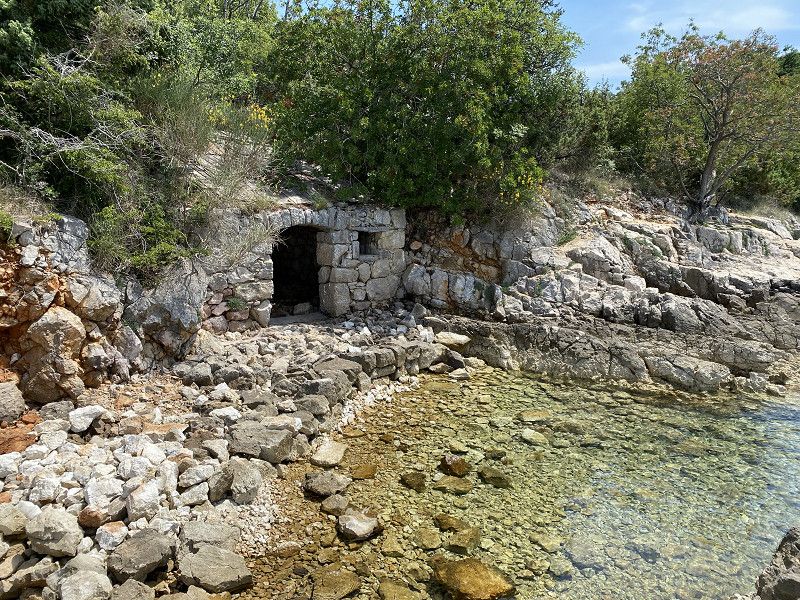
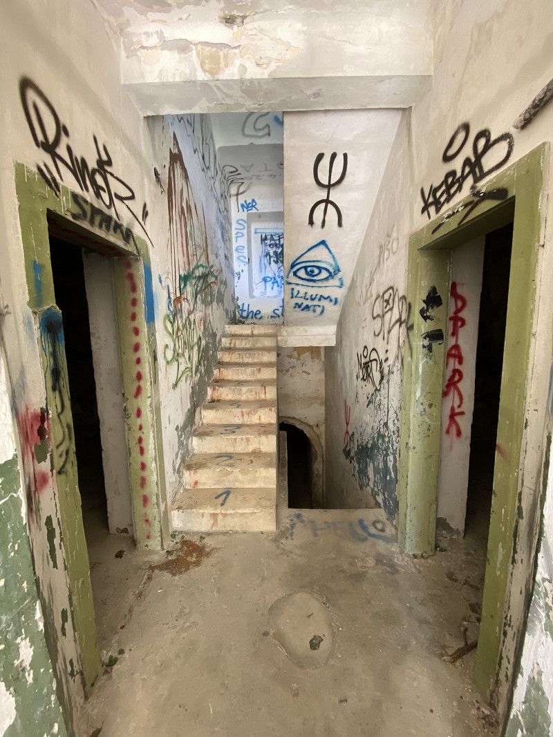
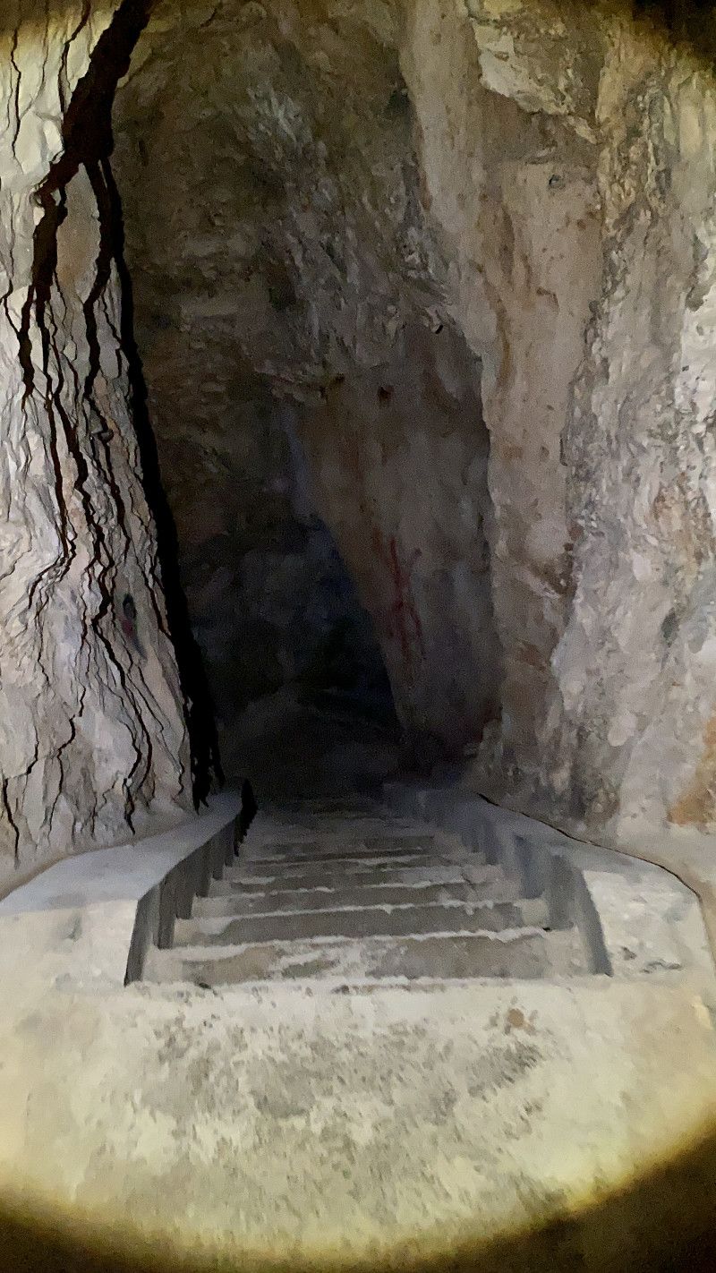
Besuch eines Bunkers aus dem 2. Weltkrieg
There is an interesting lost place on the island of Murter. A walk-in bunker with old gun installations. From the campsite you can hike or cycle directly there. You can find more information and the link on my blog.
https://www.christian-fiedler-wildlife.de/on-tour/roadtrips/dachzeltreise-mit-der-familie-in-kroatien/
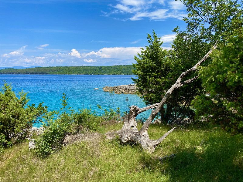
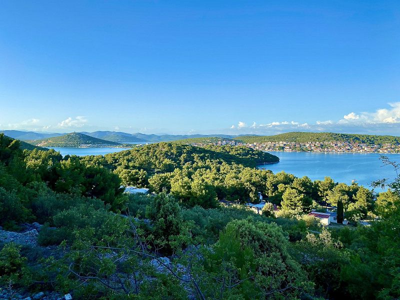
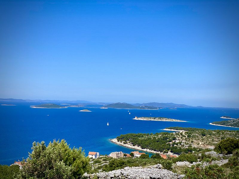
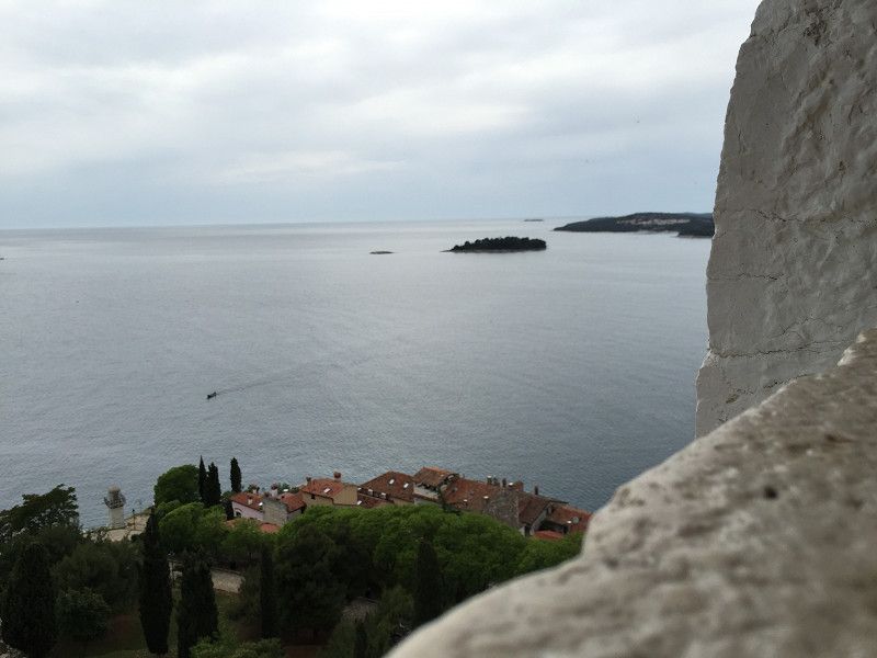
Blick auf die Inseln des Kornati Nationalparks
Day
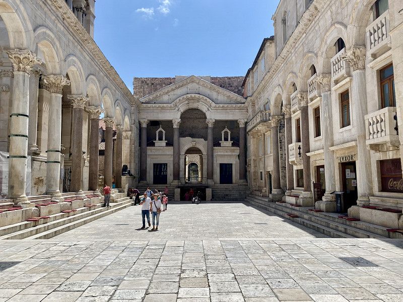
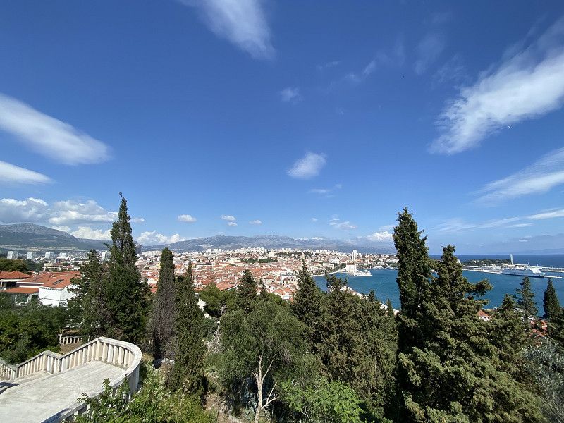
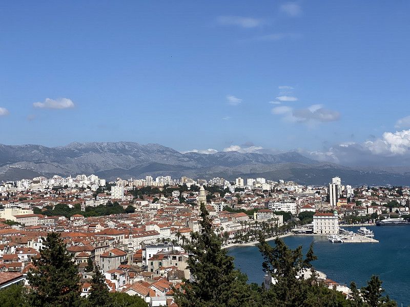
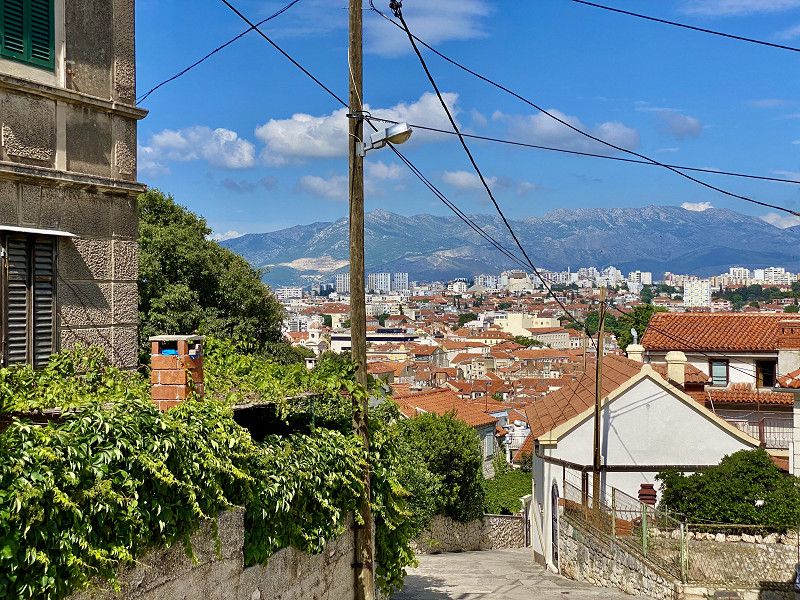
Split
Our day trip to the city of Split. Split really has a special flair. Split manages the balancing act of modern and ancient cityscape. You can find more information on my blog.
https://www.christian-fiedler-wildlife.de/on-tour/roadtrips/dachzeltreise-mit-der-familie-in-kroatien/
Slavićeva ulica, Split, Gespanschaft Split-Dalmatien, Kroatien
43° 30' 42" N 16° 26' 24.4" E
43.5116732 16.4401059
• Head toward Ulica Dujma Mikačića on Slavićeva ulica. Go for 29 m.
• Continue on Ćirilometodska ulica. Go for 161 m.
• Turn right onto Bihaćka ulica. Go for 235 m.
• Turn left onto Ulica Domovinskog rata. Go for 3.6 km.
• Turn left and take ramp onto Smokovik II (8) toward Zagreb/Rijeka/Sinj/Solin. Go for 996 m.
• Take ramp toward Sinj/A1/Zagreb/Rijeka. Go for 268 m.
• Take the 1st exit from roundabout onto 1 toward Zagreb/A1/Rijeka/Sinj/Dubrovnik. Go for 11.9 km.
• Take ramp toward Rijeka/Zagreb/Dugopolje/R. Z. Podi. Go for 257 m.
• Take the 3rd exit from roundabout toward Zagreb/Rijeka/A1. Go for 456 m.
• Take ramp onto A1 (Autocesta Bosiljevo-Split-Dubrov.) toward Zagreb/Šibenik. Go for 101 km.
• Take exit 20 toward Pakoštane/Biograd/Benkovac. Go for 1.1 km.
• Turn right onto 503 toward Biograd/Benkovac. Go for 1.6 km.
• Turn left onto 503 toward Biograd. Go for 15.5 km.
• Turn left onto Ulica Ljudevita Gaja. Go for 342 m.
• Continue on Ulica Ivana Gundulića. Go for 27 m.
• Turn right onto Ulica Ivane Brlić Mažuranić. Go for 57 m.
• Turn left onto Ulica Augusta Šenoe. Go for 737 m.
• Continue on Put Kumenta. Go for 292 m.
• Turn right onto Put Kumenta. Go for 332 m.
• Arrive at Put Kumenta. Your destination is on the right.
☍
138,6 km
(1 hrs. 28 min.)
Day
Camping PARK SOLINE
First row camping at Camping Park Soline. Even if the place is not the cheapest, it is still nice. Strolling by the sea in the morning or evening is particularly wonderful. From here you can also take a few long walks to Biograd na Moru.
Put Kumenta 16, 23210, Biograd Na Moru, Kroatien
43° 55' 39.6" N 15° 27' 21.7" E
43.9276687 15.4560180
• Head toward Ulica Grubišnog Polja on Put Kumenta. Go for 332 m.
• Turn left onto Put Kumenta. Go for 94 m.
• Turn right onto Učka ulica. Go for 244 m.
• Continue on Kalnička ulica. Go for 281 m.
• Turn left onto Put Grande. Go for 28 m.
• Turn right onto Biokovska ulica. Go for 306 m.
• Turn right onto Put Poškaljine. Go for 52 m.
• Turn left onto Kumenat. Go for 380 m.
• Turn right onto Magistralna ulica (8). Go for 8.4 km.
• Turn left onto Ulica Josipa Jovića. Go for 315 m.
• Turn slightly left. Go for 558 m.
• Turn right toward Put jezera. Go for 388 m.
• Turn left onto Put jezera. Go for 460 m.
• Arrive at Put jezera.
☍
11,8 km
( 15 min.)
Day
Naturpark Vraner-See
From the campsite you can either walk or bike to Lake Vran.
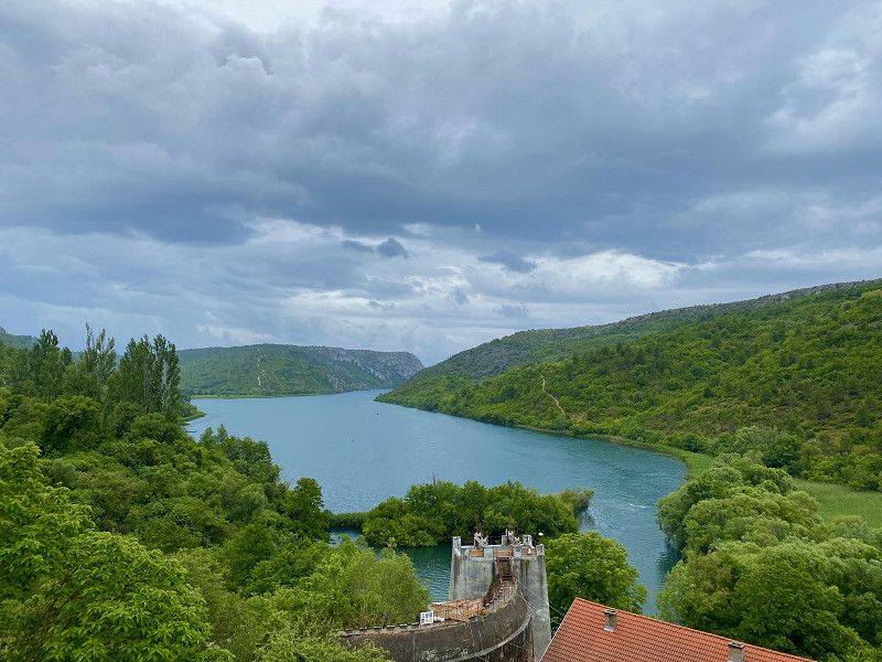
On July 21, 1999, the Vran Lake Nature Park, also known as Lake Vrana (Croatian Park prirode Vransko jezero, Italian Lago di Vrana), was declared a protected area in Croatia. It stretches in Dalmatia between the cities of Zadar and Šibenik and is home to Croatia's largest lake, Lake Vran. The total area of the nature park is 57 km², with the lake itself taking up the largest part of the area (30.2 km²).
Kroatien
43° 53' 41.5" N 15° 34' 21.9" E
43.8948673 15.5727445
• Head southwest on Put jezera. Go for 460 m.
• Turn right. Go for 388 m.
• Turn left toward Ulica Josipa Jovića. Go for 558 m.
• Turn slightly right onto Ulica Josipa Jovića. Go for 315 m.
• Turn right onto 8. Go for 3.9 km.
• Take ramp toward Pakoštane/Vrana. Go for 135 m.
• Turn left toward Marina. Go for 6.1 km.
• Turn right onto Marina toward Benkovac. Go for 736 m.
• Turn left onto Međuvode toward Benkovac. Go for 4.0 km.
• Continue on Miranje Donje. Go for 2.2 km.
• Continue on Miranje Gornje. Go for 448 m.
• Turn left onto Miranje Gornje (27). Go for 1.1 km.
• Turn right and take ramp onto A1 (Autocesta Bosiljevo-Split-Dubrov.) toward Zagreb. Go for 75.4 km.
• Take exit 14 toward Korenica/1/Udbina onto 522. Go for 14.8 km.
• Continue on 1. Go for 30.5 km.
• Take the 2nd exit from roundabout onto Trg svetog Jurja (1) toward Zagreb/Plitvička jezera. Go for 2.8 km.
• Turn left onto Vrelo (52) toward Senj/Otočac. Go for 17.8 km.
• Turn right toward Plitvički Ljeskovac. Go for 2.7 km.
• Continue on Plitvički Ljeskovac. Go for 3.3 km.
• Turn left onto Plitvički Ljeskovac. Go for 2.5 km.
• Arrive at your destination on the left.
☍
170,3 km
(2 hrs. 11 min.)
Day
Day
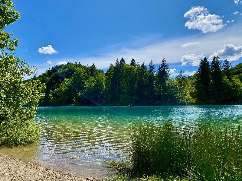
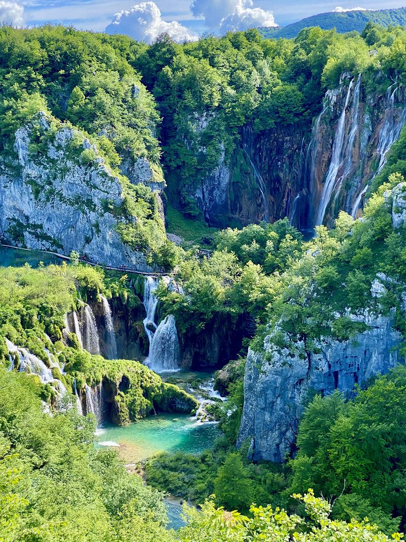
Nationalpark Plitwitzer Seen
A must-see for anyone planning to visit Croatia is Plitvice Lakes, another natural gem. As one of the most popular tourist destinations in the country, they attract thousands of visitors every year. The national park consists of 16 lakes that are connected by a magical forest landscape.
Kroatien
44° 51' 8.3" N 15° 35' 25.3" E
44.8523013 15.5903490
• Head east. Go for 2.0 km.
• Continue on Plitvički Ljeskovac. Go for 481 m.
• Turn left onto Plitvički Ljeskovac. Go for 404 m.
• Continue on Plitvički Ljeskovac. Go for 7.9 km.
• Turn left onto Jezerce (429). Go for 12.6 km.
• Continue on Selište Drežničko (42) toward Zagreb/Bihać. Go for 815 m.
• Turn right. Go for 1.1 km.
• Turn left. Go for 288 m.
• Arrive at your destination.
☍
25,6 km
( 38 min.)
Day
Camping Korana
Unfortunately I don't have any photos of the Korana campsite. We found this place in the middle of nature very beautiful. There are both small plots and the opportunity to settle freely in a suitable and cozy place.
Čatrnja 167, 47245, Rakovica, Kroatien
44° 57' 1.1" N 15° 38' 28.7" E
44.9503100 15.6413000
• Head southeast. Go for 51 m.
• Turn left. Go for 215 m.
• Turn left. Go for 38 m.
• Turn right toward Čatrnja. Go for 44 m.
• Continue on Čatrnja. Go for 46 m.
• Turn left onto Čatrnja. Go for 234 m.
• Turn left onto Čatrnja (34161). Go for 305 m.
• Turn right onto Čatrnja (34161). Go for 130 m.
• Turn right onto Čatrnja (42). Go for 2.0 km.
• Continue on Grabovac (1). Go for 20.5 km.
• Turn left onto Trg dr. Franje Tuđmana (3256) toward Kukača/Primišlje. Go for 127 m.
• Continue on Ulica 14. domobranske pukovnije (3256). Go for 550 m.
• Take the 1st exit from roundabout onto Ogulinska ulica (3256) toward Ogulin. Go for 2.3 km.
• Continue on Zečev varoš (3256). Go for 2.6 km.
• Continue on 3256. Go for 1.7 km.
• Continue on Gornje Primišlje (3256). Go for 3.6 km.
• Continue on 3256. Go for 378 m.
• Continue on Gornje Primišlje (3256). Go for 845 m.
• Continue on 3256. Go for 405 m.
• Continue on Mjesto Primišlje (3256). Go for 2.1 km.
• Continue on 3256. Go for 259 m.
• Continue on Donje Primišlje (3256). Go for 296 m.
• Continue on 3256. Go for 508 m.
• Continue on Donje Primišlje (3256). Go for 2.1 km.
• Continue on 3256. Go for 111 m.
• Continue on Tržić (3256). Go for 3.4 km.
• Continue on 3256. Go for 2.1 km.
• Continue on Kamenica (3256). Go for 2.0 km.
• Continue on 3256. Go for 1.8 km.
• Continue on Kukača (3256). Go for 1.3 km.
• Continue on 3256. Go for 641 m.
• Continue on Kukača (3256). Go for 29 m.
• Turn sharp left onto 23. Go for 2.8 km.
• Turn right onto Skradnik (3255) toward Ogulin/Oštarije. Go for 3.6 km.
• Turn right onto Ravnice (42). Go for 1.6 km.
• Turn right and take ramp toward Zagreb/Split/Rijeka. Go for 696 m.
• Take ramp onto A1 (Autocesta Bosiljevo-Split-Dubrov.) toward Zagreb/Rijeka. Go for 20.9 km.
• Take exit 7 toward Pula/Rijeka onto A6 (Čvor Bosiljevo II). Go for 78.8 km.
• Take middle ramp onto Orehovica (A7) toward Pula/Opatija/Rijeka zapad. Go for 11.9 km.
• Take ramp onto Istarski Ipsilon (A8) toward Pula/Pazin/Opatija. Go for 1.3 km.
• Take the 1st exit from roundabout onto Istarski Ipsilon (A8) toward Pula/Poreč/Pazin. Go for 9.9 km.
• Turn left onto Istarski Ipsilon (A8). Go for 54.5 km.
• Take the 2nd exit from roundabout onto 303 toward Rovinj/Bale. Go for 1.8 km.
• Continue on Kurili (303). Go for 343 m.
• Continue on 303. Go for 2.5 km.
• Continue on Putini (303). Go for 607 m.
• Continue on 303. Go for 5.9 km.
• Continue on Aleja Ruđera Boškovića (303). Go for 482 m.
• Take the 4th exit from roundabout onto Cesta za Rovinjsko Selo (5096) toward Pula/Pola/Bale/5036/Valle/Rovinj jug/Rovigno sud. Go for 328 m.
• Keep right onto Naselje Gripole (5096). Go for 1.5 km.
• Continue on Gripole (5096). Go for 60 m.
• Continue on Ulica štanga (5096). Go for 298 m.
• Take the 3rd exit from roundabout onto Aleja 30. svibnja (5105). Go for 694 m.
• Take the 2nd exit from roundabout onto Aleja 30. svibnja (5105) toward Polari. Go for 375 m.
• Continue on 5105. Go for 993 m.
• Turn right onto Polari. Go for 185 m.
• Continue on Polari. Go for 1.1 km.
• Turn slightly left. Go for 48 m.
• Continue straight ahead. Go for 670 m.
• Turn slightly left toward Cesta sv. Maksimijana iz Veštra. Go for 792 m.
• Continue on Cesta sv. Maksimijana iz Veštra. Go for 220 m.
• Turn right onto Cesta sv. Maksimijana iz Veštra. Go for 48 m.
• Turn left. Go for 12 m.
• Arrive at your destination on the left.
☍
257,7 km
(3 hrs. 22 min.)
Day
Camping Vestar
Veštar b.b., 52210, Rovinj, Kroatien
45° 3' 8.6" N 13° 41' 13.9" E
45.0523930 13.6871980
• Head northeast. Go for 43 m.
• Turn right. Go for 23 m.
• Turn right toward Cesta sv. Maksimijana iz Veštra. Go for 27 m.
• Turn right onto Cesta sv. Maksimijana iz Veštra. Go for 70 m.
• Turn left onto Cesta sv. Maksimijana iz Veštra. Go for 1.7 km.
• Turn slightly right onto Polari. Go for 1.3 km.
• Turn left onto 5105. Go for 993 m.
• Continue on Aleja 30. svibnja (5105). Go for 326 m.
• Take the 2nd exit from roundabout onto Ulica Stjepana Radića toward Centar/Centro. Go for 984 m.
• Continue on Ulica Mattea Benussia. Go for 196 m.
• Turn right onto Vijenac braće Lorenzetto. Go for 116 m.
• Arrive at Vijenac braće Lorenzetto. Your destination is on the right.
☍
5,8 km
( 13 min.)
Day
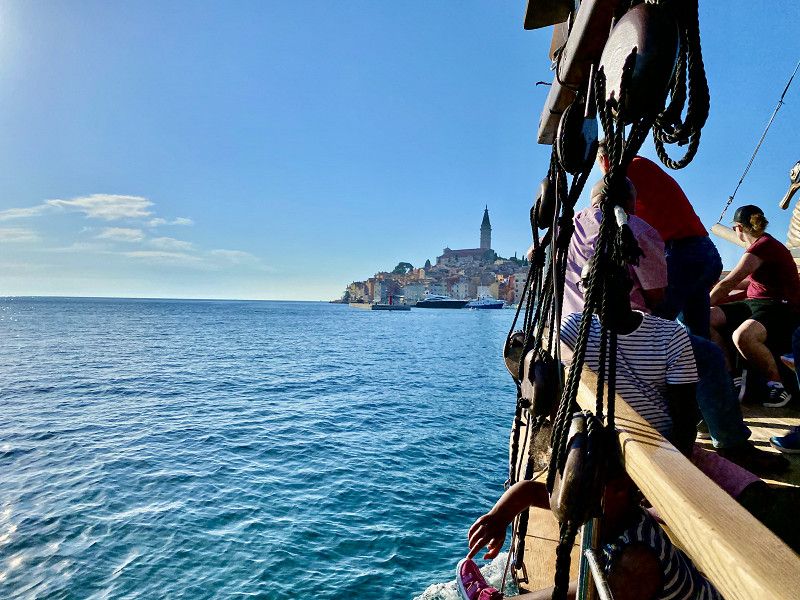
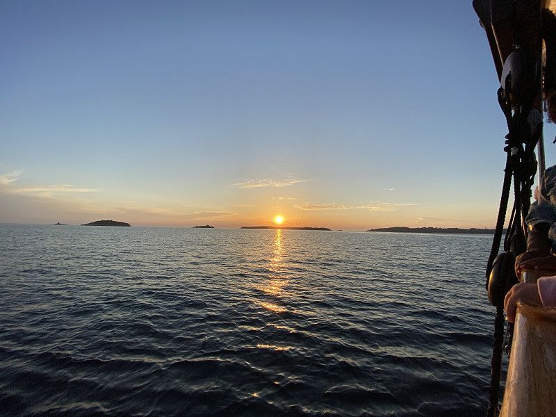
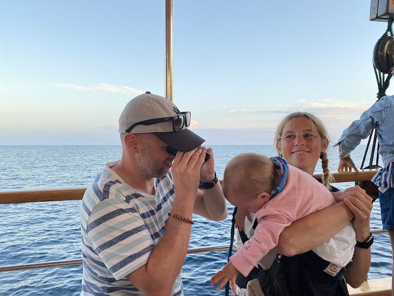
Boottrip in den Sonnenuntergang
Right next to the campsite there is the possibility of taking a boat trip. The tour was beautiful and that's why I recommend it to you. Dinner and soft and alcoholic drinks are also available on the tour.
Day
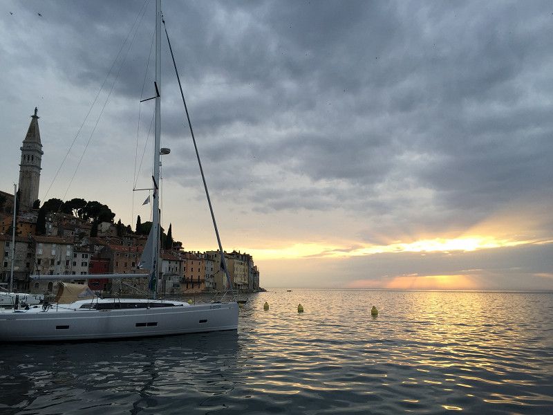
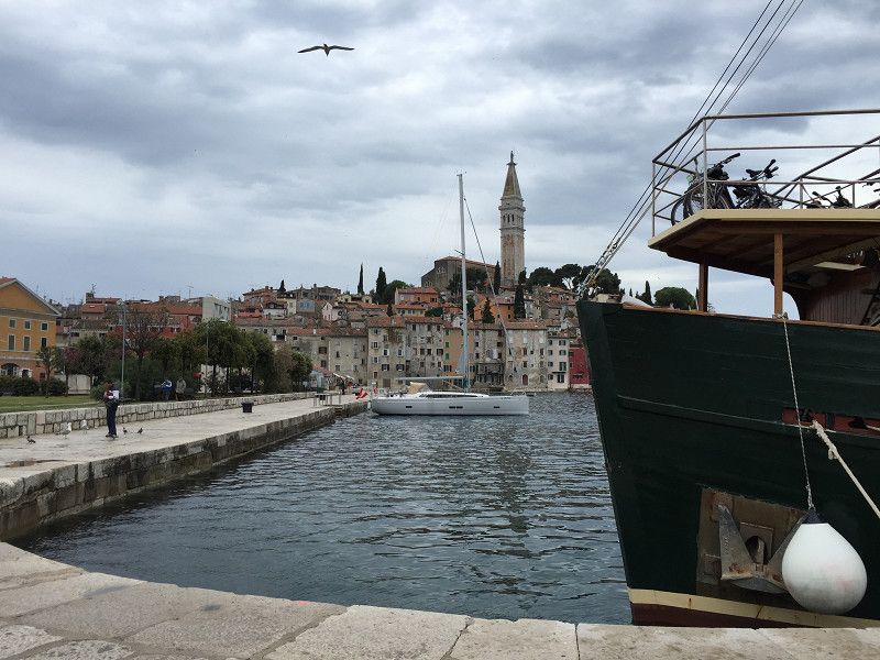
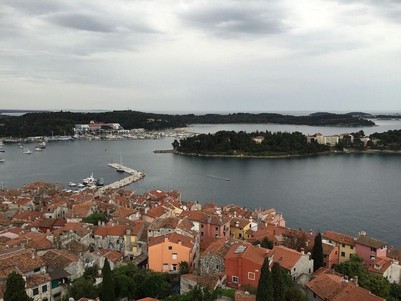
Rovinj
The old town of Rovinj impresses with its breathtaking location on a small peninsula. The narrow, cobbled streets lead through an enchanted labyrinth of historic buildings, small shops and cozy cafés. Strolling along the streets, you can feel the Venetian influence in the architecture, which gives the city its unmistakable character.
You can find more information on my blog:
https://www.christian-fiedler-wildlife.de/on-tour/roadtrips/dachzeltreise-mit-der-familie-in-kroatien/
Istarska ulica 6, Rovinj, Istrien, Kroatien
45° 4' 50.8" N 13° 38' 31" E
45.0807740 13.6419360
• Head toward Ulica 43. istarske divizije on Vijenac braće Lorenzetto. Go for 237 m.
• Turn right onto Vijenac Franje Glavinića. Go for 749 m.
• Take the 1st exit from roundabout onto Aleja Ruđera Boškovića (303) toward Trst/Trieste/Rijeka/Fiume/Pula/Pola. Go for 680 m.
• Pass 2 roundabouts and continue on Aleja Ruđera Boškovića (303). Go for 1.7 km.
• Continue on 303 toward Rijeka/A8/Pula/A9/Pola. Go for 5.9 km.
• Continue on Putini (303). Go for 607 m.
• Continue on 303. Go for 2.5 km.
• Continue on Kurili (303). Go for 343 m.
• Continue on 303. Go for 1.8 km.
• Take the 1st exit from roundabout onto Istarski Ipsilon (303) toward Rijeka/Pula/Poreč. Go for 908 m.
• Take exit 1 toward Umag/Poreč onto A9 (Istarski Ipsilon). Go for 50.8 km.
• Take the 2nd exit from roundabout onto 510 toward Trieste/Koper/Kaštel. Go for 1.8 km.
• Continue on Dragonja (11). Go for 227 m.
• Keep left onto Dragonja (11). Go for 8.3 km.
• Take the 2nd exit from roundabout onto Srgaši (11) toward Ljubljana/Koper. Go for 5.2 km.
• Keep right toward Ljubljana/Trst/Trieste/Center/Centro. Go for 98 m.
• Take the 2nd exit from roundabout onto Šmarska cesta (11) toward Trst/Trieste/Ljubljana/Center. Go for 518 m.
• Turn right onto Šmarska cesta toward Ljubljana/Trst/Trieste. Go for 294 m.
• Take the 2nd exit from roundabout onto Istrska cesta (H5) toward Ljubljana/Trst/Trieste. Go for 3.7 km.
• Continue on A1 toward Ljubljana/Reka/Rijeka/Črni Kal. Go for 93.8 km.
• Take left exit 36 toward Beljak/Villach/Kranj/Ljubljana-sever onto A2. Go for 71.8 km.
• Continue on Karawankentunnel (A11). Go for 21.1 km.
• Continue on A10 (Tauern Autobahn) toward E55/E66/Salzburg/Villach-Ossiacher See. Go for 181 km.
• Take the exit onto A1 (West Autobahn). Go for 3.5 km.
• Continue on A8. Go for 114 km.
• Take exit 95 toward Nürnberg/Stuttgart/Messe/ICM/Flughafen München onto A99. Go for 45.1 km.
• Keep right onto A99 (Autobahndreieck München-Allach) toward Stuttgart/Augsburg/Dachau/Fürstenfeldbruck. Go for 4.3 km.
• Continue on A8 (Autobahndreieck München/Eschenried). Go for 42.6 km.
• Take exit 73 toward Augsburg-Ost onto B2 (Mühlhauser Straße). Go for 4.7 km.
• Continue on Stadtbachstraße (St2036). Go for 391 m.
• Turn left onto Georg-Haindl-Straße. Go for 202 m.
• Continue on Müllerstraße. Go for 335 m.
• Continue on Unterer Graben. Go for 359 m.
• Continue on Bei den Sieben Kindeln. Go for 66 m.
• Continue on Mittlerer Graben. Go for 231 m.
• Continue on Oberer Graben. Go for 378 m.
• Continue on Am Vogeltor. Go for 109 m.
• Continue on Forsterstraße. Go for 67 m.
• Turn right onto Am Schwall. Go for 188 m.
• Continue on Predigerberg. Go for 144 m.
• Turn left onto Heilig-Grab-Gasse. Go for 83 m.
• Turn right onto Maximilianstraße. Go for 229 m.
• Arrive at Maximilianstraße. Your destination is on the left.
☍
671,2 km
(7 hrs. 17 min.)
Day
Augsburg
Bayern, Deutschland
48° 22' 0.5" N 10° 53' 55.3" E
48.3668041 10.8986971