A 3-week road trip through Montenegro with 2 stops in Croatia on the way there and back. I'll show you all of our stops here with a short description. You can get a detailed travel report on my travel blog. If you like the tour, you can follow it straight away. :-)
Augsburg
Bayern, Deutschland
48° 22' 0.5" N 10° 53' 55.3" E
48.3668041 10.8986971
• Head toward Apothekergäßchen on Maximilianstraße. Go for 231 m.
• Turn left onto Heilig-Grab-Gasse. Go for 83 m.
• Turn right onto Predigerberg. Go for 144 m.
• Continue on Am Schwall. Go for 188 m.
• Turn left onto Forsterstraße. Go for 67 m.
• Turn right onto Willy-Brandt-Platz. Go for 842 m.
• Continue on Jakobertorplatz toward A8/B2/B17/B300. Go for 78 m.
• Continue on Lechhauser Straße. Go for 749 m.
• Continue on Neuburger Straße. Go for 62 m.
• Turn left onto Schillstraße. Go for 1.1 km.
• Turn right onto Hans-Böckler-Straße (B2). Go for 2.7 km.
• Take ramp onto A8 toward München. Go for 42.9 km.
• Keep right onto A99 (Autobahndreieck München/Eschenried) toward Salzburg/A8/München-Ost/Messe/ICM/Deggendorf/A92/Flughafen M/Nürnberg/A9. Go for 47.2 km.
• Take exit 21 toward Salzburg/Innsbruck onto A8. Go for 117 km.
• Continue on A1 (West Autobahn). Go for 2.1 km.
• Take the exit toward Ljubljana/Villach/Salzburg-Süd onto A10 (Tauern Autobahn). Go for 182 km.
• Continue on A11 (Karawanken Autobahn). Go for 21.7 km.
• Continue on Predor Karavanke (A2). Go for 71.0 km.
• Take the left exit toward Gradec/Graz/Maribor/Zagreb/Novo mesto/Ljubljana-zahod onto A1/A2. Go for 9.0 km.
• Take exit 31 toward Zagreb/Novo mesto/Škofljica/Kočevje onto A2. Go for 57.0 km.
• Take exit 27 toward Metlika/Črnomelj/Dolenjske Toplice/Otočec onto 105 (Na Brezovici). Go for 723 m.
• Take the 1st exit from roundabout onto Zagrebška cesta (105) toward Novo mesto/Metlika. Go for 964 m.
• Take the 2nd exit from roundabout onto Andrijaničeva cesta (105) toward Kočevje/Metlika/Črnomelj/Center. Go for 1.0 km.
• Continue on Levičnikova cesta (105) toward Metlika. Go for 26.8 km.
• Pass 2 roundabouts and continue on Cesta bratstva in enotnosti (105). Go for 2.6 km.
• Continue on 6. Go for 15.7 km.
• Continue on 541 toward Karlovac/Zagreb/Rijeka-Split/A1. Go for 5.4 km.
• Turn left and take ramp onto A1 (Autocesta Bosiljevo-Split-Dubrov.) toward Split/Rijeka. Go for 376 km.
• Take exit 32 toward Zagvozd. Go for 1.7 km.
• Turn right onto 76 toward Makarska/Rastovac/Tučepi/Podgora. Go for 9.1 km.
• Take the 3rd exit from roundabout onto Jadranska magistrala (8) toward Dubrovnik. Go for 6.2 km.
• Arrive at Jadranska magistrala (8).
☍
1,002,1 km
(9 hrs. 41 min.)
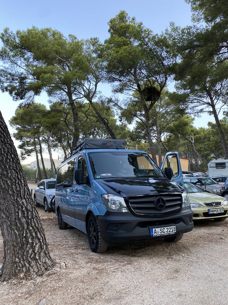
Cubano Parking
D8, Makarska, Gespanschaft Split-Dalmatien, Kroatien
43° 18' 36.3" N 17° 0' 20" E
43.3100950 17.0055571
• Head south on Jadranska magistrala (8). Go for 79.2 km.
• Keep left onto 674 toward Dubrovnik/O. Korčula/Ston. Go for 31.9 km.
• Continue on Jadranska magistrala (8). Go for 43.4 km.
• Turn left onto 420 toward Mokošica/Dubrovnik. Go for 1.0 km.
• Turn left onto 420 toward Dubrovnik. Go for 1.8 km.
• Take the 3rd exit from roundabout onto Obala pape Ivana Pavla II toward Centar/Lapad. Go for 238 m.
• Continue on Obala Stjepana Radića. Go for 303 m.
• Keep right onto Obala Stjepana Radića toward Centar/Lapad. Go for 428 m.
• Continue on Nikole Tesle. Go for 43 m.
• Continue toward Nikole Tesle. Go for 20 m.
• Continue on Nikole Tesle. Go for 231 m.
• Continue on Ulica od Batale. Go for 540 m.
• Turn right onto Ulica kralja Tomislava. Go for 338 m.
• Take the 1st exit from roundabout onto Ulica kralja Tomislava. Go for 68 m.
• Turn right onto Ulica Ive Dulčića. Go for 362 m.
• Turn right onto Ulica Riječka. Go for 99 m.
• Take the 3rd exit from Ulica Riječka roundabout onto Ulica Vatroslava Lisinskog. Go for 447 m.
• Arrive at Ulica Vatroslava Lisinskog. Your destination is on the right.
☍
160,4 km
(2 hrs. 19 min.)
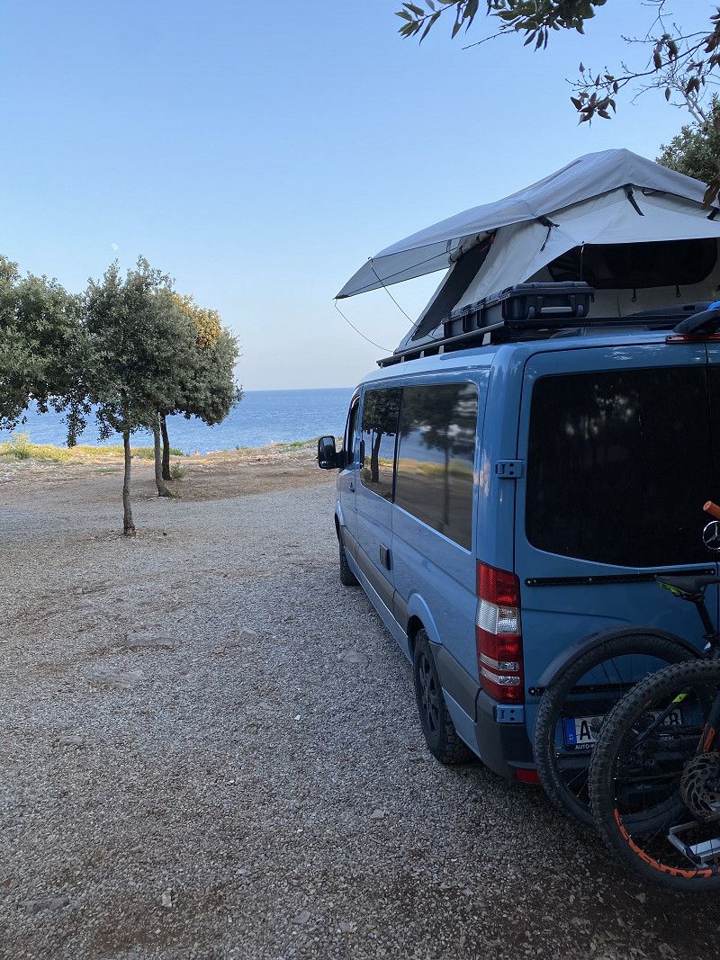
Erste längere Pause nach knapp 1.000 Km
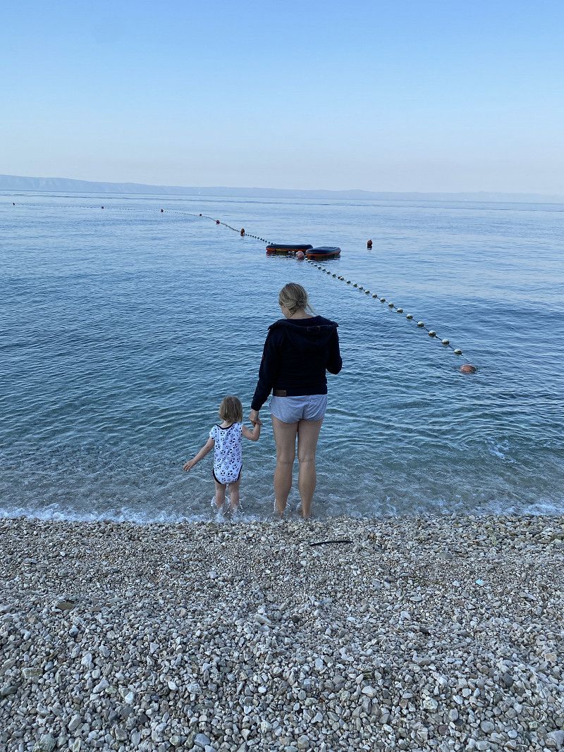
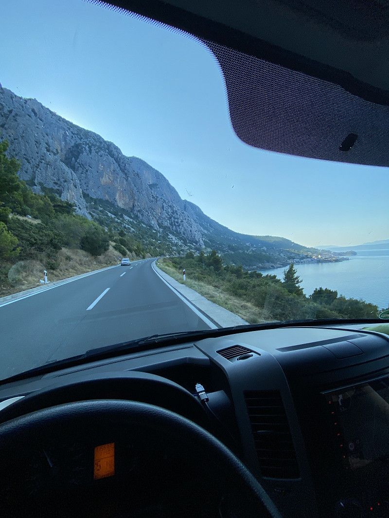
We started our tour at 9:00 p.m. in Augsburg. Apart from a fuel stop in Croatia, we rolled almost 1,000 km to Makarska (HR). After our wife and child were awake, we looked for a parking space (Cubano Parking), bought something for breakfast and went down to the beach. What a wonderful start to your holiday. After a few hours break, we drove on to Dubrovnik, where we stayed for a few days.
Solitudo Sunny Camping
Vatroslava Lisinskog 60, 20000, Dubrovnik, Croatia
42° 39' 43.3" N 18° 4' 13.2" E
42.6620300 18.0703400
• Head east on Ulica Vatroslava Lisinskog. Go for 408 m.
• Take the 1st exit from Ulica Riječka roundabout onto Ulica Riječka. Go for 110 m.
• Turn left onto Ulica Ive Dulčića. Go for 362 m.
• Turn left onto Ulica kralja Tomislava. Go for 34 m.
• Take the 1st exit from roundabout onto Ulica kralja Tomislava toward Split/Grad-Old City/Bolnica. Go for 429 m.
• Continue on Ulica Ive Vojnovića. Go for 1.3 km.
• Continue on Ulica Pera Čingrije. Go for 372 m.
• Continue on Splitski put toward Zračna luka. Go for 281 m.
• Turn right onto Ulica Vladimira Nazora toward Zračna luka. Go for 311 m.
• Keep left onto Ulica Vladimira Nazora toward Split/Cavtat/Zračna luka. Go for 48 m.
• Continue on Ulica Pera Bakića toward Split/Cavtat/Zračna luka. Go for 273 m.
• Take ramp onto Jadranska magistrala (8) toward Zračna luka/Čilipi/Cavtat. Go for 36.1 km.
• Continue on E-65/E-80. Go for 12.8 km.
• Take the 2nd exit from roundabout onto Ulica Narodnog Fronta (E-65/E-80) toward Budva/Kotor/Trajekt. Go for 11.0 km.
• Turn sharp right onto Kamenari toward Bijela. Go for 152 m.
• Arrive at Kamenari.
☍
64,0 km
(1 hrs. 9 min.)
Solitudo Sunny Camping
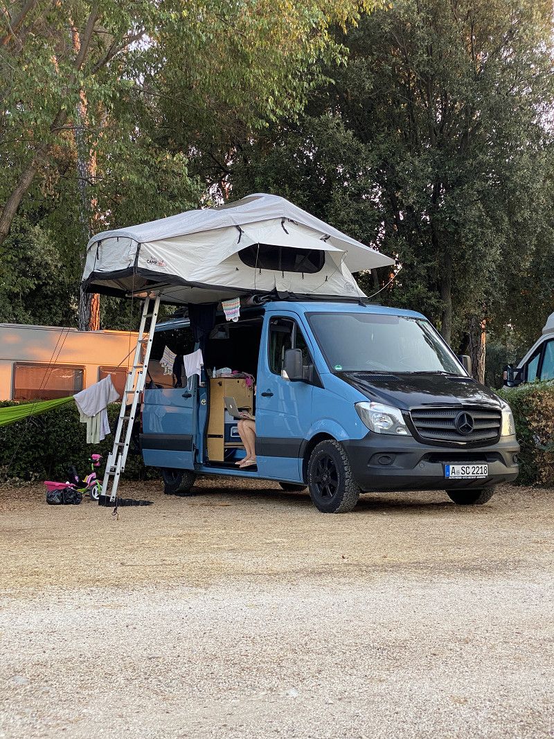
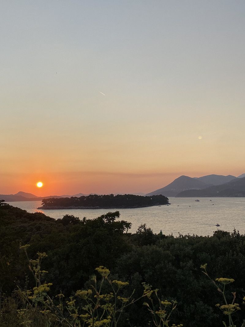
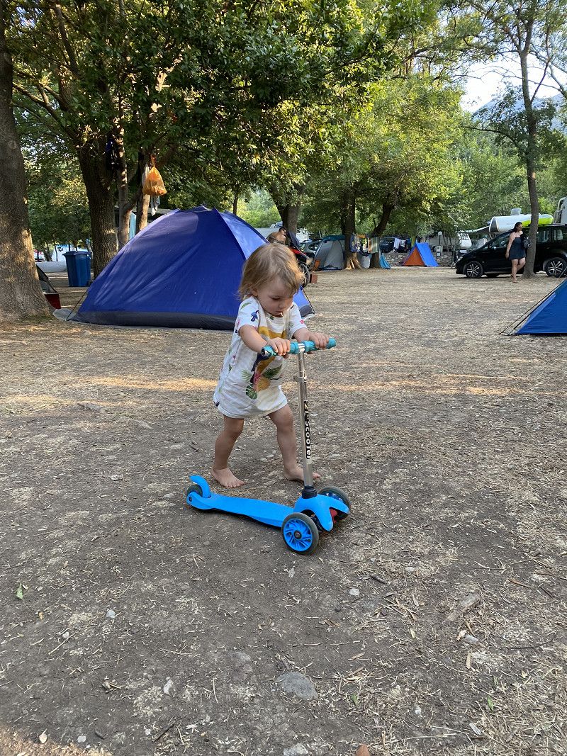
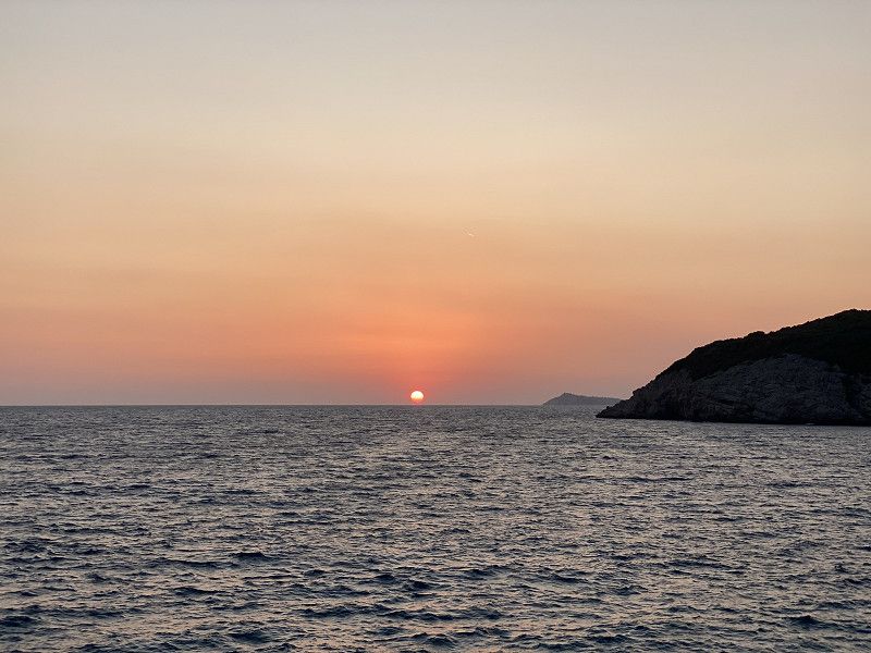
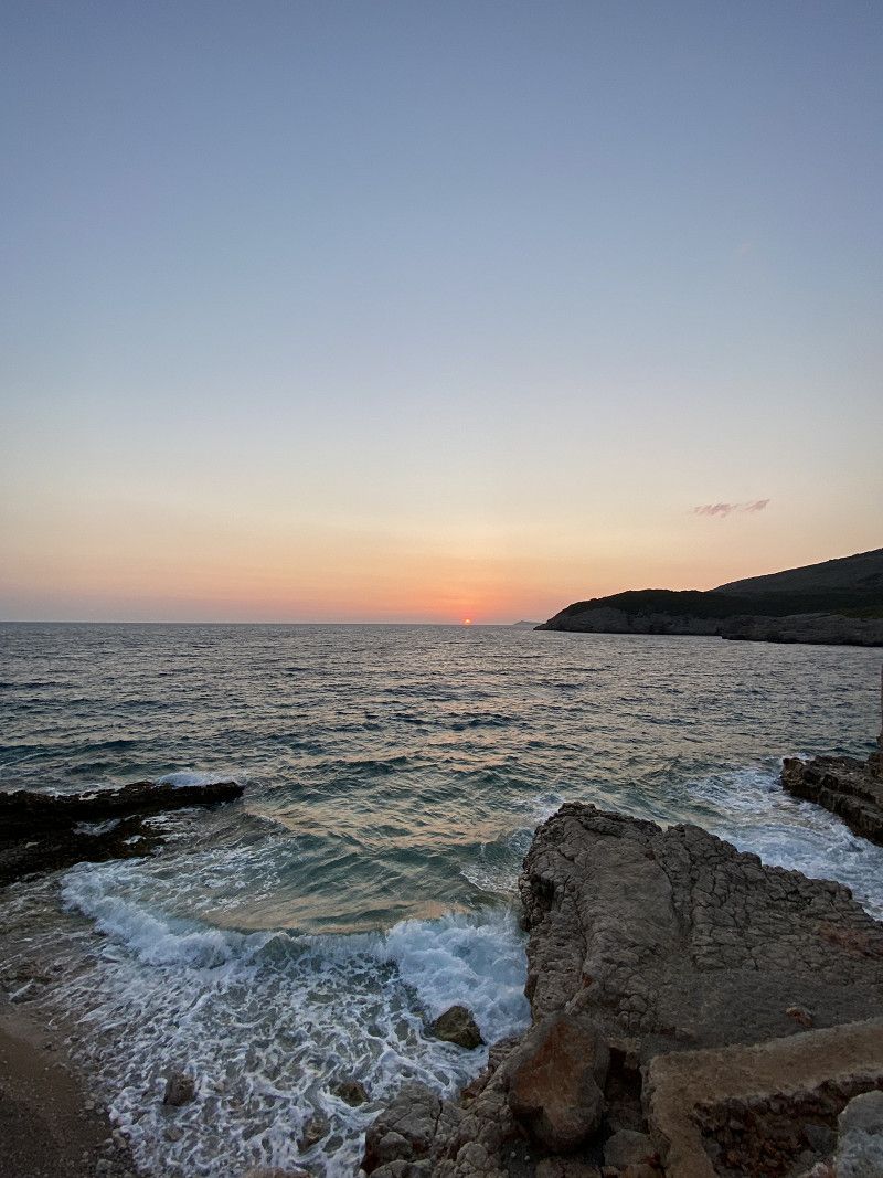
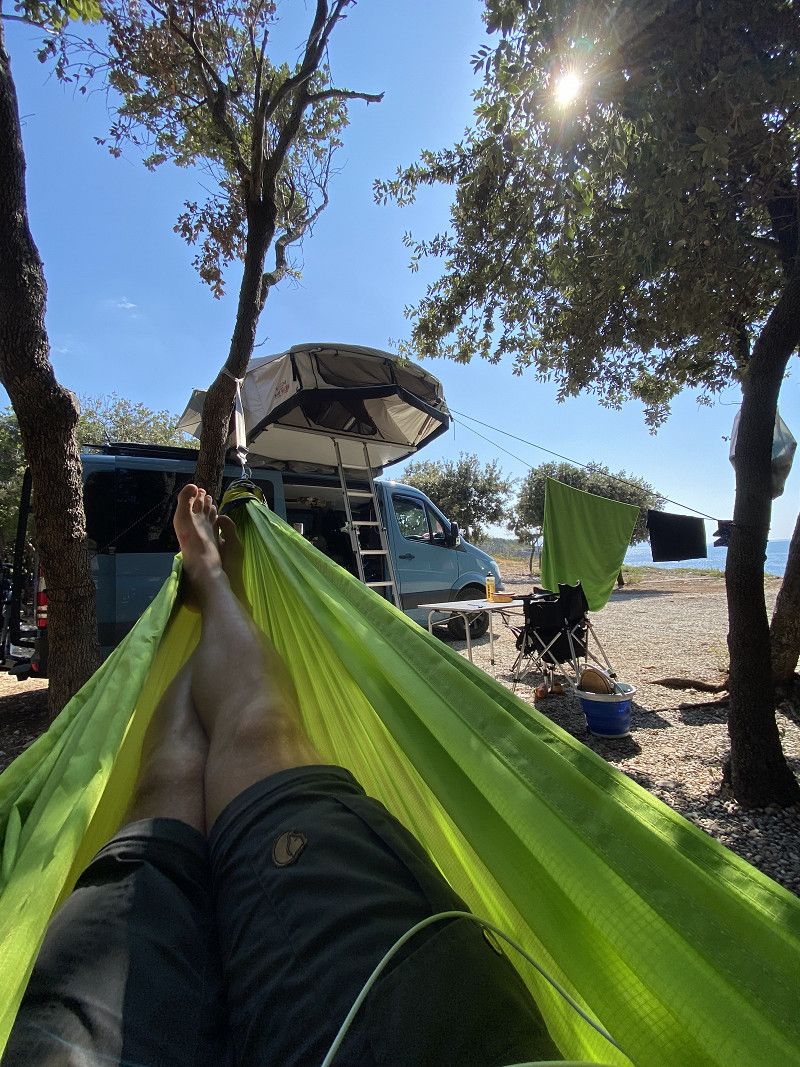
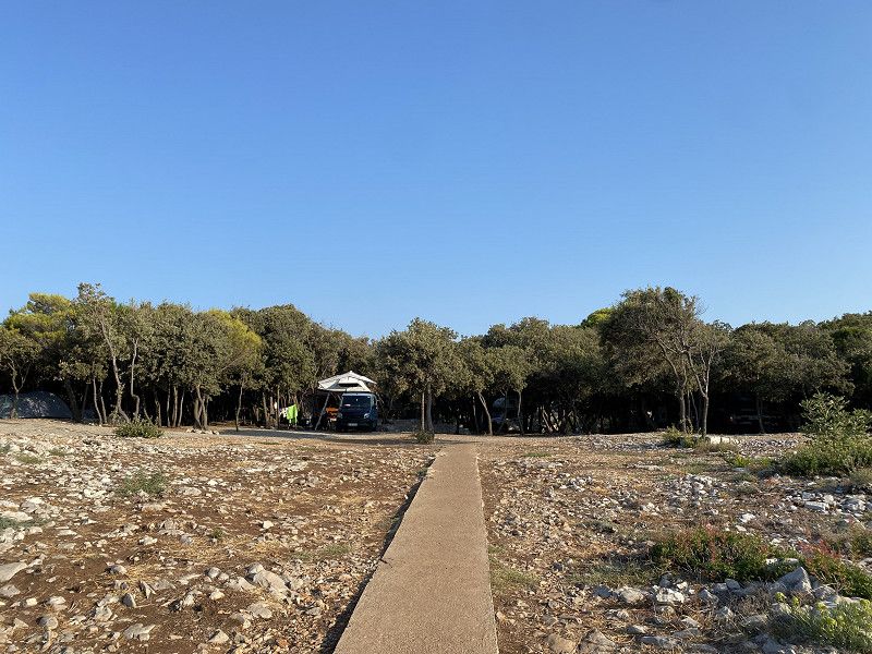
After 15 hours of touring, we finally arrived at the “Solitudo Sunny Camping” campsite and immediately set up our roof tent and hammock. The campsite is located on the Lapad Peninsula, near Babin Kuk beach. For us this is the perfect base for exploring Dubrovnik by bike and being close to the beach. From the campsite you can enjoy a wonderful sunset. The campsite itself is very clean and state of the art.
Day
Day
Dubrovnik by Bike
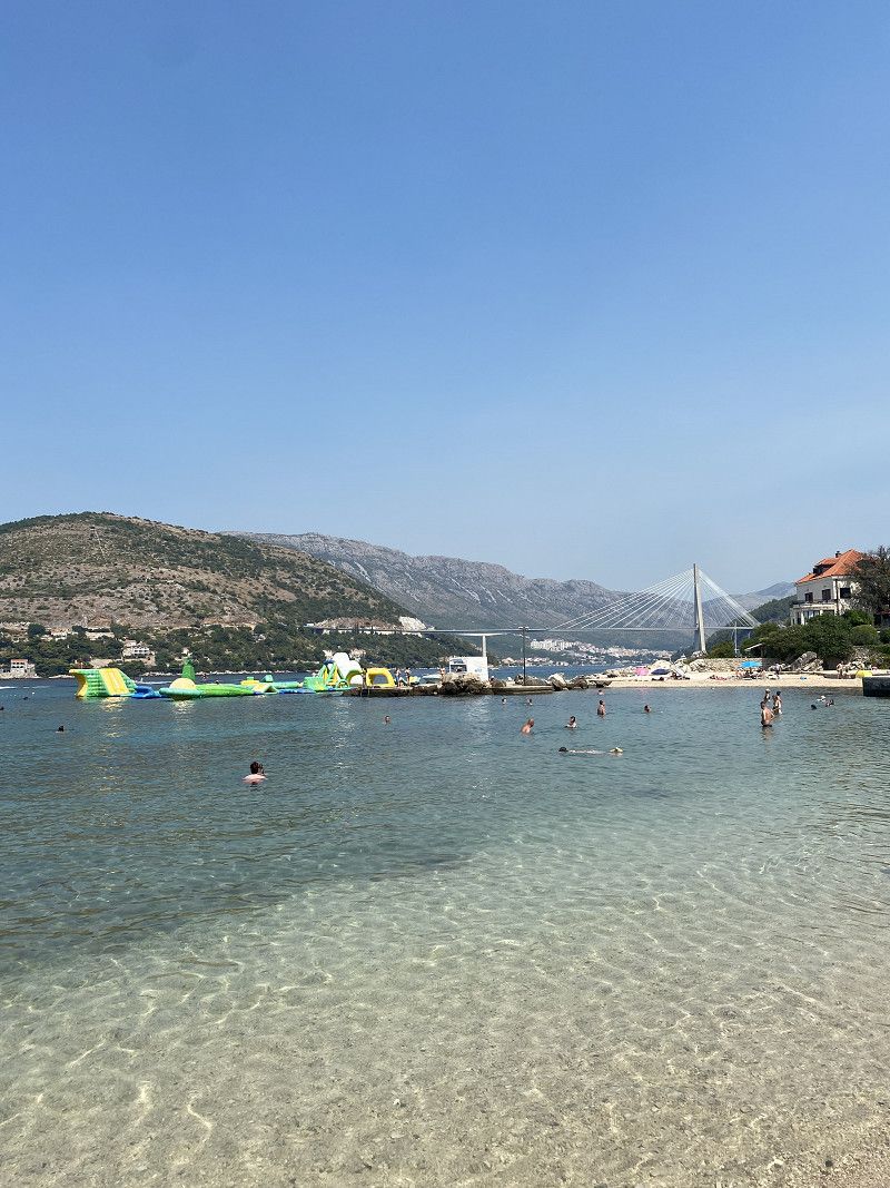
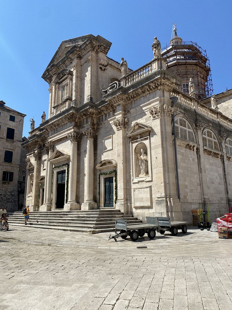
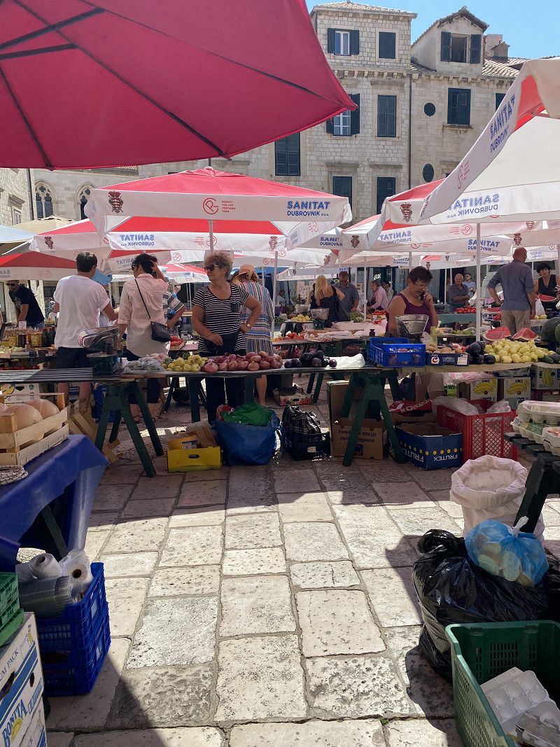
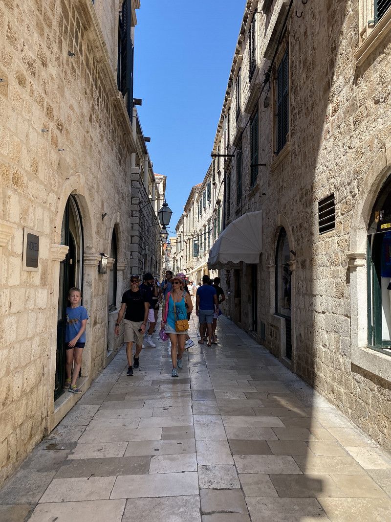
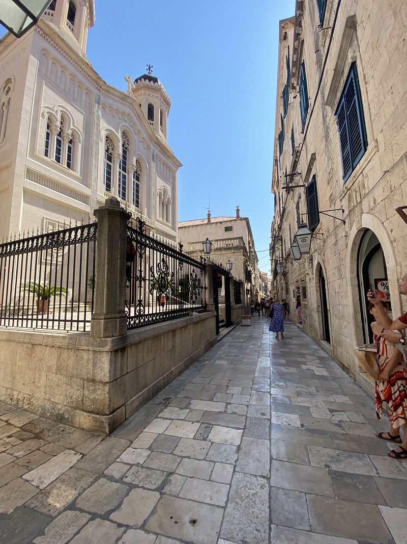
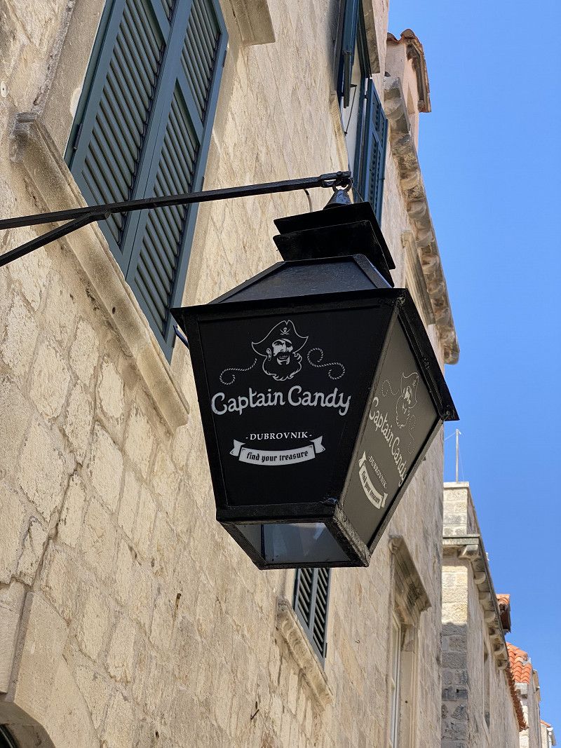
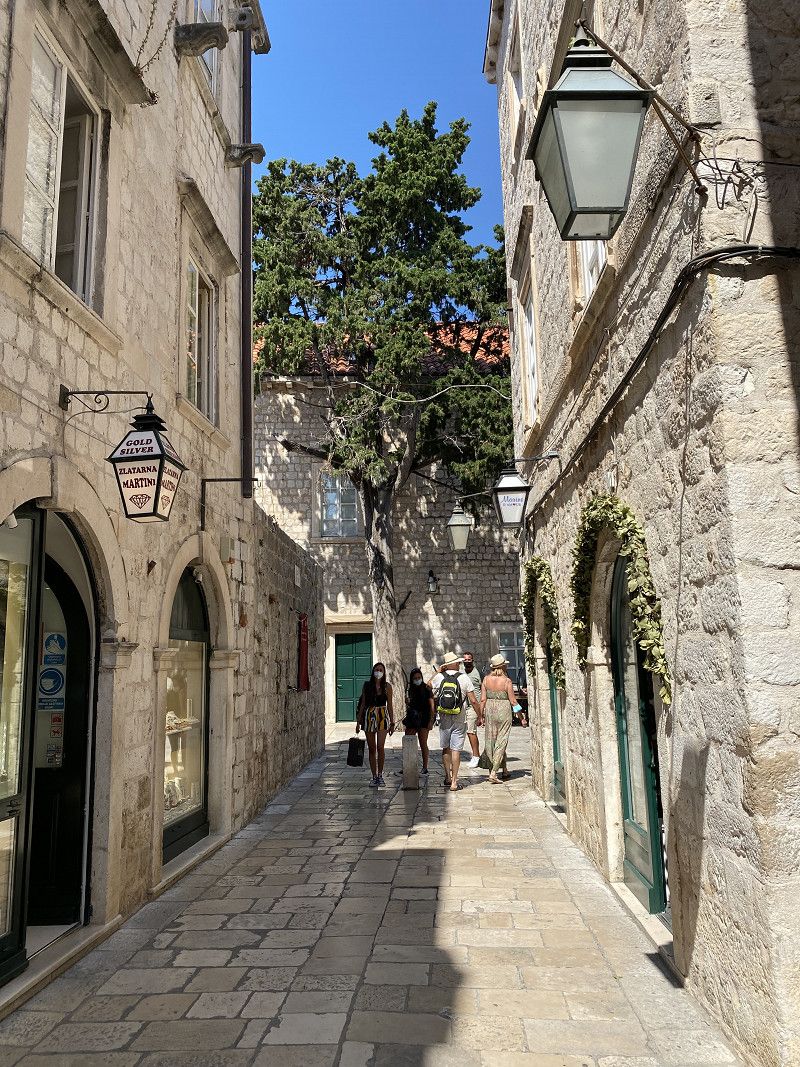
From the campsite we got to the old town really quickly on the e-bikes. You don't really have to be afraid as a cyclist in Dubrovnik. Everyone was very considerate. Dubrovnik itself undoubtedly exerts a fascinating attraction on every visitor. During our stay in this magical Croatian city, we were amazed by its rich history, impressive architecture and picturesque coastal landscape. The historic city center of Dubrovnik, surrounded by massive walls, offered us an impressive sight as we strolled through the narrow streets and admired the magnificent buildings. What couldn't be missed during our visit was a lot of delicious Croatian ice cream. :-D
Day
Day
Bucht von Kotor
Montenegro
42° 27' 15.3" N 18° 40' 19.3" E
42.4542487 18.6720302
• Head northeast on Kamenari. Go for 1.4 km.
• Keep left onto Kamenari (E-65/E-80). Go for 6.4 km.
• Take the 1st exit from roundabout onto Lipci (E-65/E-80) toward Kotor/Risan. Go for 21.8 km.
• Turn left toward Trg Mata Petrovica. Go for 67 m.
• Continue on Trg Mata Petrovica. Go for 208 m.
• Turn right. Go for 44 m.
• Arrive at your destination.
☍
29,8 km
( 34 min.)
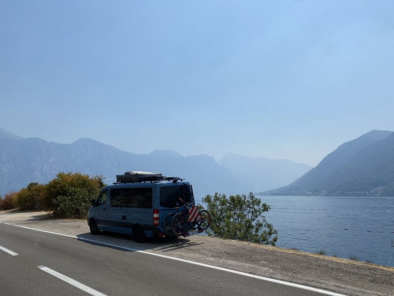
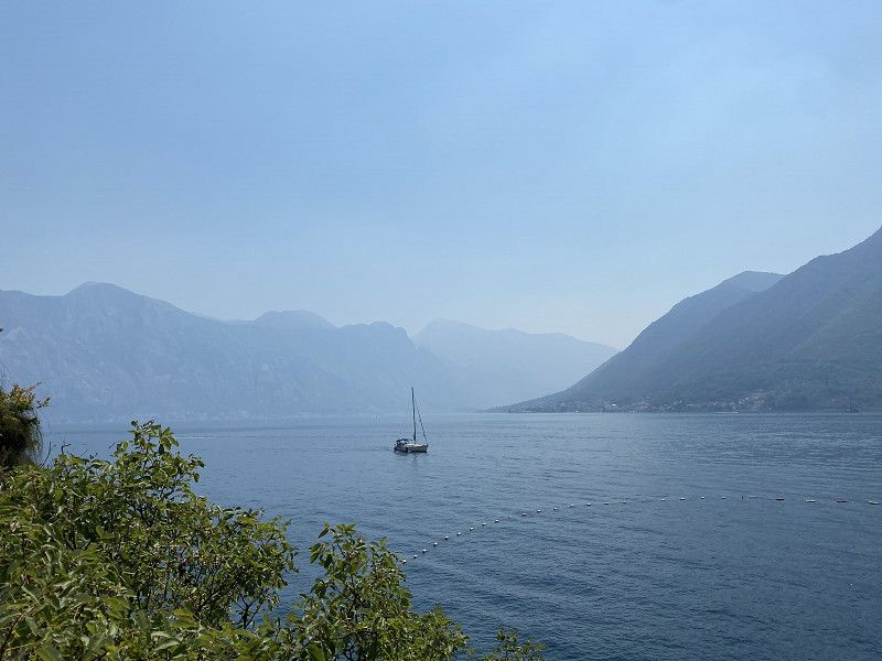
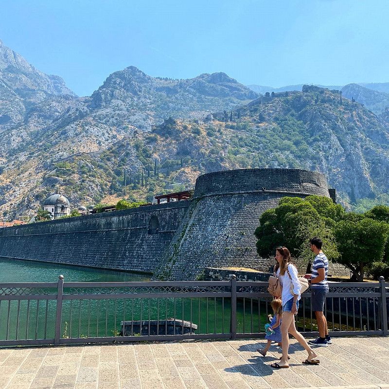
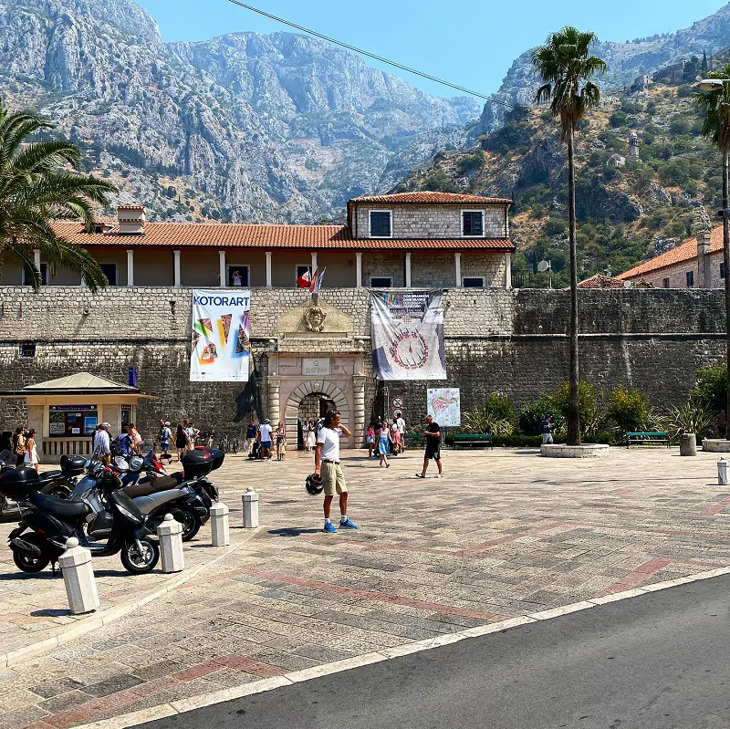
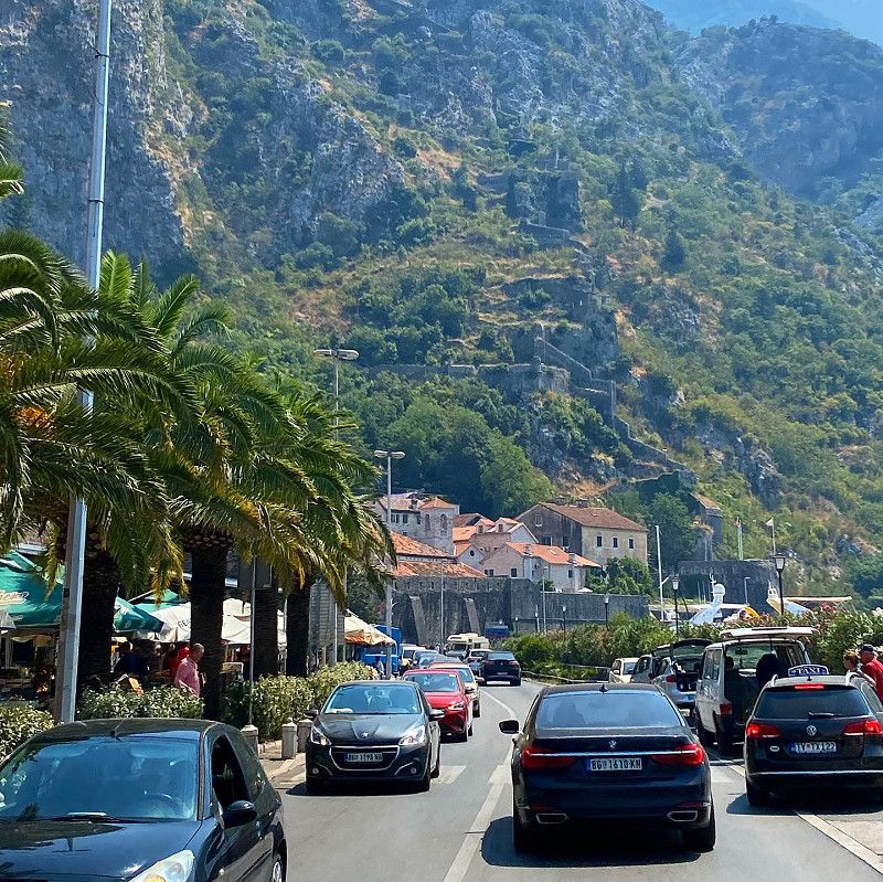
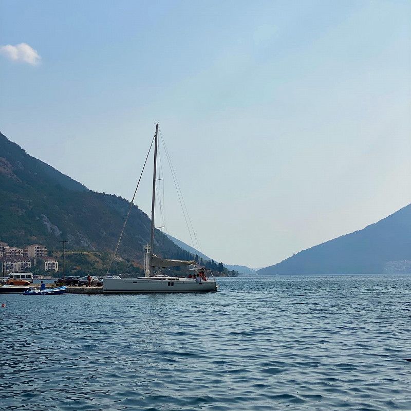
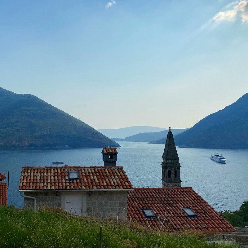
Bilder aus der Bucht von Kotor
Kotor
Gemeinde Kotor, Montenegro
42° 25' 29.5" N 18° 46' 15.8" E
42.4248515 18.7710437
• Head north. Go for 44 m.
• Turn left toward Trg Mata Petrovica. Go for 86 m.
• Continue on Trg Mata Petrovica. Go for 189 m.
• Turn left onto Ulica Jadranski put (E-65/E-80). Go for 855 m.
• Take the 2nd exit from roundabout onto Skaljari (R-1) toward Autobuska stanica/Budva/Tivat. Go for 4.4 km.
• Take the 5th exit from roundabout onto E-65/E-80 toward Budva. Go for 13.1 km.
• Turn right toward Jaz/Trsteno. Go for 487 m.
• Turn left. Go for 373 m.
• Turn right. Go for 190 m.
• Turn right. Go for 25 m.
• Arrive at your destination on the left.
☍
19,8 km
( 25 min.)
Autokamp Jaz / Parkplatz für Strand
M-1, Seoca, Gemeinde Budva, Montenegro
42° 17' 2.2" N 18° 48' 8.9" E
42.2839402 18.8024848
• Head northwest. Go for 30 m.
• Turn right. Go for 167 m.
• Turn right. Go for 22 m.
• Turn left. Go for 17 m.
• Turn left toward Prijevor/E-65/E-80. Go for 756 m.
• Turn sharp right onto Prijevor (E-65/E-80). Go for 5.8 km.
• Pass 3 roundabouts and continue on Ulica Jadranski put (E-65/E-80). Go for 7.1 km.
• Arrive at E-65/E-80.
☍
13,9 km
( 19 min.)
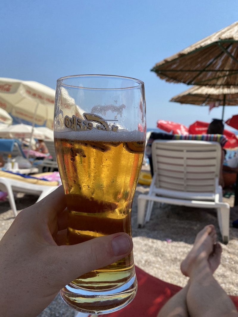
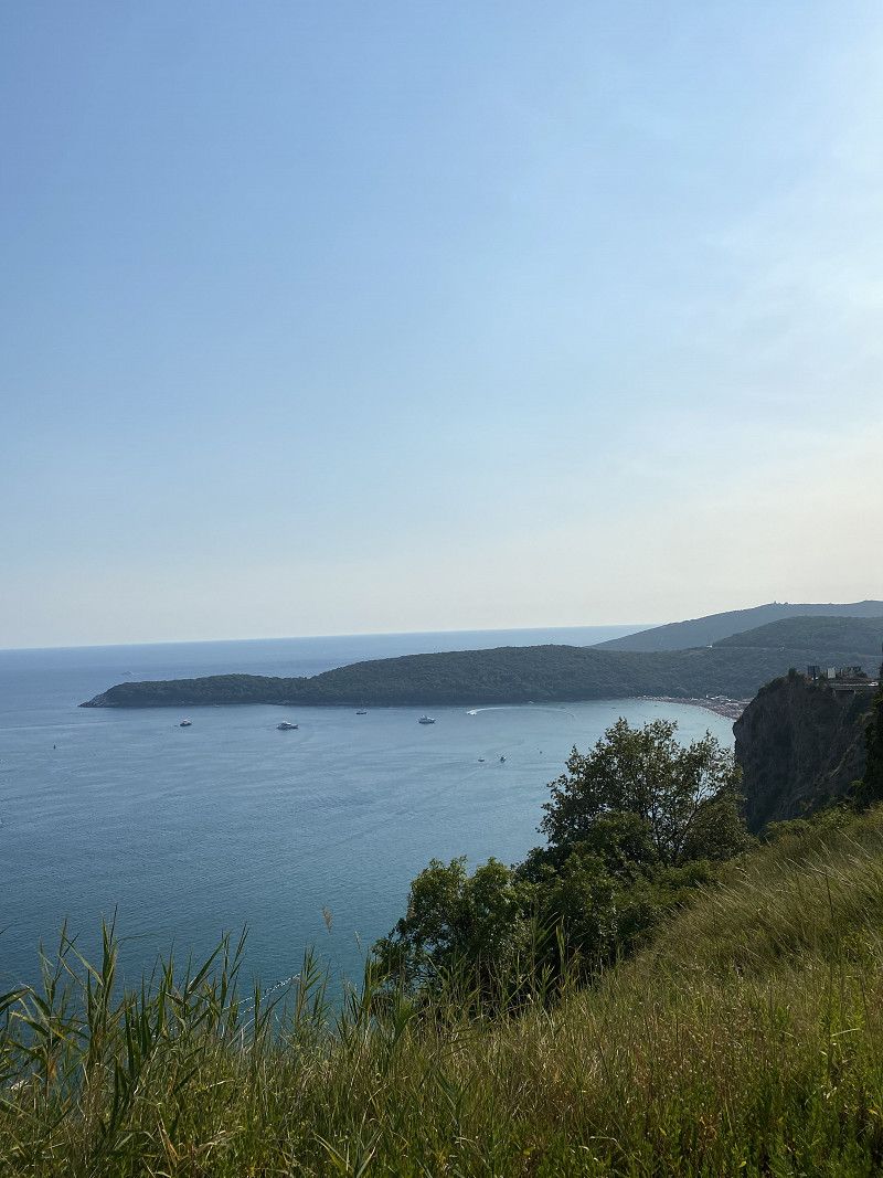
Bilder vom Strand von Jaz
After a long day we took a short break on the beach. Then we continued towards Sveti Stefan. In picture 2 you can see the bay from Panorama Street.
Day
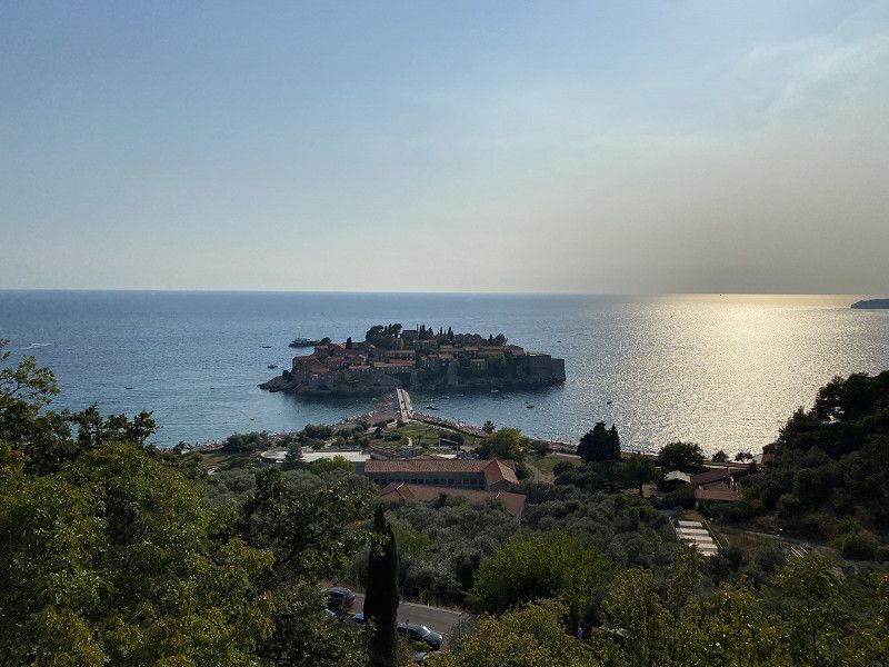
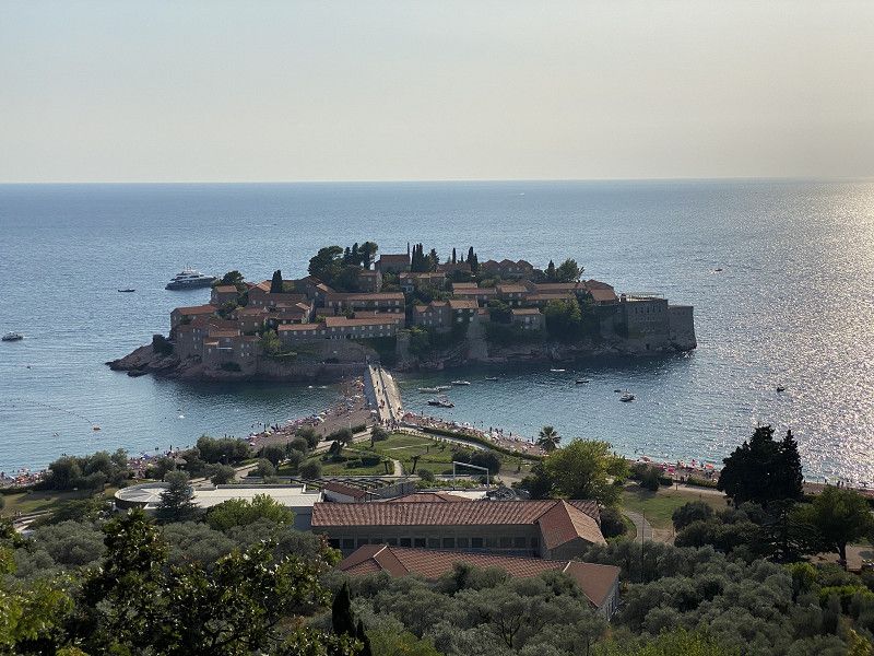
Aussichtspunkt auf Sveti Stefan
M-1, Sveti Stefan, Gemeinde Budva, Montenegro
42° 15' 25" N 18° 53' 49.4" E
42.2569336 18.8970635
• Head toward Ulica Slobode on E-65/E-80. Go for 8.8 km.
• Turn right onto E-851 toward Petrovac. Go for 2.3 km.
• Turn right onto Buljarica. Go for 157 m.
• Turn left onto Buljarica. Go for 51 m.
• Turn right onto Buljarica. Go for 123 m.
• Arrive at Buljarica. Your destination is on the right.
☍
11,4 km
( 13 min.)
Bilder vom Aussichtspunkt auf Sveti Stefan
We didn't visit Sveti Stefan ourselves. The sight of the cute hotel island from the viewing point was enough for us.
Autokamp Maslina
M-1, Buljarica, Gemeinde Budva, Montenegro
42° 11' 50.8" N 18° 57' 55.6" E
42.1974452 18.9654362
• Head north on Buljarica. Go for 123 m.
• Turn right onto Buljarica. Go for 264 m.
• Turn right onto Buljarica (E-851). Go for 8.5 km.
• Turn right toward Tunel Sozina. Go for 2.1 km.
• Continue on Tunel Sozina. Go for 7.4 km.
• Continue on Ras. Go for 2.6 km.
• Turn right onto E-65/E-80 toward Podgorica. Go for 5.3 km.
• Arrive at E-65/E-80.
☍
26,3 km
( 26 min.)
Bilder Campingplatz Autokamp Maslina
The Autokamp Maslina campsite is relatively simple. But it doesn't cost much either. It's a 2-3 minute walk to the pebble beach with a few bars and restaurants and you can refresh yourself in the sea and enjoy the evening.
Day
Parkplatz - Treffpunkt für Bootsfahrt
M-2, Kruševica, Gemeinde Bar, Montenegro
42° 16' 3.3" N 19° 6' 46" E
42.2675879 19.1127699
• Head southwest on E-65/E-80. Go for 3.8 km.
• Turn right toward Rijeka Crnojevića. Go for 2.3 km.
• Continue on Braceni. Go for 1.4 km.
• Continue on Milovici. Go for 1.6 km.
• Continue on Krusevica Dubovici. Go for 4.3 km.
• Continue on Komarno. Go for 682 m.
• Arrive at your destination on the right.
☍
14,1 km
( 24 min.)
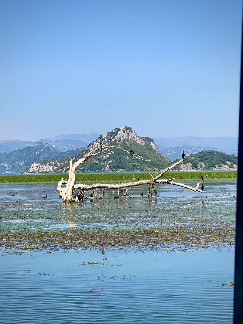
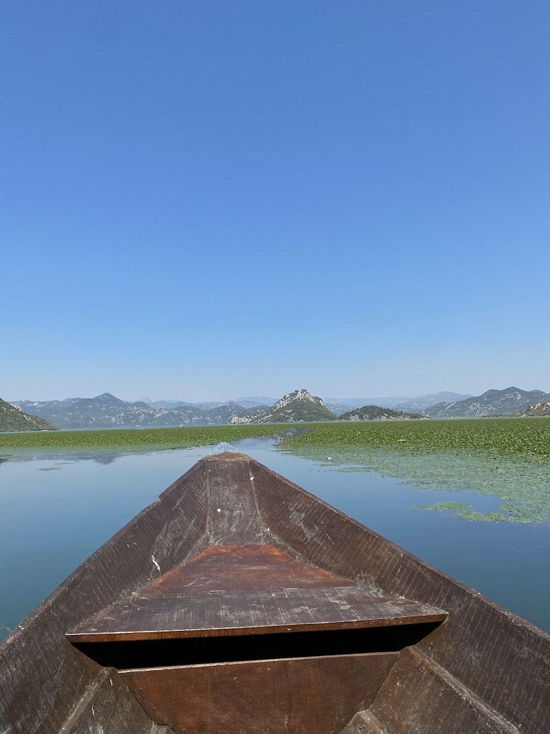
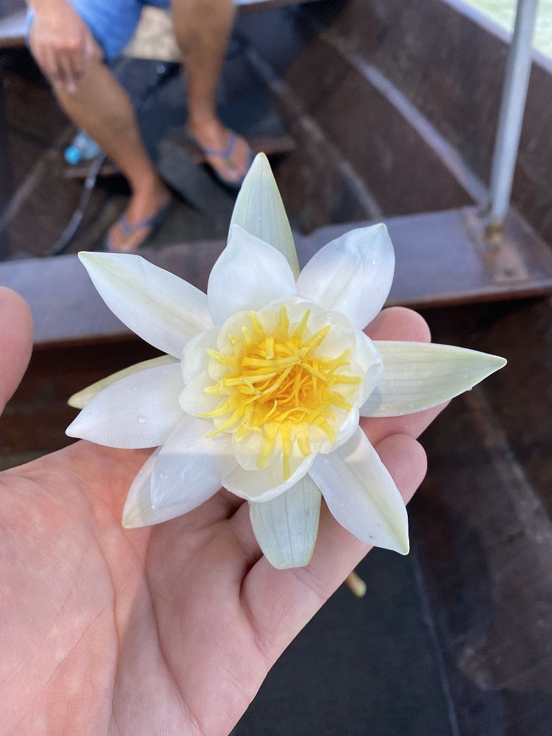
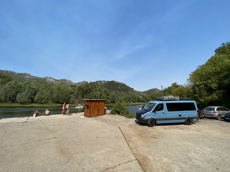
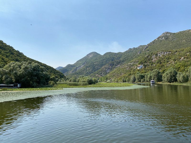
Bootsfahrt über den Skutarisee Nationalpark
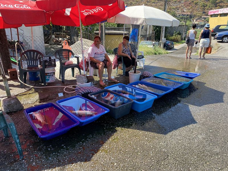
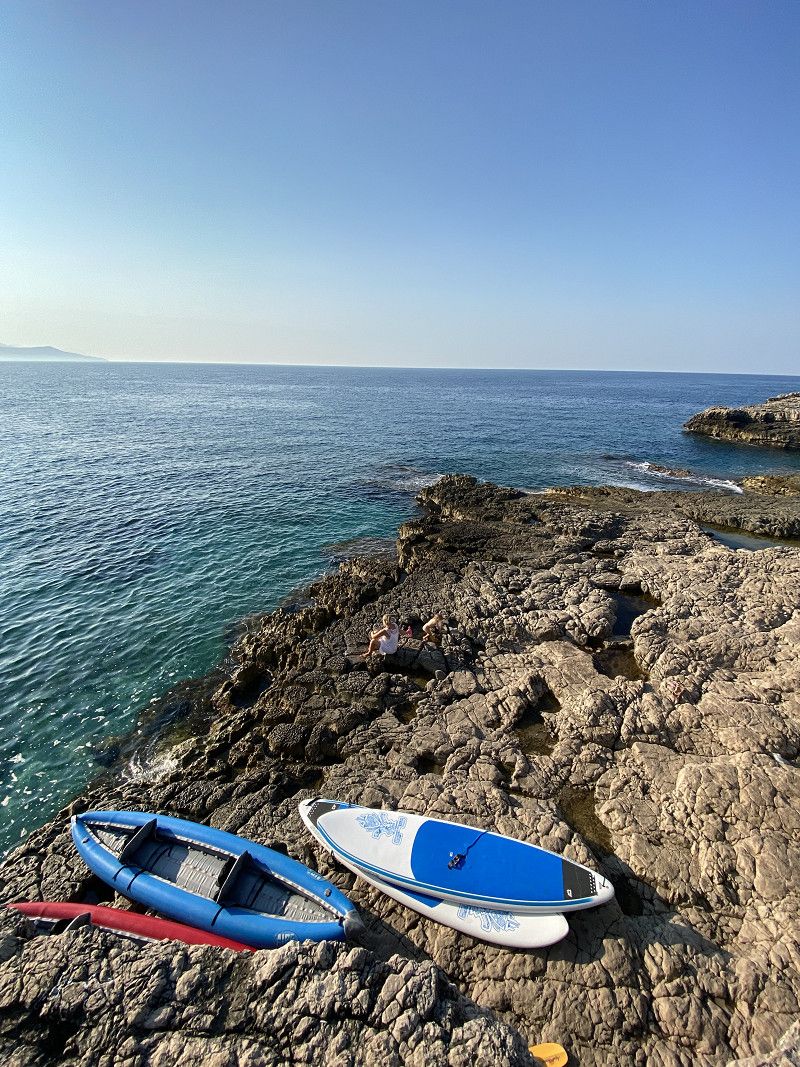
Anyone who is ever in Montenegro should definitely take a boat trip through Lake Skadar National Park. There are both real tourist boats with which you can do this and locals with their fishing boats that offer tours. We were lucky that we met a local fisherman at the parking lot in front of the bridge who asked us if we wanted to take a boat trip. This wasn't on the agenda up to this point, but it had turned into the best idea of the day. More information can be found on my travel log: https://www.christian-fiedler-wildlife.de/on-tour/roadtrips/camper-roadtrip-mit-der-familie-in-montenegro/
Day
Day
Popratnica
R 16;R-16, Popratnica, Gemeinde Bar, Montenegro
42° 17' 26.5" N 19° 3' 41.8" E
42.2907081 19.0616012
• Head north. Go for 2.3 km.
• Continue on Podseljani. Go for 467 m.
• Continue on Donje selo. Go for 623 m.
• Continue on Zajcina. Go for 1.3 km.
• Turn left. Go for 1.7 km.
• Keep right toward Gagosi. Go for 528 m.
• Continue on Gagosi. Go for 2.4 km.
• Continue on Rijecani. Go for 2.5 km.
• Arrive at your destination.
☍
11,8 km
( 21 min.)
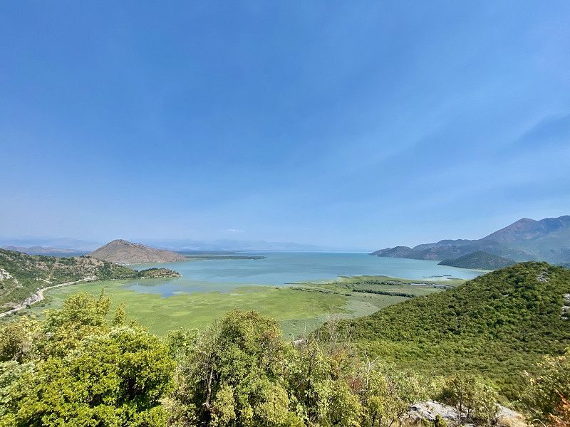
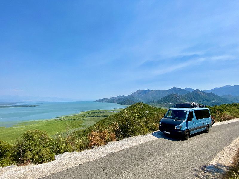
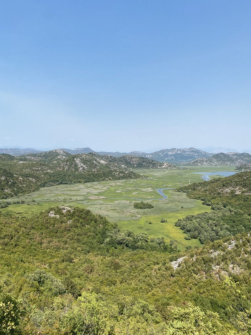
Panoramastraße Skutarisee
Pictures from the panoramic road with a view over Lake Skadar.
Badestelle am Fluss
Rijeka Crnojevića - Virpazar, Lipovik, Gemeinde Cetinje, Montenegro
42° 21' 4.2" N 19° 2' 25.3" E
42.3511564 19.0403560
• Head west. Go for 1.0 km.
• Continue on Rijeka Crnojevica. Go for 312 m.
• Turn left onto Rijeka Crnojevica. Go for 1.8 km.
• Continue on Ocevici. Go for 6.4 km.
• Turn left. Go for 4.7 km.
• Turn left. Go for 134 m.
• Turn slightly left. Go for 787 m.
• Arrive at your destination on the right.
☍
15,2 km
( 29 min.)
Bilder Badestelle
You can refresh yourself wonderfully here. The locals also bathe here.
Camp Oaza, Lipa
Lipa dobrska b.b, 81250, Lipa, Montenegro
42° 22' 16.5" N 18° 57' 10.7" E
42.3712500 18.9529700
• Head northwest. Go for 2.4 km.
• Turn right onto M-2.3. Go for 26.5 km.
• Pass 4 roundabouts and continue on Ulica Cetinjski put (M-2.3). Go for 3.2 km.
• Take the 3rd exit from roundabout onto Ulica Niksicka (E-762) toward Žablijak. Go for 2.3 km.
• Pass 7 roundabouts and continue on E-762. Go for 14.9 km.
• Take the 1st exit from roundabout onto Ulica Blaza Mrakovica toward Centar. Go for 455 m.
• Turn slightly right onto Ulica I. Bokeljske brigade. Go for 310 m.
• Take the 1st exit from roundabout. Go for 63 m.
• Turn left onto Ulica Njego Beva. Go for 109 m.
• Continue on Ulica Njegoseva. Go for 152 m.
• Turn right. Go for 36 m.
• Turn left toward Ulica Sava Burica. Go for 68 m.
• Turn right onto Ulica Sava Burica. Go for 32 m.
• Continue on Ulica Kese Djurovica. Go for 536 m.
• Turn right toward Sekulici. Go for 1.3 km.
• Continue on Sekulici. Go for 3.1 km.
• Continue on Kadica Boan. Go for 1.6 km.
• Continue on Vujkovina. Go for 242 m.
• Continue on Kalezici. Go for 3.1 km.
• Continue on Vinici. Go for 3.1 km.
• Continue on Sobaici. Go for 4.9 km.
• Continue on Orasije. Go for 1.6 km.
• Turn right. Go for 1.4 km.
• Turn sharp right. Go for 992 m.
• Arrive at your destination on the right.
☍
72,3 km
(1 hrs. 21 min.)
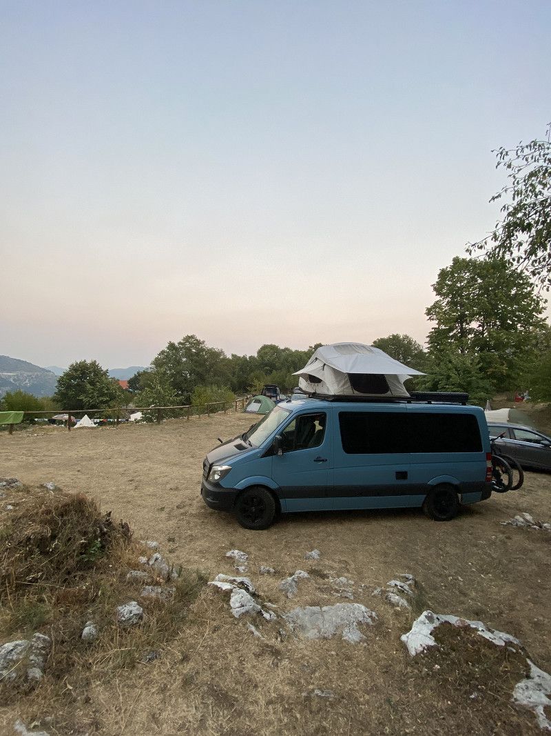
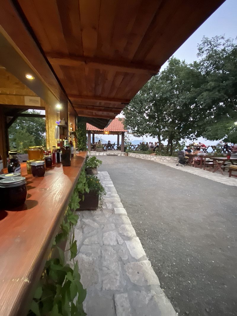
Bilder und Review Camp Oaza Lipa
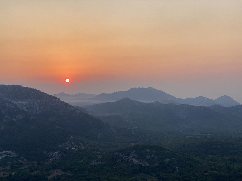
The place is kept relatively simple. There are 2 toilets and 2 showers. The bar/bistro serves delicious delicacies and also breakfast. Tip: It's worth getting up early here, especially to watch the sunrise in the mountains. The place is the ideal starting point for hikes and for visiting the Lipa Caves.
Day
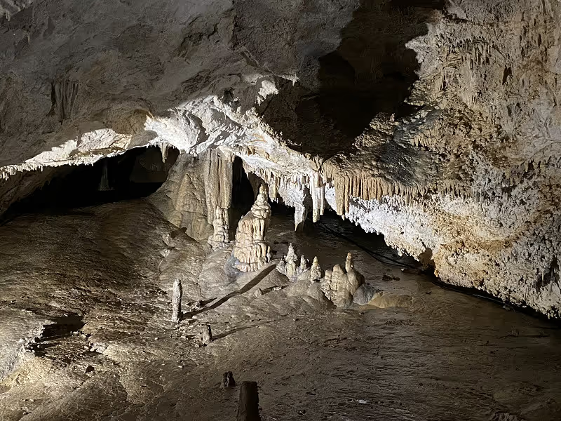
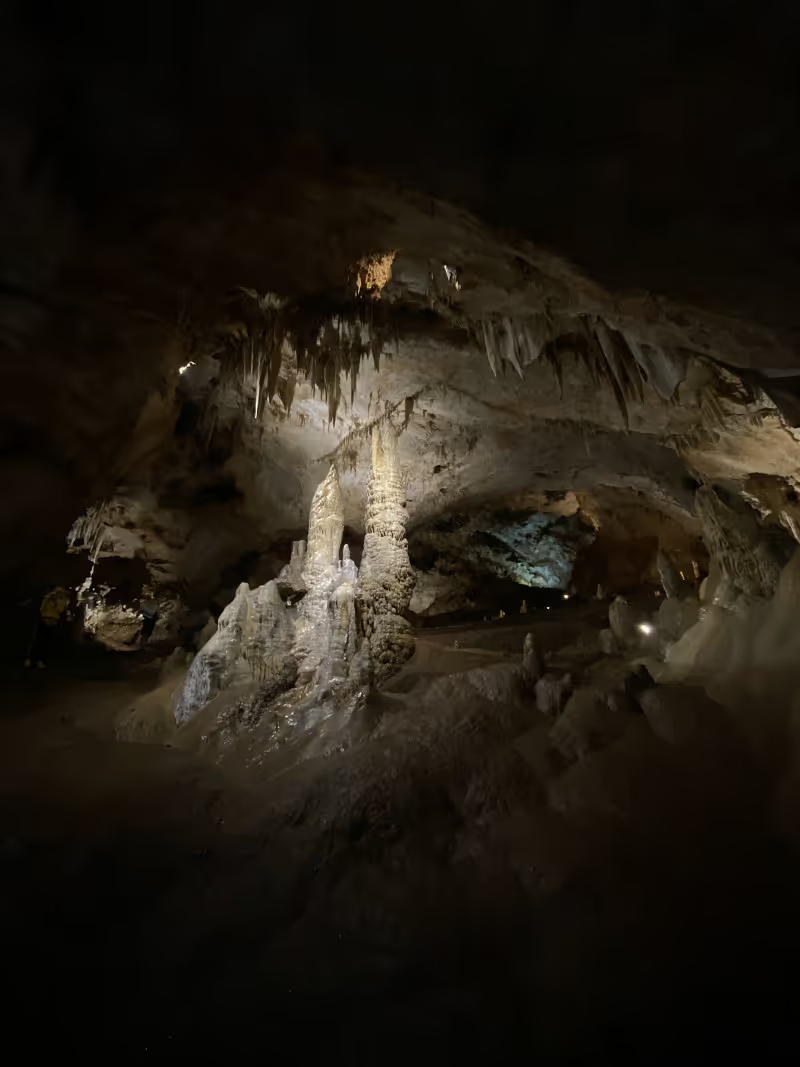
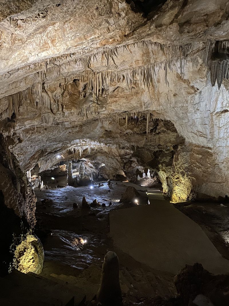
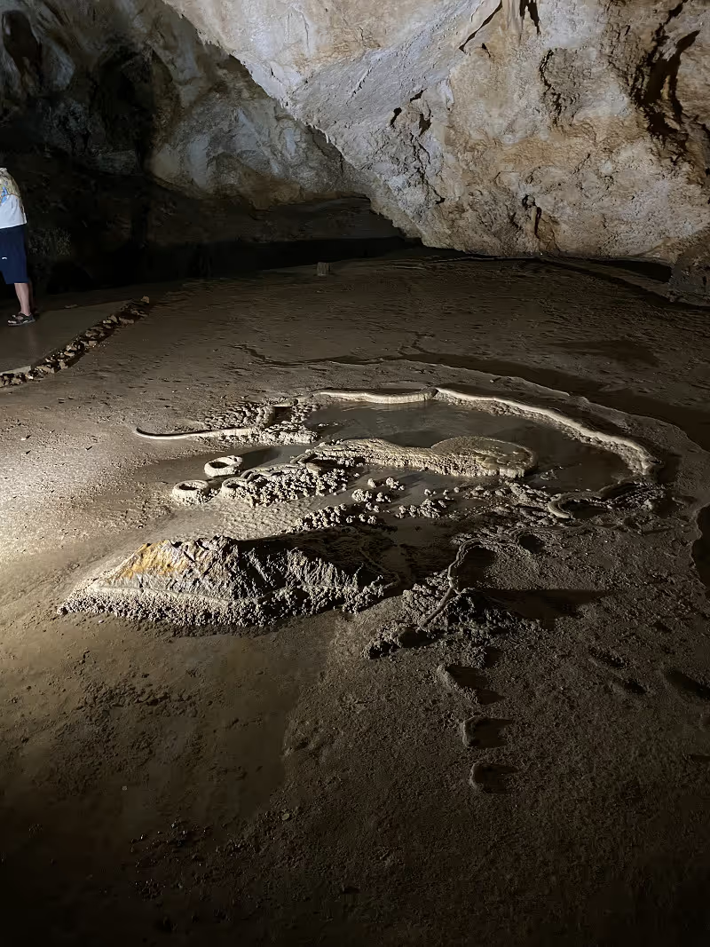
Besuch der Lipa Höhlen
Lipa Cave (Lipska pećina) in Montenegro is a paradise for nature lovers and adventurers alike. The caves impress with their impressive karst rock formations and extend over a 2,500 meter long network, offering visitors the opportunity to explore a spectacular underworld with impressive stalactites and stalagmites. A true speleologist's dream, this place is a jewel of unparalleled beauty amidst the breathtaking Montenegrin landscape. You should definitely visit this place. You can find more information on my blog. https://www.christian-fiedler-wildlife.de/on-tour/roadtrips/lipa-hoehlen-lipska-pecina/ The starting point of the cave tour and entrance tickets are available above Camp Oaza at the large parking lot. There is also a bistro and kiosk here.
Day
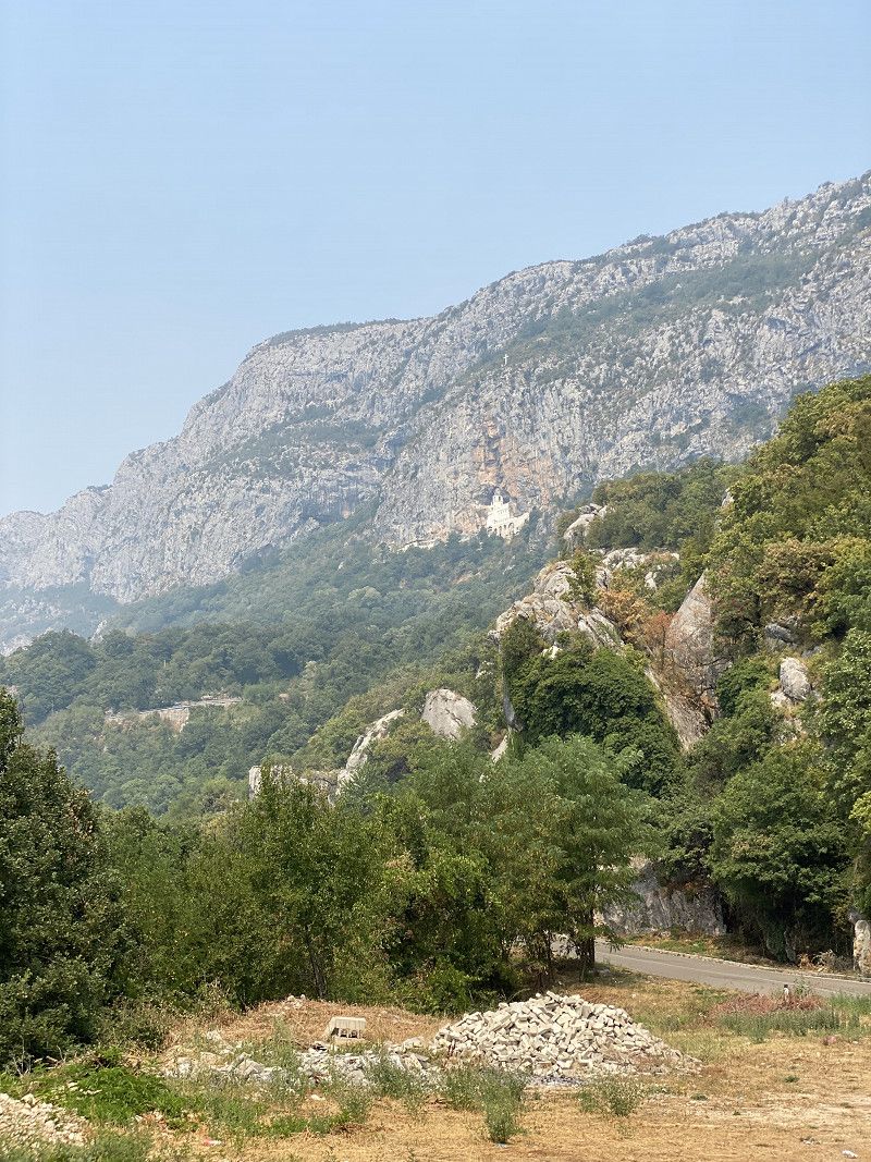
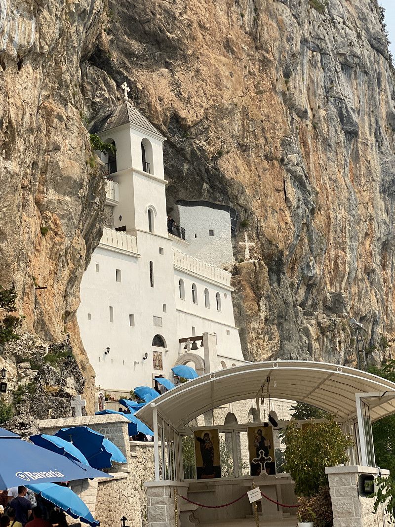
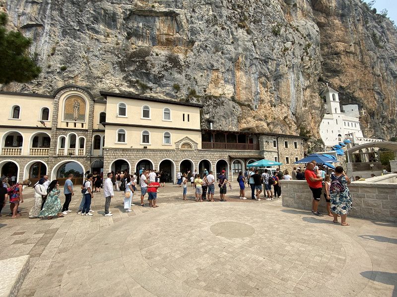
Kloster Ostrog
Wonderful rock monastery with a great view of the surrounding area.
R-23, Gemeinde Danilovgrad, Montenegro
42° 40' 29.2" N 19° 1' 49.5" E
42.6747821 19.0304301
• Head southeast.
• Turn left. Go for 1.1 km.
• Turn sharp left. Go for 1.4 km.
• Turn right. Go for 311 m.
• Turn right toward Bogetici. Go for 2.8 km.
• Continue on Bogetici. Go for 1.8 km.
• Continue on Trubasinj. Go for 482 m.
• Turn left toward E-762. Go for 2.8 km.
• Turn right and take ramp onto E-762 toward Nikšić/Žablijak. Go for 13.6 km.
• Take ramp onto Ulica Hercegovacki put (M-6) toward Trebinje. Go for 3.7 km.
• Turn right. Go for 449 m.
• Turn left. Go for 2.8 km.
• Turn slightly right. Go for 159 m.
• Turn left. Go for 9 m.
• Arrive at your destination.
☍
31,4 km
( 45 min.)
Bilder und Bericht Kloster Ostrog
In the majestic mountains of Montenegro lies the Ostrog Monastery, one of the most famous Orthodox shrines in the country, which is also known beyond the borders of Europe. It was founded in the 17th century and is dedicated to Saint Vasilije Ostroški, a Serbian Orthodox bishop who is also credited with the gift of miraculous healing.
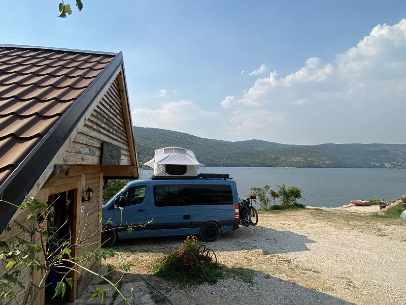
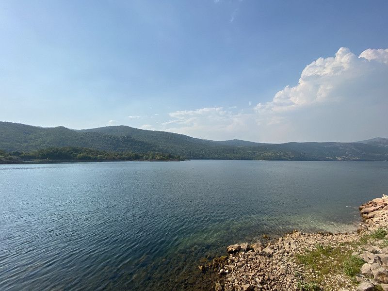
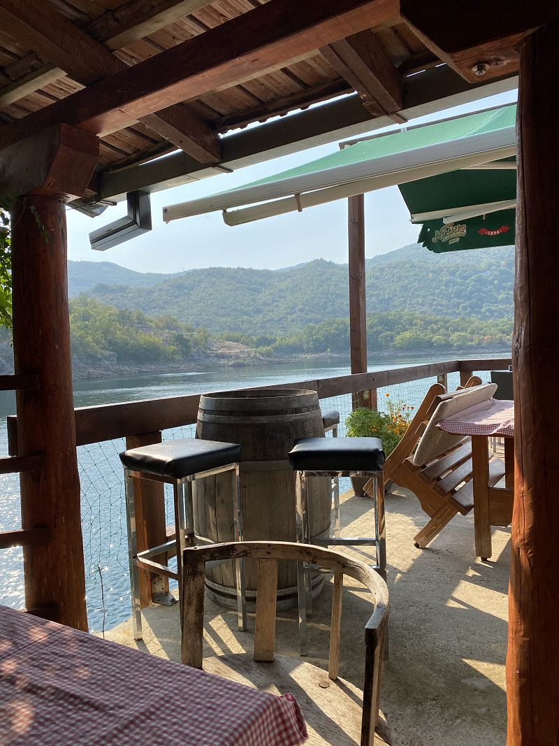
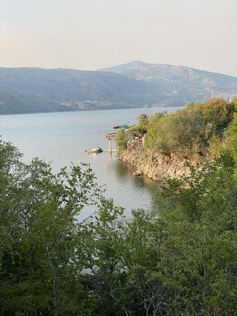
Kod Draskovica / Stellplatz an Restaurant am See
Gemeinde Nikšić, Montenegro
42° 47' 44.1" N 18° 52' 23.6" E
42.7955820 18.8732233
• Head southeast. Go for 9 m.
• Turn right. Go for 2.7 km.
• Continue straight ahead. Go for 202 m.
• Turn right toward M-6. Go for 449 m.
• Turn left onto M-6. Go for 3.6 km.
• Turn left and take ramp onto E-762. Go for 17.1 km.
• Turn right toward R-5. Go for 12.9 km.
• Turn left onto R-5 toward Šavnik/Žabljak. Go for 26.1 km.
• Continue on Tunel Ivica. Go for 14.3 km.
• Turn left onto Ulica Vuka Karadzica. Go for 848 m.
• Continue on Njegoseva ulica. Go for 1.2 km.
• Turn right toward Ulica Jovana Cvijica. Go for 217 m.
• Continue on Ulica Jovana Cvijica. Go for 401 m.
• Turn right onto Ulica Gavrila i Jovana Sibalije. Go for 16 m.
• Arrive at Ulica Gavrila i Jovana Sibalije. Your destination is on the left.
☍
80,1 km
(1 hrs. 29 min.)
Bilder Stellplatz am Restaurant
The owners are very hospitable and the food here tastes excellent. The place offers clean toilets and showers. There are a few paths and paths around the lake that need to be explored. A really great place to relax and explore.
Day
Day
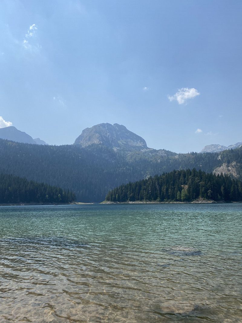
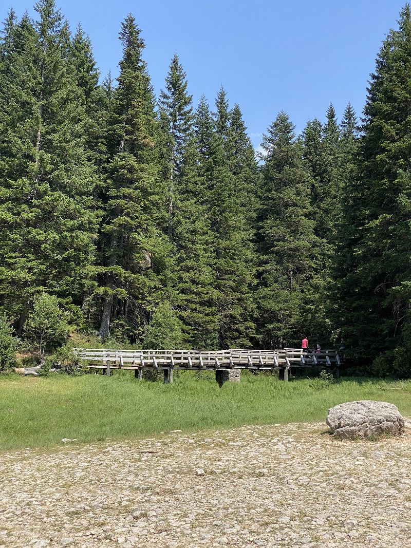
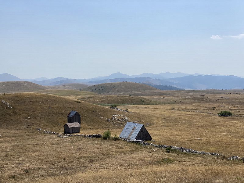
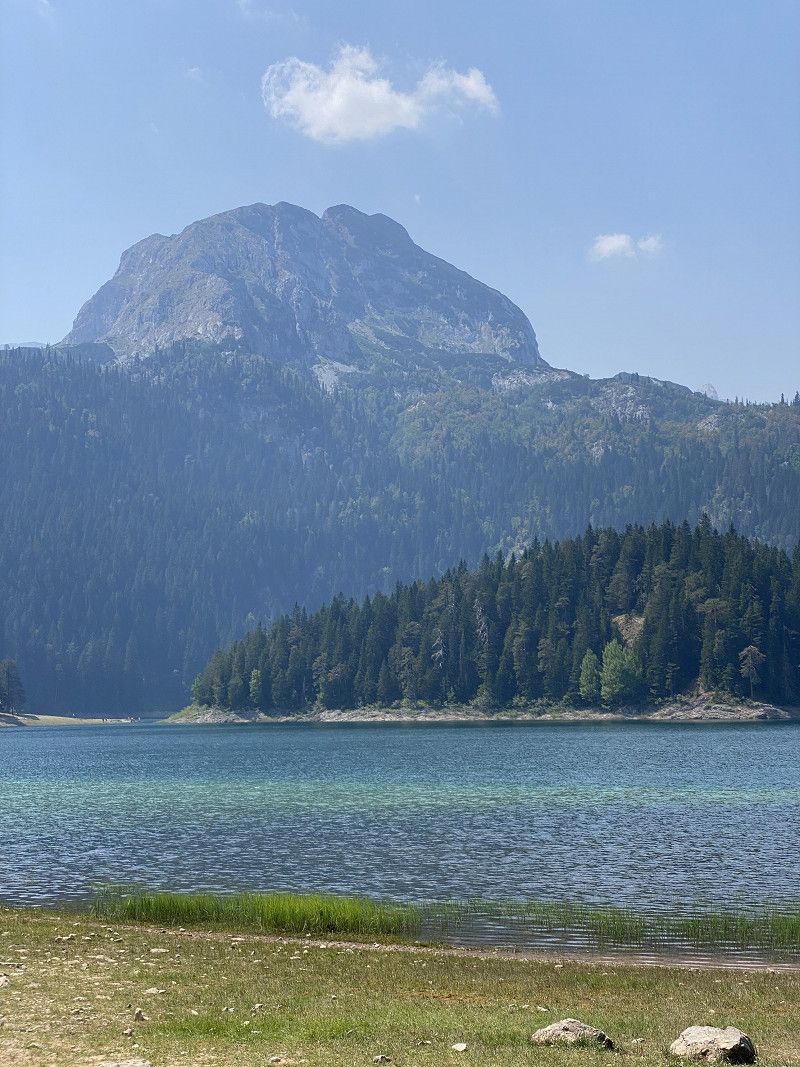
Parkplatz Cerno Jezero / Schwarzer See
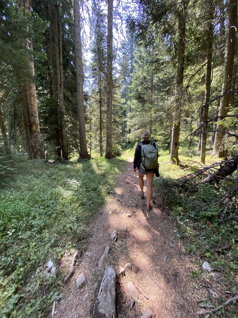
The parking lot is a wonderful starting point for hikes around and on the lake. Suitable tours are available on Komoot. Of course, you could also stay for a while at the small campsites by the lake.
Njegoševa, Pitomine, Gemeinde Žabljak, Montenegro
43° 9' 14.1" N 19° 6' 3.4" E
43.1539081 19.1009525
• Head east on Ulica Gavrila i Jovana Sibalije. Go for 16 m.
• Turn left onto Ulica Jovana Cvijica. Go for 688 m.
• Continue on Njegoseva ulica. Go for 1.1 km.
• Turn left onto Ulica Narodnih heroja. Go for 717 m.
• Continue on Tmajevci. Go for 781 m.
• Continue on Narodnih heroja (R-5). Go for 20.9 km.
• Continue on R-4 toward Pljevlja. Go for 335 m.
• Arrive at R-4. Your destination is on the left.
☍
24,5 km
( 29 min.)
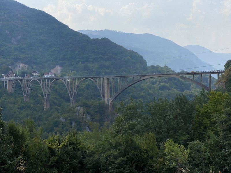
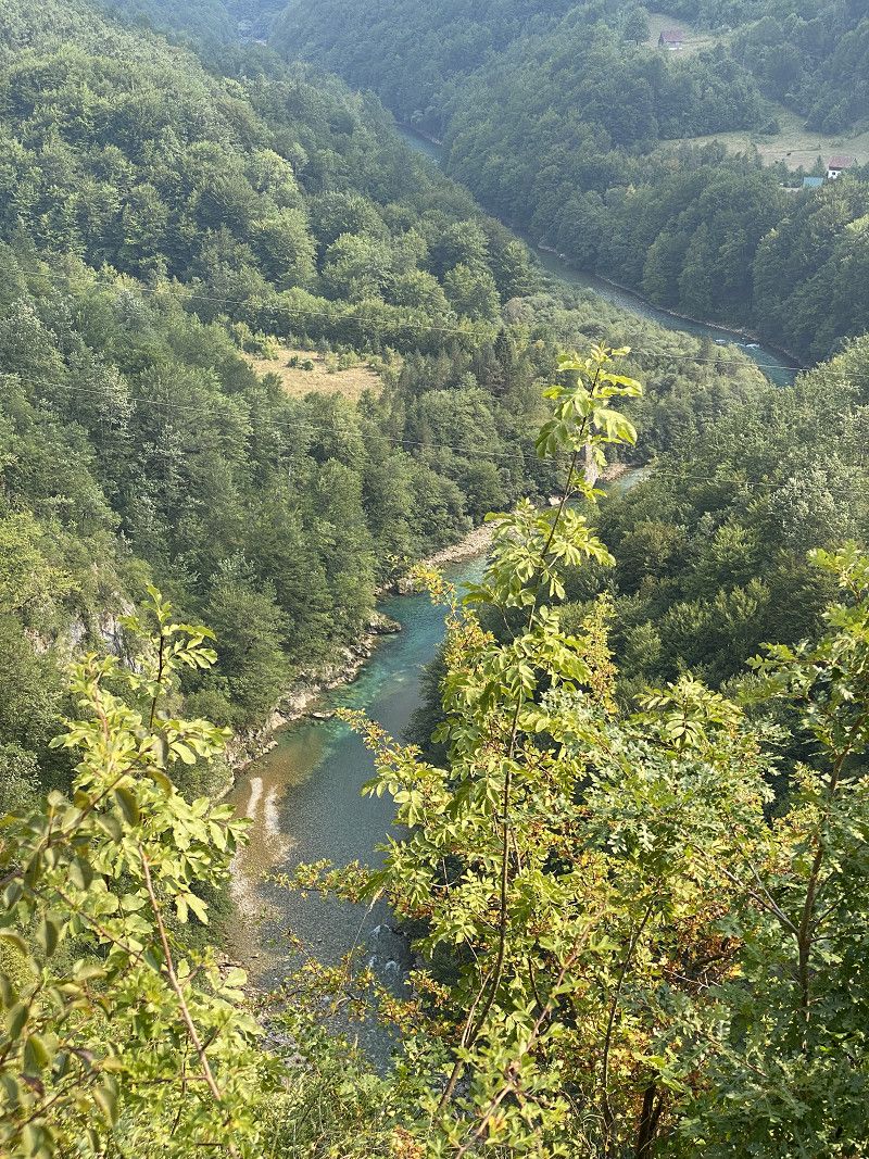
Tara Brücke / Đurđevića Tara
Most na Tari, Đurđevića Tara, Gemeinde Pljevlja, Montenegro
43° 9' 1.9" N 19° 17' 42.3" E
43.1505322 19.2950839
• Head northeast on R-4. Go for 68 m.
• Turn right. Go for 12 m.
• Turn right. Go for 361 m.
• Make a U-Turn. Go for 361 m.
• Turn left toward R-4. Go for 12 m.
• Turn left onto R-4. Go for 366 m.
• Turn right. Go for 231 m.
• Turn left. Go for 57 m.
• Turn right toward R-4. Go for 43 m.
• Turn left onto R-4. Go for 36 m.
• Turn right. Go for 883 m.
• Arrive at your destination on the left.
☍
2,4 km
( 9 min.)
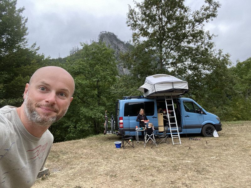
Camp Budecevica an der Tara
Gemeinde Pljevlja, Montenegro
43° 8' 43.9" N 19° 17' 42.6" E
43.1455231 19.2951596
• Head northwest. Go for 883 m.
• Turn right onto R-4. Go for 366 m.
• Turn right. Go for 12 m.
• Turn right. Go for 361 m.
• Make a U-Turn. Go for 361 m.
• Turn left toward R-4. Go for 12 m.
• Turn left onto R-4. Go for 402 m.
• Continue on R-5 toward Žabljak. Go for 20.9 km.
• Turn left onto Narodnih heroja (R-5) toward Šavnik/Nikšić. Go for 13.4 km.
• Continue on Tunel Ivica. Go for 13.4 km.
• Continue on R-5 toward Nikšić. Go for 27.9 km.
• Turn left onto E-762 toward Nikšić/Podgorica/Vilusi. Go for 17.1 km.
• Take ramp. Go for 185 m.
• Turn left onto Ulica Hercegovacki put (M-6). Go for 8.6 km.
• Arrive at M-6. Your destination is on the left.
☍
103,9 km
(1 hrs. 52 min.)
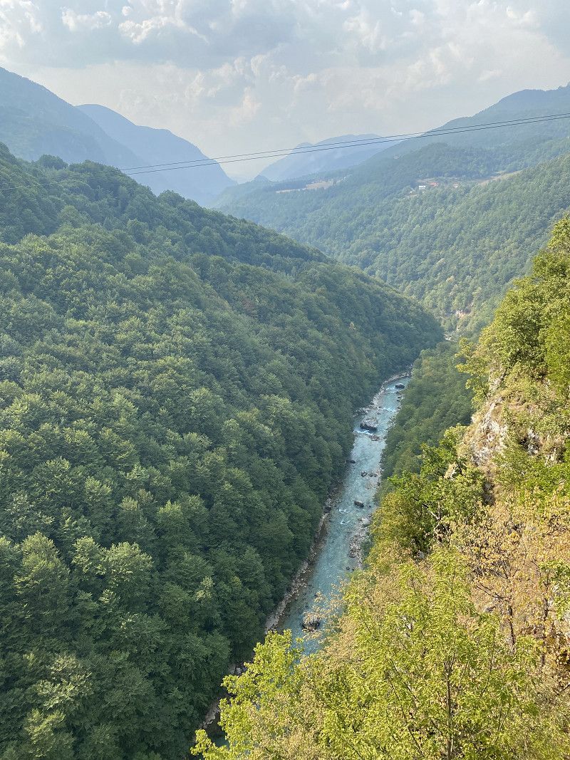
Unternehmungen und Stellpatz an der Tarabrücke
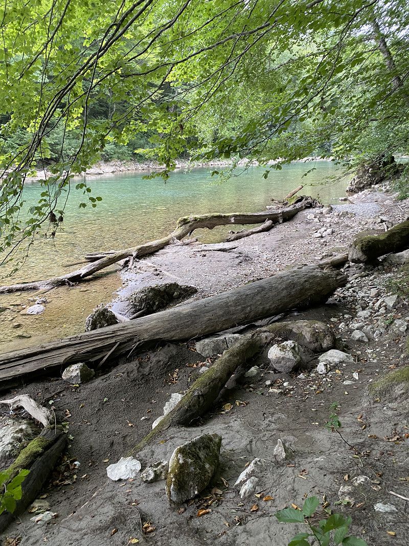
There are opportunities for white water rafting around the Tara Bridge and a huge zipline leads over the gorge. From our parking space a path leads directly down into the gorge to the Tara River, where you can cool off wonderfully. The parking space itself is relatively simple. But there are toilets and showers. You can find more information on my travel blog. https://www.christian-fiedler-wildlife.de/on-tour/roadtrips/camper-roadtrip-mit-der-familie-in-montenegro/
Day
Day
Einfach nur ein Wegpunkt
M-7, Gemeinde Nikšić, Montenegro
42° 46' 12.4" N 18° 49' 59.4" E
42.7701156 18.8331717
• Head northwest on M-6. Go for 22.5 km.
• Turn left onto M-4 toward Trebinje. Go for 19.3 km.
• Arrive at M-4.
☍
41,8 km
( 33 min.)
Einfach nur ein Wegpunkt
M-8, Gemeinde Kotor, Montenegro
42° 35' 35.1" N 18° 41' 23" E
42.5930734 18.6897253
• Head south on M-4. Go for 19.3 km.
• Take the 2nd exit from roundabout onto Lipci (E-65/E-80) toward Kotor/Risan. Go for 21.8 km.
• Turn left toward Trg Mata Petrovica. Go for 67 m.
• Continue on Trg Mata Petrovica. Go for 208 m.
• Turn right. Go for 44 m.
• Arrive at your destination.
☍
41,5 km
( 46 min.)
Kotor
Kotor is truly a beautiful city. You should also stay here for a while and visit the old city.
Gemeinde Kotor, Montenegro
42° 25' 29.5" N 18° 46' 15.8" E
42.4248515 18.7710437
• Head north. Go for 44 m.
• Turn left toward Trg Mata Petrovica. Go for 86 m.
• Continue on Trg Mata Petrovica. Go for 189 m.
• Turn left onto Ulica Jadranski put (E-65/E-80). Go for 855 m.
• Take the 2nd exit from roundabout onto Skaljari (R-1) toward Autobuska stanica/Budva/Tivat. Go for 4.4 km.
• Take the 4th exit from roundabout toward Radovići/Krašići. Go for 56 m.
• Continue straight ahead. Go for 2.2 km.
• Continue straight ahead. Go for 37 m.
• Take the 1st exit from roundabout. Go for 30 m.
• Continue straight ahead. Go for 54 m.
• Turn right. Go for 637 m.
• Arrive at your destination on the right.
☍
8,6 km
( 13 min.)
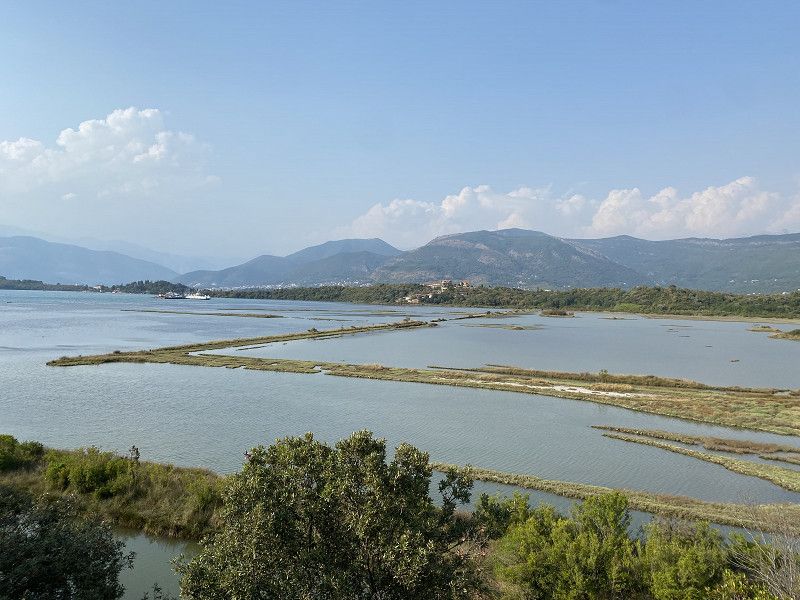
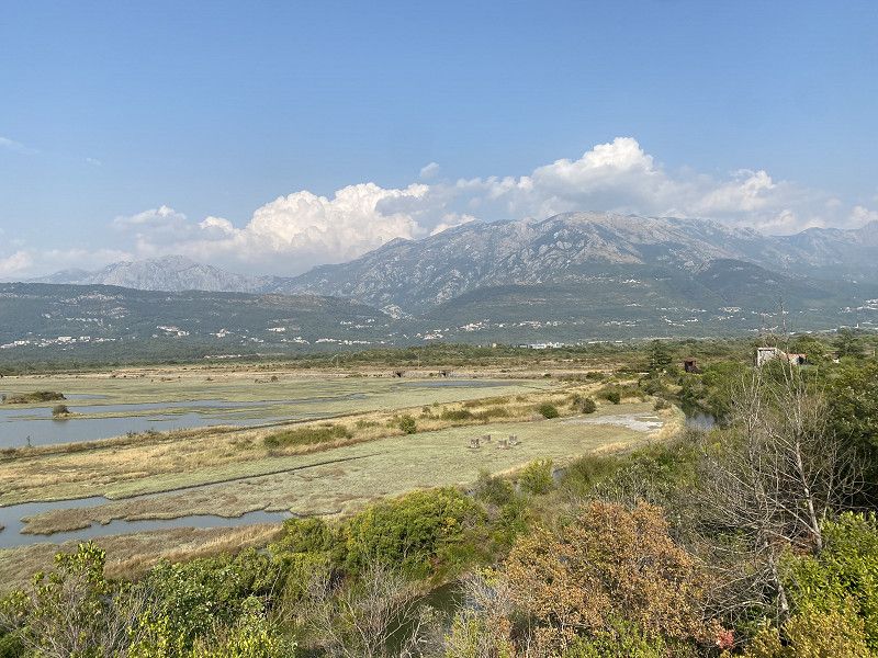
Tivatska solila
On the way to the Luštica peninsula lies Tivatska Solila, a unique bird sanctuary. This is located on the site of the former salt works. During the Middle Ages, salt production here was of greater value than gold. When the salt marshes were no longer used, numerous bird species found a habitat there. Over 120 species of birds, including flamingos, sea eagles, cranes and cormorants, can be observed here.
Montenegro
42° 23' 42.9" N 18° 42' 58.8" E
42.3952599 18.7163279
• Head southwest. Go for 637 m.
• Turn right toward Radovici. Go for 3.9 km.
• Continue on Radovici. Go for 1.2 km.
• Turn right onto Radovici. Go for 1.2 km.
• Turn left. Go for 664 m.
• Arrive at your destination on the right.
☍
7,5 km
( 13 min.)
Luštica Bay
Small harbor town for the rich and famous of Montzenegro with shopping opportunities such as groceries.
MR-1, Radovići, Gemeinde Tivat, Montenegro
42° 23' 14.3" N 18° 39' 54.3" E
42.3873116 18.6650786
• Head northwest. Go for 664 m.
• Turn left. Go for 6.6 km.
• Turn left toward Ponte Vesla. Go for 2.2 km.
• Continue on Ponte Vesla. Go for 212 m.
• Turn left onto Ponte Vesla. Go for 355 m.
• Arrive at Ponte Vesla. Your destination is on the left.
☍
9,9 km
( 20 min.)
Kamp Begovic / Veslo
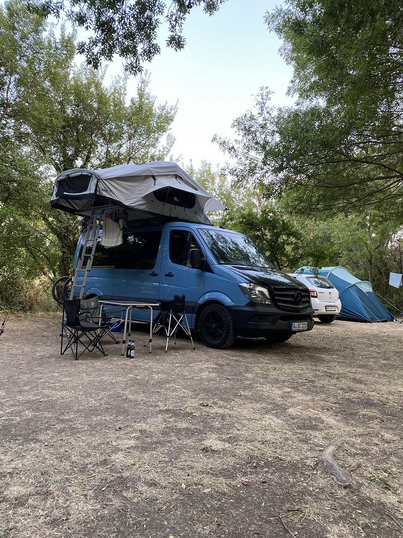
The Kamp Begovic is really beautifully located. In the morning you wake up with the first rays of sunrise and in the evening you can wonderfully watch the sunset - and all with a view of the sea. The campsite is simple, but offers all the comfort you want with toilets, showers and a bistro, but everything is a little more original. We went on an MTB tour from here, went swimming, relaxed and enjoyed the time.
Луштичка, Luštica, Gemeinde Herceg Novi, Montenegro
42° 21' 59.7" N 18° 36' 40.9" E
42.3665912 18.6113586
• Head northeast on Ponte Vesla. Go for 355 m.
• Keep left onto Ponte Vesla. Go for 185 m.
• Continue straight ahead. Go for 863 m.
• Turn left toward Trap. Go for 876 m.
• Turn slightly right onto Trap. Go for 1.4 km.
• Turn right toward Zambelici. Go for 479 m.
• Continue on Zambelici. Go for 498 m.
• Turn left. Go for 1.6 km.
• Arrive at your destination on the right.
☍
6,2 km
( 14 min.)
Day
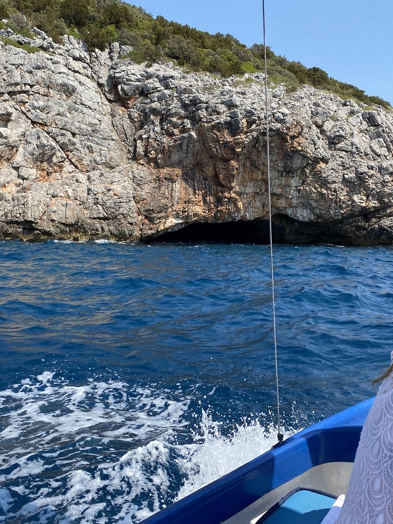
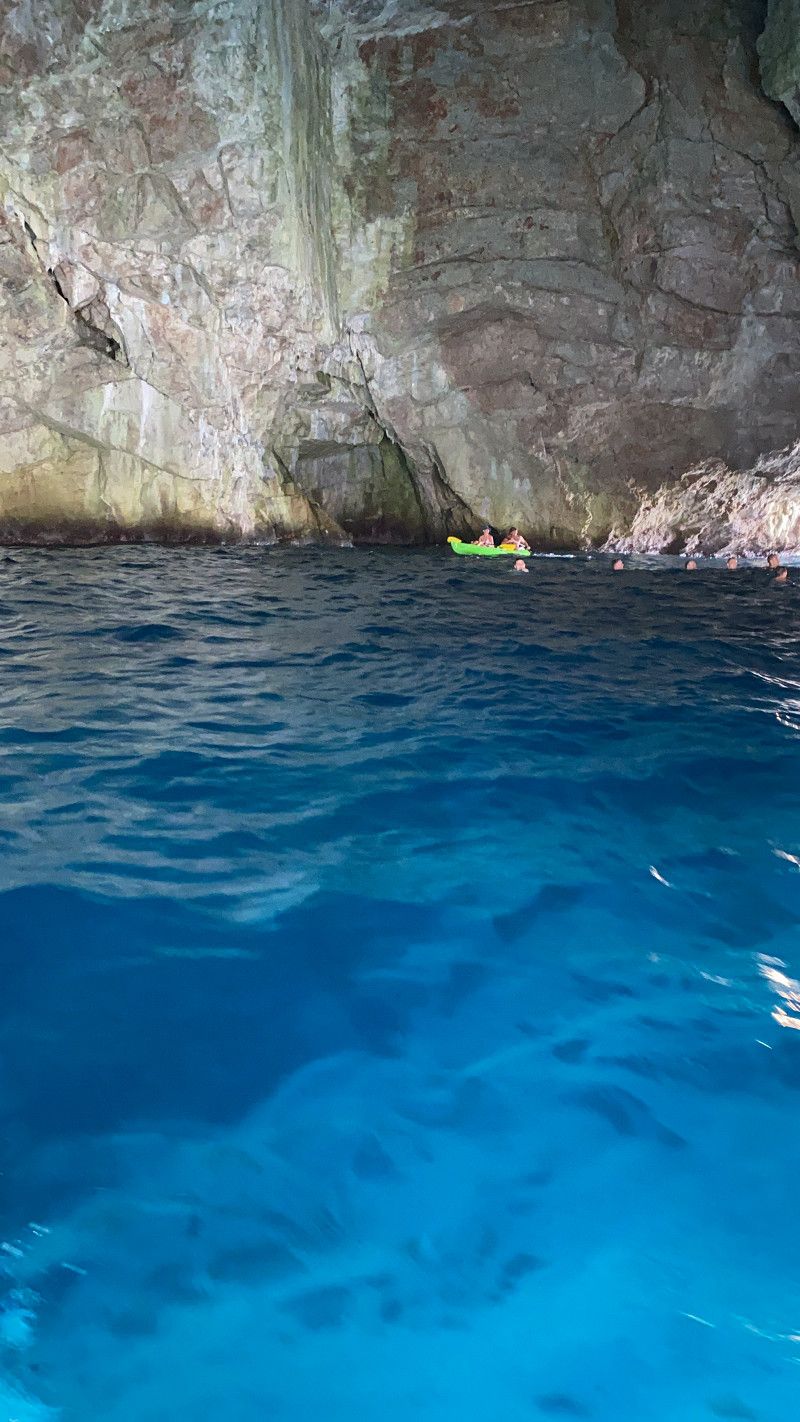
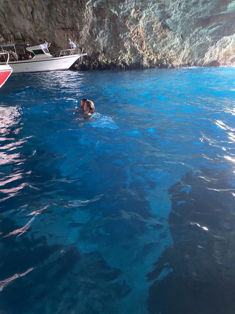
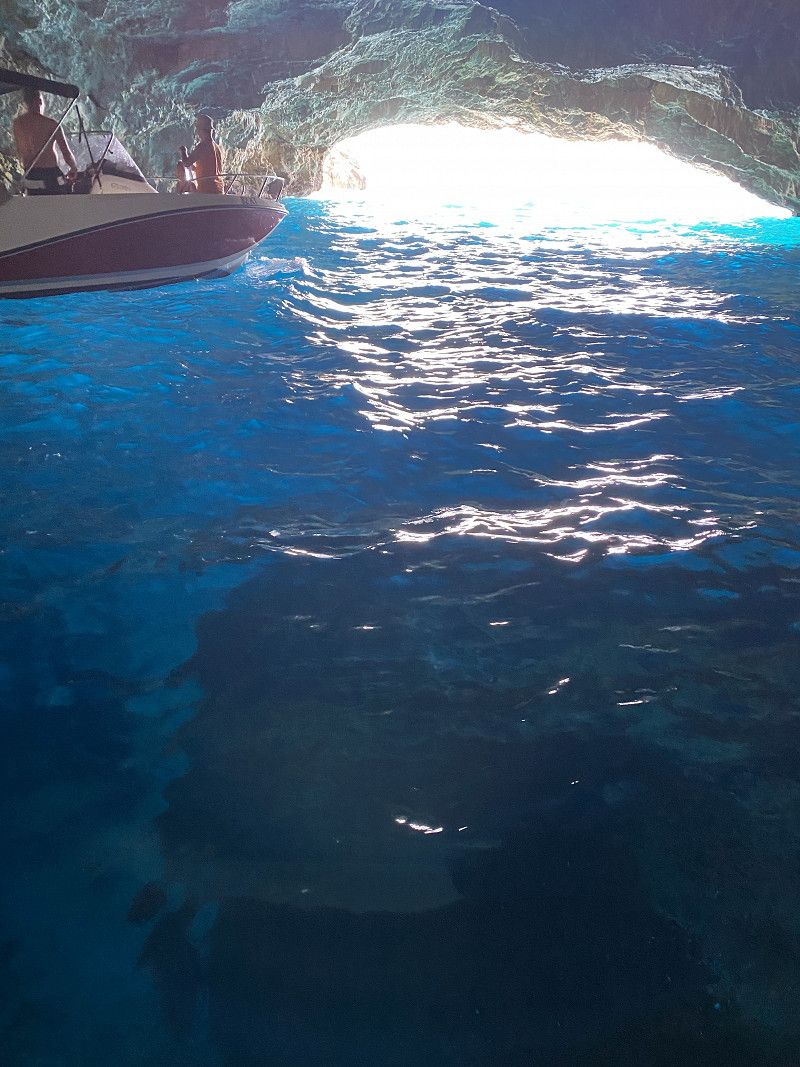
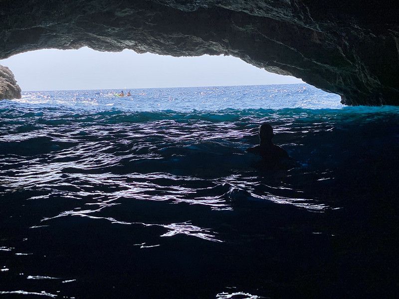
Startpunkt der Bootstour zu der blauen Höhle.
In the town of Žanjice is the starting point of many boat tours to the blue cave. It's really a great trip to the sea cave where you can jump into the sea from a boat if you want. You have the option to travel with the large tourist boats or with a small private boat that earns a living with it. In terms of price it makes no difference. In a small boat you can travel more privately. Ideal for small families. But I would take something to drink and snack with me. The tour lasts between 2 and 3 hours.
Gemeinde Herceg Novi, Montenegro
42° 24' 2" N 18° 35' 4.3" E
42.4005627 18.5845358
• Head east. Go for 1.6 km.
• Turn right toward Zambelici. Go for 244 m.
• Continue on Zambelici. Go for 733 m.
• Turn left toward Radovići. Go for 1.4 km.
• Continue on Begovici. Go for 7.9 km.
• Turn left toward Radovici. Go for 294 m.
• Turn right onto Radovici. Go for 274 m.
• Turn left onto Radovici. Go for 5.1 km.
• Continue straight ahead. Go for 30 m.
• Take the 2nd exit from roundabout. Go for 70 m.
• Continue straight ahead. Go for 2.2 km.
• Continue toward Jadranski put/R-22. Go for 46 m.
• Take the 2nd exit from roundabout onto Jadranski put (R-22) toward Kotor. Go for 4.4 km.
• Take the 1st exit from roundabout onto Skaljari (E-65/E-80). Go for 22.6 km.
• Take the 2nd exit from roundabout onto Lipci (E-65/E-80) toward Kamenari Herceg Novi/Kamenari/Herceg Novi. Go for 18.6 km.
• Take the 2nd exit from roundabout onto Ulica Zemunska (E-65/E-80) toward Dubrovnik/Igalo/Herceg Novi. Go for 5.8 km.
• Turn left toward Igalo. Go for 352 m.
• Turn right onto Ulica Nikole Kovacevica. Go for 14 m.
• Turn right onto Ulica doktora Svetozara Zivojinovica. Go for 11 m.
• Arrive at Ulica doktora Svetozara Zivojinovica. Your destination is on the right.
☍
71,5 km
(1 hrs. 42 min.)
Day
Day
Parkplatz Provodina zum Strand Igalo
Parking lot for visiting the beach.
Dr Svetozara Živojinovića, Provodina, Gemeinde Herceg Novi, Montenegro
42° 27' 14.6" N 18° 30' 21.9" E
42.4540507 18.5060928
• Head toward Ulica Nikole Kovacevica on Ulica doktora Svetozara Zivojinovica. Go for 11 m.
• Turn left onto Ulica Nikole Kovacevica. Go for 14 m.
• Turn left toward E-65/E-80. Go for 7.4 km.
• Continue on Jadranska magistrala (8). Go for 82.6 km.
• Continue on 674. Go for 31.9 km.
• Continue on Jadranska magistrala (8). Go for 21.9 km.
• Turn left onto 425 toward Ploče/A1/Zagreb/Split. Go for 150 m.
• Keep right onto 425 toward Zagreb/Split. Go for 14.7 km.
• Take the exit onto A1 (Čvor Ploče). Go for 350 km.
• Take exit 10 toward Senj onto Čvor Žuta lokva. Go for 2.0 km.
• Continue toward Žuta lokva/23. Go for 316 m.
• Take the exit. Go for 1.1 km.
• Turn left onto Žuta lokva (23) toward Rijeka/Otok Rab/Senj. Go for 305 m.
• Turn right onto Žuta lokva (23) toward Rijeka/Senj. Go for 23.4 km.
• Take the 3rd exit from roundabout onto Ulica Filipa Vukasovića toward Autokamp. Go for 218 m.
• Arrive at Ulica Filipa Vukasovića. Your destination is on the left.
☍
535,8 km
(5 hrs. 38 min.)
Day
Kamp Škver
Parking space right by the sea. Unfortunately we couldn't find a place in the middle of the night and so we stood above on the side of the road. That was okay for a non-camping night.
53270, Senj, Kroatien
44° 59' 39.4" N 14° 53' 59.6" E
44.9942900 14.8998900
• Head south on Ulica Filipa Vukasovića. Go for 178 m.
• Take the 3rd exit from roundabout onto Ulica Filipa Vukasovića (8) toward Rijeka. Go for 22.1 km.
• Continue toward Ulica Zatrep/8. Go for 22 m.
• Take the 2nd exit from roundabout onto Ulica Zatrep (8) toward Rijeka/Otok Krk/Crikvenica. Go for 21.7 km.
• Take ramp onto E65 toward Otok Lošinj/Otok Cres/Otok Krk/Zagreb/Rijeka. Go for 869 m.
• Continue on A7. Go for 15.2 km.
• Keep left onto Orehovica (A7) toward Ljubljana/Trieste/Pula/Rijeka zapad. Go for 28.7 km.
• Continue on 202. Go for 256 m.
• Continue on Jelšane (6). Go for 9.9 km.
• Take the 2nd exit from roundabout onto Bazoviška cesta toward Center. Go for 247 m.
• Take the 2nd exit from roundabout onto Bazoviška cesta toward Ljubljana/Postojna. Go for 448 m.
• Take the 1st exit from roundabout onto Gregorčičeva cesta. Go for 624 m.
• Take the 2nd exit from roundabout onto Šercerjeva cesta (404) toward Knežak. Go for 842 m.
• Take the 2nd exit from roundabout onto Šercerjeva cesta (404). Go for 909 m.
• Continue on Topolc (404). Go for 1.5 km.
• Continue on Podstenje (404). Go for 109 m.
• Continue on Topolc (404). Go for 580 m.
• Continue on Šembije (404). Go for 2.8 km.
• Continue on Knežak (404). Go for 3.6 km.
• Continue on Zagorje (404). Go for 2.4 km.
• Continue on Drskovče (404). Go for 897 m.
• Continue on Parje (404). Go for 1.3 km.
• Continue on 404. Go for 798 m.
• Continue on Snežniška cesta (404). Go for 1.2 km.
• Turn right onto Postojnska cesta (6) toward Ljubljana/Postojna. Go for 280 m.
• Take the 3rd exit from roundabout onto Postojnska cesta (6). Go for 8.5 km.
• Take ramp onto A1 toward Ljubljana. Go for 44.3 km.
• Take left exit 36 toward Beljak/Villach/Kranj/Ljubljana-sever onto A2. Go for 71.8 km.
• Continue on Karawankentunnel (A11). Go for 21.1 km.
• Continue on A10 (Tauern Autobahn) toward E55/E66/Salzburg/Villach-Ossiacher See. Go for 181 km.
• Take the exit onto A1 (West Autobahn). Go for 3.5 km.
• Continue on A8. Go for 114 km.
• Take exit 95 toward Nürnberg/Stuttgart/Messe/ICM/Flughafen München onto A99. Go for 45.1 km.
• Keep right onto A99 (Autobahndreieck München-Allach) toward Stuttgart/Augsburg/Dachau/Fürstenfeldbruck. Go for 4.3 km.
• Continue on A8 (Autobahndreieck München/Eschenried). Go for 42.6 km.
• Take exit 73 toward Augsburg-Ost onto B2 (Mühlhauser Straße). Go for 3.0 km.
• Turn left onto Neuburger Straße toward Lechhausen. Go for 134 m.
• Keep left onto Neuburger Straße. Go for 1.8 km.
• Continue on Lechhauser Straße. Go for 748 m.
• Continue on Jakobertorplatz. Go for 43 m.
• Keep left onto Jakoberwallstraße toward Gewerbegebiet Textilviertel. Go for 879 m.
• Turn left onto Forsterstraße. Go for 67 m.
• Turn right onto Am Schwall. Go for 188 m.
• Continue on Predigerberg. Go for 144 m.
• Turn left onto Heilig-Grab-Gasse. Go for 83 m.
• Turn right onto Maximilianstraße. Go for 229 m.
• Arrive at Maximilianstraße. Your destination is on the left.
☍
661,0 km
(6 hrs. 48 min.)
Day
Augsburg
Bayern, Deutschland
48° 22' 0.5" N 10° 53' 55.3" E
48.3668041 10.8986971