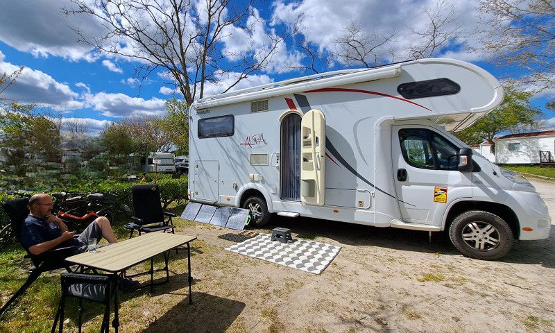
After arriving via Luxembourg, France and Spain, we explore Portugal
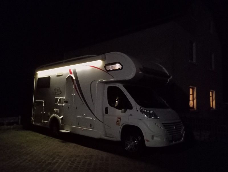
Bad Münstereifel
Kreis Euskirchen, Nordrhein-Westfalen, Deutschland
50° 33' 16.4" N 6° 45' 49.1" E
50.5545674 6.7636511
• Head toward Johannisstraße on Wertherstraße. Go for 26 m.
• Continue on Markt. Go for 30 m.
• Turn right onto Marktstraße. Go for 135 m.
• Turn slightly left onto Heisterbacher Straße. Go for 156 m.
• Turn right onto Nöthener Straße (L165). Go for 3.6 km.
• Take the 2nd exit from roundabout onto Nöthen (L206) toward Zingsheim. Go for 6.4 km.
• Take the 2nd exit from roundabout onto L115 toward Trier/B477/Gemünd/Blankenheim/Nettersheim/Zingsheim. Go for 522 m.
• Take the 2nd exit from roundabout onto L205 toward Marmagen/Nettersheim. Go for 6.7 km.
• Take the 3rd exit from roundabout onto Kölner Straße (L204). Go for 3.9 km.
• Take the 2nd exit from roundabout onto L204. Go for 1.6 km.
• Turn right onto Silberberg (K76) toward Hecken/Paulushof. Go for 131 m.
• Continue on K76. Go for 1.9 km.
• Continue on Paulushof (K76). Go for 198 m.
• Continue on K76. Go for 1.5 km.
• Continue on Wiesenstraße (K76). Go for 232 m.
• Continue on Altenbergstraße (K76). Go for 73 m.
• Arrive at Altenbergstraße (K76). Your destination is on the left.
☍
27,2 km
( 26 min.)
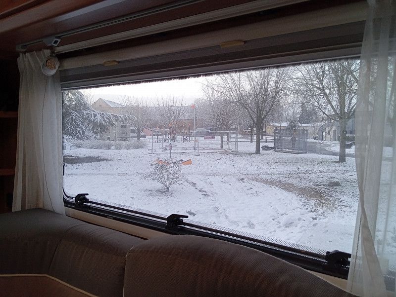
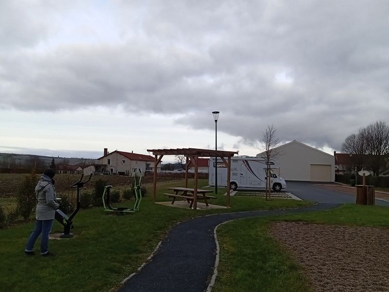
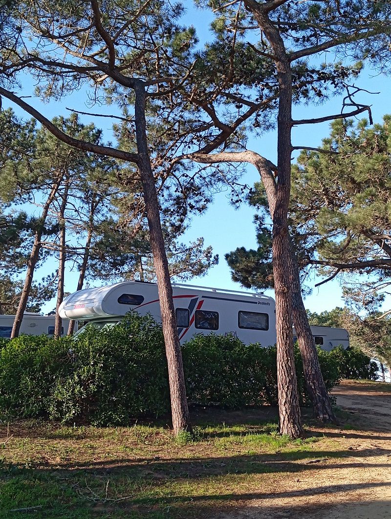
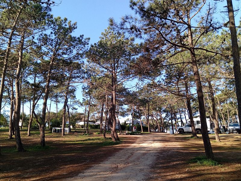
Hecken
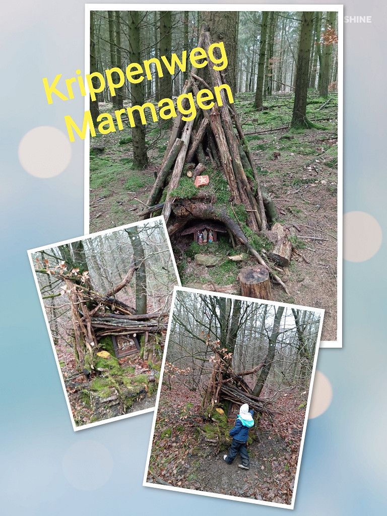
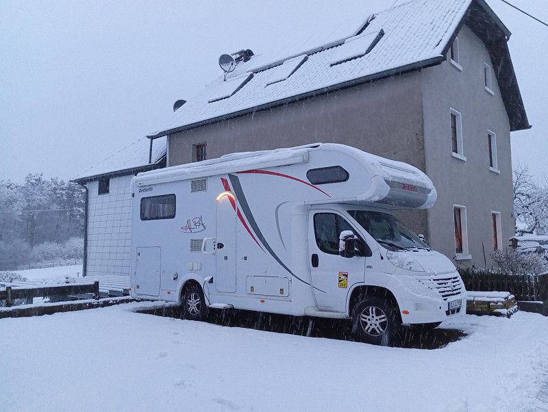
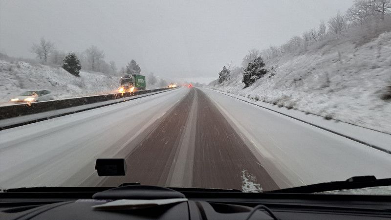
We spend lovely hours in the Eifel and hike the Nativity Trail. It snowed during the night and so we start in "winter".
Kreis Euskirchen, Nordrhein-Westfalen, Deutschland
50° 27' 11.9" N 6° 30' 48.1" E
50.4533093 6.5133599
• Head toward Ringstraße on Altenbergstraße (K76). Go for 85 m.
• Turn left onto Höhenweg toward Paulushof. Go for 102 m.
• Turn left onto Höhenweg toward Paulushof. Go for 61 m.
• Turn right onto Wiesenstraße (K76). Go for 66 m.
• Continue on K76. Go for 1.5 km.
• Continue on Paulushof (K76). Go for 198 m.
• Continue on K76. Go for 1.9 km.
• Continue on Silberberg (K76). Go for 131 m.
• Turn right onto L204 toward Schmidtheim. Go for 4.3 km.
• Turn right onto B51 toward Trier/Stadtkyll/Dahlem. Go for 25.6 km.
• Take ramp onto B51/B410. Go for 7.2 km.
• Take the 2nd exit from roundabout onto B51 toward Luxemburg/A60/Trier/Bitburg/E42/Schloßheck. Go for 219 m.
• Take ramp onto A60 toward Luxembourg/Trier/Bitburg. Go for 18.9 km.
• Take exit 6 toward Luxembourg/Bitburg onto B51. Go for 9.6 km.
• Take ramp onto B257 toward Luxemburg/Echternach/Irrel. Go for 16.5 km.
• Keep left onto B257 toward Luxemburg/Echternach. Go for 1.8 km.
• Take ramp toward Trier/Körperich/Bollendorf/Echternacherbrück. Go for 81 m.
• Take the 3rd exit from roundabout onto L1 toward Bollendorf/Echternacherbrück. Go for 831 m.
• Take the 2nd exit from roundabout onto Bitburger Straße (L1) toward Luxembourg/Echternach. Go for 71 m.
• Continue on N11. Go for 93 m.
• Turn right onto Rue du Pont (N10). Go for 462 m.
• Continue on Route de Luxembourg (N11). Go for 16.4 km.
• Keep left onto E29 toward Luxembourg/Gonderange. Go for 2.4 km.
• Take the 2nd exit from roundabout onto E29. Go for 764 m.
• Continue on N11. Go for 7.0 km.
• Take ramp onto A7 toward Bruxelles/Trier/E29/Luxembourg/Aéroport/Plateau de Kirchberg. Go for 1.6 km.
• Take the exit toward Bruxelles/Metz/Luxembourg-Gare/E29 onto A1. Go for 9.5 km.
• Take the exit toward Metz/Saarbrücken/Livange onto A3. Go for 12.3 km.
• Keep left onto A3. Go for 739 m.
• Continue on A31. Go for 100 km.
• Take the exit toward Lyon/Paris/Dijon/Toul onto A31. Go for 71.1 km.
• Take exit 9 toward Vittel/Contrexéville/Bulgnéville. Go for 1.1 km.
• Take the 3rd exit from roundabout. Go for 141 m.
• Continue toward Bulgnéville. Go for 49 m.
• Take the 3rd exit from roundabout onto D164 toward Bulgnéville. Go for 851 m.
• Turn left onto Place de la Fontaine Marant. Go for 64 m.
• Continue on Allées Derrière le Château. Go for 112 m.
• Turn slightly right onto Rue du Févry. Go for 34 m.
• Turn left. Go for 27 m.
• Turn left. Go for 31 m.
• Arrive at your destination on the right.
☍
314,1 km
(3 hrs. 17 min.)
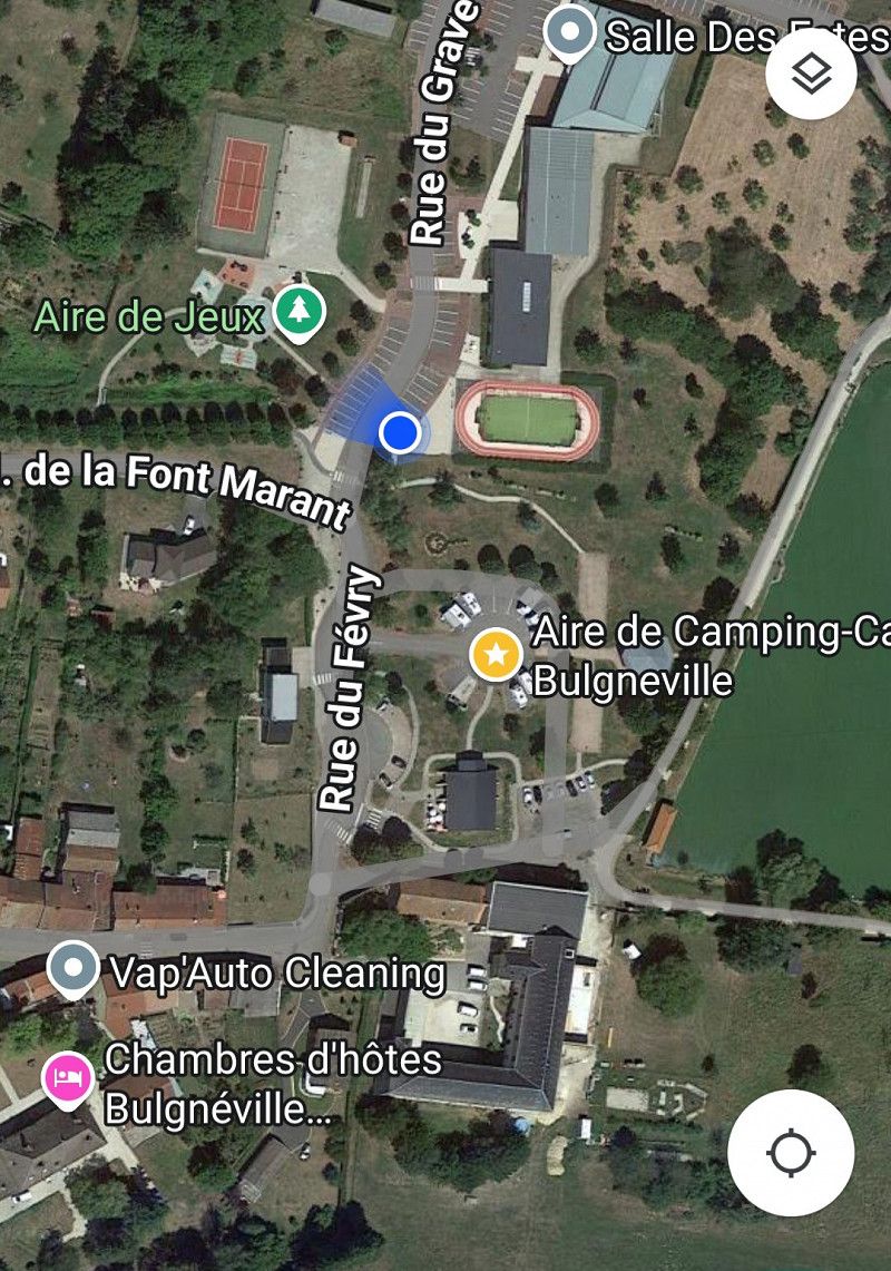
Bulgnéville
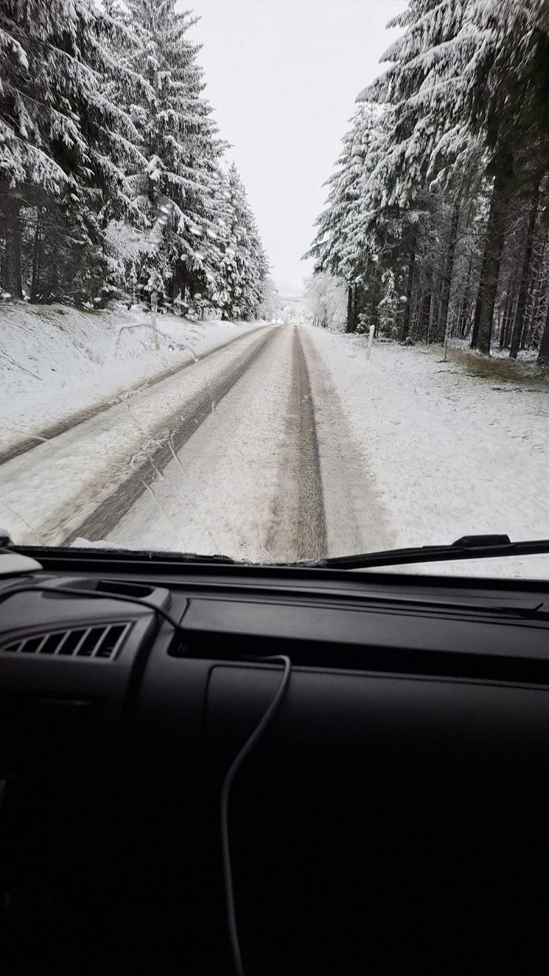
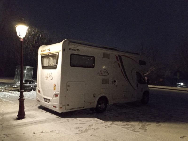
After a strenuous journey, we arrive at the parking spot quite late. All the spaces are taken and so we are parked with 10 other RVs in the adjacent parking lot. It is snowing heavily again and we are glad that we have good winter tires.
Late in the evening someone from the municipality comes and we pay 4€.
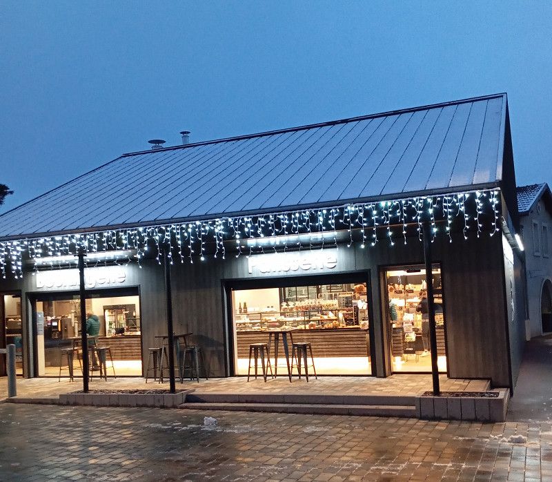
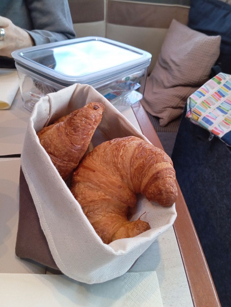
The next morning it's only 2 minutes to the bakery and there are delicious croissants and baguettes 😋
Rue du Févry, Bulgnéville, Vogesen, Grand Est, Frankreich
48° 12' 26.7" N 5° 50' 19.5" E
48.2074267 5.8387614
• Head northwest. Go for 31 m.
• Turn right toward Rue du Févry. Go for 27 m.
• Turn left onto Rue du Févry. Go for 62 m.
• Continue on Rue des Récolets. Go for 183 m.
• Turn right onto Rue Sainte-Anne (D164). Go for 848 m.
• Take the 2nd exit from roundabout toward A31/Chaumont/Dijon/Toul/Nancy. Go for 211 m.
• Take the 1st exit from roundabout. Go for 109 m.
• Take ramp onto A31 toward Troyes/Dijon. Go for 61.8 km.
• Take the left exit toward Lyon/Besançon/Dijon/Langres-Sud onto A31. Go for 115 km.
• Continue on A6 (Autoroute du Soleil). Go for 31.2 km.
• Take exit 26 toward Lons le Saunier/Montceau les M./Le Creusot. Go for 1.2 km.
• Take the 2nd exit from roundabout onto Route Express Chalon Montceau (N80) toward Moulins/Montceau les M./Le Creusot/Cluny. Go for 746 m.
• Take the 2nd exit from Giratoire de Cortelin roundabout onto Route Express Chalon Montceau (N80) toward Moulins/Montceau les M./Le Creusot. Go for 26.6 km.
• Take the 3rd exit from Rond-Point Jeanne Rose roundabout onto N70 toward Montchanin/Montceau les M./Moulins/Montchanin-Centre. Go for 44.0 km.
• Continue on N79. Go for 844 m.
• Keep left onto N79 toward Moulins/Nevers/Roanne/Vichy/Digoin/Paray le M.-Sud. Go for 9.0 km.
• Keep left onto A79 toward Montluçon/Nevers/Vichy/Moulins/Digoin-Ouest. Go for 57.6 km.
• Take exit 31 toward Moulins-la Madeleine/Chemilly. Go for 635 m.
• Take the 1st exit from roundabout onto D2009. Go for 312 m.
• Take the 2nd exit from roundabout onto D2009 toward St Pourçain S/S./Châtel de Neuvre. Go for 19.0 km.
• Turn right onto Place de Strasbourg (D987) toward Chantelle. Go for 593 m.
• Turn right onto Rue Faubourg National (D987). Go for 486 m.
• Take the 3rd exit from Place de la Liberté roundabout onto Route de Chantelle (D987). Go for 7.9 km.
• Turn left onto Rue de la Gare (D115). Go for 409 m.
• Continue on D115. Go for 522 m.
• Continue on Route de Saint-Pourcain (D115). Go for 1.6 km.
• Turn right onto Route d'Etroussat (D36). Go for 284 m.
• Turn left onto Route d'Ussel (D115). Go for 480 m.
• Continue on D115. Go for 1.0 km.
• Continue on Route de Fourilles (D115). Go for 967 m.
• Continue on D115. Go for 207 m.
• Continue on Lieu-dit Leu (D115). Go for 93 m.
• Continue on D115. Go for 976 m.
• Continue on Grande Rue (D115). Go for 157 m.
• Continue on Grande Rue (D223). Go for 66 m.
• Continue on Grande Rue (D115). Go for 118 m.
• Continue on D115. Go for 2.2 km.
• Continue on D35. Go for 118 m.
• Continue on Lieu-dit La Marche (D35). Go for 93 m.
• Continue on D35. Go for 4.5 km.
• Continue on Lieu-dit L'Étang (D35). Go for 255 m.
• Continue on D35. Go for 239 m.
• Turn left onto D35. Go for 1.1 km.
• Continue on Avenue de la Mairie (D35). Go for 362 m.
• Turn left onto Rue des Tisserands. Go for 123 m.
• Arrive at Rue des Tisserands. Your destination is on the left.
☍
394,2 km
(3 hrs. 45 min.)
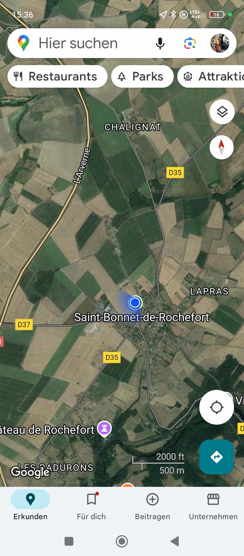
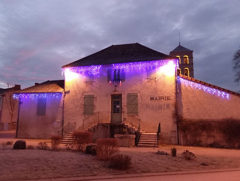
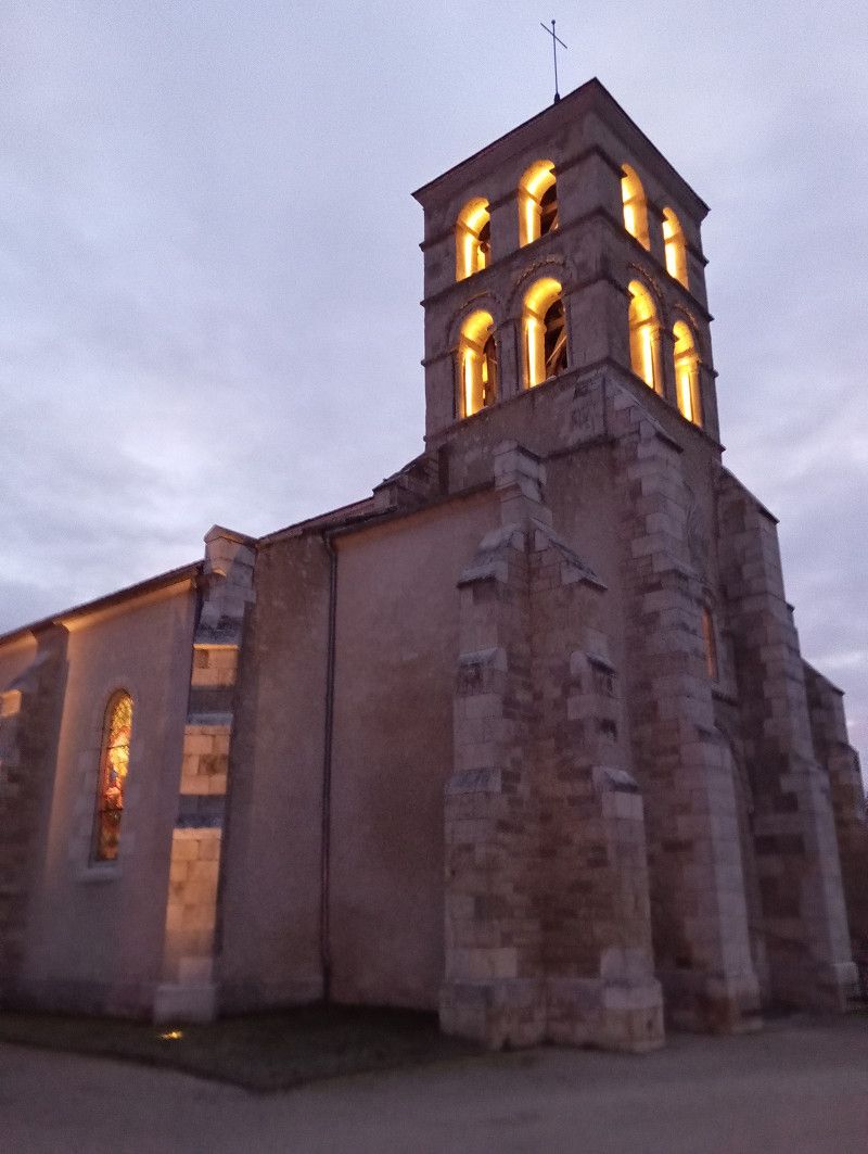
Saint-Bonnet-de-Rochefort
After a five-hour drive on the motorway and national road, and finally a long stretch of country road, we reach this small town.
The Maut1 box works great, even on the "flux libre" route.
A small parking space, provided free of charge by the municipality. Well maintained and beautifully laid out for four RVs.
In the evening all the places are full and there is a heavenly peace.
Fresh croissants and baguettes are just a few steps away 😋
Allier, Auvergne-Rhone-Alpen, Frankreich
46° 8' 48.7" N 3° 8' 16.9" E
46.1468603 3.1380310
• Head southeast on Rue des Tisserands. Go for 83 m.
• Turn right onto Rue du Riou. Go for 198 m.
• Turn right onto Route de Gannat (D37). Go for 269 m.
• Take the 3rd exit from roundabout onto Route d'Ebreuil (D35). Go for 2.3 km.
• Continue on Route d'Ébreuil (D35). Go for 781 m.
• Continue on D35. Go for 885 m.
• Continue on Route de Saint-Bonnet (D35). Go for 935 m.
• Continue on Rue du Parc (D35). Go for 376 m.
• Turn left onto Rue du Pont Neuf (D998). Go for 4.7 km.
• Turn right onto D216 toward A71/Clermont-Fd/Paris/Champs. Go for 418 m.
• Take ramp onto A719. Go for 424 m.
• Take the exit toward Clermont-Fd/Riom onto A71. Go for 14.1 km.
• Take the exit toward Bordeaux/Limoges onto A89. Go for 161 km.
• Take the left exit toward E70/Toulouse/Bordeaux/Périgueux/Brive la G. onto A20 (L'Occitane). Go for 16.7 km.
• Take the exit toward Bordeaux/Périgueux/Sarlat onto A89 (Viaduc du Maumont). Go for 157 km.
• Take exit 10 toward Saintes/Royan/Libourne/St André de C./St Denis de Pile. Go for 984 m.
• Continue on Lieu-dit Les Pradasses. Go for 553 m.
• Take the 1st exit from roundabout onto Déviation des Billaux (D258) toward Saintes/Royan/Libourne/St Denis de Pile/St André de C. Go for 656 m.
• Take the 1st exit from roundabout onto Rue de Schwandorf. Go for 121 m.
• Arrive at Rue de Schwandorf. Your destination is on the right.
☍
361,9 km
(3 hrs. 4 min.)
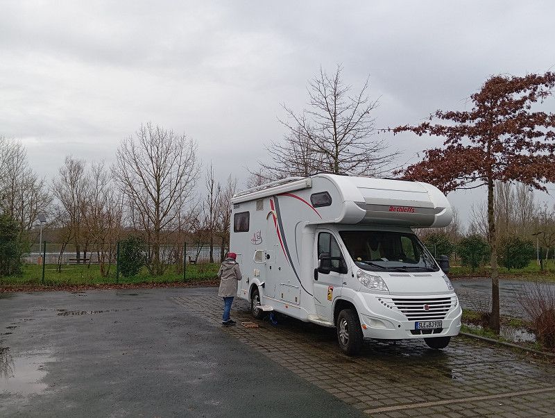
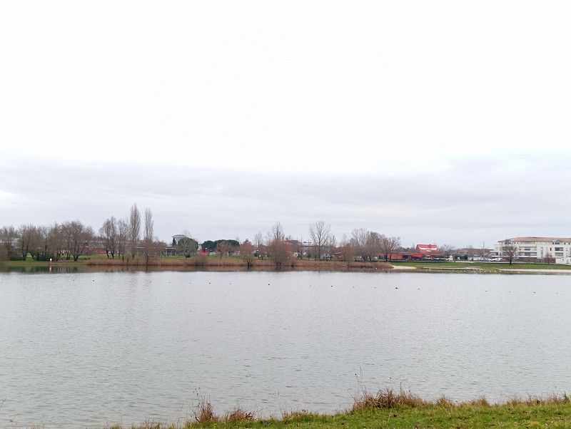
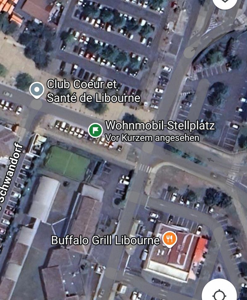
Libourne / Aire Camping Car Park
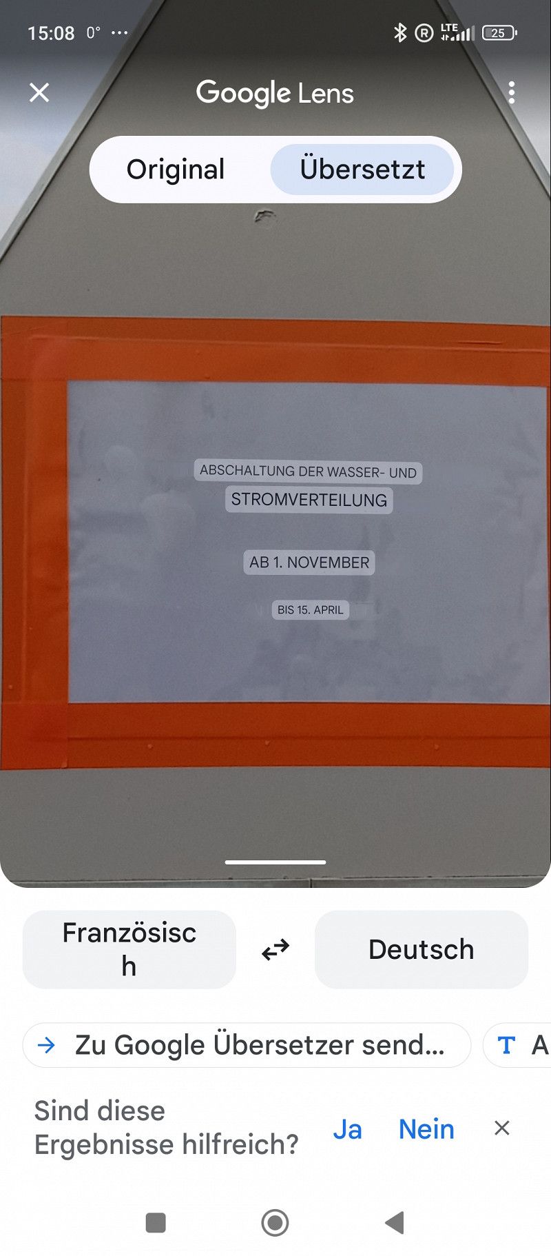
Today almost 400 km through rain and fog. Lots of climbs and headwinds on the route.
Maut1 box still without any interruptions. Tip: the lanes at the toll stations on the far right are usually a bit wider.
Visited a Camping Car Park pitch for the first time.
The pre-booked "Pass'Etapes card" was issued without any problems at the machine and can then be used to drive into all CCP parking spaces.
Basically, a section of the parking lot has been fenced off and provided with supplies, electricity and water.
17 quiet pitches right by the lake, including electricity and good WiFi for 14.36 €.
The amount is simply deducted from the credit previously booked on the card, very convenient.
Two km from the motorway, a good stopover point.
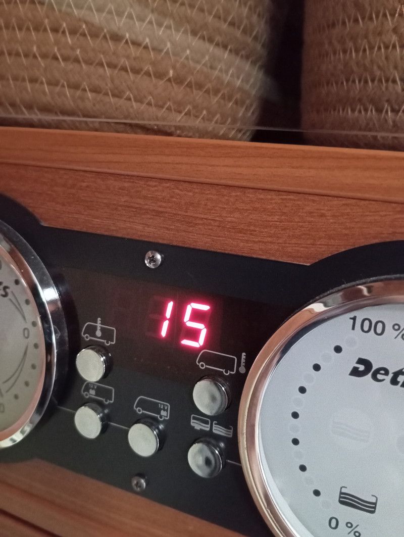
Started out in the morning at 1° and now 15° 🙂
Rue De Schwandorf 3, Libourne, Libourne, Département Gironde, Frankreich
44° 56' 49.2" N 0° 14' 39.4" W
44.9470008 -0.2442718
• Head toward Rue de Keynsham on Rue de Schwandorf. Go for 93 m.
• Take the 4th exit from roundabout onto Avenue François Mitterrand (D258). Go for 783 m.
• Take the 3rd exit from roundabout toward Bordeaux/A89/Périgueux/E70. Go for 185 m.
• Continue on Lieu-dit Les Pradasses. Go for 587 m.
• Take ramp onto A89 toward Bordeaux. Go for 12.1 km.
• Continue on N89. Go for 17.8 km.
• Keep left onto N89 toward Arcachon/Bayonne/Toulouse/Bordeaux-St Jean/Z.I. Artigues. Go for 217 m.
• Take ramp onto Rocade de Bordeaux (N230) toward Arcachon/Bayonne/Toulouse/Bordeaux-Centre/Bordeaux-St Jean/Z.I. Artigues. Go for 17.7 km.
• Take exit 15 toward Saint Sébastien/Bayonne/Mont de Marsan/Bassin d'Arcachon onto A63. Go for 167 km.
• Take exit 7 toward Ondres. Go for 887 m.
• Take the 2nd exit from roundabout onto D85 toward Ondres. Go for 1.9 km.
• Take the 1st exit from roundabout onto D810 toward Bordeaux/Mont de Marsan/Dax/Capbreton/Labenne/Ondres. Go for 2.0 km.
• Turn left onto Avenue Paul Dupruilh Laurent Stayan (D26). Go for 630 m.
• Take the 2nd exit from Rond-Point de la Vierge roundabout onto Avenue de la Plage (D26). Go for 1.7 km.
• Take the 2nd exit from roundabout onto Avenue de la Plage (D26). Go for 1.0 km.
• Take the 3rd exit from roundabout onto Avenue de la Plage. Go for 163 m.
• Arrive at Avenue de la Plage.
☍
224,4 km
(2 hrs. 8 min.)
Ondres / Aire de Camping Park
We want to see the sea and stop in Ondres after 230 km.
A fairly large municipal parking space, just a few steps from the beach.
Checking in at the machine is easy. The night costs €16.72 including tourist tax, WiFi and electricity, although the WiFi is weak.
The sky is overcast, but at 16° it is pleasantly warm and we take a nice walk on the beach.
There are only a few RVs here and it will be a quiet night.
Avenue de la Plage, Ondres, Landes, Neu-Aquitanien, Frankreich
43° 34' 30.7" N 1° 29' 3.6" W
43.5751806 -1.4843305
• Head southwest on Avenue de la Plage. Go for 91 m.
• Turn left toward Avenue de la Plage/D26. Go for 327 m.
• Turn right onto Avenue de la Plage (D26). Go for 840 m.
• Take the 2nd exit from roundabout onto Avenue de la Plage (D26). Go for 1.7 km.
• Take the 3rd exit from Rond-Point de la Vierge roundabout onto Avenue Paul Dupruilh Laurent Stayan (D26). Go for 673 m.
• Turn right onto Avenue du 11 Novembre 1918 (D810). Go for 2.0 km.
• Take the 3rd exit from roundabout onto D85 toward A63/Pau. Go for 1.9 km.
• Continue toward Pau/St Sébastien/Bayonne. Go for 38 m.
• Take the 1st exit from roundabout toward Bayonne. Go for 78 m.
• Take ramp onto A63 (Autoroute de la Côte Basque). Go for 40.0 km.
• Continue on AP-8 (Autopista del Cantábrico). Go for 12.2 km.
• Take the exit toward Bilbao/Vitoria-Gasteiz/Burgos/Hernani/A-15/Iruña/Pamplona onto AP-1/AP-8. Go for 14.8 km.
• Take the exit onto AP-1/AP-8 (Autopista del Cantábrico). Go for 41.9 km.
• Take exit 69 toward Bergara/Vitoria-Gasteiz onto AP-1. Go for 44.7 km.
• Continue on Autopista Vitoria-Eibar. Go for 87 m.
• Take exit 101 toward Vitoria-Gasteiz/Burgos/A-1 onto N-622. Go for 3.8 km.
• Take ramp onto A-1 toward Burgos/Madrid. Go for 24.0 km.
• Take exit 328 toward Burgos/Logroño/AP-68/Bilbao onto AP-1 (Autovía del Norte). Go for 83.3 km.
• Continue on A-1 (Autovía del Norte) toward Madrid/A-62/Valladolid/Portugal. Go for 7.1 km.
• Keep right onto BU-30 (Nudo de Landa) toward Palencia/Valladolid/A-62/León/A-231. Go for 1.8 km.
• Take exit 2 toward Villagonzalo Pedernales. Go for 498 m.
• Turn right. Go for 115 m.
• Continue toward Palencia/Valladolid. Go for 36 m.
• Take the 2nd exit from roundabout onto BU-P-1001. Go for 618 m.
• Take the 2nd exit from roundabout onto BU-P-1001. Go for 508 m.
• Continue on Carretera de Arcos (BU-P-1001). Go for 98 m.
• Continue on BU-P-1001. Go for 154 m.
• Take the 1st exit from Carretera de Arcos roundabout onto Carretera de Arcos (BU-P-1001). Go for 489 m.
• Continue on BU-P-1001. Go for 3.4 km.
• Take the 2nd exit from roundabout onto BU-P-1001. Go for 15.7 km.
• Continue on Carretera Burgos (BU-P-1001). Go for 87 m.
• Continue on Avenida Generalísimo (BU-V-1022). Go for 318 m.
• Continue on BU-P-1001. Go for 7.9 km.
• Continue straight ahead. Go for 27 m.
• Keep left toward BU-101. Go for 14 m.
• Turn right onto BU-101. Go for 77 m.
• Continue on Carretera Mahamud (BU-101). Go for 167 m.
• Continue on BU-101. Go for 8 m.
• Continue on Carretera Mahamud (BU-101). Go for 256 m.
• Continue on Calle Camino. Go for 252 m.
• Turn left onto Calle Los Hermosos. Go for 35 m.
• Continue on Calle Silenciosa. Go for 18 m.
• Continue on Calle Los Hermosos. Go for 98 m.
• Turn right onto Calle Fuente. Go for 160 m.
• Turn right onto Calle Fuente. Go for 7 m.
• Turn left onto Plaza Mayor. Go for 20 m.
• Arrive at Plaza Mayor. Your destination is on the right.
☍
312,4 km
(3 hrs. 1 min.)
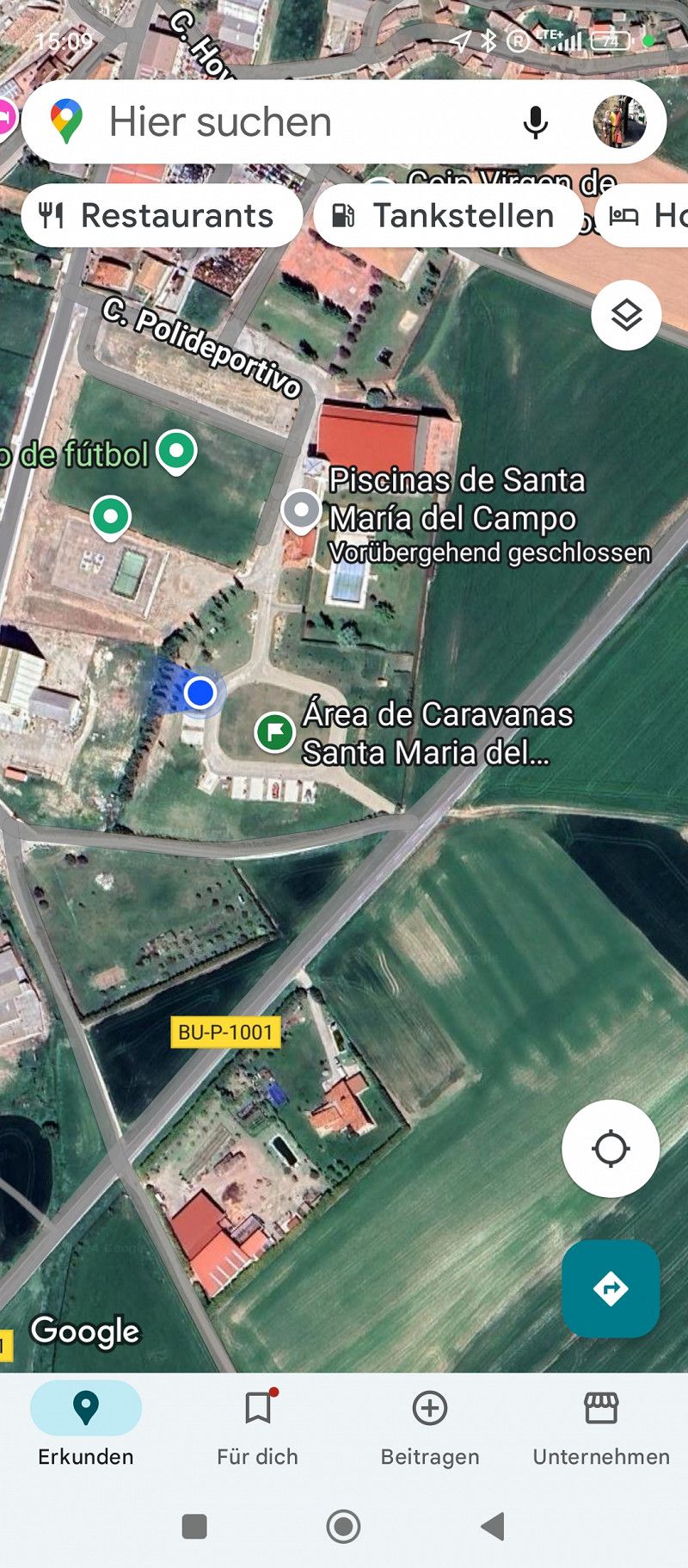
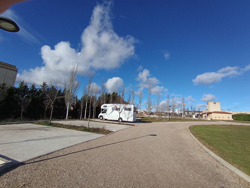
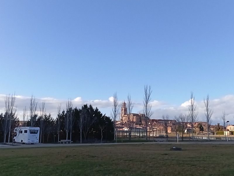
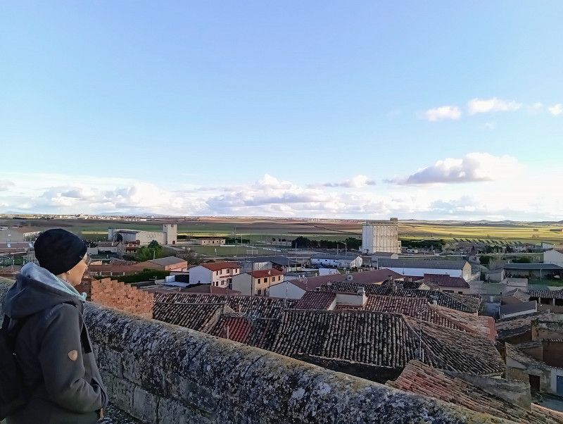
Santa María del Campo
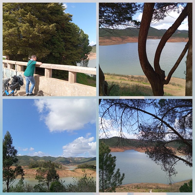
We left France and today we experienced the foothills of the Pyrenees. An impressive panoramic drive, unfortunately often with heavy rain.
We will then be welcomed with ☀️ in Santa Maria del Campo.
Here, the small town provides a spacious and very well-maintained space for 8 RVs free of charge. A great offer for self-sufficient campers.
V/E and water available.
Today is a public holiday and the place is deserted. We walk to the church, which is unfortunately closed. Bright blue skies, what more could you want.
Burgos, Kastilien und León, Spanien
42° 7' 55.1" N 3° 58' 31.6" W
42.1319646 -3.9754561
• Head toward Plaza Trinidad on Plaza Mayor. Go for 14 m.
• Turn right onto Plaza Mayor. Go for 26 m.
• Turn right onto Calle San Miguel. Go for 19 m.
• Turn left onto Calle Golondrinas. Go for 103 m.
• Turn right onto Calle Golondrinas. Go for 36 m.
• Turn slightly right onto Calle La Toba. Go for 23 m.
• Turn left onto Calle La Toba. Go for 444 m.
• Continue on BU-V-1011. Go for 8.1 km.
• Continue on Carretera Santa María del Campo (BU-V-1011). Go for 449 m.
• Continue on BU-V-1011. Go for 1.7 km.
• Turn left and take ramp onto A-62 (Autovía de Castilla) toward Palencia/Valladolid. Go for 115 km.
• Keep right onto A-62 (Autovía de Castilla) toward E-82/Zamora/A-11/Salamanca/Portugal. Go for 81.1 km.
• Take exit 234 toward Salamanca/Pol. Ind. Los Villares onto N-620. Go for 1.8 km.
• Take the 3rd exit from roundabout onto Carretera de Valladolid (N-620). Go for 1.4 km.
• Take the 2nd exit from roundabout onto Avenida de Gonzalo Torrente Ballester. Go for 1.0 km.
• Take the 3rd exit from Glorieta Castilla y León roundabout onto Avenida de los Cipreses. Go for 181 m.
• Take the 2nd exit from Glorieta Julio Robles roundabout onto Avenida de los Cipreses. Go for 633 m.
• Continue on Calle Río Miño. Go for 117 m.
• Take the 2nd exit from Glorieta Río Miño roundabout onto Calle Río Miño. Go for 111 m.
• Continue on Calle Jamaica. Go for 340 m.
• Take the 2nd exit from Glorieta de la Flecha roundabout onto Calle Bogotá. Go for 781 m.
• Take the 2nd exit from roundabout onto Avenida Fernando III El Santo. Go for 405 m.
• Take the 2nd exit from Glorieta del Arenal del Ángel roundabout onto Puente de la Serna (DSA-100). Go for 407 m.
• Take the 2nd exit from roundabout onto Avenida Serna (DSA-100). Go for 933 m.
• Take the 3rd exit from roundabout onto Avenida de Madrid (N-501a). Go for 310 m.
• Take the 3rd exit from roundabout onto Avenida de Madrid (N-501a). Go for 359 m.
• Pass 5 roundabouts and continue on Avenida de Madrid (N-501a). Go for 1.6 km.
• Turn right. Go for 53 m.
• Arrive at your destination on the left.
☍
217,3 km
(2 hrs. 2 min.)
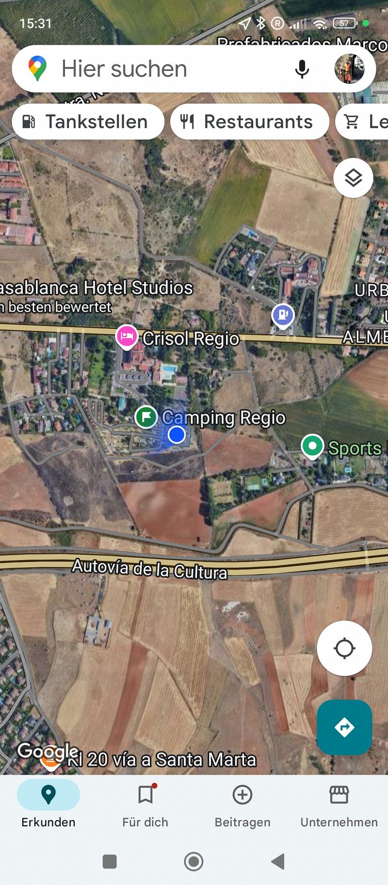
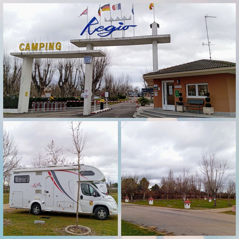
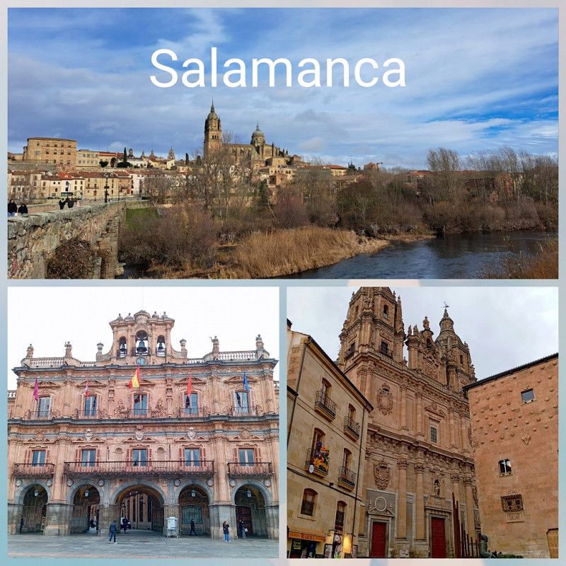
Salamanca / Camping Regio
We stayed alone at night and it was very quiet.
So after a good night's sleep we set off again after the V/E.
First a wonderful stretch of country road and then onto the motorway.
After about 200 km we reach Salamanca and replenish our supplies at a "Hyper Mercado".
A few minutes later we reach our destination for the day in "Santa Marta de Tormes".
This time a campsite with a direct bus connection to the city of Salamanca.
We are planning to stay for two nights and will pay 42 € for that, including electricity (10 A), WiFi and nice hot showers :).
The site is a bit old, but all the facilities are clean and tidy. Depending on the wind direction, you can hear the motorway quite well.
Tomorrow it's time for sightseeing.
Salamanca:
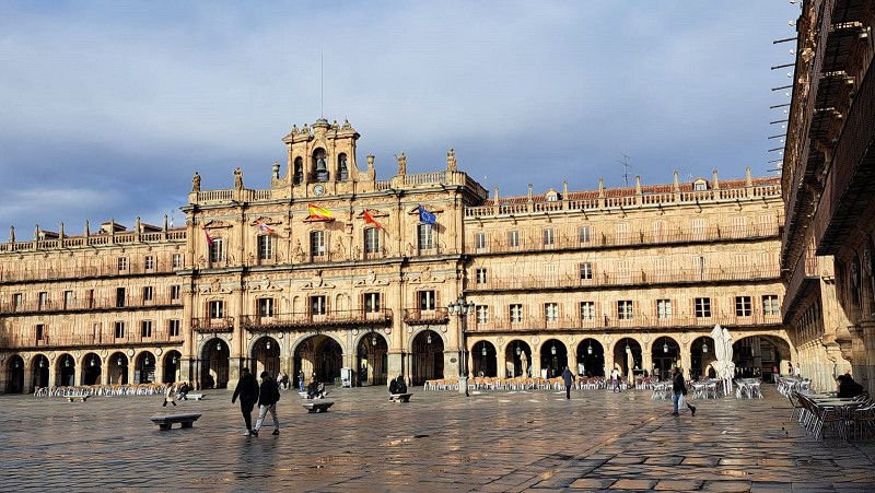
The bus station is right in front of the campsite and for €1.65 you can get to the city in half an hour. From the last stop it is just a few steps to the Plaza Mayor.
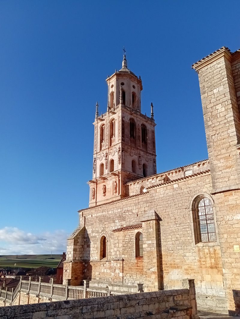
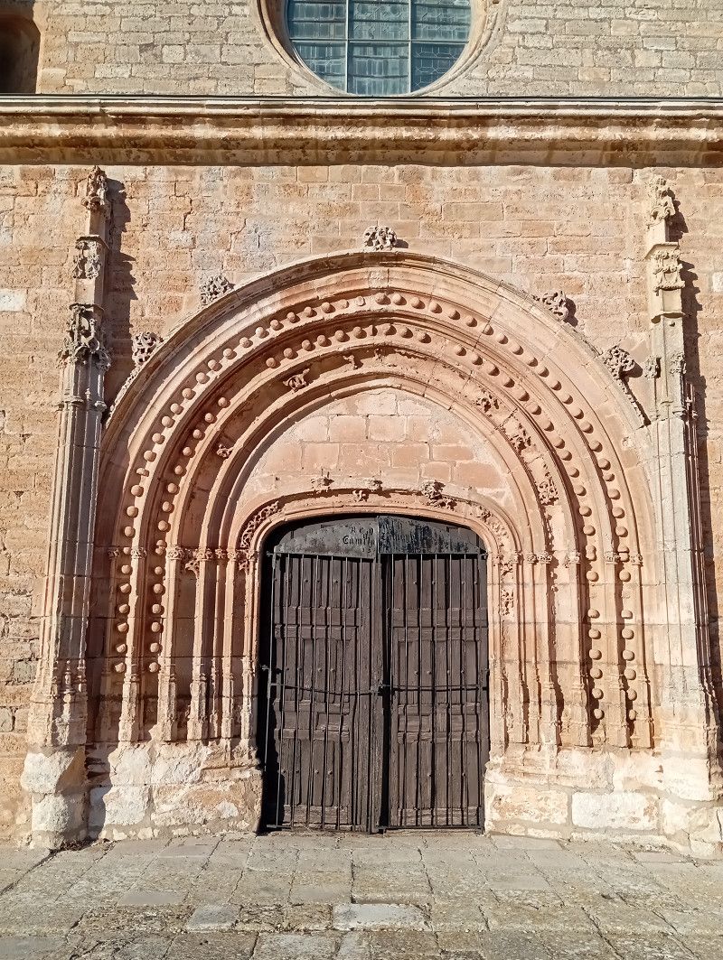
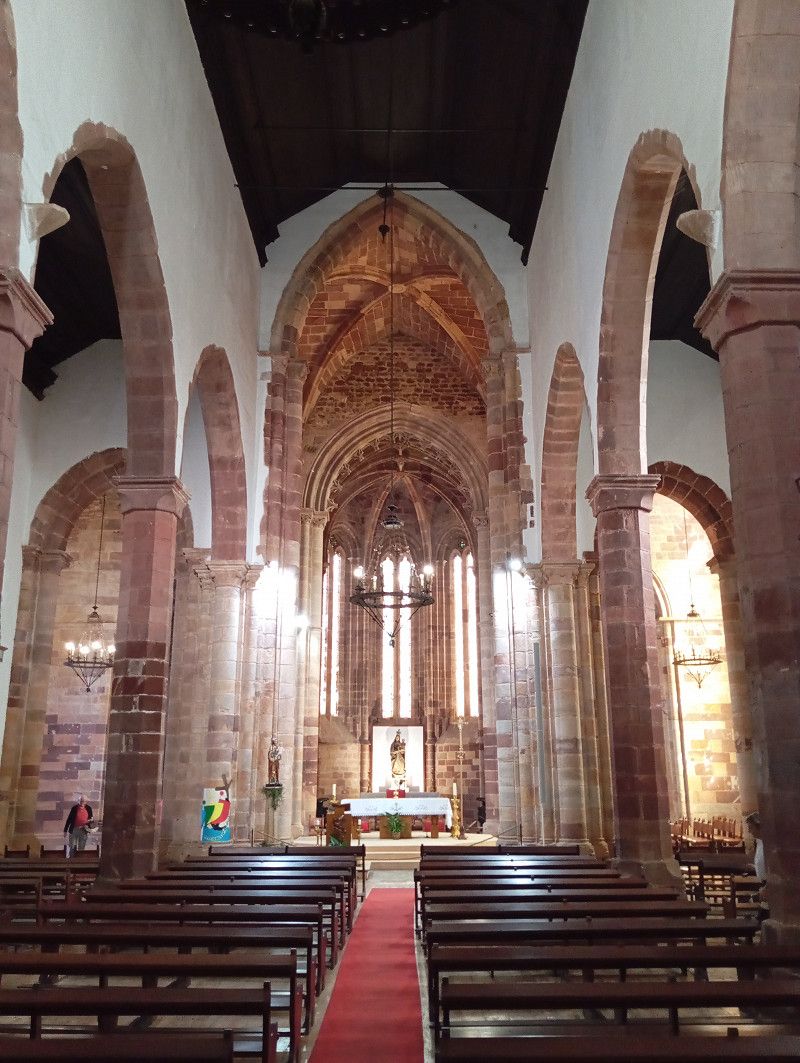
We spend the day in the historic old town, spend a long time in the cathedral and have a delicious lunch.
Salamanca is very impressive and worth a stop. We take a lot of photos, but the pictures cannot convey the impressions.
Carretera Avila-Madrid KM.4, 37900, Santa Marta de Tormes/Salamanca, Spain
40° 56' 57.3" N 5° 36' 54.2" W
40.9492531 -5.6150612
• Head south. Go for 85 m.
• Turn left. Go for 19 m.
• Turn left. Go for 39 m.
• Turn right toward Avenida de Madrid/N-501a. Go for 101 m.
• Turn right onto Avenida de Madrid (N-501a). Go for 883 m.
• Continue on N-501a. Go for 454 m.
• Take the 2nd exit from roundabout onto N-501. Go for 457 m.
• Take the 1st exit from roundabout onto A-50 (Autovía Ávila-Salamanca) toward Salamanca. Go for 3.1 km.
• Take exit 99 toward E-803/A-66/Cáceres/Zamora/E-80/A-62/Portugal/Valladolid. Go for 314 m.
• Take the 3rd exit from roundabout onto Avenida Consejo de Europa (SA-20) toward E-803/N-630/Cáceres/Zamora/E-80/A-62/Portugal/Valladolid. Go for 1.5 km.
• Take the 2nd exit from roundabout onto Avenida Consejo de Europa (SA-20) toward N-630/E-803/A-66/Cáceres/Zamora/E-80/A-62/Portugal/Valladolid. Go for 663 m.
• Take ramp toward A-66/Cáceres/Salamanca Centro Ciudad. Go for 474 m.
• Take the 4th exit from roundabout onto Avenida de Saavedra y Fajardo (N-630) toward A-66/Cáceres/Polígono Montalvo II. Go for 3.1 km.
• Take the 3rd exit from roundabout onto A-66 (Autovía Ruta de la Plata) toward Cáceres. Go for 200 km.
• Take exit 555 toward Polígono Industrial Aldea Moret/C. T. Cáceres. Go for 506 m.
• Turn right onto Carretera de Badajoz (N-523) toward Badajoz. Go for 76.9 km.
• Pass 2 roundabouts and continue on N-523. Go for 2.0 km.
• Take the 3rd exit from roundabout onto N-523. Go for 2.1 km.
• Pass 4 roundabouts and continue on Avenida Adolfo Suárez (EX-329). Go for 2.4 km.
• Take the 2nd exit from roundabout onto Avenida de Adolfo Díaz Ambrona. Go for 531 m.
• Take the 2nd exit from roundabout onto Avenida de Adolfo Díaz Ambrona toward Hospital Infanta Cristina. Go for 499 m.
• Take the 2nd exit from roundabout onto Avenida de Elvas toward E-90/A-5/Portugal/Madrid/Hospital Infanta Cristina. Go for 570 m.
• Pass 5 roundabouts and continue on Avenida de Elvas. Go for 2.4 km.
• Take the 1st exit from roundabout toward Portugal/E-90/Madrid/A-5/Mérida. Go for 124 m.
• Keep left toward E-90/A-5/Portugal. Go for 238 m.
• Continue toward Portugal. Go for 48 m.
• Take the 3rd exit from roundabout onto A-5 (Autovía de Extremadura) toward Portugal/Lisboa. Go for 966 m.
• Continue on A6 (Autoestrada do Alentejo Central). Go for 6.4 km.
• Take exit 12 toward Elvas/Este. Go for 975 m.
• Continue on N4. Go for 192 m.
• Pass 7 roundabouts and continue on Avenida de Badajoz (N4). Go for 5.1 km.
• Take the 4th exit from roundabout onto N4 toward Lisboa. Go for 223 m.
• Pass 2 roundabouts and continue on N4. Go for 1.1 km.
• Take the 4th exit from roundabout onto N4 toward Espanha/Centro/Hospital. Go for 461 m.
• Turn right. Go for 280 m.
• Arrive at your destination.
☍
314,8 km
(3 hrs. )
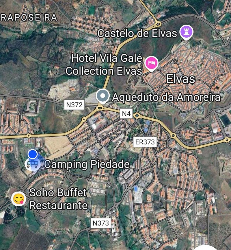
Elvas / Camping Piedade
Today the journey began bumpily. I wanted to fill up with diesel and LPG at Cepsa.
But the fuel nozzle wouldn't connect to the gas adapter. Even the friendly employee had no solution.
Then the adapter could no longer be removed, gas leaked out, pure stress.
A quick pair of pliers and the adapter was out again.
But I didn't want to give up, so I went to Repsol. The gas station attendant offered to help here too and the pump nozzle and adapter fit together, very strange.
So we hit the slopes late.
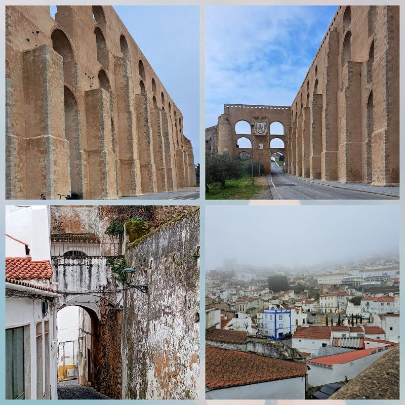
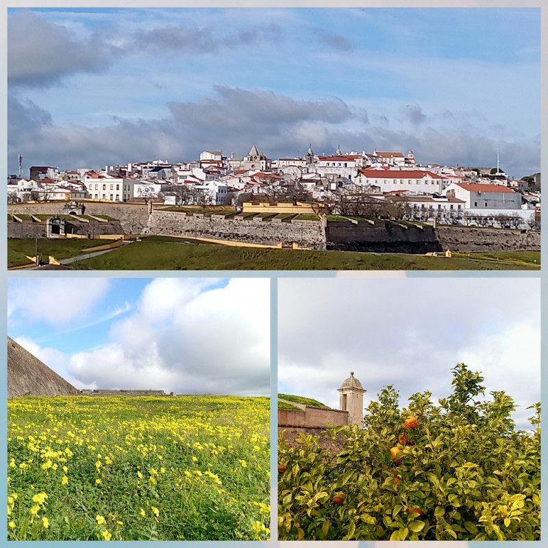
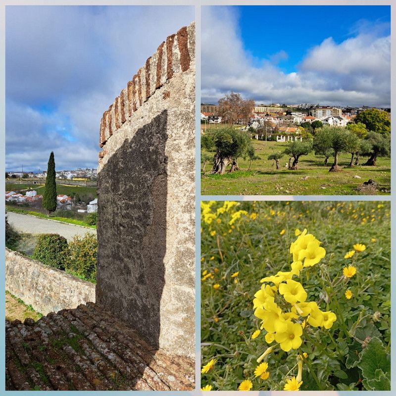
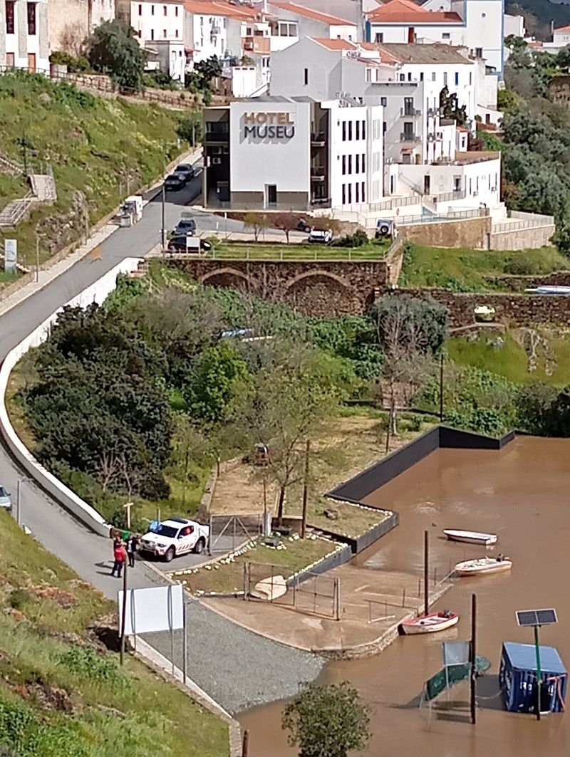
We reach Portugal and stop in Elvas, checking in at Camping Peidade.
OK, located close to the city and a very friendly welcome with good tips for exploring the city, there is nothing more positive to say.
Where the good reviews come from is a mystery to me.
We pay 40 € for two nights, get the third night free in the low season and forgo the electricity connection for 4.90 € per night 😕.
The next day we quickly head to the historic old town with the 🚲 and stroll through the narrow streets, eat a good and inexpensive lunch and marvel at the aqueduct.
Elvas has a lot to offer, so we stay for three days, explore a fortress and find "spring".
Avenida de Badajoz, Elvas, Portalegre, Portugal
38° 52' 23.1" N 7° 10' 49.5" W
38.8730719 -7.1804199
• Head north. Go for 280 m.
• Turn right onto N4. Go for 54 m.
• Take the 4th exit from roundabout onto N4 toward Lisboa/Estremoz. Go for 494 m.
• Take the 3rd exit from roundabout onto N4 toward Lisboa. Go for 568 m.
• Take the 2nd exit from roundabout onto N4 toward Lisboa. Go for 2.7 km.
• Take ramp onto A6 (Autoestrada do Alentejo Central) toward Lisboa. Go for 141 km.
• Take exit 1 toward Algarve/Alcácer onto A2 (Autoestrada do Sul). Go for 47.8 km.
• Take exit 9 toward Sines/IC1/Grândola. Go for 1.1 km.
• Continue on IP8. Go for 38.1 km.
• Continue on A26 (Autoestrada do Baixo Alentejo). Go for 7.6 km.
• Take exit 1 toward (N120)/Odemira. Go for 569 m.
• Take the 3rd exit from roundabout onto IP8 toward Odemira. Go for 2.2 km.
• Take the 2nd exit from roundabout onto IP8 toward Odemira. Go for 1.7 km.
• Take the 3rd exit from roundabout onto IC4 toward Algarve. Go for 2.5 km.
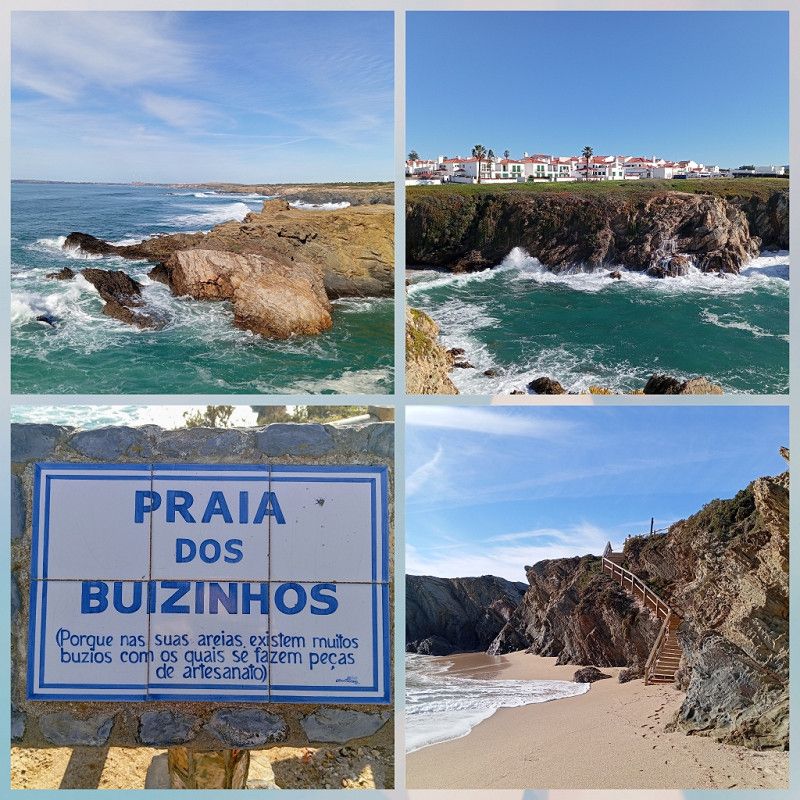
• Turn right onto M1109 toward Porto Covo/São Torpes. Go for 1.6 km.
• Take the 1st exit from roundabout onto M1109. Go for 6.8 km.
• Continue on Rua do Mar (M1109). Go for 225 m.
• Turn left onto Rua Jacinto Fernandes Bandeira. Go for 456 m.
• Turn left. Go for 151 m.
• Turn right. Go for 115 m.
• Arrive at your destination on the left.
☍
255,9 km
(2 hrs. 26 min.)
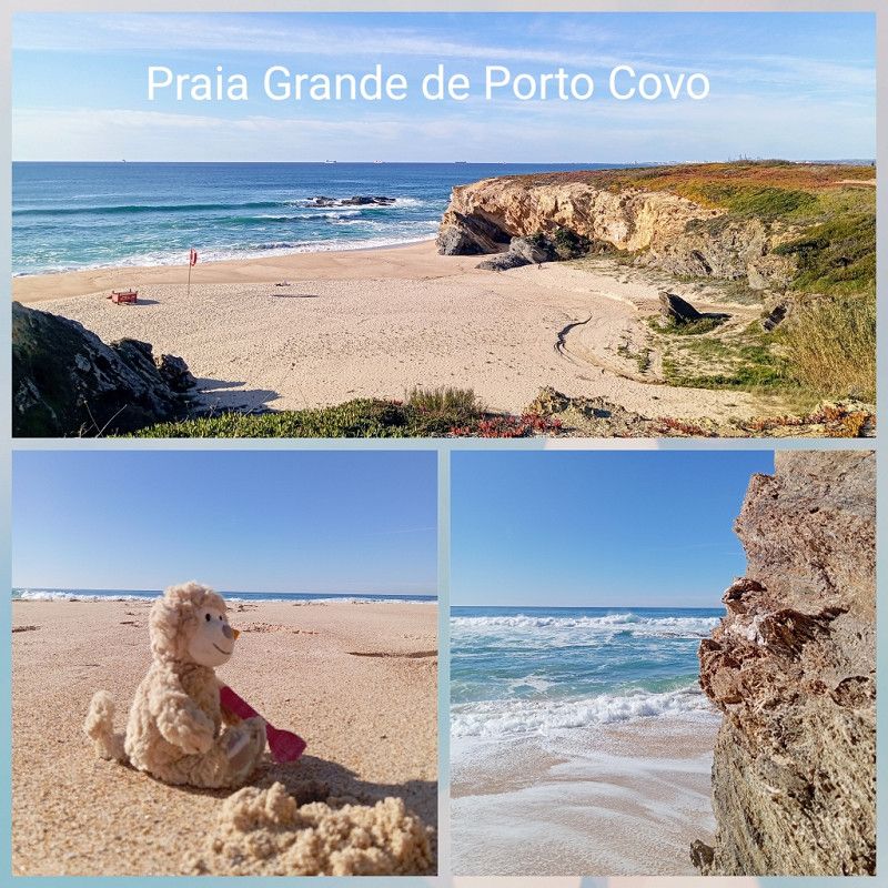
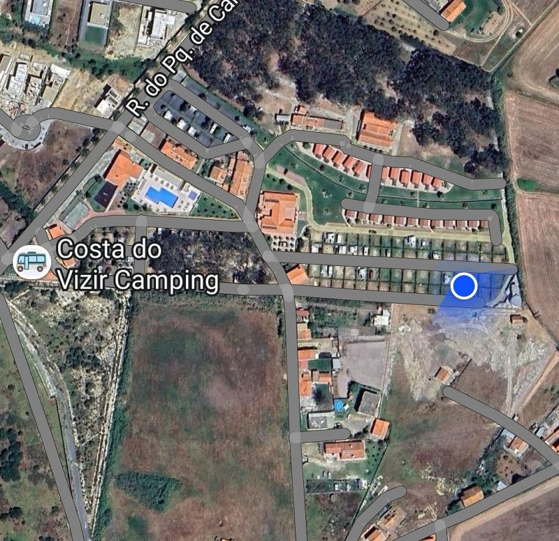
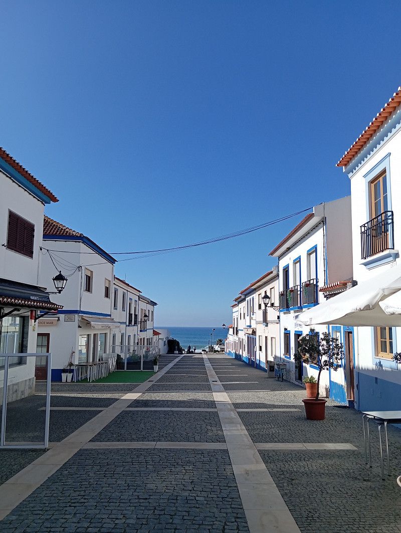
Porto Covo / Camping Costa do Vizir Beach Village
Today we want to reach Porto Covo and recover from the journey south at the "Costa do Vizir" campsite 😉.
We had already chosen the location in advance; there are many videos about it on YouTube, including one from the "Löfflers".
We are given a very friendly welcome, are able to choose one of the many free spots at our leisure and are also thrilled after the first lap.
Apparently a professionally run and very well maintained campsite.
We choose a large pitch with "two flowers" and check in for a week.
There is a 10% discount on the ADAC card. So we pay €26.10 per night including electricity (10 A) and water on site.
At 20° we drink coffee in front of the RV and go on our first short bike ride.
We'll be able to survive well here...
After a week we leave Porto Covo and move on.
We had fantastic weather, hiked and drove 🚲 along the coast and couldn't get enough of the beauty.
Plus friendly people, good food and a great campsite.
A high bar for the next locations.
Rua Jacinto Fernandes Bandeira, Porto Covo, Setúbal, Portugal
37° 51' 25.5" N 8° 47' 5.7" W
37.8570831 -8.7849058
• Head west. Go for 115 m.
• Turn left. Go for 312 m.
• Turn left toward M554. Go for 224 m.
• Turn left onto M554. Go for 2.1 km.
• Take the 1st exit from roundabout onto M554-1. Go for 344 m.
• Turn left onto M1116. Go for 2.4 km.
• Turn left onto Rua 1 de Maio. Go for 3.7 km.
• Turn right toward IC4. Go for 152 m.
• Turn right onto IC4. Go for 1.7 km.
• Continue on N120 toward Lagos/Odemira/Cercal. Go for 7.2 km.
• Take the 1st exit from Largo dos Caieiros roundabout onto Rua 25 de Abril (N390) toward Lagos/Milfontes. Go for 10.7 km.
• Pass 2 roundabouts and continue on N390. Go for 2.4 km.
• Take the 1st exit from roundabout toward V. N.va Milfontes. Go for 115 m.
• Continue on Rua Custódio Brás Pacheco. Go for 316 m.
• Take the 2nd exit from Largo Custódio Brás Pacheco roundabout onto Rua Custódio Brás Pacheco. Go for 212 m.
• Turn right onto Rua dos Combatentes Portugueses. Go for 231 m.
• Turn left toward Rua Pinhal do Moinho. Go for 90 m.
• Continue on Rua Pinhal do Moinho. Go for 311 m.
• Turn right onto Rua das Pousadas (M1099). Go for 136 m.
• Continue on M1099. Go for 169 m.
• Turn right onto Aldeamento Raminhos. Go for 111 m.
• Arrive at Aldeamento Raminhos.
☍
33,1 km
( 35 min.)
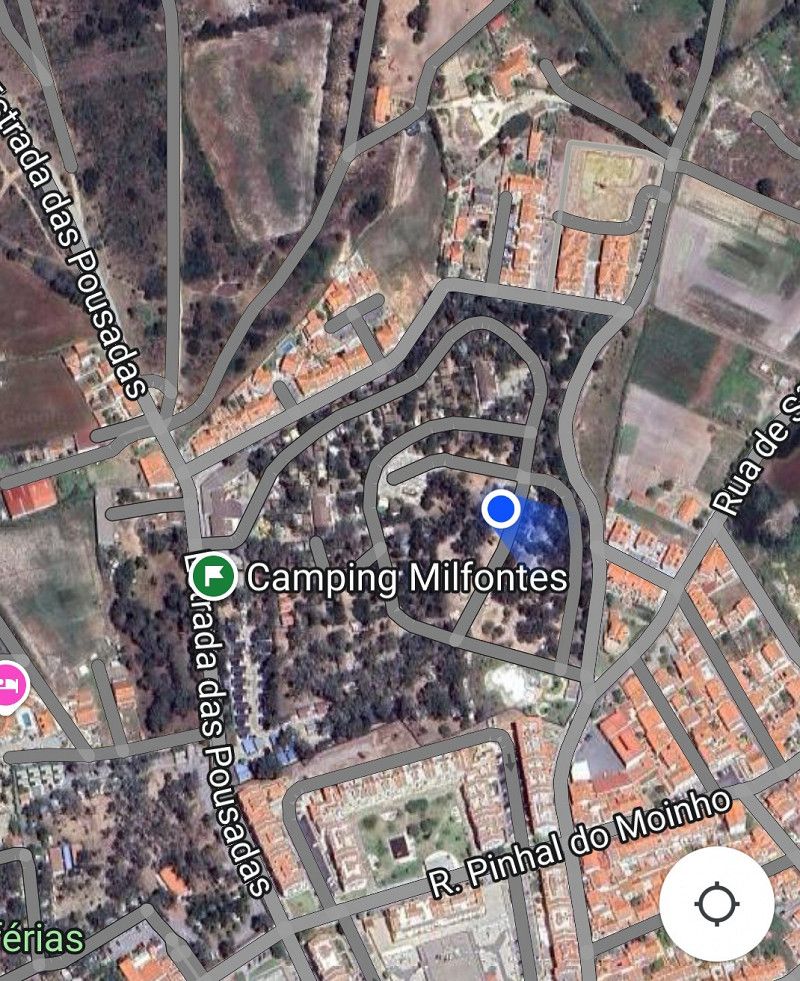
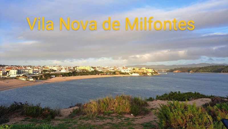
Vila Nova de Milfontes / Camping Milfontes
We have time and would now like to leisurely head south along the coast.
After a short drive we reach our next destination "Vila Nova de Milfontes" and check in at the "Milfontes" campsite.
A large, natural and winding site. There are no numbered plots and you can park wherever you like and where there is space for your vehicle.
A very relaxed and quiet atmosphere, a heavenly peace at night.
Very clean sanitary facilities and decent WiFi.
You register, stay as long as you want and only pay when you leave.
Vila Nova de Milfontes:
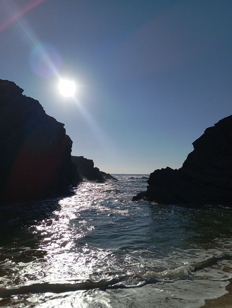
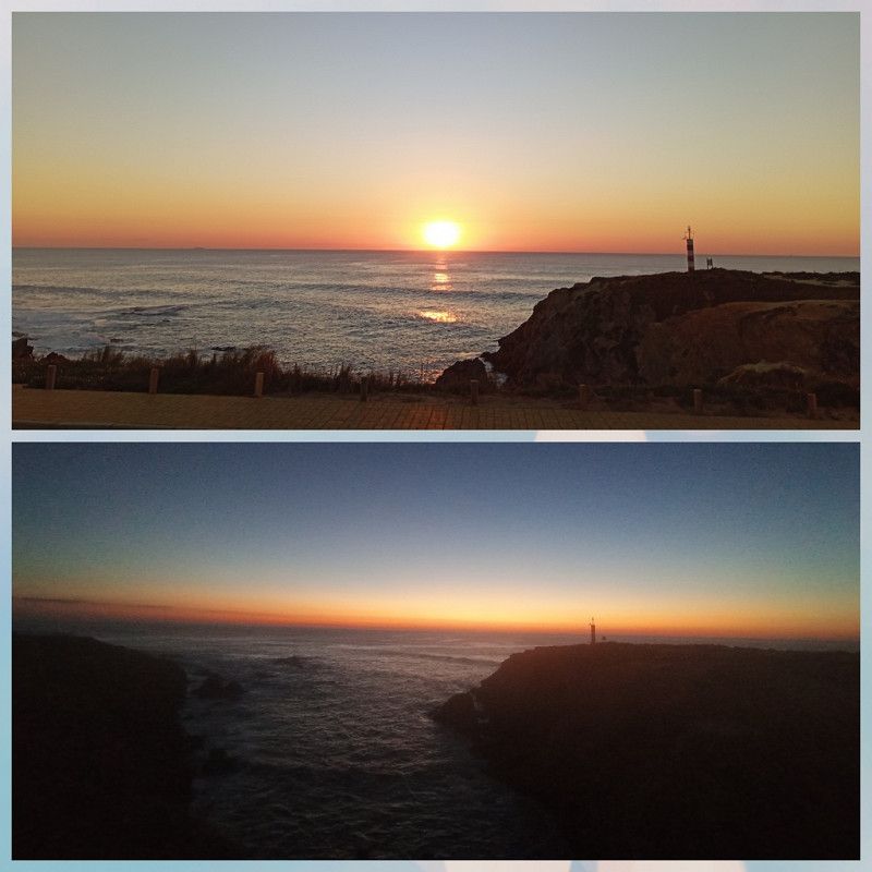
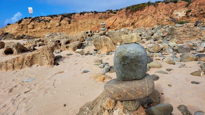
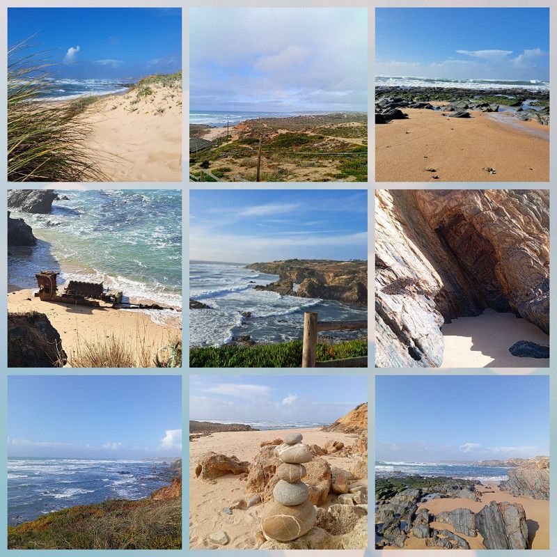
Even now in January it is a lively place with nice cafes and restaurants. The "Rio Mira" flows into the Atlantic here, so there are two beautiful, different beach areas. And again, there is an impressive cliff coast.
The weather is quite changeable, but we can do a lot of 🚴 and 🥾🥾.
After one week we pay 89.90€, or 12.84€ per night.
There was also a 10% discount on the ADAC card, well that was cheap 🙂.
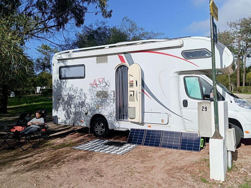
We have done without electricity at €4.50 per day. My "electricity concept" with the new "juice box" is proving successful. Even now in winter, there is enough ☀️ energy.
Praceta Brejo dos Pinheiros, Vila Nova de Milfontes, Beja, Portugal
37° 43' 55.2" N 8° 46' 53.9" W
37.7319870 -8.7816489
• Head northeast on Aldeamento Raminhos. Go for 215 m.
• Turn right onto Rua dos Brejos. Go for 261 m.
• Turn sharp left onto Rua de São Clemente. Go for 40 m.
• Turn right onto Rua da Marinha. Go for 123 m.
• Turn left toward Rua dos Combatentes Portugueses. Go for 90 m.
• Turn right onto Rua dos Combatentes Portugueses. Go for 231 m.
• Turn left onto Rua Custódio Brás Pacheco. Go for 173 m.
• Take the 1st exit from Largo Custódio Brás Pacheco roundabout onto Rua Custódio Brás Pacheco. Go for 164 m.
• Continue on Rua Custódio Brás Pacheco. Go for 255 m.
• Take the 1st exit from roundabout onto N393 toward Odemira. Go for 8.9 km.
• Take the 2nd exit from roundabout onto N393 toward Odemira. Go for 12.4 km.
• Take the 2nd exit from roundabout onto N120 toward Cercal/Odemira. Go for 3.2 km.
• Take the 1st exit from Rotunda do Lagar roundabout onto Estrada da Circunvalação (N263). Go for 410 m.
• Turn right. Go for 17 m.
• Turn right. Go for 32 m.
• Arrive at your destination on the left.
☍
26,5 km
( 26 min.)
Odemira
First we drive a scenic route to Odemira .
There is a Repsol petrol station with LPG here.
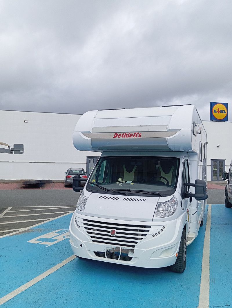
So we fill up the gas and diesel tanks. Then we head to the big Lidl, very practical: there are special spaces for RVs in the parking lot 👍.
Beja, Portugal
37° 35' 51.4" N 8° 38' 31.9" W
37.5976000 -8.6422000
• Head east. Go for 32 m.
• Turn left toward Estrada da Circunvalação/N263. Go for 17 m.
• Turn left onto Estrada da Circunvalação (N263). Go for 396 m.
• Take the 4th exit from Rotunda do Lagar roundabout onto Avenida Poole da Costa (N120). Go for 3.2 km.
• Take the 2nd exit from roundabout onto N120 toward Lagos/Aljezur/S. Teotónio. Go for 9.5 km.
• Take the 2nd exit from roundabout onto N120 toward Lagos/Aljezur. Go for 1.2 km.
• Take the 1st exit from roundabout onto M502-2 toward Zambujeira do Mar. Go for 4.4 km.
• Turn left onto M502. Go for 1.4 km.
• Arrive at M502. Your destination is on the right.
☍
20,1 km
( 22 min.)
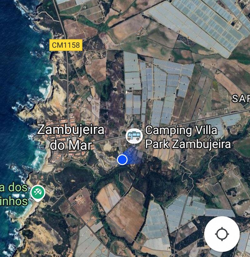
Zambujeira / Camping Villa Park Zambujeira
Just a stone's throw away we reach Zambujeira .
The camping here has a similar concept to that in Milfontes: register, choose a spot and stay as long as you want 🙂
You can see that we are moving further south and the square is definitely busier.
Again, very natural, on several levels with lots of trees. It's not easy to find a parking space at our altitude, but we take our time and find another nice spot.
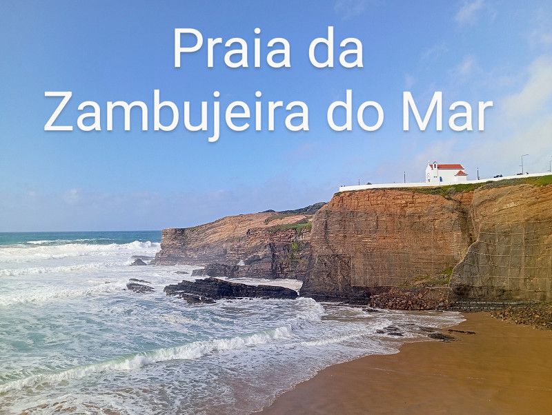
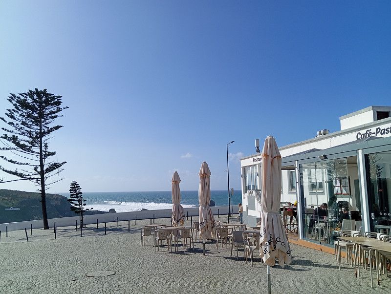
Zambujeira is a pretty little town, right on the cliffs with nice cafes and restaurants.
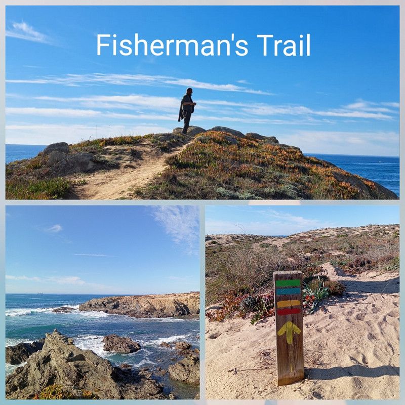
We explore the beaches, walk a part of the "Fisherman's Trail" and enjoy the peace and quiet at the campsite.
The people here are very friendly and the place is tidy and everything is very clean.
But of course we want to move on, so we check out after a week.
There is again a 10% discount on the ADAC card, so we pay 13.90€ per night without electricity.
Can't complain 🙂.
Praia da Zambujeira, 7630 - 740, Zambujeira do Mar, Portugal
37° 31' 34" N 8° 46' 30" W
37.5261100 -8.7750000
• Head east on M502. Go for 1.4 km.
• Turn right onto M502-2. Go for 4.3 km.
• Take the 1st exit from roundabout onto N120 toward Lagos. Go for 26.9 km.
• Take the 1st exit from roundabout onto Avenida General Humberto Delgado (N120) toward Lagos/Bordeira. Go for 7.5 km.
• Turn right onto N268 toward V. do Bispo/Sagres/Alfambras/Bordeira/Carrapateira. Go for 27.7 km.
• Take the 4th exit from roundabout toward Sagres. Go for 129 m.
• Turn right onto N268. Go for 7.4 km.
• Continue on Avenida Infante Dom Henrique (N268). Go for 66 m.
• Turn right onto Travessa do Pinhal. Go for 24 m.
• Turn slightly right onto Rua do Cercado. Go for 427 m.
• Turn right onto Rua do Pinhal. Go for 48 m.
• Turn left. Go for 293 m.
• Arrive at your destination on the left.
☍
76,1 km
(1 hrs. 11 min.)
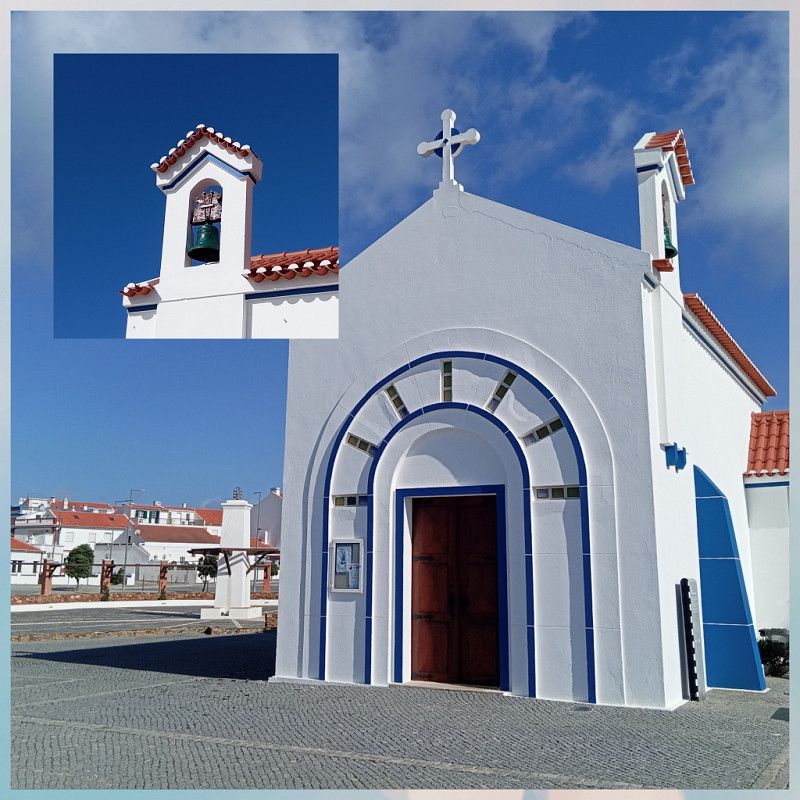
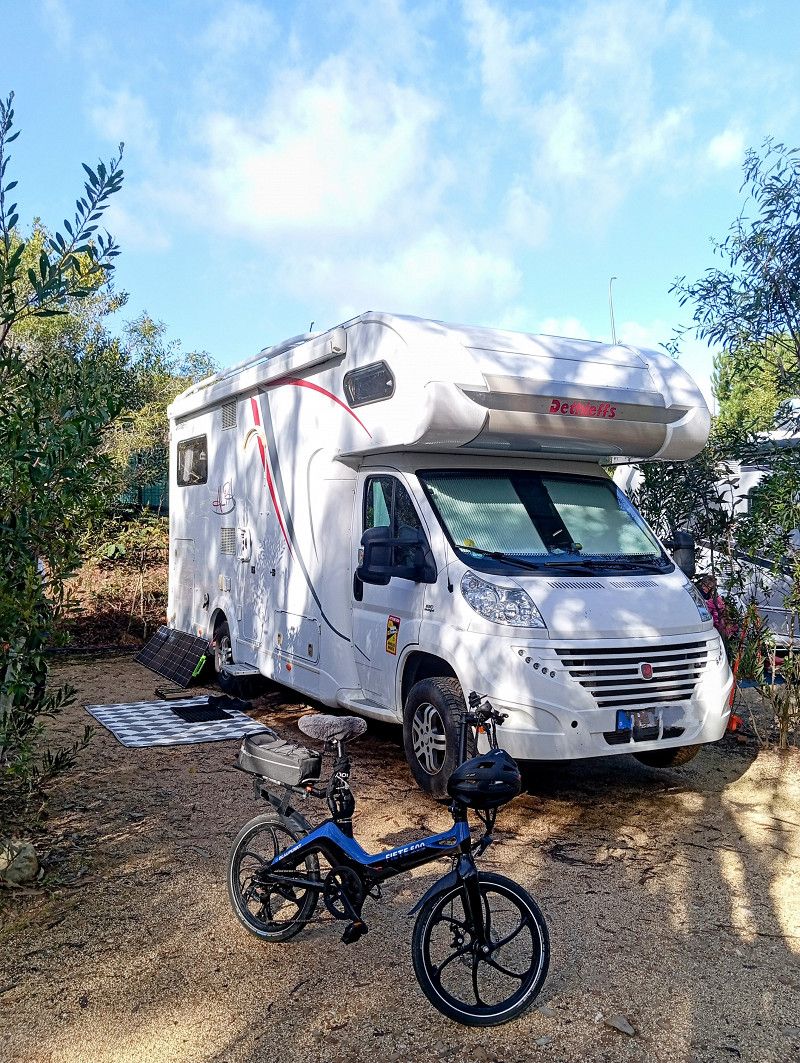
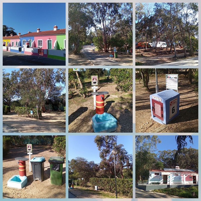
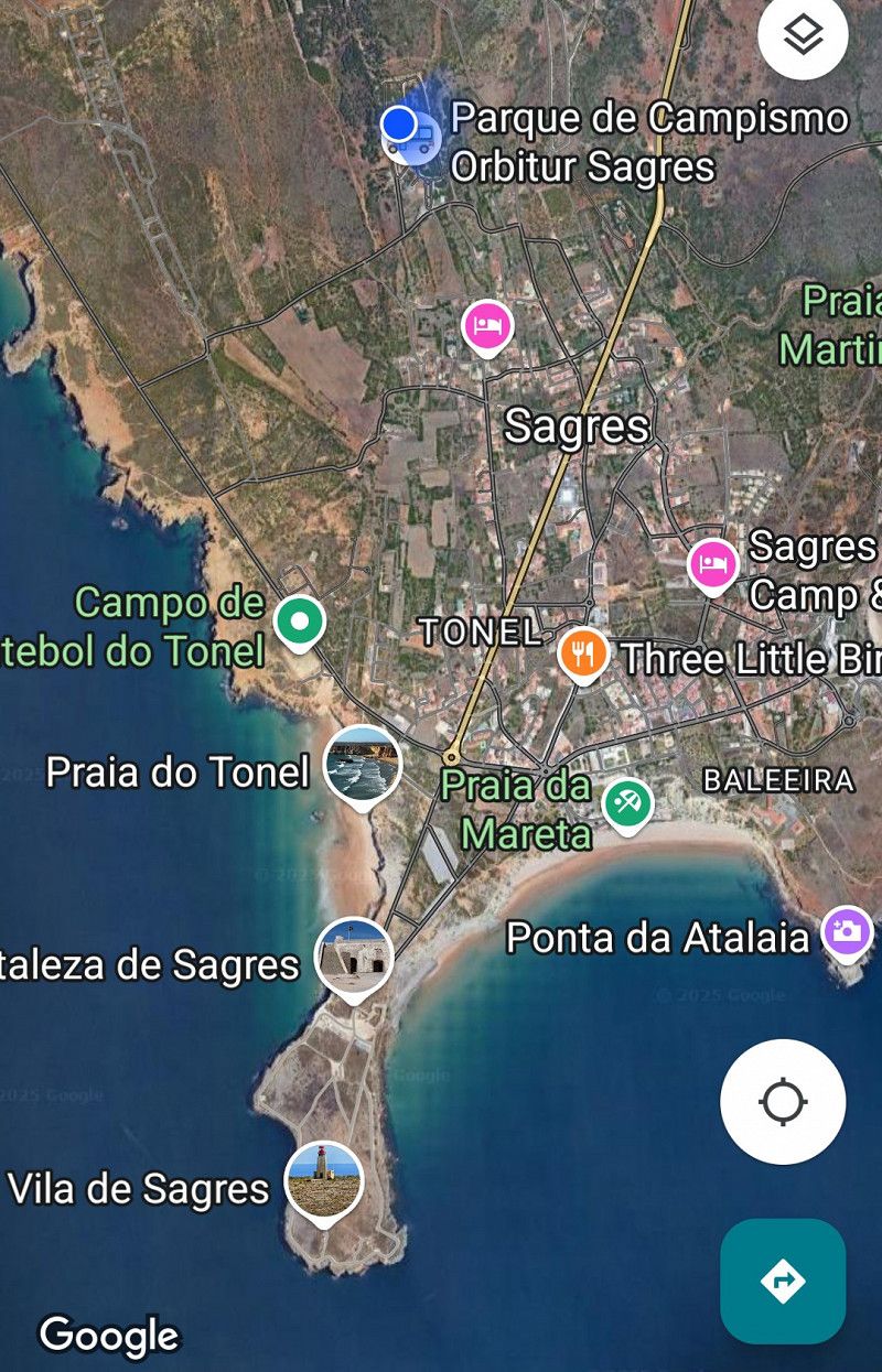
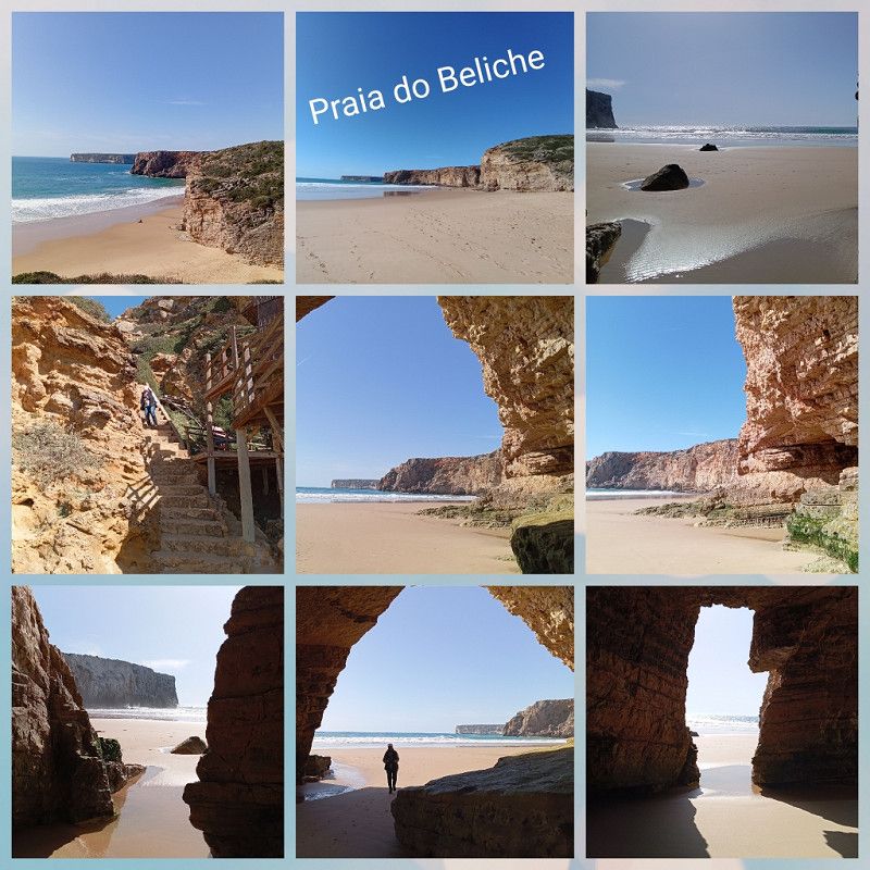
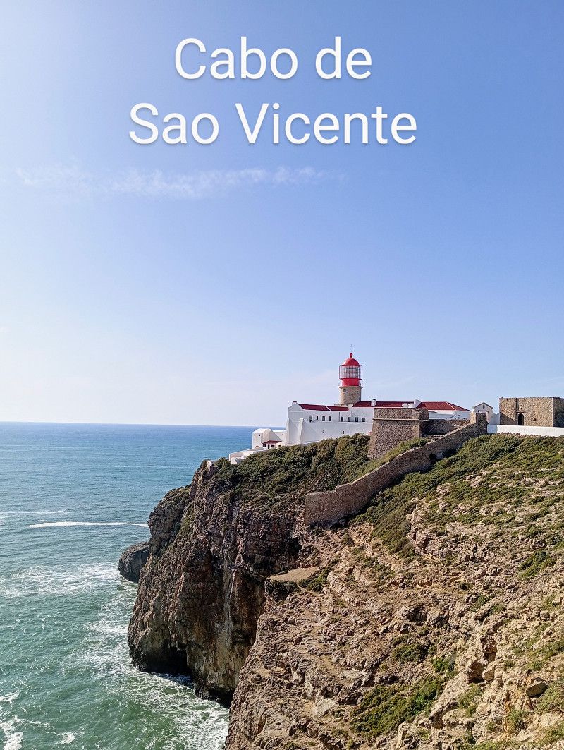
Sagres / Parque Orbitur
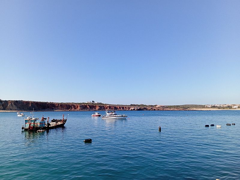
After a fantastically beautiful route, uphill and downhill, and a stop at Lidl, we reach Camping Orbitur in Sagres .
Here it works the other way round. Choose a place, decide how long you want to stay and pay in advance.
Anyone who leaves earlier is out of luck, but that's not what we plan to do.
This time there is even a 15% discount on the ADAC card, ACSI is not accepted by the way.
So we pay 14.20€ without electricity 👍 and find a great corner spot.
Basically you are standing in the middle of a pine forest, really beautiful.
The sanitary facilities are a bit dated, but very clean.
We have a relaxing week and it is very quiet again at night.
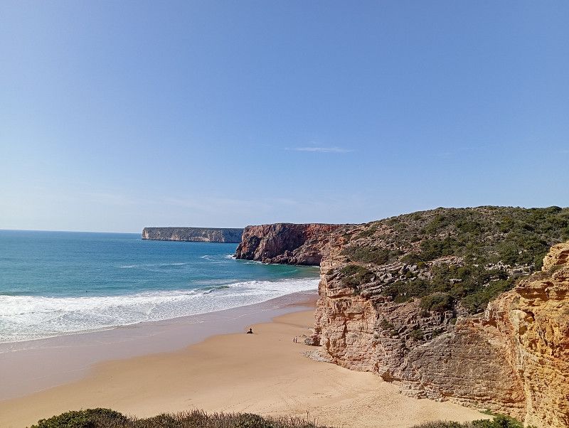
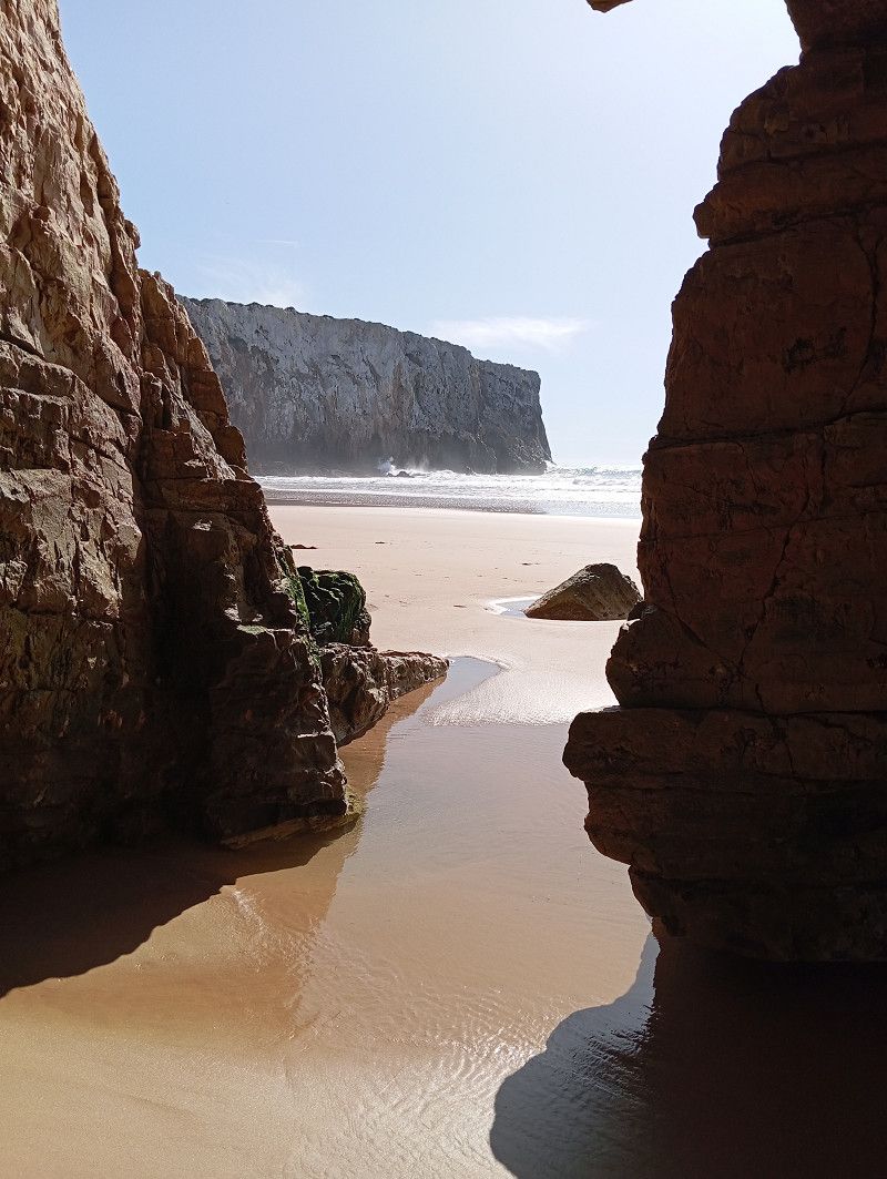
Sagres
The place is a surfer hot spot with lots of young people with their vans. Free parking is apparently tolerated.
There is a lot to explore, the place has comparatively many sights, but unfortunately no old town center.
After a week, we feel like we have seen everything and move on 🚐.
Cerro das Moitas, 8650 - 998, Sagres, Portugal
37° 1' 19" N 8° 56' 42" W
37.0219400 -8.9450000
• Head toward Rua do Pinhal. Go for 293 m.
• Turn right onto Rua do Pinhal. Go for 48 m.
• Turn left onto Rua do Cercado. Go for 427 m.
• Turn slightly left onto Travessa do Pinhal. Go for 24 m.
• Turn left onto Avenida Infante Dom Henrique (N268). Go for 66 m.
• Continue on N268. Go for 7.3 km.
• Continue on N125. Go for 3.5 km.
• Pass 6 roundabouts and continue on N125. Go for 9.3 km.
• Turn right toward M537-2. Go for 143 m.
• Turn right onto M537-2. Go for 2.0 km.
• Continue on Rua Vale do Burgau (M537-2). Go for 234 m.
• Continue on Largo da Liberdade (M537-2). Go for 26 m.
• Continue on Rua Principal (M537). Go for 87 m.
• Turn right onto Rua Principal. Go for 45 m.
• Turn right onto Rua Principal. Go for 57 m.
• Arrive at Rua Principal. Your destination is on the right.
☍
23,6 km
( 24 min.)
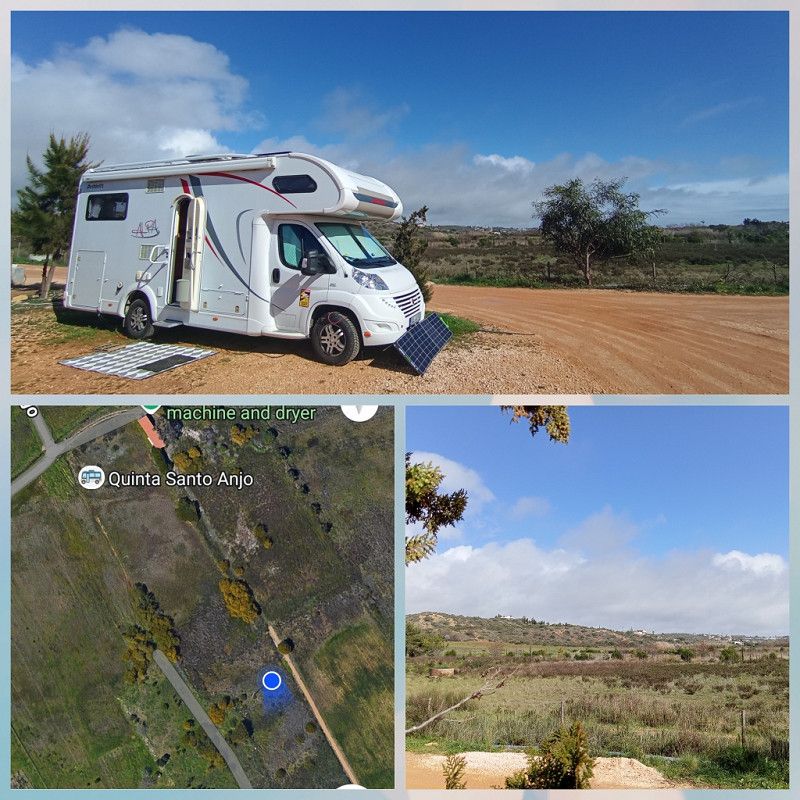
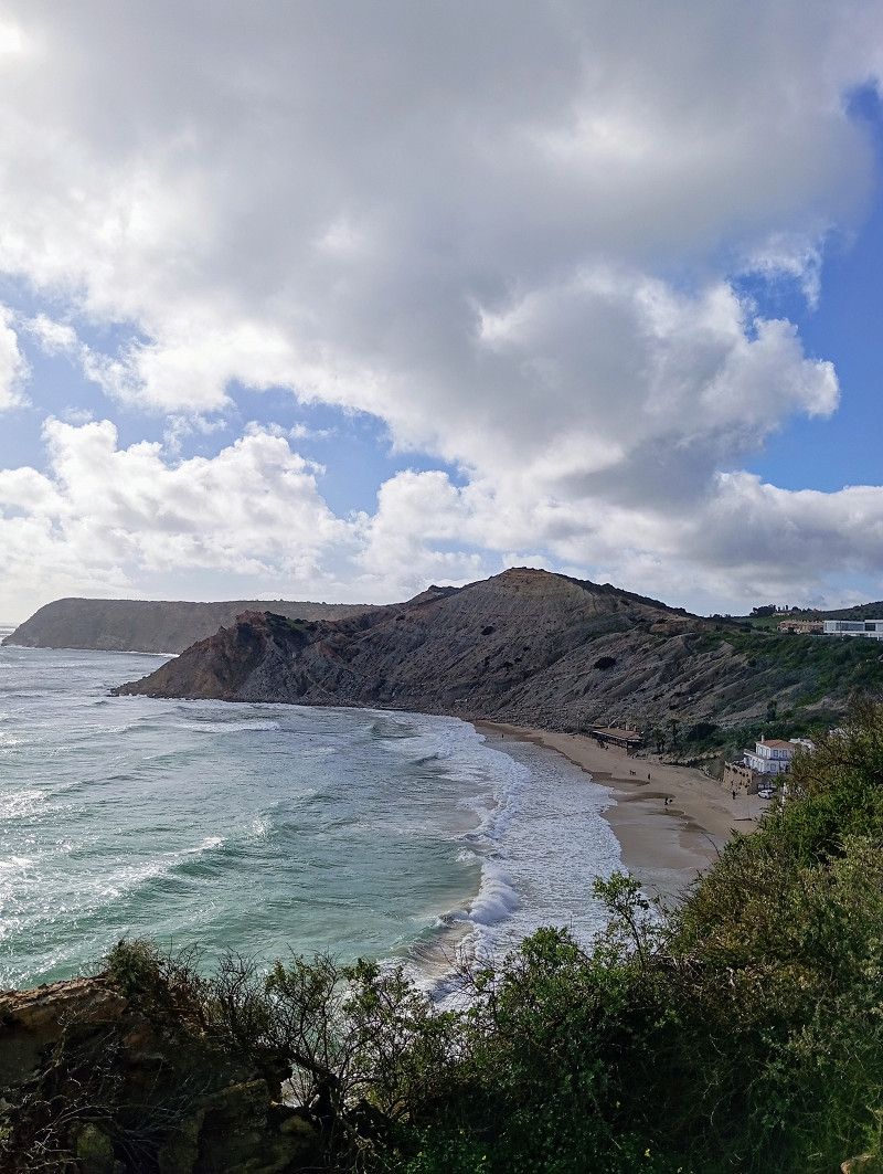
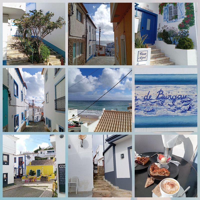
Burgau / Quinta Santo Anjo
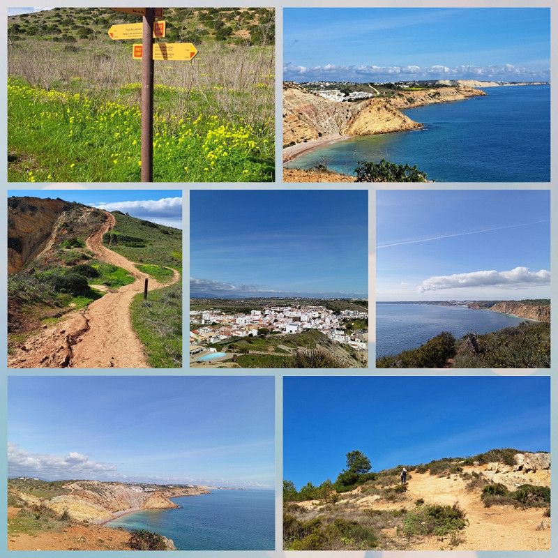
Burgau is one of the "15 most beautiful villages" in Portugal and is our next destination.
After a short drive and replenishing our supplies at Lidl, we get one of the last spots on the only RV parking space in town.
A nice corner spot with a wide view 🙂.
We are greeted very warmly and check in for 3 nights (17 € per night without electricity).
There is no discount on a Camper Card here.
Later in the town in the café we also notice that the Algarve has a higher price level.
The place is simple, the sanitary container is older but clean.
It didn't promise too much: Burgau is a picturesque place with small streets, a great beach and nice restaurants.
According to the stories of the other campers, it is definitely quieter than other hot spots in the Algarve.
I've just extended my stay for three days. We really like it here and there's still a lot to explore.
It's getting warmer, so we spend a day at the beach, cycle and hike or enjoy "doing nothing" :).
Faro, Portugal
37° 4' 23.9" N 8° 46' 28.3" W
37.0732940 -8.7745163
• Head southwest on Rua Principal. Go for 23 m.
• Turn right toward Rua da Praia. Go for 23 m.
• Turn right onto Rua da Praia. Go for 74 m.
• Turn right onto Rua Principal (M537). Go for 155 m.
• Continue on M537. Go for 198 m.
• Continue on Estrada Municipal (M537). Go for 250 m.
• Continue on M537. Go for 3.2 km.
• Turn right onto Rua 25 de Abril (M537). Go for 596 m.
• Continue on Largo da República (M537). Go for 70 m.
• Turn right onto Rua do Poço. Go for 16 m.
• Turn left onto Rua do Poço. Go for 220 m.
• Turn left onto Rua do Poço. Go for 39 m.
• Arrive at Rua do Poço. Your destination is on the left.
☍
4,9 km
( 8 min.)
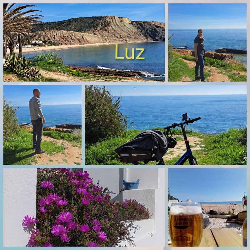
Luz
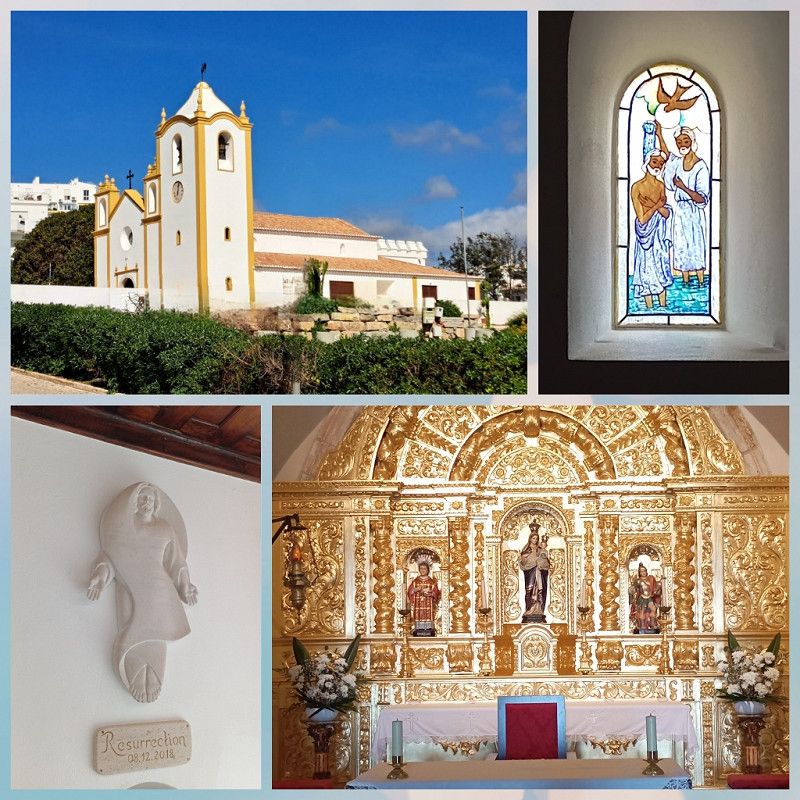
From Burgau we take a scenic 🚴 tour to Luz .
The town has a small promenade with many nice restaurants. The sun is shining, we are sitting overlooking the beach and while we eat, a street musician is playing.
At the end we go to church and light candles for our loved ones.
Luz is definitely worth a visit 👍.
Faro, Portugal
37° 5' 14.5" N 8° 43' 42.1" W
37.0873628 -8.7283673
• Head toward Travessa das Redes on Rua do Poço. Go for 8 m.
• Turn right onto Travessa das Redes. Go for 107 m.
• Turn slightly left onto Rua da Praia. Go for 158 m.
• Turn right onto Rua Direita (M537). Go for 252 m.
• Continue on M537. Go for 2.5 km.
• Take the 2nd exit from roundabout toward Lagos/A22/Portimão. Go for 105 m.
• Continue straight ahead. Go for 796 m.
• Continue toward Faro/A22/Portimão. Go for 48 m.
• Take the 3rd exit from roundabout toward Faro/Portimão. Go for 4.4 km.
• Take ramp onto A22 (Via Infante de Sagres) toward Faro/Lisboa/(A2). Go for 26.2 km.
• Take exit 6 toward Lagoa/Silves. Go for 287 m.
• Take the 3rd exit from roundabout onto N124-1. Go for 289 m.
• Take the 1st exit from roundabout onto N124-1. Go for 4.3 km.
• Turn left onto N124-1. Go for 192 m.
• Turn right onto N124. Go for 771 m.
• Take the 1st exit from roundabout onto N124. Go for 542 m.
• Take the 3rd exit from roundabout onto N124. Go for 1.3 km.
• Turn left onto M1153. Go for 321 m.
• Arrive at M1153. Your destination is on the right.
☍
42,5 km
( 32 min.)
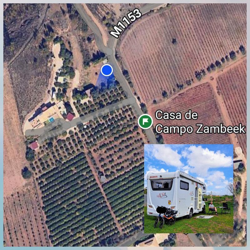
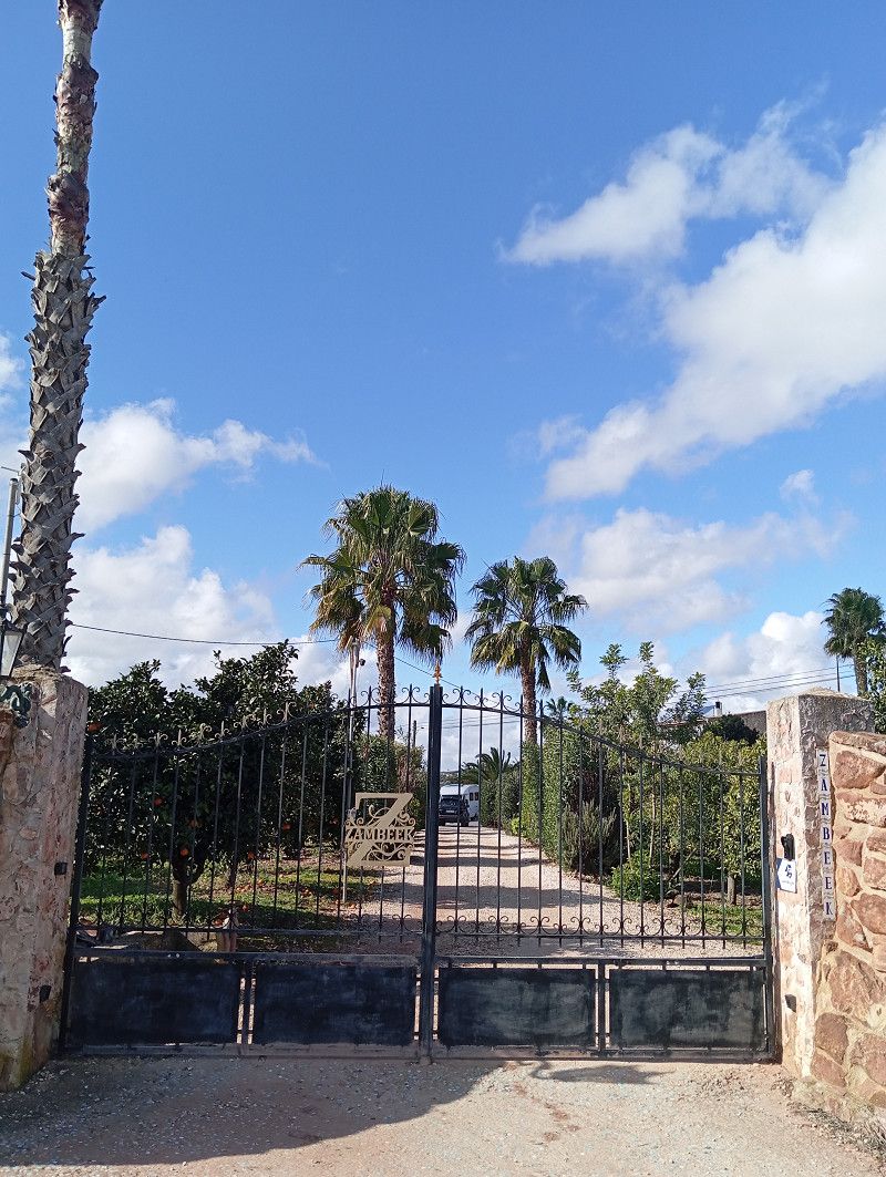
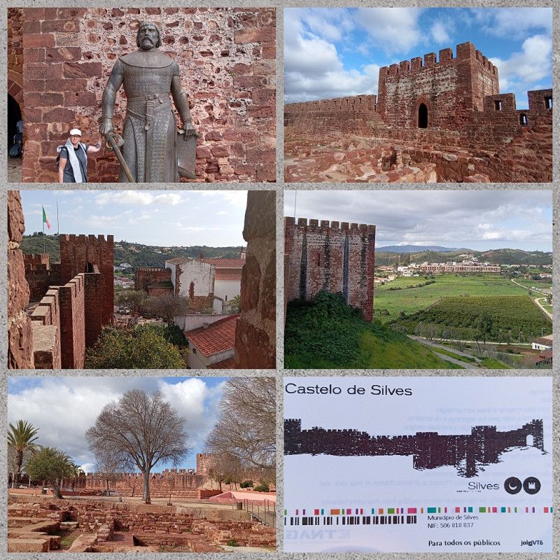
Silves / Casa de Campo Zambeek
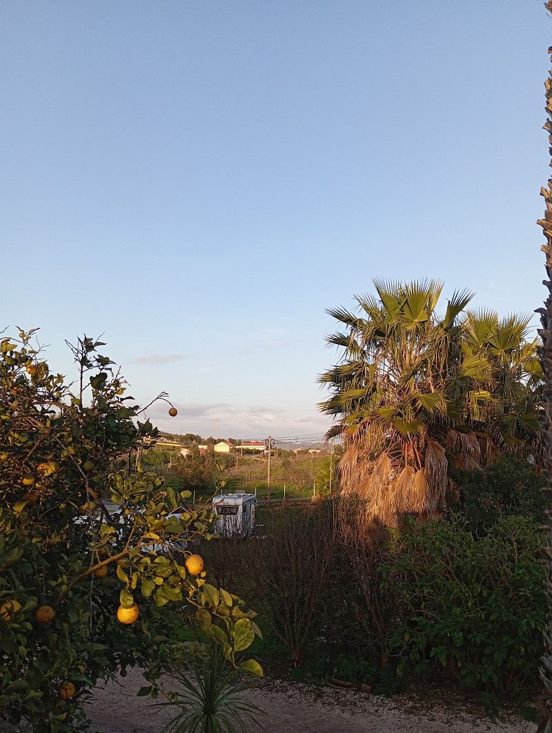
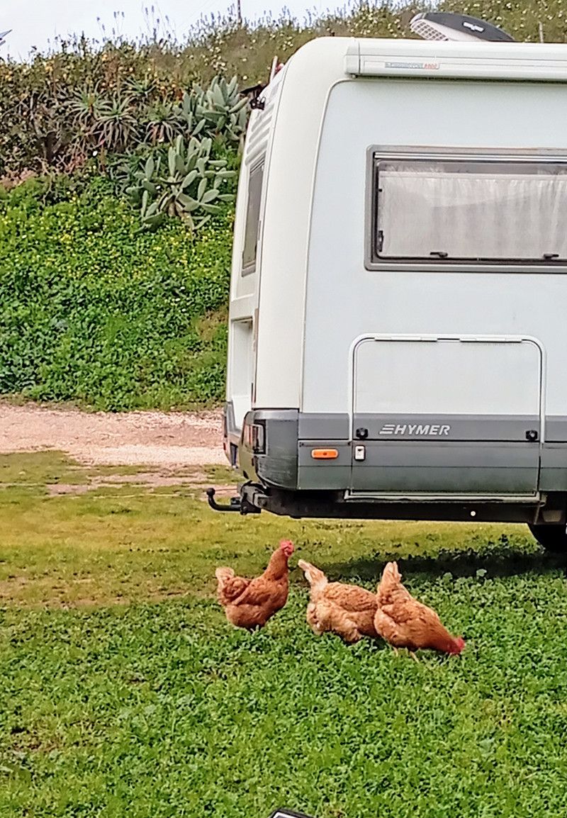
After six nights we leave Burgau and fill up our supplies and the gas tank in Lagos before heading to Silves .
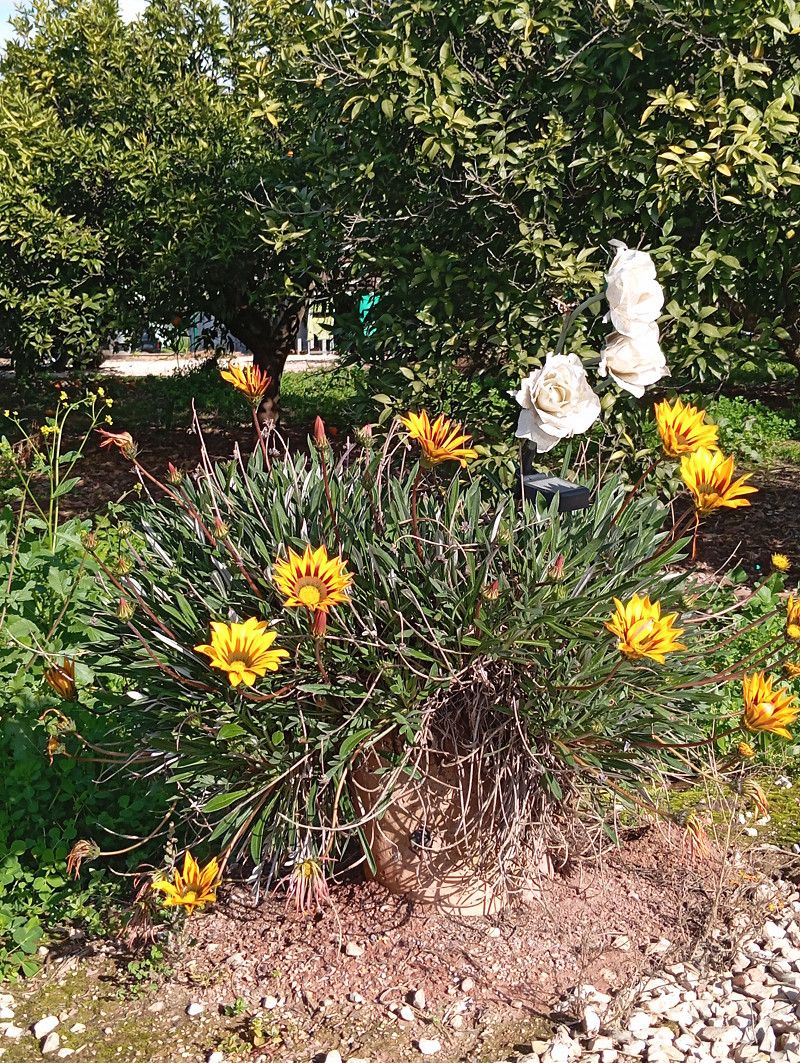
I have chosen a special place here. We are standing on a piece of meadow on a citrus plantation.
Tangerines, lemons and oranges as far as the eye can see.
A Dutch couple has made their dream come true here.
There are a few very individual accommodations to rent and a few parking spaces for RVs.
What a special place: two friendly 🐕, a few 🐈⬛ and 🐔 running around, picking and pressing for breakfast 🍊, Han brings a 🥚 from the chicken coop.
Nice and quiet during the day and at night, everyone is very chilled.
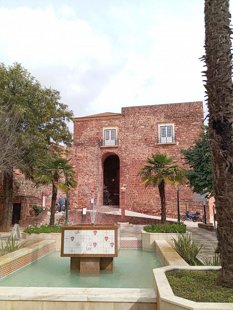
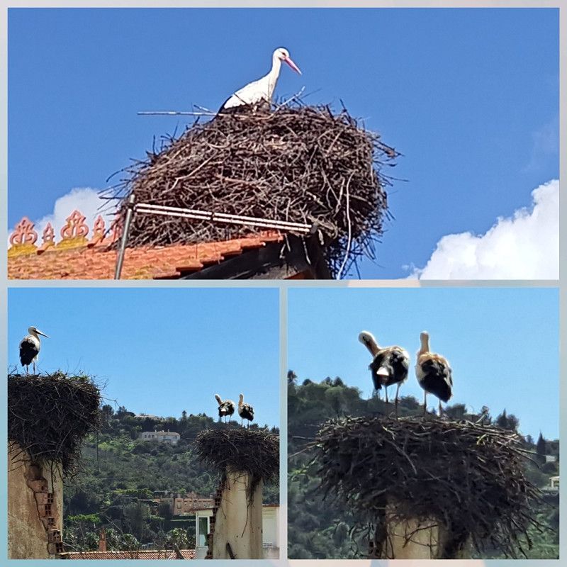
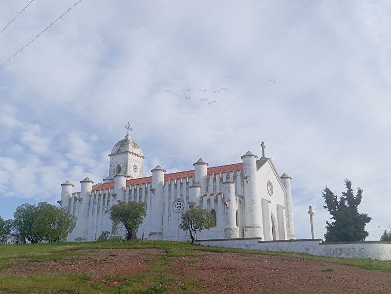
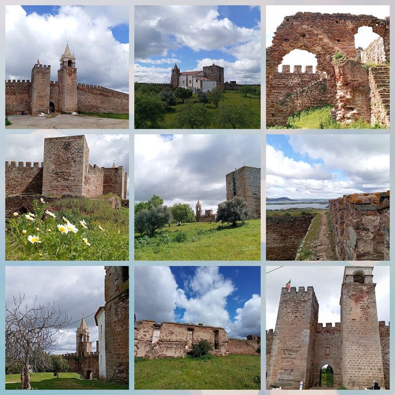
Silves : has a beautiful old town with winding streets, a great castle and an impressive cathedral.
It is wonderful to stroll through the town and now in February it is not crowded.
Especially: the many storks that breed here. We are not the only ones who spend the winter in Portugal 🙂.
Silves, a few kilometers from the Casa, is easily accessible by 🚴.
When we see the gravelled and full RV parking spaces in Silves, we are happy to be standing in such beautiful nature.
In the end we stay 8 nights with these great hosts, are given a very friendly farewell and set off for Albufeira .
For this special place we paid 15 € per night without electricity.
Includes citrus fruits and great WiFi. The sanitary facilities are simple but always very clean.
Faro, Portugal
37° 12' 22" N 8° 25' 9.8" W
37.2061206 -8.4193807
• Head southeast on M1153. Go for 321 m.
• Turn right onto N124. Go for 1.2 km.
• Pass 2 roundabouts and continue on N124. Go for 1.3 km.
• Turn left onto N124-1. Go for 178 m.
• Turn right onto N124-1. Go for 4.2 km.
• Continue toward N124-1. Go for 43 m.
• Take the 2nd exit from roundabout onto N124-1. Go for 235 m.
• Take the 2nd exit from roundabout onto A22 (Via Infante de Sagres) toward Faro/Lisboa/(A2). Go for 18.3 km.
• Take exit 9 toward (N395)/Albufeira/(N125)/Guia onto IC1. Go for 926 m.
• Take left ramp onto N125 toward (N395)/Albufeira/Ferreiras. Go for 1.4 km.
• Take ramp toward Albufeira/Ferreiras. Go for 268 m.
• Take the 1st exit from roundabout onto N395 toward Albufeira. Go for 1.5 km.
• Turn left. Go for 22 m.
• Turn right. Go for 91 m.
• Make a U-Turn. Go for 91 m.
• Turn right. Go for 135 m.
• Turn left. Go for 33 m.
• Arrive at your destination on the left.
☍
30,4 km
( 27 min.)
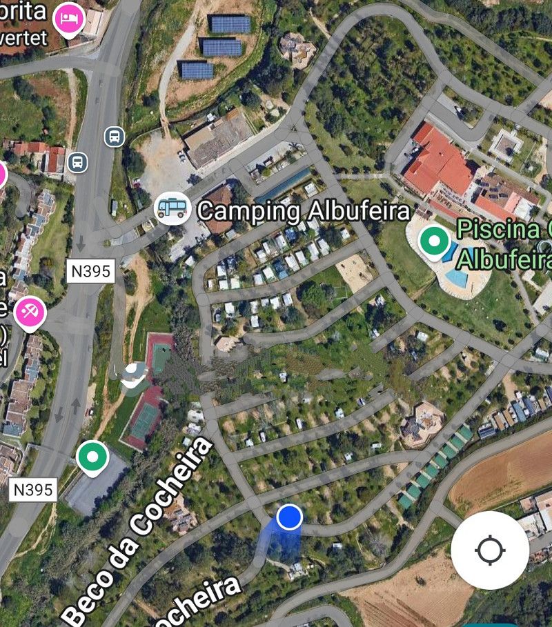
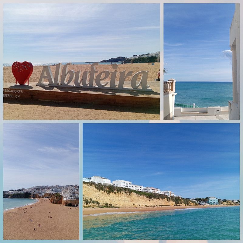
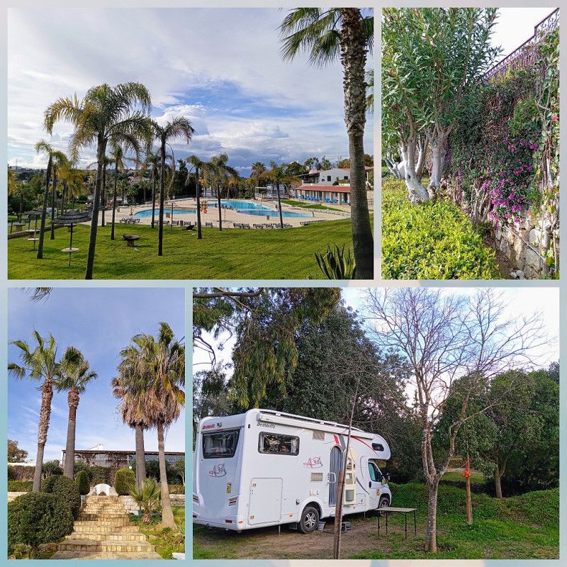
Albufeira / Camping Albufeira
After a short drive we reach Albufeira and check in at the campsite of the same name for three days.
A large area with many accommodation options and very different pitches. A stark contrast to the "orange grove" in Silves.
Here we pay in advance again, 14.76 € per night without electricity (10% discount 🙂).
Then you drive through the campsite and look for a nice spot.
There are no numbered plots, it is well occupied, but in the end we find a nice corner spot.
The campsite is very well maintained with plenty of clean sanitary facilities.
The road can be heard clearly, so find a parking space as far away from it as possible.
Particularly worth mentioning: there is a great 🚴path into town👍.
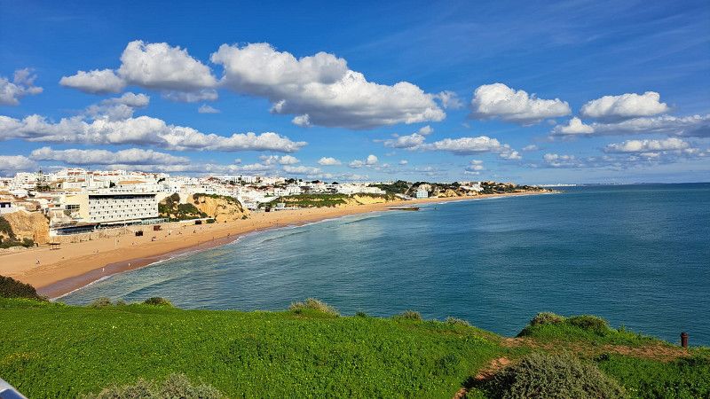
Albufeira is pure "Algarve tourism". Plenty of restaurants, bars and souvenir shops.
Beach, promenade, marina, there is a lot going on.
We also do the usual "tourist program": take the elevator to the beach and the escalator to the viewing point, sit in the front row and enjoy a sundae.
Away from the hustle and bustle you will find small alleys and peace and quiet.
Here, too, we extended our stay and stayed for a week.
Estrada das Ferreiras, 8200 - 555, Albufeira, Portugal
37° 6' 26" N 8° 15' 10" W
37.1072200 -8.2527700
• Head southwest. Go for 33 m.
• Turn right. Go for 135 m.
• Turn left. Go for 91 m.
• Make a U-Turn. Go for 91 m.
• Turn left toward N395. Go for 22 m.
• Turn right onto N395. Go for 1.5 km.
• Take the 3rd exit from roundabout onto N395 toward Faro/A22/Portimão/Lisboa/Ferreiras. Go for 245 m.
• Take the 1st exit from roundabout onto N125 toward Lisboa/IC1/Faro/A22/Portimão. Go for 1.5 km.
• Take ramp onto IC1 toward Ourique/Faro/A22/Portimão/Lisboa/(A2). Go for 779 m.
• Take ramp onto A22 (Via Infante de Sagres) toward Faro/Espanha/Lisboa/(A2). Go for 45.7 km.
• Take exit 15 toward Olhão. Go for 357 m.
• Take the 1st exit from roundabout onto N398 toward Olhão. Go for 7.5 km.
• Take the 2nd exit from roundabout onto N125. Go for 573 m.
• Turn left onto Avenida Parque Natural da Ria Formosa. Go for 649 m.
• Take the 3rd exit from roundabout. Go for 505 m.
• Turn left. Go for 159 m.
• Turn sharp left. Go for 47 m.
• Arrive at your destination on the right.
☍
60,0 km
( 43 min.)
"Bergfest" erstes Resümee
Portugal is definitely worth a visit:
👍 friendly people and
relaxed atmosphere
👍 the towns, coasts and beaches
are very clean
👍 no mosquitoes at this time
or other vermin
👍 decent camping and
parking spaces at good rates
👍 affordable living in
Comparison
🌞 Spring feels like it is already
January
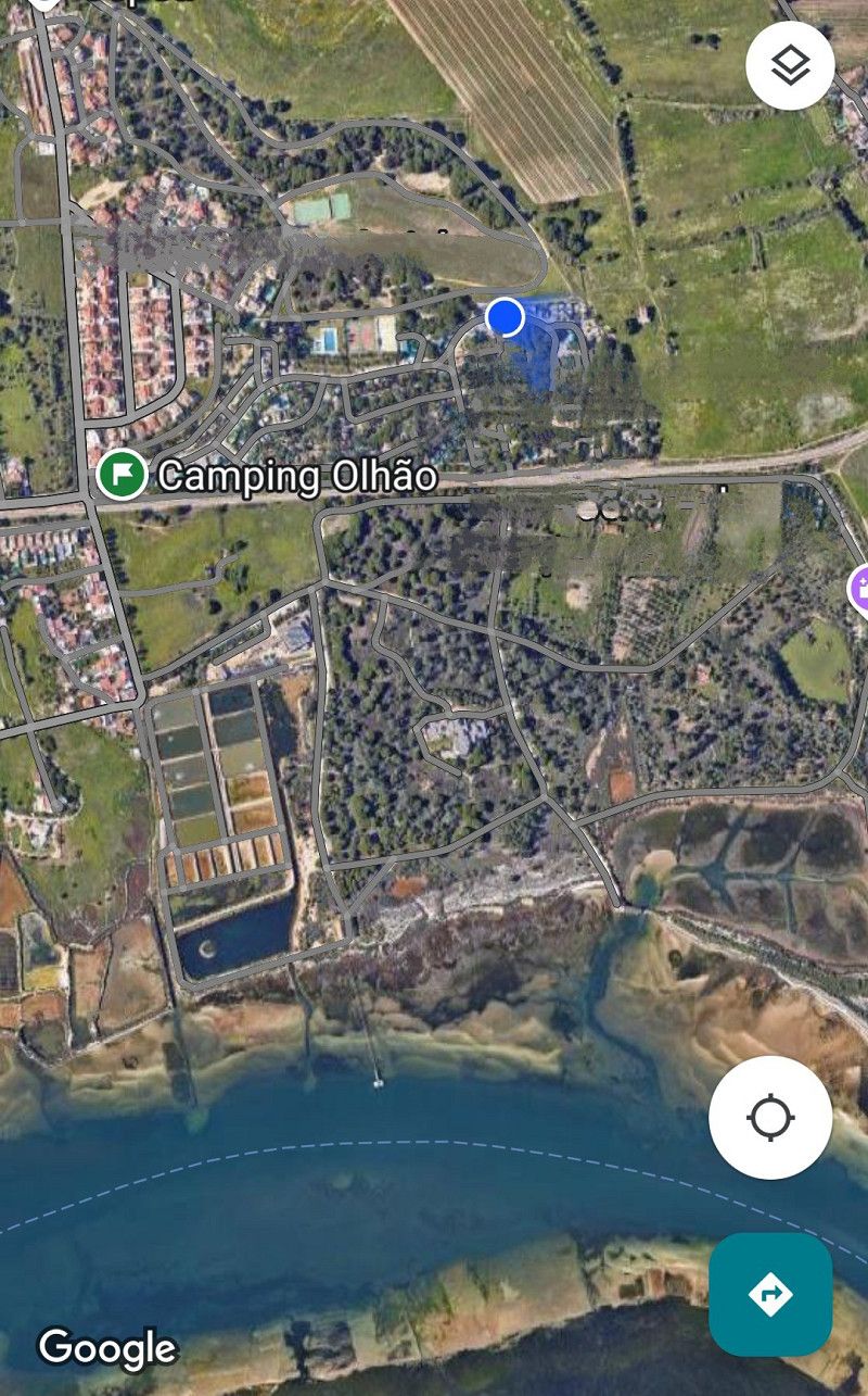
Olhão / Parque de Campismo
Our next destination in the "Sandy Algarve" was Olhao .
Sunday has now become established as a driving day for us, as has the stop at Lidl.
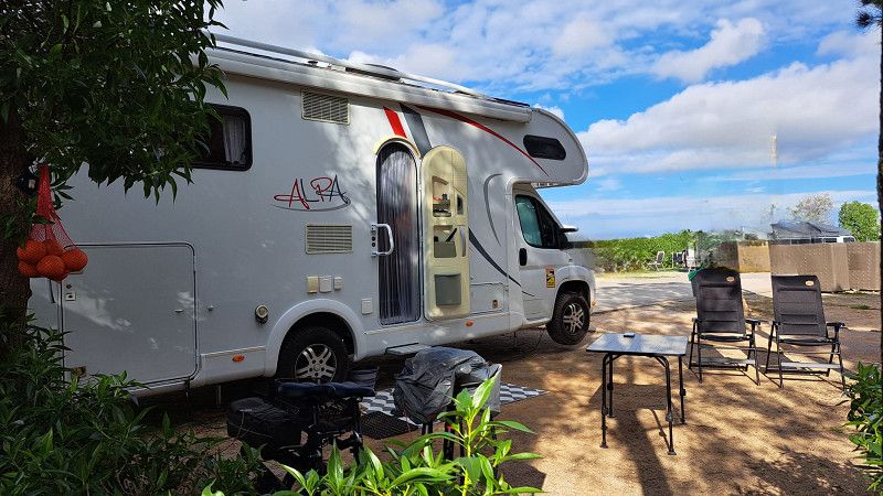
After quickly filling up with gas, we reach the campsite after about 50 km and first stroll around the grounds to look for a parking space.
There's still plenty of space, but there are also many trees and few sunny spots. We take our time and find another nice spot in the corner.
We check in and because of the Camper Card we can only pay when we leave.
13.10 € without electricity per night 👍.
After a first tour, we're satisfied. There are plenty of clean sanitary facilities, a small supermarket with fresh rolls, and a small restaurant.
Everything makes a good impression.
The next day we move again, I found a place with more ☀️.
With the 🚲 you can get to town quickly.
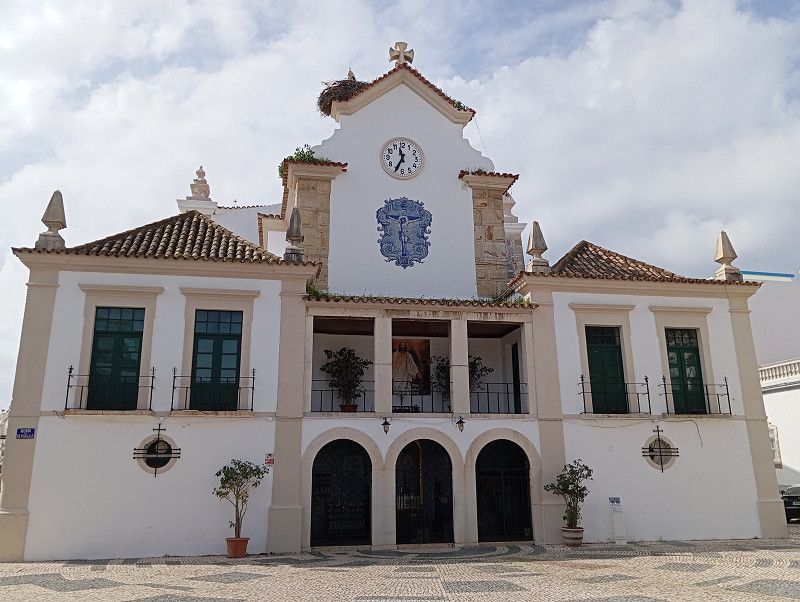
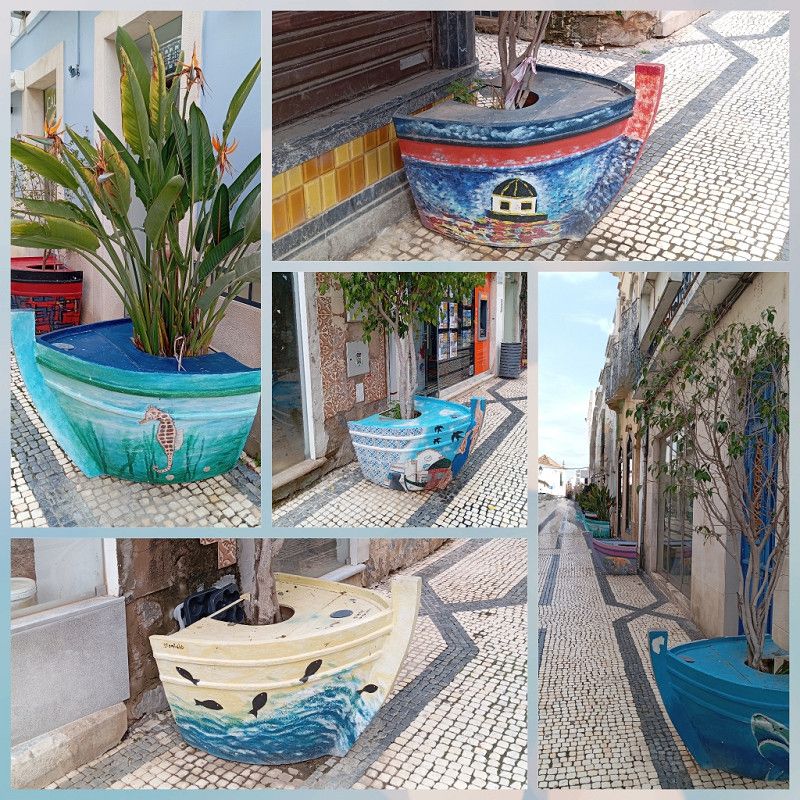
Olhao has a beautiful old town center with narrow streets and there is something new to discover around every corner.
Large harbor facilities, a long promenade, a colorful selection in the market halls - we can stay here for a while 🙂.
We linger in one of the many street cafés and watch the lively hustle and bustle.
Why did we stay for 14 days? Quite simply: the weather was bad.
Portugal and Spain are experiencing a very wet winter and it rained almost every day.
Storms, thunderstorms, cloudbursts in constant alternation.
We cycle to Olhao during the few dry hours, stroll through the town and enjoy the plentiful gastronomy.
Then quickly back to the campsite, because the next dark clouds are approaching.
The campsite was ideal for waiting out the weather.
Supermarket, fresh rolls, cafeteria, restaurant, book exchange corner...
But now we're moving on and would like to see some more places inland.
Olhao, we'll come back again when the weather is better.
Rua Cidade de Haia, Olhão, Faro, Portugal
37° 2' 11.5" N 7° 49' 5.6" W
37.0365259 -7.8182184
• Head east. Go for 47 m.
• Turn sharp right. Go for 159 m.
• Turn right toward Avenida Parque Natural da Ria Formosa. Go for 483 m.
• Take the 1st exit from roundabout onto Avenida Parque Natural da Ria Formosa. Go for 659 m.
• Turn right onto N125. Go for 514 m.
• Take the 2nd exit from roundabout onto N398. Go for 7.7 km.
• Take the 3rd exit from roundabout onto A22 (Via Infante de Sagres) toward Espanha. Go for 36.7 km.
• Take exit 18 toward Beja onto N122. Go for 1.0 km.
• Continue on IC27. Go for 26.7 km.
• Take ramp toward Alcoutim/Buarcos/Vaqueiros/Martim Longo/Pereiro. Go for 337 m.
• Turn right onto N124. Go for 2.3 km.
• Turn right toward N122-1. Go for 46 m.
• Turn right onto N122-1. Go for 5.0 km.
• Take the 1st exit from roundabout. Go for 170 m.
• Arrive at your destination on the left.
☍
81,8 km
( 56 min.)
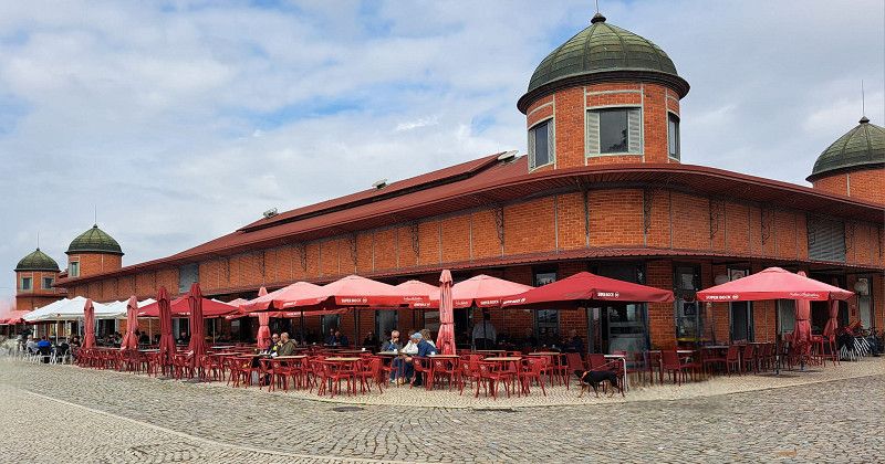
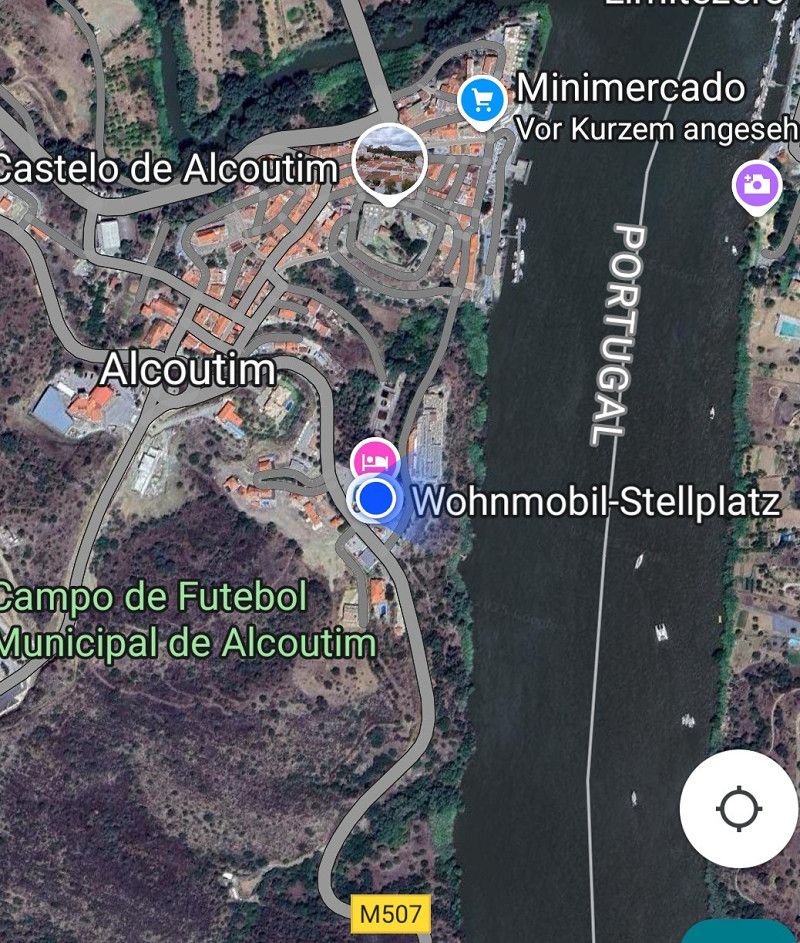
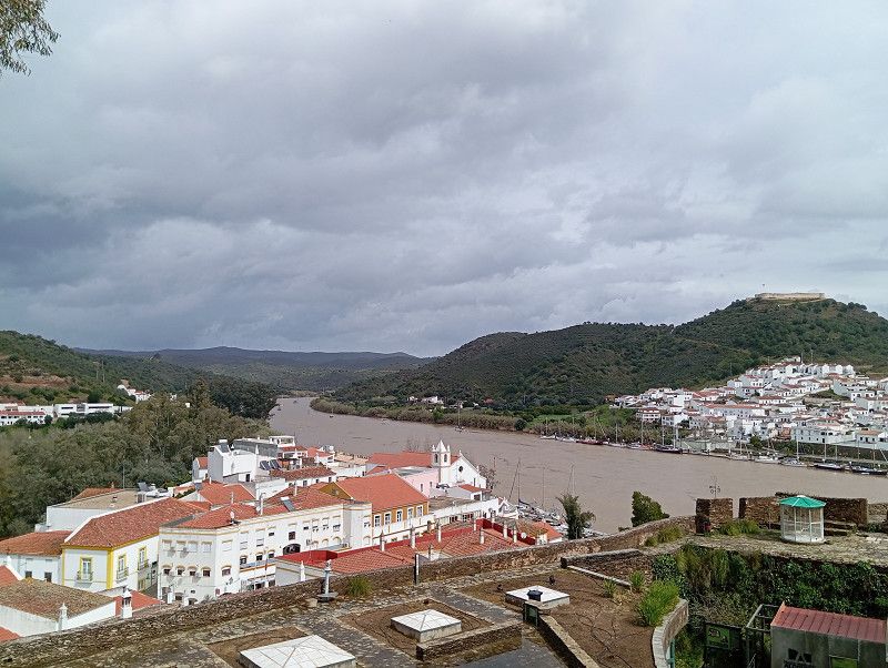
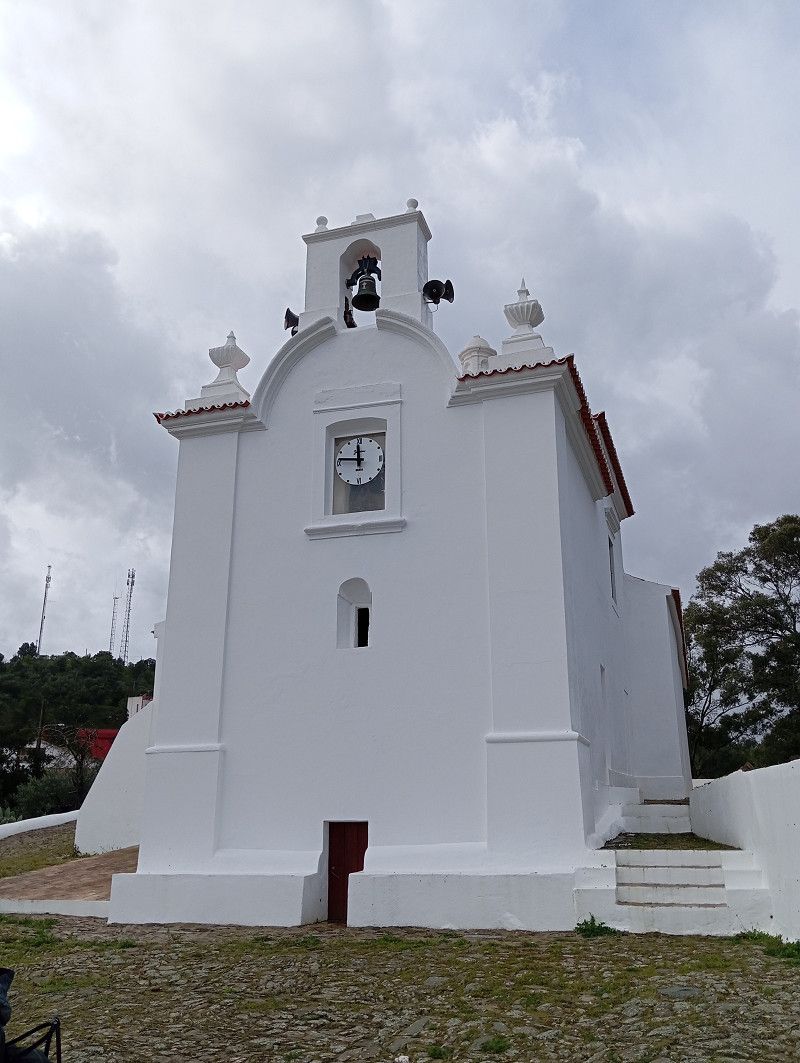
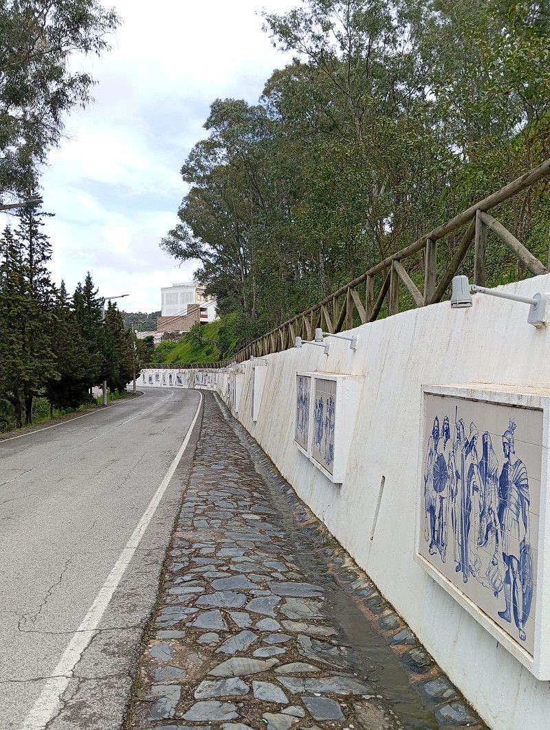
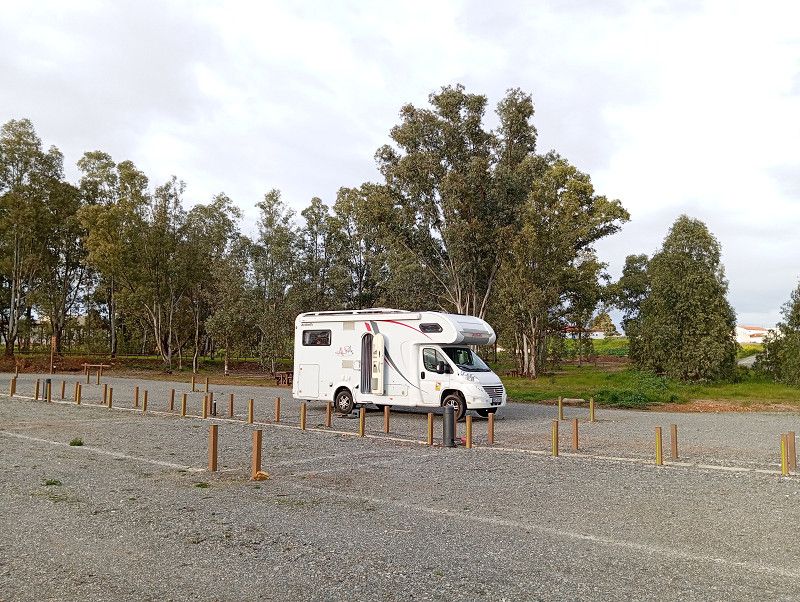
Alcoutim / Stellplatz
Don't follow the sat nav, the route shown here is incorrect.
From the motorway take the N122, then the M1063, then the M507 to Alcoutim.
We drive along this stunningly beautiful route, finally along the river bank.
Today on Sunday there were hardly any cars on the road and it was comfortable to drive in the RV 👍.
In Alcoutim, the municipality provides a free parking space, even with free electricity.
When we arrive around 2 p.m., about 10 of the 25 spaces are still free.
A nice little town awaits us, and we take a first stroll. Unfortunately, it starts to rain, so we stop for a galao and pastries.
We stayed one more night, but out of 24 hours it didn't rain for only 3 hours.
We use this time to explore the town, visit the castle and museum, and enjoy a delicious meal overlooking the river.
During the night, one cloudburst follows the next, but luckily there are good gutters around the campsite.
Incredibly, the sanitary building is open from 8 a.m. to 2 p.m. and a member of staff is on site the entire time to clean the shower after each visitor.
Faro, Portugal
37° 28' 9" N 7° 28' 19.6" W
37.4691591 -7.4721158
• Head northwest. Go for 133 m.
• Take the 2nd exit from roundabout onto N122-1. Go for 322 m.
• Turn right onto N122-1. Go for 558 m.
• Continue on Rua de Dom Fernando (M507). Go for 221 m.
• Continue on M507. Go for 10.1 km.
• Turn right onto N122. Go for 25.8 km.
• Continue on Estrada da Circunvalação. Go for 440 m.
• Turn right onto Rua Álvaro Marinha de Campos. Go for 110 m.
• Continue on Rua José Sebastião e Silva. Go for 134 m.
• Arrive at Rua José Sebastião e Silva. Your destination is on the right.
☍
37,8 km
( 36 min.)
Mértola
Beja, Portugal
37° 38' 31.4" N 7° 39' 38.3" W
37.6420430 -7.6606447
• Head east on Rua José Sebastião e Silva. Go for 25 m.
• Turn left onto Rua Soeiro Pereira Gomes. Go for 133 m.
• Turn right onto Rua do Bairro Novo. Go for 56 m.
• Turn slightly right onto Rua José Carlos Ary dos Santos. Go for 94 m.
• Take the 1st exit from roundabout onto Avenida Aureliano Mira Fernandes. Go for 247 m.
• Take the 2nd exit from roundabout onto N265. Go for 17.1 km.
• Arrive at Rua Catarina Eufémia (N265).
☍
17,6 km
( 17 min.)
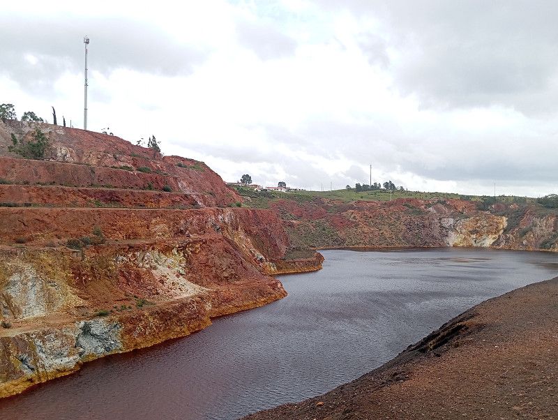
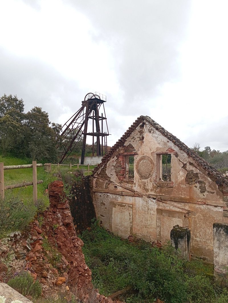
Mina de Sao Domingos
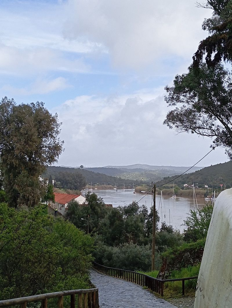
We would like to spend the night in Mina de Sao Domingos .
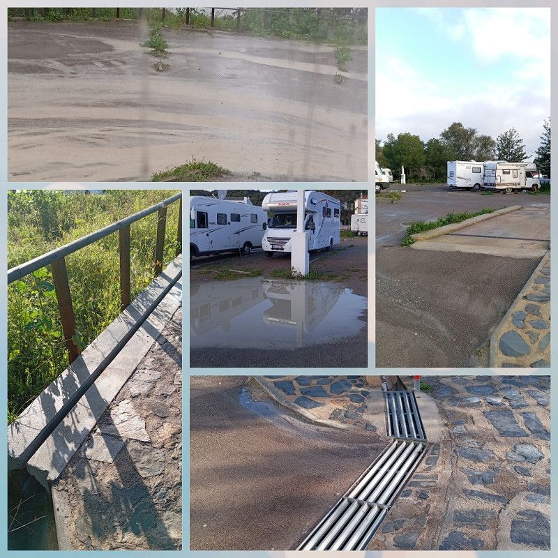
There is a new parking space (2023) with 30 parking spaces.
Since storms are forecast again, I chose the location carefully.
Flat, solid gravel, no mountains or slopes around.
Wide gutters on the square and all around calm us down.
It may sound exaggerated, but the first videos of flooded campsites are appearing online. The rivers and dams are full, as we later witness firsthand.
In the evening there are 5 RVs here and you pay 7 € per night including electricity (6A) at the machine.
There is water and electricity available, but no sanitary facilities, so you have to be self-sufficient.
It stays dry for another hour and we take a first walk around.
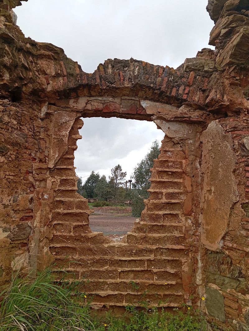
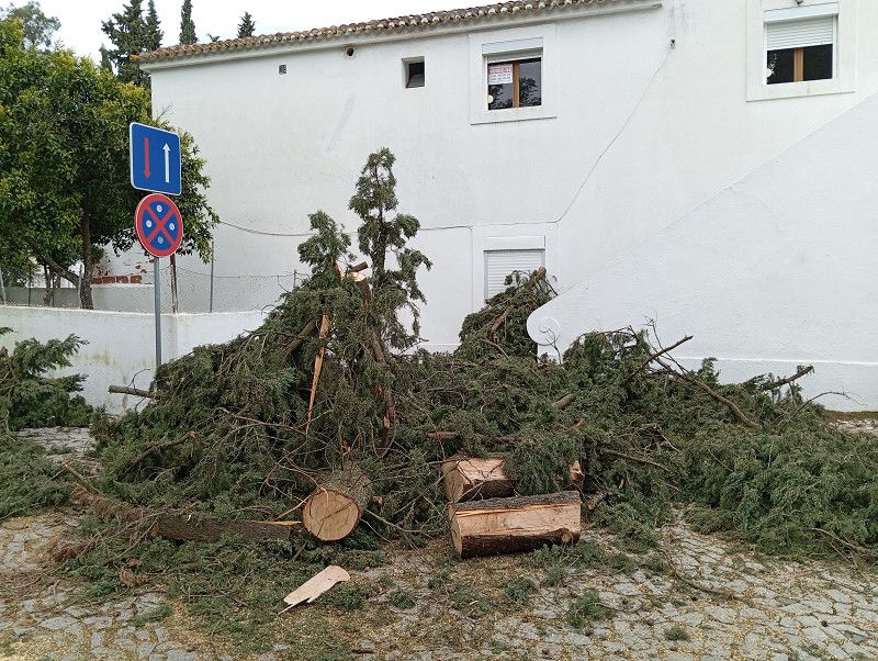
We stay two nights and, in the few dry hours, explore this special place. The abandoned mines, the dilapidated buildings—a truly lost place.
A delicious lunch and the price of 70 cents for a glass 🍷 will be remembered.
During the night, a severe storm hits: a hurricane with winds of force 10, and endless rain. Fortunately, we're safely anchored, with the bow facing the wind.
The next day, there are many pictures of fallen trees online. Also from the campsite in Zambujeira, where we stayed weeks ago.
ER 265, Mértola, Beja, Portugal
37° 40' 22.7" N 7° 29' 54.9" W
37.6729777 -7.4985698
• Head northeast on Rua Catarina Eufémia (N265). Go for 34.8 km.
• Turn left onto IP8 toward Beja/Ferreira. Go for 241 m.
• Turn left onto Avenida Nossa Senhora de Guadalupe toward Serpa. Go for 601 m.
• Continue on Avenida Nossa Senhora de Guadalupe. Go for 15 m.
• Take the 2nd exit from roundabout. Go for 334 m.
• Take the 3rd exit from roundabout onto Avenida Capitães de Abril. Go for 555 m.
• Take the 2nd exit from roundabout onto Avenida Capitães de Abril. Go for 359 m.
• Take the 1st exit from Praça Florbela Espanca roundabout onto Avenida da Paz. Go for 69 m.
• Turn left onto Rua da Liberdade. Go for 299 m.
• Arrive at Rua da Liberdade. Your destination is on the right.
☍
37,2 km
( 33 min.)
Serpa / Camping Municipal
Just a short stretch along a very bad national road and we reach Serpa .
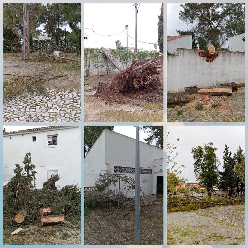
I looked for the municipal campsite and when we arrived the access road was being sawed clear.
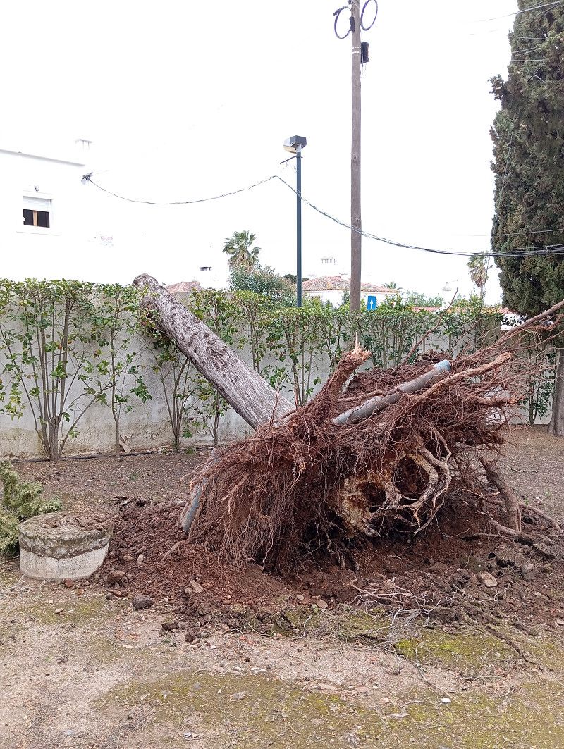
A massive tree fell during the night, scattering other large branches across the campsite. The storm really raged here, but according to reports, no campers were injured.
Since the wind speed has halved, we check in, have a snack in the RV and then explore the place.
Again an impressive old town, small alleys, pretty shops.
As dark clouds gather again, we head back. Not a minute too soon, because the next storm is about to break out.
Eira de S. Pedro, 7830-303, Serpa, Portugal
37° 56' 28.6" N 7° 36' 15.6" W
37.9412900 -7.6043300
• Head northwest on Rua da Liberdade. Go for 131 m.
• Turn left onto Rua Eira de São Pedro. Go for 82 m.
• Turn slightly left onto Rua Eira de São Pedro. Go for 123 m.
• Turn left onto Rua Manuel dos Nunes. Go for 49 m.
• Turn right onto Rua Eduardo Fernandes de Oliveira. Go for 331 m.
• Continue on Alameda do Abade Correia da Serra. Go for 125 m.
• Turn slightly left onto Rua do Calvário. Go for 99 m.
• Turn right onto Largo do Salvador. Go for 29 m.
• Turn left onto Largo do Salvador. Go for 39 m.
• Turn left onto Largo do Salvador. Go for 41 m.
• Continue on Largo de 5 de Outubro. Go for 20 m.
• Continue on Rua António Carlos Calixto. Go for 64 m.
• Turn left onto Rua de Sevilha. Go for 30 m.
• Continue on Rua dos Fidalgos. Go for 108 m.
• Turn right onto Travessa do Serra. Go for 30 m.
• Arrive at Travessa do Serra. Your destination is on the right.
☍
1,3 km
( 4 min.)
Serpa / am Hospital
Gusts of wind and torrential rain lash the campsite and a few plots away, half a tree falls to the ground.
Luckily, there are no campers in that direction, unthinkable...
This is the signal to leave: we are ready to go in 10 minutes and leave the place.
Looking at Maps we find a dead end next to the hospital, with no buildings on either side and, above all, no 🌲🌳.
I'm curious to see how we'll sleep. It's still raining and storming, although not as fiercely.
The night was restless, but we felt safe. Because of the dead-end street, there was no car traffic, just a few dogs being walked.
Beja, Portugal
37° 56' 37.1" N 7° 35' 48.1" W
37.9436517 -7.5966902
• Head toward Rua de Roque da Costa on Travessa do Serra. Go for 53 m.
• Turn left onto Rua de Roque da Costa. Go for 35 m.
• Turn right onto Rua de Pedro Anes. Go for 20 m.
• Continue on Terreiro de São João. Go for 58 m.
• Turn left onto Terreiro de São João. Go for 35 m.
• Turn slightly left onto Largo das Portas de Moura. Go for 19 m.
• Turn right onto Rua de Santo António. Go for 83 m.
• Turn left onto Rua Serpa Pinto. Go for 389 m.
• Take the 2nd exit from roundabout onto Rua Serpa Pinto. Go for 326 m.
• Turn right onto IP8 toward Ficalho/V. Nova/S. Bento. Go for 762 m.
• Turn left onto N255 toward Moura/Pias. Go for 13.9 km.
• Turn left onto Rua de João Tiago Coelho (N255). Go for 14.3 km.
• Take the 2nd exit from roundabout onto N255. Go for 553 m.
• Take the 3rd exit from roundabout onto N255. Go for 162 m.
• Turn right onto Largo de Santa Clara. Go for 64 m.
• Continue on Rua 9 de Abril. Go for 118 m.
• Continue on Praça Gago Coutinho. Go for 36 m.
• Turn right onto Rua São João de Deus. Go for 225 m.
• Turn left onto Rua Engenheiro Armando Almeida Anso. Go for 648 m.
• Turn right onto N255. Go for 3.9 km.
• Turn right onto N255/N386. Go for 11.3 km.
• Continue on Rua de Moura (N386). Go for 317 m.
• Continue on Largo Luís de Camões (N386). Go for 18 m.
• Continue on Largo Luís de Camões (M517). Go for 27 m.
• Continue on Rua da Igreja (M517). Go for 566 m.
• Continue on M517. Go for 9.7 km.
• Continue on Ponte de Alcarrache (M517). Go for 845 m.
• Continue on M517. Go for 2.8 km.
• Turn left. Go for 379 m.
• Continue toward Rua de Moura. Go for 3.1 km.
• Continue on Rua de Moura. Go for 190 m.
• Continue on Terreiro do Rossio. Go for 76 m.
• Continue on Rua da Fonte. Go for 56 m.
• Turn right onto Rua da Estrela. Go for 106 m.
• Arrive at Rua da Estrela. Your destination is on the left.
☍
65,1 km
(1 hrs. 5 min.)
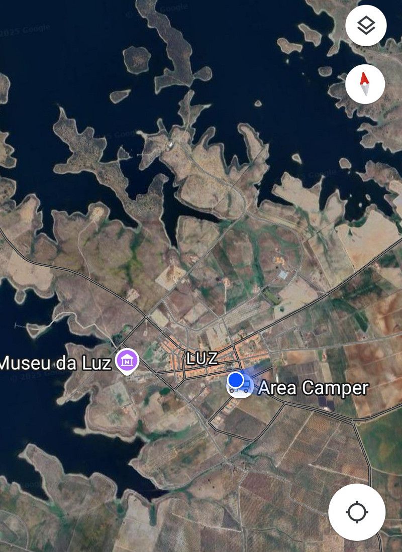
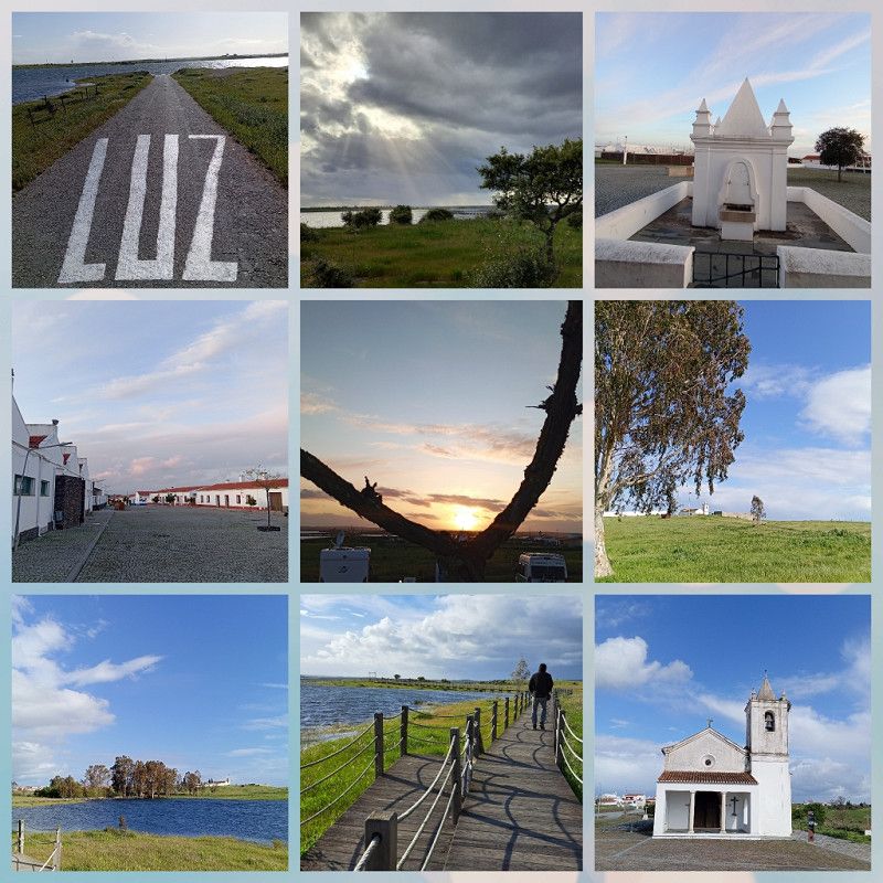
Luz / Stellplatz
Since storms are still forecast, we will not return to the campsite in Serpa.
Actually, the trip was supposed to go to the campsite in Beja , but according to the latest report, 🌳🌲 have also fallen over at this site.
We check our roughly planned route and a parking spot that had already been discarded is now interesting.
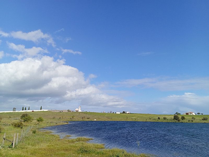
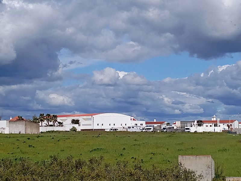
Luz , the municipality provides a small space, no tree and no bush.
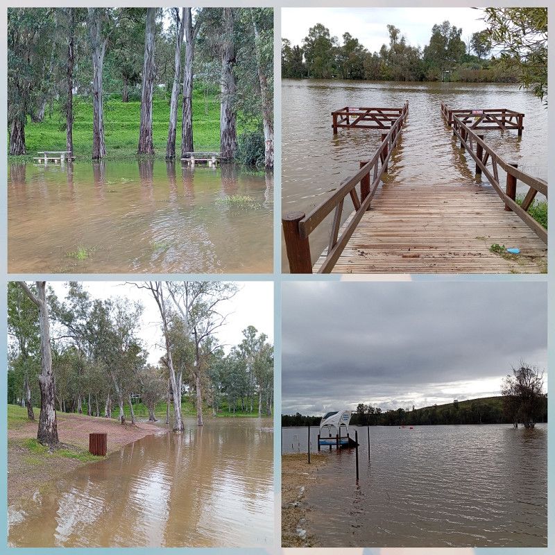
Because it was a bit defiant, a place by the lake was actually planned in this region, but it is under water and not paved.
So we head to Luz and here we immediately feel safe considering the weather conditions.
We get one of the last 8 sites with electricity and everything is there except for a sanitary building.
The pitch is now available free of charge in the pre-season, including electricity.
Here we are "weathering" again.
The place is actually a modern-day lost place. Luz was relocated during the construction of the dam. However, many people have since left the new settlement.
There is a restaurant (where we eat very tasty food), a pub and a shop.
Plus lots of water and nature.
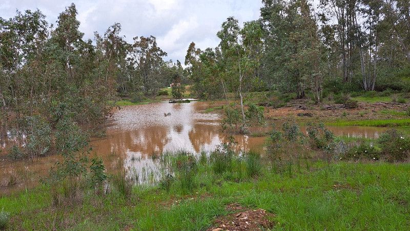
The dam is overflowing and there are constant television broadcasts of special programs about the floods in Portugal.
Rua da Estrela 21, Luz, Évora, Portugal
38° 20' 40.1" N 7° 22' 21.7" W
38.3444586 -7.3726809
• Head east on Rua da Estrela. Go for 88 m.
• Turn left toward Rua de Mourão. Go for 148 m.
• Turn right onto Rua de Mourão. Go for 4.0 km.
• Turn left onto M517. Go for 1.1 km.
• Take the 3rd exit from roundabout onto M517. Go for 706 m.
• Continue on Travessa dos Pinheiros (M517). Go for 53 m.
• Continue on Travessa dos Pinheiros. Go for 433 m.
• Turn right onto Largo das Portas de São Bento. Go for 67 m.
• Turn left onto Largo das Portas de São Bento (M1134). Go for 46 m.
• Continue on Estrada da Barca (M1134). Go for 93 m.
• Turn right onto Rua de São José. Go for 85 m.
• Turn left onto Largo Governador Furtado de Mendonça. Go for 26 m.
• Continue on Rua Frei António das Chagas. Go for 73 m.
• Turn left onto Rua Frei António das Chagas. Go for 41 m.
• Arrive at Rua Frei António das Chagas. Your destination is on the right.
☍
6,9 km
( 12 min.)
Mourão
Rua Frei António das Chagas, Mourão, Évora, Portugal
38° 23' 5.2" N 7° 20' 47.6" W
38.3847721 -7.3465632
• Head east on Rua Frei António das Chagas. Go for 41 m.
• Turn right onto Rua Frei António das Chagas. Go for 73 m.
• Continue on Largo Governador Furtado de Mendonça. Go for 26 m.
• Turn slightly left onto Rua de São Bento. Go for 127 m.
• Continue on Praça da República. Go for 84 m.
• Continue on Rua General Humberto Delgado. Go for 71 m.
• Continue on Rua Joaquim Sil. de Vasc. Rosado. Go for 134 m.
• Continue on Rua Doutor Libânio Esquível. Go for 166 m.
• Continue on Rua Doutor Libânio Esquível (N256-1). Go for 58 m.
• Continue on N256-1. Go for 574 m.
• Take the 3rd exit from roundabout onto N256. Go for 9.3 km.
• Turn right onto M514. Go for 5.0 km.
• Take the 1st exit from roundabout onto M514. Go for 94 m.
• Turn left. Go for 13 m.
• Turn right. Go for 17 m.
• Arrive at your destination.
☍
15,8 km
( 15 min.)
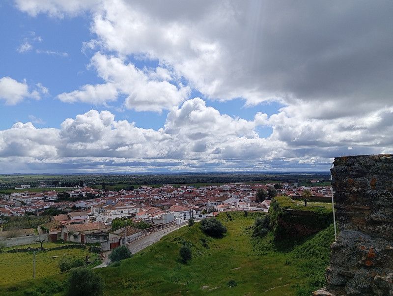
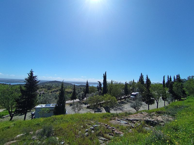
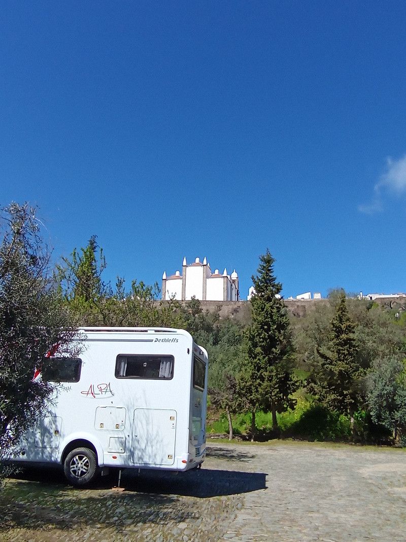
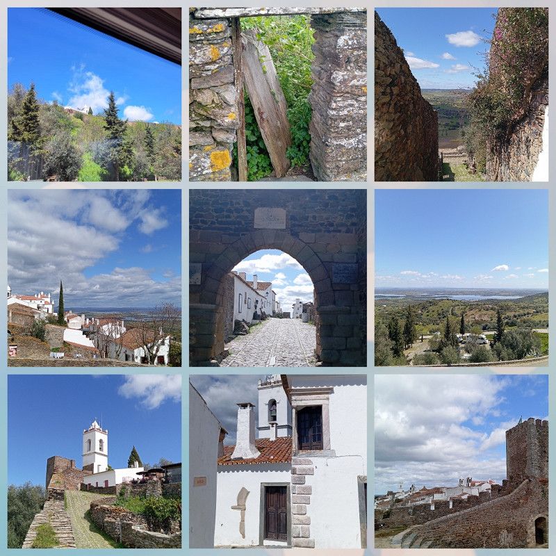
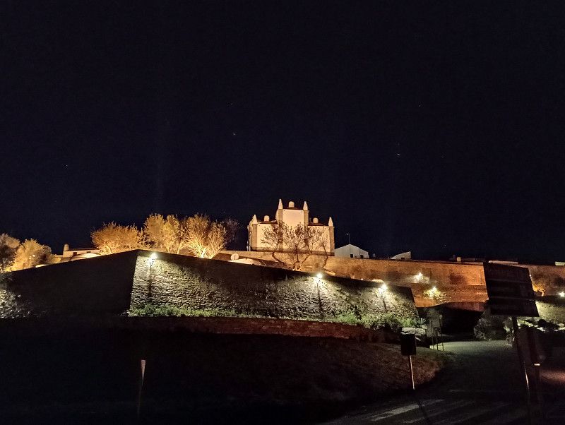
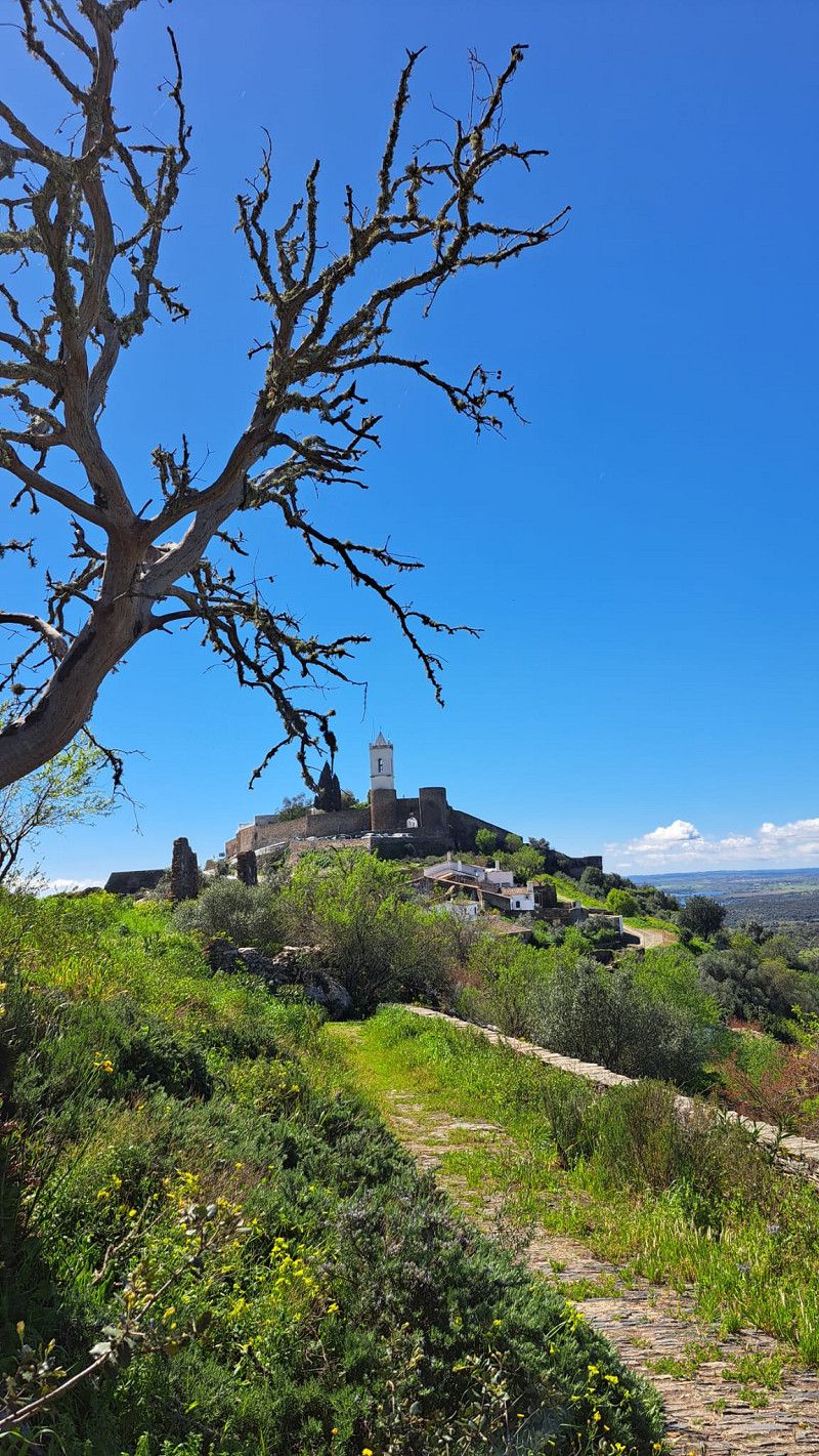
Monsaraz / Stellplatz
Finally the weather is nice and we drive to Monsaraz in sunshine.
The municipality provides one of the parking spaces free of charge for RVs, but without service. By the evening, all spaces were occupied.
We have already seen many beautiful places on our trip, but Monsaraz really tops everything.
Perched on top of the mountain, with an incredible view, an ancient town surrounded by a city wall.
You can hardly get enough of it.
Every time you stroll through the small town you discover new beautiful corners and nice little restaurants.
We cycle around Monsaraz, which is strenuous due to the inclines, enjoy a lovely evening ride, visit the church and leave this special place after two peaceful nights.
V/E is available free of charge one place further on.
But we are heading to Evora.
EM 514, Reguengos de Monsaraz, Évora, Portugal
38° 26' 34.2" N 7° 22' 43.7" W
38.4428409 -7.3788160
• Head north. Go for 174 m.
• Turn right toward M514. Go for 13 m.
• Turn right onto M514. Go for 58 m.
• Take the 2nd exit from roundabout onto M514. Go for 5.1 km.
• Turn right onto N256. Go for 9.9 km.
• Take the 2nd exit from roundabout onto Rua da Junqueira (N256). Go for 587 m.
• Continue on Rua de Mourão (N256). Go for 462 m.
• Continue on Rua General Humberto Delgado (N256). Go for 125 m.
• Continue on Praça da Liberdade (N256). Go for 47 m.
• Continue on Rua 1 de Maio (N256). Go for 212 m.
• Turn left onto Rua de Évora (N256). Go for 748 m.
• Take the 1st exit from roundabout onto Rua de Évora (N256). Go for 19.5 km.
• Take ramp onto IP2 toward Évora. Go for 14.3 km.
• Pass 2 roundabouts and continue on IP2. Go for 1.2 km.
• Take the 2nd exit from roundabout onto Variante ao Parque Industrial toward Lisboa/A6/Alcáçovas. Go for 1.0 km.
• Pass 3 roundabouts and continue on Variante ao Parque Industrial. Go for 1.9 km.
• Take the 3rd exit from roundabout onto N380 toward Alcáçovas. Go for 306 m.
• Arrive at N380. Your destination is on the right.
☍
55,7 km
( 49 min.)
Evora / Parque Orbitur
Now it's time for sightseeing again. Évora is a World Heritage Site, and the weather forecast is sunny.
We check in at Orbitur Camping, pay around €17 per night without electricity, and find a nice spot.
Once again I'm happy about the new "juice box", the electricity would have cost 5.40€ per night ☹️.
Nice, large pitches, a cafeteria, fresh rolls, clean sanitary facilities - we are satisfied.
Estrada de Alcáçovas, 7005- 206, Évora, Portugal
38° 33' 28" N 7° 55' 33" W
38.5577800 -7.9258300