We start our summer trip from the double city of Ulm/Neu-Ulm. The destination is Barcelona, we love this city and have visited it many times, but never with the motorhome, we are curious. Since we are not friends of very long distances, we have included some stopovers in Switzerland and France. For us, the way is the goal!
There are two of us and we are accompanied by our Bergamasque dog Enna, so all campsites and activities must be dog-friendly.
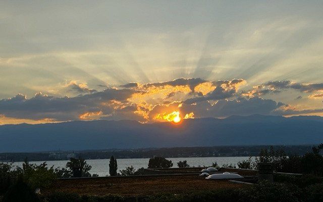
Neu-Ulm, Deutschland
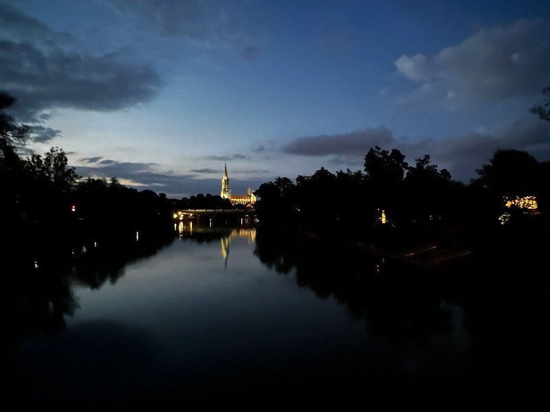
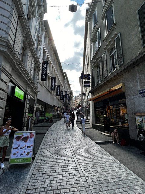
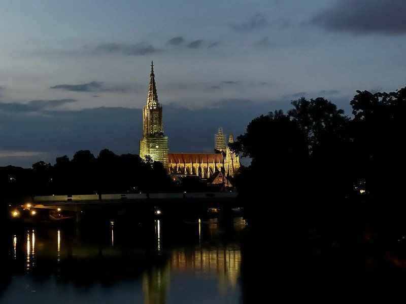
If someone from northern Germany is looking for a stopover heading south, a stop in Ulm/Neu-Ulm would be a good choice. There is a mobile home parking space directly at the Donaubad, very centrally located. From there, the city center of both cities is easily accessible for a visit to the historic fishing district or the Ulm Minster, which currently has the highest church tower in the world.
48° 23' 21" N 10° 0' 10.3" E
48.3891689 10.0028600
• Follow the roundabout. Go for 115 m.
• Take the 2nd exit from roundabout onto Memminger Straße toward Ludwigsfeld. Go for 630 m.
• Turn right and take ramp toward B28/Kempten/A7/Lindau/Friedrichshafen/Stuttgart/A8/Ulm/Gewerbegebiet Ulm-Donautal. Go for 374 m.
• Continue on Europastraße (B10). Go for 586 m.
• Take ramp onto B28 toward Kempten/A7/Lindau/Friedrichshafen/B30. Go for 10.1 km.
• Take the left exit toward Füssen/Kempten/Memmingen/Lindau onto A7. Go for 38.3 km.
• Take exit 128 toward Bregenz/Lindau onto A96. Go for 64.2 km.
• Continue on A14 (Rheintal Autobahn). Go for 26.4 km.
• Take exit 27 toward Götzis. Go for 286 m.
• Turn left onto Schweizer Straße (L55) toward Mäder. Go for 546 m.
• Take the 1st exit from roundabout onto Alte Landstraße (L58). Go for 1.1 km.
• Take the 2nd exit from roundabout onto Mäderer Landesstraße (L58). Go for 467 m.
• Continue on Zollstrasse. Go for 324 m.
• Take left ramp onto A13 toward Chur/Sargans. Go for 23.4 km.
• Take exit 8 toward Buchs/16/Grabs/Spital/Industriegebiet Buchs. Go for 603 m.
• Keep right toward 16. Go for 71 m.
• Continue on 16. Go for 311 m.
• Take the 2nd exit from roundabout onto Rheinstrasse (16). Go for 416 m.
• Take the 1st exit from roundabout onto Heldaustrasse. Go for 568 m.
• Continue on Rheinaustrasse. Go for 219 m.
• Turn right onto Churerstrasse (13). Go for 885 m.
• Arrive at Rathaus (13/16). Your destination is on the left.
☍
170,0 km
(1 hrs. 46 min.)
Day
TCS Camping Buochs, Seefeld 4, 6374 Buochs
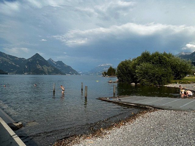
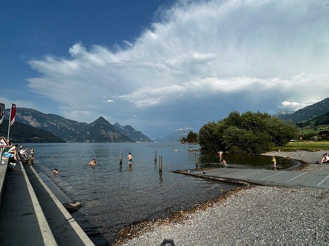
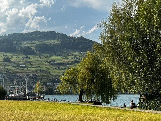
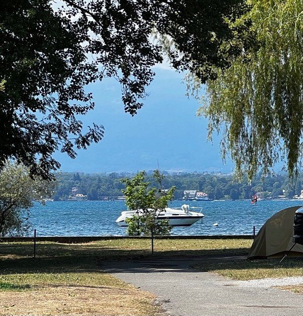
Our route leads directly past Zurich and Lucerne, unfortunately at 34 degrees we don't feel like sightseeing or shopping. We drive directly to the campsite on Lake Lucerne, with direct access to the lido, cooling off is good!
After the heat came thunderstorms during the night and with them rain for today. We spontaneously decide to continue driving.
Buchs, Schweiz
47° 9' 55.9" N 9° 28' 15.1" E
47.1655403 9.4708594
• Head toward Bahnhofstrasse on Rathaus (13/16). Go for 103 m.
• Turn left onto Grünaustrasse (16). Go for 426 m.
• Continue on 16. Go for 113 m.
• Take the 1st exit from roundabout onto 16. Go for 162 m.
• Take the 1st exit from roundabout onto 16. Go for 387 m.
• Take the 2nd exit from roundabout onto Rheinstrasse (16). Go for 346 m.
• Take ramp onto A13 toward Chur/Zürich/Sargans. Go for 16.6 km.
• Take exit 11 toward Zürich/Sargans/Mels onto A3. Go for 11.1 km.
• Take exit 49 toward Flumserberg/Unterterzen/Walenstadt/Spital. Go for 246 m.
• Take the 4th exit from roundabout onto Alte Landstrasse (3). Go for 9.5 km.
• Take the 1st exit from roundabout onto Walenseestrasse (3). Go for 4.2 km.
• Take ramp onto A3 toward Zürich/Glarus. Go for 64.0 km.
• Take exit 32 toward Flughafen/Bern/Basel/St. Gallen/Westring-Zürich onto A3. Go for 5.5 km.
• Take left exit 31 toward Bern/Basel/St. Gallen/Flughafen/Westring-Zürich onto A3/A4. Go for 10.0 km.
• Take the left exit toward Bern/Basel onto A1/A3. Go for 16.4 km.
• Continue on A1 (Verzweigung Birrfeld) toward Bern/Aarau/Mägenwil. Go for 40.6 km.
• Continue on A1 (Härkingen) toward E25/Lausanne/Bern/Biel/Bienne/Oensingen. Go for 50.8 km.
• Take the exit toward Lausanne/Fribourg/Neuchâtel/Bern-Neufeld onto A1 (Wankdorf). Go for 99.9 km.
• Continue on A1. Go for 2.7 km.
• Continue on E23 (Ecublens) toward Lausanne-Sud. Go for 106 m.
• Take the exit onto E23 (Autoroute Lausanne-Genève). Go for 4.3 km.
• Take the 3rd exit from roundabout onto Avenue de Montoie toward Montoie. Go for 624 m.
• Take the 2nd exit from roundabout onto Avenue de Montoie. Go for 518 m.
• Take the 1st exit from roundabout onto Avenue de Tivoli. Go for 127 m.
• Keep left toward Avenue de Provence/1. Go for 39 m.
• Turn right onto Avenue de Provence (1). Go for 102 m.
• Keep left onto Avenue de Tivoli (1). Go for 530 m.
• Continue on Avenue Jules Gonin. Go for 557 m.
• Continue on Rue du Grand-Chêne. Go for 165 m.
• Continue on Place Saint-François (9). Go for 9 m.
• Arrive at Place Saint-François (9). Your destination is on the left.
☍
340,3 km
(3 hrs. 32 min.)
Day
Day
Day
Camping de Vidy, Ch. du Camping 3, 1007 Lausanne, CH
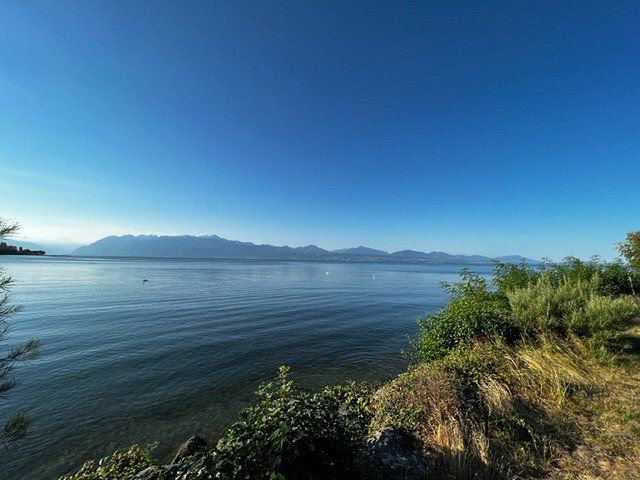
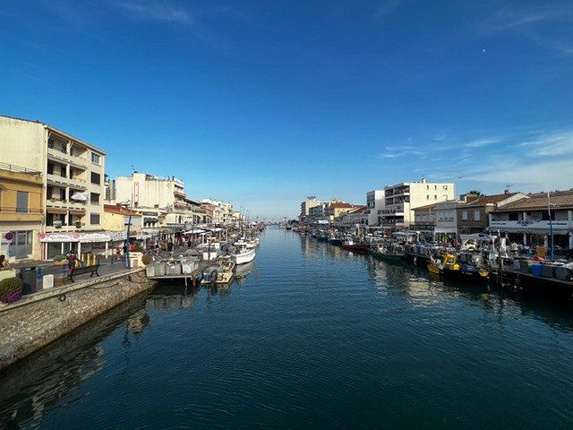
The Olympic capital of Lausanne is beautifully situated on Lake Geneva. There is all sorts of things to discover on a walk through the old town or on the shores of Lake Geneva. Very close to the campsite is the Olympic House, seat of the International Olympic Committee.
With this wonderful summer weather, the lake invites you to swim, go boating or stand up paddling.
We stayed the first night at the Euro-Relais, a camper place in front of the campsite as there was no other place available but that was fine too. Now we have moved to the campsite for two nights. The place is right on the lake and has a perfect connection to the center, with the free guest card for all public transport.
Lausanne, Schweiz
46° 31' 10.8" N 6° 37' 56.2" E
46.5196535 6.6322734
• Head east on Place Saint-François (9). Go for 156 m.
• Keep right onto Avenue du Théâtre (9). Go for 272 m.
• Turn right onto Rue Charles-Monnard. Go for 153 m.
• Turn right onto Avenue de la Gare. Go for 480 m.
• Take the 1st exit from roundabout onto Place de la Gare. Go for 174 m.
• Take the 2nd exit from roundabout onto Avenue William-Fraisse. Go for 207 m.
• Turn right onto Chemin des Epinettes. Go for 111 m.
• Turn right onto Chemin des Epinettes. Go for 10 m.
• Turn right onto Chemin des Epinettes. Go for 25 m.
• Continue on Avenue du Mont-d'Or. Go for 404 m.
• Take the 2nd exit from roundabout onto Avenue du Mont-d'Or. Go for 642 m.
• Take the 1st exit from roundabout onto Avenue des Figuiers. Go for 557 m.
• Take the 3rd exit from roundabout onto E23 (Autoroute Lausanne-Genève). Go for 3.7 km.
• Continue on A1 (Ecublens) toward Genève/Morges. Go for 52.1 km.
• Take exit 7 toward Gd-Saconnex/Ferney/Palexpo Arena/Fret-Cargo/Grand Saconnex. Go for 466 m.
• Take the 2nd exit from roundabout onto La Voie-des-Traz. Go for 1.1 km.
• Turn left onto La Voie-des-Traz. Go for 26 m.
• Turn right onto Route des Batailleux. Go for 476 m.
• Keep right onto Route des Batailleux toward Aéroport. Go for 119 m.
• Continue on Route de l'Aéroport. Go for 63 m.
• Keep right onto Route de l'Aéroport toward Parking P51 Illimité/Voiture de Location/Car Rental/Kiss & Fly. Go for 52 m.
• Keep left onto Route de l'Aéroport toward P51 Illimité/Voiture de Location/Car Rental/P1 Illimité. Go for 82 m.
• Continue on Route de Pré-Bois. Go for 332 m.
• Keep right onto Route de Pré-Bois toward Meyrin/Vernier/Genève-Centre/Parking P51 Illimité/World Trade Center. Go for 1.4 km.
• Continue toward Route de Pré-Bois. Go for 38 m.
• Turn left onto Route de Vernier. Go for 215 m.
• Take ramp onto A1 toward France/Genève-La Praille/Perly/St-Julien. Go for 9.3 km.
• Continue on A41. Go for 71.5 km.
• Continue on A43. Go for 46.9 km.
• Take the exit toward Marseille/Valence/Grenoble onto A48. Go for 25.8 km.
• Take exit 9 toward La Côte-St André/Rives/Aéroport Grenoble-Isère. Go for 811 m.
• Take the 3rd exit from roundabout onto D50 F toward Rives. Go for 2.0 km.
• Continue on Route de Colombe (D50 F). Go for 731 m.
• Take the 1st exit from roundabout onto Route de Colombe (D50). Go for 133 m.
• Continue on Rue Louis Néel (D50). Go for 450 m.
• Take the 2nd exit from roundabout onto Avenue Charles de Gaulle (D50). Go for 396 m.
• Pass 2 roundabouts and continue on Avenue Charles de Gaulle (D45/D50). Go for 423 m.
• Take the 3rd exit from roundabout onto Avenue de la Maladière (D45). Go for 418 m.
• Turn left onto Rue de la République (D12 C). Go for 78 m.
• Take the 1st exit from roundabout onto Route de Maubec (D45). Go for 205 m.
• Pass 3 roundabouts and continue on Rue de la République (D45). Go for 5.5 km.
• Turn right onto Boulevard Michel Perret (D1092). Go for 1.2 km.
• Make a U-Turn onto Avenue de la Gare (D1092). Go for 78 m.
• Keep right onto Avenue de Saint-Quentin (D45) toward A48-A49/Chambéry/Genève/Grenoble/St Quentin S/Isère. Go for 1.5 km.
• Take the 1st exit from roundabout onto Route de Saint-Quentin (D45) toward A48-A49/Grenoble. Go for 1.3 km.
• Take the 2nd exit from roundabout onto A49 toward Valence. Go for 52.4 km.
• Continue on N532. Go for 10.6 km.
• Continue on E713. Go for 240 m.
• Continue on N7. Go for 9.5 km.
• Keep left onto E713 toward E15/A7/Marseille/Montélimar/Privas/Lyon. Go for 405 m.
• Keep left onto Échangeur de Valence-Sud (E713) toward Marseille/Avignon/Montélimar/Privas. Go for 153 m.
• Take ramp onto A7 (Autoroute du Soleil). Go for 28.3 km.
• Take exit 17 toward Montélimar/Dieulefit/Le Teil. Go for 715 m.
• Take the 2nd exit from roundabout onto N7 toward Montélimar/Avignon/Le Teil/Dieulefit. Go for 2.7 km.
• Turn left onto Route de Sauzet (D74) toward Sauzet/Dieulefit/Condillac/Marsanne/Église et Site Féodal/N.D. de Fresneau. Go for 1.2 km.
• Continue on D74. Go for 385 m.
• Turn left onto D107 toward Condillac/Marsanne/Lachamp. Go for 2.4 km.
• Continue on Lieu-dit Morinet (D107). Go for 186 m.
• Continue on D107. Go for 354 m.
• Continue on D606. Go for 70 m.
• Continue on D107. Go for 1.5 km.
• Continue on Lieu-dit Les Mongis (D107). Go for 43 m.
• Continue on D107. Go for 622 m.
• Continue on Lieu-dit Mirabel (D107). Go for 107 m.
• Continue on D107. Go for 211 m.
• Turn left onto D105. Go for 236 m.
• Continue on Lieu-dit Serre Vidal (D105). Go for 142 m.
• Continue on Avenue René Chartron (D105). Go for 2.4 km.
• Continue on Place du Champ-de-Mars (D105). Go for 12 m.
• Arrive at Place du Champ-de-Mars (D105). Your destination is on the right.
☍
347,2 km
(3 hrs. 43 min.)
Day
Les Bastets, 335 Chemin du Camping, 26740 Marsanne, Frankreich
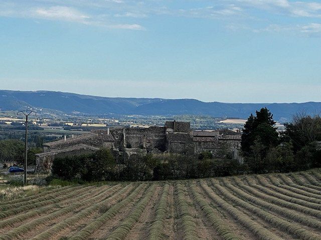
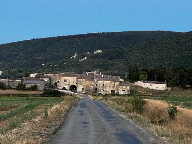
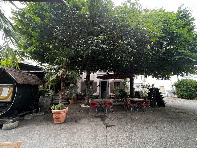
Our next stop is in the midst of sunflower and lavender fields, in France's Drôme. The beautiful landscape invites you to take long walks.
The plots on the campsite are very nicely laid out and overgrown. From the restaurant terrace you have a wonderful view over the entire valley and the food there is highly recommended, an absolutely sensational price-performance ratio. We really enjoyed the evening there.
26740 Marsanne, Frankreich
44° 38' 38.1" N 4° 52' 24.3" E
44.6439280 4.8734280
• Head toward Rue du Comte de Poitiers on Place du Champ-de-Mars (D105). Go for 2.4 km.
• Continue on Lieu-dit Serre Vidal (D105). Go for 142 m.
• Continue on D105. Go for 913 m.
• Continue on Lieu-dit Quince (D105). Go for 108 m.
• Continue on D105. Go for 96 m.
• Continue on Lieu-dit Loubet (D105). Go for 190 m.
• Continue on D105. Go for 1.5 km.
• Take the 2nd exit from roundabout onto Lieu-dit Bourbon (D6). Go for 2.0 km.
• Take the 3rd exit from roundabout onto D126. Go for 301 m.
• Continue on Lieu-dit Constantin (D126). Go for 106 m.
• Turn right onto D169. Go for 893 m.
• Continue on Lieu-dit Font Juliane (D169). Go for 136 m.
• Continue on D169. Go for 606 m.
• Continue on Lieu-dit Ronfland (D169). Go for 143 m.
• Continue on D169. Go for 599 m.
• Turn right onto D128. Go for 620 m.
• Turn left onto D169. Go for 1.1 km.
• Continue on Route de Sauzet (D169). Go for 136 m.
• Continue on Lieu-dit Bouillat (D169). Go for 97 m.
• Continue on D169. Go for 512 m.
• Turn left onto Rue Fortuné Jacquier (D169). Go for 138 m.
• Continue toward D169. Go for 34 m.
• Continue on Avenue du Général Charles de Gaulle (D169). Go for 95 m.
• Continue on D169. Go for 360 m.
• Continue on Lieu-dit Saint-Martin (D169). Go for 168 m.
• Continue on D169. Go for 33 m.
• Take the 2nd exit from roundabout onto Route d'Allan (D169). Go for 54 m.
• Continue on D169. Go for 1.3 km.
• Turn left onto D4. Go for 257 m.
• Turn right onto D169. Go for 267 m.
• Continue on Lieu-dit Morin (D169). Go for 100 m.
• Continue on D169. Go for 2.9 km.
• Continue on Lieu-dit La Chaussée (D169). Go for 156 m.
• Continue on D169. Go for 290 m.
• Take the 1st exit from roundabout onto Route d'Espeluche (D126). Go for 627 m.
• Take the 3rd exit from roundabout onto D126. Go for 1.3 km.
• Continue on Chemin de Coudouly (D126). Go for 411 m.
• Continue on Lieu-dit Le Pavillon (D126). Go for 68 m.
• Continue on D126. Go for 351 m.
• Turn right onto D126. Go for 473 m.
• Continue on Lieu-dit Sainte Agnès (D126). Go for 146 m.
• Continue on Route d'Allan (D126). Go for 557 m.
• Continue on D126. Go for 15 m.
• Continue on Route d'Allan (D126). Go for 605 m.
• Continue on D126. Go for 19 m.
• Turn sharp left onto N7. Go for 640 m.
• Take the 2nd exit from roundabout toward Valence/Marseille/Nîmes/Orange. Go for 258 m.
• Take ramp onto A7 (Autoroute du Soleil) toward Alès/Orange/Avignon/Nîmes/Marseille. Go for 42.2 km.
• Keep right onto A9 (Échangeur d'Orange) toward Barcelone/Toulouse/Montpellier/Nîmes. Go for 281 km.
• Continue on AP-7 (Autopista de la Mediterrània). Go for 20.3 km.
• Take exit 3 toward Figueres N./Roses/Figueres/Girona/Barcelona/Olot/Ripoll. Go for 390 m.
• Take the 3rd exit from roundabout onto N-2 toward Figueres/Girona/Barcelona. Go for 4.4 km.
• Take ramp toward Llançà/Portbou. Go for 257 m.
• Continue on N-260. Go for 622 m.
• Take the 2nd exit from roundabout onto N-260 toward Portbou. Go for 3.8 km.
• Turn right onto GIP-6042 toward Vilanova de la Muga. Go for 2.5 km.
• Continue on Carrer Major (GIP-6042). Go for 317 m.
• Continue on Carrer Castelló (GIV-6043). Go for 109 m.
• Continue on GIV-6043. Go for 2.7 km.
• Continue on Carretera Castelló d'Empúries a Vilanova (GIV-6043). Go for 167 m.
• Take the 2nd exit from roundabout onto Carrer Figueres (GIV-6043) toward Figueres. Go for 281 m.
• Turn left onto Carrer de Cadaqués. Go for 120 m.
• Continue on Passatge Toribi Duran IV toward Pedret i Marzà. Go for 59 m.
• Turn right onto Passatge Toribi Duran I. Go for 134 m.
• Arrive at Passatge Toribi Duran I. Your destination is on the right.
☍
383,4 km
(3 hrs. 36 min.)
Day
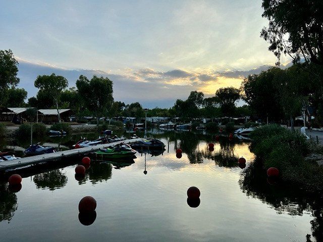
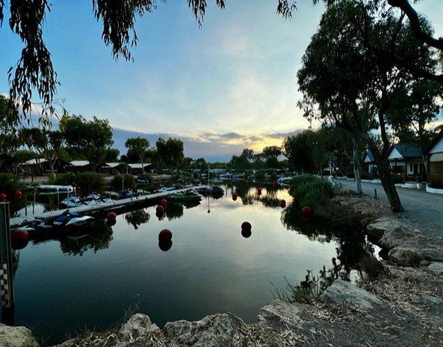
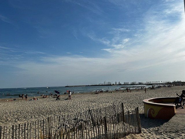
Nautic Almate, 17486 Castello d'Empuries, Spanien
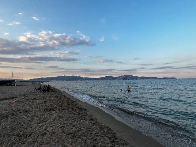
Before we go to Barcelona, we spend a few days in Castello d Empuries on the Costa Brava. The campsite is large but beautifully laid out and is located directly on the sandy beach. Perfect for water sports and especially boat trips, as private boats can be moored directly at the campsite.
17486 Castello d'Empuries, Provinz Girona, Spanien
42° 15' 37.8" N 3° 4' 26" E
42.2604918 3.0738992
• Head toward Carrer del Portal de la Mercè on Passatge Toribi Duran I. Go for 18 m.
• Turn right onto Carrer del Portal de la Mercè. Go for 75 m.
• Continue on Carrer de la Muralla. Go for 45 m.
• Continue on Carrer Pont. Go for 184 m.
• Turn left onto Avinguda de Pau Casals (GIV-6043). Go for 440 m.
• Take the 1st exit from roundabout onto Carretera de Roses (C-260a). Go for 332 m.
• Take left ramp onto C-260 toward Figueres. Go for 1.1 km.
• Take the 4th exit from roundabout onto Carretera Castelló (GIV-6213) toward Fortià. Go for 2.8 km.
• Take the 2nd exit from roundabout onto GI-8594 toward Vilamalla. Go for 3.3 km.
• Take the 3rd exit from roundabout. Go for 169 m.
• Take the 1st exit from roundabout onto C-31 toward AP-7/Figueres/Empordà Internacional. Go for 1.8 km.
• Take the 2nd exit from roundabout onto C-31 toward Sta. Llogaia d'Àlguema/Figueres. Go for 812 m.
• Take the 2nd exit from roundabout onto N-2A toward AP-7/Girona/Barcelona. Go for 1.3 km.
• Take the 2nd exit from roundabout onto N-2A toward Girona. Go for 555 m.
• Take the 1st exit from roundabout toward Barcelona/Girona. Go for 889 m.
• Take left ramp onto AP-7 (Autopista de la Mediterrània) toward Girona/Barcelona. Go for 108 km.
• Keep left onto AP-7 (Autopista de Barcelona a Mollet del Vallès) toward C-33/Centre Ciutat Barcelona/Aeropuerto. Go for 239 m.
• Continue on C-33 (Autopista de Barcelona a Mollet del Vallès). Go for 16.2 km.
• Keep left onto Avinguda Meridiana (C-33). Go for 2.6 km.
• Turn right onto Carrer d'Aragó toward C. Aragó/G. V. Corts Catalanes/Pl. Glòries/Centre Ciutat. Go for 2.6 km.
• Turn left onto Passeig de Gràcia. Go for 447 m.
• Turn right onto Passeig de Gràcia. Go for 200 m.
• Turn right onto Plaça de Catalunya. Go for 141 m.
• Arrive at Plaça de Catalunya. Your destination is on the left.
☍
143,8 km
(1 hrs. 43 min.)
Day
Day
Day
Camping Barcelona, 08304 Mataró, Spanien
On the way to Camping Barcelona, we make a stop for some shopping. We stop at Outlet Village La Roca, about 15 minutes from the campsite. All common brands and a delicious gastronomic offer, so you can also spend a few hours.
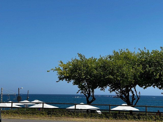
From our pitch, we have a fantastic view of the sea, but unfortunately there is a main road and the railway line between the campsite and the sea, so it is not within walking distance. However, there is a free shuttle bus to the beach that runs every 20 minutes.
For travel to Barcelona, the campsite provides a shuttle bus, twice a day to and from Barcelona to the campsite.
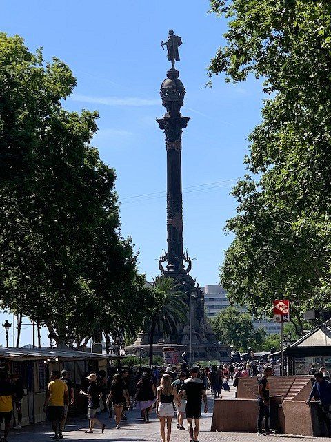
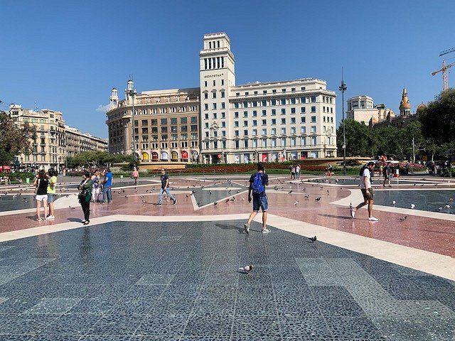
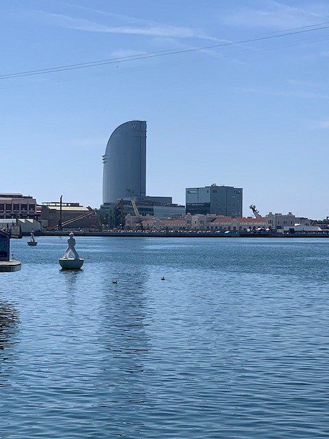
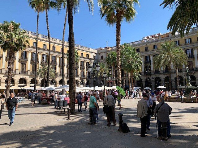
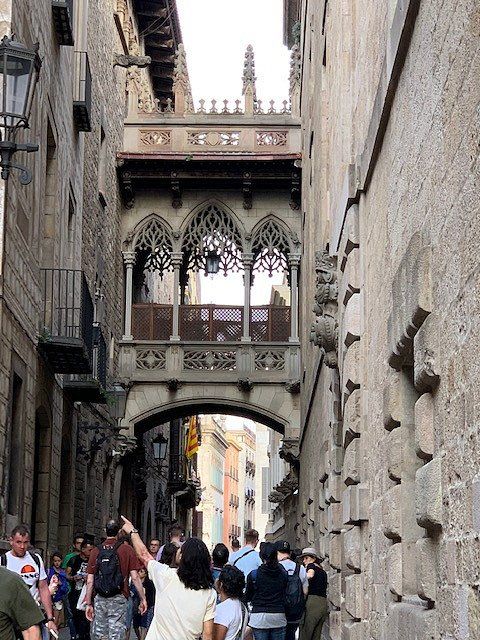
We have been to Barcelona many times, but the diversity and vibrancy of this city never fails to impress us. With so much to see and discover, this city has something for everyone.
Barcelona, Provinz Barcelona, Spanien
41° 23' 14.6" N 2° 10' 6.8" E
41.3873974 2.1685680
• Head southwest on Plaça de Catalunya.
• Continue on Ronda de la Universitat. Go for 365 m.
• Continue on Plaça de la Universitat toward Pl. Universitat/G. V. Corts Catalanes/Pl. Espanya/Rda. Sant Antoni. Go for 77 m.
• Turn right onto Plaça de la Universitat toward G. V. Corts Catalanes/C. Aragó/Pl. Espanya/Aeroport. Go for 107 m.
• Turn right onto Gran Via de les Corts Catalanes. Go for 432 m.
• Keep right toward Gran Via de les Corts Catalanes. Go for 29 m.
• Turn left onto Gran Via de les Corts Catalanes. Go for 146 m.
• Turn slightly left onto Gran Via de les Corts Catalanes toward Pl. Glòries/Pg. Sant Joan. Go for 308 m.
• Keep right onto Gran Via de les Corts Catalanes. Go for 463 m.
• Keep right onto Plaça de Tetuán. Go for 39 m.
• Continue on Gran Via de les Corts Catalanes. Go for 37 m.
• Continue on Plaça de Tetuán. Go for 17 m.
• Keep left onto Plaça de Tetuán toward Pl. de les Glòries/Pl. Mossèn Jacint Verdaguer/La Sagrada Família. Go for 89 m.
• Turn right onto Plaça de Tetuán toward Pl. Glòries/Estació del Nord/C. Marina. Go for 61 m.
• Continue on Gran Via de les Corts Catalanes toward Pl. Glòries. Go for 839 m.
• Continue on Túnel de les Glòries. Go for 3.8 km.
• Take the left exit onto B-10 (Ronda del Litoral). Go for 4.8 km.
• Continue on C-58. Go for 365 m.
• Keep right toward Girona/A-7/França. Go for 559 m.
• Continue on C-33 (Autopista de Barcelona a la Jonquera). Go for 12.2 km.
• Continue on AP-7 (Autopista de Barcelona a Mollet del Vallès). Go for 136 km.
• Continue on A9 (La Catalane). Go for 172 km.
• Keep right onto A709 toward Montpellier/Aéroport. Go for 6.5 km.
• Take exit 30 toward Montpellier-Sud/Montpellier-Centre/Lattes/Palavas les Flots onto M986 (Route de Palavas). Go for 5.7 km.
• Take the 2nd exit from roundabout onto Route de Montpellier (M986). Go for 2.5 km.
• Take the 3rd exit from Rond-Point de l'Europe roundabout onto D62 E2. Go for 483 m.
• Take the 1st exit from roundabout onto Avenue de l'Abbé Brocardi. Go for 466 m.
• Continue on Avenue de l'Étang du Grec. Go for 228 m.
• Turn right toward Avenue de la Gare Albert Dubout. Go for 80 m.
• Turn left onto Avenue de la Gare Albert Dubout. Go for 36 m.
• Arrive at Avenue de la Gare Albert Dubout. Your destination is on the right.
☍
349,1 km
(3 hrs. 25 min.)
Day
Day
Day
St. Maurice, 189 Avenue Saint Maurice, 34250 Palavas-les-Flots, Frankreich
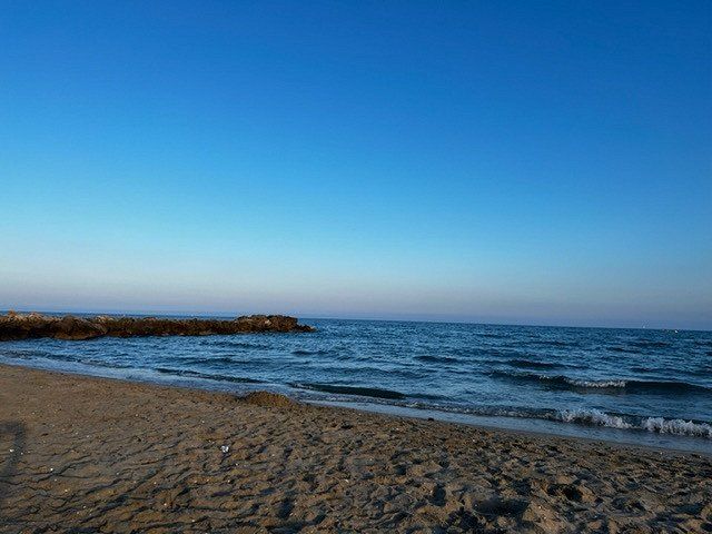
Our first stop on the return journey is Palaves-les-Flots, 10km from Montpellier on the Mediterranean Sea. The place has a nice town center with various restaurants and shops. The miles of sandy beaches invite you to water sports and swimming.
Unfortunately, there is only one section of the beach where dogs are allowed and it is far too far away from our campsite, which is a shame.
We looked at a few campsites and weren't too impressed, we decided on Camping Saint Maurice, a small and tidy campsite 50m from the beach.
34250 Palavas-les-Flots, Frankreich
43° 31' 44.1" N 3° 56' 0.6" E
43.5289060 3.9334930
• Head toward Boulevard Joseph Joffre on Avenue de la Gare Albert Dubout. Go for 100 m.
• Take the 2nd exit from roundabout. Go for 55 m.
• Continue on Rue Pierre de Provence. Go for 69 m.
• Take the 2nd exit from roundabout onto Avenue de l'Étang du Grec. Go for 359 m.
• Continue on Avenue de l'Abbé Brocardi. Go for 425 m.
• Take the 2nd exit from roundabout onto D62 E2. Go for 368 m.
• Turn right onto Avenue de Lattre de Tassigny (D986). Go for 2.5 km.
• Take the 2nd exit from roundabout onto Route de Palavas (M986). Go for 5.3 km.
• Take ramp onto A709 toward Nîmes/Alès/Lyon/Marseille/Montpellier-Centre/Montpellier-Millénaire/Aéroport Montpellier/Méditerranée/Prés d'Arènes/Millau. Go for 14.5 km.
• Continue on A9 (La Languedocienne). Go for 87.3 km.
• Continue on A7 (Autoroute du Soleil). Go for 92.5 km.
• Take exit 15 toward Genève/Chambéry/Grenoble/Romans/Valence onto E713 (Échangeur de Valence-Sud). Go for 708 m.
• Continue on N7. Go for 9.7 km.
• Continue on E713. Go for 168 m.
• Continue on N532. Go for 10.6 km.
• Keep left onto A49 toward Genève/Chambéry/Grenoble/Romans-Centre. Go for 61.1 km.
• Continue on A48. Go for 9.7 km.
• Keep right onto N481 toward St Martin le V./Bastille/Hôpital Nord/Presqu'Île. Go for 4.7 km.
• Continue on Place Aristide Briand (D1075). Go for 72 m.
• Turn right onto Pont de la Porte de France (D1075) toward Centre Ville/Hôpital Nord. Go for 170 m.
• Turn left onto Place Hubert Dubedout (D15) toward Chambéry/Hôpital Nord. Go for 774 m.
• Turn right onto Quai Claude Brosse (D15) toward Chambéry. Go for 100 m.
• Turn right onto Place de Lavalette (D590). Go for 435 m.
• Turn right onto Boulevard Maréchal Leclerc (D15) toward Genève/Chambéry. Go for 586 m.
• Continue on Rue du 19 Mars 1962. Go for 406 m.
• Turn left onto D1090. Go for 1.6 km.
• Keep right toward A41/Chambéry/Albertville/St Martin d'Hères. Go for 257 m.
• Continue on A41 toward Turin/Milan/Chambéry/Sisteron/St-Martin d'Hères. Go for 40.8 km.
• Continue on A43. Go for 10.4 km.
• Continue on N201. Go for 6.3 km.
• Keep left onto Avenue du Bourget du Lac (D1201) toward N201. Go for 640 m.
• Take ramp onto A41. Go for 71.2 km.
• Continue on A1. Go for 3 m.
• Keep left onto A1. Go for 907 m.
• Take exit 1 toward Genève-Centre/La Praille/Carouge onto A1a (Perly). Go for 5.0 km.
• Continue on Voie Centrale. Go for 479 m.
• Keep left onto Voie Centrale toward Genève-Jonction/Les Vernets. Go for 883 m.
• Continue on Route des Jeunes. Go for 279 m.
• Continue on Pont de Saint-Georges toward Cornavin. Go for 110 m.
• Continue on Rue des Deux-Ponts. Go for 375 m.
• Continue on Pont de Sous-Terre. Go for 79 m.
• Continue on Rue de Sous-Terre. Go for 301 m.
• Turn right onto Rue de Saint-Jean toward Place Bel-Air. Go for 274 m.
• Continue on Rue de Saint-Jean. Go for 158 m.
• Continue on Place Isaac-Mercier. Go for 67 m.
• Continue on Rue du Temple. Go for 8 m.
• Continue on Rue du Temple. Go for 164 m.
• Turn slightly left onto Quai Turrettini. Go for 37 m.
• Turn right onto Rue des Moulins. Go for 148 m.
• Arrive at Pont de l'Ile. Your destination is on the left.
☍
442,9 km
(4 hrs. 4 min.)
Day
Day
TSC Camping Vesenaz, Chemin de la Bise, 1222 Vesenaz, Schweiz
Genf, Schweiz
46° 12' 15.8" N 6° 8' 35.4" E
46.2043907 6.1431577
• Head toward Quai de l'Ile on Pont de l'Ile. Go for 148 m.
• Turn left onto Quai Turrettini. Go for 37 m.
• Turn slightly right onto Rue du Temple. Go for 164 m.
• Turn right onto Rue Terreaux-du-Temple toward Cornavin. Go for 267 m.
• Keep left onto Place de Cornavin (1) toward Lausanne/Cornavin. Go for 3.8 km.
• Keep left onto Route de Lausanne (1) toward Lausanne/Versoix/Route du Lac. Go for 175 m.
• Take ramp onto A1a toward Lausanne. Go for 2.3 km.
• Continue on A1. Go for 49.0 km.
• Take the exit toward Bern/Neuchâtel/Simplon/Gd-St-Bernard/Lausanne-Nord/Lausanne-Crissier onto A1 (Ecublens). Go for 21.7 km.
• Continue on A1 toward Bern/Neuchâtel/Yverdon. Go for 81.1 km.
• Take the left exit toward Zürich/Basel/Biel/Bienne onto A1/A6. Go for 5.8 km.
• Continue on A1 toward Zürich/Basel/Kirchberg. Go for 53.9 km.
• Continue on A1 (Verzweigung Wiggertal) toward Zürich/Aarau/Oftringen/Zofingen. Go for 47.9 km.
• Continue on A1H toward Zürich-City. Go for 6.5 km.
• Keep right onto A1H toward Winterthur/Chur/Flughafen. Go for 292 m.
• Continue on Pfingstweidstrasse (1/3). Go for 777 m.
• Turn left onto Duttweilerstrasse (1). Go for 569 m.
• Turn right onto Hardturmstrasse (1). Go for 368 m.
• Turn left onto Escher-Wyss-Platz. Go for 61 m.
• Keep right onto Escher-Wyss-Platz. Go for 15 m.
• Continue on Zöllystrasse. Go for 159 m.
• Continue on Sihlquai. Go for 1.7 km.
• Turn left onto Museumstrasse. Go for 334 m.
• Continue on Bahnhofquai. Go for 41 m.
• Keep right onto Bahnhofquai. Go for 110 m.
• Continue on Bahnhofplatz. Go for 156 m.
• Make a U-Turn onto Bahnhofplatz. Go for 251 m.
• Arrive at Bahnhofplatz.
☍
277,6 km
(2 hrs. 41 min.)
Aarau, Schweiz
Zürich, Schweiz
47° 22' 36.8" N 8° 32' 30.1" E
47.3768866 8.5416940
• Head toward Bahnhofquai on Bahnhofplatz. Go for 10 m.
• Turn left onto Bahnhofquai. Go for 159 m.
• Keep right onto Walchebrücke. Go for 87 m.
• Turn left onto Neumühlequai. Go for 524 m.
• Turn left onto Wasserwerkstrasse. Go for 287 m.
• Keep right onto Milchbucktunnel (A1L) toward Winterthur/Schaffhausen/Flughafen. Go for 5.1 km.
• Continue on A1/A4. Go for 19.9 km.
• Continue on A1 toward St. Gallen/Kreuzlingen/Winterthur-Ohringen. Go for 82.9 km.
• Continue on A13. Go for 2.1 km.
• Take exit 2 toward Berneck/Lustenau. Go for 352 m.
• Take the 3rd exit from roundabout onto Zollstrasse (435) toward München/Lustenau. Go for 358 m.
• Continue on Lustenauer Straße (L204). Go for 383 m.
• Turn left onto Reichsstraße (L203) toward Bregenz/Höchst Hard/Industrie Nord. Go for 841 m.
• Turn left onto Maria-Theresien-Straße (L203). Go for 1.1 km.
• Turn right onto Zellgasse (L41). Go for 2.9 km.
• Continue on Senderstraße (L41). Go for 2.3 km.
• Turn left and take ramp onto A14 (Rheintal Autobahn) toward Deutschland/Bregenz. Go for 12.8 km.
• Continue on A96. Go for 63.0 km.
• Take the left exit toward Würzburg/Ulm/Stuttgart onto A7. Go for 38.4 km.
• Take exit 122 toward Ulm/Neu-Ulm/Senden onto B28. Go for 10.6 km.
• Take ramp toward Neu-Ulm/Gewerbegebiet Neu-Ulm. Go for 356 m.
• Turn right onto Europastraße (B10) toward Augsburg/Neu-Ulm/Gewerbegebiet Neu-Ulm. Go for 519 m.
• Take ramp toward Ludwigsfeld/Zentrum/Glacis-Galerie/Hochschule/Wiley. Go for 332 m.
• Turn left onto Memminger Straße. Go for 713 m.
• Enter the roundabout. Go for 74 m.
• Arrive at Allgäuer Ring.
☍
246,1 km
(2 hrs. 21 min.)
Neu-Ulm, Deutschland
48° 23' 21" N 10° 0' 10.3" E
48.3891689 10.0028600