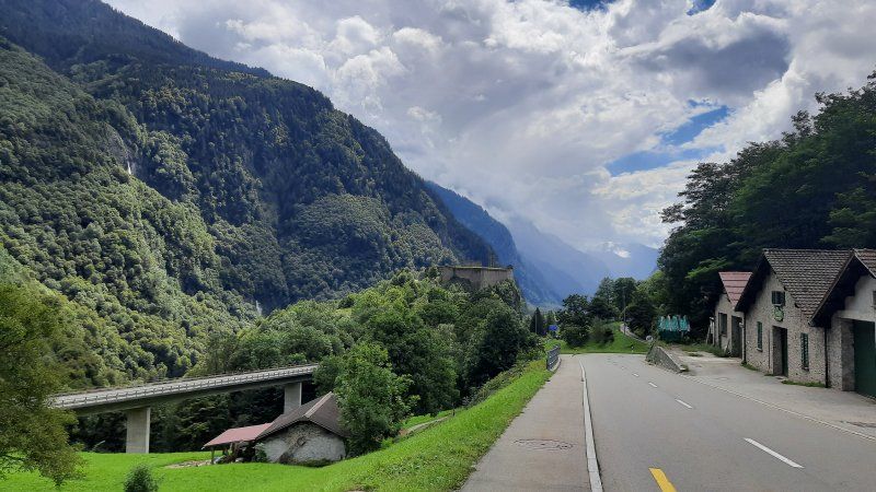
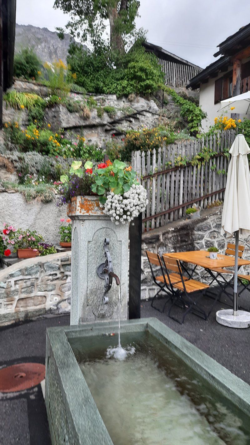
Rediscover Switzerland as a travel destination. This is not the first time that we are traveling through Switzerland in a mobile home. The country offers an incredible variety of sights and highlights. We love the mountains with their turquoise blue lakes and like to walk or cycle. This trip went through southeastern Switzerland.
Day
Unterwegs ins Nachbarland Schweiz
At 10.15 a.m. we reached the Swiss border. On the highway there were strong gusts of wind that brought the Womo off track. The weather service warned of squalls on the Feldberg with peaks of 80 - 100 km / h.
There wasn't much going on at the border, we could cross the border without stopping.
Lochenstraße 6, 78628 Rottweil, Deutschland
48° 11' 53.1" N 8° 41' 43.1" E
48.1980761 8.6953153
• Head toward Wochenbergstraße on Lochenstraße. Go for 98 m.
• Turn right onto Hardtstraße. Go for 203 m.
• Turn left onto Schömberger Straße (B27). Go for 160 m.
• Turn right onto Zepfenhaner Straße (K5549). Go for 562 m.
• Continue on Neukircher Straße (K5549). Go for 743 m.
• Turn right onto K5548. Go for 29 m.
• Continue on Rosenstraße (K5548). Go for 623 m.
• Continue on Lederstraße (K5548). Go for 452 m.
• Continue on K5548. Go for 1.8 km.
• Turn right onto K5542. Go for 1.6 km.
• Continue on Habsburger Straße (K5542). Go for 533 m.
• Continue on K5542. Go for 1.8 km.
• Continue on Feckenhauser Straße (K5542). Go for 1.1 km.
• Continue on Nonnenweg (K5542). Go for 28 m.
• Continue on Schulstraße (K5542). Go for 186 m.
• Continue on Württemberger Straße (K5542). Go for 428 m.
• Continue on Rottweiler Straße (K5542). Go for 455 m.
• Continue on Göllsdorfer Straße (K5542). Go for 140 m.
• Continue on Römerstraße (K5542). Go for 463 m.
• Continue on Römerstraße. Go for 996 m.
• Take the 1st exit from roundabout onto Neufraer Straße. Go for 141 m.
• Turn left onto Tuttlinger Straße. Go for 440 m.
• Take the 2nd exit from roundabout onto B27. Go for 7.1 km.
• Take ramp onto A81 toward Singen. Go for 55.2 km.
• Keep left onto A81 toward Schaffhausen/Bietingen. Go for 64 m.
• Take the 1st exit from roundabout onto B34 toward Schaffhausen/Bietingen. Go for 2.0 km.
• Continue on E41/E54. Go for 992 m.
• Continue on A4 toward SH-Herblingen. Go for 7.1 km.
• Keep left onto A4 toward Zürich/Rheinfall/Schaffhausen-Süd. Go for 24.4 km.
• Take exit 70 toward Zürich/Wülflingen onto A1/A4. Go for 16.3 km.
• Take exit 66 toward Rapperswil/Uster onto A15 (Oberlandautobahn). Go for 13.2 km.
• Turn right onto Aathalstrasse. Go for 840 m.
• Turn left onto Sulzbacherstrasse. Go for 2.4 km.
• Continue on Usterstrasse. Go for 1.1 km.
• Continue on Bertschikerstrasse. Go for 1.6 km.
• Take the 1st exit from roundabout onto Grütstrasse. Go for 107 m.
• Take the 2nd exit from roundabout onto Laufenbachstrasse. Go for 357 m.
• Continue on Bergstrasse. Go for 918 m.
• Continue on Altrütistrasse. Go for 953 m.
• Take the 2nd exit from roundabout onto Bubikerstrasse. Go for 1.0 km.
• Turn left and take ramp onto Forchstrasse (A52) toward Hinwil. Go for 2.5 km.
• Take ramp onto Hinwil. Go for 267 m.
• Keep right onto A15 (Oberlandautobahn) toward Chur/Rapperswil/Dürnten/Rüti. Go for 4.9 km.
• Take ramp onto Rütistrasse (15) toward Rapperswil/Kempraten/Rüti. Go for 1.1 km.
• Turn left onto Holzwiesstrasse. Go for 1.1 km.
• Continue on Allmeindstrasse. Go for 222 m.
• Pass 2 roundabouts and continue on Allmeindstrasse. Go for 218 m.
• Take the 1st exit from roundabout onto Sankt Gallerstrasse (8/17). Go for 395 m.
• Keep left onto Neue Jonastrasse (8) toward Zürich/Rapperswil. Go for 845 m.
• Turn right onto Glärnischstrasse. Go for 43 m.
• Turn right onto Jägerweg. Go for 57 m.
• Arrive at Jägerweg. Your destination is on the left.
☍
160,3 km
(2 hrs. 2 min.)
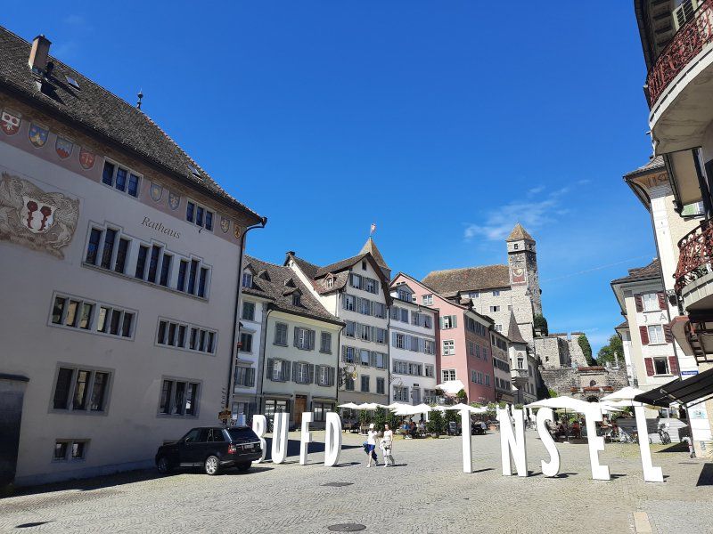
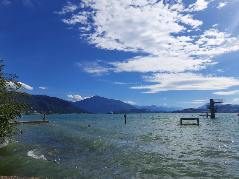
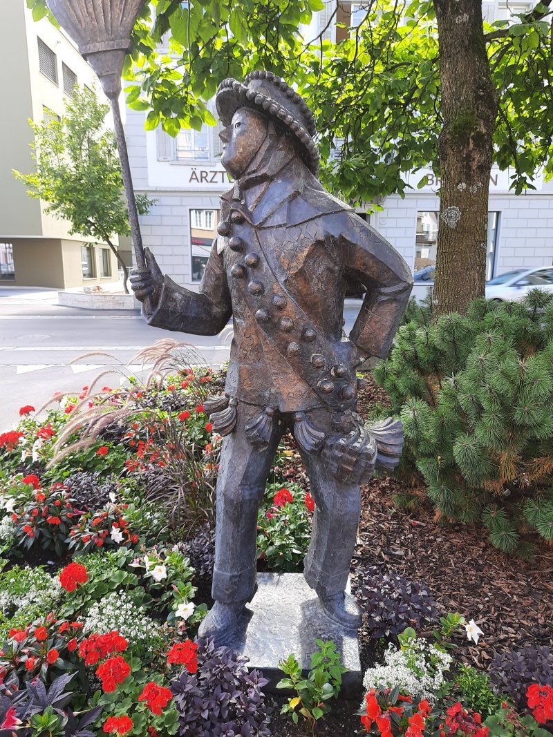
Rapperswill
Wanted to use the large parking lot (GPS: 47.227699, 8.8223) near the old town for parking, hopeless to find a free parking space. We decided to drive to parking spaces 6 + 7 that were indicated on the parking sign. We lost the signs so there was only one parking place on the Lidl parking lot in the Jona district. At the parking lot, a parking sign indicated only for customers, in which case we were customers.
Before we set out on the 2.3 km walk into the old town of Rapperswill, we had our lunch coffee first.
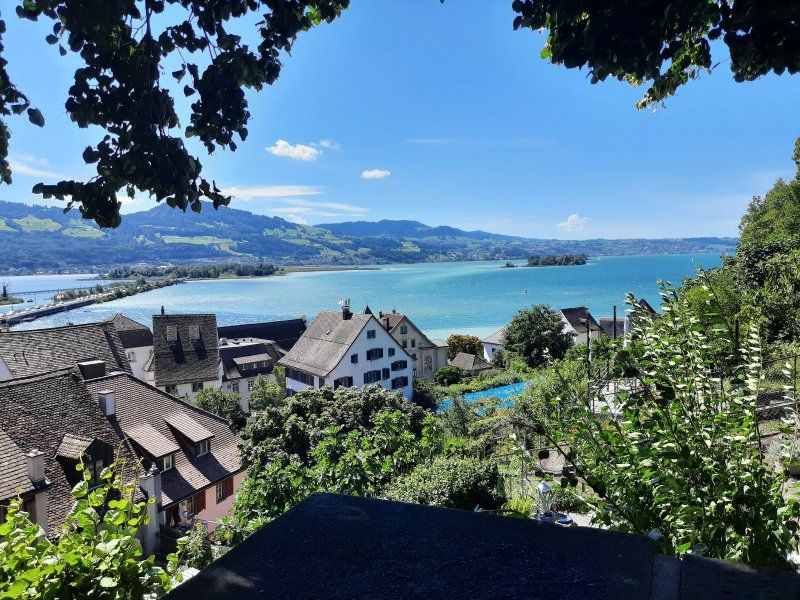
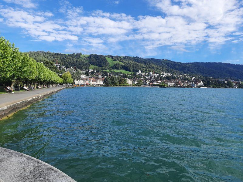
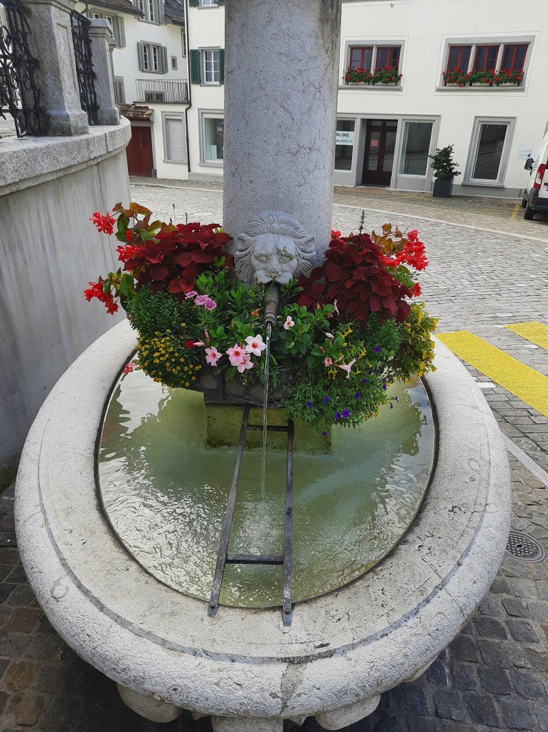
On the way to the old town it was very hot, the thermometer showed 30 degrees. We were surprised about the historic old town with the castle.
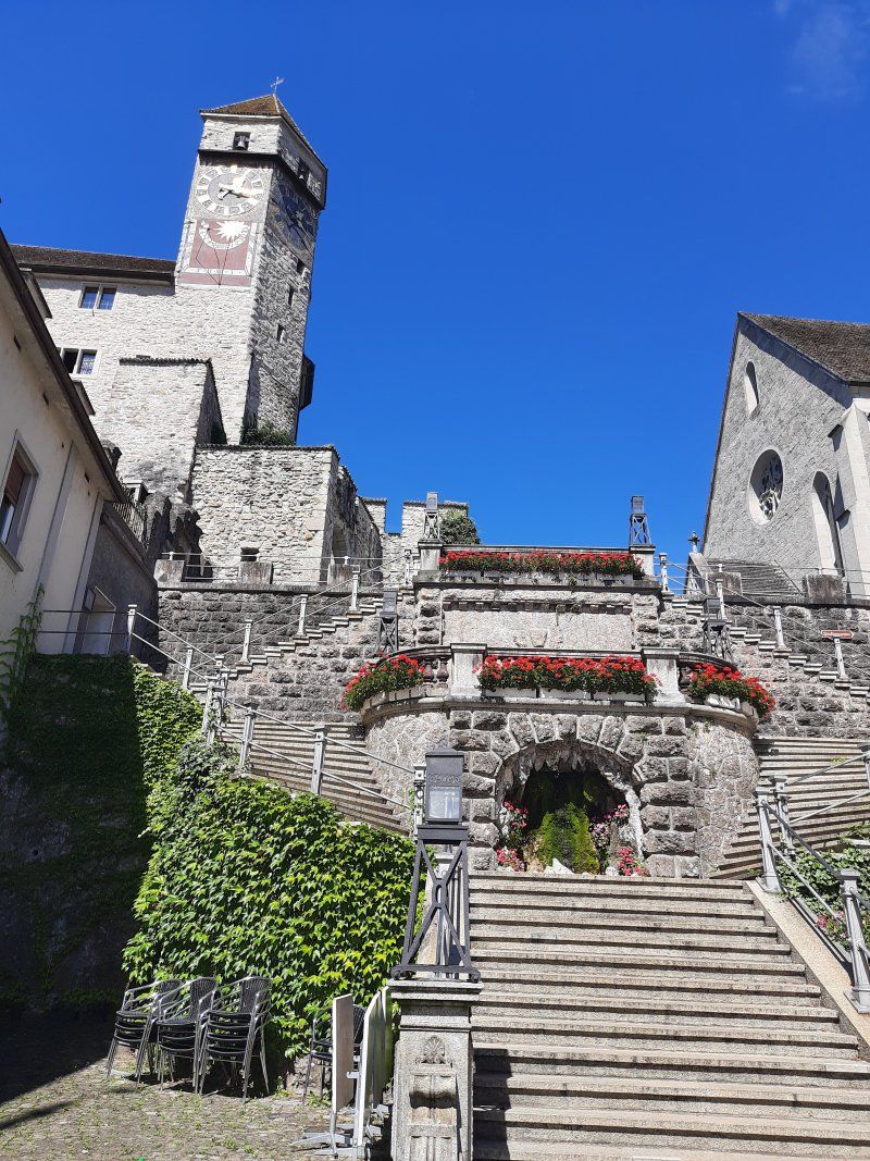
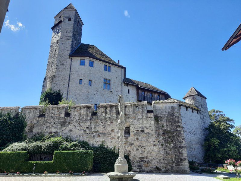
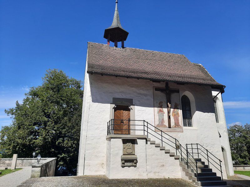
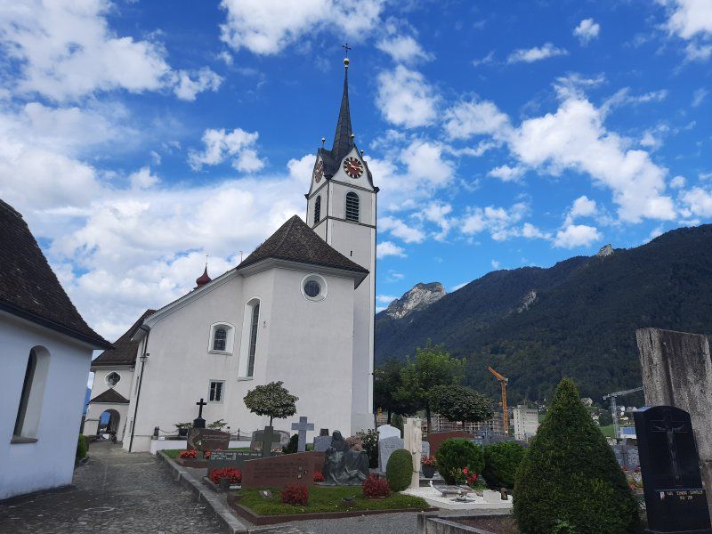
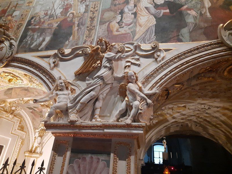
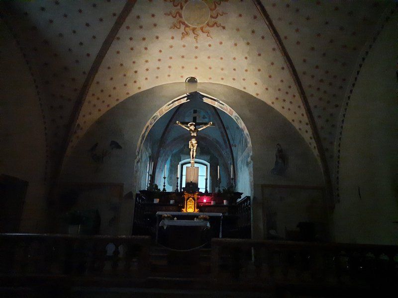
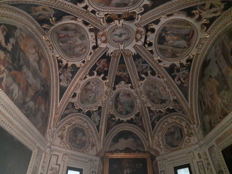
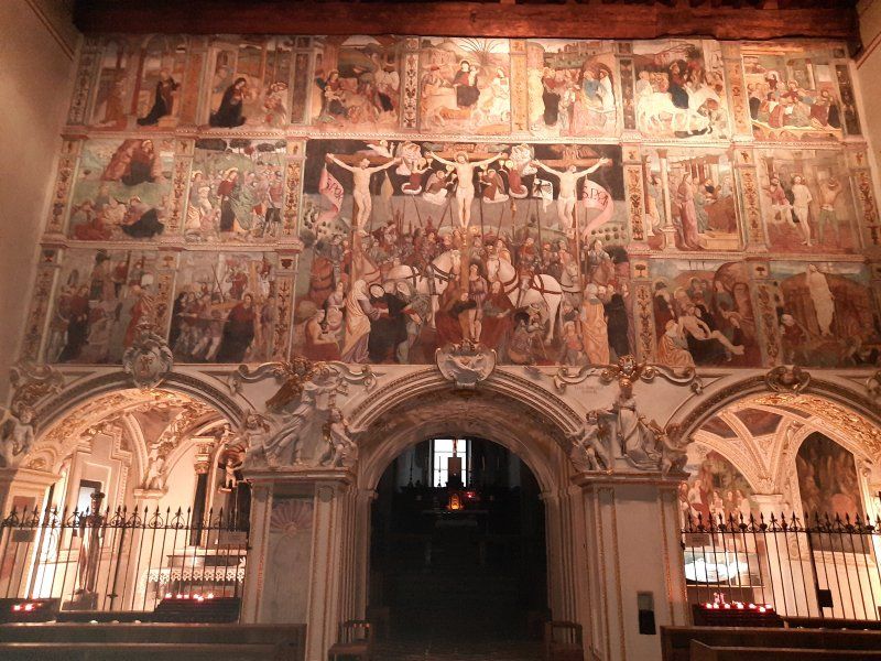
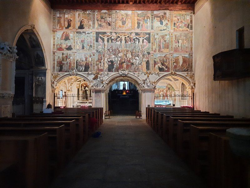
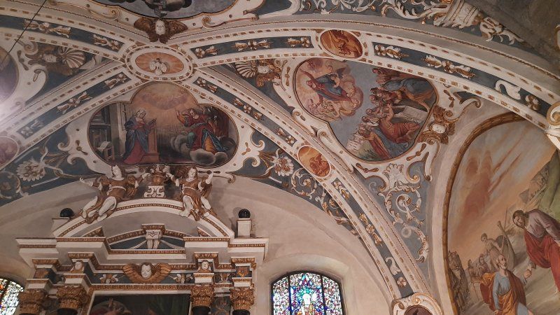
Whenever we're in Rapperswil, we didn't want to miss the walk up to the castle. The short ascent is rewarded with a great view of the old town and Lake Zurich and next to the beautiful old castle building a beautiful, small church.
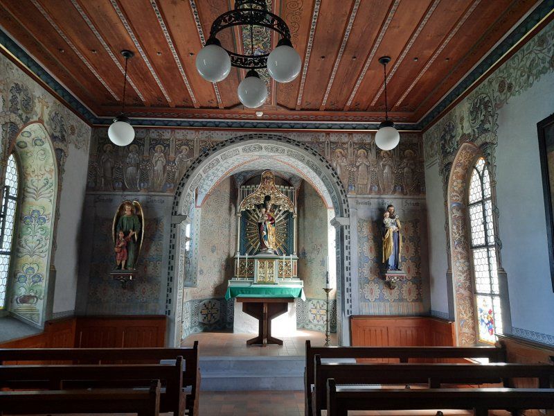
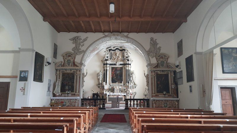
This small church is located behind the Rapperswil Castle, has a dark but beautiful interior with wall paintings and sculptures on the altar and only on the sides. There is a wooden ceiling and the murals are actually a mix of the painting and sculpture.
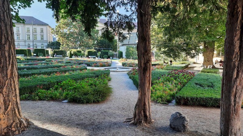
Directly under the castle a very nice garden with lots of beautiful roses.
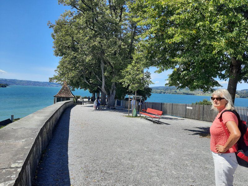
The lake promenade with its beautiful cafes invites you to linger and stroll.
The sightseeing tour was very exhausting on this hot day, so we made sure as soon as possible that we should continue to Zug, where hopefully Lake Zug will be waiting for us to swim.
8640 Rapperswil-Jona, Schweiz
47° 13' 40" N 8° 49' 19.1" E
47.2277698 8.8219654
• Head toward Kniestrasse on Jägerweg. Go for 18 m.
• Turn right onto Kniestrasse. Go for 43 m.
• Turn right onto Neue Jonastrasse (8). Go for 305 m.
• Turn left onto Untere Bahnhofstrasse (8). Go for 3.8 km.
• Keep right onto Seedammstrasse toward Zürich/Luzern/Gotthard/Einsiedeln/Seedamm-Center. Go for 75 m.
• Take left ramp onto A3. Go for 14.3 km.
• Take exit 36 toward Wädenswil/Luzern/Zug. Go for 227 m.
• Turn right onto Rietwiesstrasse. Go for 95 m.
• Take the 1st exit from roundabout onto Zugerstrasse toward Chur/Zug/Luzern. Go for 2.2 km.
• Continue on Zugerstrasse (388). Go for 6.4 km.
• Take the 3rd exit from roundabout onto Zugerstrasse (4) toward Gotthard/Luzern/Zug. Go for 327 m.
• Take the 2nd exit from roundabout onto Sihlbruggstrasse (4) toward Gotthard/Luzern/Zürich/Zug. Go for 1.4 km.
• Continue on A14 toward Gotthard/Luzern/Zürich/Zug/Baar. Go for 3.8 km.
• Take exit 3 toward Baar/Zug-Zentrum onto 4. Go for 813 m.
• Turn right onto Weststrasse (4). Go for 674 m.
• Take the 1st exit from roundabout onto Nordstrasse (4). Go for 380 m.
• Take the 2nd exit from roundabout onto Nordstrasse (4). Go for 517 m.
• Take the 1st exit from roundabout onto Feldstrasse. Go for 180 m.
• Turn slightly right onto Aabachstrasse. Go for 35 m.
• Continue on Feldstrasse. Go for 274 m.
• Turn left onto Allmendstrasse. Go for 89 m.
• Continue on Eichwaldstrasse. Go for 9 m.
• Continue on Allmendstrasse. Go for 25 m.
• Arrive at Allmendstrasse. Your destination is on the left.
☍
35,9 km
( 35 min.)
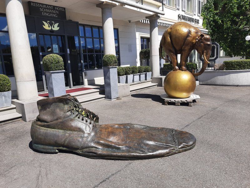
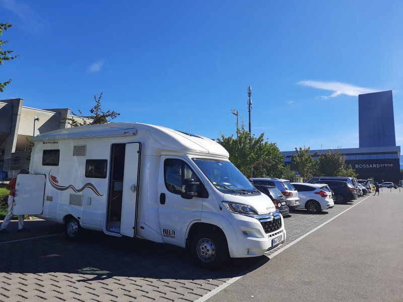
Zug Allmendstrasse 24
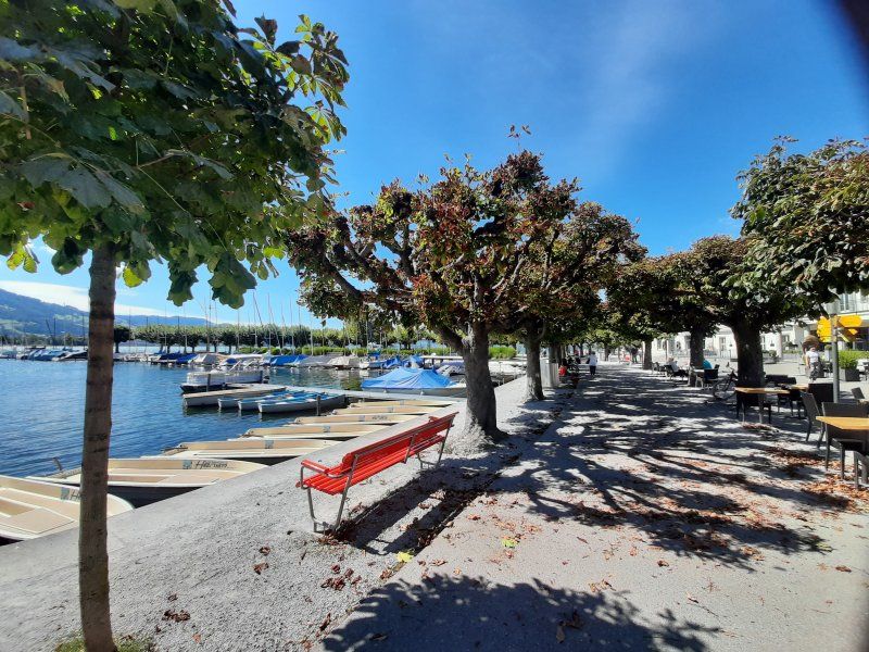
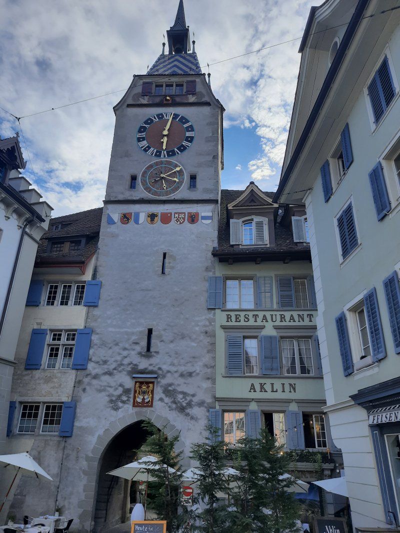
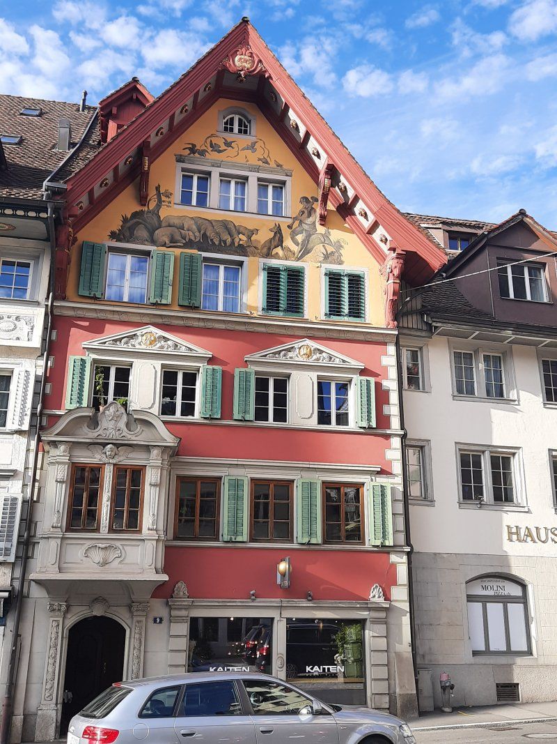
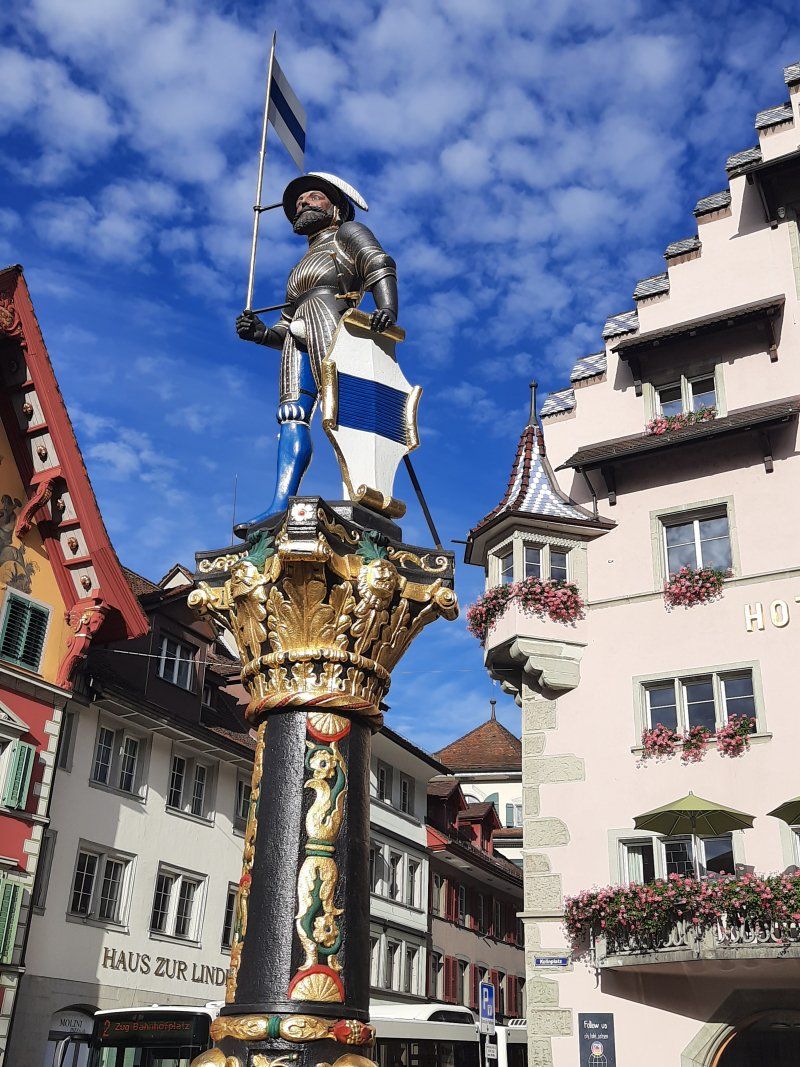
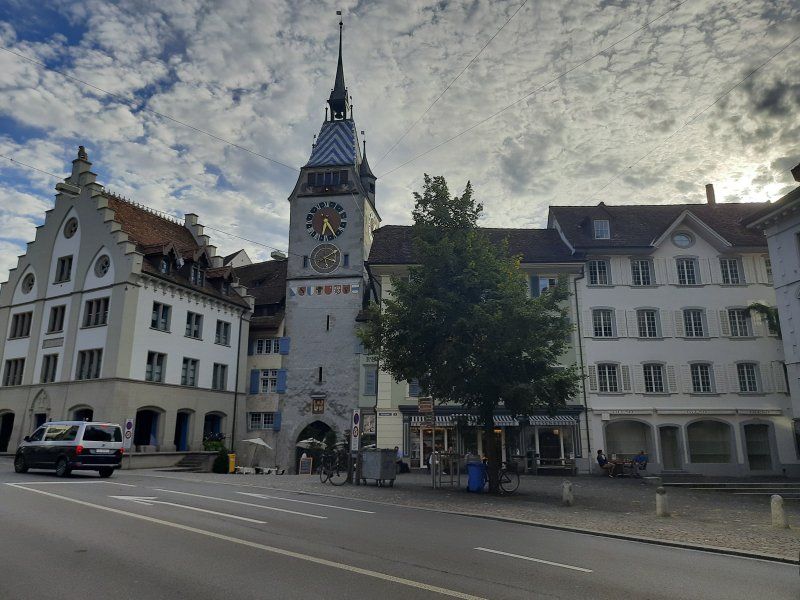
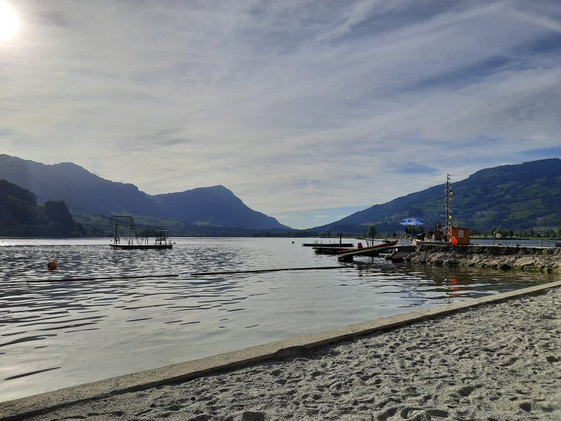
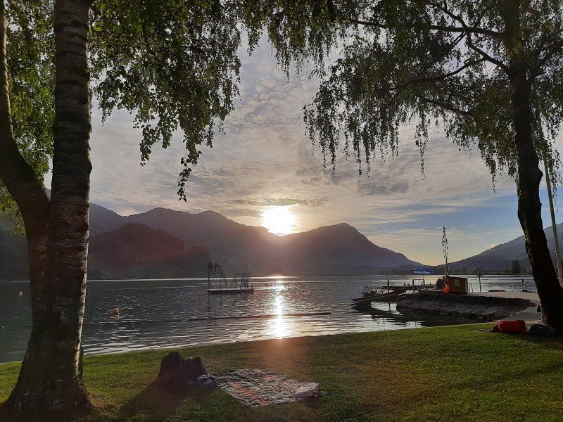
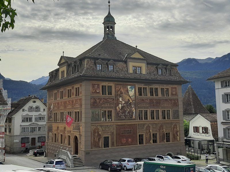
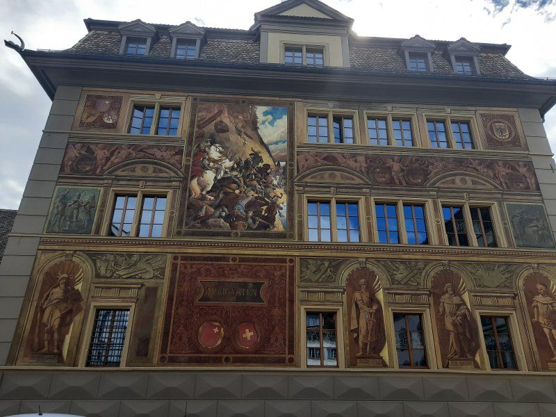
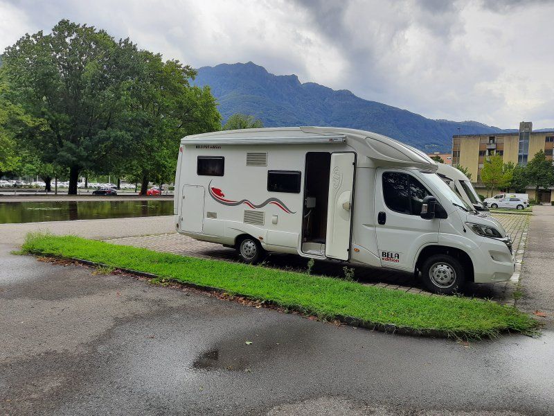
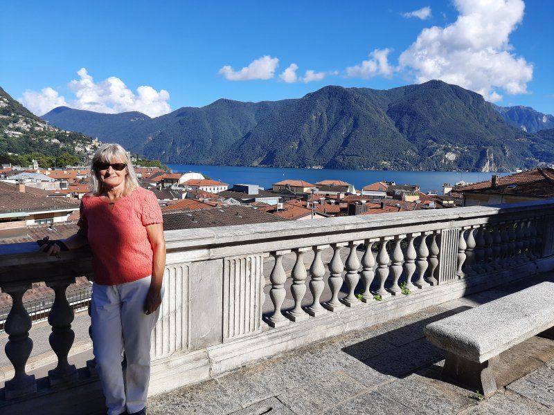
The parking lot (GPS: 47.179995, 8.50802) in Zug was easy to drive to, it was next to the stadium. The parking lot was well occupied, the parking areas are not suitable for larger mobile homes over 6 m. At our place we were able to let the rear of the camper protrude one meter into the sidewalk. On the opposite side, the parking areas are limited by a hedge. We took a lunch break and had a coffee before we went to the lido, 15 minutes away, to swim. The bath is free, has a beautiful lawn with a sandy beach. The yellow flashing lights indicated a storm warning on Lake Zug, there were strong waves on the lake. Irmgard don't mind the waves while swimming, I prefer a smooth sea for swimming. After swimming, we took a walk through the historic old town of Zug. If you walk along the lakeshore, you come to the area of the old town with the Landsgemeindeplatz (where citizens used to meet to vote and vote) and the two old town streets. If you go through the city gate, you come to the "suburb" with the old armory. The 52 meter high Zytturm is Zug's landmark. It was created in the middle of the 13th century as a simple passage. Until the construction of the second curtain wall, the tower served as a lockable entrance to the city. In 1574 the tower received the large clock and the astronomical dial on the side facing Kolinplatz.
Astronomical clock
On the east side of the Zytturm there is an astronomical clock below the dial. This has four pointers: the arrow shows the current day of the week (based on the gods and astonomic signs, above is Sunday), the crescent moon the phase of the moon (above is empty moon, below is full moon), the sun the month (based on the signs of the zodiac, below is the Change of year from December to January) and the letter S the leap year (points downwards when a leap year begins). Above the dial there is a ball that also shows the current moon phase.
Interesting buildings from the 16th and 17th centuries stand on Kolinplatz: the Kolinbrunnen (1541), the town house (also called Bossardhaus) (1543), and the Kolinhaus (1665). The four-storey town hall of Zug, built by the master builder Heinrich Sutter from 1505 to 1509, is an important secular architectural monument of the late Gothic period in Switzerland. Up the street from the suburbs is the “castle” which houses a museum with changing exhibitions. Also along the lake is part of the suburb. During a severe storm in July 1876, a whole row of houses was washed into the lake. That's why the beautiful park is there now.
6300 Zug, Schweiz
47° 10' 49.9" N 8° 30' 30.1" E
47.1805368 8.5083643
• Head south on Allmendstrasse. Go for 186 m.
• Turn right onto Hertiplatz. Go for 38 m.
• Continue on Sankt Johannes-Strasse. Go for 328 m.
• Turn slightly left onto Letzistrasse. Go for 179 m.
• Turn right onto Letzistrasse (4). Go for 300 m.
• Turn right onto Chamerstrasse (4/25). Go for 2.3 km.
• Continue on Chamerstrasse. Go for 615 m.
• Take ramp onto A14 toward Gotthard/Luzern/Aarau. Go for 1.6 km.
• Take the left exit toward E41/Chiasso/Gotthard/Luzern/Cham/Aarau onto A4. Go for 5.5 km.
• Take exit 34 toward Chiasso/Gotthard/Schwyz/Rotkreuz onto A4. Go for 24.0 km.
• Take exit 39 toward Schwyz/Pfäffikon/Sattel/Muotathal/Steinen. Go for 400 m.
• Continue on 2/8. Go for 147 m.
• Turn right onto Bahnhofstrasse (2). Go for 2.5 km.
• Turn left onto Schmiedgasse (8). Go for 92 m.
• Take the 2nd exit from roundabout onto Schmiedgasse (8). Go for 170 m.
• Take the 2nd exit from roundabout onto Schützenstrasse. Go for 152 m.
• Turn right onto Grosssteinstrasse. Go for 770 m.
• Turn right onto Grundstrasse. Go for 1.5 km.
• Arrive at Grundstrasse. Your destination is on the left.
☍
40,8 km
( 33 min.)
Day
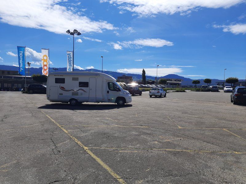
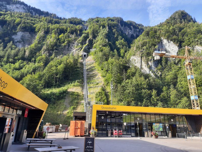
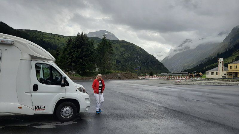
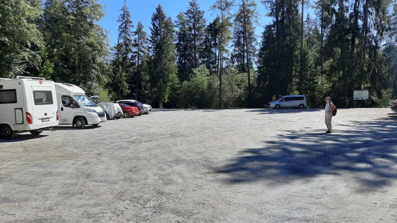
Stossbahn Parkplatz (Gps:46.99272 , 8.67452)
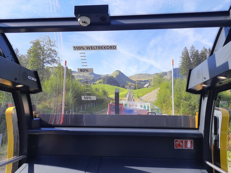
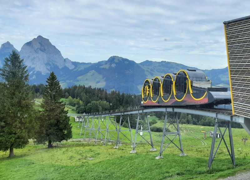
The journey here was relatively quick, there was some rush hour traffic at Zug and construction sites with traffic lights were set up on the Bergstrasse to the Stossbahn. In the lower parking lot (GPS: 46.99272, 8.67452) we were able to park on a flat parking area. The entrance to the parking lot is with a barrier. Now it was celebrated once, the Stossbahn goes up every 30 minutes to Stoss. We took the departure time 9:40 am as our destination.
Fare: Ascent and descent 22.- Sfr
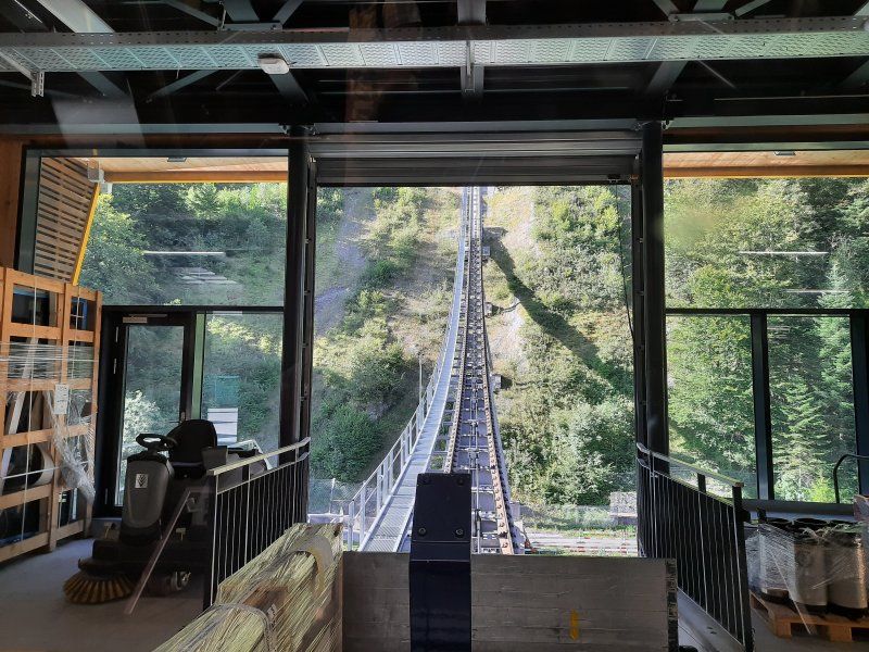
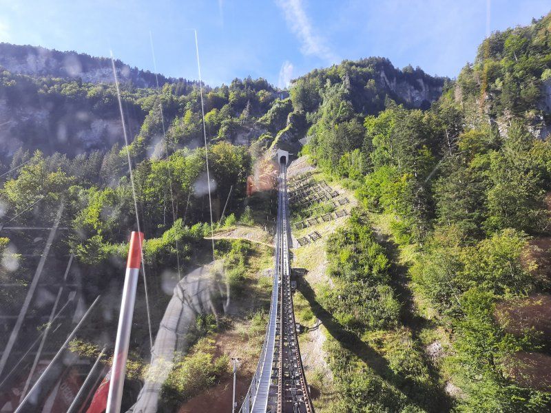
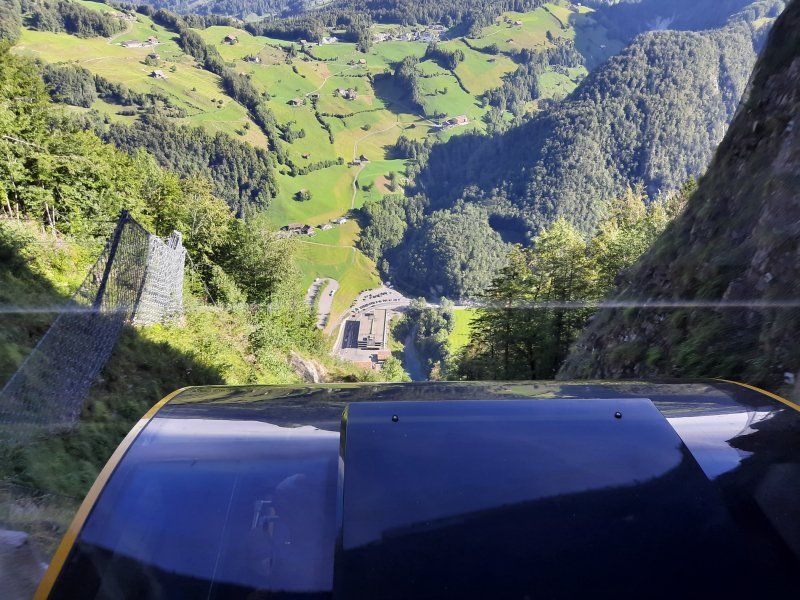
Steepest funicular in the world. Incline of up to 110 percent (47 degrees) an impressive experience with the funicular up to Stoos.
6430 Schwyz, Schweiz
47° 0' 4" N 8° 39' 16.4" E
47.0011006 8.6545660
• Head toward Viertel on Grundstrasse. Go for 1.5 km.
• Turn left onto Grosssteinstrasse. Go for 770 m.
• Turn left onto Schützenstrasse. Go for 131 m.
• Take the 2nd exit from roundabout onto Schmiedgasse (8). Go for 177 m.
• Take the 2nd exit from roundabout onto Schmiedgasse (8). Go for 131 m.
• Turn right onto Gotthardstrasse (2). Go for 2.5 km.
• Take the 2nd exit from roundabout onto 2/8. Go for 223 m.
• Turn left onto 2. Go for 32 m.
• Turn right onto Seemattliweg. Go for 298 m.
• Turn left. Go for 84 m.
• Turn right. Go for 74 m.
• Arrive at your destination on the left.
☍
5,9 km
( 10 min.)
Wanderung
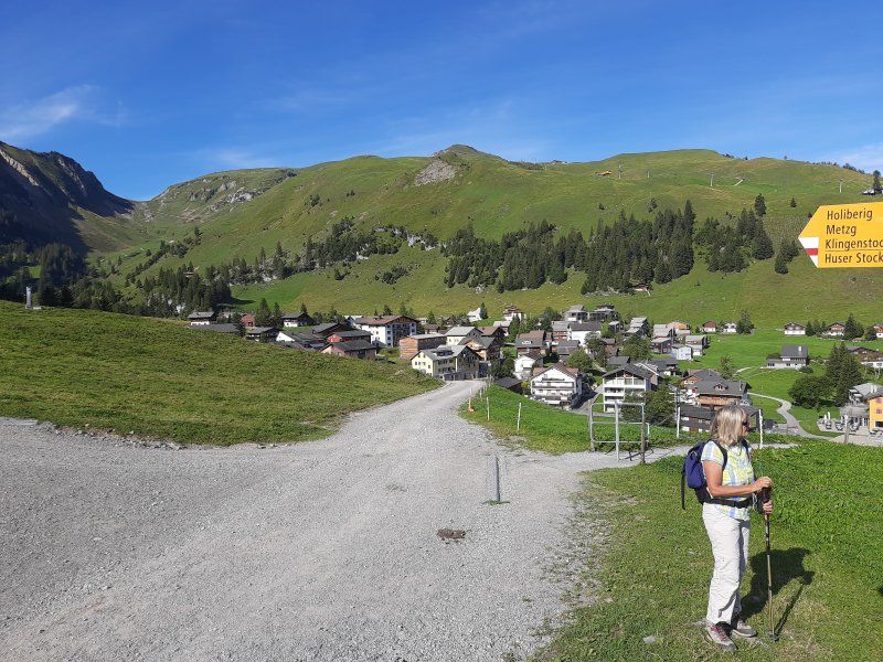
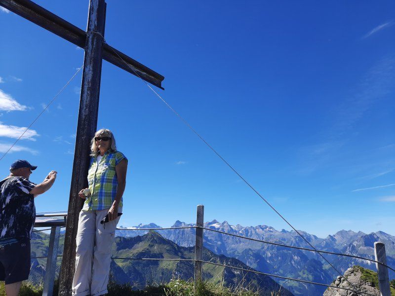
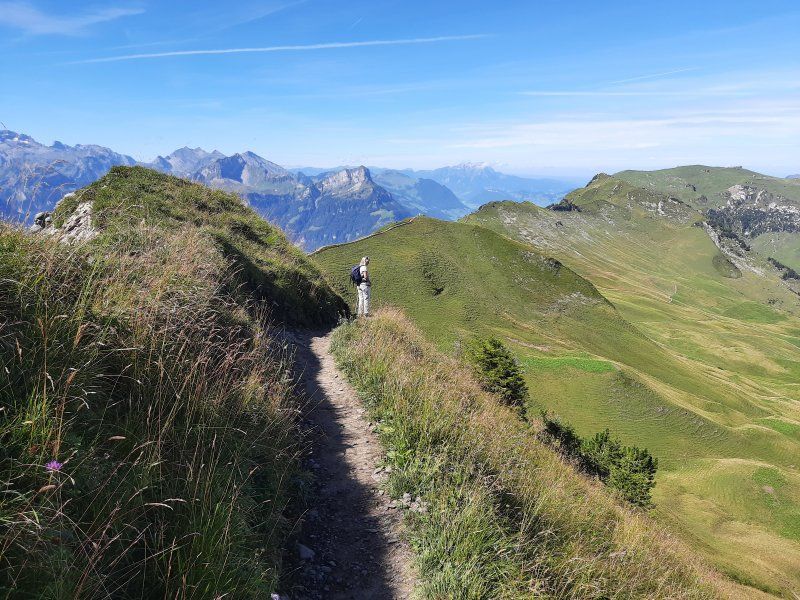
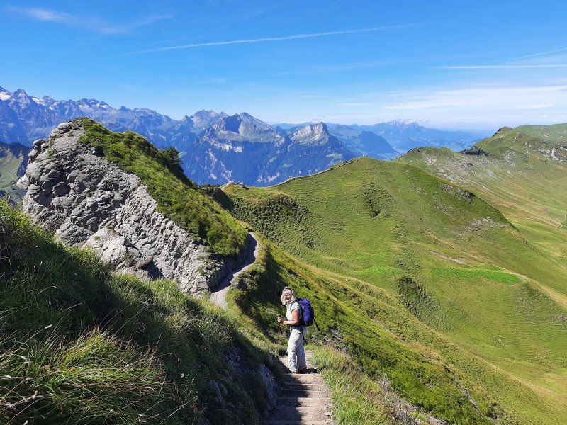
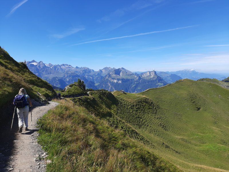
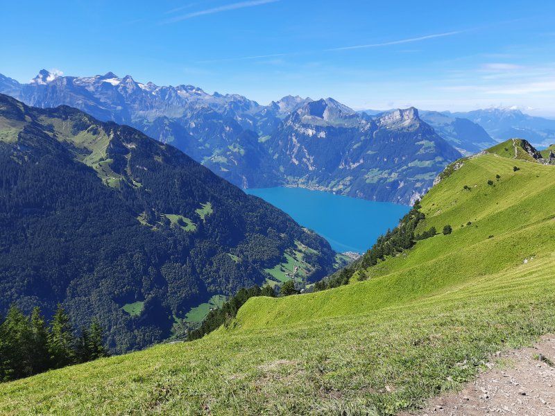
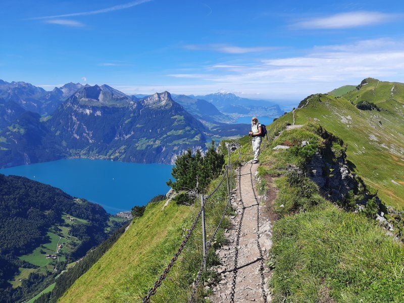
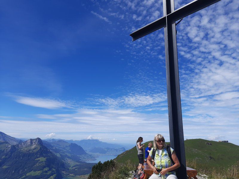
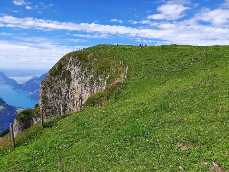
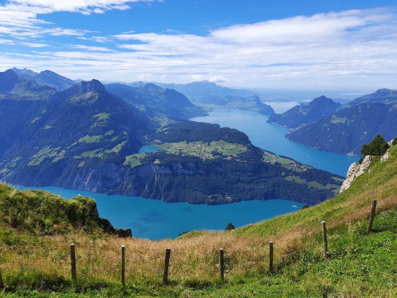
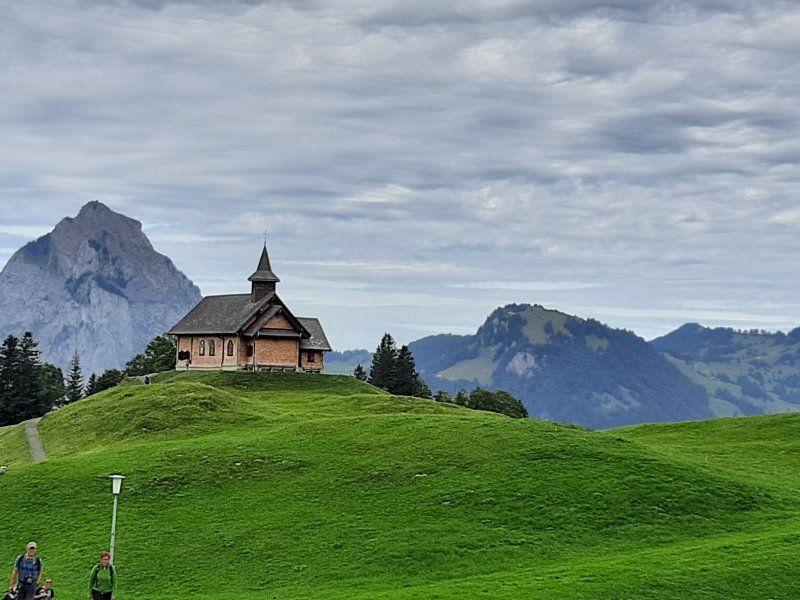
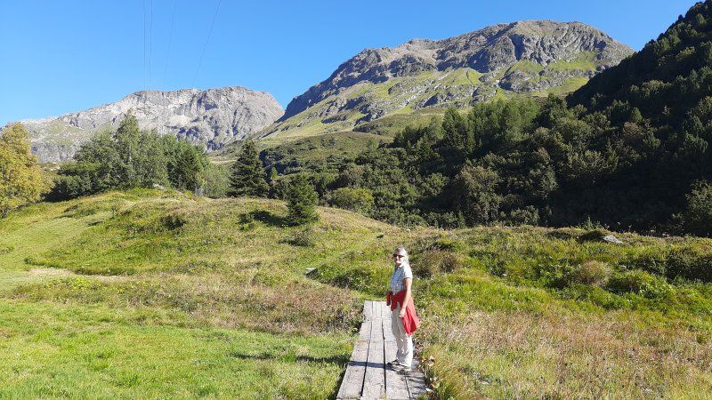
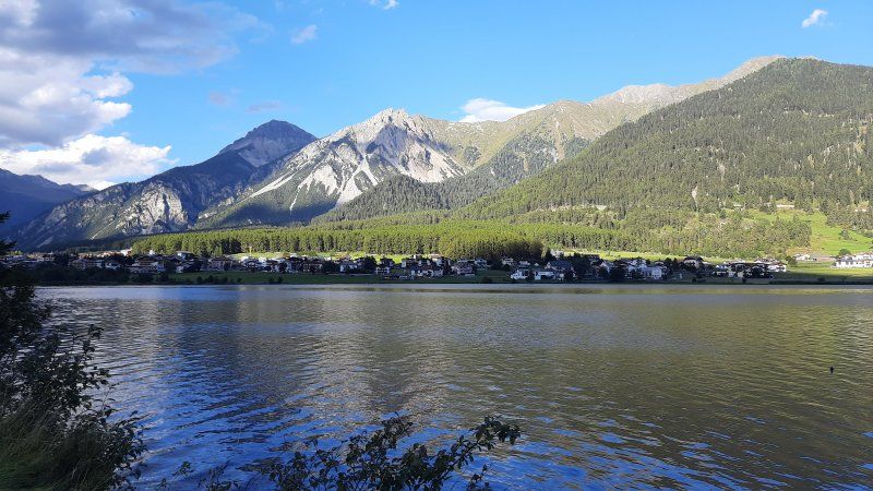
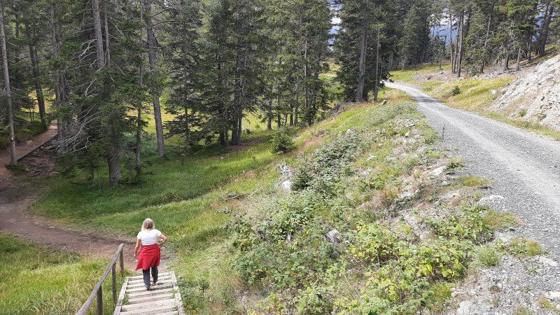
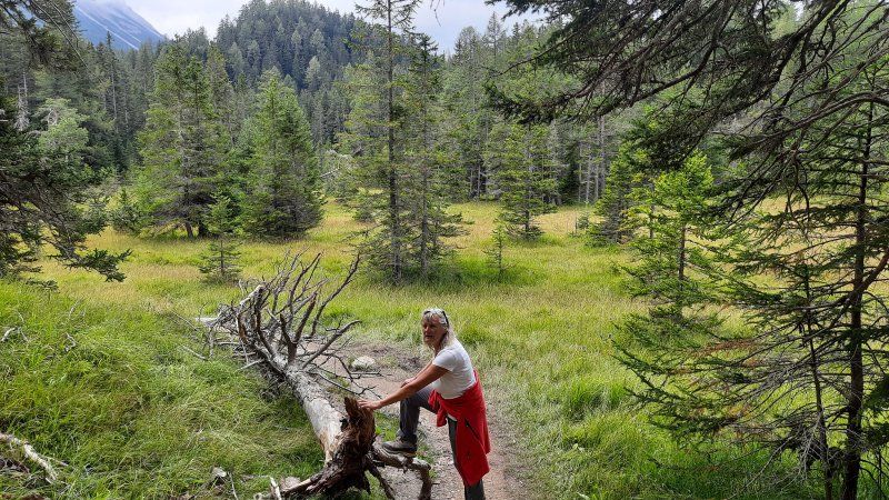
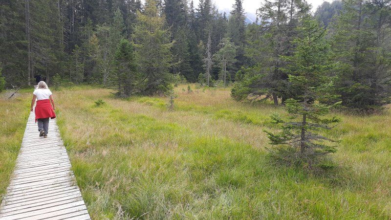
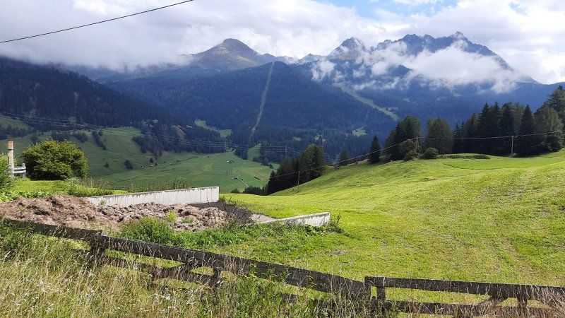
Today, again, wonderful mountain weather was announced that many hikers took advantage of. The Stossbahn brought us to the mountain station at 1200 meters. The car-free village of Stoss is also located here. In the village there was a yawning silence, only the noise of a large construction site could be heard. The hotels and guest houses were all empty. Even the cafes and restaurants were closed. We oriented ourselves according to the hiking signs that lead us to the blade stick. The Klingenstock circuit is one of the most beautiful panoramic mountain tours in Central Switzerland.
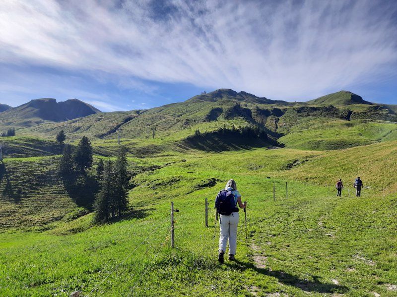
Hike: We did a great tour; From Stoos Dorf we climbed the Klingenstock and then walked over the easily accessible ridge path, which also has many vertical meters in itself, to the Fronalpstock, because on the way you have a spectacular view of over 10 lakes and countless alpine peaks in Central Switzerland. Have a cappuccino on the terrace of the restaurant on the Fronalpstock before descending. From there descended to Stoos. Fantastic view. Great tour!
Planänderung
We came back a little tired from our mountain tour at 4:30 p.m. Actually we wanted to continue to Stans, the warm day (26 degrees) turned us on to swim. On the Womo app, we looked for a suitable parking space at Lake Lauen in Seewen.
Seewen SZ
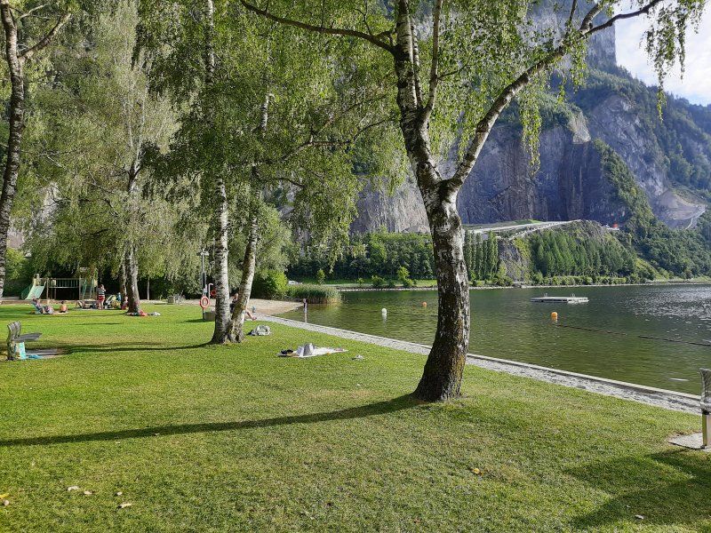
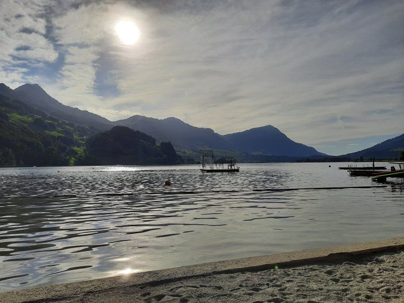
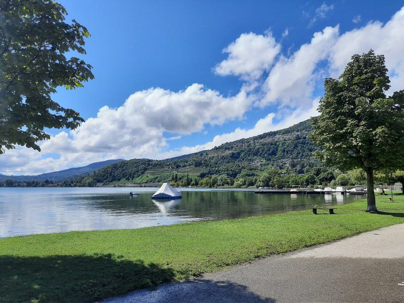
After our dreamy but exhausting hike, we did not go to Stans near Lucerne as planned, but used the hot day again to swim. The Lauener See was only 5 km away on our route. The parking lot next to the ice rink and the lido was pretty empty. There were hardly any bathers in the bathroom either. Entry cost 5 Sfr./P.
Water temperature: 21 degrees
Air temperature: 26 degrees The bathing beaches are beautiful with a bathing jetty, swimming islands and specially created sandy beaches. We stayed in the bathroom almost until 8 p.m., which also closes at 8 p.m. Parking fees none (payable 7 a.m. - 4 p.m.)
Seemattliweg 29, 6423 Seewen SZ, Schweiz
47° 1' 53.4" N 8° 37' 19.8" E
47.0314888 8.6221643
• Head south. Go for 74 m.
• Turn left toward Seemattliweg. Go for 84 m.
• Turn right onto Seemattliweg. Go for 298 m.
• Turn right onto Seemattliweg (2). Go for 2.8 km.
• Arrive at Seestrasse (2). Your destination is on the right.
☍
3,2 km
( 4 min.)
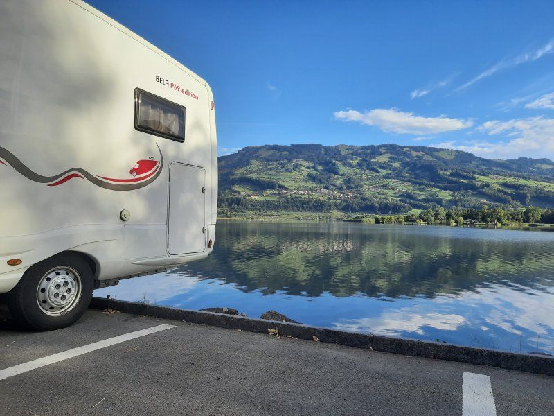
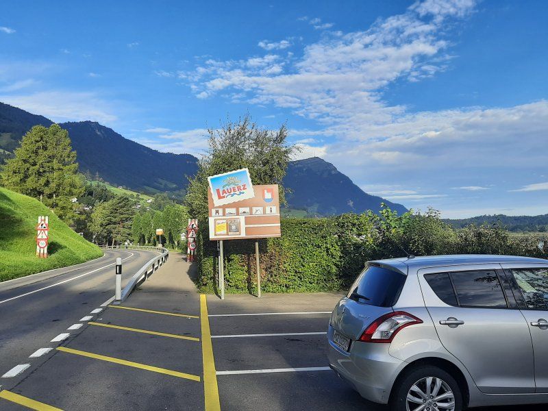
Lauerz
Had to change parking spaces at 10:02 p.m. The parking lot at the lido was very noisy due to the highway and railroad passing by. The freight trains thundered past in a five-minute tack. In addition, a constantly running roaring cooling unit from the adjacent ice rink. The new parking lot is only 3 km away directly on the lake. We found free parking spaces, but too short for our mobile home. We were able to use one of them by letting the rear of the caravan protrude over the parking area and over the water. The calm did not return until around midnight, and there was occasional car traffic on the road passing by. In the morning 6 - 7 o'clock it got very loud with the rush hour traffic.
Seestrasse 21, 6424 Lauerz, Schweiz
47° 1' 52.5" N 8° 35' 37.8" E
47.0312481 8.5938440
• Head toward Flüeli-Boden on Seestrasse (2). Go for 2.8 km.
• Continue toward Gotthard/Brunnen. Go for 8 m.
• Turn left and take ramp onto A4 toward Gotthard/Brunnen. Go for 17.3 km.
• Take the 2nd exit from roundabout onto A4 toward Gotthard/Luzern. Go for 397 m.
• Take ramp onto A2 toward Lugano/Gotthard. Go for 24.6 km.
• Take exit 39 toward Wassen/Interlaken/Sustenpass. Go for 172 m.
• Turn right onto Gotthardstrasse (2) toward Lugano/Gotthard/Wassen/Sustenpass/Interlaken. Go for 835 m.
• Continue on Gotthardstrasse (2). Go for 4.1 km.
• Take the 1st exit from roundabout toward Lugano/Gotthard/Zürich/Luzern. Go for 184 m.
• Take ramp onto A2 toward Gotthard/Lugano/Airolo. Go for 77.3 km.
• Take exit 47 toward Bellinzona Sud/Locarno/Bellinzona. Go for 1.0 km.
• Take the 2nd exit from roundabout onto In Tirada (2) toward Bellinzona/Giubiasco. Go for 246 m.
• Take ramp onto A2 toward San Gottardo/E43/San Bernardino/A13. Go for 3.5 km.
• Take the exit onto 13 (Via Pierino Tatti). Go for 902 m.
• Arrive at Via Pierino Tatti (13). Your destination is on the right.
☍
133,4 km
(1 hrs. 32 min.)
Day
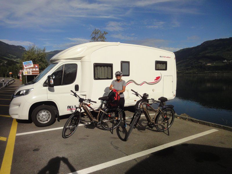
Radtour
Today we took it easy and slept in. After breakfast we set out on a bike tour to Brunnen on Lake Vierwaltstätter See, the city of Schwyz and the bypass of Lake Lauen.
Brunnen
The small village of Brunnen, then inhabited by fishermen and boaters, was founded in the High Middle Ages. In the course of time it developed into an important port and loading point for the Canton of Schwyz. In 1620, a large part of the buildings was destroyed by a devastating fire.
Schwyz
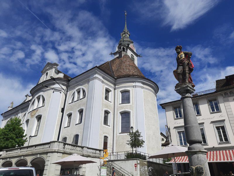
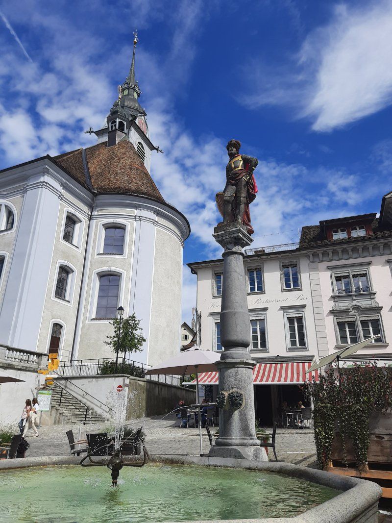
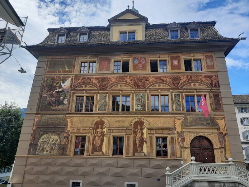
Switzerland owes its name and coat of arms to the town of Schwyz. In 1291 Uri, Schwyz and Unterwalden formed a union and in 1315 they drove out the Austrians with the victory in the Battle of Morgarten. The town hall of Schwyz is a listed parliament and court building. It is known for the historicist facade painting by Ferdinand Wagner from 1891. Like the baroque parish church of St. Martin and the hotel "Wysses Rössli", the town hall is located on the main square in the center of Schwyz.
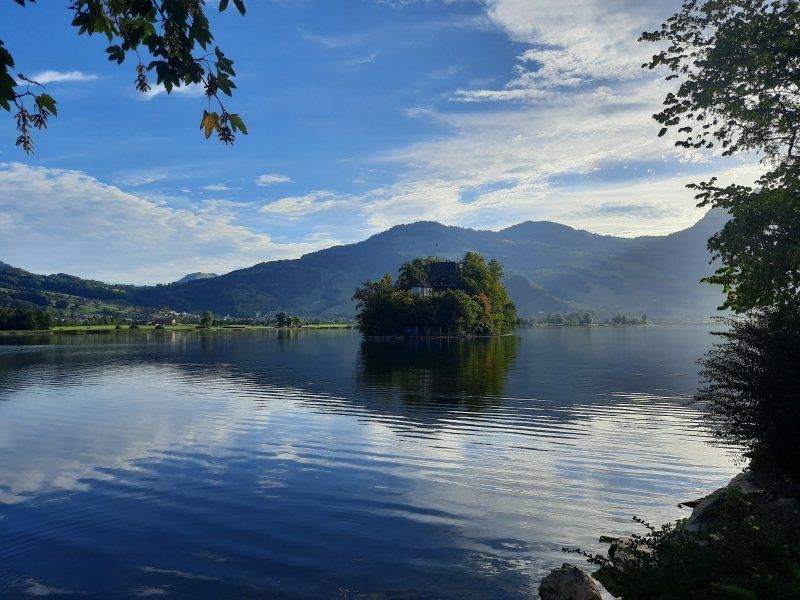
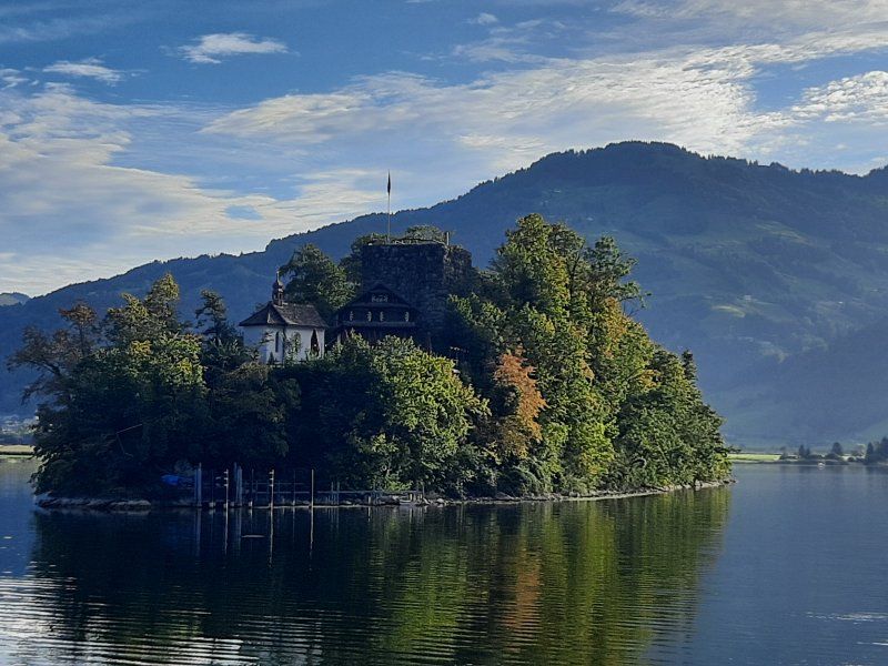
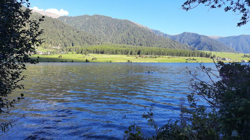
Lauerzersee:
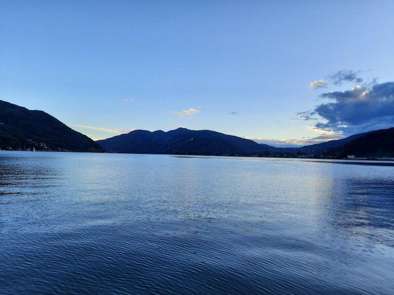
The Lauerzersee is located between the Vierwaldstättersee and Zugersee. With its maximum water depth of 14 m, it is one of the shallowest lakes in Switzerland. The island of Schwanau is located in the Lauerzersee on it is a preserved chapel and castle ruins. Also an inn.
After arriving at the Womo and stowing the bikes in the rear garage, we drank our afternoon coffee with a piece of cake. It was still so warm that we went swimming in the lake afterwards. Behind our mobile home there was a stony entrance to the lake. Start: 2:30 p.m.
Then we started towards Bellinzona to our destination for the day.
Immer dem schlechten Wetter voraus fahren.
On the way to Bellinzona the weather was getting worse. We actually wanted to drive over the Gotthard Pass road. In the Gotthard tunnel we heard on the traffic radio that the pass is closed due to snowfall. It was the right decision to drive through the tunnel.
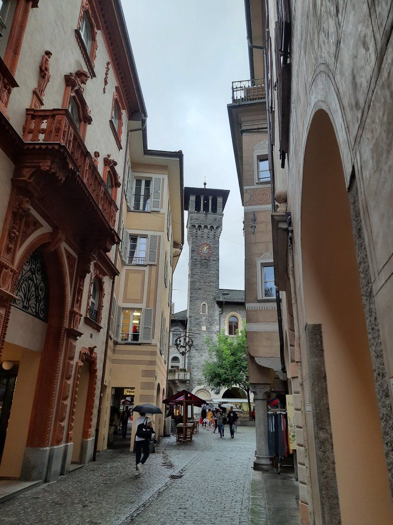
Bellinzano
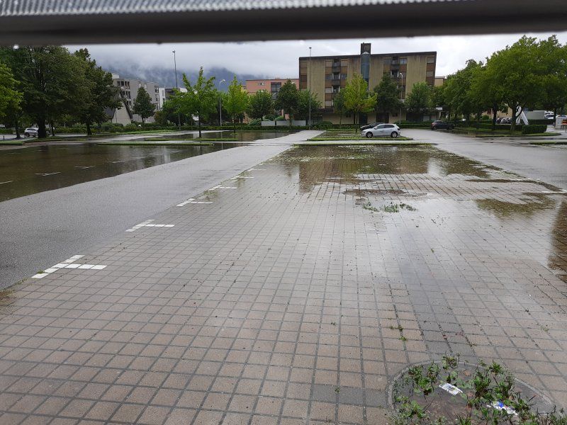
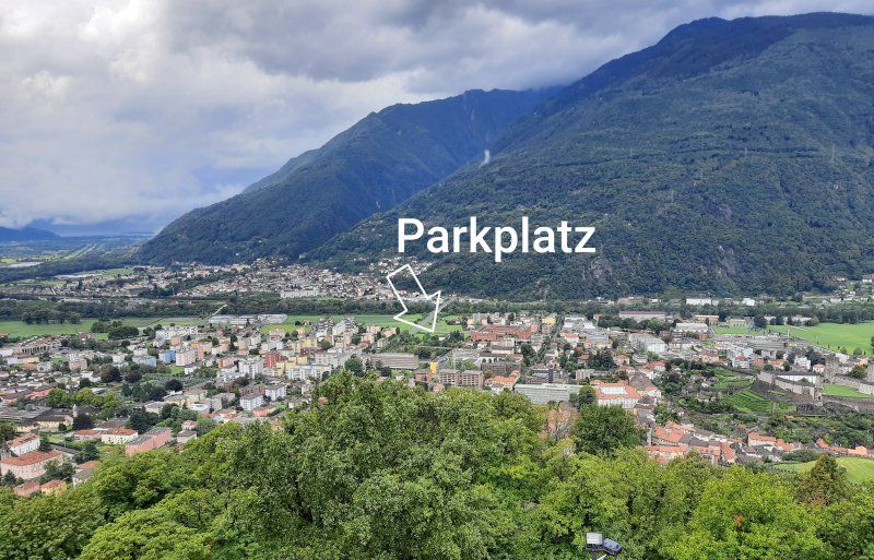
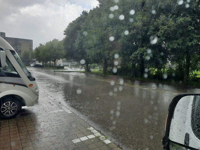
Shortly after leaving, it started to rain. On the journey the weather worsened. On the autobahn towards Gotthard things went quickly, there was little traffic. Nevertheless, we were stuck in a traffic jam 2 km from the tunnel. The traffic light had a very long red phase and a short green phase that was just enough for six vehicles. After the tunnel, it was raining cats and dogs, and a violent thunderstorm hung in the valley to Bellinzona. On the drive through the city we saw how the fire department pumped out the cellar. The approached parking lot was also under water. Once again, the navigation system guided us down a narrow one-way street to the selected parking lot, because it was not possible to approach from the one-way street. We turned again on the same one-way street to see if we had missed the entrance. There was no access to the parking lot, so we decided to drive to the parking lot on the opposite side, where the entrance to the parking lot was. (Gps: 46.1898, 9.01506) We couldn't do anything anymore, the thunderstorm hung over the city and rained from then on. So we made ourselves comfortable in the Womo.
6500 Bellinzona, Switzerland
46° 11' 20.3" N 9° 0' 54.3" E
46.1889817 9.0150695
• Head west on Via Pierino Tatti (13). Go for 605 m.
• Keep right onto Via Pierino Tatti (13). Go for 220 m.
• Turn right onto El Stradún. Go for 389 m.
• Continue on Via Birreria. Go for 1.1 km.
• Take the 2nd exit from roundabout onto Via Galbisio. Go for 2.4 km.
• Turn right onto Via Cantonale (408). Go for 431 m.
• Take the 2nd exit from roundabout onto Via San Gottardo (2/13). Go for 331 m.
• Take the 3rd exit from roundabout onto Via San Gottardo (2). Go for 422 m.
• Take ramp onto A13 toward San Bernardino. Go for 26.6 km.
• Take ramp toward Mesocco. Go for 276 m.
• Arrive at your destination on the left.
☍
32,9 km
( 26 min.)
Day
Drei Burgenwanderung
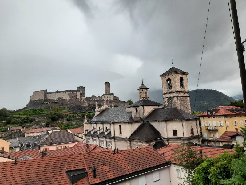
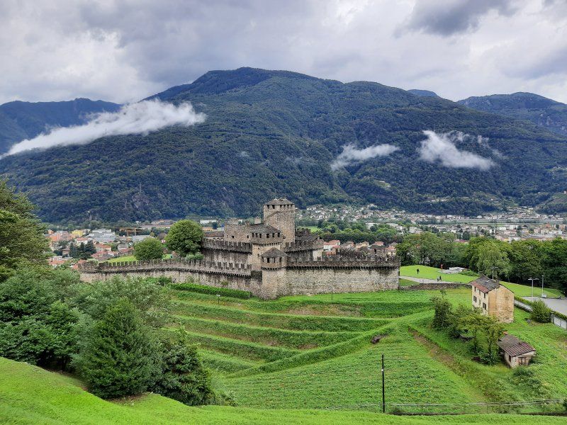
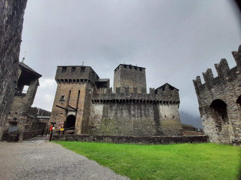
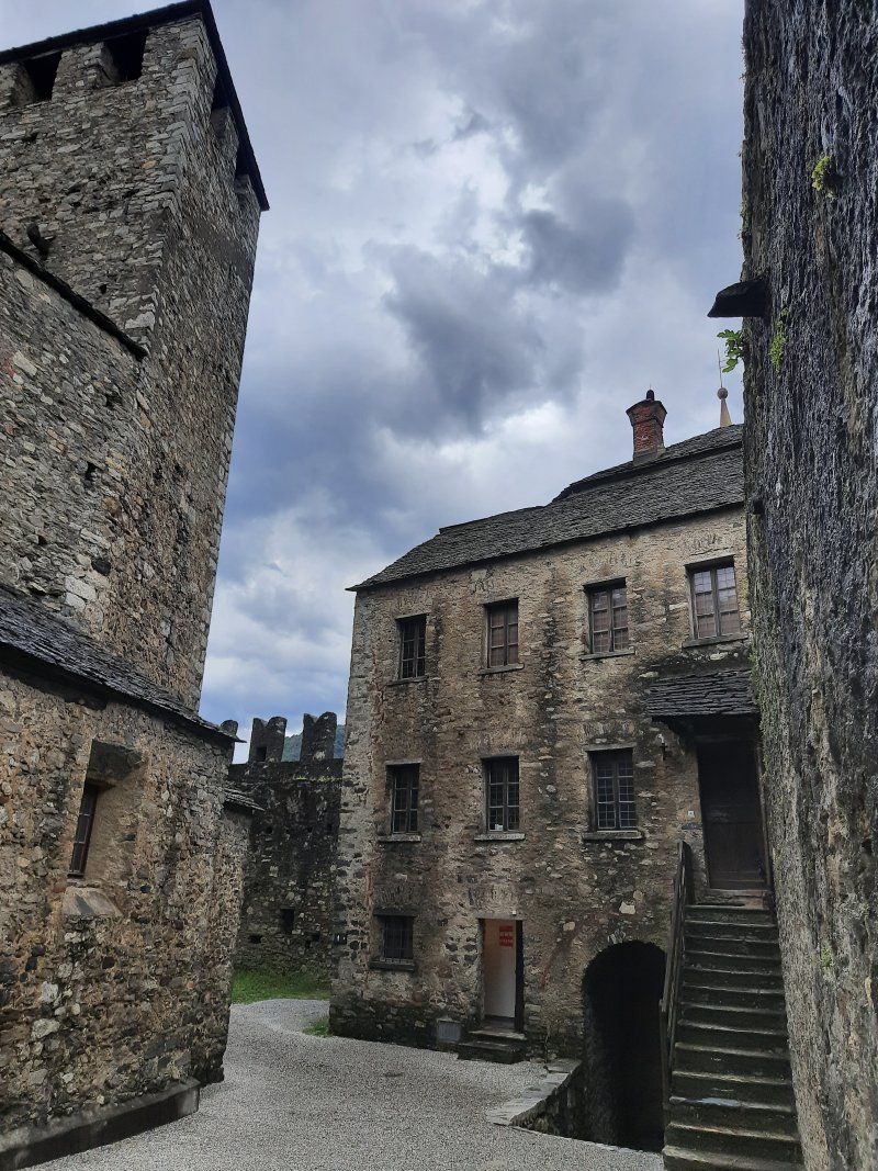
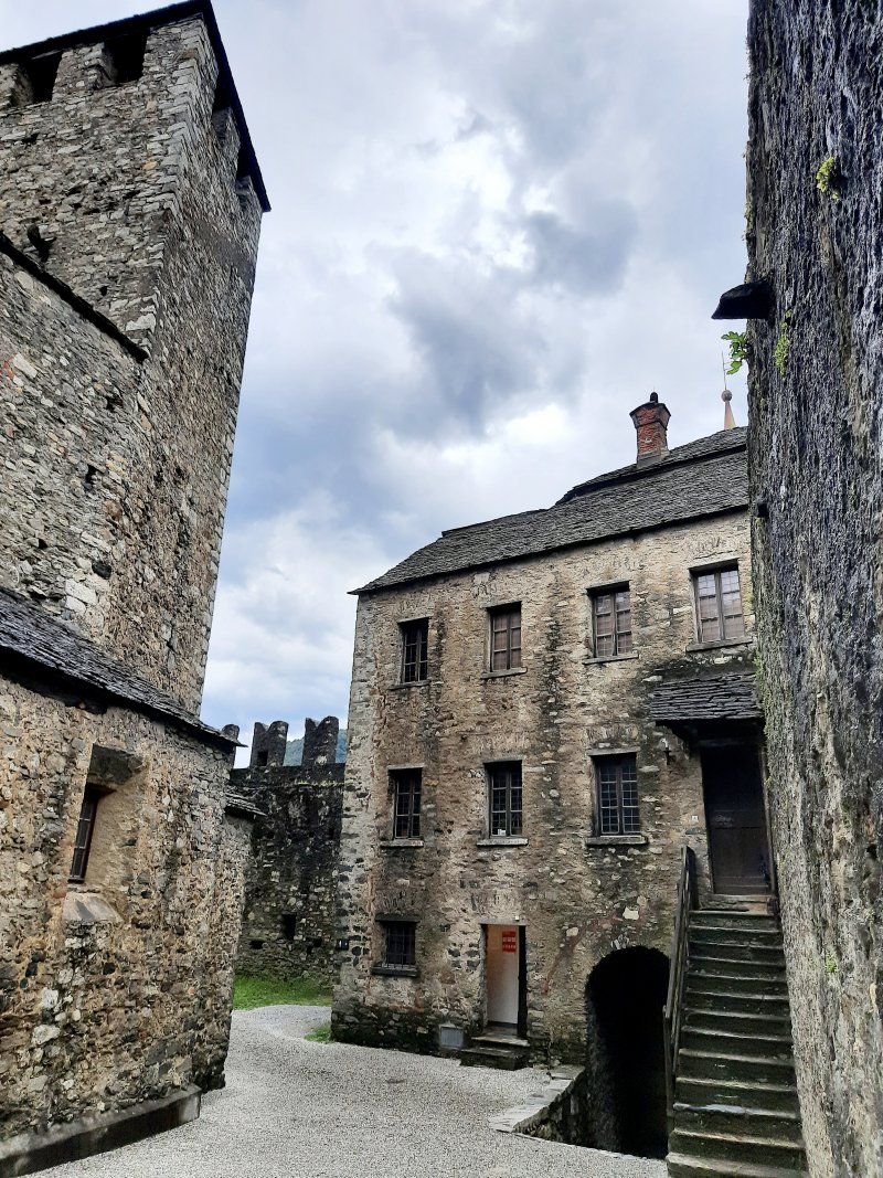
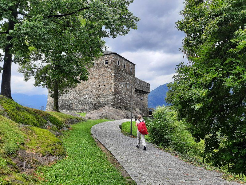
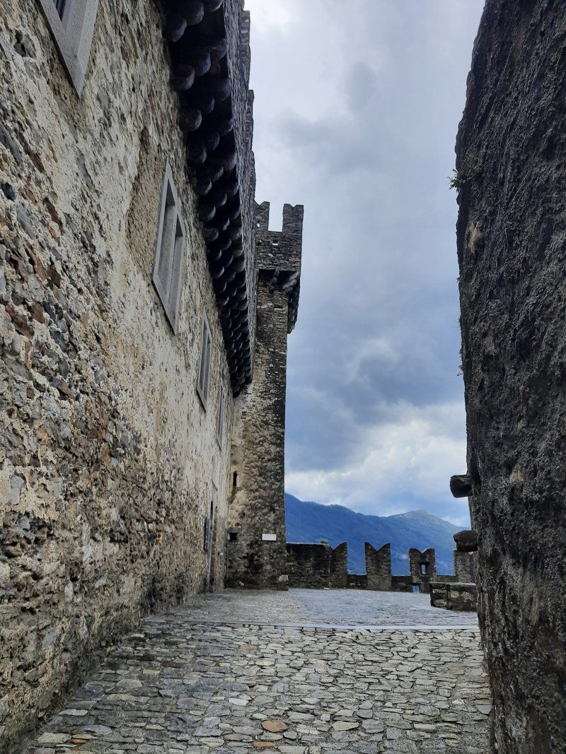
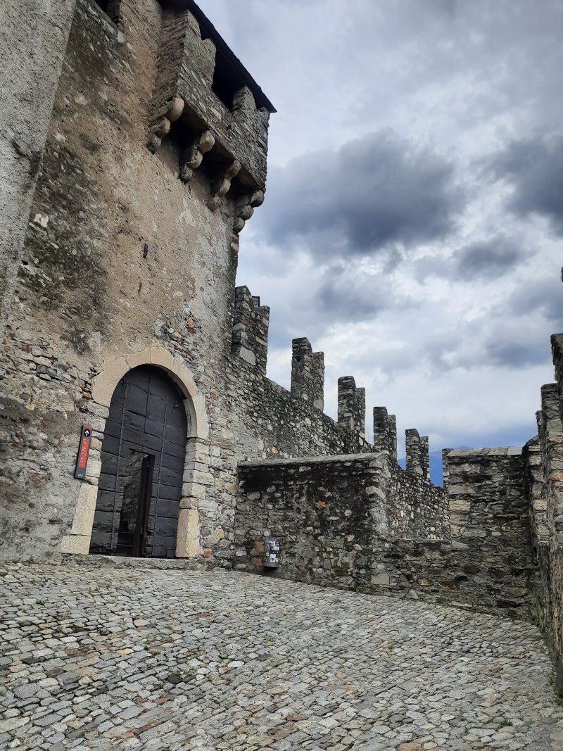
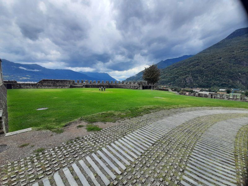
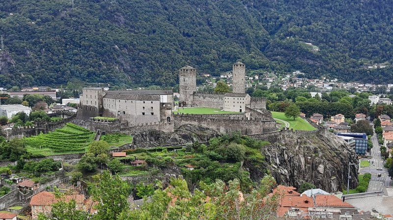
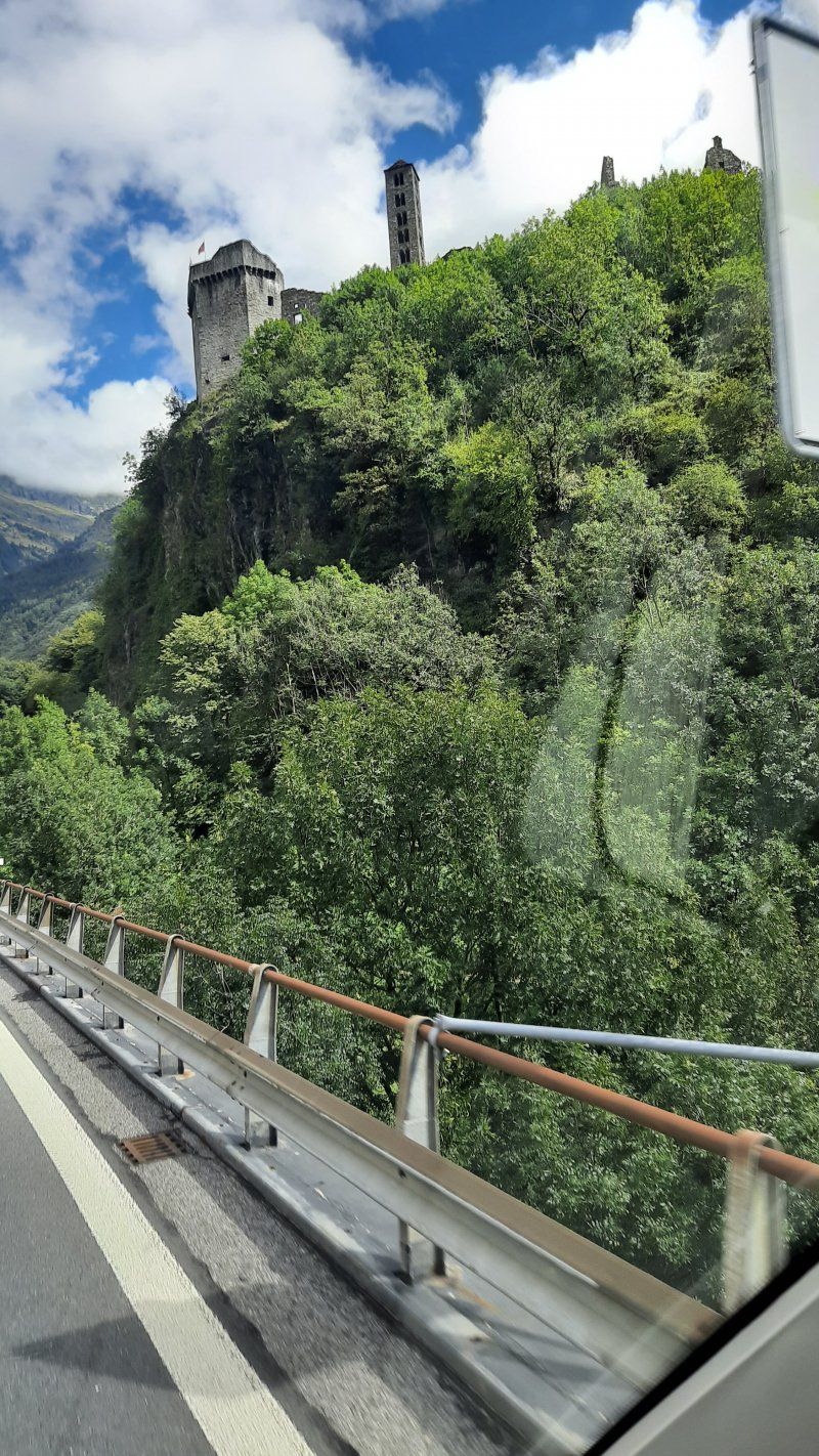
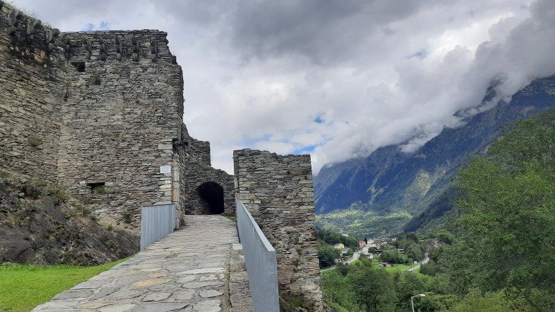
It rained incessantly all night. One thunderstorm after the other passed over us. In the morning you didn't want to leave the Womo, it was raining all the time. It was not until noon that the rain subsided, where we went on the castle hike with a city tour. The three castles of Bellinzona are a fortification in Bellinzona, the capital of the canton of Ticino in Switzerland. The facility in its current form was mainly built in the 15th century as a dam and to control the access routes to the Alpine passes. We visited Montebello Castle first. To the second castle, Castello di Sasso Corbaro, we followed the signs above Montebello.
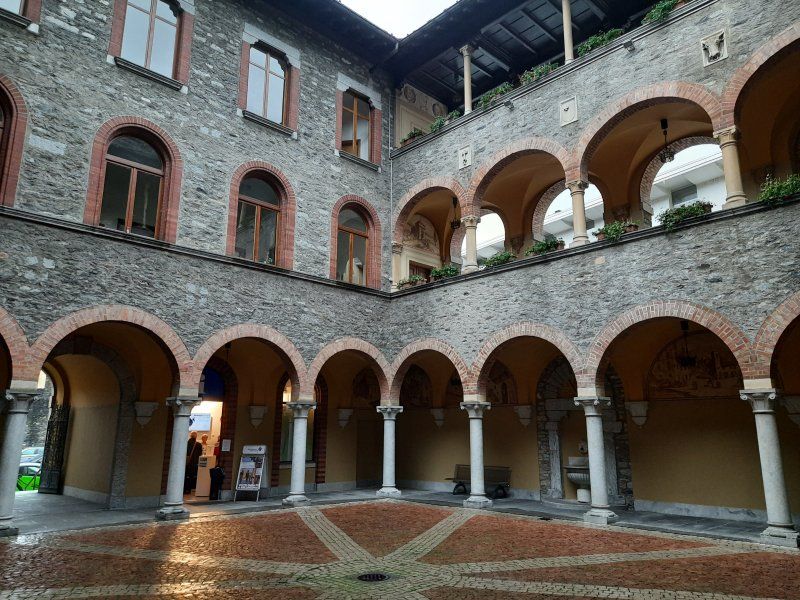
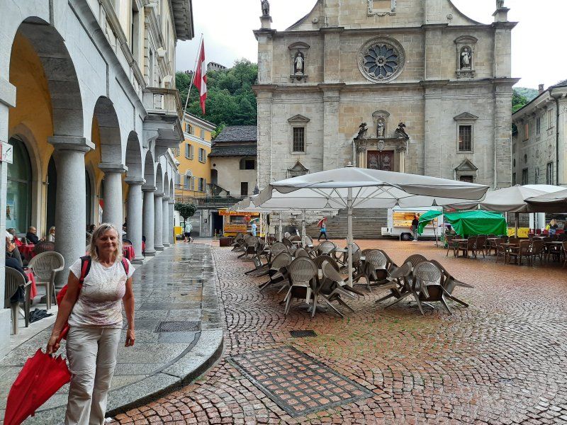
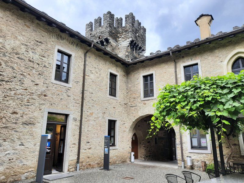
After visiting the castles we strolled through the alleys of the old town and arcades that go back to the 16th century. The Palazzo Communale (town hall) was built in 1921–1926 in place of the late medieval town hall. The rectangular floor plan, the loggia courtyard and the high tower are based on the type of the Italian medieval town hall.
Piazza Collegiata
The current square got its appearance in the 17th century. The current construction of the collegiate church Santi Pietro e Stefano began in 1515. The tower dates from 1567/1573, the facade cladding from 1640/54, the choir was expanded between 1684 and 1785, and the current appearance of the monumental staircases dates from the
19th century. The three-axis renaissance facade was completed in the Baroque era, the main portal dates from 1640.
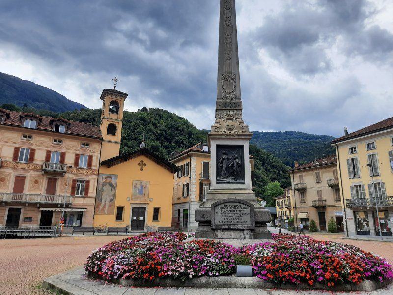
Piazza Indipendenza Square in the style of the 19th century. In the middle of the square there is an obelisk from 1903, which commemorates the construction of today's canton in 1803.
In the evening it started to rain again. I used the rainy day to write my logbook. In the course of the day two more Womos stood next to us to stay overnight.
Burg "Montebello"
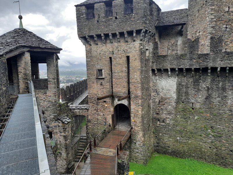
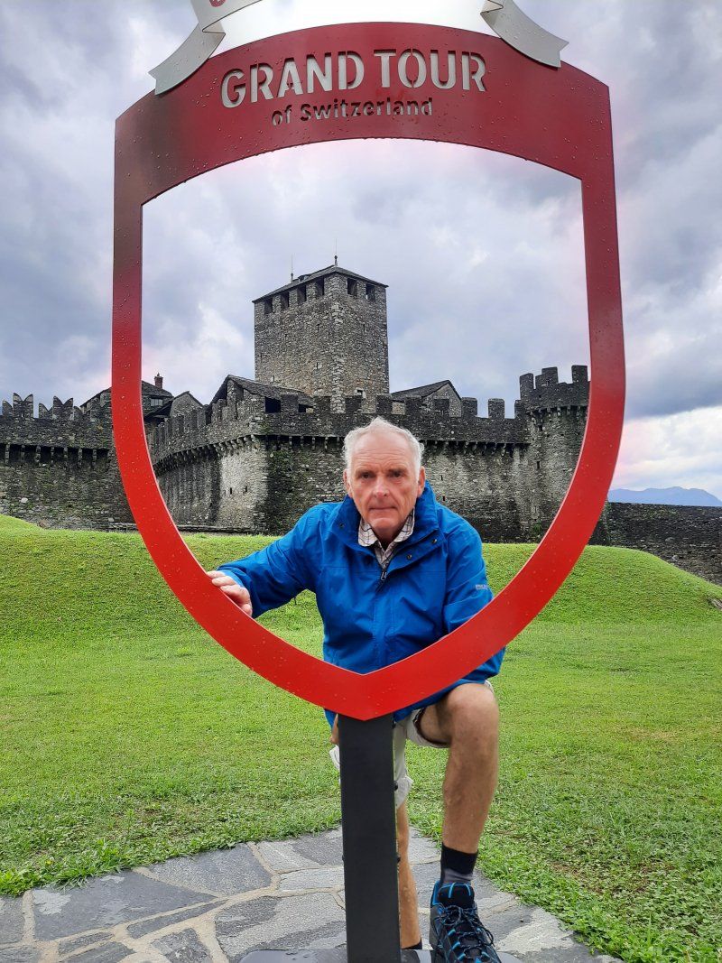
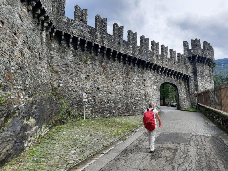
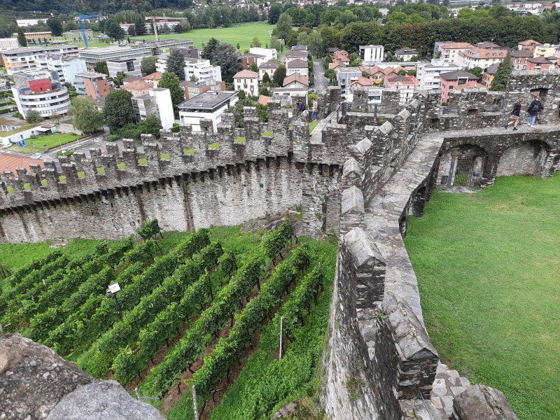
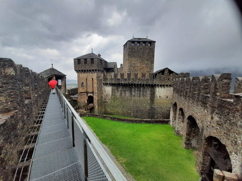
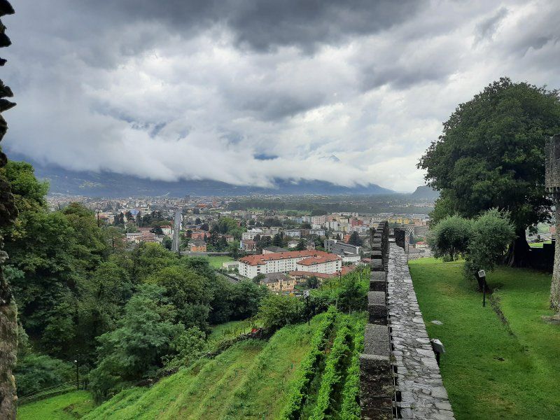
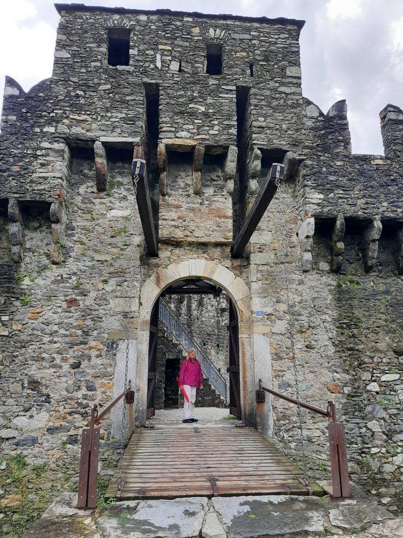
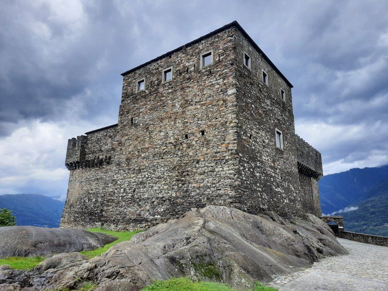
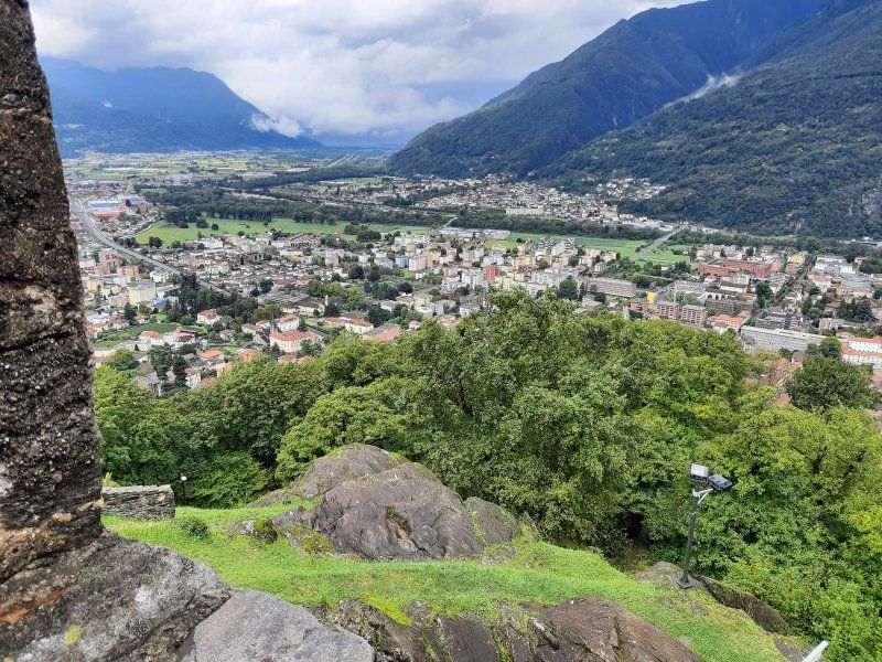
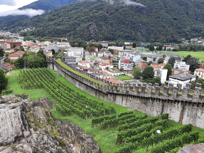
From the hill of Montebello, on which Bellinzona's second Castello towers 90 meters above the city, we look down on the Castelgrande. From here ran the walls that once encircled the old town up to the walls that led down from the hill of S. Michele. Parts of this curtain wall, which protected the northern and southern flanks of the huge triangular fortress, still exist today. The oldest internal wall core comes from the 13th / 14th centuries. Century. After a tour of the castle and the outside area, we took a souvenir photo at the photo spot of the Grand Tour of Switzerland!
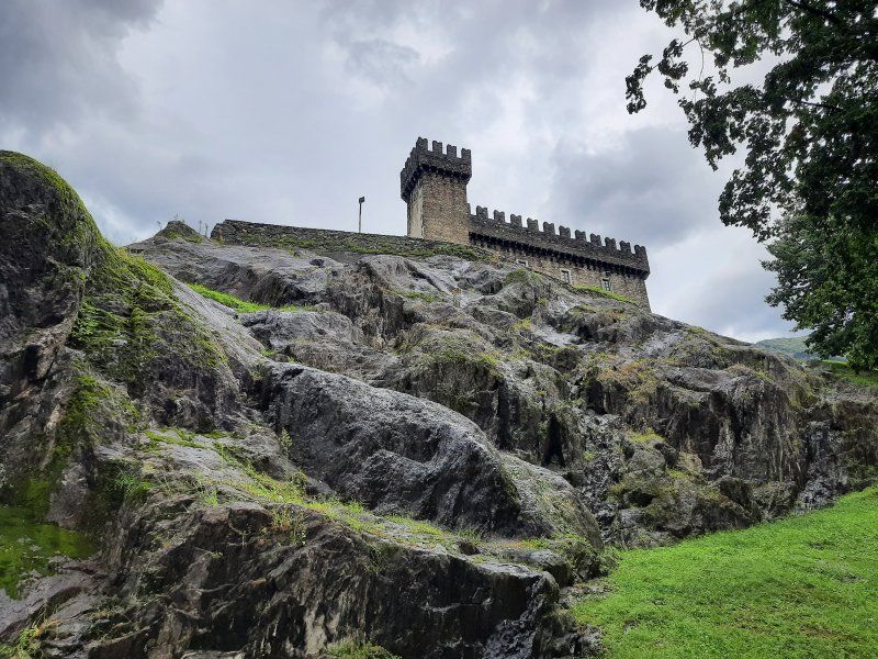
Burg "Castello di Sasso Corbaro"
The Castello di Sasso Corbaro is the only one of the 3 castles with a precise date of construction: It was the year 1479. The fortress was built in just over 6 months. The name of this fortress is based on its geographical location: the Castello is located on a rocky ledge that is as dark as the feathers of ravens (the dialectal name for "raven" is "corbatt"). This is a typical Sforza castle, the masonry of which is limited to basic geometric shapes. In addition to the square inner courtyard, which is surrounded by high walls, there is also a massive main tower and the observation tower. The Castello di Sasso Corbaro sits elegantly at 230 meters above Bellinzona and offers a fantastic panoramic view
Burg "Castelgrande"
To the third castle we descended again into the old town, where the Castelgrande stands on the mighty hill. The first human settlement on the hill of San Michele dates back to 5500/5000 BC. BC (Neolithic). The first archaeologically confirmed fortress was built in the 4th century AD. Various documents from the 6th century also confirm the existence of a fortification. The Latin name for Castelgrande, Castel Magnum, appeared for the first time in the 14th century. This is also the current name.
Day
Sonntagmorgen
The second night was also quiet, the parking lot was empty and there were repeated showers during the night.
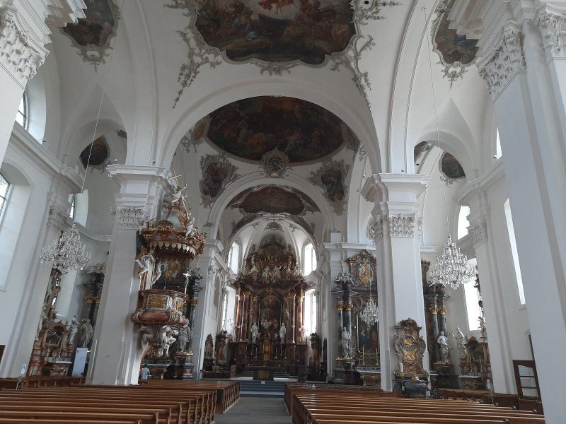
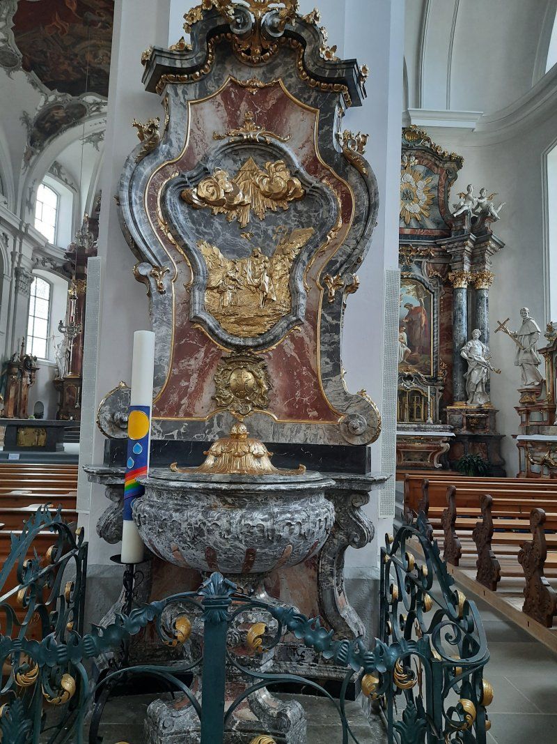
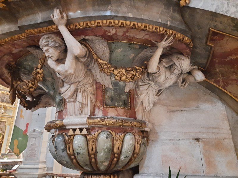
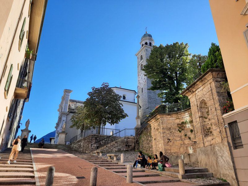
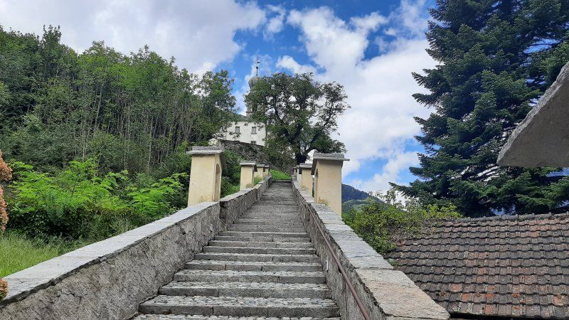
Before we left, we looked for the church of Santa Maria delle Grazie in the south of the city, which originally belonged to a Franciscan monastery. The church contains Renaissance frescoes from the Lombard school, which are among the most important in the canton of Ticino (around 1510). We made it to the church in time, after which a massive thunderstorm came down, which made for a longer stay in the church. After this sightseeing tour, we continued our journey to Lake Lugano.
Fahrt nach Lugano
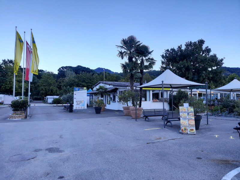
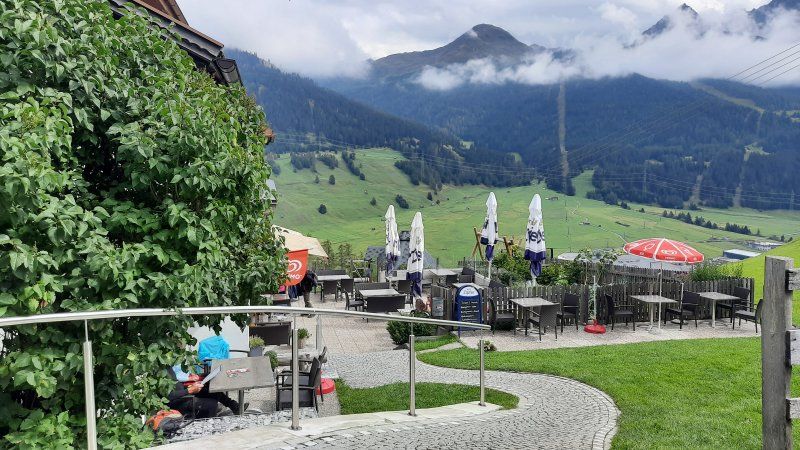
It was a short drive from Bellizona to the campsite here. The driveway is difficult to see if you don't follow the signs. The staff at the reception was friendly and we could choose 6 seats from the regular seats. We liked the place with the number 66, it is not far from the lake and the toilets and showers are also very close. The power distribution box was quite far away from the square, the cable drum and a separate cable (10m) were just enough to the motorhome.
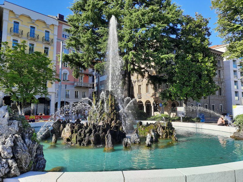
Zu Fuß nach Lugano
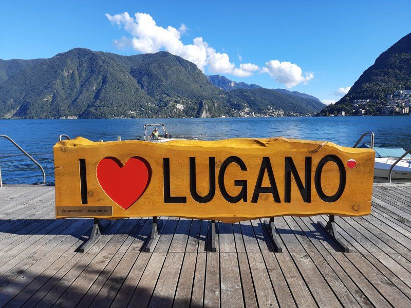
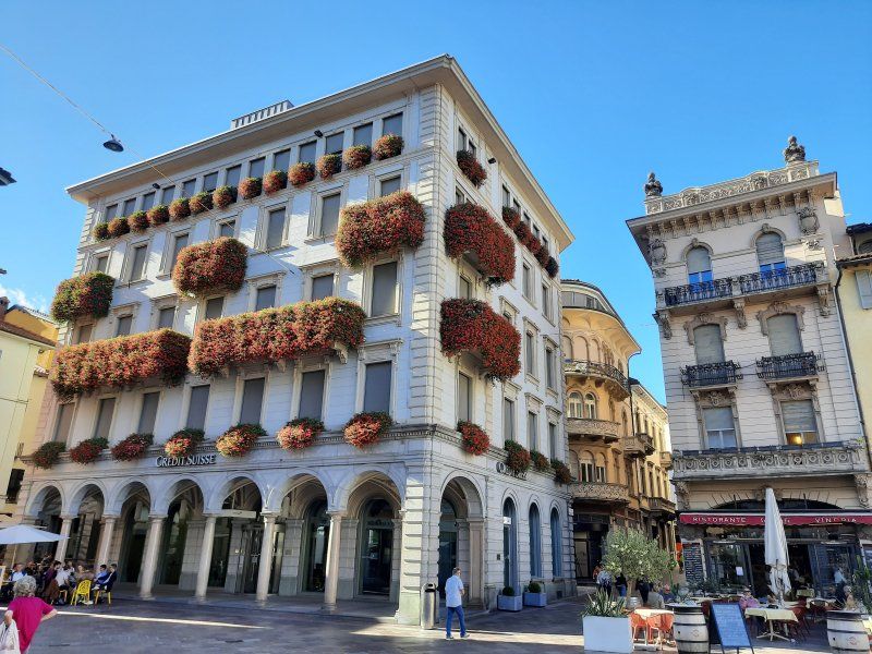
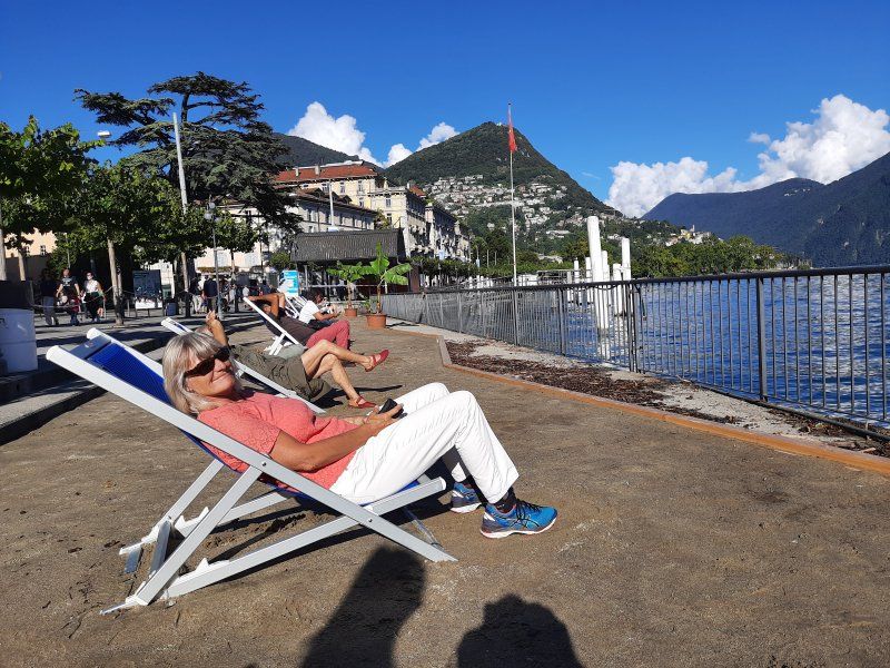
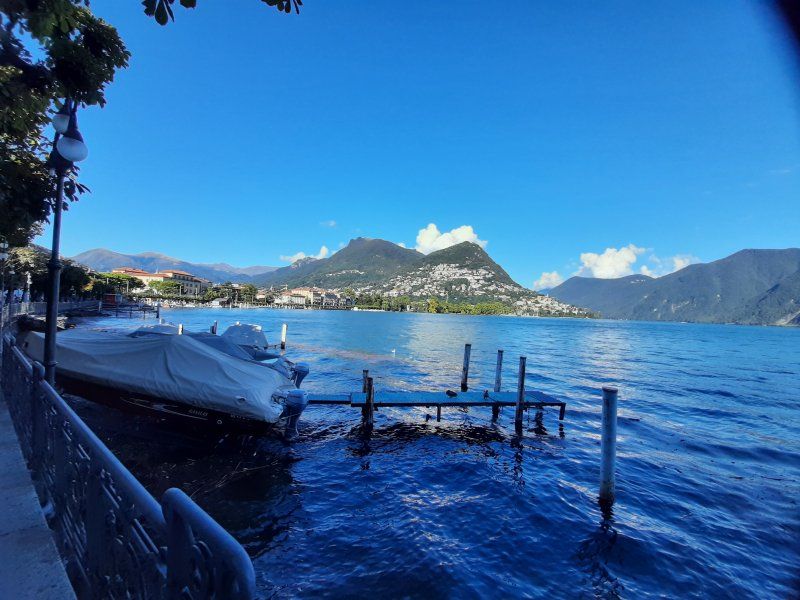
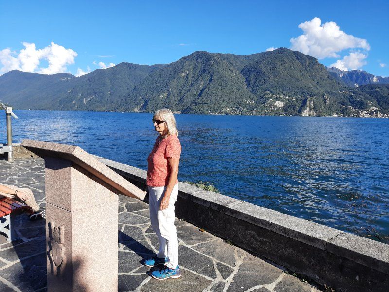
The Womo was parked quickly, Irmgard went straight to the lake to swim. After work was done, I also went to swim in the lake. Then we drank coffee in front of the mobile home and rested for a while before we set out on foot to Lugano. The center of Lugano was 2.3 km away, the GPS on the smartphone showed us the shortest route. At first it was a steep uphill climb over a ridge which then led down to the train station. The first sight we looked at was the Cattedrale San di Lorenzo. Then we went down through old streets to Piazza Manzoni and finally to the promenade on which we followed a longer route. On the way there was also a concert with string instruments. The way back began with a long staircase that led us back towards the train station. There was also a motorhome parking space on the route that was noted in our planning, which we of course had to look at. Our decision was right to drive to the campsite, the pitch was occupied when we visited. The place is just has no service only a toilet disposal. Soon afterwards we got on the way there and the way back followed the same route. After our arrival we took our coffee break and then went for a swim in the lake. The water temperature was pleasantly warm.
Day
Radtour auf den Monte Bre'
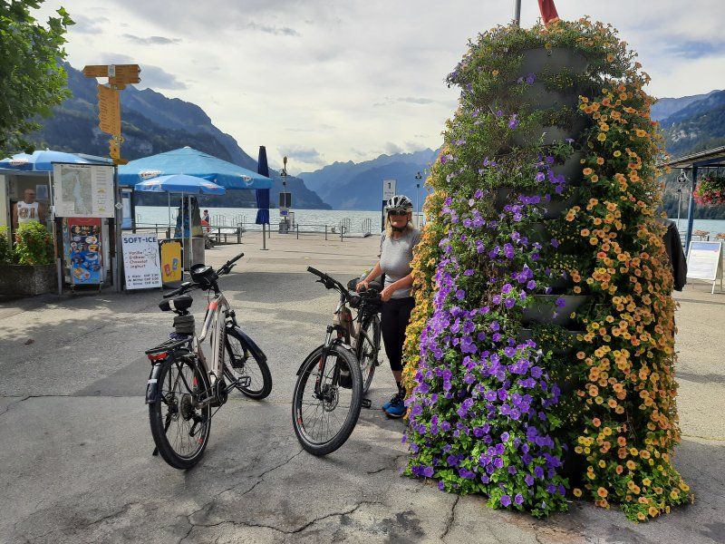
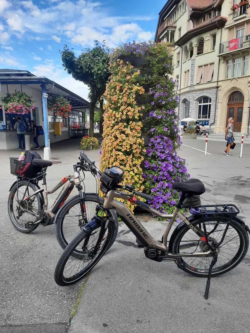
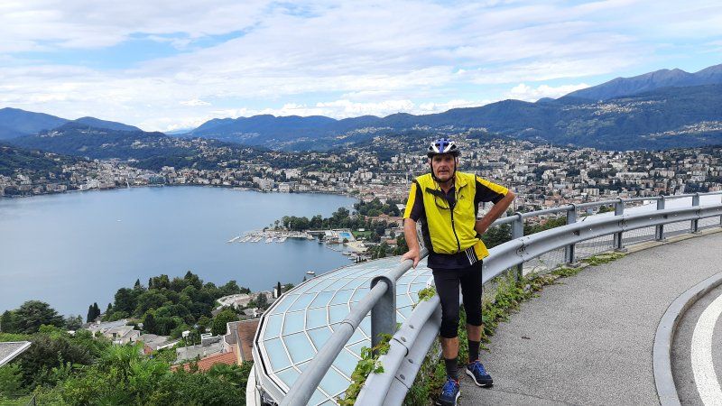
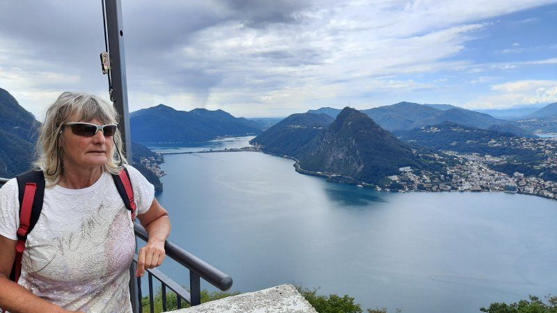
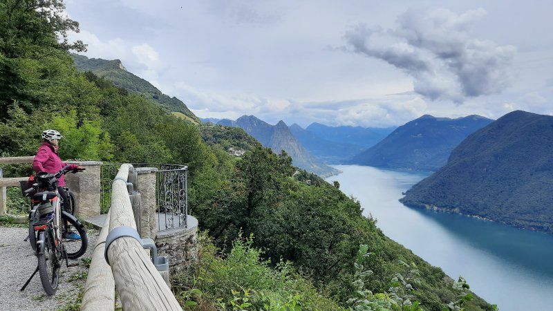
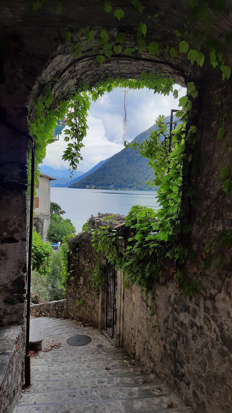
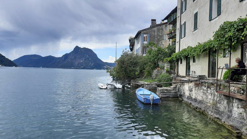
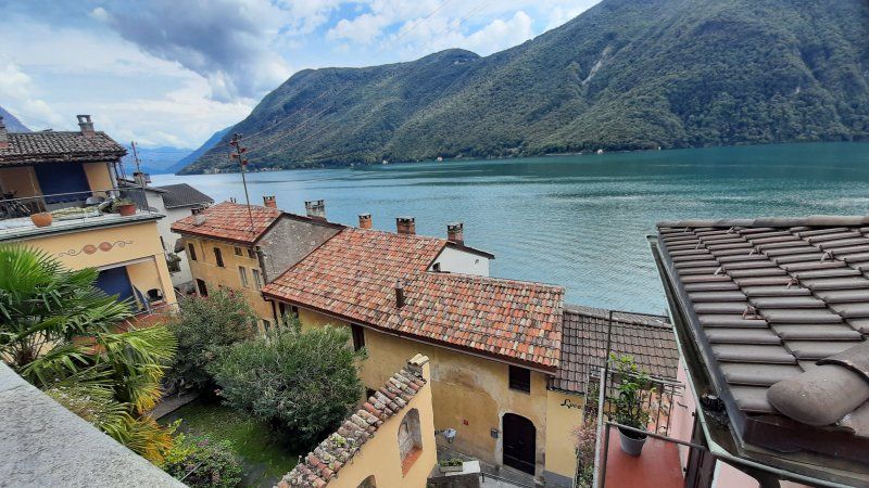
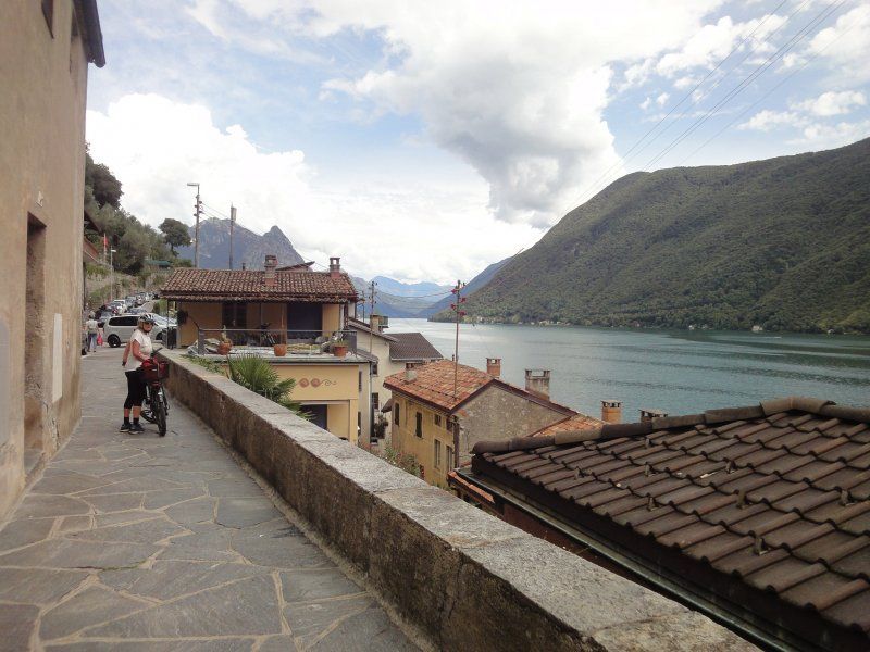
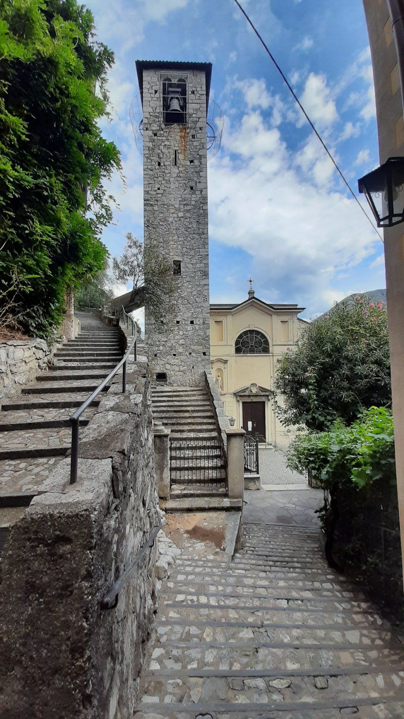
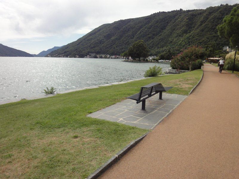
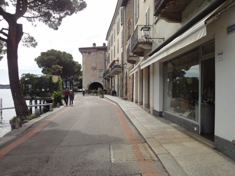
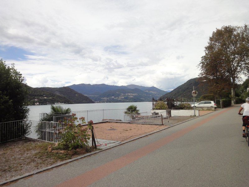
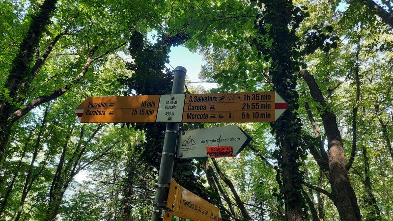
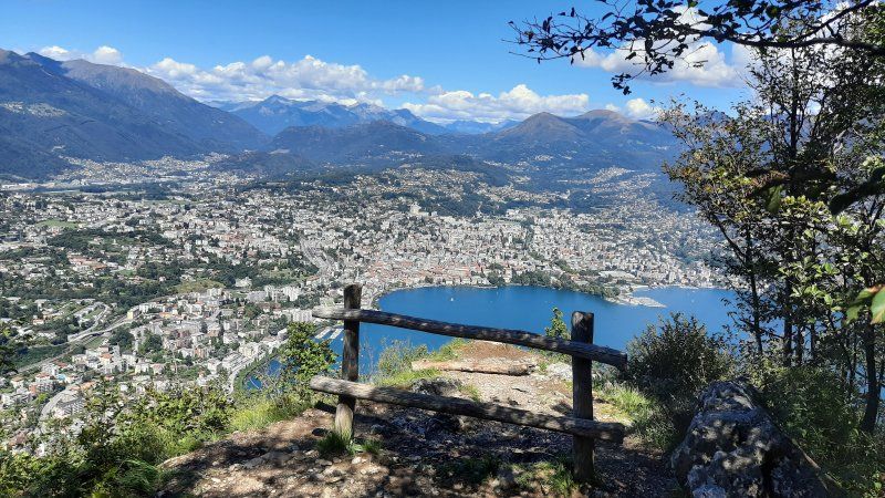
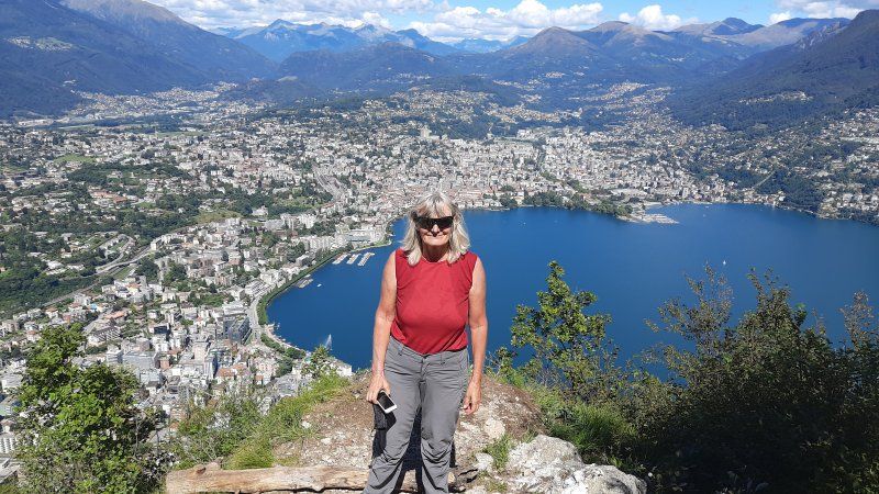
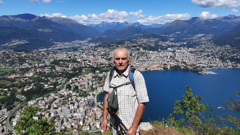
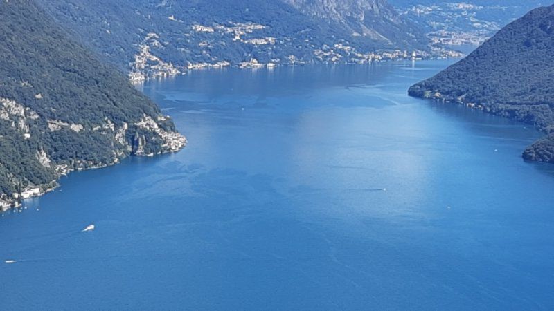
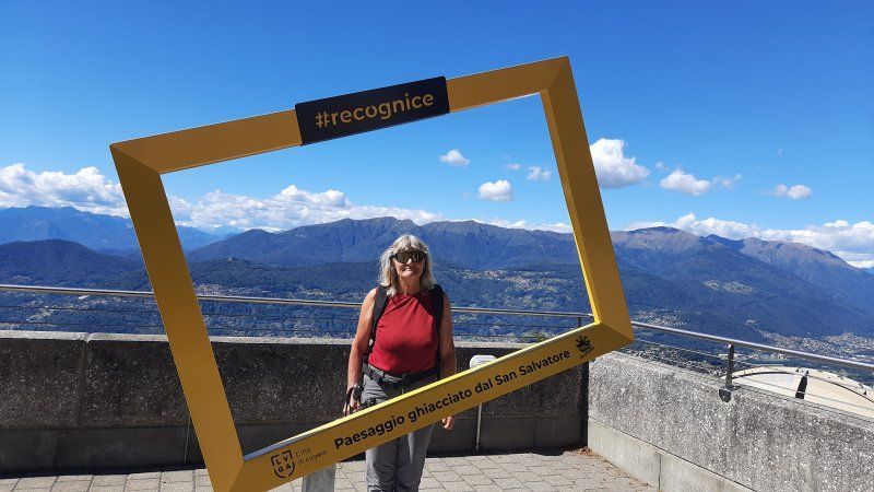
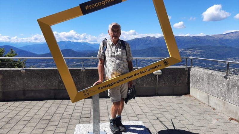
The night was very quiet, we had slept very well and long. In the morning before breakfast we went to swim in the lake. The water is very pleasantly warm, but a lot of dirt and small trees from the previous rainy days have accumulated on the bank. Around noon we set off on our e-bikes for Monte Bre '. Before climbing the mountain, we had to overcome a ridge and drive through the center of Lugano. There was heavy traffic on the roads through Lugano. Thanks to the GPS, we liked the access road to Monte Bre '. Several hairpin bends had to be driven to the top of the mountain (925 m). 10% gradient. At the top of the restaurant you have a beautiful view of the city of Lugano, Lake Lugano and far into the mountains. On the descent we made a detour to Gandria, a fishing village that is the most beautiful thing on Lake Lugano. Steeply on the mountain slope with narrow streets and stairs, it nestles against the lake. We had to leave the bicycles at the top of the church, the houses are assembled and can only be reached via steep stairs and narrow streets. After the visit, we went back to the city of Lugano. On the way back to Muzzano we took the road that led around the local mountain San Salvadore. We spent the rest of the day swimming and lazing around the square.
Distance: 57 km
Hm: 1200 m
Time: 4 h
Average: 15 km / h
Day
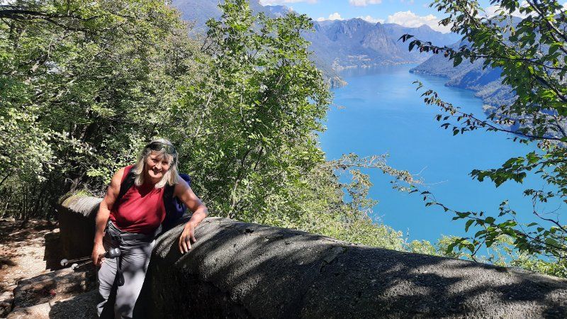
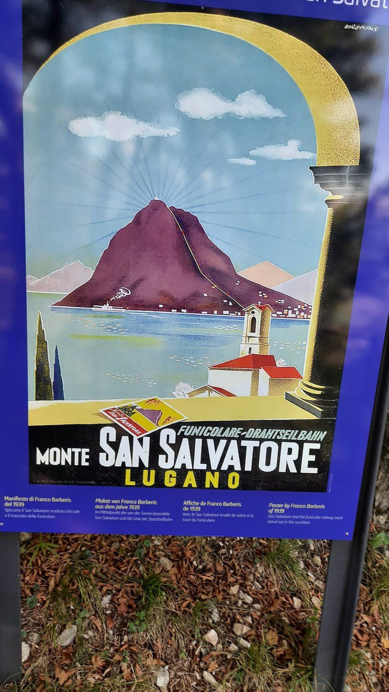
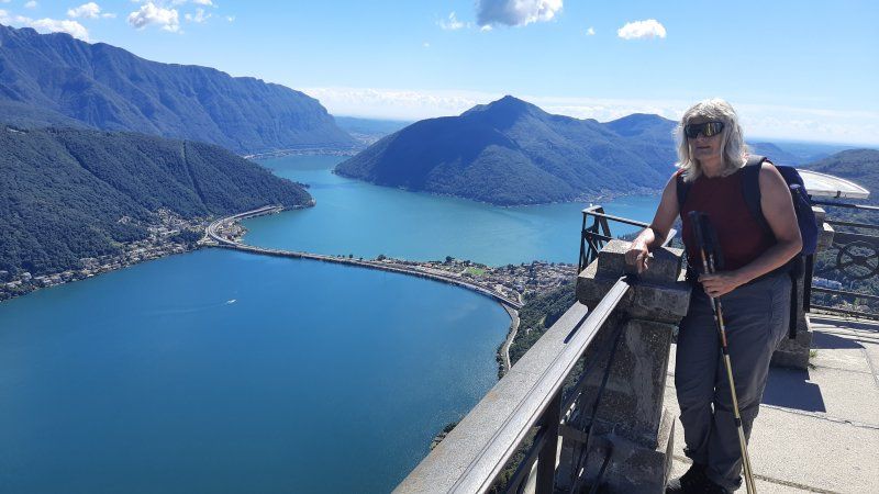
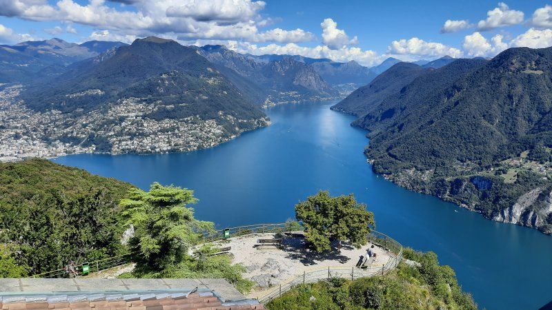
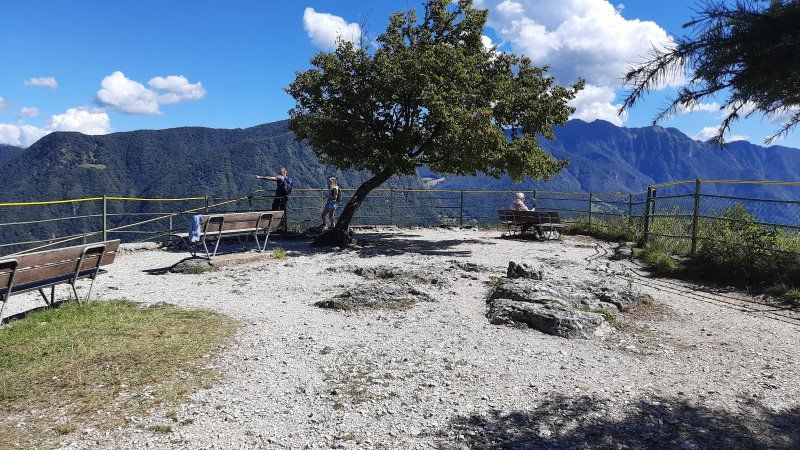
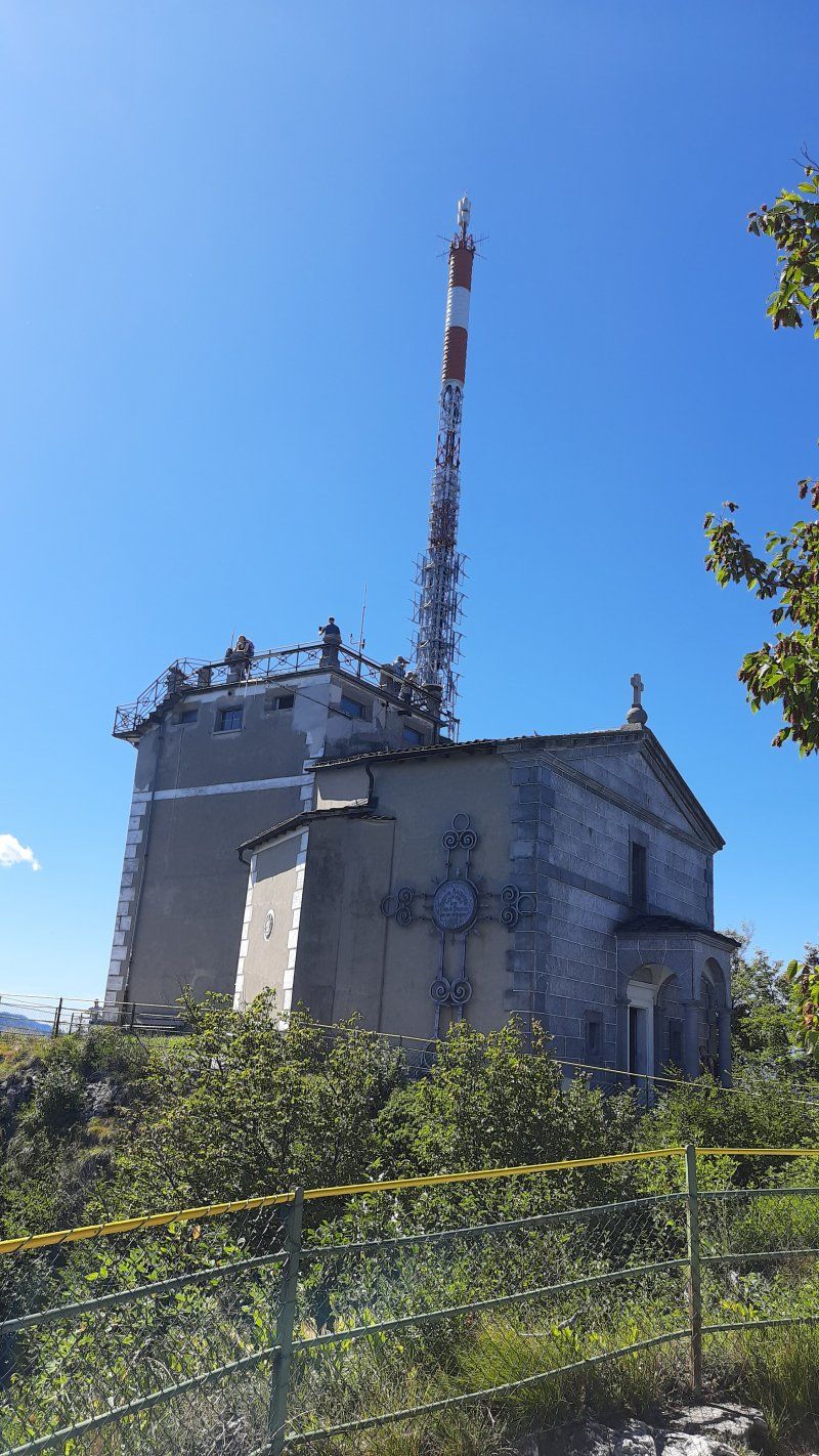
Wanderung auf den Monte Salvadore
The morning had progressed quickly with sleep in, bathing and breakfast, so that we started the hike on the San Salvadore a little late. 11:30 a.m. we started the five-hour tour. It had already got very hot around noon (26 ° C), especially when the route had sunny sections. We were very lucky that the steep and very easy to walk hiking trail ran in the shade to the summit. A number of cyclamen bloomed next to the hiking trail. From the top of the tower you have a magnificent all-round view. The panels that tell the story of the Gotthard tunnel and the old pass road are interesting. One would also have the possibility to visit the summit with the funicular. The way back was like the way there.
Distance: 18 km
Hm: 1200 m
Time: 5:30 h
Day
Camping Abreisetag
During the night we had a thunderstorm with rain. We took advantage of it again to sleep in. Irmgard went swimming in spite of the overcast sky and I set up breakfast during that time. The temperature has dropped a lot, it wasn't as pleasant to have breakfast outside as on the previous days. Many campers around us packed their mobile homes or caravans for departure. As we started to get ready to go, it started raining. It has never happened before that I had to supply the power cable and fill up with fresh water in the rain.
Costs:
3 nights Womo, 2 adults 142.- Euro
Mesocco, Schweiz
Stop at the ruin in a parking lot next to the road. Short walk to the ruins, unfortunately the entrance was closed with an iron gate. From the street you can see it as a huge structure. It is one of the largest castles in Switzerland and formed the lordly center of the valley from the beginning of the 13th century until 1526. The castle was considered impregnable and was never conquered. Below the castle is the Sta. Maria del Castello with a well-preserved late Romanesque fresco cycle.
We decided to take a closer look at the church and the place Mesocco.
Mesocco, Castello, 6563 Mesocco, Schweiz
46° 22' 58.2" N 9° 13' 56.4" E
46.3828471 9.2323339
• Head toward Deira. Go for 96 m.
• Turn left and take ramp onto A13. Go for 15.6 km.
• Turn right. Go for 97 m.
• Arrive at your destination.
☍
15,8 km
( 14 min.)
Lago d’Isola
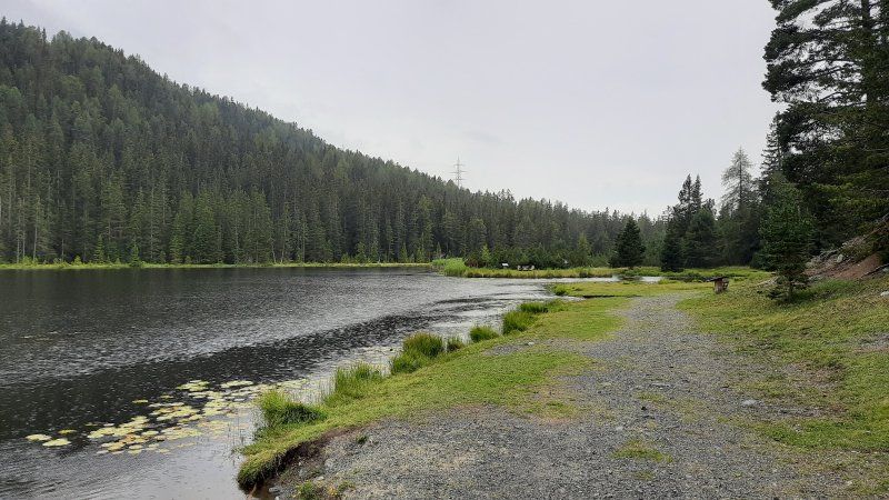
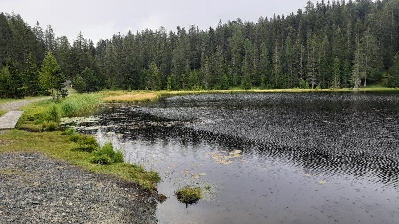
Today we had more time due to the early departure from the campsite. The planning of the tour provided that we drive to the San Bernardino Pass and spend the night on the pass. The weather made everything impossible, on the driveway to San-Bernardino, the clouds were quite low and it also started to rain. There was a hitchhike at Lago d'Isola, we looked to see if there was a path around the lake, but unfortunately there wasn't. Occasional trails lead to the water. Irmgard tested the water temperature which was 16 ° C. After the short stop, we continued to the parking lot after the San Bernardino tunnel.
S. Bernardino 653, 6565 S. Bernardino, Schweiz
46° 27' 3.1" N 9° 11' 25.9" E
46.4508498 9.1905235
• Head north. Go for 105 m.
• Continue on A13. Go for 19.3 km.
• Take ramp toward Splügen/Splügenpass. Go for 174 m.
• Take the 1st exit from roundabout. Go for 65 m.
• Arrive at your destination on the right.
☍
19,7 km
( 15 min.)
Parkplatz Hinterrhein
Parking lot at the San Bernhardino tunnel. The parking lot is being rebuilt, everything is still under construction around the space. The entry and exit to Bernhardino Strasse has been given a new route. We stood for a stopover, were unsure whether we should spend the night here. You couldn't drink anything but coffee, it was raining.
Splügen, Schweiz
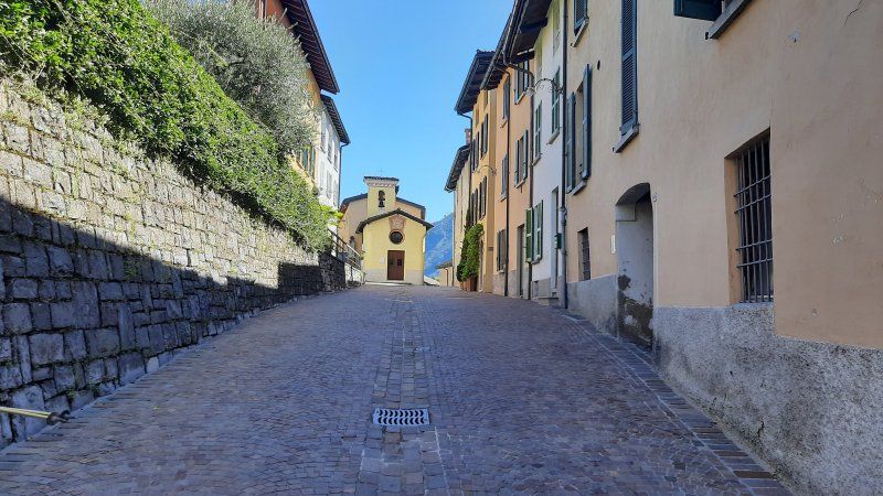
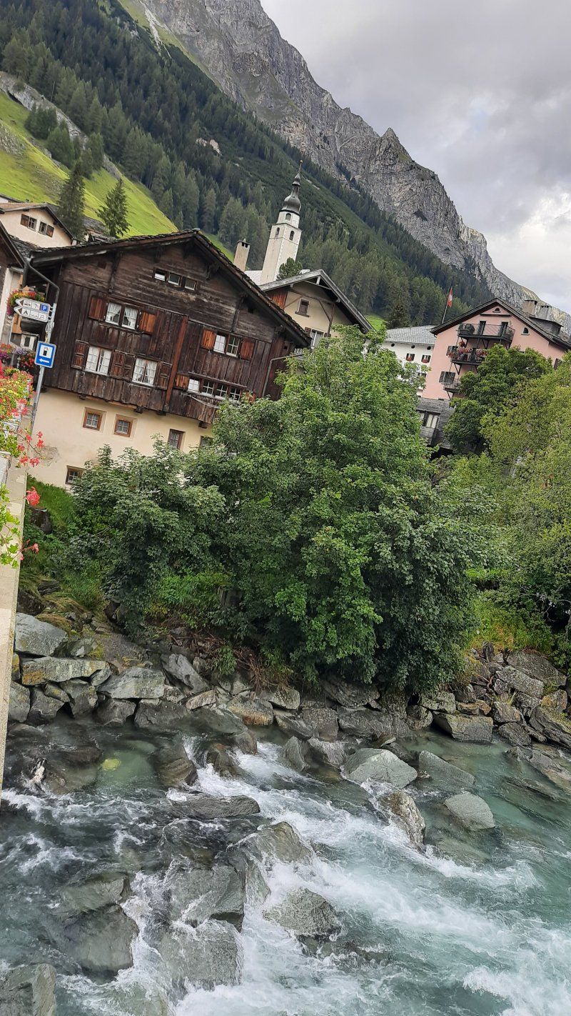
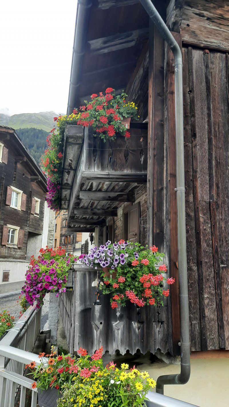
In Splügen we drove to the free parking lot (GPS: 46.549999, 9.32091; 8 am-6 pm chargeable) at the cable car. On arrival the rain had subsided, so we went straight to the village of Splügen to take a closer look. Splügen is a typical pass village with a well-preserved village image, proud palazzi and sun-tanned Walser houses. The current church is a new baroque building. It was created after the end of the confusion in Graubünden in 1687–1689. The choir room is furnished with family stalls belonging to the most important Splügen families at the time.
Auf dem Wur, 7435 Splügen, Schweiz
46° 33' 0.2" N 9° 19' 12.5" E
46.5500581 9.3201359
• Head northeast. Go for 19 m.
• Turn slightly left toward A13. Go for 38 m.
• Take the 2nd exit from roundabout toward Chur/Thusis. Go for 153 m.
• Continue on A13. Go for 12.6 km.
• Take ramp onto 13 toward Andeer/Zillis/Viamala. Go for 4.0 km.
• Turn left toward Bot da Mulegn. Go for 108 m.
• Continue on Bot da Mulegn. Go for 114 m.
• Continue on Plaz. Go for 82 m.
• Turn right onto Stradun. Go for 135 m.
• Turn slightly left onto Veia da Baselgia. Go for 147 m.
• Arrive at Veia da Baselgia. Your destination is on the left.
☍
17,4 km
( 16 min.)
Day
Ein sonniger, kalter Tagesanbruch
The parking lot was very quiet during the night, the temperatures were frosty at night. At dawn a white hoar frost lay on the meadows and mountain slopes. The heating provided a pleasant temperature in the Womo. A clear blue sky promised to be a sunny day.
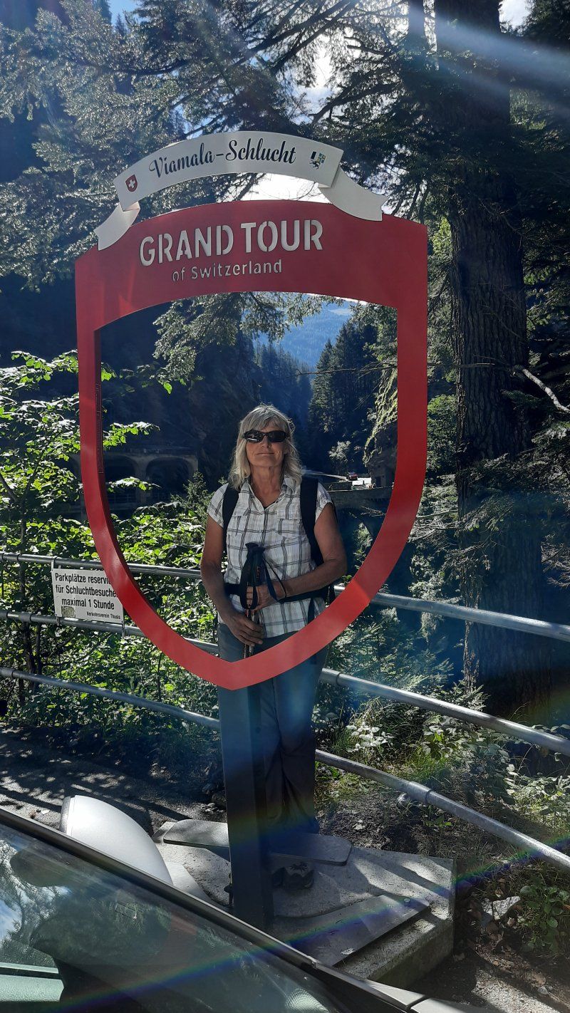
We started early to continue to Zillis. Today is a hike in the Viamala Gorge.
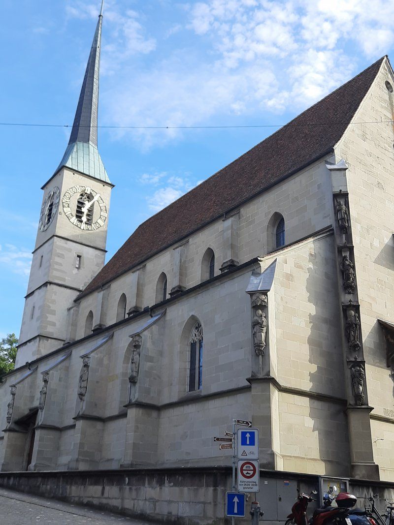
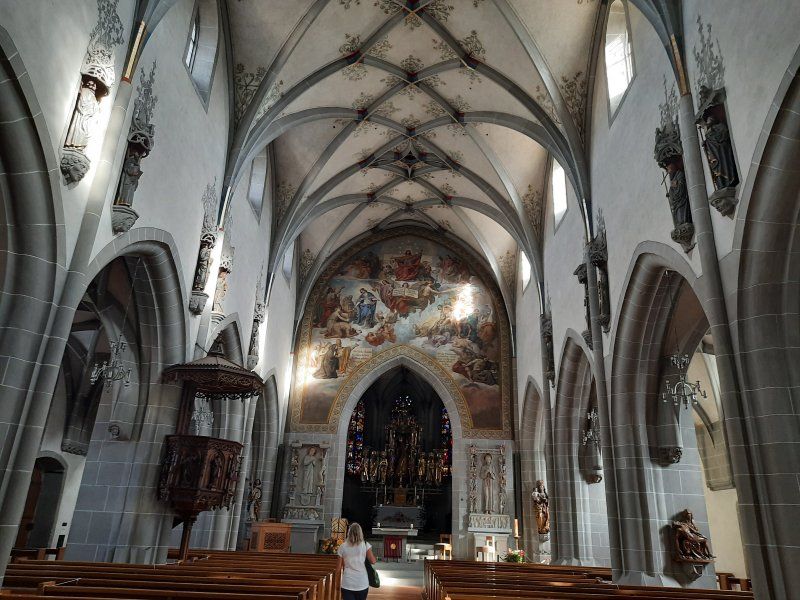
Reformierte Kirche St. Martin
After a few kilometers, drive to the free car park in Zillis by the church (GPS: 46.635379,9.450421). From here, it is a good starting point for the hike into the Viamala Gorge.
Am Postplatz, 7432 Zillis, Schweiz
46° 38' 3.6" N 9° 26' 29.8" E
46.6343212 9.4416118
• Head toward Nislas on Veia da Baselgia. Go for 78 m.
• Turn slightly left onto Veia da Baselgia. Go for 54 m.
• Turn right onto Resgia. Go for 646 m.
• Turn left onto 13. Go for 142 m.
• Take ramp onto A13 toward Chur/Thusis. Go for 30.1 km.
• Take exit 17 toward Arosa/Lenzerheide onto Waffenplatzstrasse. Go for 554 m.
• Turn left onto Kasernenstrasse (3/13). Go for 199 m.
• Pass 3 roundabouts and continue on Kasernenstrasse. Go for 1.3 km.
• Continue on Welschdörfli. Go for 175 m.
• Turn left onto Welschdörfli. Go for 16 m.
• Take the 1st exit from roundabout onto Lindenquai. Go for 232 m.
• Turn right onto Plessurquai. Go for 296 m.
• Turn left onto St. Luzistrasse. Go for 155 m.
• Turn right onto Sandstrasse. Go for 29 m.
• Turn right. Go for 47 m.
• Arrive at your destination on the right.
☍
34,0 km
( 29 min.)
Wanderung Viamala Schlucht
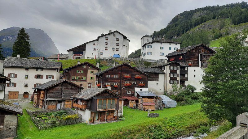
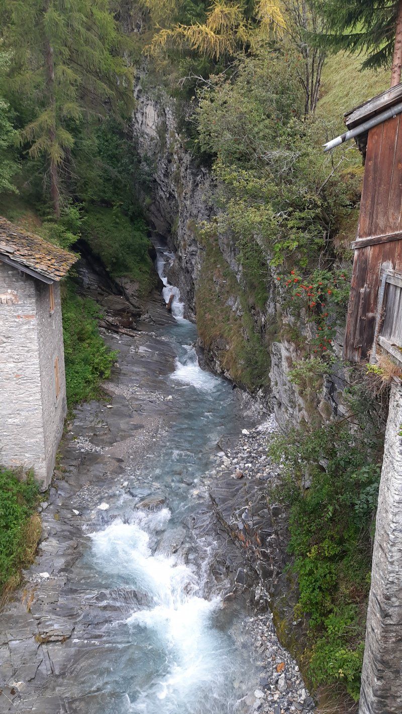
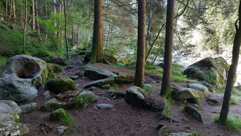
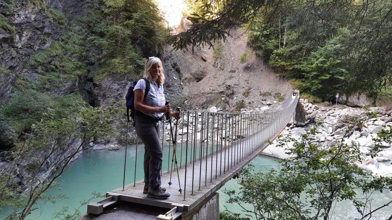
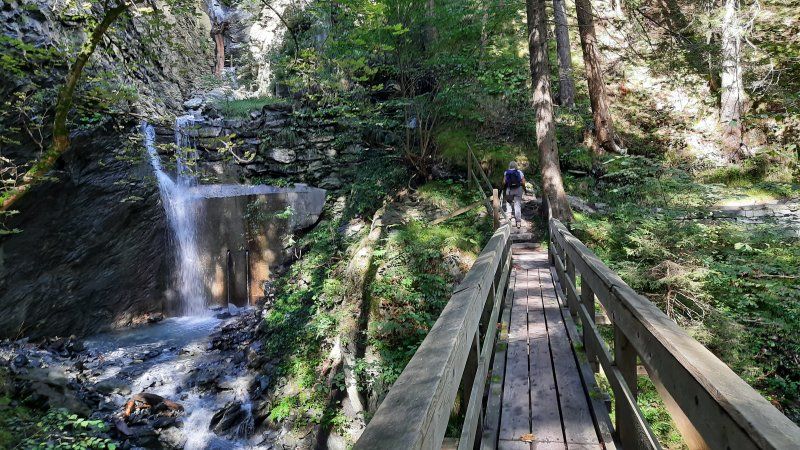
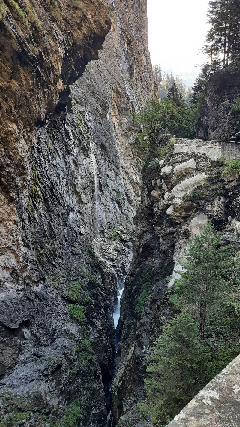
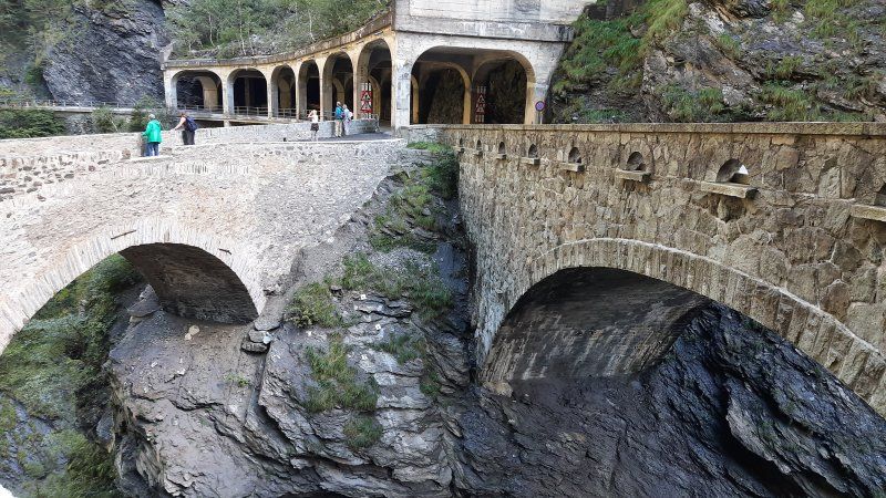
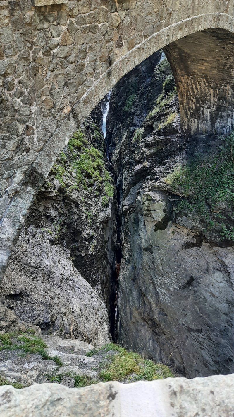
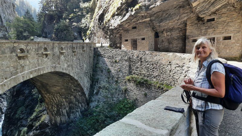
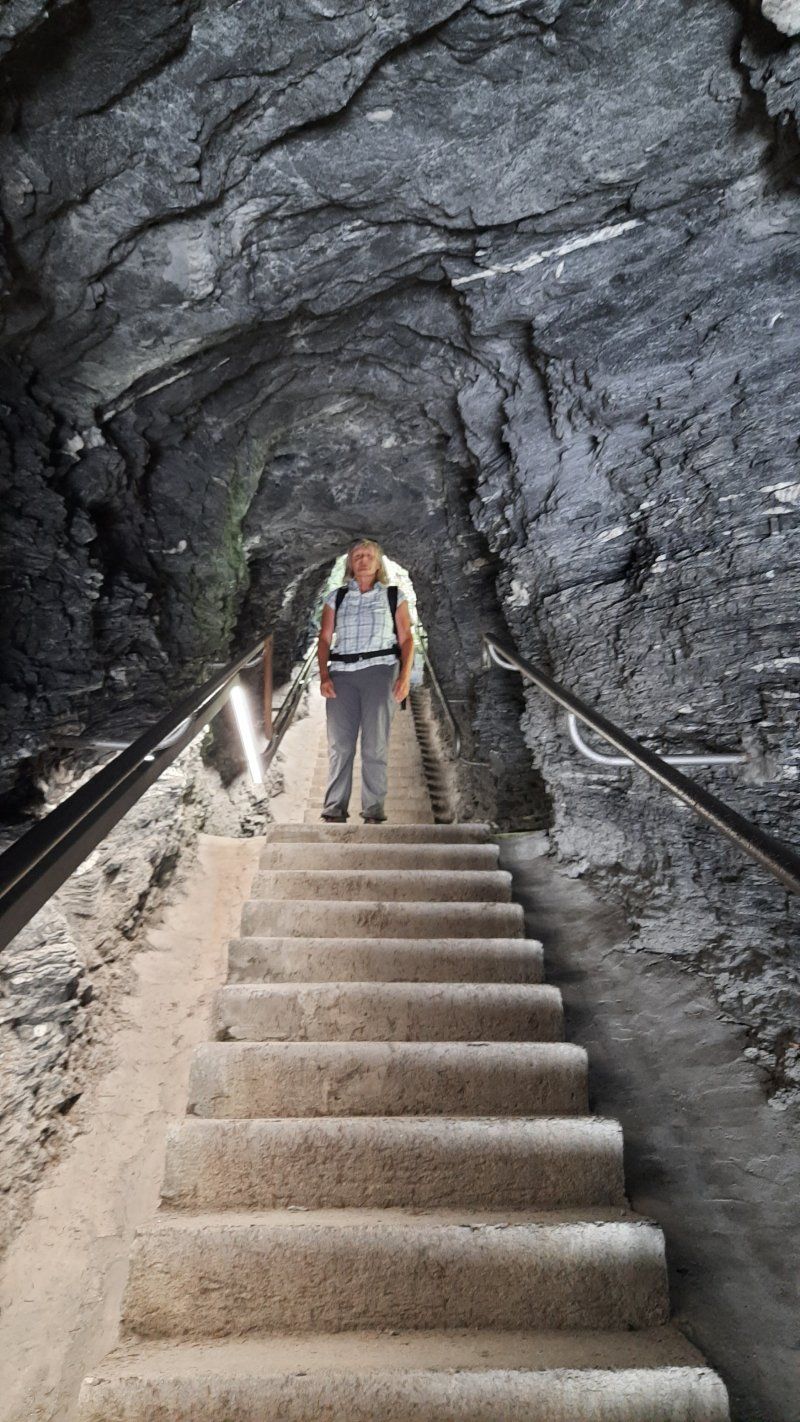
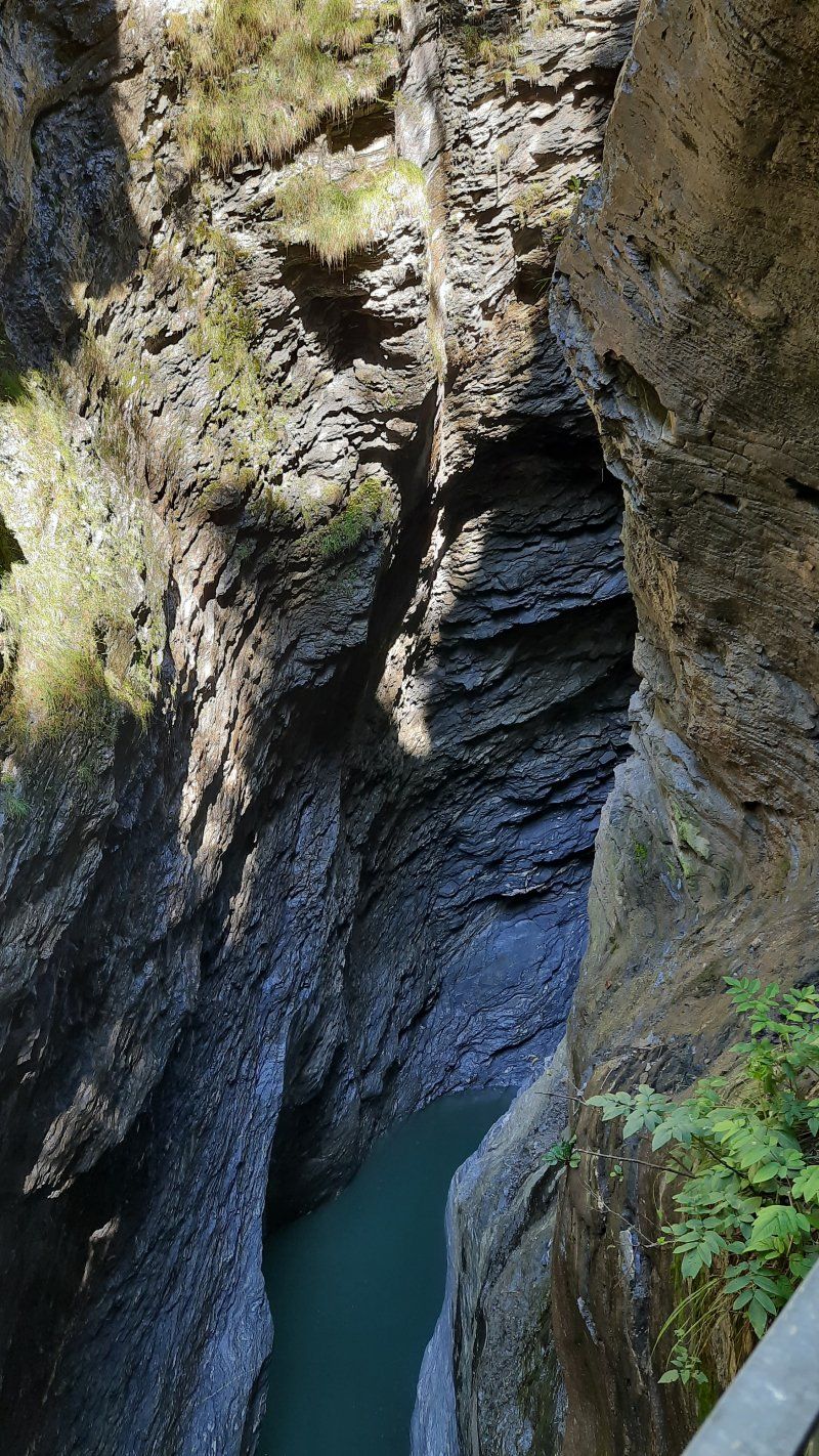
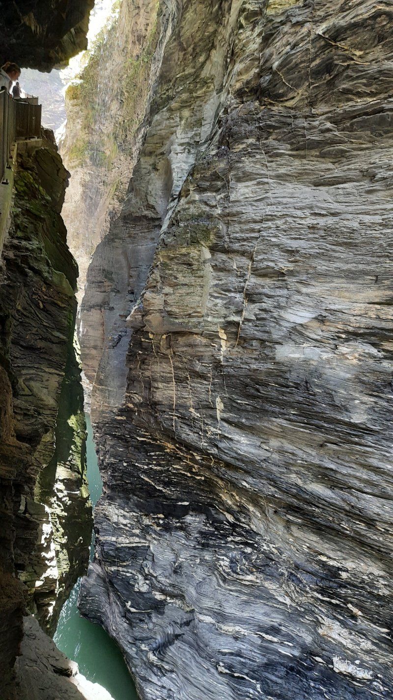
From Zillis Dorf we follow the sign Reischen / Thusis / Viamala Schlucht. We follow the path gently uphill until we meet the road to Reischen a short time later. There is a wonderful view of the valley and the surrounding mountains. We hike through the village with its numerous fountains and historic farmhouses. Shortly after Reischen we cross the first of many small, larger and exciting bridges. After some up and down through lush summer meadows, we come to the Davos Salegn point in the middle of the forest. The signpost sends us down the forest towards the gorge to the bank of the river of the Viamala Gorge. We walk upstairs and downstairs on the narrow, rooted forest path on the banks of the river. Finally we reach the Punt da Suransuns. With its construction in 1999, it is again possible to follow the old mule tracks through the gorge. Now we go up the mountain on the other side of the river until we meet the driveway. On the short way to the Viamala information booth. We took the many steps down to the viewing platform above the Viamala gorge (fee 8 CHF / P) to take a closer look at the natural phenomenon. We now leave the gorge and start the ascent to the Traversina footbridge (always follow the signs to Thusis). After a very strenuous stretch, the bridge over the Traversina Tobel is in front of us. When walking over the bridge we take our time and enjoy the view of the valley. The Traversina footbridge was realized in 2005 by an architecture firm from Chur. Because of the exposed location of the bridge, which has to be overcome a distance of 56 m and a height difference of 22 m and has a deep view down to 40 m depth. The bridge was our hiking destination, from here it was the same way back to Zillis to our mobile home. At the kiosk by the church at the parking lot we made a short coffee break before we went on to Chur.
Chur
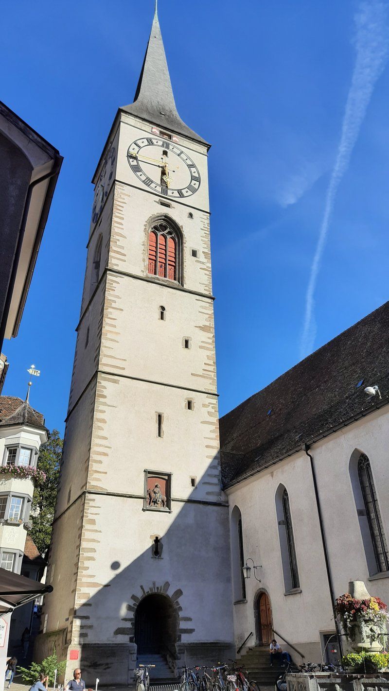
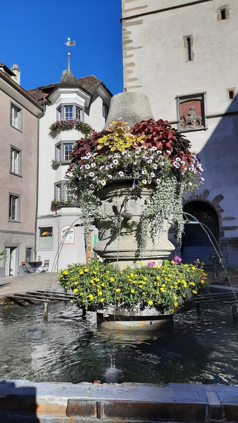
The large car park (GPS: 46.855951, 9.505652) at the swimming pool and ice rink is easy to drive into, it is located in the industrial area about 3 km from the old town. (Fee: 10.-SHF / 24h) We immediately set off on foot to the old town. We followed Pulferstrasse and Sägerstrasse which led us straight to the Upper City Gate. Chur is the oldest city in Switzerland with a settlement history of over 5000 years and the picturesque old town is undoubtedly one of the most beautiful old towns in Switzerland. In the car-free old town, winding streets lead to the three-tiered cathedral of St. Mary of the Assumption
13th century in the courtyard of the bishop's palace. The 800-year-old cathedral and its late Gothic high altar shining in golden splendor. The cathedral is dedicated to the Assumption of Mary and is one of the most important cultural monuments in Switzerland. The farm was already settled before Roman times and was used by the Romans as a base. 451 Bishopric with a simple basilica. Second cathedral in the 8th century, of which marble sculptures are still preserved.
7000 Chur, Schweiz
46° 50' 45.6" N 9° 32' 12.9" E
46.8460062 9.5369161
• Head toward Sandstrasse. Go for 47 m.
• Turn left onto Sandstrasse. Go for 29 m.
• Turn left onto St. Luzistrasse. Go for 155 m.
• Continue on Plessurquai. Go for 486 m.
• Take the 2nd exit from roundabout onto Welschdörfli. Go for 47 m.
• Continue on Malixerstrasse. Go for 340 m.
• Turn right onto Umfahrung Süd (3). Go for 1.5 km.
• Keep right onto Waffenplatzstrasse toward Zürich/St. Margrethen/San Bernardino/Disentis/Flims. Go for 275 m.
• Continue toward A13. Go for 27 m.
• Take the 3rd exit from roundabout onto A13 toward Chur Industrie/San Bernardino/Reichenau/Domat/Ems/Felsberg/13/Lenzerheide/Chur/3/Arosa. Go for 6.9 km.
• Take exit 18 toward Reichenau/Disentis/Mustér/Ilanz/Flims. Go for 370 m.
• Turn right onto 19 toward Disentis/Mustér/Flims. Go for 8.4 km.
• Take ramp onto Via Nova. Go for 907 m.
• Turn left onto Via Punt la Reisga. Go for 2.1 km.
• Turn slightly left. Go for 235 m.
• Turn left. Go for 832 m.
• Turn slightly right. Go for 623 m.
• Arrive at your destination.
☍
23,3 km
( 27 min.)
Day
Trin, Schweiz
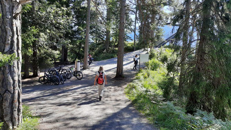
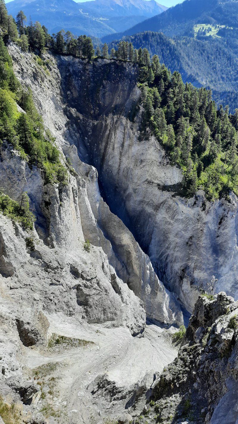
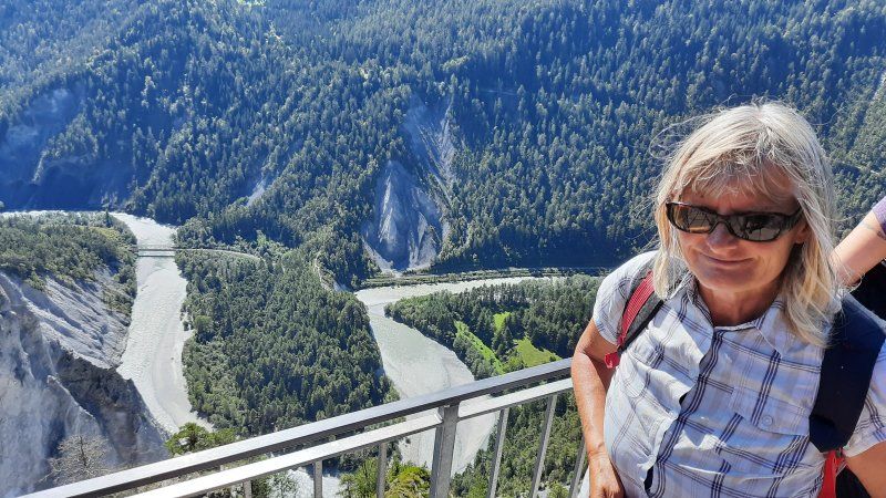
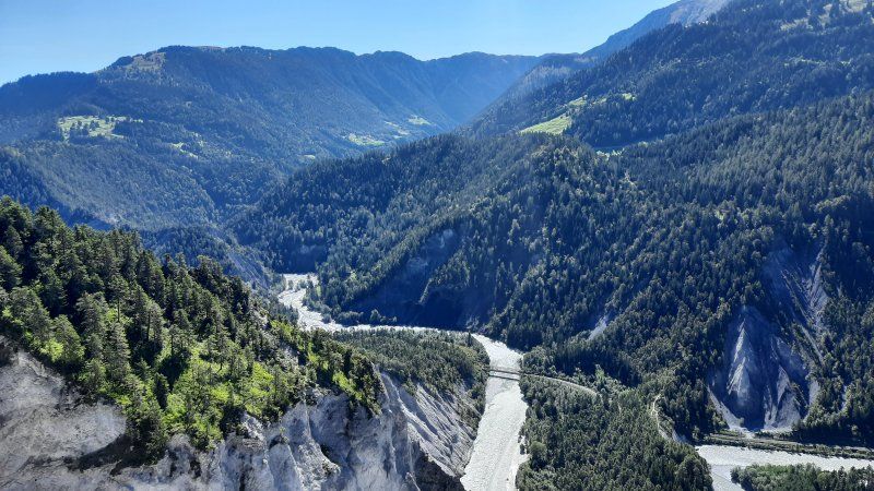
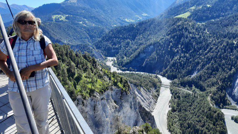
To the parking lot in Trin Mulin (GPS: 46.829253,9.335008) drive through the village, downhill to a bridge 450 m outside the village. A local woman gave us this parking lot. The car park is large and level, and there is a fee for parking. 1h = 1Sfr. , all day 5 Sfr. The parking lot is a good starting point for the Rhine Gorge. Walking time there and back: 2 hours.
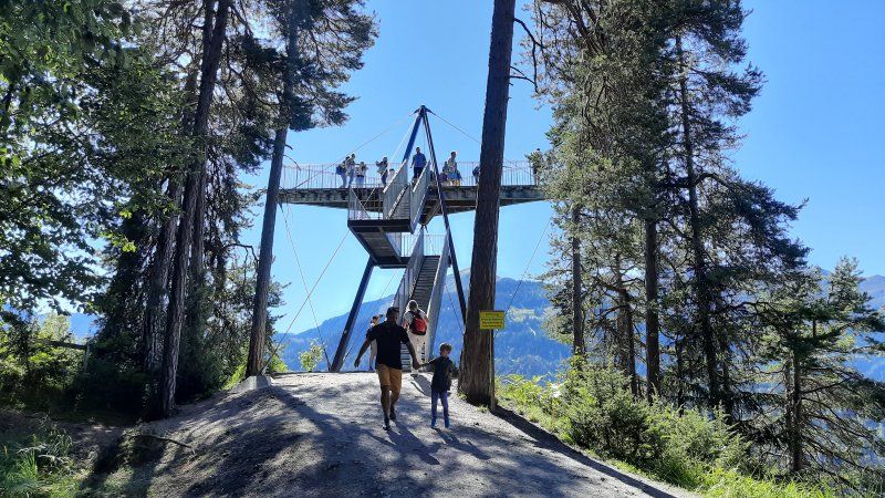
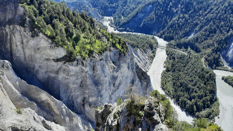
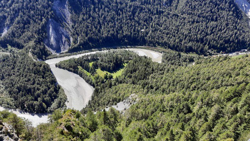
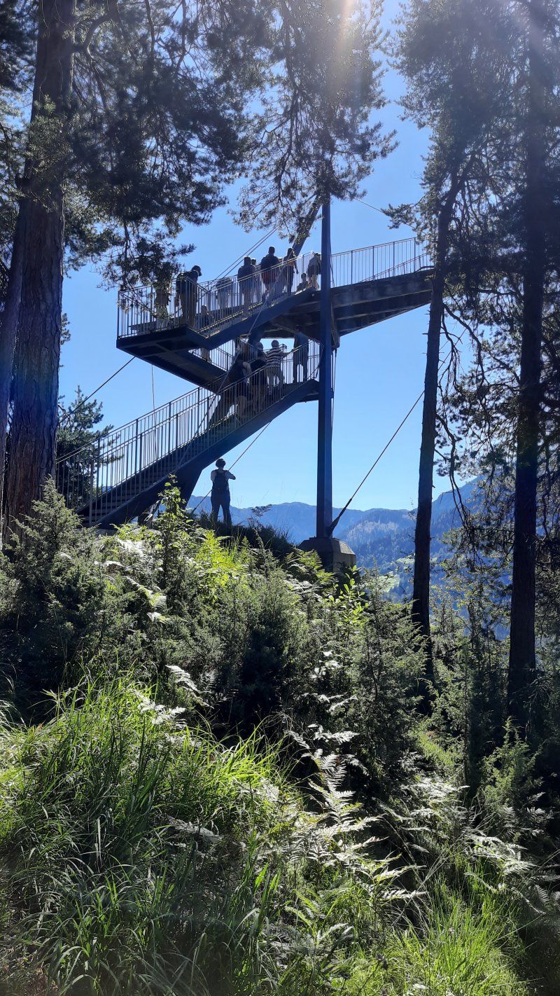
The viewing platform Il Spir is located in Conn and can be easily reached on a good hiking trail. It was designed by the Chur architect Corinna Menn and inaugurated in 2006. Here we had a unique 180 degree view over the “Swiss Grand Canyon”. There was a brisk flow of visitors on the platform, which means that space is very limited.
Unnamed Road, 7016 Trin, Schweiz
46° 49' 36.4" N 9° 19' 46.8" E
46.8267800 9.3296802
• Head toward Caschligna Dado. Go for 1.5 km.
• Turn right toward Via Punt la Reisga. Go for 235 m.
• Turn slightly right onto Via Punt la Reisga. Go for 2.1 km.
• Turn right onto Via Nova. Go for 517 m.
• Take ramp onto Via Nova (19). Go for 8.8 km.
• Turn left and take ramp onto A13 toward San Bernardino/Thusis. Go for 15.6 km.
• Take ramp toward Thusis-Süd/St. Moritz/Tiefencastel. Go for 407 m.
• Turn left toward Tunnel Sils. Go for 228 m.
• Continue on Tunnel Sils. Go for 1.8 km.
• Continue on 417. Go for 10.3 km.
• Take the 1st exit from roundabout onto 3 toward St. Moritz/Julierpass/Savognin. Go for 26.8 km.
• Arrive at Julierstrasse (3). Your destination is on the right.
☍
68,2 km
(1 hrs. 6 min.)
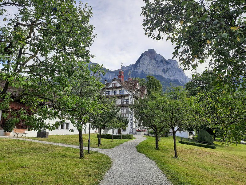
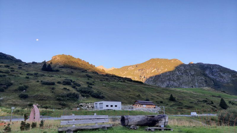
Bivio (Julierpass)
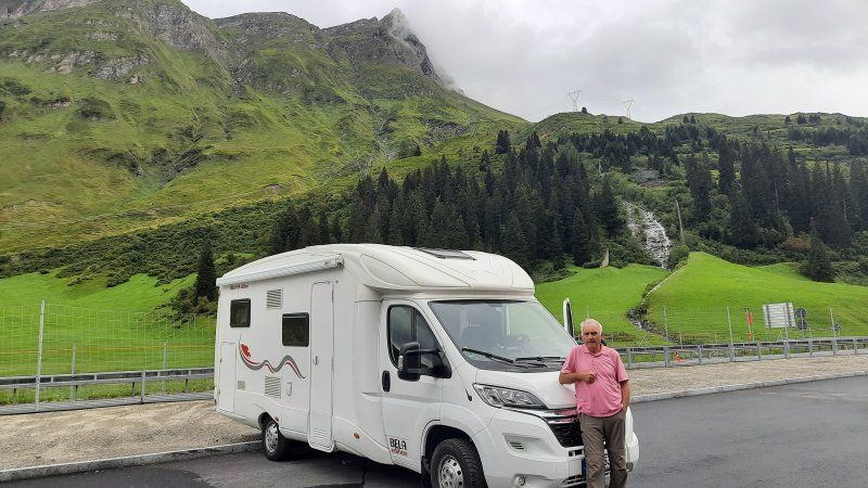
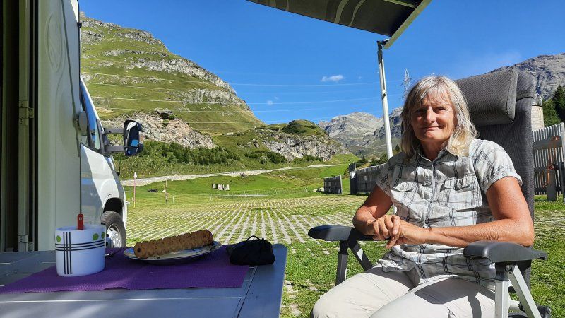
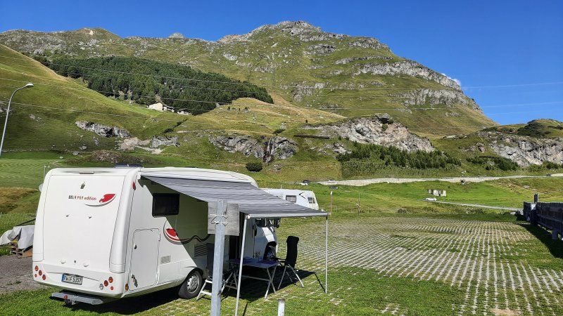
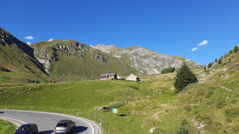
The drive up to the Julier Pass went quite well, only the narrow road in the village of Bivio was difficult to drive through. We had almost passed the bottleneck when three buses came towards us. It was inches of work as we drove past the buses and the house wall. On the further mountain road, our navigation system guided us to the entered parking space, which is a little away from the road. We liked the place and we parked our mobile home on a flat area covered with lawn grids. (Gps: 46.46329, 9.656247) The fee 15.- Sfr had to be put in an envelope in a mailbox set up for this purpose. Electricity cost an additional 5.- Sfr. At first we stood alone on the pitch. Nice little place right on the Julier Pass. Official pitch especially for long-term campers, but also well suited for 1-2 nights.
Power supply available and toilet and shower in the building (restaurant) across the street. No supply and disposal.
It was just wonderful to sit in the mountains and look at the surrounding mountains. It was already warm and we even had the awning extended which gave us the necessary shade. We made ourselves very comfortable. In the evening we went for a walk towards the top of the pass. We also found a hiking trail that led off the road to the pass. For an hour we followed the path that led along a stream, on alpine meadows and also past rock formations. On the way we were greeted by a number of marmots, who drew attention with their loud screams. Even a few meters in front of us, a fox was interested in our presence. On the way back to the wome we saw the sunset. When we returned to the Womo there was another Womo on the square.
7457 Surses, Schweiz
46° 28' 4" N 9° 39' 1.6" E
46.4677669 9.6504508
• Head toward Stalla Gronda on Julierstrasse (3). Go for 16.3 km.
• Take the 3rd exit from roundabout onto Via Chantunela (27) toward Berninapass/29/Zernez/St. Moritz. Go for 2.9 km.
• Pass 5 roundabouts and continue on 27. Go for 5.5 km.
• Take the 2nd exit from roundabout onto 27/29. Go for 2.1 km.
• Pass 2 roundabouts and continue on Sviamaint (27). Go for 27.2 km.
• Turn right onto Plaz (28). Go for 34.6 km.
• Arrive at Chasatschas (28). Your destination is on the left.
☍
88,6 km
(1 hrs. 24 min.)
Day
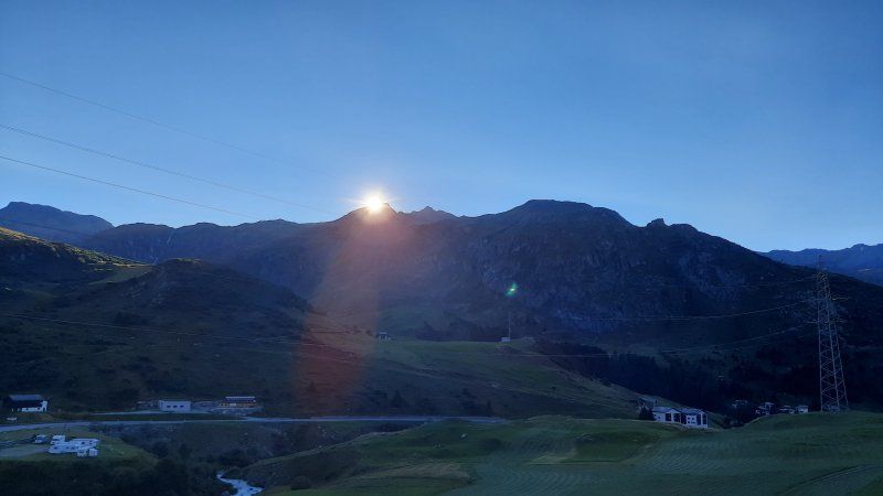
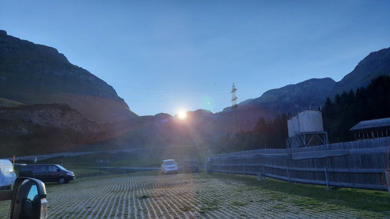
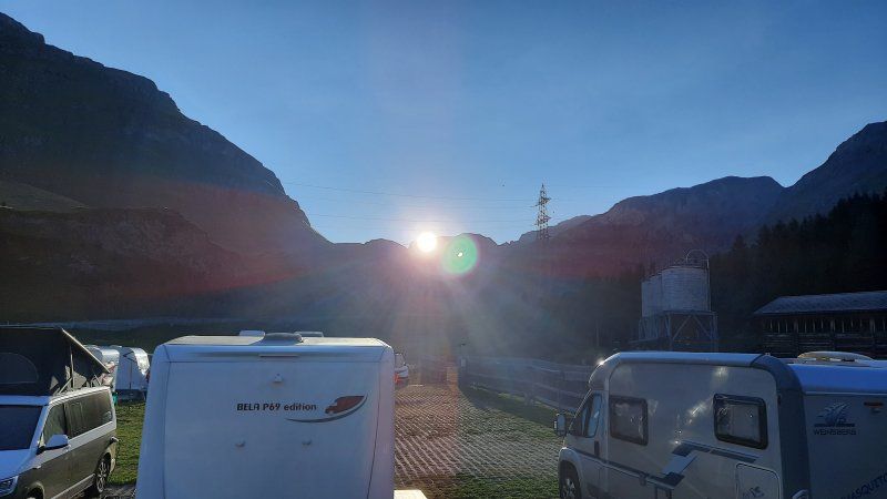
Sonnenaufgang Julierpass
The night was quiet and we slept very well. We didn't even notice a mobile home standing next to us during the night. In the morning there were five more mobile homes in the square. I woke up pretty early, I didn't want to miss the sunrise. It took a long time until the sun rose from behind the mountain peaks, it was 7:30 a.m. The daylight was already too bright to influence the effect of the sunlight. The outside temperature was 8 ° C in the morning, we preferred to have breakfast in the mobile home and then slowly got ready for the onward journey to Müstair, over the Ofen Pass.
Sta. Maria Val Müstair, Scoula
Driven to the parking lot at the entrance to the village. Originally we wanted to go to the campsite in Santa Maria. Today's plan is to ride the e-bike on the Umbrail Pass to the Stilfserjoch.
7536 Val Müstair, Schweiz
46° 36' 1.8" N 10° 25' 6.9" E
46.6005110 10.4185796
• Head east on Chasatschas (28). Go for 3.9 km.
• Arrive at Via Maistra (28). Your destination is on the right.
☍
3,9 km
( 5 min.)
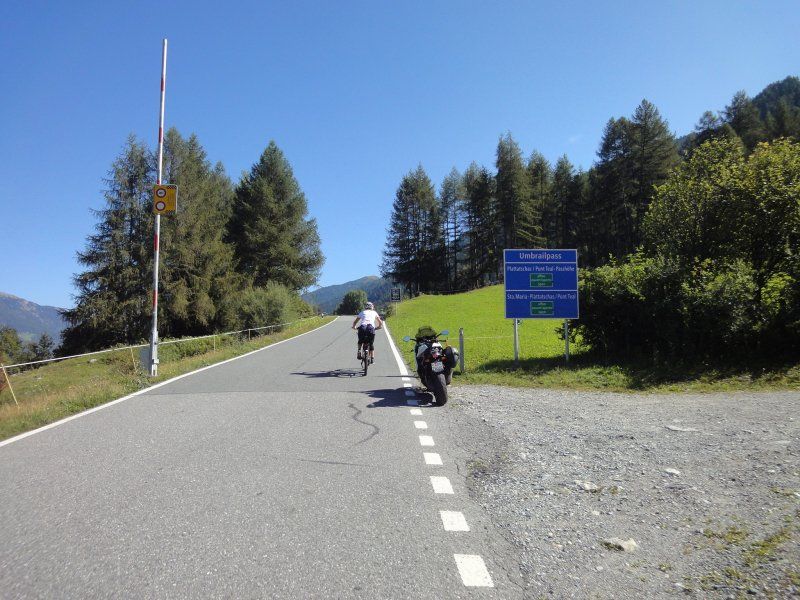
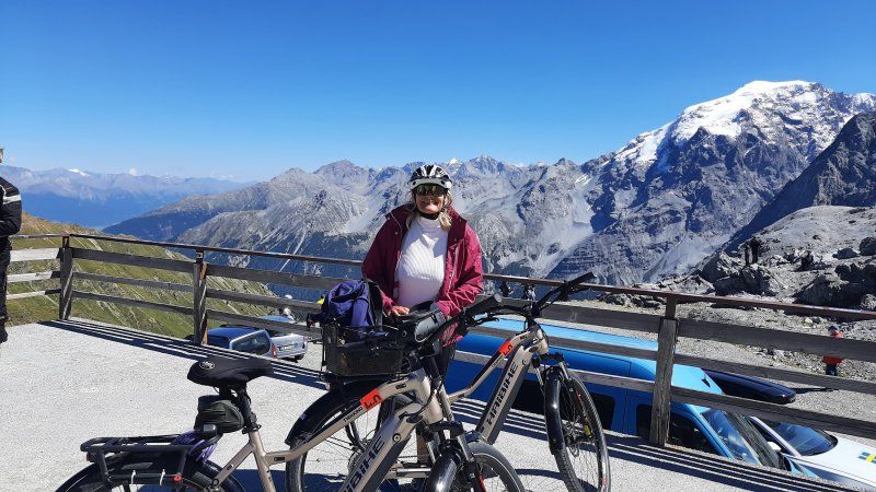
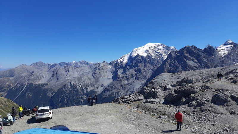
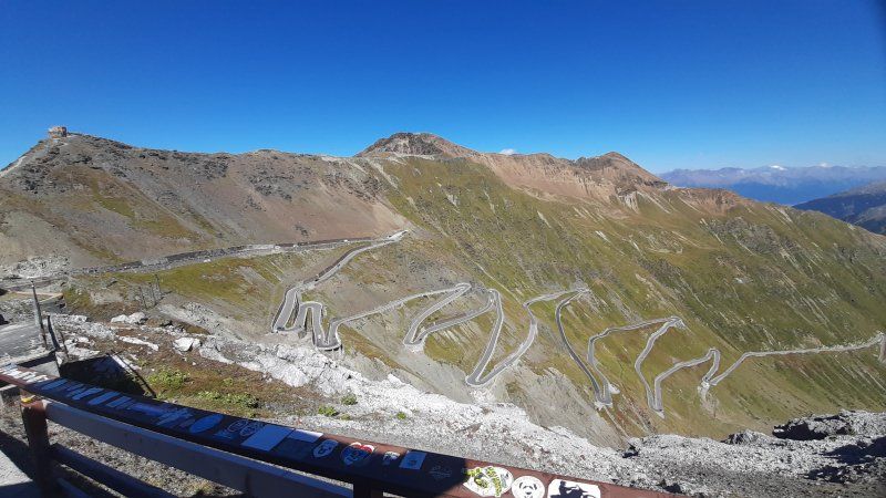
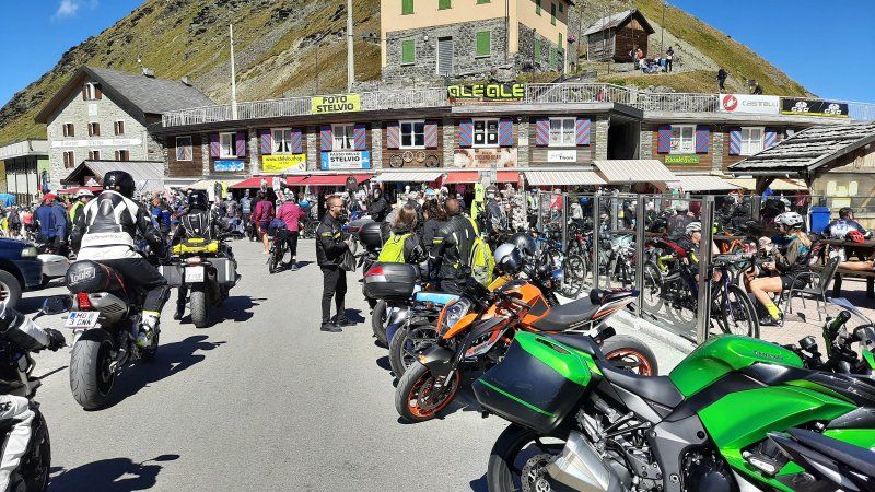
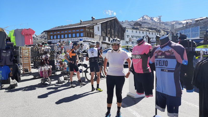
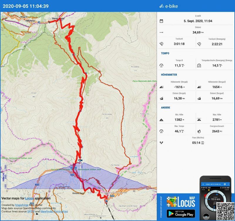
Radtour auf das Stilfser Joch
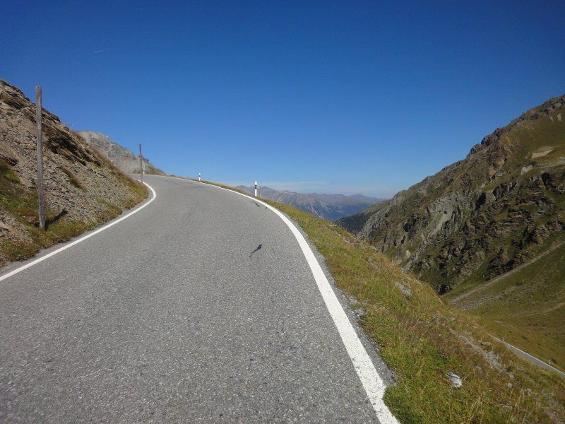
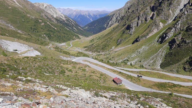
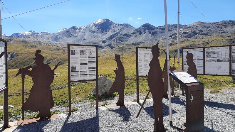
The bikes were quickly made ready for the tour and we set off on the pass road. The first section of the pass road is very steep with several 180 ° bends. I tried to ride the ride with the eco setting on the e-bike. Irmgard drove straight away with Strd. so she was a little faster than me. Despite my eco, Irmgard had more battery capacity than me at the border crossing to Italy and didn't have to work so hard with the Strd setting. From the limit I also drove with higher battery support and had to find out that my battery was running out even faster. Then I switched to the lowest gear (derailleur) and the smallest motor support (Eco +). The last bends I tortured myself to the top of the pass. Irmgard was up 10 minutes earlier and still had 4 lines out of 10 lines on the battery indicator, I only got to the finish line with one line. On the Stilfserjoch there was a crowd like at a folk festival, cyclists and bikers. There was nothing to be seen of Corona requirements. The parking lot was also very busy with skiers. But what impressed the most was the wonderful view of the mountain peaks, Ortler. Despite the sunshine, a cold wind blew around your ears. After a long rest, we went down the same way to Santa Maria. On the descent, Irmgard's brake shoes were completely worn down on the bike, so that the braking effect decreased and caused a loud noise. Upon closer inspection, it was found that the brake pads were abraded and the brake disc abraded. Both must be replaced again. After loading the bikes into the garage, we went on to Müstair.
Parkplatz Müstair
Short stop in the parking lot at the monastery.
Plaz d'Immez 65, 7537 Val Müstair, Schweiz
46° 37' 34.3" N 10° 26' 46.4" E
46.6261933 10.4462227
• Head north on Via Maistra (28). Go for 1.5 km.
• Continue on Strada Statale di Val Monastero (SS41). Go for 6.3 km.
• Turn left onto Strada Provinciale Laudes (SP104) toward Laatsch/Laudes/Mals/Malles Venosta. Go for 3.3 km.
• Turn slightly left onto Via Nazionale (SS40) toward Landeck/Reschen/Resia. Go for 3.9 km.
• Take the 2nd exit from roundabout onto Strada Statale del Passo Resia (SS40) toward Landeck. Go for 7.5 km.
• Turn left onto Via della Chiesa. Go for 48 m.
• Turn slightly left onto Via della Chiesa. Go for 115 m.
• Arrive at Via della Chiesa. Your destination is on the left.
☍
22,7 km
( 25 min.)
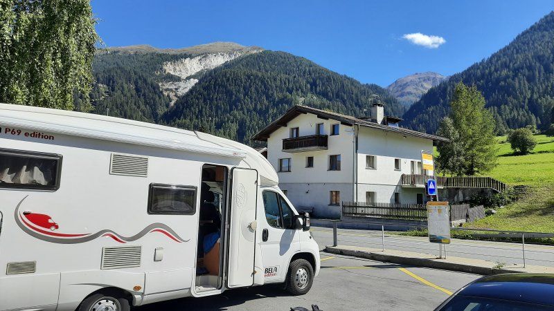
Stellplatz St.Valentin
When we arrived there were still two parking spaces available.
(GPS: 46.764099, 10.531; fee: 10.- €) Then walk to the Haidersee for a swim, to our famous spot on the lake, where there is reasonably good access to the water. The water temperature was pretty cold (16 ° C), Irmgard only swam a short lap. It was too cold for me, I only stood with my feet in the water for a short time. We spent the rest of the day at the Womo.
Camping zum See, Via Chiesa, 25, 39027 San Valentino Alla Muta BZ, Italien
46° 45' 49.9" N 10° 31' 53.5" E
46.7638562 10.5315149
• Head toward Via Campitello on Via della Chiesa. Go for 70 m.
• Turn right onto Via Campitello. Go for 160 m.
• Turn right onto Via della Chiesa. Go for 179 m.
• Turn left onto Strada Statale del Passo Resia (SS40). Go for 10.8 km.
• Continue on Reschenpass (B180). Go for 3.1 km.
• Turn right. Go for 111 m.
• Arrive at your destination on the left.
☍
14,4 km
( 14 min.)
Day
Parkplatz bei der Seilbahn
We parked the Womo in the almost empty large parking lot by the cable car. The parking lot is free of charge. From here we went on a hike to the Mutkopf. To get to the hiking trail, we first hiked 300 meters along the Reschenstrasse towards Nauders. After crossing the road it went uphill on a road in the forest. On the way there were many hiking signs that lead the way to different places, including the Schwarzsee, we decided to start at the Mutkopf. Below the summit, the path runs steeply uphill along a biker trail on which you can marvel at the bikers' driving skills. At the top there is nothing special to see, the view is limited. In the south stands the magnificent mountain range of Piz Lad, which was shrouded in gray rain clouds. For the descent we chose path number 9 that leads to the Schwarzsee. The hiking trail was more varied than the ascent path. Moors and forest meadows enriched the path. When we got to the Schwarzsee it started to rain. The lake is a moor lake and is idyllically situated in a depression. From the lake it was only downhill on a little road. On the way it stopped raining and there was a stop at one of the "Riasch" inns on the terrace of which we enjoyed an ice cream (hot love and plum cake with vanilla ice cream). On the last few meters to the parking lot, we were surprised by strong thunderstorms and arrived at the motorhome dripping wet.
Nauders 299, 6543 Nauders, Österreich
46° 52' 31.8" N 10° 30' 30.7" E
46.8755037 10.5085275
• Head west. Go for 111 m.
• Turn right onto Reschen Bundesstraße (B180). Go for 1.3 km.
• Turn left onto Martinsbrucker Straße (B185) toward St. Moritz. Go for 7.6 km.
• Continue toward Plan da La Punt. Go for 16 m.
• Continue on Plan da La Punt. Go for 13 m.
• Turn right onto 27. Go for 48 m.
• Make a U-Turn at Plan da La Punt onto Hauptstrasse (27). Go for 18.7 km.
• Pass 2 roundabouts and continue on 27. Go for 19.6 km.
• Turn right onto Grava (28). Go for 25.8 km.
• Turn right onto Sandstrasse (28). Go for 51 m.
• Turn right onto Bahnhofstrasse (28). Go for 8.1 km.
• Take ramp. Go for 107 m.
• Take the 1st exit from roundabout. Go for 211 m.
• Take the 2nd exit from roundabout onto Davoserstrasse. Go for 1.2 km.
• Turn left onto Grischunaweg. Go for 2.5 km.
• Turn right onto Madrisastrasse. Go for 254 m.
• Arrive at Madrisastrasse. Your destination is on the right.
☍
85,6 km
(1 hrs. 29 min.)
Klosters
The journey from Nauders over the Flüelapass took place in continuous rain. At the top of the Flüela pass, there was also thick fog. To the left of the street, the Hospitzhaus was not even clearly visible. With the third crossing of the pass, we experienced all weather conditions. Snow, sunshine, rain and fog.
In Klosters we drove to the parking lot (GPS: 46.884488, 9.876562) by the cable car. When driving through the center one did not see much of the supposedly pretty village. The fog and rain made everything seem gloomy. Parking fee: € 24 (€ 15, € 4.50 tourist tax)
7252 Klosters-Serneus, Schweiz
46° 53' 4.1" N 9° 52' 32.4" E
46.8844652 9.8756785
• Head southeast on Madrisastrasse. Go for 214 m.
• Turn right onto Landstrasse. Go for 365 m.
• Continue on Kantonsstrasse. Go for 1.6 km.
• Take ramp onto 28. Go for 1.1 km.
• Pass 2 roundabouts and continue on 28. Go for 26.6 km.
• Continue on Karlihof. Go for 492 m.
• Continue on Ragazerstrasse (3/13). Go for 404 m.
• Take ramp onto A13 toward Zürich/St. Margrethen. Go for 10.1 km.
• Take exit 11 toward St. Gallen/St. Margrethen/München/Feldkirch/Vaduz onto A13. Go for 52.8 km.
• Continue on A1 toward Rheineck. Go for 17.4 km.
• Take exit 84 toward A1.1/Kreuzlingen/Arbon/Rorschach onto A23. Go for 8.7 km.
• Turn left onto Buch (13) toward Frasnacht. Go for 1.5 km.
• Pass 3 roundabouts and continue on Arbonerstrasse (13). Go for 3.4 km.
• Take the 3rd exit from Hubkreisel roundabout onto Kreuzlingerstrasse (13). Go for 3.2 km.
• Pass 9 roundabouts and continue on Romanshornerstrasse (13). Go for 12.8 km.
• Turn right onto Seetalstrasse (13). Go for 456 m.
• Take the 1st exit from roundabout onto Bleichestrasse. Go for 430 m.
• Turn right onto Schwimmbadstrasse. Go for 55 m.
• Turn slightly left onto Schwimmbadstrasse. Go for 47 m.
• Turn slightly left. Go for 17 m.
• Turn right. Go for 9 m.
• Turn slightly left. Go for 8 m.
• Turn left. Go for 23 m.
• Arrive at your destination.
☍
141,7 km
(1 hrs. 37 min.)
Day
Wir haben uns für die Heimfahrt entschieden
After a rainy night we decided to start our journey home. The cloudy, rainy and foggy morning made no desire for activities, not even to take a closer look at the village of Klosters. We planned to go on a hike today, the weather prevented us from doing it. The parking space was okay, there was a clean toilet in the log cabin next door. The fee had to be paid at the ticket office of the cable car. There were three more German mobile homes on the pitch.
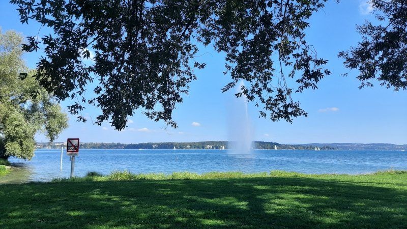
Badestopp in Kreuzlingen
Migros parking lot parked. Irmgard swam a little lap in Lake Constance. The sea had big waves with whitecaps, the water temperature was announced on the radio as 19 ° C. Air temperature 21 ° C. Then we continued our journey home
Schwimmbadstrasse 2, 8280 Kreuzlingen, Schweiz
47° 38' 42.1" N 9° 11' 54" E
47.6450324 9.1983219
• Head south. Go for 29 m.
• Turn left toward Schwimmbadstrasse. Go for 22 m.
• Turn right onto Schwimmbadstrasse. Go for 20 m.
• Turn left onto Bleichestrasse. Go for 416 m.
• Take the 1st exit from roundabout onto Seetalstrasse (13). Go for 876 m.
• Take the 2nd exit from roundabout onto Hafenstrasse (13). Go for 618 m.
• Take the 3rd exit from roundabout onto Hafenstrasse (13). Go for 914 m.
• Pass 2 roundabouts and continue on Konstanzerstrasse (1/13). Go for 655 m.
• Take the 3rd exit from roundabout onto Tägerwilerstrasse (13). Go for 287 m.
• Keep right toward Konstanz. Go for 112 m.
• Keep right toward A7. Go for 96 m.
• Continue on A7. Go for 646 m.
• Continue on B33. Go for 29.8 km.
• Continue on A81. Go for 735 m.
• Take the left exit onto A81. Go for 52.6 km.
• Take exit 34 toward Rottweil. Go for 376 m.
• Turn right onto B462 toward Rottweil/Balingen/B14/B27. Go for 1.9 km.
• Continue on B14 toward Tübingen/Balingen/Oberndorf/Villingendorf/Rottweil-Nord/Gewerbegebiet Berner Feld/Gewerbegebiet Neckartal. Go for 27 m.
• Take ramp onto B14 toward Tübingen/Balingen/Oberndorf/Villingendorf/Rottweil-Nord/Gewerbegebiet Berner Feld/Gewerbegebiet Neckartal. Go for 624 m.
• Continue on B27. Go for 272 m.
• Pass 2 roundabouts and continue on Nordumgehung (B27). Go for 8.0 km.
• Arrive at Schömberger Straße (B27). Your destination is on the right.
☍
99,0 km
(1 hrs. 1 min.)
Neukirch, Rottweil, Deutschland
Neukirch, 78628 Rottweil, Deutschland
48° 11' 50.3" N 8° 41' 59.3" E
48.1972963 8.6997975