Unfortunately, we don't support your browser (Internet Explorer) anymore, some functionalities could not work. Click here to get information on how to upgrade your browser.
Switzerland worth seeing

Travelogue
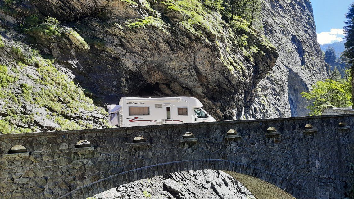
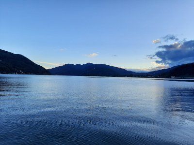
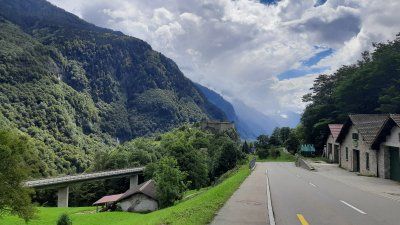
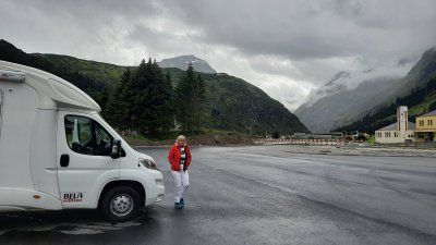
At 10.15 a.m. we reached the Swiss border. On the highway there were strong gusts of wind that brought the Womo off track. The weather service warned of squalls on the Feldberg with peaks of 80 - 100 km / h.
There wasn't much going on at the border, we could cross the border without stopping.
At 10.15 a.m. we reached the Swiss border. On the highway there were strong gusts of wind that brought the Womo off track. The weather service warned of squalls on the Feldberg with peaks of 80 - 100 km / h.
There wasn't much going on at the border, we could cross the border without stopping.
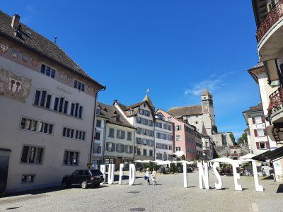
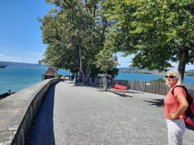
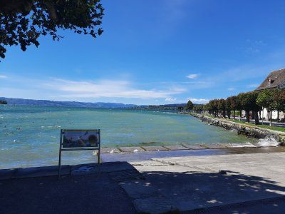
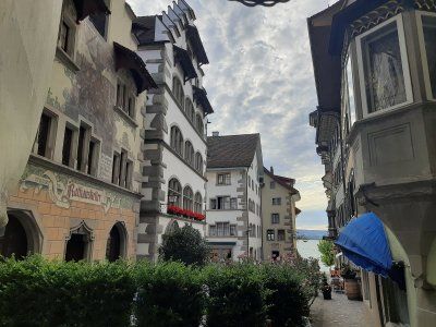
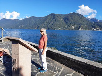
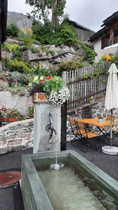
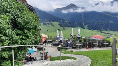
Before we set out on the 2.3 km walk into the old town of Rapperswill, we had our lunch coffee first.
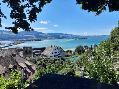
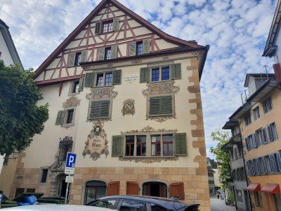
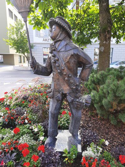
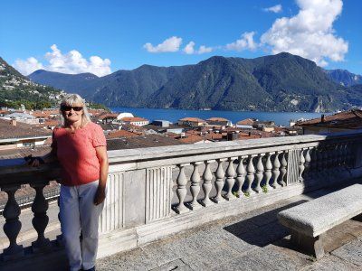
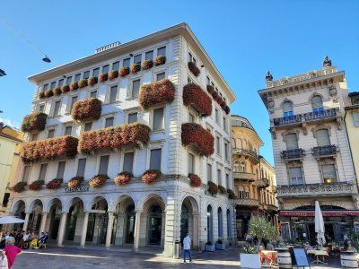
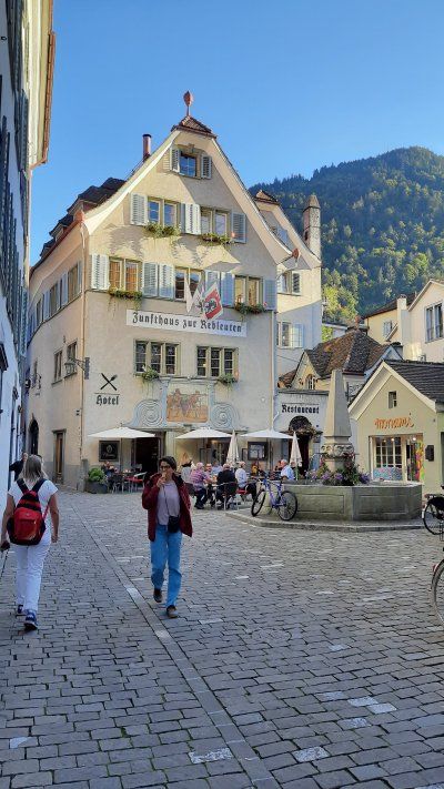
On the way to the old town it was very hot, the thermometer showed 30 degrees. We were surprised about the historic old town with the castle.
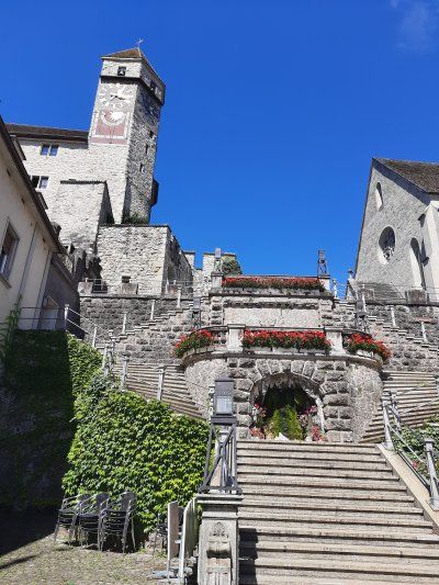
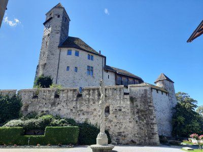
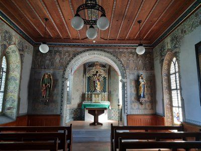
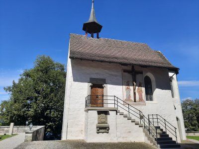
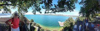
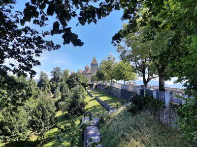
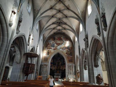
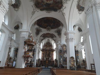
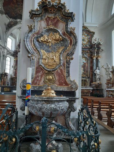
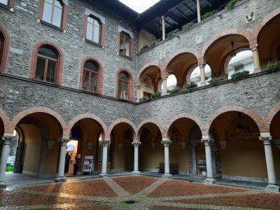
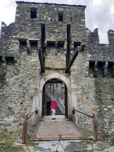
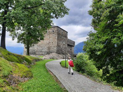
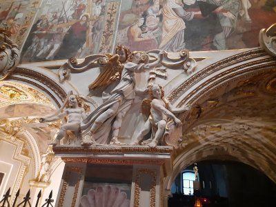
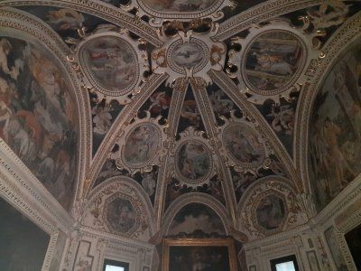
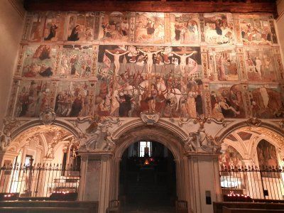
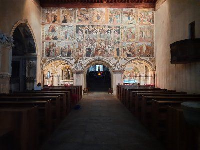
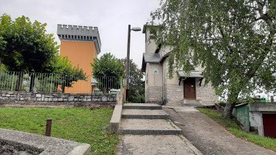
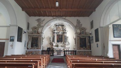
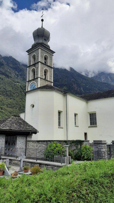
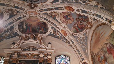
Whenever we're in Rapperswil, we didn't want to miss the walk up to the castle. The short ascent is rewarded with a great view of the old town and Lake Zurich and next to the beautiful old castle building a beautiful, small church.
This small church is located behind the Rapperswil Castle, has a dark but beautiful interior with wall paintings and sculptures on the altar and only on the sides. There is a wooden ceiling and the murals are actually a mix of the painting and sculpture.
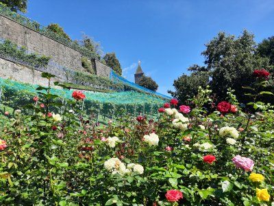
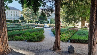
Directly under the castle a very nice garden with lots of beautiful roses.
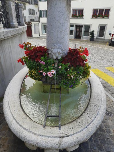
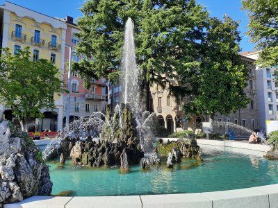
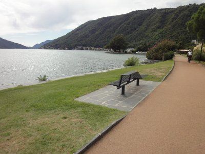
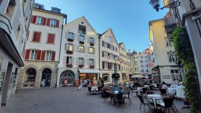
The lake promenade with its beautiful cafes invites you to linger and stroll.
The sightseeing tour was very exhausting on this hot day, so we made sure as soon as possible that we should continue to Zug, where hopefully Lake Zug will be waiting for us to swim.
Before we set out on the 2.3 km walk into the old town of Rapperswill, we had our lunch coffee first.
On the way to the old town it was very hot, the thermometer showed 30 degrees. We were surprised about the historic old town with the castle.
Whenever we're in Rapperswil, we didn't want to miss the walk up to the castle. The short ascent is rewarded with a great view of the old town and Lake Zurich and next to the beautiful old castle building a beautiful, small church.
This small church is located behind the Rapperswil Castle, has a dark but beautiful interior with wall paintings and sculptures on the altar and only on the sides. There is a wooden ceiling and the murals are actually a mix of the painting and sculpture.
Directly under the castle a very nice garden with lots of beautiful roses.
The lake promenade with its beautiful cafes invites you to linger and stroll.
The sightseeing tour was very exhausting on this hot day, so we made sure as soon as possible that we should continue to Zug, where hopefully Lake Zug will be waiting for us to swim.
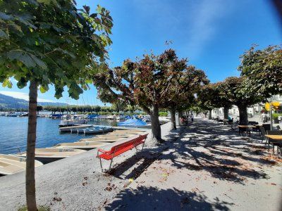
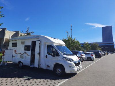
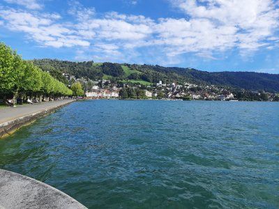
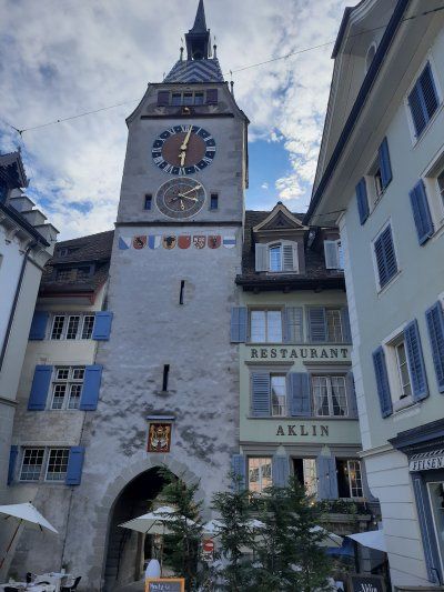
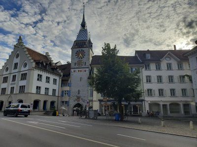
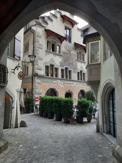
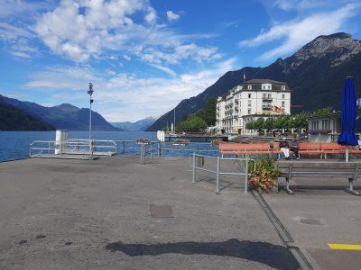
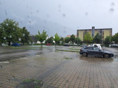
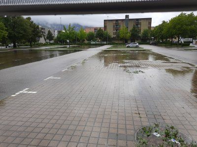
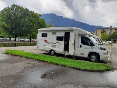
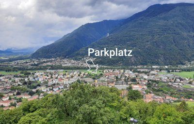
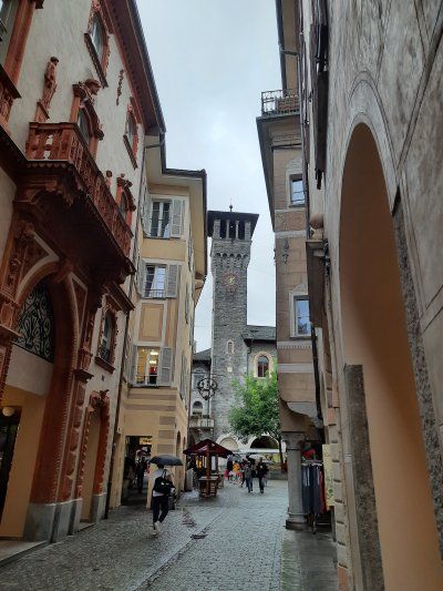
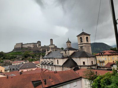
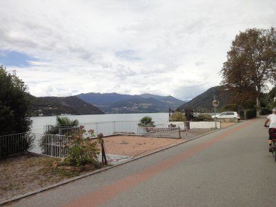
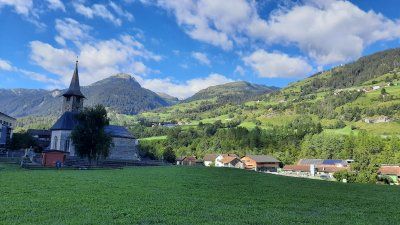
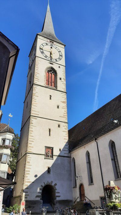
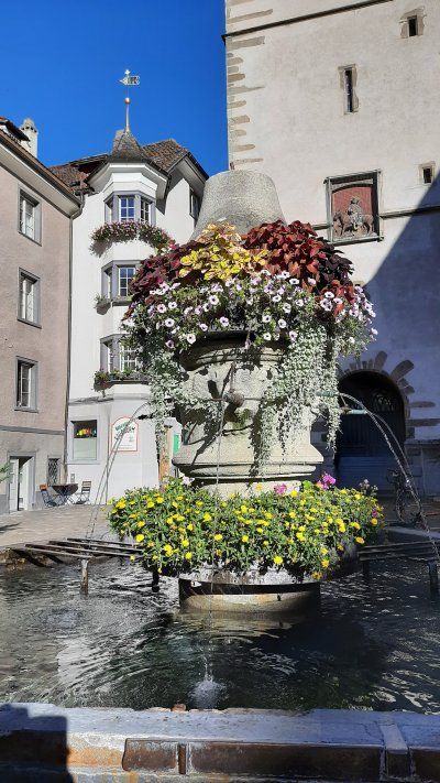
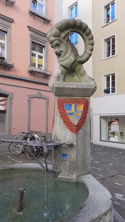
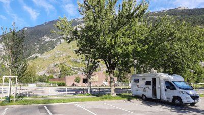
The parking lot (GPS: 47.179995, 8.50802) in Zug was easy to drive to, it was next to the stadium. The parking lot was well occupied, the parking areas are not suitable for larger mobile homes over 6 m. At our place we were able to let the rear of the camper protrude one meter into the sidewalk. On the opposite side, the parking areas are limited by a hedge. We took a lunch break and had a coffee before we went to the lido, 15 minutes away, to swim. The bath is free, has a beautiful lawn with a sandy beach. The yellow flashing lights indicated a storm warning on Lake Zug, there were strong waves on the lake. Irmgard don't mind the waves while swimming, I prefer a smooth sea for swimming. After swimming, we took a walk through the historic old town of Zug. If you walk along the lakeshore, you come to the area of the old town with the Landsgemeindeplatz (where citizens used to meet to vote and vote) and the two old town streets. If you go through the city gate, you come to the "suburb" with the old armory. The 52 meter high Zytturm is Zug's landmark. It was created in the middle of the 13th century as a simple passage. Until the construction of the second curtain wall, the tower served as a lockable entrance to the city. In 1574 the tower received the large clock and the astronomical dial on the side facing Kolinplatz.
Astronomical clock
On the east side of the Zytturm there is an astronomical clock below the dial. This has four pointers: the arrow shows the current day of the week (based on the gods and astonomic signs, above is Sunday), the crescent moon the phase of the moon (above is empty moon, below is full moon), the sun the month (based on the signs of the zodiac, below is the Change of year from December to January) and the letter S the leap year (points downwards when a leap year begins). Above the dial there is a ball that also shows the current moon phase.
Interesting buildings from the 16th and 17th centuries stand on Kolinplatz: the Kolinbrunnen (1541), the town house (also called Bossardhaus) (1543), and the Kolinhaus (1665). The four-storey town hall of Zug, built by the master builder Heinrich Sutter from 1505 to 1509, is an important secular architectural monument of the late Gothic period in Switzerland. Up the street from the suburbs is the “castle” which houses a museum with changing exhibitions. Also along the lake is part of the suburb. During a severe storm in July 1876, a whole row of houses was washed into the lake. That's why the beautiful park is there now.
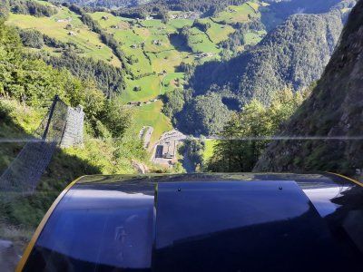
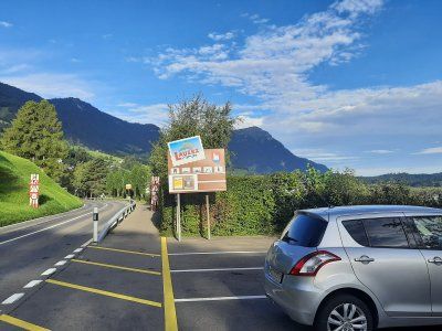
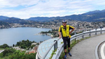
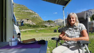
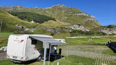
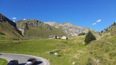
The journey here was relatively quick, there was some rush hour traffic at Zug and construction sites with traffic lights were set up on the Bergstrasse to the Stossbahn. In the lower parking lot (GPS: 46.99272, 8.67452) we were able to park on a flat parking area. The entrance to the parking lot is with a barrier. Now it was celebrated once, the Stossbahn goes up every 30 minutes to Stoss. We took the departure time 9:40 am as our destination.
Fare: Ascent and descent 22.- Sfr
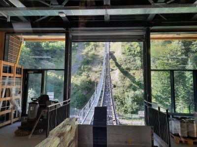
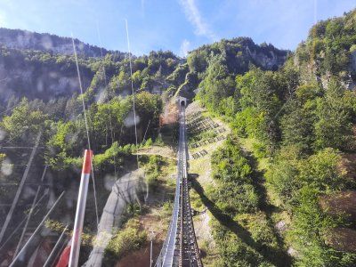
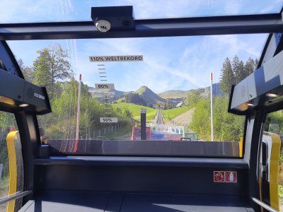
Steepest funicular in the world. Incline of up to 110 percent (47 degrees) an impressive experience with the funicular up to Stoos.
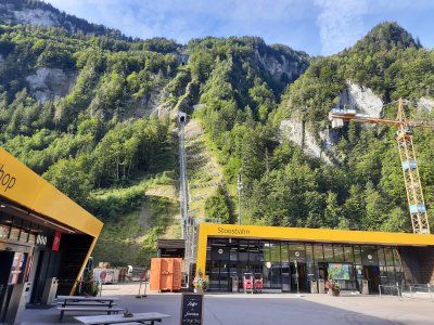
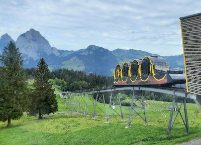
The journey here was relatively quick, there was some rush hour traffic at Zug and construction sites with traffic lights were set up on the Bergstrasse to the Stossbahn. In the lower parking lot (GPS: 46.99272, 8.67452) we were able to park on a flat parking area. The entrance to the parking lot is with a barrier. Now it was celebrated once, the Stossbahn goes up every 30 minutes to Stoss. We took the departure time 9:40 am as our destination.
Fare: Ascent and descent 22.- Sfr
Steepest funicular in the world. Incline of up to 110 percent (47 degrees) an impressive experience with the funicular up to Stoos.
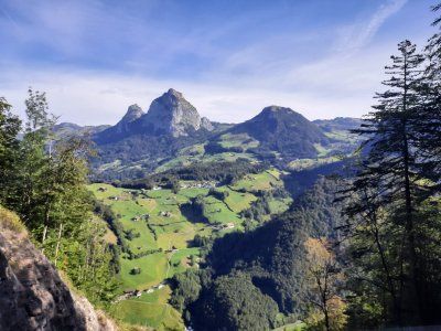
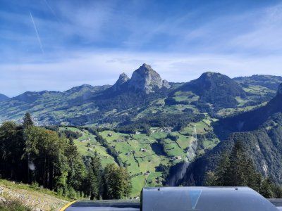
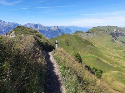
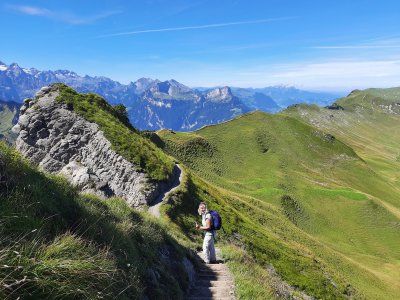
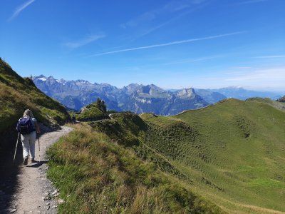
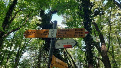
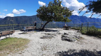
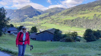
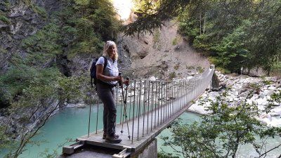
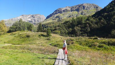
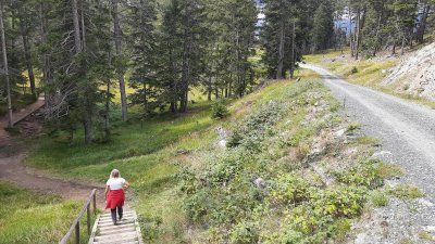
Today, again, wonderful mountain weather was announced that many hikers took advantage of. The Stossbahn brought us to the mountain station at 1200 meters. The car-free village of Stoss is also located here. In the village there was a yawning silence, only the noise of a large construction site could be heard. The hotels and guest houses were all empty. Even the cafes and restaurants were closed. We oriented ourselves according to the hiking signs that lead us to the blade stick. The Klingenstock circuit is one of the most beautiful panoramic mountain tours in Central Switzerland.
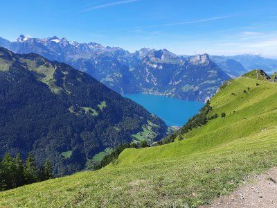
Hike: We did a great tour; From Stoos Dorf we climbed the Klingenstock and then walked over the easily accessible ridge path, which also has many vertical meters in itself, to the Fronalpstock, because on the way you have a spectacular view of over 10 lakes and countless alpine peaks in Central Switzerland. Have a cappuccino on the terrace of the restaurant on the Fronalpstock before descending. From there descended to Stoos. Fantastic view. Great tour!
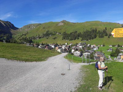
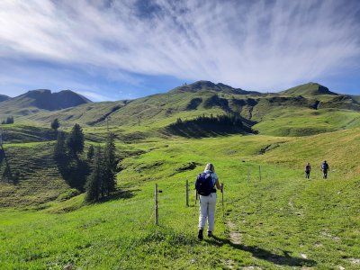

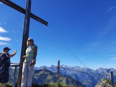
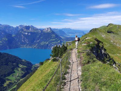
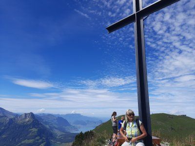
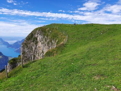
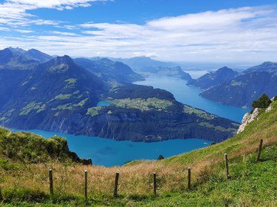

Today, again, wonderful mountain weather was announced that many hikers took advantage of. The Stossbahn brought us to the mountain station at 1200 meters. The car-free village of Stoss is also located here. In the village there was a yawning silence, only the noise of a large construction site could be heard. The hotels and guest houses were all empty. Even the cafes and restaurants were closed. We oriented ourselves according to the hiking signs that lead us to the blade stick. The Klingenstock circuit is one of the most beautiful panoramic mountain tours in Central Switzerland.
Hike: We did a great tour; From Stoos Dorf we climbed the Klingenstock and then walked over the easily accessible ridge path, which also has many vertical meters in itself, to the Fronalpstock, because on the way you have a spectacular view of over 10 lakes and countless alpine peaks in Central Switzerland. Have a cappuccino on the terrace of the restaurant on the Fronalpstock before descending. From there descended to Stoos. Fantastic view. Great tour!
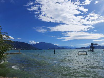
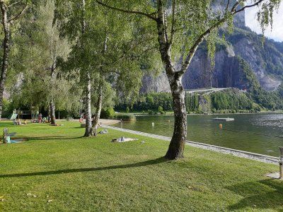
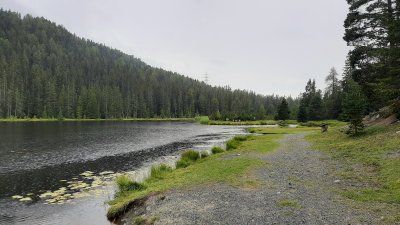
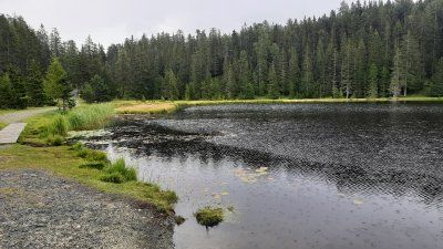
After our dreamy but exhausting hike, we did not go to Stans near Lucerne as planned, but used the hot day again to swim. The Lauener See was only 5 km away on our route. The parking lot next to the ice rink and the lido was pretty empty. There were hardly any bathers in the bathroom either. Entry cost 5 Sfr./P.
Water temperature: 21 degrees
Air temperature: 26 degrees The bathing beaches are beautiful with a bathing jetty, swimming islands and specially created sandy beaches. We stayed in the bathroom almost until 8 p.m., which also closes at 8 p.m. Parking fees none (payable 7 a.m. - 4 p.m.)
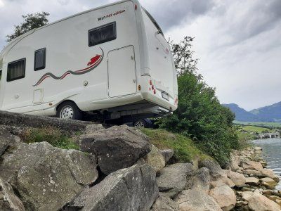
Had to change parking spaces at 10:02 p.m. The parking lot at the lido was very noisy due to the highway and railroad passing by. The freight trains thundered past in a five-minute tack. In addition, a constantly running roaring cooling unit from the adjacent ice rink. The new parking lot is only 3 km away directly on the lake. We found free parking spaces, but too short for our mobile home. We were able to use one of them by letting the rear of the caravan protrude over the parking area and over the water. The calm did not return until around midnight, and there was occasional car traffic on the road passing by. In the morning 6 - 7 o'clock it got very loud with the rush hour traffic.
Had to change parking spaces at 10:02 p.m. The parking lot at the lido was very noisy due to the highway and railroad passing by. The freight trains thundered past in a five-minute tack. In addition, a constantly running roaring cooling unit from the adjacent ice rink. The new parking lot is only 3 km away directly on the lake. We found free parking spaces, but too short for our mobile home. We were able to use one of them by letting the rear of the caravan protrude over the parking area and over the water. The calm did not return until around midnight, and there was occasional car traffic on the road passing by. In the morning 6 - 7 o'clock it got very loud with the rush hour traffic.
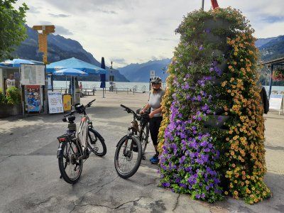
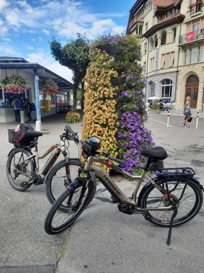
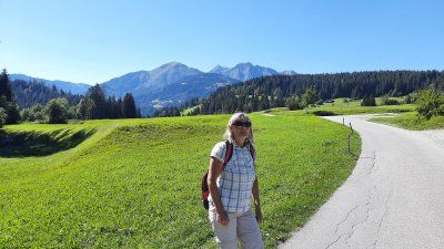
Today we took it easy and slept in. After breakfast we set out on a bike tour to Brunnen on Lake Vierwaltstätter See, the city of Schwyz and the bypass of Lake Lauen.
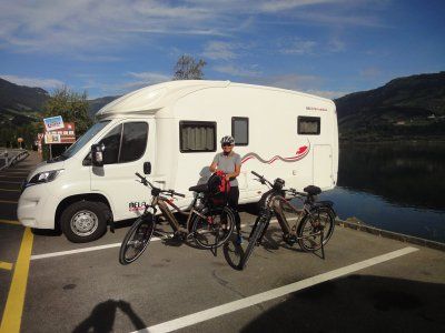
Today we took it easy and slept in. After breakfast we set out on a bike tour to Brunnen on Lake Vierwaltstätter See, the city of Schwyz and the bypass of Lake Lauen.
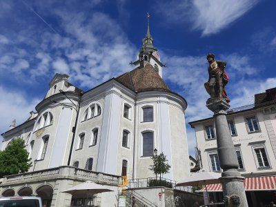
The small village of Brunnen, then inhabited by fishermen and boaters, was founded in the High Middle Ages. In the course of time it developed into an important port and loading point for the Canton of Schwyz. In 1620, a large part of the buildings was destroyed by a devastating fire.

The small village of Brunnen, then inhabited by fishermen and boaters, was founded in the High Middle Ages. In the course of time it developed into an important port and loading point for the Canton of Schwyz. In 1620, a large part of the buildings was destroyed by a devastating fire.
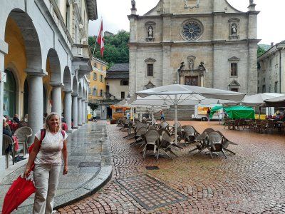
Switzerland owes its name and coat of arms to the town of Schwyz. In 1291 Uri, Schwyz and Unterwalden formed a union and in 1315 they drove out the Austrians with the victory in the Battle of Morgarten. The town hall of Schwyz is a listed parliament and court building. It is known for the historicist facade painting by Ferdinand Wagner from 1891. Like the baroque parish church of St. Martin and the hotel "Wysses Rössli", the town hall is located on the main square in the center of Schwyz.
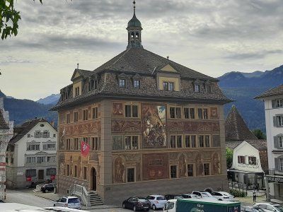
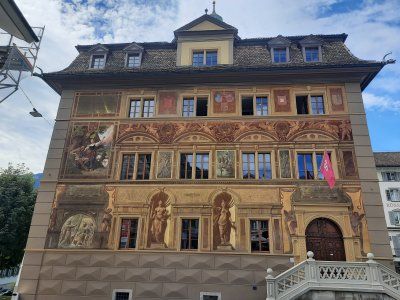
Switzerland owes its name and coat of arms to the town of Schwyz. In 1291 Uri, Schwyz and Unterwalden formed a union and in 1315 they drove out the Austrians with the victory in the Battle of Morgarten. The town hall of Schwyz is a listed parliament and court building. It is known for the historicist facade painting by Ferdinand Wagner from 1891. Like the baroque parish church of St. Martin and the hotel "Wysses Rössli", the town hall is located on the main square in the center of Schwyz.
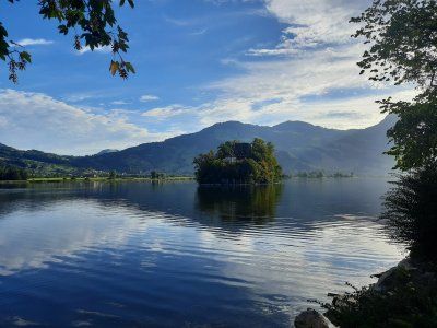
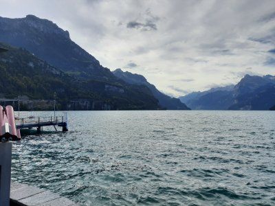
The Lauerzersee is located between the Vierwaldstättersee and Zugersee. With its maximum water depth of 14 m, it is one of the shallowest lakes in Switzerland. The island of Schwanau is located in the Lauerzersee on it is a preserved chapel and castle ruins. Also an inn.
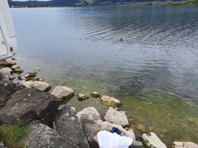
After arriving at the Womo and stowing the bikes in the rear garage, we drank our afternoon coffee with a piece of cake. It was still so warm that we went swimming in the lake afterwards. Behind our mobile home there was a stony entrance to the lake. Start: 2:30 p.m.
Then we started towards Bellinzona to our destination for the day.
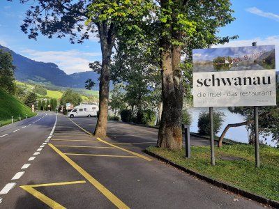
The Lauerzersee is located between the Vierwaldstättersee and Zugersee. With its maximum water depth of 14 m, it is one of the shallowest lakes in Switzerland. The island of Schwanau is located in the Lauerzersee on it is a preserved chapel and castle ruins. Also an inn.
After arriving at the Womo and stowing the bikes in the rear garage, we drank our afternoon coffee with a piece of cake. It was still so warm that we went swimming in the lake afterwards. Behind our mobile home there was a stony entrance to the lake. Start: 2:30 p.m.
Then we started towards Bellinzona to our destination for the day.
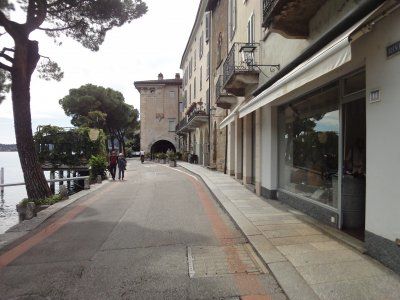
After visiting the castles we strolled through the alleys of the old town and arcades that go back to the 16th century. The Palazzo Communale (town hall) was built in 1921–1926 in place of the late medieval town hall. The rectangular floor plan, the loggia courtyard and the high tower are based on the type of the Italian medieval town hall.
Piazza Collegiata
The current square got its appearance in the 17th century. The current construction of the collegiate church Santi Pietro e Stefano began in 1515. The tower dates from 1567/1573, the facade cladding from 1640/54, the choir was expanded between 1684 and 1785, and the current appearance of the monumental staircases dates from the
19th century. The three-axis renaissance facade was completed in the Baroque era, the main portal dates from 1640.
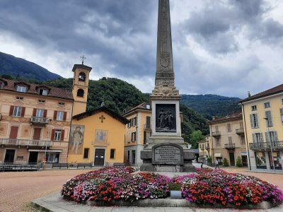
Piazza Indipendenza Square in the style of the 19th century. In the middle of the square there is an obelisk from 1903, which commemorates the construction of today's canton in 1803.
In the evening it started to rain again. I used the rainy day to write my logbook. In the course of the day two more Womos stood next to us to stay overnight.
After visiting the castles we strolled through the alleys of the old town and arcades that go back to the 16th century. The Palazzo Communale (town hall) was built in 1921–1926 in place of the late medieval town hall. The rectangular floor plan, the loggia courtyard and the high tower are based on the type of the Italian medieval town hall.
Piazza Collegiata
The current square got its appearance in the 17th century. The current construction of the collegiate church Santi Pietro e Stefano began in 1515. The tower dates from 1567/1573, the facade cladding from 1640/54, the choir was expanded between 1684 and 1785, and the current appearance of the monumental staircases dates from the
19th century. The three-axis renaissance facade was completed in the Baroque era, the main portal dates from 1640.
Piazza Indipendenza Square in the style of the 19th century. In the middle of the square there is an obelisk from 1903, which commemorates the construction of today's canton in 1803.
In the evening it started to rain again. I used the rainy day to write my logbook. In the course of the day two more Womos stood next to us to stay overnight.
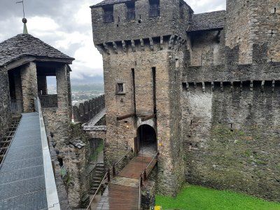
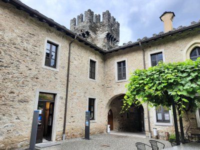
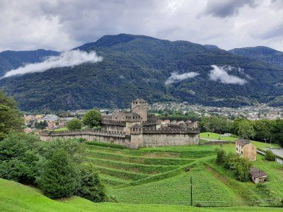
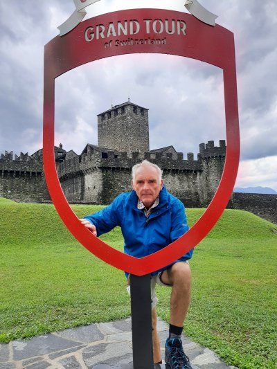
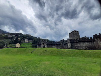
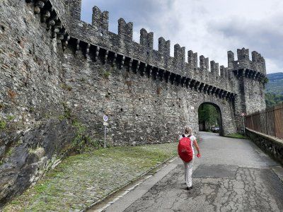
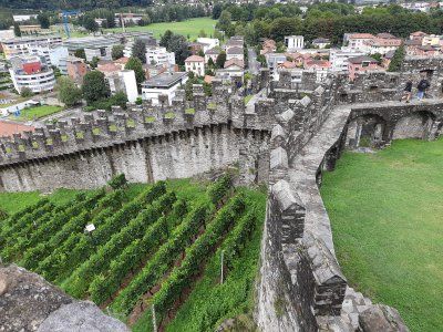
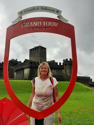
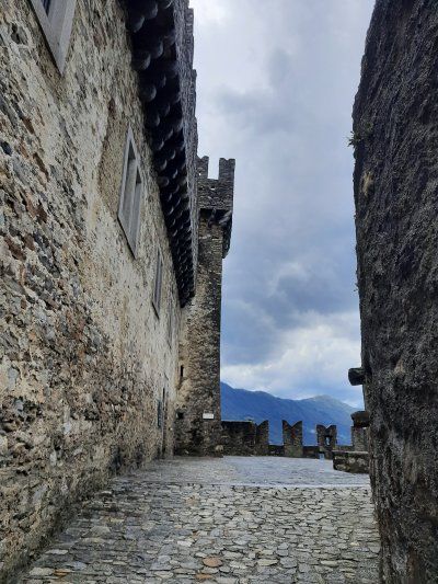
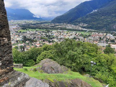
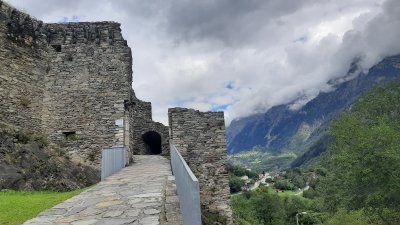
From the hill of Montebello, on which Bellinzona's second Castello towers 90 meters above the city, we look down on the Castelgrande. From here ran the walls that once encircled the old town up to the walls that led down from the hill of S. Michele. Parts of this curtain wall, which protected the northern and southern flanks of the huge triangular fortress, still exist today. The oldest internal wall core comes from the 13th / 14th centuries. Century. After a tour of the castle and the outside area, we took a souvenir photo at the photo spot of the Grand Tour of Switzerland!
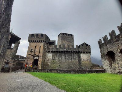
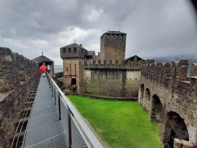
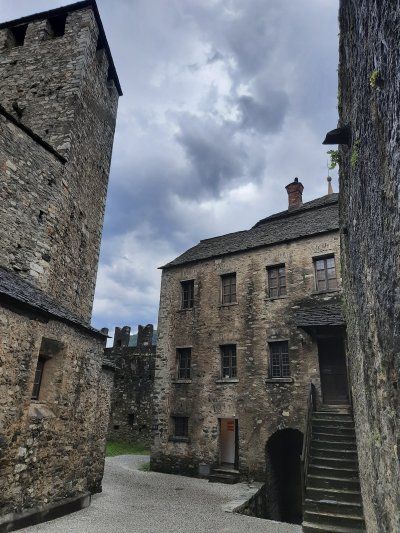
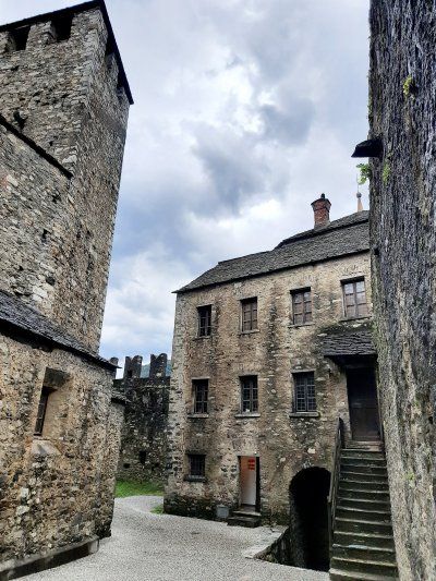
From the hill of Montebello, on which Bellinzona's second Castello towers 90 meters above the city, we look down on the Castelgrande. From here ran the walls that once encircled the old town up to the walls that led down from the hill of S. Michele. Parts of this curtain wall, which protected the northern and southern flanks of the huge triangular fortress, still exist today. The oldest internal wall core comes from the 13th / 14th centuries. Century. After a tour of the castle and the outside area, we took a souvenir photo at the photo spot of the Grand Tour of Switzerland!
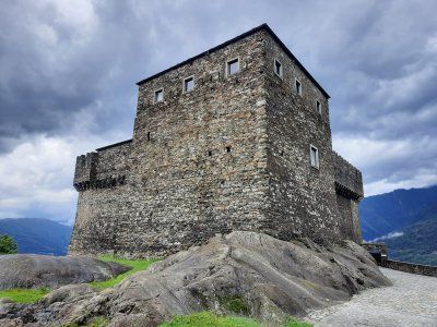
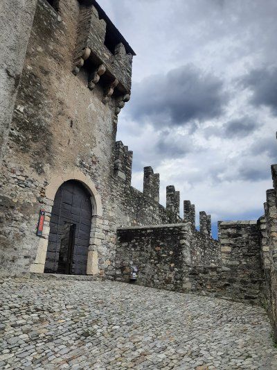
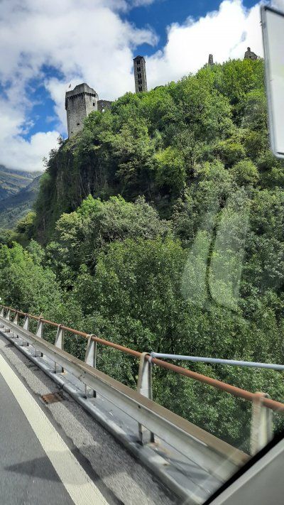
The Castello di Sasso Corbaro is the only one of the 3 castles with a precise date of construction: It was the year 1479. The fortress was built in just over 6 months. The name of this fortress is based on its geographical location: the Castello is located on a rocky ledge that is as dark as the feathers of ravens (the dialectal name for "raven" is "corbatt"). This is a typical Sforza castle, the masonry of which is limited to basic geometric shapes. In addition to the square inner courtyard, which is surrounded by high walls, there is also a massive main tower and the observation tower. The Castello di Sasso Corbaro sits elegantly at 230 meters above Bellinzona and offers a fantastic panoramic view
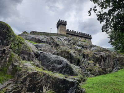


The Castello di Sasso Corbaro is the only one of the 3 castles with a precise date of construction: It was the year 1479. The fortress was built in just over 6 months. The name of this fortress is based on its geographical location: the Castello is located on a rocky ledge that is as dark as the feathers of ravens (the dialectal name for "raven" is "corbatt"). This is a typical Sforza castle, the masonry of which is limited to basic geometric shapes. In addition to the square inner courtyard, which is surrounded by high walls, there is also a massive main tower and the observation tower. The Castello di Sasso Corbaro sits elegantly at 230 meters above Bellinzona and offers a fantastic panoramic view
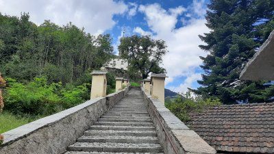
To the third castle we descended again into the old town, where the Castelgrande stands on the mighty hill. The first human settlement on the hill of San Michele dates back to 5500/5000 BC. BC (Neolithic). The first archaeologically confirmed fortress was built in the 4th century AD. Various documents from the 6th century also confirm the existence of a fortification. The Latin name for Castelgrande, Castel Magnum, appeared for the first time in the 14th century. This is also the current name.


To the third castle we descended again into the old town, where the Castelgrande stands on the mighty hill. The first human settlement on the hill of San Michele dates back to 5500/5000 BC. BC (Neolithic). The first archaeologically confirmed fortress was built in the 4th century AD. Various documents from the 6th century also confirm the existence of a fortification. The Latin name for Castelgrande, Castel Magnum, appeared for the first time in the 14th century. This is also the current name.
The second night was also quiet, the parking lot was empty and there were repeated showers during the night.
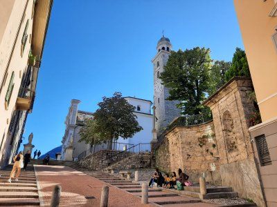
Before we left, we looked for the church of Santa Maria delle Grazie in the south of the city, which originally belonged to a Franciscan monastery. The church contains Renaissance frescoes from the Lombard school, which are among the most important in the canton of Ticino (around 1510). We made it to the church in time, after which a massive thunderstorm came down, which made for a longer stay in the church. After this sightseeing tour, we continued our journey to Lake Lugano.
The second night was also quiet, the parking lot was empty and there were repeated showers during the night.
Before we left, we looked for the church of Santa Maria delle Grazie in the south of the city, which originally belonged to a Franciscan monastery. The church contains Renaissance frescoes from the Lombard school, which are among the most important in the canton of Ticino (around 1510). We made it to the church in time, after which a massive thunderstorm came down, which made for a longer stay in the church. After this sightseeing tour, we continued our journey to Lake Lugano.
It was a short drive from Bellizona to the campsite here. The driveway is difficult to see if you don't follow the signs. The staff at the reception was friendly and we could choose 6 seats from the regular seats. We liked the place with the number 66, it is not far from the lake and the toilets and showers are also very close. The power distribution box was quite far away from the square, the cable drum and a separate cable (10m) were just enough to the motorhome.
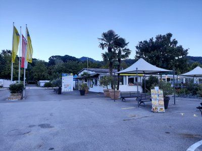
It was a short drive from Bellizona to the campsite here. The driveway is difficult to see if you don't follow the signs. The staff at the reception was friendly and we could choose 6 seats from the regular seats. We liked the place with the number 66, it is not far from the lake and the toilets and showers are also very close. The power distribution box was quite far away from the square, the cable drum and a separate cable (10m) were just enough to the motorhome.

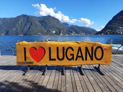
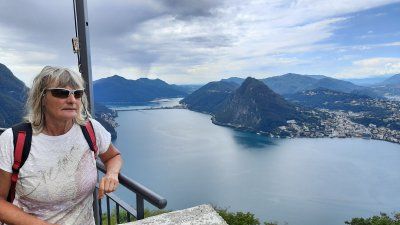
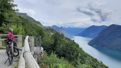
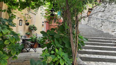
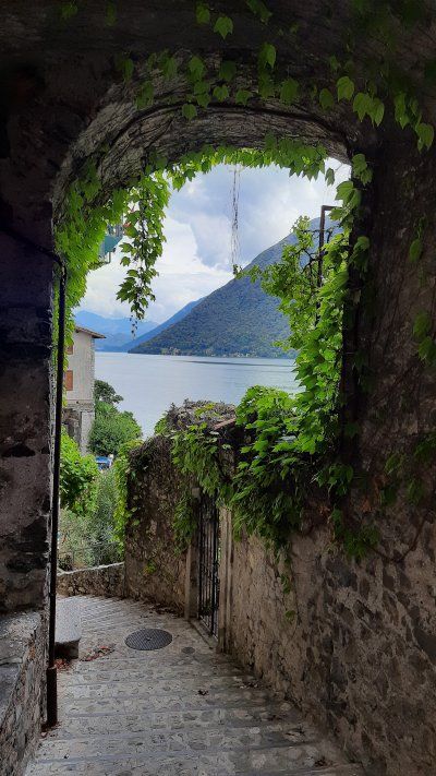
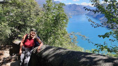
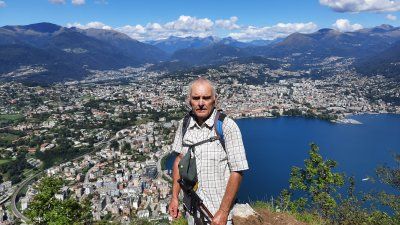
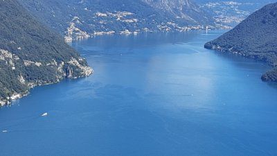
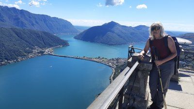
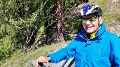
The night was very quiet, we had slept very well and long. In the morning before breakfast we went to swim in the lake. The water is very pleasantly warm, but a lot of dirt and small trees from the previous rainy days have accumulated on the bank. Around noon we set off on our e-bikes for Monte Bre '. Before climbing the mountain, we had to overcome a ridge and drive through the center of Lugano. There was heavy traffic on the roads through Lugano. Thanks to the GPS, we liked the access road to Monte Bre '. Several hairpin bends had to be driven to the top of the mountain (925 m). 10% gradient. At the top of the restaurant you have a beautiful view of the city of Lugano, Lake Lugano and far into the mountains. On the descent we made a detour to Gandria, a fishing village that is the most beautiful thing on Lake Lugano. Steeply on the mountain slope with narrow streets and stairs, it nestles against the lake. We had to leave the bicycles at the top of the church, the houses are assembled and can only be reached via steep stairs and narrow streets. After the visit, we went back to the city of Lugano. On the way back to Muzzano we took the road that led around the local mountain San Salvadore. We spent the rest of the day swimming and lazing around the square.
Distance: 57 km
Hm: 1200 m
Time: 4 h
Average: 15 km / h
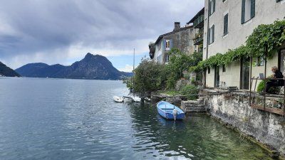
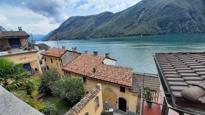
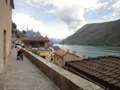
The morning had progressed quickly with sleep in, bathing and breakfast, so that we started the hike on the San Salvadore a little late. 11:30 a.m. we started the five-hour tour. It had already got very hot around noon (26 ° C), especially when the route had sunny sections. We were very lucky that the steep and very easy to walk hiking trail ran in the shade to the summit. A number of cyclamen bloomed next to the hiking trail. From the top of the tower you have a magnificent all-round view. The panels that tell the story of the Gotthard tunnel and the old pass road are interesting. One would also have the possibility to visit the summit with the funicular. The way back was like the way there.
Distance: 18 km
Hm: 1200 m
Time: 5:30 h
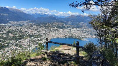
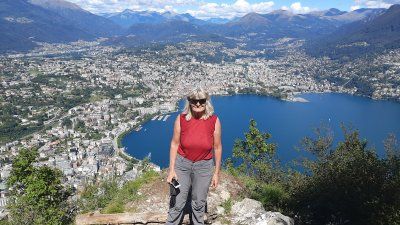
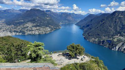
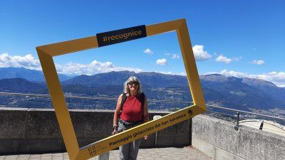
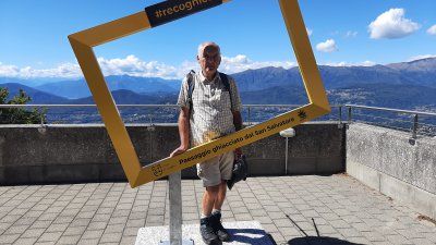
During the night we had a thunderstorm with rain. We took advantage of it again to sleep in. Irmgard went swimming in spite of the overcast sky and I set up breakfast during that time. The temperature has dropped a lot, it wasn't as pleasant to have breakfast outside as on the previous days. Many campers around us packed their mobile homes or caravans for departure. As we started to get ready to go, it started raining. It has never happened before that I had to supply the power cable and fill up with fresh water in the rain.
Costs:
3 nights Womo, 2 adults 142.- Euro
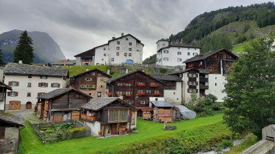
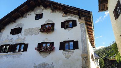
Stop at the ruin in a parking lot next to the road. Short walk to the ruins, unfortunately the entrance was closed with an iron gate. From the street you can see it as a huge structure. It is one of the largest castles in Switzerland and formed the lordly center of the valley from the beginning of the 13th century until 1526. The castle was considered impregnable and was never conquered. Below the castle is the Sta. Maria del Castello with a well-preserved late Romanesque fresco cycle.
We decided to take a closer look at the church and the place Mesocco.
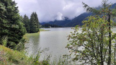
Today we had more time due to the early departure from the campsite. The planning of the tour provided that we drive to the San Bernardino Pass and spend the night on the pass. The weather made everything impossible, on the driveway to San-Bernardino, the clouds were quite low and it also started to rain. There was a hitchhike at Lago d'Isola, we looked to see if there was a path around the lake, but unfortunately there wasn't. Occasional trails lead to the water. Irmgard tested the water temperature which was 16 ° C. After the short stop, we continued to the parking lot after the San Bernardino tunnel.

Today we had more time due to the early departure from the campsite. The planning of the tour provided that we drive to the San Bernardino Pass and spend the night on the pass. The weather made everything impossible, on the driveway to San-Bernardino, the clouds were quite low and it also started to rain. There was a hitchhike at Lago d'Isola, we looked to see if there was a path around the lake, but unfortunately there wasn't. Occasional trails lead to the water. Irmgard tested the water temperature which was 16 ° C. After the short stop, we continued to the parking lot after the San Bernardino tunnel.
Parking lot at the San Bernhardino tunnel. The parking lot is being rebuilt, everything is still under construction around the space. The entry and exit to Bernhardino Strasse has been given a new route. We stood for a stopover, were unsure whether we should spend the night here. You couldn't drink anything but coffee, it was raining.
Parking lot at the San Bernhardino tunnel. The parking lot is being rebuilt, everything is still under construction around the space. The entry and exit to Bernhardino Strasse has been given a new route. We stood for a stopover, were unsure whether we should spend the night here. You couldn't drink anything but coffee, it was raining.


We started early to continue to Zillis. Today is a hike in the Viamala Gorge.
We started early to continue to Zillis. Today is a hike in the Viamala Gorge.

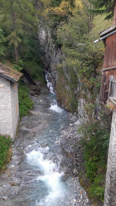
From Zillis Dorf we follow the sign Reischen / Thusis / Viamala Schlucht. We follow the path gently uphill until we meet the road to Reischen a short time later. There is a wonderful view of the valley and the surrounding mountains. We hike through the village with its numerous fountains and historic farmhouses. Shortly after Reischen we cross the first of many small, larger and exciting bridges. After some up and down through lush summer meadows, we come to the Davos Salegn point in the middle of the forest. The signpost sends us down the forest towards the gorge to the bank of the river of the Viamala Gorge. We walk upstairs and downstairs on the narrow, rooted forest path on the banks of the river. Finally we reach the Punt da Suransuns. With its construction in 1999, it is again possible to follow the old mule tracks through the gorge. Now we go up the mountain on the other side of the river until we meet the driveway. On the short way to the Viamala information booth. We took the many steps down to the viewing platform above the Viamala gorge (fee 8 CHF / P) to take a closer look at the natural phenomenon. We now leave the gorge and start the ascent to the Traversina footbridge (always follow the signs to Thusis). After a very strenuous stretch, the bridge over the Traversina Tobel is in front of us. When walking over the bridge we take our time and enjoy the view of the valley. The Traversina footbridge was realized in 2005 by an architecture firm from Chur. Because of the exposed location of the bridge, which has to be overcome a distance of 56 m and a height difference of 22 m and has a deep view down to 40 m depth. The bridge was our hiking destination, from here it was the same way back to Zillis to our mobile home. At the kiosk by the church at the parking lot we made a short coffee break before we went on to Chur.
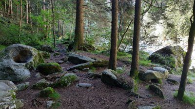

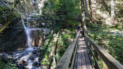
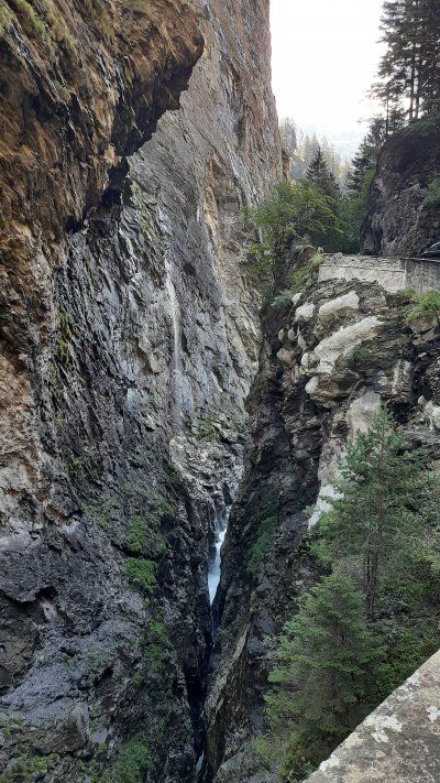
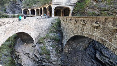
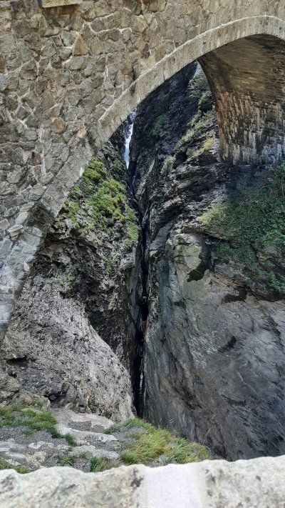
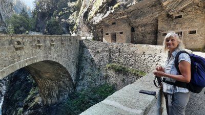
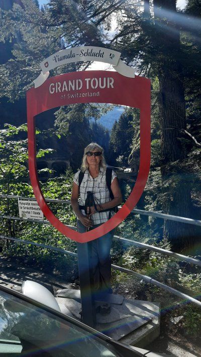
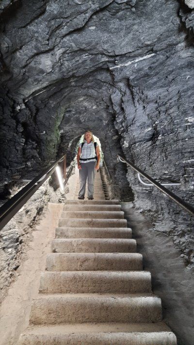

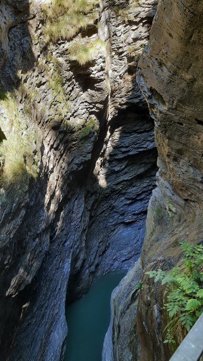
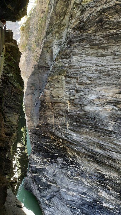
From Zillis Dorf we follow the sign Reischen / Thusis / Viamala Schlucht. We follow the path gently uphill until we meet the road to Reischen a short time later. There is a wonderful view of the valley and the surrounding mountains. We hike through the village with its numerous fountains and historic farmhouses. Shortly after Reischen we cross the first of many small, larger and exciting bridges. After some up and down through lush summer meadows, we come to the Davos Salegn point in the middle of the forest. The signpost sends us down the forest towards the gorge to the bank of the river of the Viamala Gorge. We walk upstairs and downstairs on the narrow, rooted forest path on the banks of the river. Finally we reach the Punt da Suransuns. With its construction in 1999, it is again possible to follow the old mule tracks through the gorge. Now we go up the mountain on the other side of the river until we meet the driveway. On the short way to the Viamala information booth. We took the many steps down to the viewing platform above the Viamala gorge (fee 8 CHF / P) to take a closer look at the natural phenomenon. We now leave the gorge and start the ascent to the Traversina footbridge (always follow the signs to Thusis). After a very strenuous stretch, the bridge over the Traversina Tobel is in front of us. When walking over the bridge we take our time and enjoy the view of the valley. The Traversina footbridge was realized in 2005 by an architecture firm from Chur. Because of the exposed location of the bridge, which has to be overcome a distance of 56 m and a height difference of 22 m and has a deep view down to 40 m depth. The bridge was our hiking destination, from here it was the same way back to Zillis to our mobile home. At the kiosk by the church at the parking lot we made a short coffee break before we went on to Chur.
13th century in the courtyard of the bishop's palace. The 800-year-old cathedral and its late Gothic high altar shining in golden splendor. The cathedral is dedicated to the Assumption of Mary and is one of the most important cultural monuments in Switzerland. The farm was already settled before Roman times and was used by the Romans as a base. 451 Bishopric with a simple basilica. Second cathedral in the 8th century, of which marble sculptures are still preserved.


13th century in the courtyard of the bishop's palace. The 800-year-old cathedral and its late Gothic high altar shining in golden splendor. The cathedral is dedicated to the Assumption of Mary and is one of the most important cultural monuments in Switzerland. The farm was already settled before Roman times and was used by the Romans as a base. 451 Bishopric with a simple basilica. Second cathedral in the 8th century, of which marble sculptures are still preserved.
The viewing platform Il Spir is located in Conn and can be easily reached on a good hiking trail. It was designed by the Chur architect Corinna Menn and inaugurated in 2006. Here we had a unique 180 degree view over the “Swiss Grand Canyon”. There was a brisk flow of visitors on the platform, which means that space is very limited.
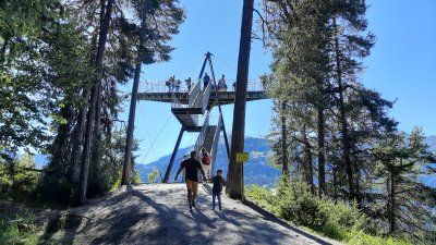
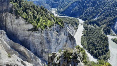
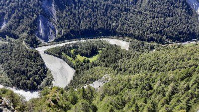
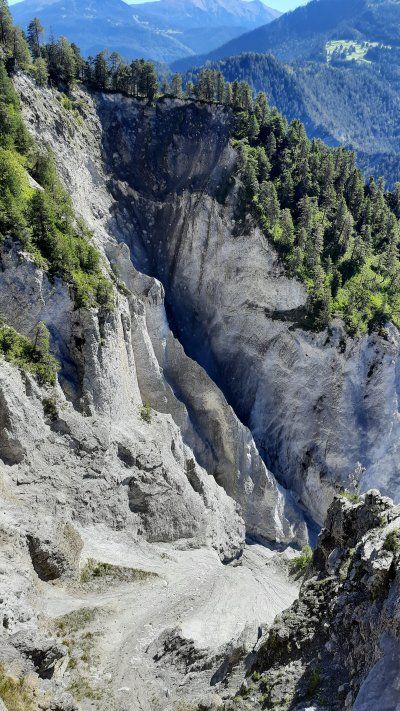
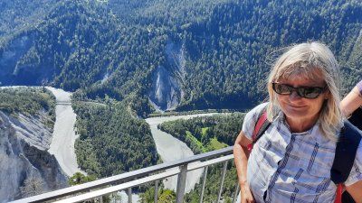
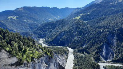
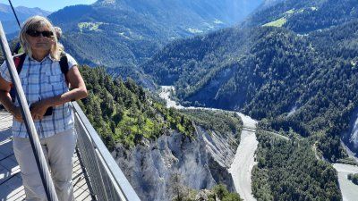
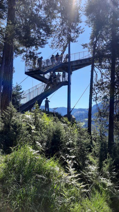
The viewing platform Il Spir is located in Conn and can be easily reached on a good hiking trail. It was designed by the Chur architect Corinna Menn and inaugurated in 2006. Here we had a unique 180 degree view over the “Swiss Grand Canyon”. There was a brisk flow of visitors on the platform, which means that space is very limited.
Power supply available and toilet and shower in the building (restaurant) across the street. No supply and disposal.
It was just wonderful to sit in the mountains and look at the surrounding mountains. It was already warm and we even had the awning extended which gave us the necessary shade. We made ourselves very comfortable. In the evening we went for a walk towards the top of the pass. We also found a hiking trail that led off the road to the pass. For an hour we followed the path that led along a stream, on alpine meadows and also past rock formations. On the way we were greeted by a number of marmots, who drew attention with their loud screams. Even a few meters in front of us, a fox was interested in our presence. On the way back to the wome we saw the sunset. When we returned to the Womo there was another Womo on the square.
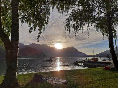
The night was quiet and we slept very well. We didn't even notice a mobile home standing next to us during the night. In the morning there were five more mobile homes in the square. I woke up pretty early, I didn't want to miss the sunrise. It took a long time until the sun rose from behind the mountain peaks, it was 7:30 a.m. The daylight was already too bright to influence the effect of the sunlight. The outside temperature was 8 ° C in the morning, we preferred to have breakfast in the mobile home and then slowly got ready for the onward journey to Müstair, over the Ofen Pass.
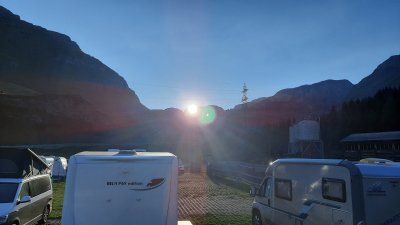
The night was quiet and we slept very well. We didn't even notice a mobile home standing next to us during the night. In the morning there were five more mobile homes in the square. I woke up pretty early, I didn't want to miss the sunrise. It took a long time until the sun rose from behind the mountain peaks, it was 7:30 a.m. The daylight was already too bright to influence the effect of the sunlight. The outside temperature was 8 ° C in the morning, we preferred to have breakfast in the mobile home and then slowly got ready for the onward journey to Müstair, over the Ofen Pass.
Driven to the parking lot at the entrance to the village. Originally we wanted to go to the campsite in Santa Maria. Today's plan is to ride the e-bike on the Umbrail Pass to the Stilfserjoch.
Driven to the parking lot at the entrance to the village. Originally we wanted to go to the campsite in Santa Maria. Today's plan is to ride the e-bike on the Umbrail Pass to the Stilfserjoch.
The bikes were quickly made ready for the tour and we set off on the pass road. The first section of the pass road is very steep with several 180 ° bends. I tried to ride the ride with the eco setting on the e-bike. Irmgard drove straight away with Strd. so she was a little faster than me. Despite my eco, Irmgard had more battery capacity than me at the border crossing to Italy and didn't have to work so hard with the Strd setting. From the limit I also drove with higher battery support and had to find out that my battery was running out even faster. Then I switched to the lowest gear (derailleur) and the smallest motor support (Eco +). The last bends I tortured myself to the top of the pass. Irmgard was up 10 minutes earlier and still had 4 lines out of 10 lines on the battery indicator, I only got to the finish line with one line. On the Stilfserjoch there was a crowd like at a folk festival, cyclists and bikers. There was nothing to be seen of Corona requirements. The parking lot was also very busy with skiers. But what impressed the most was the wonderful view of the mountain peaks, Ortler. Despite the sunshine, a cold wind blew around your ears. After a long rest, we went down the same way to Santa Maria. On the descent, Irmgard's brake shoes were completely worn down on the bike, so that the braking effect decreased and caused a loud noise. Upon closer inspection, it was found that the brake pads were abraded and the brake disc abraded. Both must be replaced again. After loading the bikes into the garage, we went on to Müstair.

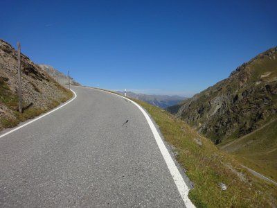
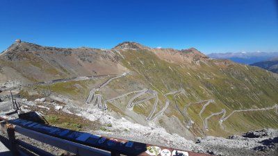
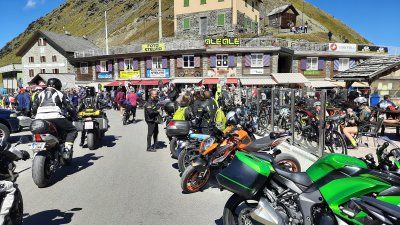
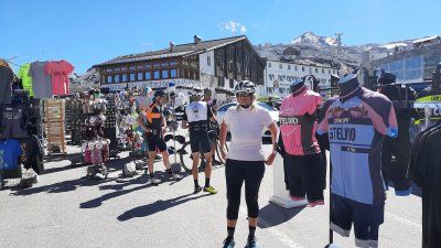
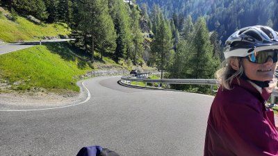

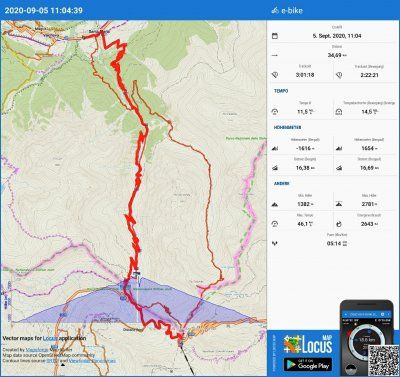
The bikes were quickly made ready for the tour and we set off on the pass road. The first section of the pass road is very steep with several 180 ° bends. I tried to ride the ride with the eco setting on the e-bike. Irmgard drove straight away with Strd. so she was a little faster than me. Despite my eco, Irmgard had more battery capacity than me at the border crossing to Italy and didn't have to work so hard with the Strd setting. From the limit I also drove with higher battery support and had to find out that my battery was running out even faster. Then I switched to the lowest gear (derailleur) and the smallest motor support (Eco +). The last bends I tortured myself to the top of the pass. Irmgard was up 10 minutes earlier and still had 4 lines out of 10 lines on the battery indicator, I only got to the finish line with one line. On the Stilfserjoch there was a crowd like at a folk festival, cyclists and bikers. There was nothing to be seen of Corona requirements. The parking lot was also very busy with skiers. But what impressed the most was the wonderful view of the mountain peaks, Ortler. Despite the sunshine, a cold wind blew around your ears. After a long rest, we went down the same way to Santa Maria. On the descent, Irmgard's brake shoes were completely worn down on the bike, so that the braking effect decreased and caused a loud noise. Upon closer inspection, it was found that the brake pads were abraded and the brake disc abraded. Both must be replaced again. After loading the bikes into the garage, we went on to Müstair.
(GPS: 46.764099, 10.531; fee: 10.- €) Then walk to the Haidersee for a swim, to our famous spot on the lake, where there is reasonably good access to the water. The water temperature was pretty cold (16 ° C), Irmgard only swam a short lap. It was too cold for me, I only stood with my feet in the water for a short time. We spent the rest of the day at the Womo.
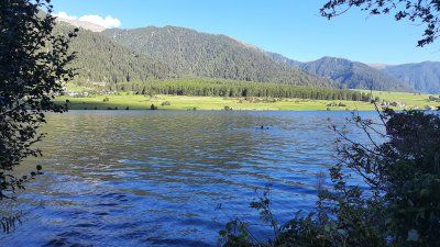
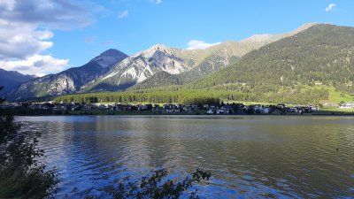
(GPS: 46.764099, 10.531; fee: 10.- €) Then walk to the Haidersee for a swim, to our famous spot on the lake, where there is reasonably good access to the water. The water temperature was pretty cold (16 ° C), Irmgard only swam a short lap. It was too cold for me, I only stood with my feet in the water for a short time. We spent the rest of the day at the Womo.
We parked the Womo in the almost empty large parking lot by the cable car. The parking lot is free of charge. From here we went on a hike to the Mutkopf. To get to the hiking trail, we first hiked 300 meters along the Reschenstrasse towards Nauders. After crossing the road it went uphill on a road in the forest. On the way there were many hiking signs that lead the way to different places, including the Schwarzsee, we decided to start at the Mutkopf. Below the summit, the path runs steeply uphill along a biker trail on which you can marvel at the bikers' driving skills. At the top there is nothing special to see, the view is limited. In the south stands the magnificent mountain range of Piz Lad, which was shrouded in gray rain clouds. For the descent we chose path number 9 that leads to the Schwarzsee. The hiking trail was more varied than the ascent path. Moors and forest meadows enriched the path. When we got to the Schwarzsee it started to rain. The lake is a moor lake and is idyllically situated in a depression. From the lake it was only downhill on a little road. On the way it stopped raining and there was a stop at one of the "Riasch" inns on the terrace of which we enjoyed an ice cream (hot love and plum cake with vanilla ice cream). On the last few meters to the parking lot, we were surprised by strong thunderstorms and arrived at the motorhome dripping wet.


We parked the Womo in the almost empty large parking lot by the cable car. The parking lot is free of charge. From here we went on a hike to the Mutkopf. To get to the hiking trail, we first hiked 300 meters along the Reschenstrasse towards Nauders. After crossing the road it went uphill on a road in the forest. On the way there were many hiking signs that lead the way to different places, including the Schwarzsee, we decided to start at the Mutkopf. Below the summit, the path runs steeply uphill along a biker trail on which you can marvel at the bikers' driving skills. At the top there is nothing special to see, the view is limited. In the south stands the magnificent mountain range of Piz Lad, which was shrouded in gray rain clouds. For the descent we chose path number 9 that leads to the Schwarzsee. The hiking trail was more varied than the ascent path. Moors and forest meadows enriched the path. When we got to the Schwarzsee it started to rain. The lake is a moor lake and is idyllically situated in a depression. From the lake it was only downhill on a little road. On the way it stopped raining and there was a stop at one of the "Riasch" inns on the terrace of which we enjoyed an ice cream (hot love and plum cake with vanilla ice cream). On the last few meters to the parking lot, we were surprised by strong thunderstorms and arrived at the motorhome dripping wet.
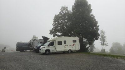
The journey from Nauders over the Flüelapass took place in continuous rain. At the top of the Flüela pass, there was also thick fog. To the left of the street, the Hospitzhaus was not even clearly visible. With the third crossing of the pass, we experienced all weather conditions. Snow, sunshine, rain and fog.
In Klosters we drove to the parking lot (GPS: 46.884488, 9.876562) by the cable car. When driving through the center one did not see much of the supposedly pretty village. The fog and rain made everything seem gloomy. Parking fee: € 24 (€ 15, € 4.50 tourist tax)
Route
Show newest first- 48.1981 8.6953
- 48° 11' 53.1" N 8° 41' 43.1" E
- 47.2278 8.822
- 47° 13' 40" N 8° 49' 19.1" E
- 47.1805 8.5084
- 47° 10' 49.9" N 8° 30' 30.1" E
- 47.0011 8.6546
- 47° 0' 4" N 8° 39' 16.4" E
Auf heute war nochmals herrliches Bergwetter angesagt das viele Wanderer ausnutzten. Die Stossbahn brachte uns zur Bergstation auf 1200 Meter. Hier liegt auch das autofreie Dorf Stoss. Im Dorf herrschte gähnende Stille nur der Lärm einer groß Baustelle war zu hören. Die Hotels, Gästehäuser waren alle nicht belegt. Selbst die Cafes und Restaurants waren geschlossen. Wir orientierten uns nach den Wanderschilder die uns zum Klingenstock führen. Die Klingenstock Runde zählt zu den schönsten Panorama Bergtouren in der Zentralschweiz.
Wanderung: Wir haben eine tolle Tour gemacht; von Stoos Dorf sind wir auf den Klingenstock gestiegen und dann über den gut begehbaren Gratweg , der auch nochmals viele Höhenmeter in sich hat , zum Fronalpstock gelaufen, denn auf dem Weg hat man eine spektakuläre Sicht auf über 10 Seen und unzählige Alpengipfel der Zentralschweiz. Auf der Terrasse des Restaurants auf dem Fronalpstock noch einen Cappuccino vor dem Abstieg getrunken. Von dort nach Stoos abgestiegen. Traumhafte Sicht. Tolle Tour !
- 47.0315 8.6222
- 47° 1' 53.4" N 8° 37' 19.8" E
- 47.0312 8.5938
- 47° 1' 52.5" N 8° 35' 37.8" E
Heute ließen wir es ruhig angehen und hatten ausgeschlafen. Nach dem Frühstück machten wir uns auf zur Radtour nach Brunnen am Vierwaltstätter See, zur Stadt Schwyz und die Umfahrung des Lauener See.
Bereits im Hochmittelalter wurde das kleine, damals von Fischern und Schiffleuten bewohnte, Dorf Brunnen gegründet. Im Laufe der Zeit entwickelte es sich zu einem wichtigen Hafen und Verladeort des Kantons Schwyz. 1620 wurde durch einen verheerenden Brand ein großer Teil der Bauten zerstört.
Dem Städtchen Schwyz verdankt die Schweiz ihren Namen und auch das Wappen. Im Jahre 1291 sind Uri, Schwyz und Unterwalden einen Bund eingegangen und haben 1315 mit dem Sieg in der Schlacht bei Morgarten die Österreicher vertrieben. Das Rathaus von Schwyz ist ein denkmalgeschütztes Parlaments- und Gerichtsgebäude. Bekannt ist es für die historistische Fassadenmalerei von Ferdinand Wagner aus dem Jahr 1891. Wie die barocke Pfarrkirche St. Martin und das Hotel «Wysses Rössli» steht das Rathaus am Hauptplatz im Zentrum von Schwyz.
Der Lauerzersee befindet sich zwischen Vierwaldstättersee und Zugersee. Mit seiner maximalen Wassertiefe von 14 m gehört er zu den flachsten Seen der Schweiz. Die Insel Schwanau liegt im Lauerzersee auf ihr steht eine erhaltene Kapelle und Burgruine. Außerdem noch ein Gasthaus.
Nach der Ankunft am Womo und nach dem Verstauen der Räder in die Heckgarage tranken wir unser Nachmittagskaffee mit einem Stück Kuchen. Es war noch derart warm dass wir danach noch in den See zum Schwimmen gingen. Hinter unserem Womo gab es ein steiniger Zugang zum See. Start: 14:30 Uhr.
Danach starteten wir Richtung Bellinzona zu unserem Tagesziel.
- 46.189 9.0151
- 46° 11' 20.3" N 9° 0' 54.3" E
Nach der Burgenbesichtigung bummelten wir noch durch die Gassen der Altstadt und Arkadengänge die auf das 16. Jahrhundert zurück gehen. Der Palazzo Communale (Rathaus) wurde 1921–1926 anstelle des spätmittelalterlichen Rathauses erbaut. Der rechteckige Grundriss, der Loggienhof und der hohe Turm orientieren sich am Typus des italienischen mittelalterlichen Rathauses.
Piazza Collegiata
Der heutige Platz hat sein Aussehen im 17. Jahrhundert bekommen. Mit dem heutigen Bau der Stiftskirche Santi Pietro e Stefano wurde 1515 angefangen. Der Turm stammt von 1567/1573, die Fassadenverkleidung von 1640/54, Chorerweiterungen fanden zwischen 1684 und 1785 statt, und das heutige Aussehen der monumentalen Treppenanlagen datiert aus dem
19. Jahrhundert. Die dreiachsige Renaissancefassade wurde im Barock vervollständigt, das Hauptportal stammt von 1640.
Piazza Indipendenza Platz im Gepräge des 19. Jahrhunderts. In der Platzmitte steht ein Obelisk von 1903, der an die Errichtung des heutigen Kantons 1803 erinnert.
Am Abend fing es wieder an zu regnen. Ich nutzte den Regentag, um mein Logbuch zu schreiben. Im laufe des Tages stellten sich noch zwei weitere Womos zum übernachten neben uns.
Vom Hügel Montebello aus, auf dem das zweite Castello von Bellinzona 90 Meter über der Stadt thront, blicken wir auf das Castelgrande hinunter. Von hier aus verliefen die Mauern, die einst die Altstadt umfingen, bis hin zu den Mauern, die vom Hügel S. Michele hinunterführten. Teile dieser Ringmauer, die die nördliche und südliche Flanke der riesigen dreieckigen Festung beschützten, existieren auch heute noch. Der älteste interne Mauerkern stammt aus dem 13./14. Jahrhundert. Nach einem Rundgang durch die Burg und Außenbereich machten wir noch ein Erinnerungsfoto am Foto-Spot der Grand Tour of Switzerland!
Das Castello di Sasso Corbaro ist die einzige der 3 Burgen mit einem präzisen Erbauungsdatum: Es war das Jahr 1479. Die Festung wurde in etwas mehr als 6 Monaten errichtet. Der Name dieser Festung basiert auf ihrer geografischen Lage: Das Castello befindet sich auf einem felsigen Vorsprung, der so dunkel ist wie die Federn der Raben (die dialektale Bezeichnung für «Rabe» ist «corbatt»). Es handelt sich hierbei um ein typisches Sforza-Schloss, dessen Mauerwerke auf geometrische Grundformen beschränkt sind. Neben dem viereckigen Innenhof, der von hohen Mauern umgeben ist, gibt es auch einen massiven Hauptturm sowie den Beobachtungsturm. Das Castello di Sasso Corbaro thront elegant auf 230 Metern oberhalb von Bellinzona und bietet einen fantastischen Panoramablick
Zur dritten Burg stiegen wir wieder in die Altstadt ab, wo auf dem mächtigen Hügel das Castelgrande steht. Die erste menschliche Besiedlung des Hügels von San Michele geht auf das Jahr 5500/5000 v. Chr. (Jungsteinzeit) zurück. Im 4. Jahrhundert n. Chr. entstand dann die erste archäologisch bestätigte Festung. Auch verschiedene Dokumente aus dem 6. Jahrhundert bestätigen das Bestehen einer Befestigungsanlage. Im 14. Jahrhundert tauchte erstmals der lateinische Name für Castelgrande, Castel Magnum, auf. Dies ist auch der heutige Name.
Die zweite Nacht war ebenfalls ruhig, der Parkplatz war leer und in der Nacht gab es immer wieder Regenschauer.
Vor unserer Abfahrt suchten wir noch die im Süden der Stadt liegende, ursprünglich zu einem Franziskanerkloster gehörende Kirche Santa Maria delle Grazie. Die Kirche enthält Renaissancefresken lombardischer Schule, die zu den bedeutendsten im Kanton Tessin zählen (um 1510). Wir schafften es noch rechtzeitig in die Kirche, danach ging ein massiver Gewitterschauer nieder, der für einen längeren Aufenthalt in der Kirche sorgte. Nach dieser Besichtigungstour setzten wir unsere Reise fort an den Luganersee.
Es war eine kurze Wegstrecke von Bellizona bis hierher zum Campingplatz. Die Zufahrt ist schwer auszumachen, wenn man die Beschilderung nicht beachtet. Das Personal an der Reception war freundlich und wir konnten 6 Plätze von den Regular Plätzen aussuchen. Der Platz mit der Nummer 66 gefiel uns, er ist nicht weit vom See entfernt und die Toiletten und Duschen sind auch ganz in der Nähe. Der Stromverteilerkasten war ziemlich weit vom Platz entfernt, die Kabeltrommel und ein separates Kabel (10m) reichten gerade zum Wohnmobil.
Die Nacht war sehr ruhig, wir hatten sehr gut und lange geschlafen. Morgens vorm Frühstück ging es erst einmal zum Schwimmen in den See. Das Wasser ist sehr angenehm warm, aber am Ufer hat sich viel Dreck und klein Gehölz von den vorigen Regentage angesammelt. Gegen Mittag fuhren wir mit unseren E-Bikes los auf den Monte Bre'. Vor dem Anstieg auf den Berg mussten wir einen Bergrücken überwinden und das Zentrum von Lugano durchfahren. Es herrschte starker Verkehr auf den Straßen durch Lugano. Dank dem Navi fanden wir die Auffahrtstrasse auf den Monte Bre' gut. Etliche Kehren mussten gefahren werden bis zum Gipfel des Berges (925 m). Steigung 10%. Oben beim Restaurant hat man eine schöne Aussicht auf die Stadt Lugano, den Luganer See und weit in die Berge. Bei der Abfahrt machten wir noch einen Abstecher nach Gandria einem Fischerdörfchen, dass das schönste am Luganersee ist. Steil am Berghang mit engen Gassen und Treppen schmiegt es sich an den See. Die Fahrräder mussten wir oben an der Kirche stehen lassen, die Häuser sind zusammengebaut und sind nur über steile Treppen und enge Gassen zu erreichen. Nach der Besichtigung ging es zurück in die Stadt Lugano. Auf der Rückfahrt nach Muzzano nahmen wir die Uferstraße die um den Hausberg San Salvadore führte. Den restlichen Tag verbrachten wir mit baden und faulenzen am Platz.
Strecke: 57 km
Hm: 1200 m
Zeit: 4 h
Schnitt: 15 km/h
Der Morgen war mit ausschlafen, baden und frühstücken schnell vorangeschritten, so dass wir uns etwas Spät auf die Wanderung auf den San Salvadore aufmachten. 11:30 Uhr starteten wir auf die fünfstündige Tour. Es war schon sehr heiß geworden um die Mittagszeit (26°C), besonders wenn die Strecke sonnige Abschnitte hatte. Großes Glück hatten wir, dass der steile und sehr gut begehbare Wanderweg im Schatten auf den Gipfel verlief. Neben dem Wanderweg blühten etliche Alpenveilchen. Oben vom Turm hat man eine grandiose Rundumsicht. Interessant sind die Bildtafeln, die die Geschichte über den Gotthard Tunnel und der alten Passstraße berichten. Man hätte auch die Möglichkeit den Gipfel mit der Standseilbahn zu besuchen. Der Rückweg erfolgte wie der Hinweg.
Strecke: 18 km
Hm: 1200 m
Zeit: 5:30 h
In der Nacht hatten wir ein Gewitter mit Regen. Wir nutzten es nochmals aus, um auszuschlafen. Irmgard ging trotz bedecktem Himmel zum Baden und ich richtete in der Zeit das Frühstück. Die Temperatur hat sich stark abgekühlt, es war nicht mehr so angenehm draußen zu Frühstücken wie an den Vortagen. Viele Camper um uns herum packten ihre Wohnmobile oder Wohnwagen zur Abreise. Als wir anfingen uns startklar zu machen, fing es an zu regnen. Das hat es noch nie gegeben das ich bei Regen, das Stromkabel versorgen und auftanken von Frischwasser machen musste.
Kosten:
3 Nächte Womo, 2 Erwachsene 142.- Euro
- 46.3828 9.2323
- 46° 22' 58.2" N 9° 13' 56.4" E
- 46.4508 9.1905
- 46° 27' 3.1" N 9° 11' 25.9" E
Parkplatz beim San Bernhardino Tunnel. Der Parkplatz wird neu angelegt, um den Platz ist noch alles Baustelle. Die Ein und Ausfahrt zur Bernhardino Straße hat eine neue Wegführung erhalten. Wir sind für einen Zwischenstopp gestanden, waren uns unschlüssig ob wir die Nacht hier verbringen sollen. Unternehmen konnte man auch nichts außer Kaffee trinken, es regnete.
- 46.5501 9.3201
- 46° 33' 0.2" N 9° 19' 12.5" E
Wir brachen frühzeitig auf zur Weiterfahrt nach Zillis. Heute steht eine Wanderung in die Viamala Schlucht an.
- 46.6343 9.4416
- 46° 38' 3.6" N 9° 26' 29.8" E
Ab Zillis Dorf folgen wir dem Wegweiser Reischen / Thusis / Viamala Schlucht. Sanft bergan folgen wir dem Weg, bis wir kurze Zeit später auf den Fahrweg nach Reischen treffen. Es bietet sich eine herrliche Sicht auf das Tal und die umliegenden Berge. Vergnüglich wandern wir durch das Örtchen mit seinen zahlreichen Brunnen und historischen Bauernhäusern. Kurz nach Reischen überqueren wir die erste von vielen kleinen, größeren und aufregenden Brücken. Nach einigem Auf und Ab durch saftige Sommerwiesen gelangen wir inmitten des Waldes auf den Punkt Davos Salegn.Der Wegweiser schickt uns den Wald hinab Richtung Schlucht zum Ufer des Flusses der Viamala Schlucht. Wir wandern am Ufer des Flusses auf dem schmalen, wurzeligen Waldweg treppauf und treppab. Schließlich erreichen wir die Punt da Suransuns. Mit ihrem Bau 1999 ist es wieder möglich, den alten Saumwegen durch die Schlucht zu folgen. Nun geht es auf der anderen Seite des Flusses den Berg hinauf, bis wir auf die Fahrstraße treffen. Auf dem kurzen Weg zum Viamala Infostand. Wir nahmen die vielen Treppenstufen hinab zur Aussichtsplattform über der Viamalaschlucht (kostenpflichtig 8.- Sfr/P), in kauf um uns das Naturereignis näher anzusehen. Wir verlassen nun die Schlucht und machen uns an den Anstieg zum Traversina Steg (immer dem Wegweiser Richtung Thusis folgen). Nach einem recht anstrengenden Wegstück liegt die Brücke über dem Traversina Tobel vor uns. Beim Begehen der Brücke lassen wir uns Zeit und genießen den Blick ins Tal.. Der Traversina Steg ist 2005 von einem Architekturbüro aus Chur realisiert worden. Wegen der exponierten Lage der Brücke, die eine Distanz von 56 m und einen Höhenunterschied von 22 m zu bewältigen ist und einen Tiefblick nach unten mit 40 m Tiefe hat. Die Brücke war unser Wanderziel, ab hier ging es auf gleichem Weg zurück nach Zillis zu unserem Wohnmobil. An dem Kiosk bei der Kirche am Parkplatz machten wir noch eine kurze Kaffeerast, bevor es weiter ging nach Chur.
- 46.8268 9.3297
- 46° 49' 36.4" N 9° 19' 46.8" E
- 46.4678 9.6505
- 46° 28' 4" N 9° 39' 1.6" E
Die Nacht war ruhig und wir hatten sehr gut geschlafen. Wir bemerkten nicht einmal, wie sich in der Nacht ein Womo neben uns stellte. Am Morgen standen fünf weitere Wohnmobile auf dem Platz. Ich wachte ziemlich früh auf, ich wollte den Sonnenaufgang nicht verpassen. Es dauerte eine lange Zeit bis sich die Sonne hinter den Bergenspitzen hervor hob, es war 7:30 Uhr. Das Tageslicht war schon zu hell, um die Wirkung des Sonnenlichts zu prägen. Die Außentemperatur betrug am Morgen 8°C, wir bevorzugten es im Womo zu frühstücken und machten uns danach langsam fertig für die Weiterfahrt nach Müstair, über den Ofenpass.
- 46.6005 10.4186
- 46° 36' 1.8" N 10° 25' 6.9" E
Die Fahrräder wurden schnell für die Tour fahrbereit gemacht und es ging los auf die Passstraße. Die erste Sektion der Passstraße ist sehr steil mit etlichen 180° Kehren. Ich versuchte die Fahrt mit Eco Einstellung am E-Bike zu fahren. Irmgard fuhr gleich mit Strd. deshalb war sie ein wenig schneller unterwegs als ich. Trotz meinem Eco hatte Irmgard am Grenzübergang zu Italien noch mehr Akku Kapazität als ich und musste sich nicht so anstrengen mit Strd Einstellung. Ab der Grenze fuhr ich auch mit höherer Akku Unterstützung und musste feststellen dass mein Akku noch schneller zu Neige ging. Daraufhin schaltete ich auf den kleinsten Gang (Kettenschaltung) und die kleinste Motorunterstützung (Eco+). Die letzten Kehren quälte ich mich vollends auf die Passhöhe. Irmgard war 10 Minuten früher oben und hatte noch 4 Striche von 10 Striche auf der Akkuanzeige, ich kam nur noch mit einem Strich ins Ziel. Auf dem Stilfserjoch war eine Menschenmasse wie bei einem Volksfest, Radler und Biker. Von Corona Auflagen war nichts zu sehen. Der Parkplatz war auch sehr frequentiert mit Skifahrer. Was aber am meisten beeindruckte war die herrliche Weitsicht auf die Berggipfel, Ortler. Trotz Sonnenschein blies ein kalter Wind einem um die Ohren. Nach ausgiebiger Rast ging es auf gleichem Weg abwärts nach Santa Maria. Bei der Abfahrt wurden Irmgards Bremsbacken am Bike total abgeschliffen, dass die Bremswirkung nach lies und ein lautes Geräusch veranlasste. Bei näherer Inspektion wurde festgestellt, Bremspacken abgeschliffen und die Bremsscheibe eingeschliffen. Beides muss neu ersetzt werden. Nach dem verladen der Bikes in die Garage ging es weiter nach Müstair.
- 46.6262 10.4462
- 46° 37' 34.3" N 10° 26' 46.4" E
- 46.7639 10.5315
- 46° 45' 49.9" N 10° 31' 53.5" E
- 46.8755 10.5085
- 46° 52' 31.8" N 10° 30' 30.7" E
- 46.8845 9.8757
- 46° 53' 4.1" N 9° 52' 32.4" E
- 47.645 9.1983
- 47° 38' 42.1" N 9° 11' 54" E
- 48.1973 8.6998
- 48° 11' 50.3" N 8° 41' 59.3" E
Travelogue
At 10.15 a.m. we reached the Swiss border. On the highway there were strong gusts of wind that brought the Womo off track. The weather service warned of squalls on the Feldberg with peaks of 80 - 100 km / h.
There wasn't much going on at the border, we could cross the border without stopping.
At 10.15 a.m. we reached the Swiss border. On the highway there were strong gusts of wind that brought the Womo off track. The weather service warned of squalls on the Feldberg with peaks of 80 - 100 km / h.
There wasn't much going on at the border, we could cross the border without stopping.
Before we set out on the 2.3 km walk into the old town of Rapperswill, we had our lunch coffee first.
On the way to the old town it was very hot, the thermometer showed 30 degrees. We were surprised about the historic old town with the castle.
Whenever we're in Rapperswil, we didn't want to miss the walk up to the castle. The short ascent is rewarded with a great view of the old town and Lake Zurich and next to the beautiful old castle building a beautiful, small church.
This small church is located behind the Rapperswil Castle, has a dark but beautiful interior with wall paintings and sculptures on the altar and only on the sides. There is a wooden ceiling and the murals are actually a mix of the painting and sculpture.
Directly under the castle a very nice garden with lots of beautiful roses.
The lake promenade with its beautiful cafes invites you to linger and stroll.
The sightseeing tour was very exhausting on this hot day, so we made sure as soon as possible that we should continue to Zug, where hopefully Lake Zug will be waiting for us to swim.
The parking lot (GPS: 47.179995, 8.50802) in Zug was easy to drive to, it was next to the stadium. The parking lot was well occupied, the parking areas are not suitable for larger mobile homes over 6 m. At our place we were able to let the rear of the camper protrude one meter into the sidewalk. On the opposite side, the parking areas are limited by a hedge. We took a lunch break and had a coffee before we went to the lido, 15 minutes away, to swim. The bath is free, has a beautiful lawn with a sandy beach. The yellow flashing lights indicated a storm warning on Lake Zug, there were strong waves on the lake. Irmgard don't mind the waves while swimming, I prefer a smooth sea for swimming. After swimming, we took a walk through the historic old town of Zug. If you walk along the lakeshore, you come to the area of the old town with the Landsgemeindeplatz (where citizens used to meet to vote and vote) and the two old town streets. If you go through the city gate, you come to the "suburb" with the old armory. The 52 meter high Zytturm is Zug's landmark. It was created in the middle of the 13th century as a simple passage. Until the construction of the second curtain wall, the tower served as a lockable entrance to the city. In 1574 the tower received the large clock and the astronomical dial on the side facing Kolinplatz.
Astronomical clock
On the east side of the Zytturm there is an astronomical clock below the dial. This has four pointers: the arrow shows the current day of the week (based on the gods and astonomic signs, above is Sunday), the crescent moon the phase of the moon (above is empty moon, below is full moon), the sun the month (based on the signs of the zodiac, below is the Change of year from December to January) and the letter S the leap year (points downwards when a leap year begins). Above the dial there is a ball that also shows the current moon phase.
Interesting buildings from the 16th and 17th centuries stand on Kolinplatz: the Kolinbrunnen (1541), the town house (also called Bossardhaus) (1543), and the Kolinhaus (1665). The four-storey town hall of Zug, built by the master builder Heinrich Sutter from 1505 to 1509, is an important secular architectural monument of the late Gothic period in Switzerland. Up the street from the suburbs is the “castle” which houses a museum with changing exhibitions. Also along the lake is part of the suburb. During a severe storm in July 1876, a whole row of houses was washed into the lake. That's why the beautiful park is there now.
The journey here was relatively quick, there was some rush hour traffic at Zug and construction sites with traffic lights were set up on the Bergstrasse to the Stossbahn. In the lower parking lot (GPS: 46.99272, 8.67452) we were able to park on a flat parking area. The entrance to the parking lot is with a barrier. Now it was celebrated once, the Stossbahn goes up every 30 minutes to Stoss. We took the departure time 9:40 am as our destination.
Fare: Ascent and descent 22.- Sfr
Steepest funicular in the world. Incline of up to 110 percent (47 degrees) an impressive experience with the funicular up to Stoos.
Today, again, wonderful mountain weather was announced that many hikers took advantage of. The Stossbahn brought us to the mountain station at 1200 meters. The car-free village of Stoss is also located here. In the village there was a yawning silence, only the noise of a large construction site could be heard. The hotels and guest houses were all empty. Even the cafes and restaurants were closed. We oriented ourselves according to the hiking signs that lead us to the blade stick. The Klingenstock circuit is one of the most beautiful panoramic mountain tours in Central Switzerland.
Hike: We did a great tour; From Stoos Dorf we climbed the Klingenstock and then walked over the easily accessible ridge path, which also has many vertical meters in itself, to the Fronalpstock, because on the way you have a spectacular view of over 10 lakes and countless alpine peaks in Central Switzerland. Have a cappuccino on the terrace of the restaurant on the Fronalpstock before descending. From there descended to Stoos. Fantastic view. Great tour!
After our dreamy but exhausting hike, we did not go to Stans near Lucerne as planned, but used the hot day again to swim. The Lauener See was only 5 km away on our route. The parking lot next to the ice rink and the lido was pretty empty. There were hardly any bathers in the bathroom either. Entry cost 5 Sfr./P.
Water temperature: 21 degrees
Air temperature: 26 degrees The bathing beaches are beautiful with a bathing jetty, swimming islands and specially created sandy beaches. We stayed in the bathroom almost until 8 p.m., which also closes at 8 p.m. Parking fees none (payable 7 a.m. - 4 p.m.)
Had to change parking spaces at 10:02 p.m. The parking lot at the lido was very noisy due to the highway and railroad passing by. The freight trains thundered past in a five-minute tack. In addition, a constantly running roaring cooling unit from the adjacent ice rink. The new parking lot is only 3 km away directly on the lake. We found free parking spaces, but too short for our mobile home. We were able to use one of them by letting the rear of the caravan protrude over the parking area and over the water. The calm did not return until around midnight, and there was occasional car traffic on the road passing by. In the morning 6 - 7 o'clock it got very loud with the rush hour traffic.
Had to change parking spaces at 10:02 p.m. The parking lot at the lido was very noisy due to the highway and railroad passing by. The freight trains thundered past in a five-minute tack. In addition, a constantly running roaring cooling unit from the adjacent ice rink. The new parking lot is only 3 km away directly on the lake. We found free parking spaces, but too short for our mobile home. We were able to use one of them by letting the rear of the caravan protrude over the parking area and over the water. The calm did not return until around midnight, and there was occasional car traffic on the road passing by. In the morning 6 - 7 o'clock it got very loud with the rush hour traffic.
Today we took it easy and slept in. After breakfast we set out on a bike tour to Brunnen on Lake Vierwaltstätter See, the city of Schwyz and the bypass of Lake Lauen.
Today we took it easy and slept in. After breakfast we set out on a bike tour to Brunnen on Lake Vierwaltstätter See, the city of Schwyz and the bypass of Lake Lauen.
The small village of Brunnen, then inhabited by fishermen and boaters, was founded in the High Middle Ages. In the course of time it developed into an important port and loading point for the Canton of Schwyz. In 1620, a large part of the buildings was destroyed by a devastating fire.
The small village of Brunnen, then inhabited by fishermen and boaters, was founded in the High Middle Ages. In the course of time it developed into an important port and loading point for the Canton of Schwyz. In 1620, a large part of the buildings was destroyed by a devastating fire.
Switzerland owes its name and coat of arms to the town of Schwyz. In 1291 Uri, Schwyz and Unterwalden formed a union and in 1315 they drove out the Austrians with the victory in the Battle of Morgarten. The town hall of Schwyz is a listed parliament and court building. It is known for the historicist facade painting by Ferdinand Wagner from 1891. Like the baroque parish church of St. Martin and the hotel "Wysses Rössli", the town hall is located on the main square in the center of Schwyz.
Switzerland owes its name and coat of arms to the town of Schwyz. In 1291 Uri, Schwyz and Unterwalden formed a union and in 1315 they drove out the Austrians with the victory in the Battle of Morgarten. The town hall of Schwyz is a listed parliament and court building. It is known for the historicist facade painting by Ferdinand Wagner from 1891. Like the baroque parish church of St. Martin and the hotel "Wysses Rössli", the town hall is located on the main square in the center of Schwyz.
The Lauerzersee is located between the Vierwaldstättersee and Zugersee. With its maximum water depth of 14 m, it is one of the shallowest lakes in Switzerland. The island of Schwanau is located in the Lauerzersee on it is a preserved chapel and castle ruins. Also an inn.
After arriving at the Womo and stowing the bikes in the rear garage, we drank our afternoon coffee with a piece of cake. It was still so warm that we went swimming in the lake afterwards. Behind our mobile home there was a stony entrance to the lake. Start: 2:30 p.m.
Then we started towards Bellinzona to our destination for the day.
After visiting the castles we strolled through the alleys of the old town and arcades that go back to the 16th century. The Palazzo Communale (town hall) was built in 1921–1926 in place of the late medieval town hall. The rectangular floor plan, the loggia courtyard and the high tower are based on the type of the Italian medieval town hall.
Piazza Collegiata
The current square got its appearance in the 17th century. The current construction of the collegiate church Santi Pietro e Stefano began in 1515. The tower dates from 1567/1573, the facade cladding from 1640/54, the choir was expanded between 1684 and 1785, and the current appearance of the monumental staircases dates from the
19th century. The three-axis renaissance facade was completed in the Baroque era, the main portal dates from 1640.
Piazza Indipendenza Square in the style of the 19th century. In the middle of the square there is an obelisk from 1903, which commemorates the construction of today's canton in 1803.
In the evening it started to rain again. I used the rainy day to write my logbook. In the course of the day two more Womos stood next to us to stay overnight.
From the hill of Montebello, on which Bellinzona's second Castello towers 90 meters above the city, we look down on the Castelgrande. From here ran the walls that once encircled the old town up to the walls that led down from the hill of S. Michele. Parts of this curtain wall, which protected the northern and southern flanks of the huge triangular fortress, still exist today. The oldest internal wall core comes from the 13th / 14th centuries. Century. After a tour of the castle and the outside area, we took a souvenir photo at the photo spot of the Grand Tour of Switzerland!
From the hill of Montebello, on which Bellinzona's second Castello towers 90 meters above the city, we look down on the Castelgrande. From here ran the walls that once encircled the old town up to the walls that led down from the hill of S. Michele. Parts of this curtain wall, which protected the northern and southern flanks of the huge triangular fortress, still exist today. The oldest internal wall core comes from the 13th / 14th centuries. Century. After a tour of the castle and the outside area, we took a souvenir photo at the photo spot of the Grand Tour of Switzerland!
The Castello di Sasso Corbaro is the only one of the 3 castles with a precise date of construction: It was the year 1479. The fortress was built in just over 6 months. The name of this fortress is based on its geographical location: the Castello is located on a rocky ledge that is as dark as the feathers of ravens (the dialectal name for "raven" is "corbatt"). This is a typical Sforza castle, the masonry of which is limited to basic geometric shapes. In addition to the square inner courtyard, which is surrounded by high walls, there is also a massive main tower and the observation tower. The Castello di Sasso Corbaro sits elegantly at 230 meters above Bellinzona and offers a fantastic panoramic view
The Castello di Sasso Corbaro is the only one of the 3 castles with a precise date of construction: It was the year 1479. The fortress was built in just over 6 months. The name of this fortress is based on its geographical location: the Castello is located on a rocky ledge that is as dark as the feathers of ravens (the dialectal name for "raven" is "corbatt"). This is a typical Sforza castle, the masonry of which is limited to basic geometric shapes. In addition to the square inner courtyard, which is surrounded by high walls, there is also a massive main tower and the observation tower. The Castello di Sasso Corbaro sits elegantly at 230 meters above Bellinzona and offers a fantastic panoramic view
To the third castle we descended again into the old town, where the Castelgrande stands on the mighty hill. The first human settlement on the hill of San Michele dates back to 5500/5000 BC. BC (Neolithic). The first archaeologically confirmed fortress was built in the 4th century AD. Various documents from the 6th century also confirm the existence of a fortification. The Latin name for Castelgrande, Castel Magnum, appeared for the first time in the 14th century. This is also the current name.
To the third castle we descended again into the old town, where the Castelgrande stands on the mighty hill. The first human settlement on the hill of San Michele dates back to 5500/5000 BC. BC (Neolithic). The first archaeologically confirmed fortress was built in the 4th century AD. Various documents from the 6th century also confirm the existence of a fortification. The Latin name for Castelgrande, Castel Magnum, appeared for the first time in the 14th century. This is also the current name.
The second night was also quiet, the parking lot was empty and there were repeated showers during the night.
Before we left, we looked for the church of Santa Maria delle Grazie in the south of the city, which originally belonged to a Franciscan monastery. The church contains Renaissance frescoes from the Lombard school, which are among the most important in the canton of Ticino (around 1510). We made it to the church in time, after which a massive thunderstorm came down, which made for a longer stay in the church. After this sightseeing tour, we continued our journey to Lake Lugano.
It was a short drive from Bellizona to the campsite here. The driveway is difficult to see if you don't follow the signs. The staff at the reception was friendly and we could choose 6 seats from the regular seats. We liked the place with the number 66, it is not far from the lake and the toilets and showers are also very close. The power distribution box was quite far away from the square, the cable drum and a separate cable (10m) were just enough to the motorhome.
It was a short drive from Bellizona to the campsite here. The driveway is difficult to see if you don't follow the signs. The staff at the reception was friendly and we could choose 6 seats from the regular seats. We liked the place with the number 66, it is not far from the lake and the toilets and showers are also very close. The power distribution box was quite far away from the square, the cable drum and a separate cable (10m) were just enough to the motorhome.
The night was very quiet, we had slept very well and long. In the morning before breakfast we went to swim in the lake. The water is very pleasantly warm, but a lot of dirt and small trees from the previous rainy days have accumulated on the bank. Around noon we set off on our e-bikes for Monte Bre '. Before climbing the mountain, we had to overcome a ridge and drive through the center of Lugano. There was heavy traffic on the roads through Lugano. Thanks to the GPS, we liked the access road to Monte Bre '. Several hairpin bends had to be driven to the top of the mountain (925 m). 10% gradient. At the top of the restaurant you have a beautiful view of the city of Lugano, Lake Lugano and far into the mountains. On the descent we made a detour to Gandria, a fishing village that is the most beautiful thing on Lake Lugano. Steeply on the mountain slope with narrow streets and stairs, it nestles against the lake. We had to leave the bicycles at the top of the church, the houses are assembled and can only be reached via steep stairs and narrow streets. After the visit, we went back to the city of Lugano. On the way back to Muzzano we took the road that led around the local mountain San Salvadore. We spent the rest of the day swimming and lazing around the square.
Distance: 57 km
Hm: 1200 m
Time: 4 h
Average: 15 km / h
The morning had progressed quickly with sleep in, bathing and breakfast, so that we started the hike on the San Salvadore a little late. 11:30 a.m. we started the five-hour tour. It had already got very hot around noon (26 ° C), especially when the route had sunny sections. We were very lucky that the steep and very easy to walk hiking trail ran in the shade to the summit. A number of cyclamen bloomed next to the hiking trail. From the top of the tower you have a magnificent all-round view. The panels that tell the story of the Gotthard tunnel and the old pass road are interesting. One would also have the possibility to visit the summit with the funicular. The way back was like the way there.
Distance: 18 km
Hm: 1200 m
Time: 5:30 h
During the night we had a thunderstorm with rain. We took advantage of it again to sleep in. Irmgard went swimming in spite of the overcast sky and I set up breakfast during that time. The temperature has dropped a lot, it wasn't as pleasant to have breakfast outside as on the previous days. Many campers around us packed their mobile homes or caravans for departure. As we started to get ready to go, it started raining. It has never happened before that I had to supply the power cable and fill up with fresh water in the rain.
Costs:
3 nights Womo, 2 adults 142.- Euro
Stop at the ruin in a parking lot next to the road. Short walk to the ruins, unfortunately the entrance was closed with an iron gate. From the street you can see it as a huge structure. It is one of the largest castles in Switzerland and formed the lordly center of the valley from the beginning of the 13th century until 1526. The castle was considered impregnable and was never conquered. Below the castle is the Sta. Maria del Castello with a well-preserved late Romanesque fresco cycle.
We decided to take a closer look at the church and the place Mesocco.
Today we had more time due to the early departure from the campsite. The planning of the tour provided that we drive to the San Bernardino Pass and spend the night on the pass. The weather made everything impossible, on the driveway to San-Bernardino, the clouds were quite low and it also started to rain. There was a hitchhike at Lago d'Isola, we looked to see if there was a path around the lake, but unfortunately there wasn't. Occasional trails lead to the water. Irmgard tested the water temperature which was 16 ° C. After the short stop, we continued to the parking lot after the San Bernardino tunnel.
Today we had more time due to the early departure from the campsite. The planning of the tour provided that we drive to the San Bernardino Pass and spend the night on the pass. The weather made everything impossible, on the driveway to San-Bernardino, the clouds were quite low and it also started to rain. There was a hitchhike at Lago d'Isola, we looked to see if there was a path around the lake, but unfortunately there wasn't. Occasional trails lead to the water. Irmgard tested the water temperature which was 16 ° C. After the short stop, we continued to the parking lot after the San Bernardino tunnel.
Parking lot at the San Bernhardino tunnel. The parking lot is being rebuilt, everything is still under construction around the space. The entry and exit to Bernhardino Strasse has been given a new route. We stood for a stopover, were unsure whether we should spend the night here. You couldn't drink anything but coffee, it was raining.
Parking lot at the San Bernhardino tunnel. The parking lot is being rebuilt, everything is still under construction around the space. The entry and exit to Bernhardino Strasse has been given a new route. We stood for a stopover, were unsure whether we should spend the night here. You couldn't drink anything but coffee, it was raining.
We started early to continue to Zillis. Today is a hike in the Viamala Gorge.
We started early to continue to Zillis. Today is a hike in the Viamala Gorge.
From Zillis Dorf we follow the sign Reischen / Thusis / Viamala Schlucht. We follow the path gently uphill until we meet the road to Reischen a short time later. There is a wonderful view of the valley and the surrounding mountains. We hike through the village with its numerous fountains and historic farmhouses. Shortly after Reischen we cross the first of many small, larger and exciting bridges. After some up and down through lush summer meadows, we come to the Davos Salegn point in the middle of the forest. The signpost sends us down the forest towards the gorge to the bank of the river of the Viamala Gorge. We walk upstairs and downstairs on the narrow, rooted forest path on the banks of the river. Finally we reach the Punt da Suransuns. With its construction in 1999, it is again possible to follow the old mule tracks through the gorge. Now we go up the mountain on the other side of the river until we meet the driveway. On the short way to the Viamala information booth. We took the many steps down to the viewing platform above the Viamala gorge (fee 8 CHF / P) to take a closer look at the natural phenomenon. We now leave the gorge and start the ascent to the Traversina footbridge (always follow the signs to Thusis). After a very strenuous stretch, the bridge over the Traversina Tobel is in front of us. When walking over the bridge we take our time and enjoy the view of the valley. The Traversina footbridge was realized in 2005 by an architecture firm from Chur. Because of the exposed location of the bridge, which has to be overcome a distance of 56 m and a height difference of 22 m and has a deep view down to 40 m depth. The bridge was our hiking destination, from here it was the same way back to Zillis to our mobile home. At the kiosk by the church at the parking lot we made a short coffee break before we went on to Chur.
From Zillis Dorf we follow the sign Reischen / Thusis / Viamala Schlucht. We follow the path gently uphill until we meet the road to Reischen a short time later. There is a wonderful view of the valley and the surrounding mountains. We hike through the village with its numerous fountains and historic farmhouses. Shortly after Reischen we cross the first of many small, larger and exciting bridges. After some up and down through lush summer meadows, we come to the Davos Salegn point in the middle of the forest. The signpost sends us down the forest towards the gorge to the bank of the river of the Viamala Gorge. We walk upstairs and downstairs on the narrow, rooted forest path on the banks of the river. Finally we reach the Punt da Suransuns. With its construction in 1999, it is again possible to follow the old mule tracks through the gorge. Now we go up the mountain on the other side of the river until we meet the driveway. On the short way to the Viamala information booth. We took the many steps down to the viewing platform above the Viamala gorge (fee 8 CHF / P) to take a closer look at the natural phenomenon. We now leave the gorge and start the ascent to the Traversina footbridge (always follow the signs to Thusis). After a very strenuous stretch, the bridge over the Traversina Tobel is in front of us. When walking over the bridge we take our time and enjoy the view of the valley. The Traversina footbridge was realized in 2005 by an architecture firm from Chur. Because of the exposed location of the bridge, which has to be overcome a distance of 56 m and a height difference of 22 m and has a deep view down to 40 m depth. The bridge was our hiking destination, from here it was the same way back to Zillis to our mobile home. At the kiosk by the church at the parking lot we made a short coffee break before we went on to Chur.
13th century in the courtyard of the bishop's palace. The 800-year-old cathedral and its late Gothic high altar shining in golden splendor. The cathedral is dedicated to the Assumption of Mary and is one of the most important cultural monuments in Switzerland. The farm was already settled before Roman times and was used by the Romans as a base. 451 Bishopric with a simple basilica. Second cathedral in the 8th century, of which marble sculptures are still preserved.
13th century in the courtyard of the bishop's palace. The 800-year-old cathedral and its late Gothic high altar shining in golden splendor. The cathedral is dedicated to the Assumption of Mary and is one of the most important cultural monuments in Switzerland. The farm was already settled before Roman times and was used by the Romans as a base. 451 Bishopric with a simple basilica. Second cathedral in the 8th century, of which marble sculptures are still preserved.
The viewing platform Il Spir is located in Conn and can be easily reached on a good hiking trail. It was designed by the Chur architect Corinna Menn and inaugurated in 2006. Here we had a unique 180 degree view over the “Swiss Grand Canyon”. There was a brisk flow of visitors on the platform, which means that space is very limited.
The viewing platform Il Spir is located in Conn and can be easily reached on a good hiking trail. It was designed by the Chur architect Corinna Menn and inaugurated in 2006. Here we had a unique 180 degree view over the “Swiss Grand Canyon”. There was a brisk flow of visitors on the platform, which means that space is very limited.
Power supply available and toilet and shower in the building (restaurant) across the street. No supply and disposal.
It was just wonderful to sit in the mountains and look at the surrounding mountains. It was already warm and we even had the awning extended which gave us the necessary shade. We made ourselves very comfortable. In the evening we went for a walk towards the top of the pass. We also found a hiking trail that led off the road to the pass. For an hour we followed the path that led along a stream, on alpine meadows and also past rock formations. On the way we were greeted by a number of marmots, who drew attention with their loud screams. Even a few meters in front of us, a fox was interested in our presence. On the way back to the wome we saw the sunset. When we returned to the Womo there was another Womo on the square.
The night was quiet and we slept very well. We didn't even notice a mobile home standing next to us during the night. In the morning there were five more mobile homes in the square. I woke up pretty early, I didn't want to miss the sunrise. It took a long time until the sun rose from behind the mountain peaks, it was 7:30 a.m. The daylight was already too bright to influence the effect of the sunlight. The outside temperature was 8 ° C in the morning, we preferred to have breakfast in the mobile home and then slowly got ready for the onward journey to Müstair, over the Ofen Pass.
The night was quiet and we slept very well. We didn't even notice a mobile home standing next to us during the night. In the morning there were five more mobile homes in the square. I woke up pretty early, I didn't want to miss the sunrise. It took a long time until the sun rose from behind the mountain peaks, it was 7:30 a.m. The daylight was already too bright to influence the effect of the sunlight. The outside temperature was 8 ° C in the morning, we preferred to have breakfast in the mobile home and then slowly got ready for the onward journey to Müstair, over the Ofen Pass.
Driven to the parking lot at the entrance to the village. Originally we wanted to go to the campsite in Santa Maria. Today's plan is to ride the e-bike on the Umbrail Pass to the Stilfserjoch.
Driven to the parking lot at the entrance to the village. Originally we wanted to go to the campsite in Santa Maria. Today's plan is to ride the e-bike on the Umbrail Pass to the Stilfserjoch.
The bikes were quickly made ready for the tour and we set off on the pass road. The first section of the pass road is very steep with several 180 ° bends. I tried to ride the ride with the eco setting on the e-bike. Irmgard drove straight away with Strd. so she was a little faster than me. Despite my eco, Irmgard had more battery capacity than me at the border crossing to Italy and didn't have to work so hard with the Strd setting. From the limit I also drove with higher battery support and had to find out that my battery was running out even faster. Then I switched to the lowest gear (derailleur) and the smallest motor support (Eco +). The last bends I tortured myself to the top of the pass. Irmgard was up 10 minutes earlier and still had 4 lines out of 10 lines on the battery indicator, I only got to the finish line with one line. On the Stilfserjoch there was a crowd like at a folk festival, cyclists and bikers. There was nothing to be seen of Corona requirements. The parking lot was also very busy with skiers. But what impressed the most was the wonderful view of the mountain peaks, Ortler. Despite the sunshine, a cold wind blew around your ears. After a long rest, we went down the same way to Santa Maria. On the descent, Irmgard's brake shoes were completely worn down on the bike, so that the braking effect decreased and caused a loud noise. Upon closer inspection, it was found that the brake pads were abraded and the brake disc abraded. Both must be replaced again. After loading the bikes into the garage, we went on to Müstair.
The bikes were quickly made ready for the tour and we set off on the pass road. The first section of the pass road is very steep with several 180 ° bends. I tried to ride the ride with the eco setting on the e-bike. Irmgard drove straight away with Strd. so she was a little faster than me. Despite my eco, Irmgard had more battery capacity than me at the border crossing to Italy and didn't have to work so hard with the Strd setting. From the limit I also drove with higher battery support and had to find out that my battery was running out even faster. Then I switched to the lowest gear (derailleur) and the smallest motor support (Eco +). The last bends I tortured myself to the top of the pass. Irmgard was up 10 minutes earlier and still had 4 lines out of 10 lines on the battery indicator, I only got to the finish line with one line. On the Stilfserjoch there was a crowd like at a folk festival, cyclists and bikers. There was nothing to be seen of Corona requirements. The parking lot was also very busy with skiers. But what impressed the most was the wonderful view of the mountain peaks, Ortler. Despite the sunshine, a cold wind blew around your ears. After a long rest, we went down the same way to Santa Maria. On the descent, Irmgard's brake shoes were completely worn down on the bike, so that the braking effect decreased and caused a loud noise. Upon closer inspection, it was found that the brake pads were abraded and the brake disc abraded. Both must be replaced again. After loading the bikes into the garage, we went on to Müstair.
(GPS: 46.764099, 10.531; fee: 10.- €) Then walk to the Haidersee for a swim, to our famous spot on the lake, where there is reasonably good access to the water. The water temperature was pretty cold (16 ° C), Irmgard only swam a short lap. It was too cold for me, I only stood with my feet in the water for a short time. We spent the rest of the day at the Womo.
(GPS: 46.764099, 10.531; fee: 10.- €) Then walk to the Haidersee for a swim, to our famous spot on the lake, where there is reasonably good access to the water. The water temperature was pretty cold (16 ° C), Irmgard only swam a short lap. It was too cold for me, I only stood with my feet in the water for a short time. We spent the rest of the day at the Womo.
We parked the Womo in the almost empty large parking lot by the cable car. The parking lot is free of charge. From here we went on a hike to the Mutkopf. To get to the hiking trail, we first hiked 300 meters along the Reschenstrasse towards Nauders. After crossing the road it went uphill on a road in the forest. On the way there were many hiking signs that lead the way to different places, including the Schwarzsee, we decided to start at the Mutkopf. Below the summit, the path runs steeply uphill along a biker trail on which you can marvel at the bikers' driving skills. At the top there is nothing special to see, the view is limited. In the south stands the magnificent mountain range of Piz Lad, which was shrouded in gray rain clouds. For the descent we chose path number 9 that leads to the Schwarzsee. The hiking trail was more varied than the ascent path. Moors and forest meadows enriched the path. When we got to the Schwarzsee it started to rain. The lake is a moor lake and is idyllically situated in a depression. From the lake it was only downhill on a little road. On the way it stopped raining and there was a stop at one of the "Riasch" inns on the terrace of which we enjoyed an ice cream (hot love and plum cake with vanilla ice cream). On the last few meters to the parking lot, we were surprised by strong thunderstorms and arrived at the motorhome dripping wet.
We parked the Womo in the almost empty large parking lot by the cable car. The parking lot is free of charge. From here we went on a hike to the Mutkopf. To get to the hiking trail, we first hiked 300 meters along the Reschenstrasse towards Nauders. After crossing the road it went uphill on a road in the forest. On the way there were many hiking signs that lead the way to different places, including the Schwarzsee, we decided to start at the Mutkopf. Below the summit, the path runs steeply uphill along a biker trail on which you can marvel at the bikers' driving skills. At the top there is nothing special to see, the view is limited. In the south stands the magnificent mountain range of Piz Lad, which was shrouded in gray rain clouds. For the descent we chose path number 9 that leads to the Schwarzsee. The hiking trail was more varied than the ascent path. Moors and forest meadows enriched the path. When we got to the Schwarzsee it started to rain. The lake is a moor lake and is idyllically situated in a depression. From the lake it was only downhill on a little road. On the way it stopped raining and there was a stop at one of the "Riasch" inns on the terrace of which we enjoyed an ice cream (hot love and plum cake with vanilla ice cream). On the last few meters to the parking lot, we were surprised by strong thunderstorms and arrived at the motorhome dripping wet.
The journey from Nauders over the Flüelapass took place in continuous rain. At the top of the Flüela pass, there was also thick fog. To the left of the street, the Hospitzhaus was not even clearly visible. With the third crossing of the pass, we experienced all weather conditions. Snow, sunshine, rain and fog.
In Klosters we drove to the parking lot (GPS: 46.884488, 9.876562) by the cable car. When driving through the center one did not see much of the supposedly pretty village. The fog and rain made everything seem gloomy. Parking fee: € 24 (€ 15, € 4.50 tourist tax)
Comments (2)
Comments from Freeontour users
hallo dit is een super tour gaan we zeker doen groetjes
Eine sehr tolle Reisebeschreibung, macht Lust auf die Schweiz. Weiterhin viele tolle Touren.