Unfortunately, we don't support your browser (Internet Explorer) anymore, some functionalities could not work. Click here to get information on how to upgrade your browser.
Normandy and Brittany

Travelogue
⛅ 15°C
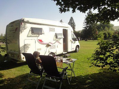
After a late departure, we headed towards France through the Kinzig valley to Kehl. We were lucky, little traffic to Offenburg (1.5 hours). We use the national roads, some of which are well developed and encountered relatively little traffic. You have to put up with the many roundabouts.
⛅ 15°C
After a late departure, we headed towards France through the Kinzig valley to Kehl. We were lucky, little traffic to Offenburg (1.5 hours). We use the national roads, some of which are well developed and encountered relatively little traffic. You have to put up with the many roundabouts.
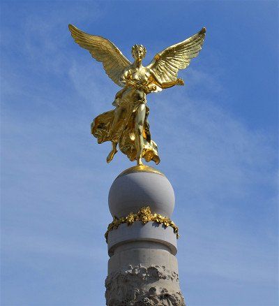
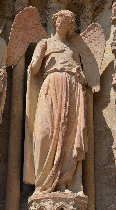
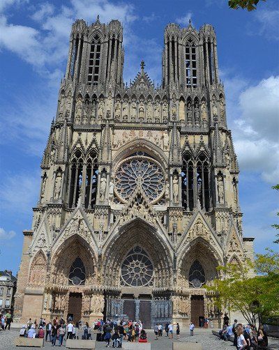
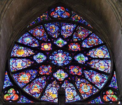
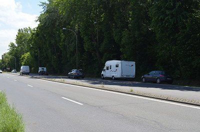
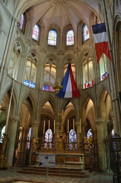
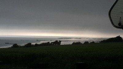
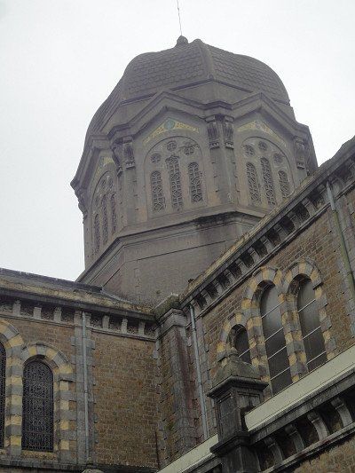
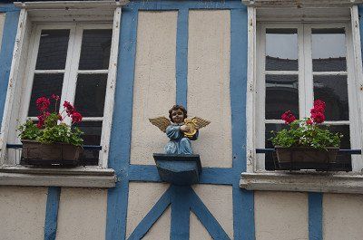
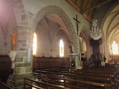
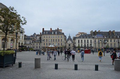
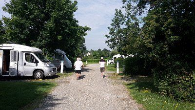
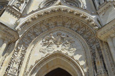
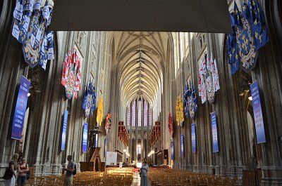
In the early afternoon we reached Reims in the Champagne region for an overnight stay. In Reims we found the selected pitch right away. Unfortunately, it was occupied and we were assigned a nice free parking space by the stadium from the tourist information. (GPS: 49.23533333,4.02815) It was not an official parking space, when we arrived there were already several mobile homes on the site. Immediately afterwards we went on a city walk with a visit to the cathedral and the center. The cathedral, a High Gothic masterpiece, a UNESCO World Heritage Site since 1991, where 29 French kings were crowned. And with the greeting of the smiling angel we said goodbye into the night. After returning we had something to eat and went to bed after a hard day.
The night was quite noisy due to the proximity of the passing freeway. After breakfast we continued to Rouen.
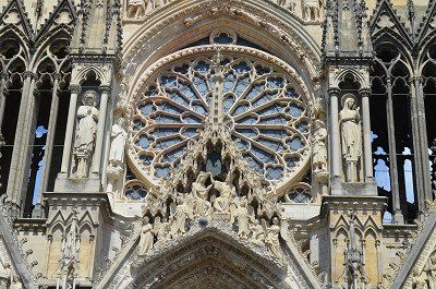
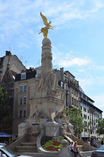
We took the state roads which, on a somewhat longer journey, give a better impression of the landscape. Already on the route you can see the first signs, military cemeteries that remind of the great battle.
We took the state roads which, on a somewhat longer journey, give a better impression of the landscape. Already on the route you can see the first signs, military cemeteries that remind of the great battle.
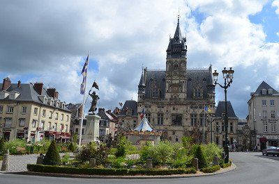
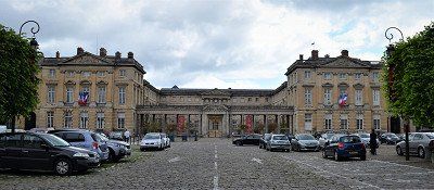
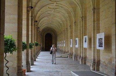
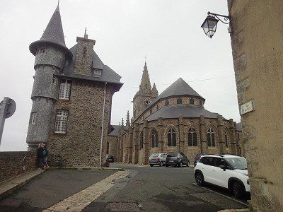
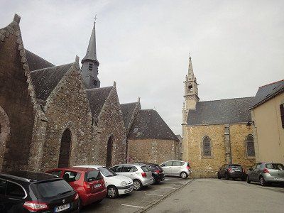
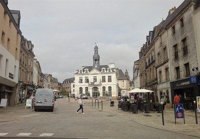
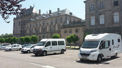
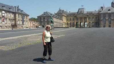
Before Rouen we made a sightseeing stop in the town of Compiègne. Difficulty entering a parking lot, height restrictions or narrow driveways.
Parking :(49.41641667,2.83101667)
Former royal residence, the Castle of Compiègne, built in the 18th century. Built in the 19th century, it houses imperial and royal residences, but also a car and tourism museum and the Second Empire Museum.
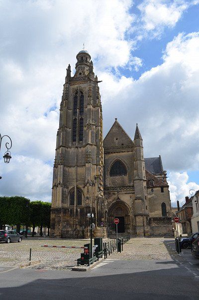
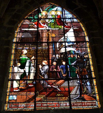
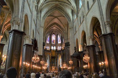
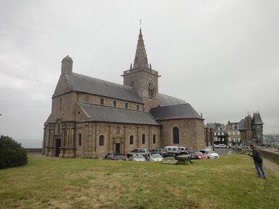
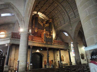
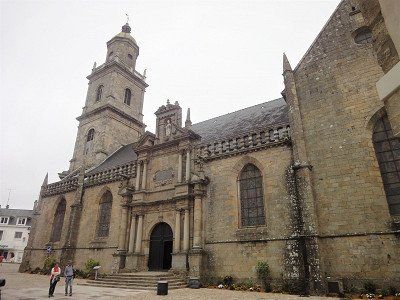
With a visit to the Jakobskirche we were able to celebrate the end of the Sunday service.
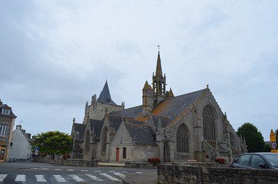
The Saint-Jacques church was originally one of the town's two parish churches. The 12th-century building has many references to its namesake, the Apostle James, and to the pilgrimage tradition of the Way of St. James to Santiago de Compostela in its decorative figures. The 15th-century bell tower was raised in the 17th century, and the statues of 14 saints were placed in its upper part. Its role as a royal church in the immediate vicinity of the castle caused extensive reconstruction in the 18th century and lavish furnishings. Since 1998, the church has been recognized as part of the UNESCO World Heritage Site "Way of St. James in France".
The town hall, finished Gothic style, is surmounted by a watchtower containing one of the oldest municipal bells of France.

Before Rouen we made a sightseeing stop in the town of Compiègne. Difficulty entering a parking lot, height restrictions or narrow driveways.
Parking :(49.41641667,2.83101667)
Former royal residence, the Castle of Compiègne, built in the 18th century. Built in the 19th century, it houses imperial and royal residences, but also a car and tourism museum and the Second Empire Museum.
With a visit to the Jakobskirche we were able to celebrate the end of the Sunday service.
The Saint-Jacques church was originally one of the town's two parish churches. The 12th-century building has many references to its namesake, the Apostle James, and to the pilgrimage tradition of the Way of St. James to Santiago de Compostela in its decorative figures. The 15th-century bell tower was raised in the 17th century, and the statues of 14 saints were placed in its upper part. Its role as a royal church in the immediate vicinity of the castle caused extensive reconstruction in the 18th century and lavish furnishings. Since 1998, the church has been recognized as part of the UNESCO World Heritage Site "Way of St. James in France".
The town hall, finished Gothic style, is surmounted by a watchtower containing one of the oldest municipal bells of France.
⛅ 15°C
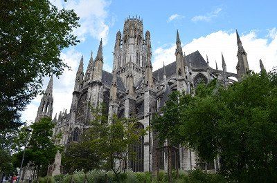
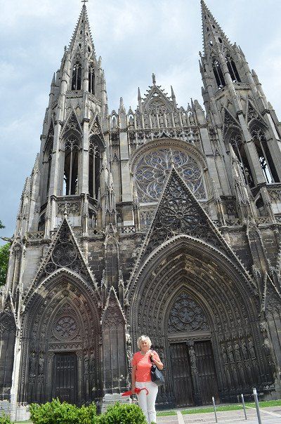
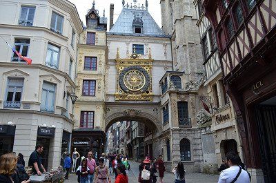
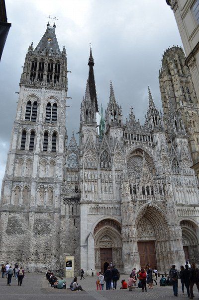
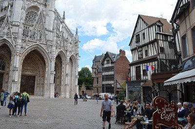
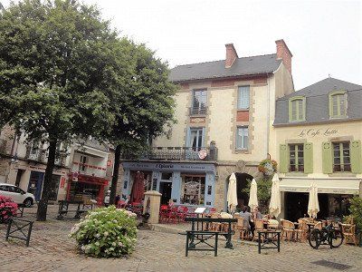
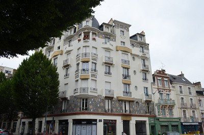
Finding a parking space in the city center is hopeless. By chance we saw a coach parked in a gravel parking lot on Avenue Georges Metayer (GPS:49.44953333,1.11435) and we stood next to it. (free) center about 30 minutes walk away. The old town of Rouen, the old Norman residence and today's capital of the Normandy region. Downtown Rouen is an open-air museum. Sights such as Notre-Dame Cathedral, Saint-Ouen Abbey, the Gros-Horloge and the Historial Joan of Arc.
> Notre Dame Cathedral: Its facade spans all Gothic styles. Another special feature are the surrounding buildings: they were built at the same time as the cathedral and have been preserved.
The Clock Tower (Gros Horloge): This popular attraction right in the city center invites you to travel back in time by visiting its inner workings.
Saint Joan of Arc Church: Completed in 1979, this church with its clean lines and 16th-century windows was built on the Old Market on the site where Saint Joan of Arc was burned.


⛅ 15°C
Finding a parking space in the city center is hopeless. By chance we saw a coach parked in a gravel parking lot on Avenue Georges Metayer (GPS:49.44953333,1.11435) and we stood next to it. (free) center about 30 minutes walk away. The old town of Rouen, the old Norman residence and today's capital of the Normandy region. Downtown Rouen is an open-air museum. Sights such as Notre-Dame Cathedral, Saint-Ouen Abbey, the Gros-Horloge and the Historial Joan of Arc.
> Notre Dame Cathedral: Its facade spans all Gothic styles. Another special feature are the surrounding buildings: they were built at the same time as the cathedral and have been preserved.
The Clock Tower (Gros Horloge): This popular attraction right in the city center invites you to travel back in time by visiting its inner workings.
Saint Joan of Arc Church: Completed in 1979, this church with its clean lines and 16th-century windows was built on the Old Market on the site where Saint Joan of Arc was burned.
⛅ 16 °C
The RV park (GPS:49.69868333,0.18406667) is right next to the Camping Municipal. The parking space was well occupied when we arrived, we found a place to stand next to the disposal station. Because of the narrow access to the disposal, for larger motorhomes we changed the next morning to another space that had become free.
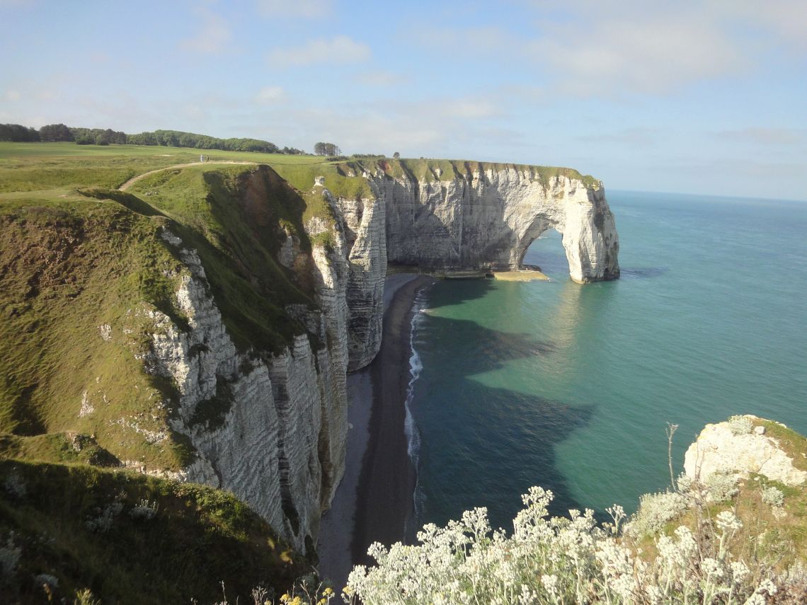
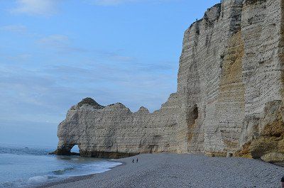
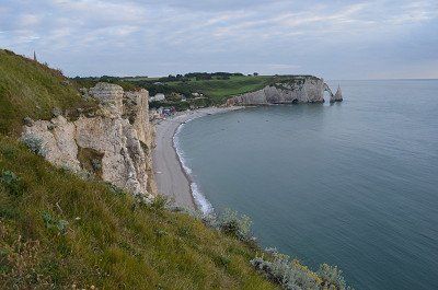
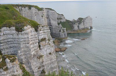
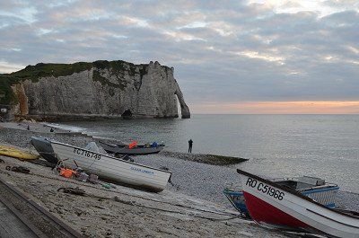
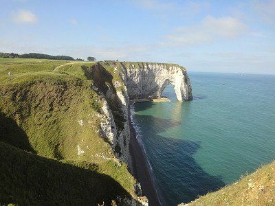
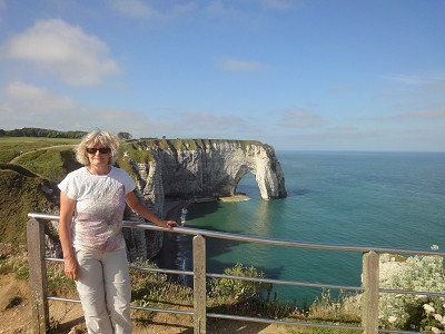
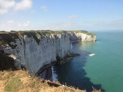
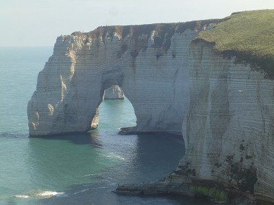
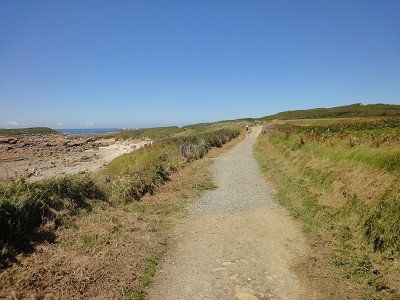
With sunny weather and pleasant temperatures, we experienced the scenic highlight of Normandy - the rock needles in Etretat. These chalk cliffs come from a sea of the Cretaceous period, on the bottom of which calcareous sediments collected. The cliffs of the Falaise d'Aval rise to the left of the beach and the Falaise d'Amont to the right. Huge rock arches open in the limestone and the sun shining in from the west produces brilliantly pale rock and (actually) emerald green waters of the English Channel. The ascent to the coast was rewarded for our efforts and we were able to take some beautiful vacation pictures. The next morning we undertook a small coastal hike on the cliffs of Calauer d'Aval, which always showed new perspectives. Irmgard took advantage of a short dip in the sea on the beach at Etretat.
The town itself with its half-timbered buildings is also worth seeing.
⛅ 16 °C
The RV park (GPS:49.69868333,0.18406667) is right next to the Camping Municipal. The parking space was well occupied when we arrived, we found a place to stand next to the disposal station. Because of the narrow access to the disposal, for larger motorhomes we changed the next morning to another space that had become free.
With sunny weather and pleasant temperatures, we experienced the scenic highlight of Normandy - the rock needles in Etretat. These chalk cliffs come from a sea of the Cretaceous period, on the bottom of which calcareous sediments collected. The cliffs of the Falaise d'Aval rise to the left of the beach and the Falaise d'Amont to the right. Huge rock arches open in the limestone and the sun shining in from the west produces brilliantly pale rock and (actually) emerald green waters of the English Channel. The ascent to the coast was rewarded for our efforts and we were able to take some beautiful vacation pictures. The next morning we undertook a small coastal hike on the cliffs of Calauer d'Aval, which always showed new perspectives. Irmgard took advantage of a short dip in the sea on the beach at Etretat.
The town itself with its half-timbered buildings is also worth seeing.
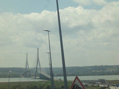
Pont de Normandie
Just south of Le Havre we come to a significant point on the Channel coast: the Seine estuary. The estuary divides Normandy into Upper Normandy and Lower Normandy (Upper... and Lower...). A very large bridge, the Pont de Normandie, crosses the estuary. It is a cable-stayed bridge and at 856 meters the bridge with the longest span in Europe. The bridge itself is subject to a toll, we pay a good €6.20 as a “Class 2” vehicle,
The largest cable-stayed suspension bridge in the world. This bridge then took us across the Seine to the department of Calvados and the fishing town of Honfleur. Continuing our journey we crossed the Saine bridge, an engineering marvel, we were amazed by the architecture of this bridge. Across the bridge is Honfleur, a beautiful old sailing and fishing town.
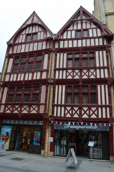
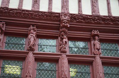
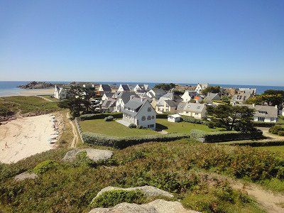
We had headed for the mobile home parking space on the outskirts of town. When we got there, we saw the extent: of what felt like 300 parking spaces on gravel surfaces, 300 were already occupied. One mobile of white goods lined up after the other. We turned around at the next roundabout and headed out of town again. Luckily we found an open area on a gravel shoulder next to the road where we could park our camper and in the shade. (GPS: 49.41641667,0.24251667) After a short lunchtime snack we went on a little tour of the town. There's no mistaking that we're on the coast. In the restaurants, the Plates de Mer pile up with all kinds of crustaceans, mussels, oysters and snails. Narrow streets and colorful half-timbered houses characterize the image of Honfleur
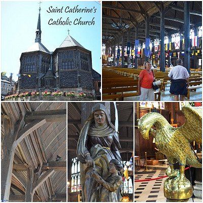
We also paid a visit to the Ste-Cathérine church, which was built entirely of wood.
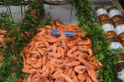
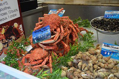
We had headed for the mobile home parking space on the outskirts of town. When we got there, we saw the extent: of what felt like 300 parking spaces on gravel surfaces, 300 were already occupied. One mobile of white goods lined up after the other. We turned around at the next roundabout and headed out of town again. Luckily we found an open area on a gravel shoulder next to the road where we could park our camper and in the shade. (GPS: 49.41641667,0.24251667) After a short lunchtime snack we went on a little tour of the town. There's no mistaking that we're on the coast. In the restaurants, the Plates de Mer pile up with all kinds of crustaceans, mussels, oysters and snails. Narrow streets and colorful half-timbered houses characterize the image of Honfleur
We also paid a visit to the Ste-Cathérine church, which was built entirely of wood.
☁️ 23°C
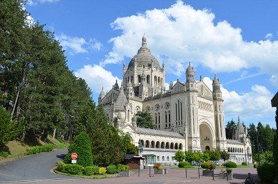
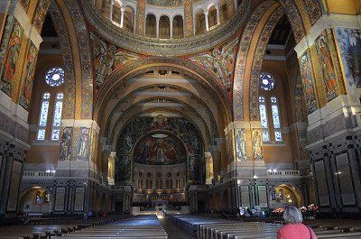
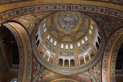
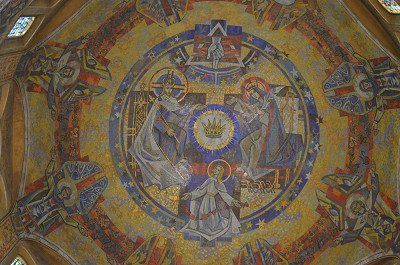
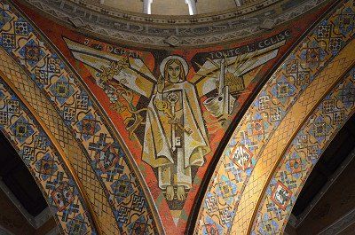
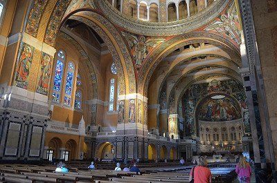
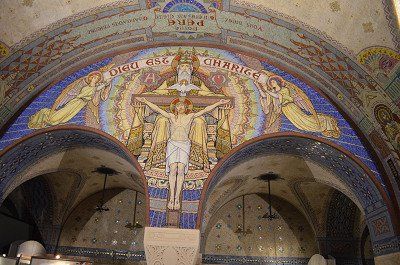
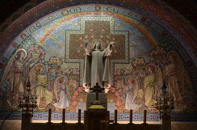
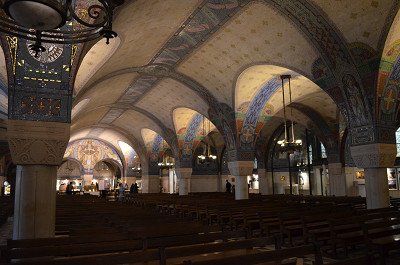
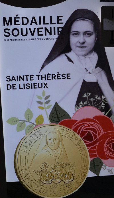
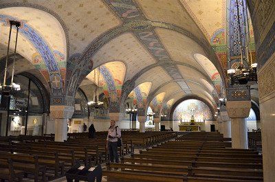
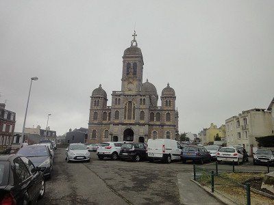
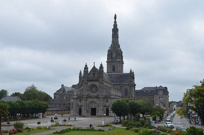
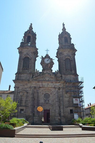
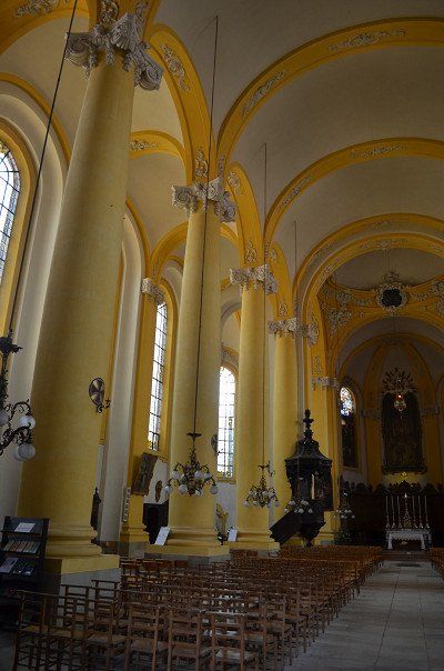
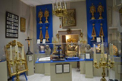
The Sainte-Thérèse Basilica. The basilica is dedicated to Saint Therese of Lisieux. The church building, built in neo-Byzantine style. We were also able to park on the free parking space by the basilica (GPS:49.14975,0.23415) . The basilica is beautiful, its architectural style and interior is a contrast to the churches we have seen in France so far. The crypt is also worth seeing, with the mosaic it is decorated with.
☁️ 23°C
The Sainte-Thérèse Basilica. The basilica is dedicated to Saint Therese of Lisieux. The church building, built in neo-Byzantine style. We were also able to park on the free parking space by the basilica (GPS:49.14975,0.23415) . The basilica is beautiful, its architectural style and interior is a contrast to the churches we have seen in France so far. The crypt is also worth seeing, with the mosaic it is decorated with.
For the overnight stay we decided to drive to the municipal campsite in Lisieux. (GPS: 49.16526667,0.22038333) The place was almost empty, we could choose the place where we would like to stand. The overnight stay cost € 19.20.
Holidays are the order of the day on the square, but on the other hand like on the narrow pitches where there is a mobile home next to a mobile home. It was a mild evening and we sat in front of the mobile home until 10 p.m.
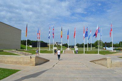
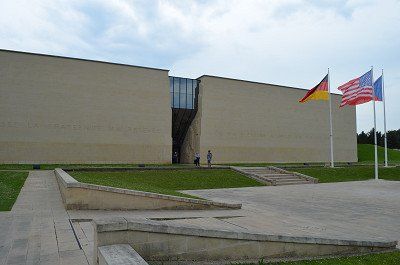
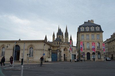
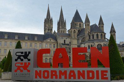
Car park (GPS:49.19973333,0.3872) at the Caens Center for History and Peace around themes such as WWII, the Battle of Normandy and the Cold War.
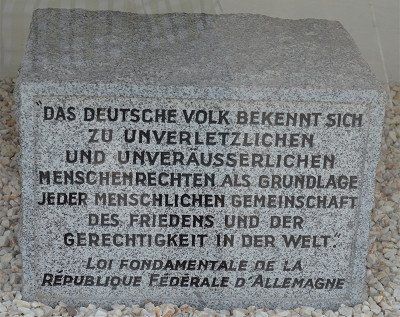
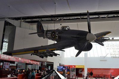
The Mémorial de Caen aims to provide visitors with the information essential to understanding the Second World War, starting from the causes that lie in the results of the First World War and ending with its impact on the events of 1989. It challenges the visitor to question yourself about the rapidly fading period of history that has changed the face of Europe and the world.
World War II, the most terrible conflict in human history, claimed the lives of some 60 million people, half of them civilians. The violence against the civilian population, be it the massive bombing of cities, the total war in the East, the greatest genocide in history or the first use of atomic bombs in Hiroshima and Nagasaki, ultimately shaped this war to a large extent.

Car park (GPS:49.19973333,0.3872) at the Caens Center for History and Peace around themes such as WWII, the Battle of Normandy and the Cold War.
The Mémorial de Caen aims to provide visitors with the information essential to understanding the Second World War, starting from the causes that lie in the results of the First World War and ending with its impact on the events of 1989. It challenges the visitor to question yourself about the rapidly fading period of history that has changed the face of Europe and the world.
World War II, the most terrible conflict in human history, claimed the lives of some 60 million people, half of them civilians. The violence against the civilian population, be it the massive bombing of cities, the total war in the East, the greatest genocide in history or the first use of atomic bombs in Hiroshima and Nagasaki, ultimately shaped this war to a large extent.
☁️ 23°C
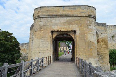
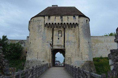
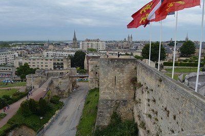
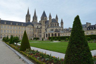
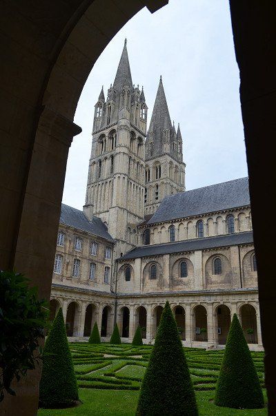
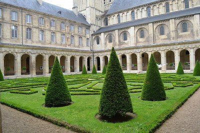
From the parking lot it was three kilometers to the center. We walked on the bike path that led us to the first viewing location. The ruins of the castle of Caen, the largest castle in France, rather the remains of it. The still intact walls are impressive. Afterwards we went through the pedestrian zone to the Piere church and on to the Hotel Ville (town hall), with a beautiful park. The tourist information is also located here, where we got a city map. The building is a former monastery and part is freely accessible with the exhibition detailing the Allied invasion of Normandy. We watched the documentation extensively with great interest. We continued through other alleys of the old town, with a short coffee break in a street cafe and finally we went back to the camper.

☁️ 23°C
From the parking lot it was three kilometers to the center. We walked on the bike path that led us to the first viewing location. The ruins of the castle of Caen, the largest castle in France, rather the remains of it. The still intact walls are impressive. Afterwards we went through the pedestrian zone to the Piere church and on to the Hotel Ville (town hall), with a beautiful park. The tourist information is also located here, where we got a city map. The building is a former monastery and part is freely accessible with the exhibition detailing the Allied invasion of Normandy. We watched the documentation extensively with great interest. We continued through other alleys of the old town, with a short coffee break in a street cafe and finally we went back to the camper.
☁️ 17°C
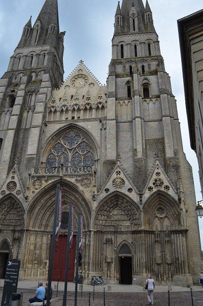
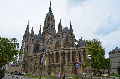
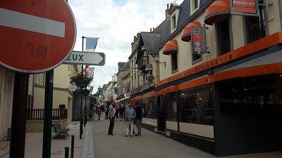
The onward journey to Bayeux was short and yet long until we found a parking space. Either the parking spaces were occupied or the parking bays were too small for our camper. We found a parking space at a larger supermarket and were free to park there. The walk to the cathedral wasn't that far either.
Bayeux can refer to an ancient settlement history, the city owes its name to the Celtic Baiokassen. The districts around the cathedral are particularly worth seeing. A visit to the medieval Bayeux Tapestry should not be missed. The embroidered "comic" from the 11th century depicts the conquest of England by William the Conqueror.
☁️ 17°C
The onward journey to Bayeux was short and yet long until we found a parking space. Either the parking spaces were occupied or the parking bays were too small for our camper. We found a parking space at a larger supermarket and were free to park there. The walk to the cathedral wasn't that far either.
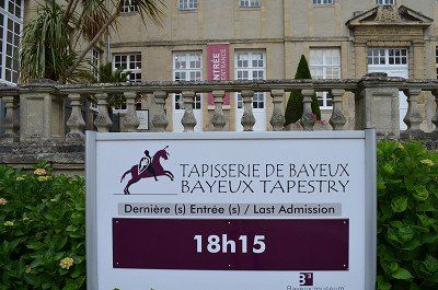
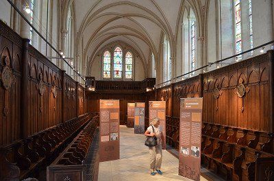
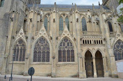
Bayeux can refer to an ancient settlement history, the city owes its name to the Celtic Baiokassen. The districts around the cathedral are particularly worth seeing. A visit to the medieval Bayeux Tapestry should not be missed. The embroidered "comic" from the 11th century depicts the conquest of England by William the Conqueror.
⛅ 18°C
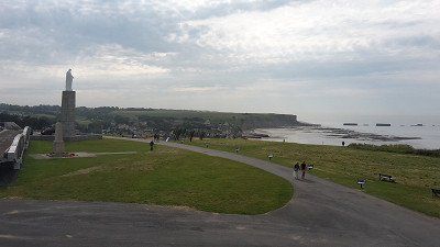
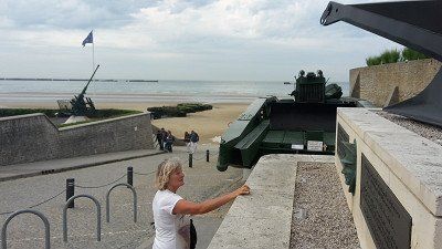
Our last stop today was 14117 Arromanches-les-Bains GPS:49.339298,-0.6147
Paid parking at the panorama board above the city.
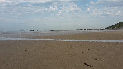
Very nice view of the Gold Beach beaches to the east and the remains of the artificial harbor.
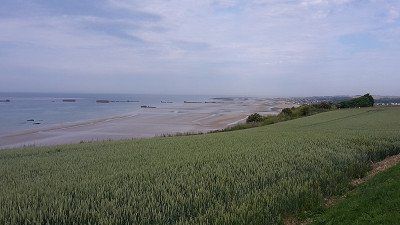
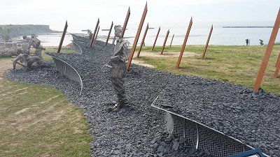
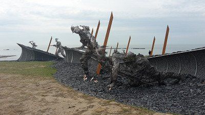
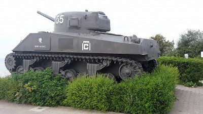
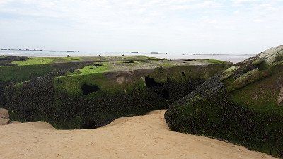
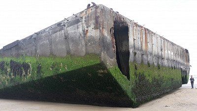
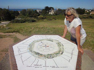
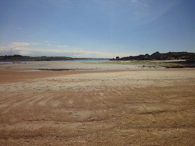
The Normandy coast is vast and beautiful with its beautiful blond sand. But here and there these extensive beaches are interspersed with old bunkers built by the Germans in the last world war. Today these bunkers are witnesses of a war that Europe no longer wants. Arromanches-les-Bains , where there is a memorial and a 360 degree cinema with information and documents about the 1944 Allied landings. This small town, with its Norman charm, with its small gray granite houses and its small streets, has been listed as a UNESCO World Heritage Site.
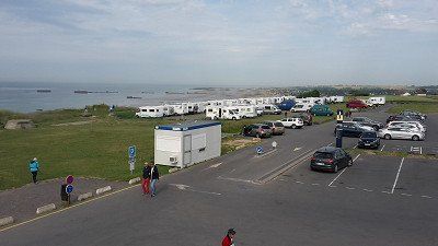
When we arrived, the first two rows of the site were already occupied by mobile homes. We were able to stand in the third row and still had a view of the sea. It was low tide and we took this opportunity to take a short walk on the mudflats and take a closer look at the remains of the war that stood freely on the beach at low tide. The colossuses of steel and concrete must be what remains of the artificial port.
In the evening, shortly after dinner, a lightning-fast thunderstorm approached, it was just enough to stow the camping chairs in the garage.
During the night another heavy thunderstorm passed over us and that four times. The lightning and especially the thunder was so strong that the Womo trembled. It was a pity that we were not allowed to experience sunrise on the coast but had to have our breakfast in the camper, it was still raining.

⛅ 18°C
Our last stop today was 14117 Arromanches-les-Bains GPS:49.339298,-0.6147
Paid parking at the panorama board above the city.
Very nice view of the Gold Beach beaches to the east and the remains of the artificial harbor.
The Normandy coast is vast and beautiful with its beautiful blond sand. But here and there these extensive beaches are interspersed with old bunkers built by the Germans in the last world war. Today these bunkers are witnesses of a war that Europe no longer wants. Arromanches-les-Bains , where there is a memorial and a 360 degree cinema with information and documents about the 1944 Allied landings. This small town, with its Norman charm, with its small gray granite houses and its small streets, has been listed as a UNESCO World Heritage Site.
When we arrived, the first two rows of the site were already occupied by mobile homes. We were able to stand in the third row and still had a view of the sea. It was low tide and we took this opportunity to take a short walk on the mudflats and take a closer look at the remains of the war that stood freely on the beach at low tide. The colossuses of steel and concrete must be what remains of the artificial port.
In the evening, shortly after dinner, a lightning-fast thunderstorm approached, it was just enough to stow the camping chairs in the garage.
During the night another heavy thunderstorm passed over us and that four times. The lightning and especially the thunder was so strong that the Womo trembled. It was a pity that we were not allowed to experience sunrise on the coast but had to have our breakfast in the camper, it was still raining.
? 15ºC
Pitch: 48.835300,-1.609500 (not found)
We couldn't find the parking space entered in the navigation system, so we parked our camper on a parking space next to the road not far from the center. There was also heavy traffic towards the center, so we were glad to have found this alternative place.
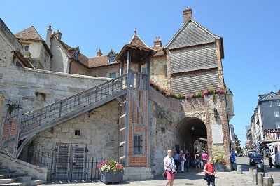
Granville is nothing special, it has a pretty center with small shops. The church stands on a hill from which one has a beautiful view of the fishing town and port. In the travel guides it is written that you can see the rock monastery Saint Michele from here when the visibility is good. Therefore, we chose the place, it should get us in the mood for the next stage destination "Mont Saint Michel" . The church is simply furnished inside. The second church, which appeared larger on the other side of town, was closed for renovation. It was also difficult to find, only a narrow driveway led up to it from the center.

? 15ºC
Pitch: 48.835300,-1.609500 (not found)
We couldn't find the parking space entered in the navigation system, so we parked our camper on a parking space next to the road not far from the center. There was also heavy traffic towards the center, so we were glad to have found this alternative place.
Granville is nothing special, it has a pretty center with small shops. The church stands on a hill from which one has a beautiful view of the fishing town and port. In the travel guides it is written that you can see the rock monastery Saint Michele from here when the visibility is good. Therefore, we chose the place, it should get us in the mood for the next stage destination "Mont Saint Michel" . The church is simply furnished inside. The second church, which appeared larger on the other side of town, was closed for renovation. It was also difficult to find, only a narrow driveway led up to it from the center.
⛅ 14 °C
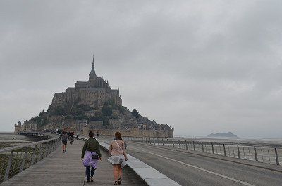
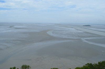
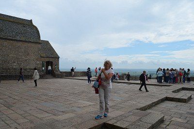
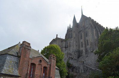
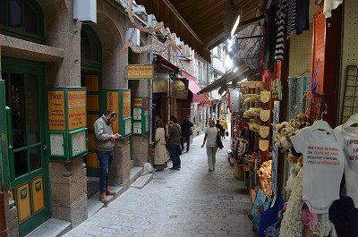
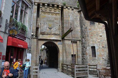
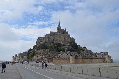
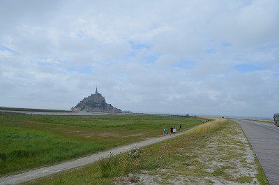
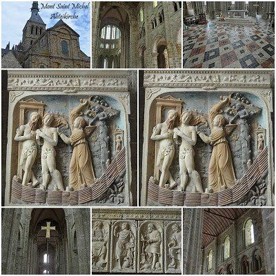
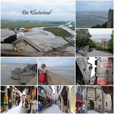
Standing Mont Saint Michel in real life in front of this unusual monastic island is unbelievable, magnificent, glorious and mysterious. From the parking space (GPS:48.5936,1.51246667) we walked (5 km) to the monastery island, first alone and on the jetty with many other people. The Inselberg, which also offers an impressive picture at low tide, and in order to reach the upper abbey church, many steep steps have to be climbed first, but the magnificent view from the top makes up for all the effort! For many years after the French Revolution, the old monastery was a feared state prison. We inspected the monastery in detail and then walked back down to the entrance through old, narrow streets and small shops. Visibly impressed by the width of the low tide, we returned back to the camper place.

⛅ 14 °C
Standing Mont Saint Michel in real life in front of this unusual monastic island is unbelievable, magnificent, glorious and mysterious. From the parking space (GPS:48.5936,1.51246667) we walked (5 km) to the monastery island, first alone and on the jetty with many other people. The Inselberg, which also offers an impressive picture at low tide, and in order to reach the upper abbey church, many steep steps have to be climbed first, but the magnificent view from the top makes up for all the effort! For many years after the French Revolution, the old monastery was a feared state prison. We inspected the monastery in detail and then walked back down to the entrance through old, narrow streets and small shops. Visibly impressed by the width of the low tide, we returned back to the camper place.
GPS: 48.64826667.2.0142
Ideal place for visiting the old town
Costs: €0.50/hour
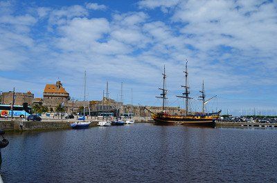
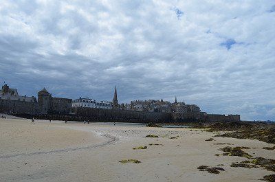
On the way to St. Malo we crossed the " Border from Normandy to Brittany".
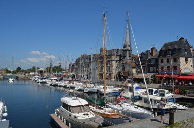
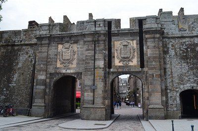
What to discover stronghold of one of King Louis XIV's most famous pirates. Here, too, it is not easy to find a parking space with a Womo. We parked a bit back from the old town and the harbor pier on the side of the road in the industrial port
Walk through the sea
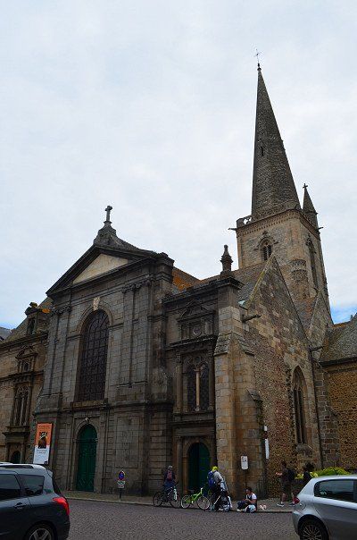
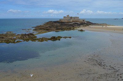
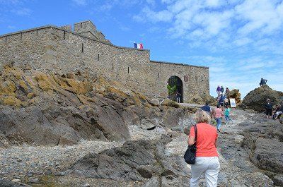
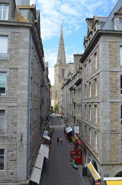
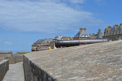
As you walk along the beachfront, Fort National is the obvious sight. Built on a tidal island, this fort was used to defend the coast from an attack by the English. The special thing is that you can walk across to the island at low tide. And we are lucky! We have low tide and of course we make our way, which is not too long. Sure, the rocks and the fort are interesting to look at up close, but the view of the old town of Saint Malo from there is even more beautiful. The fort can be visited for a fee, which we leave out. After a while, the path takes us back to the mainland and along the fortress wall in the direction of the old town. A visit to the Cathédrale Saint Vincent is particularly impressive.
GPS: 48.64826667.2.0142
Ideal place for visiting the old town
Costs: €0.50/hour
On the way to St. Malo we crossed the " Border from Normandy to Brittany".
What to discover stronghold of one of King Louis XIV's most famous pirates. Here, too, it is not easy to find a parking space with a Womo. We parked a bit back from the old town and the harbor pier on the side of the road in the industrial port
Walk through the sea
As you walk along the beachfront, Fort National is the obvious sight. Built on a tidal island, this fort was used to defend the coast from an attack by the English. The special thing is that you can walk across to the island at low tide. And we are lucky! We have low tide and of course we make our way, which is not too long. Sure, the rocks and the fort are interesting to look at up close, but the view of the old town of Saint Malo from there is even more beautiful. The fort can be visited for a fee, which we leave out. After a while, the path takes us back to the mainland and along the fortress wall in the direction of the old town. A visit to the Cathédrale Saint Vincent is particularly impressive.
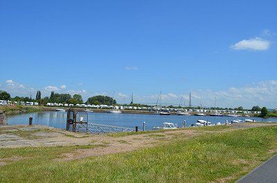
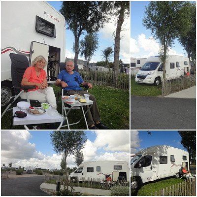
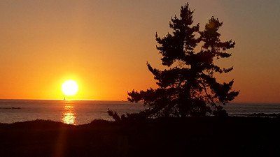
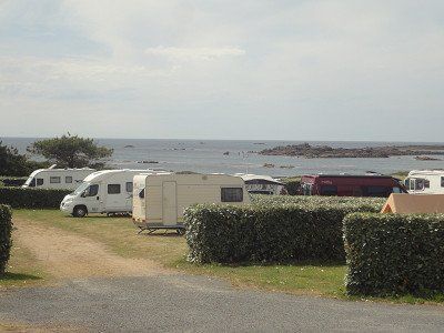
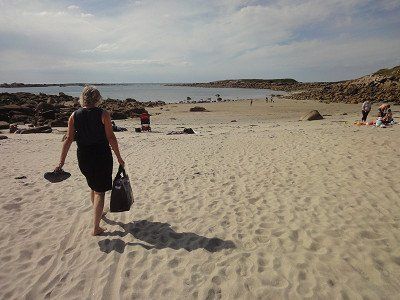
After visiting Saints Malo we drove 40 km further to the pitch in Erqux. (GPS:48.62138333,2.47281667) It was already full when we arrived, but there was still a gap where we could stand. It was only late afternoon and so we took a walk on the beach at low tide and on a fine sandy beach. The sea waves were already violent, Irmgard didn't miss the opportunity to bathe in them for a moment. Emotionally, the water was warmer than the wind. We had an air temperature of 17°C. Around 10 p.m. we were able to end the day with a wonderful sunset.
The night was quiet and those of the campers who planned to stay longer moved early in the morning to a vacated pitch, in the front row with a sea view.
Before leaving, we visited the more distant town center that had a small shop to buy bread.
⛅ 17°C
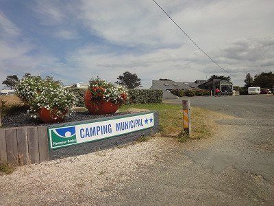
The weather report was decisive that we drove to the campsite. A parking space was provided from which we planned a hike. The weather forecast announced two days of sunny weather for the "Granite of the Rose" region. It was only planned for a later date, on the "Quiberon" peninsula, for a two-day rest day for swimming.
From where we saw the campsite, clean and spacious with a beautiful sandy beach, our decision was correct. Rain was already forecast for the Quiberon Peninsula. We stayed two nights.
(Camping GPS:48.81816667,3.53858333)


⛅ 17°C
The weather report was decisive that we drove to the campsite. A parking space was provided from which we planned a hike. The weather forecast announced two days of sunny weather for the "Granite of the Rose" region. It was only planned for a later date, on the "Quiberon" peninsula, for a two-day rest day for swimming.
From where we saw the campsite, clean and spacious with a beautiful sandy beach, our decision was correct. Rain was already forecast for the Quiberon Peninsula. We stayed two nights.
(Camping GPS:48.81816667,3.53858333)
⛅ 19 °C
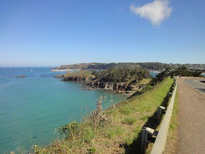
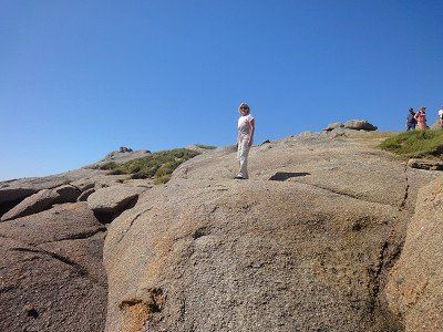
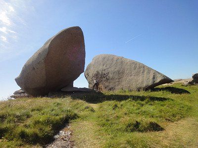
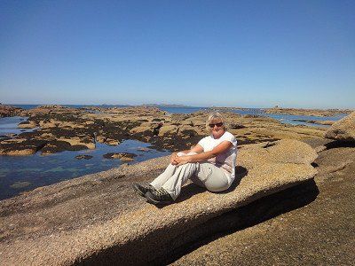
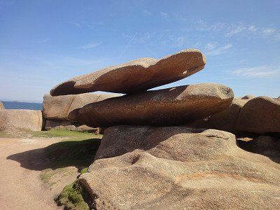
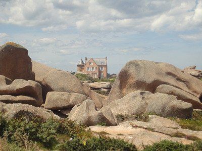
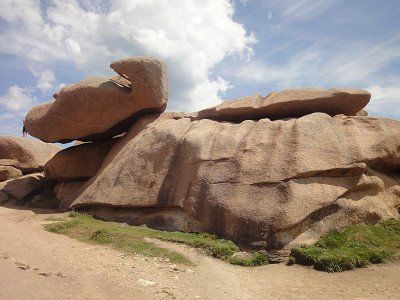
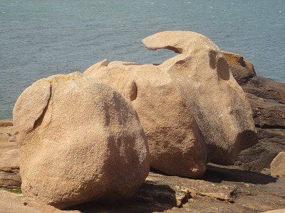
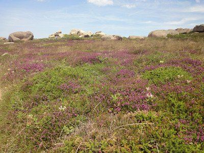
We started the beautiful and first hike of our trip in wonderful weather and pleasant temperatures of 19°. First we walked from the campsite along the beach and through the elegant residential area of Trégastel. This is where the geologically most interesting part began. These stones were formed 300 million years ago, forming bizarre formations as if thrown by a giant hand.
The Renote peninsula on the pink granite coast (Côte de Granit Rose) in Brittany has extraordinary rock formations made of reddish granite. The peninsula of Presqu'île Renote is located in the municipality of Trégastel. Trégastel, Perros-Guirec and Ploumanac'h are the main towns on the Pink Granite Coast in the Côtes d'Armor department of Brittany.
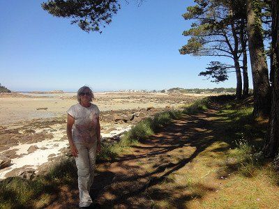
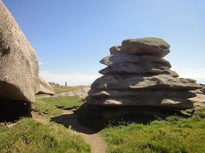
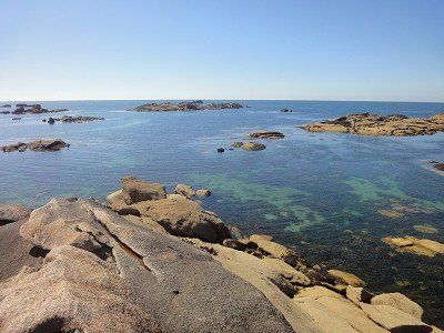
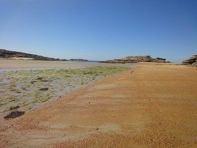
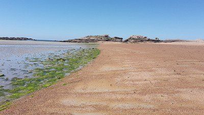
The sign "Bienvenue sur la presqu'ile Renote" (Welcome to the Renote peninsula) welcomes the hiker. When entering the Renote peninsula, you can see the island Île du Grande Gouffre (English: island of the great abyss), which can only be reached at low tide. The transition to the island was not washed over by the water during our visit, so that a visit was possible. There are many rocks in the sea off the coast of the Presqu'île Renote peninsula, some of which look like small offshore islands. The Grève Blanche is a beach with white sand, above is a viewpoint with a great view of the coast and the town of Trégastel. The view of rocks stacked on top of each other by magic in front of the English Channel is impressive. We took advantage of the high tide and were able to walk across the mud flats at low tide, making it a nice circular hike.

⛅ 19 °C
We started the beautiful and first hike of our trip in wonderful weather and pleasant temperatures of 19°. First we walked from the campsite along the beach and through the elegant residential area of Trégastel. This is where the geologically most interesting part began. These stones were formed 300 million years ago, forming bizarre formations as if thrown by a giant hand.
The Renote peninsula on the pink granite coast (Côte de Granit Rose) in Brittany has extraordinary rock formations made of reddish granite. The peninsula of Presqu'île Renote is located in the municipality of Trégastel. Trégastel, Perros-Guirec and Ploumanac'h are the main towns on the Pink Granite Coast in the Côtes d'Armor department of Brittany.
The sign "Bienvenue sur la presqu'ile Renote" (Welcome to the Renote peninsula) welcomes the hiker. When entering the Renote peninsula, you can see the island Île du Grande Gouffre (English: island of the great abyss), which can only be reached at low tide. The transition to the island was not washed over by the water during our visit, so that a visit was possible. There are many rocks in the sea off the coast of the Presqu'île Renote peninsula, some of which look like small offshore islands. The Grève Blanche is a beach with white sand, above is a viewpoint with a great view of the coast and the town of Trégastel. The view of rocks stacked on top of each other by magic in front of the English Channel is impressive. We took advantage of the high tide and were able to walk across the mud flats at low tide, making it a nice circular hike.
⛅ 23°C
The day started with a sunny morning. Had slept late and went into the sea for a swim before breakfast. The water was so cold that we couldn't stay in the water for long. (estimated 15 degrees).
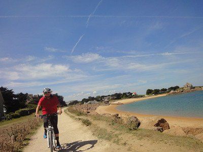
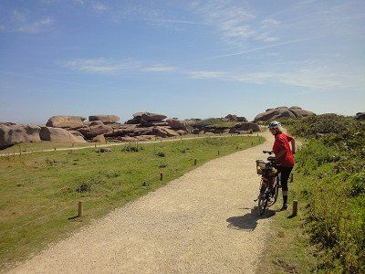
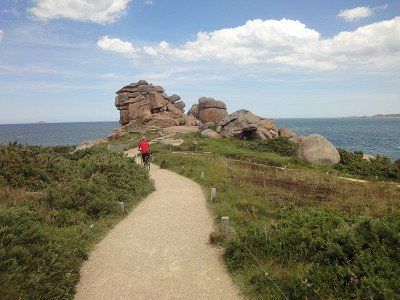
After breakfast we got ready for the bike ride to the granite rocks. The landscape is more of a hiking area, there are very few cycle paths and the signposting is also very incomplete.
Small bike tour on the smugglers' path.
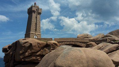
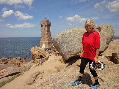
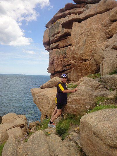
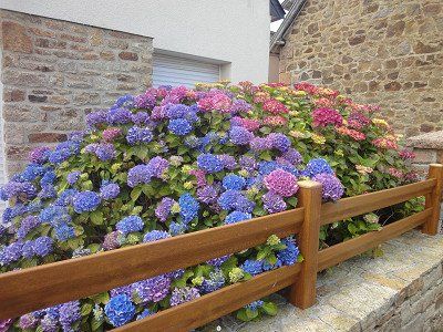
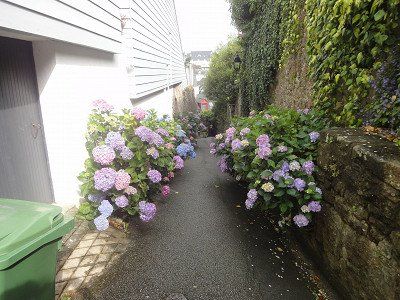
Sleeping giants snore along the way and we cycled along the old customs officer's path, which always offers us wonderful views of the sea and the offshore islands. The whole bike tour, during which we also walked a lot, was a single play of colors: the pink granite, the deep blue sky, the emerald green of the sea, dark green conifers and the blue-violet blooming hydrangeas. In the middle of the beach of Ploumenac'h, at the lighthouse, we climbed over the bare rocks.
We cycled the smugglers' trail, which is designed as a hiking trail, and were often told that it wasn't a bike trail (8km). The Ploumanac'h lighthouse (Phare Mean Ruz) and the former home of Alexandre Gustave Eiffel. Alexandre Gustave Eiffel built the Eiffel Tower in Paris in the 19th century.
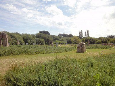
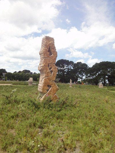
A stone circle made of granite sculptures by the Breton association VALLEY OF THE SAINTS was very interesting
On the way back we had to buy bread and bananas in a supermarket. After returning to the WoMo, we approved our lunchtime coffee with the pastries we had bought. Of course, swimming in the sea was not to be missed. It was still low tide, the tide had already started and will have peaked around 10pm. The water was noticeably warmer than in the morning.
Sitting outside was uncomfortable, a really cold wind was blowing. We got our camper ready for the onward journey the next day.
⛅ 23°C
The day started with a sunny morning. Had slept late and went into the sea for a swim before breakfast. The water was so cold that we couldn't stay in the water for long. (estimated 15 degrees).
After breakfast we got ready for the bike ride to the granite rocks. The landscape is more of a hiking area, there are very few cycle paths and the signposting is also very incomplete.
Small bike tour on the smugglers' path.
Sleeping giants snore along the way and we cycled along the old customs officer's path, which always offers us wonderful views of the sea and the offshore islands. The whole bike tour, during which we also walked a lot, was a single play of colors: the pink granite, the deep blue sky, the emerald green of the sea, dark green conifers and the blue-violet blooming hydrangeas. In the middle of the beach of Ploumenac'h, at the lighthouse, we climbed over the bare rocks.
We cycled the smugglers' trail, which is designed as a hiking trail, and were often told that it wasn't a bike trail (8km). The Ploumanac'h lighthouse (Phare Mean Ruz) and the former home of Alexandre Gustave Eiffel. Alexandre Gustave Eiffel built the Eiffel Tower in Paris in the 19th century.
A stone circle made of granite sculptures by the Breton association VALLEY OF THE SAINTS was very interesting
On the way back we had to buy bread and bananas in a supermarket. After returning to the WoMo, we approved our lunchtime coffee with the pastries we had bought. Of course, swimming in the sea was not to be missed. It was still low tide, the tide had already started and will have peaked around 10pm. The water was noticeably warmer than in the morning.
Sitting outside was uncomfortable, a really cold wind was blowing. We got our camper ready for the onward journey the next day.
Our onward journey through rural Brittany took us to Saint-Thegonnec. (GPS:48.52125,3.9422833) One of the most important Calvary mountains in France is located in the enclosed parish of the small town. More than forty figures depict the life of Jesus and his last journey on Calvary. The most imposing feature of the parish of Saint-Thégonnec is undoubtedly the two-story ossuary with Corinthian half-columns, built between 1676 and 1682. In contrast, the Calvaire shows only about 40 figures; the scenes depicted are the Passion and the Resurrection. The story of Saint Thégonnec is depicted in the base.
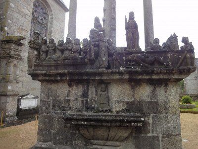
Our onward journey through rural Brittany took us to Saint-Thegonnec. (GPS:48.52125,3.9422833) One of the most important Calvary mountains in France is located in the enclosed parish of the small town. More than forty figures depict the life of Jesus and his last journey on Calvary. The most imposing feature of the parish of Saint-Thégonnec is undoubtedly the two-story ossuary with Corinthian half-columns, built between 1676 and 1682. In contrast, the Calvaire shows only about 40 figures; the scenes depicted are the Passion and the Resurrection. The story of Saint Thégonnec is depicted in the base.
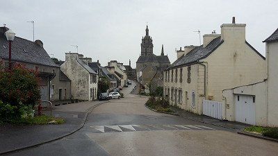
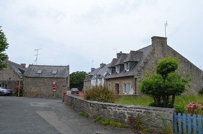
The travel guide says you want to go back to the Middle Ages? Then make a stop in Locronan before heading to the Corzon Peninsula. The town can rightly call itself one of the most beautiful villages in France. Narrow, picturesque alleys, creperies and small shops invite you to stroll through the medieval town centre.
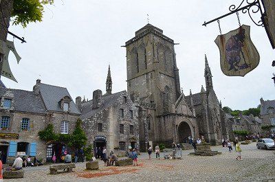
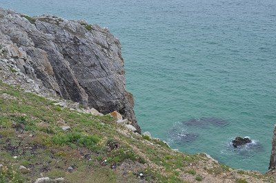
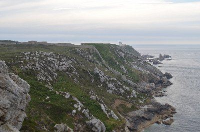
Another highlight of the day was the visit to the town of Locronan. (GPS:48.09941667,4.20538333) In the 11th century Saint Ronan Christianized the site and founded the town: Loc Ronan, the site of Ronan. From the 14th century the town prospered through canvas weaving and trading with all the major navies, reflected in beautiful granite houses and an imposing village church. It is not for nothing that the place was awarded the title "Particularly Picturesque Place" in Brittany and the label of the "Most Beautiful Villages in France". Car traffic in the city of 800 is strictly regulated, giving you the feeling that time has stood still here The appearance of the village is still completely medieval and seems very English to us Steep cliffs and a strong surf, gorse, heather and crouching cottages characterize the peninsula of Crozon.The 70 m high, spectacular cliff Pointe de Penhir offers a view in good weather to the Pointe du Raz.
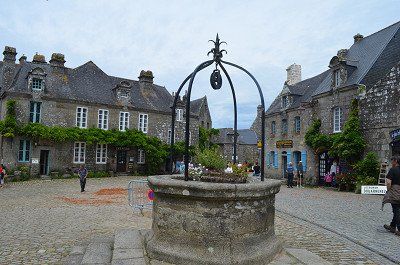

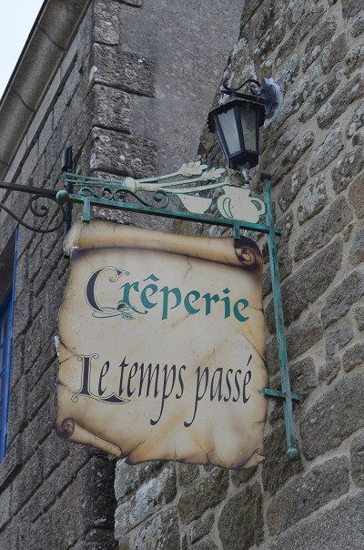
The travel guide says you want to go back to the Middle Ages? Then make a stop in Locronan before heading to the Corzon Peninsula. The town can rightly call itself one of the most beautiful villages in France. Narrow, picturesque alleys, creperies and small shops invite you to stroll through the medieval town centre.
Another highlight of the day was the visit to the town of Locronan. (GPS:48.09941667,4.20538333) In the 11th century Saint Ronan Christianized the site and founded the town: Loc Ronan, the site of Ronan. From the 14th century the town prospered through canvas weaving and trading with all the major navies, reflected in beautiful granite houses and an imposing village church. It is not for nothing that the place was awarded the title "Particularly Picturesque Place" in Brittany and the label of the "Most Beautiful Villages in France". Car traffic in the city of 800 is strictly regulated, giving you the feeling that time has stood still here The appearance of the village is still completely medieval and seems very English to us Steep cliffs and a strong surf, gorse, heather and crouching cottages characterize the peninsula of Crozon.The 70 m high, spectacular cliff Pointe de Penhir offers a view in good weather to the Pointe du Raz.
⛅ 19 °C
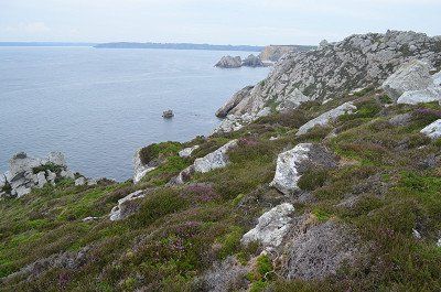
The best comes last in Finistère: the Crozon peninsula in the west is a unique natural experience.
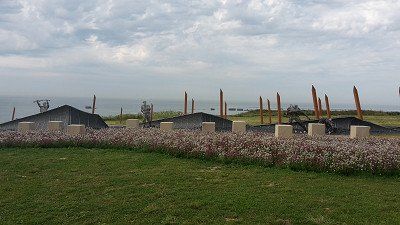
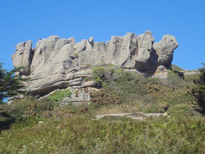
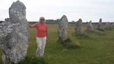
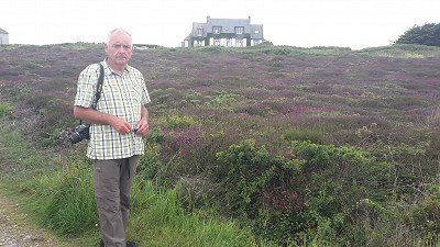
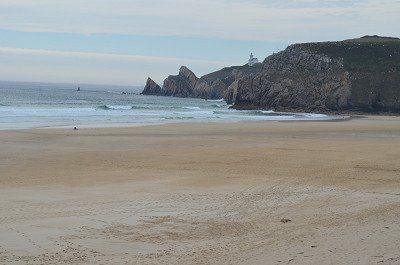
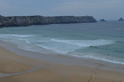
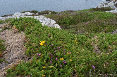
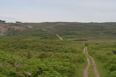
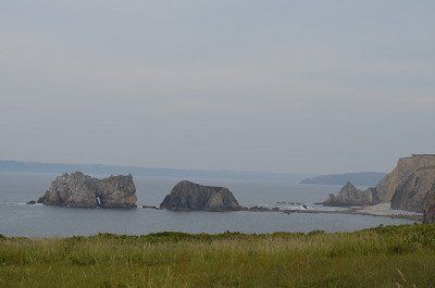
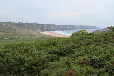
The last destination of the day was the wild coast of Brittany. (GPS:48.2748,4.60768333) The western tip of France is one of the most impressive experiences of Breton nature. Steep cliffs and strong surf, gorse, heather and crouched cottages characterize the Crozon Peninsula. The 70 m high, spectacular cliff Pointe de Penhir offers a view up to the Pointe du Raz in good weather. A short walk brought us to the top of the headland with a view of the offshore Sein Islands and the lighthouse. We were very lucky with the weather this time too. We could enjoy the cape with the blooming heather.
The stone rows of Lagatjar are not far from the parking lot. They are said to have originally consisted of up to 400 stones, so that the total length of the main structure used to be 600 meters. Many of the fallen stones of white quartzite were raised again in 1928 so that the rows now consist of 72 menhirs.
Back in the camper, we enjoyed the evening with a glass of cider.

⛅ 19 °C
The best comes last in Finistère: the Crozon peninsula in the west is a unique natural experience.
The last destination of the day was the wild coast of Brittany. (GPS:48.2748,4.60768333) The western tip of France is one of the most impressive experiences of Breton nature. Steep cliffs and strong surf, gorse, heather and crouched cottages characterize the Crozon Peninsula. The 70 m high, spectacular cliff Pointe de Penhir offers a view up to the Pointe du Raz in good weather. A short walk brought us to the top of the headland with a view of the offshore Sein Islands and the lighthouse. We were very lucky with the weather this time too. We could enjoy the cape with the blooming heather.
The stone rows of Lagatjar are not far from the parking lot. They are said to have originally consisted of up to 400 stones, so that the total length of the main structure used to be 600 meters. Many of the fallen stones of white quartzite were raised again in 1928 so that the rows now consist of 72 menhirs.
Back in the camper, we enjoyed the evening with a glass of cider.
⛅ 17 ° C
(Parking GPS: 47.99238333.4.1077)
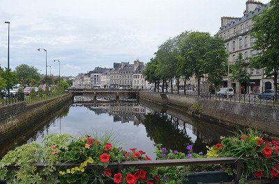
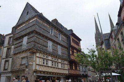
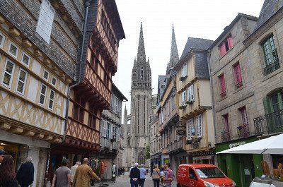
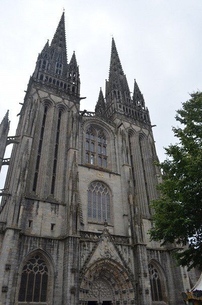
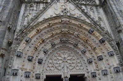
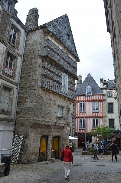
This morning we wanted to take a closer look at Quimper and went along the Odet to the St. Corentin Cathedral. Similar to Rome, the city lies on seven hills. Three rivers meet here and it is only a few kilometers to the sea. Quimper is the capital of the Cornouaille. We strolled through the alleys of the old town with its beautiful half-timbered houses before we visited the interior of the Saint Corentin Cathedral. More than 600 years had to pass before the church got its current shape. What is striking is the slightly bent choir, which leaves plenty of room for speculation, but is unique in terms of building history in this form. Time passed much too quickly and we left Quimper, with its magnificent cathedral, its small streets with half-timbered houses, its canals "à la Venise du Nord".
⛅ 17 ° C
(Parking GPS: 47.99238333.4.1077)
This morning we wanted to take a closer look at Quimper and went along the Odet to the St. Corentin Cathedral. Similar to Rome, the city lies on seven hills. Three rivers meet here and it is only a few kilometers to the sea. Quimper is the capital of the Cornouaille. We strolled through the alleys of the old town with its beautiful half-timbered houses before we visited the interior of the Saint Corentin Cathedral. More than 600 years had to pass before the church got its current shape. What is striking is the slightly bent choir, which leaves plenty of room for speculation, but is unique in terms of building history in this form. Time passed much too quickly and we left Quimper, with its magnificent cathedral, its small streets with half-timbered houses, its canals "à la Venise du Nord".
⛅ 18 ° C
In Penmarc'h you will encounter cultural heritage at every turn. Sights include chapels and churches and the Calvary at the Chapelle de Notre-Dame de Tronoën,
What was described here in the travel guide did not exist. Our navigation system first led us to a parking lot at the harbor in Guilvingec (GPS: 47.799,4.27568333) , where there were also several campers. We stood by them and wanted to explore the sights on foot. But soon we realized that this was not feasible from a distance. So we decided to drive to Penamach directly. We also found a good parking lot (GPS: 47.81361667,4.33868333) near the church. We strolled through the village, the church was closed and disappointed we returned to the Womo. We didn't want to give up completely and followed a signpost to the Notre-Dame chapel. We also came to the chapel on a very narrow street and were so disappointed that we didn't even get out. To save the day we decided to go to Carnac.
? 18 ° C
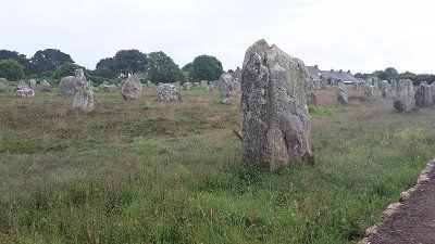
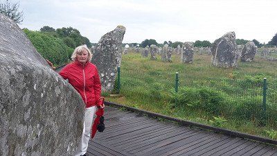
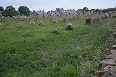
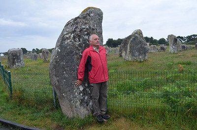
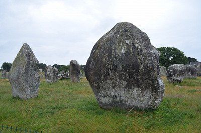
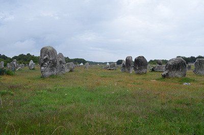
The unsolved mysteries of megalithic culture. The onset of rain could not stop us and so we booted along the rows of stones that gave us a view of the seemingly endless rows of stones. The ideal place for speculation about the meaning of the system; If you add to the 4000 standing stones still standing, those that were destroyed by lightning strikes and by human hands, and those that sank in the sea, this system was the largest of its kind in Europe in the 5th millennium BC - and is still white today no one for what purpose it was built. Carnac, the place name is based on the English word carns for stones. More than five thousand years ago, people set up partially hewn erratic boulders and aligned them in parallel rows. Six of the so-called menhir fields north of Carnac can still be seen today, each with approx. 950 - 1150 stones. They are the largest megalithic complex in the world and have been a UNESCO World Heritage Site since 1996.
Megaliths (Greek: megas = large; lithos = stone). However, most are menhirs now fenced to prevent further erosion from the large crowds that passed through the rows of stones every year. These erosions and the excess powers of some tourists have caused some megaliths to tip over. Other megaliths are missing from the ranks because they were smashed and used as building material.
? 18 ° C
The unsolved mysteries of megalithic culture. The onset of rain could not stop us and so we booted along the rows of stones that gave us a view of the seemingly endless rows of stones. The ideal place for speculation about the meaning of the system; If you add to the 4000 standing stones still standing, those that were destroyed by lightning strikes and by human hands, and those that sank in the sea, this system was the largest of its kind in Europe in the 5th millennium BC - and is still white today no one for what purpose it was built. Carnac, the place name is based on the English word carns for stones. More than five thousand years ago, people set up partially hewn erratic boulders and aligned them in parallel rows. Six of the so-called menhir fields north of Carnac can still be seen today, each with approx. 950 - 1150 stones. They are the largest megalithic complex in the world and have been a UNESCO World Heritage Site since 1996.
Megaliths (Greek: megas = large; lithos = stone). However, most are menhirs now fenced to prevent further erosion from the large crowds that passed through the rows of stones every year. These erosions and the excess powers of some tourists have caused some megaliths to tip over. Other megaliths are missing from the ranks because they were smashed and used as building material.
⛅ 17 ° C
In Carnac we drove to a campsite where we didn't like to stay the night, so we drove to Auray where we found a free parking lot at the cemetery. (GPS: 47.6643,2.9733) On arrival it was still raining and we didn't want to do anything that evening.
The next day after breakfast we went to take a closer look at Auray. The old port area was once the third largest port in Brittany. The old pavement that still lies in the streets and alleys dates from this time. Our walk led down to the harbor through the old streets to the church of St. Goustan, which we could also visit. The St. Saveur chapel is right next to it. Crossing the bridge to the other side of the port, we climbed the path to the city center. After an extensive tour, we made our way to Ste. Anne d'Auray.
☁️ 19 ° C
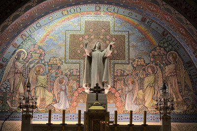
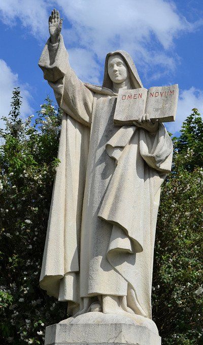
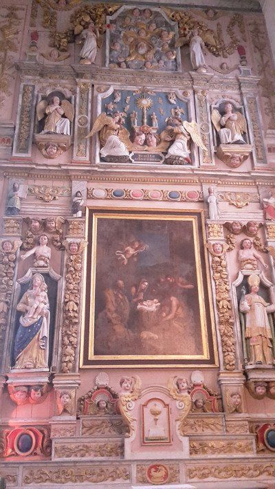
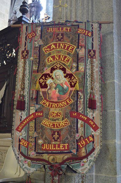
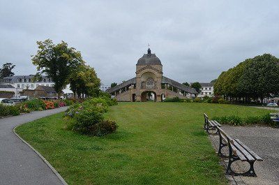
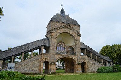
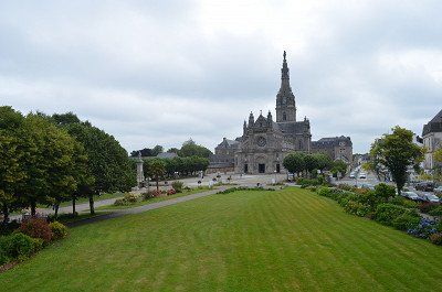
By chance we became aware of the approximately 6 km northeast of Auray, the most important place of pilgrimage in Brittany: Ste-Anne-d'Auray. In Ste. Anne d'Auray we found a parking lot near the Church of the Pilgrimage (GPS: 47.70511667.2.95601667) and then made our way to the Basilica of the Pilgrimage. Saint is worshiped Anna, the mother of the Virgin Mary. 1623 appeared to the agricultural worker Yves Nicolazic. Anna and asked him to rebuild a dilapidated chapel in her field. In 1625 an old statue of St. Anna found.
The cathedral is built on an ancient power place. A source with very good medicinal water. In the square between the source and the cathedral, even Sirius' cross is immersed in the ground.
According to Breton history, Anna, the grandmother of Jesus, was a Breton who traveled to the Holy Land for her Joachim
Maria, the mother of Jesus, and later Jesus himself was born.
The energies of the church are clear and pure, no astral impurities. It is very worthwhile to meditate here and to connect with Anna.
☁️ 19 ° C
By chance we became aware of the approximately 6 km northeast of Auray, the most important place of pilgrimage in Brittany: Ste-Anne-d'Auray. In Ste. Anne d'Auray we found a parking lot near the Church of the Pilgrimage (GPS: 47.70511667.2.95601667) and then made our way to the Basilica of the Pilgrimage. Saint is worshiped Anna, the mother of the Virgin Mary. 1623 appeared to the agricultural worker Yves Nicolazic. Anna and asked him to rebuild a dilapidated chapel in her field. In 1625 an old statue of St. Anna found.
The cathedral is built on an ancient power place. A source with very good medicinal water. In the square between the source and the cathedral, even Sirius' cross is immersed in the ground.
According to Breton history, Anna, the grandmother of Jesus, was a Breton who traveled to the Holy Land for her Joachim
Maria, the mother of Jesus, and later Jesus himself was born.
The energies of the church are clear and pure, no astral impurities. It is very worthwhile to meditate here and to connect with Anna.
☁️ 20 ° C
(Parking GPS: 48.09785,1.64433333)
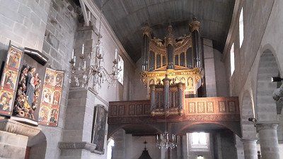
Of course we visited the Romanesque cathedral of Rennes, which is adorned with these gildings.
☁️ 20 ° C
(Parking GPS: 48.09785,1.64433333)
Of course we visited the Romanesque cathedral of Rennes, which is adorned with these gildings.
☀️ 34 ° C
Great parking space with shower, toilet, sink
GPS: 48.12756667,0.75195
The night was very calm. Towards morning a thunderstorm passed by, dropping a few raindrops. For breakfast you could sit outside in the sun again. For the onward journey we had to dispose of the toilet and fill up with fresh water, we didn't know the next place to stay. The intermediate goal was clear and that was Orleans.
☀️ 34 ° C
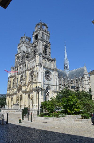
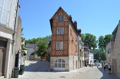
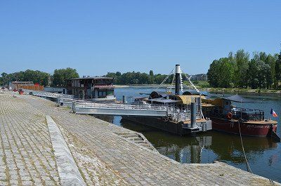
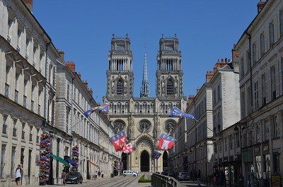
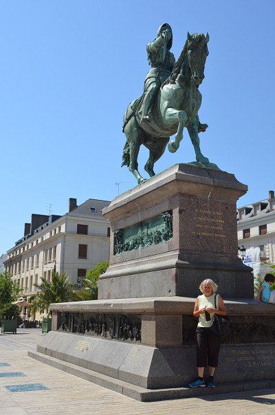
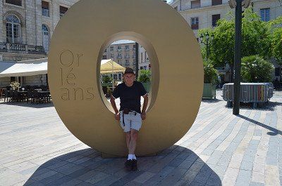
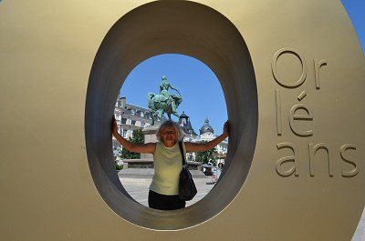
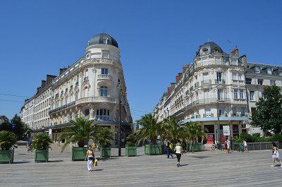
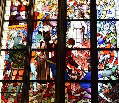
Good parking lot (GPS: 47.90318333,1.9182) approached not far from the center. We first walked towards the cathedral, the interior was very pleasant with the outside temperature of 38 degrees. The life of the Jeanned'Arc is beautifully depicted in the church window. After visiting the cathedral we went into the old town through beautiful alleys down to the Loare. We ended our tour of the city in the large square with the Jeanned'Arc memorial. The great heat was a problem and we were happy to be able to continue in the air-conditioned WoMo.
☀️ 34 ° C
Good parking lot (GPS: 47.90318333,1.9182) approached not far from the center. We first walked towards the cathedral, the interior was very pleasant with the outside temperature of 38 degrees. The life of the Jeanned'Arc is beautifully depicted in the church window. After visiting the cathedral we went into the old town through beautiful alleys down to the Loare. We ended our tour of the city in the large square with the Jeanned'Arc memorial. The great heat was a problem and we were happy to be able to continue in the air-conditioned WoMo.
☀️ 33 ° C
With our early return home and from Orleans the unbearable heat of 38 ° C during star visits, the planned parking spaces had also changed. So we found this beautiful, private, quiet, shady parking space on our parking space app. (GPS: 48.22848333,3.72276667) Only a few km away from our route.
☀️ 32 ° C
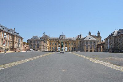
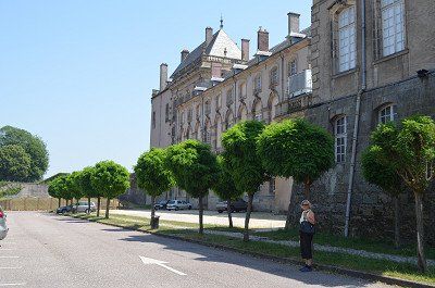
After we were on our last leg of the trip, we took a closer look at Lunéville over lunchtime. Lorraine, a sovereign state for almost ten centuries, has one of the largest castles in France,
The Château de Lunéville is a wonderful gateway to the 18th century. A castle that was the largest construction site in Europe after the winter fire of 2003 to 2010.
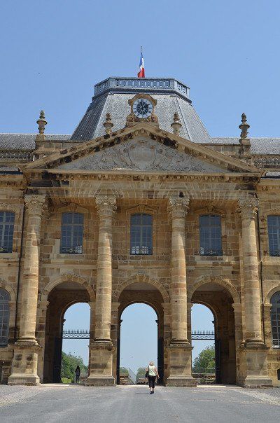
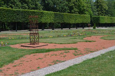
An impressive sight as soon as you arrive. Free parking spaces are available in front of and next to the castle, unfortunately there is a no parking sign for motorhomes. (GPS: 48.59531667,6.49101667) Since it was a very hot day, we ignored the no parking and parked next to the castle. We didn't spend long outside, short visits to the palace complex and the park. We lacked the time to explore the interior of the castle and it is also closed at lunchtime. .
It was so hot on our little city tour that it was no fun staying in the city for too long. The temperature inside the church was very pleasant.
The castle of Luneville, (Rococo castle) also called little Versailles. The city with the old German name Lünstadt was the residence of the Dukes of Lorraine from 1702 to 1737. During this time, the Rococo castle Lunéville was built, which is still the main attraction of the 20,000-inhabitant city. In 1801 peace between France and Austria was decided here.
☀️ 32 ° C
After we were on our last leg of the trip, we took a closer look at Lunéville over lunchtime. Lorraine, a sovereign state for almost ten centuries, has one of the largest castles in France,
The Château de Lunéville is a wonderful gateway to the 18th century. A castle that was the largest construction site in Europe after the winter fire of 2003 to 2010.
An impressive sight as soon as you arrive. Free parking spaces are available in front of and next to the castle, unfortunately there is a no parking sign for motorhomes. (GPS: 48.59531667,6.49101667) Since it was a very hot day, we ignored the no parking and parked next to the castle. We didn't spend long outside, short visits to the palace complex and the park. We lacked the time to explore the interior of the castle and it is also closed at lunchtime. .
It was so hot on our little city tour that it was no fun staying in the city for too long. The temperature inside the church was very pleasant.
The castle of Luneville, (Rococo castle) also called little Versailles. The city with the old German name Lünstadt was the residence of the Dukes of Lorraine from 1702 to 1737. During this time, the Rococo castle Lunéville was built, which is still the main attraction of the 20,000-inhabitant city. In 1801 peace between France and Austria was decided here.
Route
Show newest first- 49.2481 4.0222
- 49° 14' 53" N 4° 1' 20" E
Wir nahmen die Staaatsstraßen die auf etwas längerer Fahrt aber einen besseren Landschaftseindruck vermittelt. Bereits auf der Fahrstrecke sieht man erste Hinweisschilder, Soldatenfriedhöfe die an die große Schlacht erinnern.
- 49.4167 2.8308
- 49° 25' 0.1" N 2° 49' 50.9" E
- 49.4481 1.1121
- 49° 26' 53.3" N 1° 6' 43.5" E
- 49.7014 0.2142
- 49° 42' 5" N 0° 12' 51" E
- 49.4729 0.2707
- 49° 28' 22.3" N 0° 16' 14.6" E
- 49.4158 0.2424
- 49° 24' 56.8" N 0° 14' 32.8" E
- 49.1459 0.2278
- 49° 8' 45.3" N 0° 13' 40.3" E
- 49.1653 0.2206
- 49° 9' 55" N 0° 13' 14.1" E
- 49.2012 -0.3821
- 49° 12' 4.5" N 0° 22' 55.7" W
☁️ 23 °C
Vom Parkplatz aus waren es drei Kilometer bis ins Zentrum. Zu Fuß ging es auf dem Radweg der uns zum ersten Besichtungsort führte. Die Ruinen der Burg Caen, die größte Burg Frankreichs, eher die Überreste davon. Die noch intakten Mauern sind beeindruckend. Im Anschluss danach ging es durch die Fußgängerzone zur Kirche Piere und weiter zum Hotel Ville (Rathaus), mit einer schönen Parkanlage. Hier ist auch die Touristik-Info untergebracht, wo wir uns einen Stadtplan besorgten. Das Gebäude ist eine ehemalige Klosteranlge und ein Teil ist frei zugänglich mit der Ausstellung in der die Invasion der Alleierten in der Normandie ausführlich dargestellt ist. Mit großem Interesse schauten wir uns die Dokumentation ausgiebig an. Weiter ging es noch durch weitere Gassen der Altstadt,mit einer kleinen Kaffeepause in einem Straßenkaffee und schließlich ging`s wieder zurück zum Womo.
- 49.2814 -0.6968
- 49° 16' 53" N 0° 41' 48.5" W
- 49.339 -0.6224
- 49° 20' 20.5" N 0° 37' 20.7" W
- 48.8353 -1.6095
- 48° 50' 7.1" N 1° 36' 34.1" W
- 48.5935 -1.5123
- 48° 35' 36.8" N 1° 30' 44.2" W
- 48.6493 -2.0257
- 48° 38' 57.6" N 2° 1' 32.4" W
- 48.6219 -2.4722
- 48° 37' 19" N 2° 28' 20" W
- 48.8239 -3.503
- 48° 49' 26.1" N 3° 30' 10.7" W
⛅ 19 °C
Wir starteten die schöne und erste Wanderung unserer Reise bei herrlichem Wetter und angenehmen Temperaturen bei 19°. Erst wanderten wir vom Campingplatz aus den Strand entlang und durch die eleganten Villenviertel von Trégastel. Hier begann dann der geologisch interessanteste Teil. Vor 300 Millionen Jahren sind diese Steine entstanden, die, wie von Riesenhand geworfen, bizarre Formationen bilden.
Außergewöhnliche Felsformationen aus rötlichem Granitstein weist die Halbinsel Renote an der rosa Granitküste (Côte de Granit Rose) in der Bretagne auf. Die Halbinsel Presqu'île Renote liegt auf dem Gemeindegebiet von Trégastel. Trégastel, Perros-Guirec und Ploumanac'h sind die bedeutendsten Orte der rosa Granitküste im Département Côtes d'Armor in der Bretagne.
Das Schild "Bienvenue sur la presqu'ile Renote" (willkommen auf der Halbinsel Renote) empfängt den Wanderer. Bei Betreten der Halbinsel Renote sieht man auf die nur bei Ebbe erreichbare Insel Île du Grande Gouffre (deutsch:Insel des großen Abgrundes). Der Übergang zur Insel war bei unserem Besuch nicht vom Wasser überspült, so dass eine Besichtigung möglich war. Vor der Küste der Halbinsel Presqu'île Renote liegen viele Felsen im Meer, die teilweise wie vorgelagerte kleine Inseln wirken. Die Grève Blanche ist ein Strand mit weißem Sand, oberhalb liegt ein Aussichtspunkt mit einen tollen Blick auf die Küste und den Ort Trégastel. Die Aussicht auf von Geisterhand aufeinander gestapelte Felsen vor dem Ärmelkanal ist beeindruckend.Wir nutzten die Gezeiten der Flut aus und konnten bei Ebbe übers Watt gehen, so dass es eine schöne Rundwanderung wurde.
⛅ 23 °C
Der Tag begann mit einem sonnigen Morgen. Hatten lange geschlafen und gingen noch vorm Frühstück ins Meer zum Baden. Das Wasser war derart kalt dass wir es nicht lange im Wasser aushielten. (geschätzte 15 Grad).
Nach dem Frühstück machten wir uns fertig zur Radtour zu den Granit Felsen. Die Landschaft ist eher ein Wandergebiet, Radwege gibt es ganz wenige die Ausschilderung ist auch sehr lückenhaft.
Auf dem Schmugglerpfad kleine Radtour.
Schlafende Riesen schnarchen am Wegesrand und wir radelten über den alten Zöllnerpfad, der uns immer wieder herrliche Ausblicke auf das Meer und die vorgelagerten Inselchen bietet. Die ganze Radtour bei der wir auch viel zu Fuß gingen war ein einziges Spiel der Farben: der rosa Granit, der tief blaue Himmel, das Smaragdgrün des Meeres dunkelgrüne Koniferen und dazu die blau- violett blühenden Hortensien. Mitten am Strand von Ploumenac´h, am Leuchtturm kletterten wir über die baren Felsen.
Den Schmugglerweg der als Wanderweg ausgelegt ist sind wir mit dem Fahrrad abgefahren und wurden des öfteren angewiesen, dass es kein Radweg ist (8km). Der Leuchtturm von Ploumanac'h (Phare Mean Ruz) und das ehemalige Wohnhaus von Alexandre Gustave Eiffel. Alexandre Gustave Eiffel hat im 19. Jahrhundert den Pariser Eiffelturm erbaut.
Sehr interessant war ein Steinkreis aus Granitskulpturen des bretonischen Vereins VALLEY OF THE SAINTS
Auf dem Rückweg mussten wir noch in einem Supermarkt Brot und Bananen kaufen. Nach der Rückkehr beim WoMo genehmigten wir unser Mittagskaffee mit dem Gebäck das wir gekauft hatten. Natürlich durfte das Baden im Meer nicht fehlen. Es war immer noch Ebbe die Flut hatte schon begonnen und wird gegen 22 Uhr den Höchststand erreicht haben. Das Wasser war spürbar wärmer wie am Morgen.
Beim draußen Sitzen war es unangenehm, es blies ein richtig kalter Wind. Wir machten unser WoMo für die Weiterfahrt am nächsten Tag noch startklar.
- 48.4876 -4.0001
- 48° 29' 15.4" N 4° 0' 0.3" W
- 48.0995 -4.2055
- 48° 5' 58.2" N 4° 12' 19.7" W
- 48.2744 -4.6083
- 48° 16' 27.7" N 4° 36' 30" W
- 47.9975 -4.0979
- 47° 59' 51.2" N 4° 5' 52.4" W
- 47.8136 -4.3387
- 47° 48' 49" N 4° 20' 19.2" W
- 47.5847 -3.0778
- 47° 35' 4.9" N 3° 4' 40" W
- 47.6641 -2.9723
- 47° 39' 50.6" N 2° 58' 20.1" W
- 47.7036 -2.9504
- 47° 42' 13" N 2° 57' 1.3" W
- 48.0901 -1.6449
- 48° 5' 24.4" N 1° 38' 41.7" W
- 48.1327 -0.752
- 48° 7' 57.6" N 0° 45' 7.1" W
- 47.9033 1.9184
- 47° 54' 11.7" N 1° 55' 6.1" E
- 48.2225 3.7309
- 48° 13' 21" N 3° 43' 51.3" E
- 48.5952 6.4909
- 48° 35' 42.7" N 6° 29' 27.2" E
- 48.1653 8.6285
- 48° 9' 54.9" N 8° 37' 42.4" E
Travelogue
⛅ 15°C
After a late departure, we headed towards France through the Kinzig valley to Kehl. We were lucky, little traffic to Offenburg (1.5 hours). We use the national roads, some of which are well developed and encountered relatively little traffic. You have to put up with the many roundabouts.
⛅ 15°C
After a late departure, we headed towards France through the Kinzig valley to Kehl. We were lucky, little traffic to Offenburg (1.5 hours). We use the national roads, some of which are well developed and encountered relatively little traffic. You have to put up with the many roundabouts.
In the early afternoon we reached Reims in the Champagne region for an overnight stay. In Reims we found the selected pitch right away. Unfortunately, it was occupied and we were assigned a nice free parking space by the stadium from the tourist information. (GPS: 49.23533333,4.02815) It was not an official parking space, when we arrived there were already several mobile homes on the site. Immediately afterwards we went on a city walk with a visit to the cathedral and the center. The cathedral, a High Gothic masterpiece, a UNESCO World Heritage Site since 1991, where 29 French kings were crowned. And with the greeting of the smiling angel we said goodbye into the night. After returning we had something to eat and went to bed after a hard day.
The night was quite noisy due to the proximity of the passing freeway. After breakfast we continued to Rouen.
We took the state roads which, on a somewhat longer journey, give a better impression of the landscape. Already on the route you can see the first signs, military cemeteries that remind of the great battle.
We took the state roads which, on a somewhat longer journey, give a better impression of the landscape. Already on the route you can see the first signs, military cemeteries that remind of the great battle.
Before Rouen we made a sightseeing stop in the town of Compiègne. Difficulty entering a parking lot, height restrictions or narrow driveways.
Parking :(49.41641667,2.83101667)
Former royal residence, the Castle of Compiègne, built in the 18th century. Built in the 19th century, it houses imperial and royal residences, but also a car and tourism museum and the Second Empire Museum.
With a visit to the Jakobskirche we were able to celebrate the end of the Sunday service.
The Saint-Jacques church was originally one of the town's two parish churches. The 12th-century building has many references to its namesake, the Apostle James, and to the pilgrimage tradition of the Way of St. James to Santiago de Compostela in its decorative figures. The 15th-century bell tower was raised in the 17th century, and the statues of 14 saints were placed in its upper part. Its role as a royal church in the immediate vicinity of the castle caused extensive reconstruction in the 18th century and lavish furnishings. Since 1998, the church has been recognized as part of the UNESCO World Heritage Site "Way of St. James in France".
The town hall, finished Gothic style, is surmounted by a watchtower containing one of the oldest municipal bells of France.
⛅ 15°C
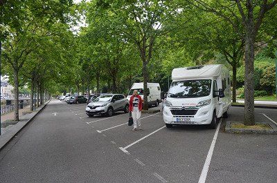
Finding a parking space in the city center is hopeless. By chance we saw a coach parked in a gravel parking lot on Avenue Georges Metayer (GPS:49.44953333,1.11435) and we stood next to it. (free) center about 30 minutes walk away. The old town of Rouen, the old Norman residence and today's capital of the Normandy region. Downtown Rouen is an open-air museum. Sights such as Notre-Dame Cathedral, Saint-Ouen Abbey, the Gros-Horloge and the Historial Joan of Arc.
> Notre Dame Cathedral: Its facade spans all Gothic styles. Another special feature are the surrounding buildings: they were built at the same time as the cathedral and have been preserved.
The Clock Tower (Gros Horloge): This popular attraction right in the city center invites you to travel back in time by visiting its inner workings.
Saint Joan of Arc Church: Completed in 1979, this church with its clean lines and 16th-century windows was built on the Old Market on the site where Saint Joan of Arc was burned.
⛅ 15°C
Finding a parking space in the city center is hopeless. By chance we saw a coach parked in a gravel parking lot on Avenue Georges Metayer (GPS:49.44953333,1.11435) and we stood next to it. (free) center about 30 minutes walk away. The old town of Rouen, the old Norman residence and today's capital of the Normandy region. Downtown Rouen is an open-air museum. Sights such as Notre-Dame Cathedral, Saint-Ouen Abbey, the Gros-Horloge and the Historial Joan of Arc.
> Notre Dame Cathedral: Its facade spans all Gothic styles. Another special feature are the surrounding buildings: they were built at the same time as the cathedral and have been preserved.
The Clock Tower (Gros Horloge): This popular attraction right in the city center invites you to travel back in time by visiting its inner workings.
Saint Joan of Arc Church: Completed in 1979, this church with its clean lines and 16th-century windows was built on the Old Market on the site where Saint Joan of Arc was burned.
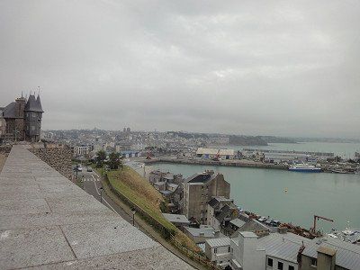
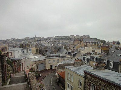
⛅ 16 °C
The RV park (GPS:49.69868333,0.18406667) is right next to the Camping Municipal. The parking space was well occupied when we arrived, we found a place to stand next to the disposal station. Because of the narrow access to the disposal, for larger motorhomes we changed the next morning to another space that had become free.
With sunny weather and pleasant temperatures, we experienced the scenic highlight of Normandy - the rock needles in Etretat. These chalk cliffs come from a sea of the Cretaceous period, on the bottom of which calcareous sediments collected. The cliffs of the Falaise d'Aval rise to the left of the beach and the Falaise d'Amont to the right. Huge rock arches open in the limestone and the sun shining in from the west produces brilliantly pale rock and (actually) emerald green waters of the English Channel. The ascent to the coast was rewarded for our efforts and we were able to take some beautiful vacation pictures. The next morning we undertook a small coastal hike on the cliffs of Calauer d'Aval, which always showed new perspectives. Irmgard took advantage of a short dip in the sea on the beach at Etretat.
The town itself with its half-timbered buildings is also worth seeing.
Pont de Normandie
Just south of Le Havre we come to a significant point on the Channel coast: the Seine estuary. The estuary divides Normandy into Upper Normandy and Lower Normandy (Upper... and Lower...). A very large bridge, the Pont de Normandie, crosses the estuary. It is a cable-stayed bridge and at 856 meters the bridge with the longest span in Europe. The bridge itself is subject to a toll, we pay a good €6.20 as a “Class 2” vehicle,
The largest cable-stayed suspension bridge in the world. This bridge then took us across the Seine to the department of Calvados and the fishing town of Honfleur. Continuing our journey we crossed the Saine bridge, an engineering marvel, we were amazed by the architecture of this bridge. Across the bridge is Honfleur, a beautiful old sailing and fishing town.
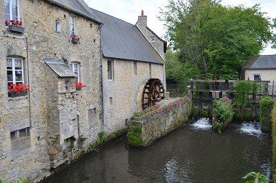
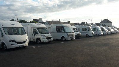
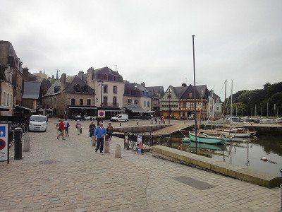
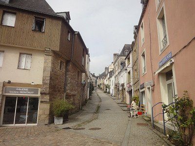
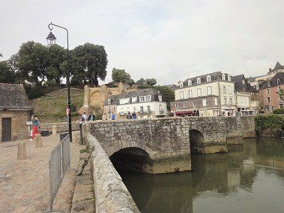
We had headed for the mobile home parking space on the outskirts of town. When we got there, we saw the extent: of what felt like 300 parking spaces on gravel surfaces, 300 were already occupied. One mobile of white goods lined up after the other. We turned around at the next roundabout and headed out of town again. Luckily we found an open area on a gravel shoulder next to the road where we could park our camper and in the shade. (GPS: 49.41641667,0.24251667) After a short lunchtime snack we went on a little tour of the town. There's no mistaking that we're on the coast. In the restaurants, the Plates de Mer pile up with all kinds of crustaceans, mussels, oysters and snails. Narrow streets and colorful half-timbered houses characterize the image of Honfleur
We also paid a visit to the Ste-Cathérine church, which was built entirely of wood.
☁️ 23°C
The Sainte-Thérèse Basilica. The basilica is dedicated to Saint Therese of Lisieux. The church building, built in neo-Byzantine style. We were also able to park on the free parking space by the basilica (GPS:49.14975,0.23415) . The basilica is beautiful, its architectural style and interior is a contrast to the churches we have seen in France so far. The crypt is also worth seeing, with the mosaic it is decorated with.
For the overnight stay we decided to drive to the municipal campsite in Lisieux. (GPS: 49.16526667,0.22038333) The place was almost empty, we could choose the place where we would like to stand. The overnight stay cost € 19.20.
Holidays are the order of the day on the square, but on the other hand like on the narrow pitches where there is a mobile home next to a mobile home. It was a mild evening and we sat in front of the mobile home until 10 p.m.
Car park (GPS:49.19973333,0.3872) at the Caens Center for History and Peace around themes such as WWII, the Battle of Normandy and the Cold War.
The Mémorial de Caen aims to provide visitors with the information essential to understanding the Second World War, starting from the causes that lie in the results of the First World War and ending with its impact on the events of 1989. It challenges the visitor to question yourself about the rapidly fading period of history that has changed the face of Europe and the world.
World War II, the most terrible conflict in human history, claimed the lives of some 60 million people, half of them civilians. The violence against the civilian population, be it the massive bombing of cities, the total war in the East, the greatest genocide in history or the first use of atomic bombs in Hiroshima and Nagasaki, ultimately shaped this war to a large extent.
☁️ 23°C
From the parking lot it was three kilometers to the center. We walked on the bike path that led us to the first viewing location. The ruins of the castle of Caen, the largest castle in France, rather the remains of it. The still intact walls are impressive. Afterwards we went through the pedestrian zone to the Piere church and on to the Hotel Ville (town hall), with a beautiful park. The tourist information is also located here, where we got a city map. The building is a former monastery and part is freely accessible with the exhibition detailing the Allied invasion of Normandy. We watched the documentation extensively with great interest. We continued through other alleys of the old town, with a short coffee break in a street cafe and finally we went back to the camper.
☁️ 17°C
The onward journey to Bayeux was short and yet long until we found a parking space. Either the parking spaces were occupied or the parking bays were too small for our camper. We found a parking space at a larger supermarket and were free to park there. The walk to the cathedral wasn't that far either.
Bayeux can refer to an ancient settlement history, the city owes its name to the Celtic Baiokassen. The districts around the cathedral are particularly worth seeing. A visit to the medieval Bayeux Tapestry should not be missed. The embroidered "comic" from the 11th century depicts the conquest of England by William the Conqueror.
⛅ 18°C
Our last stop today was 14117 Arromanches-les-Bains GPS:49.339298,-0.6147
Paid parking at the panorama board above the city.
Very nice view of the Gold Beach beaches to the east and the remains of the artificial harbor.
The Normandy coast is vast and beautiful with its beautiful blond sand. But here and there these extensive beaches are interspersed with old bunkers built by the Germans in the last world war. Today these bunkers are witnesses of a war that Europe no longer wants. Arromanches-les-Bains , where there is a memorial and a 360 degree cinema with information and documents about the 1944 Allied landings. This small town, with its Norman charm, with its small gray granite houses and its small streets, has been listed as a UNESCO World Heritage Site.
When we arrived, the first two rows of the site were already occupied by mobile homes. We were able to stand in the third row and still had a view of the sea. It was low tide and we took this opportunity to take a short walk on the mudflats and take a closer look at the remains of the war that stood freely on the beach at low tide. The colossuses of steel and concrete must be what remains of the artificial port.
In the evening, shortly after dinner, a lightning-fast thunderstorm approached, it was just enough to stow the camping chairs in the garage.
During the night another heavy thunderstorm passed over us and that four times. The lightning and especially the thunder was so strong that the Womo trembled. It was a pity that we were not allowed to experience sunrise on the coast but had to have our breakfast in the camper, it was still raining.
? 15ºC
Pitch: 48.835300,-1.609500 (not found)
We couldn't find the parking space entered in the navigation system, so we parked our camper on a parking space next to the road not far from the center. There was also heavy traffic towards the center, so we were glad to have found this alternative place.
Granville is nothing special, it has a pretty center with small shops. The church stands on a hill from which one has a beautiful view of the fishing town and port. In the travel guides it is written that you can see the rock monastery Saint Michele from here when the visibility is good. Therefore, we chose the place, it should get us in the mood for the next stage destination "Mont Saint Michel" . The church is simply furnished inside. The second church, which appeared larger on the other side of town, was closed for renovation. It was also difficult to find, only a narrow driveway led up to it from the center.
⛅ 14 °C
Standing Mont Saint Michel in real life in front of this unusual monastic island is unbelievable, magnificent, glorious and mysterious. From the parking space (GPS:48.5936,1.51246667) we walked (5 km) to the monastery island, first alone and on the jetty with many other people. The Inselberg, which also offers an impressive picture at low tide, and in order to reach the upper abbey church, many steep steps have to be climbed first, but the magnificent view from the top makes up for all the effort! For many years after the French Revolution, the old monastery was a feared state prison. We inspected the monastery in detail and then walked back down to the entrance through old, narrow streets and small shops. Visibly impressed by the width of the low tide, we returned back to the camper place.
GPS: 48.64826667.2.0142
Ideal place for visiting the old town
Costs: €0.50/hour
On the way to St. Malo we crossed the " Border from Normandy to Brittany".
What to discover stronghold of one of King Louis XIV's most famous pirates. Here, too, it is not easy to find a parking space with a Womo. We parked a bit back from the old town and the harbor pier on the side of the road in the industrial port
Walk through the sea
As you walk along the beachfront, Fort National is the obvious sight. Built on a tidal island, this fort was used to defend the coast from an attack by the English. The special thing is that you can walk across to the island at low tide. And we are lucky! We have low tide and of course we make our way, which is not too long. Sure, the rocks and the fort are interesting to look at up close, but the view of the old town of Saint Malo from there is even more beautiful. The fort can be visited for a fee, which we leave out. After a while, the path takes us back to the mainland and along the fortress wall in the direction of the old town. A visit to the Cathédrale Saint Vincent is particularly impressive.
After visiting Saints Malo we drove 40 km further to the pitch in Erqux. (GPS:48.62138333,2.47281667) It was already full when we arrived, but there was still a gap where we could stand. It was only late afternoon and so we took a walk on the beach at low tide and on a fine sandy beach. The sea waves were already violent, Irmgard didn't miss the opportunity to bathe in them for a moment. Emotionally, the water was warmer than the wind. We had an air temperature of 17°C. Around 10 p.m. we were able to end the day with a wonderful sunset.
The night was quiet and those of the campers who planned to stay longer moved early in the morning to a vacated pitch, in the front row with a sea view.
Before leaving, we visited the more distant town center that had a small shop to buy bread.
⛅ 17°C
The weather report was decisive that we drove to the campsite. A parking space was provided from which we planned a hike. The weather forecast announced two days of sunny weather for the "Granite of the Rose" region. It was only planned for a later date, on the "Quiberon" peninsula, for a two-day rest day for swimming.
From where we saw the campsite, clean and spacious with a beautiful sandy beach, our decision was correct. Rain was already forecast for the Quiberon Peninsula. We stayed two nights.
(Camping GPS:48.81816667,3.53858333)
⛅ 19 °C
We started the beautiful and first hike of our trip in wonderful weather and pleasant temperatures of 19°. First we walked from the campsite along the beach and through the elegant residential area of Trégastel. This is where the geologically most interesting part began. These stones were formed 300 million years ago, forming bizarre formations as if thrown by a giant hand.
The Renote peninsula on the pink granite coast (Côte de Granit Rose) in Brittany has extraordinary rock formations made of reddish granite. The peninsula of Presqu'île Renote is located in the municipality of Trégastel. Trégastel, Perros-Guirec and Ploumanac'h are the main towns on the Pink Granite Coast in the Côtes d'Armor department of Brittany.
The sign "Bienvenue sur la presqu'ile Renote" (Welcome to the Renote peninsula) welcomes the hiker. When entering the Renote peninsula, you can see the island Île du Grande Gouffre (English: island of the great abyss), which can only be reached at low tide. The transition to the island was not washed over by the water during our visit, so that a visit was possible. There are many rocks in the sea off the coast of the Presqu'île Renote peninsula, some of which look like small offshore islands. The Grève Blanche is a beach with white sand, above is a viewpoint with a great view of the coast and the town of Trégastel. The view of rocks stacked on top of each other by magic in front of the English Channel is impressive. We took advantage of the high tide and were able to walk across the mud flats at low tide, making it a nice circular hike.
⛅ 23°C
The day started with a sunny morning. Had slept late and went into the sea for a swim before breakfast. The water was so cold that we couldn't stay in the water for long. (estimated 15 degrees).
After breakfast we got ready for the bike ride to the granite rocks. The landscape is more of a hiking area, there are very few cycle paths and the signposting is also very incomplete.
Small bike tour on the smugglers' path.
Sleeping giants snore along the way and we cycled along the old customs officer's path, which always offers us wonderful views of the sea and the offshore islands. The whole bike tour, during which we also walked a lot, was a single play of colors: the pink granite, the deep blue sky, the emerald green of the sea, dark green conifers and the blue-violet blooming hydrangeas. In the middle of the beach of Ploumenac'h, at the lighthouse, we climbed over the bare rocks.
We cycled the smugglers' trail, which is designed as a hiking trail, and were often told that it wasn't a bike trail (8km). The Ploumanac'h lighthouse (Phare Mean Ruz) and the former home of Alexandre Gustave Eiffel. Alexandre Gustave Eiffel built the Eiffel Tower in Paris in the 19th century.
A stone circle made of granite sculptures by the Breton association VALLEY OF THE SAINTS was very interesting
On the way back we had to buy bread and bananas in a supermarket. After returning to the WoMo, we approved our lunchtime coffee with the pastries we had bought. Of course, swimming in the sea was not to be missed. It was still low tide, the tide had already started and will have peaked around 10pm. The water was noticeably warmer than in the morning.
Sitting outside was uncomfortable, a really cold wind was blowing. We got our camper ready for the onward journey the next day.
Our onward journey through rural Brittany took us to Saint-Thegonnec. (GPS:48.52125,3.9422833) One of the most important Calvary mountains in France is located in the enclosed parish of the small town. More than forty figures depict the life of Jesus and his last journey on Calvary. The most imposing feature of the parish of Saint-Thégonnec is undoubtedly the two-story ossuary with Corinthian half-columns, built between 1676 and 1682. In contrast, the Calvaire shows only about 40 figures; the scenes depicted are the Passion and the Resurrection. The story of Saint Thégonnec is depicted in the base.
Our onward journey through rural Brittany took us to Saint-Thegonnec. (GPS:48.52125,3.9422833) One of the most important Calvary mountains in France is located in the enclosed parish of the small town. More than forty figures depict the life of Jesus and his last journey on Calvary. The most imposing feature of the parish of Saint-Thégonnec is undoubtedly the two-story ossuary with Corinthian half-columns, built between 1676 and 1682. In contrast, the Calvaire shows only about 40 figures; the scenes depicted are the Passion and the Resurrection. The story of Saint Thégonnec is depicted in the base.
The travel guide says you want to go back to the Middle Ages? Then make a stop in Locronan before heading to the Corzon Peninsula. The town can rightly call itself one of the most beautiful villages in France. Narrow, picturesque alleys, creperies and small shops invite you to stroll through the medieval town centre.
Another highlight of the day was the visit to the town of Locronan. (GPS:48.09941667,4.20538333) In the 11th century Saint Ronan Christianized the site and founded the town: Loc Ronan, the site of Ronan. From the 14th century the town prospered through canvas weaving and trading with all the major navies, reflected in beautiful granite houses and an imposing village church. It is not for nothing that the place was awarded the title "Particularly Picturesque Place" in Brittany and the label of the "Most Beautiful Villages in France". Car traffic in the city of 800 is strictly regulated, giving you the feeling that time has stood still here The appearance of the village is still completely medieval and seems very English to us Steep cliffs and a strong surf, gorse, heather and crouching cottages characterize the peninsula of Crozon.The 70 m high, spectacular cliff Pointe de Penhir offers a view in good weather to the Pointe du Raz.
⛅ 19 °C
The best comes last in Finistère: the Crozon peninsula in the west is a unique natural experience.
The last destination of the day was the wild coast of Brittany. (GPS:48.2748,4.60768333) The western tip of France is one of the most impressive experiences of Breton nature. Steep cliffs and strong surf, gorse, heather and crouched cottages characterize the Crozon Peninsula. The 70 m high, spectacular cliff Pointe de Penhir offers a view up to the Pointe du Raz in good weather. A short walk brought us to the top of the headland with a view of the offshore Sein Islands and the lighthouse. We were very lucky with the weather this time too. We could enjoy the cape with the blooming heather.
The stone rows of Lagatjar are not far from the parking lot. They are said to have originally consisted of up to 400 stones, so that the total length of the main structure used to be 600 meters. Many of the fallen stones of white quartzite were raised again in 1928 so that the rows now consist of 72 menhirs.
Back in the camper, we enjoyed the evening with a glass of cider.
⛅ 17 ° C
(Parking GPS: 47.99238333.4.1077)
This morning we wanted to take a closer look at Quimper and went along the Odet to the St. Corentin Cathedral. Similar to Rome, the city lies on seven hills. Three rivers meet here and it is only a few kilometers to the sea. Quimper is the capital of the Cornouaille. We strolled through the alleys of the old town with its beautiful half-timbered houses before we visited the interior of the Saint Corentin Cathedral. More than 600 years had to pass before the church got its current shape. What is striking is the slightly bent choir, which leaves plenty of room for speculation, but is unique in terms of building history in this form. Time passed much too quickly and we left Quimper, with its magnificent cathedral, its small streets with half-timbered houses, its canals "à la Venise du Nord".
⛅ 18 ° C
In Penmarc'h you will encounter cultural heritage at every turn. Sights include chapels and churches and the Calvary at the Chapelle de Notre-Dame de Tronoën,
What was described here in the travel guide did not exist. Our navigation system first led us to a parking lot at the harbor in Guilvingec (GPS: 47.799,4.27568333) , where there were also several campers. We stood by them and wanted to explore the sights on foot. But soon we realized that this was not feasible from a distance. So we decided to drive to Penamach directly. We also found a good parking lot (GPS: 47.81361667,4.33868333) near the church. We strolled through the village, the church was closed and disappointed we returned to the Womo. We didn't want to give up completely and followed a signpost to the Notre-Dame chapel. We also came to the chapel on a very narrow street and were so disappointed that we didn't even get out. To save the day we decided to go to Carnac.
? 18 ° C
The unsolved mysteries of megalithic culture. The onset of rain could not stop us and so we booted along the rows of stones that gave us a view of the seemingly endless rows of stones. The ideal place for speculation about the meaning of the system; If you add to the 4000 standing stones still standing, those that were destroyed by lightning strikes and by human hands, and those that sank in the sea, this system was the largest of its kind in Europe in the 5th millennium BC - and is still white today no one for what purpose it was built. Carnac, the place name is based on the English word carns for stones. More than five thousand years ago, people set up partially hewn erratic boulders and aligned them in parallel rows. Six of the so-called menhir fields north of Carnac can still be seen today, each with approx. 950 - 1150 stones. They are the largest megalithic complex in the world and have been a UNESCO World Heritage Site since 1996.
Megaliths (Greek: megas = large; lithos = stone). However, most are menhirs now fenced to prevent further erosion from the large crowds that passed through the rows of stones every year. These erosions and the excess powers of some tourists have caused some megaliths to tip over. Other megaliths are missing from the ranks because they were smashed and used as building material.
⛅ 17 ° C
In Carnac we drove to a campsite where we didn't like to stay the night, so we drove to Auray where we found a free parking lot at the cemetery. (GPS: 47.6643,2.9733) On arrival it was still raining and we didn't want to do anything that evening.
The next day after breakfast we went to take a closer look at Auray. The old port area was once the third largest port in Brittany. The old pavement that still lies in the streets and alleys dates from this time. Our walk led down to the harbor through the old streets to the church of St. Goustan, which we could also visit. The St. Saveur chapel is right next to it. Crossing the bridge to the other side of the port, we climbed the path to the city center. After an extensive tour, we made our way to Ste. Anne d'Auray.
☁️ 19 ° C
By chance we became aware of the approximately 6 km northeast of Auray, the most important place of pilgrimage in Brittany: Ste-Anne-d'Auray. In Ste. Anne d'Auray we found a parking lot near the Church of the Pilgrimage (GPS: 47.70511667.2.95601667) and then made our way to the Basilica of the Pilgrimage. Saint is worshiped Anna, the mother of the Virgin Mary. 1623 appeared to the agricultural worker Yves Nicolazic. Anna and asked him to rebuild a dilapidated chapel in her field. In 1625 an old statue of St. Anna found.
The cathedral is built on an ancient power place. A source with very good medicinal water. In the square between the source and the cathedral, even Sirius' cross is immersed in the ground.
According to Breton history, Anna, the grandmother of Jesus, was a Breton who traveled to the Holy Land for her Joachim
Maria, the mother of Jesus, and later Jesus himself was born.
The energies of the church are clear and pure, no astral impurities. It is very worthwhile to meditate here and to connect with Anna.
☁️ 20 ° C
(Parking GPS: 48.09785,1.64433333)
Of course we visited the Romanesque cathedral of Rennes, which is adorned with these gildings.
☁️ 20 ° C
(Parking GPS: 48.09785,1.64433333)
Of course we visited the Romanesque cathedral of Rennes, which is adorned with these gildings.
☀️ 34 ° C
Great parking space with shower, toilet, sink
GPS: 48.12756667,0.75195
The night was very calm. Towards morning a thunderstorm passed by, dropping a few raindrops. For breakfast you could sit outside in the sun again. For the onward journey we had to dispose of the toilet and fill up with fresh water, we didn't know the next place to stay. The intermediate goal was clear and that was Orleans.
☀️ 34 ° C
Good parking lot (GPS: 47.90318333,1.9182) approached not far from the center. We first walked towards the cathedral, the interior was very pleasant with the outside temperature of 38 degrees. The life of the Jeanned'Arc is beautifully depicted in the church window. After visiting the cathedral we went into the old town through beautiful alleys down to the Loare. We ended our tour of the city in the large square with the Jeanned'Arc memorial. The great heat was a problem and we were happy to be able to continue in the air-conditioned WoMo.
☀️ 33 ° C
With our early return home and from Orleans the unbearable heat of 38 ° C during star visits, the planned parking spaces had also changed. So we found this beautiful, private, quiet, shady parking space on our parking space app. (GPS: 48.22848333,3.72276667) Only a few km away from our route.
☀️ 32 ° C
After we were on our last leg of the trip, we took a closer look at Lunéville over lunchtime. Lorraine, a sovereign state for almost ten centuries, has one of the largest castles in France,
The Château de Lunéville is a wonderful gateway to the 18th century. A castle that was the largest construction site in Europe after the winter fire of 2003 to 2010.
An impressive sight as soon as you arrive. Free parking spaces are available in front of and next to the castle, unfortunately there is a no parking sign for motorhomes. (GPS: 48.59531667,6.49101667) Since it was a very hot day, we ignored the no parking and parked next to the castle. We didn't spend long outside, short visits to the palace complex and the park. We lacked the time to explore the interior of the castle and it is also closed at lunchtime. .
It was so hot on our little city tour that it was no fun staying in the city for too long. The temperature inside the church was very pleasant.
The castle of Luneville, (Rococo castle) also called little Versailles. The city with the old German name Lünstadt was the residence of the Dukes of Lorraine from 1702 to 1737. During this time, the Rococo castle Lunéville was built, which is still the main attraction of the 20,000-inhabitant city. In 1801 peace between France and Austria was decided here.
Comments (4)
Comments from Freeontour users
Guter und informativer Bericht! Zu welcher Jahreszeit waren Sie unterwegs? Die vielen vollen Stellplätze machen mich etwas nervös für unsere Normandie/Bretagne Tour im ab Mitte Juli.
Hallo, wir waren Ende Mai Anfang Juni 2018 unterwegs.
danke für Euren Bericht! das macht Lust Eure Route Nachzuchten!
LG W.
Herzlichen Dank für den tollen Reisebericht. Nächstes Jahr steht auch die Normandie und die Bretagne auf meiner Reiseplanung und da ist mir dieser Bericht eine wertvolle Hilfe.
Danke für die tolle Dokumentation