Unfortunately, we don't support your browser (Internet Explorer) anymore, some functionalities could not work. Click here to get information on how to upgrade your browser.

Discovered Belgium in spring 2023

Travelogue
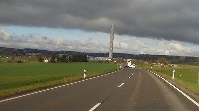
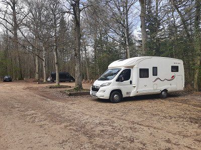
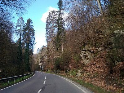
The journey went from our home town, past the Thyssen test tower in Rottweil, towards the Black Forest. Through the Kinzig valley we crossed the Black Forest and finally we crossed the Rhine near Strasbourg.
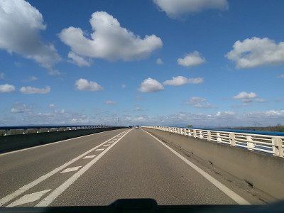
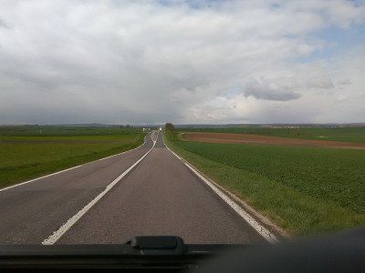
After crossing the border into France, you often drive kilometers across the country on dead-straight roads.

The journey went from our home town, past the Thyssen test tower in Rottweil, towards the Black Forest. Through the Kinzig valley we crossed the Black Forest and finally we crossed the Rhine near Strasbourg.
After crossing the border into France, you often drive kilometers across the country on dead-straight roads.
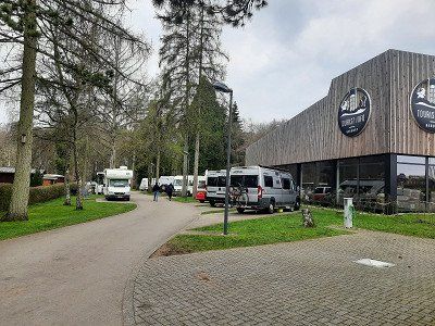
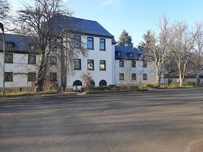
The new navigation system guided us to the parking lot at the police building, unfortunately the free spaces were occupied and the paid spaces cost 3 hours/12 €.
We drove on and tried our luck at an RV lot.
The new navigation system guided us to the parking lot at the police building, unfortunately the free spaces were occupied and the paid spaces cost 3 hours/12 €.
We drove on and tried our luck at an RV lot.
From the parking lot further here it went right through Metz and everything went well until the GPS navigated us into a street that was a dead end and was closed with a gate. A quick look at the map and we saw that we were standing at the end of the campsite. The parking space was in front of the entrance to the campsite. The navigation system has probably chosen the route through the campsite as the shortest route to the pitch. At first we had to continue on our own coordination, the navigation system kept trying to lead us to a dead end. Over time we outwitted the navigation system and it showed us the right way to the pitch. Upon arrival, the barrier was open, a sign said "Out of order". After the coffee break, we made our way to Metz's old town.
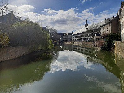
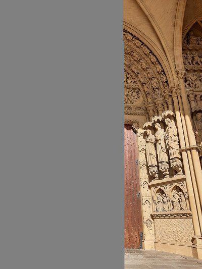
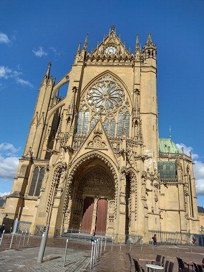
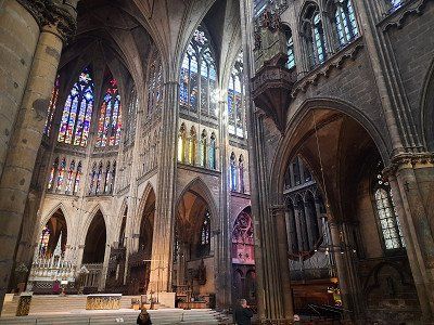
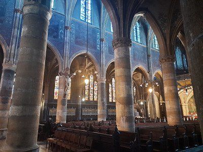
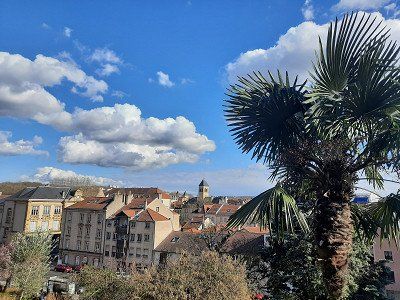
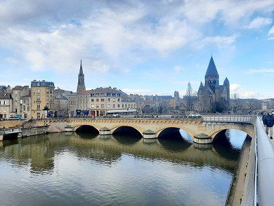
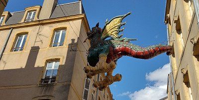
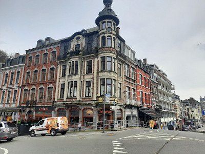
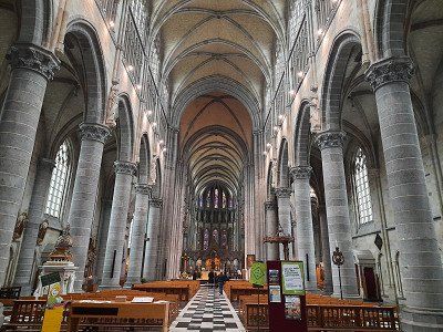
The capital of Lorraine was built on several islands separated by the arms of the Moselle and the Seille and in turn connected by 20 bridges. The ocher-colored natural stone of many of the facades provides southern flair, and lush floral decorations have even earned Metz the nickname "garden city". The Porte des Allemands, the last fortifications of the medieval city ring, and the Eglise St - Pierre - aux - Nonnains are particularly worth seeing in Metz. With its foundations from the 4th century, it is one of the oldest churches in France. The Gothic Saint-Etienne cathedral made of golden yellow sandstone (13th - 16th centuries) is enthroned on a hill above the old town. Its nave is one of the highest in France at 42 m.

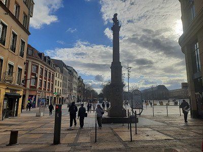
From the parking lot further here it went right through Metz and everything went well until the GPS navigated us into a street that was a dead end and was closed with a gate. A quick look at the map and we saw that we were standing at the end of the campsite. The parking space was in front of the entrance to the campsite. The navigation system has probably chosen the route through the campsite as the shortest route to the pitch. At first we had to continue on our own coordination, the navigation system kept trying to lead us to a dead end. Over time we outwitted the navigation system and it showed us the right way to the pitch. Upon arrival, the barrier was open, a sign said "Out of order". After the coffee break, we made our way to Metz's old town.
The capital of Lorraine was built on several islands separated by the arms of the Moselle and the Seille and in turn connected by 20 bridges. The ocher-colored natural stone of many of the facades provides southern flair, and lush floral decorations have even earned Metz the nickname "garden city". The Porte des Allemands, the last fortifications of the medieval city ring, and the Eglise St - Pierre - aux - Nonnains are particularly worth seeing in Metz. With its foundations from the 4th century, it is one of the oldest churches in France. The Gothic Saint-Etienne cathedral made of golden yellow sandstone (13th - 16th centuries) is enthroned on a hill above the old town. Its nave is one of the highest in France at 42 m.
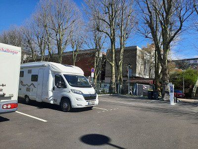
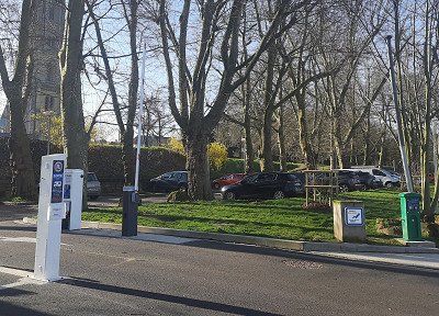

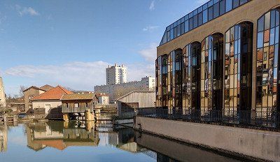
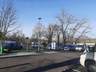
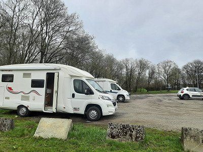
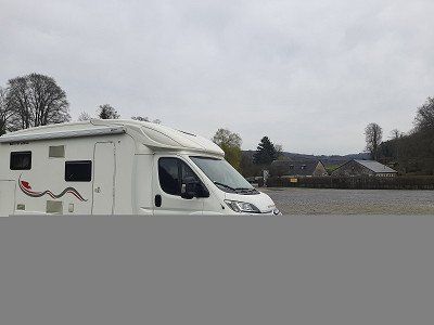
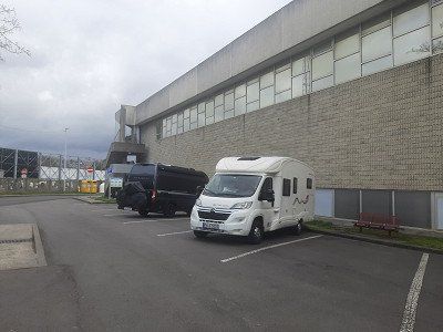
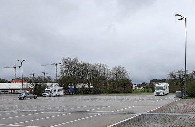
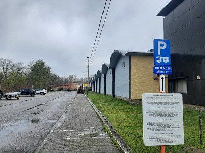
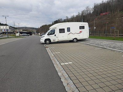
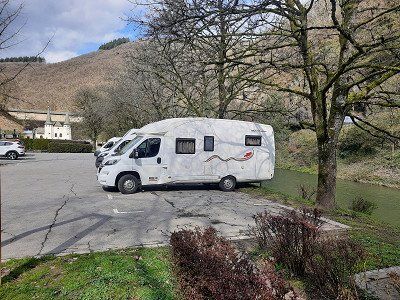
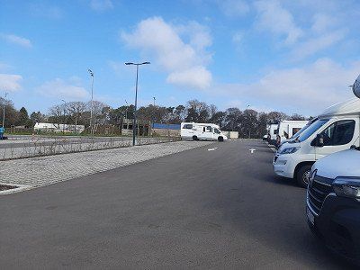
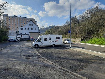
Parking space was occupied, drove on to a hiking car park. GPS: 49.632127,06.109911
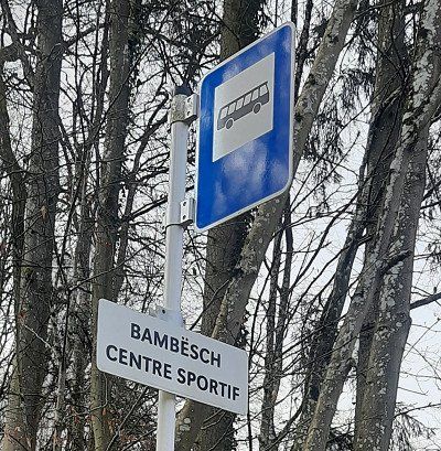
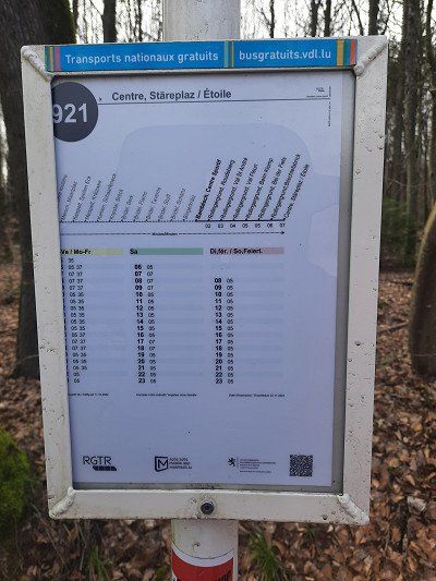
There is a bus stop near the parking lot, you can easily get to the center of the city.
Parking space was occupied, drove on to a hiking car park. GPS: 49.632127,06.109911
There is a bus stop near the parking lot, you can easily get to the center of the city.
GPS: 49.632127,06.109911
Alternative space, hiking car park on the outskirts.
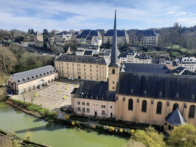
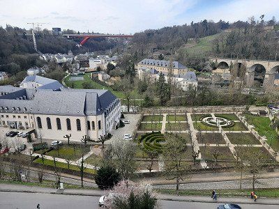
Luxembourg, the capital of the Grand Duchy of Luxembourg, is surrounded by the valleys of the Petrusse and Alzette rivers.
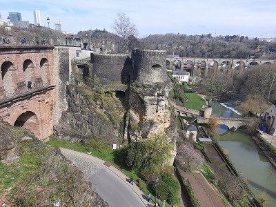
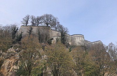
Count Siegried bought the Bock, as the rock above the Alzette is called, in 963 and built the castle "Lucilinburhuc". The first city wall was built in the 12th century. The city grew rapidly and so in the XIV c. an expansion is necessary. New protective walls had to be built.
In 1354 Luxembourg was made a duchy. In 1443, the Duke of Burgundy conquered the city, which from then on belonged to the Netherlands and was involved in various wars.
In 1867, Luxembourg became a neutral Grand Duchy.
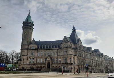
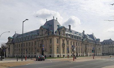
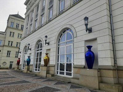
Today's Luxembourg is the seat of several European organizations. At the Kirchberg Plateau we find the Court of Justice, the Court of Auditors, the Investment Bank and some other departments of the European Union.
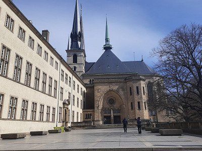
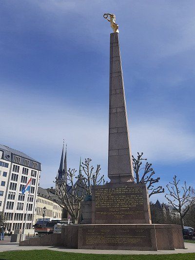
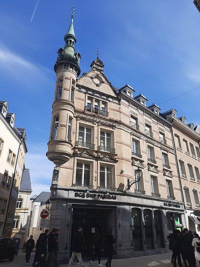
Luxembourg has a lot to offer in terms of cultural and historical sights. In 2007 the city became the European Capital of Culture. The Cathedrale Notre Dame on Place Guillaume II, built between 1613 and 1617, is the most important religious building in Luxembourg. In the northeast of the city is the most modern part of the city with the Kirchberg plateau. In addition to banks and authorities, several European institutions have settled here, such as the European Court of Auditors and the European Court of Justice. In the old town is the Chapelle St. Quirin, which is well worth seeing. Also characteristic of the city of Luxembourg are the large bridges that connect different plateaus, such as the New, the Old and the Red Bridge. The numerous remains of the Luxembourg Fortress with the Bock and Petrusse casemates are also worth seeing.


GPS: 49.632127,06.109911
Alternative space, hiking car park on the outskirts.
Luxembourg, the capital of the Grand Duchy of Luxembourg, is surrounded by the valleys of the Petrusse and Alzette rivers.
Count Siegried bought the Bock, as the rock above the Alzette is called, in 963 and built the castle "Lucilinburhuc". The first city wall was built in the 12th century. The city grew rapidly and so in the XIV c. an expansion is necessary. New protective walls had to be built.
In 1354 Luxembourg was made a duchy. In 1443, the Duke of Burgundy conquered the city, which from then on belonged to the Netherlands and was involved in various wars.
In 1867, Luxembourg became a neutral Grand Duchy.
Today's Luxembourg is the seat of several European organizations. At the Kirchberg Plateau we find the Court of Justice, the Court of Auditors, the Investment Bank and some other departments of the European Union.
Luxembourg has a lot to offer in terms of cultural and historical sights. In 2007 the city became the European Capital of Culture. The Cathedrale Notre Dame on Place Guillaume II, built between 1613 and 1617, is the most important religious building in Luxembourg. In the northeast of the city is the most modern part of the city with the Kirchberg plateau. In addition to banks and authorities, several European institutions have settled here, such as the European Court of Auditors and the European Court of Justice. In the old town is the Chapelle St. Quirin, which is well worth seeing. Also characteristic of the city of Luxembourg are the large bridges that connect different plateaus, such as the New, the Old and the Red Bridge. The numerous remains of the Luxembourg Fortress with the Bock and Petrusse casemates are also worth seeing.
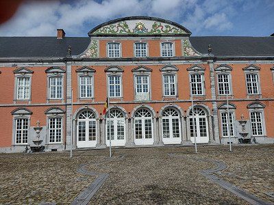
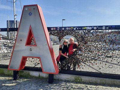
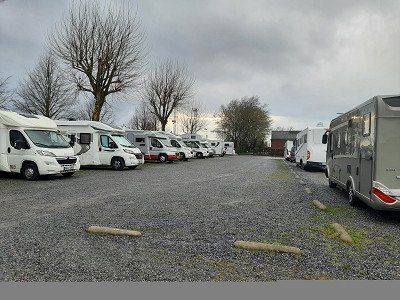
Arlon* - parking space at the fire brigade was occupied.
Arlon* - parking space at the fire brigade was occupied.
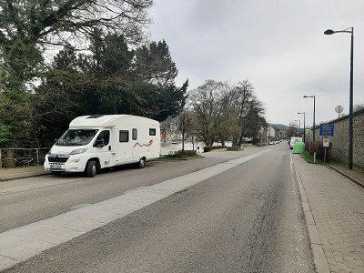
Since the camper place was occupied, we drove to a nearby parking lot with a view of the city of Arlon.
A little later, another WoMo drove up to spend the night.
We had only gone to Arlon as a place to stay overnight, in Luxembourg we didn't want to spend the night in the hikers' car park.
Since the camper place was occupied, we drove to a nearby parking lot with a view of the city of Arlon.
A little later, another WoMo drove up to spend the night.
We had only gone to Arlon as a place to stay overnight, in Luxembourg we didn't want to spend the night in the hikers' car park.
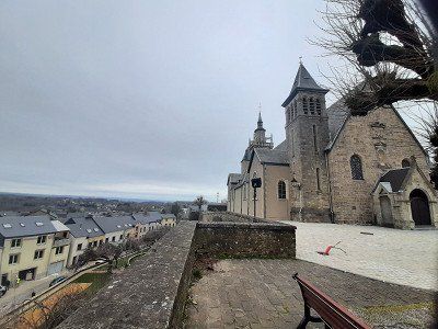
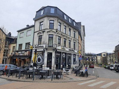
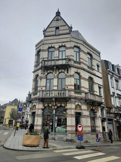
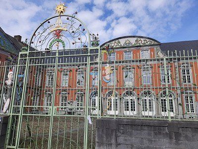
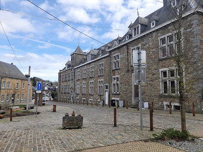
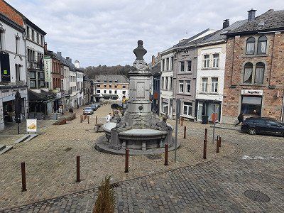
We used the morning to visit the city.
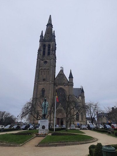
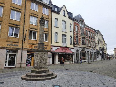
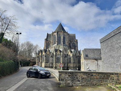
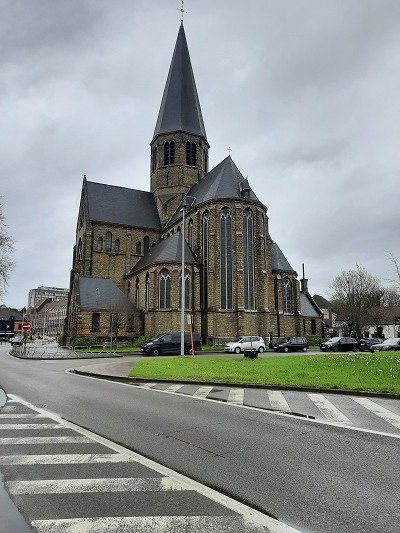
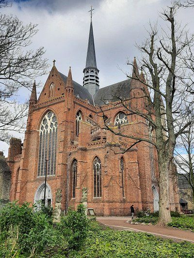
The French-speaking city of Arlon is located in the Belgian province of Luxembourg. In the old town of Arlon is the Grand Place, a historic butter market. The St. Donatus Church, which we stopped at during our visit, stands on a small hill. It is part of a former Capuchin monastery. The town center is striking with many small shops.
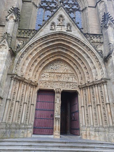
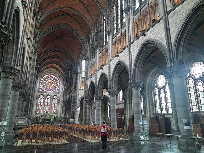
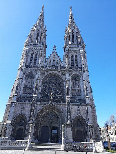
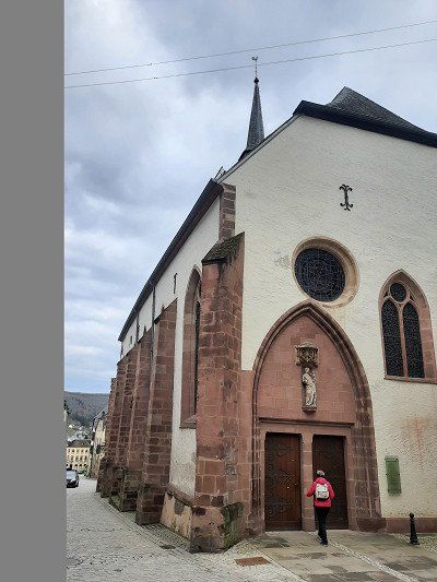
Finally, we went to the neo-Gothic Saint-Martin church, which was built between 1907 and 1914.
To walk to the center you have to plan 20 minutes.


We used the morning to visit the city.
The French-speaking city of Arlon is located in the Belgian province of Luxembourg. In the old town of Arlon is the Grand Place, a historic butter market. The St. Donatus Church, which we stopped at during our visit, stands on a small hill. It is part of a former Capuchin monastery. The town center is striking with many small shops.
Finally, we went to the neo-Gothic Saint-Martin church, which was built between 1907 and 1914.
To walk to the center you have to plan 20 minutes.
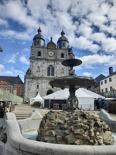
In Saint-Hubert you must definitely see the 25 m high, five-aisled abbey church (St-Hubert) of the former Benedictine abbey, with a Romanesque crypt.
The free parking space position: 50.027074,05.380880 is located in the immediate vicinity of the abbey church.
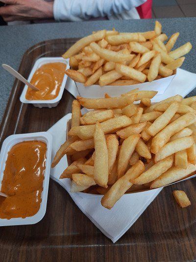
It was around lunchtime, which prompted us to try the Belgian fries that everyone is raving about. We struggled with the choice of sauces to serve with it, we chose the Andalusia sauce, which had a slightly spicy taste.

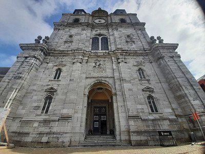
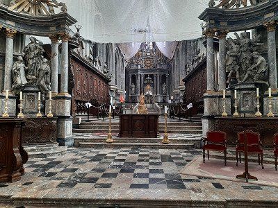
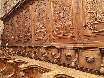
In Saint-Hubert you must definitely see the 25 m high, five-aisled abbey church (St-Hubert) of the former Benedictine abbey, with a Romanesque crypt.
The free parking space position: 50.027074,05.380880 is located in the immediate vicinity of the abbey church.
It was around lunchtime, which prompted us to try the Belgian fries that everyone is raving about. We struggled with the choice of sauces to serve with it, we chose the Andalusia sauce, which had a slightly spicy taste.
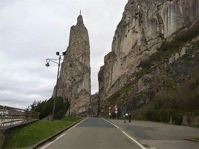
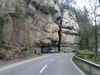
Through a narrow gap: passage at the entrance to Dinant, the spectacular rock needle.
Legend of the Bayard Rock
The rock is named after Bayard, the magic horse of Saint Reinoldus. According to legend, a horse's hoof hit the rock formation while it was fleeing from Charlemagne with the children of Haimon. The power of the wondrous horse is said to have been so great that the rock was split 40 meters deep by the kick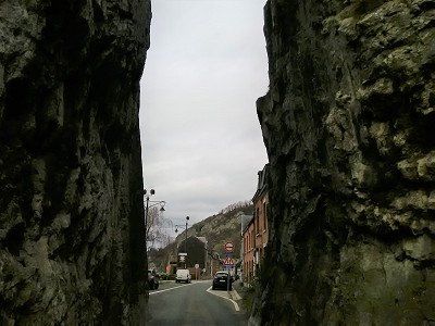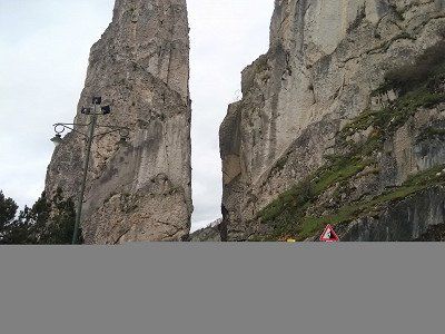
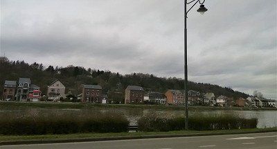
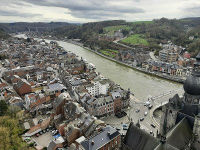
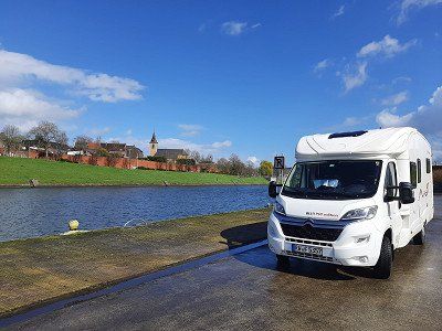
We landed in Dinant and parked along the road on the banks of the Meuse. GPS: 50.263847,04.906047
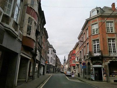
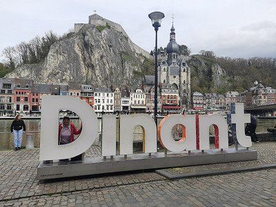
The idyllic town of Dinant is located in the Maas Valley in Wallonia. Already mentioned as a Roman settlement, Dinant only arrived in the 12th century. too important. It is thanks to the occurrence of calamine nearby that the town established itself as a center for brass production.
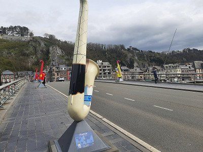
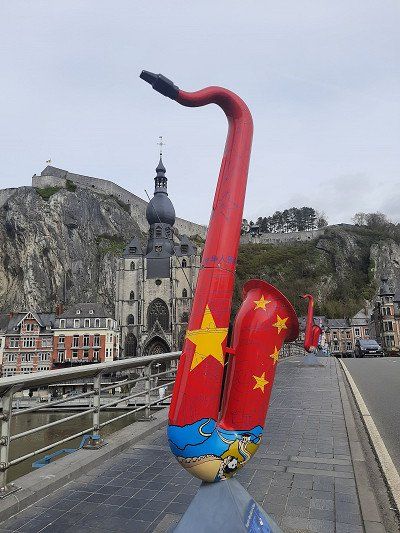
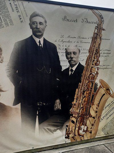
The city's most important son is Adolphe Sax, the inventor of the saxophone, who was born here in 1814. The many sculptures of saxophones in the city are also beautiful
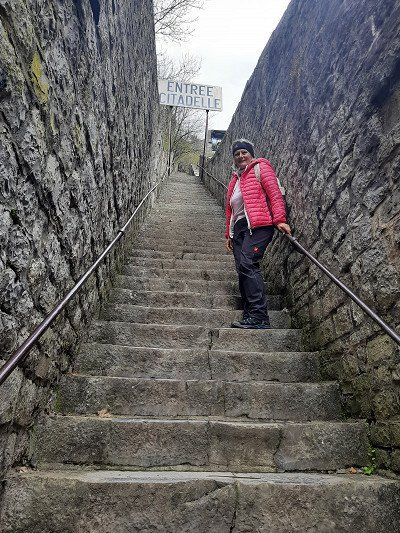
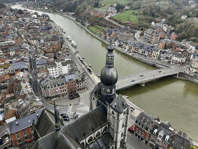
From the city we went straight up to the citadel, the ascent and descent can be done on foot or by cable car. We walked up the 408 steps, the view over the city from above was impressive.
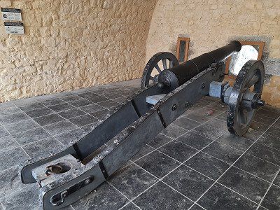
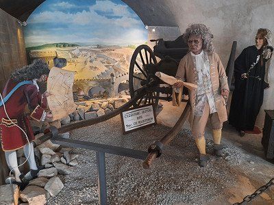
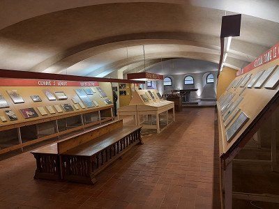
The citadel houses, among other things, a weapons museum.
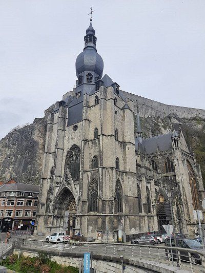
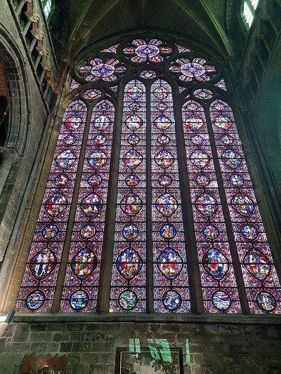
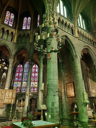
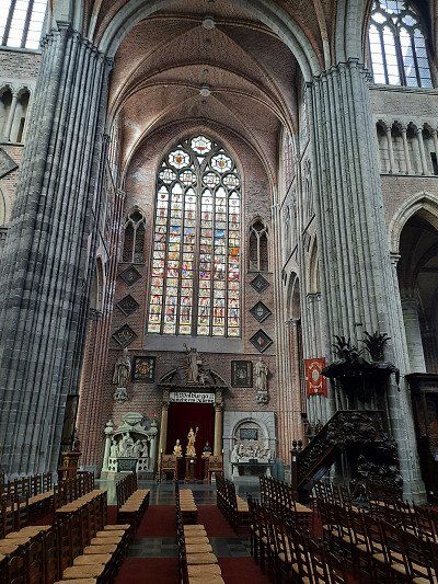
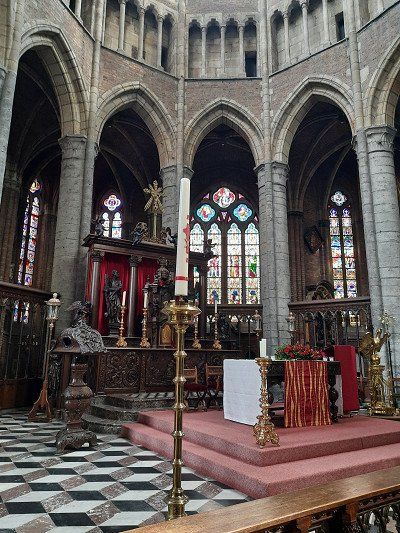
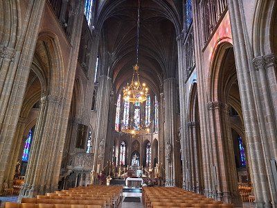
The Collegiate Church of Notre-Dame is located in the main square of the city, just below the citadel.
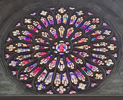
A visit to the Cathedral of Dinant is definitely worthwhile because of the wonderful interior with a very large glass window, which you certainly don't expect from the outside, as the church is built rather inconspicuously on the rock..
We landed in Dinant and parked along the road on the banks of the Meuse. GPS: 50.263847,04.906047
The idyllic town of Dinant is located in the Maas Valley in Wallonia. Already mentioned as a Roman settlement, Dinant only arrived in the 12th century. too important. It is thanks to the occurrence of calamine nearby that the town established itself as a center for brass production.
The city's most important son is Adolphe Sax, the inventor of the saxophone, who was born here in 1814. The many sculptures of saxophones in the city are also beautiful
From the city we went straight up to the citadel, the ascent and descent can be done on foot or by cable car. We walked up the 408 steps, the view over the city from above was impressive.
The citadel houses, among other things, a weapons museum.
The Collegiate Church of Notre-Dame is located in the main square of the city, just below the citadel.
A visit to the Cathedral of Dinant is definitely worthwhile because of the wonderful interior with a very large glass window, which you certainly don't expect from the outside, as the church is built rather inconspicuously on the rock..
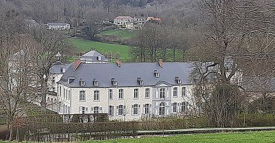
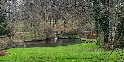
Annevoie GPS: 50.34655 , 4.84551
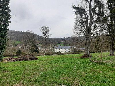
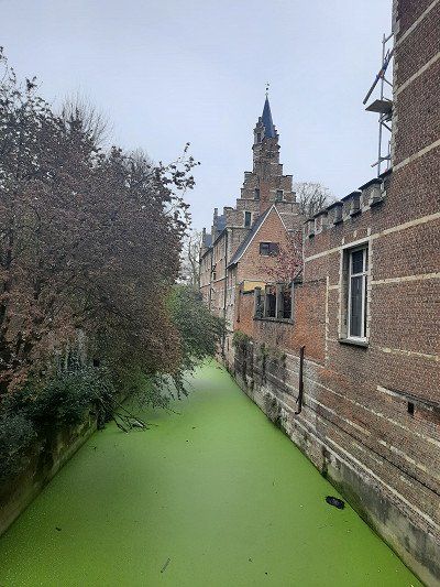
The facility did not look inviting for a tour, entry was also closed. We only walked as far as we could along the castle.
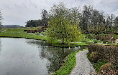
The castle wall and tall bushes blocked our view of the gardens. Occasionally you could take a look at the plant. In the summer when everything is blooming, it may be a beautiful place.
We stayed in the visitor car park at the back, free of charge.
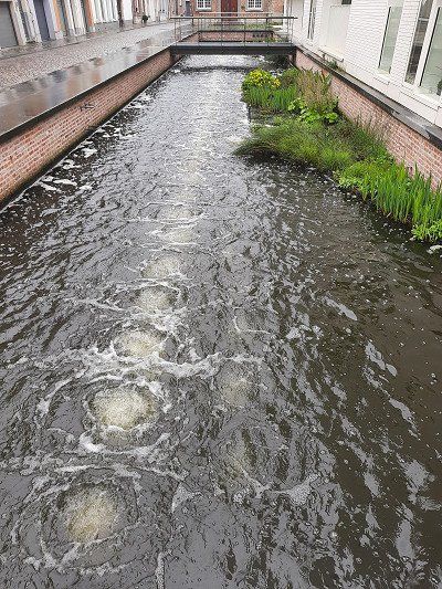
Another special feature is that the water features have been operated without interruption and without machines for more than 250 years, only by natural level differences.
Open daily from 9:30 a.m. to 5:30 p.m. (July/August until 6:30 p.m.)

Annevoie GPS: 50.34655 , 4.84551
The facility did not look inviting for a tour, entry was also closed. We only walked as far as we could along the castle.
The castle wall and tall bushes blocked our view of the gardens. Occasionally you could take a look at the plant. In the summer when everything is blooming, it may be a beautiful place.
We stayed in the visitor car park at the back, free of charge.
Another special feature is that the water features have been operated without interruption and without machines for more than 250 years, only by natural level differences.
Open daily from 9:30 a.m. to 5:30 p.m. (July/August until 6:30 p.m.)
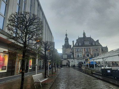
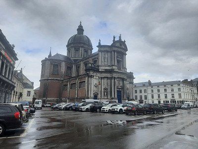
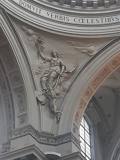
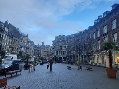
Pitch Namur GPS: 50.4677, 04.85
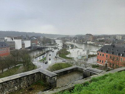
Parked free of charge for the city tour.Namur, the capital of the province of Namur in the Wallonia region, is located where the Sambre meets the Meuse. The inhabitants are French-speaking and are considered to be outspoken gourmets. Petit Gris (snails) or Biétrumé de Namur (caramel sweets) are the city's specialities.
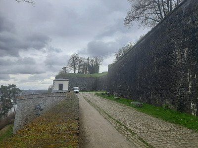
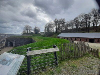
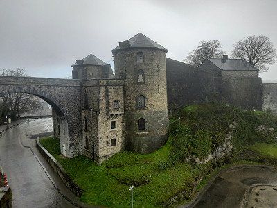
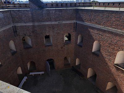
The first fortress was built under the Merovingians, and over the centuries it was converted and expanded into one of the largest fortresses in Europe. Nonetheless, the city was captured and occupied many times before being incorporated into the Kingdom of Belgium in 1830. During the two world wars, Namur was again conquered and destroyed.
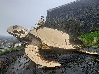
The visit to the citadel of Namur was the first stop for us, which is definitely recommended. Unfortunately, heavy rain had spoiled the great view over the Maas and Sambre to Namur. The outdoor area of the citadel was possible free of charge. Underground tours of the citadel are also available from the visitor center.
We climbed a lot of stairs to get to the old town of Namur, which we visited quickly and under umbrellas. The St. Aubin Cathedral was the last port of call before we went back to the WoMo.


Pitch Namur GPS: 50.4677, 04.85
Parked free of charge for the city tour.Namur, the capital of the province of Namur in the Wallonia region, is located where the Sambre meets the Meuse. The inhabitants are French-speaking and are considered to be outspoken gourmets. Petit Gris (snails) or Biétrumé de Namur (caramel sweets) are the city's specialities.
The first fortress was built under the Merovingians, and over the centuries it was converted and expanded into one of the largest fortresses in Europe. Nonetheless, the city was captured and occupied many times before being incorporated into the Kingdom of Belgium in 1830. During the two world wars, Namur was again conquered and destroyed.
The visit to the citadel of Namur was the first stop for us, which is definitely recommended. Unfortunately, heavy rain had spoiled the great view over the Maas and Sambre to Namur. The outdoor area of the citadel was possible free of charge. Underground tours of the citadel are also available from the visitor center.
We climbed a lot of stairs to get to the old town of Namur, which we visited quickly and under umbrellas. The St. Aubin Cathedral was the last port of call before we went back to the WoMo.
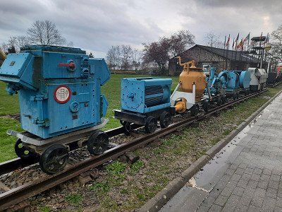
GPS: 50.471506,04.090016
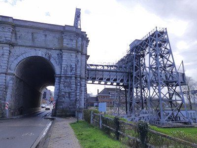
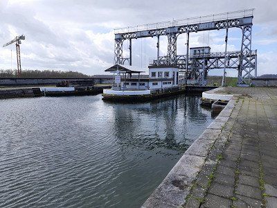
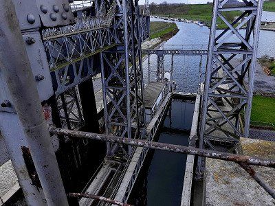
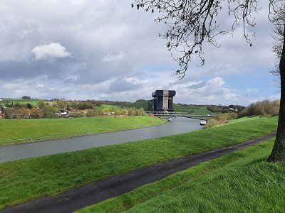
Visited one of 4 old hydraulic lifts in the Canal du Center.
The Canal du Center connects the Canal Nimy-Blaton-Péronnes with the Canal Charleroi-Brussels. The height difference that had to be overcome along the route presented a particular obstacle at the time of construction.
The Strépy-Thieu electromechanical boat lift at km 11.466 of the Canal du Center has been used since 2002 to overcome the difference in level between the Mons region and the North Sea, replacing the neighboring lift with its four hydraulic lifts.
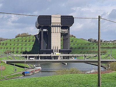
The last two pictures show the new hoist, which can be visited.
The reinforced concrete lift is about 81 m wide, 130 m long and 117 m high. The ships are transported up and down in two troughs that can hold 1350 ton vessels. It overcomes a height difference of 73 meters. The troughs are 112 m long, 12 m wide and 3.35 to 4.15 m deep. Around 20 ships use the hoist every day.
It is considered one of the largest ship lifts in the world and was included in the UNESCO World Heritage List in 1998.
GPS: 50.471506,04.090016
Visited one of 4 old hydraulic lifts in the Canal du Center.
The Canal du Center connects the Canal Nimy-Blaton-Péronnes with the Canal Charleroi-Brussels. The height difference that had to be overcome along the route presented a particular obstacle at the time of construction.
The Strépy-Thieu electromechanical boat lift at km 11.466 of the Canal du Center has been used since 2002 to overcome the difference in level between the Mons region and the North Sea, replacing the neighboring lift with its four hydraulic lifts.
The last two pictures show the new hoist, which can be visited.
The reinforced concrete lift is about 81 m wide, 130 m long and 117 m high. The ships are transported up and down in two troughs that can hold 1350 ton vessels. It overcomes a height difference of 73 meters. The troughs are 112 m long, 12 m wide and 3.35 to 4.15 m deep. Around 20 ships use the hoist every day.
It is considered one of the largest ship lifts in the world and was included in the UNESCO World Heritage List in 1998.
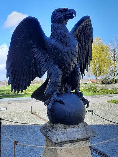
Waterloo
Item: 50.679838,04.407857
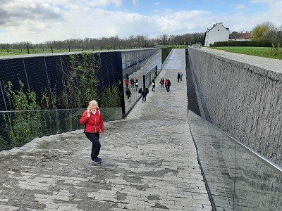
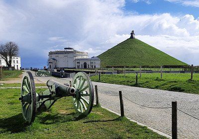
We only arrived in the late afternoon, so we only visited the facility from the outside. A visit to the museum was no longer worthwhile, it was about to close.
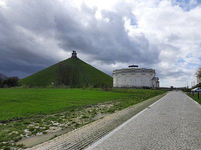
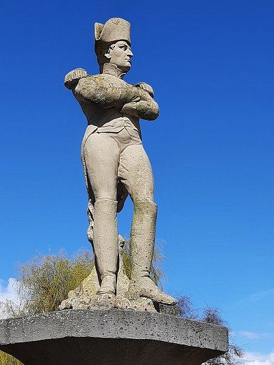
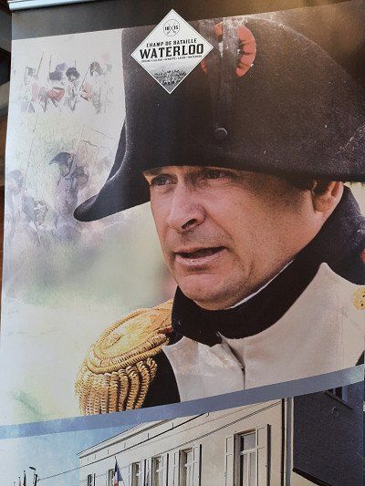
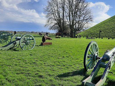
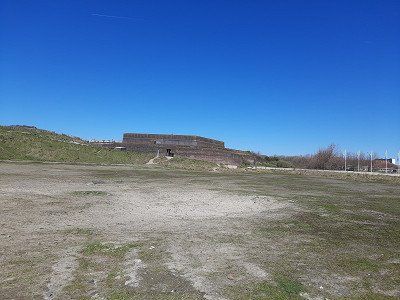
The former battlefields of the Battle of Waterloo spread out near the town of Waterloo. This historic battle on June 18, 1815 made the small town of Waterloo world famous. A visitor center provides all the information you need about the Battle of Waterloo scene. It presents a 10m model with video laser and a short film.Napoleon Bonaparte fought his last battle on this desolate field on June 18, 1815. At the end of the long, bloody day, he had to admit defeat to British General Wellington and Prussian General Blucher. A number of memorials for the fallen of the various nations stand on the huge battlefield, which has been lying fallow to this day. The entire extent of the battlefield can be seen from the 40 m high Lion's Mound.


Waterloo
Item: 50.679838,04.407857
We only arrived in the late afternoon, so we only visited the facility from the outside. A visit to the museum was no longer worthwhile, it was about to close.
The former battlefields of the Battle of Waterloo spread out near the town of Waterloo. This historic battle on June 18, 1815 made the small town of Waterloo world famous. A visitor center provides all the information you need about the Battle of Waterloo scene. It presents a 10m model with video laser and a short film.Napoleon Bonaparte fought his last battle on this desolate field on June 18, 1815. At the end of the long, bloody day, he had to admit defeat to British General Wellington and Prussian General Blucher. A number of memorials for the fallen of the various nations stand on the huge battlefield, which has been lying fallow to this day. The entire extent of the battlefield can be seen from the 40 m high Lion's Mound.
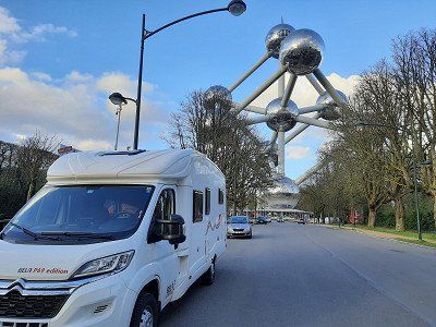
We wanted to take a closer look at Brussels, the capital of the Kingdom of Belgium, but nothing came of it.
The selected parking space no longer existed, the gate was locked without any information about the space.
Then we headed for the parking lots at the stadium, where everyone had a parking ban.
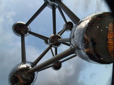
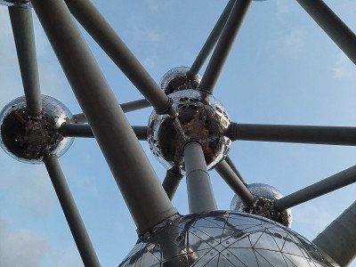
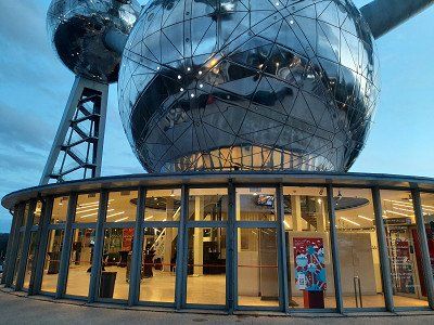
We were lucky on the road to the Atomium where there were still free parking spaces. Free of charge from 9 p.m. to 8 a.m., where we also stayed overnight. It was quite noisy at night, so we lost interest in seeing Brussels. The rain was another reason.


We wanted to take a closer look at Brussels, the capital of the Kingdom of Belgium, but nothing came of it.
The selected parking space no longer existed, the gate was locked without any information about the space.
Then we headed for the parking lots at the stadium, where everyone had a parking ban.
We were lucky on the road to the Atomium where there were still free parking spaces. Free of charge from 9 p.m. to 8 a.m., where we also stayed overnight. It was quite noisy at night, so we lost interest in seeing Brussels. The rain was another reason.
Had to download the app first, initially had problems logging in. Although we were standing on a free space, the app showed it as occupied. We tried the pool ticket office, which didn't work either.
Now we had breakfast first, we left shortly before the end of the free parking time in Brussels.
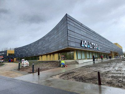
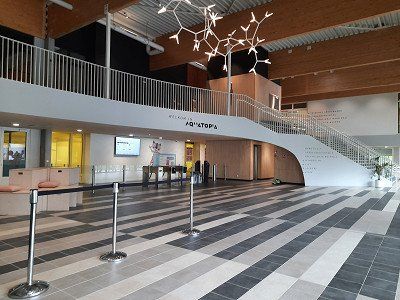
After breakfast we made our way to downtown Aalst. After a good two hours we had looked at the sights and went back to the camper.After returning, we tried again with the registration, which also worked without any problems. 9€ court fee.
And payable with invoice.
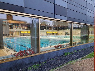
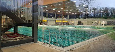
We spent the rest of the afternoon in the indoor pool, which only cost €5 per person for the whole day.
In the indoor pool there is a hall with 8 lanes of 50 m, a hall with 8 lanes of 25 m and a diving platform with 1m, 3m, 5m.


Had to download the app first, initially had problems logging in. Although we were standing on a free space, the app showed it as occupied. We tried the pool ticket office, which didn't work either.
Now we had breakfast first, we left shortly before the end of the free parking time in Brussels.
After breakfast we made our way to downtown Aalst. After a good two hours we had looked at the sights and went back to the camper.After returning, we tried again with the registration, which also worked without any problems. 9€ court fee.
And payable with invoice.
We spent the rest of the afternoon in the indoor pool, which only cost €5 per person for the whole day.
In the indoor pool there is a hall with 8 lanes of 50 m, a hall with 8 lanes of 25 m and a diving platform with 1m, 3m, 5m.
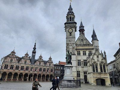
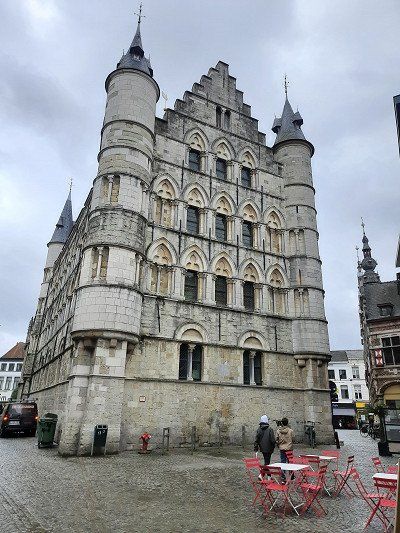
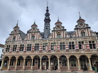
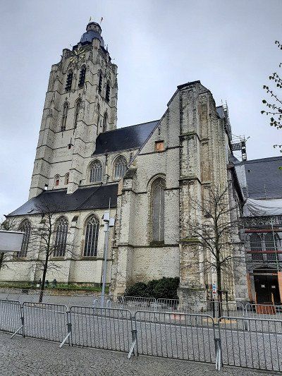
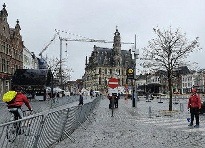
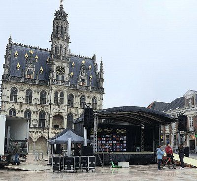
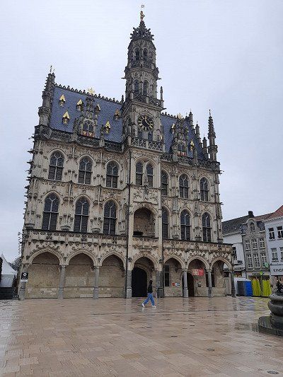
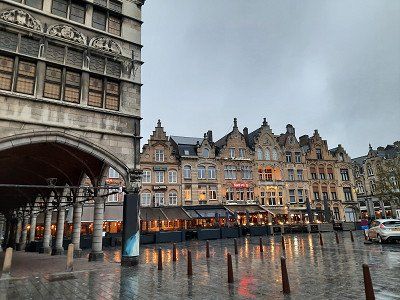
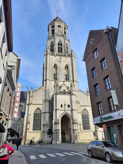
Due to a cycling event "Tour of Flanders", many streets in the city center were closed, so we had to drive to the parking lot GPS: 50.838657,03.604731.
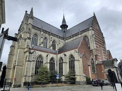
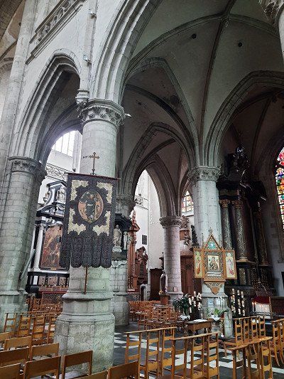
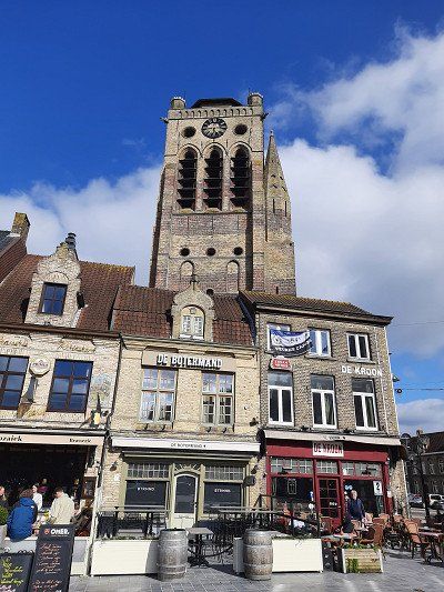
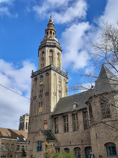
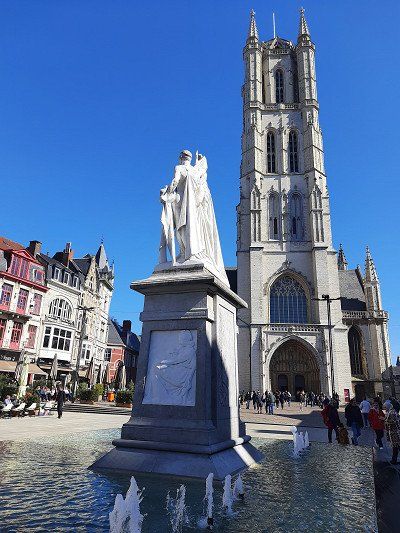
The 90m high tower of the St. Walburga Church, built in the 17th century, characterizes the cityscape. The magnificent town hall on the market square, the beguinage, churches, abbeys and stately homes are among the extraordinary sights of this attractive city. In Gentiel Antheunis Square is a restored Napoleonic fountain.
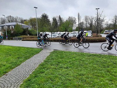
Due to a cycling event "Tour of Flanders", many streets in the city center were closed, so we had to drive to the parking lot GPS: 50.838657,03.604731.
The 90m high tower of the St. Walburga Church, built in the 17th century, characterizes the cityscape. The magnificent town hall on the market square, the beguinage, churches, abbeys and stately homes are among the extraordinary sights of this attractive city. In Gentiel Antheunis Square is a restored Napoleonic fountain.
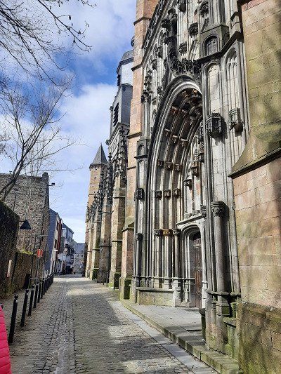
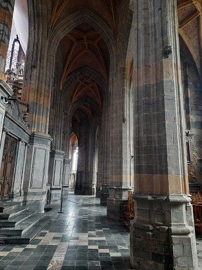
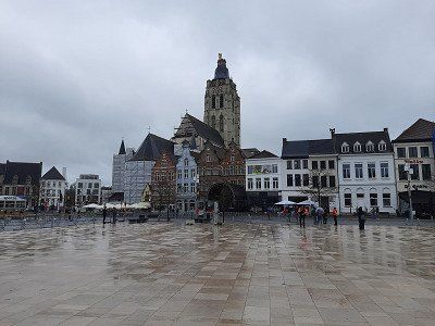
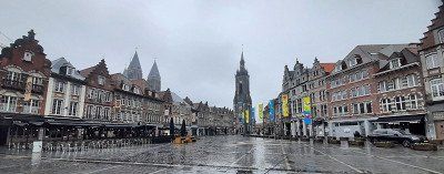
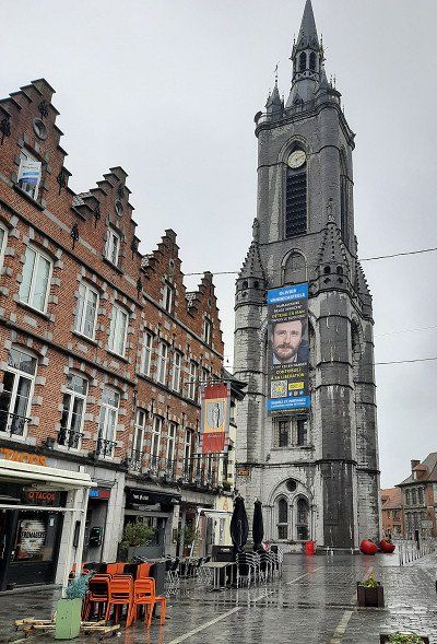
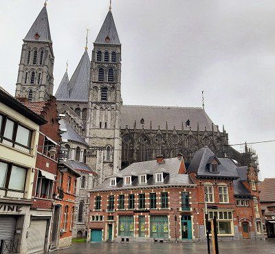
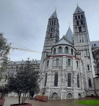
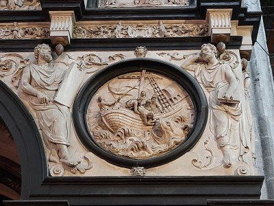
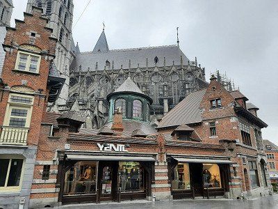
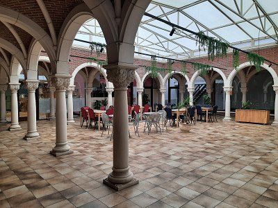
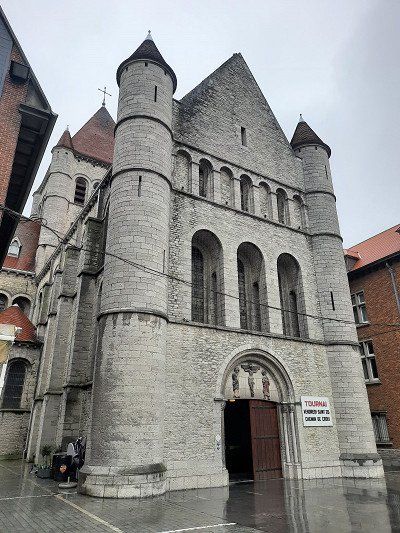
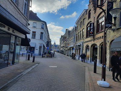
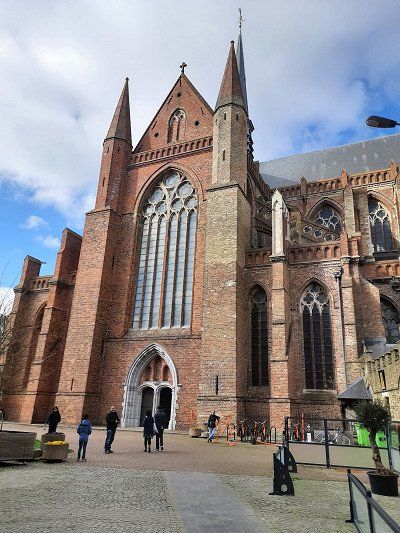
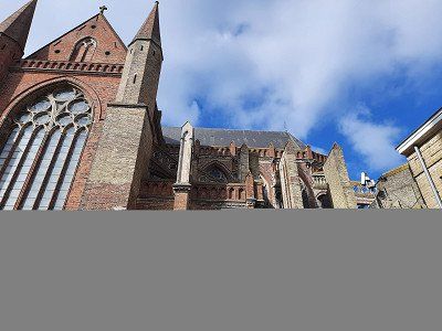
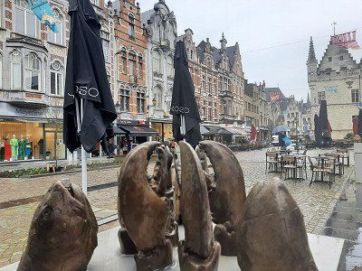
Tournai is a city steeped in history, also in architectural terms. The Gothic Cloth Hall, medieval churches and countless pretty, narrow houses stand on the Grand Place.
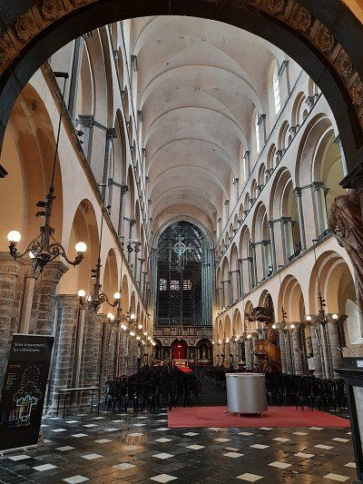
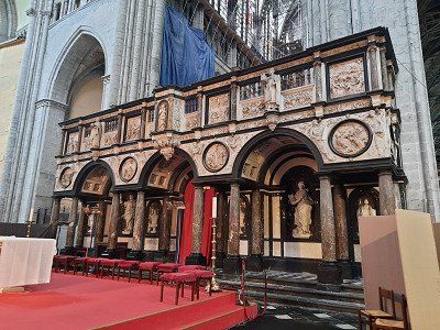
The first thing we saw was Grand Place with the oldest belfry in Belgium, which proudly watches over the city. The belfry, the bell tower was used as a watchtower, prison, bell tower and town hall. Its bell informed and warned citizens of invasions and fires.It can be read that there are twelve churches and chapels scattered around the city center, which we didn't all look at. Most of them date from the twelfth and thirteenth centuries, including a masterpiece of the time, the Notre-Dame Cathedral, which we really wanted to visit. A very great and impressive cathedral that is fully justified UNESCO World Heritage.
Unfortunately we had a rainy day while visiting the city.
Tournai is a city steeped in history, also in architectural terms. The Gothic Cloth Hall, medieval churches and countless pretty, narrow houses stand on the Grand Place.
The first thing we saw was Grand Place with the oldest belfry in Belgium, which proudly watches over the city. The belfry, the bell tower was used as a watchtower, prison, bell tower and town hall. Its bell informed and warned citizens of invasions and fires.It can be read that there are twelve churches and chapels scattered around the city center, which we didn't all look at. Most of them date from the twelfth and thirteenth centuries, including a masterpiece of the time, the Notre-Dame Cathedral, which we really wanted to visit. A very great and impressive cathedral that is fully justified UNESCO World Heritage.
Unfortunately we had a rainy day while visiting the city.
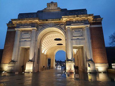
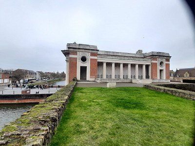
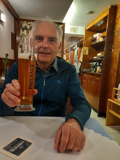
Approached the pitch in Ypres when it rained. There were still enough free places. The parking space was in a green meadow by a small lake and about 30 minutes from the center. The wet and cold weather was not inviting to visit the city. We rested in the WoMo. To commemorate the fallen soldiers, The Last Post is blown under the Menin Gate every evening at 8 p.m., a ceremony that has drawn many visitors every day since 1928 and which we definitely wanted to see. We walked to the center of the city on the bike path along the road for about 30 minutes. At 8 p.m. we were at the big market, which is not far from the Menin Gate. We were a little late for the ceremony, we still heard the end of the Last Pist. It was really as described, hundreds of people attended the spectacle. A number of buses were parked along the city wall. After the ceremony we drank a traditional Belgian beer in a pub near the Menin Gate. We had 24 types of beer to choose from and we made a good choice of beers. I had a dark strong beer, Irmgard a light, light beer. Back to the WoMo it was the same way back.

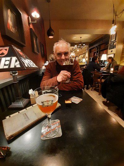
Approached the pitch in Ypres when it rained. There were still enough free places. The parking space was in a green meadow by a small lake and about 30 minutes from the center. The wet and cold weather was not inviting to visit the city. We rested in the WoMo. To commemorate the fallen soldiers, The Last Post is blown under the Menin Gate every evening at 8 p.m., a ceremony that has drawn many visitors every day since 1928 and which we definitely wanted to see. We walked to the center of the city on the bike path along the road for about 30 minutes. At 8 p.m. we were at the big market, which is not far from the Menin Gate. We were a little late for the ceremony, we still heard the end of the Last Pist. It was really as described, hundreds of people attended the spectacle. A number of buses were parked along the city wall. After the ceremony we drank a traditional Belgian beer in a pub near the Menin Gate. We had 24 types of beer to choose from and we made a good choice of beers. I had a dark strong beer, Irmgard a light, light beer. Back to the WoMo it was the same way back.
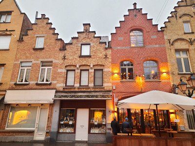
The evening before, it was important for us to see the ceremony at the Menin Gate, it was then too late for a city tour. That's why we decided to go to the old town of Ypres again this morning. On a nice footpath we got directly from the parking space to the center.
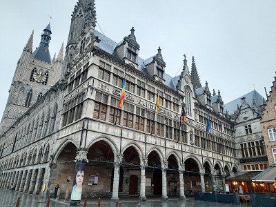
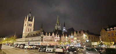
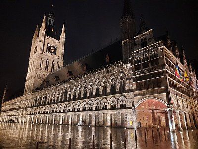
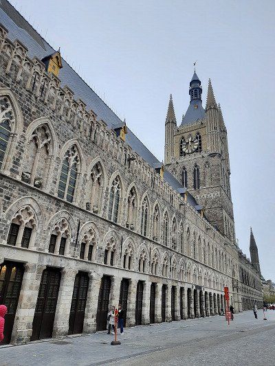
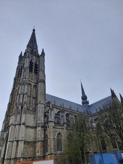
The city is just 12 kilometers from the French border. The fate of Ypres is difficult - in the early Middle Ages the city was considered one of the richest cities in Europe, but it was almost completely destroyed in the First World War. The most important buildings are again properly reconstructed. One of them is the Great Cloth Hall - the pride of the city. But the memory of the war lives on today - the Menin Gate is a monument of sorts, with the names of 54,000 British soldiers who died near Ypres engraved on its walls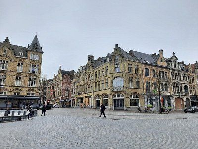
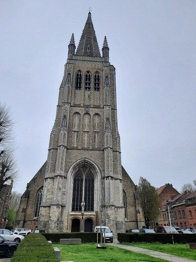


The evening before, it was important for us to see the ceremony at the Menin Gate, it was then too late for a city tour. That's why we decided to go to the old town of Ypres again this morning. On a nice footpath we got directly from the parking space to the center.
The city is just 12 kilometers from the French border. The fate of Ypres is difficult - in the early Middle Ages the city was considered one of the richest cities in Europe, but it was almost completely destroyed in the First World War. The most important buildings are again properly reconstructed. One of them is the Great Cloth Hall - the pride of the city. But the memory of the war lives on today - the Menin Gate is a monument of sorts, with the names of 54,000 British soldiers who died near Ypres engraved on its wallsAfter the city tour of Ypres we drove directly to Veurne. The parking space was behind the sports hall, the entrance must have changed, our navigation system guided us to a newly created parking lot from which access to the parking space was not possible. Pay machine in the terminal. We chose seat No.1, typed No.1 into the display and paid €12 by card. The barcode on the printed ticket held up to the scanner and the barrier opened. Upon arrival we took our coffee break. Veurne is a city of art worth seeing. The market square is surrounded by several historic buildings, including the town hall built between 1596 and 1612 and the belfry. The St. Nicolas Church and the St. Walburga Church, with their construction in the 13./14. century were worth a visit.
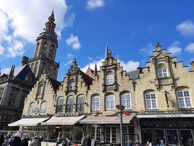
After the city tour of Ypres we drove directly to Veurne. The parking space was behind the sports hall, the entrance must have changed, our navigation system guided us to a newly created parking lot from which access to the parking space was not possible. Pay machine in the terminal. We chose seat No.1, typed No.1 into the display and paid €12 by card. The barcode on the printed ticket held up to the scanner and the barrier opened. Upon arrival we took our coffee break. Veurne is a city of art worth seeing. The market square is surrounded by several historic buildings, including the town hall built between 1596 and 1612 and the belfry. The St. Nicolas Church and the St. Walburga Church, with their construction in the 13./14. century were worth a visit.
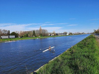
Today we did a 75 km bike ride to the coast of Belgium. Verune to Ostend and back again. In Ostend we happened to meet Natascha, Tobias and Samuel at Fort Napoleon. We walked with them along the promenade of Ostend for a while. Irmgard, Natascha and Samuel really wanted to walk barefoot along the beach. Samuel had wet pants afterwards. It was freezing cold on the tour and on the way there we had a strong headwind. In the flat country it is good to cycle without a motor, on the coast the motor support was good. That way you got a little faster. Our coffee break was at a cafe by the cathedral where we could sit outside. The cappuccino and the pastries were beautifully presented. On the way we used the bike ferry twice across the channel, the ferries were free.
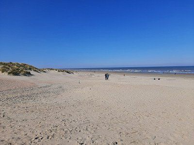
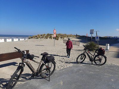
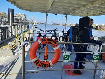
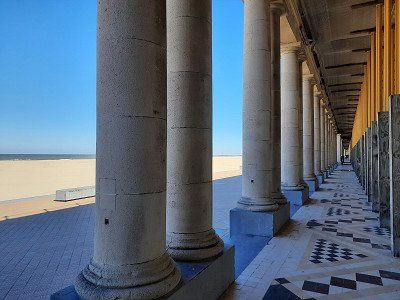

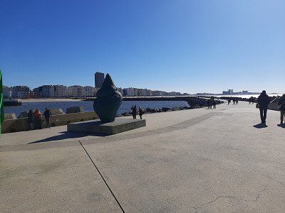
Today we did a 75 km bike ride to the coast of Belgium. Verune to Ostend and back again. In Ostend we happened to meet Natascha, Tobias and Samuel at Fort Napoleon. We walked with them along the promenade of Ostend for a while. Irmgard, Natascha and Samuel really wanted to walk barefoot along the beach. Samuel had wet pants afterwards. It was freezing cold on the tour and on the way there we had a strong headwind. In the flat country it is good to cycle without a motor, on the coast the motor support was good. That way you got a little faster. Our coffee break was at a cafe by the cathedral where we could sit outside. The cappuccino and the pastries were beautifully presented. On the way we used the bike ferry twice across the channel, the ferries were free.
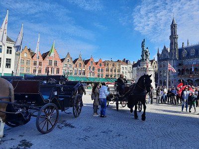
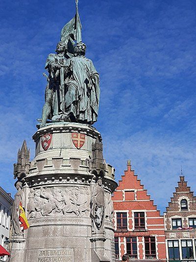
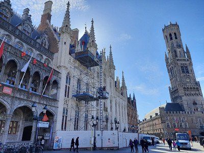
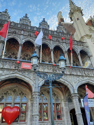
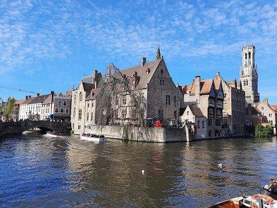
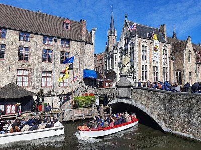
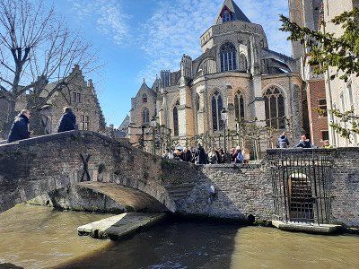
Bruges has a beautiful historic city center. It is one of the most beautiful towns we had seen on our Belgium tour, we considered it the "Venice of the North".
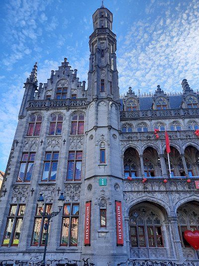
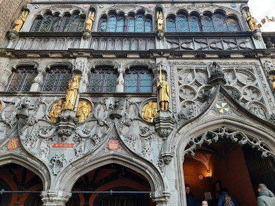
We could easily reach almost all sights on foot and Bruges is therefore also ideal for a short trip. The paths to various sights branch off from the market square. The Great Market is surrounded by magnificent guild houses with their high gables. The main buildings are the Belfry with the Cloth Hall and the Provincial Palace, which also contains the Tourist Information and the Historium. The facades of the buildings around the square are very nice photo motifs.The basilica is tucked away, you wouldn't expect it on the first floor of the building, but it's all the more beautiful for that. In the Basilica of the Holy Blood, in the Gothic upper church (1480), the relic of the Holy Blood is kept. The history of this church is explained very nicely on descriptive boards.
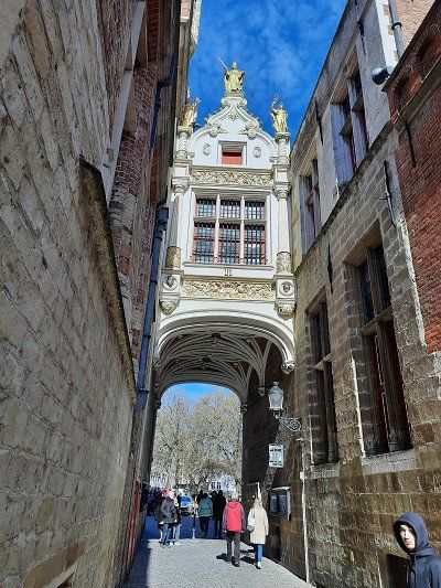
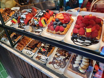
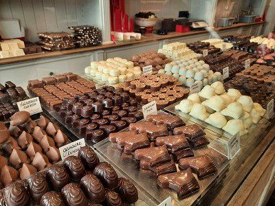
The narrow little streets, canals, buildings and canals are beautiful. And on every corner the opportunity to stop off comfortably gives Bruges a unique charm. Many waffle bakeries invite you to feast, with a wide variety of creations and chocolate everywhere.
The Gauls founded in the 2nd century. a settlement but Bruges only gained importance after the great storm tide of 1134. This created direct access to the sea and made Bruges the richest city in Northern Europe. end of the 15th century the access to the North Sea silted up and the merchants and traders relocated their places of work to Antwerp. Until Bruges in the 19th century came to the Kingdom of Belgium, the French, the Habsburgs and the Dutch ruled the city alternately.


Bruges has a beautiful historic city center. It is one of the most beautiful towns we had seen on our Belgium tour, we considered it the "Venice of the North".
We could easily reach almost all sights on foot and Bruges is therefore also ideal for a short trip. The paths to various sights branch off from the market square. The Great Market is surrounded by magnificent guild houses with their high gables. The main buildings are the Belfry with the Cloth Hall and the Provincial Palace, which also contains the Tourist Information and the Historium. The facades of the buildings around the square are very nice photo motifs.The basilica is tucked away, you wouldn't expect it on the first floor of the building, but it's all the more beautiful for that. In the Basilica of the Holy Blood, in the Gothic upper church (1480), the relic of the Holy Blood is kept. The history of this church is explained very nicely on descriptive boards.
The narrow little streets, canals, buildings and canals are beautiful. And on every corner the opportunity to stop off comfortably gives Bruges a unique charm. Many waffle bakeries invite you to feast, with a wide variety of creations and chocolate everywhere.
The Gauls founded in the 2nd century. a settlement but Bruges only gained importance after the great storm tide of 1134. This created direct access to the sea and made Bruges the richest city in Northern Europe. end of the 15th century the access to the North Sea silted up and the merchants and traders relocated their places of work to Antwerp. Until Bruges in the 19th century came to the Kingdom of Belgium, the French, the Habsburgs and the Dutch ruled the city alternately.
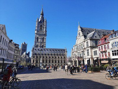
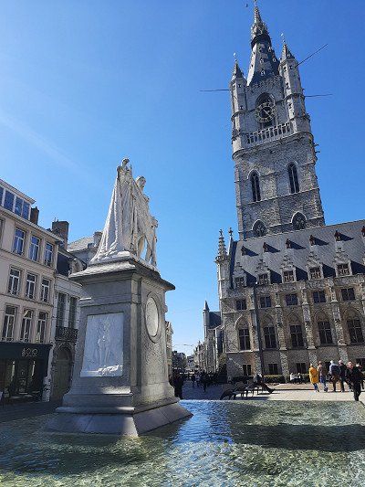
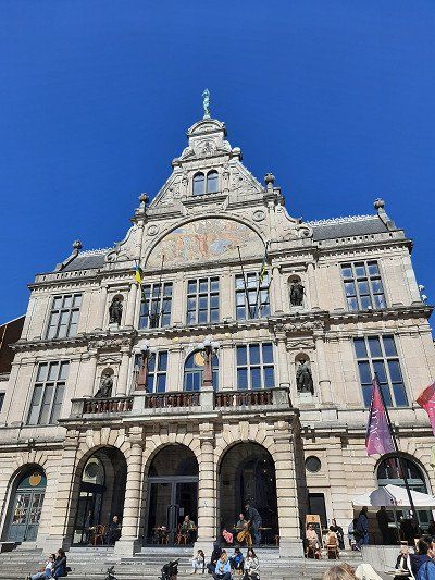
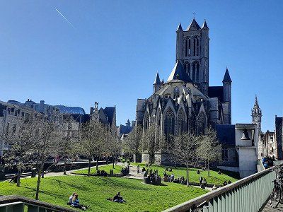
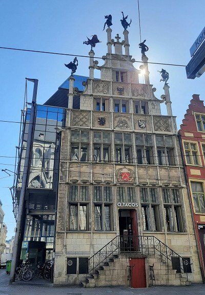
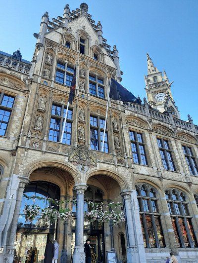
Approached a day parking lot at the water sports area, free parking. We were able to take the city bus to the center for free. At first we didn't like Ghent at all, probably still had the images of Bruges in our heads. The picture then changed when we saw the mighty buildings and house facades. The center of Ghent just kept getting nicer and what a beautiful walk along the Leie. We strolled along the water here as old houses line both sides of the shore. Grain, spices and vegetables used to be stored here.
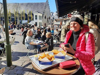
In the sun it was much warmer than on the previous days, you could also tell from the number of people sitting outside. We insisted on eating fries at a Frite Bude. We tried four sauces with them: Triffelsoße, Andalusian, Bernaise and Curry.
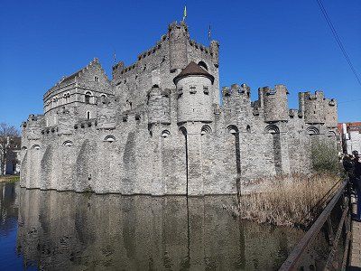
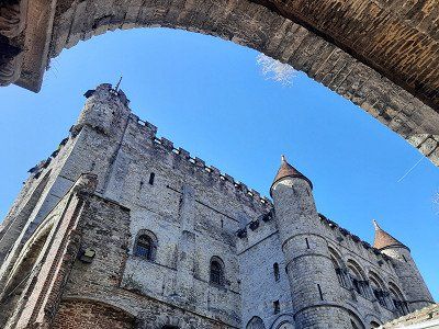
A great Gravensteen castle in the old town with a special location on a canal. Gravensteen is located right in the historic center of Ghent at Sant Veerleplein and Burgstraat, which is the only one in Flanders that has an almost completely intact defense system.
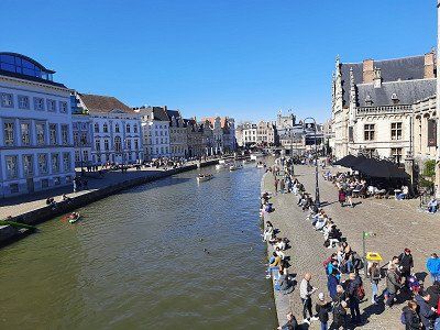
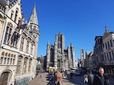
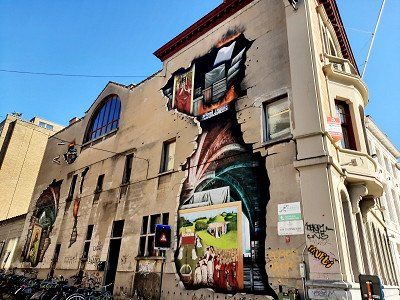
Approached a day parking lot at the water sports area, free parking. We were able to take the city bus to the center for free. At first we didn't like Ghent at all, probably still had the images of Bruges in our heads. The picture then changed when we saw the mighty buildings and house facades. The center of Ghent just kept getting nicer and what a beautiful walk along the Leie. We strolled along the water here as old houses line both sides of the shore. Grain, spices and vegetables used to be stored here.
In the sun it was much warmer than on the previous days, you could also tell from the number of people sitting outside. We insisted on eating fries at a Frite Bude. We tried four sauces with them: Triffelsoße, Andalusian, Bernaise and Curry.
A great Gravensteen castle in the old town with a special location on a canal. Gravensteen is located right in the historic center of Ghent at Sant Veerleplein and Burgstraat, which is the only one in Flanders that has an almost completely intact defense system.
A free parking space in front of the campsite where overnight stays are allowed. We had no traffic through the city when approaching the square. By coincidence, Natascha was at the campsite with her family without us having arranged this beforehand. We walked together along the banks of the Scheldt to the Sint Anna Tunnel. From the parking lot we had a view of the city in the moonlight.
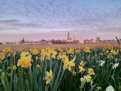
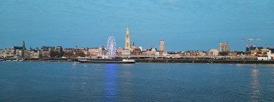
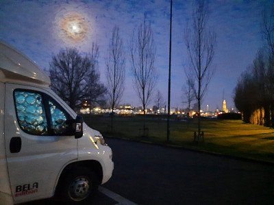
A free parking space in front of the campsite where overnight stays are allowed. We had no traffic through the city when approaching the square. By coincidence, Natascha was at the campsite with her family without us having arranged this beforehand. We walked together along the banks of the Scheldt to the Sint Anna Tunnel. From the parking lot we had a view of the city in the moonlight.
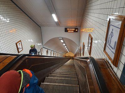
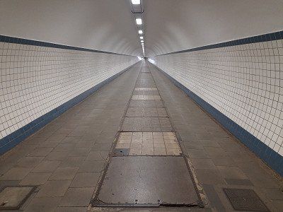
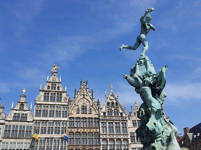
Today the visit of Antwerp was on the program. Together we went to the old town in bright sunshine and the warmest day since we were on the trip. We changed banks in Antwerp via the so-called Sint-Anna tunnel. With its wooden escalators, the Sint-Anna tunnel is a real eye-catcher today. The ride on the old escalators alone is worth a visit: it rumbles and rattles, and the noise is almost deafening. The listed pedestrian tunnel is very close to the historic center and was built in the 1930s. The tunnel tube is 31 meters below the water surface and is 572 long.
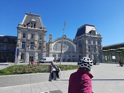
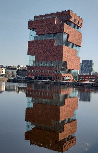
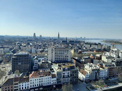
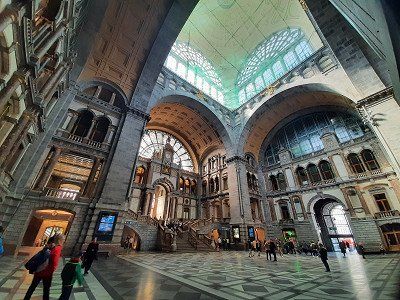
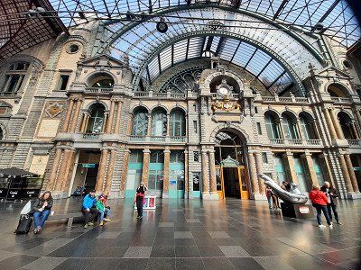
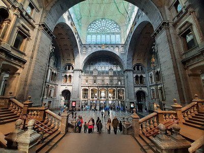
The Museum aan de Stroom is a great museum, the ascent with escalators to the top 10th floor to the viewing platform was free. Up there we had a fantastic view of the whole of Antwerp. We decided not to visit the museum. We continued to the historical station building. This train station is an architectural highlight and a "must see" in Antwerp.
We decided not to pay a visit to the cathedral.

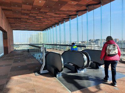
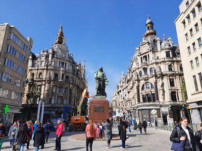
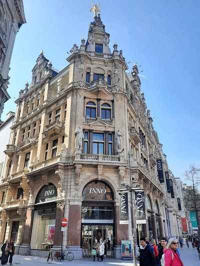

Today the visit of Antwerp was on the program. Together we went to the old town in bright sunshine and the warmest day since we were on the trip. We changed banks in Antwerp via the so-called Sint-Anna tunnel. With its wooden escalators, the Sint-Anna tunnel is a real eye-catcher today. The ride on the old escalators alone is worth a visit: it rumbles and rattles, and the noise is almost deafening. The listed pedestrian tunnel is very close to the historic center and was built in the 1930s. The tunnel tube is 31 meters below the water surface and is 572 long.
The Museum aan de Stroom is a great museum, the ascent with escalators to the top 10th floor to the viewing platform was free. Up there we had a fantastic view of the whole of Antwerp. We decided not to visit the museum. We continued to the historical station building. This train station is an architectural highlight and a "must see" in Antwerp.
We decided not to pay a visit to the cathedral.
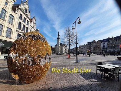
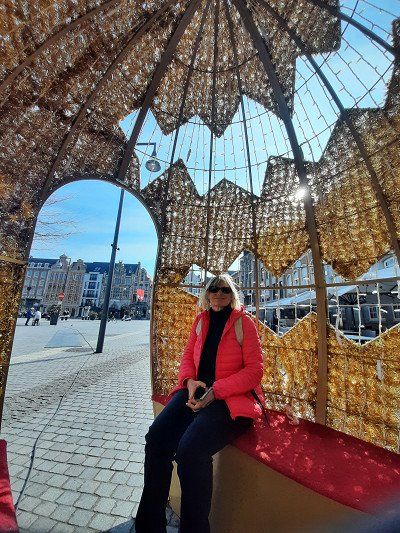
Approached the free parking space of the municipality of Lier. Worth seeing here was the room tower with a mechanical art clock. Other sights included the large market with the town hall. The medieval St.
Gummarus Church was closed.
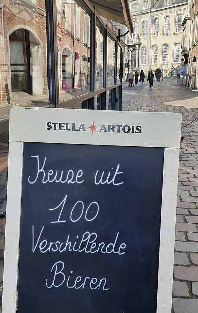
We used the stop in Lier to buy food supplies. On this occasion we also bought three different types of beer to try.
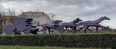
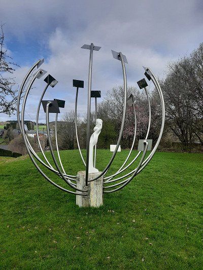
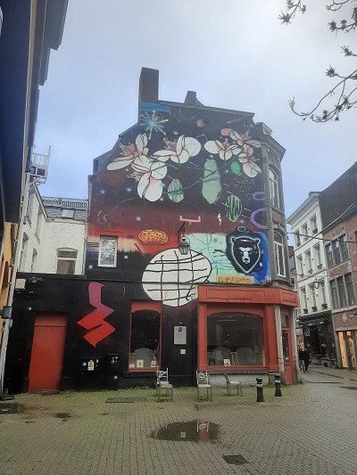
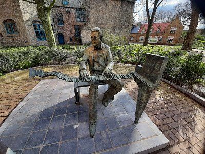
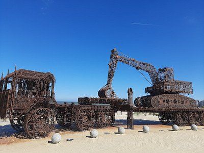
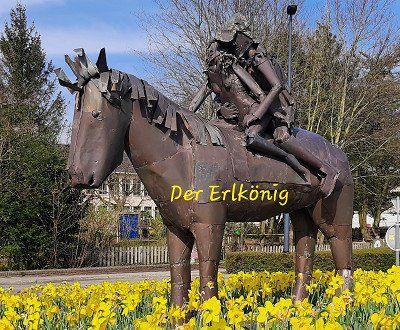
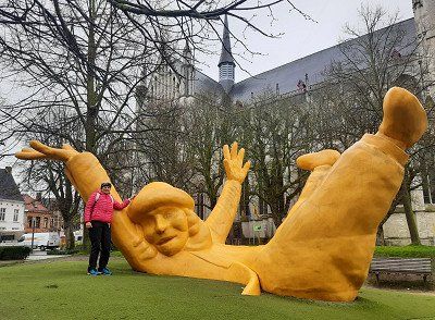
On the way we came across a work of art which, in my opinion, should represent "Der Erlkönig", a ballad by Johann Wolfgang von Goethe.
We considered whether we should stop for the night and then decided to continue to Mechelen. The skate park next door was heavily frequented with young people and it could get noisy well into the night.

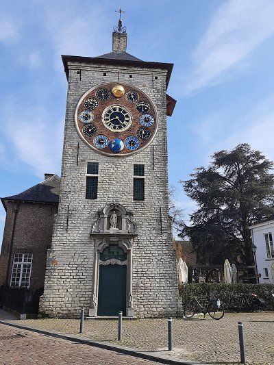
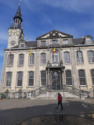

Approached the free parking space of the municipality of Lier. Worth seeing here was the room tower with a mechanical art clock. Other sights included the large market with the town hall. The medieval St.
Gummarus Church was closed.
We used the stop in Lier to buy food supplies. On this occasion we also bought three different types of beer to try.
On the way we came across a work of art which, in my opinion, should represent "Der Erlkönig", a ballad by Johann Wolfgang von Goethe.
We considered whether we should stop for the night and then decided to continue to Mechelen. The skate park next door was heavily frequented with young people and it could get noisy well into the night.
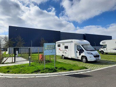
Driving through Mechelen city center was stressful. The given road was closed, so we drove on at our own discretion.
But the navigation system didn't accept our route and wanted to send us back to the starting point unabated. Then, with the help of the navigation system, we drove to the selected parking space. We found a locked parking space, the space was full of residential containers for Ukraine refugees. A sign gave the address of a replacement site that was located on an industrial site, which we saw when we arrived. The spaces were already occupied or blocked with traffic cones, we were still able to park at the very end of the parking marking.
This morning we looked at the city center of Mechelen. It was already raining lightly when we left. It was a 2 km walk to the center.
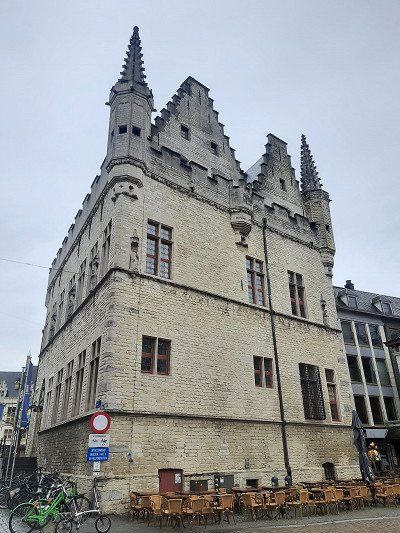
There are said to be more than 300 historical monuments in the small town of Mechelen. One of them is the 15th-century town hall.
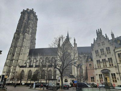
The first thing we encountered was the Gothic Cathedral of St. Rombout, it is the most imposing church in the city and its landmark.
It houses valuable paintings. Mechelen is well known at UNESCO, as the city has been included in the World Heritage List four times. In the tourist information you could read and see a lot of interesting things about the city.
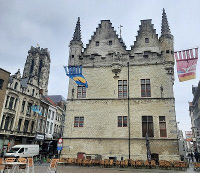
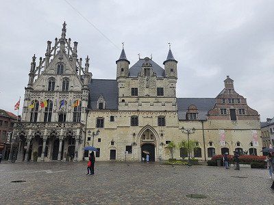
This morning we looked at the city center of Mechelen. It was already raining lightly when we left. It was a 2 km walk to the center.
There are said to be more than 300 historical monuments in the small town of Mechelen. One of them is the 15th-century town hall.
The first thing we encountered was the Gothic Cathedral of St. Rombout, it is the most imposing church in the city and its landmark.
It houses valuable paintings. Mechelen is well known at UNESCO, as the city has been included in the World Heritage List four times. In the tourist information you could read and see a lot of interesting things about the city.
After the city tour of Mechelen we drove to the city of Leuven to visit. The far parking lot at the cemetery to the center distracted us from the visit. The rainy day wasn't inviting either. We took a coffee break in the parking lot before continuing. On the way to Blegny on the autobahn, it rained continuously. The highway was so loud, the reason for this was a concrete surface that caused an unbearable driving noise.
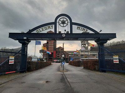
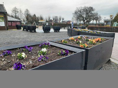
The free parking space at the Blegny mine was occupied by two mobile homes. After our arrival, the parking spaces filled up quickly and the other parking lot was used by mobile homes.
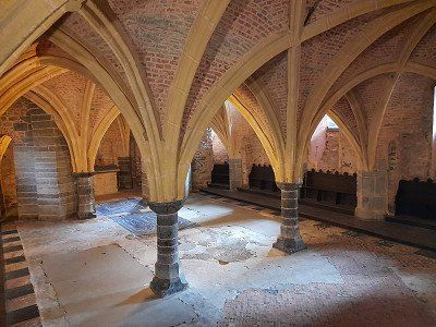
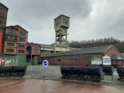
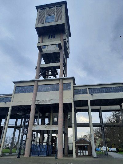
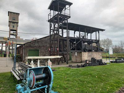
In the rainy weather we didn't feel like doing anything outside. When the rain stopped in the evening, we looked at the site of the Blegny mine, which is one of the four most important collieries in Wallonia and is on the UNESCO World Heritage List.
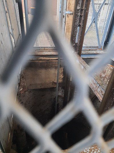
The last witness of the Liège coal industry is the Blegny colliery, one of the four authentic underground coal mines in Europe. The coal was mined at a depth of between 30 and 60 meters. The coal mine can be visited via the original access shaft. Equipped with a helmet and jacket, you can go underground with the hoisting cage.

After the city tour of Mechelen we drove to the city of Leuven to visit. The far parking lot at the cemetery to the center distracted us from the visit. The rainy day wasn't inviting either. We took a coffee break in the parking lot before continuing. On the way to Blegny on the autobahn, it rained continuously. The highway was so loud, the reason for this was a concrete surface that caused an unbearable driving noise.
The free parking space at the Blegny mine was occupied by two mobile homes. After our arrival, the parking spaces filled up quickly and the other parking lot was used by mobile homes.
In the rainy weather we didn't feel like doing anything outside. When the rain stopped in the evening, we looked at the site of the Blegny mine, which is one of the four most important collieries in Wallonia and is on the UNESCO World Heritage List.
The last witness of the Liège coal industry is the Blegny colliery, one of the four authentic underground coal mines in Europe. The coal was mined at a depth of between 30 and 60 meters. The coal mine can be visited via the original access shaft. Equipped with a helmet and jacket, you can go underground with the hoisting cage.
When I looked out the window in the morning, a dense fog hung over the country. A bike ride to Liège was planned for today. The weather kept us from the plan and we drove to the next place on the route.
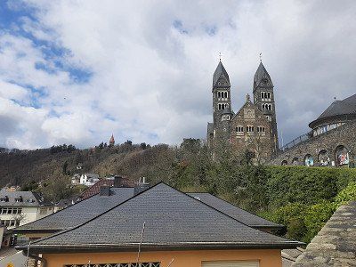
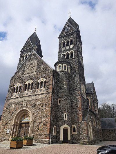
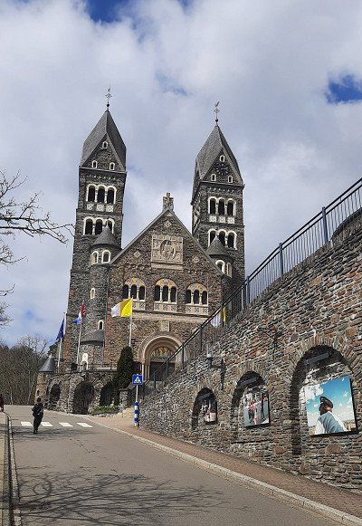
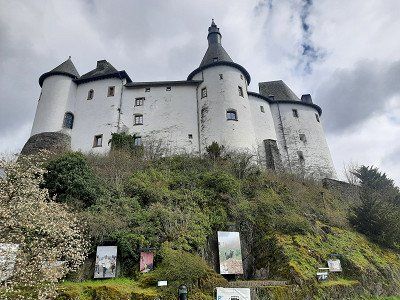
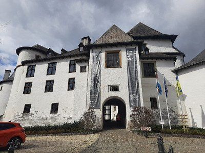
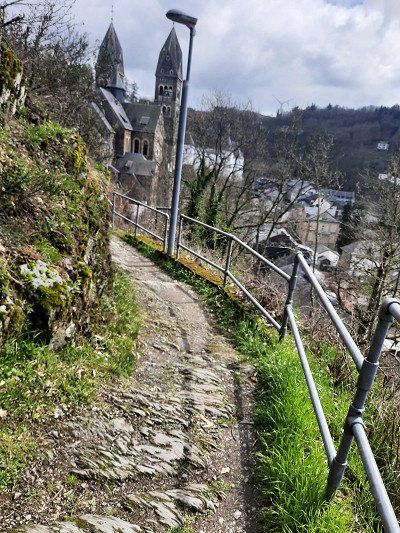
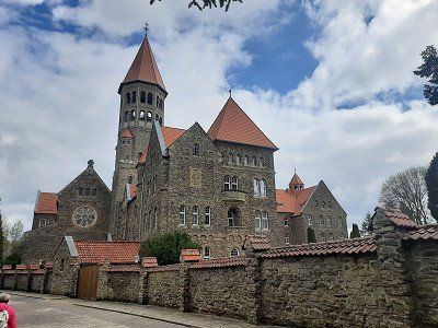
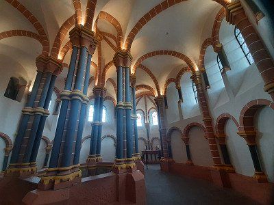
Finally, after a two-hour drive, the small town of Clervaux appears, which is pretty well hidden in its green surroundings. A rocky spur crosses the valley and forms the foundation for three of the most impressive buildings in this place: above the Benedictine Abbey of Saint-Maurice, below the Church of Saints Como and Damien and the imposing white castle of Clervaux. We head for the town church, which is located directly above the castle in the heart of the old town.
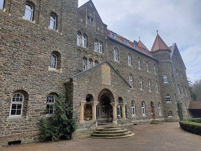
The climb up the rocky spur to Saint-Maurice is indeed quite steep. We finally get to the top and have a good look at the huge building of the Benedictine abbey. The small museum showing the life of the monks in the monastery was also very interesting.
At the beginning of the 20th century, Benedictines, expelled from France, found a new home in Clervaux and built a monumental neo-Romanesque monastery complex in 1909/1910. In 1941, during the occupation by Nazi Germany, the monastery became the "Hitler School for Girls". In 1952 it was rebuilt in the sober style of the time.

When I looked out the window in the morning, a dense fog hung over the country. A bike ride to Liège was planned for today. The weather kept us from the plan and we drove to the next place on the route.
Finally, after a two-hour drive, the small town of Clervaux appears, which is pretty well hidden in its green surroundings. A rocky spur crosses the valley and forms the foundation for three of the most impressive buildings in this place: above the Benedictine Abbey of Saint-Maurice, below the Church of Saints Como and Damien and the imposing white castle of Clervaux. We head for the town church, which is located directly above the castle in the heart of the old town.
The climb up the rocky spur to Saint-Maurice is indeed quite steep. We finally get to the top and have a good look at the huge building of the Benedictine abbey. The small museum showing the life of the monks in the monastery was also very interesting.
At the beginning of the 20th century, Benedictines, expelled from France, found a new home in Clervaux and built a monumental neo-Romanesque monastery complex in 1909/1910. In 1941, during the occupation by Nazi Germany, the monastery became the "Hitler School for Girls". In 1952 it was rebuilt in the sober style of the time.
We parked and stayed the night directly below the castle, on the Our river near the cemetery. The municipal parking lot was overcrowded.
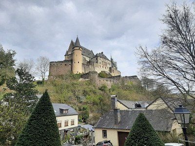
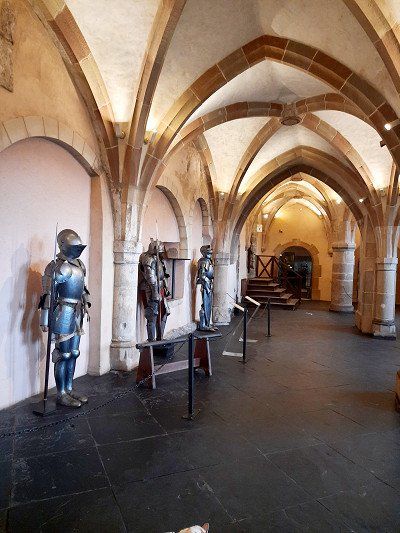
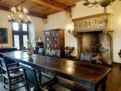
The castle high above Vianden is absolutely impressive even from the city. It is worth making the way up and investing the 7€ for entry. The castle inspires even before entering the first rooms. Large pillars, a great ceiling construction, knight's armor and beautifully furnished living rooms, such as the kitchen, etc.
After visiting the chateau we walked down to the small town on the Our on steep, small winding streets with beautiful old houses. The town itself doesn't have much to offer apart from the beautiful location and the spectacular view of the castle and the Our valley.


We parked and stayed the night directly below the castle, on the Our river near the cemetery. The municipal parking lot was overcrowded.
The castle high above Vianden is absolutely impressive even from the city. It is worth making the way up and investing the 7€ for entry. The castle inspires even before entering the first rooms. Large pillars, a great ceiling construction, knight's armor and beautifully furnished living rooms, such as the kitchen, etc.
After visiting the chateau we walked down to the small town on the Our on steep, small winding streets with beautiful old houses. The town itself doesn't have much to offer apart from the beautiful location and the spectacular view of the castle and the Our valley.
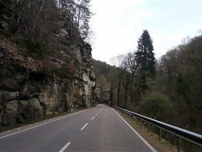
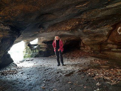
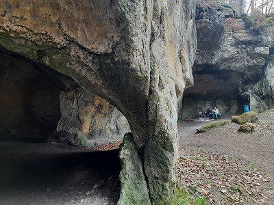
Berdorf was the starting point of our hike.
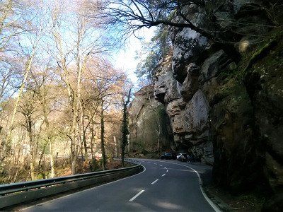
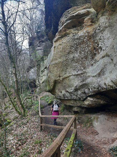
On the way we passed the spectacular rocks.
Berdorf was the starting point of our hike.
On the way we passed the spectacular rocks.
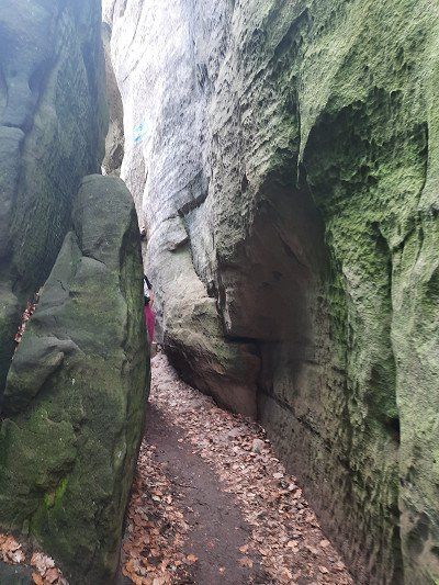
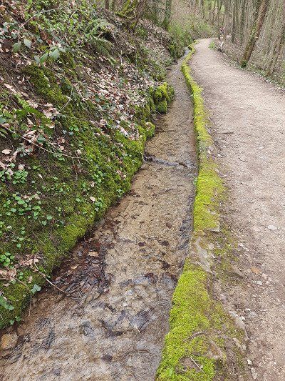
At first we stayed along the eaves and only later climbed into a mostly dry river bed that meandered between the rocks.
The steep sandstone cliffs towered up to 50 meters to the left and right.
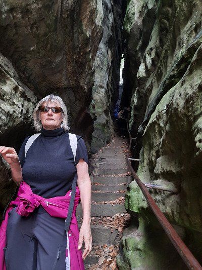
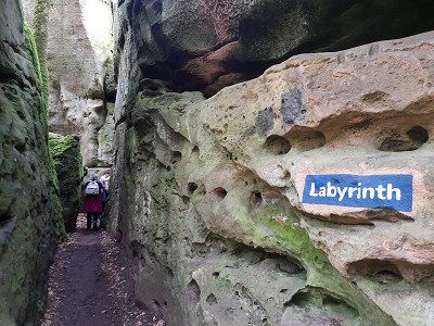
We passed rock cracks whose gaps in the rocks can be climbed using a ladder.
The hiking trail sometimes winds through narrow, crooked rock gaps, so that one of the sections is also called a labyrinth.
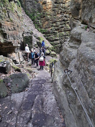
Then we reached the first highlight of the hike: the spectacular Wolfsschlucht, steep stairs down the narrow gorge.
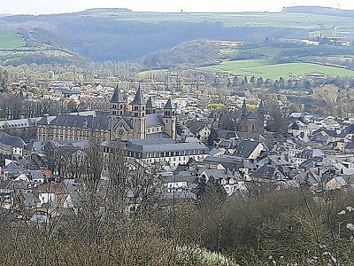
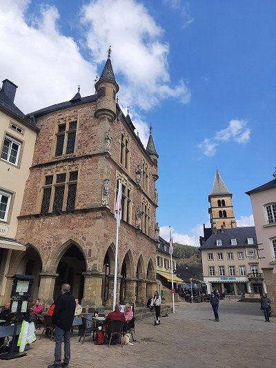
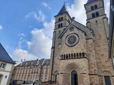
A beautiful view of Echternach offered itself before it went steeply on a paved path to the basilica in Echternach.It went through the city, across the market square past the town hall and the former courthouse. Next door is the St. Willibrord Basilica and the neighboring former Benedictine monastery of St. Peter and Paul.
We went back along a beautiful Waalwegand since we no longer had to make our way through narrow crevices and over steep stairs, we made good progress on the beautiful, slightly uphill forest path.
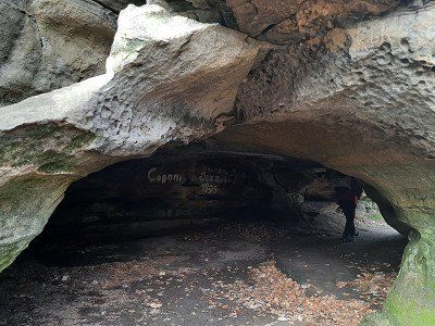
And then we reached the Hohllay, an impressive hollowed-out rock through which our path led.
The material for the millstones needed in the region used to be mined here.Route length 18 km
Altitude difference: 680 m


At first we stayed along the eaves and only later climbed into a mostly dry river bed that meandered between the rocks.
The steep sandstone cliffs towered up to 50 meters to the left and right.
We passed rock cracks whose gaps in the rocks can be climbed using a ladder.
The hiking trail sometimes winds through narrow, crooked rock gaps, so that one of the sections is also called a labyrinth.
Then we reached the first highlight of the hike: the spectacular Wolfsschlucht, steep stairs down the narrow gorge.
A beautiful view of Echternach offered itself before it went steeply on a paved path to the basilica in Echternach.It went through the city, across the market square past the town hall and the former courthouse. Next door is the St. Willibrord Basilica and the neighboring former Benedictine monastery of St. Peter and Paul.
We went back along a beautiful Waalwegand since we no longer had to make our way through narrow crevices and over steep stairs, we made good progress on the beautiful, slightly uphill forest path.
And then we reached the Hohllay, an impressive hollowed-out rock through which our path led.
The material for the millstones needed in the region used to be mined here.Route length 18 km
Altitude difference: 680 m
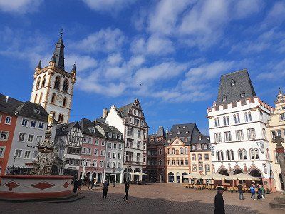
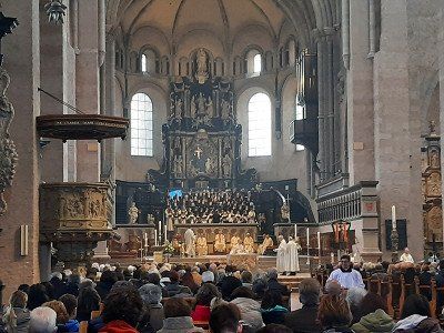
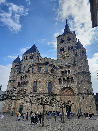
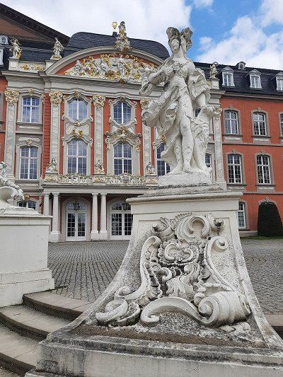
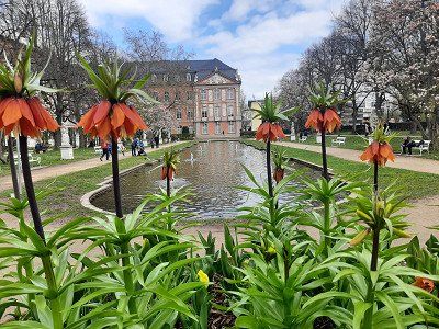
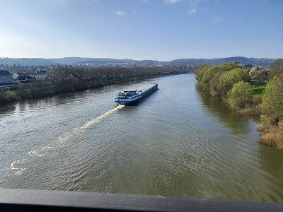
Trier Region Moselle Valley
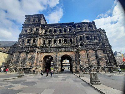
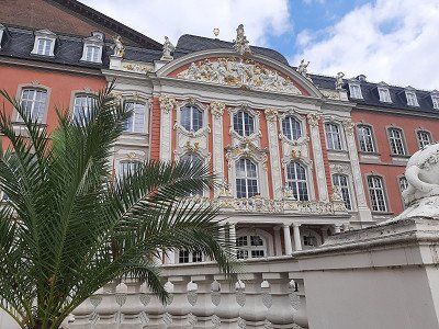
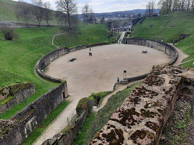
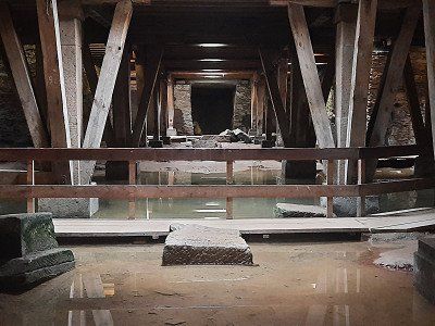
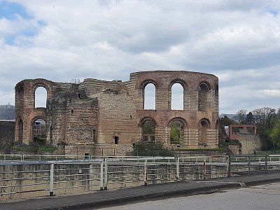
Sights: historic old town, main market, Dreikönigshaus, Palais Walderdorff, cathedral, electoral palace, Constantine Basilica, imperial thermal baths, Porta Nigra, Roman bridge, amphitheater, Monaise Castle, Quint Castle, Wallmauer Pfalzel
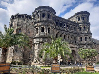
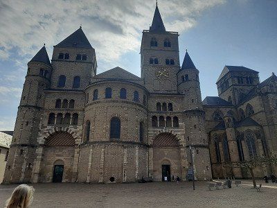
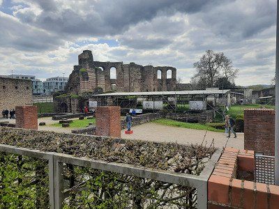
Trier is the oldest city in Germany and is home to numerous Roman monuments that have been a UNESCO World Heritage Site since 1986. These include the amphitheater from 100 AD, the remains of the so-called Imperial Baths, the Barbara Baths and the Viehmarkt Baths. The Constantine Basilica, the largest surviving room from antiquity, was built around 305 and 311 AD and served Emperor Constantine as a meeting and representation building. The well-known landmark of the city is the Porta Nigra, a Roman city gate built around 180. The oldest bishop's church in Germany, St. Peter's Cathedral, consists largely of Roman masonry, the remains of a previous building that was built in the 4th century AD at the time of Emperor Constantine. Five of the seven remaining pillars are from the Roman bridge built in the 2nd century. The Church of Our Lady is the only non-Roman building that is one of the UNESCO World Heritage Sites in Trier. It was built in the 13th century and is considered the earliest Gothic church. The district of Euren is home to a special cultural and historical building, the imposing Monaise Castle, which was built in the style of early French classicism.
Trier Region Moselle Valley
Sights: historic old town, main market, Dreikönigshaus, Palais Walderdorff, cathedral, electoral palace, Constantine Basilica, imperial thermal baths, Porta Nigra, Roman bridge, amphitheater, Monaise Castle, Quint Castle, Wallmauer Pfalzel
Trier is the oldest city in Germany and is home to numerous Roman monuments that have been a UNESCO World Heritage Site since 1986. These include the amphitheater from 100 AD, the remains of the so-called Imperial Baths, the Barbara Baths and the Viehmarkt Baths. The Constantine Basilica, the largest surviving room from antiquity, was built around 305 and 311 AD and served Emperor Constantine as a meeting and representation building. The well-known landmark of the city is the Porta Nigra, a Roman city gate built around 180. The oldest bishop's church in Germany, St. Peter's Cathedral, consists largely of Roman masonry, the remains of a previous building that was built in the 4th century AD at the time of Emperor Constantine. Five of the seven remaining pillars are from the Roman bridge built in the 2nd century. The Church of Our Lady is the only non-Roman building that is one of the UNESCO World Heritage Sites in Trier. It was built in the 13th century and is considered the earliest Gothic church. The district of Euren is home to a special cultural and historical building, the imposing Monaise Castle, which was built in the style of early French classicism.
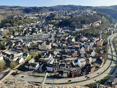
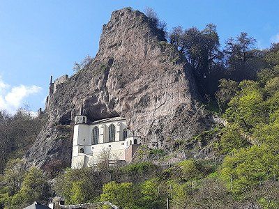
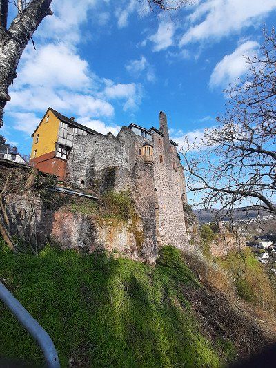
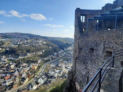
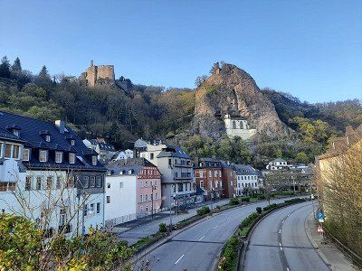
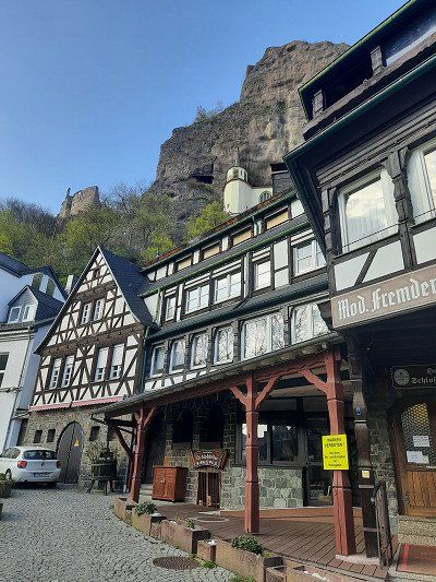
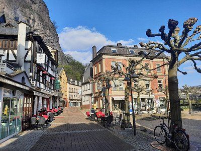
Stopover in Idar Oberstein.
During my military service I was stationed in the hollow barracks for three months, which I visited on this occasion. There were many memories from that time.
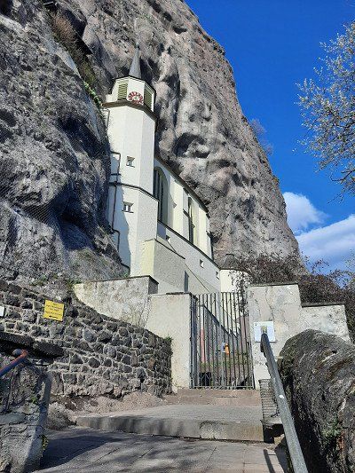
Of course we took a closer look at the little town with the rock church and ended our tour at an Italian restaurant. We spent the night on the designated pitch.

Stopover in Idar Oberstein.
During my military service I was stationed in the hollow barracks for three months, which I visited on this occasion. There were many memories from that time.
Of course we took a closer look at the little town with the rock church and ended our tour at an Italian restaurant. We spent the night on the designated pitch.
Route
Show newest first- 48.1982 8.6956
- 48° 11' 53.5" N 8° 41' 44.2" E
- 49.1197 6.1764
- 49° 7' 10.9" N 6° 10' 34.9" E
- 49.1193 6.1757
- 49° 7' 9.5" N 6° 10' 32.6" E
- 49.1227 6.168
- 49° 7' 21.7" N 6° 10' 5" E
- 49.6184 6.1184
- 49° 37' 6.1" N 6° 7' 6.4" E
- 49.6321 6.1099
- 49° 37' 55.7" N 6° 6' 35.7" E
- 49.6851 5.8105
- 49° 41' 6.5" N 5° 48' 37.7" E
- 49.6908 5.8214
- 49° 41' 26.8" N 5° 49' 17.2" E
Den Vormittag nutzten wir doch noch, um einen Stadtbesuch zu machen.
Die französischsprachige Stadt Arlon liegt in der belgischen Provinz Luxemburg. In der Altstadt Arlons befindet sich die Grand Place, ein historischer Buttermarkt. Auf einer kleinen Anhöhe steht die St.-Donatus-Kirche, die wir bei unserem Besuch anliefen. Sie ist Teil eines ehemaligen Kapuzinerklosters. Der Stadtkern ist auffallend mit vielen kleinen Einkaufsläden.
Zum Schluss ging es noch zur neugotischen Kirche Saint-Martin, die 1907 bis 1914 erbaut wurde.
Um zu Fuß ins Zentrum zu gehen, muss 20 Minuten eigeplant werden.
- 50.2509 4.9184
- 50° 15' 3.2" N 4° 55' 6.3" E
- 50.2638 4.906
- 50° 15' 49.8" N 4° 54' 21.8" E
- 50.3466 4.8454
- 50° 20' 47.7" N 4° 50' 43.6" E
- 50.4715 4.09
- 50° 28' 17.4" N 4° 5' 24.1" E
- 50.8926 4.3337
- 50° 53' 33.3" N 4° 20' 1.2" E
- 50.9381 4.0567
- 50° 56' 17.2" N 4° 3' 24.2" E
- 50.8387 3.6047
- 50° 50' 19.2" N 3° 36' 17" E
- 50.6027 3.3783
- 50° 36' 9.6" N 3° 22' 41.9" E
- 50.8198 2.9127
- 50° 49' 11.2" N 2° 54' 45.7" E
Am Vorabend war die Zeremonie am Menentor für uns wichtig anzuschauen, für eine Stadtbesichtigung war es dann zu spät. Darum entschlossen wir uns am heutigen Vormittag nochmals in die Altstadt Ypern zu gehen. Auf schönem Fußweg gelangten wir direkt vom Stellplatz ins Zentrum.
Die Stadt liegt nur 12 Kilometer von der Grenze zu Frankreich entfernt. Das Schicksal Yperns ist ein schweres – so galt die Stadt im frühen Mittelalter als eine der reichsten Städte Europas, im ersten Weltkrieg aber wurde sie fast vollständig zerstört. Die bedeutendsten Gebäude sind wieder ordentlich rekonstruiert. Eines davon ist die große Tuchhalle – ganzer Stolz der Stadt. Die Erinnerung an den Krieg aber währt noch heute – das Menentor ist eine Art Denkmal, an dessen Wänden die Namen von 54.000 britischen Soldaten eingraviert sind, die in der Nähe von Ypern starben- 51.0732 2.668
- 51° 4' 23.4" N 2° 40' 4.9" E
Heute machten wir eine 75 km lange Radtour an die Küste von Belgien. Verune bis Ostende und wieder zurück. In Ostende trafen wir Natascha,Tobias und Samuel ganz zufällig am Fort Napoleon. Wir gingen noch eine Zeitlang mit ihnen die Promenade von Ostende entlang. Irmgard, Natascha und Samuel wollten unbedingt noch barfuß am Strand entlang gehen. Samuel hatte danach nasse Hosen. Es war eisig kalt auf der Tour und auf der Hinfahrt hatten wir einen starken Gegenwind. Im flachen Land ist es gut, ohne Motor zu Radeln, an der Küste tat die Motorunterstützung gut. So kam man doch etwas schneller voran. Unsere Kaffeepause war in einem Kaffee bei der Kathedrale, wo wir draußen sitzen konnten. Der Cappuccino und das Süßgebäck waren schön angerichtet. Unterwegs benutzten wir zweimal die Radfähre über den Kanal, die Fähren waren frei.
- 51.1986 3.2282
- 51° 11' 55" N 3° 13' 41.5" E
- 51.0514 3.6781
- 51° 3' 4.9" N 3° 40' 41" E
- 51.2335 4.3914
- 51° 14' 0.6" N 4° 23' 28.9" E
Heute stand die Besichtigung von Antwerpen auf dem Programm. Gemeinsam ging es, bei strahlendem Sonnenschein und dem wärmsten Tag seit wir auf der Reise waren in die Altstadt. Wir wechselten in Antwerpen das Ufer über den sogenannten Sint-Annatunnel . Mit seinen hölzernen Rolltreppen ist der Sint-Annatunnel heute ein echter Hingucker. Allein die Fahrt mit den alten Rolltreppen ist ein Besuch wert: es rumpelt und rattert, dazu ein fast ohrenbetäubender Lärm. Der denkmalgeschützte Fußgängertunnel liegt ganz in der Nähe des historischen Zentrums und wurde in den 1930er-Jahren gebaut. Die Tunnelröhre liegt 31 Meter unter der Wasseroberfläche und ist 572 lang.
Das Museum aan de Stroom ist ein tolles Museum, die Auffahrt mit Rolltreppen in die oberste 10. Etage zur Aussichtsplattform war kostenlos. Dort oben hatte wir einen traumhaften Blick auf ganz Antwerpen. Auf den Besuch des Museums haben wir verzichtet. Weiter ging es zum Historischen Bahnhofgebäude. Dieser Bahnhof ist ein architektonisches Highlight und ein "muss man sehen" in Antwerpen.
Auf die kostenpflichtige Besichtigung der Kathedrale haben wir verzichtet.
- 51.1256 4.5742
- 51° 7' 32.3" N 4° 34' 27" E
- 51.0431 4.495
- 51° 2' 35.3" N 4° 29' 42.1" E
Heute früh schauten wir uns noch die Innenstadt von Mechelen an. Als wir losgingen hatte es schon leicht geregnet. Zu Fuß waren es 2 km bis ins Zentrum.
Mehr als 300 historische Denkmäler soll es in der Kleinstadt Mechelen geben. Eines von ihnen ist das aus dem 15. Jahrhundert stammende Rathaus.
Die gotische Kathedrale St. Rombout trafen wir als erstes an, sie ist die imposanteste Kirche der Stadt und deren Wahrzeichen.
Sie beherbergt wertvolle Gemälde. Bei der UNESCO ist Mechelen wohlbekannt, denn die Stadt steht ganze vier Mal auf der Liste des Weltkulturerbes. In der Touristik-Info war viel Interessantes über die Stadt zu lesen und sehen.
- 50.6854 5.7233
- 50° 41' 7.6" N 5° 43' 24" E
- 50.0628 6.0244
- 50° 3' 46.2" N 6° 1' 27.8" E
- 49.9396 6.205
- 49° 56' 22.6" N 6° 12' 18" E
- 49.8223 6.351
- 49° 49' 20.4" N 6° 21' 3.5" E
Anfangs blieben wir oben am Trauf entlang und stiegen erst später in eines zum größtenteils ausgetrockneten Flußbetts, das sich zwischen den Felsen hindurch schlängelte.
Bis zu 50 Meter hoch ragten die steilen Sandsteinfelsen links und rechts empor.
Wir kamen an Felsrissen vorbei, deren Felslücken man über eine Leiter erklimmen kann.
Teilweise windet sich der Wanderpfad durch enge, verwinkelte Felslücken, so dass einer der Abschnitte auch Labyrinth genannt wird.
Dann erreichten wir auch schon das erste Highlight der Wanderung: die spektakuläre Wolfsschlucht, über steile Treppen ging es in der engen Schlucht abwärts.
Einen schönen Ausblick auf Echternach bot sich an, bevor es steil auf einem gepflasterten Pfad zur Basilika in Echternach ging.Es ging durch die Stadt, über den Marktplatz vorbei am Rathaus und dem ehemaligen Gerichtsgebäude. Nebenan liegt die St. Willibrord Basilika und das benachbarte ehemalige Benediktinerkloster St. Peter und Paul.
Zurück ging es an einem schönen Waalwegund da wir uns nun auch nicht mehr den Weg durch enge Felsspalten und über steile Treppen bahnen mussten, kamen wir auf dem schönen, leicht ansteigenden Waldpfad auch entsprechend schnell vorwärts.
Und dann erreichten wir die Hohllay, einen beeindruckenden, ausgehöhlten Felsen, durch den unser Weg führte.
Hier wurde früher das Material für die in der Region benötigten Mühlsteine abgebaut.Streckenlänge 18 km
Höhenmeter: 680 m
- 49.75 6.6371
- 49° 44' 60" N 6° 38' 13.7" E
- 49.7016 7.3348
- 49° 42' 5.8" N 7° 20' 5.3" E
- 49.0253 8.7681
- 49° 1' 31.1" N 8° 46' 5.2" E
- 48.1973 8.6998
- 48° 11' 50.3" N 8° 41' 59.3" E
Travelogue
The journey went from our home town, past the Thyssen test tower in Rottweil, towards the Black Forest. Through the Kinzig valley we crossed the Black Forest and finally we crossed the Rhine near Strasbourg.
After crossing the border into France, you often drive kilometers across the country on dead-straight roads.
The new navigation system guided us to the parking lot at the police building, unfortunately the free spaces were occupied and the paid spaces cost 3 hours/12 €.
We drove on and tried our luck at an RV lot.
The new navigation system guided us to the parking lot at the police building, unfortunately the free spaces were occupied and the paid spaces cost 3 hours/12 €.
We drove on and tried our luck at an RV lot.
From the parking lot further here it went right through Metz and everything went well until the GPS navigated us into a street that was a dead end and was closed with a gate. A quick look at the map and we saw that we were standing at the end of the campsite. The parking space was in front of the entrance to the campsite. The navigation system has probably chosen the route through the campsite as the shortest route to the pitch. At first we had to continue on our own coordination, the navigation system kept trying to lead us to a dead end. Over time we outwitted the navigation system and it showed us the right way to the pitch. Upon arrival, the barrier was open, a sign said "Out of order". After the coffee break, we made our way to Metz's old town.
The capital of Lorraine was built on several islands separated by the arms of the Moselle and the Seille and in turn connected by 20 bridges. The ocher-colored natural stone of many of the facades provides southern flair, and lush floral decorations have even earned Metz the nickname "garden city". The Porte des Allemands, the last fortifications of the medieval city ring, and the Eglise St - Pierre - aux - Nonnains are particularly worth seeing in Metz. With its foundations from the 4th century, it is one of the oldest churches in France. The Gothic Saint-Etienne cathedral made of golden yellow sandstone (13th - 16th centuries) is enthroned on a hill above the old town. Its nave is one of the highest in France at 42 m.
Parking space was occupied, drove on to a hiking car park. GPS: 49.632127,06.109911
There is a bus stop near the parking lot, you can easily get to the center of the city.
Parking space was occupied, drove on to a hiking car park. GPS: 49.632127,06.109911
There is a bus stop near the parking lot, you can easily get to the center of the city.
GPS: 49.632127,06.109911
Alternative space, hiking car park on the outskirts.
Luxembourg, the capital of the Grand Duchy of Luxembourg, is surrounded by the valleys of the Petrusse and Alzette rivers.
Count Siegried bought the Bock, as the rock above the Alzette is called, in 963 and built the castle "Lucilinburhuc". The first city wall was built in the 12th century. The city grew rapidly and so in the XIV c. an expansion is necessary. New protective walls had to be built.
In 1354 Luxembourg was made a duchy. In 1443, the Duke of Burgundy conquered the city, which from then on belonged to the Netherlands and was involved in various wars.
In 1867, Luxembourg became a neutral Grand Duchy.
Today's Luxembourg is the seat of several European organizations. At the Kirchberg Plateau we find the Court of Justice, the Court of Auditors, the Investment Bank and some other departments of the European Union.
Luxembourg has a lot to offer in terms of cultural and historical sights. In 2007 the city became the European Capital of Culture. The Cathedrale Notre Dame on Place Guillaume II, built between 1613 and 1617, is the most important religious building in Luxembourg. In the northeast of the city is the most modern part of the city with the Kirchberg plateau. In addition to banks and authorities, several European institutions have settled here, such as the European Court of Auditors and the European Court of Justice. In the old town is the Chapelle St. Quirin, which is well worth seeing. Also characteristic of the city of Luxembourg are the large bridges that connect different plateaus, such as the New, the Old and the Red Bridge. The numerous remains of the Luxembourg Fortress with the Bock and Petrusse casemates are also worth seeing.
Arlon* - parking space at the fire brigade was occupied.
Arlon* - parking space at the fire brigade was occupied.
Since the camper place was occupied, we drove to a nearby parking lot with a view of the city of Arlon.
A little later, another WoMo drove up to spend the night.
We had only gone to Arlon as a place to stay overnight, in Luxembourg we didn't want to spend the night in the hikers' car park.
Since the camper place was occupied, we drove to a nearby parking lot with a view of the city of Arlon.
A little later, another WoMo drove up to spend the night.
We had only gone to Arlon as a place to stay overnight, in Luxembourg we didn't want to spend the night in the hikers' car park.
We used the morning to visit the city.
The French-speaking city of Arlon is located in the Belgian province of Luxembourg. In the old town of Arlon is the Grand Place, a historic butter market. The St. Donatus Church, which we stopped at during our visit, stands on a small hill. It is part of a former Capuchin monastery. The town center is striking with many small shops.
Finally, we went to the neo-Gothic Saint-Martin church, which was built between 1907 and 1914.
To walk to the center you have to plan 20 minutes.
In Saint-Hubert you must definitely see the 25 m high, five-aisled abbey church (St-Hubert) of the former Benedictine abbey, with a Romanesque crypt.
The free parking space position: 50.027074,05.380880 is located in the immediate vicinity of the abbey church.
It was around lunchtime, which prompted us to try the Belgian fries that everyone is raving about. We struggled with the choice of sauces to serve with it, we chose the Andalusia sauce, which had a slightly spicy taste.
Through a narrow gap: passage at the entrance to Dinant, the spectacular rock needle.
Legend of the Bayard Rock
The rock is named after Bayard, the magic horse of Saint Reinoldus. According to legend, a horse's hoof hit the rock formation while it was fleeing from Charlemagne with the children of Haimon. The power of the wondrous horse is said to have been so great that the rock was split 40 meters deep by the kick
We landed in Dinant and parked along the road on the banks of the Meuse. GPS: 50.263847,04.906047
The idyllic town of Dinant is located in the Maas Valley in Wallonia. Already mentioned as a Roman settlement, Dinant only arrived in the 12th century. too important. It is thanks to the occurrence of calamine nearby that the town established itself as a center for brass production.
The city's most important son is Adolphe Sax, the inventor of the saxophone, who was born here in 1814. The many sculptures of saxophones in the city are also beautiful
From the city we went straight up to the citadel, the ascent and descent can be done on foot or by cable car. We walked up the 408 steps, the view over the city from above was impressive.
The citadel houses, among other things, a weapons museum.
The Collegiate Church of Notre-Dame is located in the main square of the city, just below the citadel.
A visit to the Cathedral of Dinant is definitely worthwhile because of the wonderful interior with a very large glass window, which you certainly don't expect from the outside, as the church is built rather inconspicuously on the rock..
Annevoie GPS: 50.34655 , 4.84551
The facility did not look inviting for a tour, entry was also closed. We only walked as far as we could along the castle.
The castle wall and tall bushes blocked our view of the gardens. Occasionally you could take a look at the plant. In the summer when everything is blooming, it may be a beautiful place.
We stayed in the visitor car park at the back, free of charge.
Another special feature is that the water features have been operated without interruption and without machines for more than 250 years, only by natural level differences.
Open daily from 9:30 a.m. to 5:30 p.m. (July/August until 6:30 p.m.)
Pitch Namur GPS: 50.4677, 04.85
Parked free of charge for the city tour.Namur, the capital of the province of Namur in the Wallonia region, is located where the Sambre meets the Meuse. The inhabitants are French-speaking and are considered to be outspoken gourmets. Petit Gris (snails) or Biétrumé de Namur (caramel sweets) are the city's specialities.
The first fortress was built under the Merovingians, and over the centuries it was converted and expanded into one of the largest fortresses in Europe. Nonetheless, the city was captured and occupied many times before being incorporated into the Kingdom of Belgium in 1830. During the two world wars, Namur was again conquered and destroyed.
The visit to the citadel of Namur was the first stop for us, which is definitely recommended. Unfortunately, heavy rain had spoiled the great view over the Maas and Sambre to Namur. The outdoor area of the citadel was possible free of charge. Underground tours of the citadel are also available from the visitor center.
We climbed a lot of stairs to get to the old town of Namur, which we visited quickly and under umbrellas. The St. Aubin Cathedral was the last port of call before we went back to the WoMo.
GPS: 50.471506,04.090016
Visited one of 4 old hydraulic lifts in the Canal du Center.
The Canal du Center connects the Canal Nimy-Blaton-Péronnes with the Canal Charleroi-Brussels. The height difference that had to be overcome along the route presented a particular obstacle at the time of construction.
The Strépy-Thieu electromechanical boat lift at km 11.466 of the Canal du Center has been used since 2002 to overcome the difference in level between the Mons region and the North Sea, replacing the neighboring lift with its four hydraulic lifts.
The last two pictures show the new hoist, which can be visited.
The reinforced concrete lift is about 81 m wide, 130 m long and 117 m high. The ships are transported up and down in two troughs that can hold 1350 ton vessels. It overcomes a height difference of 73 meters. The troughs are 112 m long, 12 m wide and 3.35 to 4.15 m deep. Around 20 ships use the hoist every day.
It is considered one of the largest ship lifts in the world and was included in the UNESCO World Heritage List in 1998.
Waterloo
Item: 50.679838,04.407857
We only arrived in the late afternoon, so we only visited the facility from the outside. A visit to the museum was no longer worthwhile, it was about to close.
The former battlefields of the Battle of Waterloo spread out near the town of Waterloo. This historic battle on June 18, 1815 made the small town of Waterloo world famous. A visitor center provides all the information you need about the Battle of Waterloo scene. It presents a 10m model with video laser and a short film.Napoleon Bonaparte fought his last battle on this desolate field on June 18, 1815. At the end of the long, bloody day, he had to admit defeat to British General Wellington and Prussian General Blucher. A number of memorials for the fallen of the various nations stand on the huge battlefield, which has been lying fallow to this day. The entire extent of the battlefield can be seen from the 40 m high Lion's Mound.
We wanted to take a closer look at Brussels, the capital of the Kingdom of Belgium, but nothing came of it.
The selected parking space no longer existed, the gate was locked without any information about the space.
Then we headed for the parking lots at the stadium, where everyone had a parking ban.
We were lucky on the road to the Atomium where there were still free parking spaces. Free of charge from 9 p.m. to 8 a.m., where we also stayed overnight. It was quite noisy at night, so we lost interest in seeing Brussels. The rain was another reason.
Had to download the app first, initially had problems logging in. Although we were standing on a free space, the app showed it as occupied. We tried the pool ticket office, which didn't work either.
Now we had breakfast first, we left shortly before the end of the free parking time in Brussels.
After breakfast we made our way to downtown Aalst. After a good two hours we had looked at the sights and went back to the camper.After returning, we tried again with the registration, which also worked without any problems. 9€ court fee.
And payable with invoice.
We spent the rest of the afternoon in the indoor pool, which only cost €5 per person for the whole day.
In the indoor pool there is a hall with 8 lanes of 50 m, a hall with 8 lanes of 25 m and a diving platform with 1m, 3m, 5m.
Due to a cycling event "Tour of Flanders", many streets in the city center were closed, so we had to drive to the parking lot GPS: 50.838657,03.604731.
The 90m high tower of the St. Walburga Church, built in the 17th century, characterizes the cityscape. The magnificent town hall on the market square, the beguinage, churches, abbeys and stately homes are among the extraordinary sights of this attractive city. In Gentiel Antheunis Square is a restored Napoleonic fountain.
Tournai is a city steeped in history, also in architectural terms. The Gothic Cloth Hall, medieval churches and countless pretty, narrow houses stand on the Grand Place.
The first thing we saw was Grand Place with the oldest belfry in Belgium, which proudly watches over the city. The belfry, the bell tower was used as a watchtower, prison, bell tower and town hall. Its bell informed and warned citizens of invasions and fires.It can be read that there are twelve churches and chapels scattered around the city center, which we didn't all look at. Most of them date from the twelfth and thirteenth centuries, including a masterpiece of the time, the Notre-Dame Cathedral, which we really wanted to visit. A very great and impressive cathedral that is fully justified UNESCO World Heritage.
Unfortunately we had a rainy day while visiting the city.
Approached the pitch in Ypres when it rained. There were still enough free places. The parking space was in a green meadow by a small lake and about 30 minutes from the center. The wet and cold weather was not inviting to visit the city. We rested in the WoMo. To commemorate the fallen soldiers, The Last Post is blown under the Menin Gate every evening at 8 p.m., a ceremony that has drawn many visitors every day since 1928 and which we definitely wanted to see. We walked to the center of the city on the bike path along the road for about 30 minutes. At 8 p.m. we were at the big market, which is not far from the Menin Gate. We were a little late for the ceremony, we still heard the end of the Last Pist. It was really as described, hundreds of people attended the spectacle. A number of buses were parked along the city wall. After the ceremony we drank a traditional Belgian beer in a pub near the Menin Gate. We had 24 types of beer to choose from and we made a good choice of beers. I had a dark strong beer, Irmgard a light, light beer. Back to the WoMo it was the same way back.
Approached the pitch in Ypres when it rained. There were still enough free places. The parking space was in a green meadow by a small lake and about 30 minutes from the center. The wet and cold weather was not inviting to visit the city. We rested in the WoMo. To commemorate the fallen soldiers, The Last Post is blown under the Menin Gate every evening at 8 p.m., a ceremony that has drawn many visitors every day since 1928 and which we definitely wanted to see. We walked to the center of the city on the bike path along the road for about 30 minutes. At 8 p.m. we were at the big market, which is not far from the Menin Gate. We were a little late for the ceremony, we still heard the end of the Last Pist. It was really as described, hundreds of people attended the spectacle. A number of buses were parked along the city wall. After the ceremony we drank a traditional Belgian beer in a pub near the Menin Gate. We had 24 types of beer to choose from and we made a good choice of beers. I had a dark strong beer, Irmgard a light, light beer. Back to the WoMo it was the same way back.
The evening before, it was important for us to see the ceremony at the Menin Gate, it was then too late for a city tour. That's why we decided to go to the old town of Ypres again this morning. On a nice footpath we got directly from the parking space to the center.
The city is just 12 kilometers from the French border. The fate of Ypres is difficult - in the early Middle Ages the city was considered one of the richest cities in Europe, but it was almost completely destroyed in the First World War. The most important buildings are again properly reconstructed. One of them is the Great Cloth Hall - the pride of the city. But the memory of the war lives on today - the Menin Gate is a monument of sorts, with the names of 54,000 British soldiers who died near Ypres engraved on its walls The evening before, it was important for us to see the ceremony at the Menin Gate, it was then too late for a city tour. That's why we decided to go to the old town of Ypres again this morning. On a nice footpath we got directly from the parking space to the center.
The city is just 12 kilometers from the French border. The fate of Ypres is difficult - in the early Middle Ages the city was considered one of the richest cities in Europe, but it was almost completely destroyed in the First World War. The most important buildings are again properly reconstructed. One of them is the Great Cloth Hall - the pride of the city. But the memory of the war lives on today - the Menin Gate is a monument of sorts, with the names of 54,000 British soldiers who died near Ypres engraved on its wallsAfter the city tour of Ypres we drove directly to Veurne. The parking space was behind the sports hall, the entrance must have changed, our navigation system guided us to a newly created parking lot from which access to the parking space was not possible. Pay machine in the terminal. We chose seat No.1, typed No.1 into the display and paid €12 by card. The barcode on the printed ticket held up to the scanner and the barrier opened. Upon arrival we took our coffee break. Veurne is a city of art worth seeing. The market square is surrounded by several historic buildings, including the town hall built between 1596 and 1612 and the belfry. The St. Nicolas Church and the St. Walburga Church, with their construction in the 13./14. century were worth a visit.
After the city tour of Ypres we drove directly to Veurne. The parking space was behind the sports hall, the entrance must have changed, our navigation system guided us to a newly created parking lot from which access to the parking space was not possible. Pay machine in the terminal. We chose seat No.1, typed No.1 into the display and paid €12 by card. The barcode on the printed ticket held up to the scanner and the barrier opened. Upon arrival we took our coffee break. Veurne is a city of art worth seeing. The market square is surrounded by several historic buildings, including the town hall built between 1596 and 1612 and the belfry. The St. Nicolas Church and the St. Walburga Church, with their construction in the 13./14. century were worth a visit.
Today we did a 75 km bike ride to the coast of Belgium. Verune to Ostend and back again. In Ostend we happened to meet Natascha, Tobias and Samuel at Fort Napoleon. We walked with them along the promenade of Ostend for a while. Irmgard, Natascha and Samuel really wanted to walk barefoot along the beach. Samuel had wet pants afterwards. It was freezing cold on the tour and on the way there we had a strong headwind. In the flat country it is good to cycle without a motor, on the coast the motor support was good. That way you got a little faster. Our coffee break was at a cafe by the cathedral where we could sit outside. The cappuccino and the pastries were beautifully presented. On the way we used the bike ferry twice across the channel, the ferries were free.
Today we did a 75 km bike ride to the coast of Belgium. Verune to Ostend and back again. In Ostend we happened to meet Natascha, Tobias and Samuel at Fort Napoleon. We walked with them along the promenade of Ostend for a while. Irmgard, Natascha and Samuel really wanted to walk barefoot along the beach. Samuel had wet pants afterwards. It was freezing cold on the tour and on the way there we had a strong headwind. In the flat country it is good to cycle without a motor, on the coast the motor support was good. That way you got a little faster. Our coffee break was at a cafe by the cathedral where we could sit outside. The cappuccino and the pastries were beautifully presented. On the way we used the bike ferry twice across the channel, the ferries were free.
Bruges has a beautiful historic city center. It is one of the most beautiful towns we had seen on our Belgium tour, we considered it the "Venice of the North".
We could easily reach almost all sights on foot and Bruges is therefore also ideal for a short trip. The paths to various sights branch off from the market square. The Great Market is surrounded by magnificent guild houses with their high gables. The main buildings are the Belfry with the Cloth Hall and the Provincial Palace, which also contains the Tourist Information and the Historium. The facades of the buildings around the square are very nice photo motifs.The basilica is tucked away, you wouldn't expect it on the first floor of the building, but it's all the more beautiful for that. In the Basilica of the Holy Blood, in the Gothic upper church (1480), the relic of the Holy Blood is kept. The history of this church is explained very nicely on descriptive boards.
The narrow little streets, canals, buildings and canals are beautiful. And on every corner the opportunity to stop off comfortably gives Bruges a unique charm. Many waffle bakeries invite you to feast, with a wide variety of creations and chocolate everywhere.
The Gauls founded in the 2nd century. a settlement but Bruges only gained importance after the great storm tide of 1134. This created direct access to the sea and made Bruges the richest city in Northern Europe. end of the 15th century the access to the North Sea silted up and the merchants and traders relocated their places of work to Antwerp. Until Bruges in the 19th century came to the Kingdom of Belgium, the French, the Habsburgs and the Dutch ruled the city alternately.
Approached a day parking lot at the water sports area, free parking. We were able to take the city bus to the center for free. At first we didn't like Ghent at all, probably still had the images of Bruges in our heads. The picture then changed when we saw the mighty buildings and house facades. The center of Ghent just kept getting nicer and what a beautiful walk along the Leie. We strolled along the water here as old houses line both sides of the shore. Grain, spices and vegetables used to be stored here.
In the sun it was much warmer than on the previous days, you could also tell from the number of people sitting outside. We insisted on eating fries at a Frite Bude. We tried four sauces with them: Triffelsoße, Andalusian, Bernaise and Curry.
A great Gravensteen castle in the old town with a special location on a canal. Gravensteen is located right in the historic center of Ghent at Sant Veerleplein and Burgstraat, which is the only one in Flanders that has an almost completely intact defense system.
A free parking space in front of the campsite where overnight stays are allowed. We had no traffic through the city when approaching the square. By coincidence, Natascha was at the campsite with her family without us having arranged this beforehand. We walked together along the banks of the Scheldt to the Sint Anna Tunnel. From the parking lot we had a view of the city in the moonlight.
A free parking space in front of the campsite where overnight stays are allowed. We had no traffic through the city when approaching the square. By coincidence, Natascha was at the campsite with her family without us having arranged this beforehand. We walked together along the banks of the Scheldt to the Sint Anna Tunnel. From the parking lot we had a view of the city in the moonlight.
Today the visit of Antwerp was on the program. Together we went to the old town in bright sunshine and the warmest day since we were on the trip. We changed banks in Antwerp via the so-called Sint-Anna tunnel. With its wooden escalators, the Sint-Anna tunnel is a real eye-catcher today. The ride on the old escalators alone is worth a visit: it rumbles and rattles, and the noise is almost deafening. The listed pedestrian tunnel is very close to the historic center and was built in the 1930s. The tunnel tube is 31 meters below the water surface and is 572 long.
The Museum aan de Stroom is a great museum, the ascent with escalators to the top 10th floor to the viewing platform was free. Up there we had a fantastic view of the whole of Antwerp. We decided not to visit the museum. We continued to the historical station building. This train station is an architectural highlight and a "must see" in Antwerp.
We decided not to pay a visit to the cathedral.
Approached the free parking space of the municipality of Lier. Worth seeing here was the room tower with a mechanical art clock. Other sights included the large market with the town hall. The medieval St.
Gummarus Church was closed.
We used the stop in Lier to buy food supplies. On this occasion we also bought three different types of beer to try.
On the way we came across a work of art which, in my opinion, should represent "Der Erlkönig", a ballad by Johann Wolfgang von Goethe.
We considered whether we should stop for the night and then decided to continue to Mechelen. The skate park next door was heavily frequented with young people and it could get noisy well into the night.
Driving through Mechelen city center was stressful. The given road was closed, so we drove on at our own discretion.
But the navigation system didn't accept our route and wanted to send us back to the starting point unabated. Then, with the help of the navigation system, we drove to the selected parking space. We found a locked parking space, the space was full of residential containers for Ukraine refugees. A sign gave the address of a replacement site that was located on an industrial site, which we saw when we arrived. The spaces were already occupied or blocked with traffic cones, we were still able to park at the very end of the parking marking.
This morning we looked at the city center of Mechelen. It was already raining lightly when we left. It was a 2 km walk to the center.
There are said to be more than 300 historical monuments in the small town of Mechelen. One of them is the 15th-century town hall.
The first thing we encountered was the Gothic Cathedral of St. Rombout, it is the most imposing church in the city and its landmark.
It houses valuable paintings. Mechelen is well known at UNESCO, as the city has been included in the World Heritage List four times. In the tourist information you could read and see a lot of interesting things about the city.
After the city tour of Mechelen we drove to the city of Leuven to visit. The far parking lot at the cemetery to the center distracted us from the visit. The rainy day wasn't inviting either. We took a coffee break in the parking lot before continuing. On the way to Blegny on the autobahn, it rained continuously. The highway was so loud, the reason for this was a concrete surface that caused an unbearable driving noise.
The free parking space at the Blegny mine was occupied by two mobile homes. After our arrival, the parking spaces filled up quickly and the other parking lot was used by mobile homes.
In the rainy weather we didn't feel like doing anything outside. When the rain stopped in the evening, we looked at the site of the Blegny mine, which is one of the four most important collieries in Wallonia and is on the UNESCO World Heritage List.
The last witness of the Liège coal industry is the Blegny colliery, one of the four authentic underground coal mines in Europe. The coal was mined at a depth of between 30 and 60 meters. The coal mine can be visited via the original access shaft. Equipped with a helmet and jacket, you can go underground with the hoisting cage.
When I looked out the window in the morning, a dense fog hung over the country. A bike ride to Liège was planned for today. The weather kept us from the plan and we drove to the next place on the route.
Finally, after a two-hour drive, the small town of Clervaux appears, which is pretty well hidden in its green surroundings. A rocky spur crosses the valley and forms the foundation for three of the most impressive buildings in this place: above the Benedictine Abbey of Saint-Maurice, below the Church of Saints Como and Damien and the imposing white castle of Clervaux. We head for the town church, which is located directly above the castle in the heart of the old town.
The climb up the rocky spur to Saint-Maurice is indeed quite steep. We finally get to the top and have a good look at the huge building of the Benedictine abbey. The small museum showing the life of the monks in the monastery was also very interesting.
At the beginning of the 20th century, Benedictines, expelled from France, found a new home in Clervaux and built a monumental neo-Romanesque monastery complex in 1909/1910. In 1941, during the occupation by Nazi Germany, the monastery became the "Hitler School for Girls". In 1952 it was rebuilt in the sober style of the time.
We parked and stayed the night directly below the castle, on the Our river near the cemetery. The municipal parking lot was overcrowded.
The castle high above Vianden is absolutely impressive even from the city. It is worth making the way up and investing the 7€ for entry. The castle inspires even before entering the first rooms. Large pillars, a great ceiling construction, knight's armor and beautifully furnished living rooms, such as the kitchen, etc.
After visiting the chateau we walked down to the small town on the Our on steep, small winding streets with beautiful old houses. The town itself doesn't have much to offer apart from the beautiful location and the spectacular view of the castle and the Our valley.
Berdorf was the starting point of our hike.
On the way we passed the spectacular rocks.
Berdorf was the starting point of our hike.
On the way we passed the spectacular rocks.
At first we stayed along the eaves and only later climbed into a mostly dry river bed that meandered between the rocks.
The steep sandstone cliffs towered up to 50 meters to the left and right.
We passed rock cracks whose gaps in the rocks can be climbed using a ladder.
The hiking trail sometimes winds through narrow, crooked rock gaps, so that one of the sections is also called a labyrinth.
Then we reached the first highlight of the hike: the spectacular Wolfsschlucht, steep stairs down the narrow gorge.
A beautiful view of Echternach offered itself before it went steeply on a paved path to the basilica in Echternach.It went through the city, across the market square past the town hall and the former courthouse. Next door is the St. Willibrord Basilica and the neighboring former Benedictine monastery of St. Peter and Paul.
We went back along a beautiful Waalwegand since we no longer had to make our way through narrow crevices and over steep stairs, we made good progress on the beautiful, slightly uphill forest path.
And then we reached the Hohllay, an impressive hollowed-out rock through which our path led.
The material for the millstones needed in the region used to be mined here.Route length 18 km
Altitude difference: 680 m
Trier Region Moselle Valley
Sights: historic old town, main market, Dreikönigshaus, Palais Walderdorff, cathedral, electoral palace, Constantine Basilica, imperial thermal baths, Porta Nigra, Roman bridge, amphitheater, Monaise Castle, Quint Castle, Wallmauer Pfalzel
Trier is the oldest city in Germany and is home to numerous Roman monuments that have been a UNESCO World Heritage Site since 1986. These include the amphitheater from 100 AD, the remains of the so-called Imperial Baths, the Barbara Baths and the Viehmarkt Baths. The Constantine Basilica, the largest surviving room from antiquity, was built around 305 and 311 AD and served Emperor Constantine as a meeting and representation building. The well-known landmark of the city is the Porta Nigra, a Roman city gate built around 180. The oldest bishop's church in Germany, St. Peter's Cathedral, consists largely of Roman masonry, the remains of a previous building that was built in the 4th century AD at the time of Emperor Constantine. Five of the seven remaining pillars are from the Roman bridge built in the 2nd century. The Church of Our Lady is the only non-Roman building that is one of the UNESCO World Heritage Sites in Trier. It was built in the 13th century and is considered the earliest Gothic church. The district of Euren is home to a special cultural and historical building, the imposing Monaise Castle, which was built in the style of early French classicism.
Stopover in Idar Oberstein.
During my military service I was stationed in the hollow barracks for three months, which I visited on this occasion. There were many memories from that time.
Of course we took a closer look at the little town with the rock church and ended our tour at an Italian restaurant. We spent the night on the designated pitch.
Comments (2)
Comments from Freeontour users
Vielen Dank für das Teilen dieser wunderschönen Tour! Ich dachte als Kenner Belgiens schon viel zu wissen, aber Ihr habt tatsächlich noch neue Ziele hinzufügen können!!
Vielen Dank für die detaillierten Schilderungen, die GPS-Daten sowie vor allem auch für die vielen schönen Fotos. Damit lässt sich vieles gut nachvollziehen und manches Selbsterlebnis wieder auffrischen.