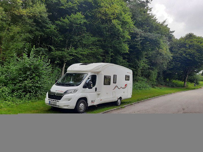
Tour with the mobile home through the Bavarian Forest.
This time we wanted to drive the upcoming motorhome tour along the German-Czech border. Climb the highest peaks of the national park with hikes and experience pure nature. We got to feel the cold Bohemian wind on the foray. On the way we got to know the grandiose buildings, the Victory Hall and Walhalla near Regensburg. We also had to see Passau, the city on the Danube, and the huge castle complex "Burghausen". We couldn't miss the place of pilgrimage Altötting either.
Day
6
Route: B27 via Tübingen - Echterdingen onto the A8.
Exit Nürtingen - Göppingen - Heidenheim -Donauwörth- Ingolstadt-Neustadt (bathing lake).
We left the A8 near Nürtingen, the traffic radio reported a 10 km traffic jam on the Eichelberg, we decided to drive overland. Due to extensive detour routes, we needed an hour and a half longer than the navigation system told us at the beginning of the trip. From Donauwörth it worked
very good, little traffic was on the road.
Lochenstraße 6, 78628 Rottweil, Deutschland
48° 11' 53.2" N 8° 41' 43.3" E
48.1981249 8.6953661
• Head toward Wochenbergstraße on Lochenstraße. Go for 93 m.
• Turn right onto Hardtstraße. Go for 203 m.
• Turn left onto Schömberger Straße (B27). Go for 37.3 km.
• Keep left onto Hechinger Straße (B27) toward Stuttgart/Tübingen/Dußlingen. Go for 42.9 km.
• Take ramp onto A8 toward Gewerbegebiet Vaihingen-Möhringen/München. Go for 146 km.
• Take exit 72 toward Donauwörth/Gersthofen onto B2. Go for 35.8 km.
• Take ramp onto DON29 toward Donauwörth-Süd/Gewerbegebiet-Süd/Genderkingen. Go for 942 m.
• Turn right onto Rainer Straße (St2215) toward Marxheim/Leitheim/Stadtmitte. Go for 2.1 km.
• Continue on Kapellstraße. Go for 354 m.
• Continue on Rathausplatz. Go for 9 m.
• Turn left onto Reichsstraße. Go for 251 m.
• Turn left onto Augsburger Botengasse. Go for 64 m.
• Turn left onto Kronengasse. Go for 13 m.
• Arrive at Kronengasse. Your destination is on the right.
☍
265,7 km
(2 hrs. 45 min.)
Donauwörth, Deutschland
86609 Donauwörth, Deutschland
48° 43' 6.9" N 10° 46' 40.1" E
48.7185826 10.7778041
• Head toward Hirtenberg on Kronengasse. Go for 218 m.
• Turn left onto Spitalstraße. Go for 23 m.
• Turn sharp right onto Kapellstraße. Go for 354 m.
• Continue on Augsburger Straße (St2215). Go for 845 m.
• Take ramp onto DON28. Go for 878 m.
• Turn left and take ramp onto Südspange (B16). Go for 34.5 km.
• Take the 2nd exit from roundabout onto B16 toward A9/Regensburg/Ingolstadt/Eichstätt/Gewerbegebiet ND-Grünau/Rödenhof. Go for 16.4 km.
• Keep left onto B16 toward Regensburg/A9/Ingolstadt. Go for 7.8 km.
• Take the 1st exit from roundabout onto B16. Go for 21.9 km.
• Take ramp toward Mühlhausen. Go for 167 m.
• Turn left onto KEH22. Go for 1.6 km.
• Continue on Landshuter Straße. Go for 1.0 km.
• Arrive at Landshuter Straße. Your destination is on the right.
☍
85,7 km
(1 hrs. 10 min.)
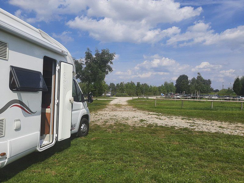
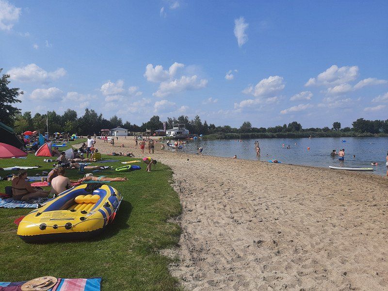
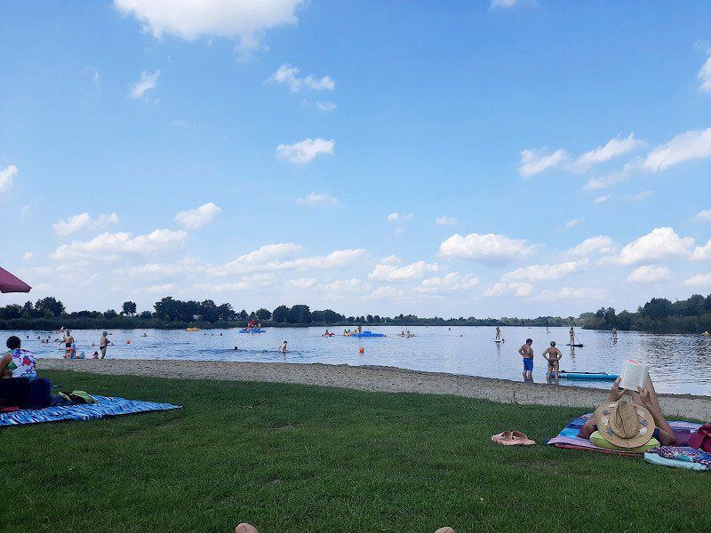
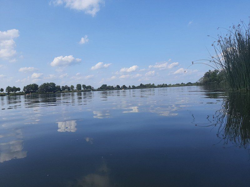
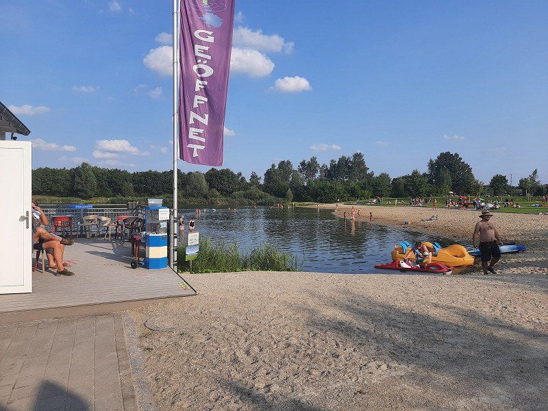
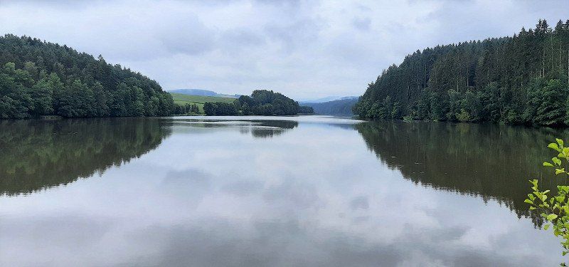
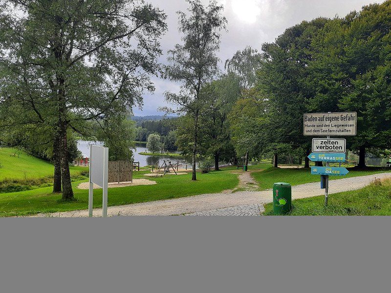
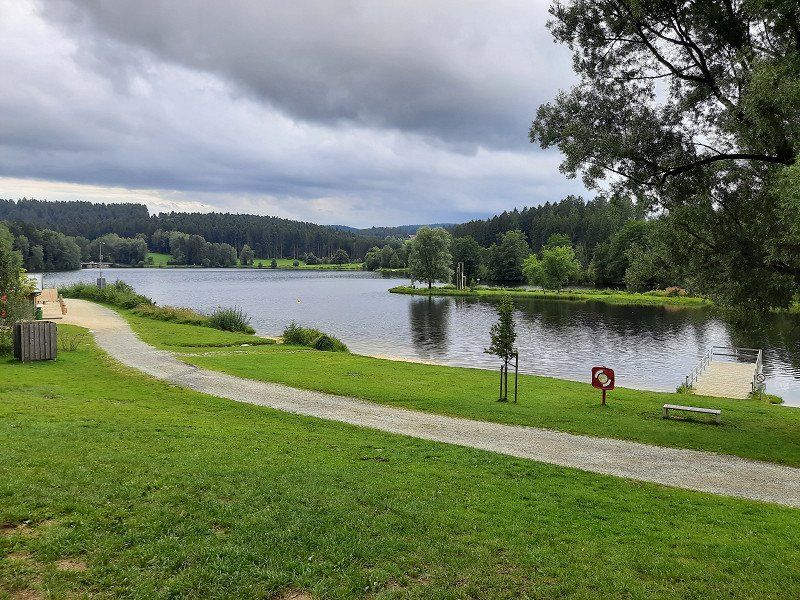
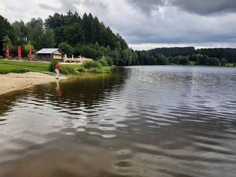
Neustadt an der Donau (Badesee)48.7766 ,11.7215
Arrived at the bathing lake we found enough free parking spaces. Overnight parking is permitted and free of charge. After the coffee break we had to go swimming right away. We were amazed at the bathing lake, even with a sandy beach. The water is very clean and the water temperature was pleasantly warm.
Air temperature was 26°C.
We stood at the edge of the squares and had a very quiet night.
93333, Deutschland
48° 48' 10.8" N 11° 46' 1.5" E
48.8030062 11.7670734
• Head northwest on Landshuter Straße. Go for 35 m.
• Take the 4th exit from roundabout onto Landshuter Straße. Go for 2.5 km.
• Continue on KEH22. Go for 181 m.
• Turn right toward B16/B299. Go for 20 m.
• Take ramp onto B16/B299. Go for 6.7 km.
• Take ramp toward München/A93/Regensburg/Abensberg/Langquaid. Go for 244 m.
• Continue on KEH7. Go for 96 m.
• Take the 3rd exit from roundabout onto St2144. Go for 604 m.
• Pass 2 roundabouts and continue on Straubinger Straße (St2144). Go for 921 m.
• Take the 1st exit from roundabout onto Regensburger Torplatz (KEH7). Go for 95 m.
• Turn right onto Regensburger Straße (KEH19). Go for 300 m.
• Arrive at Regensburger Straße (KEH19). Your destination is on the left.
☍
11,8 km
( 12 min.)
Day
Abensberg, 48°48,727'N / 11°50,628'O
We made the first sightseeing stop in Abensberg. The city is also the starting point of the German Hopfenstraße and ›Gateway to the Hallertau‹, the largest hop-growing region in the world. The many hop fields on the way there were striking. Architectural witnesses of the past are the castle from the 12th century, the Carmelite church "Our Lady", the parish church of St. Barbara with a rococo tower and the late medieval ducal case.
93326 Abensberg, Deutschland
48° 49' 3.8" N 11° 51' 2.8" E
48.8177181 11.8507867
• Head toward Löffelholzstraße on Regensburger Straße (KEH19). Go for 1.5 km.
• Continue on KEH19. Go for 1.5 km.
• Turn left toward Windfalterstraße. Go for 472 m.
• Continue on Windfalterstraße. Go for 447 m.
• Continue on Dorfstraße. Go for 6.1 km.
• Continue on Buchhofstraße. Go for 315 m.
• Turn right onto Alte Dorfstraße. Go for 80 m.
• Turn left onto Pater-Josef-Straße (St2233). Go for 321 m.
• Turn right onto Asamstraße. Go for 1.0 km.
• Arrive at Asamstraße. Your destination is on the right.
☍
11,8 km
( 14 min.)
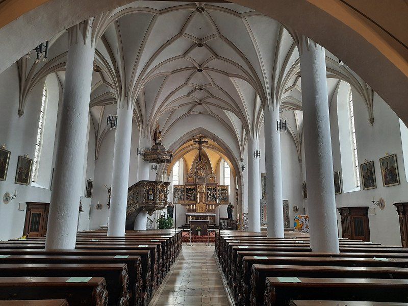
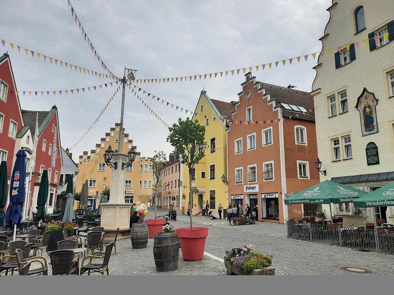
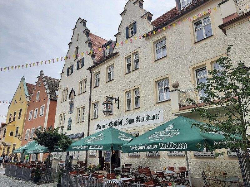
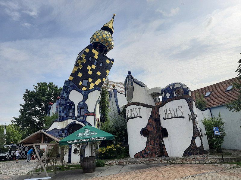
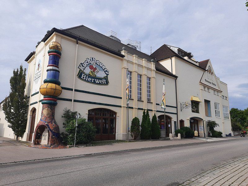
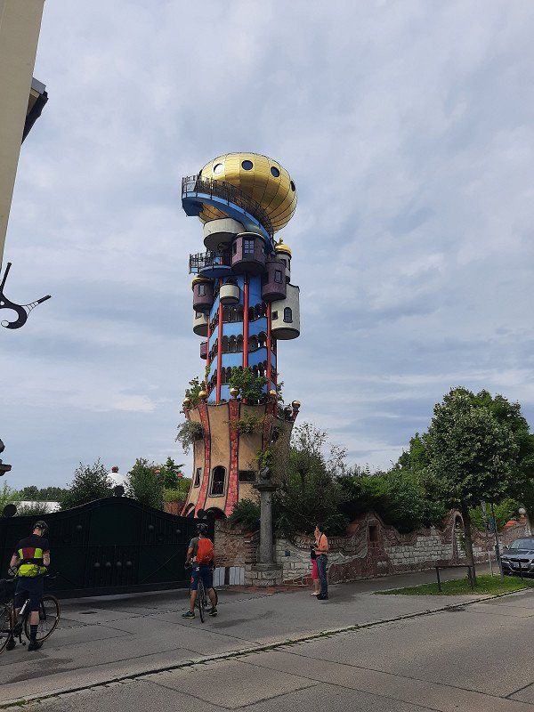
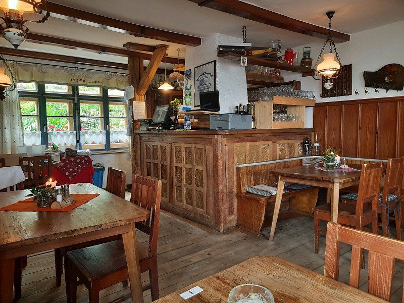
Brauereigasthof ›Zum Kuchlbauer
The town square with the narrow gabled houses and the ›Zum Kuchlbauer‹ brewery inn is beautiful. The landmark of the brewery, the Kuchlbauer Tower, was built by Friedensreich
Hundertwasser (1928-2000) planned, but only opened in 2010. Friedensreich Hundertwasser has immortalized himself with a remarkable architectural project in Abensberg: the landmark of the
Kuchlbauer Brewery, the Kuchlbauer Tower, is a work of the world-renowned artist. A brewery has thus become part of a work of art and a work of art has become part of a brewery. Such a combination is probably unique and cannot be classified in any conventional tourist scheme. Round shapes, dancing windows, wavy floors and organic lines, onion domes and plants, these are Hundertwasser's elements for humane building in harmony with nature.
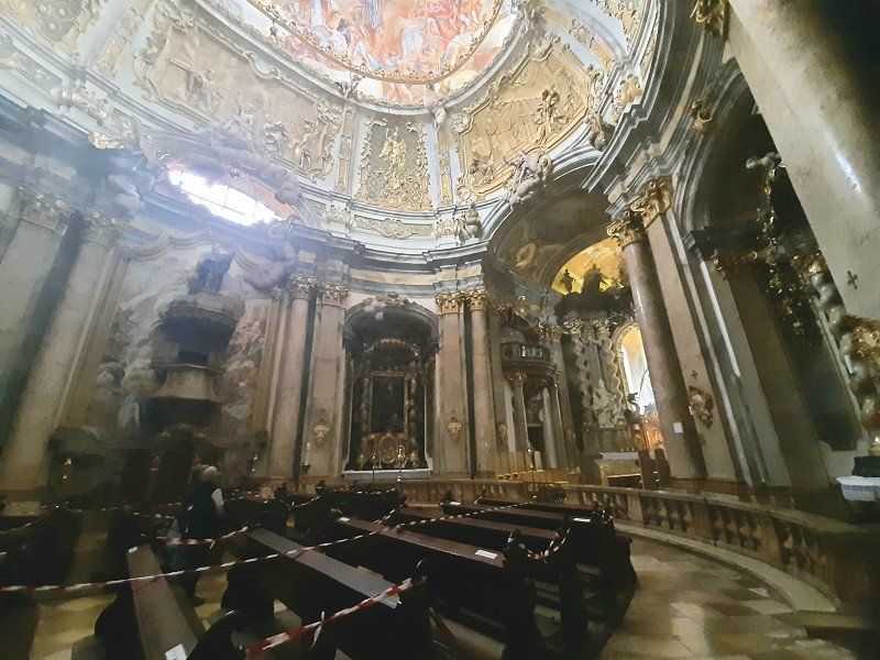
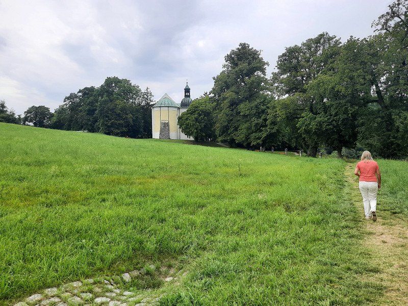
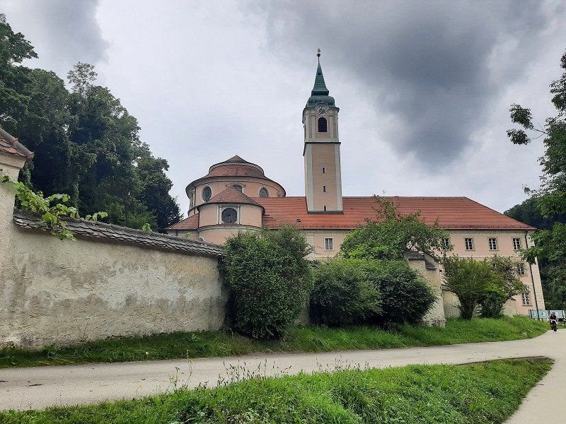
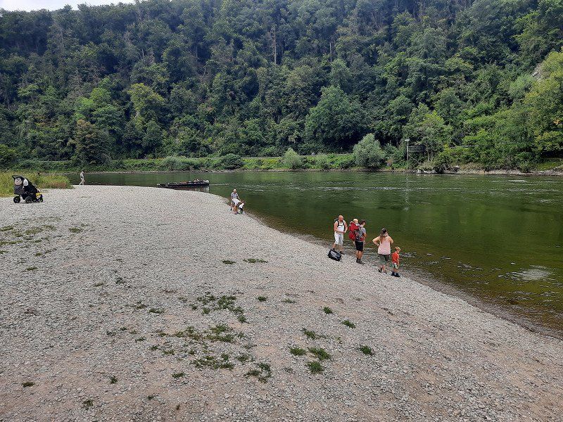
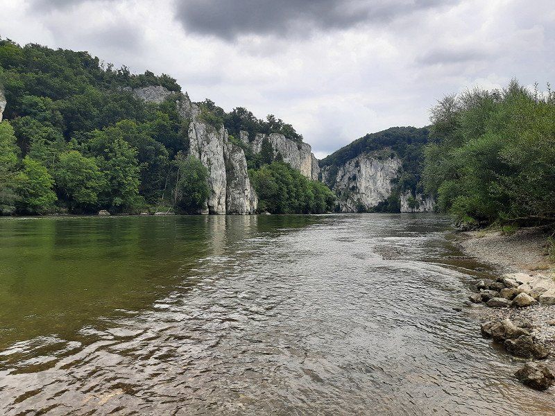
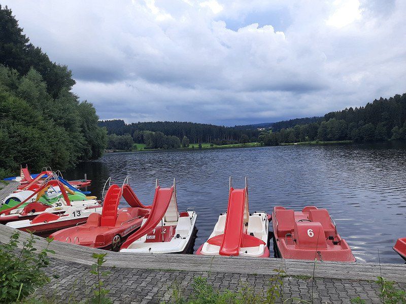
Kloster Weltenburg, 48°53,513'N / 11°49,463'O
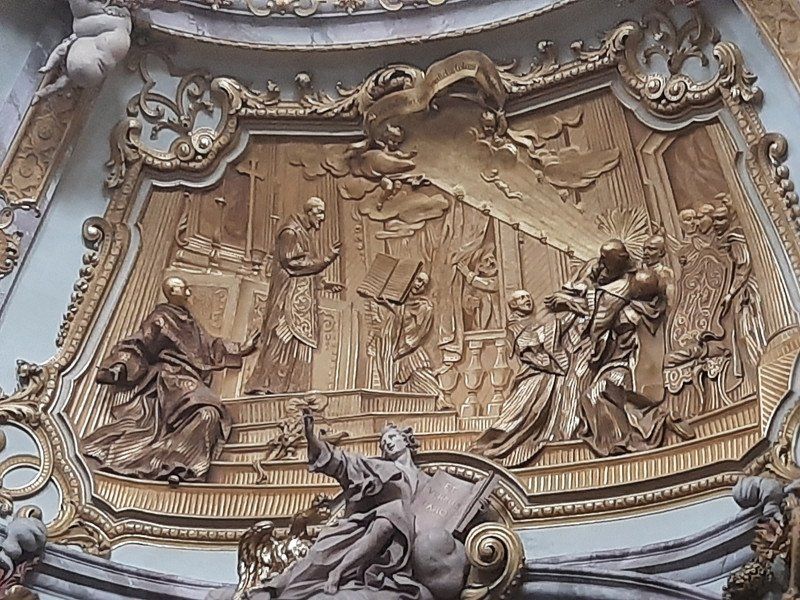
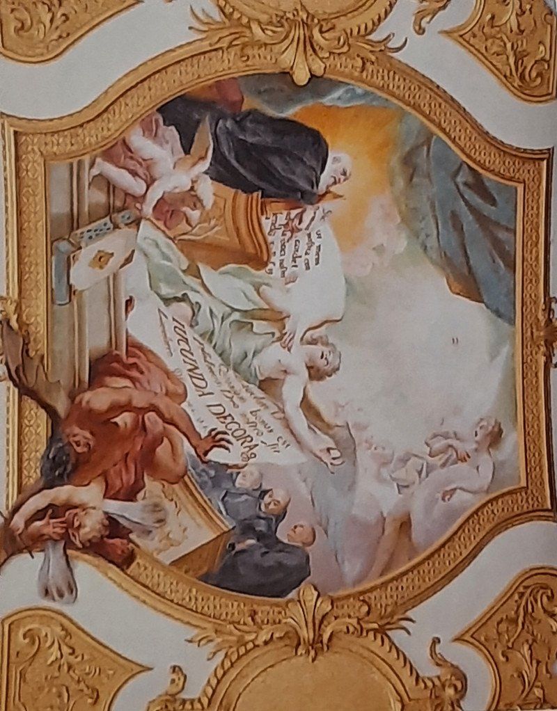
After the interesting town of Abensberg we drive to the parking lot of the Weltenburg Monastery. The parking lot is on the banks of the Danube and you still have to walk 600 m along the Danube to the monastery. There was a lot going on in the huge beer garden, the first guests were already having lunch. Weltenburg Monastery was founded at the beginning of the 7th century and is considered to be the original Bavarian monastery. In the monastery tavern you can drink beer from the oldest monastery brewery in the world (since 1050). The Asam brothers decorated the monastery church of St. George and Martin 1716-39 with magnificent
stucco work and theatrical light effects. We walked up the hill to the
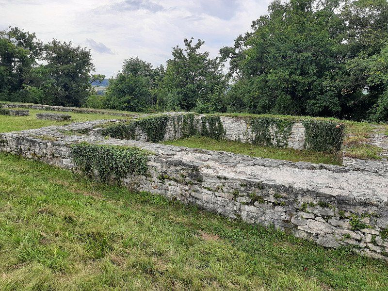
Frauenkapelle, continue to the excavations of a former Roman castle.
The Weltenburg Danube breakthrough is supposed to be a unique natural experience that we wanted to see from above, so we walked the hiking trail in the direction of Kehlheim to a vantage point from which you should see the Danube breakthrough. (Walking time approx. 30 min.) Is not recommended, instead we walked along the Danube to the pier, where unfortunately you can see very little of the Danube breakthrough.
Asamstraße 32, 93309 Kelheim, Deutschland
48° 53' 56.9" N 11° 49' 12.3" E
48.8991364 11.8200913
• Head south on Asamstraße. Go for 1.0 km.
• Turn left onto Pater-Josef-Straße (St2233). Go for 5.5 km.
• Take the 2nd exit from roundabout onto Bahnhofstraße (St2230) toward Hemau/Riedenburg/Altstadt/Goldberg-Klinik. Go for 1.1 km.
• Turn right onto Kelheimwinzerstraße. Go for 500 m.
• Turn left onto Weinstraße. Go for 170 m.
• Turn left onto Mostweg. Go for 23 m.
• Arrive at Mostweg. Your destination is on the left.
☍
8,3 km
( 11 min.)
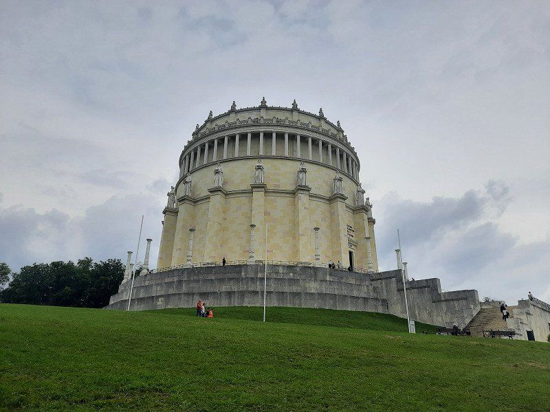
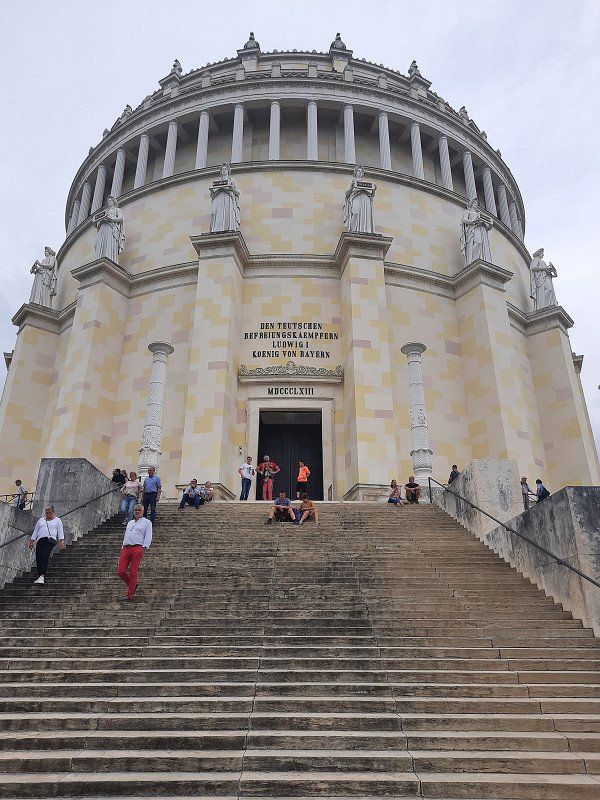
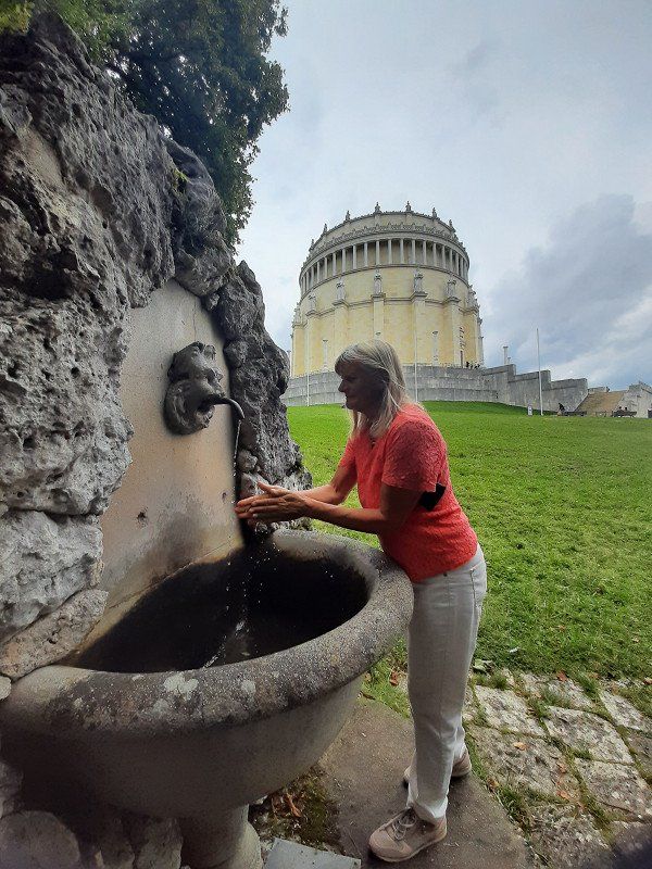
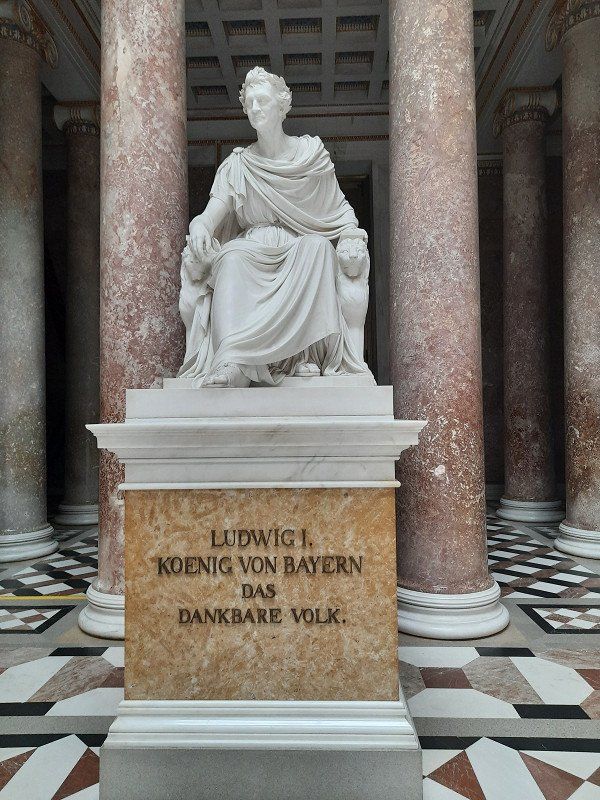
Kelheim Befreiungshalle 48°54,845'N / 11°52,517'O
Large free parking lot on the Danube, the parking space for mobile homes is right next to it, which we didn't use. We only intended to look at the Liberation Hall.
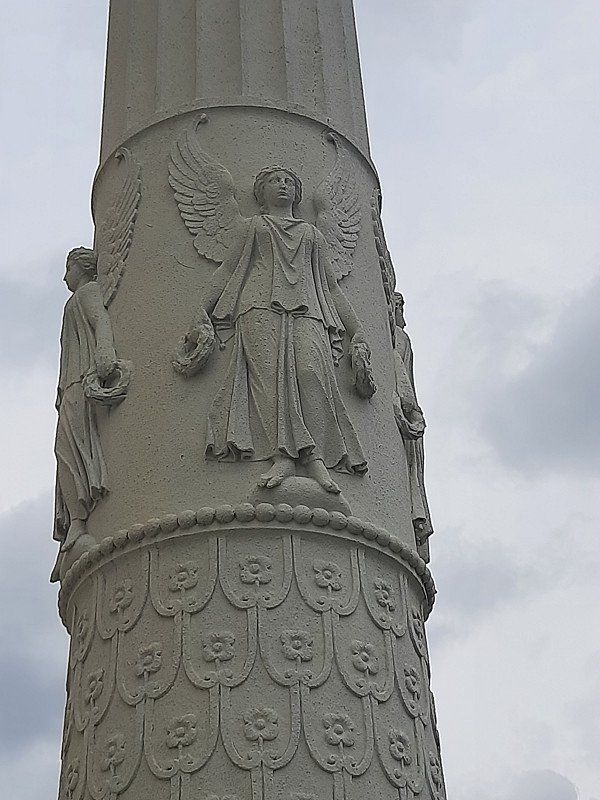
We quickly run up to the Liberation Hall. The hall built by King Ludwig I of Bavaria (1842) for the victories over Napoleon is impressive. The dimensions of the 48 m high domed hall are revealed on a tour of the columned gallery on the upper floor.
We only looked at the Liberation Hall from the outside and were amazed at the mighty scale of the hall. The ticket for visiting the hall had to be bought in the tourist information, we didn't feel like going there anymore.
93309, Deutschland
48° 55' 6.3" N 11° 53' 11.6" E
48.9184118 11.8865630
• Head toward Weinstraße on Mostweg. Go for 23 m.
• Turn right onto Weinstraße. Go for 170 m.
• Turn left onto Kelheimwinzerstraße. Go for 419 m.
• Take the 3rd exit from roundabout onto Starenstraße. Go for 316 m.
• Turn right onto KEH38 toward Ingolstadt/Regensburg. Go for 3.3 km.
• Continue on Industriestraße. Go for 71 m.
• Take ramp onto B16. Go for 15.6 km.
• Take ramp onto A93 toward Hof/Regensburg/Nürnberg/Passau. Go for 1.5 km.
• Take exit 44 toward Passau/Regensburg-Ost/Regensburg-Hafen/Regensburg-GVZ/Regensburg-Universität onto A3. Go for 10.0 km.
• Take exit 102 toward Neutraubling/Donaustauf/Barbing. Go for 498 m.
• Turn left onto St2145 toward Donaustauf/Barbing/Osthafen Regensburg/Walhalla. Go for 359 m.
• Turn right onto St2660 toward Nürnberg/Regensburg/A3/München/Hof/Passau/Straubing/Donaustauf/Barbing-Ost Gewerbegebiet/Walhalla. Go for 1.2 km.
• Turn left onto St2145 toward Donaustauf/Walhalla. Go for 3.4 km.
• Turn right onto Barbinger Straße. Go for 72 m.
• Turn right onto Maxstraße. Go for 215 m.
• Continue on Wörther Straße. Go for 374 m.
• Turn left onto Walhallastraße. Go for 229 m.
• Arrive at Walhallastraße.
☍
37,8 km
( 33 min.)
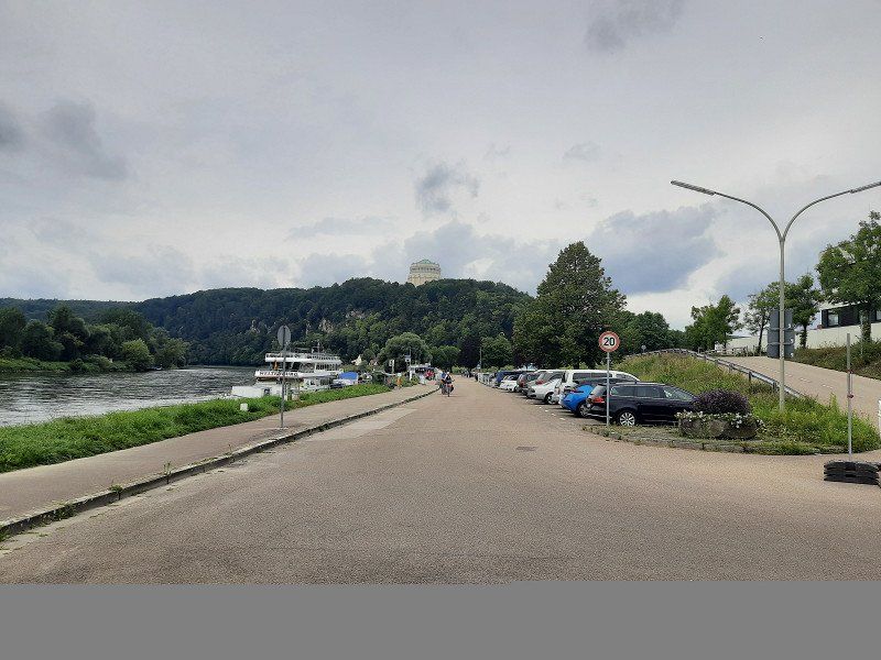
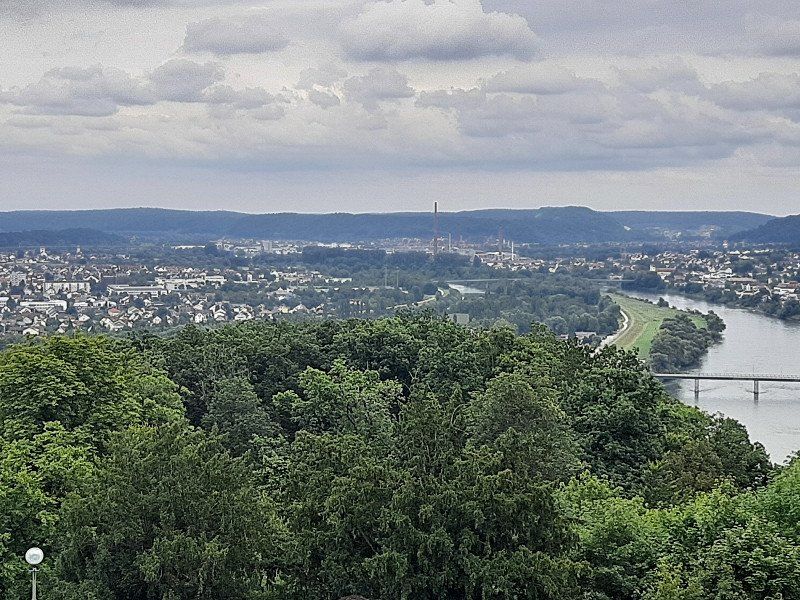
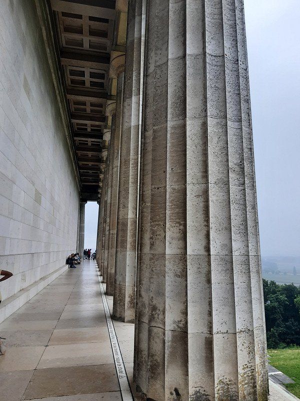
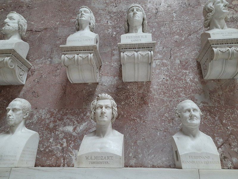
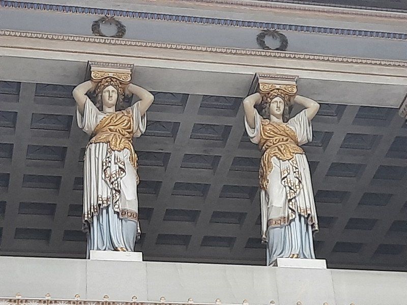
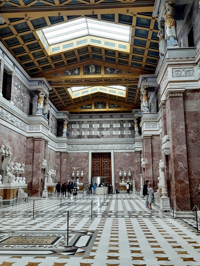
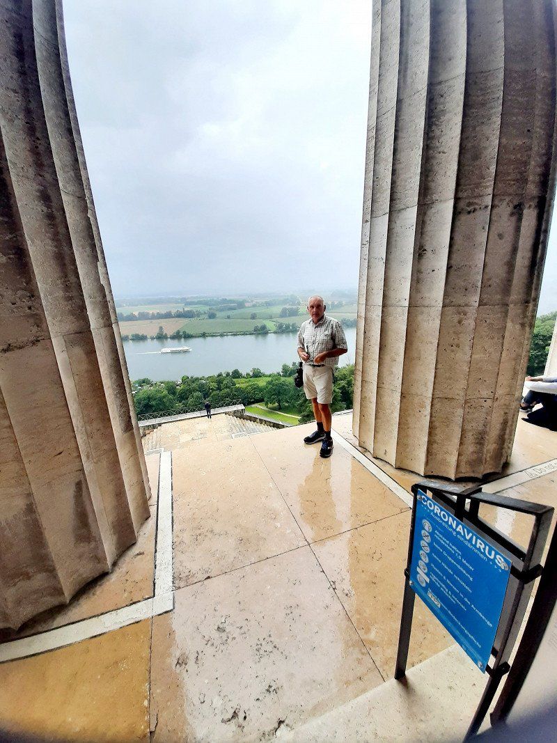
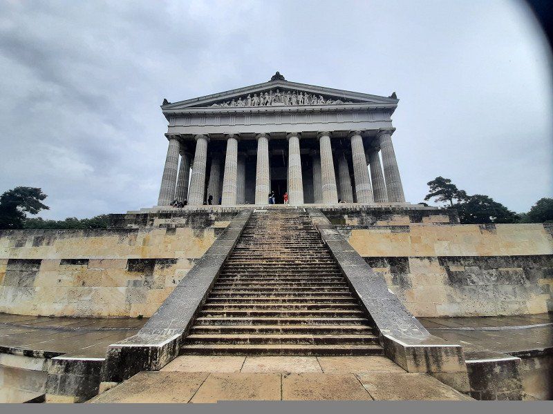
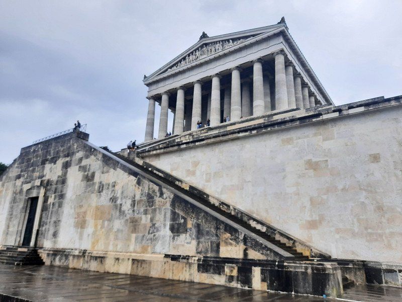
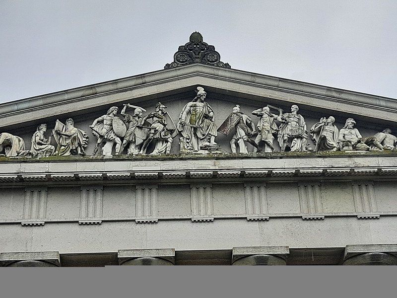
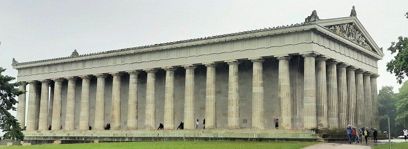
Walhalla bei Regensburg 49°01,963'N / 12°13,689'O
First it goes on to Germany's hall of fame - the Walhalla .
Before we could go up the few steps from the large parking lot, we had to wait out a heavy rain in the camper. After waiting for half an hour we stood in front of the truly impressive building. Admission to the hall cost 4 euros, but it's definitely worth it and the view over the Danube valley is free.
High above the Danube, not far from Regensburg, the Walhalla was built in ancient Greek style in 1830 by King Ludwig I of Bavaria. 130 busts of German personalities stand in the impressive building, the last entry for German-speaking people
Personalities were Heinrich Heine and Sophie Scholl.
93093 Donaustauf, Deutschland
49° 1' 52.1" N 12° 13' 26.7" E
49.0311443 12.2240770
• Head toward Wörther Straße on Walhallastraße. Go for 229 m.
• Turn left onto Wörther Straße. Go for 222 m.
• Turn left onto St2125. Go for 1.3 km.
• Take ramp. Go for 381 m.
• Continue on St2145. Go for 10.8 km.
• Continue on St2153. Go for 11.7 km.
• Continue on St2146. Go for 9.6 km.
• Turn right onto St2146. Go for 10.8 km.
• Take the 3rd exit from roundabout onto B20 toward Krankenhaus Cham/Amberg/B85/Regensburg/Roding/Gewerbegebiet Altenmarkt. Go for 243 m.
• Continue on St2146. Go for 125 m.
• Turn right onto Mittelweg. Go for 552 m.
• Turn left onto Vilzinger Straße. Go for 39 m.
• Continue on Janahof. Go for 634 m.
• Take the 2nd exit from roundabout onto Janahofer Straße (St2146). Go for 914 m.
• Continue on Obere Regenstraße. Go for 190 m.
• Continue on Bürgermeister-Zimmermann-Straße. Go for 92 m.
• Take the 4th exit from roundabout onto Johann-Brunner-Straße. Go for 323 m.
• Turn left onto Auf der Schanze. Go for 203 m.
• Turn right onto Schleinkoferstraße. Go for 360 m.
• Turn right. Go for 56 m.
• Arrive at your destination on the right.
☍
48,8 km
( 47 min.)
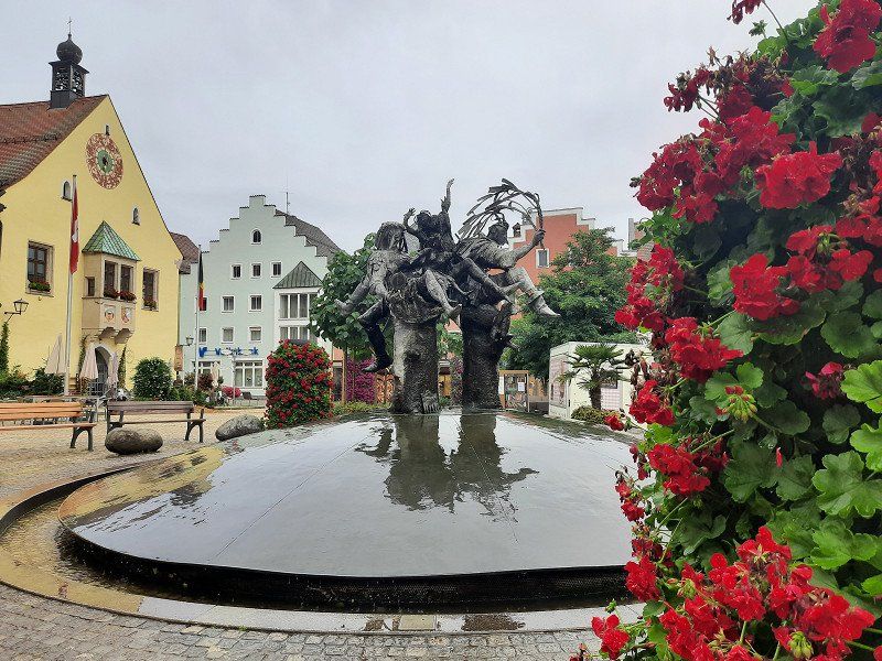
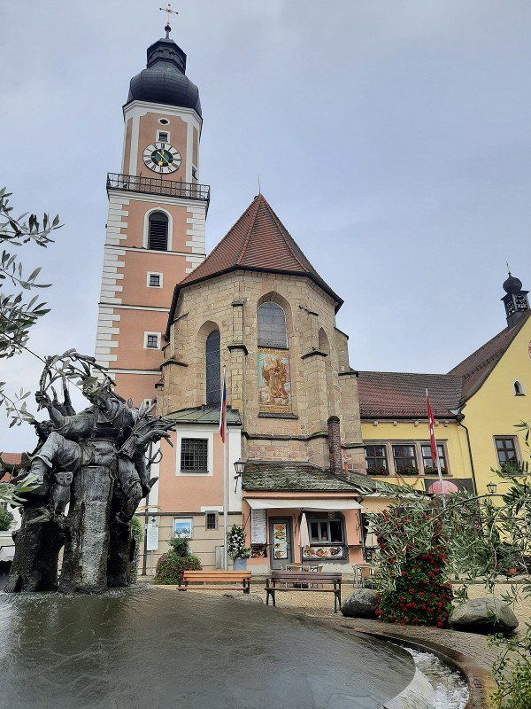
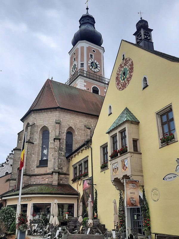
Cham 49°13,269'N / 12°39,698'O
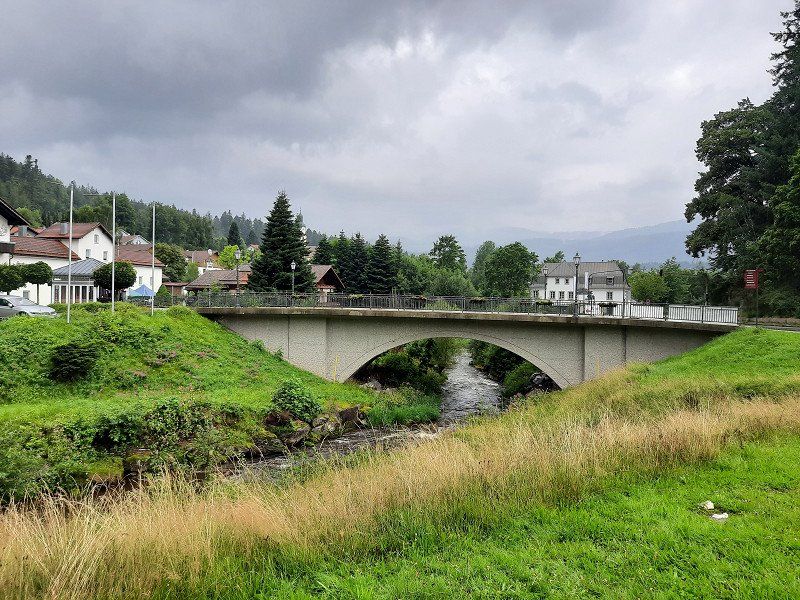
Cham is located directly on the Regen river, which makes a bend there, and consequently it is simply called 'City on the Rainbow'. In the 8th century, monks founded the Chammünster monastery nearby in order to evangelize the eastern countries from here.
We made a short stop here.
The town hall is the eye-catcher of the Cham market square. Its bay window is adorned with a municipal and an Upper Palatinate coat of arms.
One of the three water-spouting figures in the market fountain depicts Count Nikolaus von Luckner, who was born in Cham. He made a career in the French army under Napoleon and must have been quite popular with his soldiers, because Claude Joseph dedicated Rouget de Lisle to him
the same marching song that later became the national anthem of France.
93413, Deutschland
49° 13' 25.9" N 12° 39' 43.5" E
49.2238643 12.6620845
• Head toward Schleinkoferstraße. Go for 56 m.
• Turn left onto Schleinkoferstraße. Go for 360 m.
• Turn left onto Auf der Schanze. Go for 203 m.
• Turn right onto Johann-Brunner-Straße. Go for 257 m.
• Take the 1st exit from roundabout onto Bürgermeister-Zimmermann-Straße. Go for 110 m.
• Continue on Obere Regenstraße. Go for 190 m.
• Turn left onto Janahofer Straße. Go for 440 m.
• Turn left onto St2146. Go for 584 m.
• Continue on B20. Go for 1.7 km.
• Keep left onto B20 toward Pilsen/Furth im Wald. Go for 15.7 km.
• Take ramp. Go for 237 m.
• Turn right onto Äußere Kötztinger Straße (St2154). Go for 140 m.
• Continue on St2154. Go for 4.0 km.
• Turn right onto St2140. Go for 718 m.
• Turn left onto Austraße. Go for 2.1 km.
• Continue on Unterfaustern. Go for 1.3 km.
• Continue on Untere Au. Go for 2.1 km.
• Continue on Austraße. Go for 720 m.
• Continue on Hohenbogenstraße. Go for 38 m.
• Continue on Freibachstraße. Go for 246 m.
• Turn right onto Walching (St2154). Go for 693 m.
• Turn right onto Paßstraße (CHA46). Go for 1.0 km.
• Turn right onto Liftstraße. Go for 905 m.
• Arrive at Liftstraße. Your destination is on the left.
☍
33,9 km
( 30 min.)
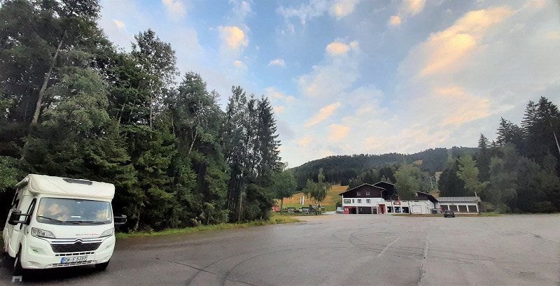
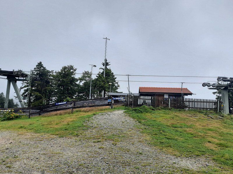
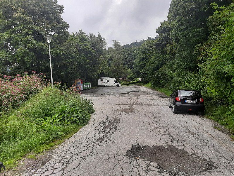
Skicenter 49°14,636'N / 12°57,355'O
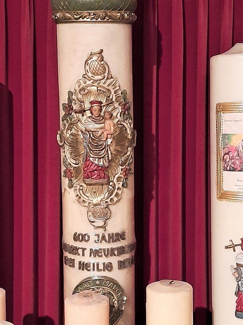
Neukirchen bei Heiligen Blut is a resort in beautiful nature at the foot of the Hohenbogen (1079 m). Where the Bavarian Forest merges into the Bohemian Forest. Our destination for the day is the parking lot at the valley station of the Hohe Bogen chairlift. A huge parking lot and completely empty we met him. The only drawback is the crooked position. The wheel chocks are not quite enough to stand up straight. Besides us, there was another WoMo in the parking lot. The evening was rainy, we didn't even feel like going to the ski center with the leisure activities (summer toboggan run ..) us
to look at
Neukirchen beim Heiligen Blut, Deutschland
49° 14' 27.2" N 12° 58' 4.4" E
49.2408750 12.9678947
• Head toward Paßstraße on Liftstraße. Go for 905 m.
• Turn left onto Paßstraße (CHA46). Go for 1.0 km.
• Turn left onto Lamer Straße (St2154). Go for 1.8 km.
• Turn right onto Hinterbuchberger Straße (CHA43). Go for 71 m.
• Turn right onto Vorderbuchberger Straße. Go for 27 m.
• Arrive at Vorderbuchberger Straße. Your destination is on the right.
☍
3,9 km
( 6 min.)
Day
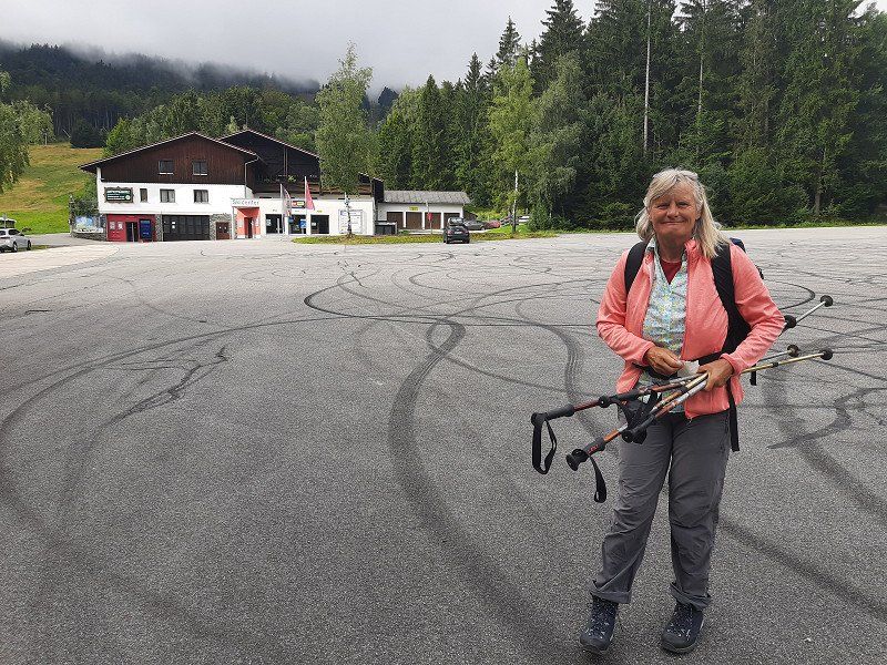
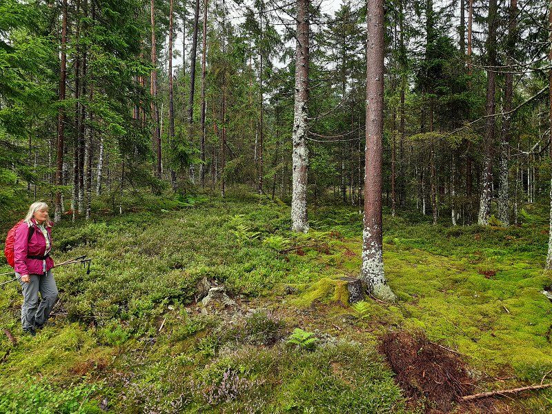
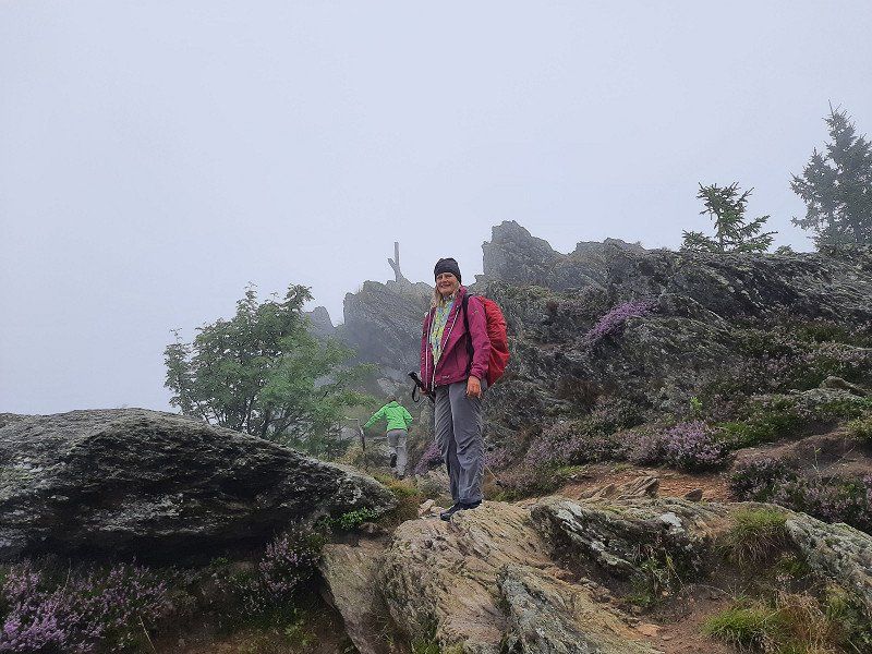
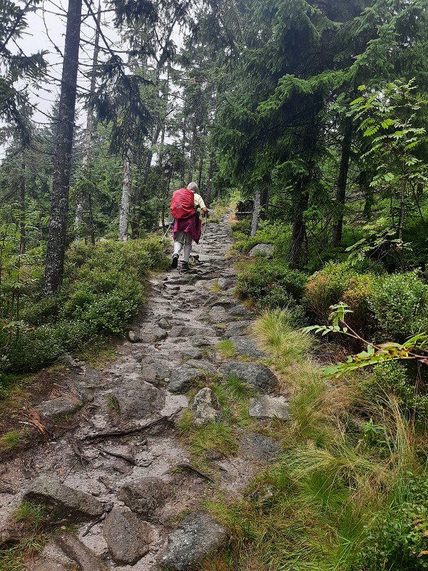
Wanderung auf den "Hohen Bogen"
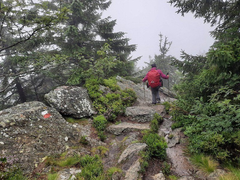
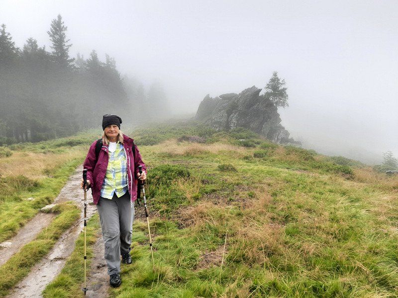
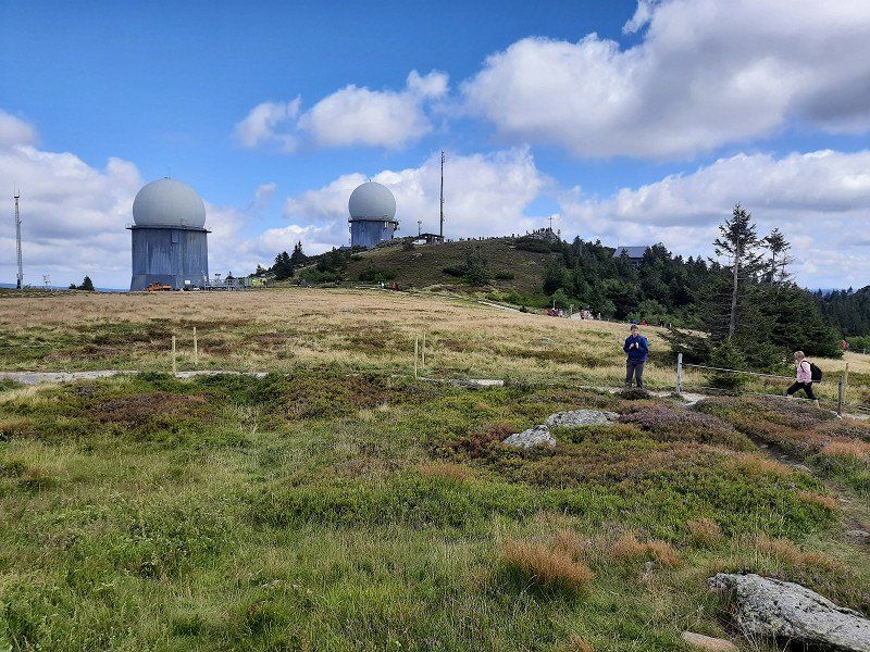
Dawn with the first rays of sunshine on the parking lot at the ski center near Neukirchen-Heilig Blut, where our hike to the Hoher Bogen began. The Hohe Bogen is the northernmost mountain bastion of the Bavarian Forest, in the state of Bavaria in the Upper Palatinate in the district of Cham, and a panoramic phenomenon with almost five thousand meters:
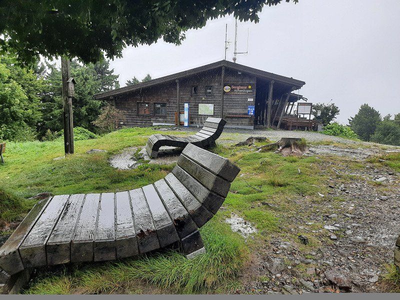
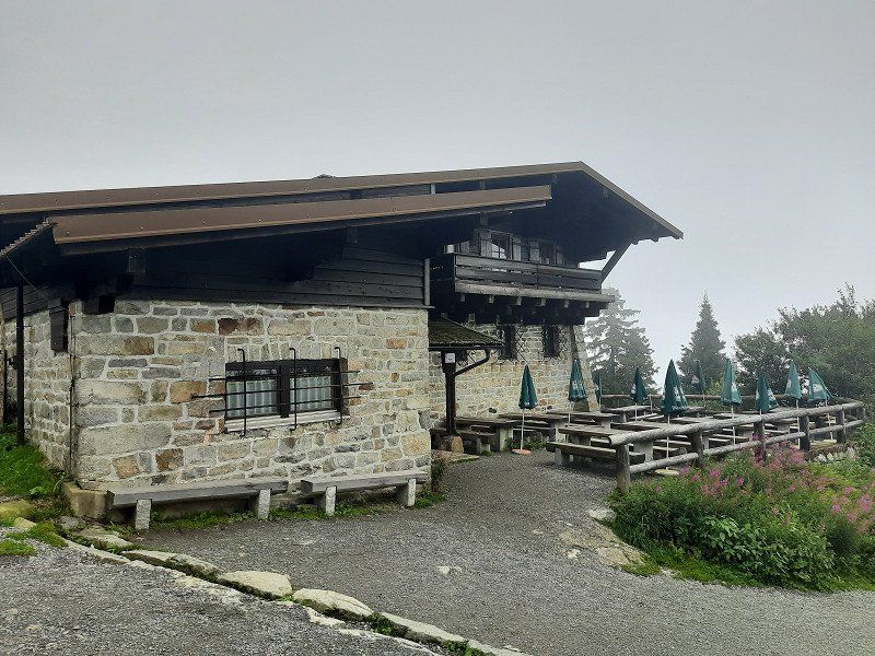
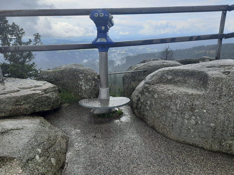
The highest is the Schwarzriegel at 1,079m, followed by the Eckstein at 1,073m, the chairlift mountain station is on the Ahornriegel (1,050m), a quiet forest path leads over the Bärenriegel (1,017m) and the Burgstall (976m).
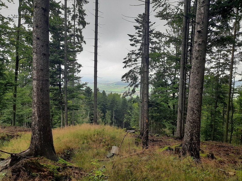
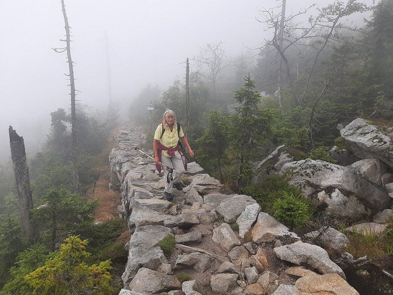
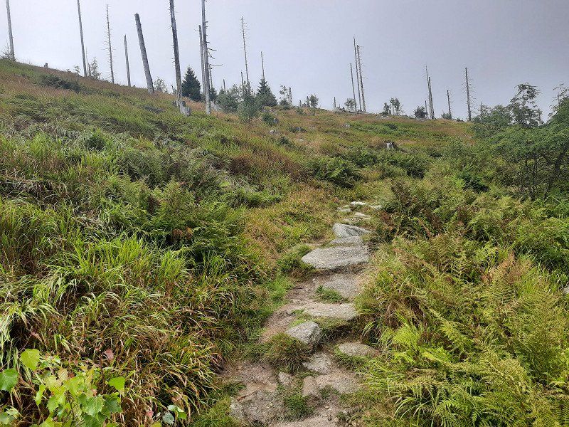
The weather had deteriorated and drizzle accompanied us at the beginning of the tour. We chose the tourist route to the Pürzerriegel (923m). On the way we briefly lost the route and had to turn back to get back on our planned tour. We made a loop around the Schmidtriegel (915m) and hike to the forest service hut. We took the Baierweg (mountain trail) over the Farrenruck (979m) and came to the Bärenriegel. The Bärenriegel measures 1,017m. With
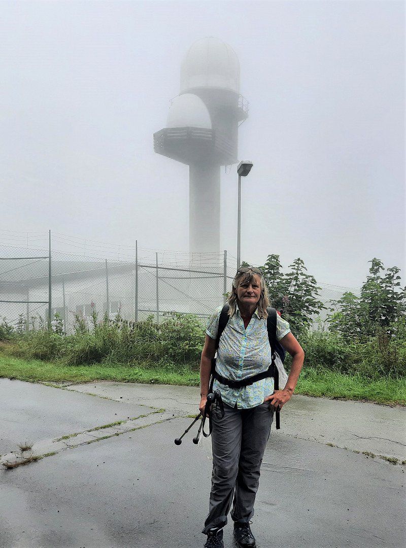
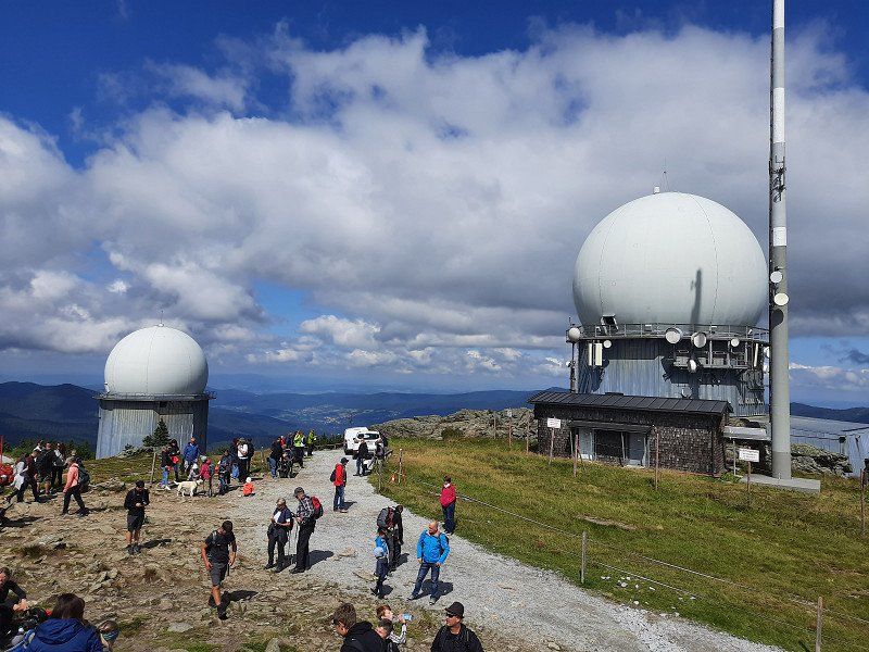
Accompanied by trees, we continue up to another part of the Hohenbogen, the Eckstein (1,073m) with the telecommunications sector F, which has been shut down so far, whereby we are at around 1,043m here.
Dense fog prevented the view and the viewing platform was too
closed. On the legendary north-west pillar of the Hoher Bogen, Count Albert III founded.
von Bogen built a castle around 1190, but the complex remained unfinished.
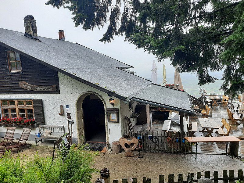
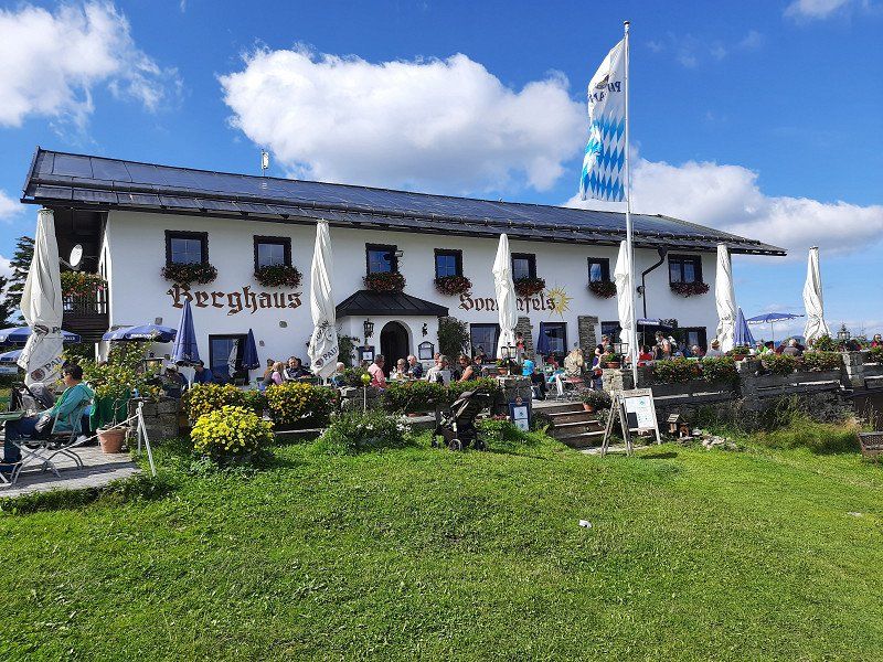
The Hohe Bogen is an 8 km long ridge in the Bavarian Forest. On the Ahornriegel (1,050m) with skiing and gastronomy, a mountain chapel and a view called Schönblick. on one
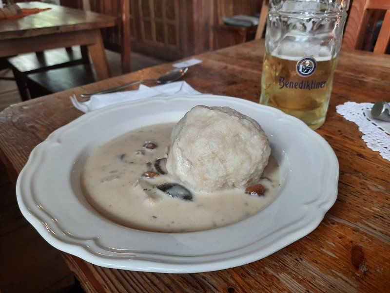
Asphalt road it went downhill to the inn "Schönblick" where we made the lunch break.
Gradually we hike down to the Kagerstein (793m), along with a vantage point
Kagerstein and also on narrow root paths back to the parking lot at
ski center.
Parkplatz Kloster, Neukirchen beim Heiligen Blut
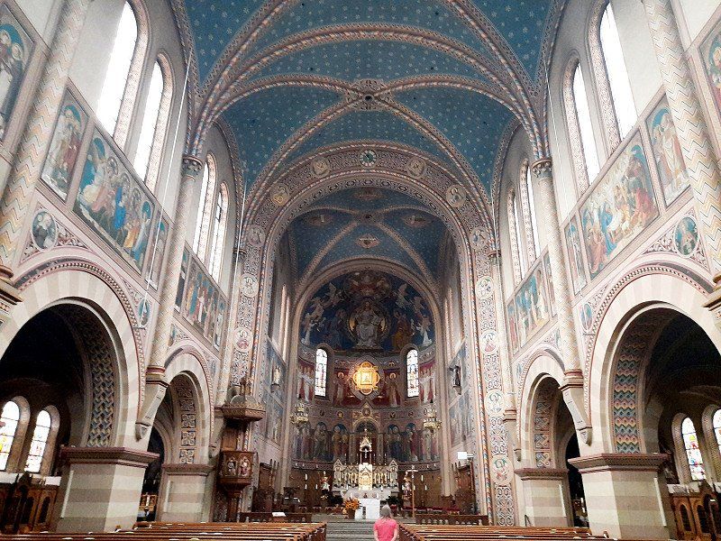
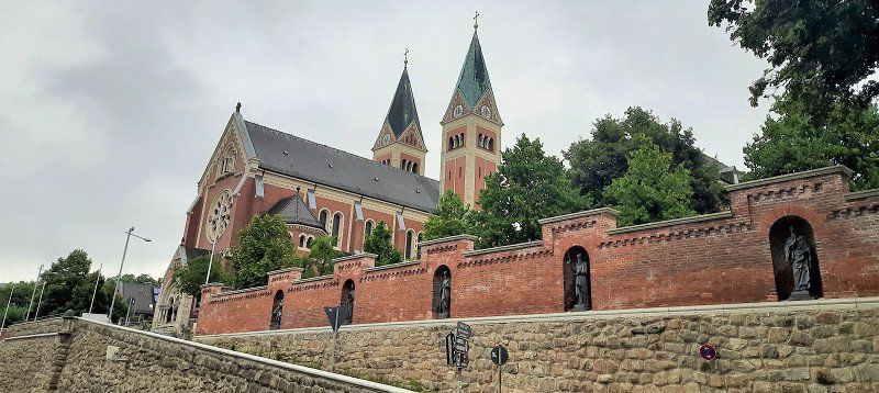
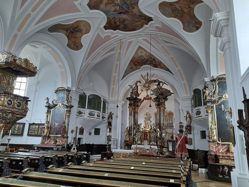
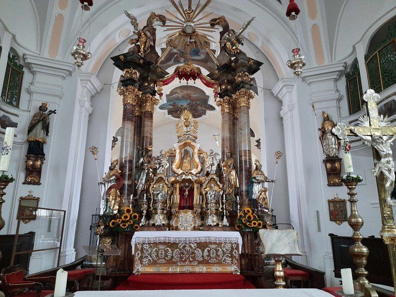
As we continued our journey, we had to make a detour to the pilgrimage church of the Nativity of the Virgin Mary with the neighboring Franciscan monastery. The baroque pilgrimage church with the onion dome
the tower rises in a broad valley, to the east of the High Arch. In her double altar is the miraculous image with the forked head under a glass dome.
The church with a nave from 1610 and the tower from the late 17th century was designed in this way in 1720. It is connected by the altar to the Franciscan church behind it.
The Franciscans have been taking care of the pilgrimage in Cham since the 17th century and received permission to build a monastery and a monastery church in 1658.
The place name is somewhat unusual and has its origins in the pilgrimage history associated with a legend (peasant woman vs. Hussites). In 1420, a Hussite tried to destroy the head of the figure of Mary with a sword, whereupon "blood" flowed from this head.
Vorderbuchberger Str. 2-4, 93453 Neukirchen beim Heiligen Blut, Deutschland
49° 15' 55.6" N 12° 58' 4" E
49.2654378 12.9677723
• Head toward Hinterbuchberger Straße on Vorderbuchberger Straße. Go for 27 m.
• Turn left onto Hinterbuchberger Straße (CHA43). Go for 71 m.
• Turn left onto Marktstraße (St2154). Go for 1.8 km.
• Turn right onto Paßstraße (CHA46). Go for 1.7 km.
• Continue on Passstraße (CHA46). Go for 59 m.
• Continue on Paßstraße (CHA46). Go for 1.8 km.
• Continue on CHA46. Go for 585 m.
• Continue on Höll (CHA46). Go for 72 m.
• Continue on CHA46. Go for 92 m.
• Continue on Höll (CHA46). Go for 213 m.
• Continue on CHA46. Go for 303 m.
• Continue on Ponholz (CHA46). Go for 170 m.
• Continue on CHA46. Go for 252 m.
• Continue on Ponholz (CHA46). Go for 123 m.
• Continue on CHA46. Go for 1.8 km.
• Turn right onto St2138. Go for 2.1 km.
• Turn left onto Am Bach. Go for 362 m.
• Continue on Ferienzentrum. Go for 178 m.
• Continue on Haselmühle. Go for 254 m.
• Turn right onto Kötztinger Straße (St2138). Go for 4.9 km.
• Turn left onto Lamer Straße (St2140). Go for 1.2 km.
• Pass 2 roundabouts and continue on Arnbrucker Straße (St2140). Go for 997 m.
• Turn left onto Weißenregener Straße (CHA48). Go for 915 m.
• Continue on CHA48. Go for 213 m.
• Continue on Hafenberg (CHA48). Go for 1.5 km.
• Continue on CHA48. Go for 1.4 km.
• Continue on Ried am See (CHA48). Go for 109 m.
• Turn right onto Ried am See. Go for 77 m.
• Turn slightly left onto Ried am See. Go for 275 m.
• Turn left. Go for 1.7 km.
• Arrive at your destination.
☍
25,1 km
( 30 min.)
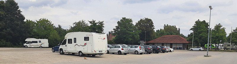
Blaibacher See, Blaibach 49°09,447'N / 12°50,006'O
First we drove past the parking lot and turned in Blaibach. In town we quickly bought some bread. Except for two cars, the approached parking lot was empty, had enough space
stand. Actually, we had planned and approached the parking lot to swim in the lake.
The weather was not inviting for swimming, it was raining. We tried an evening walk
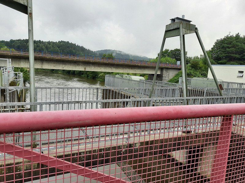
along the lake, but soon turned back, the path was wet and dirty. An annoying booming noise from the hydroelectric power station and the noise from the road leading by made us change parking spaces.
Blaibacher See, Blaibach, Deutschland
49° 8' 54.2" N 12° 50' 6.3" E
49.1483899 12.8350902
• Head toward Riedersfurt. Go for 1.7 km.
• Turn right toward Ried am See. Go for 111 m.
• Continue on Ried am See. Go for 241 m.
• Turn left onto Ried am See (CHA48). Go for 109 m.
• Continue on CHA48. Go for 1.4 km.
• Continue on Hafenberg (CHA48). Go for 1.5 km.
• Continue on CHA48. Go for 213 m.
• Continue on Weißenregener Straße (CHA48). Go for 915 m.
• Turn right onto Weißenregener Straße (St2140). Go for 737 m.
• Pass 2 roundabouts and continue on Lamer Straße (St2140). Go for 1.5 km.
• Turn right onto Beckendorf (St2138). Go for 4.9 km.
• Turn left onto Haselmühle. Go for 254 m.
• Continue on Ferienzentrum. Go for 381 m.
• Continue on Am Bach. Go for 159 m.
• Turn right onto St2138. Go for 5.5 km.
• Arrive at St2138.
☍
19,5 km
( 22 min.)
93474 Arrach, 49°09,750'N / 12°59,429'O
Subject to a fee of 2.-€
Large parking lot when approaching it started raining again. Today we did nothing more, we spent the evening in the WoMo.
93474 Arrach, Deutschland
49° 11' 51.4" N 12° 59' 46.3" E
49.1976225 12.9962056
• Head toward Gewerbepark on St2138. Go for 3.4 km.
• Continue on St2154. Go for 993 m.
• Turn left onto Arberstraße. Go for 110 m.
• Turn right onto Lohberger Straße. Go for 425 m.
• Turn left onto Dorfstraße. Go for 37 m.
• Turn left onto Dorfstraße. Go for 321 m.
• Turn left onto Dorfstraße. Go for 30 m.
• Turn right onto Dorfstraße. Go for 295 m.
• Turn slightly left toward Berghäusl. Go for 458 m.
• Turn right onto Berghäusl. Go for 88 m.
• Arrive at Berghäusl. Your destination is on the left.
☍
6,2 km
( 8 min.)
Day
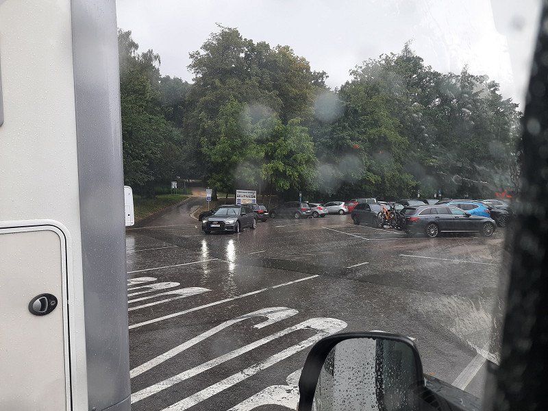
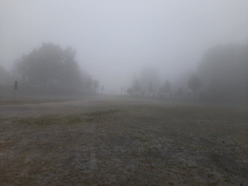
Der Tag fing nicht erfreulich an
Today's view from the WoMo was not pleasant, apart from fog you can't see anything. The adjoining inn is only slightly visible. The outside temperature was 8°C. We had to heat the WoMo, it's really cold and rainy this morning. The parking lot is at 904 m. Today we wanted to hike up the Great Osser and see how the weather turns out
still developed. I think there is a rest day in the WoMo.
We decided to continue our journey, hoping that the weather would improve.
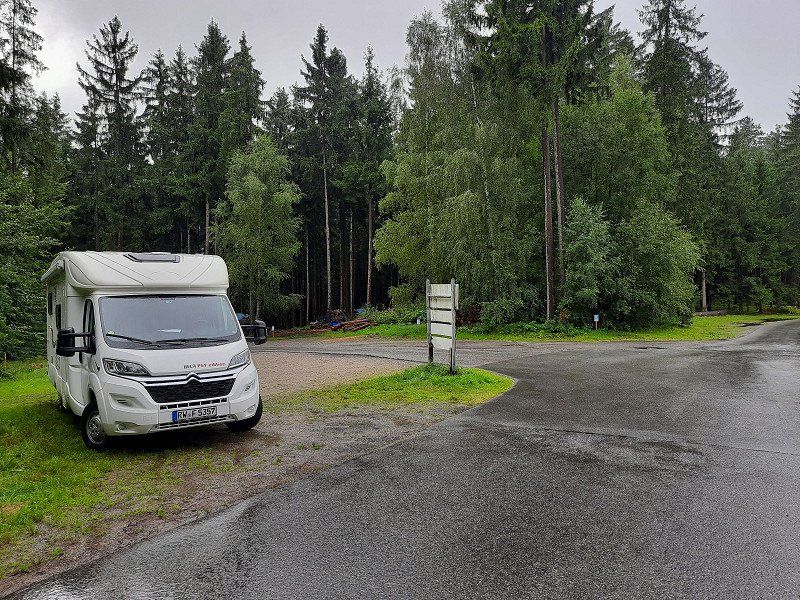
Sahneberg Wanderparkplatz 49°11,677'N / 13°04,305'O
For our upcoming hike on the big Osser, we drove to the hiking car park on the Sahneberg. The driveway ran along a narrow, steep access road.
Berghäusl 1, 93470 Lohberg, Deutschland
49° 11' 39.6" N 13° 4' 22.5" E
49.1943435 13.0729141
• Head north on Berghäusl. Go for 88 m.
• Turn left toward Dorfstraße. Go for 458 m.
• Turn slightly right onto Dorfstraße. Go for 295 m.
• Turn left onto Dorfstraße. Go for 30 m.
• Turn slightly right onto Hochfeldstraße. Go for 396 m.
• Turn left onto Lohberger Straße. Go for 720 m.
• Turn left onto St2154. Go for 14.7 km.
• Turn left onto Brennes (St2154). Go for 6.9 km.
• Turn right onto Hauptstraße (B11). Go for 45 m.
• Turn right onto Eichendorffstraße. Go for 20 m.
• Arrive at Eichendorffstraße. Your destination is on the left.
☍
23,6 km
( 24 min.)
Wanderung zum großen Osser
Hike to the Great Osser.
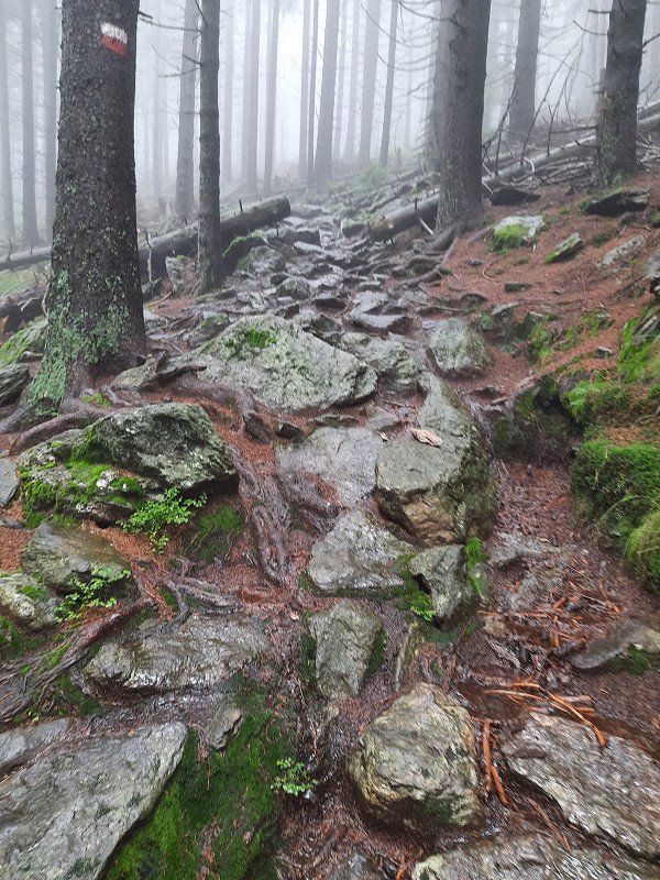
Today we go on our second hiking tour, we want to go up to the big Osser. According to our planning, 680 meters of altitude must be overcome on the Osser, but yesterday's tour to the "Hoher Bogen" sector was a walk.
We parked in the small hiking car park in Lam-Thürnstein at Cafee Sahneberg, there were no cars here.
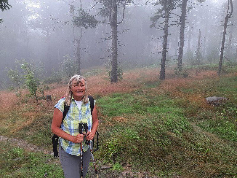
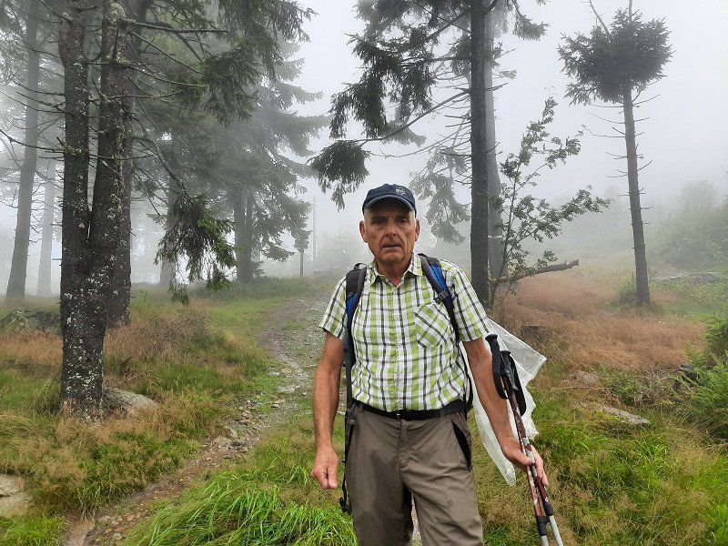
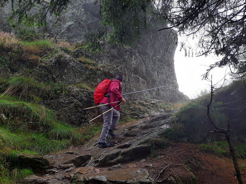
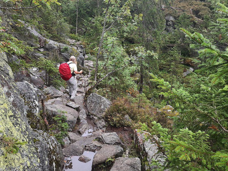
The rainy weather is not exactly inviting for a hike. The path was well signposted, through the forest we went first on forest paths, later on boulders, always steeply uphill. The rain has turned the path into small rivulets in places. In the saddle of the small and large Osser, we first became acquainted with the cold Bohemian wind, a strong wind blows cold air and dense fog from the Bohemian Forest. We're glad about
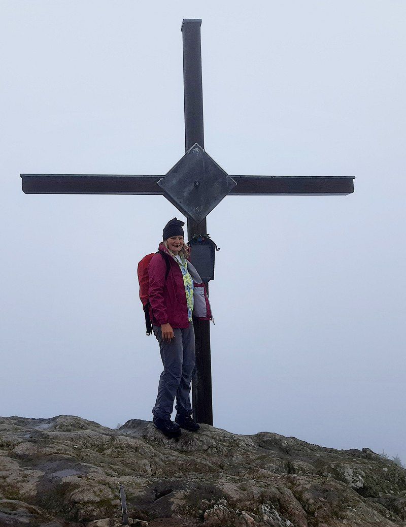
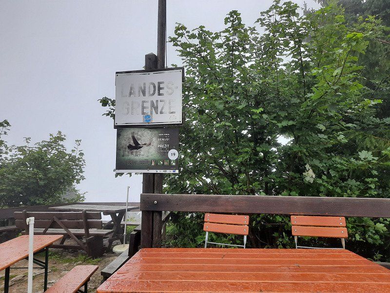
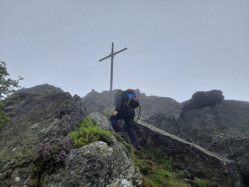
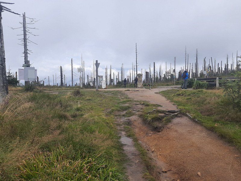
our rain jackets. The last section runs over rock ridges and is secured with ropes to the large Osser summit. (1273m)
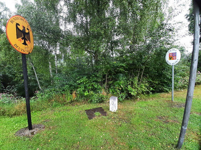
The summit ridge is also the border, signs point this out in German and Czech. We did not stop at the Osser Haus but continued our tour on the small Osser. The path ran again over boulders to the summit, which was 25 meters
We didn't feel like rock climbing to the cross because of the fog, especially for safety reasons and also because of the lack of visibility. Little Osser (1238m)
The descent then runs steeply over wet, slippery boulders
leisurely turned into a hiking trail into the valley.
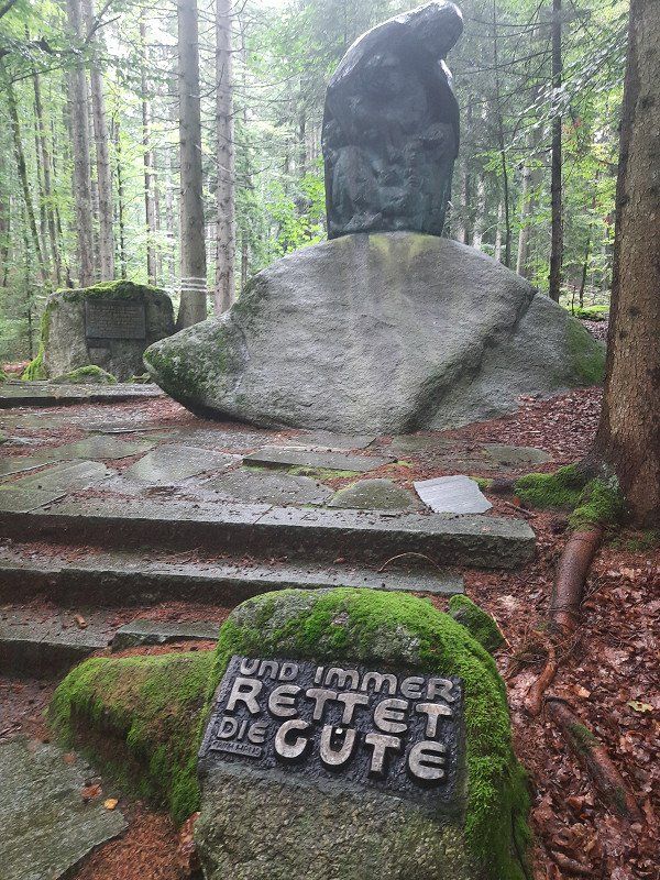
On the way we passed the stone of the Teufelstritt, over which there is a
interesting legend to read.
Arrived at the hiking car park, the sun shone for a short time.
The circular route was about 15 kilometers, you met a few people at the summit, otherwise
we were almost alone in the forest
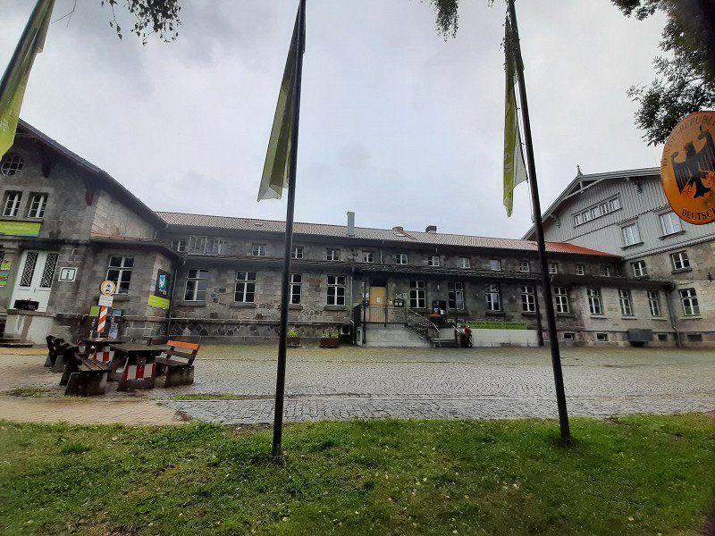
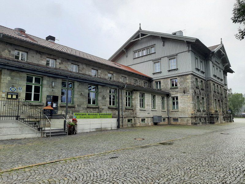
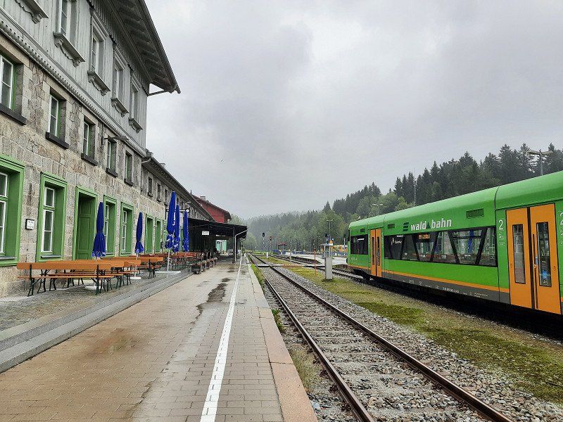
Bayerisch Eisenstein
Upon arrival it was raining again. Air temperature 12°C
Parking is on the river "Big Rain" Bayerisch Eisenstein
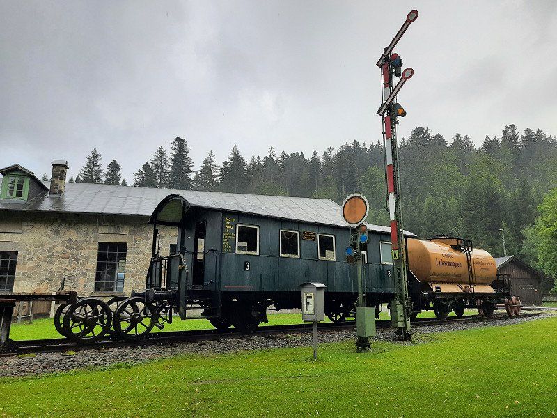
During the Cold War, this was the hard border that ran right through the station.
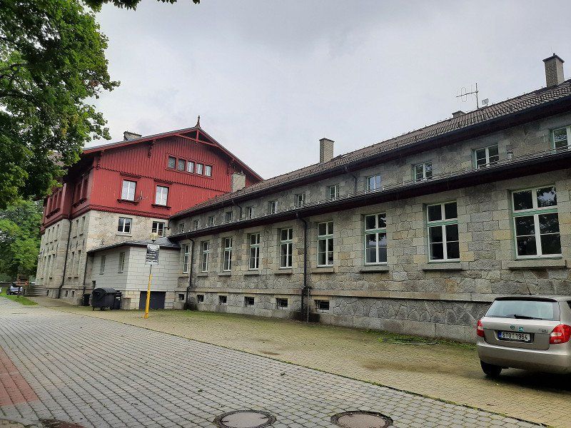
A border wall was built through the station and tracks, on the German side the end of the world, on the Czech restricted area. Since 1991, trains have been rolling here again across the border to Prague. A historical railway museum is housed in the German part of the station.
With a short walk through the village we took a closer look at the historic train station.
We spent the night in the parking lot.
94252 Bayerisch Eisenstein, Deutschland
49° 7' 20" N 13° 12' 8.8" E
49.1222310 13.2024329
• Head toward Hauptstraße on Eichendorffstraße. Go for 20 m.
• Turn right onto Hauptstraße (B11). Go for 14.9 km.
• Turn right toward Zwiesel-Mitte/Grafenau/Frauenau. Go for 181 m.
• Turn right onto Dr.-Georg-Priehäußer-Straße. Go for 783 m.
• Continue on Hochstraße. Go for 145 m.
• Turn left onto Hochstraße. Go for 90 m.
• Arrive at Hochstraße. Your destination is on the left.
☍
16,2 km
( 14 min.)
Day
Wanderung "Großer Arber"
This morning, for the first time in two days, the sun shone warmingly through the windows of the WoMo.
This gives reason to get up and get ready for the hike to the big Arber.
We walked leisurely along the Regen river and the mill canal. After a certain time we left the river and initially went up the forest road in the direction of the Großer Arber, which then turned into a hiking trail and led steeply uphill through the forest.
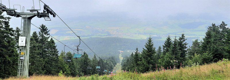
There was a large crowd of visitors at the big Abersee. From here we hiked quickly on to the Arber summit, the signpost indicated 3.5 km. After about 1.5 km it went very steeply on boulders towards the summit. Mass tourism prevailed on the Arber summit. At the top of the Arber it is really crowded compared to our last two days, mountain bikers, hikers, day tourists a colorful mixture cavorted on the summit plateau.
We still walk the summit trail and enjoy the great views over the Bavarian Forest. From up here you can see the Osser, the towers of sector-f, Lusen and the small Arber See deep down in the valley.
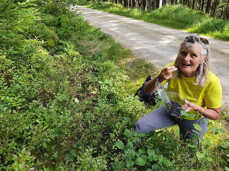
After an hour at the summit, we made our way down the Brenner back to Bayrisch Eisenstein. The way back was exclusively on
driveways and was good to walk on. On the way we plowed blueberries.
Zwiesel
Our next stop on our mobile home tour through the Bavarian Forest for the next night is the Tröppelkeller campsite in Zwiesel. 49°00.790'N / 13°12.515'E
The small campsite on the outskirts is really nice and we were warmly welcomed. There are no marked out plots here. The campsite was occupied by four WoMos and bicycle tourists with their tents.
94227 Zwiesel, Deutschland
49° 1' 3.9" N 13° 14' 16.6" E
49.0177574 13.2379307
• Head north on Hochstraße. Go for 90 m.
• Turn right onto Hochstraße. Go for 145 m.
• Continue on Dr.-Georg-Priehäußer-Straße. Go for 783 m.
• Turn right and take ramp. Go for 115 m.
• Turn left onto Frauenauer Straße (St2132). Go for 19.7 km.
• Take the 1st exit from roundabout onto Dr.-Geiger-Straße (St2132). Go for 904 m.
• Turn left onto Herzogstraße (FRG22). Go for 2.1 km.
• Continue on FRG22. Go for 1.1 km.
• Continue on Höhenbrunner Straße (FRG22). Go for 235 m.
• Turn right onto Höhenbrunner Straße (FRG22). Go for 460 m.
• Continue on FRG22. Go for 775 m.
• Continue on Guntherstraße (FRG22). Go for 445 m.
• Turn left onto Lusenstraße (FRG23). Go for 1.3 km.
• Continue on Siebenellen (FRG23). Go for 1.1 km.
• Continue on FRG23. Go for 1.1 km.
• Turn right onto FRG4. Go for 1.1 km.
• Turn left onto FRG4. Go for 121 m.
• Continue on Graupsäge (FRG4). Go for 55 m.
• Continue on FRG4. Go for 2.7 km.
• Continue on Lusenstraße (FRG4). Go for 483 m.
• Turn left onto Lusenstraße (FRG4). Go for 184 m.
• Arrive at Lusenstraße (FRG4). Your destination is on the left.
☍
35,0 km
( 39 min.)
Day
Waldhäuser (48.9279 , 13.4622)
The car park is above the village of Waldhäuser. It is a paved level parking lot. When we arrived it had been lightly drizzling. The place is free.
Despite the bad weather, after the coffee break we set out on a hike up the Lusen.
94556 Neuschönau, Deutschland
48° 55' 44" N 13° 27' 47" E
48.9288881 13.4630457
• Head toward Reinhold-Koeppel-Straße on Lusenstraße (FRG4). Go for 667 m.
• Continue on FRG4. Go for 2.7 km.
• Continue on Graupsäge (FRG4). Go for 55 m.
• Continue on FRG4. Go for 121 m.
• Turn left onto FRG5. Go for 5.4 km.
• Continue on Am Sagwasser (FRG19). Go for 1.6 km.
• Turn right onto FRG19 toward Freyung/Hohenau. Go for 116 m.
• Continue on Weidhütte (FRG19). Go for 385 m.
• Continue on FRG19. Go for 323 m.
• Continue on Schönbrunnerhäuser (FRG19). Go for 519 m.
• Continue on FRG19. Go for 9 m.
• Continue on Schönbrunnerhäuser (FRG19). Go for 67 m.
• Continue on FRG19. Go for 634 m.
• Continue on FRG41. Go for 1.5 km.
• Continue on Schönbrunnerhäuser (FRG41). Go for 113 m.
• Continue on FRG16. Go for 883 m.
• Continue on FRG41. Go for 160 m.
• Continue on Schönbrunn am Lusen (FRG41). Go for 992 m.
• Continue on FRG41. Go for 520 m.
• Continue on Unterkashof (FRG41). Go for 29 m.
• Continue on Am Reschbach (FRG41). Go for 205 m.
• Continue on Unterkashof (FRG41). Go for 556 m.
• Continue on Reschmühle (FRG41). Go for 327 m.
• Turn left onto Kreuzberg (B533) toward Prag/Passau/Freyung. Go for 3.0 km.
• Take the 3rd exit from roundabout onto B12 toward Prag/Philippsreut/Grainet/Mitterfirmiansreut/Freyung-Nord/Gewerbegebiet Linden Bannholz. Go for 684 m.
• Turn right onto Bannholz (St2630) toward Neureichenau/Dreisessel/Grainet/Freyung-Nord/Stadtmitte. Go for 1.2 km.
• Continue on Stadtplatz. Go for 206 m.
• Turn left onto Bahnhofstraße (St2132). Go for 9.6 km.
• Turn left onto Nordumgehung (St2131) toward Haidmühle/Grainet/Jandelsbrunn/Waldkirchen-Ost. Go for 6.9 km.
• Continue on FRG57. Go for 6.8 km.
• Turn left onto Langbruck (St2130). Go for 1.4 km.
• Turn right onto Gern (FRG8). Go for 274 m.
• Continue on Schimmelbach (FRG8). Go for 3.0 km.
• Continue on Riedelsbach (FRG8). Go for 774 m.
• Turn right onto Riedelsbach. Go for 527 m.
• Arrive at Riedelsbach. Your destination is on the right.
☍
52,4 km
( 45 min.)
Wanderung " Lusen"
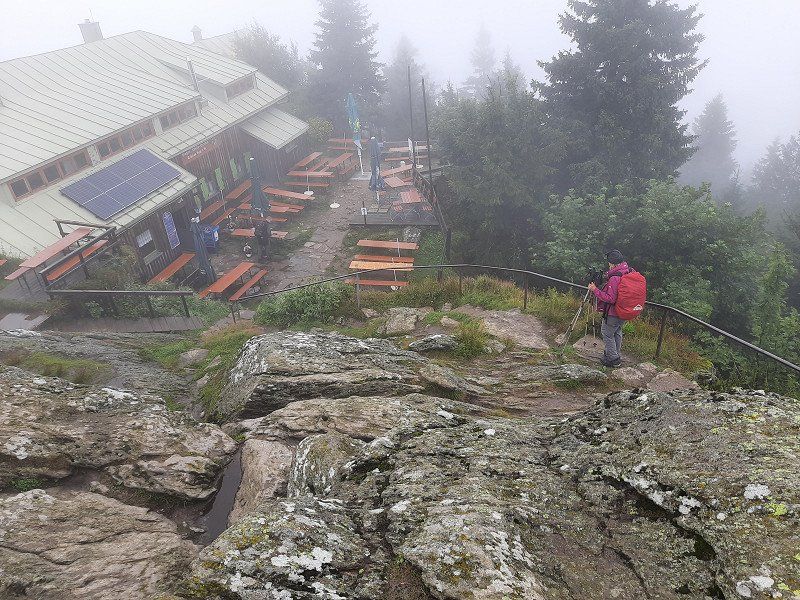
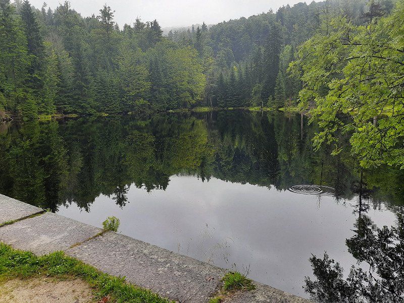
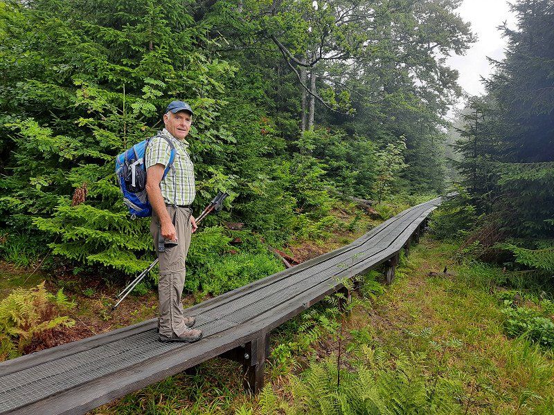
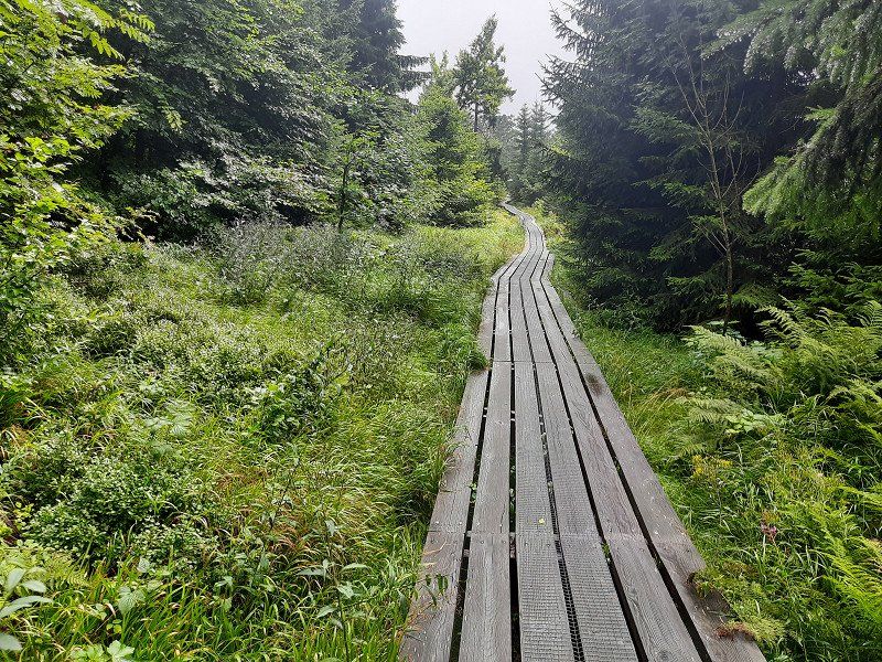
In the drizzle we started our tour on the Lusen. The drizzle that lasted almost the entire tour, we followed the signpost "Lusen / Martinsklause". We soon reached an atmospheric, dark lake, the Martinsklause. The lake was created in the 19th century by the construction of a dam wall for the purpose of timber drift. On a narrow path (signpost: Lusen, Teufelsloch) it went steeply uphill. Slightly descending you reach the Teufelsloch, a gorge section of the "Kleine Ohe" filled with large granite stones. The creek flows beneath the boulders, so you can cross without getting your feet wet. From here you walk on a long wooden footbridge through a picturesque wetland to the Böhmweg refuge. In front of it is the "Glass Ark". Following the summer path to the Lusen, you walk along a gravel path drawn like a ruler. You reach an open plateau with tree skeletons that give the landscape a strangely bizarre character. Expansive fields of blueberries, which turn fiery red in autumn, adorn the floors.
The round summit of the Lusen with the imposing ladder to heaven comes into view. The name hides a long stone staircase made of natural granite blocks, which leads up in a direct line to the summit cross. Looking back at the ladder to heaven In the middle of a sea of granite blocks covered with shimmering yellow-green lichen, you climb step by step up the long stone “ladder to heaven” to the summit cross of the Lusen. We were very lucky when we arrived at the summit, the fog lifted and we had a great view for a short moment. From the summit we followed the signpost to the Lusenschutzhaus, which we reached after a few minutes over rocky steps. A short stop for a short coffee break and to warm up in the Lusenschutzhaus. From there we walked comfortably on a forest road down to the Waldhausreibe (Luse car park) and on to the starting point in Waldhäuser.
Day
Riedelsbach 27
During the night it rained through. The morning is gray. The parking lot was very quiet at night.
Today's destination is Riedelsbach. At the end of the town we found a parking space at the fire station. There was no parking ban.
The hike to the border triangle (14 km; 5.5 hours)
94089 Neureichenau, Deutschland
48° 44' 52.3" N 13° 46' 55.8" E
48.7478734 13.7821762
• Head southwest on Riedelsbach. Go for 499 m.
• Turn slightly right toward Spillerhäuser. Go for 388 m.
• Turn left onto Spillerhäuser. Go for 518 m.
• Turn left onto Klafferstraß. Go for 1.1 km.
• Turn left onto Klafferstraß (St2130). Go for 3.9 km.
• Turn right onto Passauer Straße (St2128). Go for 1.3 km.
• Turn left onto Wegscheider Straße (St2130). Go for 12.1 km.
• Turn right onto Marktstraße (B388). Go for 4.8 km.
• Turn left onto Maierhof (PA53) toward Oberkappel. Go for 373 m.
• Turn left onto Maierhof. Go for 120 m.
• Arrive at Maierhof. Your destination is on the left.
☍
25,1 km
( 24 min.)
Wanderung zum Dreiländereck
We hike to the Steinemeer, Dreiländereck, then on to the summit of the Dreisessel. The starting point is the car park at the fire brigade in Lackenhäuser.
On the way here it rained in places and at the start of the hike the peaks were covered with clouds. The first sight of the tour was the Bohemian Monument. The path was well signposted and runs first on forest roads, then on a small path uphill through the forest. At 1100m altitude we followed the forest road for 2.1 km to the Steinemeer. From the fork in the hiking trail, we continued on a narrow path on boulders to the Steinemeer. We were just before the German - Austrian border. Dreiländereck (1340m) This is the border between the Czech Republic, Austria and Germany.
Via the Grenzsteig it goes a bit higher to the Plöckenstein.(1364m) On the way it got really uncomfortable, it started to rain heavily and an ice-cold Bohemian wind swept over the ridge.
Finally we stand at the actual three-chair with soaked clothes. Berggasthof Dreisessel (1323m) Despite the rain we climbed the Dreisesselfesen. The three stone armchairs
A short hole in the clouds allowed a view of the Bavarian National Park.
A stop at the Dreisessel Haus was really good.
Warmed up and strengthened, we went down the shortest route to the starting point in
Lackenhauser.
At the end of the trek, the cloud cover has lifted and the landscape has revealed its
Beauty.
After our return from the hike, we immediately made our way to the Rannastausee. We want to spend the night there.
Maierhof 20 (48.5707 , 13.7657)
Large three level car park, we preferred the lower car park. The parking spaces are slightly sloping, the WoMo had to compensate with wheel chocks. After our arrival we walked to the lake, in warmer weather it would be a beautiful, inviting bathing lake. After a closer look we saw that we were standing directly on the Austrian border. The dam is close to the border. Just before night fell it started raining again.
94110 Wegscheid, Deutschland
48° 34' 11.6" N 13° 45' 57" E
48.5699000 13.7658427
• Head north on Maierhof. Go for 120 m.
• Turn right onto Maierhof (PA53). Go for 373 m.
• Turn left onto B388. Go for 7.2 km.
• Turn right onto Hauzenberger Straße (St2320) toward Hauzenberg/Kropfmühl. Go for 358 m.
• Turn left onto Bürgermeister-Kainz-Straße (St2319). Go for 680 m.
• Continue on St2319. Go for 147 m.
• Continue on Zipf (St2319). Go for 195 m.
• Continue on Taubing (St2319). Go for 102 m.
• Continue on St2319. Go for 223 m.
• Continue on Taubing (St2319). Go for 254 m.
• Continue on St2319. Go for 294 m.
• Continue on Steinbruck (St2319). Go for 193 m.
• Continue on St2319. Go for 855 m.
• Continue on Rothenkreuz (St2319). Go for 38 m.
• Turn left onto Rothenkreuz (St2319). Go for 129 m.
• Continue on PA24. Go for 66 m.
• Continue on Kreisstraße (PA24). Go for 910 m.
• Continue on PA24. Go for 755 m.
• Continue on Nottau (PA24). Go for 398 m.
• Continue on PA24. Go for 944 m.
• Continue on Kreisstraße (PA24). Go for 892 m.
• Continue on PA24. Go for 348 m.
• Continue on Haarer Straße (PA24). Go for 1.9 km.
• Continue on Dr.-Hans-Vogt-Platz (PA24). Go for 84 m.
• Turn right onto Hauptstraße (B388). Go for 10.0 km.
• Continue on Freyunger Straße (B12). Go for 142 m.
• Turn left onto Ilzbrücke (B12) toward A3/B85/Regen/Zentrum. Go for 187 m.
• Keep right onto Ferdinand-Wagner-Straße (B12). Go for 1.2 km.
• Take ramp onto Schanzlbrücke (B12) toward Stadtmitte. Go for 415 m.
• Turn right onto Regensburger Straße (B8). Go for 3.0 km.
• Keep left onto Regensburger Straße (B8) toward Straubing/Vilshofen/Zollamt Hafen. Go for 1.5 km.
• Turn left onto Heininger Straße toward Heining. Go for 400 m.
• Turn left onto Hennebergerstraße. Go for 518 m.
• Turn right onto Buchenstraße. Go for 112 m.
• Turn right onto Fraunhoferstraße. Go for 171 m.
• Turn right onto Anrichterstraße. Go for 434 m.
• Take the 2nd exit from roundabout onto Anrichterstraße. Go for 156 m.
• Turn slightly right. Go for 60 m.
• Arrive at your destination on the right.
☍
35,8 km
( 34 min.)
Day
Weiterfahrt nach Passau
It rained heavily last night and the sun was shining when we got up in the morning. Irmgard has brought himself to go swimming in the lake before breakfast. The water had
about 16°C, the air temperature was 11°C. On our mobile home tour through the Bavarian Forest we leave the national park and the loneliness, we go to Passau. The distance is
manageable, 31 km into the Danube valley.
Passau Racklau (48.5741 , 13.4267)
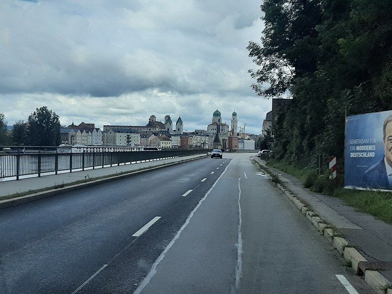
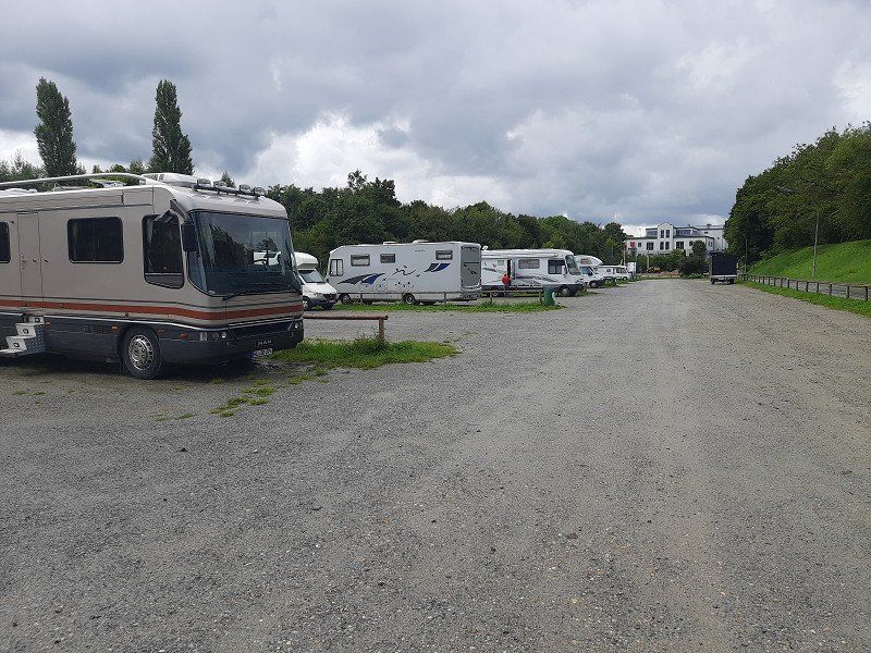
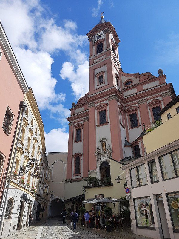
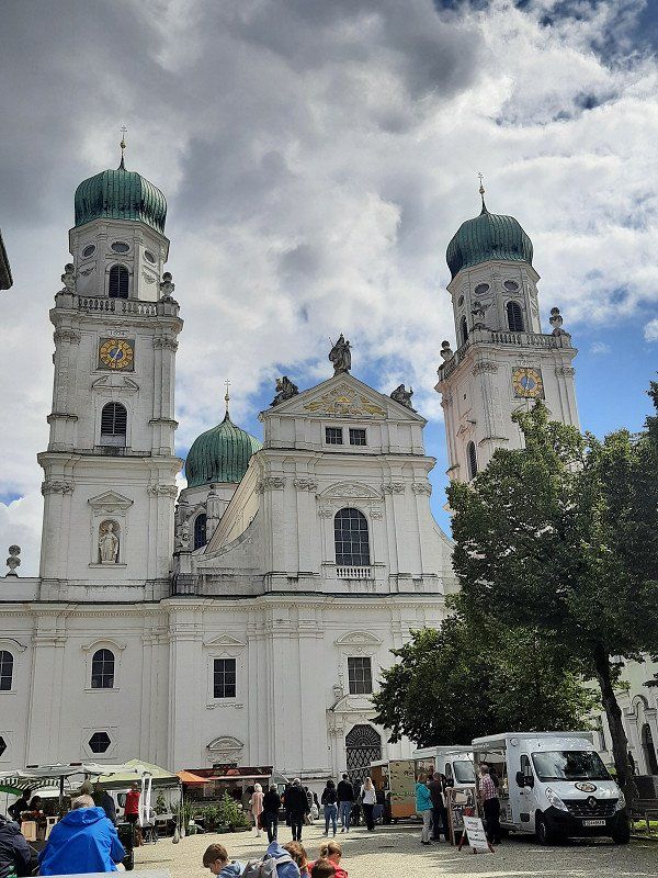
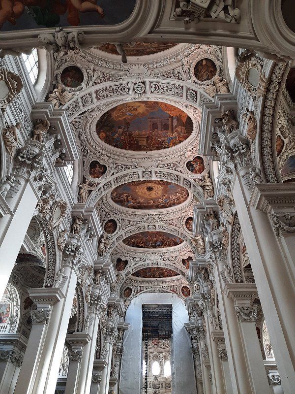
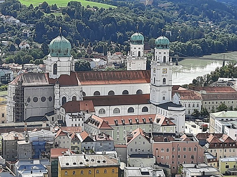
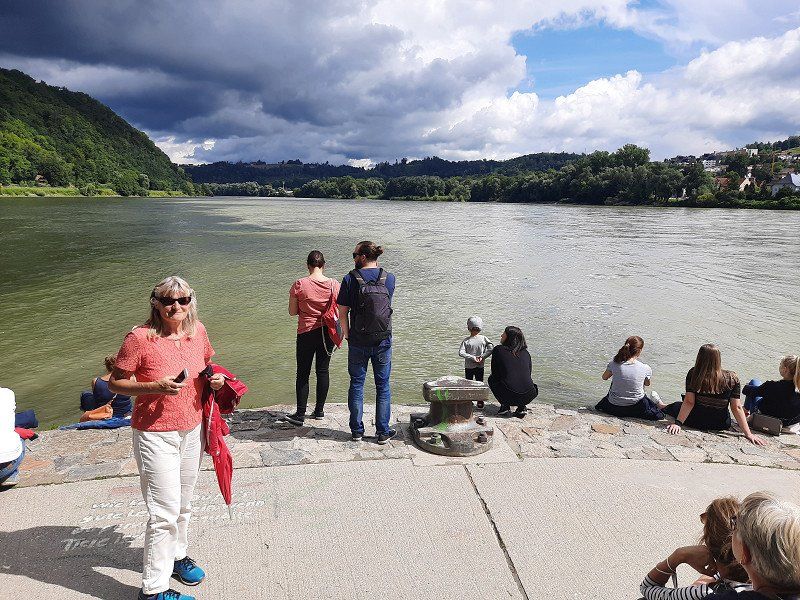
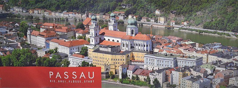
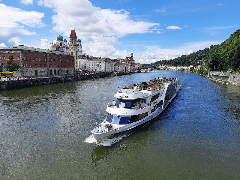
RV park offers generous space but has no facilities. That's why it's free. There were still free spaces on the free parking space at the Ilzbrücke, but it was well occupied. It rained heavily when we arrived, but soon the sun came out again. We got ready to look at the old town. It was about a 3km walk to the center of Passau.
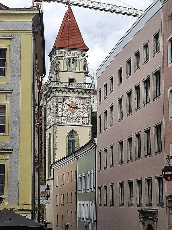
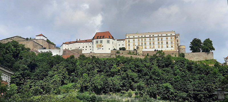
The city backdrop of cathedral, town hall and castle. Around AD 80, the Romans set up a military camp at the confluence of the Danube, Inn and Ilz. In 739, the missionary Boniface founded a diocese here, whose sphere of influence soon extended to Hungary. The bishopric and city became wealthy through the salt trade on the Danube, and from the 13th century the bishops of Passau also exercised secular power as prince bishops.
Passau, Deutschland
48° 34' 44.7" N 13° 22' 59.8" E
48.5790873 13.3832805
• Head toward Reinhard-Raffalt-Straße. Go for 60 m.
• Turn right onto Reinhard-Raffalt-Straße. Go for 302 m.
• Continue on Eichetstraße. Go for 40 m.
• Continue on Martin-Seitz-Straße. Go for 559 m.
• Turn left onto Alte Poststraße. Go for 151 m.
• Turn right onto Richterstraße. Go for 81 m.
• Turn left onto Ölberggasse. Go for 413 m.
• Turn right onto Fürstenzeller Straße. Go for 1.6 km.
• Turn left onto Haarschedl. Go for 130 m.
• Turn left onto St2118. Go for 1.1 km.
• Turn left and take ramp onto A3 toward Linz. Go for 15.4 km.
• Take the exit. Go for 335 m.
• Turn left onto B12. Go for 155 m.
• Continue on A94. Go for 570 m.
• Continue on B12. Go for 10.3 km.
• Continue on A94. Go for 10.5 km.
• Continue on B12. Go for 15.4 km.
• Take ramp onto B12 toward München/A94/Landshut/Straubing/Burghausen. Go for 14.0 km.
• Continue on A94. Go for 160 m.
• Take exit 25 toward Salzburg/Freilassing/Burghausen onto B20. Go for 463 m.
• Take the 2nd exit from roundabout onto B20 toward Salzburg/Freilassing/Burghausen/Gewerbegebiet Unterer Sulzbogen. Go for 8.3 km.
• Continue on Marktler Straße toward Salzburg/B20/Freilassing. Go for 398 m.
• Turn right onto Robert-Koch-Straße. Go for 966 m.
• Continue on Robert-Koch-Straße. Go for 1.2 km.
• Continue on Bachstraße. Go for 8 m.
• Turn left onto Berghamer Straße. Go for 42 m.
• Arrive at Berghamer Straße. Your destination is on the right.
☍
82,8 km
(1 hrs. 3 min.)
Berghamer Straße 1 48.1544, 12.8086
We had still reached the WoMo without rain, two kilometers further on our journey it started to rain heavily. The drive took us onto the Autobahn that leads to Linz in Austria. A kilometer before the border there were signs for the Austrian border which briefly panicked us
brought. A relief came when we were just before the border crossing
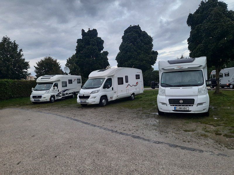
were able to leave the Autobahn on the German side. We liked the approached pitch so we parked here.
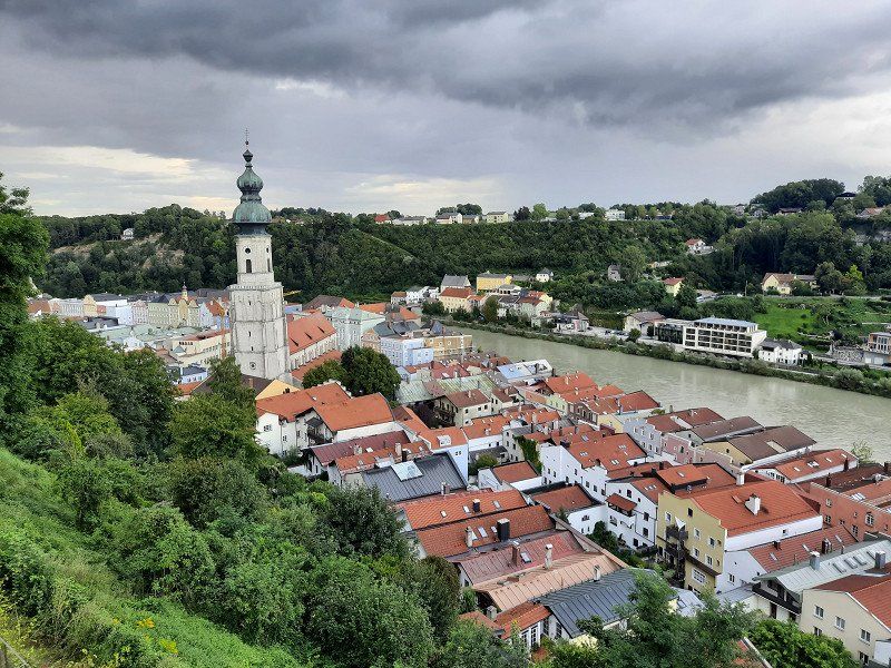
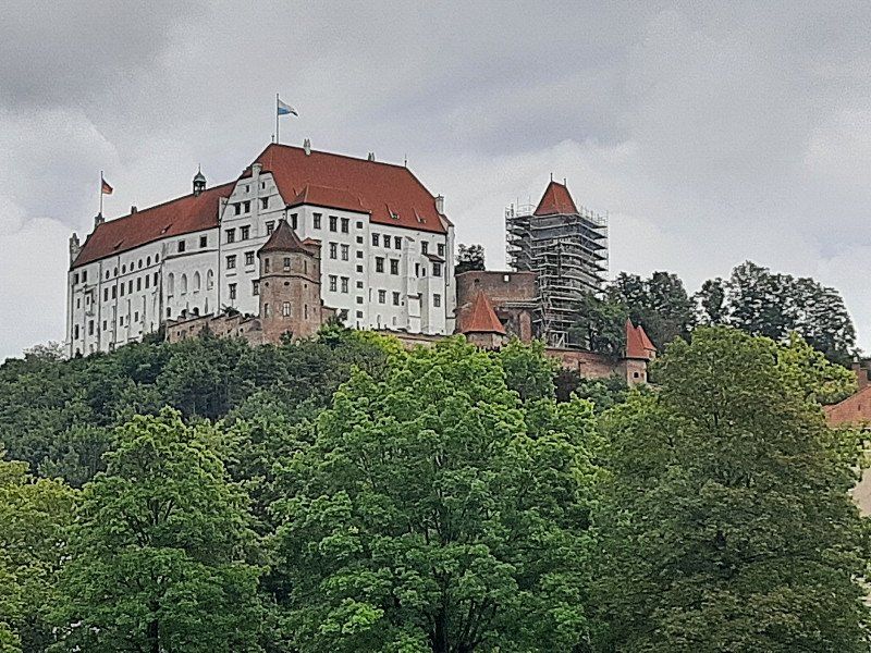
It had rained almost non-stop on the drive here. The sun was shining when we arrived in Burghausen.
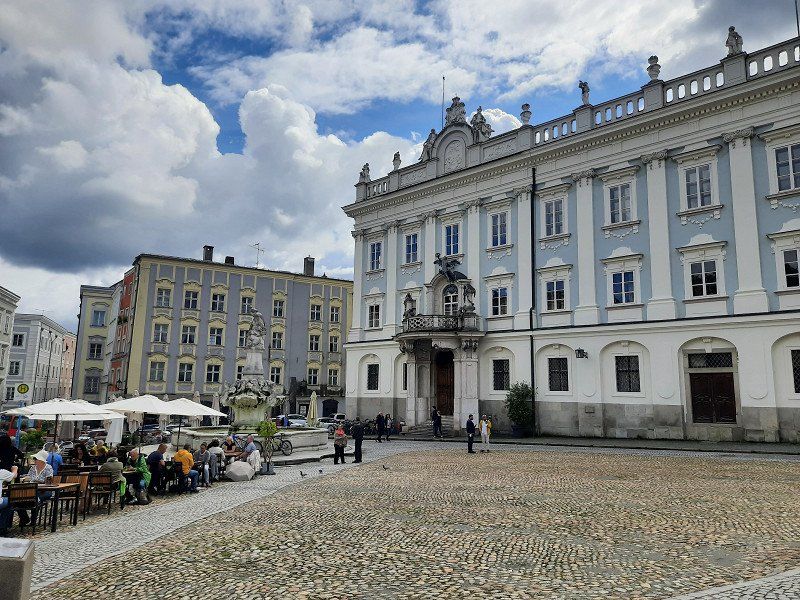
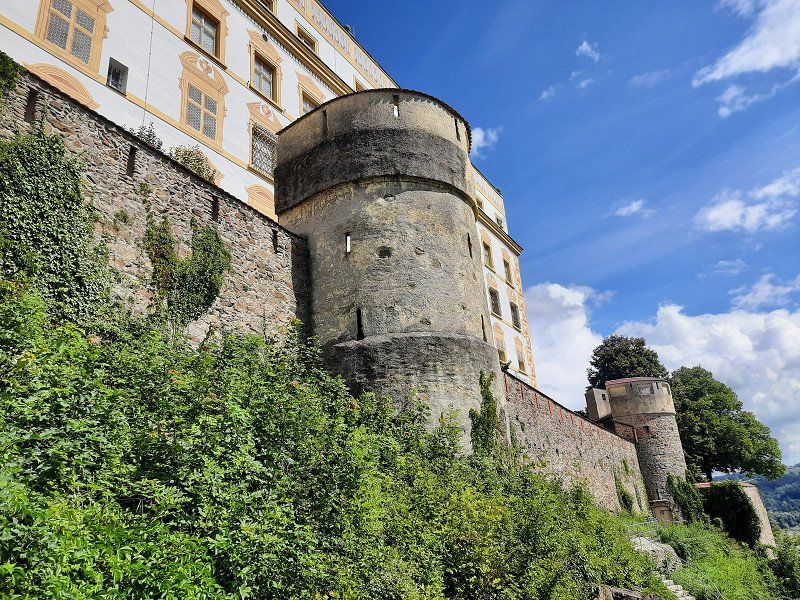
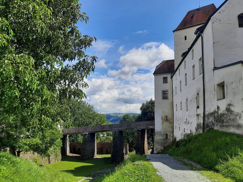
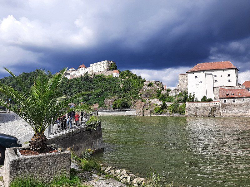
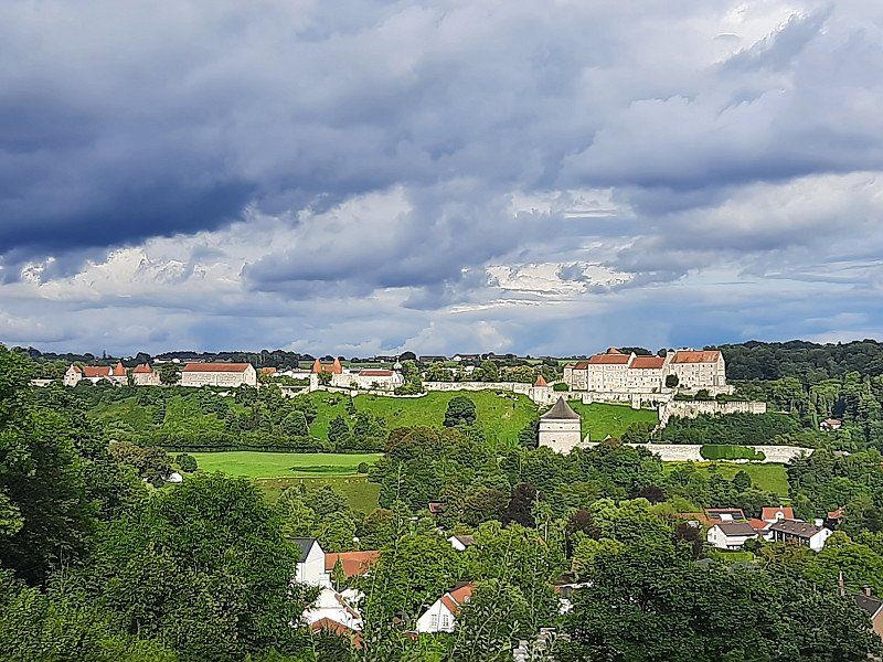
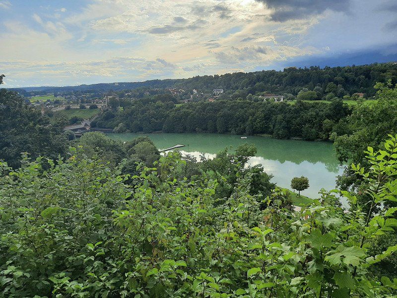
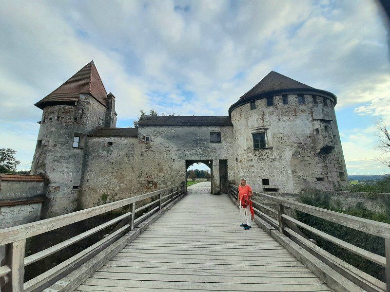
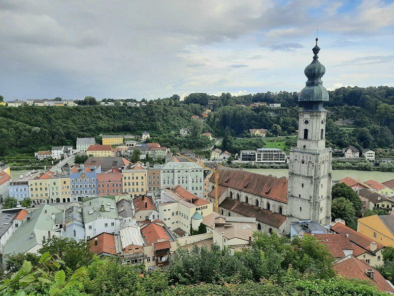
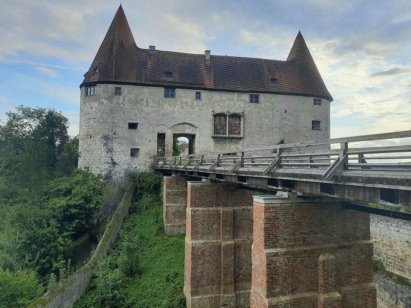
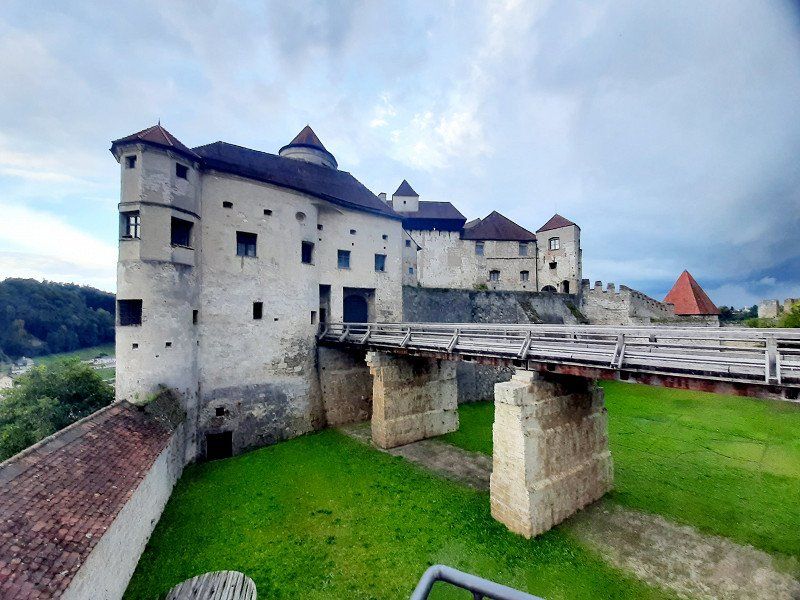
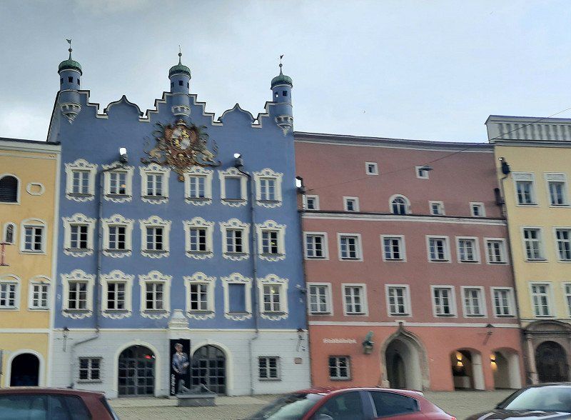
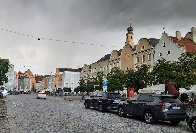
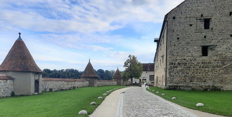
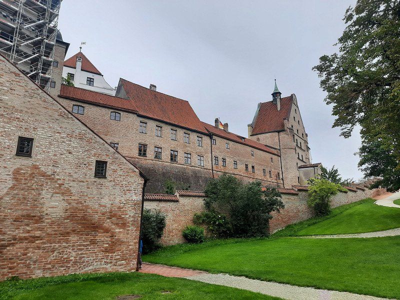
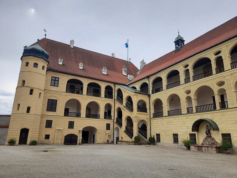
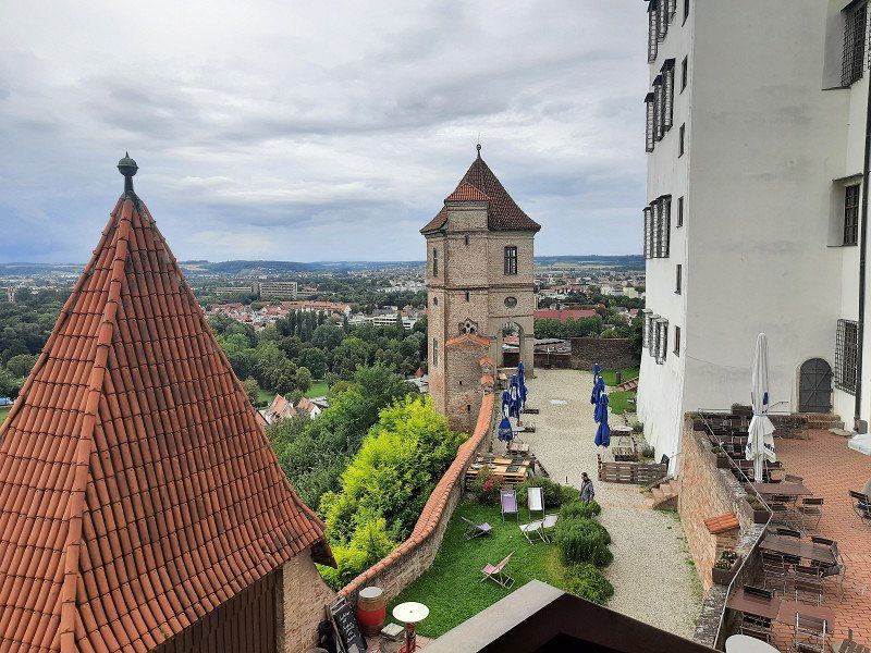
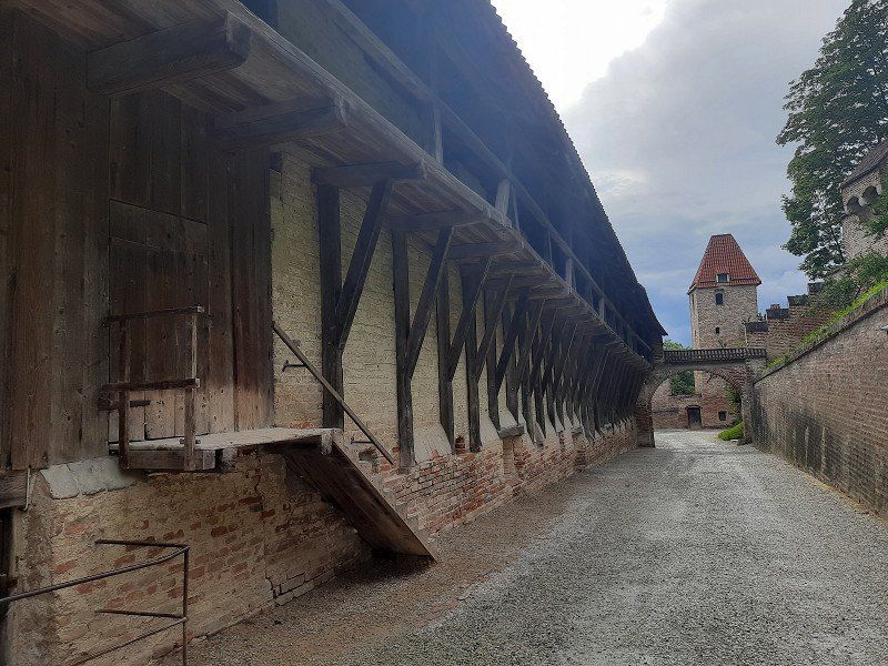
The sunny evening encouraged us to visit the castle again. From the Stellplatt it is 1.5 km via the old town to the castle. Not far from the parking space you have a wonderful view of the entire castle complex. Below the castle on the west side is the blue-green Wöhrsee and a landscape conservation and recreation area that we passed. A footpath with stairs leads to the Vordeburg. The mighty castle towers majestically high above the city, Salzach and Wöhrsee. The longest castle in the world, at 1043 m, actually consists of six fortifications one behind the other. This impregnable fortress was built from defiant walls, 26 towers, bridges, battlements and gates by 1490. The State Castle Museum in the Palas provides access to the ducal living quarters and the State Gallery in Burghausen with medieval paintings.
Unfortunately we were too late at the castle, access to the living quarters is closed at 6 p.m. We were still able to see the castle in its full length. Another footpath with 62 steps takes you to the old town of Burghausen, just as it was around 500 years ago
the Gothic old town below the mighty castle enthroned high above the town of Burghausen. The winding, almost Mediterranean-style streets are lined with slender gabled houses in the typical Inn-Salzach architectural style, but also with some Renaissance, Baroque and Rococo facades.
We could not visit the old town more closely, it started to rain so heavily that we had to shelter under an archway for a long time. When the rain stopped we went back to the WoMo as quickly as possible.
84489 Burghausen, Deutschland
48° 9' 24" N 12° 48' 46.2" E
48.1566713 12.8128258
• Head toward Bachstraße on Berghamer Straße. Go for 42 m.
• Turn right onto Bachstraße. Go for 8 m.
• Continue on Robert-Koch-Straße. Go for 677 m.
• Turn right onto Mozartstraße. Go for 118 m.
• Turn left onto Berchtesgadener Straße. Go for 1.2 km.
• Turn left onto Marktler Straße toward B20/Straubing/A94/Passau/Marktl a. Inn/Sportpark SV Wacker. Go for 1.8 km.
• Take ramp toward Altötting/Neuötting/Emmerting. Go for 252 m.
• Take the 2nd exit from roundabout onto St2108. Go for 8.8 km.
• Turn left toward Burghauser Straße. Go for 2.5 km.
• Continue on Burghauser Straße. Go for 147 m.
• Take the 3rd exit from roundabout onto Burghauser Straße. Go for 959 m.
• Arrive at Burghauser Straße. Your destination is on the left.
☍
16,6 km
( 15 min.)
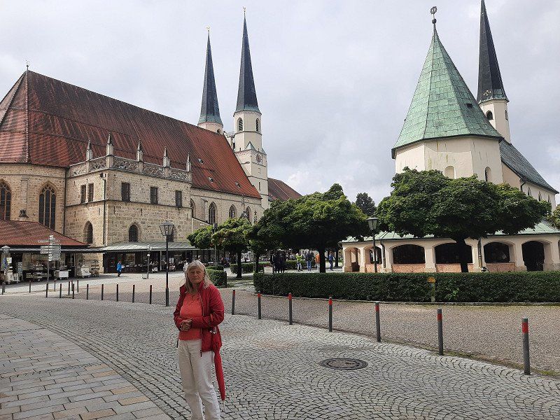
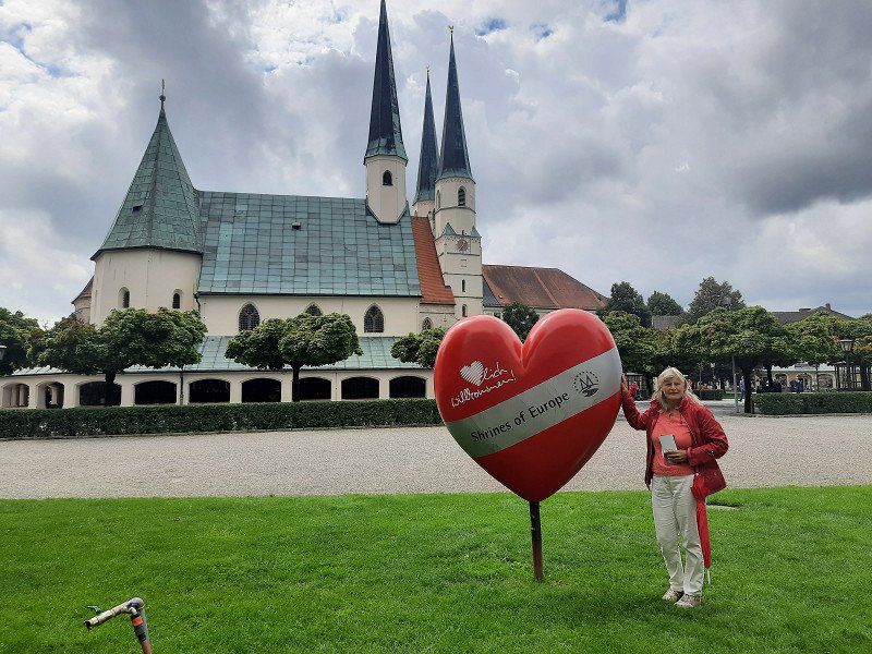
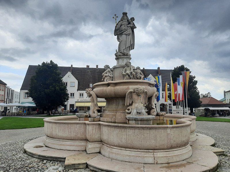
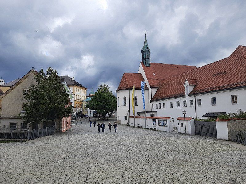
Altötting
On our continuation of today's journey, we visit the place of pilgrimage Altötting.
From the parking space it is only a few minutes to the Chapel of Grace.
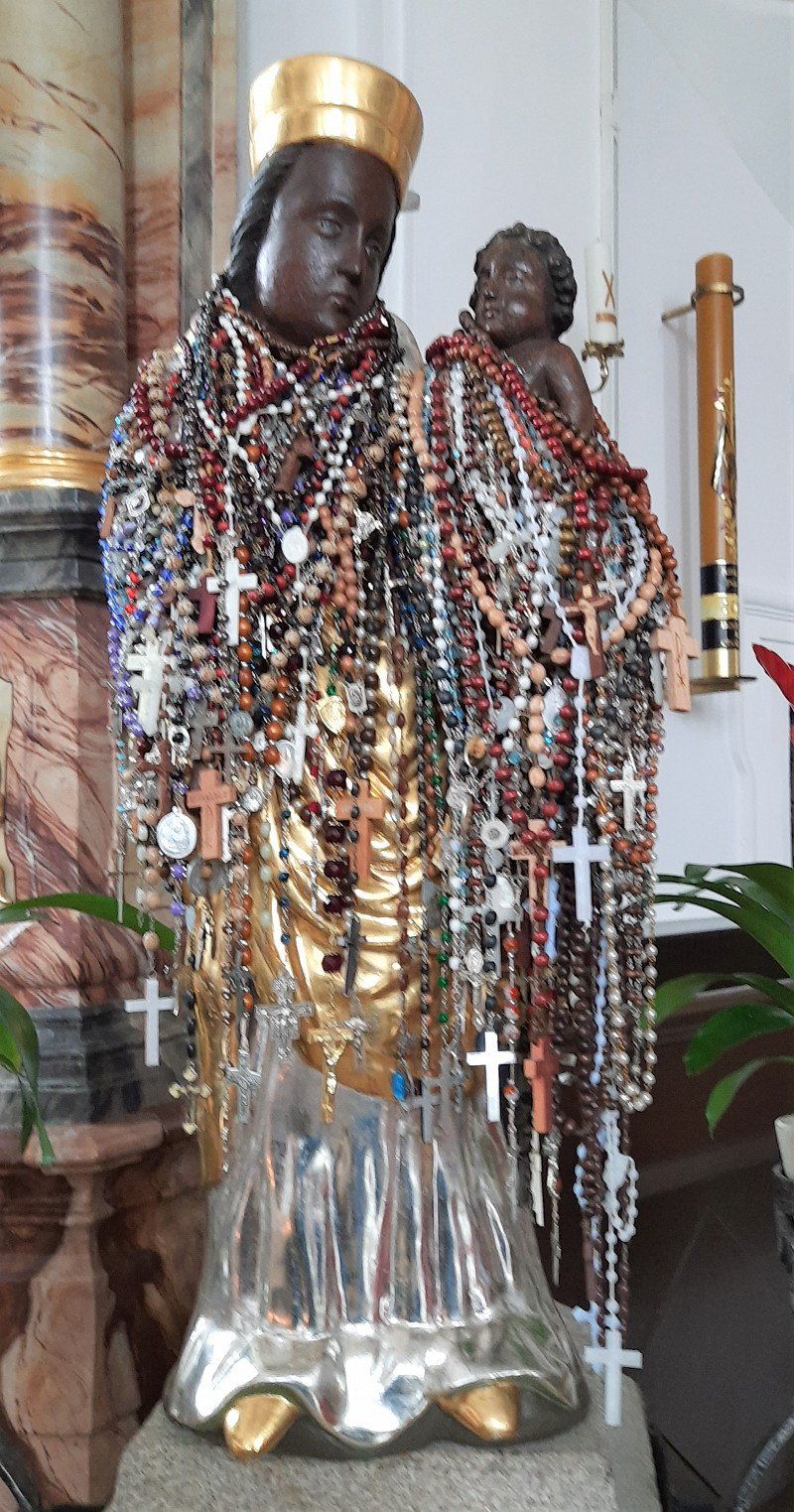
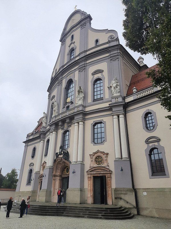
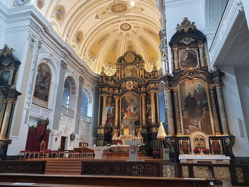
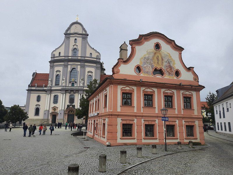
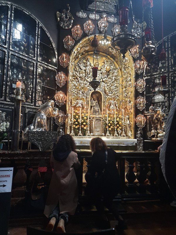
More than a million pilgrims visit the oldest place of pilgrimage in Bavaria, which has been the religious heart of Bavaria for over 500 years. The centrally located Kapellplatz was used solely as a pilgrimage destination. In the middle is the octagonal Chapel of Mercy with the Black Madonna. 2000 plaques tell of their miraculous activity.
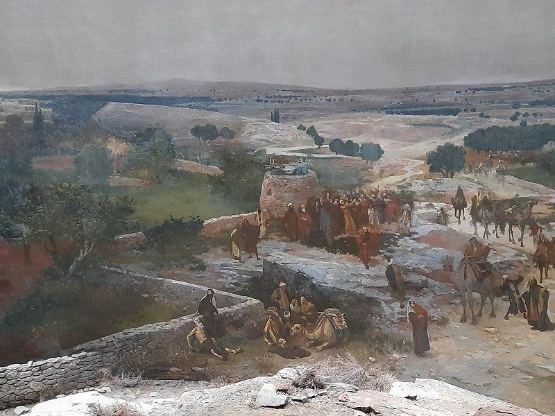
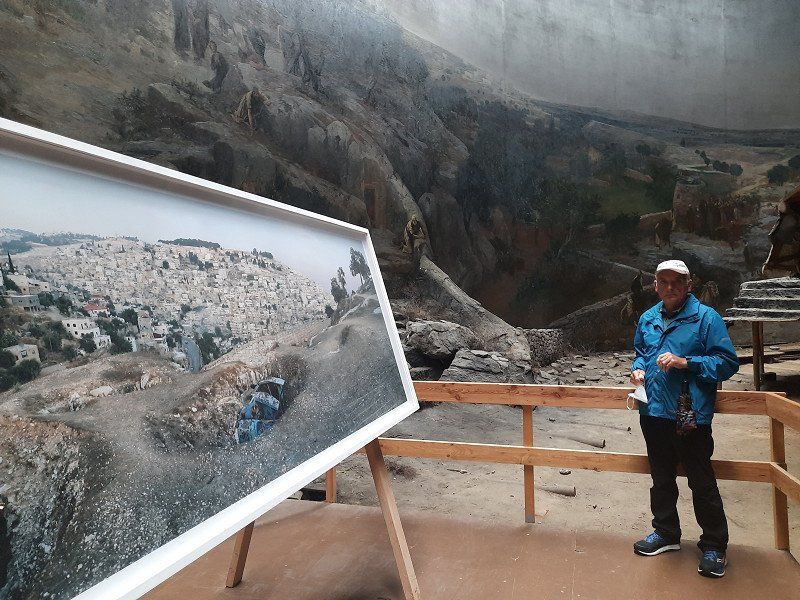
A large-scale panorama in Germany shows a crucifixion of Christ in front of the Jerusalem Panorama and is located just a short distance behind the St. Magdalena Church (Kapellplatz East). The screen surface is approx. 1200 square meters. The panorama is under monument protection and belongs to
UNESCO world cultural heritage. Collegiate Church of St.Philipp and Jakob. The twin-towered parish church of St. Philipp and Jakob, a late Gothic hall church with a cloister from the 13th century.
Altötting, Deutschland
48° 13' 25.3" N 12° 40' 47.8" E
48.2236975 12.6799462
• Head northwest on Burghauser Straße.
• Turn left onto Traunsteiner Straße. Go for 509 m.
• Continue on Bahnhofplatz. Go for 172 m.
• Continue on Trostberger Straße. Go for 80 m.
• Turn right onto Chiemgaustraße. Go for 445 m.
• Turn left onto Mühldorfer Straße. Go for 961 m.
• Take the 4th exit from roundabout onto AÖ12. Go for 99 m.
• Turn right onto B299. Go for 3.2 km.
• Take ramp onto A94 toward München. Go for 9.0 km.
• Take exit 20 toward Mühldorf-Nord/Zentrum/Gewerbegebiet Mühldorf/Landshut/Neumarkt-St.Veit. Go for 286 m.
• Turn right onto B299 toward Landshut/Neumarkt-St. Veit. Go for 11.5 km.
• Take the 2nd exit from roundabout onto B299 toward Landshut/Vilsbiburg. Go for 1.8 km.
• Take the 2nd exit from roundabout onto B299 toward Landshut/Vilsbiburg/Egglkofen. Go for 9.5 km.
• Take the 2nd exit from roundabout onto Vilsbiburger Straße (B299) toward Landshut/Vilsbiburg. Go for 1.8 km.
• Take ramp toward A92/Landshut/München/Passau. Go for 153 m.
• Turn right onto B299/B388 toward München/Landshut/Velden. Go for 2.5 km.
• Take ramp onto B299 toward Landshut/Frontenhausen/Vilsbiburg. Go for 199 m.
• Turn right onto Achldorf (B299) toward Landshut/Frontenhausen/Vilsbiburg. Go for 3.8 km.
• Take the 3rd exit from roundabout onto B299 toward Landshut. Go for 14.3 km.
• Turn left onto Weickmannshöhe toward Achdorf/Landshut-Berg/Krankenhäuser. Go for 2.1 km.
• Continue on Neue Bergstraße. Go for 1.8 km.
• Turn right onto Neue Bergstraße (B15) toward A92/München/Deggendorf/Neustadt a.d. Donau/Zentrum/Klinikum. Go for 378 m.
• Turn left onto Innere Münchener Straße (B15). Go for 82 m.
• Turn right onto Wittstraße (B15) toward Deggendorf/A92/Regensburg/A93. Go for 300 m.
• Turn left. Go for 65 m.
• Turn right. Go for 219 m.
• Arrive at your destination on the left.
☍
65,4 km
( 52 min.)
Day
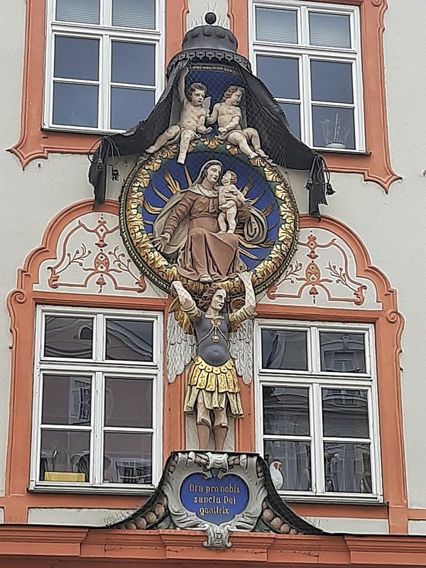
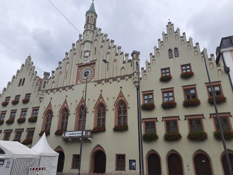
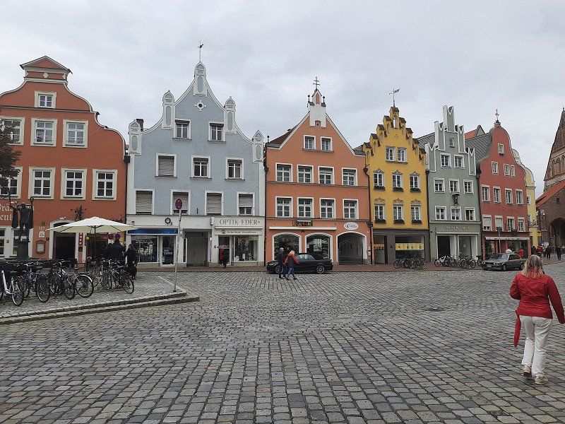
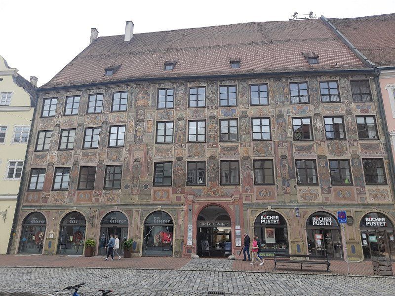
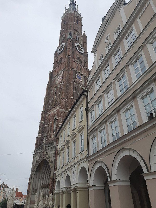
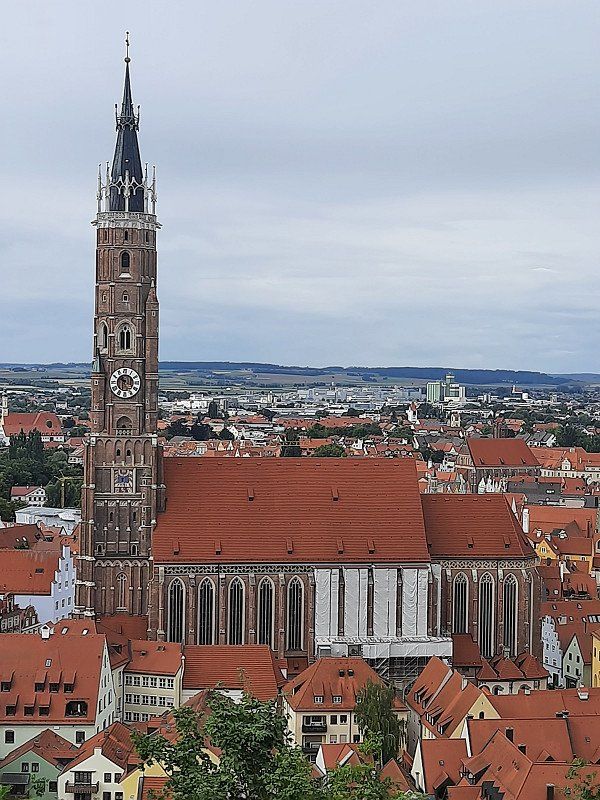
Landshut Preysingallee 5 (48.531028, 12.144817)
To visit the old town, conveniently located large car park, right on the Isar cycle path, it was relatively quiet at night. Where mobile homes are also allowed to park. Landshut was already the capital of Lower Bavaria when today's administrative district was still an incredibly rich duchy and stretched to Reichenhall and Kitzbühel.
First we made our way to
Trausnitz Castle. The castle rises directly above the old town. In the courtyard garden there is a vantage point over the city of Landshut. It is worth going up the Burgberg for the view alone. The medieval backdrop of the old town under the castle creates a very authentic atmosphere.
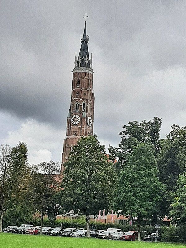
We then visited the St. Martin Church. The 133 m high tower of the late Gothic hall church of St. Martin is the tallest brick building in the world.
When you look at the long, slender columns with their 29 meters in height, you feel tiny in this church building, which otherwise seems rather unadorned at first.
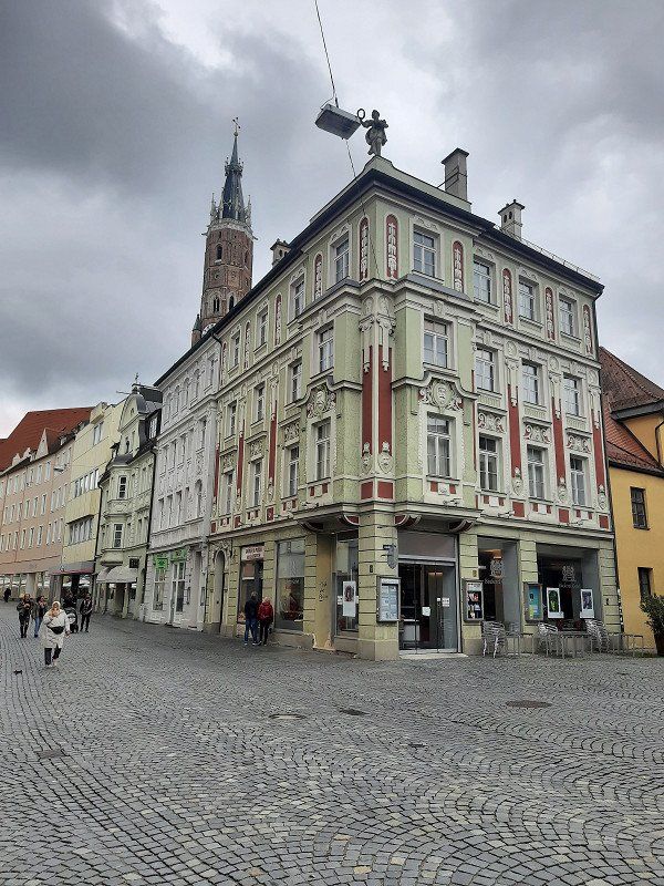
We walk along the main street through the old town, we look at particularly striking house facades, the landscape house is particularly worth seeing.
On our way back to the parking lot we pass the remains of the old city wall and the city gate.
We stayed the night but left early in the morning.
84028 Landshut, Deutschland
48° 31' 56.2" N 12° 8' 42.7" E
48.5322700 12.1451900
• Head northeast.
• Turn right toward Wittstraße/B15. Go for 173 m.
• Turn right onto Wittstraße (B15). Go for 527 m.
• Continue on Wittstraße (B11). Go for 10.5 km.
• Take the 3rd exit from roundabout onto B11 toward A92/München/Deggendorf/Freising. Go for 2.0 km.
• Take ramp onto A92 toward München. Go for 47.8 km.
• Take the left exit toward Stuttgart/Augsburg/Lindau/München-West onto A99. Go for 8.3 km.
• Keep right onto A99 (Autobahndreieck München-Allach) toward Stuttgart/Augsburg/Dachau/Fürstenfeldbruck. Go for 4.3 km.
• Continue on A8 (Autobahndreieck München/Eschenried). Go for 191 km.
• Take exit 52 toward Tübingen/Reutlingen/Filderstadt/L.-E.-Echterdingen/Flughafen/Messe onto B27. Go for 1.3 km.
• Keep left onto B27 toward Tübingen/Reutlingen/Filderstadt/L.-E.-Echterdingen/Flughafen. Go for 30.7 km.
• Keep left onto Stuttgarter Straße (B27) toward Rottweil/Hechingen. Go for 40.8 km.
• Continue on B27. Go for 9.1 km.
• Turn right onto Hardtstraße. Go for 203 m.
• Turn left onto Lochenstraße. Go for 93 m.
• Arrive at Lochenstraße. Your destination is on the right.
☍
347,0 km
(3 hrs. 8 min.)
Neukirch
Lochenstraße 6, 78628 Rottweil, Deutschland
48° 11' 53.2" N 8° 41' 43.3" E
48.1981249 8.6953661