Unfortunately, we don't support your browser (Internet Explorer) anymore, some functionalities could not work. Click here to get information on how to upgrade your browser.
Bavarian Forest

Travelogue
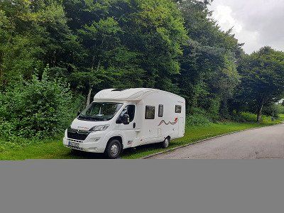
Route: B27 via Tübingen - Echterdingen onto the A8.
Exit Nürtingen - Göppingen - Heidenheim -Donauwörth- Ingolstadt-Neustadt (bathing lake).
We left the A8 near Nürtingen, the traffic radio reported a 10 km traffic jam on the Eichelberg, we decided to drive overland. Due to extensive detour routes, we needed an hour and a half longer than the navigation system told us at the beginning of the trip. From Donauwörth it worked
very good, little traffic was on the road.
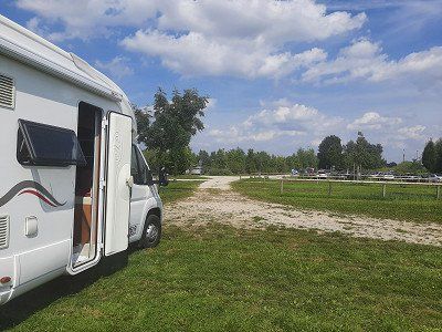
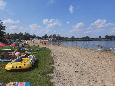
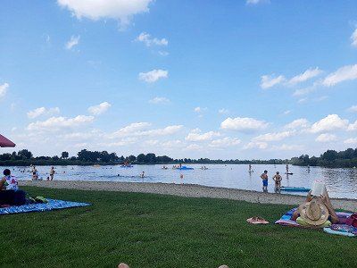
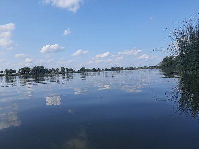
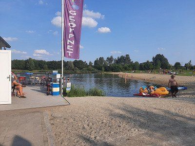
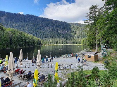
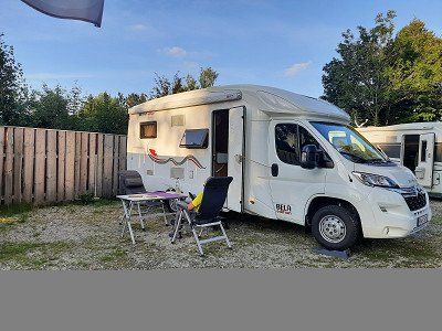
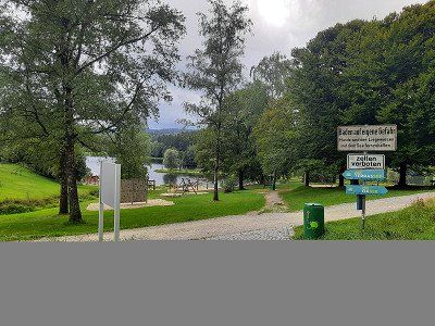
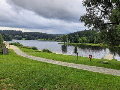
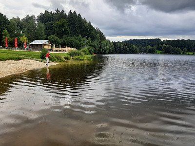
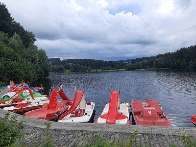
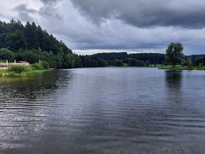
Arrived at the bathing lake we found enough free parking spaces. Overnight parking is permitted and free of charge. After the coffee break we had to go swimming right away. We were amazed at the bathing lake, even with a sandy beach. The water is very clean and the water temperature was pleasantly warm.
Air temperature was 26°C.
We stood at the edge of the squares and had a very quiet night.
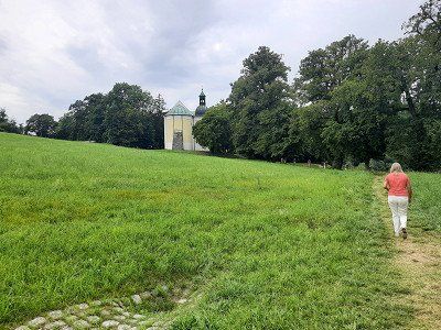
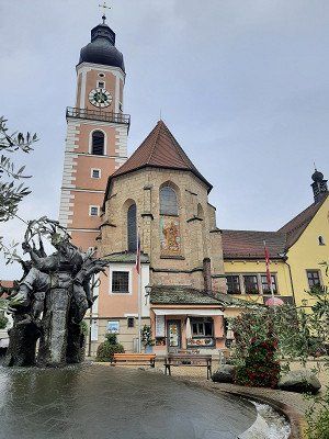
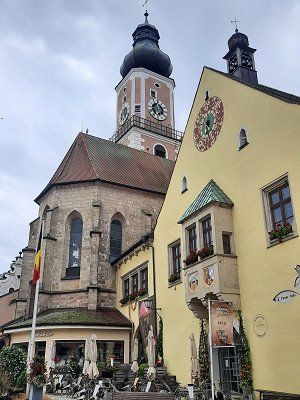
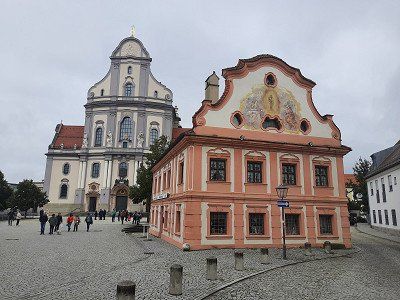
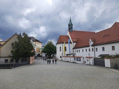
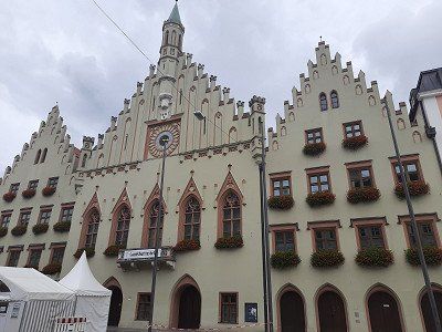
We made the first sightseeing stop in Abensberg. The city is also the starting point of the German Hopfenstraße and ›Gateway to the Hallertau‹, the largest hop-growing region in the world. The many hop fields on the way there were striking. Architectural witnesses of the past are the castle from the 12th century, the Carmelite church "Our Lady", the parish church of St. Barbara with a rococo tower and the late medieval ducal case.
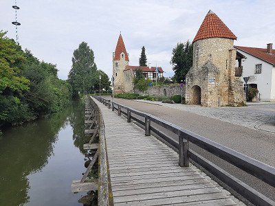
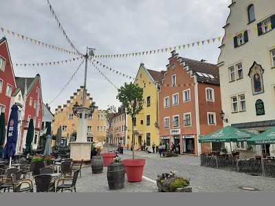
We made the first sightseeing stop in Abensberg. The city is also the starting point of the German Hopfenstraße and ›Gateway to the Hallertau‹, the largest hop-growing region in the world. The many hop fields on the way there were striking. Architectural witnesses of the past are the castle from the 12th century, the Carmelite church "Our Lady", the parish church of St. Barbara with a rococo tower and the late medieval ducal case.
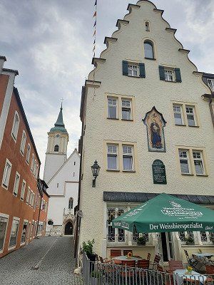
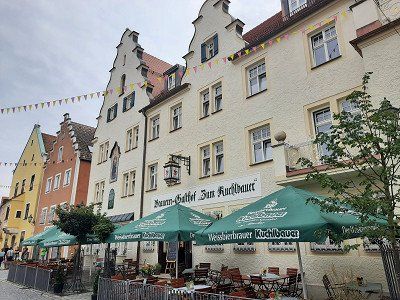
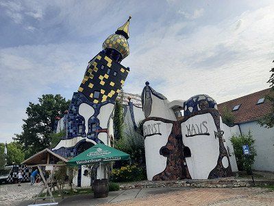
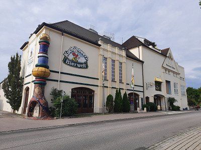
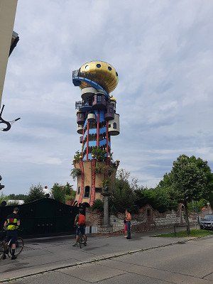
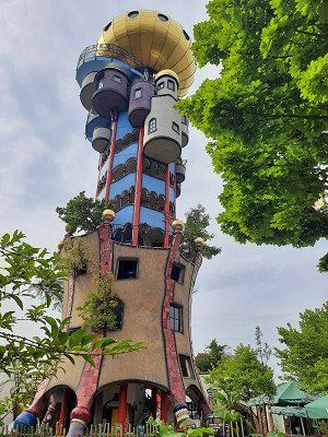
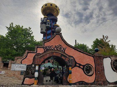
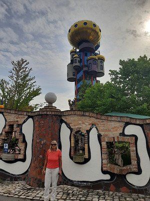
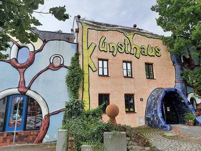
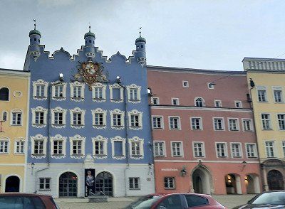
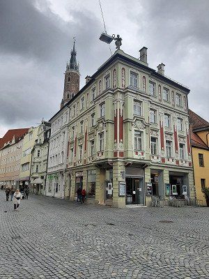
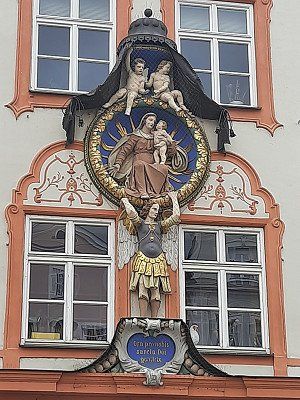
The town square with the narrow gabled houses and the ›Zum Kuchlbauer‹ brewery inn is beautiful. The landmark of the brewery, the Kuchlbauer Tower, was built by Friedensreich
Hundertwasser (1928-2000) planned, but only opened in 2010. Friedensreich Hundertwasser has immortalized himself with a remarkable architectural project in Abensberg: the landmark of the
Kuchlbauer Brewery, the Kuchlbauer Tower, is a work of the world-renowned artist. A brewery has thus become part of a work of art and a work of art has become part of a brewery. Such a combination is probably unique and cannot be classified in any conventional tourist scheme. Round shapes, dancing windows, wavy floors and organic lines, onion domes and plants, these are Hundertwasser's elements for humane building in harmony with nature.
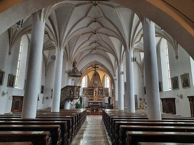
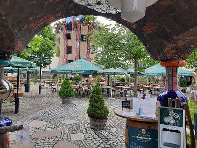
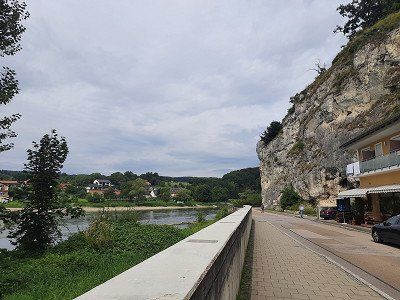
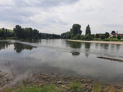
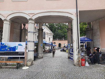
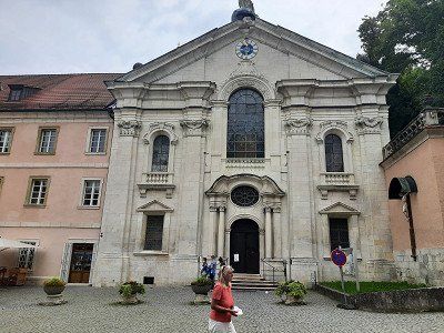
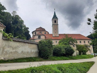
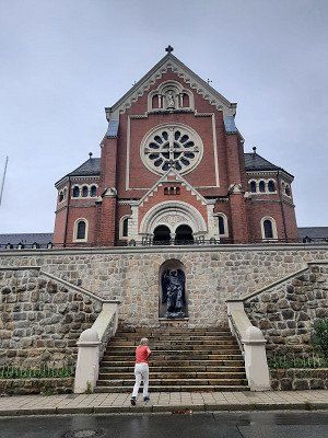
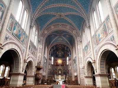
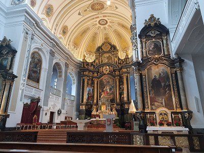
After the interesting town of Abensberg we drive to the parking lot of the Weltenburg Monastery. The parking lot is on the banks of the Danube and you still have to walk 600 m along the Danube to the monastery. There was a lot going on in the huge beer garden, the first guests were already having lunch. Weltenburg Monastery was founded at the beginning of the 7th century and is considered to be the original Bavarian monastery. In the monastery tavern you can drink beer from the oldest monastery brewery in the world (since 1050). The Asam brothers decorated the monastery church of St. George and Martin 1716-39 with magnificent
stucco work and theatrical light effects. We walked up the hill to the
Frauenkapelle, continue to the excavations of a former Roman castle.
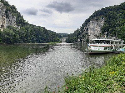
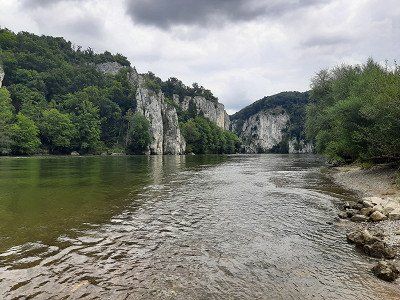
The Weltenburg Danube breakthrough is supposed to be a unique natural experience that we wanted to see from above, so we walked the hiking trail in the direction of Kehlheim to a vantage point from which you should see the Danube breakthrough. (Walking time approx. 30 min.) Is not recommended, instead we walked along the Danube to the pier, where unfortunately you can see very little of the Danube breakthrough.


After the interesting town of Abensberg we drive to the parking lot of the Weltenburg Monastery. The parking lot is on the banks of the Danube and you still have to walk 600 m along the Danube to the monastery. There was a lot going on in the huge beer garden, the first guests were already having lunch. Weltenburg Monastery was founded at the beginning of the 7th century and is considered to be the original Bavarian monastery. In the monastery tavern you can drink beer from the oldest monastery brewery in the world (since 1050). The Asam brothers decorated the monastery church of St. George and Martin 1716-39 with magnificent
stucco work and theatrical light effects. We walked up the hill to the
Frauenkapelle, continue to the excavations of a former Roman castle.
The Weltenburg Danube breakthrough is supposed to be a unique natural experience that we wanted to see from above, so we walked the hiking trail in the direction of Kehlheim to a vantage point from which you should see the Danube breakthrough. (Walking time approx. 30 min.) Is not recommended, instead we walked along the Danube to the pier, where unfortunately you can see very little of the Danube breakthrough.
Large free parking lot on the Danube, the parking space for mobile homes is right next to it, which we didn't use. We only intended to look at the Liberation Hall.
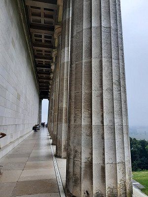
We quickly run up to the Liberation Hall. The hall built by King Ludwig I of Bavaria (1842) for the victories over Napoleon is impressive. The dimensions of the 48 m high domed hall are revealed on a tour of the columned gallery on the upper floor.
We only looked at the Liberation Hall from the outside and were amazed at the mighty scale of the hall. The ticket for visiting the hall had to be bought in the tourist information, we didn't feel like going there anymore.


Large free parking lot on the Danube, the parking space for mobile homes is right next to it, which we didn't use. We only intended to look at the Liberation Hall.
We quickly run up to the Liberation Hall. The hall built by King Ludwig I of Bavaria (1842) for the victories over Napoleon is impressive. The dimensions of the 48 m high domed hall are revealed on a tour of the columned gallery on the upper floor.
We only looked at the Liberation Hall from the outside and were amazed at the mighty scale of the hall. The ticket for visiting the hall had to be bought in the tourist information, we didn't feel like going there anymore.
First it goes on to Germany's hall of fame - the Walhalla .
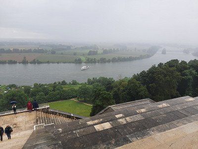
Before we could go up the few steps from the large parking lot, we had to wait out a heavy rain in the camper. After waiting for half an hour we stood in front of the truly impressive building. Admission to the hall cost 4 euros, but it's definitely worth it and the view over the Danube valley is free.
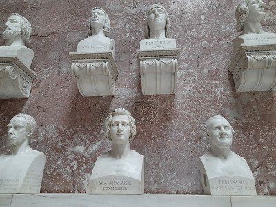
High above the Danube, not far from Regensburg, the Walhalla was built in ancient Greek style in 1830 by King Ludwig I of Bavaria. 130 busts of German personalities stand in the impressive building, the last entry for German-speaking people
Personalities were Heinrich Heine and Sophie Scholl.


First it goes on to Germany's hall of fame - the Walhalla .
Before we could go up the few steps from the large parking lot, we had to wait out a heavy rain in the camper. After waiting for half an hour we stood in front of the truly impressive building. Admission to the hall cost 4 euros, but it's definitely worth it and the view over the Danube valley is free.
High above the Danube, not far from Regensburg, the Walhalla was built in ancient Greek style in 1830 by King Ludwig I of Bavaria. 130 busts of German personalities stand in the impressive building, the last entry for German-speaking people
Personalities were Heinrich Heine and Sophie Scholl.
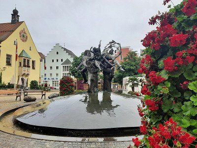
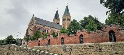
Cham is located directly on the Regen river, which makes a bend there, and consequently it is simply called 'City on the Rainbow'. In the 8th century, monks founded the Chammünster monastery nearby in order to evangelize the eastern countries from here.
We made a short stop here.
The town hall is the eye-catcher of the Cham market square. Its bay window is adorned with a municipal and an Upper Palatinate coat of arms.
One of the three water-spouting figures in the market fountain depicts Count Nikolaus von Luckner, who was born in Cham. He made a career in the French army under Napoleon and must have been quite popular with his soldiers, because Claude Joseph dedicated Rouget de Lisle to him
the same marching song that later became the national anthem of France.
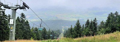
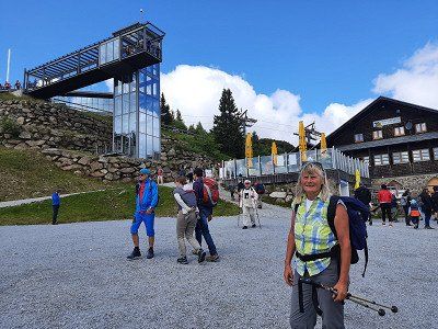
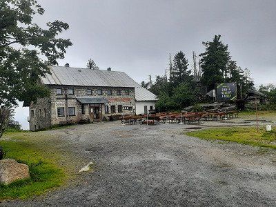
Neukirchen bei Heiligen Blut is a resort in beautiful nature at the foot of the Hohenbogen (1079 m). Where the Bavarian Forest merges into the Bohemian Forest. Our destination for the day is the parking lot at the valley station of the Hohe Bogen chairlift. A huge parking lot and completely empty we met him. The only drawback is the crooked position. The wheel chocks are not quite enough to stand up straight. Besides us, there was another WoMo in the parking lot. The evening was rainy, we didn't even feel like going to the ski center with the leisure activities (summer toboggan run ..) us
to look at
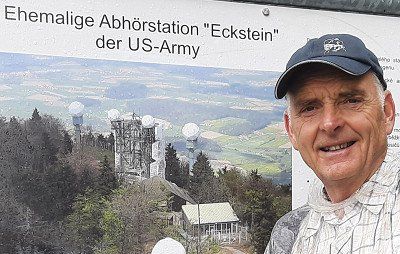
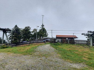
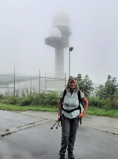
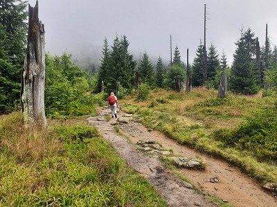
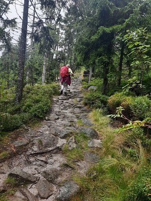
Dawn with the first rays of sunshine on the parking lot at the ski center near Neukirchen-Heilig Blut, where our hike to the Hoher Bogen began. The Hohe Bogen is the northernmost mountain bastion of the Bavarian Forest, in the state of Bavaria in the Upper Palatinate in the district of Cham, and a panoramic phenomenon with almost five thousand meters:
The highest is the Schwarzriegel at 1,079m, followed by the Eckstein at 1,073m, the chairlift mountain station is on the Ahornriegel (1,050m), a quiet forest path leads over the Bärenriegel (1,017m) and the Burgstall (976m).
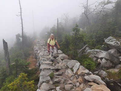
The weather had deteriorated and drizzle accompanied us at the beginning of the tour. We chose the tourist route to the Pürzerriegel (923m). On the way we briefly lost the route and had to turn back to get back on our planned tour. We made a loop around the Schmidtriegel (915m) and hike to the forest service hut. We took the Baierweg (mountain trail) over the Farrenruck (979m) and came to the Bärenriegel. The Bärenriegel measures 1,017m. With
Accompanied by trees, we continue up to another part of the Hohenbogen, the Eckstein (1,073m) with the telecommunications sector F, which has been shut down so far, whereby we are at around 1,043m here.
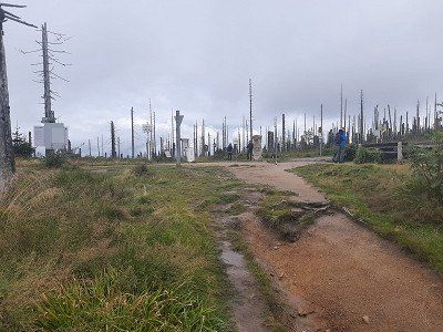
Dense fog prevented the view and the viewing platform was too
closed. On the legendary north-west pillar of the Hoher Bogen, Count Albert III founded.
von Bogen built a castle around 1190, but the complex remained unfinished.
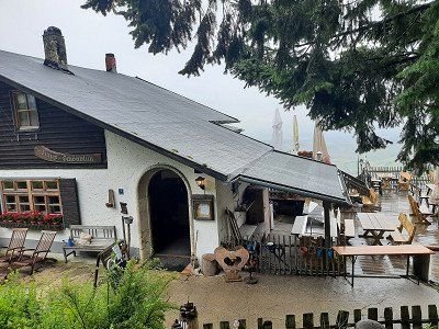
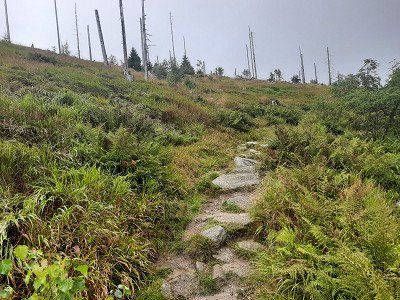
The Hohe Bogen is an 8 km long ridge in the Bavarian Forest. On the Ahornriegel (1,050m) with skiing and gastronomy, a mountain chapel and a view called Schönblick. on one
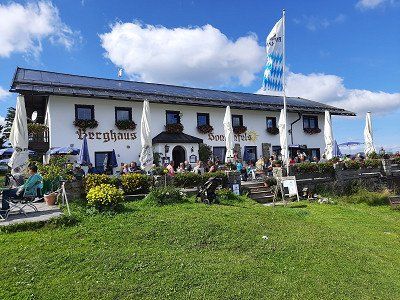
Asphalt road it went downhill to the inn "Schönblick" where we made the lunch break.
Gradually we hike down to the Kagerstein (793m), along with a vantage point
Kagerstein and also on narrow root paths back to the parking lot at
ski center.


Dawn with the first rays of sunshine on the parking lot at the ski center near Neukirchen-Heilig Blut, where our hike to the Hoher Bogen began. The Hohe Bogen is the northernmost mountain bastion of the Bavarian Forest, in the state of Bavaria in the Upper Palatinate in the district of Cham, and a panoramic phenomenon with almost five thousand meters:
The highest is the Schwarzriegel at 1,079m, followed by the Eckstein at 1,073m, the chairlift mountain station is on the Ahornriegel (1,050m), a quiet forest path leads over the Bärenriegel (1,017m) and the Burgstall (976m).
The weather had deteriorated and drizzle accompanied us at the beginning of the tour. We chose the tourist route to the Pürzerriegel (923m). On the way we briefly lost the route and had to turn back to get back on our planned tour. We made a loop around the Schmidtriegel (915m) and hike to the forest service hut. We took the Baierweg (mountain trail) over the Farrenruck (979m) and came to the Bärenriegel. The Bärenriegel measures 1,017m. With
Accompanied by trees, we continue up to another part of the Hohenbogen, the Eckstein (1,073m) with the telecommunications sector F, which has been shut down so far, whereby we are at around 1,043m here.
Dense fog prevented the view and the viewing platform was too
closed. On the legendary north-west pillar of the Hoher Bogen, Count Albert III founded.
von Bogen built a castle around 1190, but the complex remained unfinished.
The Hohe Bogen is an 8 km long ridge in the Bavarian Forest. On the Ahornriegel (1,050m) with skiing and gastronomy, a mountain chapel and a view called Schönblick. on one
Asphalt road it went downhill to the inn "Schönblick" where we made the lunch break.
Gradually we hike down to the Kagerstein (793m), along with a vantage point
Kagerstein and also on narrow root paths back to the parking lot at
ski center.
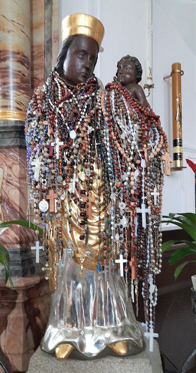
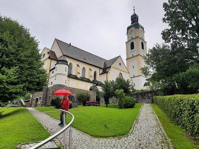
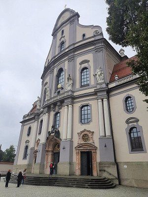
As we continued our journey, we had to make a detour to the pilgrimage church of the Nativity of the Virgin Mary with the neighboring Franciscan monastery. The baroque pilgrimage church with the onion dome
the tower rises in a broad valley, to the east of the High Arch. In her double altar is the miraculous image with the forked head under a glass dome.
The church with a nave from 1610 and the tower from the late 17th century was designed in this way in 1720. It is connected by the altar to the Franciscan church behind it.
The Franciscans have been taking care of the pilgrimage in Cham since the 17th century and received permission to build a monastery and a monastery church in 1658.
The place name is somewhat unusual and has its origins in the pilgrimage history associated with a legend (peasant woman vs. Hussites). In 1420, a Hussite tried to destroy the head of the figure of Mary with a sword, whereupon "blood" flowed from this head.
First we drove past the parking lot and turned in Blaibach. In town we quickly bought some bread. Except for two cars, the approached parking lot was empty, had enough space
stand. Actually, we had planned and approached the parking lot to swim in the lake.
The weather was not inviting for swimming, it was raining. We tried an evening walk
along the lake, but soon turned back, the path was wet and dirty. An annoying booming noise from the hydroelectric power station and the noise from the road leading by made us change parking spaces.
Subject to a fee of 2.-€
Large parking lot when approaching it started raining again. Today we did nothing more, we spent the evening in the WoMo.
Subject to a fee of 2.-€
Large parking lot when approaching it started raining again. Today we did nothing more, we spent the evening in the WoMo.
Today's view from the WoMo was not pleasant, apart from fog you can't see anything. The adjoining inn is only slightly visible. The outside temperature was 8°C. We had to heat the WoMo, it's really cold and rainy this morning. The parking lot is at 904 m. Today we wanted to hike up the Great Osser and see how the weather turns out
still developed. I think there is a rest day in the WoMo.
We decided to continue our journey, hoping that the weather would improve.
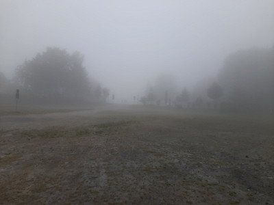
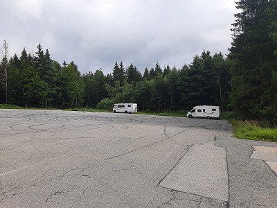
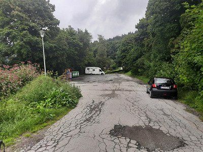
For our upcoming hike on the big Osser, we drove to the hiking car park on the Sahneberg. The driveway ran along a narrow, steep access road.
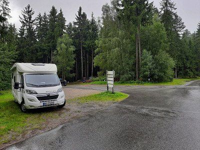
For our upcoming hike on the big Osser, we drove to the hiking car park on the Sahneberg. The driveway ran along a narrow, steep access road.
Today we go on our second hiking tour, we want to go up to the big Osser. According to our planning, 680 meters of altitude must be overcome on the Osser, but yesterday's tour to the "Hoher Bogen" sector was a walk.
We parked in the small hiking car park in Lam-Thürnstein at Cafee Sahneberg, there were no cars here.
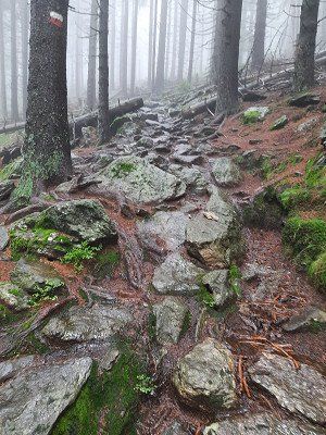
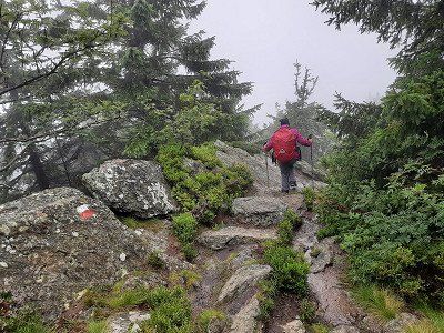
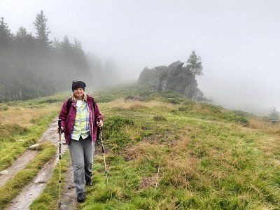
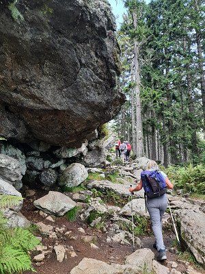
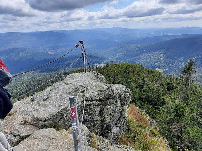
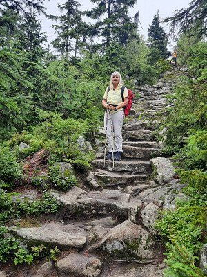
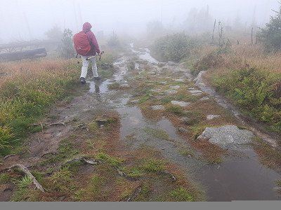
The rainy weather is not exactly inviting for a hike. The path was well signposted, through the forest we went first on forest paths, later on boulders, always steeply uphill. The rain has turned the path into small rivulets in places. In the saddle of the small and large Osser, we first became acquainted with the cold Bohemian wind, a strong wind blows cold air and dense fog from the Bohemian Forest. We're glad about
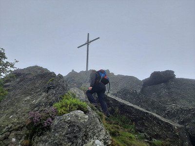
our rain jackets. The last section runs over rock ridges and is secured with ropes to the large Osser summit. (1273m)
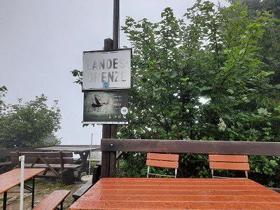
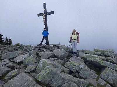
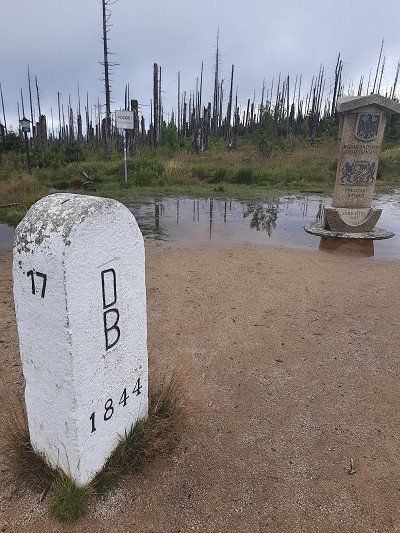
The summit ridge is also the border, signs point this out in German and Czech. We did not stop at the Osser Haus but continued our tour on the small Osser. The path ran again over boulders to the summit, which was 25 meters
We didn't feel like rock climbing to the cross because of the fog, especially for safety reasons and also because of the lack of visibility. Little Osser (1238m)
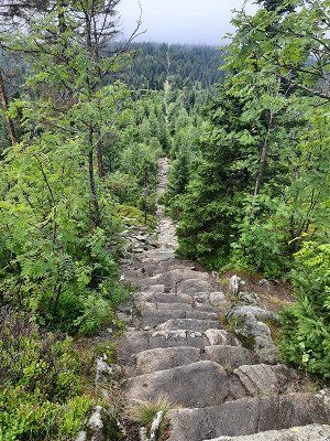
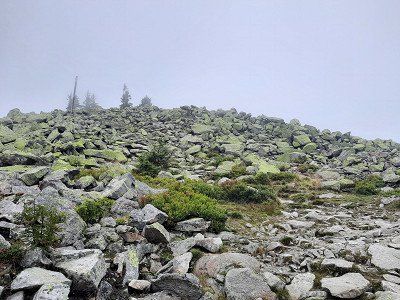
The descent then runs steeply over wet, slippery boulders
leisurely turned into a hiking trail into the valley.
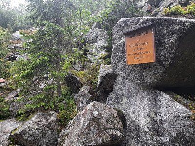
On the way we passed the stone of the Teufelstritt, over which there is a
interesting legend to read.
Arrived at the hiking car park, the sun shone for a short time.
The circular route was about 15 kilometers, you met a few people at the summit, otherwise
we were almost alone in the forest

Today we go on our second hiking tour, we want to go up to the big Osser. According to our planning, 680 meters of altitude must be overcome on the Osser, but yesterday's tour to the "Hoher Bogen" sector was a walk.
We parked in the small hiking car park in Lam-Thürnstein at Cafee Sahneberg, there were no cars here.
The rainy weather is not exactly inviting for a hike. The path was well signposted, through the forest we went first on forest paths, later on boulders, always steeply uphill. The rain has turned the path into small rivulets in places. In the saddle of the small and large Osser, we first became acquainted with the cold Bohemian wind, a strong wind blows cold air and dense fog from the Bohemian Forest. We're glad about
our rain jackets. The last section runs over rock ridges and is secured with ropes to the large Osser summit. (1273m)
The summit ridge is also the border, signs point this out in German and Czech. We did not stop at the Osser Haus but continued our tour on the small Osser. The path ran again over boulders to the summit, which was 25 meters
We didn't feel like rock climbing to the cross because of the fog, especially for safety reasons and also because of the lack of visibility. Little Osser (1238m)
The descent then runs steeply over wet, slippery boulders
leisurely turned into a hiking trail into the valley.
On the way we passed the stone of the Teufelstritt, over which there is a
interesting legend to read.
Arrived at the hiking car park, the sun shone for a short time.
The circular route was about 15 kilometers, you met a few people at the summit, otherwise
we were almost alone in the forest
Upon arrival it was raining again. Air temperature 12°C
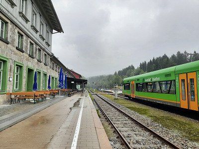
Parking is on the river "Big Rain" Bayerisch Eisenstein
During the Cold War, this was the hard border that ran right through the station.
A border wall was built through the station and tracks, on the German side the end of the world, on the Czech restricted area. Since 1991, trains have been rolling here again across the border to Prague. A historical railway museum is housed in the German part of the station.
With a short walk through the village we took a closer look at the historic train station.
We spent the night in the parking lot.
Upon arrival it was raining again. Air temperature 12°C
Parking is on the river "Big Rain" Bayerisch Eisenstein
During the Cold War, this was the hard border that ran right through the station.
A border wall was built through the station and tracks, on the German side the end of the world, on the Czech restricted area. Since 1991, trains have been rolling here again across the border to Prague. A historical railway museum is housed in the German part of the station.
With a short walk through the village we took a closer look at the historic train station.
We spent the night in the parking lot.
This morning, for the first time in two days, the sun shone warmingly through the windows of the WoMo.
This gives reason to get up and get ready for the hike to the big Arber.
We walked leisurely along the Regen river and the mill canal. After a certain time we left the river and initially went up the forest road in the direction of the Großer Arber, which then turned into a hiking trail and led steeply uphill through the forest.
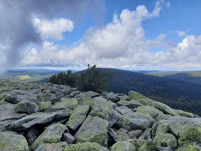
There was a large crowd of visitors at the big Abersee. From here we hiked quickly on to the Arber summit, the signpost indicated 3.5 km. After about 1.5 km it went very steeply on boulders towards the summit. Mass tourism prevailed on the Arber summit. At the top of the Arber it is really crowded compared to our last two days, mountain bikers, hikers, day tourists a colorful mixture cavorted on the summit plateau.
We still walk the summit trail and enjoy the great views over the Bavarian Forest. From up here you can see the Osser, the towers of sector-f, Lusen and the small Arber See deep down in the valley.
After an hour at the summit, we made our way down the Brenner back to Bayrisch Eisenstein. The way back was exclusively on
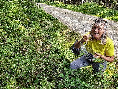
driveways and was good to walk on. On the way we plowed blueberries.


This morning, for the first time in two days, the sun shone warmingly through the windows of the WoMo.
This gives reason to get up and get ready for the hike to the big Arber.
We walked leisurely along the Regen river and the mill canal. After a certain time we left the river and initially went up the forest road in the direction of the Großer Arber, which then turned into a hiking trail and led steeply uphill through the forest.
There was a large crowd of visitors at the big Abersee. From here we hiked quickly on to the Arber summit, the signpost indicated 3.5 km. After about 1.5 km it went very steeply on boulders towards the summit. Mass tourism prevailed on the Arber summit. At the top of the Arber it is really crowded compared to our last two days, mountain bikers, hikers, day tourists a colorful mixture cavorted on the summit plateau.
We still walk the summit trail and enjoy the great views over the Bavarian Forest. From up here you can see the Osser, the towers of sector-f, Lusen and the small Arber See deep down in the valley.
After an hour at the summit, we made our way down the Brenner back to Bayrisch Eisenstein. The way back was exclusively on
driveways and was good to walk on. On the way we plowed blueberries.
Our next stop on our mobile home tour through the Bavarian Forest for the next night is the Tröppelkeller campsite in Zwiesel. 49°00.790'N / 13°12.515'E
The small campsite on the outskirts is really nice and we were warmly welcomed. There are no marked out plots here. The campsite was occupied by four WoMos and bicycle tourists with their tents.
The car park is above the village of Waldhäuser. It is a paved level parking lot. When we arrived it had been lightly drizzling. The place is free.
Despite the bad weather, after the coffee break we set out on a hike up the Lusen.
The car park is above the village of Waldhäuser. It is a paved level parking lot. When we arrived it had been lightly drizzling. The place is free.
Despite the bad weather, after the coffee break we set out on a hike up the Lusen.
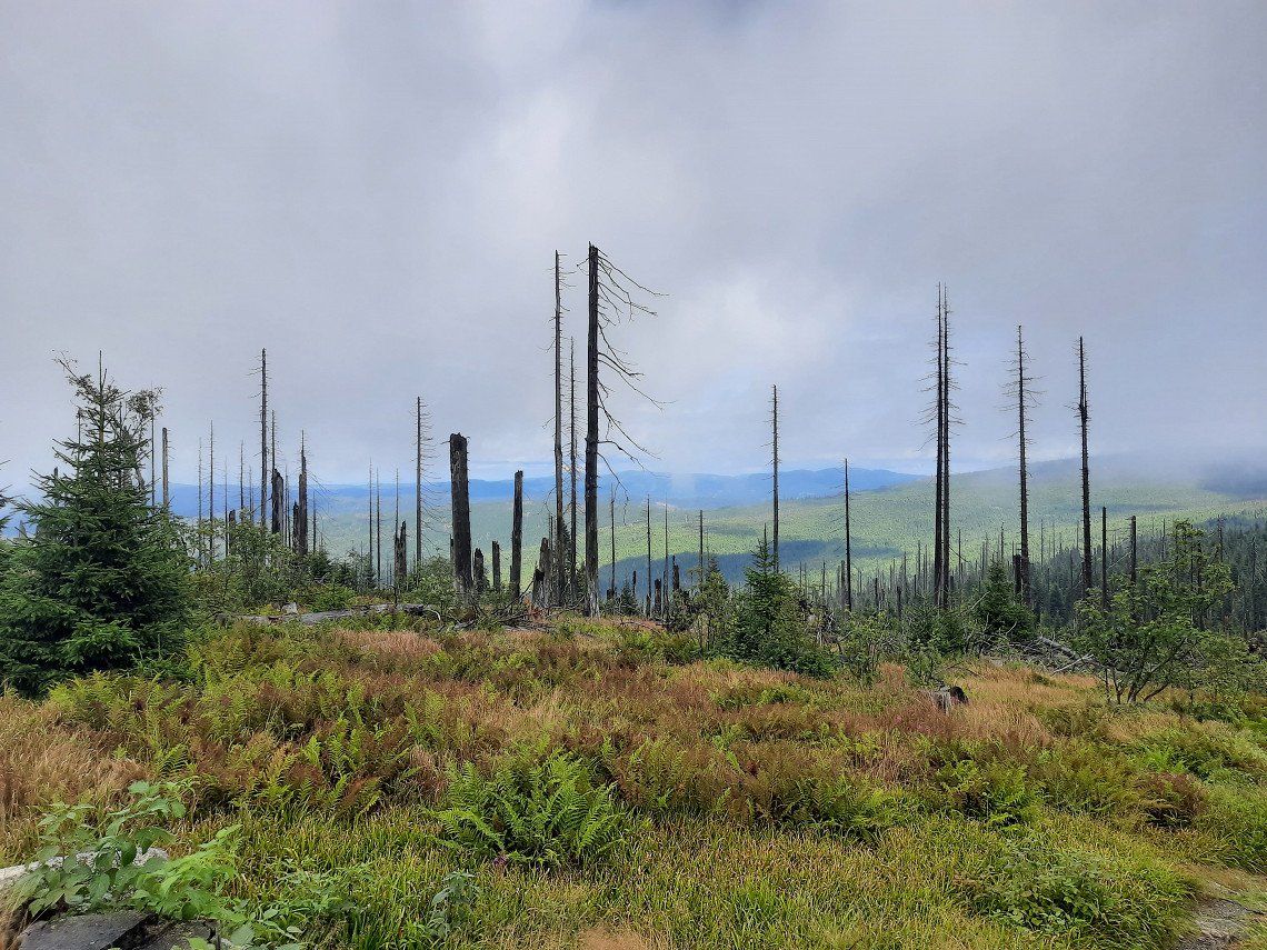
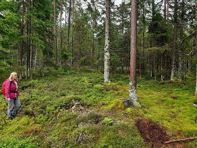
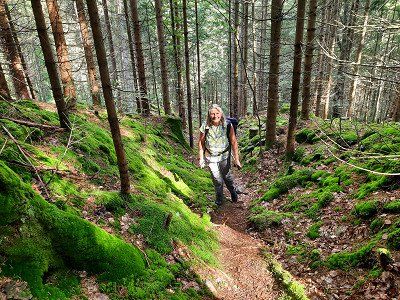
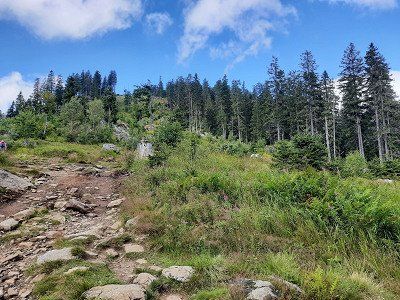
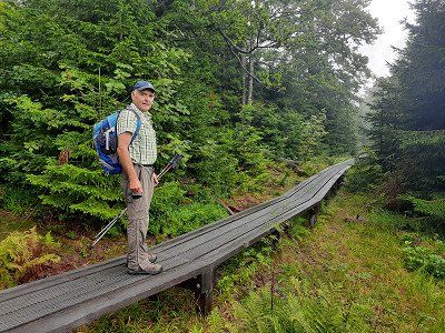
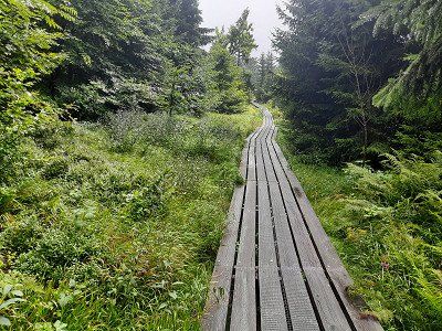
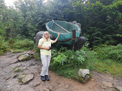
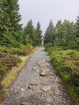
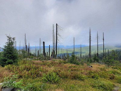
In the drizzle we started our tour on the Lusen. The drizzle that lasted almost the entire tour, we followed the signpost "Lusen / Martinsklause". We soon reached an atmospheric, dark lake, the Martinsklause. The lake was created in the 19th century by the construction of a dam wall for the purpose of timber drift. On a narrow path (signpost: Lusen, Teufelsloch) it went steeply uphill. Slightly descending you reach the Teufelsloch, a gorge section of the "Kleine Ohe" filled with large granite stones. The creek flows beneath the boulders, so you can cross without getting your feet wet. From here you walk on a long wooden footbridge through a picturesque wetland to the Böhmweg refuge. In front of it is the "Glass Ark". Following the summer path to the Lusen, you walk along a gravel path drawn like a ruler. You reach an open plateau with tree skeletons that give the landscape a strangely bizarre character. Expansive fields of blueberries, which turn fiery red in autumn, adorn the floors.
The round summit of the Lusen with the imposing ladder to heaven comes into view. The name hides a long stone staircase made of natural granite blocks, which leads up in a direct line to the summit cross. Looking back at the ladder to heaven In the middle of a sea of granite blocks covered with shimmering yellow-green lichen, you climb step by step up the long stone “ladder to heaven” to the summit cross of the Lusen. We were very lucky when we arrived at the summit, the fog lifted and we had a great view for a short moment. From the summit we followed the signpost to the Lusenschutzhaus, which we reached after a few minutes over rocky steps. A short stop for a short coffee break and to warm up in the Lusenschutzhaus. From there we walked comfortably on a forest road down to the Waldhausreibe (Luse car park) and on to the starting point in Waldhäuser.
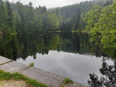
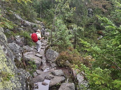
During the night it rained through. The morning is gray. The parking lot was very quiet at night.
Today's destination is Riedelsbach. At the end of the town we found a parking space at the fire station. There was no parking ban.
The hike to the border triangle (14 km; 5.5 hours)
During the night it rained through. The morning is gray. The parking lot was very quiet at night.
Today's destination is Riedelsbach. At the end of the town we found a parking space at the fire station. There was no parking ban.
The hike to the border triangle (14 km; 5.5 hours)We hike to the Steinemeer, Dreiländereck, then on to the summit of the Dreisessel. The starting point is the car park at the fire brigade in Lackenhäuser.
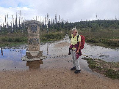
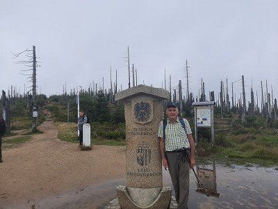
On the way here it rained in places and at the start of the hike the peaks were covered with clouds. The first sight of the tour was the Bohemian Monument. The path was well signposted and runs first on forest roads, then on a small path uphill through the forest. At 1100m altitude we followed the forest road for 2.1 km to the Steinemeer. From the fork in the hiking trail, we continued on a narrow path on boulders to the Steinemeer. We were just before the German - Austrian border. Dreiländereck (1340m) This is the border between the Czech Republic, Austria and Germany.
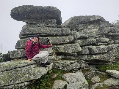
Via the Grenzsteig it goes a bit higher to the Plöckenstein.(1364m) On the way it got really uncomfortable, it started to rain heavily and an ice-cold Bohemian wind swept over the ridge.
Finally we stand at the actual three-chair with soaked clothes. Berggasthof Dreisessel (1323m) Despite the rain we climbed the Dreisesselfesen. The three stone armchairs
A short hole in the clouds allowed a view of the Bavarian National Park.
A stop at the Dreisessel Haus was really good.
Warmed up and strengthened, we went down the shortest route to the starting point in
Lackenhauser.
At the end of the trek, the cloud cover has lifted and the landscape has revealed its
Beauty.
After our return from the hike, we immediately made our way to the Rannastausee. We want to spend the night there.


We hike to the Steinemeer, Dreiländereck, then on to the summit of the Dreisessel. The starting point is the car park at the fire brigade in Lackenhäuser.
On the way here it rained in places and at the start of the hike the peaks were covered with clouds. The first sight of the tour was the Bohemian Monument. The path was well signposted and runs first on forest roads, then on a small path uphill through the forest. At 1100m altitude we followed the forest road for 2.1 km to the Steinemeer. From the fork in the hiking trail, we continued on a narrow path on boulders to the Steinemeer. We were just before the German - Austrian border. Dreiländereck (1340m) This is the border between the Czech Republic, Austria and Germany.
Via the Grenzsteig it goes a bit higher to the Plöckenstein.(1364m) On the way it got really uncomfortable, it started to rain heavily and an ice-cold Bohemian wind swept over the ridge.
Finally we stand at the actual three-chair with soaked clothes. Berggasthof Dreisessel (1323m) Despite the rain we climbed the Dreisesselfesen. The three stone armchairs
A short hole in the clouds allowed a view of the Bavarian National Park.
A stop at the Dreisessel Haus was really good.
Warmed up and strengthened, we went down the shortest route to the starting point in
Lackenhauser.
At the end of the trek, the cloud cover has lifted and the landscape has revealed its
Beauty.
After our return from the hike, we immediately made our way to the Rannastausee. We want to spend the night there.
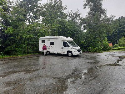
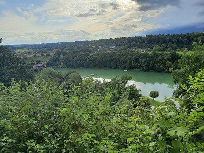
Large three level car park, we preferred the lower car park. The parking spaces are slightly sloping, the WoMo had to compensate with wheel chocks. After our arrival we walked to the lake, in warmer weather it would be a beautiful, inviting bathing lake. After a closer look we saw that we were standing directly on the Austrian border. The dam is close to the border. Just before night fell it started raining again.
Large three level car park, we preferred the lower car park. The parking spaces are slightly sloping, the WoMo had to compensate with wheel chocks. After our arrival we walked to the lake, in warmer weather it would be a beautiful, inviting bathing lake. After a closer look we saw that we were standing directly on the Austrian border. The dam is close to the border. Just before night fell it started raining again.
It rained heavily last night and the sun was shining when we got up in the morning. Irmgard has brought himself to go swimming in the lake before breakfast. The water had
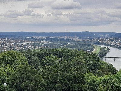
about 16°C, the air temperature was 11°C. On our mobile home tour through the Bavarian Forest we leave the national park and the loneliness, we go to Passau. The distance is
manageable, 31 km into the Danube valley.
It rained heavily last night and the sun was shining when we got up in the morning. Irmgard has brought himself to go swimming in the lake before breakfast. The water had
about 16°C, the air temperature was 11°C. On our mobile home tour through the Bavarian Forest we leave the national park and the loneliness, we go to Passau. The distance is
manageable, 31 km into the Danube valley.
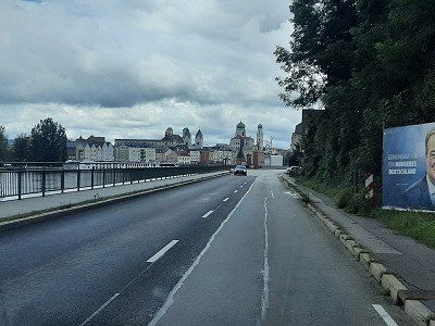
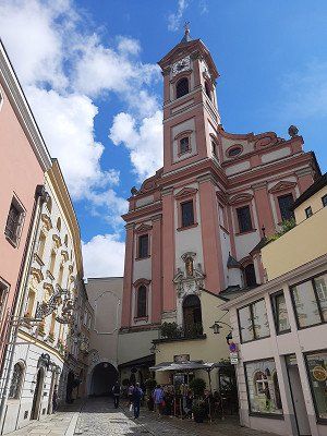
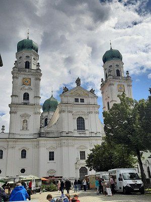
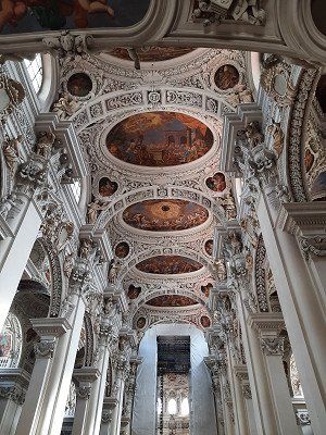
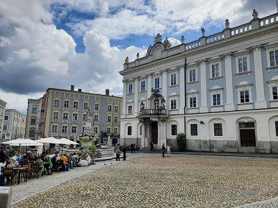
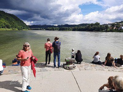
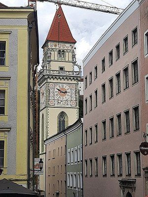
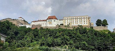
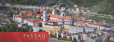
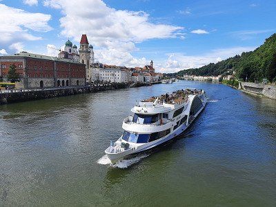
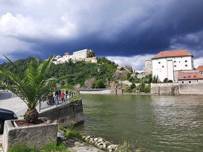
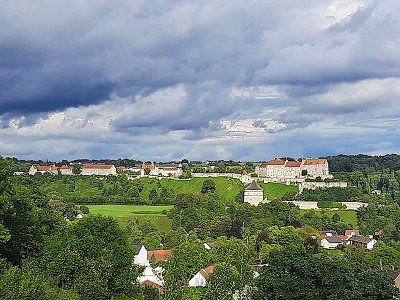
RV park offers generous space but has no facilities. That's why it's free. There were still free spaces on the free parking space at the Ilzbrücke, but it was well occupied. It rained heavily when we arrived, but soon the sun came out again. We got ready to look at the old town. It was about a 3km walk to the center of Passau.
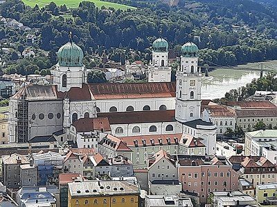
The city backdrop of cathedral, town hall and castle. Around AD 80, the Romans set up a military camp at the confluence of the Danube, Inn and Ilz. In 739, the missionary Boniface founded a diocese here, whose sphere of influence soon extended to Hungary. The bishopric and city became wealthy through the salt trade on the Danube, and from the 13th century the bishops of Passau also exercised secular power as prince bishops.
RV park offers generous space but has no facilities. That's why it's free. There were still free spaces on the free parking space at the Ilzbrücke, but it was well occupied. It rained heavily when we arrived, but soon the sun came out again. We got ready to look at the old town. It was about a 3km walk to the center of Passau.
The city backdrop of cathedral, town hall and castle. Around AD 80, the Romans set up a military camp at the confluence of the Danube, Inn and Ilz. In 739, the missionary Boniface founded a diocese here, whose sphere of influence soon extended to Hungary. The bishopric and city became wealthy through the salt trade on the Danube, and from the 13th century the bishops of Passau also exercised secular power as prince bishops.
We had still reached the WoMo without rain, two kilometers further on our journey it started to rain heavily. The drive took us onto the Autobahn that leads to Linz in Austria. A kilometer before the border there were signs for the Austrian border which briefly panicked us
brought. A relief came when we were just before the border crossing
were able to leave the Autobahn on the German side. We liked the approached pitch so we parked here.
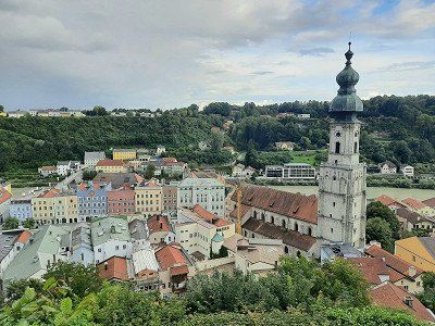
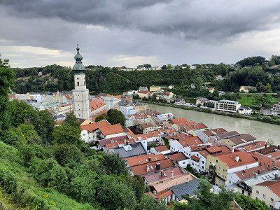
It had rained almost non-stop on the drive here. The sun was shining when we arrived in Burghausen.
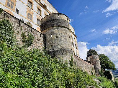
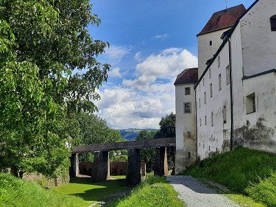
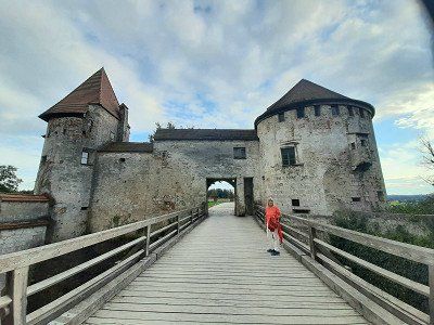
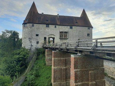
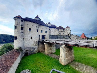
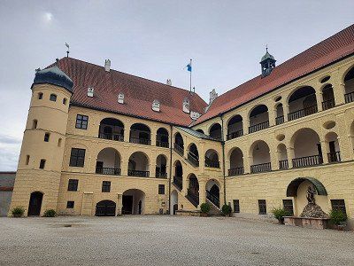
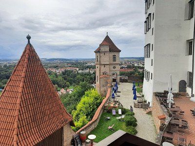
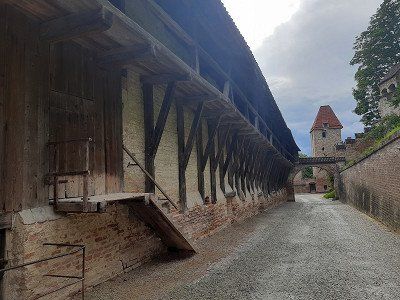
The sunny evening encouraged us to visit the castle again. From the Stellplatt it is 1.5 km via the old town to the castle. Not far from the parking space you have a wonderful view of the entire castle complex. Below the castle on the west side is the blue-green Wöhrsee and a landscape conservation and recreation area that we passed. A footpath with stairs leads to the Vordeburg. The mighty castle towers majestically high above the city, Salzach and Wöhrsee. The longest castle in the world, at 1043 m, actually consists of six fortifications one behind the other. This impregnable fortress was built from defiant walls, 26 towers, bridges, battlements and gates by 1490. The State Castle Museum in the Palas provides access to the ducal living quarters and the State Gallery in Burghausen with medieval paintings.
Unfortunately we were too late at the castle, access to the living quarters is closed at 6 p.m. We were still able to see the castle in its full length. Another footpath with 62 steps takes you to the old town of Burghausen, just as it was around 500 years ago
the Gothic old town below the mighty castle enthroned high above the town of Burghausen. The winding, almost Mediterranean-style streets are lined with slender gabled houses in the typical Inn-Salzach architectural style, but also with some Renaissance, Baroque and Rococo facades.
We could not visit the old town more closely, it started to rain so heavily that we had to shelter under an archway for a long time. When the rain stopped we went back to the WoMo as quickly as possible.


We had still reached the WoMo without rain, two kilometers further on our journey it started to rain heavily. The drive took us onto the Autobahn that leads to Linz in Austria. A kilometer before the border there were signs for the Austrian border which briefly panicked us
brought. A relief came when we were just before the border crossing
were able to leave the Autobahn on the German side. We liked the approached pitch so we parked here.
It had rained almost non-stop on the drive here. The sun was shining when we arrived in Burghausen.
The sunny evening encouraged us to visit the castle again. From the Stellplatt it is 1.5 km via the old town to the castle. Not far from the parking space you have a wonderful view of the entire castle complex. Below the castle on the west side is the blue-green Wöhrsee and a landscape conservation and recreation area that we passed. A footpath with stairs leads to the Vordeburg. The mighty castle towers majestically high above the city, Salzach and Wöhrsee. The longest castle in the world, at 1043 m, actually consists of six fortifications one behind the other. This impregnable fortress was built from defiant walls, 26 towers, bridges, battlements and gates by 1490. The State Castle Museum in the Palas provides access to the ducal living quarters and the State Gallery in Burghausen with medieval paintings.
Unfortunately we were too late at the castle, access to the living quarters is closed at 6 p.m. We were still able to see the castle in its full length. Another footpath with 62 steps takes you to the old town of Burghausen, just as it was around 500 years ago
the Gothic old town below the mighty castle enthroned high above the town of Burghausen. The winding, almost Mediterranean-style streets are lined with slender gabled houses in the typical Inn-Salzach architectural style, but also with some Renaissance, Baroque and Rococo facades.
We could not visit the old town more closely, it started to rain so heavily that we had to shelter under an archway for a long time. When the rain stopped we went back to the WoMo as quickly as possible.
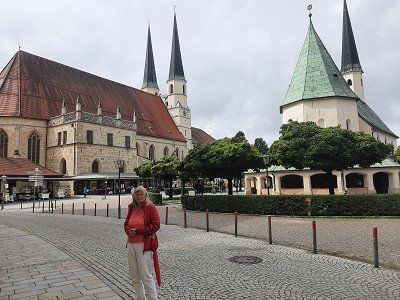
From the parking space it is only a few minutes to the Chapel of Grace.
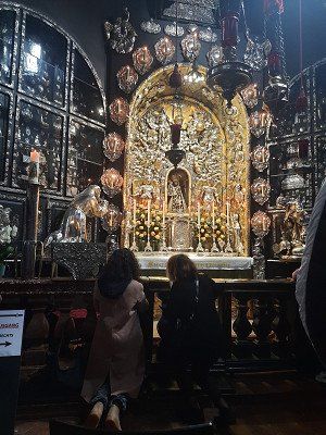
More than a million pilgrims visit the oldest place of pilgrimage in Bavaria, which has been the religious heart of Bavaria for over 500 years. The centrally located Kapellplatz was used solely as a pilgrimage destination. In the middle is the octagonal Chapel of Mercy with the Black Madonna. 2000 plaques tell of their miraculous activity.
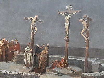
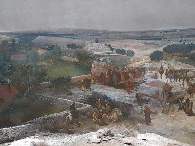
A large-scale panorama in Germany shows a crucifixion of Christ in front of the Jerusalem Panorama and is located just a short distance behind the St. Magdalena Church (Kapellplatz East). The screen surface is approx. 1200 square meters. The panorama is under monument protection and belongs to
UNESCO world cultural heritage. Collegiate Church of St.Philipp and Jakob. The twin-towered parish church of St. Philipp and Jakob, a late Gothic hall church with a cloister from the 13th century.


From the parking space it is only a few minutes to the Chapel of Grace.
More than a million pilgrims visit the oldest place of pilgrimage in Bavaria, which has been the religious heart of Bavaria for over 500 years. The centrally located Kapellplatz was used solely as a pilgrimage destination. In the middle is the octagonal Chapel of Mercy with the Black Madonna. 2000 plaques tell of their miraculous activity.
A large-scale panorama in Germany shows a crucifixion of Christ in front of the Jerusalem Panorama and is located just a short distance behind the St. Magdalena Church (Kapellplatz East). The screen surface is approx. 1200 square meters. The panorama is under monument protection and belongs to
UNESCO world cultural heritage. Collegiate Church of St.Philipp and Jakob. The twin-towered parish church of St. Philipp and Jakob, a late Gothic hall church with a cloister from the 13th century.
To visit the old town, conveniently located large car park, right on the Isar cycle path, it was relatively quiet at night. Where mobile homes are also allowed to park. Landshut was already the capital of Lower Bavaria when today's administrative district was still an incredibly rich duchy and stretched to Reichenhall and Kitzbühel.
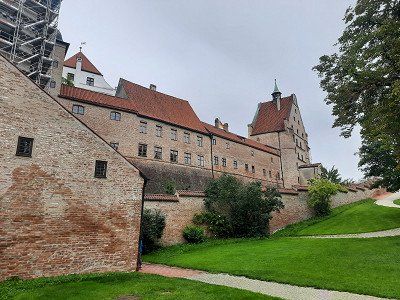
First we made our way to
Trausnitz Castle. The castle rises directly above the old town. In the courtyard garden there is a vantage point over the city of Landshut. It is worth going up the Burgberg for the view alone. The medieval backdrop of the old town under the castle creates a very authentic atmosphere.
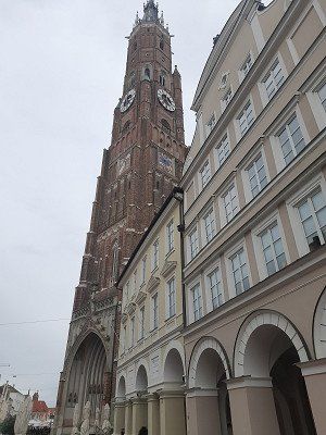
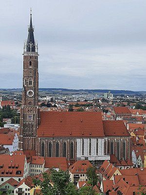
We then visited the St. Martin Church. The 133 m high tower of the late Gothic hall church of St. Martin is the tallest brick building in the world.
When you look at the long, slender columns with their 29 meters in height, you feel tiny in this church building, which otherwise seems rather unadorned at first.
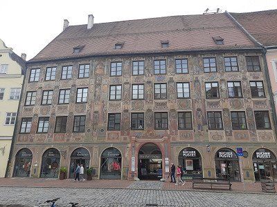
We walk along the main street through the old town, we look at particularly striking house facades, the landscape house is particularly worth seeing.
On our way back to the parking lot we pass the remains of the old city wall and the city gate.
We stayed the night but left early in the morning.


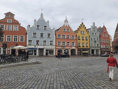
To visit the old town, conveniently located large car park, right on the Isar cycle path, it was relatively quiet at night. Where mobile homes are also allowed to park. Landshut was already the capital of Lower Bavaria when today's administrative district was still an incredibly rich duchy and stretched to Reichenhall and Kitzbühel.
First we made our way to
Trausnitz Castle. The castle rises directly above the old town. In the courtyard garden there is a vantage point over the city of Landshut. It is worth going up the Burgberg for the view alone. The medieval backdrop of the old town under the castle creates a very authentic atmosphere.
We then visited the St. Martin Church. The 133 m high tower of the late Gothic hall church of St. Martin is the tallest brick building in the world.
When you look at the long, slender columns with their 29 meters in height, you feel tiny in this church building, which otherwise seems rather unadorned at first.
We walk along the main street through the old town, we look at particularly striking house facades, the landscape house is particularly worth seeing.
On our way back to the parking lot we pass the remains of the old city wall and the city gate.
We stayed the night but left early in the morning.
Route
Show newest first- 48.1981 8.6954
- 48° 11' 53.2" N 8° 41' 43.3" E
- 48.7186 10.7778
- 48° 43' 6.9" N 10° 46' 40.1" E
- 48.803 11.7671
- 48° 48' 10.8" N 11° 46' 1.5" E
- 48.8177 11.8508
- 48° 49' 3.8" N 11° 51' 2.8" E
Schön ist der Stadtplatz mit den eng stehenden Giebelhäusern und dem Brauereigasthof ›Zum Kuchlbauer‹. Das Wahrzeichen der Brauerei, der Kuchlbauer Turm, wurde von Friedensreich
Hundertwasser (1928-2000) geplant, allerdings erst 2010 eröffnet. Friedensreich Hundertwasser hat sich mit einem bemerkenswerten Architekturprojekt in Abensberg verewigt: das Wahrzeichen der
Kuchlbauer Brauerei, der Kuchlbauer Turm, ist ein Werk des weltbekannten Künstlers. Eine Brauerei ist so Teil eines Kunstwerks und ein Kunstwerk zum Teil einer Brauerei geworden. Eine solche Kombination ist wohl einmalig und lässt sich in kein herkömmliches touristisches Schema einordnen. Runde Formen, tanzende Fenster, wellige Böden und organische Linien, Zwiebeltürme und Pflanzen, das sind die Elemente Hundertwassers für menschengerechtes Bauen im Einklang mit der Natur.
- 48.8991 11.8201
- 48° 53' 56.9" N 11° 49' 12.3" E
- 48.9184 11.8866
- 48° 55' 6.3" N 11° 53' 11.6" E
- 49.0311 12.2241
- 49° 1' 52.1" N 12° 13' 26.7" E
- 49.2239 12.6621
- 49° 13' 25.9" N 12° 39' 43.5" E
- 49.2409 12.9679
- 49° 14' 27.2" N 12° 58' 4.4" E
Morgendämmerung mit den ersten Sonnenstrahlen auf dem Parkplatz am Skicenter bei Neukirchen-Heilig Blut, wo unsere Wanderung zum Hohen Bogen begann. Der Hohe Bogen ist die nördlichste Bergbastion des Bayerischen Waldes, im Bundesland Bayern in der Oberpfalz im Landkreis Cham, und ein Aussichtsphänomen mit fast fünf Tausendern:
Der höchste ist der Schwarzriegel mit 1.079m, gefolgt vom Eckstein mit 1.073 m Höhe, am Ahornriegel (1.050 m) befindet sich die Sesselbahn-Bergstation, über den Bärenriegel (1.017 m) führt ein stiller Waldpfad und der Burgstall (976 m).
Das Wetter hatte sich verschlechtert Nieselregen begleitete uns am Anfang der Tour. Wir wählten den Touristenweg zum Pürzerriegel (923m). Unterwegs verloren wir kurz die Route und mussten umkehren, dass wir wieder auf unsere geplante Tour kamen. Wir drehten eine Schleife um den Schmidtriegel (915m) und wandern zur Forstdiensthütte. Wir schlugen den Baierweg (Bergsteig) über den Farrenruck (979m) ein und kommen zum Bärenriegel. Der Bärenriegel misst 1.017m. Mit
Baumbegleitung geht es weiter hinauf zu einem weiteren Gesellen des Hohenbogens, dem Eckstein (1.073m) mit dem soweit stillgelegten Fernmeldesektor F, wobei wir hier auf rund 1.043m sind.
Dichter Nebel verhinderte die Aussicht und die Aussichtsplattform war auch
geschlossen. Auf dem sagenumwobenen Nordwestpfeiler des Hohen Bogens gründete Graf Albert III.
von Bogen um 1190 eine Burg, doch die Anlage blieb unvollendet.
Der Hohe Bogen ist ein 8 km langen Höhenzug im Bayerischen Wald. Am Ahornriegel (1.050m) mit Ski und Gastronomie, einer Bergkapelle und einer Aussicht namens Schönblick. Auf einem
Asphaltweg ging es kurz bergab zum Gasthaus "Schönblick" In der wir die Mittagsrast machten.
Nach und nach wandern wir abwärts zum Kagerstein (793m), nebst Aussichtspunkt
Kagerstein und auch auf schmalen Wurzelwegen zurück zum Parkplatz beim
Skicenter.
- 49.2654 12.9678
- 49° 15' 55.6" N 12° 58' 4" E
- 49.1484 12.8351
- 49° 8' 54.2" N 12° 50' 6.3" E
- 49.1976 12.9962
- 49° 11' 51.4" N 12° 59' 46.3" E
Der heutige Blick aus dem WoMo war nicht erfreulich, außer Nebel sieht man nichts. Das angrenzende Gasthaus ist nur leicht zu erkennen. Die außen Teperatur lag bei 8°C. Wir mussten im WoMo heizen, es ist heute morgen richtig kalt und regnerisch. Der Parkplatz liegt auf 904 m. Heute wollten wir eine Wanderung auf den Großen Osser unternehmen mal sehen wie sich das Wetter
noch entwickelt. Ich glaube es gibt ein Ruhetag im WoMo.
Wir entschlossen uns zur Weiterfahrt, mit der Hoffnung, dass sich das Wetter bessert.
- 49.1943 13.0729
- 49° 11' 39.6" N 13° 4' 22.5" E
Heute geht es auf unsere zweite Wandertour, wir wollen hoch zum großen Osser. Nach unserer Planung sind auf den Osser, 680 Höhenmeter zu überwinden, dagegen war die Tour gestern zum Sector-f "Hoher Bogen" ein Spaziergang.
Wir parkten auf dem kleinen Wanderparkplatz in Lam-Thürnstein beim Cafee Sahneberg, keine Autos standen hier.
Das regnerische Wetter ist nicht gerade einladend für eine Wanderung. Der Weg war gut ausgeschildert, durch den Wald ging es zuerst auf Forstwegen, später auf Blockgestein immer steil bergauf. Der Regen hat den Weg stellenweise in kleine Bachrinnsale verwandelt. Im Sattel des kleinen und großen Osser machten wir das erste Mal Bekanntschaft mit dem kalten Böhmerwind, ein kräftiger Wind bläst kalte Luft und dichten Nebel aus dem Böhmerwald herüber. Wir sind froh über
unsere Regenjacken. Der letzte Abschnitt verläuft über Felsrippen und ist mit Seilen gesichert auf den großen Osser Gipfel.(1273m)
Der Gipfelgrat ist gleichzeitig die Grenze, Hinweisschilder weisen auf deutsch und tschechisch darauf hin. Eine Einkehr im Osser Haus machten wir nicht sondern setzten unsere Tour auf den kleinen Osser fort. Der Weg verlief wieder über Blockgestein zum Gipfel, die 25 Meter
Felsklettern zum Kreuz hatten wir wegen des Nebels keine Lust mehr, zumal aus Sicherheitsgründen und auch wegen keiner Sicht. Kleiner Osser (1238m)
Der Abstieg verläuft dann steil über nasses, rutschiges Blockgestein das dann
gemächlich in einen Wanderpfad ins Tal überging.
Unterwegs kamen wir am Stein des Teufelstritt vorbei, über den es eine
interessante Sage zu lesen gab.
Am Wanderparkplatz angekommen schien die Sonne kurzfristig.
Rund 15 Kilometer war der Rundweg, am Gipfel traf man ein paar Menschen, sonst
waren wir im Wald fast alleine unterwegs
- 49.1222 13.2024
- 49° 7' 20" N 13° 12' 8.8" E
Heute früh schien nach zwei Tagen zum ersten Mal am Morgen die Sonne wärmend durch die Fenster ins WoMo.
Das gibt Anlass zum Aufstehen und sich für die Wanderung auf den großen Arber fertig zumachen.
Es ging gemächlich am Fluss Regen und dem Mühlenkanal entlang. Nach einer gewissen Zeit verließen wir den Fluss und gingen zunächst mit leichter Steigung das Waldsträßchen Richtung Großer Arber weiter der dann in ein Wanderweg überging und steil durch den Wald aufwärts führte.
Am großen Abersee herrschte ein großer Besucherantrang. Ab hier wanderten wir zügig weiter auf den Arber Gipfel, das Wegschild gab 3,5 km an. Nach etwa 1,5 km ging es zuteil sehr steil auf Blockgestein Richtung Gipfel. Auf dem Arber Gipfel herrschte Massentourismus. Oben am Arber ist es im Vergleich zu unseren letzten zwei Tagen richtig voll, Mountainbiker, Wanderer, Tagestouristen eine bunte Mischung tummelte sich auf dem Gipfelplateau.
Wir laufen noch den Gipfelrundweg und genießen die tollen Aussichten über den Bayerischen Wald. Von hier oben sieht man den Osser, die Türme vom sector-f, Lusen und den kleinen Arber See tief unten im Tal.
Nach einer Stunde Gipfelaufenthalt machten wir uns auf den Abstieg über den Brenner zurück nach Bayrisch Eisenstein. Der Rückweg verlief ausschließlich auf
Fahrwegen und war gut zu gehen. Unterwegs pflügten wir noch Heidelbeeren.
- 49.0178 13.2379
- 49° 1' 3.9" N 13° 14' 16.6" E
- 48.9289 13.463
- 48° 55' 44" N 13° 27' 47" E
Bei Nieselregen starteten wir unsere Tour auf den Lusen. Der Nieselregen der fast auf der ganzen Tour anhielt, folgten wir dem Wegweiser „Lusen / Martinsklause“. Bald erreichten wir einen stimmungsvollen, dunklen See, die Martinsklause. Der See entstand im 19. Jahrhundert durch den Bau einer Staumauer zum Zweck der Holztrift. Auf einem schmalen Weg (Wegweiser: Lusen, Teufelsloch) ging es steil bergan. Leicht fallend erreicht man das Teufelsloch, einen mit großen Granitsteinen gefüllten Schluchtabschnitt der „Kleinen Ohe“. Der Bach fließt unterhalb der Blöcke dahin, so dass man trockenen Fußes queren kann. Von hier geht man auf einem langen Holzsteg durch ein malerisches Feuchtgebiet zur Böhmweg-Schutzhütte. Davor steht die „Glasarche“ Dem Sommerweg zum Lusen folgend, zieht man auf einem Kiesweg, der wie mit einem Lineal gezogen ist, dahin. Man erreicht eine freie Hochebene mit Baumgerippen, die der Landschaft einen seltsam bizarren Charakter verleihen ausgedehnte Blaubeerfelder, die sich im Herbst feuerrot verfärben, schmücken die Böden.
Die runde Gipfelkuppe des Lusen mit der imposanten Himmelsleiter rückt ins Blickfeld. Hinter dem Namen verbirgt sich eine lange Steintreppe aus naturbelassenen Granitblöcken, die in einer direkten Linie zum Gipfelkreuz hinaufleitet. Blick zurück auf die Himmelsleiter Mitten in einem Meer von Granitblöcken, die mit schimmernden gelbgrünen Flechten überzogen sind, steigt man Stufe um Stufe auf der langen steinernen „Himmelsleiter“ hinauf zum Gipfelkreuz des Lusen. Wir hatten großes Glück bei unserer Ankunft auf dem Gipfel lichtete sich der Nebel und wir hatten eine kurzen Augenblick eine tolle Weitsicht. Vom Gipfel aus folgten wir dem Wegweiser zum Lusenschutzhaus, welches nach wenigen Minuten über felsige Stufen erreichten. Eine kurze Einkehr für eine kurze Kaffeepause und zum Aufwärmen im Lusenschutzhaus. Von dort marschierten wir dann auf einer Forststraße gemütlich hinab zur Waldhausreibe (Lusenparkplatz) und weiter zum Ausgangspunkt in Waldhäuser.
- 48.7479 13.7822
- 48° 44' 52.3" N 13° 46' 55.8" E
Wir wandern zum Steinemeer, Dreiländereck, dann weiter auf den Gipfel des Dreisessel. Ausgangspunkt ist der Parkplatz bei der Feuerwehr in Lackenhäuser.
Bei der Anfahrt hierher regnete es stellenweise und beim Start der Wanderung waren die Gipfel mit Wolken verhangen. Die erste Sehenswürdigkeit der Tour war das Böhmer Denkmal. Der Weg war gut ausgeschildert und verläuft zuerst auf Forstwegen, weiter auf einem kleinem Pfad durch den Wald bergauf. Bei 1100m Höhe folgten wir dem Waldsträßchen 2,1 km eben zum Steinemeer. Ab der Wanderweggabelung ging es auf Blockgestein auf schmalem Pfad weiter zum Steinemeer. Wir standen kurz vor der deutsch - österreichischen Grenze. Dreiländereck (1340m) Hier ist die Grenze zwischen Tschechien, Österreich und Deutschland.
Über den Grenzsteig geht es noch ein Stück höher zum Plöckenstein.(1364m) Unterwegs wurde es richtig ungemütlich, es fing stark an zu regnen und ein eiskalter Böhmerwind fegte über den Grat.
Endlich stehen wir am eigentlichem Dreisessel mit durchnässter Kleidung. Berggasthof Dreisessel (1323m) Trotz Regen bestiegen wir noch den Dreisesselfesen. Die drei steinernen Sessel
Ein kurzes Wolkenloch ermöglichte noch einen Ausblick zum Bayrischen Nationalpark.
Eine Einkehr im Dreisessel Haus tat richtig Gut.
Aufgewärmt und gestärkt ging es abwärts auf kürzestem Weg zum Ausgangspunkt in
Lackenhäuser.
Am Ende der Wanderung, die Wolkendecke hat sich aufgetan und die Landschaft zeigte seine
Schönheit.
Nach unserer Rückkehr von der Wanderung machten wir uns gleich auf den Weg zum Rannastausee. Dort wollen wir die Nacht verbringen.
- 48.5699 13.7658
- 48° 34' 11.6" N 13° 45' 57" E
Heute Nacht hatte es stark geregnet und morgens beim Aufstehen schien die Sonne. Irmgard hat sich überwunden vor dem Frühstück in den See zum eine Runde schwimmen zu gehen. Das Wasser hatte
ca.16°C, die Lufttemperatur lag bei11°C. Auf unserer Wohnmobiltour durch den Bayerischen Wald verlassen wir nun den Nationalpark und die Einsamkeit, es geht nach Passau. Die Entfernung ist
überschaubar, 31 km in das Donautal.
- 48.5791 13.3833
- 48° 34' 44.7" N 13° 22' 59.8" E
- 48.1567 12.8128
- 48° 9' 24" N 12° 48' 46.2" E
- 48.2237 12.6799
- 48° 13' 25.3" N 12° 40' 47.8" E
- 48.5323 12.1452
- 48° 31' 56.2" N 12° 8' 42.7" E
- 48.1981 8.6954
- 48° 11' 53.2" N 8° 41' 43.3" E
Travelogue
Route: B27 via Tübingen - Echterdingen onto the A8.
Exit Nürtingen - Göppingen - Heidenheim -Donauwörth- Ingolstadt-Neustadt (bathing lake).
We left the A8 near Nürtingen, the traffic radio reported a 10 km traffic jam on the Eichelberg, we decided to drive overland. Due to extensive detour routes, we needed an hour and a half longer than the navigation system told us at the beginning of the trip. From Donauwörth it worked
very good, little traffic was on the road.
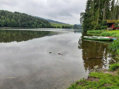
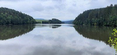
Arrived at the bathing lake we found enough free parking spaces. Overnight parking is permitted and free of charge. After the coffee break we had to go swimming right away. We were amazed at the bathing lake, even with a sandy beach. The water is very clean and the water temperature was pleasantly warm.
Air temperature was 26°C.
We stood at the edge of the squares and had a very quiet night.
We made the first sightseeing stop in Abensberg. The city is also the starting point of the German Hopfenstraße and ›Gateway to the Hallertau‹, the largest hop-growing region in the world. The many hop fields on the way there were striking. Architectural witnesses of the past are the castle from the 12th century, the Carmelite church "Our Lady", the parish church of St. Barbara with a rococo tower and the late medieval ducal case.
We made the first sightseeing stop in Abensberg. The city is also the starting point of the German Hopfenstraße and ›Gateway to the Hallertau‹, the largest hop-growing region in the world. The many hop fields on the way there were striking. Architectural witnesses of the past are the castle from the 12th century, the Carmelite church "Our Lady", the parish church of St. Barbara with a rococo tower and the late medieval ducal case.
The town square with the narrow gabled houses and the ›Zum Kuchlbauer‹ brewery inn is beautiful. The landmark of the brewery, the Kuchlbauer Tower, was built by Friedensreich
Hundertwasser (1928-2000) planned, but only opened in 2010. Friedensreich Hundertwasser has immortalized himself with a remarkable architectural project in Abensberg: the landmark of the
Kuchlbauer Brewery, the Kuchlbauer Tower, is a work of the world-renowned artist. A brewery has thus become part of a work of art and a work of art has become part of a brewery. Such a combination is probably unique and cannot be classified in any conventional tourist scheme. Round shapes, dancing windows, wavy floors and organic lines, onion domes and plants, these are Hundertwasser's elements for humane building in harmony with nature.
After the interesting town of Abensberg we drive to the parking lot of the Weltenburg Monastery. The parking lot is on the banks of the Danube and you still have to walk 600 m along the Danube to the monastery. There was a lot going on in the huge beer garden, the first guests were already having lunch. Weltenburg Monastery was founded at the beginning of the 7th century and is considered to be the original Bavarian monastery. In the monastery tavern you can drink beer from the oldest monastery brewery in the world (since 1050). The Asam brothers decorated the monastery church of St. George and Martin 1716-39 with magnificent
stucco work and theatrical light effects. We walked up the hill to the
Frauenkapelle, continue to the excavations of a former Roman castle.
The Weltenburg Danube breakthrough is supposed to be a unique natural experience that we wanted to see from above, so we walked the hiking trail in the direction of Kehlheim to a vantage point from which you should see the Danube breakthrough. (Walking time approx. 30 min.) Is not recommended, instead we walked along the Danube to the pier, where unfortunately you can see very little of the Danube breakthrough.
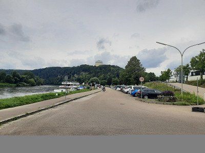
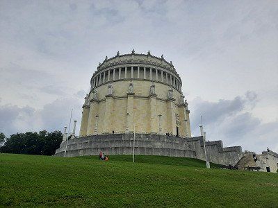
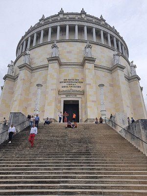
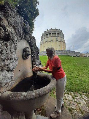
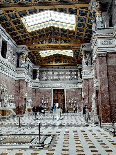
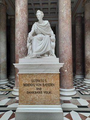
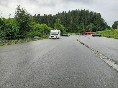
Large free parking lot on the Danube, the parking space for mobile homes is right next to it, which we didn't use. We only intended to look at the Liberation Hall.
We quickly run up to the Liberation Hall. The hall built by King Ludwig I of Bavaria (1842) for the victories over Napoleon is impressive. The dimensions of the 48 m high domed hall are revealed on a tour of the columned gallery on the upper floor.
We only looked at the Liberation Hall from the outside and were amazed at the mighty scale of the hall. The ticket for visiting the hall had to be bought in the tourist information, we didn't feel like going there anymore.
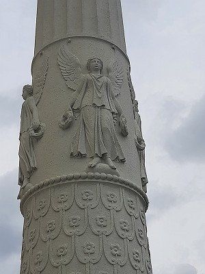
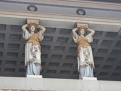
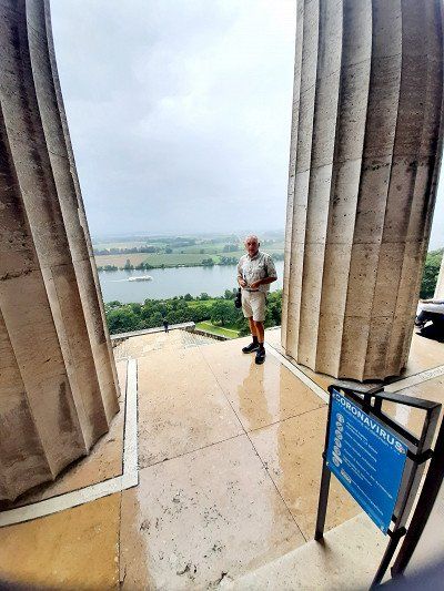
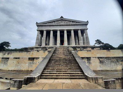
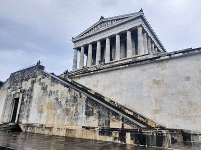
First it goes on to Germany's hall of fame - the Walhalla .
Before we could go up the few steps from the large parking lot, we had to wait out a heavy rain in the camper. After waiting for half an hour we stood in front of the truly impressive building. Admission to the hall cost 4 euros, but it's definitely worth it and the view over the Danube valley is free.
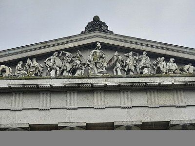
High above the Danube, not far from Regensburg, the Walhalla was built in ancient Greek style in 1830 by King Ludwig I of Bavaria. 130 busts of German personalities stand in the impressive building, the last entry for German-speaking people
Personalities were Heinrich Heine and Sophie Scholl.
First it goes on to Germany's hall of fame - the Walhalla .
Before we could go up the few steps from the large parking lot, we had to wait out a heavy rain in the camper. After waiting for half an hour we stood in front of the truly impressive building. Admission to the hall cost 4 euros, but it's definitely worth it and the view over the Danube valley is free.
High above the Danube, not far from Regensburg, the Walhalla was built in ancient Greek style in 1830 by King Ludwig I of Bavaria. 130 busts of German personalities stand in the impressive building, the last entry for German-speaking people
Personalities were Heinrich Heine and Sophie Scholl.
Cham is located directly on the Regen river, which makes a bend there, and consequently it is simply called 'City on the Rainbow'. In the 8th century, monks founded the Chammünster monastery nearby in order to evangelize the eastern countries from here.
We made a short stop here.
The town hall is the eye-catcher of the Cham market square. Its bay window is adorned with a municipal and an Upper Palatinate coat of arms.
One of the three water-spouting figures in the market fountain depicts Count Nikolaus von Luckner, who was born in Cham. He made a career in the French army under Napoleon and must have been quite popular with his soldiers, because Claude Joseph dedicated Rouget de Lisle to him
the same marching song that later became the national anthem of France.
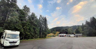
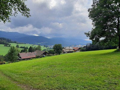
Neukirchen bei Heiligen Blut is a resort in beautiful nature at the foot of the Hohenbogen (1079 m). Where the Bavarian Forest merges into the Bohemian Forest. Our destination for the day is the parking lot at the valley station of the Hohe Bogen chairlift. A huge parking lot and completely empty we met him. The only drawback is the crooked position. The wheel chocks are not quite enough to stand up straight. Besides us, there was another WoMo in the parking lot. The evening was rainy, we didn't even feel like going to the ski center with the leisure activities (summer toboggan run ..) us
to look at
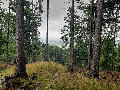
Dawn with the first rays of sunshine on the parking lot at the ski center near Neukirchen-Heilig Blut, where our hike to the Hoher Bogen began. The Hohe Bogen is the northernmost mountain bastion of the Bavarian Forest, in the state of Bavaria in the Upper Palatinate in the district of Cham, and a panoramic phenomenon with almost five thousand meters:
The highest is the Schwarzriegel at 1,079m, followed by the Eckstein at 1,073m, the chairlift mountain station is on the Ahornriegel (1,050m), a quiet forest path leads over the Bärenriegel (1,017m) and the Burgstall (976m).
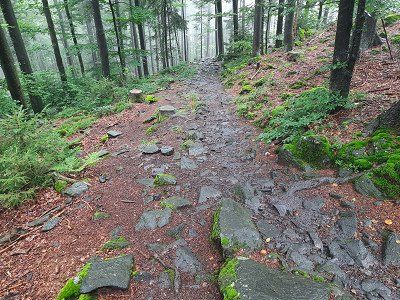
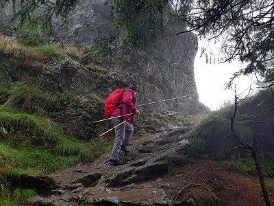
The weather had deteriorated and drizzle accompanied us at the beginning of the tour. We chose the tourist route to the Pürzerriegel (923m). On the way we briefly lost the route and had to turn back to get back on our planned tour. We made a loop around the Schmidtriegel (915m) and hike to the forest service hut. We took the Baierweg (mountain trail) over the Farrenruck (979m) and came to the Bärenriegel. The Bärenriegel measures 1,017m. With
Accompanied by trees, we continue up to another part of the Hohenbogen, the Eckstein (1,073m) with the telecommunications sector F, which has been shut down so far, whereby we are at around 1,043m here.
Dense fog prevented the view and the viewing platform was too
closed. On the legendary north-west pillar of the Hoher Bogen, Count Albert III founded.
von Bogen built a castle around 1190, but the complex remained unfinished.
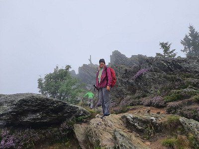
The Hohe Bogen is an 8 km long ridge in the Bavarian Forest. On the Ahornriegel (1,050m) with skiing and gastronomy, a mountain chapel and a view called Schönblick. on one
Asphalt road it went downhill to the inn "Schönblick" where we made the lunch break.
Gradually we hike down to the Kagerstein (793m), along with a vantage point
Kagerstein and also on narrow root paths back to the parking lot at
ski center.
Dawn with the first rays of sunshine on the parking lot at the ski center near Neukirchen-Heilig Blut, where our hike to the Hoher Bogen began. The Hohe Bogen is the northernmost mountain bastion of the Bavarian Forest, in the state of Bavaria in the Upper Palatinate in the district of Cham, and a panoramic phenomenon with almost five thousand meters:
The highest is the Schwarzriegel at 1,079m, followed by the Eckstein at 1,073m, the chairlift mountain station is on the Ahornriegel (1,050m), a quiet forest path leads over the Bärenriegel (1,017m) and the Burgstall (976m).
The weather had deteriorated and drizzle accompanied us at the beginning of the tour. We chose the tourist route to the Pürzerriegel (923m). On the way we briefly lost the route and had to turn back to get back on our planned tour. We made a loop around the Schmidtriegel (915m) and hike to the forest service hut. We took the Baierweg (mountain trail) over the Farrenruck (979m) and came to the Bärenriegel. The Bärenriegel measures 1,017m. With
Accompanied by trees, we continue up to another part of the Hohenbogen, the Eckstein (1,073m) with the telecommunications sector F, which has been shut down so far, whereby we are at around 1,043m here.
Dense fog prevented the view and the viewing platform was too
closed. On the legendary north-west pillar of the Hoher Bogen, Count Albert III founded.
von Bogen built a castle around 1190, but the complex remained unfinished.
The Hohe Bogen is an 8 km long ridge in the Bavarian Forest. On the Ahornriegel (1,050m) with skiing and gastronomy, a mountain chapel and a view called Schönblick. on one
Asphalt road it went downhill to the inn "Schönblick" where we made the lunch break.
Gradually we hike down to the Kagerstein (793m), along with a vantage point
Kagerstein and also on narrow root paths back to the parking lot at
ski center.
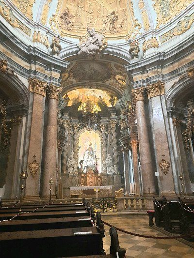
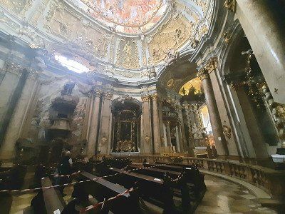
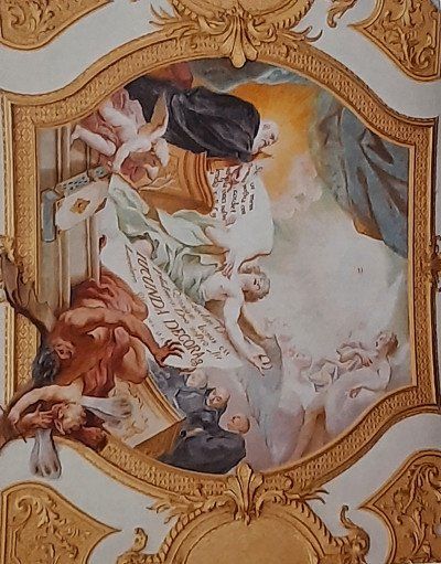
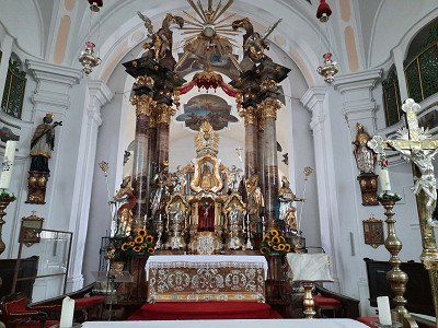
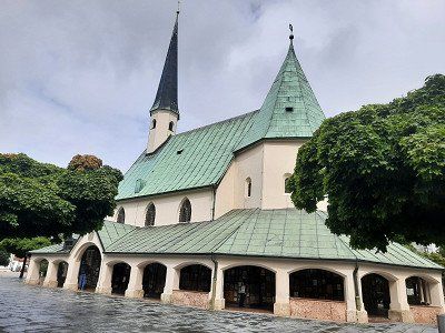
As we continued our journey, we had to make a detour to the pilgrimage church of the Nativity of the Virgin Mary with the neighboring Franciscan monastery. The baroque pilgrimage church with the onion dome
the tower rises in a broad valley, to the east of the High Arch. In her double altar is the miraculous image with the forked head under a glass dome.
The church with a nave from 1610 and the tower from the late 17th century was designed in this way in 1720. It is connected by the altar to the Franciscan church behind it.
The Franciscans have been taking care of the pilgrimage in Cham since the 17th century and received permission to build a monastery and a monastery church in 1658.
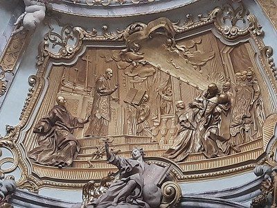
The place name is somewhat unusual and has its origins in the pilgrimage history associated with a legend (peasant woman vs. Hussites). In 1420, a Hussite tried to destroy the head of the figure of Mary with a sword, whereupon "blood" flowed from this head.
As we continued our journey, we had to make a detour to the pilgrimage church of the Nativity of the Virgin Mary with the neighboring Franciscan monastery. The baroque pilgrimage church with the onion dome
the tower rises in a broad valley, to the east of the High Arch. In her double altar is the miraculous image with the forked head under a glass dome.
The church with a nave from 1610 and the tower from the late 17th century was designed in this way in 1720. It is connected by the altar to the Franciscan church behind it.
The Franciscans have been taking care of the pilgrimage in Cham since the 17th century and received permission to build a monastery and a monastery church in 1658.
The place name is somewhat unusual and has its origins in the pilgrimage history associated with a legend (peasant woman vs. Hussites). In 1420, a Hussite tried to destroy the head of the figure of Mary with a sword, whereupon "blood" flowed from this head.
First we drove past the parking lot and turned in Blaibach. In town we quickly bought some bread. Except for two cars, the approached parking lot was empty, had enough space
stand. Actually, we had planned and approached the parking lot to swim in the lake.
The weather was not inviting for swimming, it was raining. We tried an evening walk
along the lake, but soon turned back, the path was wet and dirty. An annoying booming noise from the hydroelectric power station and the noise from the road leading by made us change parking spaces.
Subject to a fee of 2.-€
Large parking lot when approaching it started raining again. Today we did nothing more, we spent the evening in the WoMo.
Subject to a fee of 2.-€
Large parking lot when approaching it started raining again. Today we did nothing more, we spent the evening in the WoMo.
Today's view from the WoMo was not pleasant, apart from fog you can't see anything. The adjoining inn is only slightly visible. The outside temperature was 8°C. We had to heat the WoMo, it's really cold and rainy this morning. The parking lot is at 904 m. Today we wanted to hike up the Great Osser and see how the weather turns out
still developed. I think there is a rest day in the WoMo.
We decided to continue our journey, hoping that the weather would improve.
For our upcoming hike on the big Osser, we drove to the hiking car park on the Sahneberg. The driveway ran along a narrow, steep access road.
For our upcoming hike on the big Osser, we drove to the hiking car park on the Sahneberg. The driveway ran along a narrow, steep access road.
Today we go on our second hiking tour, we want to go up to the big Osser. According to our planning, 680 meters of altitude must be overcome on the Osser, but yesterday's tour to the "Hoher Bogen" sector was a walk.
We parked in the small hiking car park in Lam-Thürnstein at Cafee Sahneberg, there were no cars here.
The rainy weather is not exactly inviting for a hike. The path was well signposted, through the forest we went first on forest paths, later on boulders, always steeply uphill. The rain has turned the path into small rivulets in places. In the saddle of the small and large Osser, we first became acquainted with the cold Bohemian wind, a strong wind blows cold air and dense fog from the Bohemian Forest. We're glad about
our rain jackets. The last section runs over rock ridges and is secured with ropes to the large Osser summit. (1273m)
The summit ridge is also the border, signs point this out in German and Czech. We did not stop at the Osser Haus but continued our tour on the small Osser. The path ran again over boulders to the summit, which was 25 meters
We didn't feel like rock climbing to the cross because of the fog, especially for safety reasons and also because of the lack of visibility. Little Osser (1238m)
The descent then runs steeply over wet, slippery boulders
leisurely turned into a hiking trail into the valley.
On the way we passed the stone of the Teufelstritt, over which there is a
interesting legend to read.
Arrived at the hiking car park, the sun shone for a short time.
The circular route was about 15 kilometers, you met a few people at the summit, otherwise
we were almost alone in the forest
Upon arrival it was raining again. Air temperature 12°C
Parking is on the river "Big Rain" Bayerisch Eisenstein
During the Cold War, this was the hard border that ran right through the station.
A border wall was built through the station and tracks, on the German side the end of the world, on the Czech restricted area. Since 1991, trains have been rolling here again across the border to Prague. A historical railway museum is housed in the German part of the station.
With a short walk through the village we took a closer look at the historic train station.
We spent the night in the parking lot.
This morning, for the first time in two days, the sun shone warmingly through the windows of the WoMo.
This gives reason to get up and get ready for the hike to the big Arber.
We walked leisurely along the Regen river and the mill canal. After a certain time we left the river and initially went up the forest road in the direction of the Großer Arber, which then turned into a hiking trail and led steeply uphill through the forest.
There was a large crowd of visitors at the big Abersee. From here we hiked quickly on to the Arber summit, the signpost indicated 3.5 km. After about 1.5 km it went very steeply on boulders towards the summit. Mass tourism prevailed on the Arber summit. At the top of the Arber it is really crowded compared to our last two days, mountain bikers, hikers, day tourists a colorful mixture cavorted on the summit plateau.
We still walk the summit trail and enjoy the great views over the Bavarian Forest. From up here you can see the Osser, the towers of sector-f, Lusen and the small Arber See deep down in the valley.
After an hour at the summit, we made our way down the Brenner back to Bayrisch Eisenstein. The way back was exclusively on
driveways and was good to walk on. On the way we plowed blueberries.
Our next stop on our mobile home tour through the Bavarian Forest for the next night is the Tröppelkeller campsite in Zwiesel. 49°00.790'N / 13°12.515'E
The small campsite on the outskirts is really nice and we were warmly welcomed. There are no marked out plots here. The campsite was occupied by four WoMos and bicycle tourists with their tents.
The car park is above the village of Waldhäuser. It is a paved level parking lot. When we arrived it had been lightly drizzling. The place is free.
Despite the bad weather, after the coffee break we set out on a hike up the Lusen.
The car park is above the village of Waldhäuser. It is a paved level parking lot. When we arrived it had been lightly drizzling. The place is free.
Despite the bad weather, after the coffee break we set out on a hike up the Lusen.
In the drizzle we started our tour on the Lusen. The drizzle that lasted almost the entire tour, we followed the signpost "Lusen / Martinsklause". We soon reached an atmospheric, dark lake, the Martinsklause. The lake was created in the 19th century by the construction of a dam wall for the purpose of timber drift. On a narrow path (signpost: Lusen, Teufelsloch) it went steeply uphill. Slightly descending you reach the Teufelsloch, a gorge section of the "Kleine Ohe" filled with large granite stones. The creek flows beneath the boulders, so you can cross without getting your feet wet. From here you walk on a long wooden footbridge through a picturesque wetland to the Böhmweg refuge. In front of it is the "Glass Ark". Following the summer path to the Lusen, you walk along a gravel path drawn like a ruler. You reach an open plateau with tree skeletons that give the landscape a strangely bizarre character. Expansive fields of blueberries, which turn fiery red in autumn, adorn the floors.
The round summit of the Lusen with the imposing ladder to heaven comes into view. The name hides a long stone staircase made of natural granite blocks, which leads up in a direct line to the summit cross. Looking back at the ladder to heaven In the middle of a sea of granite blocks covered with shimmering yellow-green lichen, you climb step by step up the long stone “ladder to heaven” to the summit cross of the Lusen. We were very lucky when we arrived at the summit, the fog lifted and we had a great view for a short moment. From the summit we followed the signpost to the Lusenschutzhaus, which we reached after a few minutes over rocky steps. A short stop for a short coffee break and to warm up in the Lusenschutzhaus. From there we walked comfortably on a forest road down to the Waldhausreibe (Luse car park) and on to the starting point in Waldhäuser.
During the night it rained through. The morning is gray. The parking lot was very quiet at night.
Today's destination is Riedelsbach. At the end of the town we found a parking space at the fire station. There was no parking ban.
The hike to the border triangle (14 km; 5.5 hours) During the night it rained through. The morning is gray. The parking lot was very quiet at night.
Today's destination is Riedelsbach. At the end of the town we found a parking space at the fire station. There was no parking ban.
The hike to the border triangle (14 km; 5.5 hours)We hike to the Steinemeer, Dreiländereck, then on to the summit of the Dreisessel. The starting point is the car park at the fire brigade in Lackenhäuser.
On the way here it rained in places and at the start of the hike the peaks were covered with clouds. The first sight of the tour was the Bohemian Monument. The path was well signposted and runs first on forest roads, then on a small path uphill through the forest. At 1100m altitude we followed the forest road for 2.1 km to the Steinemeer. From the fork in the hiking trail, we continued on a narrow path on boulders to the Steinemeer. We were just before the German - Austrian border. Dreiländereck (1340m) This is the border between the Czech Republic, Austria and Germany.
Via the Grenzsteig it goes a bit higher to the Plöckenstein.(1364m) On the way it got really uncomfortable, it started to rain heavily and an ice-cold Bohemian wind swept over the ridge.
Finally we stand at the actual three-chair with soaked clothes. Berggasthof Dreisessel (1323m) Despite the rain we climbed the Dreisesselfesen. The three stone armchairs
A short hole in the clouds allowed a view of the Bavarian National Park.
A stop at the Dreisessel Haus was really good.
Warmed up and strengthened, we went down the shortest route to the starting point in
Lackenhauser.
At the end of the trek, the cloud cover has lifted and the landscape has revealed its
Beauty.
After our return from the hike, we immediately made our way to the Rannastausee. We want to spend the night there.
We hike to the Steinemeer, Dreiländereck, then on to the summit of the Dreisessel. The starting point is the car park at the fire brigade in Lackenhäuser.
On the way here it rained in places and at the start of the hike the peaks were covered with clouds. The first sight of the tour was the Bohemian Monument. The path was well signposted and runs first on forest roads, then on a small path uphill through the forest. At 1100m altitude we followed the forest road for 2.1 km to the Steinemeer. From the fork in the hiking trail, we continued on a narrow path on boulders to the Steinemeer. We were just before the German - Austrian border. Dreiländereck (1340m) This is the border between the Czech Republic, Austria and Germany.
Via the Grenzsteig it goes a bit higher to the Plöckenstein.(1364m) On the way it got really uncomfortable, it started to rain heavily and an ice-cold Bohemian wind swept over the ridge.
Finally we stand at the actual three-chair with soaked clothes. Berggasthof Dreisessel (1323m) Despite the rain we climbed the Dreisesselfesen. The three stone armchairs
A short hole in the clouds allowed a view of the Bavarian National Park.
A stop at the Dreisessel Haus was really good.
Warmed up and strengthened, we went down the shortest route to the starting point in
Lackenhauser.
At the end of the trek, the cloud cover has lifted and the landscape has revealed its
Beauty.
After our return from the hike, we immediately made our way to the Rannastausee. We want to spend the night there.
Large three level car park, we preferred the lower car park. The parking spaces are slightly sloping, the WoMo had to compensate with wheel chocks. After our arrival we walked to the lake, in warmer weather it would be a beautiful, inviting bathing lake. After a closer look we saw that we were standing directly on the Austrian border. The dam is close to the border. Just before night fell it started raining again.
Large three level car park, we preferred the lower car park. The parking spaces are slightly sloping, the WoMo had to compensate with wheel chocks. After our arrival we walked to the lake, in warmer weather it would be a beautiful, inviting bathing lake. After a closer look we saw that we were standing directly on the Austrian border. The dam is close to the border. Just before night fell it started raining again.
It rained heavily last night and the sun was shining when we got up in the morning. Irmgard has brought himself to go swimming in the lake before breakfast. The water had
about 16°C, the air temperature was 11°C. On our mobile home tour through the Bavarian Forest we leave the national park and the loneliness, we go to Passau. The distance is
manageable, 31 km into the Danube valley.
RV park offers generous space but has no facilities. That's why it's free. There were still free spaces on the free parking space at the Ilzbrücke, but it was well occupied. It rained heavily when we arrived, but soon the sun came out again. We got ready to look at the old town. It was about a 3km walk to the center of Passau.
The city backdrop of cathedral, town hall and castle. Around AD 80, the Romans set up a military camp at the confluence of the Danube, Inn and Ilz. In 739, the missionary Boniface founded a diocese here, whose sphere of influence soon extended to Hungary. The bishopric and city became wealthy through the salt trade on the Danube, and from the 13th century the bishops of Passau also exercised secular power as prince bishops.
We had still reached the WoMo without rain, two kilometers further on our journey it started to rain heavily. The drive took us onto the Autobahn that leads to Linz in Austria. A kilometer before the border there were signs for the Austrian border which briefly panicked us
brought. A relief came when we were just before the border crossing
were able to leave the Autobahn on the German side. We liked the approached pitch so we parked here.
It had rained almost non-stop on the drive here. The sun was shining when we arrived in Burghausen.
The sunny evening encouraged us to visit the castle again. From the Stellplatt it is 1.5 km via the old town to the castle. Not far from the parking space you have a wonderful view of the entire castle complex. Below the castle on the west side is the blue-green Wöhrsee and a landscape conservation and recreation area that we passed. A footpath with stairs leads to the Vordeburg. The mighty castle towers majestically high above the city, Salzach and Wöhrsee. The longest castle in the world, at 1043 m, actually consists of six fortifications one behind the other. This impregnable fortress was built from defiant walls, 26 towers, bridges, battlements and gates by 1490. The State Castle Museum in the Palas provides access to the ducal living quarters and the State Gallery in Burghausen with medieval paintings.
Unfortunately we were too late at the castle, access to the living quarters is closed at 6 p.m. We were still able to see the castle in its full length. Another footpath with 62 steps takes you to the old town of Burghausen, just as it was around 500 years ago
the Gothic old town below the mighty castle enthroned high above the town of Burghausen. The winding, almost Mediterranean-style streets are lined with slender gabled houses in the typical Inn-Salzach architectural style, but also with some Renaissance, Baroque and Rococo facades.
We could not visit the old town more closely, it started to rain so heavily that we had to shelter under an archway for a long time. When the rain stopped we went back to the WoMo as quickly as possible.
From the parking space it is only a few minutes to the Chapel of Grace.
More than a million pilgrims visit the oldest place of pilgrimage in Bavaria, which has been the religious heart of Bavaria for over 500 years. The centrally located Kapellplatz was used solely as a pilgrimage destination. In the middle is the octagonal Chapel of Mercy with the Black Madonna. 2000 plaques tell of their miraculous activity.
A large-scale panorama in Germany shows a crucifixion of Christ in front of the Jerusalem Panorama and is located just a short distance behind the St. Magdalena Church (Kapellplatz East). The screen surface is approx. 1200 square meters. The panorama is under monument protection and belongs to
UNESCO world cultural heritage. Collegiate Church of St.Philipp and Jakob. The twin-towered parish church of St. Philipp and Jakob, a late Gothic hall church with a cloister from the 13th century.
To visit the old town, conveniently located large car park, right on the Isar cycle path, it was relatively quiet at night. Where mobile homes are also allowed to park. Landshut was already the capital of Lower Bavaria when today's administrative district was still an incredibly rich duchy and stretched to Reichenhall and Kitzbühel.
First we made our way to
Trausnitz Castle. The castle rises directly above the old town. In the courtyard garden there is a vantage point over the city of Landshut. It is worth going up the Burgberg for the view alone. The medieval backdrop of the old town under the castle creates a very authentic atmosphere.
We then visited the St. Martin Church. The 133 m high tower of the late Gothic hall church of St. Martin is the tallest brick building in the world.
When you look at the long, slender columns with their 29 meters in height, you feel tiny in this church building, which otherwise seems rather unadorned at first.
We walk along the main street through the old town, we look at particularly striking house facades, the landscape house is particularly worth seeing.
On our way back to the parking lot we pass the remains of the old city wall and the city gate.
We stayed the night but left early in the morning.
Comments (2)
Comments from Freeontour users
Super Bericht, Respekt für Eure Arbeit, scheint eine recht abwechslungsreiche Tour zu sein, wenn man sich dann noch etwas schöneres Wetter dazudenkt. Danke !!!
Kleiner Wunsch für die nächste Tourenbeschreibung: Ein paar Angaben über Gehzeiten und Schwierigkeitsgrade wären perfekt. Alles Gute für die nächste Tour!
Tolle Tour - und wieder einmal super beschrieben und ausgearbeitet!