Unfortunately, we don't support your browser (Internet Explorer) anymore, some functionalities could not work. Click here to get information on how to upgrade your browser.
Baroque street Saar Palatinate

Travelogue
1120-2020
900 year anniversary
1120-2020
900 year anniversary
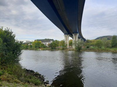
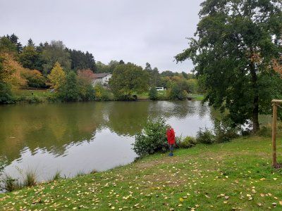
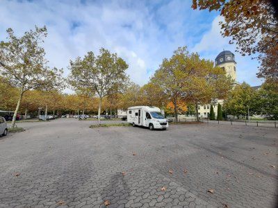
It was already dark when we drove to the parking space (49.204399, 7.60807). We were lucky there was still a space available.
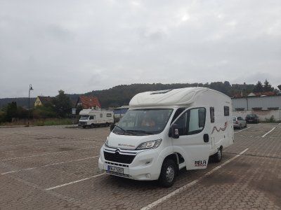
The pitch was easy to drive to, the ground is on firm brown sand, which had the disadvantage that it was carried into the motorhome.
It was already dark when we drove to the parking space (49.204399, 7.60807). We were lucky there was still a space available.
The pitch was easy to drive to, the ground is on firm brown sand, which had the disadvantage that it was carried into the motorhome.
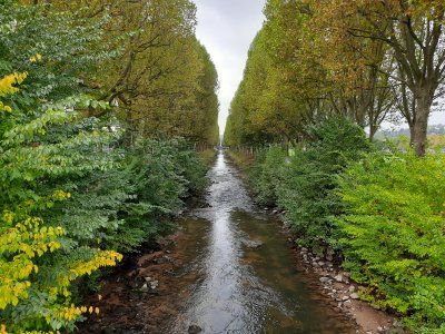
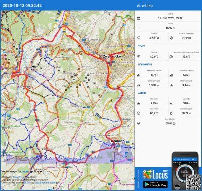
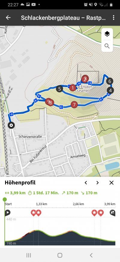
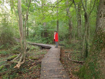
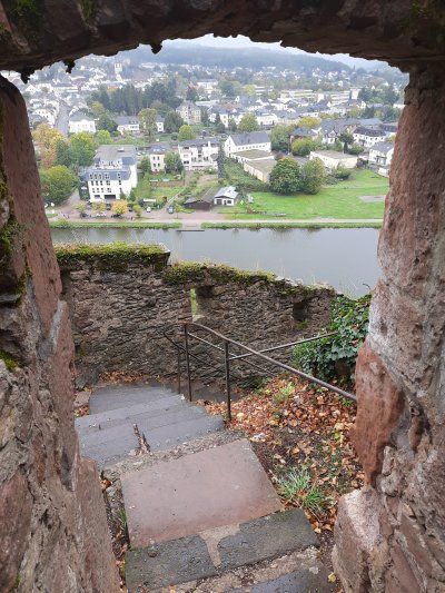
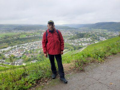
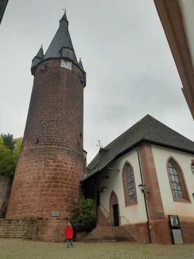
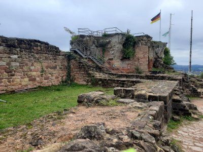
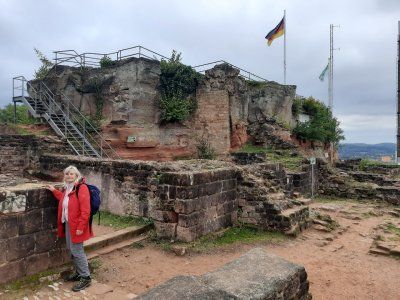
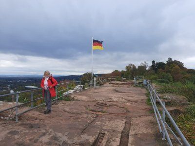
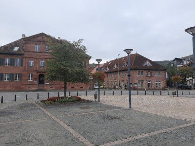
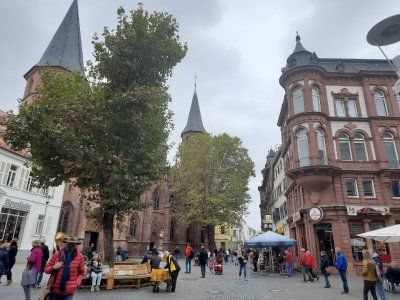
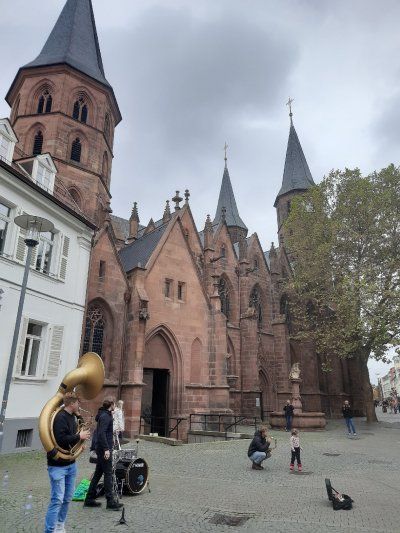
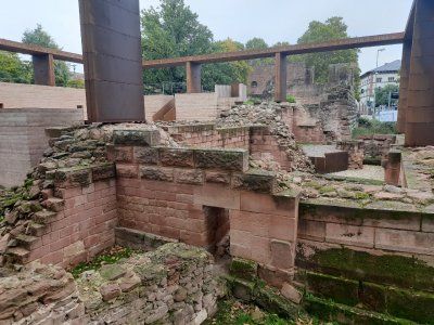
On Sunday morning we set out for a tour of Pirmasens and a hike through the rock forest. The center was only a 10-minute walk from the parking space, a total of around 14 km were ahead of us. And said in advance - we were (almost) alone.
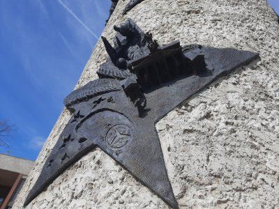
The parade ground in its current form has only existed since 1995. Before that, it was a square paved with small granite stones, which was primarily used as a parking lot and - as is still the case today - as the location of the weekly market. Today the "Exe" is provided with an underground car park that only existed once in its round shape in Germany at the time it was built, namely in Baden-Baden at the Festspielhaus.
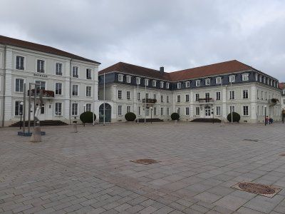
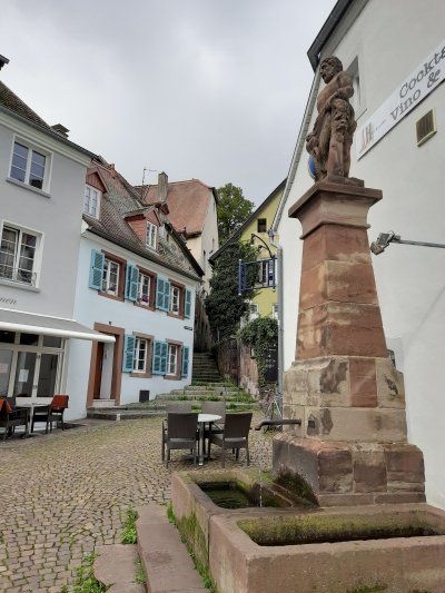
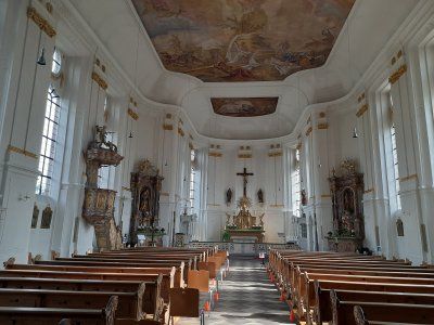
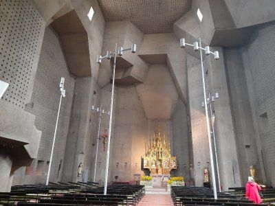
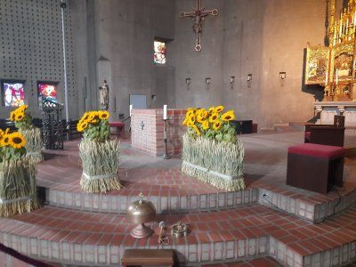
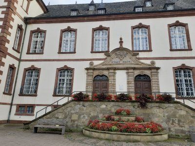
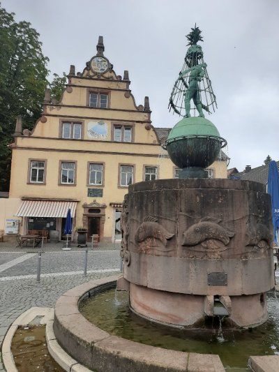
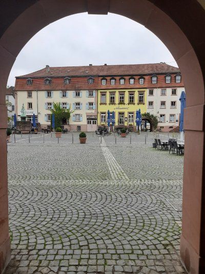
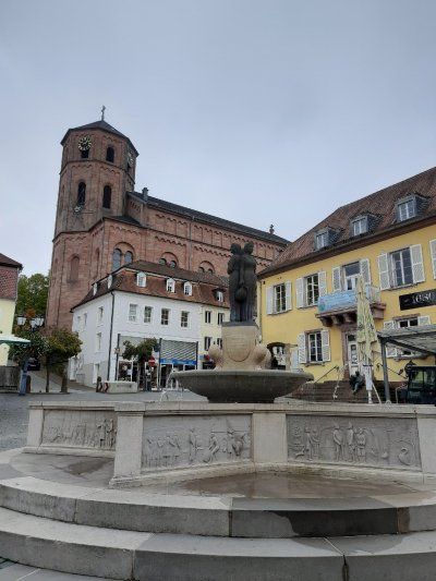
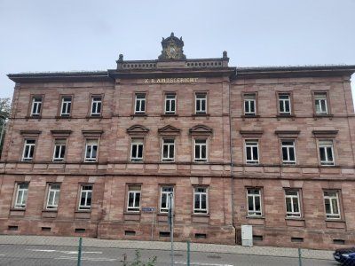
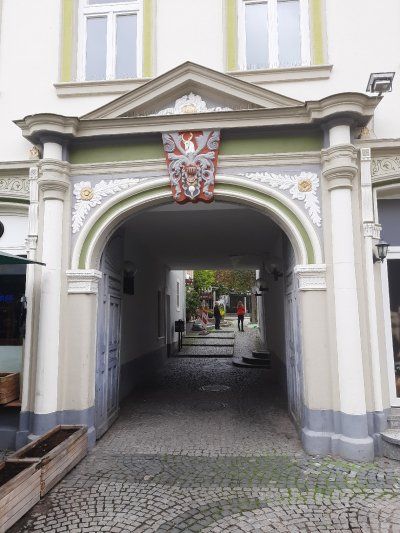
The "Schlossplatz" (also "Unterer Schlossplatz") is the center of Pirmasens. Located on the main street, it connects the "Old Town Hall" with the Pirminius Church via the castle stairs. A water cascade and an oversized bull's head are the eye-catchers of this ascent. At the lower end is the "Old Town Hall". Destroyed in the war and then rebuilt. The carillon also sounds every day at 11:00 a.m. We were surprised to find such a great facility in the middle of the beautiful pedestrian zone.
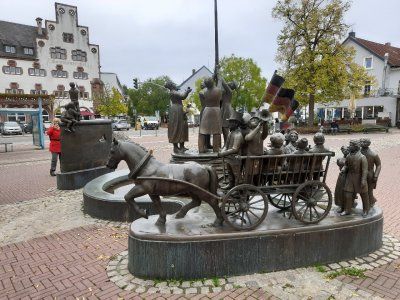
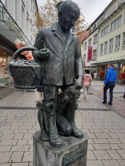
What would the (former) shoe town of Pirmasens be without its shoemaker Jean Joss?
After his apprenticeship as a shoemaker, which he completed in Paris, he settled in Pirmasens and laid the foundation stone for the local shoe industry. It is said that he sent his wife to the Prussian Rhine Province at the beginning of the 19th century to sell shoes there. When other Pirmasens shoemakers saw how much money the Joss couple had made from this trade, they too began to do the same.
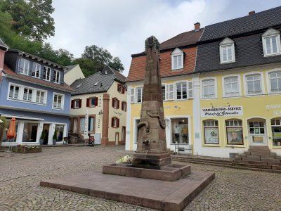
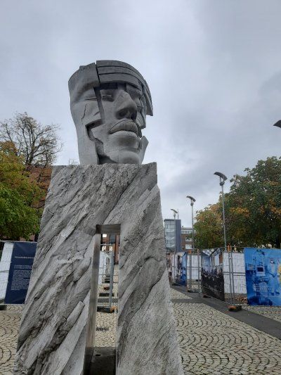
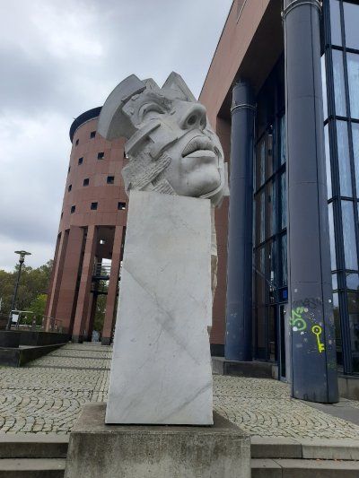
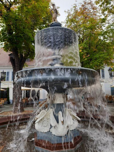
And so began the rise of the “shoe city” - at least that is the legend. Today a bronze figure on the shoemaker's fountain in front of the Luther Church commemorates Jean Joss. The fountain figure had initially stood on the Upper Schloßplatz since 1921, before it was finally placed here in 1981 after the construction of the pedestrian zone. Pithy sayings adorn the octagonal fountain basin, which at least partially express the pride of the Pirmasens in their history.
This is what it says here, for example
"The shoe made us great here,
so don't despise shoes and shoemakers! "
or
"If the shoe leaves the urban 'border',
should he be praise for Pirmasens! "


On Sunday morning we set out for a tour of Pirmasens and a hike through the rock forest. The center was only a 10-minute walk from the parking space, a total of around 14 km were ahead of us. And said in advance - we were (almost) alone.
The parade ground in its current form has only existed since 1995. Before that, it was a square paved with small granite stones, which was primarily used as a parking lot and - as is still the case today - as the location of the weekly market. Today the "Exe" is provided with an underground car park that only existed once in its round shape in Germany at the time it was built, namely in Baden-Baden at the Festspielhaus.
The "Schlossplatz" (also "Unterer Schlossplatz") is the center of Pirmasens. Located on the main street, it connects the "Old Town Hall" with the Pirminius Church via the castle stairs. A water cascade and an oversized bull's head are the eye-catchers of this ascent. At the lower end is the "Old Town Hall". Destroyed in the war and then rebuilt. The carillon also sounds every day at 11:00 a.m. We were surprised to find such a great facility in the middle of the beautiful pedestrian zone.
What would the (former) shoe town of Pirmasens be without its shoemaker Jean Joss?
After his apprenticeship as a shoemaker, which he completed in Paris, he settled in Pirmasens and laid the foundation stone for the local shoe industry. It is said that he sent his wife to the Prussian Rhine Province at the beginning of the 19th century to sell shoes there. When other Pirmasens shoemakers saw how much money the Joss couple had made from this trade, they too began to do the same.
And so began the rise of the “shoe city” - at least that is the legend. Today a bronze figure on the shoemaker's fountain in front of the Luther Church commemorates Jean Joss. The fountain figure had initially stood on the Upper Schloßplatz since 1921, before it was finally placed here in 1981 after the construction of the pedestrian zone. Pithy sayings adorn the octagonal fountain basin, which at least partially express the pride of the Pirmasens in their history.
This is what it says here, for example
"The shoe made us great here,
so don't despise shoes and shoemakers! "
or
"If the shoe leaves the urban 'border',
should he be praise for Pirmasens! "
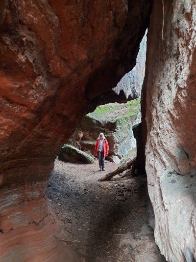
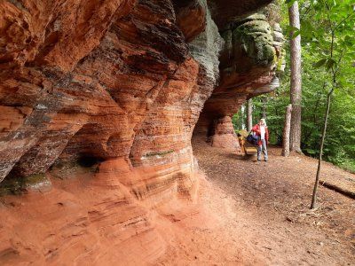
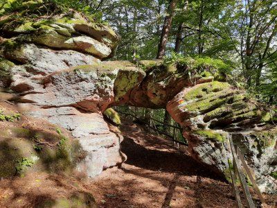
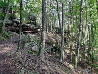
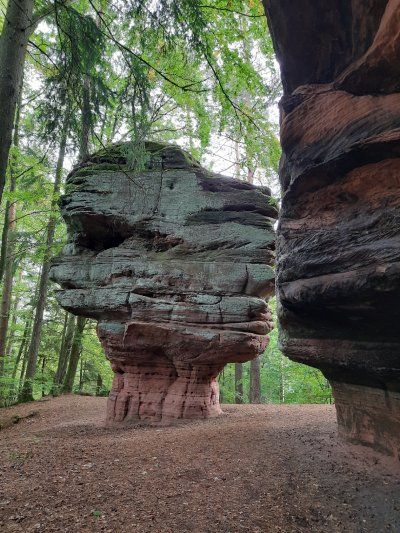
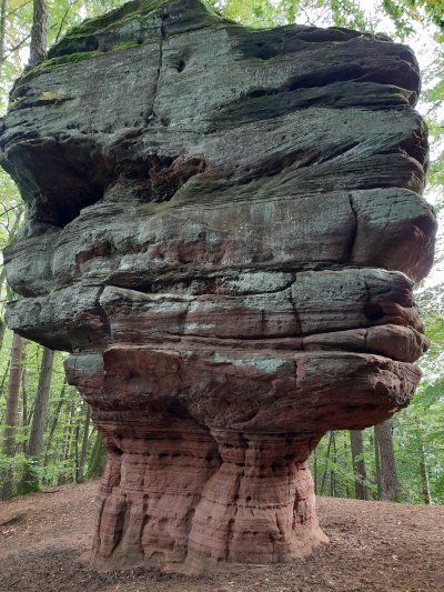
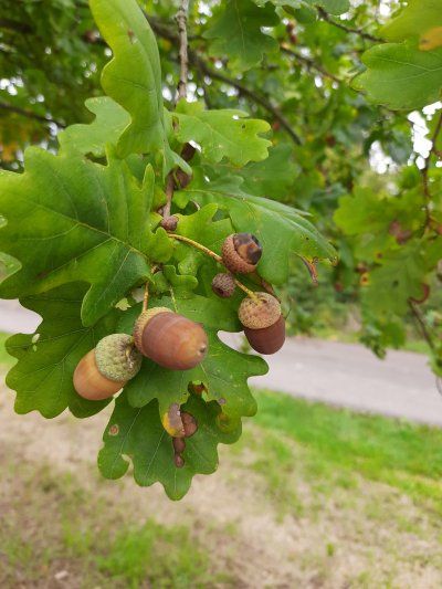
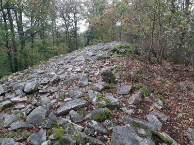
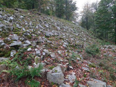
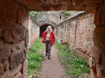
Rock forest
The tour lives up to its name - through an attractive forest with hidden meadow valleys, streams, springs and ponds, it led us past bizarre sandstone rock formations and through crevices. There were two places to stop for refreshments on the way, the forester's house and ...

Rock forest
The tour lives up to its name - through an attractive forest with hidden meadow valleys, streams, springs and ponds, it led us past bizarre sandstone rock formations and through crevices. There were two places to stop for refreshments on the way, the forester's house and ...
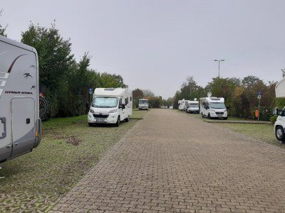
Nice local parking space in the monastery town of Hornbach. Larger RVs shouldn't have a problem. Barbecue hut and hut with tables and benches available. The place is divided and graveled.
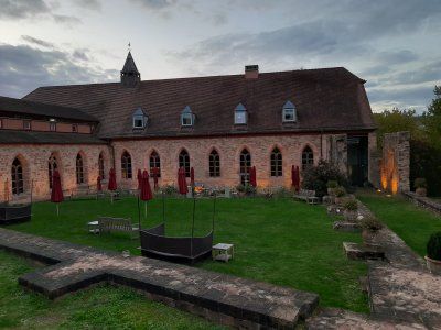
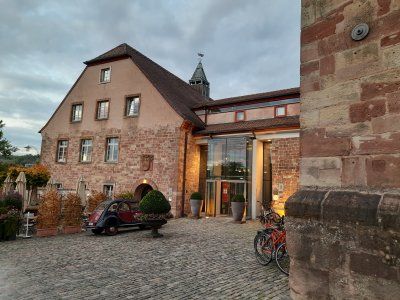
Nice local parking space in the monastery town of Hornbach. Larger RVs shouldn't have a problem. Barbecue hut and hut with tables and benches available. The place is divided and graveled.
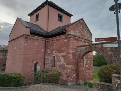
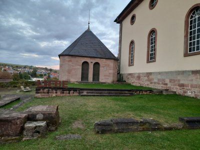
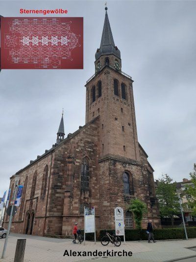
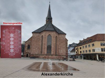
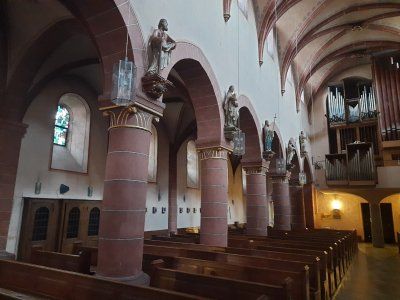
Our city tour began at the Alexander Church. Zweibrücken is on the north side of the signposted Jakobusweg. In the Middle Ages, pilgrims were shown evidence of medieval art along the way. The Alexander Church was built between 1493 and 1515 and is one of the most important building arts of the late Gothic period. The interior was characterized by an extraordinary star vault.
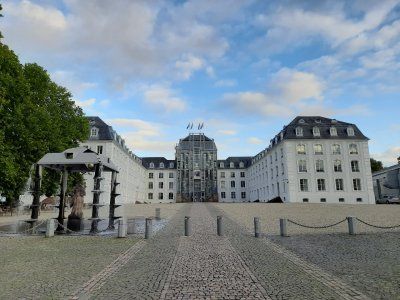
The name Zweibrücken comes from a castle built in the late 12th century, which had a double moat that had to be crossed by two drawbridges.
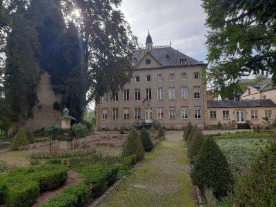
The Duke's Castle in Zweibrücken - built in its current form in 1725 - is the largest secular building in the Palatinate in the baroque style of the Nordic region. Clear lines, few flourishes, Zweibrücken is shaped by the Baroque, built in the style of the Nordic Baroque.
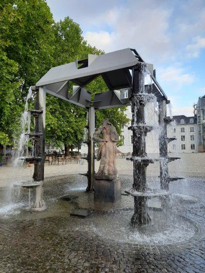
The path led through the palace gardens and past the Rhineland-Palatinate state stud that houses Zweibrücken.
Palace garden When the doctor and botanist Hieronymus Bock became famous in the 16th century with the first German herbal book, the city's green heart began to beat. Garden art reached its peak in the 18th century with spectacular inner-city parks in the baroque style. Only one baroque green vein has survived to this day: the canal and avenue allow you to feel the splendor of that time and make the hearts of walkers beat faster.
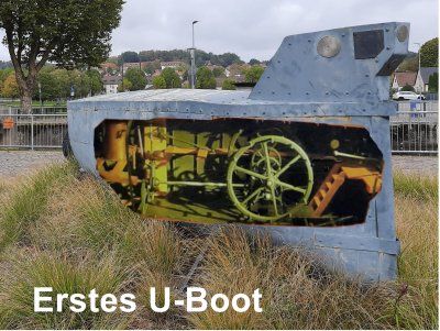
Zweibrücken and the first submarine
The inventor and inventor Wilhelm Bauer (1822 to 1875) constructed the first submarine called Brandtaucher in Kiel in 1849/50 during the German-Danish War. This marked the beginning of the age of underwater ships for Germany. The fire diver sank in the Kiel harbor basin on his first dive on February 1, 1851. The three-man crew, including Bauer himself, managed to save themselves. Wilhelm Bauer worked in Zweibrücken from October 1867 to July 1868. He planned to build an oil-powered submarine engine in the Dingler factory (now Terex). The factory, founded in 1827, was one of the most important steel construction companies in Germany at that time. At that time it was considered to be the world's leading company in the field of steam engine and air apparatus construction. Bauer went down in history as the developer and inventor of submarines through the submarines "Brandtaucher" and the successor model "Seeteufel".
The tour ended at the Duke suburb.
The Herzogsvorstadt is today the oldest preserved building ensemble in Zweibrücken, even the devastating bombing raids of 1945 could not harm it. The Duke's better officials, valets and court gardeners, lived here from 1770 near the castle.
The bike tour continued to Blieskastel

Our city tour began at the Alexander Church. Zweibrücken is on the north side of the signposted Jakobusweg. In the Middle Ages, pilgrims were shown evidence of medieval art along the way. The Alexander Church was built between 1493 and 1515 and is one of the most important building arts of the late Gothic period. The interior was characterized by an extraordinary star vault.
The name Zweibrücken comes from a castle built in the late 12th century, which had a double moat that had to be crossed by two drawbridges.
The Duke's Castle in Zweibrücken - built in its current form in 1725 - is the largest secular building in the Palatinate in the baroque style of the Nordic region. Clear lines, few flourishes, Zweibrücken is shaped by the Baroque, built in the style of the Nordic Baroque.
The path led through the palace gardens and past the Rhineland-Palatinate state stud that houses Zweibrücken.
Palace garden When the doctor and botanist Hieronymus Bock became famous in the 16th century with the first German herbal book, the city's green heart began to beat. Garden art reached its peak in the 18th century with spectacular inner-city parks in the baroque style. Only one baroque green vein has survived to this day: the canal and avenue allow you to feel the splendor of that time and make the hearts of walkers beat faster.
Zweibrücken and the first submarine
The inventor and inventor Wilhelm Bauer (1822 to 1875) constructed the first submarine called Brandtaucher in Kiel in 1849/50 during the German-Danish War. This marked the beginning of the age of underwater ships for Germany. The fire diver sank in the Kiel harbor basin on his first dive on February 1, 1851. The three-man crew, including Bauer himself, managed to save themselves. Wilhelm Bauer worked in Zweibrücken from October 1867 to July 1868. He planned to build an oil-powered submarine engine in the Dingler factory (now Terex). The factory, founded in 1827, was one of the most important steel construction companies in Germany at that time. At that time it was considered to be the world's leading company in the field of steam engine and air apparatus construction. Bauer went down in history as the developer and inventor of submarines through the submarines "Brandtaucher" and the successor model "Seeteufel".
The tour ended at the Duke suburb.
The Herzogsvorstadt is today the oldest preserved building ensemble in Zweibrücken, even the devastating bombing raids of 1945 could not harm it. The Duke's better officials, valets and court gardeners, lived here from 1770 near the castle.
The bike tour continued to Blieskastel
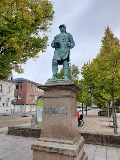
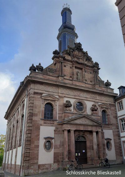
The present-day appearance of downtown Blieskastel was created in the Baroque era. In many places, palaces and mansions determine the image of the former royal seat, which is why it is a stop on Baroque Street Saar-Palatinate. Only remnants of the former castle are left.
A strong man standing on the fountain, the Greek hero Hercules, muscled and with his club he guards a coat of arms that the Count von der Leyen. A ghastly town keeper had the fountain built for the first time in 1691. The fountain used to be very important for the Blieskasteler because on the one hand there was drinking water and on the other hand there was even more important extinguishing water, there was a very high risk of fire, the houses were all only covered with simple shingles.
The castle church was one of the many major construction sites that Countess Marianne had to complete as the client after her husband suddenly died. The church was finished in 1778. It belonged to a Franciscan monastery that was housed in the large building to the right of the church. The count couple had recruited the Franciscans to open a Latin school here, another example of enlightened absolutism in which the nobility no longer only had themselves but also the welfare of their subjects in view. The count couple obviously wanted to develop Blieskastel sustainably. The artfully designed sandstone facade of the church is an eye-catcher, here we see a mixture of baroque and style that became more and more fashionable at the end of the 18th century This time two coats of arms are shown, on the left that the Count von der Leyen, on the right, that of those of Dalberg, the nobility of the Countess, underneath is that of Sebastian, hit by arrows, he is the patron saint of the city. The countess immortalized two men who were very important to her on the two vases above the entrance portal, her son Philipp is depicted on the medallion of the left vase and her late husband Franz-Karl is depicted on the one on the right vase. Inside the church, the huge ceiling painting is worth seeing, it shows, among other things, scenes from the life of St. Sebastian.
The orangery, the only building spared by the revolutionary troops, could be because it was used as a residential building very early on. At the time of the castle, the orangery was probably the place where the exotic plants from the garden were housed in winter, e.g. oranges and lemon trees, today it's a nice place to get married and there are always concerts and exhibitions. The large arches on the ground floor of the orangery are now glazed, they used to be open, behind that there was a portico in which the nobility could stroll, just as they liked it most in the shade. At that time very important, you wanted to enjoy the beautiful weather, the sun, but just not get dark facial skin, had the lower working class.
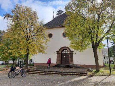
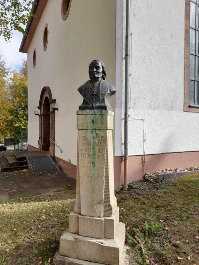
Altheim
Worth seeing in the center of Altheim is the tower of the Catholic parish church St. Andreas, the basement of which dates from the 14th century. The tower was raised in 1499, which shows the year on the upper sound hole on the north side.
After returning we quickly stowed the bikes in the garage before it started raining and after a break we got ready to continue our journey.
Finding a parking space in Ingberth is extremely difficult, especially for larger vehicles. We used the parking lot at a shopping center not far from the center. On the way to the city center, it started to rain in torrents, the parish church of St Engelbert came as called, which we saw first
The St. Engelbert Church is the baroque heart of the city of St. Ingbert. It is one of the three landmarks of the city. The only exterior decoration, the beautifully executed large alliance coat of arms of Count Friedrich Ferdinand von der Leyen and his wife Charlotte von Hatzfeldt above the entrance portal.
The carillon
The carillon on the tower of Engelberts Church was put into service on June 30, 2007, it comprises 23 bells.
Every weekday at 12 o'clock the miner's song "Glück auf, Glück auf, der Steiger is coming" can be heard.
On our city tour we went to St.Josef Church. The Catholic parish church of St. Josef is the second largest church in the Speyer diocese. Only the Speyer Cathedral itself offers more space for believers. The church is one of the three landmarks of the city of St. Ingbert. During repair work on the roof structure, a fire broke out in the top of the church tower on July 17th, 2007, which led to the complete destruction of the roof structure and the bells.
On the way back to the Womo we went through the small pedestrian zone. From 1816 to 1920 St. Ingbert belonged to the Kingdom of Bavaria and the traces of that time can still be discovered everywhere.
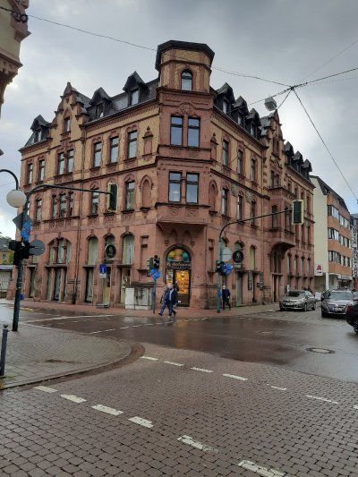
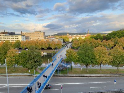
Shortly after our arrival, we set out for a city tour. A 30-minute walk took us along the Saar to the Old Bridge. The name of the city of Saarbrücken does not come from the bridges over the Saar, but from the castle that perched high above the Saar on a sandstone rock: "Sara Brocca": Brocken, rock, in the Saar. Saarbrücken as we know it today has existed since 1909: the two cities were only united in the imperial era. Over the old bridge we went to the castle. A Jewish museum is housed in the castle, which was closed when we arrived. Back over the bridge it went to the St. Johann district. With the town hall built by Kaiser Wilhelm II and the Johanneskirche. After a long stroll and a stop, we went back to the Womo.
In good time before dark we drove to Saarlouis to the pitch to stay overnight.
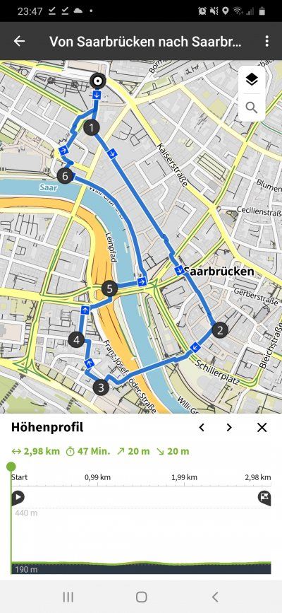
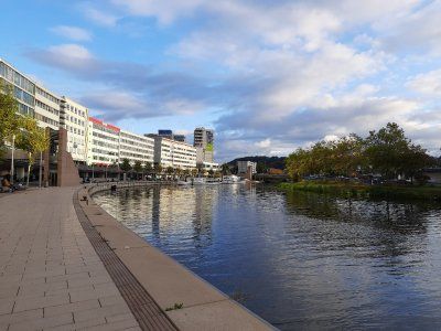
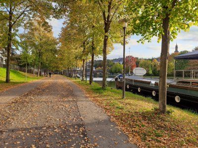
Again we drove to a parking space in the dark. There were still enough free spaces to park. The place wasn't lit.
Again we drove to a parking space in the dark. There were still enough free spaces to park. The place wasn't lit.
We used the morning for a city tour. From the parking space we first went through the city park, if you follow the network of paths you reach the "Vauban Island", formerly also known as "the Halwe Mond", via a footbridge. This facility was built in 1698 as the “Contregarde de l écluse” to protect the lock bridge. From the “Vauban Island” you can look over to the well-preserved “Bastion VI”. It was called "Bastion de Vaudrevange", since 1821 "Bastion Prince Albrecht". From the platform on it you can enjoy an impressive panoramic view of the area. Numerous information boards provide information about the history of the facility. We continued to the old town. The narrow house fronts are characteristic. Barracks VI in Alte-Brauerei-Straße was built between 1866 and 1869 in place of the original French barracks in the classical style. Its unusual length of 185 m indicates the great strategic importance that the Prussians also attached to the fortress city of Saarlouis. In the building there is an interesting museum that you should definitely visit, free of charge. Opposite you come to the longest beer bar alley in Saarland. On the eve of the 200th anniversary, the baroque church tower of the Ludwigskirche fell victim to a fire. The new monolithic nave, completed in 1970, a striking asymmetrical concrete architecture. We strolled on through the old and new market places and through the German gate. The Prussian royal crown and Prussian coat of arms are still reminiscent of the Prussian era after 1815. The cannons in front of the German Gate were also positioned there in the early 1970s. The casemates were built by the Prussians in the area of the main wall in the course of the expansion of the fortifications between 1824 and 1829 as a bomb-proof defense system. The earth-covered vaults served soldiers and horses as accommodation and command posts in the event of a defense. From here it was the same way back to the Womo, with subsequent drive to the Druid Path.
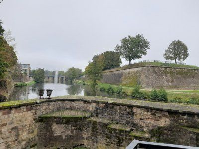
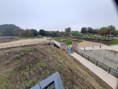

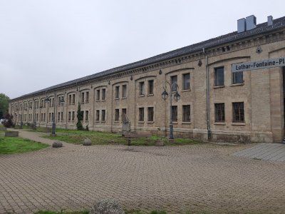
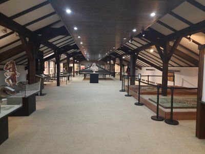
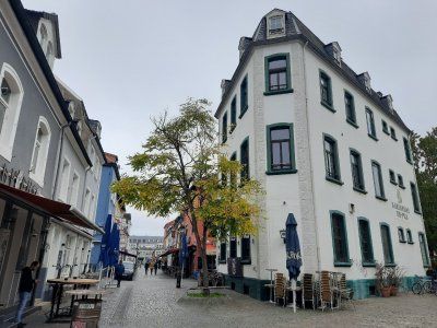
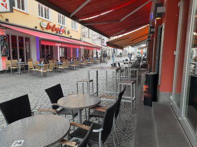


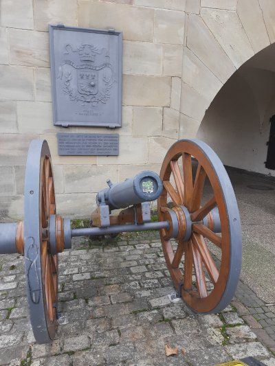
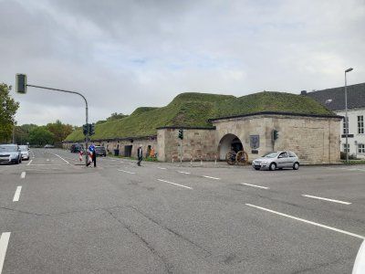
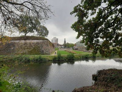
We used the morning for a city tour. From the parking space we first went through the city park, if you follow the network of paths you reach the "Vauban Island", formerly also known as "the Halwe Mond", via a footbridge. This facility was built in 1698 as the “Contregarde de l écluse” to protect the lock bridge. From the “Vauban Island” you can look over to the well-preserved “Bastion VI”. It was called "Bastion de Vaudrevange", since 1821 "Bastion Prince Albrecht". From the platform on it you can enjoy an impressive panoramic view of the area. Numerous information boards provide information about the history of the facility. We continued to the old town. The narrow house fronts are characteristic. Barracks VI in Alte-Brauerei-Straße was built between 1866 and 1869 in place of the original French barracks in the classical style. Its unusual length of 185 m indicates the great strategic importance that the Prussians also attached to the fortress city of Saarlouis. In the building there is an interesting museum that you should definitely visit, free of charge. Opposite you come to the longest beer bar alley in Saarland. On the eve of the 200th anniversary, the baroque church tower of the Ludwigskirche fell victim to a fire. The new monolithic nave, completed in 1970, a striking asymmetrical concrete architecture. We strolled on through the old and new market places and through the German gate. The Prussian royal crown and Prussian coat of arms are still reminiscent of the Prussian era after 1815. The cannons in front of the German Gate were also positioned there in the early 1970s. The casemates were built by the Prussians in the area of the main wall in the course of the expansion of the fortifications between 1824 and 1829 as a bomb-proof defense system. The earth-covered vaults served soldiers and horses as accommodation and command posts in the event of a defense. From here it was the same way back to the Womo, with subsequent drive to the Druid Path.
The approach to the hikers' car park was at the exit of Rehlingen on a narrow farm road.
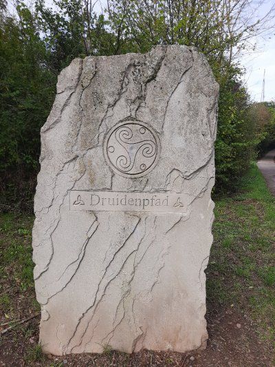
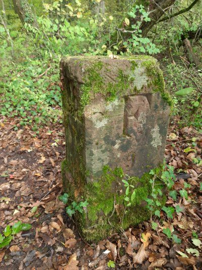
Druid path
There is a lot to discover on the Druidenpfad in Rehlingen-Siersburg. A Celtic house, a high granary and a barrow were built there. In addition, the history of the buildings and interesting facts about the life of the Celts are told on information boards. An eight kilometer long path (path) leads through orchards and along old boundary stones on the smuggler's path, past mysterious mardelles and Celtic barrows. The Galgenberg tells its story as does the old oak. A Celtic tree calendar takes you into the world of the druids and their knowledge of the value and effect of these plants.
The approach to the hikers' car park was at the exit of Rehlingen on a narrow farm road.
Druid path
There is a lot to discover on the Druidenpfad in Rehlingen-Siersburg. A Celtic house, a high granary and a barrow were built there. In addition, the history of the buildings and interesting facts about the life of the Celts are told on information boards. An eight kilometer long path (path) leads through orchards and along old boundary stones on the smuggler's path, past mysterious mardelles and Celtic barrows. The Galgenberg tells its story as does the old oak. A Celtic tree calendar takes you into the world of the druids and their knowledge of the value and effect of these plants.
Bad Merzig car park
We were undecided whether we should go to the Bietzener Heilwasser bath after the city tour. The decision to do this was also decisive as to whether we would spend the night in the parking lot.
Parking fee in the car park: 2.50 euros
Fee for adjacent parking space with electricity: 7.50 euros pay at the bathroom counter.
After the sightseeing, we decided to go to the parking lot on the banks of the Moselle in Besch.
St. Peter is the largest preserved Romanesque sacral building in the Saarland. The monastery church, which was completed at the beginning of the 13th century, is an excellent late Romanesque building which has largely retained its original shape. The three-aisled basilica with Gothic cross vault from the 16th century.
The centrally located drinking fountain fed by Bietzener medicinal water is ideal for inhalations. Bundles of hawthorn and blackthorn brushwood form the walls of a salt works in the city park. The air blowing through atomizes the water and distributes the healing water finely in the area. The nebulized medicinal water has a beneficial and soothing effect, especially for respiratory diseases.
The parking lot in Besch is inconspicuously located directly on the banks of the Moselle. When we arrived we thought at first that there is no parking space here. Every now and then a Moselle barge chugs by, the place is very quiet.
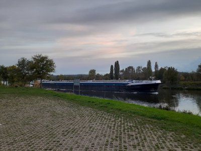
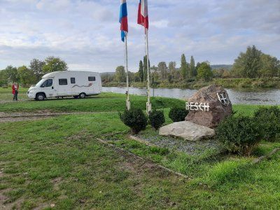
The parking lot in Besch is inconspicuously located directly on the banks of the Moselle. When we arrived we thought at first that there is no parking space here. Every now and then a Moselle barge chugs by, the place is very quiet.
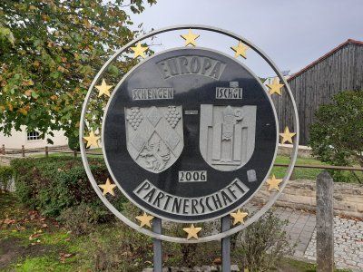
The next morning we set out on foot to the small wine-growing town of Schengen, where on June 14, 1985 the first of the Schengen agreements was signed on the ship Marie Astrid.
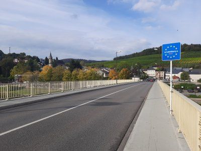

The next morning we set out on foot to the small wine-growing town of Schengen, where on June 14, 1985 the first of the Schengen agreements was signed on the ship Marie Astrid.
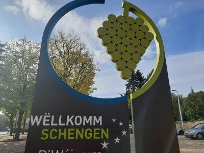
The Luxembourg star architect Francois Valentiny designed the monument and the pillars of the nations with the country stars of all countries that have signed the agreement. An entertaining
An informative walk through the history of Europe and its countries ended the varied excursion destination. On the same bike path along the Moselle (3.9 km) we went back to the Womo.
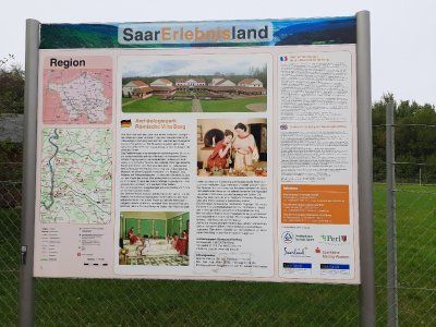
Another destination of today is the Villa Borg, which we then drove to with the mobile home.

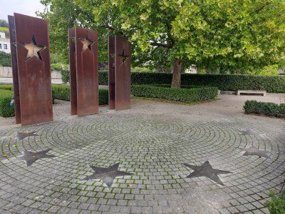
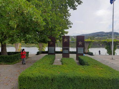

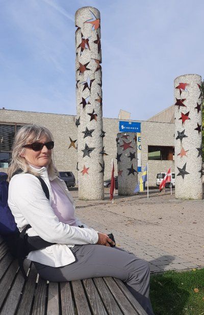
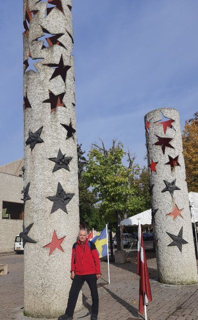
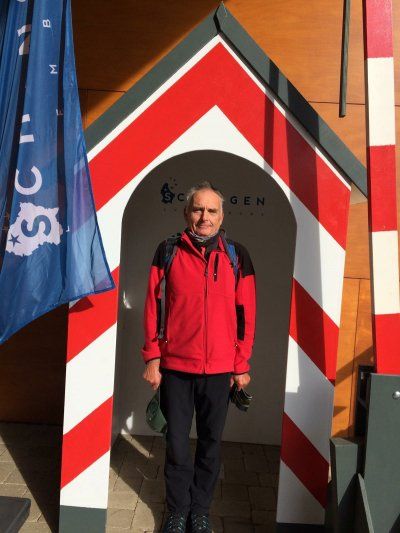
The Luxembourg star architect Francois Valentiny designed the monument and the pillars of the nations with the country stars of all countries that have signed the agreement. An entertaining
An informative walk through the history of Europe and its countries ended the varied excursion destination. On the same bike path along the Moselle (3.9 km) we went back to the Womo.
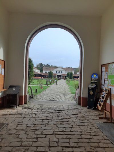
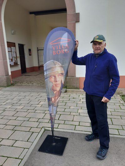
Another destination of today is the Villa Borg, which we then drove to with the mobile home.
Today's destination is the Celtic village near Nonnenweiler. There are two intermediate stops on the way there, one at the Villa Borg and one at the Saarschleife.
Today is a day with closed roads. The access road to the villa was closed, so we parked 500 m in a parking lot near the Villa Borg.
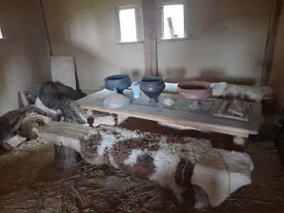
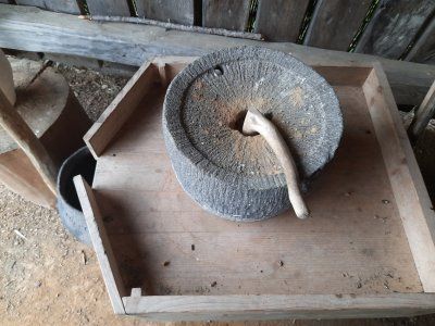
The Roman Villa Borg was not only excavated, it was completely rebuilt true to the original. The excavation site is unique in Europe and offers authentic insights into the life of the Romans.
It was only a short visit to the villa and only looked at the outside of the Roman villa.
We made sure that we get on quickly to the actual main goal, the Celtic village.
Today's destination is the Celtic village near Nonnenweiler. There are two intermediate stops on the way there, one at the Villa Borg and one at the Saarschleife.
Today is a day with closed roads. The access road to the villa was closed, so we parked 500 m in a parking lot near the Villa Borg.
The Roman Villa Borg was not only excavated, it was completely rebuilt true to the original. The excavation site is unique in Europe and offers authentic insights into the life of the Romans.
It was only a short visit to the villa and only looked at the outside of the Roman villa.
We made sure that we get on quickly to the actual main goal, the Celtic village.
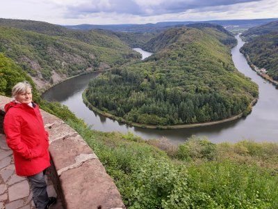
When we arrived in Cloef, we started looking for a parking space. The parking lot that was approached was completely occupied, another one was blocked for mobile homes, so we had no choice but to park at a supermarket.
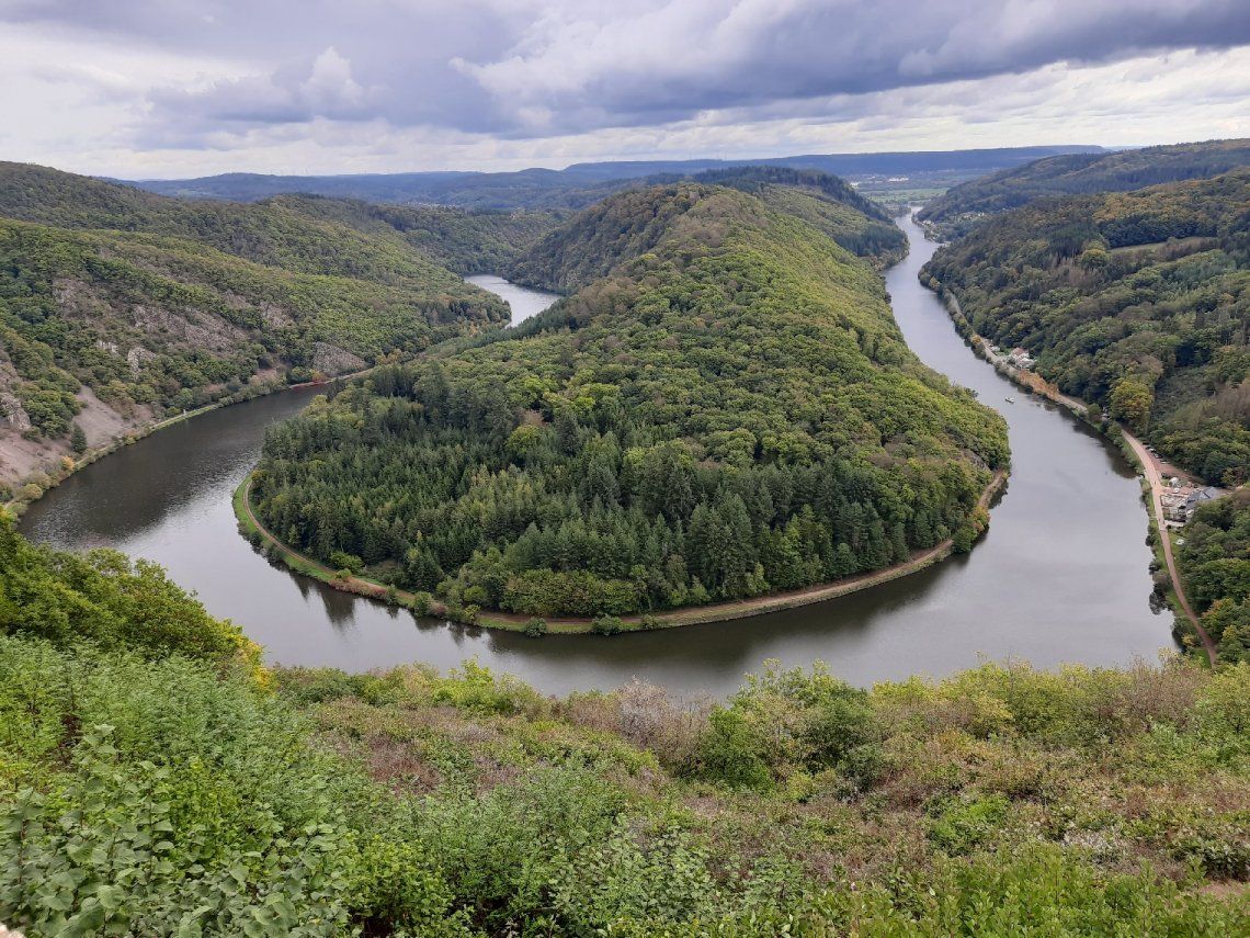
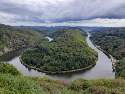
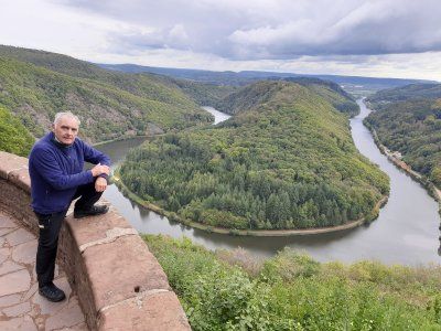
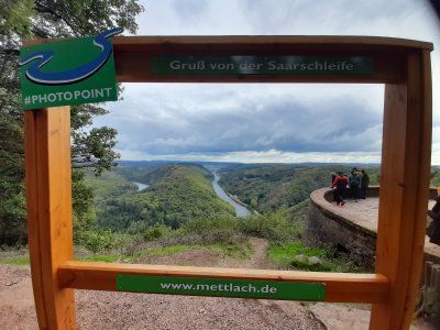
We had to walk a few hundred meters to the lookout point, in the hope that the weather would not worsen even more and that the beautiful landscape with the Saar loop could be seen. A circulating mountain made of hard Taunus quartzite forces the river to make a detour of ten kilometers and thus offers an incomparable natural spectacle, the most beautiful river bend in Germany. The Saarschleife, the symbol of the Saarland.
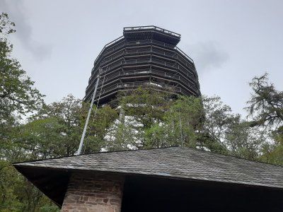
We did not use the tree top path, which you can take further up to lofty heights. On the 42 meter high observation tower you will be rewarded with a wonderful 360 ° view! Germany, Luxembourg and France meet here. From the lookout point it was the shortest way back to the Womo (1.5 km).
The journey then went on to a Celtic village in Nonnenweiler.
When we arrived in Cloef, we started looking for a parking space. The parking lot that was approached was completely occupied, another one was blocked for mobile homes, so we had no choice but to park at a supermarket.
We had to walk a few hundred meters to the lookout point, in the hope that the weather would not worsen even more and that the beautiful landscape with the Saar loop could be seen. A circulating mountain made of hard Taunus quartzite forces the river to make a detour of ten kilometers and thus offers an incomparable natural spectacle, the most beautiful river bend in Germany. The Saarschleife, the symbol of the Saarland.
We did not use the tree top path, which you can take further up to lofty heights. On the 42 meter high observation tower you will be rewarded with a wonderful 360 ° view! Germany, Luxembourg and France meet here. From the lookout point it was the shortest way back to the Womo (1.5 km).
The journey then went on to a Celtic village in Nonnenweiler.
On the way there it was raining, thank God it stopped raining during the tour.
The Celtic village and ring wall is located in the Hundsrück National Park. The parking lot was easy to drive into.
Admission: Celtic village € 5
After the visit, we hiked to the Celtic ring wall circular route 2.8 km.
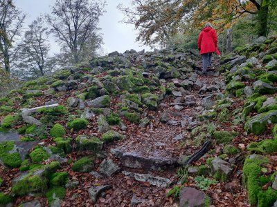
The Celtic ring wall Otzenhausen is one of the most impressive Celtic fortifications in Europe. Even today, ten meter high stone walls bear witness to the monumental ground monument from the 1st century BC.
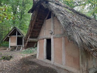
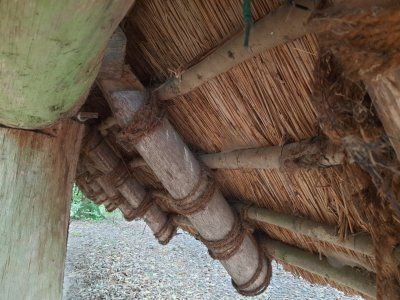
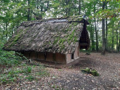
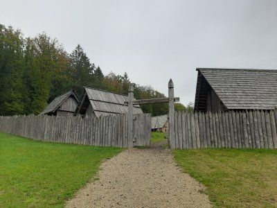
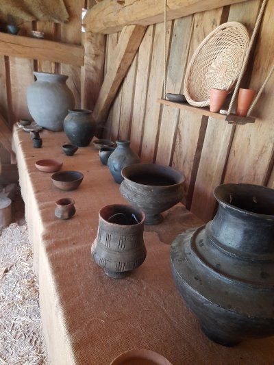
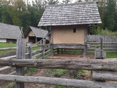
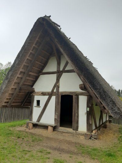
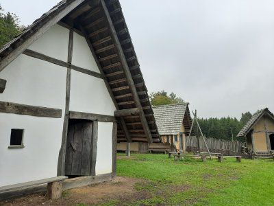
In contrast, a "real" Celtic village has emerged at the foot of the ring wall, in the Celtic Park. A village that could have stood within the huge fortress on the Dollberg 2,000 years ago. The reconstruction of a Celtic settlement is an essential part of the emerging Celtic park. The settlement currently consists of 10 residential, craft and storage buildings, the architecture and construction of which are based on historical findings and models. The settlement is surrounded by a wooden palisade made of sharpened oak trunks, which give the ensemble an authentic character.

On the way there it was raining, thank God it stopped raining during the tour.
The Celtic village and ring wall is located in the Hundsrück National Park. The parking lot was easy to drive into.
Admission: Celtic village € 5
After the visit, we hiked to the Celtic ring wall circular route 2.8 km.
The Celtic ring wall Otzenhausen is one of the most impressive Celtic fortifications in Europe. Even today, ten meter high stone walls bear witness to the monumental ground monument from the 1st century BC.
In contrast, a "real" Celtic village has emerged at the foot of the ring wall, in the Celtic Park. A village that could have stood within the huge fortress on the Dollberg 2,000 years ago. The reconstruction of a Celtic settlement is an essential part of the emerging Celtic park. The settlement currently consists of 10 residential, craft and storage buildings, the architecture and construction of which are based on historical findings and models. The settlement is surrounded by a wooden palisade made of sharpened oak trunks, which give the ensemble an authentic character.
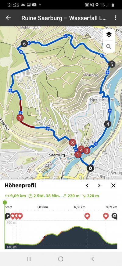
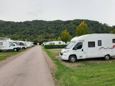
After a long and unplanned diversion of the route, we reached the Saarburg parking space annoyed.
Fee: 11.50 €
Electricity: € 0.50 / 1Kw
Shower token: 1.- € (2.- €)
Gas bottle: 11kg € 24.80
After a long and unplanned diversion of the route, we reached the Saarburg parking space annoyed.
Fee: 11.50 €
Electricity: € 0.50 / 1Kw
Shower token: 1.- € (2.- €)
Gas bottle: 11kg € 24.80
Unfortunately the day started with fog and light drizzle. The temperature was 8 ° C.
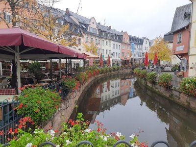
From the parking space we walked through the beautiful old town of Saarburg.
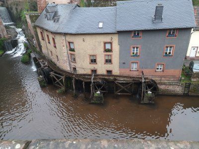
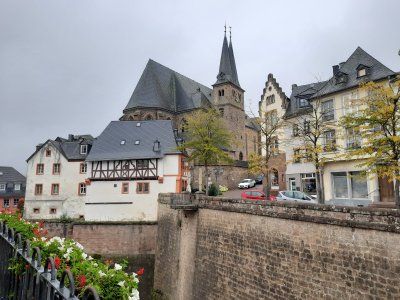
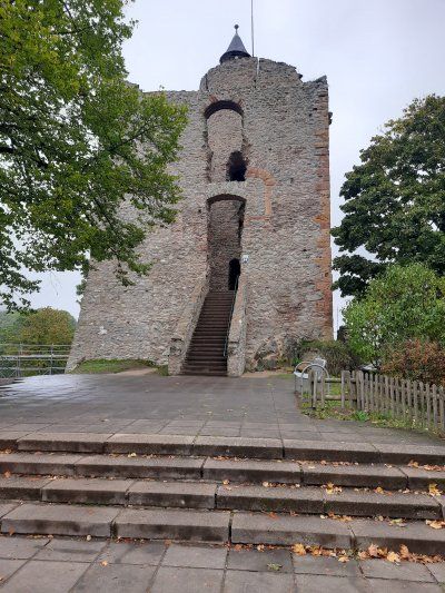
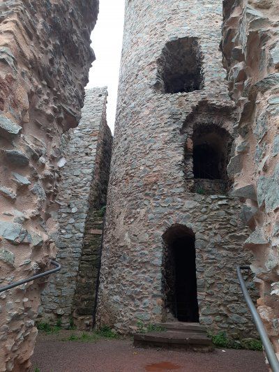
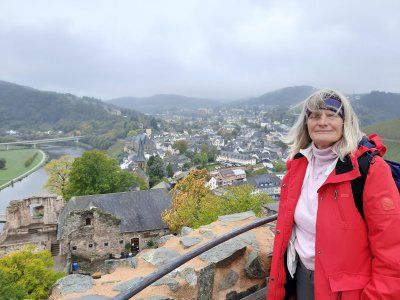
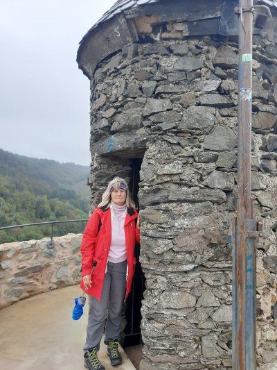
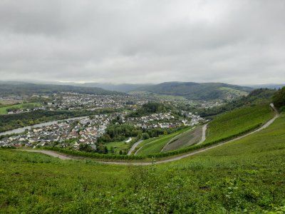
There the old castle of Siegfried the Ardennes Count, who founded Luxembourg in 963, proudly towers over the valley. We started the ascent to the castle ruins with the chapel in front and climbed the tower, which is over twenty meters high, to enjoy the wonderful view of the town and the foggy river landscape. The specialty of the place is the small Leukbach, which is cleverly diverted to form an 18 meter high waterfall in the middle of the town center. The water is still used to generate electricity today. In the past, the town mills were operated using water power. Three mill wheels staggered one behind the other drove the grinders.
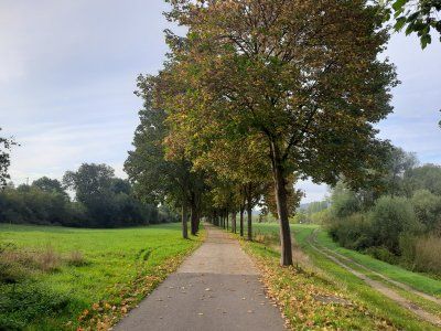
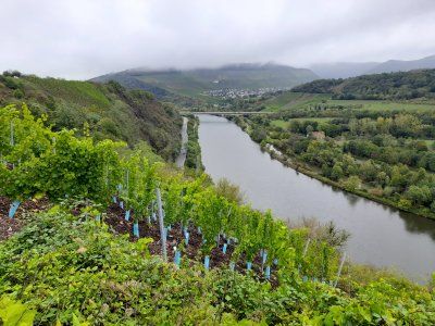
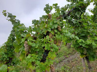
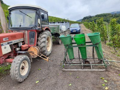
After an extensive tour we went on a short hike through the surrounding vineyards. The harvest was not yet over, vines were still being harvested in individual vineyards.


Unfortunately the day started with fog and light drizzle. The temperature was 8 ° C.
From the parking space we walked through the beautiful old town of Saarburg.
There the old castle of Siegfried the Ardennes Count, who founded Luxembourg in 963, proudly towers over the valley. We started the ascent to the castle ruins with the chapel in front and climbed the tower, which is over twenty meters high, to enjoy the wonderful view of the town and the foggy river landscape. The specialty of the place is the small Leukbach, which is cleverly diverted to form an 18 meter high waterfall in the middle of the town center. The water is still used to generate electricity today. In the past, the town mills were operated using water power. Three mill wheels staggered one behind the other drove the grinders.
After an extensive tour we went on a short hike through the surrounding vineyards. The harvest was not yet over, vines were still being harvested in individual vineyards.
Parking space is easy to drive.
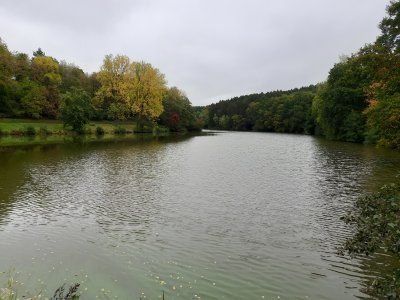
There is a beautiful lake nearby
Parking space 5.- € (pay with envelope)
Weather drizzle, 10 ° C
Parking space is easy to drive.
There is a beautiful lake nearby
Parking space 5.- € (pay with envelope)
Weather drizzle, 10 ° C
Slept well in a very quiet pitch.
Weather overcast / dry
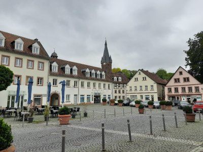
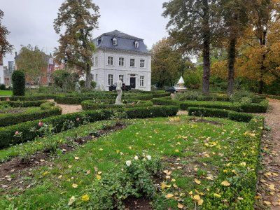
After breakfast, walked to the old town of Ottweiler, 2km away. Nice old town. During a stroll through the old town there are alleys built with historic stone and half-timbered houses to discover, but also the tower of the Protestant parish church known as Zibbelkapp, extensive remains of the city wall and the magnificent stem pavilion with its baroque rose garden. Nevertheless, the tour is not too strenuous as Ottweiler is relatively small.
Disposed of the toilet on return and continued to Homburg.


Slept well in a very quiet pitch.
Weather overcast / dry
After breakfast, walked to the old town of Ottweiler, 2km away. Nice old town. During a stroll through the old town there are alleys built with historic stone and half-timbered houses to discover, but also the tower of the Protestant parish church known as Zibbelkapp, extensive remains of the city wall and the magnificent stem pavilion with its baroque rose garden. Nevertheless, the tour is not too strenuous as Ottweiler is relatively small.
Disposed of the toilet on return and continued to Homburg.
Free parking space
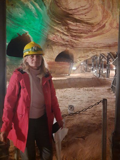
City tour, then we looked at the Schlossberg caves and the castle ruins of Homburg.
Entrance to the Schlossberg caves € 10
Stop in a cafe € 14
Weather overcast, dry, 11 ° C
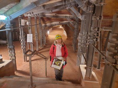
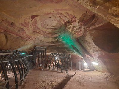
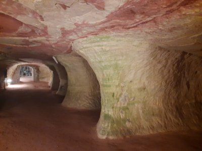
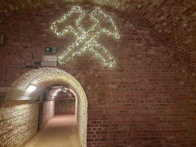
The Schlossberg caves near Homburg were actually once a mine, today they are Europe's largest red sandstone caves.
In addition to visiting the imposing Schlossberg caves, the highlights of the tour include great views, as well as an old castle ruin in the Karlsberg Castle Forest Park (the Hohenburg castle ruins), an old Celtic cult site and chestnut trees that are over 200 years old.


Free parking space
City tour, then we looked at the Schlossberg caves and the castle ruins of Homburg.
Entrance to the Schlossberg caves € 10
Stop in a cafe € 14
Weather overcast, dry, 11 ° C
The Schlossberg caves near Homburg were actually once a mine, today they are Europe's largest red sandstone caves.
In addition to visiting the imposing Schlossberg caves, the highlights of the tour include great views, as well as an old castle ruin in the Karlsberg Castle Forest Park (the Hohenburg castle ruins), an old Celtic cult site and chestnut trees that are over 200 years old.
little traffic on the way.
Driven to a free parking lot.
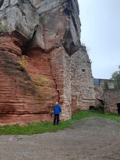
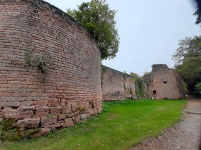
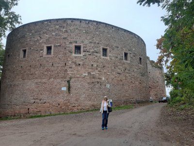
On the way to the city center we saw the castle ruins Nanstein on the hill, which we then visited, but only from the outside. Castle ruins Nanstein, built by Emperor Barbarossa around 1160, the castle came to the Knights of Sickingen clan through marriage in 1475. In 1689, the castle was finally destroyed by French troops during the War of the Palatinate Succession.
The old town wasn't really interesting, we walked quickly through the city and to the mobile home.


little traffic on the way.
Driven to a free parking lot.
On the way to the city center we saw the castle ruins Nanstein on the hill, which we then visited, but only from the outside. Castle ruins Nanstein, built by Emperor Barbarossa around 1160, the castle came to the Knights of Sickingen clan through marriage in 1475. In 1689, the castle was finally destroyed by French troops during the War of the Palatinate Succession.
The old town wasn't really interesting, we walked quickly through the city and to the mobile home.
Driven to the parking space at the city cemetery, we didn't stand on the square, but in the free parking lot next door.
Parking fee 10, - € 24h. that was too much for us to park for 3 hours.
It took about 30 minutes to walk to the city center. First we strolled through the mighty pedestrian zone. By chance we came to the remains of the mighty Kaiserpfalz, (Barbarossa's imperial city). Passing the city theater, we came to an old part of the old town near St. Martin's Church with a beautiful fountain and house facades. The Kaiserbrunnen was the last attraction that we looked at.
Route
Show newest first- 48.1981 8.6953
- 48° 11' 53.1" N 8° 41' 43.1" E
- 49.2044 7.6075
- 49° 12' 16" N 7° 36' 27" E
Am Sonntagmorgen machten wir uns auf zur Runde durch Pirmasens und mit einer Wanderung durch den Felsenwald. Das Zentrum lag nur 10 Minuten zu Fuß vom Stellplatz entfernt, insgesamt lagen rund 14 km vor uns. Und vorweg gesagt - wir waren (fast) alleine unterwegs.
Der Exerzierplatz in der heutigen Form besteht erst seit 1995. Davor war es ein mit kleinen Granitsteinen gepflastertes Quadrat, das primär als Parkplatz und – wie auch heute noch als Standort des Wochenmarktes genutzt wurde. Heute ist der „Exe“ mit einer Tiefgarage versehen, die es in Ihrer runden Form zum Zeitpunkt der Entstehung in Deutschland nur noch einmal gab, nämlich in Baden-Baden am Festspielhaus.
Der "Schlossplatz" (auch "Unterer Schlossplatz") ist der Mittelpunkt von Pirmasens. An der Hauptstraße gelegen, verbindet er über die Schlosstreppen das "Alte Rathaus" mit der Pirminiuskirche. Eine Wasserkaskade und ein überdimensionaler Stierkopf sind der Blickfang dieses Aufstieges. Am unteren Ende steht das "Alte Rathaus". Im Krieg zerstört und danach wieder aufgebaut. Täglich um 11:00 Uhr ertönt zudem das Glockenspiel. Wir waren überrascht hier eine derart tolle Anlage mitten in der schönen Fußgängerzone anzutreffen.
Was wäre die (ehemalige) Schuhstadt Pirmasens ohne ihren Schuster Jean Joss?
Nach seiner Ausbildung zum Schuster, die er in Paris absolvierte, ließ er sich in Pirmasens nieder und legte den Grundstein für die hiesige Schuhindustrie. Es wird ihm nachgesagt, dass er bereits Anfang des 19. Jahrhunderts seine Frau in die preußische Rheinprovinz geschickt haben soll, um dort Schuhe zu verkaufen. Als andere Pirmasenser Schuhmacher sahen, wie viel Geld das Ehepaar Joss mit diesem Handel verdient hatte, begannen auch sie, es ihnen gleich zu tun.
Und damit begann der Aufstieg der „Schuhstadt“ - so jedenfalls die Sage. Heute erinnert eine Bronzefigur auf dem Schusterbrunnen vor der Lutherkirche an Jean Joss. Die Brunnenfigur stand zunächst seit 1921 auf dem Oberen Schloßplatz, bevor sie nach dem Bau der Fußgängerzone hier 1981 ihren endgültigen Standort bekam. Markige Sprüche zieren das 8-eckige Brunnenbecken, die zumindest teilweise auch den Stolz der Pirmasenser auf ihre Geschichte ausdrücken.
So heißt es hier z.B.
„Der Schuh hat hier uns groß gemacht,
drum Schuh und Schuster nicht veracht'!“
oder
„Verlässt der Schuh die städtisch’ Grenz’,
soll Lob er sein für Pirmasens!“
Felsenwald
Die Tour wird ihrem Namen gerecht – durch attraktiven Wald mit darin verborgenen Wiesentälern, Bächen, Quellen und Weihern führte er uns vorbei an bizarren Sandstein-Felsformationen und durch Felsspalten hindurch. Unterwegs standen zwei Einkehrmöglichkeiten zur Verfügung, das Forsthaus und...
- 49.1839 7.3656
- 49° 11' 2" N 7° 21' 56" E
Unser Stadtrundgang begann bei der Alexanderkirche. Zweibrücken liegt an der Nordseite des ausgeschilderten Jakobusweges. Im Mittelalter wurden den Pilger Zeugnisse Mittelalterlicher Kunst am Wegesrand dargestellt. Die Alexanderkirche wurde 1493 - 1515 erbaut und gehört zu den bedeutsamen Baukünsten der Spätgotik. Der Innenraum war durch ein außergewöhnliches Sternengewölbe geprägt.
Der Name Zweibrücken stammt von einer im ausgehenden 12. Jahrhundert erbauten Burg, die einen doppelten Wehrgraben hatte, der über zwei Zugbrücken überquert werden musste.
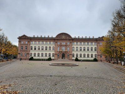
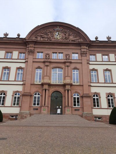
Das Herzogschloss Zweibrücken - in seiner derzeitigen Form 1725 errichtet - ist der größte pfälzische Profanbau im Barockstil nordischer Prägung. Klare Linien, wenig Schnörkel, Zweibrücken ist vom Barock geprägt, im Stile des nordischen Barock errichtet.
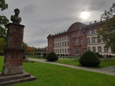
Der Weg führte durch die Schlossgärten und vorbei am Landgestüt von Rheinland-Pfalz das Zweibrücken beherbergt.
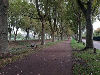
Schlossgarten Als im 16. Jahrhundert der Arzt und Botaniker Hieronymus Bock mit dem ersten deutschen Kräuterbuch Berühmtheit erlangte, begann das grüne Herz der Stadt zu schlagen. ihren Höhepunkt erreichte die Gartenkunst im 18.Jahrhundert mit spektakulären innerstädtischen Parkanlagen im barocken Stil. Einzig eine barocke Grünader ist bis heute erhalten: Kanal und Allee lassen die Pracht jener Zeit spüren und das Herz von Spaziergängern höher schlagen.
Zweibrücken und das erste U-Boot
Der Tüftler und Erfinder Wilhelm Bauer (1822 bis 1875) konstruierte 1849/50 während des Deutsch dänischen Kriegs in Kiel das erste U-Boot Brandtaucher genannt. Damit begann für Deutschland das Zeitalter der Unterwasser Schiffe. Der Brandtaucher ging bei seiner ersten Tauchfahrt am 1. Februar 1851 im Kieler Hafenbecken unter. Die dreiköpfige Besatzung, darunter auch Bauer selbst konnte sich retten. Wilhelm Bauer arbeitete von Oktober 1867 bis Juli 1868 in Zweibrücken. Er hatte vor, in der Dinglerschen Fabrik (heute Terex) einen ölbetriebenen U-Boot Motor zu bauen. Das 1827 gegründete Werk zählte zur damaligen Zeit zu den bedeutendsten Stahlbauunternehmen in Deutschland. Es galt damals als weltweit führendes Unternehmen im Bereich Dampfmaschine und Luftapparatebau. Bauer ging durch die U-Boote "Brandtaucher" und das Folgemodell "Seeteufel" als der Entwickler und Erfinder von Unterseebooten in die Geschichte ein.
Den Abschluss der Besichtigungstour fand bei der Herzogsvorstadt statt.
Die Herzogsvorstadt, ist heute das älteste erhaltene Bauensemble in Zweibrücken, auch die verheerenden Bombenangriffe von 1945 konnten ihr nichts anhaben. Die besseren Beamten des Herzogs, Kammerdiener und Hofgärtner, wohnten hier ab 1770 nahe dem Schloss.
Weiter ging die Radtour nach Blieskastel
Im Zeitalter des Barock entstand das heutige Aussehen der Innenstadt von Blieskastel. Palais und Herrenhäuser bestimmen an vielen Stellen das Bild der ehemaligen Residenzstadt, die deshalb eine Station an der Barockstraße Saar-Pfalz ist. Lediglich das einstige Schloss ist nur noch in Resten vorhanden.
Ein starken Mann stehend auf dem Brunnen, der griechische Held Herkules, muskelbepackt und mit seiner Keule bewacht er ein Wappen, dass der Grafen von der Leyen. Ein grässlicher Stadthalter hat den Brunnen im Jahr 1691 erstmals bauen lassen. Der Brunnen war für die Blieskasteler früher sehr wichtig, denn zum Einen gab es hier Trinkwasser und zum Anderen noch wichtiger Löschwasser, es herrschte eine sehr hohe Brandgefahr, die Häuser waren alle nur mit einfachen Schindeln gedeckt.
Die Schlosskirche war eine der vielen Großbaustellen die Gräfin Marianne als Bauherrin vollenden musste, nachdem ihr Mann plötzlich verstorben war. Im Jahr 1778 war die Kirche fertig sie gehörte zu einem Franziskanerkloster, dass in dem großen Bau rechts neben der Kirche untergebracht war. Das Grafenpaar hatte die Franziskaner angeworben um hier eine Lateinschule zu eröffnen auch wieder ein Beispiel für den aufgeklärten Absolutismus bei dem der Adel eben nicht mehr nur sich selbst sondern auch das Wohl der Untertanen im Blick hatte. Das Grafenpaar wollte Blieskastel offensichtlich nachhaltig weiterentwickeln. Ein Hingucker ist die kunstvoll gestaltete Sandsteinfassade der Kirche, wir sehen hier eine Mischung aus Barock und außerdem Stil der Ende des 18 Jahrhunderts immer mehr in Mode kam dem Klassizismus typisch für den Klassizismus sind z.B die Säulen die an griechische Tempel erinnern, oben im Giebel sind diesmal zwei Wappen dargestellt, links dass der Grafen von der Leyen rechts daneben das derer von Dalberg den Adelsstand der Gräfin, darunter steht der von Pfeilen getroffen der Sebastian er ist der Schutzpatron der Stadt. Auf den beiden Vasen über dem Eingangsportal hat die Gräfin zwei für sie sehr wichtige Männer verewigt, auf dem Medaillon der Linken Vase ist ihr Sohn Philipp und auf dem der rechten Vase ihr verstorbener Ehemann Franz-Karl dargestellt. Im Innern der Kirche ist das riesige Deckengemälde sehenswert, es zeigt unter anderem Szenen aus dem Leben des heiligen Sebastian.
Die Orangerie einziges Gebäude von den Revolutionstruppen verschont geblieben, könnte daran liegen dass sie recht früh als Wohnhaus genutzt wurde. Zu Schloss Zeiten war die Orangerie wahrscheinlich der Ort an dem im Winter die exotischen Pflanzen aus dem Garten untergebracht waren z.B. Orangen und Zitronenbäume, heute ist ja ein schöner Ort zum Heiraten außerdem gibt's immer wieder Konzerte und Ausstellungen. Die großen Bögen im Erdgeschoss der Orangerie sind mittlerweile verglast, früher waren sie offen, dahinter war eine Säulenhalle in der der Adel lustwandeln konnte und zwar so wie er es am liebsten hatte im Schatten. Damals ganz wichtig, wollte man das schöne Wetter die Sonne genießen aber bloß keine dunkle Gesichtshaut bekommen, hatte die niedere Arbeiterklasse.
Altheim
Sehenswert im Ortskern von Altheim ist der Turm der katholischen Pfarrkirche St. Andreas, dessen Untergeschoss aus dem 14. Jahrhundert stammt. Der Turm wurde 1499 erhöht, das zeigt die Jahreszahl am oberen Schallloch der Nordseite.
Nach der Rückkehr verstauten wir rasch die Räder in die Garage bevor es anfing zu regnen und machten uns nach einer Pause auf die Weiterfahrt fertig.
- 49.2774 7.1119
- 49° 16' 38.8" N 7° 6' 42.8" E
- 49.3211 6.7425
- 49° 19' 16" N 6° 44' 33" E
Den Morgen nutzten wir für eine Stadtbesichtigung. Vom Stellplatz aus ging es zuerst durch den Stadtpark, folgt man dem Wegenetz erreicht man über eine Fußgängerbrücke die „Vauban-Insel“, früher auch „der Halwe Mond“ genannt. Diese Anlage wurde 1698 als „Contregarde de l écluse“ ebenfalls zum Schutz der Schleusenbrücke errichtet.Von der „Vauban-Insel“ schaut man hinüber auf die noch gut erhaltene „Bastion VI“. Sie trug die Bezeichnung „Bastion de Vaudrevange“, seit 1821 „Bastion Prinz Albrecht“. Von der darauf befindlichen Plattform aus genießt man einen eindrucksvollen Rundblick in die Umgebung. Zahlreiche Infotafeln geben Auskunft über die Geschichte der Anlage. Weiter ging es in die Altstadt Charakteristisch sind die schmalen Häuserfronten. Mit der Kaserne VI in der Alte-Brauerei-Straße wurde 1866 - 1869 anstelle der ursprünglichen französischen Kaserne im klassizistischen Stil erbaut. Ihre ungewöhnliche Länge von 185 m deutet auf die große strategische Bedeutung hin, die auch die Preußen der Festungsstadt Saarlouis beimaßen. Im Gebäude befindet sich ein interessantes Museum das man unbedingt besuchen sollte, kostenlos. Gegenüber kommt man in die längste Biertheken Gasse im Saarland. Am Vorabend der 200-Jahrfeier fiel der barocke Kirchturm der Ludwigskirche einem Brand zum Opfer. Das neue, 1970 fertig gestellte monolithische Kirchenschiff, eine markante asymmetrische Betonarchitektur. Wir bummelten weiter über den alten und neuen Marktplatz und durch das deutsche Tor. Preußische Königskrone und preußisches Wappen erinnern heute noch an die preußische Zeit nach 1815. Die Kanonen vor dem Deutschen Tor wurden ebenfalls Anfang der 70er Jahre dort postiert. Die Kasematten wurden im Zuge der Erweiterung der Festungsanlagen in den Jahren 1824 bis 1829 von den Preußen im Bereich des Hauptwalles als bombensichere Verteidigungsanlagen gebaut. Die mit Erde bedeckten Gewölbe dienten im Verteidigungsfalle Soldaten und Pferden als Unterkünfte und als Gefechtsstände. Ab hier ging es auf dem gleichen Weg zurück zum Womo, mit anschließender Weiterfahrt zum Druidenpfad.
- 49.3418 6.5907
- 49° 20' 30.4" N 6° 35' 26.3" E
- 49.4453 6.6242
- 49° 26' 43" N 6° 37' 27" E
- 49.5064 6.368
- 49° 30' 23" N 6° 22' 4.6" E
Der luxemburger Stararchitekt Francois Valentiny gestaltete das Denkmal und die Säulen der Nationen mit den Ländersternen aller Länder, die das Abkommen unterzeichnet haben. Ein unterhaltsam-
informativer Spaziergang durch die Geschichte Europas und seiner Länder beendete den abwechslungsreichen Ausflugsort. Auf dem selben Radweg an der Mosel entlang (3,9 km) ging es zurück zum Womo.
Ein weiteres Ziel des heutigen Tages ist die Villa Borg, die wir anschließend mit dem Womo ansteuerten.
- 49.4974 6.4386
- 49° 29' 50.5" N 6° 26' 18.9" E
- 49.5019 6.5408
- 49° 30' 6.7" N 6° 32' 26.9" E
- 49.6156 6.9984
- 49° 36' 56.1" N 6° 59' 54.2" E
- 49.6008 6.5533
- 49° 36' 3" N 6° 33' 12" E
Leider begann der Tag mit Nebel und leichtem Nieselregen. Die Temperatur lag bei 8°C.
Vom Stellplatz aus ging es zu Fuß durch die schöne Altstadt Saarburg.
Dort thront die alte Burg von Siegfried dem Ardennengrafen, der im Jahre 963 Luxemburg gründete, stolz über dem Tal. Wir machten uns an den Aufstieg zur Burgruine mit der vorgelagerten Kapelle und bestiegen den über zwanzig Meter hohen Turm, um die herrliche Aussicht auf das Städtchen und die nebelige Flusslandschaft zu genießen. Die Besonderheit des Ortes ist der kleine Leukbach, der raffiniert umgeleitet, einen 18 Meter hohen Wasserfall inmitten des Ortskerns bildet. Mit dem Wasser wird bis heute Strom erzeugt. Früher wurden mithilfe der Wasserkraft die Stadtmühlen betrieben. Drei hintereinander gestaffelte Mühlräder trieben die Mahlwerke an.
Nach ausgiebiger Besichtigung unternahmen wir noch eine kleine Wanderung durch die umliegenden Weinberge. Die Weinlese war noch nicht beendet, in einzelnen Rebhängen wurden noch Reben gelesen.
- 49.4114 7.1806
- 49° 24' 41" N 7° 10' 50" E
- 49.4043 7.163
- 49° 24' 15.6" N 7° 9' 46.9" E
- 49.3278 7.3374
- 49° 19' 40.1" N 7° 20' 14.5" E
- 49.4158 7.57
- 49° 24' 57" N 7° 34' 12" E
- 49.024 8.7583
- 49° 1' 26.4" N 8° 45' 29.9" E
- 48.1981 8.6953
- 48° 11' 53.1" N 8° 41' 43.1" E
Travelogue
1120-2020
900 year anniversary
1120-2020
900 year anniversary
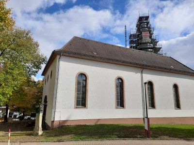
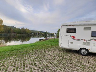
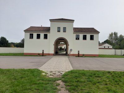
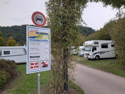
It was already dark when we drove to the parking space (49.204399, 7.60807). We were lucky there was still a space available.
The pitch was easy to drive to, the ground is on firm brown sand, which had the disadvantage that it was carried into the motorhome.
It was already dark when we drove to the parking space (49.204399, 7.60807). We were lucky there was still a space available.
The pitch was easy to drive to, the ground is on firm brown sand, which had the disadvantage that it was carried into the motorhome.
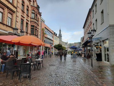
On Sunday morning we set out for a tour of Pirmasens and a hike through the rock forest. The center was only a 10-minute walk from the parking space, a total of around 14 km were ahead of us. And said in advance - we were (almost) alone.
The parade ground in its current form has only existed since 1995. Before that, it was a square paved with small granite stones, which was primarily used as a parking lot and - as is still the case today - as the location of the weekly market. Today the "Exe" is provided with an underground car park that only existed once in its round shape in Germany at the time it was built, namely in Baden-Baden at the Festspielhaus.
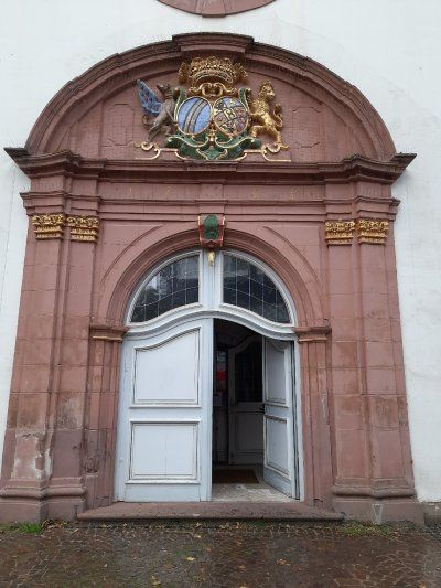
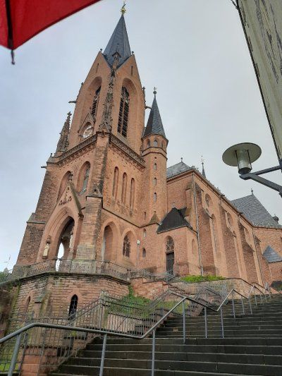
The "Schlossplatz" (also "Unterer Schlossplatz") is the center of Pirmasens. Located on the main street, it connects the "Old Town Hall" with the Pirminius Church via the castle stairs. A water cascade and an oversized bull's head are the eye-catchers of this ascent. At the lower end is the "Old Town Hall". Destroyed in the war and then rebuilt. The carillon also sounds every day at 11:00 a.m. We were surprised to find such a great facility in the middle of the beautiful pedestrian zone.
What would the (former) shoe town of Pirmasens be without its shoemaker Jean Joss?
After his apprenticeship as a shoemaker, which he completed in Paris, he settled in Pirmasens and laid the foundation stone for the local shoe industry. It is said that he sent his wife to the Prussian Rhine Province at the beginning of the 19th century to sell shoes there. When other Pirmasens shoemakers saw how much money the Joss couple had made from this trade, they too began to do the same.
And so began the rise of the “shoe city” - at least that is the legend. Today a bronze figure on the shoemaker's fountain in front of the Luther Church commemorates Jean Joss. The fountain figure had initially stood on the Upper Schloßplatz since 1921, before it was finally placed here in 1981 after the construction of the pedestrian zone. Pithy sayings adorn the octagonal fountain basin, which at least partially express the pride of the Pirmasens in their history.
This is what it says here, for example
"The shoe made us great here,
so don't despise shoes and shoemakers! "
or
"If the shoe leaves the urban 'border',
should he be praise for Pirmasens! "
On Sunday morning we set out for a tour of Pirmasens and a hike through the rock forest. The center was only a 10-minute walk from the parking space, a total of around 14 km were ahead of us. And said in advance - we were (almost) alone.
The parade ground in its current form has only existed since 1995. Before that, it was a square paved with small granite stones, which was primarily used as a parking lot and - as is still the case today - as the location of the weekly market. Today the "Exe" is provided with an underground car park that only existed once in its round shape in Germany at the time it was built, namely in Baden-Baden at the Festspielhaus.
The "Schlossplatz" (also "Unterer Schlossplatz") is the center of Pirmasens. Located on the main street, it connects the "Old Town Hall" with the Pirminius Church via the castle stairs. A water cascade and an oversized bull's head are the eye-catchers of this ascent. At the lower end is the "Old Town Hall". Destroyed in the war and then rebuilt. The carillon also sounds every day at 11:00 a.m. We were surprised to find such a great facility in the middle of the beautiful pedestrian zone.
What would the (former) shoe town of Pirmasens be without its shoemaker Jean Joss?
After his apprenticeship as a shoemaker, which he completed in Paris, he settled in Pirmasens and laid the foundation stone for the local shoe industry. It is said that he sent his wife to the Prussian Rhine Province at the beginning of the 19th century to sell shoes there. When other Pirmasens shoemakers saw how much money the Joss couple had made from this trade, they too began to do the same.
And so began the rise of the “shoe city” - at least that is the legend. Today a bronze figure on the shoemaker's fountain in front of the Luther Church commemorates Jean Joss. The fountain figure had initially stood on the Upper Schloßplatz since 1921, before it was finally placed here in 1981 after the construction of the pedestrian zone. Pithy sayings adorn the octagonal fountain basin, which at least partially express the pride of the Pirmasens in their history.
This is what it says here, for example
"The shoe made us great here,
so don't despise shoes and shoemakers! "
or
"If the shoe leaves the urban 'border',
should he be praise for Pirmasens! "
Rock forest
The tour lives up to its name - through an attractive forest with hidden meadow valleys, streams, springs and ponds, it led us past bizarre sandstone rock formations and through crevices. There were two places to stop for refreshments on the way, the forester's house and ...
Rock forest
The tour lives up to its name - through an attractive forest with hidden meadow valleys, streams, springs and ponds, it led us past bizarre sandstone rock formations and through crevices. There were two places to stop for refreshments on the way, the forester's house and ...
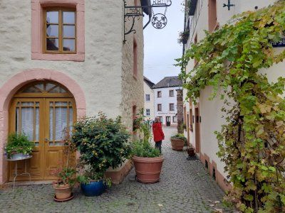
Nice local parking space in the monastery town of Hornbach. Larger RVs shouldn't have a problem. Barbecue hut and hut with tables and benches available. The place is divided and graveled.
Nice local parking space in the monastery town of Hornbach. Larger RVs shouldn't have a problem. Barbecue hut and hut with tables and benches available. The place is divided and graveled.
Our city tour began at the Alexander Church. Zweibrücken is on the north side of the signposted Jakobusweg. In the Middle Ages, pilgrims were shown evidence of medieval art along the way. The Alexander Church was built between 1493 and 1515 and is one of the most important building arts of the late Gothic period. The interior was characterized by an extraordinary star vault.
The name Zweibrücken comes from a castle built in the late 12th century, which had a double moat that had to be crossed by two drawbridges.
The Duke's Castle in Zweibrücken - built in its current form in 1725 - is the largest secular building in the Palatinate in the baroque style of the Nordic region. Clear lines, few flourishes, Zweibrücken is shaped by the Baroque, built in the style of the Nordic Baroque.
The path led through the palace gardens and past the Rhineland-Palatinate state stud that houses Zweibrücken.
Palace garden When the doctor and botanist Hieronymus Bock became famous in the 16th century with the first German herbal book, the city's green heart began to beat. Garden art reached its peak in the 18th century with spectacular inner-city parks in the baroque style. Only one baroque green vein has survived to this day: the canal and avenue allow you to feel the splendor of that time and make the hearts of walkers beat faster.
Zweibrücken and the first submarine
The inventor and inventor Wilhelm Bauer (1822 to 1875) constructed the first submarine called Brandtaucher in Kiel in 1849/50 during the German-Danish War. This marked the beginning of the age of underwater ships for Germany. The fire diver sank in the Kiel harbor basin on his first dive on February 1, 1851. The three-man crew, including Bauer himself, managed to save themselves. Wilhelm Bauer worked in Zweibrücken from October 1867 to July 1868. He planned to build an oil-powered submarine engine in the Dingler factory (now Terex). The factory, founded in 1827, was one of the most important steel construction companies in Germany at that time. At that time it was considered to be the world's leading company in the field of steam engine and air apparatus construction. Bauer went down in history as the developer and inventor of submarines through the submarines "Brandtaucher" and the successor model "Seeteufel".
The tour ended at the Duke suburb.
The Herzogsvorstadt is today the oldest preserved building ensemble in Zweibrücken, even the devastating bombing raids of 1945 could not harm it. The Duke's better officials, valets and court gardeners, lived here from 1770 near the castle.
The bike tour continued to Blieskastel
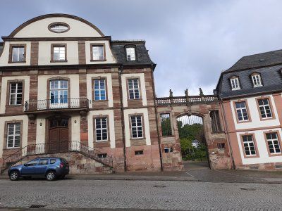
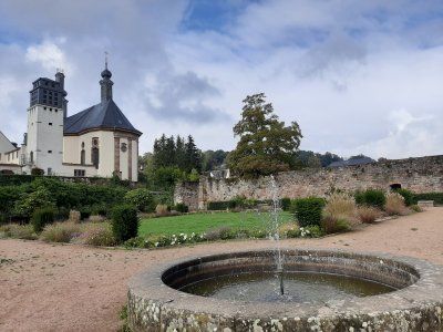
The present-day appearance of downtown Blieskastel was created in the Baroque era. In many places, palaces and mansions determine the image of the former royal seat, which is why it is a stop on Baroque Street Saar-Palatinate. Only remnants of the former castle are left.
A strong man standing on the fountain, the Greek hero Hercules, muscled and with his club he guards a coat of arms that the Count von der Leyen. A ghastly town keeper had the fountain built for the first time in 1691. The fountain used to be very important for the Blieskasteler because on the one hand there was drinking water and on the other hand there was even more important extinguishing water, there was a very high risk of fire, the houses were all only covered with simple shingles.
The castle church was one of the many major construction sites that Countess Marianne had to complete as the client after her husband suddenly died. The church was finished in 1778. It belonged to a Franciscan monastery that was housed in the large building to the right of the church. The count couple had recruited the Franciscans to open a Latin school here, another example of enlightened absolutism in which the nobility no longer only had themselves but also the welfare of their subjects in view. The count couple obviously wanted to develop Blieskastel sustainably. The artfully designed sandstone facade of the church is an eye-catcher, here we see a mixture of baroque and style that became more and more fashionable at the end of the 18th century This time two coats of arms are shown, on the left that the Count von der Leyen, on the right, that of those of Dalberg, the nobility of the Countess, underneath is that of Sebastian, hit by arrows, he is the patron saint of the city. The countess immortalized two men who were very important to her on the two vases above the entrance portal, her son Philipp is depicted on the medallion of the left vase and her late husband Franz-Karl is depicted on the one on the right vase. Inside the church, the huge ceiling painting is worth seeing, it shows, among other things, scenes from the life of St. Sebastian.
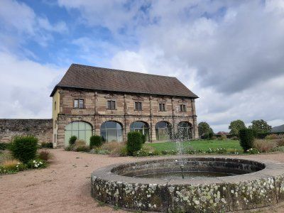
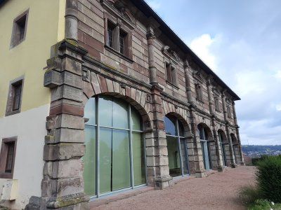
The orangery, the only building spared by the revolutionary troops, could be because it was used as a residential building very early on. At the time of the castle, the orangery was probably the place where the exotic plants from the garden were housed in winter, e.g. oranges and lemon trees, today it's a nice place to get married and there are always concerts and exhibitions. The large arches on the ground floor of the orangery are now glazed, they used to be open, behind that there was a portico in which the nobility could stroll, just as they liked it most in the shade. At that time very important, you wanted to enjoy the beautiful weather, the sun, but just not get dark facial skin, had the lower working class.
The present-day appearance of downtown Blieskastel was created in the Baroque era. In many places, palaces and mansions determine the image of the former royal seat, which is why it is a stop on Baroque Street Saar-Palatinate. Only remnants of the former castle are left.
A strong man standing on the fountain, the Greek hero Hercules, muscled and with his club he guards a coat of arms that the Count von der Leyen. A ghastly town keeper had the fountain built for the first time in 1691. The fountain used to be very important for the Blieskasteler because on the one hand there was drinking water and on the other hand there was even more important extinguishing water, there was a very high risk of fire, the houses were all only covered with simple shingles.
The castle church was one of the many major construction sites that Countess Marianne had to complete as the client after her husband suddenly died. The church was finished in 1778. It belonged to a Franciscan monastery that was housed in the large building to the right of the church. The count couple had recruited the Franciscans to open a Latin school here, another example of enlightened absolutism in which the nobility no longer only had themselves but also the welfare of their subjects in view. The count couple obviously wanted to develop Blieskastel sustainably. The artfully designed sandstone facade of the church is an eye-catcher, here we see a mixture of baroque and style that became more and more fashionable at the end of the 18th century This time two coats of arms are shown, on the left that the Count von der Leyen, on the right, that of those of Dalberg, the nobility of the Countess, underneath is that of Sebastian, hit by arrows, he is the patron saint of the city. The countess immortalized two men who were very important to her on the two vases above the entrance portal, her son Philipp is depicted on the medallion of the left vase and her late husband Franz-Karl is depicted on the one on the right vase. Inside the church, the huge ceiling painting is worth seeing, it shows, among other things, scenes from the life of St. Sebastian.
The orangery, the only building spared by the revolutionary troops, could be because it was used as a residential building very early on. At the time of the castle, the orangery was probably the place where the exotic plants from the garden were housed in winter, e.g. oranges and lemon trees, today it's a nice place to get married and there are always concerts and exhibitions. The large arches on the ground floor of the orangery are now glazed, they used to be open, behind that there was a portico in which the nobility could stroll, just as they liked it most in the shade. At that time very important, you wanted to enjoy the beautiful weather, the sun, but just not get dark facial skin, had the lower working class.
Altheim
Worth seeing in the center of Altheim is the tower of the Catholic parish church St. Andreas, the basement of which dates from the 14th century. The tower was raised in 1499, which shows the year on the upper sound hole on the north side.
After returning we quickly stowed the bikes in the garage before it started raining and after a break we got ready to continue our journey.
Finding a parking space in Ingberth is extremely difficult, especially for larger vehicles. We used the parking lot at a shopping center not far from the center. On the way to the city center, it started to rain in torrents, the parish church of St Engelbert came as called, which we saw first
The St. Engelbert Church is the baroque heart of the city of St. Ingbert. It is one of the three landmarks of the city. The only exterior decoration, the beautifully executed large alliance coat of arms of Count Friedrich Ferdinand von der Leyen and his wife Charlotte von Hatzfeldt above the entrance portal.
The carillon
The carillon on the tower of Engelberts Church was put into service on June 30, 2007, it comprises 23 bells.
Every weekday at 12 o'clock the miner's song "Glück auf, Glück auf, der Steiger is coming" can be heard.
On our city tour we went to St.Josef Church. The Catholic parish church of St. Josef is the second largest church in the Speyer diocese. Only the Speyer Cathedral itself offers more space for believers. The church is one of the three landmarks of the city of St. Ingbert. During repair work on the roof structure, a fire broke out in the top of the church tower on July 17th, 2007, which led to the complete destruction of the roof structure and the bells.
On the way back to the Womo we went through the small pedestrian zone. From 1816 to 1920 St. Ingbert belonged to the Kingdom of Bavaria and the traces of that time can still be discovered everywhere.
Shortly after our arrival, we set out for a city tour. A 30-minute walk took us along the Saar to the Old Bridge. The name of the city of Saarbrücken does not come from the bridges over the Saar, but from the castle that perched high above the Saar on a sandstone rock: "Sara Brocca": Brocken, rock, in the Saar. Saarbrücken as we know it today has existed since 1909: the two cities were only united in the imperial era. Over the old bridge we went to the castle. A Jewish museum is housed in the castle, which was closed when we arrived. Back over the bridge it went to the St. Johann district. With the town hall built by Kaiser Wilhelm II and the Johanneskirche. After a long stroll and a stop, we went back to the Womo.
In good time before dark we drove to Saarlouis to the pitch to stay overnight.
Again we drove to a parking space in the dark. There were still enough free spaces to park. The place wasn't lit.
Again we drove to a parking space in the dark. There were still enough free spaces to park. The place wasn't lit.
We used the morning for a city tour. From the parking space we first went through the city park, if you follow the network of paths you reach the "Vauban Island", formerly also known as "the Halwe Mond", via a footbridge. This facility was built in 1698 as the “Contregarde de l écluse” to protect the lock bridge. From the “Vauban Island” you can look over to the well-preserved “Bastion VI”. It was called "Bastion de Vaudrevange", since 1821 "Bastion Prince Albrecht". From the platform on it you can enjoy an impressive panoramic view of the area. Numerous information boards provide information about the history of the facility. We continued to the old town. The narrow house fronts are characteristic. Barracks VI in Alte-Brauerei-Straße was built between 1866 and 1869 in place of the original French barracks in the classical style. Its unusual length of 185 m indicates the great strategic importance that the Prussians also attached to the fortress city of Saarlouis. In the building there is an interesting museum that you should definitely visit, free of charge. Opposite you come to the longest beer bar alley in Saarland. On the eve of the 200th anniversary, the baroque church tower of the Ludwigskirche fell victim to a fire. The new monolithic nave, completed in 1970, a striking asymmetrical concrete architecture. We strolled on through the old and new market places and through the German gate. The Prussian royal crown and Prussian coat of arms are still reminiscent of the Prussian era after 1815. The cannons in front of the German Gate were also positioned there in the early 1970s. The casemates were built by the Prussians in the area of the main wall in the course of the expansion of the fortifications between 1824 and 1829 as a bomb-proof defense system. The earth-covered vaults served soldiers and horses as accommodation and command posts in the event of a defense. From here it was the same way back to the Womo, with subsequent drive to the Druid Path.
We used the morning for a city tour. From the parking space we first went through the city park, if you follow the network of paths you reach the "Vauban Island", formerly also known as "the Halwe Mond", via a footbridge. This facility was built in 1698 as the “Contregarde de l écluse” to protect the lock bridge. From the “Vauban Island” you can look over to the well-preserved “Bastion VI”. It was called "Bastion de Vaudrevange", since 1821 "Bastion Prince Albrecht". From the platform on it you can enjoy an impressive panoramic view of the area. Numerous information boards provide information about the history of the facility. We continued to the old town. The narrow house fronts are characteristic. Barracks VI in Alte-Brauerei-Straße was built between 1866 and 1869 in place of the original French barracks in the classical style. Its unusual length of 185 m indicates the great strategic importance that the Prussians also attached to the fortress city of Saarlouis. In the building there is an interesting museum that you should definitely visit, free of charge. Opposite you come to the longest beer bar alley in Saarland. On the eve of the 200th anniversary, the baroque church tower of the Ludwigskirche fell victim to a fire. The new monolithic nave, completed in 1970, a striking asymmetrical concrete architecture. We strolled on through the old and new market places and through the German gate. The Prussian royal crown and Prussian coat of arms are still reminiscent of the Prussian era after 1815. The cannons in front of the German Gate were also positioned there in the early 1970s. The casemates were built by the Prussians in the area of the main wall in the course of the expansion of the fortifications between 1824 and 1829 as a bomb-proof defense system. The earth-covered vaults served soldiers and horses as accommodation and command posts in the event of a defense. From here it was the same way back to the Womo, with subsequent drive to the Druid Path.
The approach to the hikers' car park was at the exit of Rehlingen on a narrow farm road.
Druid path
There is a lot to discover on the Druidenpfad in Rehlingen-Siersburg. A Celtic house, a high granary and a barrow were built there. In addition, the history of the buildings and interesting facts about the life of the Celts are told on information boards. An eight kilometer long path (path) leads through orchards and along old boundary stones on the smuggler's path, past mysterious mardelles and Celtic barrows. The Galgenberg tells its story as does the old oak. A Celtic tree calendar takes you into the world of the druids and their knowledge of the value and effect of these plants.
Bad Merzig car park
We were undecided whether we should go to the Bietzener Heilwasser bath after the city tour. The decision to do this was also decisive as to whether we would spend the night in the parking lot.
Parking fee in the car park: 2.50 euros
Fee for adjacent parking space with electricity: 7.50 euros pay at the bathroom counter.
After the sightseeing, we decided to go to the parking lot on the banks of the Moselle in Besch.
St. Peter is the largest preserved Romanesque sacral building in the Saarland. The monastery church, which was completed at the beginning of the 13th century, is an excellent late Romanesque building which has largely retained its original shape. The three-aisled basilica with Gothic cross vault from the 16th century.
The centrally located drinking fountain fed by Bietzener medicinal water is ideal for inhalations. Bundles of hawthorn and blackthorn brushwood form the walls of a salt works in the city park. The air blowing through atomizes the water and distributes the healing water finely in the area. The nebulized medicinal water has a beneficial and soothing effect, especially for respiratory diseases.
The parking lot in Besch is inconspicuously located directly on the banks of the Moselle. When we arrived we thought at first that there is no parking space here. Every now and then a Moselle barge chugs by, the place is very quiet.
The parking lot in Besch is inconspicuously located directly on the banks of the Moselle. When we arrived we thought at first that there is no parking space here. Every now and then a Moselle barge chugs by, the place is very quiet.
The next morning we set out on foot to the small wine-growing town of Schengen, where on June 14, 1985 the first of the Schengen agreements was signed on the ship Marie Astrid.
The next morning we set out on foot to the small wine-growing town of Schengen, where on June 14, 1985 the first of the Schengen agreements was signed on the ship Marie Astrid.
The Luxembourg star architect Francois Valentiny designed the monument and the pillars of the nations with the country stars of all countries that have signed the agreement. An entertaining
An informative walk through the history of Europe and its countries ended the varied excursion destination. On the same bike path along the Moselle (3.9 km) we went back to the Womo.
Another destination of today is the Villa Borg, which we then drove to with the mobile home.
Today's destination is the Celtic village near Nonnenweiler. There are two intermediate stops on the way there, one at the Villa Borg and one at the Saarschleife.
Today is a day with closed roads. The access road to the villa was closed, so we parked 500 m in a parking lot near the Villa Borg.
The Roman Villa Borg was not only excavated, it was completely rebuilt true to the original. The excavation site is unique in Europe and offers authentic insights into the life of the Romans.
It was only a short visit to the villa and only looked at the outside of the Roman villa.
We made sure that we get on quickly to the actual main goal, the Celtic village.
When we arrived in Cloef, we started looking for a parking space. The parking lot that was approached was completely occupied, another one was blocked for mobile homes, so we had no choice but to park at a supermarket.
We had to walk a few hundred meters to the lookout point, in the hope that the weather would not worsen even more and that the beautiful landscape with the Saar loop could be seen. A circulating mountain made of hard Taunus quartzite forces the river to make a detour of ten kilometers and thus offers an incomparable natural spectacle, the most beautiful river bend in Germany. The Saarschleife, the symbol of the Saarland.
We did not use the tree top path, which you can take further up to lofty heights. On the 42 meter high observation tower you will be rewarded with a wonderful 360 ° view! Germany, Luxembourg and France meet here. From the lookout point it was the shortest way back to the Womo (1.5 km).
The journey then went on to a Celtic village in Nonnenweiler.
On the way there it was raining, thank God it stopped raining during the tour.
The Celtic village and ring wall is located in the Hundsrück National Park. The parking lot was easy to drive into.
Admission: Celtic village € 5
After the visit, we hiked to the Celtic ring wall circular route 2.8 km.
The Celtic ring wall Otzenhausen is one of the most impressive Celtic fortifications in Europe. Even today, ten meter high stone walls bear witness to the monumental ground monument from the 1st century BC.
In contrast, a "real" Celtic village has emerged at the foot of the ring wall, in the Celtic Park. A village that could have stood within the huge fortress on the Dollberg 2,000 years ago. The reconstruction of a Celtic settlement is an essential part of the emerging Celtic park. The settlement currently consists of 10 residential, craft and storage buildings, the architecture and construction of which are based on historical findings and models. The settlement is surrounded by a wooden palisade made of sharpened oak trunks, which give the ensemble an authentic character.
After a long and unplanned diversion of the route, we reached the Saarburg parking space annoyed.
Fee: 11.50 €
Electricity: € 0.50 / 1Kw
Shower token: 1.- € (2.- €)
Gas bottle: 11kg € 24.80
After a long and unplanned diversion of the route, we reached the Saarburg parking space annoyed.
Fee: 11.50 €
Electricity: € 0.50 / 1Kw
Shower token: 1.- € (2.- €)
Gas bottle: 11kg € 24.80
Unfortunately the day started with fog and light drizzle. The temperature was 8 ° C.
From the parking space we walked through the beautiful old town of Saarburg.
There the old castle of Siegfried the Ardennes Count, who founded Luxembourg in 963, proudly towers over the valley. We started the ascent to the castle ruins with the chapel in front and climbed the tower, which is over twenty meters high, to enjoy the wonderful view of the town and the foggy river landscape. The specialty of the place is the small Leukbach, which is cleverly diverted to form an 18 meter high waterfall in the middle of the town center. The water is still used to generate electricity today. In the past, the town mills were operated using water power. Three mill wheels staggered one behind the other drove the grinders.
After an extensive tour we went on a short hike through the surrounding vineyards. The harvest was not yet over, vines were still being harvested in individual vineyards.
Parking space is easy to drive.
There is a beautiful lake nearby
Parking space 5.- € (pay with envelope)
Weather drizzle, 10 ° C
Parking space is easy to drive.
There is a beautiful lake nearby
Parking space 5.- € (pay with envelope)
Weather drizzle, 10 ° C
Slept well in a very quiet pitch.
Weather overcast / dry
After breakfast, walked to the old town of Ottweiler, 2km away. Nice old town. During a stroll through the old town there are alleys built with historic stone and half-timbered houses to discover, but also the tower of the Protestant parish church known as Zibbelkapp, extensive remains of the city wall and the magnificent stem pavilion with its baroque rose garden. Nevertheless, the tour is not too strenuous as Ottweiler is relatively small.
Disposed of the toilet on return and continued to Homburg.
Free parking space
City tour, then we looked at the Schlossberg caves and the castle ruins of Homburg.
Entrance to the Schlossberg caves € 10
Stop in a cafe € 14
Weather overcast, dry, 11 ° C
The Schlossberg caves near Homburg were actually once a mine, today they are Europe's largest red sandstone caves.
In addition to visiting the imposing Schlossberg caves, the highlights of the tour include great views, as well as an old castle ruin in the Karlsberg Castle Forest Park (the Hohenburg castle ruins), an old Celtic cult site and chestnut trees that are over 200 years old.
little traffic on the way.
Driven to a free parking lot.
On the way to the city center we saw the castle ruins Nanstein on the hill, which we then visited, but only from the outside. Castle ruins Nanstein, built by Emperor Barbarossa around 1160, the castle came to the Knights of Sickingen clan through marriage in 1475. In 1689, the castle was finally destroyed by French troops during the War of the Palatinate Succession.
The old town wasn't really interesting, we walked quickly through the city and to the mobile home.
Driven to the parking space at the city cemetery, we didn't stand on the square, but in the free parking lot next door.
Parking fee 10, - € 24h. that was too much for us to park for 3 hours.
It took about 30 minutes to walk to the city center. First we strolled through the mighty pedestrian zone. By chance we came to the remains of the mighty Kaiserpfalz, (Barbarossa's imperial city). Passing the city theater, we came to an old part of the old town near St. Martin's Church with a beautiful fountain and house facades. The Kaiserbrunnen was the last attraction that we looked at.
Comments (0)
Comments from Freeontour users