From Stuttgart to Lake Lugano, Pisa, once around Sardinia, Rome and from Lake Garda back to Stuttgart.
Day
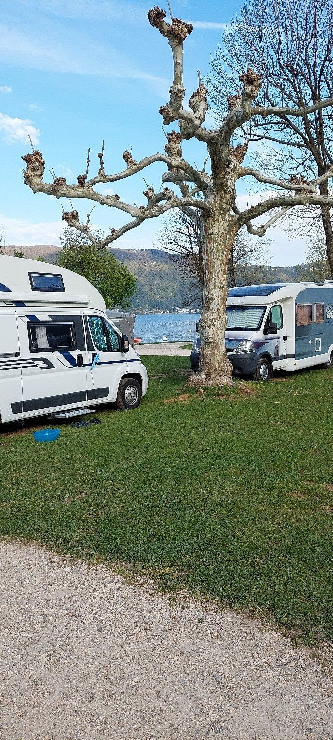
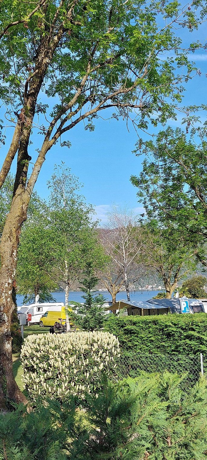
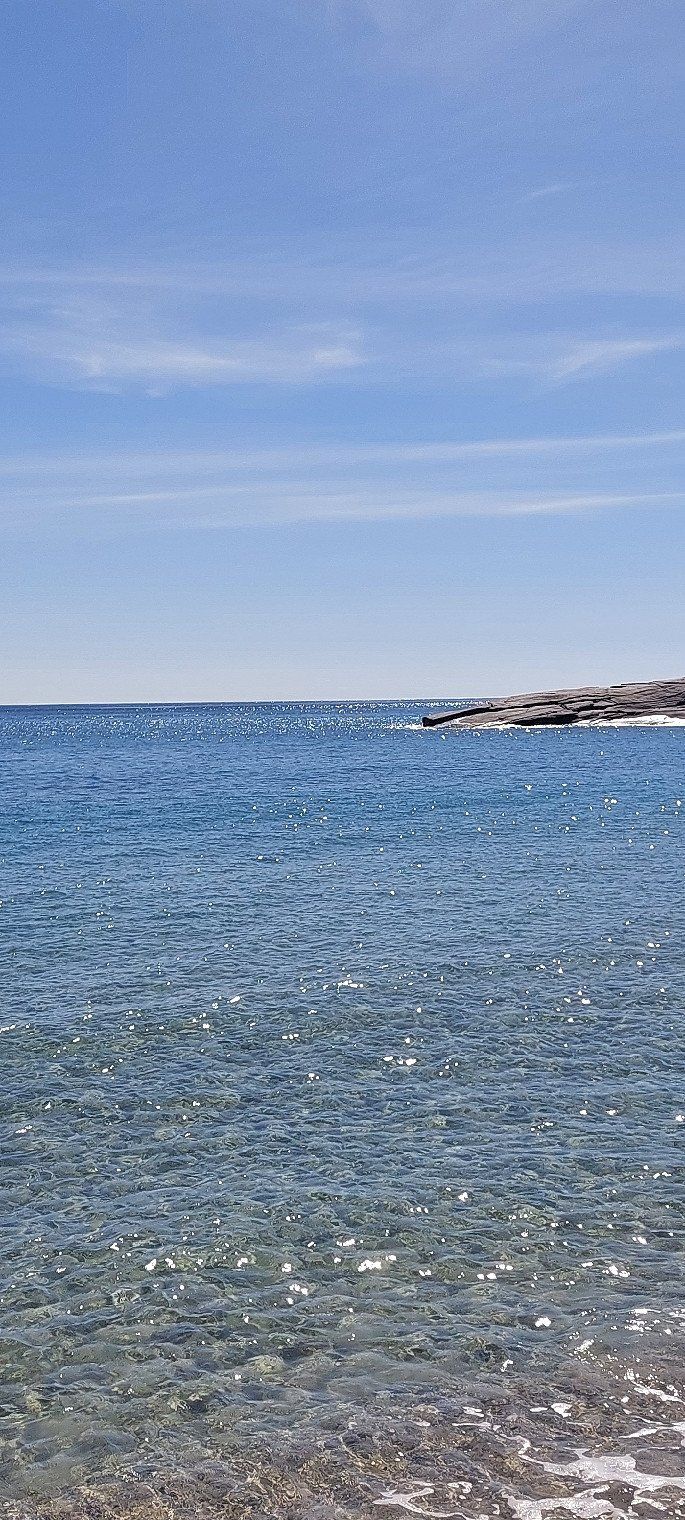
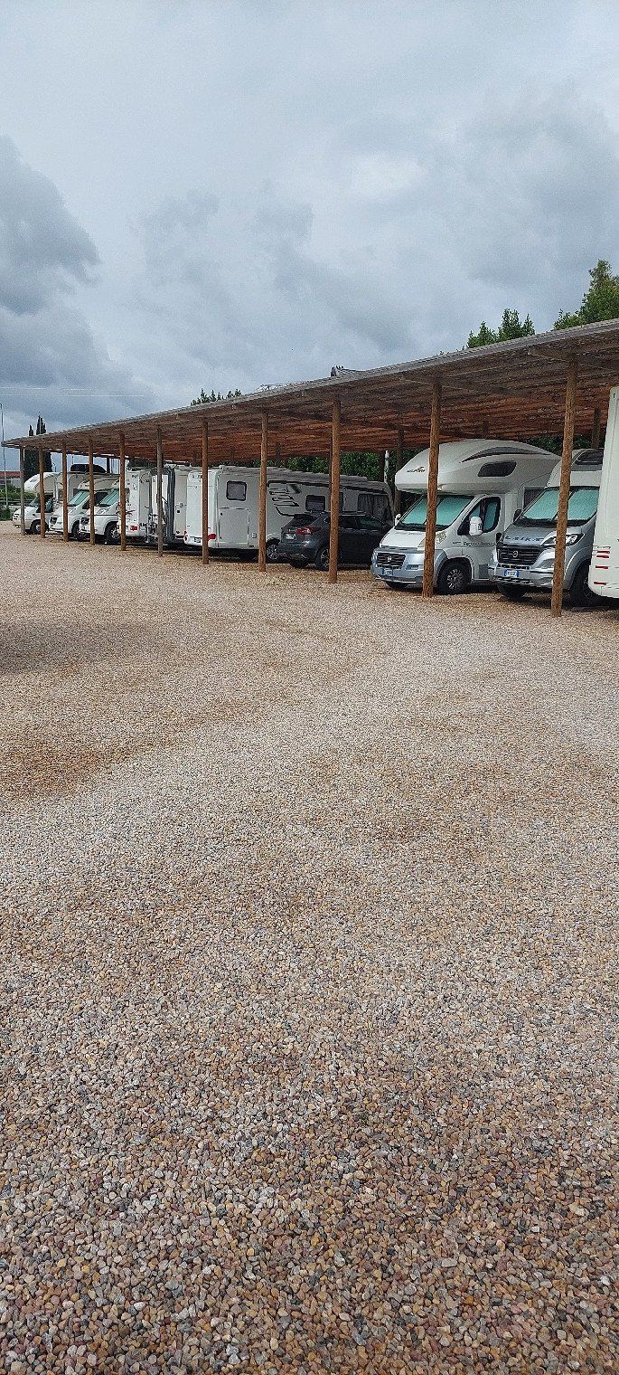
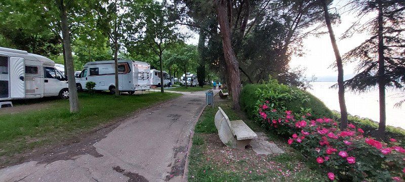
Camping Monte Generoso
April 17th, 2023 the place costs 40.40 SFR with ACSI Card
Via Tannini 12, 6818, Melano, Schweiz
45° 55' 41.2" N 8° 58' 36" E
45.9281100 8.9766700
• Head toward Via Cantonale on Via Tannini. Go for 278 m.
• Turn right onto Via Cantonale (2). Go for 4.2 km.
• Pass 2 roundabouts and continue on Via Carlo Maderno (2). Go for 1.8 km.
• Continue on Via Vignalunga (2). Go for 551 m.
• Take the 2nd exit from roundabout onto Via Vignalunga (2). Go for 579 m.
• Take the 2nd exit from roundabout toward Valle di Muggio/M.te Generoso. Go for 121 m.
• Take the 2nd exit from roundabout onto Via Franco Zorzi. Go for 439 m.
• Pass 2 roundabouts. Go for 266 m.
• Take the 2nd exit from roundabout onto A2 toward Mendrisio/Milano/Chiasso/Varese/Stabio. Go for 7.6 km.
• Continue on A9 (Autostrada dei Laghi). Go for 7.9 km.
• Take the exit toward Como Centro. Go for 851 m.
• Take the 1st exit from roundabout toward Milano. Go for 348 m.
• Take the 2nd exit from roundabout onto Via Giuditta Pasta. Go for 637 m.
• Take the 1st exit from roundabout. Go for 39 m.
• Continue on Via Strada Statale dei Giovi (SPEXSS35). Go for 618 m.
• Pass 3 roundabouts and continue on Via Giuseppe Garibaldi (SPEXSS35). Go for 2.1 km.
• Take the 1st exit from roundabout onto Via Fratelli Balestrini. Go for 486 m.
• Take the 2nd exit from roundabout onto Via Guanzasca. Go for 906 m.
• Turn right onto Viale Repubblica (SP27). Go for 85 m.
• Continue on Viale Roma (SP27). Go for 115 m.
• Take the 4th exit from roundabout onto Viale Roma (SP27). Go for 202 m.
• Continue on Viale Repubblica (SP27). Go for 241 m.
• Continue on SP27. Go for 14 m.
• Take the 1st exit from roundabout onto A9 (Autostrada dei Laghi) toward Milano. Go for 7.7 km.
• Take the exit toward Strada Statale dei Giovi/SS35/Lentate S.S. onto A36 (Autostrada Pedemontana Lombarda). Go for 7.9 km.
• Continue on Strada Provinciale dei Giovi Nord (SPEXSS35). Go for 16.2 km.
• Take ramp onto A52 (Tangenziale Nord) toward Tangenziali Nord e Est/A51/A1/A4/Aeroporto Linate. Go for 13.3 km.
• Continue on A51 (Tangenziale Est). Go for 10.9 km.
• Continue on A1 (Cavalcavia San Donato). Go for 103 km.
• Take the exit toward Parma Ovest/La Spezia onto A15 (Autostrada della Cisa). Go for 51.1 km.
• Take the exit toward Berceto. Go for 671 m.
• Turn left onto Strada Provinciale di Valbona (SP114) toward P.Sso Cisa/SS62/Berceto/Bosco C./Corniglio. Go for 4.0 km.
• Continue on Via Giovanni Lucchi. Go for 315 m.
• Continue on Piazza Micheli. Go for 38 m.
• Turn right onto Strada Provinciale del Colle di Cento Croci (SP523r). Go for 505 m.
• Turn right onto Strada Statale della Cisa (SS62) toward La Spezia/Passo Cisa/Calestano. Go for 13.4 km.
• Turn left onto Strada Statale della Cisa (SS62). Go for 14.6 km.
• Turn right onto Strada Provinciale della Val di Magra (SP31). Go for 1.3 km.
• Turn left and take ramp onto A15 (Autostrada della Cisa) toward E80/Genova/A12/Livorno/La Spezia. Go for 25.8 km.
• Take the exit toward Firenze/A11/E76/Livorno onto A12 (Autostrada Azzurra). Go for 67.6 km.
• Take the exit toward Pisa Centro/Aeroporto Pisa onto Strada di Grande Comunicazione Fi-Pi-Li. Go for 1.6 km.
• Take ramp toward Marina di Pisa/SS224/Tirrenia/Camp Darby. Go for 3.3 km.
• Turn right onto Via Livornese (SP22) toward S. Piero G. Go for 1.6 km.
• Take the 3rd exit from roundabout onto Lungarno Gabriele D'Annunzio (SP224). Go for 5.7 km.
• Arrive at Lungarno Gabriele D'Annunzio (SP224). Your destination is on the right.
☍
380,5 km
(3 hrs. 59 min.)
Day
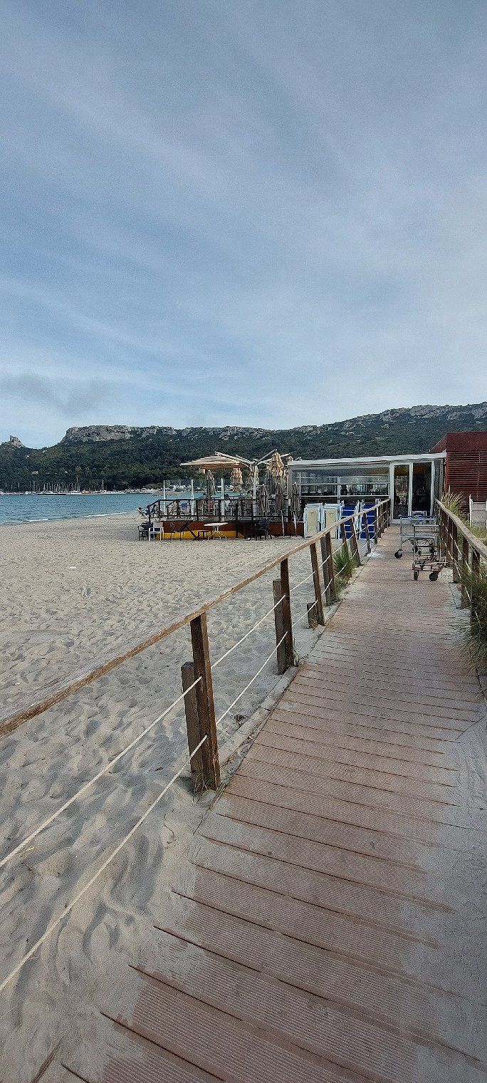
Area Sosta Camper Marina di Pisa
Right at the port. Simple pitch without toilet and shower. Electricity €4 per day. The place costs €12 for 24 hours. Very good for overnight stay. Bus stop 5 minutes away. Drives to Livorno or to Pisa. 04/18/2023
Lungarno Gabriele D'Annunzio, 252, 56128, Pisa, Italien
43° 40' 45" N 10° 16' 45" E
43.6791667 10.2791667
• Head west on Lungarno Gabriele D'Annunzio (SP224). Go for 105 m.
• Take the 3rd exit from roundabout onto Lungarno Gabriele D'Annunzio (SP224) toward Pisa. Go for 4.2 km.
• Keep right onto Via Vecchia di Marina. Go for 1.5 km.
• Turn right onto Parco Giovanni Paolo II. Go for 392 m.
• Turn right onto Via Livornese (SP22) toward FI-PI-LI. Go for 402 m.
• Keep right onto Via Livornese (SP22) toward Livorno. Go for 2.0 km.
• Take the 2nd exit from Rotonda Fratelli Oreste e Egidio Bani roundabout onto Via Livornese (SP22) toward Roma/Livorno/Camp Darby. Go for 2.1 km.
• Turn right onto Strada Statale Aurelia (SS1). Go for 3.8 km.
• Take the 4th exit from roundabout onto A12 (Viadotto Stagno). Go for 2.7 km.
• Take the exit toward Stagno/SS1. Go for 1.0 km.
• Take the 2nd exit from roundabout onto Strada Statale Aurelia (SS1) toward Livorno Centro. Go for 1.1 km.
• Take the 2nd exit from roundabout onto Via Firenze (SS1). Go for 1.3 km.
• Keep left onto Strada Statale Aurelia (SS1). Go for 318 m.
• Turn right onto Viale Genova (SP224). Go for 546 m.
• Continue on Via delle Cateratte. Go for 1.2 km.
• Continue on Via Guido Donegani. Go for 635 m.
• Take the 2nd exit from roundabout onto Via Andrea Costa. Go for 376 m.
• Take the 3rd exit from roundabout onto Via Andrea Costa. Go for 213 m.
• Take the 1st exit from roundabout onto Calata Carrara. Go for 42 m.
• Turn right onto Piazza del Portuale. Go for 174 m.
• Continue on Calata Siena. Go for 135 m.
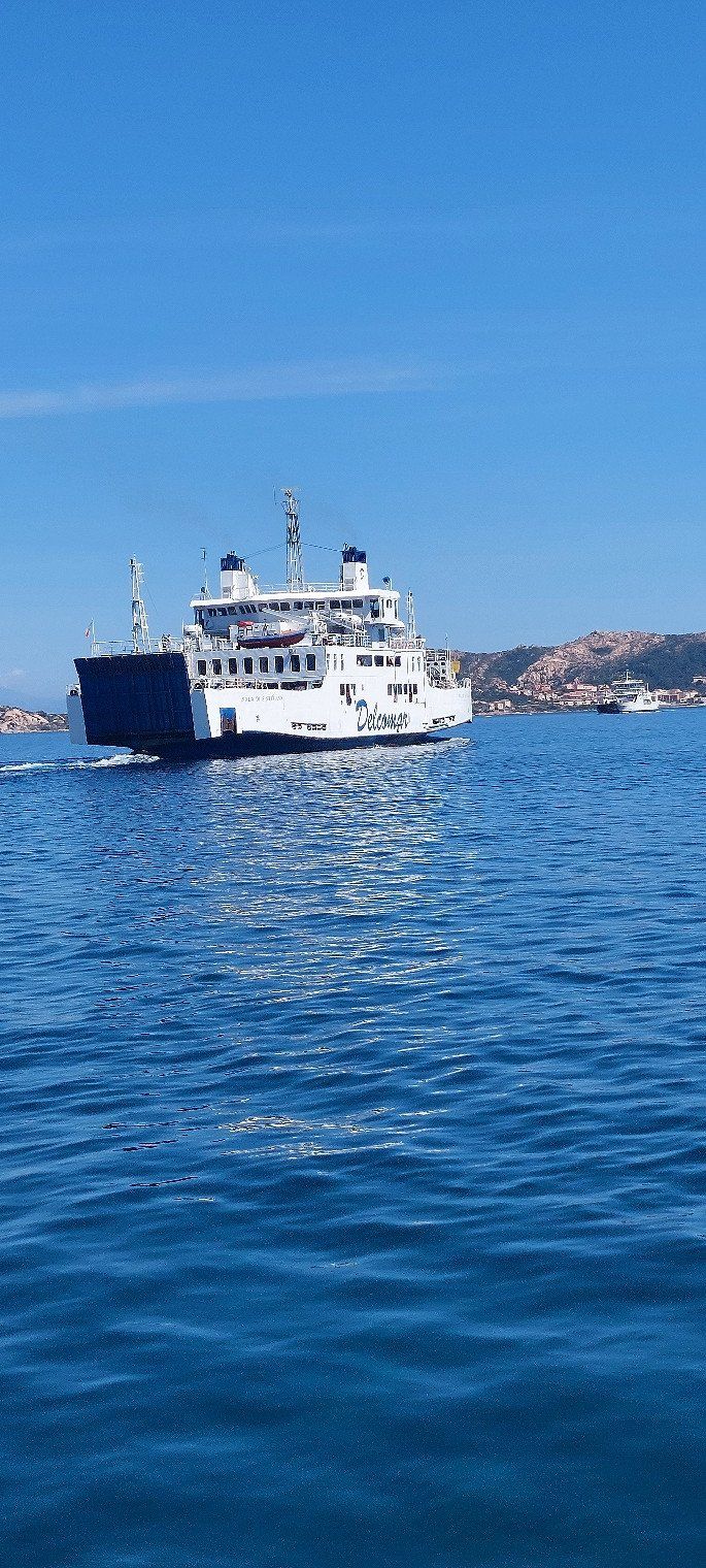
• Take the Livorno-Bastia Ferry. Stay on for 121 km.
• Head toward Quai Nord. Go for 230 m.
• Turn right toward Rue Chanoine Leschi. Go for 274 m.
• Take the 6th exit from roundabout toward Centre Ville/Ajaccio/Calvi/Bonifacio. Go for 249 m.
• Continue on Rue Chanoine Leschi. Go for 303 m.
• Keep left toward T11. Go for 207 m.
• Continue on T11. Go for 2.9 km.
• Keep left onto T11 toward Ajaccio/Bonifacio/Aéroport Poretta. Go for 1.7 km.
• Take the 2nd exit from roundabout onto Avenue Sampiero Corso (T11) toward Calvi/Ajaccio/Bonifacio/Aéroport Poretta. Go for 919 m.
• Keep left toward Avenue Sampiero Corso/T11. Go for 418 m.
• Continue on Avenue Sampiero Corso (T11). Go for 2.6 km.
• Pass 3 roundabouts and continue on T11. Go for 16.1 km.
• Take the 3rd exit from roundabout onto T10 toward Aléria. Go for 997 m.
• Pass 19 roundabouts and continue on T10. Go for 117 km.
• Take the 2nd exit from roundabout onto T10 toward Ajaccio/Bonifacio/Aéroport Figari. Go for 680 m.
• Take the 3rd exit from roundabout onto T10 toward Ajaccio/Bonifacio/Aéroport Figari. Go for 1.2 km.
• Pass 2 roundabouts and continue on T10. Go for 998 m.
• Turn right onto T10 toward Ajaccio/Bonifacio/Aéroport Figari. Go for 624 m.
• Pass 4 roundabouts and continue on T10. Go for 22.5 km.
• Take the 3rd exit from roundabout onto Avenue Sylver Bohn (T40) toward Bonifacio/Centre-Ville. Go for 2.2 km.
• Continue on Rue Sauveur-Paul Étienne. Go for 193 m.
• Continue on Quai Sott a Portigliola toward Gare Maritime. Go for 207 m.
• Take the Bonifacio-Santa Teresa di Gallura Ferry. Stay on for 18.2 km.
• Head southwest on SP161. Go for 96 m.
• Turn left onto SP161. Go for 455 m.
• Turn left onto Via Sandro Pertini. Go for 202 m.
• Turn right onto Via Aa17. Go for 845 m.
• Continue toward Strada Statale Santa Teresa-Ponte Liscia/SS133bis. Go for 52 m.
• Turn left onto Strada Statale Santa Teresa-Ponte Liscia (SS133bis). Go for 15.5 km.
• Continue on SS133 toward Palau Porto/Olbia. Go for 5.5 km.
• Take the 1st exit from roundabout onto Strada Statale Orientale Sarda (SS125) toward Olbia Porto/Aeroporto Olbia. Go for 10.8 km.
• Keep right onto Viale Costa Smeralda (SP115) toward Bassacutena/Circonvallazione/Olbia/Tempio/Arzachena. Go for 267 m.
• Turn left toward Circonvallazione/Olbia/Tempio. Go for 57 m.
• Continue on Circonvallazione Arzachena. Go for 1.7 km.
• Take the 2nd exit from roundabout onto Circonvallazione Arzachena (SP14) toward Olbia. Go for 915 m.
• Take the 2nd exit from roundabout onto Circonvallazione Arzachena (SP14). Go for 3.5 km.
• Take the 1st exit from roundabout onto Strada Statale Orientale Sarda (SS125) toward Aeroporto Olbia/Olbia Porto. Go for 13.8 km.
• Take the 1st exit from roundabout onto Strada Statale Orientale Sarda (SS125) toward Olbia. Go for 3.5 km.
• Take ramp onto Strada Panoramica Olbia toward Aeroporto Olbia/Nuoro/Sassari/Cagliari. Go for 9.8 km.
• Keep left onto Via Burrai. Go for 153 m.
• Continue on SS131d.C.N. Go for 36.9 km.
• Take ramp onto Strada Statale Orientale Sarda (SS125) toward Posada/Budoni. Go for 3.6 km.
• Turn left onto Via Antonio Gramsci (SP24). Go for 1.9 km.
• Take the 1st exit from roundabout onto Strada Posada-la Caletta (SP24). Go for 2.2 km.
• Turn right onto Via Antonio Gramsci (SP24). Go for 46 m.
• Turn left onto Via Palermo (SP3). Go for 127 m.
• Turn right onto Via Palermo (SP3). Go for 717 m.
• Take the 2nd exit from roundabout onto SP3. Go for 2.2 km.
• Continue on Strada Statale Orientale Sarda (SS125). Go for 1.3 km.
• Turn left onto Viale dei Pini (SP125). Go for 1.1 km.
• Arrive at Viale dei Pini (SP125). Your destination is on the right.
☍
452,5 km
(9 hrs. 38 min.)
Day
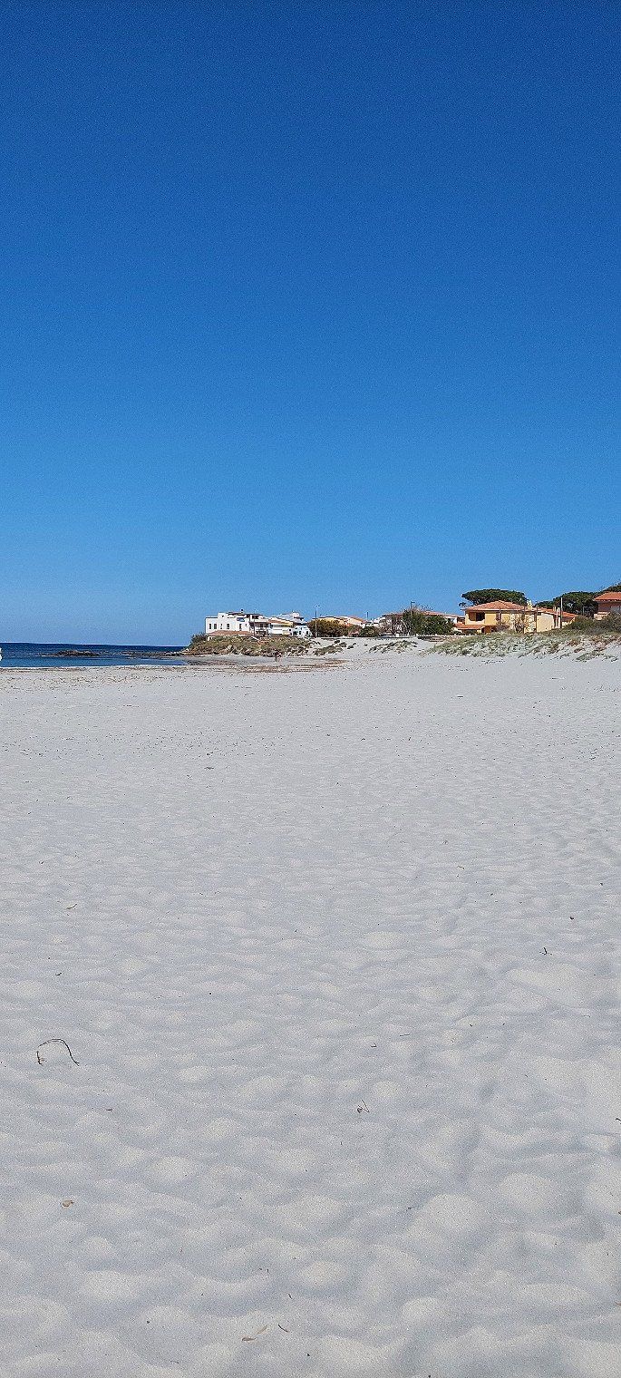
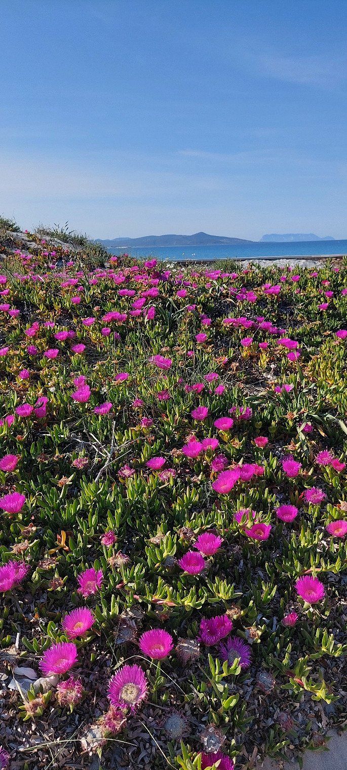
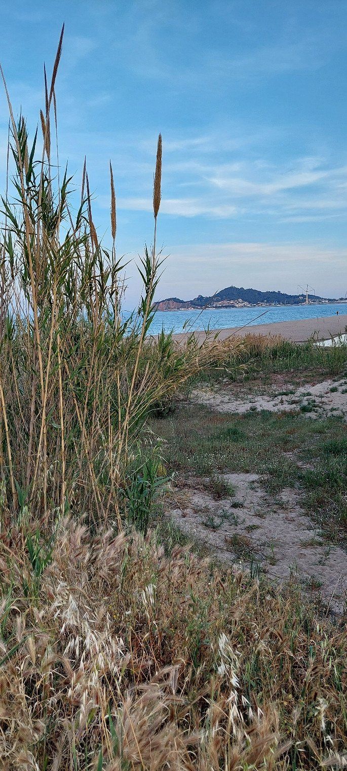
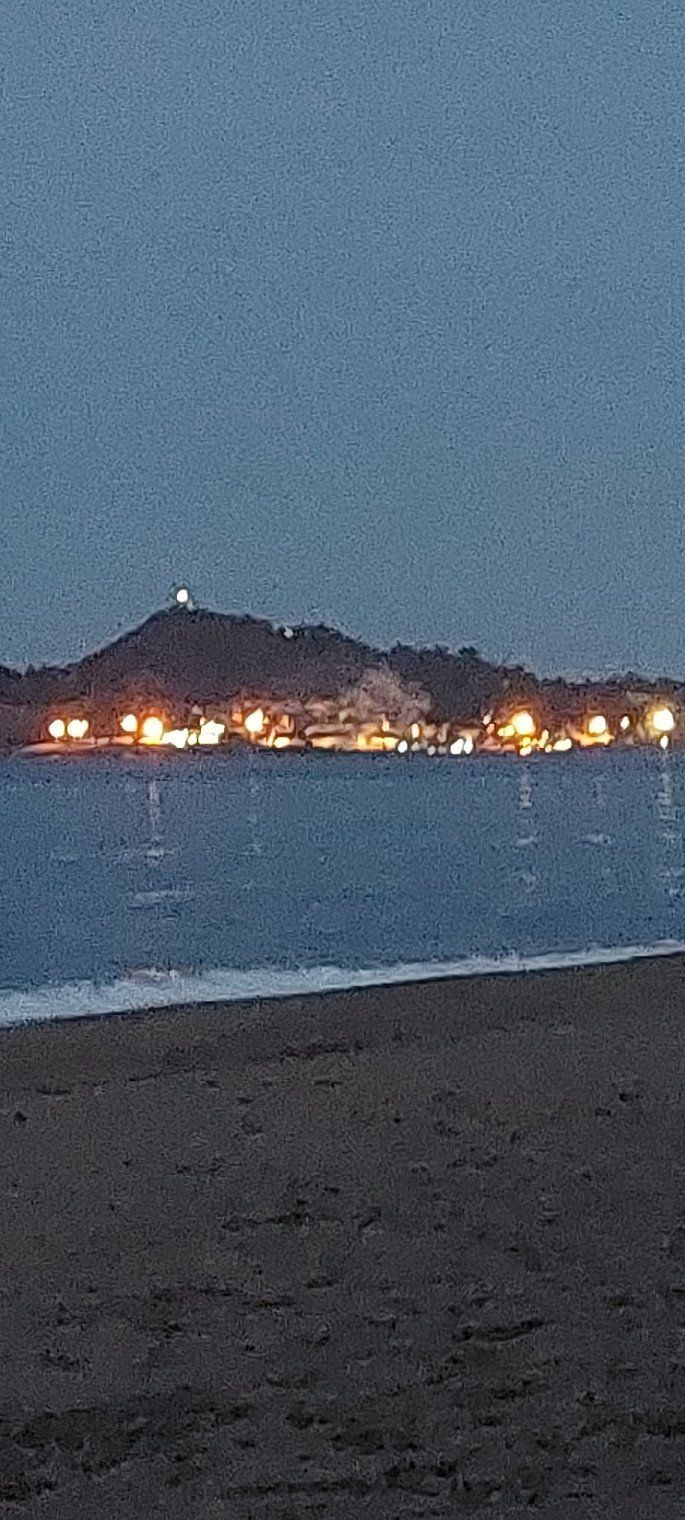
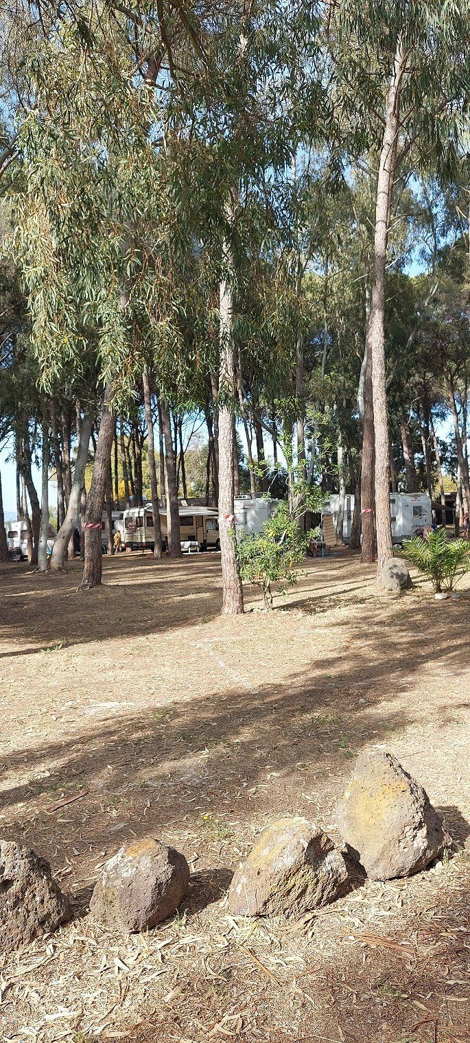
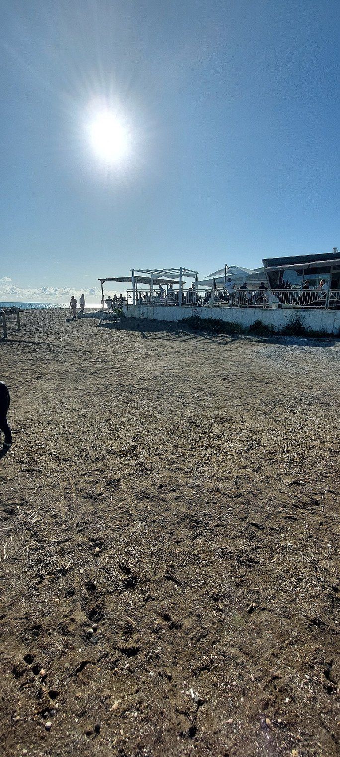
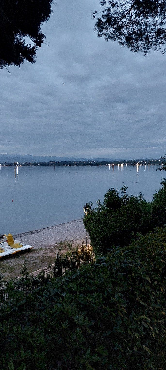
Camping Selema
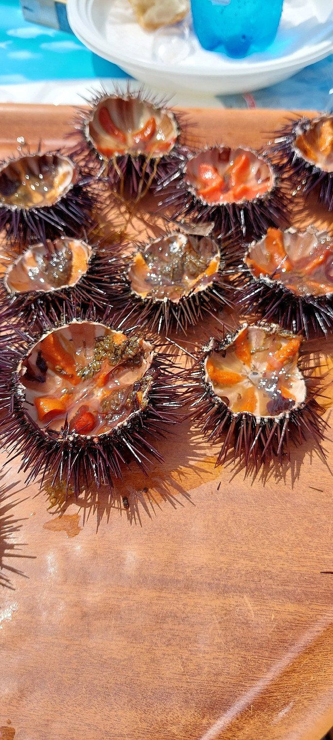
Wildly romantic campsite 300 meters from the sea. On April 20th, 2023 we paid €22 with ACSI Card. Siniscola is within walking distance.
Loc. S. Lucia, 08020, Siniscola, Italien
40° 34' 49.8" N 9° 46' 35.9" E
40.5805100 9.7766300
• Head northeast on Viale dei Pini (SP125).
• Arrive at Viale dei Pini (SP125). Your destination is on the right.
☍
Distance not available
(Duration not available)
Day
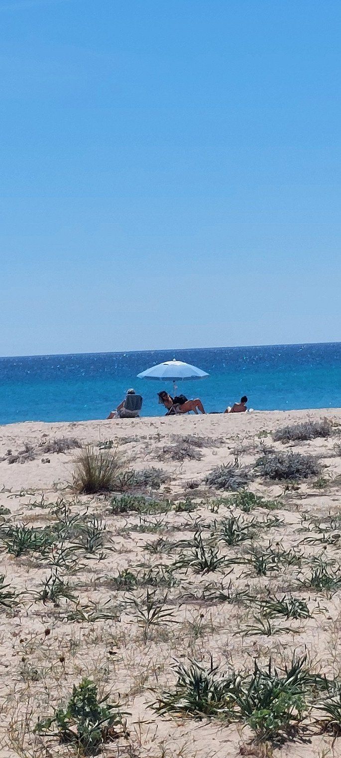
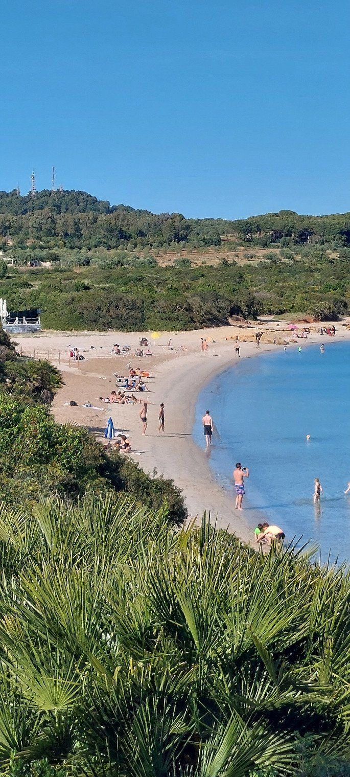
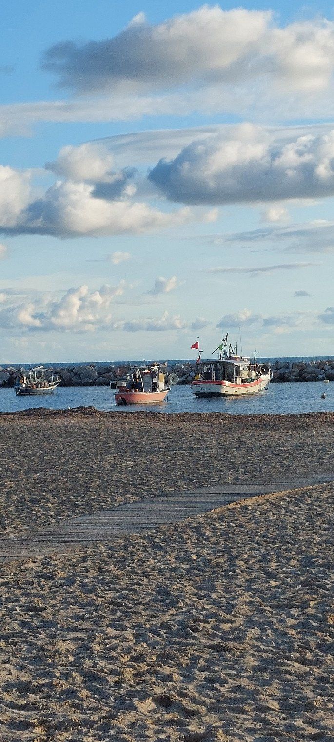
Camping Selema
2nd day at Camping Selema and we like it more and more. The pitches are not subdivided, the long beach and the relaxed atmosphere.
Loc. S. Lucia, 08020, Siniscola, Italien
40° 34' 49.8" N 9° 46' 35.9" E
40.5805100 9.7766300
• Head northeast on Viale dei Pini (SP125). Go for 71 m.
• Turn right onto Via Giovanni da Verrazzano. Go for 30 m.
• Continue on Via Genova. Go for 61 m.
• Turn right onto Via Vittorio Bottego. Go for 601 m.
• Turn right onto Via Vittorio Bottego. Go for 144 m.
• Turn right onto Strada Statale Orientale Sarda (SS125). Go for 6.8 km.
• Turn left onto Via Walter Tobagi (SP12). Go for 146 m.
• Continue on SP12. Go for 4.6 km.
• Take left ramp onto SS131d.C.N. toward Nuoro. Go for 44.0 km.
• Take ramp onto SS389 toward Nuoro/Lanusei. Go for 2.0 km.
• Continue on SS389/Var. Go for 36.8 km.
• Continue on SS389. Go for 17 m.
• Continue on SS389/Var. Go for 14.4 km.
• Turn left onto SP27. Go for 5.1 km.
• Turn sharp right onto SP27. Go for 15.6 km.
• Continue on Strada Provinciale Villagrande Tortolì (SP27). Go for 38 m.
• Continue on SS198. Go for 2.2 km.
• Take left ramp onto Strada Statale Orientale Sarda (SS125) toward Olbia/Orosei. Go for 5.5 km.
• Turn right onto Via Sebastiano Satta. Go for 86 m.
• Keep left onto Via Alessandro Manzoni. Go for 527 m.
• Turn slightly right onto Via Dante Alighieri. Go for 151 m.
• Turn slightly right onto Via Dante Alighieri. Go for 93 m.
• Continue on Via Gioacchino Rossini. Go for 17 m.
• Continue on Via Pollu. Go for 1.3 km.
• Arrive at Via Pollu. Your destination is on the right.
☍
140,3 km
(1 hrs. 50 min.)
Day
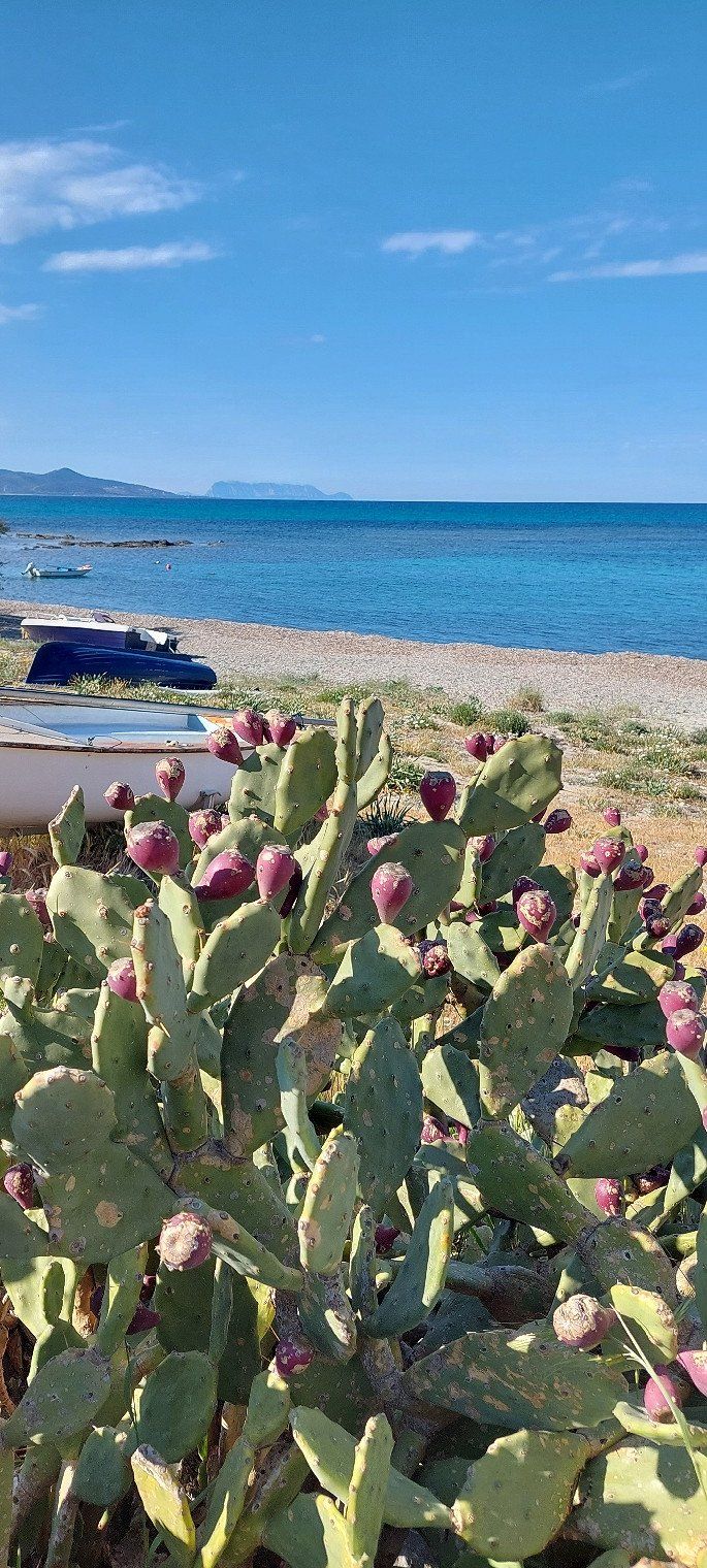
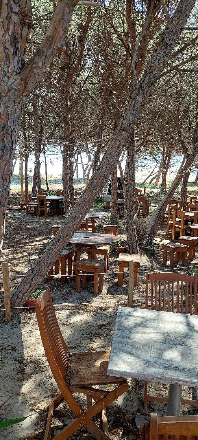
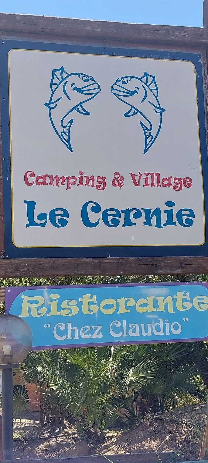
Camping le Cernie
Campsite in need of some refurbishment but the sea views make up for it. €30 without electricity plus €0.50 tourist tax.
Località Case Sparse 17, 08040, Lotzorai, Italien
39° 58' 11" N 9° 41' 2" E
39.9697200 9.6838800
• Head southwest on Via Pollu.
• Arrive at Via Pollu. Your destination is on the right.
☍
Distance not available
(Duration not available)
Day
Camping le Cernie
Località Case Sparse 17, 08040, Lotzorai, Italien
39° 58' 11" N 9° 41' 2" E
39.9697200 9.6838800
• Head southwest on Via Pollu. Go for 343 m.
• Continue on Via Is Orrosas. Go for 1.2 km.
• Turn slightly left onto Via Gioacchino Rossini. Go for 17 m.
• Turn right onto Via Gian Lorenzo Bernini. Go for 69 m.
• Turn slightly left onto Via Tiziano. Go for 96 m.
• Continue on Via Raffaello. Go for 141 m.
• Turn right onto Via Dante Alighieri. Go for 579 m.
• Turn left onto Via Roma (SS125). Go for 6.4 km.
• Take the 1st exit from roundabout onto Nuova S.S. 125. Go for 6.1 km.
• Continue on Strada Statale Orientale Sarda (SS125). Go for 9.0 km.
• Continue on SS125var. Go for 10.6 km.
• Continue on Strada Statale Orientale Sarda (SS125). Go for 5.6 km.
• Continue on SS125 Orientale Sarda. Go for 5.3 km.
• Take the 1st exit from roundabout onto Strada Statale Orientale Sarda (SS125) toward Cagliari. Go for 8.1 km.
• Keep right toward Villaputzu/Cagliari. Go for 110 m.
• Take ramp onto Nuova SS125. Go for 17.8 km.
• Take ramp onto SS387. Go for 841 m.
• Take the 1st exit from roundabout onto Strada Statale Orientale Sarda (SS125). Go for 11.4 km.
• Keep right onto Via Indipendenza (SS125). Go for 2.8 km.
• Take left ramp onto Nuova SS125. Go for 10.2 km.
• Take ramp toward Olia Speciosa. Go for 312 m.
• Turn left onto Via Centrale (SP20). Go for 476 m.
• Turn left onto SP97. Go for 69 m.
• Continue on Località Maloccu (SP97). Go for 289 m.
• Continue on SP97. Go for 192 m.
• Turn right onto Località Maloccu (SP18). Go for 2.5 km.
• Continue on Località Santa Giusta (SP18). Go for 2.3 km.
• Turn left onto Località Santa Giusta. Go for 40 m.
• Turn left onto Via Ichnusa. Go for 888 m.
• Turn right onto Via delle Ginestre. Go for 146 m.
• Turn right. Go for 169 m.
• Arrive at your destination on the left.
☍
104,1 km
(1 hrs. 26 min.)
Day
Camping Village Capo Ferrato
04/24/2023 a beautiful piece of earth.
€30 plus €4.50 for electricity.
Loc. Costa Rei - Via delle Ginestre,12, 09043, Muravera, Italien
39° 14' 35" N 9° 34' 9.7" E
39.2430493 9.5693496
• Head south.
• Arrive at your destination on the left.
☍
Distance not available
(Duration not available)
Day
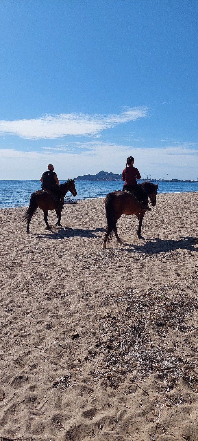
Camping Village Capo Ferrato
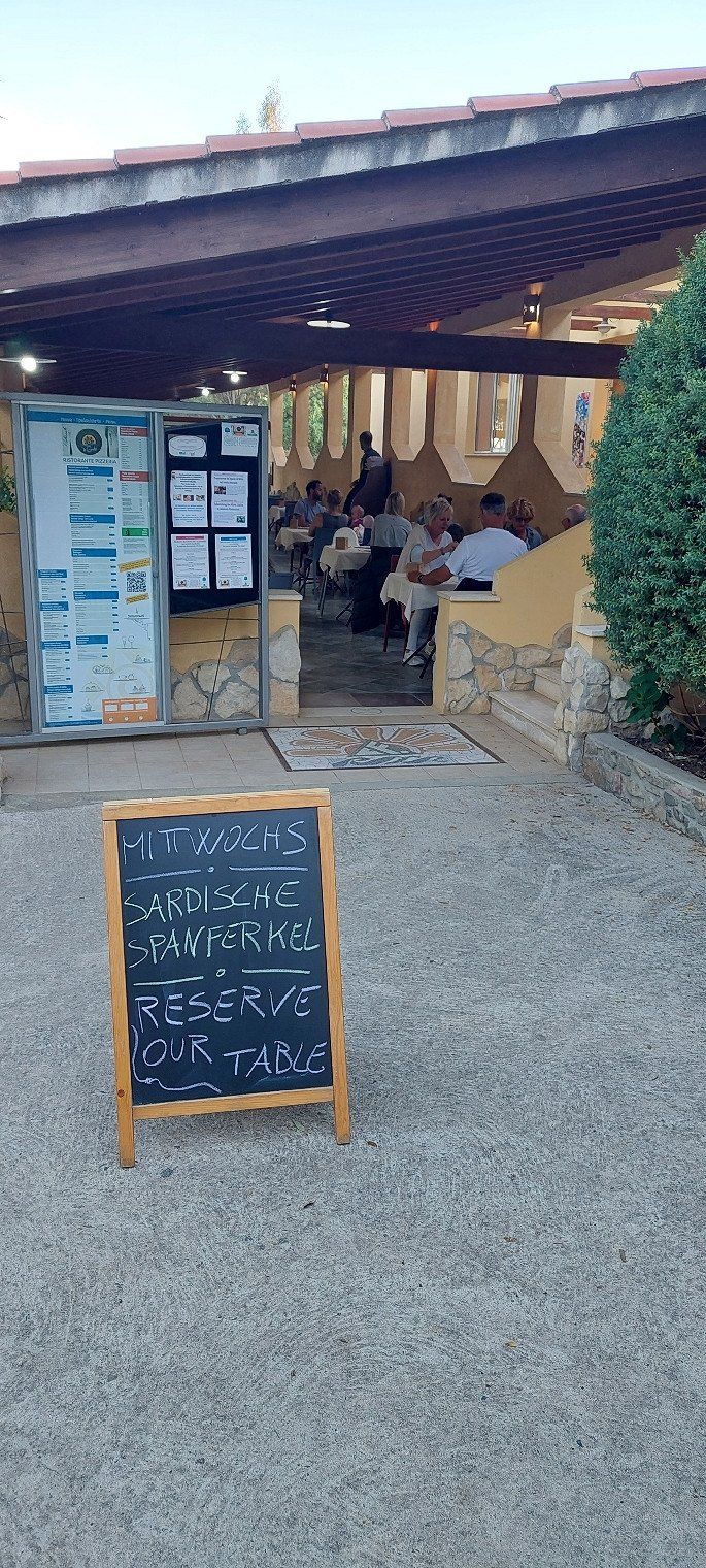
The beach invites to long walks. The campsite offers various events. Eg. an astrologer will explain the starry sky to you, or there are currently various events on the topic of "Sardinian weeks". Customs, visits to historical museums or Sardinian specialties in the restaurant.
Loc. Costa Rei - Via delle Ginestre,12, 09043, Muravera, Italien
39° 14' 35" N 9° 34' 9.7" E
39.2430493 9.5693496
• Head south.
• Arrive at your destination on the left.
☍
Distance not available
(Duration not available)
Day
Camping Village Capo Ferrato
Loc. Costa Rei - Via delle Ginestre,12, 09043, Muravera, Italien
39° 14' 35" N 9° 34' 9.7" E
39.2430493 9.5693496
• Head toward Via delle Ginestre. Go for 169 m.
• Turn left onto Via delle Ginestre. Go for 146 m.
• Turn left onto Via Ichnusa. Go for 888 m.
• Turn right onto Località Santa Giusta. Go for 40 m.
• Turn right onto Località Santa Giusta (SP18). Go for 2.3 km.
• Continue on Località Maloccu (SP18). Go for 2.5 km.
• Continue on SP97. Go for 215 m.
• Continue on Località Maloccu (SP97). Go for 289 m.
• Continue on SP97. Go for 69 m.
• Turn right onto Via Centrale (SP20). Go for 432 m.
• Keep right toward Nuova SS125. Go for 153 m.
• Take ramp onto Nuova SS125 toward Cagliari/Muravera. Go for 14.0 km.
• Continue on Strada Statale Orientale Sarda (SS125). Go for 14.9 km.
• Take ramp onto Nuova SS554 toward Aeroporto Elmas/Cagliari. Go for 7.8 km.
• Take ramp onto Strada Statale Orientale Sarda (SS125). Go for 2.3 km.
• Take the 3rd exit from roundabout onto Località Ganni (SP15). Go for 2.2 km.
• Continue on Via Marco Polo (SP15). Go for 581 m.
• Take the 2nd exit from roundabout onto Via Marco Polo (SP15). Go for 1.6 km.
• Take the 1st exit from roundabout. Go for 34 m.
• Continue on Viale Leonardo da Vinci (SP17). Go for 1.4 km.
• Continue toward Viale Lungomare Golfo di Quartu. Go for 80 m.
• Take the 3rd exit from roundabout. Go for 219 m.
• Turn right onto Viale Lungomare Golfo di Quartu. Go for 1.4 km.
• Pass 2 roundabouts and continue on Viale Lungomare Golfo di Quartu. Go for 2.5 km.
• Continue on Via Lungo Saline. Go for 809 m.
• Continue toward Via Lungo Saline. Go for 67 m.
• Take the 1st exit from roundabout onto Via Lungo Saline. Go for 916 m.
• Take the 1st exit from roundabout onto Via Lungo Saline. Go for 1.8 km.
• Continue toward Piazza degli Arcipelaghi. Go for 44 m.
• Take the 1st exit from Piazza degli Arcipelaghi roundabout. Go for 75 m.
• Continue on Viale Poetto. Go for 1.3 km.
• Continue on Viale Campioni d'Italia 1969-70. Go for 224 m.
• Take the 2nd exit from roundabout onto Viale Campioni d'Italia 1969-70. Go for 469 m.
• Take the 3rd exit from Piazza Manlio Scopigno roundabout onto Via della Pineta. Go for 445 m.
• Turn left onto Via Milano. Go for 400 m.
• Turn right onto Via Grosseto. Go for 99 m.
• Turn left onto Via Ravenna. Go for 169 m.
• Turn right onto Via Stanislao Caboni. Go for 155 m.
• Arrive at Via Stanislao Caboni.
☍
63,1 km
( 55 min.)
Day
Camper Cagliari Park
We made a great bike tour along the Spiaggia Poetto with its beach bars, people bathing, sailing ships and joggers. A city living city, I like it.
Via Stanislao Caboni 13, 08040, Cagliari, Italien
39° 12' 37" N 9° 7' 40" E
39.2102778 9.1277778
• Head north on Via Stanislao Caboni. Go for 335 m.
• Turn right onto Via Gianquinto Degioannis. Go for 22 m.
• Turn left onto Via Domenico Filia. Go for 60 m.
• Turn left onto Via Domenico Filia. Go for 49 m.
• Turn right onto Via Filippo Vivanet. Go for 42 m.
• Turn right onto Via Enrico Pessina. Go for 180 m.
• Turn left onto Via Antonio Scano. Go for 801 m.
• Turn right onto Piazza Padre Pio. Go for 306 m.
• Take the 3rd exit from roundabout onto Via dell'Abbazia. Go for 387 m.
• Take the 2nd exit from roundabout onto Via Berlino. Go for 195 m.
• Take middle ramp onto Nuovo Asse Mediano di Scorrimento. Go for 2.6 km.
• Keep left onto Strada Statale Carlo Felice (SS131dir) toward SS554/SS130/SS131/Aeroporto. Go for 5.2 km.
• Take left ramp onto Strada Statale Carlo Felice (SS131) toward Sassari/Oristano/Nuoro. Go for 85.7 km.
• Take ramp toward Aeroporto Fenosu. Go for 351 m.
• Continue on SP70 toward Aeroporto Fenosu. Go for 114 m.
• Turn sharp left onto SP57. Go for 2.1 km.
• Turn left onto Via Martiri del Congo (SP55). Go for 558 m.
• Turn right onto SP93. Go for 2.3 km.
• Turn right onto SP54. Go for 1.0 km.
• Keep left toward Cabras/Torregrande/San Giovanni di Sinis. Go for 207 m.
• Keep left toward Cabras/Torregrande/S. Giovanni S. Go for 287 m.
• Continue on Via Torre Grande. Go for 3.2 km.
• Take the 4th exit from roundabout onto Strada Provinciale Oristano Torre Grande (SP1). Go for 2.4 km.
• Take the 1st exit from Piazza della Torre roundabout. Go for 42 m.
• Arrive at SP1.
☍
108,5 km
(1 hrs. 13 min.)
Day
Area Sosta Camper Torre Grande
Pitch with a simple toilet and shower for €20 including electricity. 500 meters to the beach.
Oristano, Italien
39° 54' 25.8" N 8° 30' 59.4" E
39.9071533 8.5164940
• Head north on Via Cristoforo Colombo (SP1). Go for 13 m.
• Continue on Via Cristoforo Colombo (SP1). Go for 13 m.
• Turn left onto Via dei Pescatori. Go for 98 m.
• Turn right onto Via Trieste. Go for 60 m.
• Turn right onto Via Magellano. Go for 99 m.
• Turn right onto Via Cristoforo Colombo (SP1). Go for 106 m.
• Take the 3rd exit from Piazza della Torre roundabout onto Via Stella Maris (SP1). Go for 2.3 km.
• Take the 2nd exit from roundabout onto Strada Provinciale Oristano Torre Grande (SP1). Go for 3.5 km.
• Take the 2nd exit from roundabout onto SS292. Go for 1.4 km.
• Take the 3rd exit from roundabout onto Via Rimedio (SS292). Go for 672 m.
• Pass 2 roundabouts and continue on SS292. Go for 2.5 km.
• Continue on SS292. Go for 331 m.
• Take the 1st exit from roundabout toward Sassari/Siamaggiore. Go for 325 m.
• Turn left and take ramp onto Strada Statale Carlo Felice (SS131) toward Nuoro/Sassari. Go for 63.2 km.
• Take ramp. Go for 226 m.
• Take the 3rd exit from roundabout. Go for 199 m.
• Keep right toward SS131. Go for 265 m.
• Continue on SS131. Go for 47.3 km.
• Keep left onto SS131 toward Porto Torres/Alghero. Go for 7.4 km.
• Take ramp onto Strada Statale Variante della Nurra (SS291var) toward Aeroporto/Alghero/Olmedo. Go for 9.2 km.
• Take ramp toward Aeroporto/Fertilia. Go for 210 m.
• Take the 1st exit from roundabout onto Strada Statale della Nurra (SS291) toward Aeroporto/Alghero. Go for 6.4 km.
• Take the 2nd exit from roundabout onto Strada Statale della Nurra (SS291). Go for 4.9 km.
• Turn left onto Strada Statale della Nurra (SS291). Go for 7.1 km.
• Take the 3rd exit from roundabout onto SS127bis. Go for 733 m.
• Arrive at SS127bis. Your destination is on the left.
☍
158,8 km
(1 hrs. 36 min.)
Day
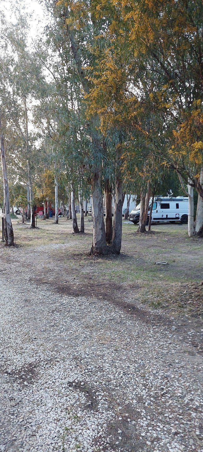
Camping Village Laguna Blu
Top campsite between the sea and a river. With an ACSI Card on April 30th, 2023 we paid €30 including electricity.
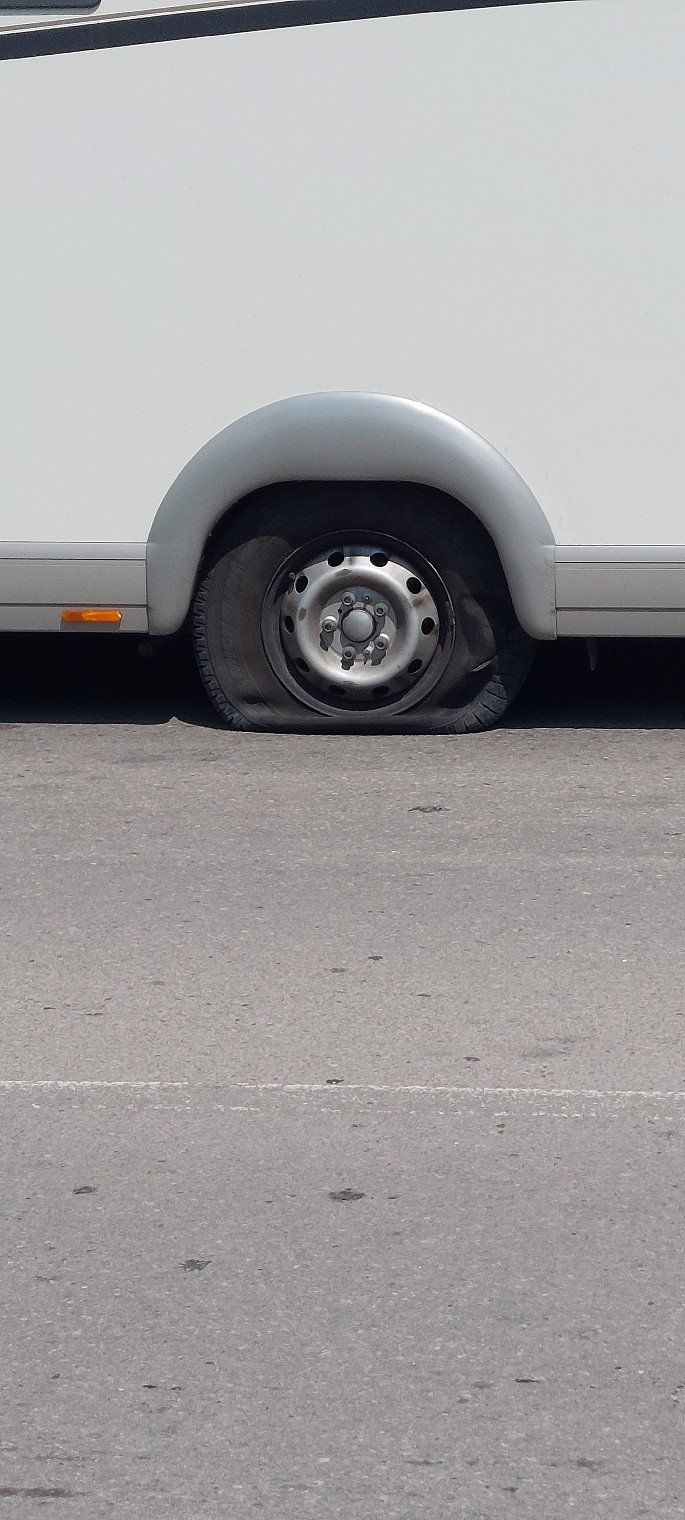
Shortly before Alghero we had a flat tire with our 4.5t camper. Everything was uncomplicated with the ADAC roadside assistance app and the towing service came after 45 minutes (I don’t get any money from ADAC for advertising, that was really the case)
S.S. 127, 07041, Alghero, Italien
40° 35' 41.1" N 8° 17' 27.3" E
40.5947404 8.2909176
• Head east on SS127bis.
• Arrive at SS127bis. Your destination is on the left.
☍
Distance not available
(Duration not available)
Day
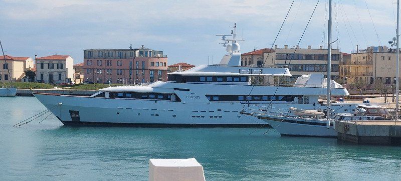
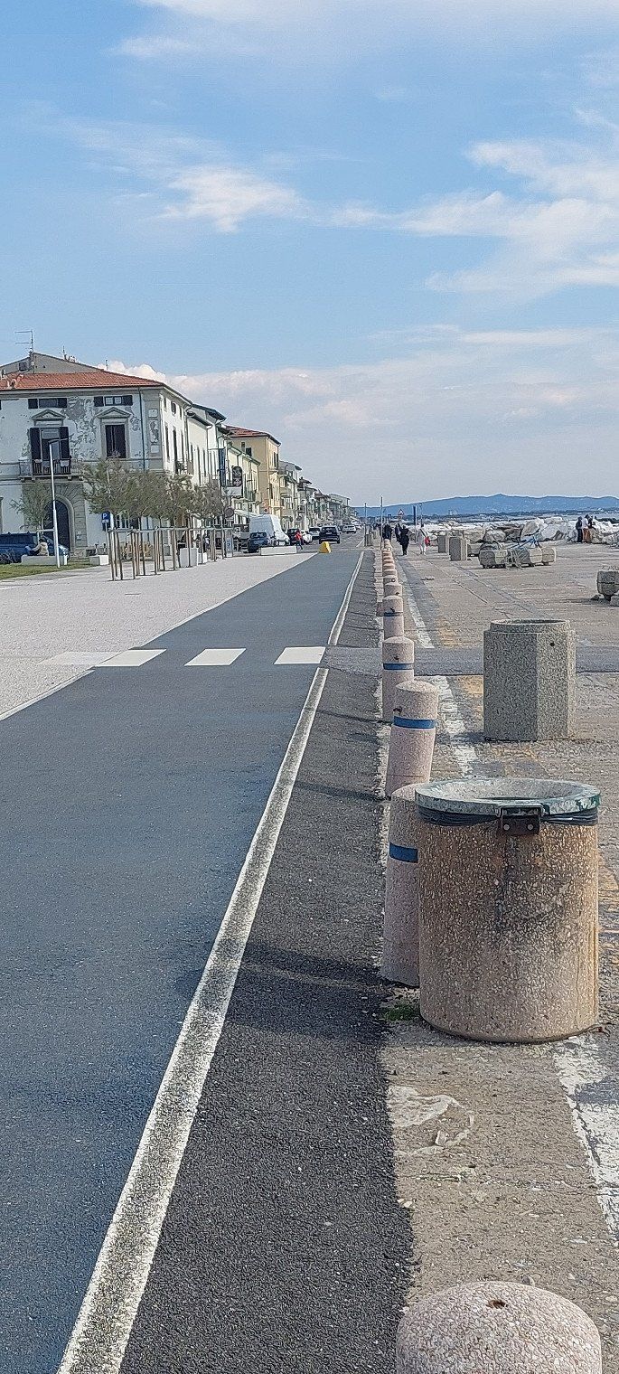
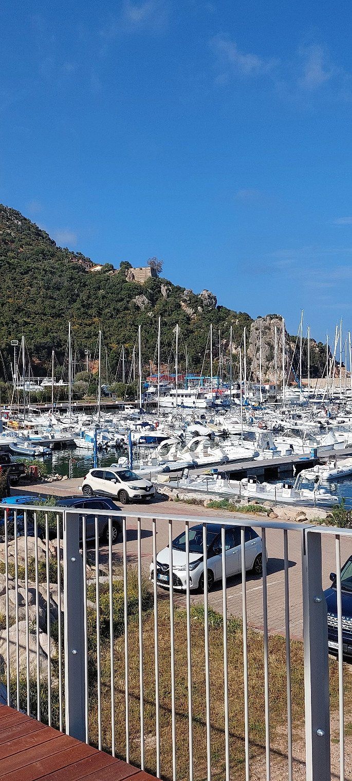
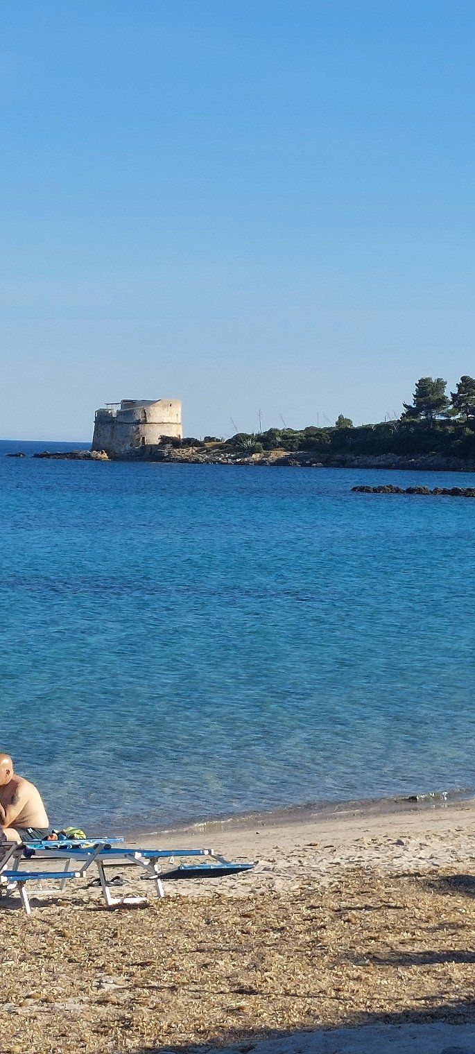
Camping Village Laguna Blu
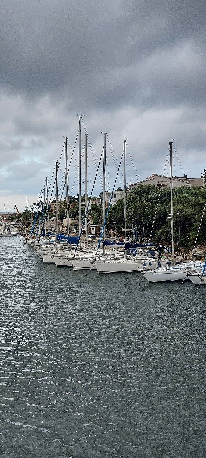
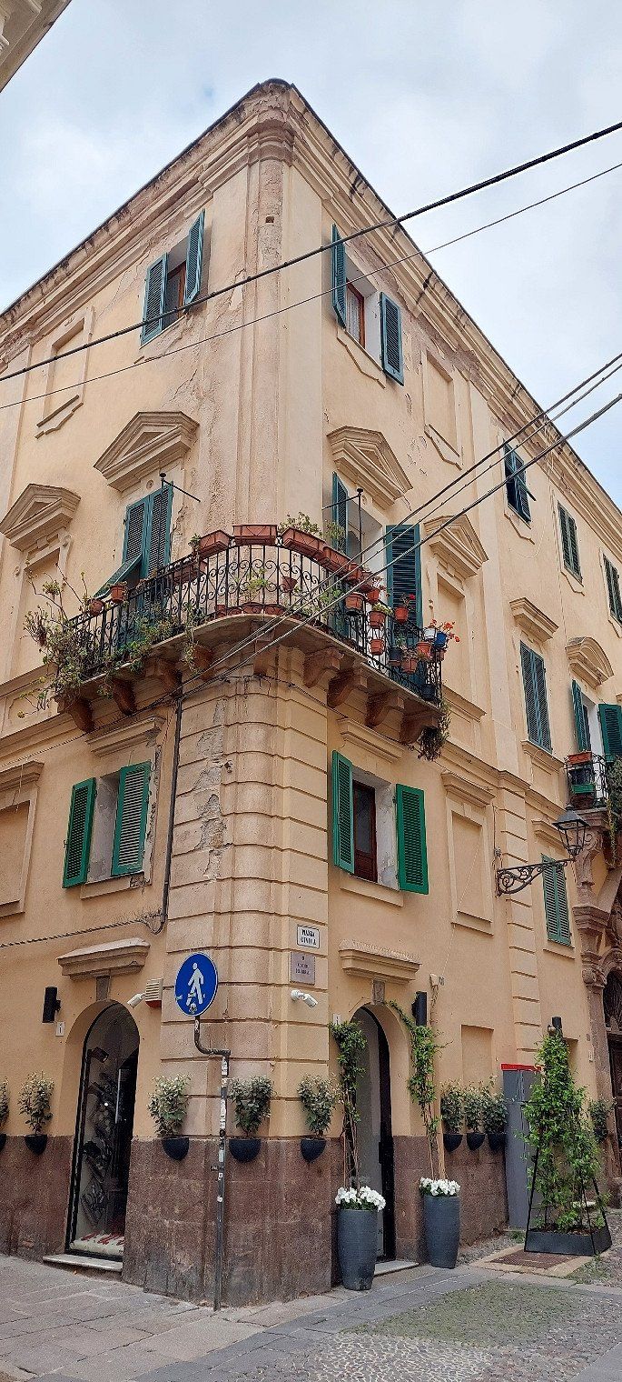
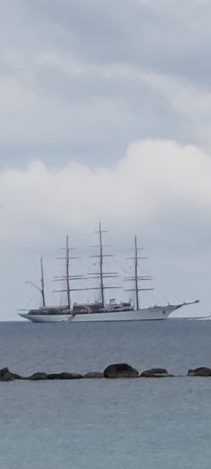
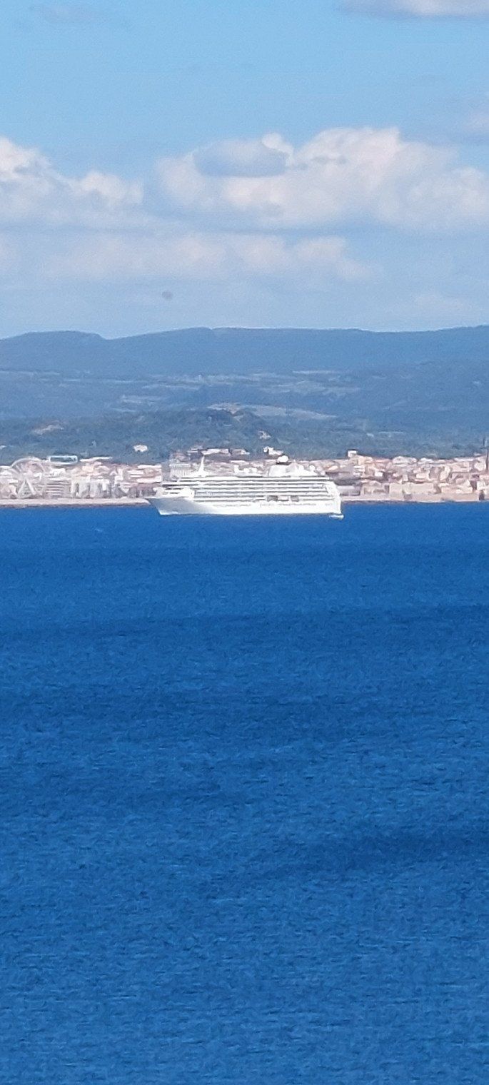
A trip to Alghero is worthwhile.
The Sea Cloud anchored in front of the harbor.
S.S. 127, 07041, Alghero, Italien
40° 35' 41.1" N 8° 17' 27.3" E
40.5947404 8.2909176
• Head east on SS127bis.
• Arrive at SS127bis. Your destination is on the left.
☍
Distance not available
(Duration not available)
Day
Camping Village Laguna Blu
S.S. 127, 07041, Alghero, Italien
40° 35' 41.1" N 8° 17' 27.3" E
40.5947404 8.2909176
• Head east on SS127bis.
• Arrive at SS127bis. Your destination is on the left.
☍
Distance not available
(Duration not available)
Day
Camping Village Laguna Blu
The new tires have arrived and are being fitted
S.S. 127, 07041, Alghero, Italien
40° 35' 41.1" N 8° 17' 27.3" E
40.5947404 8.2909176
• Head east on SS127bis.
• Arrive at SS127bis. Your destination is on the left.
☍
Distance not available
(Duration not available)
Day
Camping Village Laguna Blu
S.S. 127, 07041, Alghero, Italien
40° 35' 41.1" N 8° 17' 27.3" E
40.5947404 8.2909176
• Head east on SS127bis. Go for 234 m.
• Take the 3rd exit from roundabout onto Viale Tore Burruni (SS127bis). Go for 2.4 km.
• Continue on SS127bis. Go for 66 m.
• Take the 4th exit from roundabout onto SP42. Go for 915 m.
• Continue toward SP42. Go for 46 m.
• Take the 2nd exit from roundabout onto SP42. Go for 8.9 km.
• Take the 1st exit from roundabout onto Strada Statale della Nurra (SS291). Go for 1.5 km.
• Keep left onto Strada Statale della Nurra (SS291). Go for 4.7 km.
• Take ramp. Go for 170 m.
• Take the 3rd exit from roundabout onto Strada Statale Variante della Nurra (SS291var) toward SS291/Sassari. Go for 9.3 km.
• Take ramp onto SS131 toward Cagliari. Go for 24.3 km.
• Take ramp toward Olbia/Tempio/SS672/Ozieri. Go for 629 m.
• Continue on SS729. Go for 80.0 km.
• Take ramp onto Strada Statale Orientale Sarda (SS125) toward Olbia/Olbia Porto/Golfo Aranci. Go for 2.4 km.
• Keep left onto Strada Statale Orientale Sarda (SS125) toward Porto Industriale/Golfo Aranci Porto/Arzachena-Palau. Go for 2.3 km.
• Take the 2nd exit from roundabout onto Strada Statale Orientale Sarda (SS125). Go for 4.1 km.
• Take the 2nd exit from roundabout onto Strada Statale Orientale Sarda (SS125) toward Arzachena/Palau/Olbia. Go for 13.9 km.
• Take the 2nd exit from roundabout onto Strada Statale Orientale Sarda (SS125) toward Cannigione/Arzachena/Palau. Go for 1.2 km.
• Keep right toward SP13. Go for 79 m.
• Turn right onto SP13. Go for 3.7 km.
• Continue on Via Nazionale (SP13). Go for 720 m.
• Continue on Via Nazionale (SP13). Go for 1.0 km.
• Turn slightly right onto Strada Comunale Cannigione-Saline (SP13). Go for 87 m.
• Continue on Strada Comunale Cannigione-Saline (SP13). Go for 916 m.
• Continue on Strada Comunale Cannigione-Saline (SP13). Go for 1.3 km.
• Turn right onto Località Isuledda. Go for 778 m.
• Turn slightly left. Go for 15 m.
• Arrive at your destination on the right.
☍
165,7 km
(1 hrs. 58 min.)
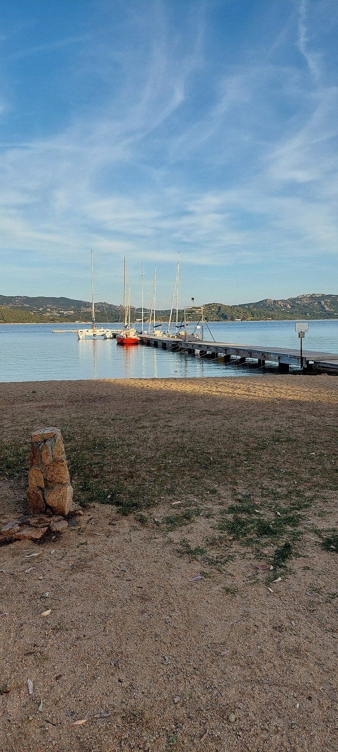
Day
Centro Vacanze Isuledda
Loc. La Conia, 07021, Cannigione di Arzachena, Italien
41° 7' 55.6" N 9° 26' 36" E
41.1321187 9.4433398
• Head northeast.
• Arrive at your destination on the right.
☍
Distance not available
(Duration not available)
Day
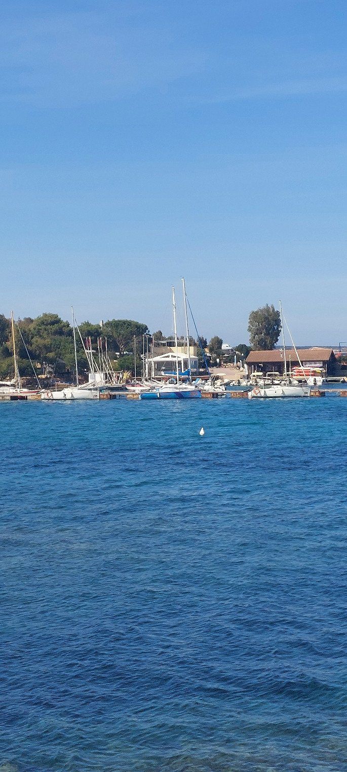
Centro Vacanze Isuledda
On May 5th, 2023 with ACSI Card €30.
The location of the campsite is unique. And there is a spa, sailing school, diving station and boat rentals.
Loc. La Conia, 07021, Cannigione di Arzachena, Italien
41° 7' 55.6" N 9° 26' 36" E
41.1321187 9.4433398
• Head northeast.
• Arrive at your destination on the right.
☍
Distance not available
(Duration not available)
Day
Centro Vacanze Isuledda
We did a bike tour to Palau today. From here the ferry leaves for Isola Madalena. A nice place, but very touristy. The view of the island from the port is very nice.
Loc. La Conia, 07021, Cannigione di Arzachena, Italien
41° 7' 55.6" N 9° 26' 36" E
41.1321187 9.4433398
• Head southwest. Go for 211 m.
• Continue on Località Isuledda. Go for 582 m.
• Turn left onto Strada Comunale Cannigione-Saline (SP13). Go for 412 m.
• Turn slightly right onto Via Monti Corru. Go for 449 m.
• Continue on Località La Conia. Go for 114 m.
• Take the 1st exit from roundabout onto Via Lampara. Go for 620 m.
• Turn slightly right onto Via Lampara. Go for 842 m.
• Turn left toward Via Egadi. Go for 758 m.
• Continue on Via Egadi. Go for 335 m.
• Turn right onto Via Sicilia. Go for 440 m.
• Turn slightly right onto Via Nazionale (SP13). Go for 1.3 km.
• Continue on SP13. Go for 3.8 km.
• Turn left onto SP13. Go for 46 m.
• Turn left onto Strada Statale Orientale Sarda (SS125). Go for 1.2 km.
• Continue toward Strada Statale Orientale Sarda/SS125. Go for 45 m.
• Take the 2nd exit from roundabout onto Strada Statale Orientale Sarda (SS125) toward Circonvallazione/Arzachena/Calangianus/Palau/S.Teresa/Aeroporto Olbia/Olbia Porto. Go for 13.9 km.
• Pass 2 roundabouts and continue on Strada Statale Orientale Sarda (SS125). Go for 6.2 km.
• Take ramp toward Tempio. Go for 226 m.
• Turn right onto Via Alessandro Nanni. Go for 576 m.
• Turn left onto Via Gabriele D'Annunzio. Go for 435 m.
• Turn left onto Via San Simplicio. Go for 117 m.
• Arrive at Via San Simplicio. Your destination is on the left.
☍
32,5 km
( 42 min.)
Day
Olbia
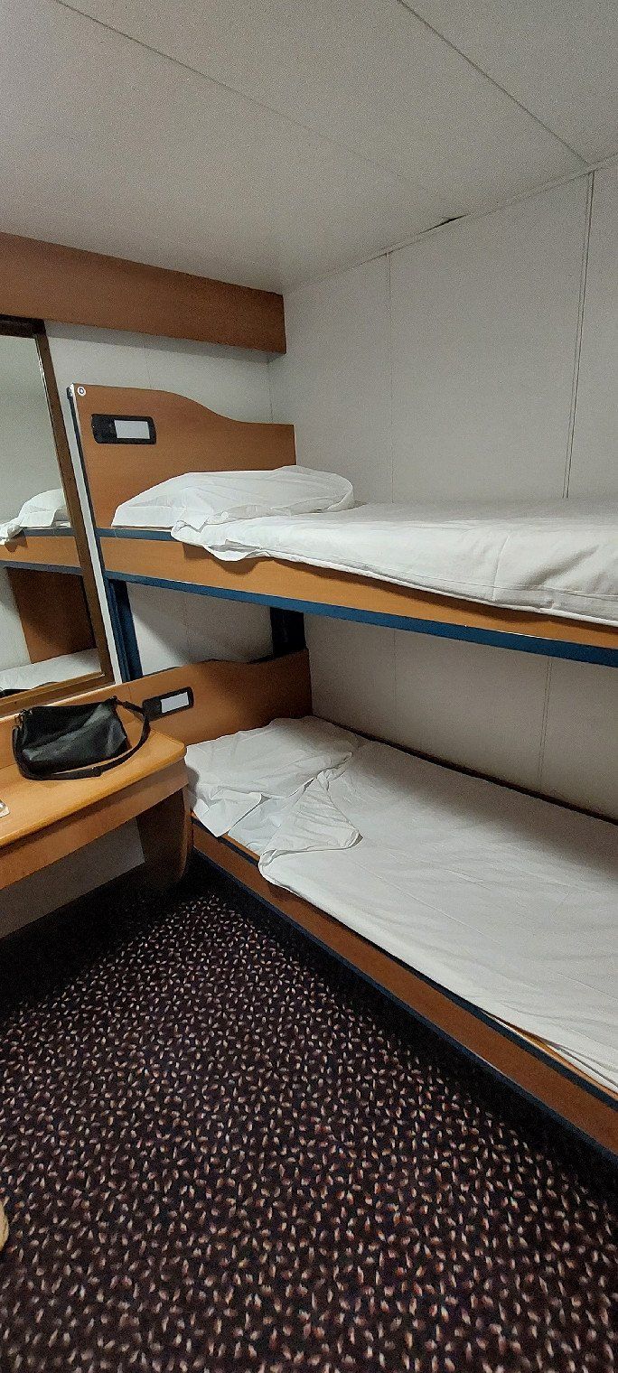
With the night ferry from Olbia to Civitavecchia. The crossing for 2 people with cabin, dinner and mobile home 8.20 m long cost €520
Sassari, Italien
40° 55' 24.9" N 9° 29' 47.2" E
40.9235764 9.4964429
• Head toward Via Brigata Sassari on Via San Simplicio. Go for 117 m.
• Turn right onto Via Gabriele D'Annunzio. Go for 435 m.
• Turn right toward Via Alessandro Nanni. Go for 42 m.
• Continue on Via Alessandro Nanni. Go for 534 m.
• Turn right onto Viale Principe Umberto. Go for 23 m.
• Take the 3rd exit from roundabout onto Via Isola di Mezzo. Go for 707 m.
• Take the 1st exit from roundabout onto Via Isola di Mezzo. Go for 199 m.
• Take the 1st exit from roundabout onto Banchina Isola Bianca. Go for 622 m.
• Turn left onto Banchina Isola Bianca. Go for 18 m.
• Turn right onto Banchina Isola Bianca. Go for 51 m.
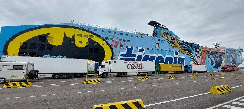
• Take the Olbia-Civitavecchia Ferry. Stay on for 233 km.
• Head northeast on Banchina Santa Fermina. Go for 308 m.
• Turn right onto Banchina Compagnia di Roma. Go for 76 m.
• Take the 2nd exit from roundabout. Go for 259 m.
• Take the 2nd exit from Calata Principe Tommaso roundabout onto Calata Principe Tommaso. Go for 498 m.
• Continue on Banchina Principe Tommaso. Go for 61 m.
• Continue on Calata Principe Tommaso. Go for 99 m.
• Continue on Calata Cesare Laurenti. Go for 74 m.
• Take the 2nd exit from roundabout onto Calata Cesare Laurenti. Go for 182 m.
• Take the 1st exit from roundabout onto Viale Giuseppe Garibaldi (SS1). Go for 1.2 km.
• Keep right onto Via Castronovo (SS1). Go for 3.6 km.
• Turn left toward Roma/A12/E80/Tarquinia. Go for 503 m.
• Take ramp onto A12 (Autostrada Azzurra) toward Roma. Go for 36.9 km.
• Take the exit toward Torrimpietra/Roma onto SS1 (Via Aurelia). Go for 16.9 km.
• Take ramp onto A90 (Grande Raccordo Anulare) toward Firenze/A1/E80/L'Aquila/A24/Cassia/SS2. Go for 17.8 km.
• Take the exit toward Roma Centro Tor di Quinto/Flaminia/SS3. Go for 653 m.
• Take the exit toward Roma Centro/Tor di Quinto onto Variante Flaminia. Go for 401 m.
• Continue on Via Flaminia. Go for 2.2 km.
• Continue on Via Flaminia Nuova. Go for 654 m.
• Keep left onto Via Flaminia Nuova toward Flaminio/Corso di Francia. Go for 383 m.
• Arrive at Via Flaminia Nuova. Your destination is on the right.
☍
318,0 km
(7 hrs. 26 min.)
Day
Village Camping Flaminio
Very good location to get to the center. 20 minutes by train to the center. Single journey €1.50 or €7 for a 24-hour ticket for €7.
The campsite costs €49 on May 9th, 2023 with an ACSI Card including electricity.
Via Flaminia Nuova 821, 00189, Roma, Italien
41° 57' 24" N 12° 28' 60" E
41.9566700 12.4833300
• Head southwest on Via Flaminia Nuova.
• Arrive at Via Flaminia Nuova. Your destination is on the right.
☍
Distance not available
(Duration not available)
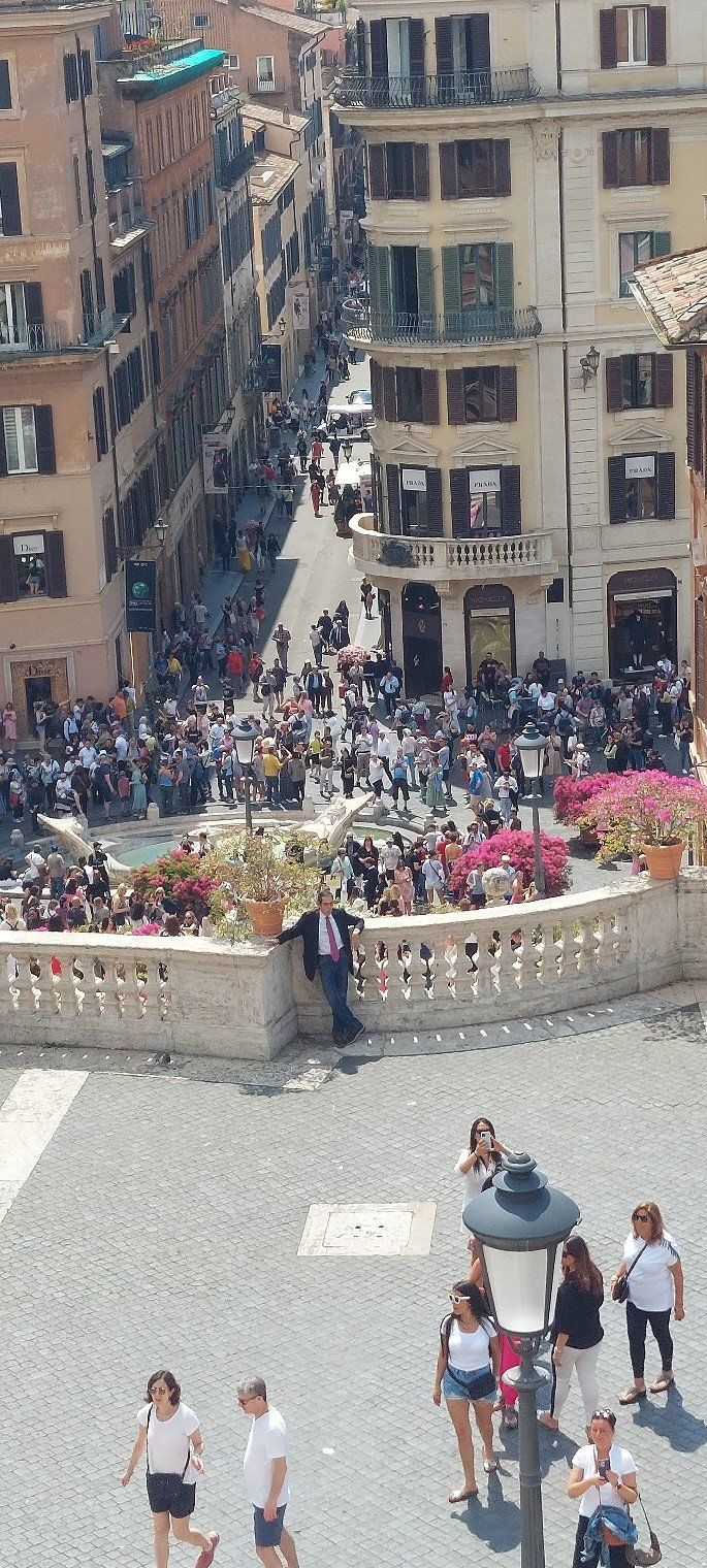
Day
Village Camping Flaminio
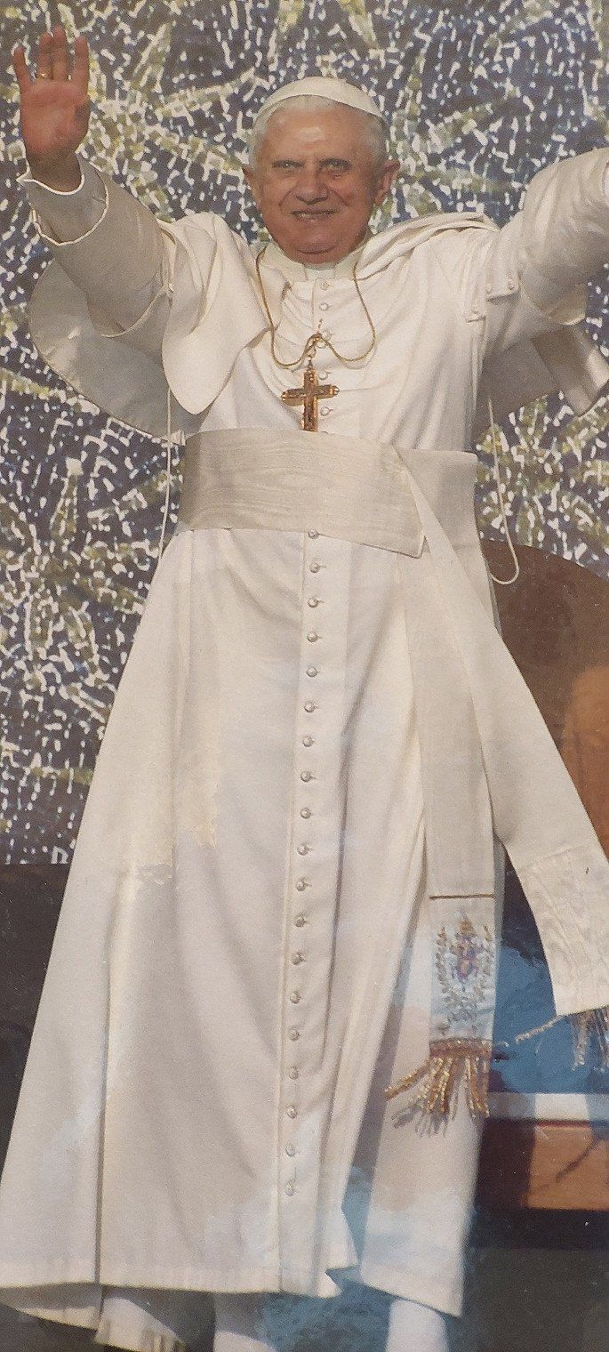
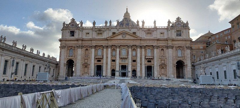
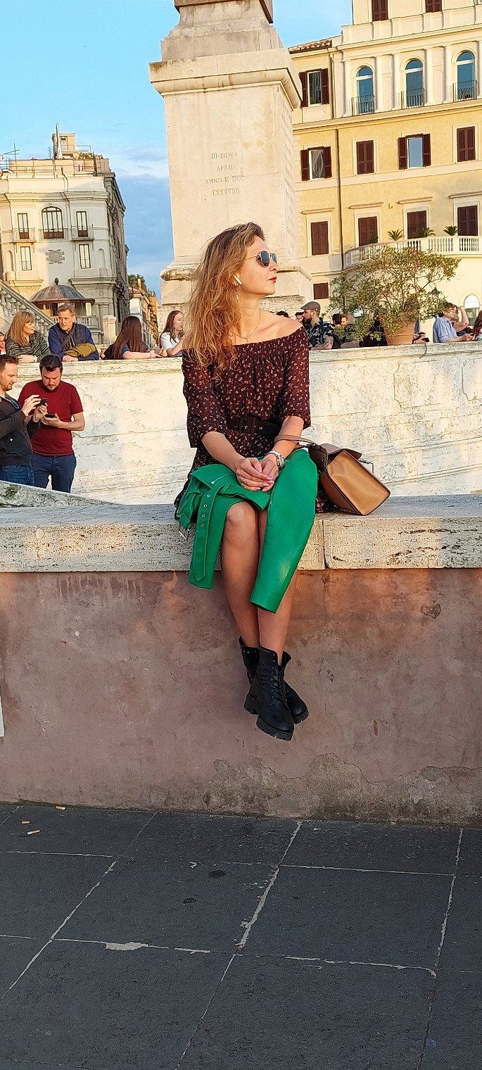
We got tickets for the Vatican for €35. 20000 tickets are sold daily.
Via Flaminia Nuova 821, 00189, Roma, Italien
41° 57' 24" N 12° 28' 60" E
41.9566700 12.4833300
• Head southwest on Via Flaminia Nuova.
• Arrive at Via Flaminia Nuova. Your destination is on the right.
☍
Distance not available
(Duration not available)
Day
Village Camping Flaminio
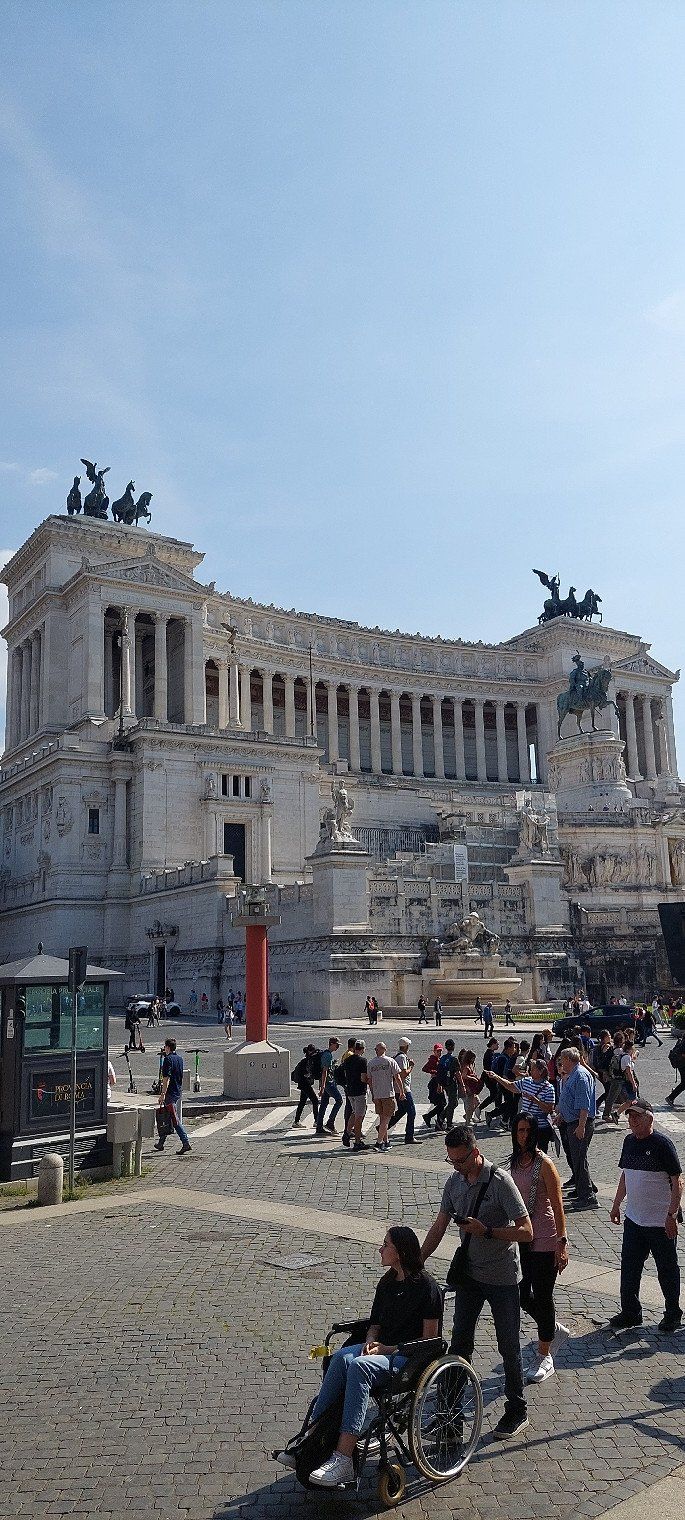
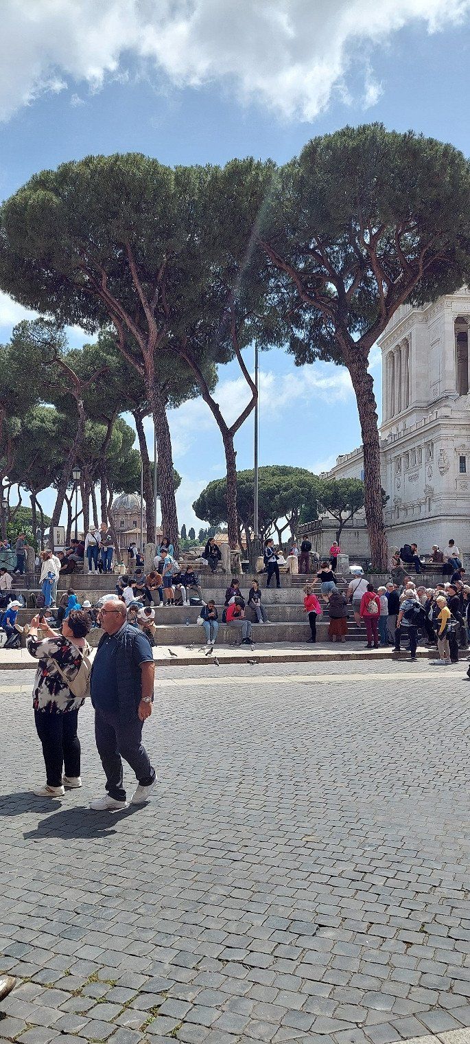
Day 3 in Rome. We use the day for shopping and admired the Colosseum. To get a ticket the wait was 45 minutes so we checked it out from the outside. It is worth it ..
Via Flaminia Nuova 821, 00189, Roma, Italien
41° 57' 24" N 12° 28' 60" E
41.9566700 12.4833300
• Head southwest on Via Flaminia Nuova.
• Arrive at Via Flaminia Nuova. Your destination is on the right.
☍
Distance not available
(Duration not available)
Day
Village Camping Flaminio
Via Flaminia Nuova 821, 00189, Roma, Italien
41° 57' 24" N 12° 28' 60" E
41.9566700 12.4833300
• Head southwest on Via Flaminia Nuova. Go for 1.2 km.
• Turn right onto Via Flaminia Nuova. Go for 16 m.
• Turn left onto Via Flaminia Nuova. Go for 236 m.
• Turn left onto Via Antonio De Viti De Marco. Go for 25 m.
• Turn left onto Via Flaminia Nuova toward Saxa Rubra. Go for 1.9 km.
• Keep left onto Via Flaminia Nuova toward Saxa Rubra. Go for 619 m.
• Continue on Via Flaminia. Go for 2.2 km.
• Continue on Variante Flaminia toward Terni/SS3/Flaminia/SS3/Prima Porta. Go for 73 m.
• Keep left onto Variante Flaminia. Go for 421 m.
• Take ramp toward Civitavecchia/A12/Fiumicino/Aurelia/SS1/Cassia/SS2. Go for 1.2 km.
• Continue on A90 (Grande Raccordo Anulare). Go for 16.7 km.
• Take exit 1 toward E80/Porto Civitavecchia/A12/Aurelia/SS1 onto Via Aurelia. Go for 16.0 km.
• Take ramp onto A12 (Autostrada Azzurra) toward Civitavecchia. Go for 65.6 km.
• Continue on Via Aurelia (SS1). Go for 80.3 km.
• Take ramp onto Via Aurelia Santa Maria toward Grosseto Sud. Go for 3.5 km.
• Keep left onto Via Aurelia Sud toward Livorno. Go for 77 m.
• Take the 2nd exit from roundabout onto Piazza del Risorgimento. Go for 593 m.
• Take the 2nd exit from Piazza Alfonso La Marmora roundabout onto Viale Sidney Sonnino. Go for 588 m.
• Keep right onto Viale Sidney Sonnino. Go for 337 m.
• Turn right onto Viale Giacomo Matteotti. Go for 325 m.
• Enter the roundabout. Go for 24 m.
• Arrive at Piazza Fratelli Rosselli. Your destination is on the right.
☍
192,0 km
(2 hrs. 3 min.)
Day
Grosseto, Camper Area 51
20,- with electricity. Located on a main street.
Italien
42° 45' 48.7" N 11° 6' 44.5" E
42.7635254 11.1123634
• Follow the roundabout. Go for 31 m.
• Take the 3rd exit from roundabout onto Via Roma. Go for 538 m.
• Continue on Via Aurelia Nord. Go for 334 m.
• Take the 2nd exit from roundabout onto Via Aurelia Nord. Go for 503 m.
• Turn right onto Via Monte Rosa. Go for 37 m.
• Continue on Via Monte Labro. Go for 202 m.
• Continue on Via di Francia. Go for 172 m.
• Take the 2nd exit from roundabout onto Via Monte Labro. Go for 153 m.
• Take the 2nd exit from roundabout onto Via Circonvallazione Nord. Go for 579 m.
• Take the 1st exit from roundabout onto Via Aurelia Nord. Go for 1.4 km.
• Take the 1st exit from roundabout onto Strada Statale Aurelia (SS1) toward Livorno. Go for 96.0 km.
• Take ramp toward Cecina Nord/Livorno/SS1/Cecina. Go for 301 m.
• Continue on Strada Regionale di Val di Cecina (SR68) toward Cecina. Go for 218 m.
• Take the 1st exit from roundabout onto Via Po. Go for 1.6 km.
• Take the 2nd exit from roundabout onto Strada Regionale Pisana-Livornese (SR206). Go for 549 m.
• Take the 2nd exit from Via Pisana Livornese roundabout onto Località San Pietro in Palazzi. Go for 169 m.
• Turn left onto Piazza dei Mille. Go for 384 m.
• Take the 1st exit from roundabout onto Via Francesco Domenico Guerrazzi. Go for 2.3 km.
• Take the 1st exit from roundabout. Go for 44 m.
• Continue on Via Campilunghi. Go for 1.3 km.
• Turn left onto Via Campilunghi. Go for 29 m.
• Turn right. Go for 21 m.
• Turn slightly left. Go for 106 m.
• Arrive at your destination on the left.
☍
107,0 km
(1 hrs. 9 min.)
Day
Camping Mareblu
The campsite is 300 meters from the beach. With ACSI Card €39.
Via dei Campilunghi, 57023, Cecina Mare, Italien
43° 19' 7" N 10° 28' 21" E
43.3186100 10.4725000
• Head northwest.
• Arrive at your destination on the left.
☍
Distance not available
(Duration not available)
Day
Day
Camping Mareblu
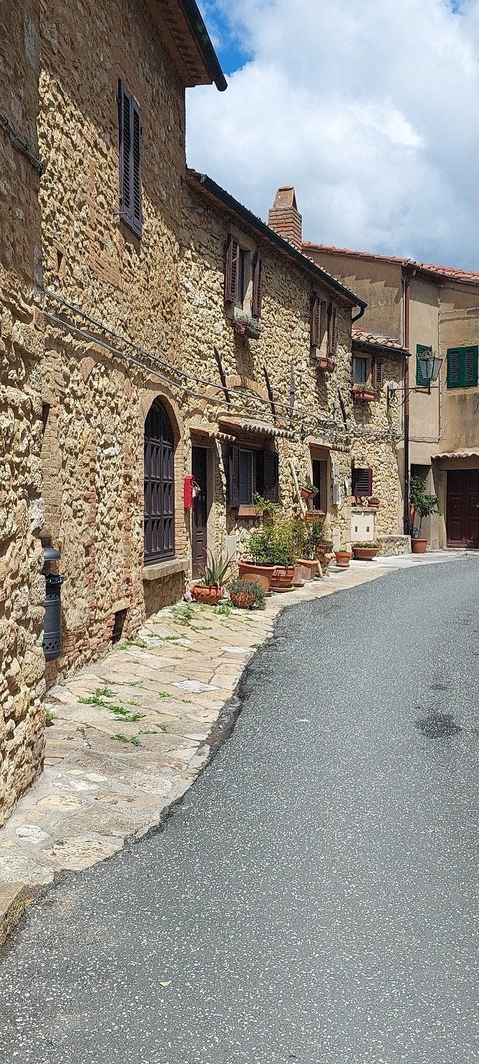
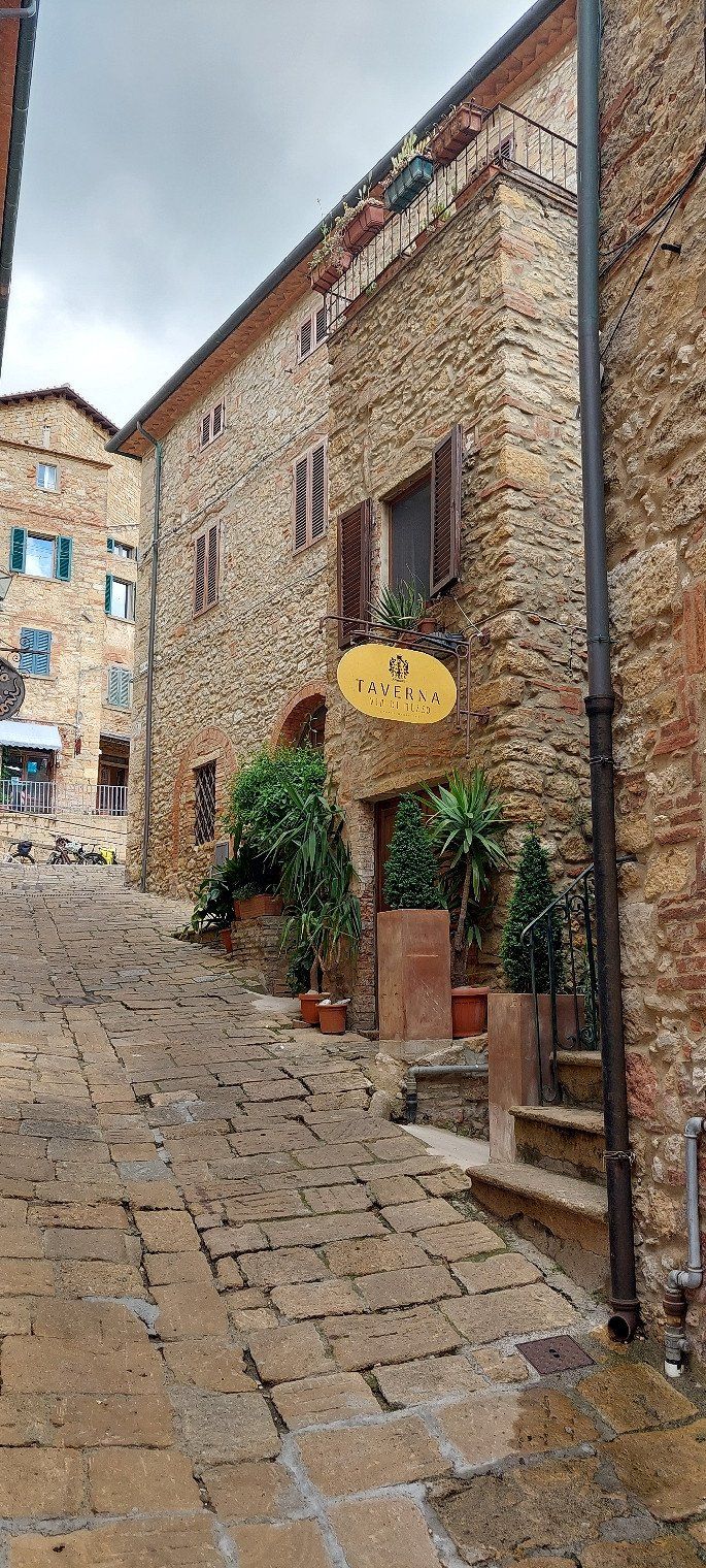
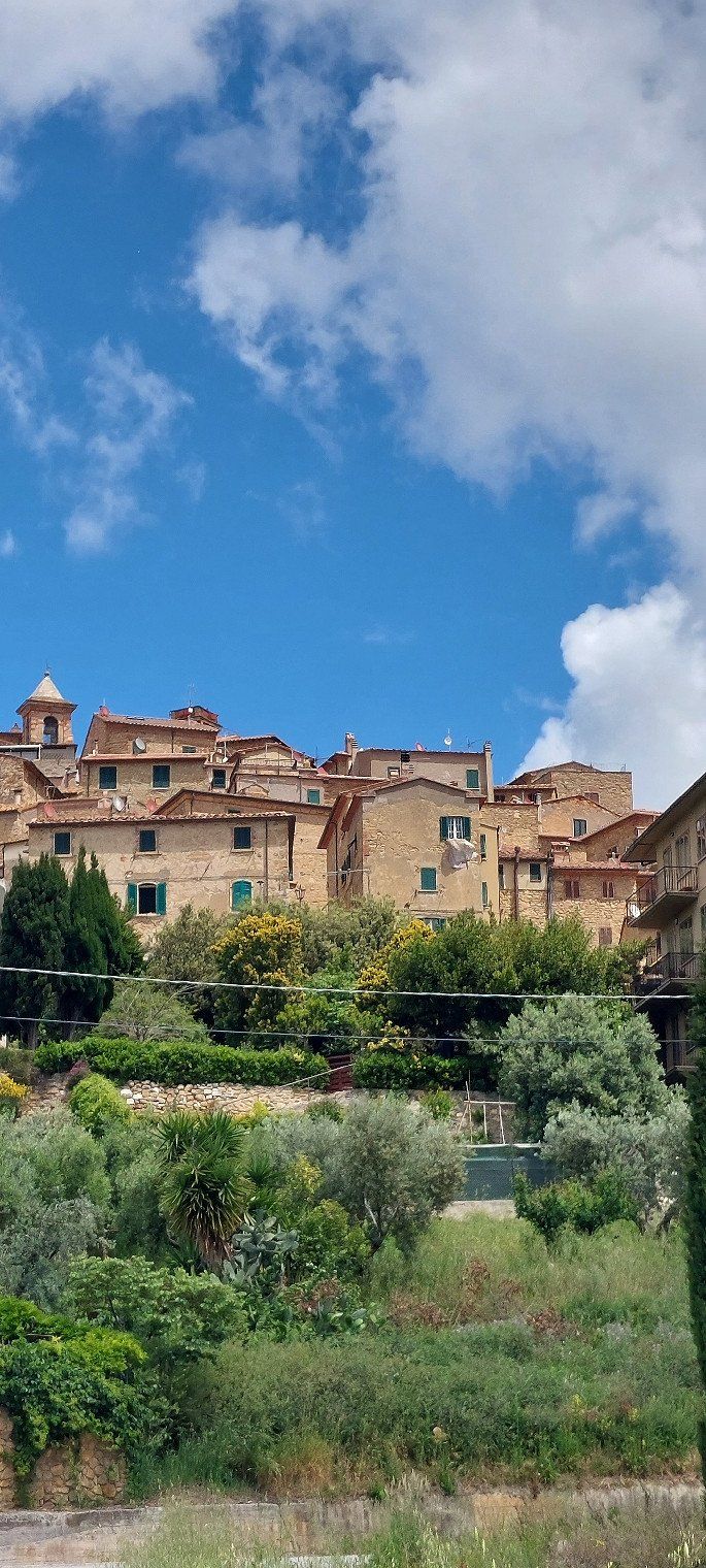
A bike tour to Casale Marittimo was impressive. Located on a slope and the houses are 500 years old.
Via dei Campilunghi, 57023, Cecina Mare, Italien
43° 19' 7" N 10° 28' 21" E
43.3186100 10.4725000
• Head southeast. Go for 127 m.
• Turn left onto Via Campilunghi. Go for 29 m.
• Turn right onto Via Campilunghi. Go for 1.2 km.
• Continue toward Via Francesco Domenico Guerrazzi. Go for 47 m.
• Take the 3rd exit from roundabout onto Via Francesco Domenico Guerrazzi. Go for 2.3 km.
• Continue straight ahead. Go for 46 m.
• Take the 1st exit from roundabout. Go for 46 m.
• Keep left toward Autostrada. Go for 35 m.
• Take the 2nd exit from roundabout onto Via San Pietro in Palazzi. Go for 490 m.
• Turn right onto Strada Regionale di Val di Cecina (SR68). Go for 143 m.
• Keep right onto Strada Regionale di Val di Cecina (SR68). Go for 1.0 km.
• Pass 2 roundabouts and continue on Strada Regionale di Val di Cecina (SR68). Go for 1.5 km.
• Turn left onto Località Fagiolaia toward Livorno/Genova/A12. Go for 137 m.
• Turn right toward Livorno/Genova/A12. Go for 18 m.
• Continue on Fagiolaia toward Livorno/Genova/A12. Go for 129 m.
• Continue on Località Fagiolaia toward Livorno/Genova/A12. Go for 112 m.
• Turn right onto Strada Regionale di Val di Cecina (SR68) toward Livorno/Genova/A12. Go for 711 m.
• Take ramp onto Strada Statale Aurelia (SS1) toward Livorno/Genova/A12. Go for 1.5 km.
• Continue on A12 (Autostrada Azzurra). Go for 31.7 km.
• Take the exit toward Collesalvetti/Firenze onto Strada di Grande Comunicazione Fi-Pi-Li. Go for 67.3 km.
• Take ramp onto A1 (Viadotto Arno) toward E35/Bologna-Roma/E74/Pisa Nord/A11/E80/Genova-Livorno/A12/Bologna. Go for 25.8 km.
• Keep right onto A1var toward Bologna/Barberino. Go for 39.1 km.
• Continue on A1 (Autostrada del Sole). Go for 63.7 km.
• Take the exit toward Brennero onto A22 (Autostrada del Brennero). Go for 84.8 km.
• Take the exit toward Milano onto A4 (Autostrada della Serenissima). Go for 17.5 km.
• Take the exit toward Peschiera. Go for 1.2 km.
• Continue on Strada Regionale Gardesana Orientale (SR249). Go for 27 m.
• Keep right toward Brescia/Verona/SR11/Mantova/Valeggio S/M. Go for 275 m.
• Continue toward SR11/Sirmione/Brescia. Go for 46 m.
• Take the 1st exit from roundabout onto Strada Regionale Padana Superiore (SR11) toward Sirmione/Brescia. Go for 2.8 km.
• Keep right onto Via Tangenziale (SR11) toward Peschiera Centro/S. Benedetto. Go for 137 m.
• Take the 1st exit from roundabout onto Via Bell'Italia toward Peschiera Centro/Peschiera. Go for 96 m.
• Turn left onto Via Bell'Italia. Go for 101 m.
• Turn slightly left onto Via Bell'Italia. Go for 257 m.
• Arrive at Via Bell'Italia. Your destination is on the right.
☍
344,5 km
(3 hrs. 28 min.)
Camping Bella Italia
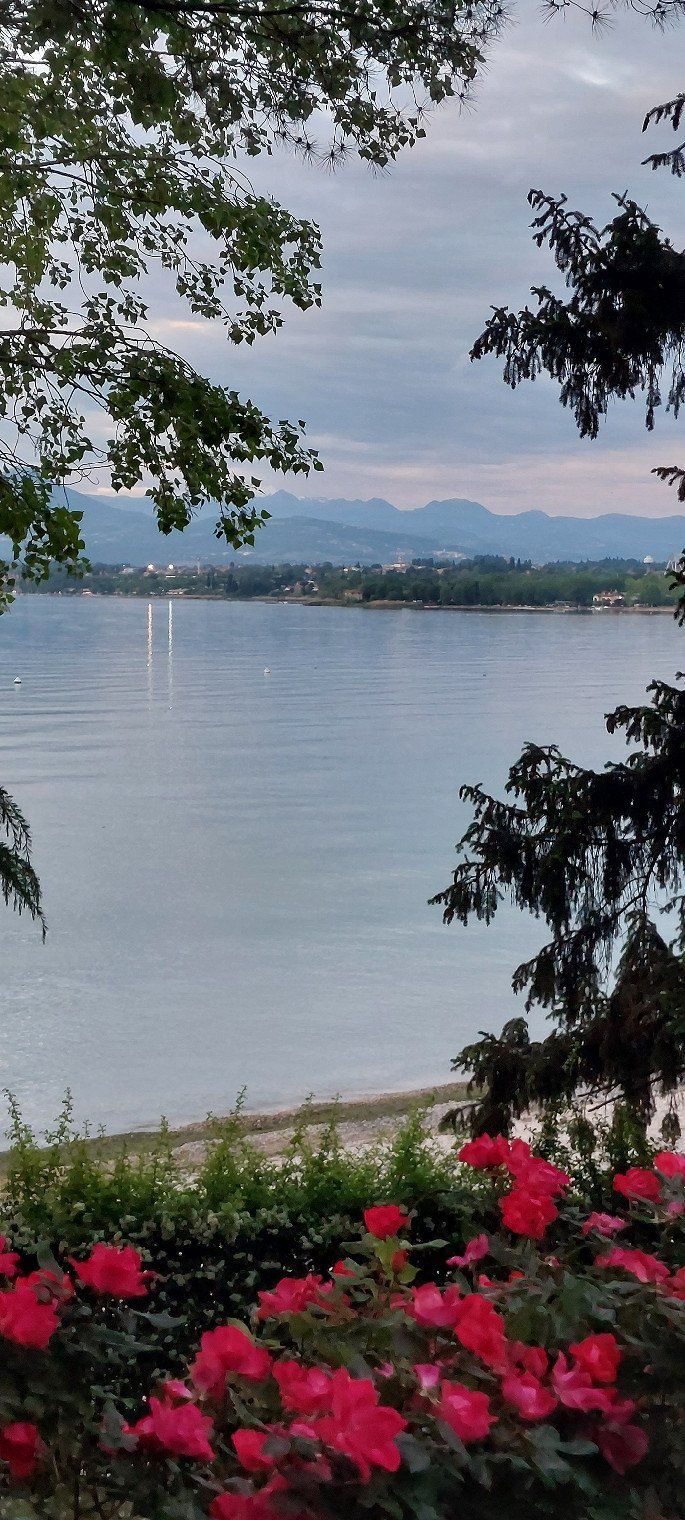
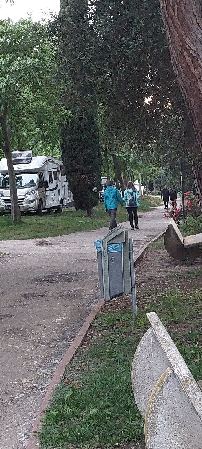
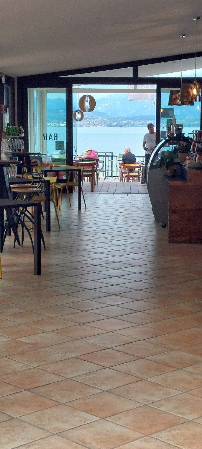
Large campsite right on the lake. Peschiera del Garda can be reached in 20 minutes on foot. On May 16, 2023 we paid €23 with an ACSI Card.
Via Bella Italia 2, 37019, Peschiera del Garda, Italien
45° 26' 37.4" N 10° 40' 30.9" E
45.4437264 10.6752555
• Head northwest on Via Bell'Italia.
• Arrive at Via Bell'Italia. Your destination is on the right.
☍
Distance not available
(Duration not available)
Day
Camping Bella Italia
I would not have thought that the place is already so full in mid-May.
Via Bella Italia 2, 37019, Peschiera del Garda, Italien
45° 26' 37.4" N 10° 40' 30.9" E
45.4437264 10.6752555
• Head northwest on Via Bell'Italia.
• Arrive at Via Bell'Italia. Your destination is on the right.
☍
Distance not available
(Duration not available)
Day
Camping Bella Italia
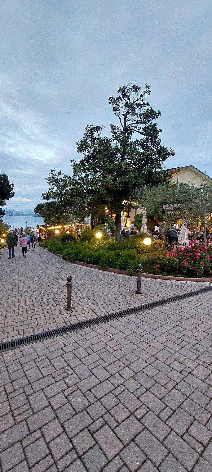
Our last day at Lake Garda. The campsite is full. We went to Lazise by bike.
Via Bella Italia 2, 37019, Peschiera del Garda, Italien
45° 26' 37.4" N 10° 40' 30.9" E
45.4437264 10.6752555
• Head southeast on Via Bell'Italia. Go for 257 m.
• Turn right onto Via Bell'Italia. Go for 67 m.
• Continue on Via Bell'Italia. Go for 33 m.
• Turn right onto Via Bell'Italia. Go for 66 m.
• Take the 3rd exit from roundabout onto SPBS11 toward Brescia/Sirmione. Go for 3.3 km.
• Continue on Strada Padana Superiore (SPBS11VAR). Go for 3.1 km.
• Take ramp toward Milano-Venezia/A4/Desenzano Est/Sirmione/S. Martino D.B./Pozzolengo. Go for 208 m.
• Take the 3rd exit from roundabout onto Via dei Colli Storici toward Milano/A4/Venezia/Pozzolengo/S.Martino D/B. Go for 528 m.
• Turn right toward Via dei Colli Storici. Go for 27 m.
• Pass 2 roundabouts and continue on Via dei Colli Storici. Go for 1.4 km.
• Take the 4th exit from roundabout onto A4 (Autostrada della Serenissima) toward Milano. Go for 127 km.
• Take the exit toward E62/Varese/Aeroporto Malpensa/Gravellona T./A26/E35/Como-Chiasso/A9 onto A8 (Autostrada Milano-Varese). Go for 10.6 km.
• Take the exit toward Como/Chiasso onto A9 (Autostrada dei Laghi). Go for 23.7 km.
• Take the exit toward Como Centro. Go for 725 m.
• Take the 3rd exit from roundabout onto Via del Dos toward Varese/Chiasso. Go for 537 m.
• Continue toward Via Gabriele D'Annunzio/SP17. Go for 49 m.
• Take the 2nd exit from roundabout onto Via Gabriele D'Annunzio (SP17) toward Chiasso/S.Fermo. Go for 2.0 km.
• Pass 2 roundabouts and continue on Via Roma (SP17). Go for 539 m.
• Take the 1st exit from roundabout onto Via Alessandro Noseda (SP17). Go for 216 m.
• Take the 2nd exit from roundabout onto Strada Provinciale Garibaldina (SP17). Go for 2.1 km.
• Take the 2nd exit from Largo Ceresio roundabout onto Via Luigi Camozzi. Go for 179 m.
• Take the 3rd exit from roundabout onto Via Bellinzona toward Chiasso/Cernobbio/Menaggio. Go for 748 m.
• Take the 3rd exit from roundabout onto Via Bellinzona toward Milano/A9/Svizzera. Go for 1.1 km.
• Take the 1st exit from roundabout onto Via Bellinzona. Go for 60 m.
• Continue on Via Bellinzona. Go for 142 m.
• Continue on Via Maestri Comacini (2). Go for 538 m.
• Take the 1st exit from roundabout onto Via Como (2). Go for 227 m.
• Take the 1st exit from roundabout toward Lugano. Go for 173 m.
• Take ramp onto A2 toward Lugano. Go for 194 km.
• Keep middle onto A14 toward Zürich/Zug/Buchrain. Go for 15.6 km.
• Continue on A4. Go for 32.7 km.
• Take the exit toward St. Gallen/Flughafen/Nordring-Zürich onto A1/A4. Go for 34.1 km.
• Continue on A1 toward St. Gallen/Kreuzlingen/Winterthur-Ohringen. Go for 7.4 km.
• Keep right onto A7 (Winterthur-Ost) toward Konstanz/Kreuzlingen/Frauenfeld. Go for 33.4 km.
• Take the 2nd exit from Anschlussstelle Kreuzlingen Nord roundabout onto A7 toward Konstanz. Go for 760 m.
• Continue on B33. Go for 18.6 km.
• Take ramp toward Radolfzell/Stockach. Go for 308 m.
• Turn right onto B34 toward Stockach/Radolfzell-Güttlingen. Go for 4.7 km.
• Turn right onto K6101 toward Bodman. Go for 2.5 km.
• Turn right onto Kaiserpfalzstraße toward Bodman. Go for 402 m.
• Turn left onto Im Weiler. Go for 141 m.
• Turn right onto In Neustückern. Go for 118 m.
• Turn slightly left onto In Neustückern. Go for 15 m.
• Arrive at In Neustückern. Your destination is on the left.
☍
524,1 km
(5 hrs. 34 min.)
Day
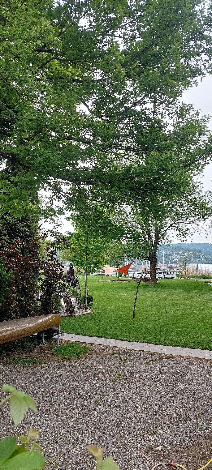
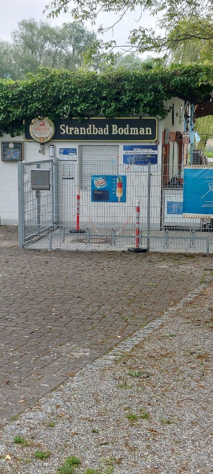
Stellplatz Strandbad
24 hours cost €5 here. There is no electricity or water connection here. The pitch is right on the lake. The area is very easy to explore by bike.
In Neustückern 4, 78351, Bodman-Ludwigshafen, Deutschland
47° 48' 17" N 9° 1' 46" E
47.8047222 9.0294444
• Head north on In Neustückern. Go for 272 m.
• Turn left onto Im Weiler. Go for 75 m.
• Turn right onto Im Weiler. Go for 98 m.
• Take the 1st exit from roundabout onto Espasinger Straße (K6101) toward Stockach/Ludwigshafen. Go for 911 m.
• Continue on K6102. Go for 1.2 km.
• Turn right onto Riedstraße (B34) toward Stockach. Go for 207 m.
• Turn left onto Riedstraße (B313) toward Lindau/Überlingen/Stuttgart/Singen/Sigmaringen/Stockach. Go for 3.1 km.
• Turn left and take ramp onto A98 toward Stuttgart/Singen. Go for 10.2 km.
• Take exit 11 toward Stuttgart/Villingen-Schwenningen onto A81. Go for 131 km.
• Continue on A831 toward Stuttgart/S-Vaihingen. Go for 2.8 km.
• Continue on B14. Go for 3.0 km.
• Take ramp toward Waiblingen/Stadion Neckarpark/S-Süd/Zentrum/Magstadt/S-Büsnau. Go for 310 m.
• Keep right onto B14 toward Waiblingen/S-Zentrum/S-Süd/Stadion Neckarpark. Go for 6.0 km.
• Keep left onto Hauptstätter Straße (B14) toward Waiblingen/Esslingen/B10/City-Ring/S-Bad Cannstatt/Stadion Neckarpark. Go for 828 m.
• Keep right onto Konrad-Adenauer-Straße toward City-Ring/Stuttgart-Ost/Stuttgart-Nord/Hauptbahnhof. Go for 209 m.
• Make a U-Turn onto Konrad-Adenauer-Straße. Go for 353 m.
• Keep right onto Konrad-Adenauer-Straße. Go for 265 m.
• Turn slightly left. Go for 65 m.
• Arrive at your destination on the right.
☍
161,4 km
(1 hrs. 33 min.)
Day
Stuttgart
Back home, unfortunately.
Deutschland
48° 46' 33" N 9° 10' 58.6" E
48.7758459 9.1829321