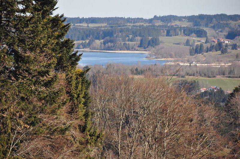
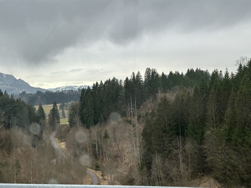
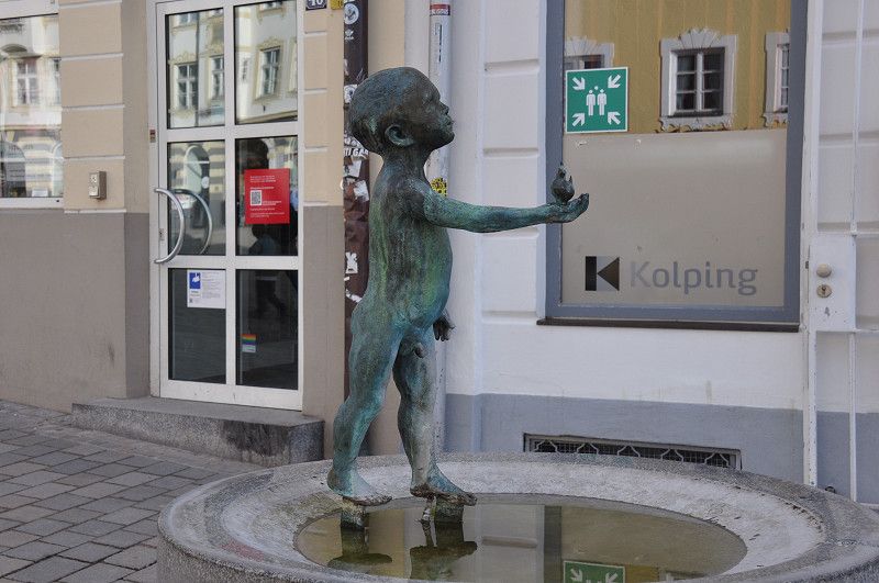
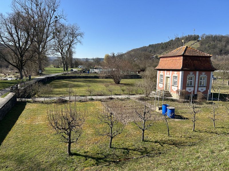
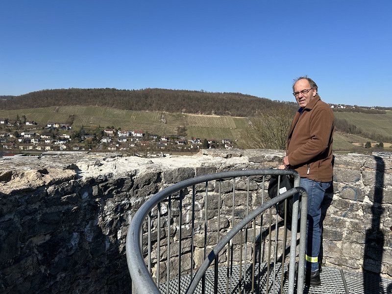
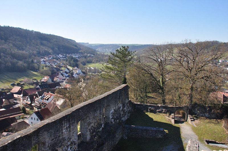
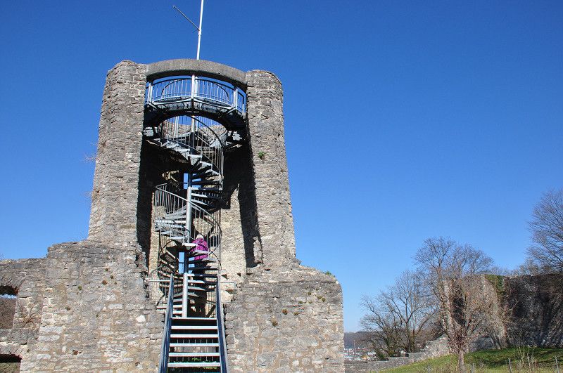
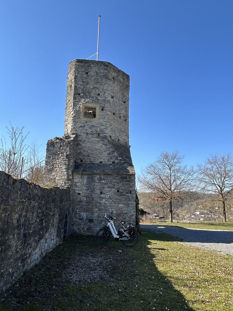
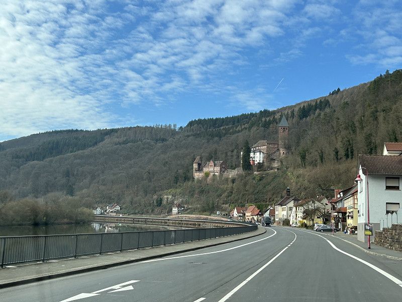
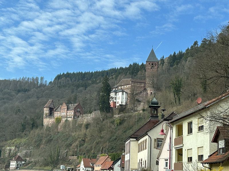
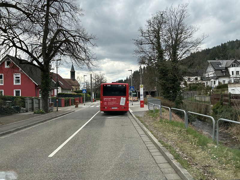
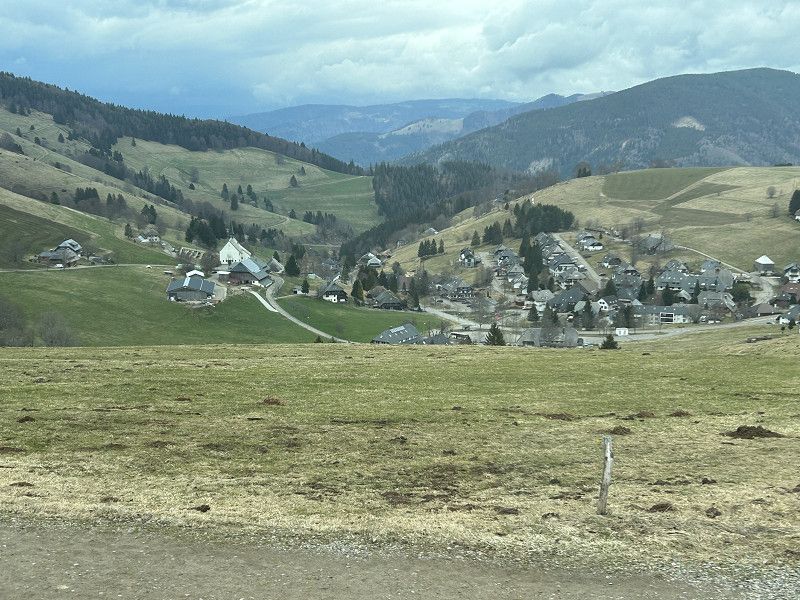
Pilatusblick
Luzern, Schweiz
47° 4' 2.7" N 8° 16' 24.3" E
47.0674254 8.2734092
• Head northeast on Pilatusblick. Go for 72 m.
• Turn right onto Pilatusblick. Go for 282 m.
• Turn left onto Rothenbadstrasse. Go for 377 m.
• Turn left onto Rothenbadstrasse. Go for 177 m.
• Turn right onto Rothenstrasse (2). Go for 303 m.
• Turn left onto Reussbühlstrasse (2) toward E35/14/Zürich/Basel/Hochdorf/26/Emmen/Emmenbrücke. Go for 104 m.
• Keep right onto Reusseggstrasse toward E35/A2/A14/Ebikon/Rotsee. Go for 398 m.
• Continue on Ibachbrücke toward Zürich/Basel/Ebikon/Rotsee. Go for 52 m.
• Continue on Reusseggstrasse. Go for 279 m.
• Take the 3rd exit from roundabout onto Reusseggstrasse toward Basel/Zürich/Luzern/Ebikon/Hochdorf. Go for 578 m.
• Take ramp onto A14 toward Zürich/Chur/Zug/Schwyz. Go for 9.9 km.
• Take exit 4 toward Gisikon/Root/Ebikon/Sins/Inwil. Go for 353 m.
• Turn left toward Herzighaus. Go for 212 m.
• Turn right onto Herzighaus. Go for 1.6 km.
• Continue on Luzernerstrasse. Go for 2.2 km.
• Continue on Hauptstrasse. Go for 3.0 km.
• Continue toward Baden/Bremgarten/Sins/Industriegebiet Sins Nord. Go for 29 m.
• Take the 2nd exit from roundabout toward Baden/Bremgarten/Sins/Industriegebiet Sins Nord. Go for 171 m.
• Continue on Luzernerstrasse. Go for 505 m.
• Turn left onto Blumenweg. Go for 95 m.
• Arrive at Blumenweg. Your destination is on the left.
☍
20,8 km
( 20 min.)
Sins
Bezirk Muri, Aargau, Schweiz
47° 11' 27.7" N 8° 23' 40.6" E
47.1910321 8.3946059
• Head toward Luzernerstrasse on Blumenweg. Go for 95 m.
• Turn left onto Luzernerstrasse. Go for 30 m.
• Take the 1st exit from roundabout onto Bremgartenstrasse toward Baden/Bremgarten/Industrie Nord. Go for 1.1 km.
• Continue on Reussegg. Go for 2.1 km.
• Continue on Luzernerstrasse. Go for 1.2 km.
• Continue on Aarauerstrasse. Go for 1.8 km.
• Continue on Im Feld. Go for 134 m.
• Continue on Luzernerstrasse. Go for 1.6 km.
• Take the 2nd exit from roundabout onto Bremgartenstrasse. Go for 690 m.
• Pass 3 roundabouts and continue on Bremgartenstrasse. Go for 4.9 km.
• Continue on Mohrentalstrasse. Go for 2.0 km.
• Continue on Kantonsstrasse. Go for 1.9 km.
• Continue on Luzernerstrasse. Go for 1.3 km.
• Continue on Oberebenestrasse. Go for 1.3 km.
• Take the 2nd exit from roundabout onto Fischbacherstrasse. Go for 911 m.
• Continue on Bremgarterstrasse. Go for 1.1 km.
• Continue on Mellingerstrasse. Go for 1.0 km.
• Continue on Landstrasse. Go for 668 m.
• Pass 2 roundabouts and continue on Reusstal. Go for 3.3 km.
• Continue on Bremgartenstrasse. Go for 976 m.
• Turn left onto Lenzburgerstrasse. Go for 330 m.
• Take the 2nd exit from roundabout onto Lenzburgerstrasse. Go for 232 m.
• Take the 1st exit from roundabout. Go for 946 m.
• Take the 3rd exit from roundabout onto Birrfeldstrasse. Go for 4.2 km.
• Turn left onto Zentralstrasse. Go for 150 m.
• Turn right onto Lenzburgerstrasse. Go for 1.8 km.
• Continue on Zubringer Hausen. Go for 1.8 km.
• Keep left toward Aarau/Brugg. Go for 869 m.
• Take the 2nd exit from roundabout onto Unterwerkstrasse toward Industriegebiet-Hunzikerareal/Industriegebiet Hunzikerareal. Go for 138 m.
• Turn right onto Unterwerkstrasse. Go for 239 m.
• Turn right onto Aarauerstrasse (5). Go for 851 m.
• Keep right onto Aarauerstrasse toward Basel/Koblenz/Bad Zurzach. Go for 619 m.
• Turn right onto Zurzacherstrasse (5). Go for 741 m.
• Turn right onto Untere Au. Go for 222 m.
• Turn right onto Rössliackerstrasse. Go for 162 m.
• Turn left onto Märkiweg. Go for 126 m.
• Turn left onto Ländistrasse. Go for 16 m.
• Turn left. Go for 29 m.
• Continue straight ahead. Go for 76 m.
• Arrive at your destination on the left.
☍
41,7 km
( 44 min.)
06. Mar. 2025 -
07. Mar. 2025
Brugg
Ländistrasse, Brugg, Bezirk Brugg, Aargau, Schweiz
47° 29' 22" N 8° 13' 17.2" E
47.4894332 8.2214565
• Head east. Go for 61 m.
• Turn right onto Ländistrasse. Go for 108 m.
• Turn right onto Märkiweg. Go for 284 m.
• Turn left onto Zurzacherstrasse (5). Go for 693 m.
• Continue on Zurzacherstrasse (3). Go for 1.6 km.
• Take the 3rd exit from roundabout onto Villnachernstrasse. Go for 187 m.
• Turn right onto Oberdorfstrasse. Go for 46 m.
• Arrive at Oberdorfstrasse. Your destination is on the right.
☍
3,0 km
( 5 min.)
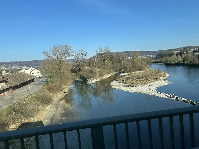
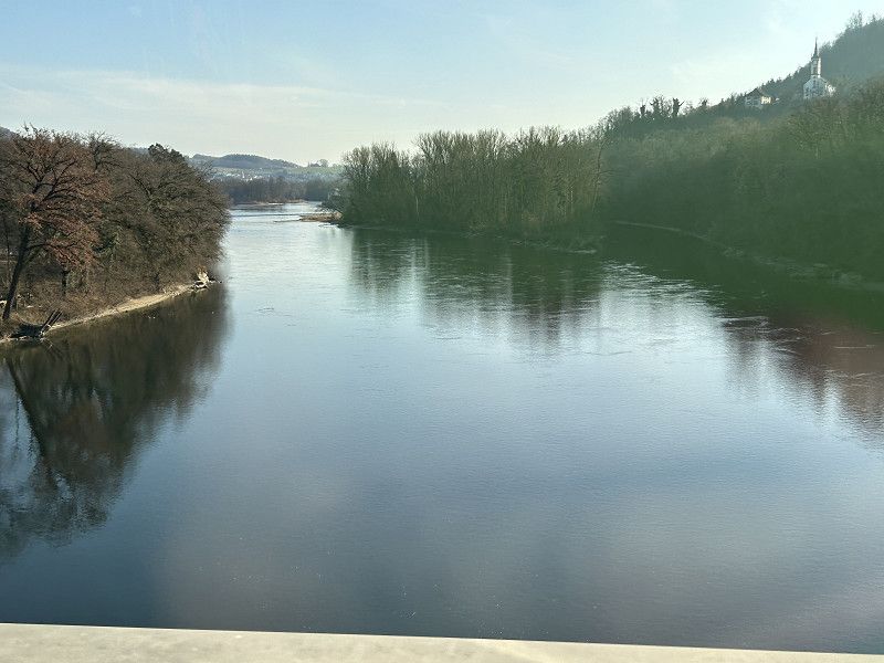
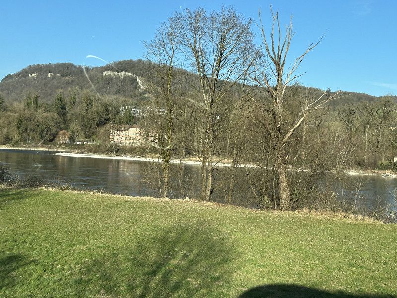
Fahrt
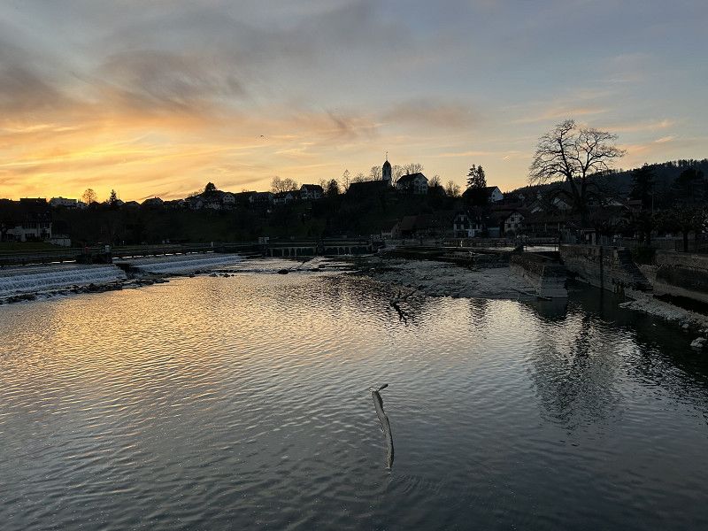
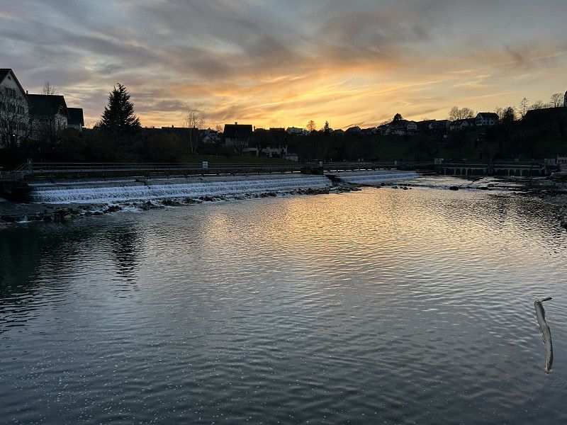
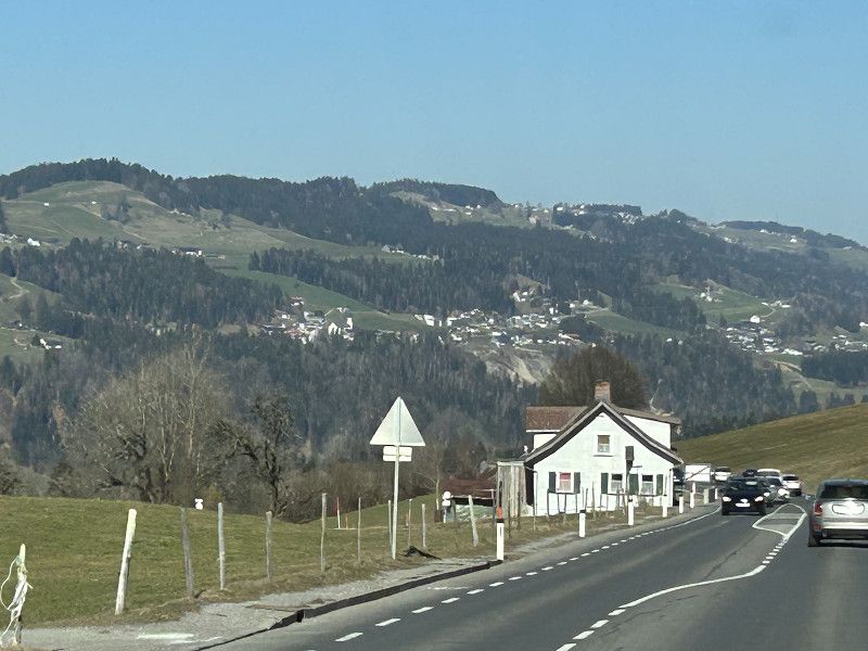
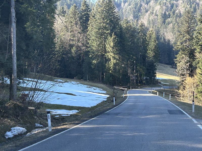
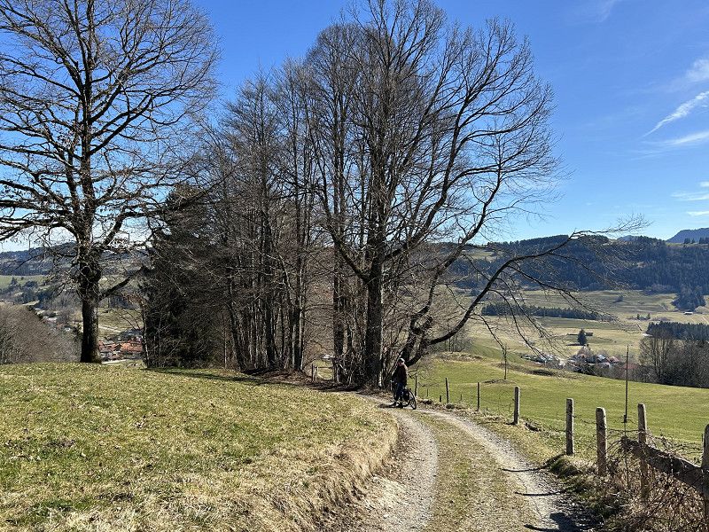
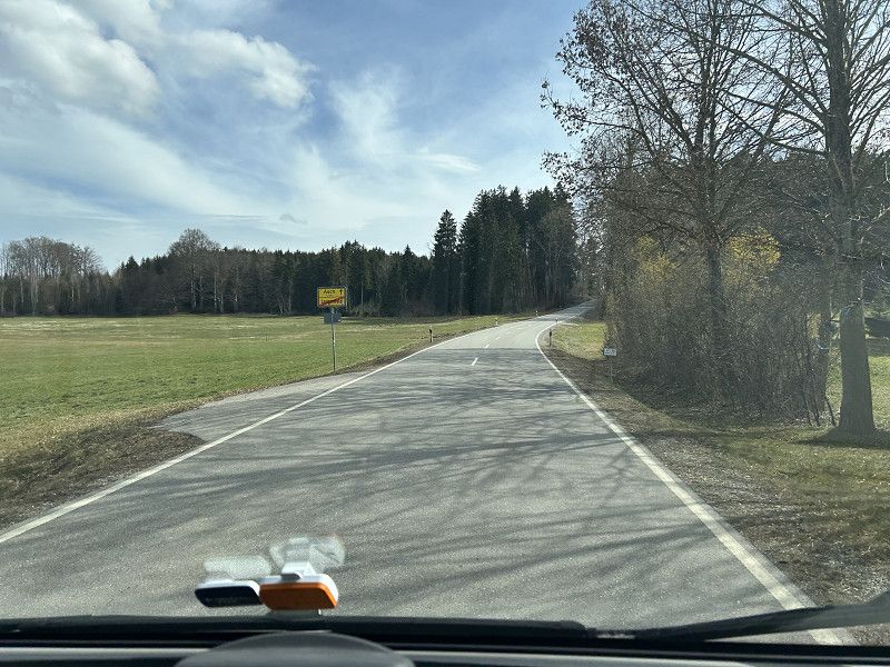
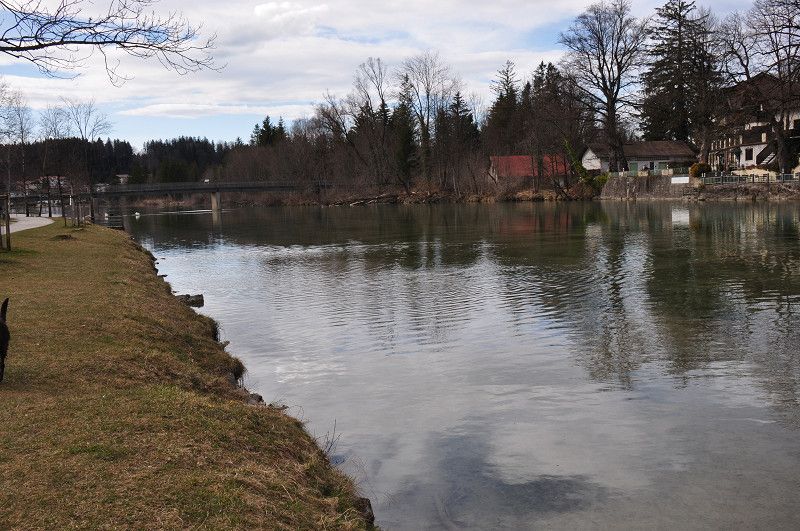
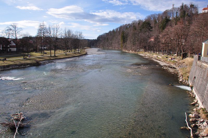
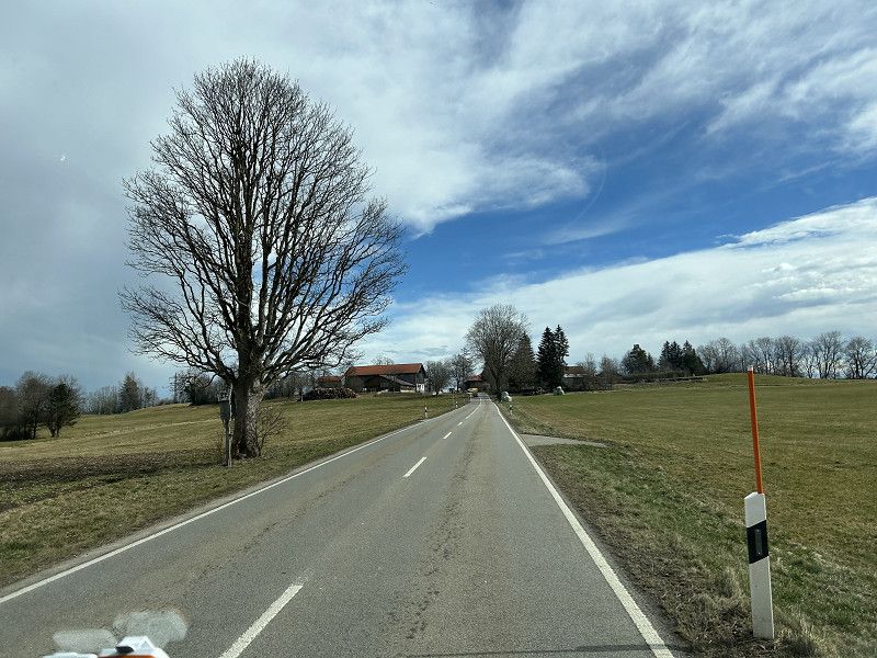
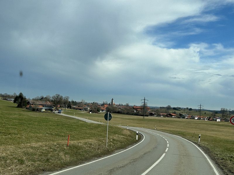
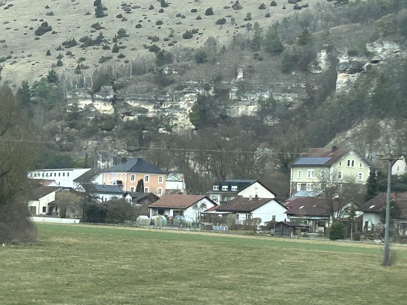
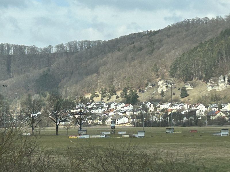
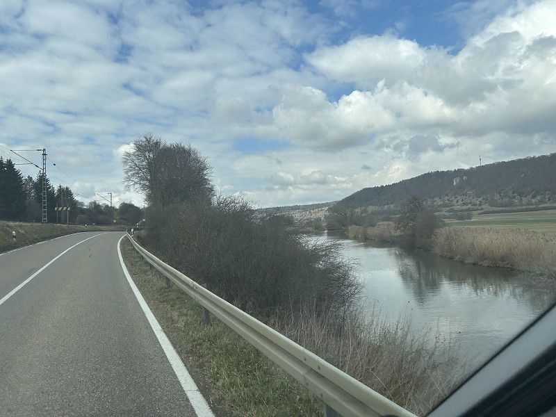
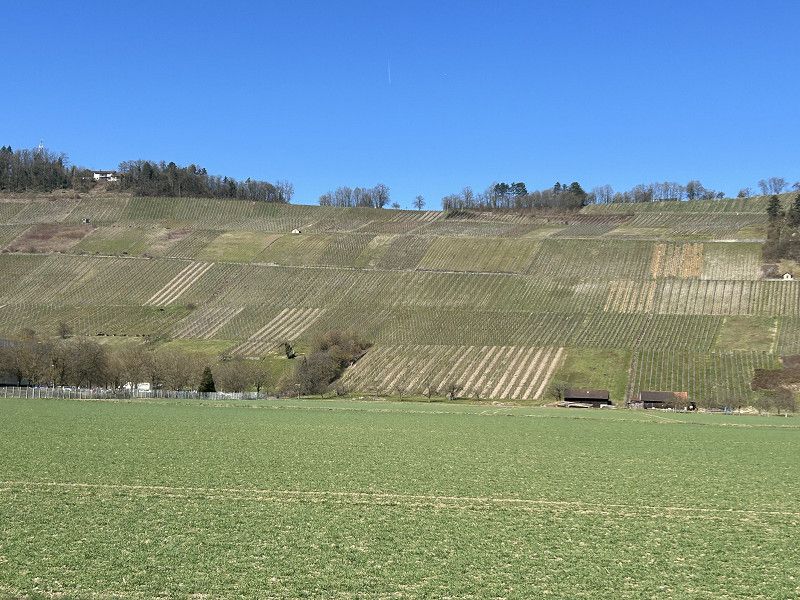
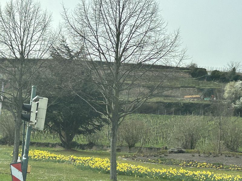
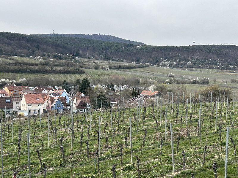
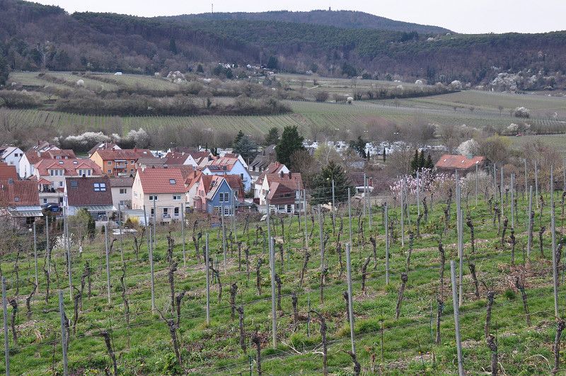
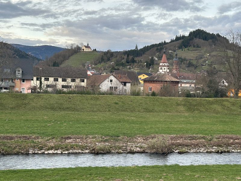
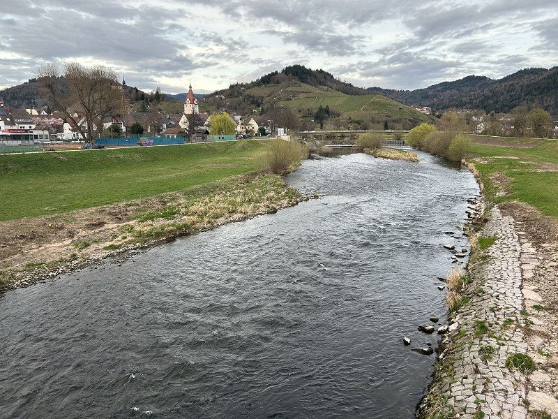
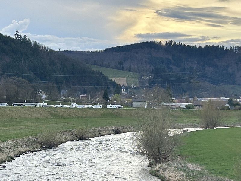
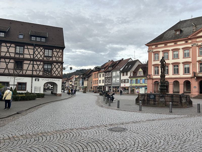
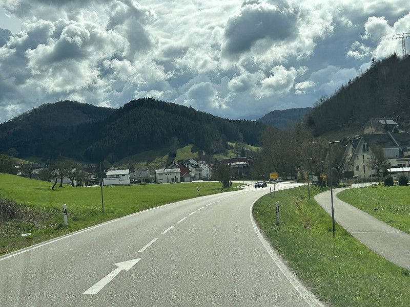
How beautiful Switzerland is. We drive leisurely through the Reuss Valley via Bremgarten, Mellingen, and Brugg.
Although I have driven this route countless times, I still find the villages, the river, and simply this little corner of Switzerland worth seeing.
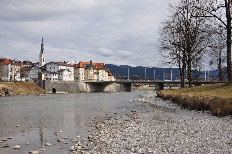
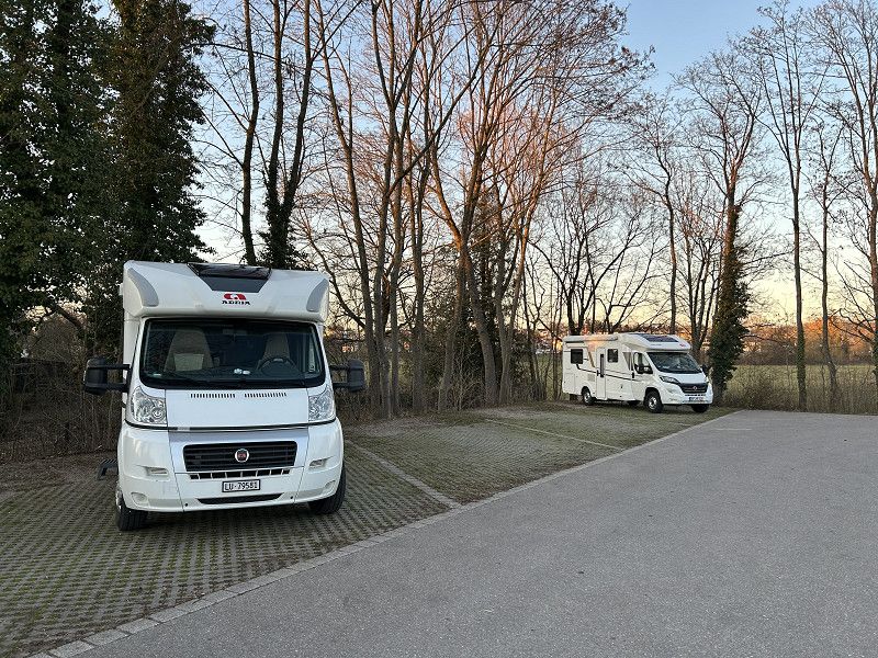
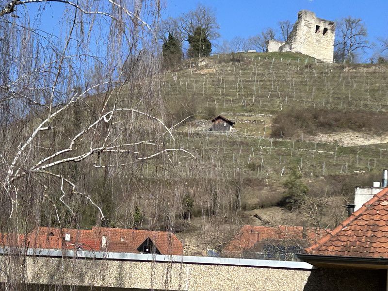
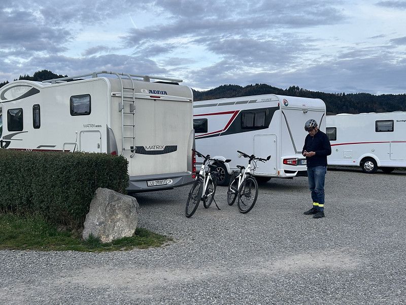
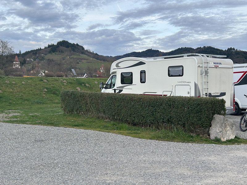
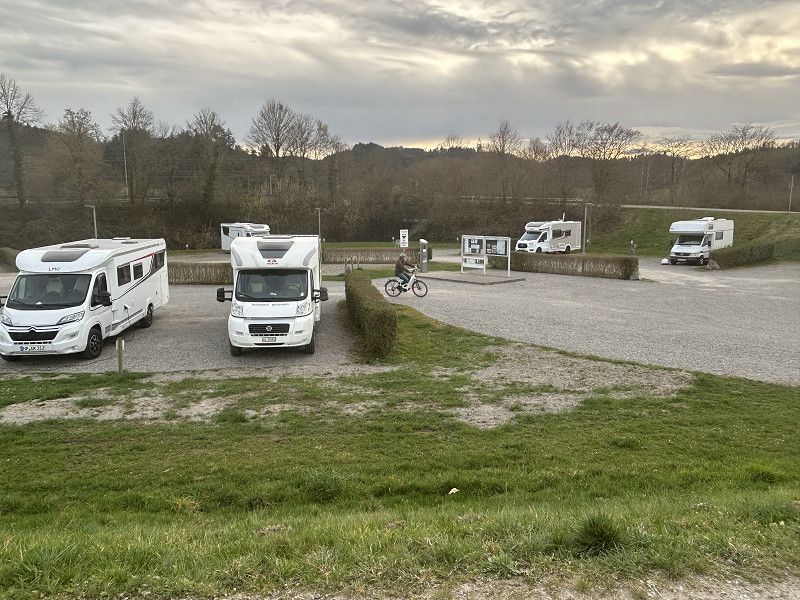
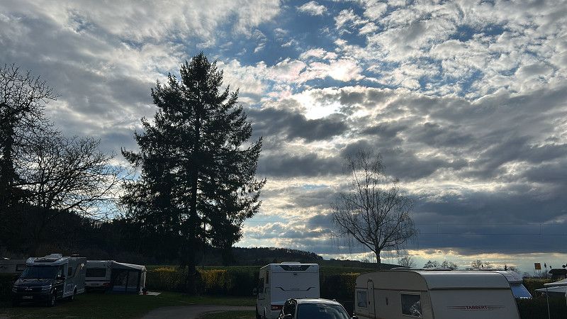
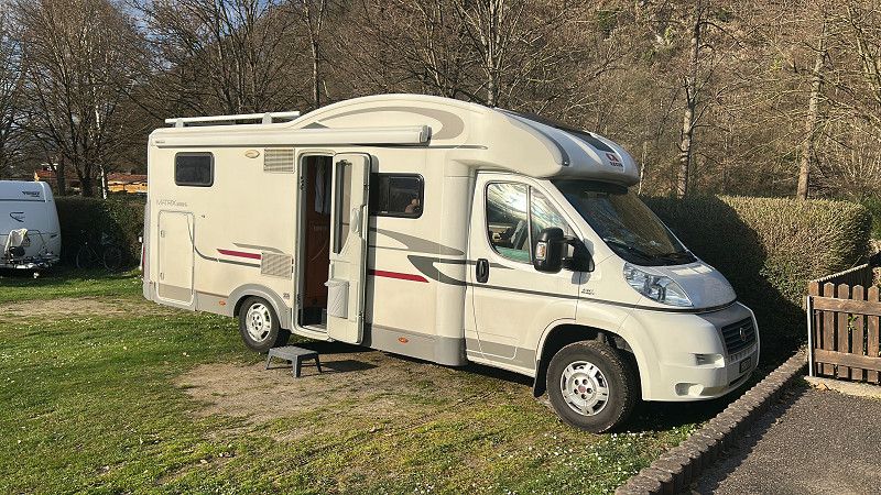
Stellplatz Schachen Brugg
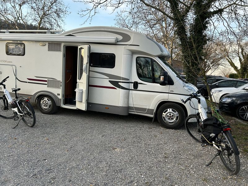
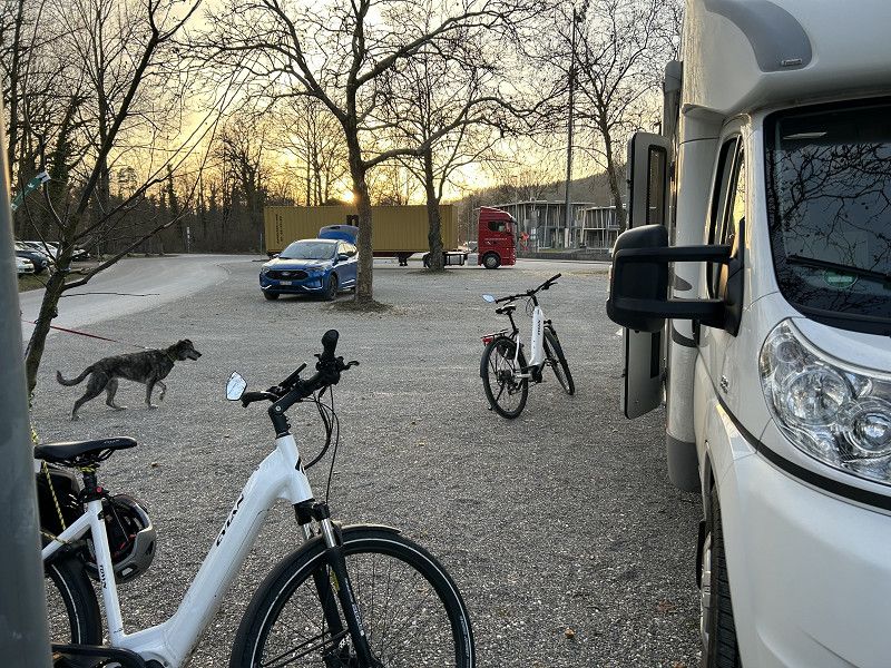
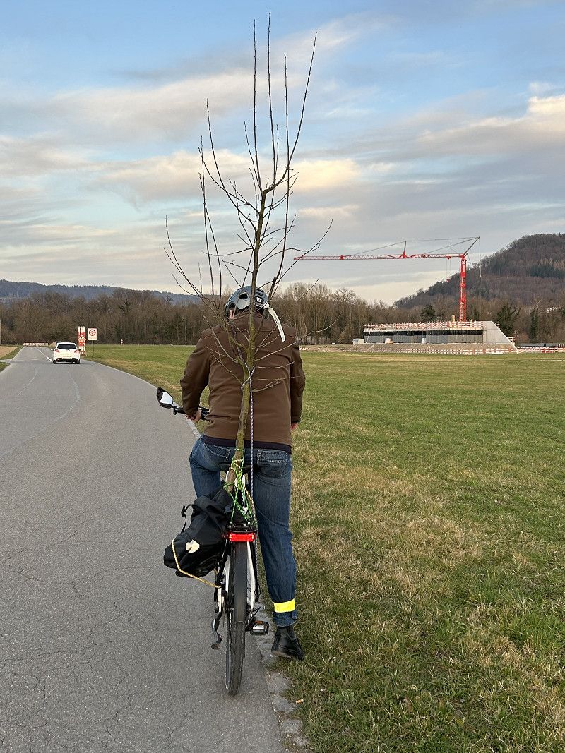
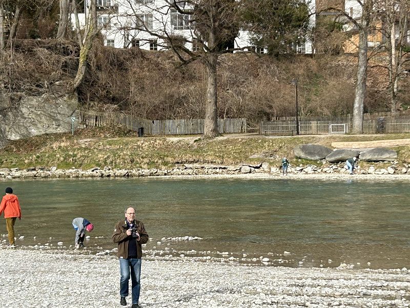
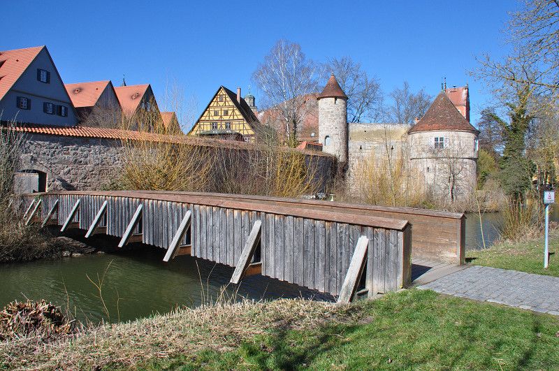
A simple parking lot near the sports and military field. That doesn't sound very attractive, but you'd hardly believe it - the local recreation area of the town of Brugg is right next to the parking lot. The cycle paths and walking trails start right at the parking lot. We cycle over a suspension bridge to Gebensforf. Cross the Aare and the Reuss and end up in my godchild's cozy new home. We bring a plum tree as a gift. It's almost a feat to transport a tree like that by bike. The cozy evening just flies by. So late in the evening we cycle directly back to our warm camper's room via Windisch.
Umiken
Bezirk Brugg, Aargau, Schweiz
47° 28' 56.9" N 8° 11' 21.5" E
47.4824620 8.1893151
• Head toward Villnachernstrasse on Oberdorfstrasse. Go for 46 m.
• Turn right onto Villnachernstrasse. Go for 1.0 km.
• Continue on Fleckenacker. Go for 84 m.
• Continue on Spannagel. Go for 338 m.
• Continue on Neumühle. Go for 147 m.
• Continue on Habsburgblick. Go for 200 m.
• Continue on Hauptstrasse. Go for 3.5 km.
• Take the 1st exit from roundabout. Go for 158 m.
• Continue on Steinach. Go for 193 m.
• Continue on Steinachbrücke. Go for 38 m.
• Take the 3rd exit from roundabout onto Unterdorfstrasse. Go for 457 m.
• Arrive at Unterdorfstrasse. Your destination is on the right.
☍
6,2 km
( 6 min.)
Schinznach Dorf
Bezirk Brugg, Aargau, Schweiz
47° 26' 48.5" N 8° 8' 32.2" E
47.4467994 8.1422836
• Head toward Gäbigasse on Unterdorfstrasse. Go for 421 m.
• Take the 1st exit from roundabout onto Steinachbrücke. Go for 51 m.
• Continue on Veltheimerstrasse. Go for 350 m.
• Continue on Oberdorfstrasse. Go for 437 m.
• Turn left onto Oberdorfstrasse. Go for 279 m.
• Turn right onto Wildeggerstrasse. Go for 1.8 km.
• Continue on Talstrasse. Go for 676 m.
• Turn left onto Talstrasse. Go for 385 m.
• Continue on Jurastrasse. Go for 396 m.
• Turn right onto Poststrasse. Go for 151 m.
• Arrive at Poststrasse. Your destination is on the right.
☍
4,9 km
( 6 min.)
Wildegg
Bezirk Lenzburg, Aargau, Schweiz
47° 24' 55.4" N 8° 9' 49.1" E
47.4153808 8.1636356
• Head toward Bahnhofstrasse on Poststrasse. Go for 12 m.
• Turn left onto Bahnhofstrasse. Go for 74 m.
• Take the 1st exit from roundabout onto Aarauerstrasse (5). Go for 1.0 km.
• Take the 2nd exit from roundabout onto Aaretalstrasse (5). Go for 1.9 km.
• Take the 2nd exit from roundabout onto Aaretalstrasse (5). Go for 345 m.
• Take ramp toward Bern/Zürich/Hunzenschwil/Rupperswil. Go for 307 m.
• Turn left onto Seetalstrasse. Go for 242 m.
• Take ramp onto A1 toward Bern. Go for 9.3 km.
• Take exit 49 toward Schöftland/Kölliken onto 24 (Suhrentalstrasse). Go for 1.1 km.
• Turn right onto Hardstrasse toward Bern/Kölliken. Go for 336 m.
• Take the 2nd exit from roundabout onto Hardstrasse. Go for 455 m.
• Continue on Kirchgasse. Go for 694 m.
• Take the 3rd exit from roundabout onto Hauptstrasse (1). Go for 344 m.
• Turn right onto Scheidgasse. Go for 457 m.
• Turn left onto Scheidgasse. Go for 47 m.
• Turn right onto Neuer Wallisweg. Go for 56 m.
• Arrive at Neuer Wallisweg.
☍
16,7 km
( 15 min.)
Kölliken Auf der Höhe
Bezirk Zofingen, Aargau, Schweiz
47° 19' 55.2" N 8° 1' 5.6" E
47.3319890 8.0182320
• Head toward Auf der Höhe on Neuer Wallisweg. Go for 59 m.
• Turn right onto Auf der Höhe. Go for 135 m.
• Turn right onto Auf der Höhe. Go for 85 m.
• Turn left onto Scheidgasse. Go for 457 m.
• Turn left onto Hauptstrasse (1). Go for 306 m.
• Take the 1st exit from roundabout onto Kirchgasse. Go for 707 m.
• Continue on Hardstrasse. Go for 417 m.
• Take the 2nd exit from roundabout onto Hardstrasse. Go for 380 m.
• Turn left onto Suhrentalstrasse (24). Go for 504 m.
• Take ramp onto A1 toward Zürich. Go for 16.7 km.
• Take exit 52 toward Mägenwil/Mellingen/Birr. Go for 522 m.
• Take the 3rd exit from roundabout onto Birrfeldstrasse. Go for 484 m.
• Pass 2 roundabouts. Go for 736 m.
• Continue on Lenzburgerstrasse. Go for 3.3 km.
• Continue on Zubringer Hausen. Go for 1.8 km.
• Keep left toward Aarau/Brugg. Go for 869 m.
• Take the 2nd exit from roundabout onto Unterwerkstrasse toward Industriegebiet-Hunzikerareal/Industriegebiet Hunzikerareal. Go for 138 m.
• Turn right onto Unterwerkstrasse. Go for 239 m.
• Turn right onto Aarauerstrasse (5). Go for 851 m.
• Keep right onto Aarauerstrasse toward Basel/Koblenz/Bad Zurzach. Go for 619 m.
• Turn right onto Zurzacherstrasse (5). Go for 2.0 km.
• Take the 3rd exit from roundabout onto Reinerstrasse. Go for 137 m.
• Turn right onto Dorfstrasse. Go for 205 m.
• Arrive at Dorfstrasse. Your destination is on the right.
☍
31,6 km
( 29 min.)
Lauffohr
Bezirk Brugg, Aargau, Schweiz
47° 30' 2.7" N 8° 13' 52.1" E
47.5007623 8.2311520
• Head north on Dorfstrasse. Go for 326 m.
• Turn left onto Zurzacherstrasse (5). Go for 2.0 km.
• Take ramp. Go for 207 m.
• Turn right onto Landstrasse (5). Go for 655 m.
• Turn right onto Siggenthalerstrasse. Go for 668 m.
• Take the 2nd exit from roundabout onto Siggenthalerstrasse. Go for 212 m.
• Continue on Breitenstrasse. Go for 860 m.
• Turn right onto Dorfstrasse. Go for 273 m.
• Arrive at Dorfstrasse. Your destination is on the right.
☍
5,2 km
( 7 min.)
Würenlingen
Bezirk Baden, Aargau, Schweiz
47° 31' 55.5" N 8° 15' 25.1" E
47.5320878 8.2569618
• Head toward Rosenweg on Dorfstrasse. Go for 273 m.
• Turn right onto Tegerfelderstrasse. Go for 1.4 km.
• Continue on Würenlingerstrasse. Go for 2.9 km.
• Continue on Steig. Go for 262 m.
• Continue on Staltig. Go for 225 m.
• Turn left onto Zurzibergstrasse. Go for 501 m.
• Take the 2nd exit from roundabout onto Zurzibergstrasse. Go for 1.4 km.
• Continue on Bruggerstrasse. Go for 1.6 km.
• Turn left onto Bruggerstrasse. Go for 52 m.
• Continue on Hauptstrasse. Go for 463 m.
• Turn right onto Kirchgasse. Go for 118 m.
• Arrive at Kirchgasse. Your destination is on the right.
☍
9,2 km
( 10 min.)
Bad Zurzach
Bezirk Zurzach, Aargau, Schweiz
47° 35' 11.9" N 8° 17' 38.6" E
47.5866477 8.2940658
• Head toward Langwiesstrasse on Kirchgasse. Go for 70 m.
• Turn left onto Langwiesstrasse. Go for 31 m.
• Turn right onto Schwertgasse. Go for 20 m.
• Continue on Promenadestrasse. Go for 282 m.
• Continue on Zürcherstrasse. Go for 88 m.
• Turn left onto Zürcherstrasse. Go for 814 m.
• Take the 1st exit from roundabout onto Zürcherstrasse (7) toward Schaffhausen/Winterthur/Zürich. Go for 10.1 km.
• Take the 2nd exit from roundabout onto Hauptstrasse (7) toward Schaffhausen/Winterthur/Zürich. Go for 9.0 km.
• Turn left onto Im Gländ. Go for 372 m.
• Turn right onto Zürcherstrasse (4). Go for 1.0 km.
• Continue on Weiacherstrasse (7). Go for 7.0 km.
• Take the 3rd exit from Aequadukt roundabout onto Winterthurerstrasse (7). Go for 4.4 km.
• Pass 2 roundabouts and continue on Weiachstrasse (7). Go for 4.4 km.
• Keep left onto Wülflingerstrasse (7). Go for 2.4 km.
• Turn right onto Sankt Georgenplatz (7/15). Go for 13 m.
• Keep left onto Merkurstrasse (7/15). Go for 98 m.
• Turn slightly left onto Museumstrasse (7/15). Go for 519 m.
• Turn right onto General-Guisan-Strasse (7/15). Go for 129 m.
• Turn left onto Römerstrasse. Go for 915 m.
• Turn left onto Römerstrasse (1). Go for 609 m.
• Turn right onto Talackerstrasse. Go for 325 m.
• Turn left onto Sulzerallee. Go for 775 m.
• Turn left. Go for 22 m.
• Turn right. Go for 23 m.
• Arrive at your destination on the right.
☍
43,4 km
( 48 min.)
06. Mar. 2025 -
07. Mar. 2025
Winterthur Sulzerallee
Sulzerallee 41, Winterthur, Bezirk Winterthur, Zürich, Schweiz
47° 30' 8" N 8° 45' 43.8" E
47.5022114 8.7621794
• Head west. Go for 23 m.
• Turn left toward Sulzerallee. Go for 22 m.
• Turn left onto Sulzerallee. Go for 53 m.
• Turn left and take ramp. Go for 132 m.
• Turn right onto Seenerstrasse. Go for 531 m.
• Turn right onto Frauenfelderstrasse (1). Go for 2.9 km.
• Take ramp onto A1 toward St. Gallen/Kreuzlingen/Frauenfeld. Go for 76.7 km.
• Continue on A13. Go for 2.1 km.
• Take exit 2 toward Berneck/Lustenau. Go for 352 m.
• Take the 3rd exit from roundabout onto Zollstrasse (435) toward München/Lustenau. Go for 358 m.
• Continue on Lustenauer Straße (L204). Go for 383 m.
• Turn right onto Reichsstraße (L203) toward Innsbruck/A14/Bregenz/E60/Dornbirn/Hohenems. Go for 1.7 km.
• Take the 3rd exit from roundabout onto Dornbirner Straße (L204) toward Innsbruck/A14/E60/Bregenz/Dornbirn/Industrie Süd. Go for 473 m.
• Pass 2 roundabouts and continue on Dornbirner Straße (L204). Go for 3.1 km.
• Keep left onto Lustenauer Straße (L204) toward Dornbirn/Bregenz/A14/E60. Go for 297 m.
• Take the 3rd exit from roundabout onto Lustenauer Straße (L204) toward Dornbirn. Go for 2.6 km.
• Turn left onto Hatlerstraße (L190). Go for 981 m.
• Turn left onto Marktplatz. Go for 93 m.
• Arrive at Marktplatz. Your destination is on the left.
☍
92,9 km
(1 hrs. 3 min.)
Fahrt
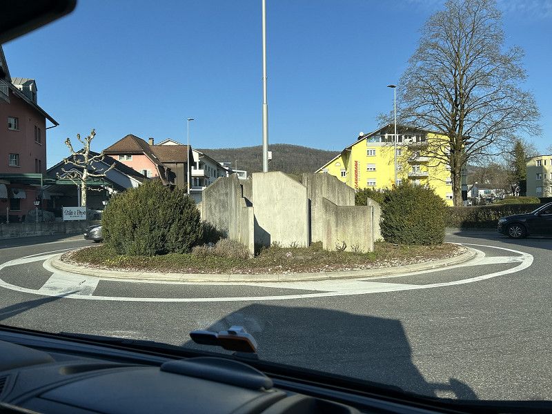
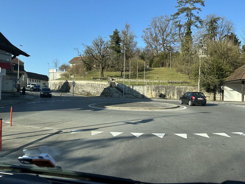
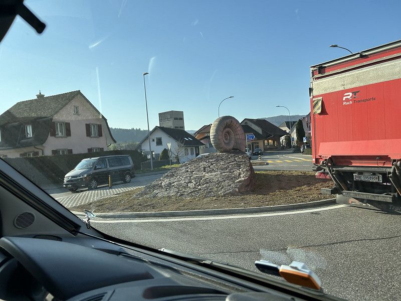
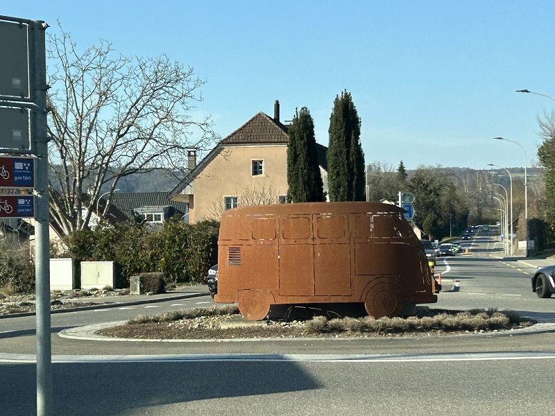
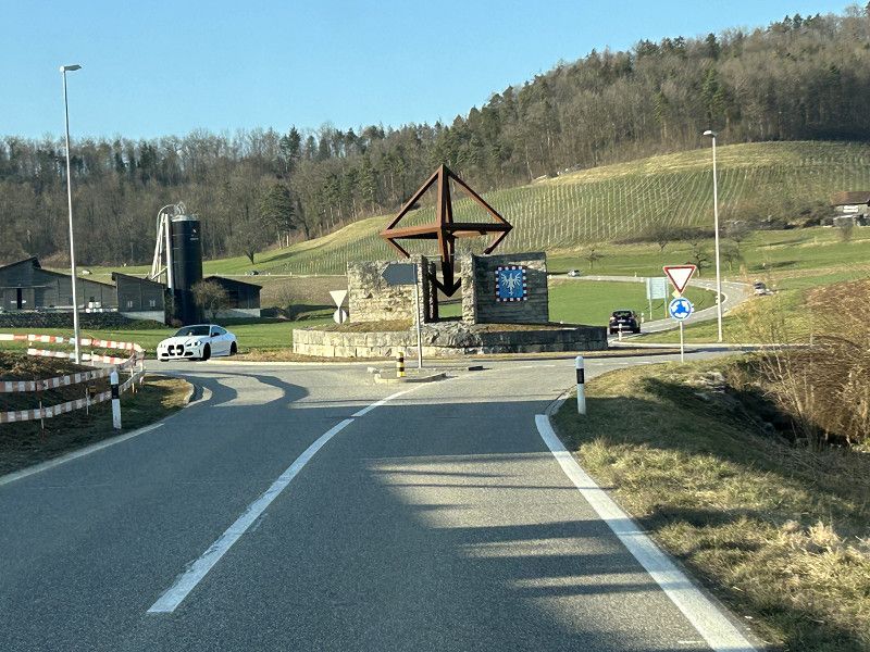
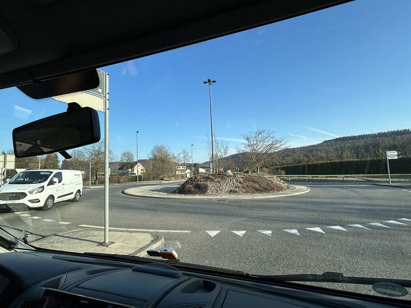
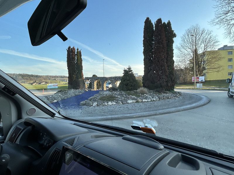
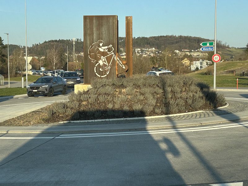
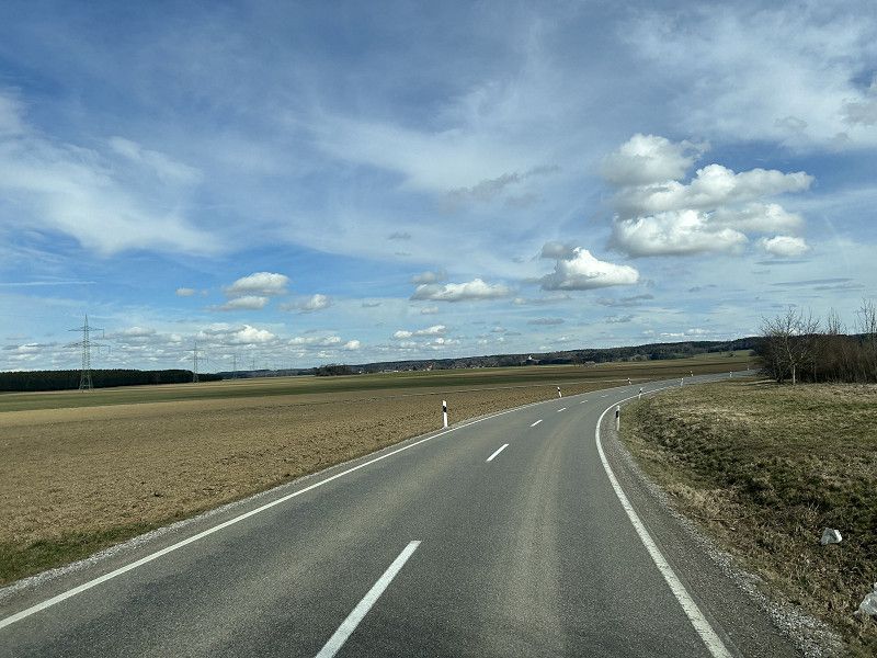
- The night was short but the sleep was very deep. Enough to enjoy our second day of vacation. We start today as we ended yesterday, with a short bike ride. We are invited to brunch at Daniel's brother's. So we spend a leisurely morning with fine delicacies. Thank you for the excellent breakfast. We are back in the camper around midday. I call to find out whether we can spend the night at the RV park in Winterthur, because we have an RV viewing appointment tomorrow at 10 a.m. Great, the overnight stay is approved. Since we don't want to arrive at the industrial site in the early afternoon, we think about an afternoon program here in Brugg. Daniel's siblings all live nearby, but apart from Yvonne, in Kölliken, no one answers the phone. What the heck, we are on vacation, so we just drive about 20 km west instead of east and visit Yvonne and Roli. Here we enjoy warm hospitality again, THANK YOU. Now we're finally heading east to Winterthur. We're driving overland and I'm trying to enjoy our beautiful Switzerland through the eyes of a tourist. Today I chose the many roundabouts as a special subject for my photos.
WoMoPark Winterthur
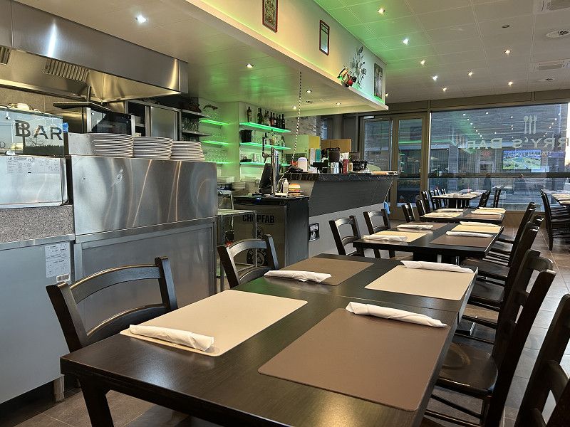
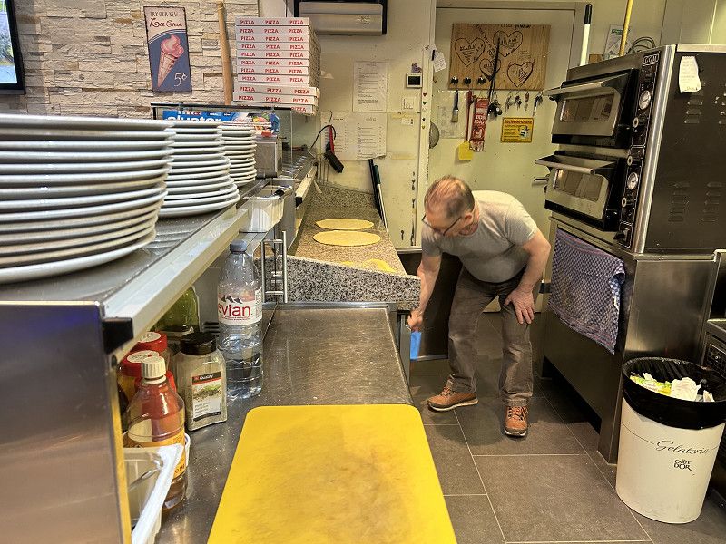
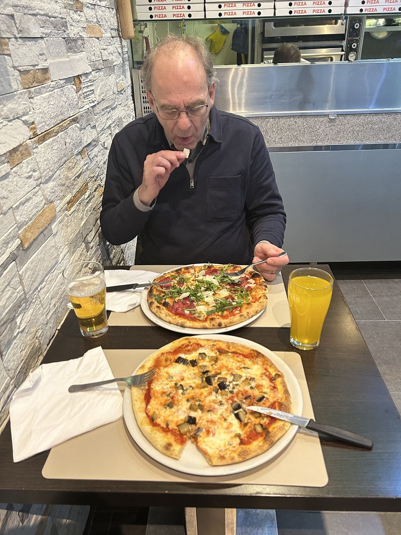
The journey through Winterthur puts a lot of strain on our navigation system, on me as co-pilot, and especially on Daniel, the nerveless driver. We end up narrowly missing the entrance. So, for better or worse, we have to do an involuntary lap of honor, because turning around or stopping is impossible. Instead of calculating an alternative route and guiding us to our desired destination, our beloved navigation system quits and doesn't give us any further information. So I have no choice but to direct Daniel back to the entrance with the help of Google Maps. We make it at 6:00 p.m. The office worker is just about to head off for a well-earned break. Being the friendly guy he is, he greets us and even gives us a restaurant recommendation. We settle down at Gerry's Bar, an Italian restaurant, and enjoy a great pizza. The short walk back to the camper also serves as our digestive walk. Now we're looking forward to a slightly longer night so we can continue our journey tomorrow, well rested.
Dornbirn
Bezirk Dornbirn, Vorarlberg, Österreich
47° 24' 49.1" N 9° 44' 32.6" E
47.4136351 9.7423762
• Head toward Bergmannstraße on Marktplatz. Go for 93 m.
• Turn left onto Rathausplatz (L190). Go for 199 m.
• Turn right onto Eisengasse. Go for 720 m.
• Turn right onto Dr.-Anton-Schneider-Straße (L3). Go for 2.9 km.
• Turn right onto Schwarzach-Tobelstraße (L7). Go for 3.0 km.
• Turn left onto Bregenzerwald Landesstraße (L200). Go for 7.8 km.
• Turn left onto Müselbach (L205). Go for 2.8 km.
• Turn left onto Dörnle (L6). Go for 484 m.
• Continue on Lingenau (L6). Go for 1.9 km.
• Continue on Kuhn (L6). Go for 4.8 km.
• Turn left onto Dorf (L205). Go for 5.9 km.
• Continue on Aach (St2005). Go for 6.9 km.
• Turn left onto St2005. Go for 23 m.
• Turn right onto B308. Go for 2.7 km.
• Pass 2 roundabouts and continue on Julius-Kunert-Straße (B308). Go for 12.9 km.
• Take the 1st exit from roundabout onto Bahnhofstraße toward Oberstdorf/Kempten/Sonthofen/Zentrum/Krankenhaus. Go for 277 m.
• Continue on Staufner Straße. Go for 414 m.
• Turn left onto Mittagstraße. Go for 98 m.
• Take the 3rd exit from roundabout onto Jahnstraße toward Kempten/B19/Oberstdorf/Sonthofen/B308/Krankenhaus. Go for 221 m.
• Take the 1st exit from roundabout onto Kemptener Straße (B308) toward Kempten/Oberstdorf/Sonthofen/Füssen/Krankenhaus. Go for 354 m.
• Take the 2nd exit from roundabout onto Kemptener Straße (B308) toward Kempten/Oberstdorf/Sonthofen/Füssen. Go for 1.1 km.
• Turn right onto OA30 toward Untermaiselstein/Rauhenzell/Gewerbegebiet Nord. Go for 1.6 km.
• Continue on Oberau (OA30). Go for 71 m.
• Continue on OA30. Go for 315 m.
• Continue on Immenstädter Straße (OA30). Go for 791 m.
• Turn right onto Freidorfer Straße (OA30). Go for 192 m.
• Continue on OA30. Go for 420 m.
• Continue on Rettenberg (OA30). Go for 47 m.
• Continue on Dorfstraße (OA30). Go for 132 m.
• Continue on Rettenberg (OA30). Go for 87 m.
• Turn left onto OA30. Go for 246 m.
• Turn left onto OA3. Go for 1.3 km.
• Continue on Humbach (OA3). Go for 150 m.
• Continue on OA3. Go for 971 m.
• Continue on Gindels (OA3). Go for 162 m.
• Continue on Hauptstraße (OA3). Go for 1.3 km.
• Continue on Sulzberger Straße (OA3). Go for 26 m.
• Turn left onto Langeneggerweg. Go for 282 m.
• Arrive at Langeneggerweg. Your destination is on the right.
☍
63,5 km
(1 hrs. 11 min.)
07. Mar. 2025 -
09. Mar. 2025
Bauernhof Rettenberg Bockenberg 1
Langeneggerweg 4, Rettenberg, Landkreis Oberallgäu, Bayern, Deutschland
47° 36' 25.1" N 10° 17' 35.1" E
47.6069607 10.2930933
• Head toward Sulzberger Straße on Langeneggerweg. Go for 282 m.
• Turn right onto Sulzberger Straße (OA3). Go for 26 m.
• Continue on Hauptstraße (OA3). Go for 1.3 km.
• Continue on Gindels (OA3). Go for 162 m.
• Continue on OA3. Go for 971 m.
• Continue on Humbach (OA3). Go for 150 m.
• Continue on OA3. Go for 2.1 km.
• Continue on Greggenhofen (OA3). Go for 1.2 km.
• Continue on Goimoosmühle (OA3). Go for 68 m.
• Continue on OA3. Go for 90 m.
• Take the 3rd exit from roundabout onto Burgberger Straße (St2007). Go for 11.9 km.
• Take the 2nd exit from roundabout onto St2007. Go for 1.1 km.
• Arrive at St2007. Your destination is on the left.
☍
19,4 km
( 20 min.)
Fahrt
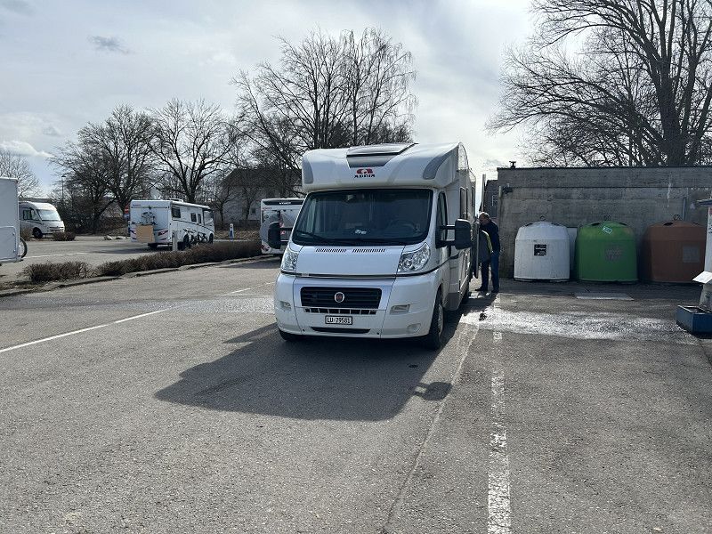
Before we continue on our way, there's a camper inspection to be done. This is, after all, the reason we're here in Winterthur. At 10:00 a.m. sharp, Sibylle, Orfeo, and Nerea arrive at the campsite. Together with Daniel, they inspect the new Rimor. Daniel, the camper expert, advises and notes everything that needs to be retrofitted or modified on their own new camper. Nerea retreats to our camper for a while and fortifies herself with sausage and bread. Shortly after 12:00 p.m., the three of them set off for home to Lucerne. Daniel and I decide which route we'll take today.
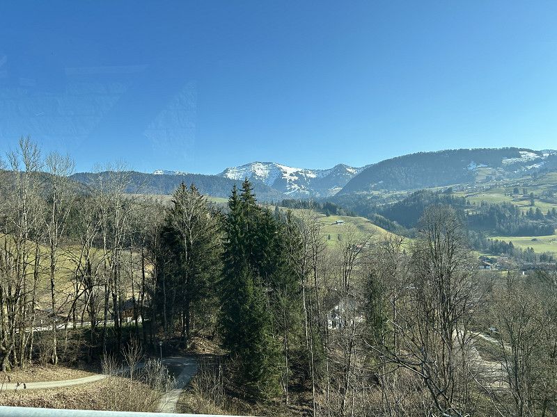
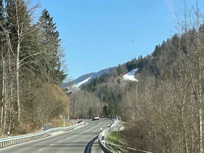
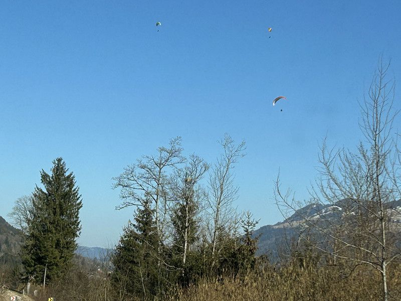
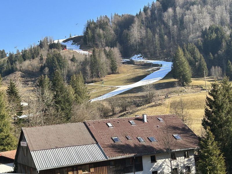
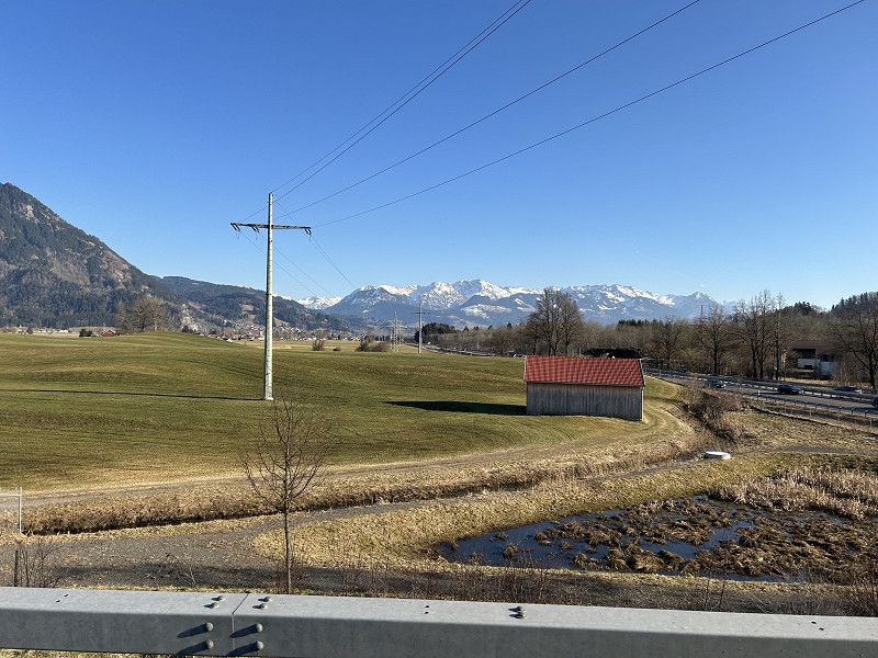
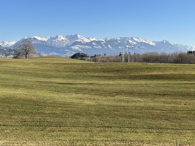
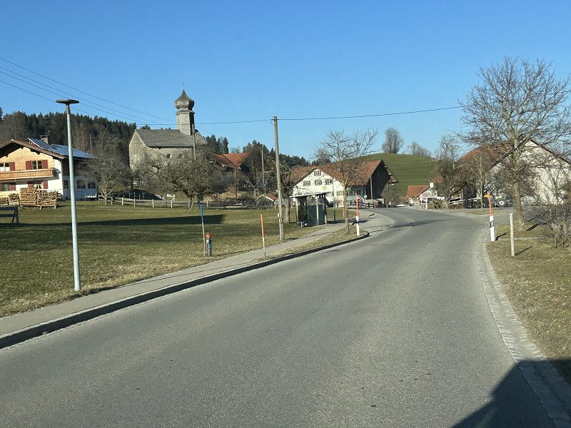
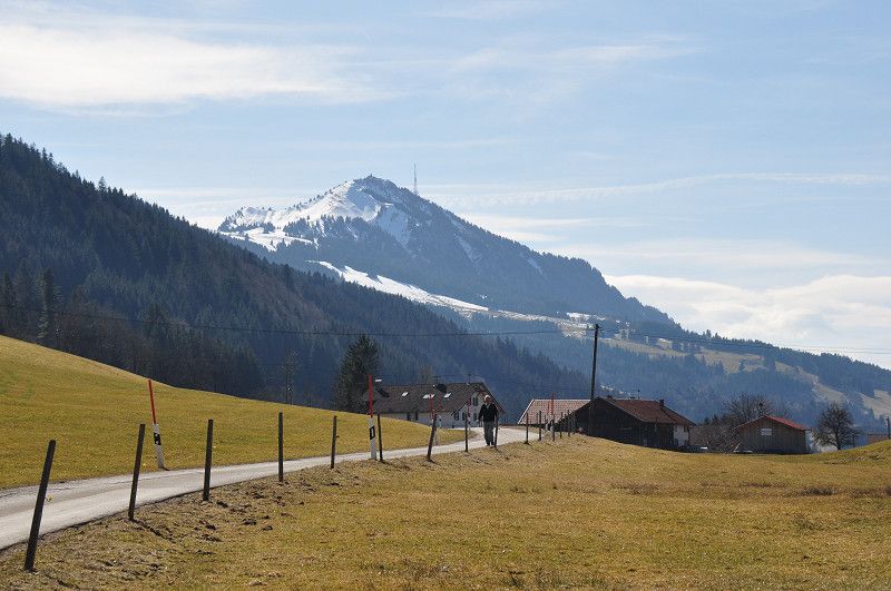
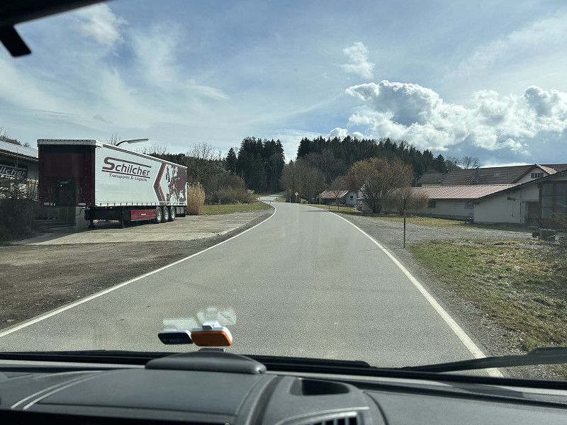
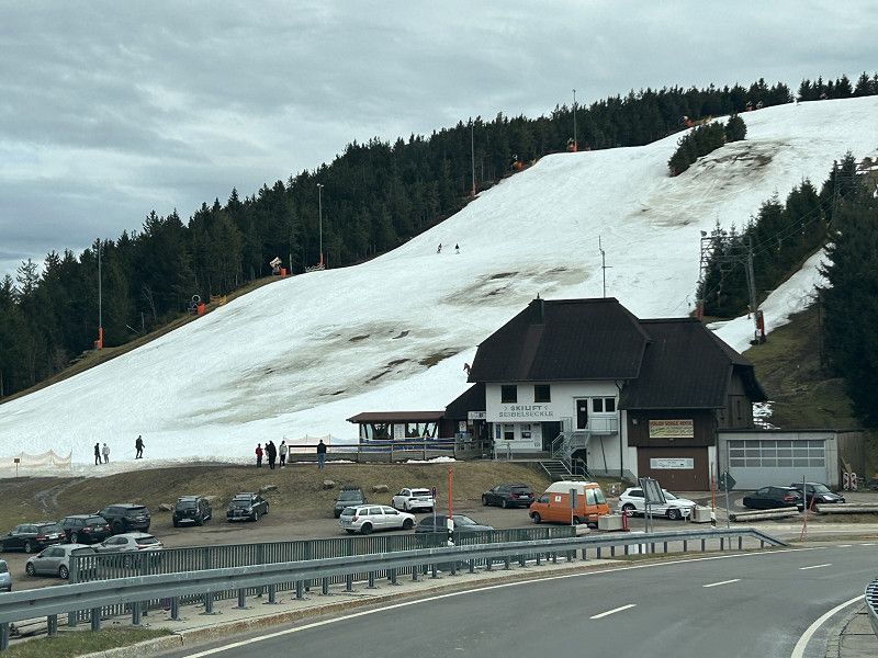
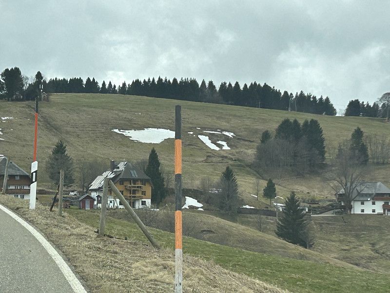
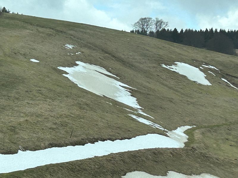
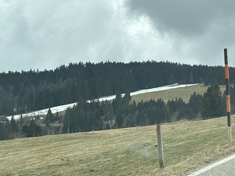
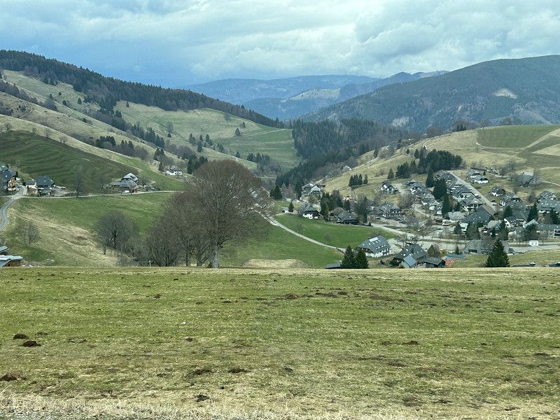
Our rough plan is to spend a few days in Munich next week. That means for today, we're driving west toward Allgäu. We enter the parking space in Immenstadt into the sat nav. To get through the Swiss cities of Winterthur, Wil, and St. Gallen quickly, we take the motorway to the Austrian border. In Austria, we stay on the motorway until the "Dornbirn Nord" exit. This motorway is toll-free for us, so we both feel a certain tension. We wonder if the "Gobox" is still working. At the first checkpoint, it beeps, and we both breathe an audible sigh of relief; it's working. From Dornbirn onward, the landscape changes abruptly. We're driving through the "Bregenzerwald" region, a lovely, hilly landscape, quite winding in places and, above all, hardly any industry, but all agriculture. Shortly before Müselbach, we turn onto an unnamed white road. This means it becomes even more rural and idyllic. In short, we're enjoying the drive through Austria. In Krumbach, we buy our breakfast bread and some meat for dinner. From here, it's only a few kilometers to the German border. The nearly 20 kilometers on the German side, to Immenstadt, also lead through the mountains. We see remnants of snow, and shortly before Immenstadt, we pass a cable car whose ski slope is still accessible all the way down to the road. Of course, this is only thanks to the artificial snow. Immenstadt is located on the "Alpenstrasse" and the "Alpensee." That actually sounds romantic and a bit touristy, so we're hoping the parking spot is in nature and close to the town. But unfortunately, we don't feel at home here. The spot is a huge parking lot, and the location isn't all that bad; you're on the outskirts of town, and you could probably quickly reach the small town center on foot. Unfortunately, the sun isn't shining over the mountains; both the town and the parking spot are in a patch of shadow, which bothers me too much on today's sunny day. Daniel empties the toilet, and then we move on. We decide to drive to around 1,000 meters above sea level, where a farming family is supposed to be offering a parking space. Park4nigt promises friendly farmers and a fabulous view.
Bauernhof Stellplatz
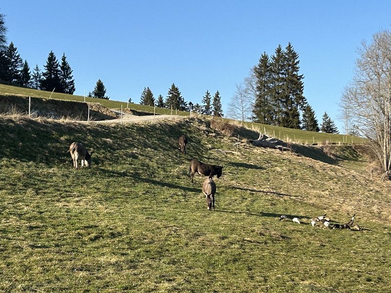
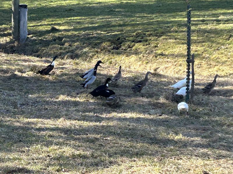
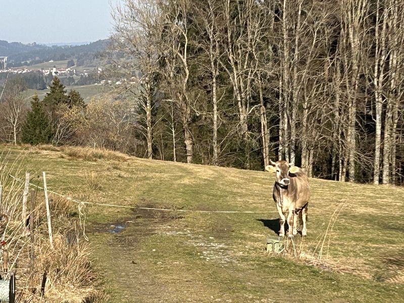
Daniel winds his way up an increasingly narrow road. I wonder if we'll find what we're looking for up there? The sat nav shows they've reached their destination. Daniel stops at the farmyard. Three small boys are playing there. As soon as I get out, the three boys are already standing next to me: "Do you want to camp here?" "Yes, can you tell me where to go?" The cheekiest boy explains to me: "The two of us live here, that guy lives over there and you can park your camper there too." The boy in question adds: "Just drive there and then knock on the door." But knocking isn't necessary. We've barely arrived at the Brackenberger farm when the young farmer's wife comes towards us. She greets us with surprise: "Oh, you're early." I explain to her that it's almost 5 p.m. and ask if that's too early. But as soon as she says it, I understand what she means by early, because she says with a smile: "You're the first this year; campers don't usually arrive this early before Easter." She and her husband quickly clear the one pitch they are offering for 20 euros a night. She seems pleased that the season is already starting. And we are pleased to have found such a great place to stay overnight today. We quickly put the chairs in front of the car and enjoy a cup of coffee under the last rays of sunshine. The view and the sounds are unique. Indian runner ducks quack, donkeys graze, cows graze and moo, and the cat Mowgli roams around the car. From our spot we can see down into the valley and up to the other farmers. Simply agriculture at its best.
Sonntag auf dem Bauernhof
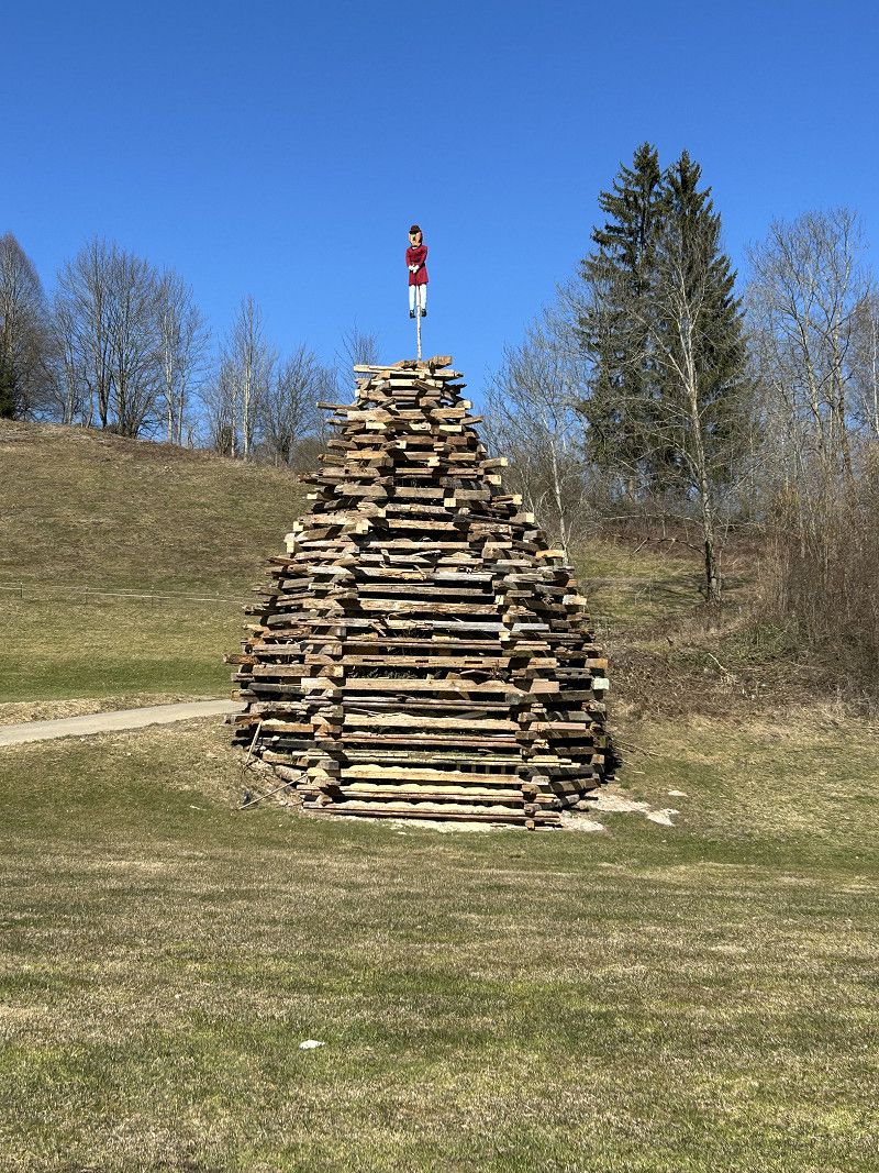
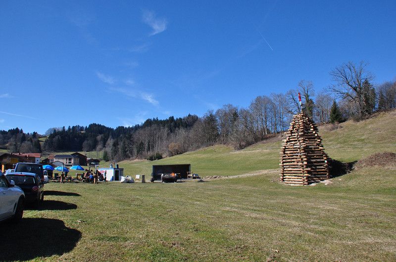
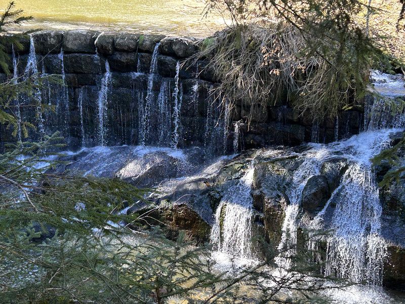
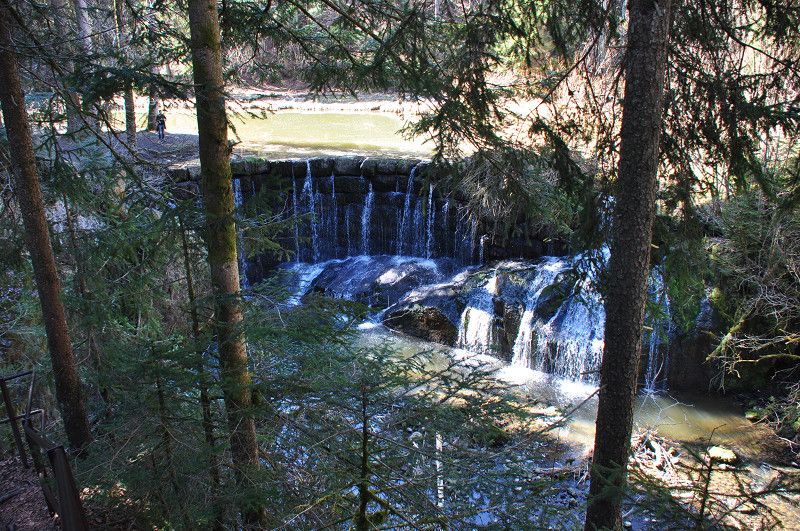
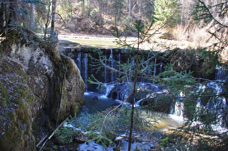
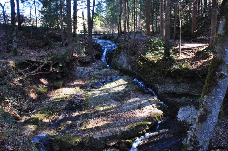
Today is another truly "magnificent day." We have breakfast in the camper, but then nothing can stop us. First, we enjoy the sunshine on our private forecourt. The weather also entices hikers out of the house, as quite a few walkers stroll past "our" farm. Around midday, we pack our steel horses to explore the surrounding area. Our plan is to visit a waterfall and the "Hirsch" restaurant in the nearby village of Vorderburg. The farmer's wife explains to Daniel the various routes to reach our destinations. The muddy trail down to the village is long, steep, slippery, and rocky. Apart from one unintentional full-body contact with the ground, I find the path quite acceptable. A little outside Vorderburg, we encounter another spark witch; we saw these fires in all the villages yesterday. Are you familiar with the tradition of spark bonfires? No, then you're like us. In the restaurant, a young local couple told us about this old tradition with some pride. The young man even kept watch last night. But I'm copying more detailed information from the internet.
"Every year on the first Sunday after Ash Wednesday, the bonfires are lit. This old Alemannic custom is intended to drive out the winter and is widespread not only in the Allgäu, but also in Vorarlberg, Switzerland and Liechtenstein. On the Saturday before the bonfire, old wood is collected in the village and burned on the bonfire. The core of the bonfire is the so-called bonfire fir tree, which is stripped of branches down to the top, and on top of which the bonfire witch is placed. This witch doll is made of straw and filled with a charge of black powder. The explosion of this charge is said to bring good luck. As soon as the bonfire is built, the bonfire guard takes over. Its purpose is to prevent residents of other villages from igniting the bonfire prematurely. This "game" is still associated with the custom in many places, and time and again a bonfire is successfully lit early. On bonfire Sunday, the bonfire is then ceremoniously lit after dark. It's said to bring bad luck if the spark tips over before the witch's doll explodes. Some old farmers' sayings are also based on the spark fire. For example, long icicles on Spark Sunday are said to promise long flax. More interesting for today is the farmers' saying that if you see many stars on Spark Sunday, you'll get many cherries. Let's see if we see many stars today.
On our bike ride, we pause briefly at the bonfire. Although it's only midday, the first festive visitors are already arriving. There's plenty of beer, coffee, and cake. We continue to the waterfall. Although it's rather small and man-made, I'm amazed at how many hikers walk to this destination. Our bike ride continues through the village of "Morgen" to the "Hirsch" restaurant. A hearty lunch fortifies us for the journey home. For the return trip to the camper, we take the narrow road we drove up yesterday.
With a fine cup of coffee we enjoy the almost excessively warm March weather.
PS We'll leave the bonfire festival to the locals. Up here, we're enjoying the restful silence and the starry sky. Whether that means there will really be more cherries this year is still up in the air. 😉
Wertach
St 2007, Wertach, Landkreis Oberallgäu, Bayern, Deutschland
47° 35' 51.3" N 10° 24' 53.7" E
47.5975788 10.4149248
• Head east on St2007. Go for 192 m.
• Turn left onto B310. Go for 661 m.
• Continue on B310. Go for 4.5 km.
• Pass 2 roundabouts and continue on B310. Go for 3.2 km.
• Turn left onto St2520. Go for 706 m.
• Take the 1st exit from roundabout onto OA34 toward Görisried. Go for 3.6 km.
• Continue on Schmalzhansenstein (OA34). Go for 646 m.
• Continue on OA34. Go for 117 m.
• Continue on OAL27. Go for 1.5 km.
• Continue on Hasenmahd (OAL3). Go for 428 m.
• Continue on OAL3. Go for 512 m.
• Continue on Hasenmahd (OAL3). Go for 241 m.
• Continue on Kemptener Straße (OAL3). Go for 498 m.
• Turn left onto Kemptener Straße (OAL3). Go for 255 m.
• Continue on Marktoberdorfer Straße (OAL3). Go for 233 m.
• Continue on OAL3. Go for 678 m.
• Continue on Durber (OAL3). Go for 94 m.
• Continue on OAL3. Go for 950 m.
• Continue on Weiherstraße (OAL3). Go for 1.3 km.
• Continue on OAL3. Go for 2.2 km.
• Take the 3rd exit from roundabout onto Hauptstraße (OAL3). Go for 818 m.
• Keep right onto Thingaustraße (OAL3). Go for 237 m.
• Continue on Oberthingauer Straße (OAL3). Go for 1.5 km.
• Continue on Marktplatz (OAL3). Go for 91 m.
• Turn right onto Marktplatz (OAL3). Go for 674 m.
• Turn left onto OAL3. Go for 4.8 km.
• Continue on OAL5. Go for 3.9 km.
• Continue on Hauptstraße (OAL5). Go for 1.1 km.
• Continue on OAL5. Go for 169 m.
• Take the 3rd exit from roundabout onto OAL7 toward Kaufbeuren/Apfeltrang. Go for 3.0 km.
• Continue on Apfeltranger Dorfstraße (OAL7). Go for 534 m.
• Continue on KF7. Go for 705 m.
• Continue on Apfeltranger Straße (KF7). Go for 2.8 km.
• Turn left onto Hölzlestraße (KF7). Go for 68 m.
• Turn right onto Kemptener Straße (St2055). Go for 297 m.
• Take the 1st exit from roundabout onto Kemptener Straße (St2055). Go for 344 m.
• Turn left onto An der Schnelle (B16). Go for 2.0 km.
• Pass 3 roundabouts and continue on Kemptener Straße (B16). Go for 4.9 km.
• Continue on Kemptener Straße (St2015) toward Mindelheim/A96/Bad Wörishofen. Go for 9.6 km.
• Take the 3rd exit from roundabout onto Rudolf-Diesel-Straße (MN23) toward Mindelheim/Kirchdorf. Go for 1.1 km.
• Take the 2nd exit from roundabout onto Thermenallee. Go for 231 m.
• Turn right onto Thermenallee. Go for 431 m.
• Turn left. Go for 119 m.
• Continue straight ahead. Go for 19 m.
• Turn left. Go for 43 m.
• Arrive at your destination on the right.
☍
61,9 km
( 56 min.)
10. Mar. 2025 -
11. Mar. 2025
Reisemobilpark Therme
Thermenallee 1, 86825, Bad Wörishofen, Germany
48° 1' 12" N 10° 35' 29" E
48.0200000 10.5913889
• Head south. Go for 255 m.
• Turn right onto Thermenallee. Go for 431 m.
• Turn left onto Thermenallee. Go for 186 m.
• Take the 2nd exit from roundabout onto Rudolf-Diesel-Straße (MN23) toward A96/Kaufbeuren. Go for 1.1 km.
• Take the 3rd exit from roundabout onto St2015 toward Lindau/A96/München/Augsburg/Türkheim. Go for 2.6 km.
• Take ramp onto A96 toward München. Go for 8.3 km.
• Take exit 22 toward Jengen/Kaufbeuren/Kempten/Marktoberdorf onto B12. Go for 2.4 km.
• Take ramp onto St2035 toward Buchloe/Jengen. Go for 450 m.
• Take the 3rd exit from roundabout onto Kardinalstraße (St2035). Go for 7.8 km.
• Turn left onto Kardinalstraße (St2035). Go for 22 m.
• Turn left onto Flurstraße. Go for 38 m.
• Arrive at Flurstraße. Your destination is on the left.
☍
23,5 km
( 21 min.)
Fahrt
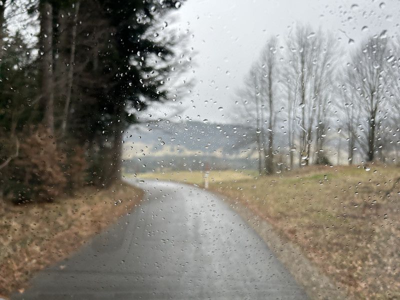
As the weather forecast had warned, raindrops woke us up. Luckily, it wasn't exactly heavy, persistent rain, but the temperature drop of about 10°C was still very noticeable. How glad we were that we packed everything for our camper last night, so we could have a leisurely breakfast, pay the farmer for two nights, and then set off for our next overnight stop. Because of the change in the weather, we chose "Bad Wörishofen" as our new destination last night. True to our holiday philosophy, we drove all along side roads and main roads. We slowly wound our way down to the village of Vorderburg, where we saw the traces of yesterday's bonfire. I was amazed at how large the burned-out circle of grass was and that a small fire was still burning in the middle. Well, these bonfire festivals are really a big deal in the small Allgäu villages.
The drive through the countryside is a feast for the eyes; we enjoy the shingled houses, the charming little villages, and the agricultural landscape one last time. By the time we reach Unterthingau, we realize that we're no longer in the mountainous Upper Allgäu, but in the flatter Eastern Allgäu. The mountains are now just small hills, and agriculture is merging with more and more industry. But what strikes me most is the change in architectural style. The villages are considerably larger, and instead of the charming shingled houses, ordinary brick houses now dominate the townscape.
Stellplatz
After almost 70 kilometers, we arrive at the thermal spa parking lot in Bad Wörishofen. After a fortifying snack, we pack our swimsuits and enjoy a two-hour warm bath under the palm trees. The pool looks less beautiful from the outside than it is inside. I thought two hours in the pool was a long time, but the many small bathing niches with their various mineral-enriched baths invite you to linger. The shower and changing rooms are also clean and comfortable.
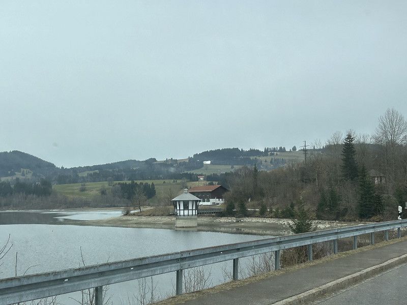
As you can see from the photos, the parking space and the area in front of the thermal baths are both uninviting. I also find the prices – €13.00 for the parking space (including electricity and waste disposal) plus an additional €22.00 per person for a two-hour entrance fee – rather expensive by German standards. Nevertheless, this trip was worthwhile, and we had a wonderful rest.
Unterostendorf
Flurstraße 1, Unterostendorf, Landkreis Ostallgäu, Bayern, Deutschland
47° 56' 34.3" N 10° 44' 39.7" E
47.9428569 10.7443660
• Head toward Kardinalstraße on Flurstraße. Go for 38 m.
• Turn right onto Kardinalstraße (St2035). Go for 124 m.
• Turn right onto Lengenfelder Straße (St2055). Go for 6.6 km.
• Turn right onto Hauptstraße (LL16). Go for 381 m.
• Continue on LL16. Go for 71 m.
• Continue on Hauptstraße (LL16). Go for 544 m.
• Turn right onto Bahnhofstraße (LL16). Go for 24 m.
• Continue on Hauptstraße (LL16). Go for 628 m.
• Continue on LL16. Go for 1.6 km.
• Continue on Leederer Straße (LL16). Go for 686 m.
• Continue on Bahnhofstraße (LL16). Go for 414 m.
• Continue on LL16. Go for 3.7 km.
• Continue on Denklinger Straße (LL16). Go for 78 m.
• Continue on Landsberger Straße (LL16). Go for 409 m.
• Turn left onto Via Claudia (LL8). Go for 24 m.
• Turn right onto Sankt-Lorenz-Straße (LL8). Go for 373 m.
• Continue on LL8. Go for 1.7 km.
• Continue on Sankt-Nikolaus-Straße (LL8). Go for 379 m.
• Turn right onto Untergasse (LL15) toward Weilheim/Rott. Go for 708 m.
• Continue on LL15. Go for 1.5 km.
• Take the 2nd exit from roundabout onto LL15. Go for 1.6 km.
• Continue on Michael-Merk-Straße (LL15). Go for 278 m.
• Turn right onto Weilheimer Straße (St2055). Go for 693 m.
• Continue on Weilheimer Straße (St2057). Go for 16.0 km.
• Turn right onto Münchener Straße (St2057). Go for 102 m.
• Turn left onto Mittlerer Graben (St2057). Go for 240 m.
• Turn right onto Pütrichstraße (B2) toward Garmisch-Part./Seeshaupt/A2. Go for 1.9 km.
• Take the 2nd exit from roundabout onto Ettinger Straße (B2) toward Garmisch-Part./Murnau. Go for 1.3 km.
• Continue on B2. Go for 10.3 km.
• Take the 3rd exit from roundabout onto B472 toward München/A95/Bad Tölz. Go for 19.5 km.
• Continue on B472. Go for 2.7 km.
• Take the 1st exit from roundabout onto Tölzer Straße (B472). Go for 5.8 km.
• Turn left and take ramp onto Benediktbeurer Straße (St2064) toward Wackersberg/Bad Tölz-West. Go for 1.4 km.
• Continue on Wilhelm-Dusch-Straße (TÖL7). Go for 241 m.
• Turn right onto Königsdorfer Straße. Go for 668 m.
• Turn left. Go for 55 m.
• Turn left. Go for 80 m.
• Turn right. Go for 59 m.
• Arrive at your destination on the right.
☍
82,9 km
(1 hrs. 14 min.)
11. Mar. 2025 -
12. Mar. 2025
Bad Tölz
Bürgermeister-Stollreither-Promenade, Bad Tölz, Landkreis Bad Tölz-Wolfratshausen, Bayern, Deutschland
47° 45' 47.9" N 11° 32' 59.7" E
47.7633155 11.5499179
• Head west. Go for 36 m.
• Turn left. Go for 147 m.
• Turn right toward Königsdorfer Straße. Go for 55 m.
• Turn left onto Königsdorfer Straße. Go for 69 m.
• Turn right onto Angerstraße. Go for 286 m.
• Turn right onto Badstraße. Go for 213 m.
• Continue on Max-Höfler-Platz. Go for 22 m.
• Continue on Arzbacher Straße. Go for 422 m.
• Turn right onto Arzbacher Straße (St2072). Go for 64 m.
• Turn left onto B472 toward Miesbach/Sylvenstein/Lenggries. Go for 2.7 km.
• Turn left onto B13 toward München/Holzkirchen. Go for 17.0 km.
• Turn right onto Marktplatz (B13) toward München-Salzburg/Tegernsee/Miesbach/Mitterdarching. Go for 1.4 km.
• Take ramp toward München/A8/Salzburg/B13/Gewerbegebiet Holzkirchen/Gewerbegebiet Sandoz-Hexal. Go for 212 m.
• Turn right onto B318. Go for 2.2 km.
• Take ramp onto A8 toward München. Go for 14.2 km.
• Take exit 95 toward Nürnberg/Stuttgart/Messe/ICM/Flughafen München onto A99. Go for 33.8 km.
• Take exit 12A toward B13/München/München-Neuherberg/Helmholtz-Zentrum. Go for 288 m.
• Turn left onto St2053 toward München/München-Neuherberg/Helmholtz-Zentrum/B13. Go for 230 m.
• Take ramp onto A99 toward Salzburg. Go for 2.4 km.
• Take exit 13 toward Arena/P+R. Go for 1.0 km.
• Continue on Werner-Heisenberg-Allee. Go for 40 m.
• Turn right. Go for 49 m.
• Arrive at your destination on the left.
☍
76,9 km
( 57 min.)
Fahrt
Today's cross-country journey is hard to top. Just outside of Bad Wörishofen, we turn onto a narrow side road. Then, for several kilometers, we drive right and left, true to our motto: "follow your nose." Since, as co-pilot, I constantly have to give turn-by-turn instructions, I hardly get a chance to take photos. Whatever, we simply enjoy the ride. Sometimes we get the feeling that the narrow road leads directly across the front courtyards of the farmhouses. We do our daily shopping in a village shop, where a chatty customer explains to us that we're no longer in the Allgäu, but in Upper Bavaria. And lo and behold, from Weilheim in Upper Bavaria, this becomes quite official, and to our amazement, we drive a few kilometers on the "German Alpine Road" again, which of course also means that the snow-capped mountains are once again in sight. We leave the Alpine Road again when we turn towards Bad Tölz instead of Garmisch-Partenkirchen; from this junction onwards it becomes noticeably more “urban” again.
Stellplatz Bad Tölz
The parking space on the Isar River is very well signposted, even before entering Bad Tölz. The site is, as described, directly on the Isar River. It's large, flat, and, above all, quiet. Bad Tölz's old town is only about 500 meters from the parking space. So we decide to stroll along the banks of the Isar and then enter the old town at the Isar Bridge. The old town center is small but extremely beautiful. It's car and bicycle free. The houses to the left and right of Marktstrasse are in very good condition and beautifully painted. I'm amazed at how old these townhouses are. I saw one house that was over 600 years old. On the way back, I read an information board about the town and the Tölzer Land region: "South of Munich, between the Isar and Loisach rivers, stretches the Tölzer Land region. Mountains and lakes, churches and monasteries, towns and villages, tradition, culture, health, and all sorts of sporting activities—the Tölzer Land region offers holidays for connoisseurs, those seeking relaxation, athletes, families, and gourmets—in short, for every taste.
Bad Tölz, the historic spa town on the Isar River, long profited from the lucrative salt trade. This is reflected in the townscape; the facades of the gabled houses on Marktstrasse, also called the "most beautiful ballroom in the Oberland," are particularly impressive. Tranquil alleys, the historic spa district, inns, and cozy cafés—all of the town's sights can be easily explored on foot.
Bad Tölz is truly worth a visit. If you don't just want to visit Munich, I highly recommend this detour to the Isar River. We're only staying one night, so we'll only visit Marktstrasse. We might explore the wider Tölz region another time.
12. Mar. 2025 -
16. Mar. 2025
Stellplatz an der Allianz Arena
Werner-Heisenberg-Allee 25, 80331, München, Germany
48° 13' 18" N 11° 37' 28" E
48.2216667 11.6244444
• Head northeast. Go for 24 m.
• Turn right onto Werner-Heisenberg-Allee. Go for 464 m.
• Keep left onto Werner-Heisenberg-Allee. Go for 1.6 km.
• Keep left onto Anschlussstelle München-Fröttmaning-Süd toward Stuttgart/Nürnberg/Salzburg. Go for 17 m.
• Take ramp onto A9. Go for 7.1 km.
• Take exit 70 toward Garching-Nord. Go for 349 m.
• Turn left toward Dachau/B471/Oberschleißheim/Gewerbegebiet Garching-Hochbrück/Gewerbegebiet Business Campus/Gewerbegebiet Schleißheimer Straße/Stadion Garchinger See/P+R. Go for 340 m.
• Take ramp onto A9. Go for 630 m.
• Arrive at A9.
☍
10,6 km
( 8 min.)
Fahrt
Today we want to look for a parking space in Munich for three nights. We entered the "Allianz Arena" parking space into the navigation system. This space costs €20 per 24 hours, including electricity and waste disposal, so it's more ideal for us than the Olympia parking space, which doesn't include anything. The distance to the city center is also perfect for us—about 13 kilometers on a bike path.
So, we're heading for Munich, so as co-pilot, I'd like us to approach Munich on the Autobahn. I suspect this way we can simply take the "Allianz Arena" exit and drive directly to the parking space.
But one thing at a time; we're still in Bad Tölz. And to my amazement, it takes a really long time before we pass the end-of-town sign. It's a really big town. And my amazement continues. Instead of quickly getting onto the autobahn, we wind our way through the countryside, just like yesterday, leisurely and wonderfully. About 50 kilometers before Munich, we reach the autobahn. But here, too, there's little traffic; nothing to indicate that we're approaching the Bavarian capital. The closer we get to Munich, the more lanes the autobahn becomes, and slowly the traffic also increases. We cross huge autobahn junctions without any problems, change autobahn numbers, and feel reliably guided by our navigation system. Everything is going well; I'm only a little surprised when I don't see any signs for "Allianz Arena." So, quite confidently, we take the "Dirnismaning" exit, drive into the village, and, now a little hesitant, turn onto a narrow industrial road. After a few meters, Daniel stops abruptly. Our favorite sat nav wants us over a narrow bridge, past a no-entry sign, and then on along a gravel road. No, that's not how it works. To make matters worse, we see the arena in the distance, but we can't take that route. We turn around and, with the help of Google Maps, head back onto the motorway. But anyone who thinks we'll end up right at the Arena is mistaken. We drive a few kilometers on the motorway, then we're told to take the exit, go straight ahead, and get back onto the motorway... I don't know how many times we took that twist and turn. Finally, the exit sign said "Allianz Arena," and you won't believe it - at exactly 12:00 p.m. we're at our overnight spot, right in front of the Allianz Arena.
We're really wondering if this is the only access to the park. We don't know. It doesn't matter, the main thing is that we found our destination.
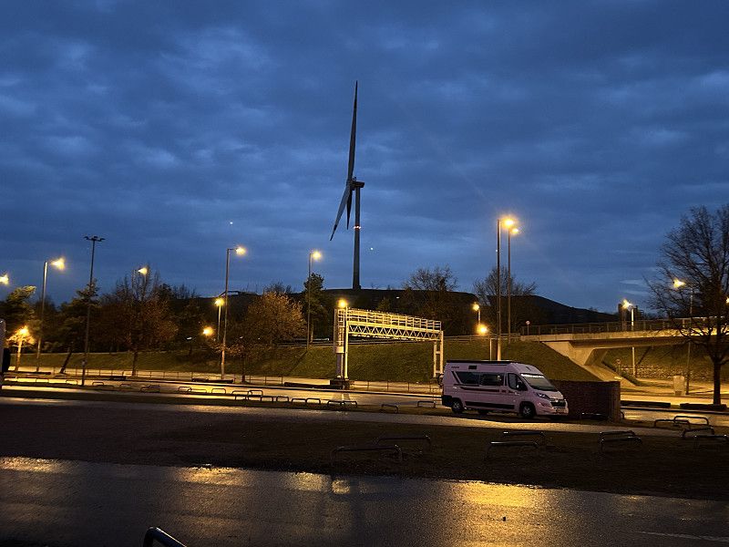
München Stellplatz Allianz Arena
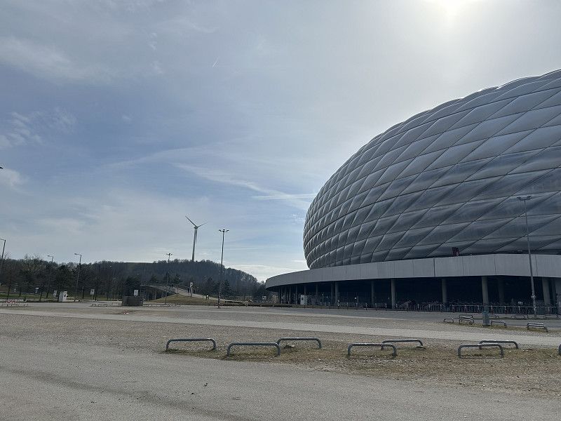
You have to give the architect credit for that; the arena is an impressive building.
We feel comfortable at the campsite and enjoy the direct connection to Munich's bike path network. The noise from the highway takes some getting used to, but it's bearable. We settle in for four nights, as the city tour "Schmankerltour" has been postponed to Saturday. Whatever, we have time and no other plans yet.
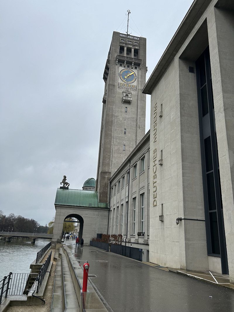
Radtour und Besuch im Deutschen Museum
I wake up in the middle of the night to the heavy rain pounding on our roof. Oh my God, I think to myself, if it rains like this all day tomorrow, our visit to the Deutsches Museum will probably be canceled.
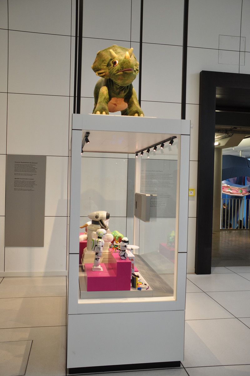
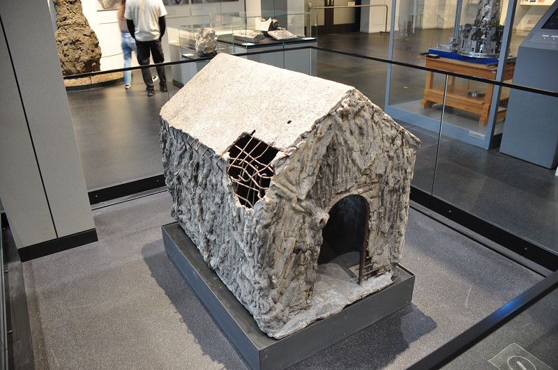
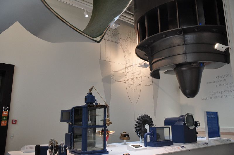
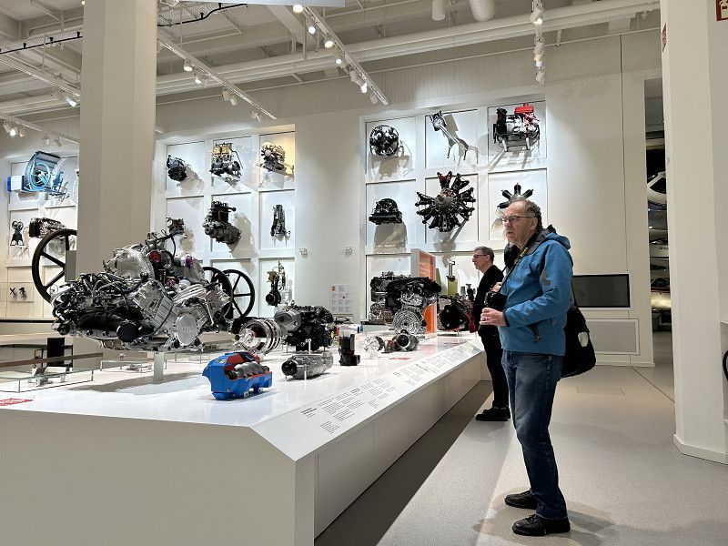
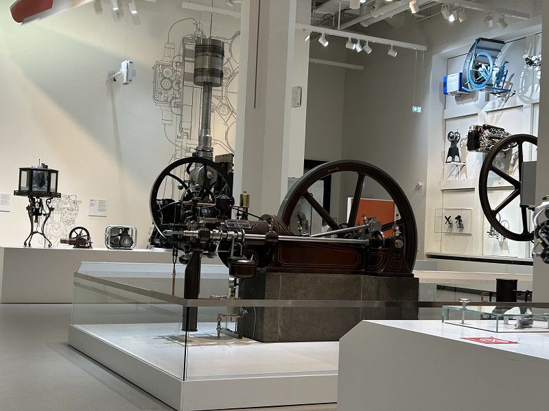
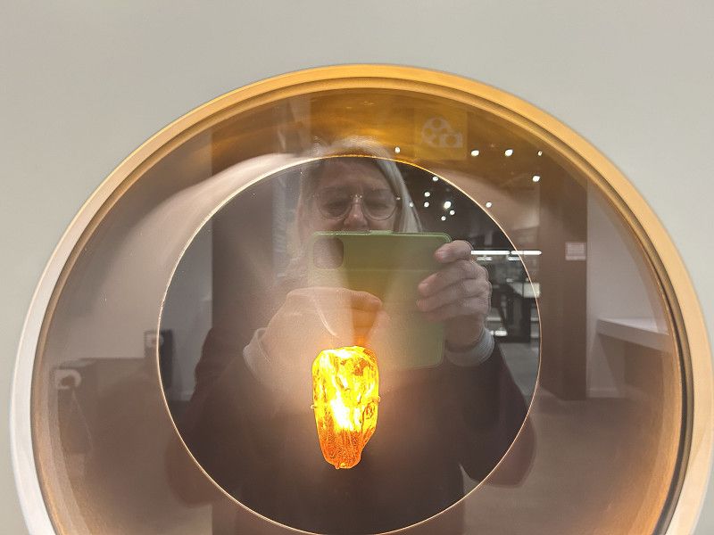
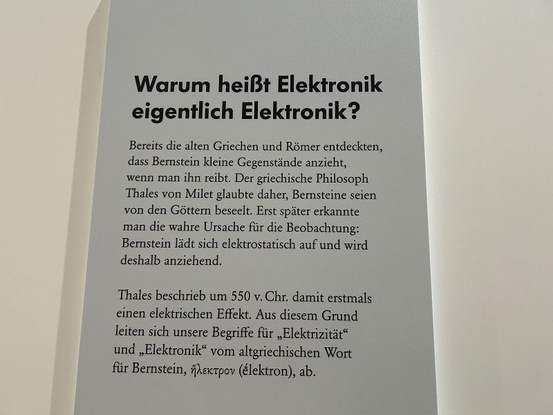
Luckily, the weather is changing to "changeable." Mostly wet in the morning, with increasingly longer dry breaks around midday. We get our e-bikes ready. Daniel programs the bike computer. Pack our bags for the museum visit and, above all, dress warmly. Our day trip begins, leaving the Arena Arena, briefly along the highway, after a short while crossing the main road, and then along the bike path for about 12 kilometers. We follow the sign for "Marienplatz" to the Isar River. First, we cycle along a puddle-filled forest path, then we cross the English Garden and finally along the Isar to Museum Island. In this cold and drizzle, I didn't feel like photographing the otherwise beautiful bike path, sorry. Luckily, it only drizzled lightly during the ride, so our pants weren't completely soaked, just dry enough for the museum trip. I think the admission price of 8 euros per person (seniors) is good value. But unfortunately, we are greeted by a completely different museum than it was 30 years ago. We're much less fond of today's exhibition style. Nevertheless, we linger with interest in various halls. Bridge and hydraulic engineering, machines and their inventors, aircraft, and finally, technology. Here I learn why I'm so drawn to amber. 🙈 See photos.
Tired and hungry, we prepare for the return journey. If only navigation systems weren't so tricky. Just like our car navigation system, our cycling navigation system is up to its tricks today. Daniel enters the Allianz Arena as our "favorite location," the navigation system calculates, and instead of 13.6 kilometers, it spits out a route of 110 kilometers, back to the farm in the Oberallgäu region. After a few restarts, Daniel turns off the navigation system because we already know the way back, and besides, the bike paths here in Munich are excellently signposted. From the English Garden, we can simply follow the "Arena" sign. GREAT.
We arrive at our camper frozen, wet, and covered in mud. Luckily, our living room warms up quickly. A good meal and a warm cup of tea fortify us for a peaceful evening.
Let's see if the weather is as cloudy and changeable tomorrow. Then we'll probably stay in the car and treat ourselves to a real day of rest.
Ruhetag im Camper
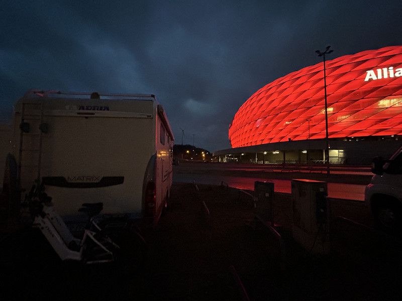
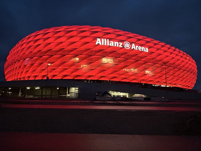
We're now standing in front of this impressive football stadium for three days. There's no city tour planned today, and the weather is so cold and wet that we'd rather spend a proper day relaxing in the camper. Between reading, playing, cooking, and... I do a bit of internet research about the Allianz Arena. Upon arrival, I praised the architects for their idea of designing such a football stadium. Now I can write with a bit of pride: "Who invented it? Two Swiss, of course." The Basel architectural firm Herzog and de Meuron won the competition in 2001. The foundation stone for the football stadium, which seats 66,000 people, was laid in 2002, and the building was completed in 2005. The website "baunetzwissen.de" states: "The design impresses with its innovative building shell and the associated opportunity for two football clubs to identify with their stadium. Bayern Munich and TSV 1860 Munich will both host this sports arena in the future. The stadium's facade is one of the largest membrane shells in the world. It consists of 2,800 pneumatically pre-tensioned ETFE foil cushions. The extremely transparent foil has a light transmittance of 93% and, with a thickness of 0.2 mm, weighs just 350 g/m2. At the request of the developers, the stadium's facades can glow in different colors, depending on which team is playing. Almost a third of all cushions are illuminated by approximately 25,000 fluorescent lamps in varying colors of white, red, and blue. The area of the illuminated facade shell is approximately 24,000 m2, with a total area of 64,000 m2. As you can see, we're stuck on the "exterior." Daniel and I are definitely not football fans and therefore forgo a tour of the stadium. The football museum doesn't appeal to us at all either. So we enjoy our spot in front of the magnificent building, occasionally chatting among the bustling tourist crowds in front of the stadium. And, of course, we're amazed by the patient security guard at the bridge. His shift starts at 8:00 a.m., and he stands, sits, briefly goes into the small booth, then stands, sits... until he finishes work in the late afternoon. It's a mystery to us how he endures these long and particularly boring days.
Ruhetag Stadtführung
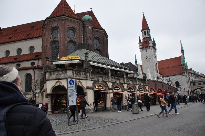
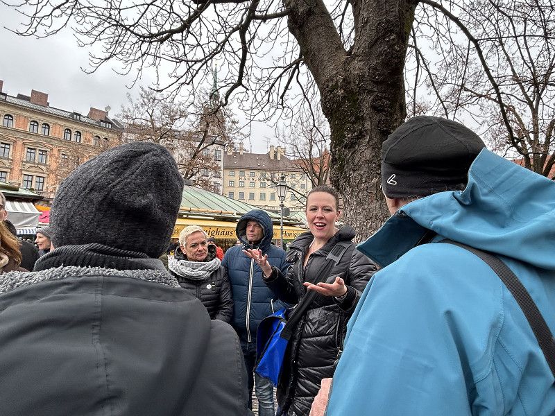
The alarm goes off at 8:00 a.m., and today is the end of our rest day. Today is the day for the "Schmankerltour Altstadt" (Old Town Delights Tour) in Munich. It starts at 1:00 p.m. at the Isartor. Unfortunately, the weather is more wintry than spring-like today, so we dress as warmly as possible and set off around 10:00 a.m. in drizzle and an icy wind. To avoid having to ride on the muddy bike paths again, we choose the bike path that runs alongside the main road. Thanks to our bike navigation system and the good bike path signage, we reach our destination without any major detours at 11:00 a.m. We park our bikes under the arbor by the Toy Museum, right next to Marienplatz, and walk back to the Isartor. Completely frozen, we are glad to be able to warm up at the Haxenbauer restaurant. We rarely enjoy a hot chocolate like we did here. But we aren't satisfied with just the chocolate. With a pan of cheese spaetzle, we prepare for the popular culinary tour, including a beer tasting, of course. As if revitalized, we arrive punctually at the Isartor, where our city guide greets us.
The description below for the "Weis(s)er Stadtvogel" (White City Bird) city tour reflects what we were able to experience in the two hours. Thanks to a group of friendly couples from Munich, this tour is even taking place. The minimum number of participants is 10, and without the group, we two are the only tourists. The tour guide confirms that many tours have to be canceled this time of year. Fortunately, we can enjoy this tour through Munich's old town today. In addition to the wealth of interesting information about beer consumption, beer production, and Munich's history, we also enjoy the delicious delicacies.
Old Town Tasty Tour
City tour through Munich with extensive tasting
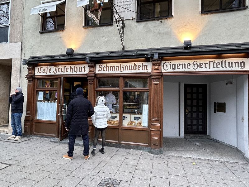
On this tour, we'll indulge in Munich delicacies. After our cosmobiodynamic welcome drink at the Isartor Gate, we'll embark on a culinary journey of discovery through the Old Town. Try your hand at being a beer sommelier with a guided beer tasting and sample traditional Munich baked goods with Munich's best Obazda (spicy cheese). Upon arrival at the Viktualienmarkt, the market butchers will offer a special treat. Finally, we'll stroll to another institution of traditional Munich cuisine: the Schmalznudel (dairy noodles). There, we can watch how our Auszog'ne (dairy noodles), Strizerl (dairy noodles), or Schmalznudeln (dairy noodles) are made, which we'll then enjoy.
• refreshing welcome drink
• traditional Munich Pfennigmuggerl from the Hofkunstmühle
• best Obazda from the Viktualienmarkt
• moderated beer tasting 3x 0.1l with crispy pretzels
• hearty Leberkas roll from the Metzgerzeile
• freshly baked Schmalznudel from Café Frischhut
After the tour, we don't feel like staying any longer in Munich's old town. The weather is still bitterly cold, yet the alleys are packed with shopaholics and tourists. No, that's not fun for us; we'd rather cycle back to the camper as quickly as possible. Once again, we're frozen to the bone, so the only thing that helps is a hot cup of tea and a quick warm blanket. The spaetzle pan and the delicacies from the Schmankerltour fill us up so much that we slip into bed without dinner and drift off to dreamland early.
Garching bei München
A 9, Garching bei München, Landkreis München, Bayern, Deutschland
48° 15' 42.2" N 11° 38' 49.2" E
48.2617297 11.6469985
• Head south on A9. Go for 1.6 km.
• Take exit 71 toward P+R. Go for 492 m.
• Turn right onto B471 toward Dachau/Oberschleißheim/Landshut/Freising/Gewerbegebiet Garching-Hochbrück/P+R/Gewerbegebiet Business Campus/Gewerbegebiet Schleißheimer Straße/Stadion Garchinger See. Go for 2.9 km.
• Turn right onto Ingolstädter Landstraße. Go for 729 m.
• Arrive at Ingolstädter Landstraße.
☍
5,8 km
( 6 min.)
Oberschleißheim
Ingolstädter Landstraße, Oberschleißheim, Landkreis München, Bayern, Deutschland
48° 15' 17.9" N 11° 35' 59.9" E
48.2549609 11.5999655
• Head south on Ingolstädter Landstraße. Go for 729 m.
• Turn right onto Schleißheimer Straße (B471). Go for 68 m.
• Turn right onto Ingolstädter Landstraße (B13) toward A92/Ingolstadt/Unterschleißheim. Go for 12.9 km.
• Take the 2nd exit from roundabout onto Hauptstraße (B13) toward Ingolstadt/Hohenkammer. Go for 7.9 km.
• Arrive at B13. Your destination is on the right.
☍
21,5 km
( 19 min.)
Unterwohlbach
B 13, Unterwohlbach, Landkreis Freising, Bayern, Deutschland
48° 25' 7.5" N 11° 31' 54" E
48.4187417 11.5316644
• Head northwest on B13. Go for 5.8 km.
• Take the 2nd exit from roundabout onto Münchener Straße (B13) toward Ingolstadt/Pfaffenhofen. Go for 5.9 km.
• Turn right onto Dr.-Wirzmüller-Straße. Go for 123 m.
• Continue on Weinbergstraße. Go for 82 m.
• Continue on Weinbergweg. Go for 62 m.
• Arrive at Weinbergweg. Your destination is on the right.
☍
12,0 km
( 11 min.)
Hettenshausen
Weinbergstraße 1, Hettenshausen, Landkreis Pfaffenhofen an der Ilm, Bayern, Deutschland
48° 30' 50.1" N 11° 30' 36.8" E
48.5139081 11.5102118
• Head north on Weinbergweg. Go for 62 m.
• Continue on Weinbergstraße. Go for 82 m.
• Continue on Dr.-Wirzmüller-Straße. Go for 123 m.
• Turn right onto Münchner Straße (B13). Go for 858 m.
• Continue on Münchner Straße (B13) toward A9/Ingolstadt/Au i.d. Hallertau. Go for 2.5 km.
• Turn right onto St2232. Go for 9.0 km.
• Take the 3rd exit from roundabout onto St2232. Go for 10.1 km.
• Continue on Maximilianstraße (B300). Go for 249 m.
• Turn right onto Regensburger Straße (B300) toward Regensburg/Abensberg/Münchsmünster. Go for 10.4 km.
• Continue on B16A. Go for 305 m.
• Continue on St2233. Go for 1.4 km.
• Continue on PAF16. Go for 2.3 km.
• Continue on EI35. Go for 578 m.
• Continue on PAF16. Go for 202 m.
• Continue on EI35. Go for 887 m.
• Turn right onto St2232. Go for 2.7 km.
• Turn right onto B299. Go for 2.7 km.
• Turn left onto KEH4 toward Kelheim/Irnsing. Go for 1.7 km.
• Continue on Kelsstraße (KEH4). Go for 827 m.
• Continue on Hofmarkstraße (KEH4). Go for 293 m.
• Continue on KEH4. Go for 30 m.
• Continue on KEH5. Go for 2.3 km.
• Continue on Kelheimer Straße (KEH5). Go for 1.9 km.
• Continue on KEH5. Go for 6.5 km.
• Continue on Heidenstein (KEH5). Go for 450 m.
• Continue on KEH5 toward Hemau. Go for 458 m.
• Turn left and take ramp onto St2230. Go for 717 m.
• Arrive at St2230. Your destination is on the left.
☍
59,7 km
( 50 min.)
15. Mar. 2025 -
16. Mar. 2025
Essing Parkplatz am schiffssteg
Auenweg, Altessing, Landkreis Kelheim, Bayern, Deutschland
48° 55' 49.8" N 11° 47' 28.3" E
48.9304898 11.7912017
• Head northwest on St2230. Go for 25.1 km.
• Take the 2nd exit from roundabout onto St2230. Go for 520 m.
• Arrive at St2230. Your destination is on the left.
☍
25,6 km
( 18 min.)
Fahrt
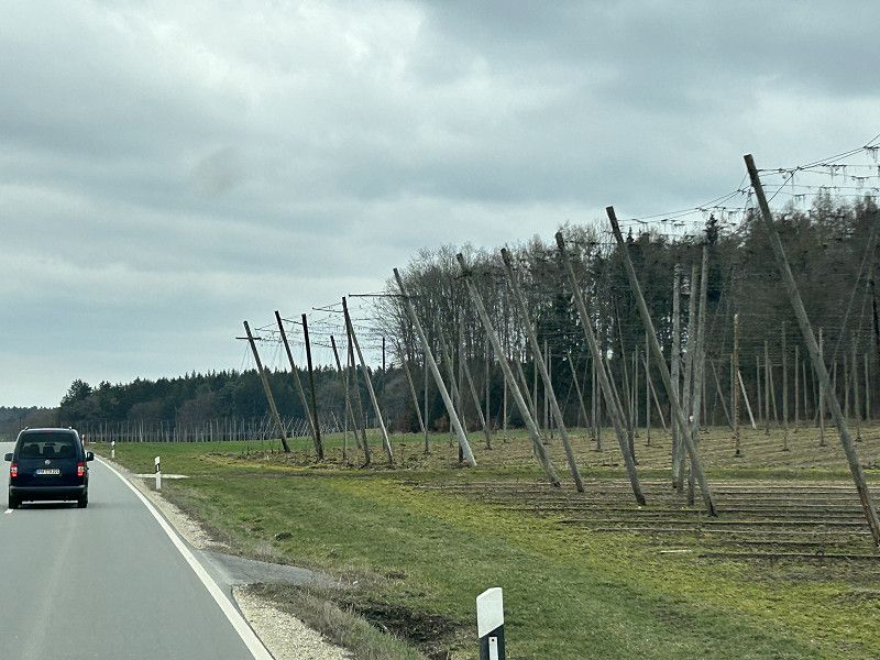
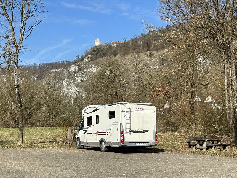
Today we have a less hectic start to the day, as we don't have to leave the parking lot until 12:00, which is when our day ticket is valid. Well rested, we enjoy breakfast and do a thorough cleaning of the house. However, something's wrong with our sat nav again, as it wants to direct us back out of the parking lot via the gravel road and the farm bridge. To leave Munich as smoothly as possible, we let Google Maps guide us onto the autobahn. From there, our sat nav finds the way again. We drive briefly towards Dachau, then turn onto the No. 13 towards Ingoldstadt. We are amazed at how little traffic there is on this main road. As in the last few days, we drive through idyllic countryside. As soon as we leave the autobahn, we see deer several times. A total of 15 deer are grazing near the road. Near Pfaffenhausen, we turn onto a side road to Geisenfeld. This route may be called the "German Limes Road," but for us it's the "Hop Road." We've never driven past so many hop fields, or such large ones. Shortly before Essing, we cross the Danube, and as the weather forecast on the radio announced today: "It's sunny near the Danube," the sun really does blind us. This beautiful and varied ride ends at a small hiking parking lot on the Main-Danube Canal at the entrance to the village of Essing.
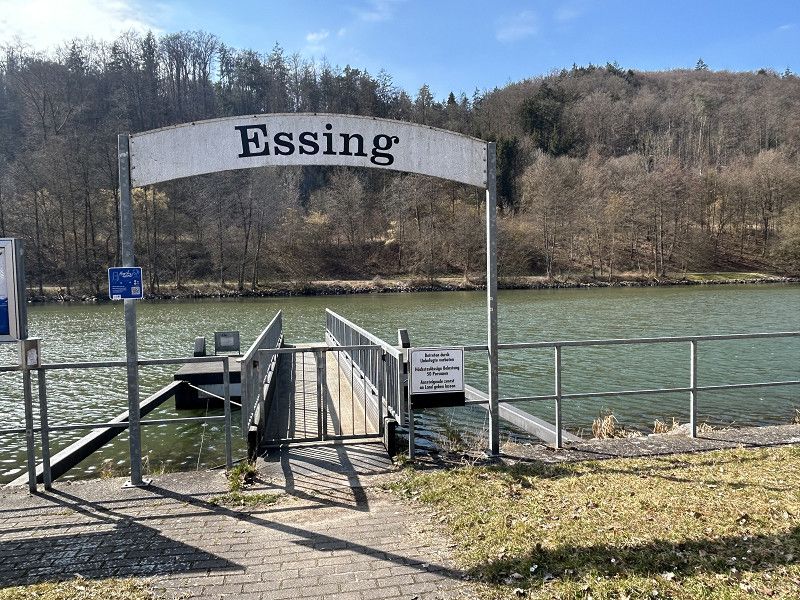
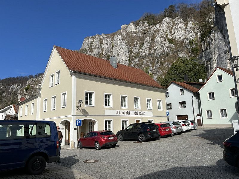
Essing Wanderparkplatz am Schiffssteg
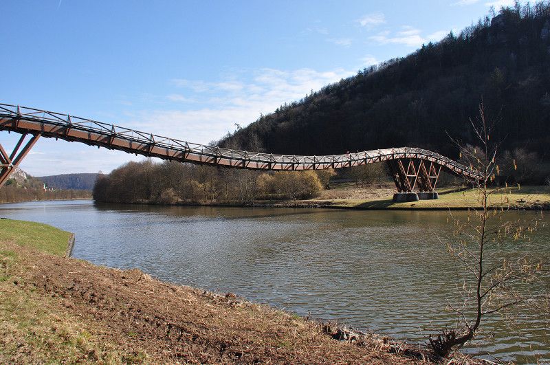
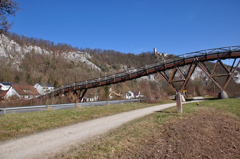
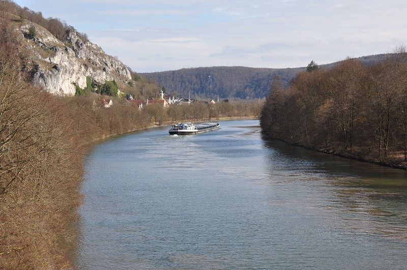
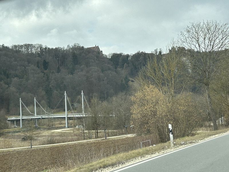
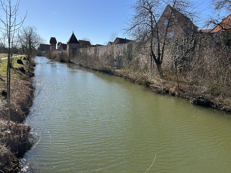
We are now standing directly at the "Essing" boat dock. However, we have barely arrived, as the restaurant in Essing only serves hot meals until 1:45 p.m. Ten minutes before 1:45 p.m., we enter the cozy "Brauereigasthof Schneider" restaurant. Luckily, we managed to arrive before the kitchen closed, as the food tasted really good and the service was attentive and friendly. In beautiful, warm sunshine, we cycle about another kilometer along the canal until we reach our destination, the "Tatzelwurm" wooden pedestrian bridge. We saw a model of this bridge in the Deutsches Museum, and now we are standing in front of this special structure. In front of the bridge is an information board about this wooden bridge. "Extensive studies and planning were required for this unique structure. The static calculations were carried out at the Technical University of Munich, models were created, and tests were carried out in a wind tunnel, among other things. The sophisticated statics of the structure alone demonstrate the impressive engineering feat. Almost the entire load is borne by the tension of the 193-meter-long structure; the two piers absorb only 10% of the acting forces. The bridge can withstand a load of 500 kilograms per square meter. The structure spans the bypass road and the Main-Danube Canal and serves primarily for recreational traffic. If necessary, the bridge can also be used by motor vehicles. Due to its elegantly curved shape, the bridge blends elegantly into the landscape of the Altmühl Valley.
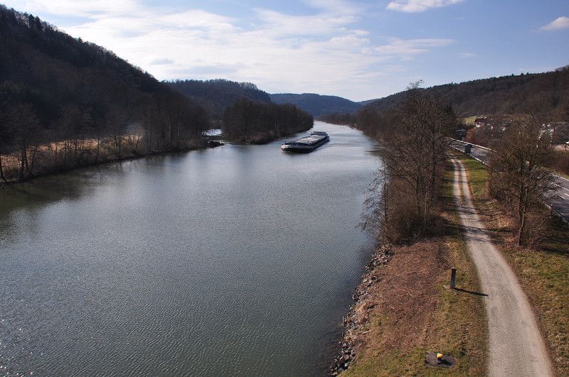
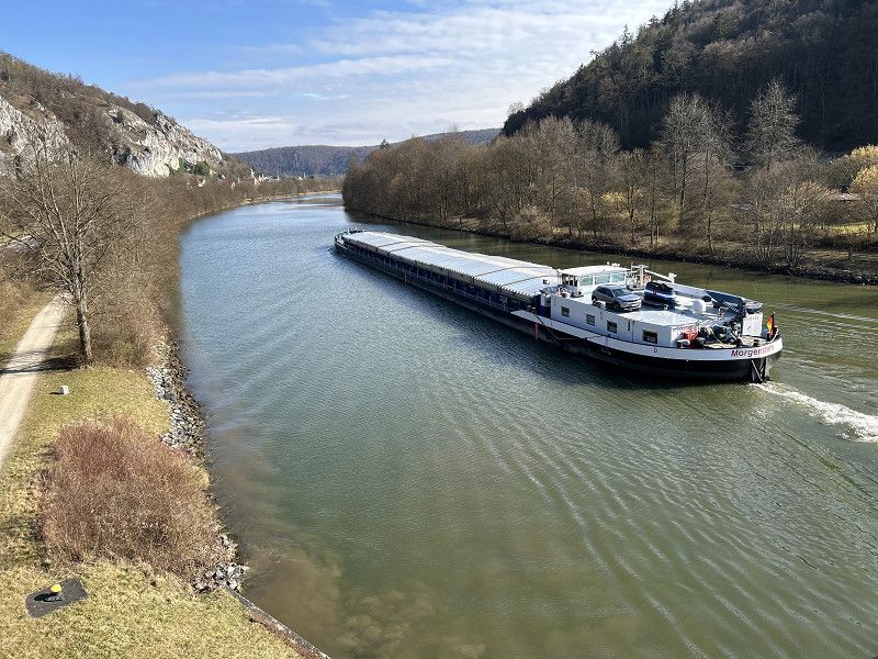
Yes, and the landscape here is truly unique, lovely. To my surprise, the many cargo ships passing in front of our car don't even bother us. The nearby thoroughfare doesn't bother us either.
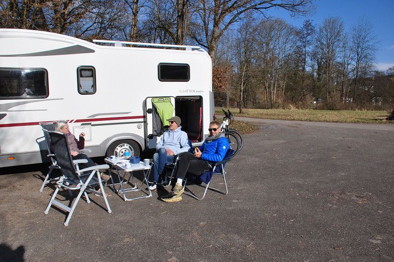
We round off the afternoon with a leisurely coffee break in front of the camper. Two campers from Nuremberg, who were just out for a Sunday outing, joined us. It's wonderful how spontaneously you can strike up conversations while camping and get a little insight into the lives of strangers.
Dietfurt an der Altmühl
St 2230, Dietfurt an der Altmühl, Landkreis Neumarkt in der Oberpfalz, Bayern, Deutschland
49° 1' 39.3" N 11° 35' 4.9" E
49.0275968 11.5846919
• Head northwest on St2230. Go for 101 m.
• Take the 2nd exit from roundabout onto St2230. Go for 9.6 km.
• Turn left onto Kelheimer Straße (B299). Go for 49 m.
• Arrive at Kelheimer Straße (B299). Your destination is on the right.
☍
9,8 km
( 8 min.)
Beilngries
Kelheimer Straße 8, Beilngries, Landkreis Eichstätt, Bayern, Deutschland
49° 2' 2.2" N 11° 28' 36.8" E
49.0339494 11.4768901
• Head southwest on Kelheimer Straße (B299). Go for 169 m.
• Turn left onto Ingolstädter Straße (B299) toward München/A9/Landshut/Neustadt/Ingolstadt/Paulushofen. Go for 973 m.
• Take the 1st exit from roundabout onto St2230 toward Nürnberg/A9/Eichstätt/Kinding/Industriegebiet Beilngries. Go for 1.8 km.
• Take the 2nd exit from roundabout onto Eichstätter Straße (St2230) toward A9/Eichstätt/Kinding. Go for 8.0 km.
• Continue on St2228. Go for 956 m.
• Take the 2nd exit from roundabout onto St2228 toward A9/Eichstätt. Go for 3.8 km.
• Turn right onto St2228 toward Titting/Erlingshofen. Go for 11.3 km.
• Turn left onto Jurastraße (St2225). Go for 2.9 km.
• Arrive at Hauptstraße (St2225). Your destination is on the right.
☍
30,0 km
( 25 min.)
Pollenfeld
Hauptstraße 3, Pollenfeld, Landkreis Eichstätt, Bayern, Deutschland
48° 56' 48.3" N 11° 12' 25.1" E
48.9467385 11.2069726
• Head toward Fichtengasse on Hauptstraße (St2225). Go for 177 m.
• Turn left onto Kirchstraße (St2228). Go for 1.7 km.
• Continue on Kapellenstraße (St2047). Go for 4.8 km.
• Turn right onto B13. Go for 10.2 km.
• Turn left onto Laubental (WUG36) toward Treuchtlingen. Go for 8.9 km.
• Continue on St2216. Go for 1.9 km.
• Take the 2nd exit from roundabout onto Nürnberger Straße (St2216). Go for 782 m.
• Continue on Oettinger Straße (St2216). Go for 509 m.
• Turn left onto Hahnenkammstraße (St2216). Go for 5.6 km.
• Turn right onto St2218 toward Heidenheim/Windischhausen. Go for 6.9 km.
• Turn right onto St2218. Go for 2.9 km.
• Arrive at St2218. Your destination is on the right.
☍
44,4 km
( 37 min.)
Heidenheim
St 2218, Heidenheim, Landkreis Weißenburg-Gunzenhausen, Bayern, Deutschland
49° 0' 46.4" N 10° 45' 3.6" E
49.0129020 10.7509870
• Head northeast on St2218. Go for 2.9 km.
• Turn left onto St2218. Go for 6.9 km.
• Turn left onto St2216 toward Treuchtlingen. Go for 5.6 km.
• Turn right onto Wettelsheimer Straße (St2216). Go for 1.2 km.
• Take the 1st exit from roundabout onto Nürnberger Straße (St2216). Go for 1.9 km.
• Continue on WUG36. Go for 8.9 km.
• Turn right onto B13. Go for 10.8 km.
• Take the 2nd exit from roundabout onto B13. Go for 6.3 km.
• Arrive at Ingolstädter Straße (B13). Your destination is on the left.
☍
44,6 km
( 39 min.)
Eichstätt
Ingolstädter Straße 54, Eichstätt, Landkreis Eichstätt, Bayern, Deutschland
48° 52' 54.2" N 11° 11' 50.7" E
48.8817135 11.1974168
• Head southeast on Ingolstädter Straße (B13). Go for 79 m.
• Take the 3rd exit from roundabout onto Ingolstädter Straße (B13) toward Würzburg/Ansbach/Weißenburg/Nürnberg/Dollnstein/Altmühltal. Go for 6.4 km.
• Take the 2nd exit from roundabout onto B13 toward Würzburg/Ansbach/Nürnberg. Go for 10.8 km.
• Turn left onto Laubental (WUG36) toward Treuchtlingen. Go for 8.9 km.
• Continue on St2216. Go for 1.9 km.
• Take the 2nd exit from roundabout onto Nürnberger Straße (St2216). Go for 782 m.
• Continue on Oettinger Straße (St2216). Go for 509 m.
• Continue on Wettelsheimer Straße (St2230). Go for 12.4 km.
• Turn left onto St2384. Go for 6.9 km.
• Turn right onto St2218. Go for 3.8 km.
• Turn left onto B466. Go for 397 m.
• Turn right onto Geilsheimer Straße (St2218) toward Wassertrüdingen/Geilsheim. Go for 6.7 km.
• Turn right onto St2218. Go for 507 m.
• Arrive at St2218. Your destination is on the right.
☍
60,1 km
( 50 min.)
Wassertrüdingen
St 2221, Wassertrüdingen, Landkreis Ansbach, Bayern, Deutschland
49° 2' 0.2" N 10° 36' 29.3" E
49.0333963 10.6081258
• Head toward Hertleinsmühle on St2218. Go for 21.5 km.
• Take the 1st exit from roundabout onto B25 toward Würzburg/Rothenburg/T./Dinkelsbühl. Go for 1.3 km.
• Take the 3rd exit from roundabout onto Am Brühl (St2220) toward Ellwangen/Fichtenau/Historische Altstadt. Go for 425 m.
• Take the 3rd exit from roundabout onto Mönchsrother Straße. Go for 246 m.
• Turn left. Go for 29 m.
• Arrive at your destination on the left.
☍
23,4 km
( 19 min.)
17. Mar. 2025 -
19. Mar. 2025
Dinkelsbühl Stellplatz beim Friedhof
Mönchsrother Straße, Dinkelsbühl, Landkreis Ansbach, Bayern, Deutschland
49° 3' 50.3" N 10° 19' 37.3" E
49.0639586 10.3270165
• Head toward Mönchsrother Straße. Go for 29 m.
• Turn right onto Mönchsrother Straße. Go for 178 m.
• Take the 3rd exit from roundabout onto Südring (St2220). Go for 1.1 km.
• Take the 2nd exit from roundabout onto St2220 toward Crailsheim/Ellwangen. Go for 415 m.
• Take the 2nd exit from roundabout onto AN45. Go for 1.3 km.
• Turn left onto Seidelsdorf (St2218). Go for 6.5 km.
• Continue on L2218. Go for 548 m.
• Pass 2 roundabouts and continue on Dr.-Bareilles-Straße (L2218). Go for 11.8 km.
• Turn right onto Ellwanger Straße (B290). Go for 1.1 km.
• Enter the roundabout. Go for 7 m.
• Arrive at your destination on the left.
☍
23,0 km
( 21 min.)
Fahrt
We originally only drove to Essing because from there we can follow a beautiful tourist road, north to Beingries and then directly through the Altmühl Valley. But then we discovered how much this small town has to offer: the wonderful parking lot, the pretty village with a very good restaurant, the Main-Danube Canal with its fantastic cargo ships, and of course, not to forget the Tatzel Bridge. We're saying goodbye to all of that around midday today and looking forward to the highly recommended tourist route. The drive along the canal is highly recommended for many kilometers. To our surprise, although we didn't see any deer today, we did see a flock of wild geese pecking at worms in the field. They remind me of the story by Selma Lagerlöff, and I chuckle to myself, thinking how funny it would be if I could see the tame goose Martin with little Nils Holgersen here. But I can't dwell on fairytale thoughts for long, because the weather suddenly takes a turn. Instead of sunshine, we're first surprised by rain, which soon turns to sleet. The white grains make visibility difficult and start to touch the ground. Not only the weather but also the road layout, which doesn't match the sat nav's expectations, requires utmost concentration. Our solution is to repeatedly enter via points and then delete them in good time so we don't accidentally drive into city or town centers. Despite my utmost concentration, I miss the turnoff to the Altmühl Valley in Beingries. I thought that if we kept driving towards Eichstätt from here on, we'd automatically end up in the Altmühl Valley. Wrong thought, because I soon see that our road layout and the image on the sat nav don't match the road map at all. Upon closer inspection, I realize that we're driving over the hills to the right of the Altmühl Valley. At Pollenfeld, we turn right and arrive directly in Eichstätt in the Altmühl Valley after all. We now curve along our favorite route without any problems. We drove this route a few years ago and were absolutely thrilled back then. Today, our enthusiasm is more limited. On the one hand, we suspect that the trip through the Altmühl Valley in the opposite direction would be much more attractive. Above all, you'd get a longer and better view of the Burgstein rocks near Dollenstein. On the other hand, the early days of March don't seem ideal, as the brown, bare trees and rain clouds cast a rather gloomy picture. Whatever, the trip was still beautiful, and we can always cycle through the otherwise scenic Altmühl Valley again. We follow the Altmühl to the town of Treuchtlingen, then continue via Heidenheim and Wassertrüdingen to Dinkelsbühl.
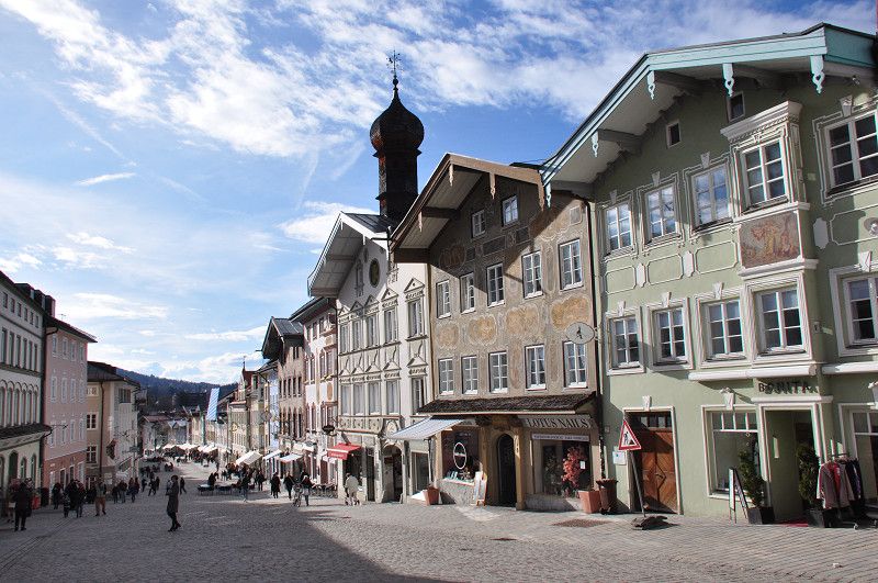
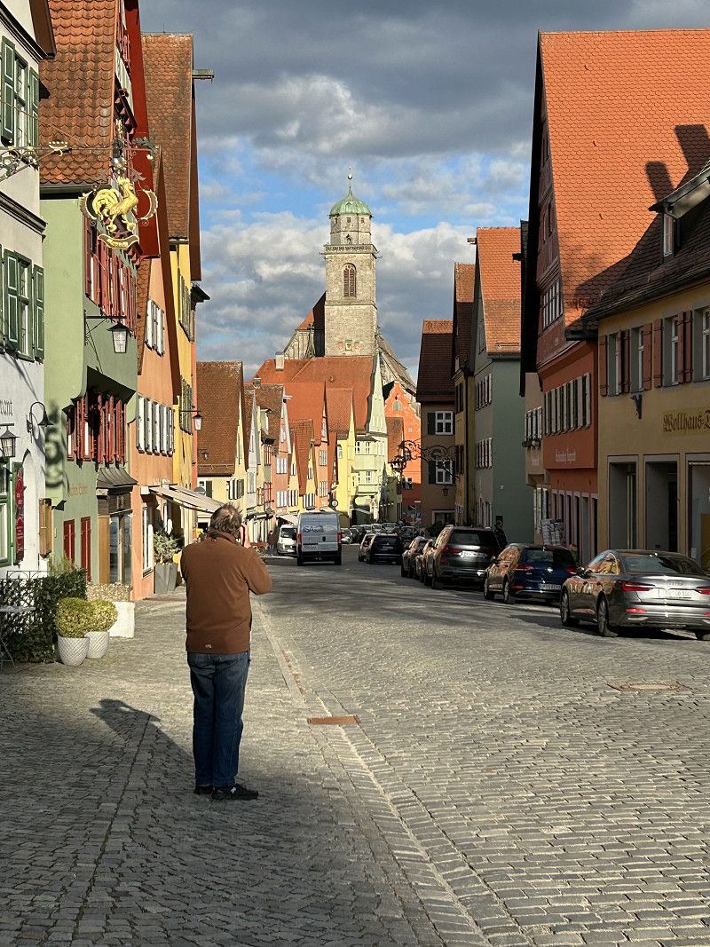
On this section of the route, we're once again driving on the German Limes Road. We wonder what "Limes" means, and whether it's a river? But yesterday we drove far away from here on the "Limes Road," so it can hardly be a river. Google enlightens us: "The Limes was part of the border between the Roman Empire and the land of the Germanic tribes. The word Limes means "border wall or protective wall." The Limes was created about 2,000 years ago, when Roman soldiers occupied what is now Switzerland and part of present-day Germany." Well, now it's clear to us too that the Limes Road can lead right across Germany. And indeed, in the coming days, we'll repeatedly encounter "Limes" roads. But we're now more excited about the small town of Dinkelsbühl. According to our travel guide "On the Road," there are supposed to be four RV parking spaces here, and the travel author also recommends Dinkelsbühl for its unique history. "Dinkelsbühl was spared all wars and other disasters, which is why it is one of the best-preserved medieval towns in Germany." The little town doesn't disappoint us at all, but you can read more about it tomorrow after our city tour, which the tourist office offers every day at 11:00 a.m. We really wonder where all the tourists and history buffs come from that a city tour can be offered every day in such a small town.
I found an answer online as to why so many people visit Dinkelsbühl: "In 2014, the news magazine "Focus" named Dinkelsbühl's old town the "most beautiful old town in Germany." In 2021, CNN listed Dinkelsbühl as the "Most Beautiful Town in Europe." Dinkelsbühl was the only German representative in this ranking."
Stellplatz Dinkelsbühl
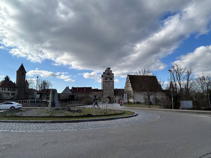
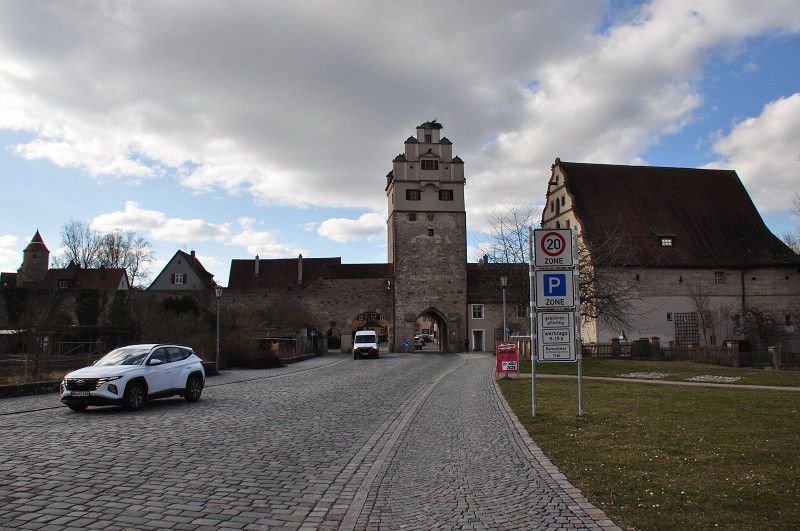
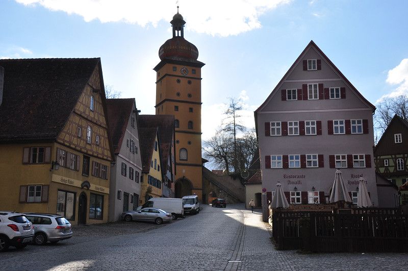
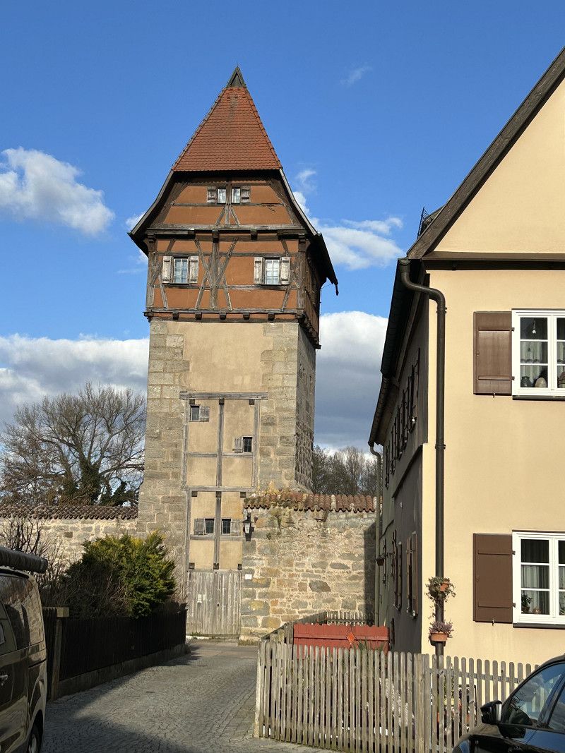
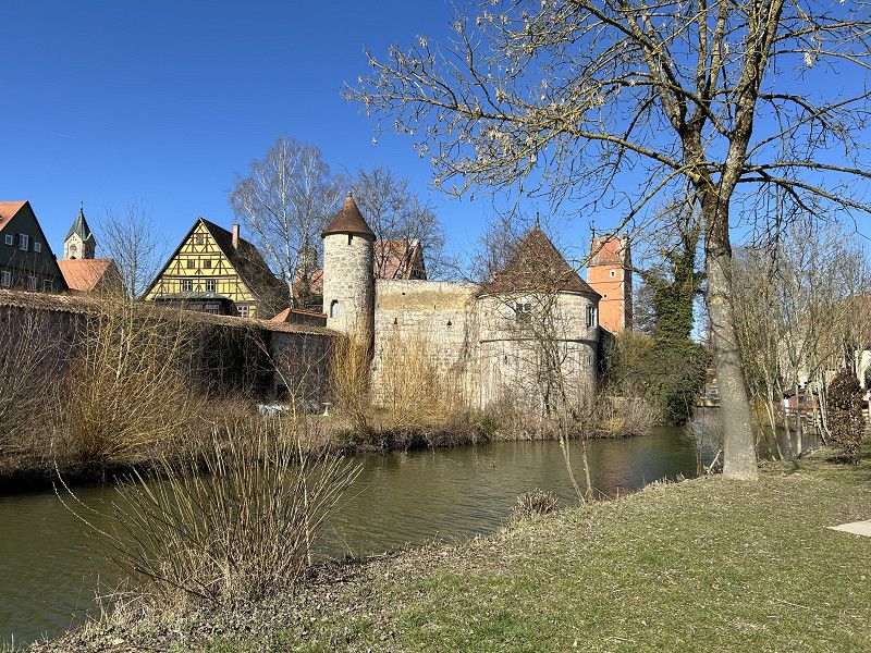
The parking space on Mönchsrother Strasse, right next to the cemetery, is highly recommended. For €8.00 (24 hours), waste disposal is free, and electricity and fresh water are available for a small fee. The site is just a few meters from the Nördlingen city gate, allowing us to explore the town briefly on foot. The entire old town is surrounded by a city wall, and there are city gates in every direction.
To the east is the "Wörnitz Gate." It is the oldest gate and dates back to the Staufen period, at the end of the 14th century.
To the west is the "Segringer Tor." This originally mighty, four-story city gate was severely damaged by the siege of Swedish troops in 1648 and completely collapsed in 1649. In 1655, it was rebuilt in the Baroque style in its present form, with its characteristic onion dome.
To the north, the "Rothenburger Tor" (Rothenburg Gate) was, along with the Nördlinger Tor, the most important entrance and exit to the city. The upper floors housed the loopholes and prison cells, some of which were so small that prisoners couldn't even lie down. Suspected witches were tried here.
To the south is the “Nördlinger Tor” The gate with the gable roof was built during the expansion of the city wall at the end of the 14th century.
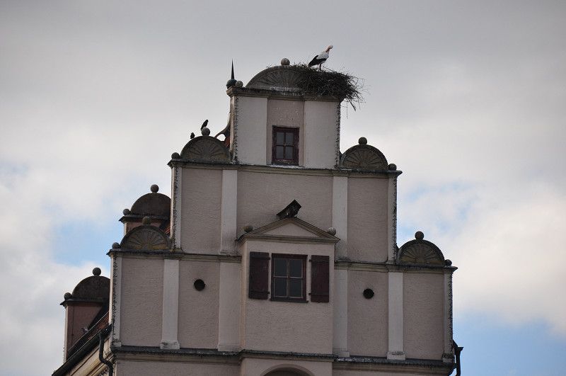
Through this gate we enter the city, and on this tower is one of the city's many stork nests. The storks are currently breeding, and of course, they are one of the city's attractions.
The travel author certainly wasn't exaggerating; this small town with its mere 12,000 inhabitants is worth a visit. Today, in the freezing cold, we stroll up and down the alleys, looking for a bakery where we can buy a Bienenstich (a kind of German biscuit). Unfortunately, we don't find one. At the market square, I buy two slices of cake, which we enjoy in the camper with a cup of hot coffee. We find the campsite and the town so beautiful that we decide to spend the next day here.
Ruhetag Stadtführung Dinkelsbühl
Since the city tour doesn't start until 11:00 a.m., we can take it easy. As usual, we have breakfast and, even though the sun is shining, we dress warmly today. We ride our bikes to the tourist office because after the tour, we want to cycle around the city walls. It's hard to believe, but today, on a perfectly normal weekday, nine people are taking the city tour. And not all of them are well-traveled tourists; one couple even lives nearby. The tour starts at the tourist office or the House of History. A brief chronology of the city's founding: Around 730, a Frankish royal court is considered the nucleus of the settlement.
Around the 10th century, construction of a fortification with a rampart and ditch at the intersection of two old trade routes.
1188 First documented mention as “gift of Emperor Frederick I etc.”
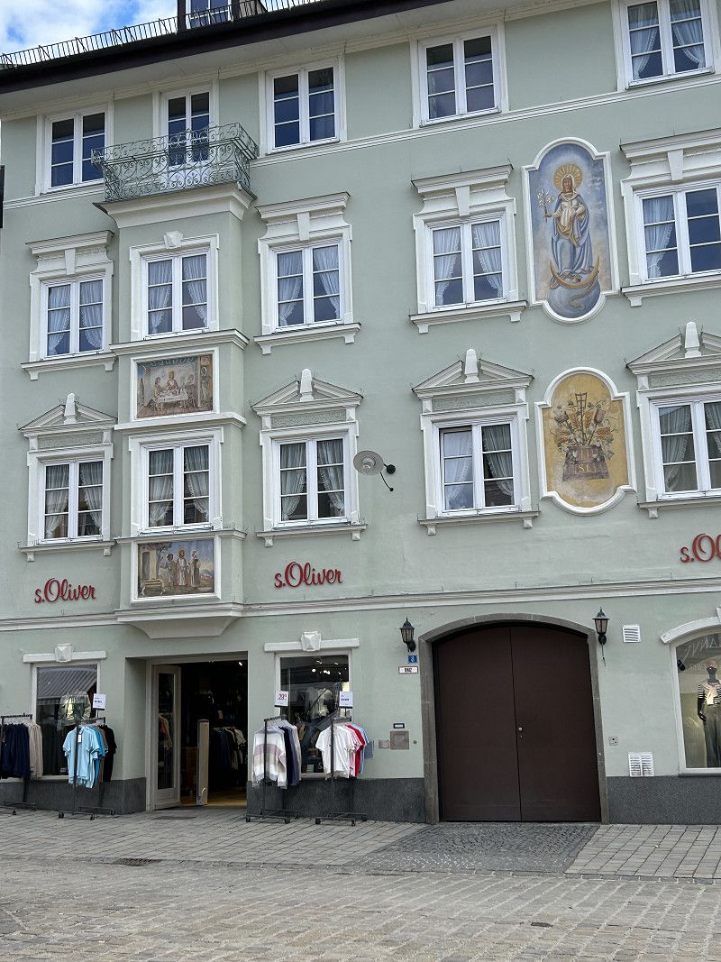
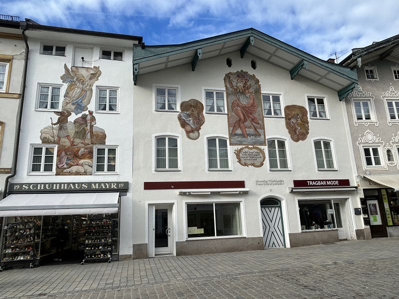
We realize that we are standing on very ancient ground here. The tourist office is located in the old town hall, next to it is the Lion Fountain, and not far away is the Wörnitz Gate. Every year in July, for 10 days, this location provides the imposing backdrop for the town's handover of the Kinderzeche (Children's Mine). For the people of Dinkelsbühl, this festival is the so-called 5th season, and guests and onlookers are warmly welcome. From the Wörnitz Tower, the tower bell is clearly visible. The tour guide explains to us how important this bell was in the Middle Ages. All four gates were closed at sunset. To ensure that traders and farmers working in the fields could enter the town before closing time, the bell rang half an hour before closing time. Our tour continues to the Minster, a late Gothic hall church. Here, the guide explains to us the uniqueness of the town's religious mix. After the Reformation, the town was equally populated by Protestants and Catholics; both were allowed to use the church, and both denominations had to be represented in the government. That actually sounds very modern, but in this case it led to the town having to spend significantly more money and thus becoming increasingly impoverished. As a result, the imposing church tower, which was probably planned, could no longer be built, and therefore the small tower of the previous church still stands today next to the hall church. We continue along the town wall to the Spitalhof, a complex of buildings that resembles a small village. Here, too, we hear many exciting stories and, of course, also learn about the current use of the buildings. After the Spitalhof, we reach the Rothenburgerturm (the Witches' Tower) and continue along the old and stately row of houses on the main street. Here we see that the town consists almost exclusively of half-timbered houses, many of which are hidden behind plaster. The fact that the town has so many half-timbered houses is also due to the aforementioned impoverishment; the townspeople could only afford this inexpensive architectural style. Today, they are, of course, grateful for this unique townscape. The town tour ends on the market square in front of St. George's Cathedral at 12:00 noon sharp. Of course, there's still much to tell about this small town, and if you look at the city tour on the map, this is only a small part of the entire old town. For us, it was good; we learned a lot of interesting facts and now see the city with different eyes than yesterday. But one thing still bothers us, and as we learned during the city tour, we're not the only ones: the sheer volume of traffic through these beautiful old alleys and streets is extreme. There isn't a single meter of pedestrian zone in this city.
After the city tour, we hop on our bikes and cycle around the outside of the city wall. This route was recommended by our guide; you pass playgrounds and some of the city's many ponds. The park-like grounds are well-kept and beautifully landscaped. Our tour ends at the Segringer Gate, and so we cycle down Segringer Strasse toward the market square. But what do we see after a few meters? The Eichner Old Town Bakery is open today, whereas yesterday it was closed. And what do you get at the bakery? That's right, our long-awaited Bienenstich (bee sting cake). So we can warm up and fortify ourselves at a small table inside the bakery with hot chocolate and a delicious Bienenstich (bee sting cake). Afterward, we head back to the camper without stopping.
The sun shines until sunset, but the cold wind is simply stronger than the warmth of the sun today. So we stay in the warm room and enjoy the usual camping life.
Of course we'll look at the roadside to see where we might go tomorrow, I'll tell you this much: we'll just go with our noses again.
Crailsheim
B 290, Crailsheim, Landkreis Schwäbisch Hall, Baden-Württemberg, Deutschland
49° 8' 1.8" N 10° 4' 23" E
49.1338233 10.0730635
• Follow the roundabout. Go for 49 m.
• Take the 3rd exit from roundabout onto Goethestraße (B290) toward Heilbronn/A6/Nürnberg/Bad Mergentheim/Bahnhof/Hofwiesen/Flügelau/Hardt. Go for 497 m.
• Continue on Goethestraße toward A6/Bad Mergentheim/Schwäbisch Hall/Gaildorf/Bahnhof. Go for 203 m.
• Turn right onto Alter Postweg (L1066). Go for 725 m.
• Turn left onto Haller Straße (L2218). Go for 2.2 km.
• Take the 2nd exit from roundabout onto Haller Straße (L2218). Go for 8.9 km.
• Arrive at L2218. Your destination is on the left.
☍
12,6 km
( 12 min.)
Ilshofen
L 2218, Ilshofen, Landkreis Schwäbisch Hall, Baden-Württemberg, Deutschland
49° 10' 12.8" N 9° 55' 47.1" E
49.1702274 9.9297422
• Head toward Großallmerspanner Weg on L2218. Go for 1.3 km.
• Turn right onto Hörlebacher Straße (L1042). Go for 2.7 km.
• Continue on Landturmstraße (L1037). Go for 1.8 km.
• Continue on L1042. Go for 1.7 km.
• Turn left onto Brühlweg. Go for 26 m.
• Arrive at Brühlweg. Your destination is on the left.
☍
7,5 km
( 6 min.)
Ilshofen
Brühlweg 1, Ilshofen, Landkreis Schwäbisch Hall, Baden-Württemberg, Deutschland
49° 12' 19.4" N 9° 51' 56.5" E
49.2053979 9.8656950
• Head toward Landturmstraße on Brühlweg. Go for 26 m.
• Turn left onto L1042. Go for 8.2 km.
• Turn left onto L1033. Go for 9.7 km.
• Turn right onto Mergentheimer Straße (B19). Go for 1.0 km.
• Continue on Mergentheimer Straße (B19). Go for 248 m.
• Keep right onto Mergentheimer Straße (B19). Go for 531 m.
• Turn left onto Ingelfinger Straße (L1045) toward Neuenstadt a.K./Weißbach/Niedernhall/Ingelfingen. Go for 10.0 km.
• Turn left onto L1048 toward Waldenburg/Forchtenberg. Go for 80 m.
• Turn right onto Schöntaler Straße (K2320). Go for 37 m.
• Turn left. Go for 231 m.
• Arrive at your destination on the left.
☍
30,1 km
( 26 min.)
Forchtenberg
Schöntaler Straße, Forchtenberg, Hohenlohekreis, Baden-Württemberg, Deutschland
49° 17' 27.5" N 9° 33' 30.3" E
49.2909733 9.5584214
• Head toward Schöntaler Straße. Go for 231 m.
• Turn right onto Schöntaler Straße (K2320). Go for 37 m.
• Turn left onto L1048. Go for 80 m.
• Turn left onto L1045 toward Neuenstadt a.K./Ernsbach. Go for 7.1 km.
• Turn right onto L1050. Go for 3.9 km.
• Arrive at Sindringer Straße (L1050).
☍
11,3 km
( 10 min.)
Fahrt
It's a true joy to start a new day's travels in such sunshine and, to top it all, no wind. Today we certainly don't miss our winter jackets, as the sun is already warming us up. It seems as if spring has suddenly exploded from its winter slumber. It's almost T-shirt weather; snowdrops, daffodils, and narcissus are blooming in the meadow, and we campers are more likely to strike up conversations now that the cold is no longer forcing us into the car. So we chat with our neighbors before we continue our journey. Although our morning chat isn't just due to the warm weather, but rather due to our "starting problem." Daniel forgets to retract our jack stands. He starts the engine, and at the same time a warning signal sounds on the jack stand indicator. Normally this isn't a problem; the safety system retracts the jack stands automatically. But today it's quite different; a warning light indicates a breakdown. The jack stands won't retract, and the control panel seems to be locked. The jack stands remain down, and so we are locked out too. Daniel and I know that Daniel can raise the supports manually in an emergency, although this is a complex installation. Daniel can't find any information in the manual about how to fix this. In the meantime, of course, the neighbors have come to visit us and are looking on with pity at how things are going. We still have one more try: Disconnect the system from the power supply, i.e. do a reset, and see what happens. Luckily, Daniel can raise the supports without any problems. After disposing of the water and toilet and filling up with fresh water, the journey begins again. Alternating over countryside and then through industrial towns, we slowly chug out of Bavaria and into Baden-Württemberg. Today we find that there are an extremely large number of solar panels on the roofs; even a church roof is completely covered with power generators. Parallel to this, there are also many wind turbines. Renewable energy production seems to be very much promoted here.
From Künzelsau, we turn once again onto a tourist-friendly road, the "Württemberg Wine Route." We would have realized that we were driving through a wine-growing region even without the road's name, as endless vineyards stretch across the hills.
Stellplatz Forchtenberg beim Friedhof
In Forchtenberg, we easily find the parking spot; it's very well signposted. Like yesterday, we're parked next to a cemetery. But this spot is considerably more idyllic. The Kocher River rushes in front of us, fruit trees stand beside us, and just a few meters away, on the other bank of the Kocher, is the small town of Forchtenberg.
Rund um die Stadt Forchtenberg
The Forchtenberg Castle ruins tower above the small town. According to Google Maps, you can climb the observation tower. With the wonderful weather we're blessed with today, we naturally want to cycle up to the castle. I found the following (abbreviated) information online: "The Forchtenberg Castle ruins are the ruins of a medieval hilltop castle near Forchtenberg in Baden-Württemberg. Konrad von Dürn is said to have been the builder. To consolidate his holdings, Konrad built the castle on a mountain spur in 1234. The construction of the castle was also connected to the founding of the town of Forchtenberg below. The castle changed hands several times over the centuries, being destroyed and rebuilt until finally, in 1989, the town of Forchtenberg took over the complex and, for 1.3 million euros, extensively renovated and secured it, making the ruins accessible to the public." Luckily, we were on e-bikes, as we hitchhiked up the pretty steep hill. But the view from up there is really good and the whole castle complex is worth seeing. Once back down in the town, we cycle a few more kilometers along the Kocher River. Unfortunately, we have to take the same cycle path back because there is only a cycle path on one side of the river. We enjoy the peace and quiet in our car until we go to the Italian restaurant in the evening. Diagonally across the street, we see a German couple who were next to us yesterday also pulling into this parking space. Maybe we'll run into them at the Italian restaurant, that would actually be nice. No, they aren't at the Italian restaurant, but the small restaurant is already packed; we're amazed at how popular this place is, even though the owners only took over a month ago. We congratulate the landlords and hope that business continues to be so good for them. In any case, we can warmly recommend the restaurant.
Jagsthausen
Sindringer Straße 13, Jagsthausen, Landkreis Heilbronn, Baden-Württemberg, Deutschland
49° 18' 21.9" N 9° 27' 55.5" E
49.3060843 9.4654142
• Head toward Bahnhofstraße on Sindringer Straße (L1050). Go for 276 m.
• Turn left onto Hauptstraße (L1025). Go for 11.1 km.
• Arrive at L1025.
☍
11,3 km
( 9 min.)
Möckmühl
L 1025, Möckmühl, Landkreis Heilbronn, Baden-Württemberg, Deutschland
49° 19' 35" N 9° 22' 16.6" E
49.3263877 9.3712643
• Head toward Ruchsener Straße on L1025. Go for 871 m.
• Turn left onto Züttlinger Straße (L1095). Go for 4.6 km.
• Turn right toward L1096. Go for 48 m.
• Turn right onto L1096. Go for 6.1 km.
• Turn left onto Bahnhofstraße (L720). Go for 226 m.
• Take the 1st exit from roundabout onto Herbolzheimer Straße (L720). Go for 4.3 km.
• Arrive at L1096. Your destination is on the left.
☍
16,1 km
( 14 min.)
Herbolzheim
L 1096, Herbolzheim, Landkreis Heilbronn, Baden-Württemberg, Deutschland
49° 16' 33.7" N 9° 14' 4" E
49.2760413 9.2344562
• Head west on L1096. Go for 4.0 km.
• Turn right onto Heuchlingen (K2159) toward Gundelsheim/Obergriesheim/Offenau/Duttenberg. Go for 3.0 km.
• Arrive at Heidelberger Straße (K2159). Your destination is on the left.
☍
7,0 km
( 7 min.)
Gundelsheim
K 2159, Gundelsheim, Landkreis Heilbronn, Baden-Württemberg, Deutschland
49° 16' 1.7" N 9° 11' 31.2" E
49.2671357 9.1919945
• Head toward Obergriesheimer Berg on Heidelberger Straße (K2159). Go for 3.3 km.
• Take the 3rd exit from roundabout onto Mühlstraße (K2159). Go for 232 m.
• Turn right onto Mosbacher Straße (B27) toward Heidelberg/Mosbach. Go for 32.2 km.
• Turn right onto Fahrgasse (L595) toward Aglasterhausen/Lobbach/Schönbrunn/Altstadt-Ost. Go for 54 m.
• Turn right onto Neckarstraße. Go for 99 m.
• Continue on Neckarhälde. Go for 303 m.
• Arrive at Neckarhälde. Your destination is on the right.
☍
36,1 km
( 28 min.)
Eberbach
Neckarhälde 15, Eberbach, Rhein-Neckar-Kreis, Baden-Württemberg, Deutschland
49° 27' 22.6" N 8° 59' 33.1" E
49.4562889 8.9925347
• Head northwest on Neckarhälde. Go for 303 m.
• Continue on Neckarstraße. Go for 99 m.
• Turn left onto Fahrgasse (L595). Go for 54 m.
• Turn right onto Uferstraße (B37) toward Heidelberg/Hirschhorn/Amorbach/Stadtmitte/Gewerbegeb. West/Gewerbegeb. Ost. Go for 2.1 km.
• Continue on Uferstraße (B37) toward B45/Mannheim/Heidelberg/Hirschhorn. Go for 16.8 km.
• Take the 2nd exit from roundabout onto Neckarsteinacher Straße (B37) toward Mannheim/Heidelberg/Sinsheim/B45. Go for 832 m.
• Turn left onto An der Friedensbrücke (B37) toward Mannheim/Heidelberg/Sinsheim/B45/Neckargemünd. Go for 377 m.
• Turn slightly left onto Bammentaler Straße (B45) toward Sinsheim/Dilsberg/Mückenloch/Waldhilsbach. Go for 956 m.
• Turn right onto Adam-Siefert-Straße. Go for 146 m.
• Arrive at Adam-Siefert-Straße. Your destination is on the right.
☍
21,7 km
( 21 min.)
Neckargemünd
Adam-Siefert-Straße 16, Neckargemünd, Rhein-Neckar-Kreis, Baden-Württemberg, Deutschland
49° 23' 9.8" N 8° 47' 34.5" E
49.3860493 8.7929265
• Head toward Bammentaler Straße on Adam-Siefert-Straße. Go for 366 m.
• Turn right onto Bammentaler Straße (B45). Go for 2.7 km.
• Continue on Bammentaler Straße (B45) toward Sinsheim/Meckesheim/Aglasterhausen. Go for 5.0 km.
• Arrive at B45.
☍
8,1 km
( 7 min.)
Meckesheim
Bammentaler Straße, Meckesheim, Rhein-Neckar-Kreis, Baden-Württemberg, Deutschland
49° 19' 37.2" N 8° 48' 44.1" E
49.3270066 8.8122546
• Head toward Leopoldstraße on B45. Go for 7.0 km.
• Turn right onto Eschelbacher Straße (L612) toward Eschelbach/Horrenberg/Balzfeld. Go for 2.3 km.
• Arrive at K4176. Your destination is on the right.
☍
9,4 km
( 9 min.)
Sinsheim
K 4176, Sinsheim, Rhein-Neckar-Kreis, Baden-Württemberg, Deutschland
49° 15' 55.1" N 8° 48' 49.8" E
49.2652971 8.8138229
• Head west on K4176. Go for 3.2 km.
• Turn right onto Eichtersheimer Straße (B39/B292) toward Karlsruhe/Speyer/Walldorf/Angelbachtal. Go for 1.0 km.
• Arrive at B39/B292. Your destination is on the right.
☍
4,3 km
( 4 min.)
Angelbachtal
B 39;B 292, Angelbachtal, Rhein-Neckar-Kreis, Baden-Württemberg, Deutschland
49° 14' 29.3" N 8° 46' 26.7" E
49.2414708 8.7740800
• Head toward Sportplatzstraße on B39/B292. Go for 446 m.
• Take the 2nd exit from roundabout onto Hauptstraße (B292) toward A5/Bad Schönborn/Östringen. Go for 591 m.
• Take the 2nd exit from roundabout onto Schloßstraße (L551) toward Eppingen/Michelfeld. Go for 987 m.
• Pass 3 roundabouts and continue on L551. Go for 6.6 km.
• Continue on L552. Go for 1.9 km.
• Pass 2 roundabouts. Go for 5.9 km.
• Continue on Adelshofer Straße. Go for 832 m.
• Turn left onto Rappenauer Straße. Go for 232 m.
• Turn right onto Altstadtring. Go for 422 m.
• Take the 1st exit from roundabout onto Bahnhofstraße. Go for 347 m.
• Continue on Heilbronner Straße. Go for 29 m.
• Take the 1st exit from roundabout. Go for 49 m.
• Continue on Theodor-Storm-Straße. Go for 90 m.
• Continue on Waldstraße. Go for 1.6 km.
• Turn left onto Waldstraße. Go for 8 m.
• Arrive at Waldstraße. Your destination is on the right.
☍
20,0 km
( 26 min.)
20. Mar. 2025 -
21. Mar. 2025
Stadtwald Eppingen
Waldstraße, Eppingen, Landkreis Heilbronn, Baden-Württemberg, Deutschland
49° 7' 50.8" N 8° 55' 58.3" E
49.1307731 8.9328638
• Head north on Waldstraße. Go for 14 m.
• Turn left. Go for 151 m.
• Turn left toward Waldstraße. Go for 19 m.
• Turn right onto Waldstraße. Go for 1.4 km.
• Continue on Theodor-Storm-Straße. Go for 120 m.
• Take the 2nd exit from roundabout onto Heilbronner Straße. Go for 74 m.
• Continue on Bahnhofstraße. Go for 66 m.
• Turn right onto Bahnhofstraße. Go for 261 m.
• Take the 2nd exit from roundabout onto Altstadtring. Go for 457 m.
• Turn left onto Rappenauer Straße. Go for 232 m.
• Turn right onto Adelshofer Straße. Go for 998 m.
• Take the 1st exit from roundabout. Go for 333 m.
• Continue on L552. Go for 5.3 km.
• Take the 2nd exit from roundabout onto L552. Go for 1.9 km.
• Continue on L551. Go for 4.6 km.
• Pass 3 roundabouts and continue on Friedrichstraße (L551). Go for 2.9 km.
• Take the 1st exit from roundabout onto Hauptstraße (B292) toward A6/Walldorf/Sinsheim/B39. Go for 566 m.
• Take the 2nd exit from roundabout onto Heidelberger Straße (B39) toward Mannheim/A6/Walldorf/Mühlhausen. Go for 2.1 km.
• Arrive at B39. Your destination is on the right.
☍
21,7 km
( 28 min.)
Mühlhausen
B 39, Mühlhausen, Rhein-Neckar-Kreis, Baden-Württemberg, Deutschland
49° 14' 43.3" N 8° 44' 50.2" E
49.2453730 8.7472791
• Head northwest on B39. Go for 7.3 km.
• Continue on L723. Go for 825 m.
• Turn right and take ramp toward Bruchsal/Wiesloch-Zentrum/Krankenhaus Psychiatrisches Zentrum/Gewerbegebiet St. Leon-Rot. Go for 173 m.
• Turn right onto L594. Go for 1.3 km.
• Arrive at Messplatzstraße (L594). Your destination is on the left.
☍
9,5 km
( 7 min.)
Wiesloch
Münchäckerweg 1, Wiesloch, Rhein-Neckar-Kreis, Baden-Württemberg, Deutschland
49° 17' 24" N 8° 42' 7.3" E
49.2899933 8.7020363
• Head toward Zum Keitelberg on Messplatzstraße (L594). Go for 214 m.
• Take the 2nd exit from roundabout onto Messplatzstraße (L594). Go for 1.4 km.
• Turn right onto L594 toward Nußloch. Go for 2.1 km.
• Pass 2 roundabouts and continue on L594. Go for 1.8 km.
• Arrive at L594. Your destination is on the right.
☍
5,5 km
( 7 min.)
Nußloch
Rohrbacher Straße, Nußloch, Rhein-Neckar-Kreis, Baden-Württemberg, Deutschland
49° 20' 14.6" N 8° 41' 41.3" E
49.3373967 8.6948028
• Head north on L594. Go for 1.5 km.
• Turn left onto Schwetzinger Straße (L600). Go for 800 m.
• Take the 2nd exit from roundabout onto Schwetzinger Straße (L600) toward Sandhausen/Gewerbegebiet L.-Nord. Go for 1.6 km.
• Turn right onto Sandhäuser Straße (L598). Go for 985 m.
• Continue on Sandhäuser Straße (L598) toward Heidelberg/HD-Kirchheim. Go for 339 m.
• Continue on Cuzaring (K9707) toward Heidelberg/HD-Kirchheim-Mitte. Go for 1.4 km.
• Turn right onto Speyerer Straße (L600A) toward Heidelberg. Go for 731 m.
• Turn left onto Diebsweg (K9706) toward HD-Pfaffengrund/HD-Wieblingen. Go for 1.0 km.
• Arrive at Diebsweg (K9706). Your destination is on the right.
☍
8,4 km
( 10 min.)
Heidelberg
Diebsweg 11, Heidelberg, Baden-Württemberg, Deutschland
49° 23' 48.8" N 8° 39' 20.8" E
49.3968919 8.6557851
• Head toward Schwalbenweg on Diebsweg (K9706). Go for 1.0 km.
• Turn left onto Eppelheimer Straße. Go for 1.2 km.
• Continue on Hauptstraße. Go for 221 m.
• Take the 2nd exit from roundabout onto Hauptstraße toward Schwetzingen. Go for 776 m.
• Turn right onto Schwetzinger Straße. Go for 936 m.
• Arrive at Schwetzinger Straße. Your destination is on the left.
☍
4,1 km
( 6 min.)
Eppelheim
Schwetzinger Straße, Eppelheim, Rhein-Neckar-Kreis, Baden-Württemberg, Deutschland
49° 23' 49.3" N 8° 36' 53.1" E
49.3970309 8.6147402
• Head west on Schwetzinger Straße. Go for 130 m.
• Continue on Eppelheimer Straße. Go for 762 m.
• Take the 3rd exit from roundabout onto Oftersheimer Landstraße (K4147) toward A5/Heidelberg/Schwetzingen/Plankstadt-Süd. Go for 1.3 km.
• Take ramp onto B535 toward A6/Mannheim/Plankstadt-Nord Gewerbegebiet. Go for 3.4 km.
• Take ramp toward MA-Friedrichsfeld/Brühl-Süd/Schw.-Hirschacker/Gewerbegebiet Langer Sand. Go for 155 m.
• Turn left onto L597. Go for 929 m.
• Turn right onto Brühler Landstraße (L630) toward Ketsch/Brühl-Süd. Go for 1.8 km.
• Take the 2nd exit from roundabout onto Schwetzinger Straße (L630) toward Brühl/Zentrum. Go for 928 m.
• Take the 1st exit from roundabout onto Weidweg (L630) toward Koller-Fähre. Go for 1.0 km.
• Continue on Kollerstraße (L630). Go for 1.3 km.
• Continue on Kollerstraße. Go for 42 m.
• Arrive at Kollerstraße. Your destination is on the left.
☍
11,8 km
( 12 min.)
Brühl
Kollerstraße, Brühl, Rhein-Neckar-Kreis, Baden-Württemberg, Deutschland
49° 23' 29.1" N 8° 30' 8.5" E
49.3914259 8.5023647
• Head southeast on Kollerstraße. Go for 1.4 km.
• Continue on Weidweg (L630). Go for 1.0 km.
• Take the 1st exit from roundabout onto Brühler Landstraße. Go for 142 m.
• Continue on Ketscher Straße. Go for 411 m.
• Continue on Brühler Landstraße. Go for 886 m.
• Continue on Brühler Straße. Go for 1.3 km.
• Continue on Hockenheimer Straße. Go for 63 m.
• Continue on Hockenheimer Straße toward Hockenheim. Go for 1.2 km.
• Take the 2nd exit from roundabout onto Hockenheimer Straße. Go for 1.8 km.
• Turn right onto L722. Go for 1.6 km.
• Arrive at L722. Your destination is on the left.
☍
9,7 km
( 12 min.)
Hockenheim
L 722, Hockenheim, Rhein-Neckar-Kreis, Baden-Württemberg, Deutschland
49° 20' 4.1" N 8° 30' 48" E
49.3344732 8.5133236
• Head southwest on L722. Go for 3.8 km.
• Continue on B39 toward Speyer. Go for 229 m.
• Arrive at B39. Your destination is on the right.
☍
4,0 km
( 3 min.)
Altlußheim
B 39, Altlußheim, Rhein-Neckar-Kreis, Baden-Württemberg, Deutschland
49° 19' 15.3" N 8° 27' 44.1" E
49.3209129 8.4622529
• Head southwest on B39. Go for 4.2 km.
• Take ramp onto B9/B39. Go for 746 m.
• Take ramp toward Neustadt/Weinstr./Haßloch/Dudenhofen. Go for 322 m.
• Continue on B39. Go for 846 m.
• Keep left onto B39 toward Neustadt/Weinstr./Dudenhofen-Nord/Holiday-Park. Go for 6.6 km.
• Turn right onto Holidayparkstraße (L529) toward Haßloch/Holiday-Park. Go for 2.2 km.
• Arrive at L529. Your destination is on the left.
☍
15,0 km
( 11 min.)
Haßloch
Holidayparkstraße, Haßloch, Landkreis Bad Dürkheim, Rheinland-Pfalz, Deutschland
49° 19' 31.6" N 8° 17' 22.6" E
49.3254332 8.2896162
• Head north on L529. Go for 7.0 km.
• Take the 2nd exit from roundabout onto L530 toward Karlsruhe/A65/Neustadt/Weinstr./Bad Dürkheim/Meckenheim. Go for 406 m.
• Turn left and take ramp onto A65 toward Neustadt/Weinstr. Go for 2.3 km.
• Take the exit toward Deidesheim/Bad Dürkheim onto B271. Go for 11.6 km.
• Turn right onto B271. Go for 260 m.
• Turn left onto B37 toward Kaiserslautern/Grünstadt/B271. Go for 928 m.
• Continue on B37 toward Kaiserslautern/Bad Dürkheim/Stadtmitte/B271. Go for 1.4 km.
• Take the 1st exit from Wurstmarktkreisel roundabout onto L517 toward Leistadt/Weisenheim/Bg. Go for 424 m.
• Arrive at L517. Your destination is on the right.
☍
24,3 km
( 18 min.)
21. Mar. 2025 -
23. Mar. 2025
Bad Dürkheim Stellplatz in der Silz
L 517 Leistadter Straße, 67098, Bad Dürkheim, Germany
49° 28' 10" N 8° 10' 3" E
49.4694444 8.1675000
• Head south on L517. Go for 399 m.
• Take the 1st exit from Wurstmarktkreisel roundabout onto Weinstraße Nord (B37). Go for 942 m.
• Take the 2nd exit from roundabout onto B37. Go for 16.0 km.
• Turn right onto Hauptstraße (B37). Go for 6.6 km.
• Arrive at B37.
☍
23,9 km
( 21 min.)
Ferientag
Hard to believe, yesterday we were enjoying the spring sunshine, and today we're woken up by heavy rain. We decide to stay another day in Bad Dürkheim anyway. On the one hand, the weather forecast is good; the rain is only a short shower, and on the other hand, we don't want to look for a place to stay on a Saturday in this tourist-heavy area. After a leisurely breakfast, the sun is already shining from a blue sky. So we're treated to another glorious spring day. We combine our bike ride with a shopping trip in the neighboring village, where we buy some local wine. Back at the campsite, we enjoy the great weather with a glass of sweet wine and dolce far niente in front of the camper. A local red wine will be served for dinner, and then we'll probably call it a day pretty early. We don't usually drink much wine. But here on the Wine Route, an exception is almost mandatory.
Hochspeyer
B 37, Hochspeyer, Landkreis Kaiserslautern, Rheinland-Pfalz, Deutschland
49° 26' 58.6" N 7° 53' 49.1" E
49.4496180 7.8969766
• Head west on B37. Go for 2.2 km.
• Take ramp toward Hochspeyer. Go for 307 m.
• Take the 3rd exit from roundabout onto Hauptstraße toward Bad Bergzabern/Johanniskreuz/Hochspeyer. Go for 1.3 km.
• Arrive at Hauptstraße. Your destination is on the left.
☍
3,8 km
( 3 min.)
Hochspeyer
Hauptstraße 59, Hochspeyer, Landkreis Kaiserslautern, Rheinland-Pfalz, Deutschland
49° 26' 36.4" N 7° 53' 24.2" E
49.4434407 7.8900432
• Head toward Heidestraße on Hauptstraße. Go for 182 m.
• Turn right onto Am Stockacker. Go for 179 m.
• Turn right onto Kirchstraße. Go for 105 m.
• Turn left onto Am Weiherberg. Go for 148 m.
• Turn left onto Weiherstraße. Go for 232 m.
• Turn right onto Trippstadter Straße (B48). Go for 24.6 km.
• Arrive at B48. Your destination is on the right.
☍
25,5 km
( 22 min.)
Landau in der Pfalz
B 48, Landau in der Pfalz, Rheinland-Pfalz, Deutschland
49° 17' 10.6" N 7° 52' 10.6" E
49.2862748 7.8696126
• Head toward Am Häusel on B48. Go for 9.4 km.
• Turn left onto L490 toward A.-Sarnstall/Rinnthal. Go for 3.8 km.
• Take the 1st exit from roundabout onto B48 toward Landau/Bad Bergzabern. Go for 9.7 km.
• Turn right onto B48 toward Bad Bergzabern/Klingenmünster/Pfalzklinikum/Pfalzinstitut. Go for 1.7 km.
• Pass 2 roundabouts and continue on B48. Go for 5.1 km.
• Continue on B38. Go for 44 m.
• Arrive at B38. Your destination is on the left.
☍
29,7 km
( 27 min.)
Pleisweiler
B 38;B 48, Pleisweiler, Landkreis Südliche Weinstraße, Rheinland-Pfalz, Deutschland
49° 6' 20.1" N 8° 0' 54.7" E
49.1055839 8.0151808
• Head south on B38. Go for 472 m.
• Take ramp toward Strasbourg/Wissembourg/Oberotterbach/Bad Bergzabern-Süd. Go for 285 m.
• Turn right onto Kapeller Straße (B427) toward Karlsruhe/Kandel/Gewerbegebiet Kapellen-Drusweiler. Go for 593 m.
• Turn left onto K16. Go for 93 m.
• Continue on Obere Hauptstraße (K16). Go for 624 m.
• Turn left onto Raiffeisenstraße (K16) toward Niederhorbach. Go for 335 m.
• Continue on K16. Go for 7 m.
• Continue on Bahnhofstraße (K16). Go for 1.1 km.
• Turn right onto Landauer Straße (B38) toward Landau. Go for 2.2 km.
• Turn left onto L510 toward Heuchelheim-Klingen. Go for 1.3 km.
• Turn left onto Klingbachstraße (L510) toward Heuchelheim. Go for 626 m.
• Turn left onto Hauptstraße (L493). Go for 397 m.
• Turn right onto Kirchstraße (K17). Go for 111 m.
• Turn left onto Kaiserbachstraße (K17). Go for 221 m.
• Continue on K17. Go for 2.9 km.
• Continue on An der Ahlmühle (K17). Go for 65 m.
• Turn right onto L509. Go for 1.9 km.
• Arrive at L509. Your destination is on the left.
☍
13,2 km
( 13 min.)
Ilbesheim bei Landau in der Pfalz
L 509, Ilbesheim bei Landau in der Pfalz, Landkreis Südliche Weinstraße, Rheinland-Pfalz, Deutschland
49° 10' 48.8" N 8° 3' 45.8" E
49.1802270 8.0627227
• Head toward Im Brühl on L509. Go for 327 m.
• Turn left onto Mörzheimer Straße (K20). Go for 957 m.
• Continue on K6. Go for 631 m.
• Continue on Mörzheimer Hauptstraße (K6). Go for 691 m.
• Turn left onto Jakob-Becker-Straße. Go for 51 m.
• Arrive at Jakob-Becker-Straße. Your destination is on the left.
☍
2,7 km
( 3 min.)
Landau in der Pfalz
Jakob-Becker-Straße 36, Landau in der Pfalz, Rheinland-Pfalz, Deutschland
49° 9' 56.1" N 8° 4' 26.2" E
49.1655896 8.0739391
• Head toward Heuchelheimer Straße on Jakob-Becker-Straße. Go for 51 m.
• Turn left onto Heuchelheimer Straße (L510). Go for 2.6 km.
• Turn left onto Hauptstraße (L493). Go for 349 m.
• Arrive at L493. Your destination is on the left.
☍
3,0 km
( 3 min.)
Heuchelheim
L 493, Heuchelheim, Landkreis Südliche Weinstraße, Rheinland-Pfalz, Deutschland
49° 8' 38.8" N 8° 3' 45.2" E
49.1441020 8.0625662
• Head east on L493. Go for 1.7 km.
• Take the 1st exit from roundabout onto Firststraße (L493). Go for 2.5 km.
• Arrive at L493.
☍
4,2 km
( 4 min.)
Billigheim
L 493, Billigheim, Landkreis Südliche Weinstraße, Rheinland-Pfalz, Deutschland
49° 8' 17.9" N 8° 7' 0.6" E
49.1383163 8.1168361
• Head east on L493. Go for 722 m.
• Turn right onto Landauer Straße (L493). Go for 584 m.
• Turn left onto Bahnhofstraße. Go for 680 m.
• Turn left onto Bahnhofstraße (L493). Go for 1.6 km.
• Take ramp onto A65 toward Karlsruhe/Wörth. Go for 16.2 km.
• Continue on B10. Go for 7.9 km.
• Keep left onto K9657. Go for 1.8 km.
• Take ramp onto Brauerstraße (L605) toward Basel/A5/Ettlingen/KA-Bulach/KA-Oberreut/Gewerbegebiet Südwest. Go for 434 m.
• Take ramp toward KA-Grünwinkel/KA-Bulach/KA-Oberreut/Gewerbegebiet Südwest/Bulach. Go for 229 m.
• Turn left onto Pulverhausstraße (K9655). Go for 154 m.
• Take the 2nd exit from roundabout onto Grünwinkler Straße toward Beiertheim/Bülach. Go for 196 m.
• Turn right onto Rolandstraße. Go for 100 m.
• Arrive at Rolandstraße. Your destination is on the left.
☍
30,6 km
( 22 min.)
Karlsruhe
39a, Rolandstraße, Bulach, Beiertheim-Bulach, Karlsruhe, Baden-Württemberg, 76135, Deutschland
48° 59' 14.8" N 8° 22' 41.7" E
48.9874369 8.3782592
• Head toward Grünwinkler Straße on Rolandstraße. Go for 100 m.
• Turn left onto Grünwinkler Straße. Go for 148 m.
• Take the 2nd exit from roundabout onto Pulverhausstraße (K9655) toward Messe/dm-Arena/Grünwinkel/Oberreut/Gewerbegebiet Südwest. Go for 135 m.
• Take ramp onto L605 toward Ettlingen. Go for 3.3 km.
• Continue on B3. Go for 351 m.
• Take ramp onto B3 toward Rastatt/Malsch/Messe/dm-arena/Gewerbegebiet Ettlingen-West/Gewerbegebiet Beim Runden Plom. Go for 443 m.
• Arrive at B3. Your destination is on the right.
☍
4,5 km
( 4 min.)
Ettlingen
B 3, Ettlingen, Landkreis Karlsruhe, Baden-Württemberg, Deutschland
48° 57' 26.7" N 8° 22' 34.5" E
48.9574297 8.3762378
• Head southwest on B3. Go for 974 m.
• Take ramp onto L566 toward Ettlingen/Gewerbegebiet Ettlingen-West. Go for 414 m.
• Take ramp onto B3 toward Bad Herrenalb/Karlsruhe. Go for 1.4 km.
• Take ramp onto B3 toward Bad Herrenalb. Go for 431 m.
• Take ramp onto A5 toward Basel. Go for 25.1 km.
• Take exit 51 toward Baden-Baden onto B500. Go for 4.4 km.
• Keep right toward Europastraße/B500. Go for 43 m.
• Take the 2nd exit from Europaplatz roundabout onto Europastraße (B500) toward Baden-Baden/Centrum/Krankenhaus KMB Balg/Balg/Weststadt. Go for 3.1 km.
• Keep right onto B500 toward Freudenstadt/B28/Lichtental/Centrum-Congress. Go for 155 m.
• Arrive at B500. Your destination is on the right.
☍
36,0 km
( 23 min.)
Baden-Baden
B 500, Baden-Baden, Baden-Württemberg, Deutschland
48° 46' 6.8" N 8° 13' 46.6" E
48.7685590 8.2295987
• Head southeast on B500. Go for 3.6 km.
• Turn right onto Eckbergstraße. Go for 118 m.
• Continue on Schafbergstraße. Go for 50 m.
• Turn left onto Hauptstraße toward Schwarzwaldhochstraße/B500/Freudenstadt. Go for 312 m.
• Turn right onto Geroldsauer Straße (B500) toward Schwarzwaldhochstraße/Freudenstadt/Geroldsau/Bühlerhöhe/Plättig. Go for 30.8 km.
• Take the 1st exit from roundabout onto Schwarzwaldhochstraße (B500) toward Freudenstadt/Kniebis. Go for 12.9 km.
• Arrive at Schwarzwaldhochstraße (B500). Your destination is on the right.
☍
47,8 km
( 43 min.)
Baiersbronn
B 500, Baiersbronn, Landkreis Freudenstadt, Baden-Württemberg, Deutschland
48° 28' 56.8" N 8° 16' 27.8" E
48.4824526 8.2743857
• Head south on Schwarzwaldhochstraße (B500). Go for 303 m.
• Turn right onto B28 toward Strasbourg/Bad Peterstal-Griesbach. Go for 11.4 km.
• Turn right onto Insel. Go for 99 m.
• Arrive at Insel. Your destination is on the right.
☍
11,8 km
( 14 min.)
Bad Peterstal
Insel 3, Bad Peterstal, Ortenaukreis, Baden-Württemberg, Deutschland
48° 25' 43.5" N 8° 12' 13.6" E
48.4287584 8.2037852
• Head toward Renchtalstraße on Insel. Go for 99 m.
• Turn right onto Renchtalstraße (B28). Go for 7.9 km.
• Pass 2 roundabouts and continue on B28. Go for 11.3 km.
• Take the 1st exit from roundabout onto L89 toward Kappelrodeck/Renchen/Ringelbach. Go for 224 m.
• Arrive at L89.
☍
19,6 km
( 20 min.)
Oberkirch
B 28, Oberkirch, Ortenaukreis, Baden-Württemberg, Deutschland
48° 32' 15.1" N 8° 2' 50.6" E
48.5375386 8.0473778
• Head toward Lange Tauen on L89. Go for 715 m.
• Turn left. Go for 24 m.
• Turn right toward Appenweierer Straße/L89. Go for 60 m.
• Turn right onto Appenweierer Straße (L89). Go for 942 m.
• Take the 1st exit from roundabout onto B28 toward A5/Karlsruhe/Basel/Strasbourg/Appenweier. Go for 6.2 km.
• Take ramp toward Offenburg. Go for 266 m.
• Turn left onto B3 toward Offenburg. Go for 1.9 km.
• Continue on Appenweierstraße (B3) toward Offenburg. Go for 2.3 km.
• Turn right onto Bachstraße. Go for 88 m.
• Turn right onto Gewerbestraße. Go for 134 m.
• Continue on Wackerstraße. Go for 12 m.
• Arrive at Wackerstraße. Your destination is on the left.
☍
12,6 km
( 14 min.)
Offenburg
Gewerbestraße 45, Offenburg, Ortenaukreis, Baden-Württemberg, Deutschland
48° 29' 50.4" N 7° 57' 11.4" E
48.4973301 7.9531772
• Head toward Am Hopfenweg on Wackerstraße. Go for 12 m.
• Continue on Gewerbestraße. Go for 134 m.
• Turn left onto Bachstraße. Go for 75 m.
• Turn right onto Bundesstraße (B3). Go for 1.2 km.
• Turn right onto Englerstraße toward A5/B33/Villingen-Schwenningen/Lahr/Gewerbegebiet West/Messe. Go for 711 m.
• Continue on Otto-Hahn-Straße toward B33/Villingen-Schwenningen/B3/Lahr/Strasbourg/Gewerbegebiet-West. Go for 969 m.
• Continue on Otto-Hahn-Straße. Go for 152 m.
• Take the 2nd exit from roundabout onto Otto-Hahn-Straße. Go for 105 m.
• Turn right toward Lahr/Vil.-Schwennigen/Messe. Go for 1.1 km.
• Continue straight ahead. Go for 388 m.
• Keep left toward Villingen/B33/Schwenningen/Lahr/OG-Süd Flughafen/Gewerbegebiet Elgersweier/Messe. Go for 263 m.
• Continue on B3. Go for 1.7 km.
• Keep right onto B33 toward Villingen-Schwenningen/Biberach/Kinzigtal/Gengenbach/Gewerbegebiet Elgersweier-Nord. Go for 8.0 km.
• Take ramp toward Gengenbach-Mitte/Gewerbegebiet Berghaupten. Go for 109 m.
• Turn left onto Berghauptener Straße (K5335) toward Gengenbach. Go for 388 m.
• Turn left. Go for 189 m.
• Arrive at your destination on the left.
☍
15,5 km
( 16 min.)
23. Mar. 2025 -
24. Mar. 2025
Womo-Park Gengenbach
Berghauptener Straße 29, 77723, Gengenbach, Germany
48° 24' 6" N 8° 0' 28.1" E
48.4016610 8.0078100
• Head north. Go for 189 m.
• Turn right onto Berghauptener Straße (K5335). Go for 388 m.
• Turn right and take ramp onto B33 toward Villingen-Schwenningen. Go for 15.4 km.
• Keep right onto B33 toward Villingen-Schwenningen/Haslach/Gewerbegebiet Steinach-Ost. Go for 265 m.
• Turn right onto Steinacher Straße (B33). Go for 1.6 km.
• Turn right onto Sägerstraße (B294) toward Freiburg/Elzach/Mühlenbach. Go for 1.5 km.
• Arrive at B294. Your destination is on the left.
☍
19,3 km
( 18 min.)
Fahrt
Today's trip is entitled "From the almond blossom to the snow and back to the almond blossom" with the addition "including kilometers of detours.
But let's start with the departure. There's a veritable exodus from the huge (300 RV) campsite. We're still having a leisurely breakfast, as campers are already queuing at the waste disposal station. At around 11:30 a.m., we join the queue. Fortunately, there's no rush; on the contrary, people are chatting and helping each other. At 11:15 a.m., the time has come. We drive along route 37 toward Kaiserslautern. The route is marked as beautiful for tourists. With today's rain and the brown, bare trees, the narrow valley has a rather gloomy autumnal feel. Aside from the road, stream, and railway, there's not much else here. Oh, I almost forgot: several outdated, partially disused paper mills still line the roadside. The route isn't as negative as it sounds; on a sunny summer day, it would certainly be idyllic. What's less idyllic is that we can't turn onto Route 48 in Hochspeyer. Due to construction work, we first have to bypass the village and then drive right through the narrow streets of the hillside village. This is the only way to get to the recommended "Franco-German Tourist Route." Another problem is our navigation system. It insisted on going to Kaiserslautern in Hochspeyer. Even now, as we're driving on such a beautiful, mountainous, but wide road, it keeps wanting to turn off again and again. It's getting tiresome, so we turn off the "truck" setting again. Now we're finally on the same page, the navigation system and we. Now we can enjoy this wonderful mountain road even more. Since our camper isn't equipped to French standards, we certainly don't want to cross the French border. So we leave Route 48 at Rinnthal and take Route 10 toward Landau in der Pfalz. But as I said, we're driving in "detour mode" today. Before the second tunnel, which we were supposed to use to bypass Annweiler, there's a barrier and a detour sign. This detour points to route 48, so we drive close to the French border through the spa town of Bad Bergzabern anyway. Since we absolutely want to drive south on the German Autobahn, we head back uphill toward Landau. Then we drive a few more kilometers through the countryside and are already back in the middle of the almond blossom and vineyard region. So I can better photograph the blossoms, Daniel cleans the windshield. Shortly before Karlsruhe, we reach the Autobahn. For once, we're taking this expressway so we can bypass the city in peace. Peace!? If a detour isn't bothering us, our oil pressure light is flashing for a change. We pull over to the emergency lane, pop the hood, top up the oil, and continue on our journey. Soon we reach the Baden-Baden exit, where we leave the autobahn and take route 500, another recommended scenic road. I hadn't realized when planning that this was the Black Forest High Road. Now, as we drive, we really feel it. We drive up to 1000 meters above sea level, with snow on both sides, and we once again see skiers. It's hard to believe the climatic contrasts we're driving through today. In Bad Peterstal, we consider spending the night at the parking lot near the town entrance. The spot is really just a parking lot on the street, and it's still very expensive, so we keep going. Actually, it's not that far to Gengenbach. If it weren't for the detours. Because at the turnoff toward Zell am Hammersbach, there's another "No Entry" sign. A detour via Offenburg. Oh no, I actually wanted to bypass that town. What the heck, we have to go through it. We take the 28 to Offenburg, the 3 through Offenburg, and finally the 33 out of Offenbach. This road leads us directly to the wonderful campsite in Gengenbach. And what greets us at the entrance to Gengenbach: a whole field of almond blossom trees.
WoMo Stellplatz Gengenbach
Haslach im Kinzigtal
Vulkanweg, Haslach im Kinzigtal, Ortenaukreis, Baden-Württemberg, Deutschland
48° 16' 5.1" N 8° 5' 52.2" E
48.2680853 8.0978427
• Head southeast on B294. Go for 12.6 km.
• Pass 2 roundabouts and continue on Bahnhofstraße (B294). Go for 1.3 km.
• Take the 3rd exit from roundabout onto Freiburger Straße (B294). Go for 18.5 km.
• Take ramp toward St. Peter/Glottertal/Denzlingen. Go for 236 m.
• Turn left onto Elzstraße (L112) toward St. Peter/Glottertal/Denzlingen/Ortsmitte. Go for 146 m.
• Turn left onto L112 toward St. Peter/Glottertal. Go for 9.6 km.
• Arrive at Ränke (L112).
☍
42,4 km
( 42 min.)
Glottertal
L 112, Glottertal, Landkreis Breisgau-Hochschwarzwald, Baden-Württemberg, Deutschland
48° 1' 46.4" N 8° 0' 27.9" E
48.0295576 8.0077599
• Head southeast on Ränke (L112). Go for 4.2 km.
• Continue on L127. Go for 6.5 km.
• Turn left onto Feldbergstraße (L128). Go for 5.1 km.
• Turn left onto Erlenbach. Go for 21 m.
• Arrive at Erlenbach. Your destination is on the left.
☍
15,7 km
( 16 min.)
St. Märgen
Saatschulweg, St. Märgen, Landkreis Breisgau-Hochschwarzwald, Baden-Württemberg, Deutschland
47° 58' 57" N 8° 7' 27.1" E
47.9824936 8.1241840
• Head west on Erlenbach. Go for 21 m.
• Turn left onto Erlenbach (L128). Go for 1.2 km.
• Turn right onto Thurner (B500). Go for 327 m.
• Turn right onto Thurner (K4907). Go for 383 m.
• Continue on K4907. Go for 157 m.
• Continue on Schweighöfe (K4907). Go for 1.1 km.
• Continue on K4907. Go for 429 m.
• Turn left onto In der Spirzen (K4907). Go for 1.3 km.
• Continue on K4907. Go for 562 m.
• Continue on In der Spirzen (K4907). Go for 1.5 km.
• Continue on K4907. Go for 1.2 km.
• Continue on Spirzenstraße (K4907). Go for 1.7 km.
• Turn left onto Talstraße (L128). Go for 3.8 km.
• Turn left and take ramp toward Freiburg. Go for 122 m.
• Continue on B31. Go for 3.4 km.
• Take ramp toward St. Peter/Stegen/Todtnau/Oberried/Kirchzarten. Go for 212 m.
• Turn left onto L127 toward Todtnau/Oberried/Kirchzarten. Go for 313 m.
• Continue on L126. Go for 10.2 km.
• Turn right onto Steinwasenpark (K4996) toward Todtnau. Go for 1.4 km.
• Arrive at Silberbergstraße (K4996). Your destination is on the left.
☍
29,4 km
( 30 min.)
Hofsgrund
Silberbergstraße 3, Hofsgrund, Landkreis Breisgau-Hochschwarzwald, Baden-Württemberg, Deutschland
47° 54' 21.9" N 7° 54' 37.2" E
47.9060968 7.9103284
• Head west on Silberbergstraße (K4996). Go for 2.9 km.
• Turn left onto L124. Go for 2.6 km.
• Turn right onto Notschrei (L126). Go for 7.5 km.
• Turn right onto Schönauer Straße (B317). Go for 227 m.
• Turn right. Go for 67 m.
• Arrive at your destination on the right.
☍
13,2 km
( 14 min.)
Todtnau (Kernstadt)
Wiesentalweg, Todtnau (Kernstadt), Landkreis Lörrach, Baden-Württemberg, Deutschland
47° 49' 34.9" N 7° 56' 27.8" E
47.8263736 7.9410421
• Head toward Schönauer Straße. Go for 67 m.
• Turn right onto Schönauer Straße (B317). Go for 3.2 km.
• Turn right onto Außer Ort Geschwend (L123) toward Münstertal/Wieden/Utzenfeld. Go for 773 m.
• Turn right onto Landstraße (L123). Go for 10.4 km.
• Arrive at Oberwieden (L123). Your destination is on the right.
☍
14,5 km
( 16 min.)
Wieden
L 123, Wieden, Landkreis Lörrach, Baden-Württemberg, Deutschland
47° 50' 42" N 7° 52' 4.7" E
47.8449904 7.8679609
• Head west on Oberwieden (L123). Go for 8.2 km.
• Turn right onto Sorbaum (K4957) toward Stohren. Go for 365 m.
• Continue on K4957. Go for 2.4 km.
• Turn right onto Stohren (K4957). Go for 2.2 km.
• Continue on Steinbrunnen (K4957). Go for 161 m.
• Turn right onto Gießhübel (K4957). Go for 64 m.
• Continue on K4957. Go for 604 m.
• Continue on K9854. Go for 1.3 km.
• Turn left onto Schauinslandstraße (L124). Go for 8.6 km.
• Arrive at Im Bohrer (L124). Your destination is on the right.
☍
23,8 km
( 31 min.)
Horben
Bohrerweg, Horben, Landkreis Breisgau-Hochschwarzwald, Baden-Württemberg, Deutschland
47° 56' 48.4" N 7° 52' 2.7" E
47.9467799 7.8674181
• Head north on Im Bohrer (L124). Go for 4.8 km.
• Turn left onto Lorettostraße. Go for 813 m.
• Turn left onto Merzhauser Straße (L122). Go for 1.5 km.
• Take the 2nd exit from Freiburger Tor roundabout onto Hexentalstraße (L122). Go for 2.5 km.
• Arrive at L122. Your destination is on the right.
☍
9,6 km
( 17 min.)
Au
Hexentalstraße, Au, Landkreis Breisgau-Hochschwarzwald, Baden-Württemberg, Deutschland
47° 57' 5.5" N 7° 49' 36.7" E
47.9515218 7.8268608
• Head toward Stöckenhöfe on L122. Go for 8.1 km.
• Turn left onto Marktplatz (K4949). Go for 512 m.
• Continue on K4949. Go for 1.3 km.
• Turn left onto L125. Go for 1.7 km.
• Take the 2nd exit from roundabout onto Neumagenstraße (L123) toward Schönau/Münstertal/Müllheim/Staufen. Go for 793 m.
• Pass 3 roundabouts and continue on L123. Go for 2.8 km.
• Turn left onto Im Steiner. Go for 39 m.
• Turn right onto Münstertäler Straße. Go for 122 m.
• Arrive at Münstertäler Straße. Your destination is on the right.
☍
15,4 km
( 17 min.)
24. Mar. 2025 -
26. Mar. 2025
Camping Belchenblick
Münstertäler Str. 43, 79219, Staufen, Germany
47° 52' 19.6" N 7° 44' 8.1" E
47.8721100 7.7355700
Fahrt
No dreams, we both just slept soundly. The location here is perfect, central, yet not noisy despite the nearby road. As our vacation days are slowly coming to an end, we are already leaving this beautiful place and are planning to spend the night in Staufen at the Belchenblick campsite. Of course, I'm choosing roads recommended for tourists again today. So, instead of driving via Offenbach to Freiburg, as would have been logical, we're driving via Hasloch into the Elztal. I actually assumed we'd be entering the mountains again here, but that's not the case. In the walking section, we drive through a lovely, rural valley. Between Elzach and Waldkirch, our sat nav wants to take us via Simonswald on a narrow road. Before we even turn, we see the height restriction of 2.85m. Our camper is exactly that tall. So we forego this suggested route and instead venture the mountainous route via Kandel, past the Altersbach waterfall. Excuse me, the roadblocks are starting again. After Kandel, the road is closed; the bypass goes via Waldkirch. Well, then we'll just enjoy the high-altitude road through the Glottertal valley via the "Black Forest Clock Road." I don't see any cuckoo clocks or any other clocks, but the landscape is once again lovely and beautiful. We enjoy the quiet drive and joke that we certainly won't encounter snow today. Perhaps this would have been true if we had driven via Titisee as originally planned. But a few kilometers after St. Peter, or just before Waldau, we take the shortcut via Buchenbach to Totau. From Totau, another extreme mountain road begins; to the right, we see the summer toboggan run and to the left, the mountains, with our road winding up between them. In Wieden, contrary to our expectations, we're back in the snow. According to the navigation system, we now only have a few more kilometers to Staufen. Shortly after Wieden, we only have to drive down to Münstertal via Spielweg and Obermünstertal. At the relevant junction, Daniel stops and says: "We're not going down here." Of course, the road is only approved for vehicles up to 3.5 tons, and our car weighs 4 tons. At the nearby parking lot, we consider where we should drive. We set the navigation system to truck mode again and see which route it suggests. His suggestion is down the mountain, then via Au to Staufen. This route at least bypasses the nearby city of Freiburg. Instead of the few kilometers to Staufen, we now drive another 35 kilometers. From this parking lot, it's all downhill, and extremely so. The gradient is listed as 14%; we can't even count the hairpin bends on this 11-kilometer mountain stretch. Incidentally, the route is so attractive and dangerous for motorcyclists that it's closed to motorcyclists on weekends. I'm amazed at how Daniel navigates this winding route without any problems. At the "Schauinsland" valley station, we leave the mountain road, because this is where we should be going via Horben and Au to Staufen. A few meters above the railway, we turn right about 5 meters and find ourselves in front of a roadblock. The road to Horben is closed due to construction work. Now we have no choice but to go via Freiburg. So we bite the bullet and set off. I hope our navigation system will guide us outside the city. At first, we're in good spirits, but suddenly, almost unprepared, we find ourselves in the city center, right in front of the cathedral. Daniel follows the navigation system, but he's already in a driving ban zone. I just want to get on the highway and get out of this mess. Although the highway sign points to Colmar, we drive in that direction. Fortunately, our navigation system finds the route to Staufen again. It leads us out of the city, and soon we see the sign for "Staufen." Via Au, we now see the closed road up to Horben from below. We drive leisurely towards Münstertal. We joke that maybe, who knows, the road to Staufen is also closed. No sooner said than the turnoff to Staufen is blocked by a detour sign. Once again, construction work blocks our direct route to our destination. We think Germany invests heavily in road construction. Well, this detour only costs us a few kilometers, and we finally reach our destination just before 4:00 p.m., two hours later than originally planned, and probably with a few more kilometers on the clock than originally expected.