Finally done - we are pensioners. The first no-limited tour is set to go to France and specifically Corsica. After a short tour of Normandy and visiting old friends, we take the national roads (no tolls) to Toulon and board the ferry to Corsica.
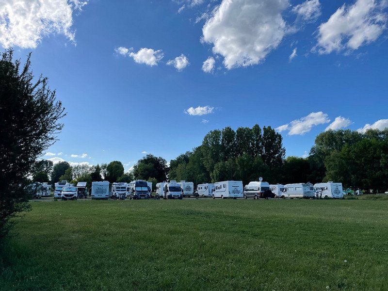
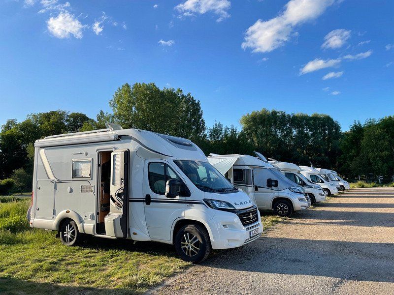
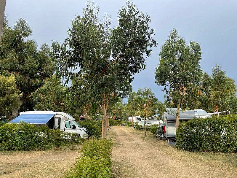
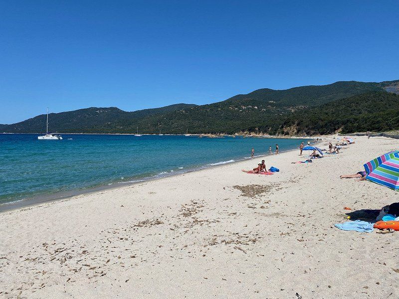
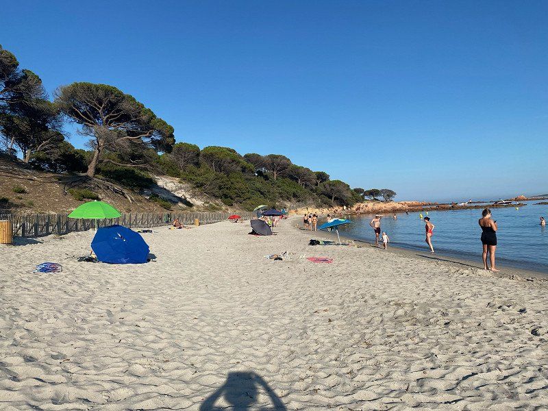
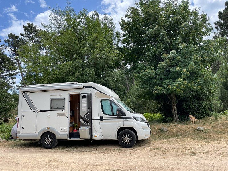
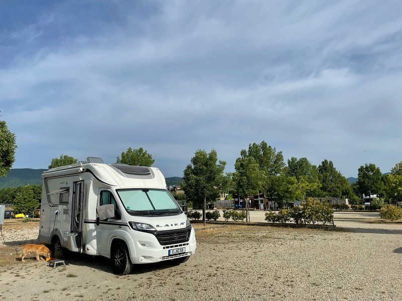
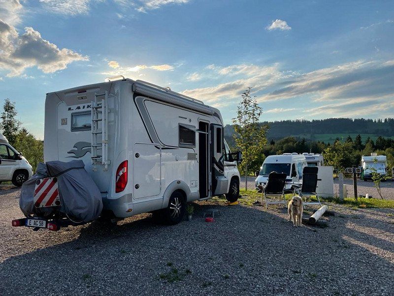
In 4 weeks we covered 880 km in Corsica. We drove yellow and some white roads on the coast and inland. With a width of 2.30 m and a length of approx. 7 m, we got through everywhere easily. On some roads, especially on the coast, we drove early in the morning (8-9 a.m.) to avoid the bus traffic. We only rarely used electricity on the CPs (solar system and voltage converter on board), as some of them were very expensive. On average we paid about 25 €/N (2 adults, dog, camper).
We drove back from Corsica from Livorno via South Tyrol and the Allgäu and made a few stops there.
We did the tour from late May to early July.
Day
Essen, Deutschland
On a beautiful Saturday at the end of May, we start at 9:00 a.m. from home.
51° 27' 20.3" N 7° 0' 41.6" E
51.4556432 7.0115552
• Head toward Friedensplatz on I. Hagen. Go for 16 m.
• Turn left onto Kennedyplatz. Go for 73 m.
• Turn slightly left onto I. Hagen. Go for 10 m.
• Turn left onto II. Hagen. Go for 74 m.
• Turn right onto Am Waldthausenpark. Go for 138 m.
• Continue on Alfred-Herrhausen-Brücke. Go for 234 m.
• Take the 1st exit from Heinz-Renner-Platz roundabout onto Hoffnungstraße. Go for 36 m.
• Turn right onto Lazarettstraße. Go for 100 m.
• Turn right onto Hindenburgstraße (K15). Go for 67 m.
• Keep left onto Hindenburgstraße (K15) toward A52/A40/Solingen/B224/Messe/Gruga/Hbf. Go for 531 m.
• Continue on Bismarckstraße (K15) toward Düsseldorf/A52/Solingen/B224/Messe/Gruga. Go for 2.9 km.
• Turn right onto Anschlussstelle Essen-Rüttenscheid (L176) toward Düsseldorf. Go for 1.0 km.
• Take left ramp onto A52 toward Düsseldorf. Go for 18.3 km.
• Take the exit toward Velbert/Mönchengladbach/Flughafen Düsseldorf onto A44. Go for 14.5 km.
• Take exit 27 toward Köln/Neuss onto A57. Go for 13.3 km.
• Take exit 20 toward Heinsberg/Aachen/NE-Holzheim onto A46. Go for 17.4 km.
• Continue on Autobahnkreuz Holz toward Aachen/Koblenz/A61. Go for 1.1 km.
• Continue on A44. Go for 53.6 km.
• Continue on E40. Go for 50.0 km.
• Continue on E42 toward Namur/Seraing/A604/Aéroport Liège. Go for 134 km.
• Keep left onto E19 toward Paris/Valenciennes. Go for 7.3 km.
• Continue on A2. Go for 77.7 km.
• Continue on A1 (Autoroute du Nord). Go for 115 km.
• Take exit 6 toward Aéroport Charles de Gaulle/Roissy en France/Cergy-Pontoise/Louvres/Goussainville onto N104. Go for 16.9 km.
• Keep left onto La Francilienne (N104) toward Cergy-Pontoise/A15/Domont/Montsoult. Go for 12.7 km.
• Keep left onto N184 toward Cergy-Pontoise/A15/Méry S/Oise-Z.A. Go for 7.0 km.
• Take ramp onto A15 toward Cergy-Préfecture. Go for 4.4 km.
• Continue on N14. Go for 4.6 km.
• Continue on D14. Go for 19.6 km.
• Take ramp toward Hodent/Vernon. Go for 224 m.
• Turn right onto Rue de la Libération (D86). Go for 205 m.
• Take the 4th exit from Rue de la Libération roundabout onto Rue de la Libération (D86). Go for 9.2 km.
• Continue on D37. Go for 7.4 km.
• Continue on Route de Magny (D128). Go for 635 m.
• Turn right onto Rue des Arches (D313). Go for 218 m.
• Turn left onto D5. Go for 5.7 km.
• Turn right onto Rue Claude Monet. Go for 454 m.
• Arrive at Rue Claude Monet. Your destination is on the right.
☍
596,3 km
(5 hrs. 42 min.)
Giverny, Rue Claude Monet, Giverny, Frankreich
After a good 8-hour drive with stops in between, we reach the parking space (see Promobil App) at the Claude Monet Museum at around 5:30 p.m. It is well filled, but we still find a place. The place is free, but offers no supply and disposal. Approx. 30 places are available.
A first tour of the place inspires us - a great, artistic atmosphere. Even walking the dog is no problem. A hiking and cycling trail starts directly at the campsite.
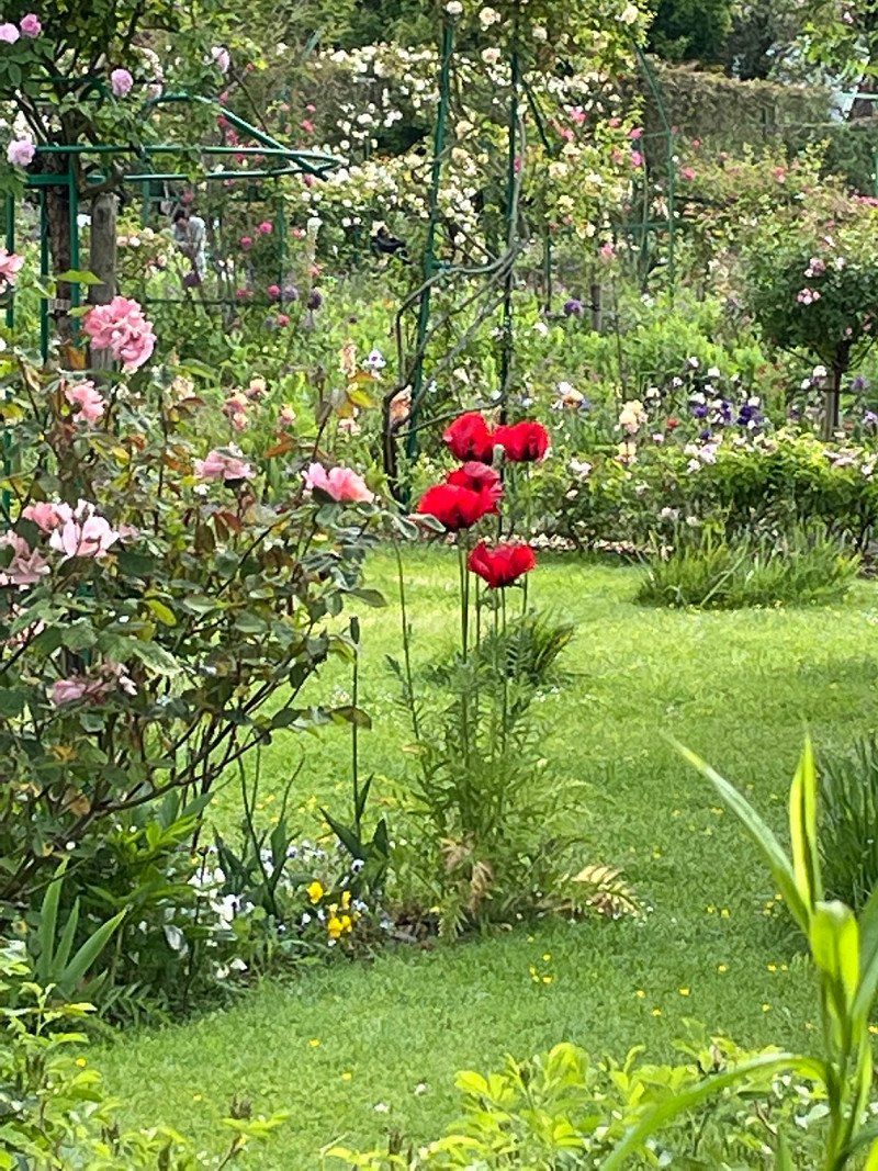
The next day is a visit to the museum with the Monet Gardens.
Even if the water lilies haven't bloomed yet, the floral splendor is absolutely impressive. Monet's home is also worth a visit. It is best to visit the gardens early in the morning.
101-99 Rue Claude Monet, 27620 Giverny, Frankreich
49° 4' 32.8" N 1° 31' 54.7" E
49.0757843 1.5318524
• Head toward Rue du Pressoir on Rue Claude Monet. Go for 38 m.
• Turn right onto Rue du Pressoir. Go for 108 m.
• Turn right onto Chemin du Roy (D5). Go for 154 m.
• Pass 2 roundabouts and continue on Rue d'Orgival (D5). Go for 3.8 km.
• Continue on Rue des Combattants d'Indochine. Go for 231 m.
• Take the 3rd exit from Rond-Point de l'Espace roundabout onto Pont Clemenceau (D181) toward Mantes/Évreux/Rouen/Centre Ville. Go for 396 m.
• Take the 1st exit from roundabout onto Rue Clemenceau (D181) toward Évreux/Rouen. Go for 98 m.
• Take the 2nd exit from roundabout onto Boulevard du Maréchal Leclerc (D6015) toward Évreux/Rouen/Bizy/Z.I. du Virolet. Go for 741 m.
• Turn left onto Avenue du Maréchal Foch (D181) toward Elbeuf/Rouen/Évreux/Bizy/Glatigny/Z.I. du Virolet. Go for 197 m.
• Take the 2nd exit from roundabout onto Avenue du Maréchal Foch (D181). Go for 585 m.
• Take the 3rd exit from Rond-Point des Anciens Combattants d'A.F.N. roundabout onto Avenue des Capucins (D181). Go for 3.4 km.
• Take the 2nd exit from roundabout onto D181. Go for 2.3 km.
• Take the 2nd exit from roundabout onto A13 (Autoroute de Normandie) toward Elbeuf/Rouen. Go for 87.1 km.
• Take exit 27 toward Pont-Audemer-Centre. Go for 713 m.
• Take the 2nd exit from roundabout onto Avenue des Peupliers (D675). Go for 4.6 km.
• Turn right onto Place de l'Église (D180) toward A29/Honfleur/Pont de Normandie/Fiquefleur/Boulleville-Mairie. Go for 9.8 km.
• Take the 2nd exit from roundabout onto D180 toward A29/Le Havre/Honfleur/Pont de Normandie. Go for 390 m.
• Continue on D580. Go for 1.9 km.
• Take the 3rd exit from roundabout onto D580 toward Trouville/Deauville/Honfleur. Go for 424 m.
• Pass 2 roundabouts and continue on D580. Go for 981 m.
• Take the 3rd exit from roundabout onto Cours Jean de Vienne (D580) toward Honfleur. Go for 768 m.
• Take the 2nd exit from Rond-Point du Port roundabout onto Cours Jean de Vienne (D580). Go for 388 m.
• Take the 2nd exit from Rond-Point Carnot roundabout onto Pont Mercedès Villey. Go for 112 m.
• Turn right onto Quai de la Cale. Go for 144 m.
• Turn right onto Quai de la Cale. Go for 137 m.
• Arrive at Quai de la Cale. Your destination is on the right.
☍
119,7 km
(1 hrs. 17 min.)
Day
Stellplatz am Bassin Carnot in Honfleur aus dem ACSI
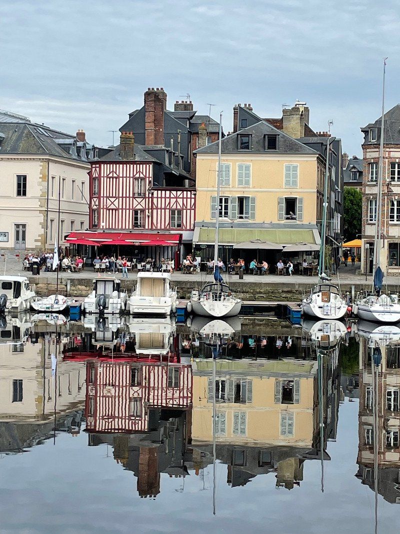
After Honfleur we chose a route without a motorway. Despite the many roundabouts, the trip overland is worthwhile, and not just financially.
The parking space in Honfleur is huge, simply equipped and ok for 12€/24h with supply and disposal.
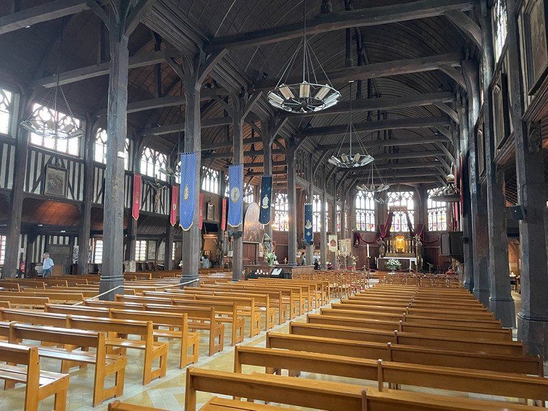
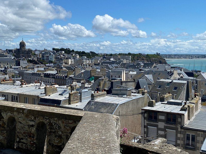
The place itself has a medieval flair and is characterized by many different house styles. The wooden church and bell tower are of particular interest.
Quai du Nord, 14600, Honfleur, Frankreich
49° 25' 8" N 0° 14' 37" E
49.4188889 0.2436111
• Head east on Quai de la Cale.
• Turn left. Go for 132 m.
• Turn left toward Quai de la Cale. Go for 21 m.
• Continue on Quai de la Cale. Go for 144 m.
• Turn left onto Pont Mercedès Villey. Go for 67 m.
• Take the 3rd exit from Rond-Point Carnot roundabout onto Cours Jean de Vienne (D580). Go for 430 m.
• Take the 1st exit from Rond-Point du Port roundabout onto Cours Jean de Vienne (D580). Go for 749 m.
• Take the 1st exit from roundabout onto Rue des 4 Francs (D579) toward Caen/Deauville/Trouville/Lisieux/La Rivière-St Sauveur/Pont-l'Évêque. Go for 256 m.
• Pass 2 roundabouts and continue on D579. Go for 1.8 km.
• Take the 2nd exit from roundabout onto D144 toward Pont-l'Évêque. Go for 3.5 km.
• Take the 1st exit from roundabout onto D144 toward Deauville/Trouville/Caen/Pont-l'Évêque. Go for 1.4 km.
• Continue on D579. Go for 8.6 km.
• Take the 2nd exit from roundabout onto Route de Honfleur (D579) toward Caen/Paris/Lisieux. Go for 170 m.
• Take the 2nd exit from roundabout onto A132 toward Caen/Rouen/Paris. Go for 894 m.
• Keep right onto A132 toward Paris/Rouen/Caen. Go for 328 m.
• Continue toward Autoroute de Normandie/A13. Go for 10 m.
• Take the exit toward Caen onto A13 (Autoroute de Normandie). Go for 21.7 km.
• Take exit 30 toward Houlgate/Cabourg/Dives S/Mer/Dozulé. Go for 1.7 km.
• Keep right onto D400 toward Houlgate/Cabourg/Dives S/Mer. Go for 3.4 km.
• Take the 2nd exit from roundabout onto D400. Go for 1.3 km.
• Keep left onto D400 A. Go for 2.8 km.
• Take the 2nd exit from roundabout onto D400 A. Go for 588 m.
• Take the 2nd exit from roundabout onto Avenue Guillaume le Conquérant (D513). Go for 180 m.
• Turn right onto Chemin Cailloué. Go for 330 m.
• Turn left onto Avenue du Président René Coty (D514). Go for 1.6 km.
• Take the 1st exit from roundabout onto Avenue du Président René Coty (D514). Go for 3.2 km.
• Take the 1st exit from roundabout onto Avenue de Paris. Go for 190 m.
• Turn left onto Avenue de Brûlon. Go for 129 m.
• Turn slightly right onto Avenue de Brûlon. Go for 147 m.
• Continue on Avenue de Brûlon. Go for 100 m.
• Turn slightly left onto Avenue de Pont-l'Évêque. Go for 287 m.
• Take the 3rd exit from roundabout onto Boulevard Wattier. Go for 126 m.
• Arrive at Boulevard Wattier. Your destination is on the right.
☍
56,4 km
( 45 min.)
Day
Aire municipale pour Camping-cars
From Honfleur we drove the D513 along the coast. Unfortunately, the weather was very bad, so we didn't see much of the flower coast. Some of the roads are very narrow and mostly only passable up to 3.5 tons.
The parking lot is very nice. However, the seats are very narrow, so that when you get off you end up directly against the wall of your neighbors. Since the place was full (max. 6 Womos) we drove on.
Boulevard Wattier, 14810, Merville-Franceville-Plage, Frankreich
49° 17' 6" N 0° 12' 36" W
49.2850000 -0.2100000
• Head west on Boulevard Wattier. Go for 114 m.
• Turn right onto Boulevard Kennedy. Go for 719 m.
• Turn slightly left onto Avenue des Dunes. Go for 220 m.
• Turn right onto Avenue de Paris. Go for 99 m.
• Take the 1st exit from roundabout onto Route de Cabourg (D514). Go for 6.5 km.
• Pass 3 roundabouts and continue on D514. Go for 1.6 km.
• Take ramp onto D514 toward Ouistreham Car Ferry/Douvres la Délivrande/Zone d'Activités de Bénouville. Go for 2.8 km.
• Take the 2nd exit from roundabout onto Avenue du Grand-Large (D84) toward Ouistreham Car Ferry/Le Port/Port Ouistreham Car Ferry Gare Maritime/Plage de Riva-Bella. Go for 835 m.
• Take the 3rd exit from roundabout onto Avenue du Grand-Large (D84). Go for 1.0 km.
• Turn right onto Place du Général de Gaulle toward Stade Kieffer. Go for 434 m.
• Keep left. Go for 33 m.
• Keep left. Go for 33 m.
• Continue toward Rue des Dunes. Go for 22 m.
• Continue on Rue des Dunes. Go for 506 m.
• Continue on Boulevard Maritime. Go for 22 m.
• Arrive at Boulevard Maritime. Your destination is on the left.
☍
15,1 km
( 18 min.)
Aire de Camping-cars
The place is located directly at the ferry port, but with access to the beach. 12€/24h with supply and disposal are ok. Electricity is only available from a socket at the emptying station - a bit strange.
We stayed one night and had a nice walk on the beach. At the square itself there is a skating track, a Ferris wheel and a go-kart track. Very ideal with a dog.
Boulevard Maritime , 14150, Ouistreham, Frankreich
49° 17' 14" N 0° 14' 59" W
49.2872222 -0.2497222
• Head northwest on Boulevard Maritime. Go for 69 m.
• Turn left onto Avenue de la Hève. Go for 89 m.
• Turn left onto Avenue du 6 Juin. Go for 114 m.
• Turn right onto Rue des Dunes. Go for 508 m.
• Continue on Place du Général de Gaulle. Go for 1.4 km.
• Take the 2nd exit from roundabout onto Avenue du Grand-Large (D84). Go for 816 m.
• Take the 3rd exit from roundabout onto D514 toward A13/Caen/Cabourg. Go for 2.5 km.
• Keep left onto D515. Go for 8.0 km.
• Take the 1st exit from roundabout onto Avenue Georges Clemenceau toward Caen/Caen-Centre/C.H.R. Clémenceau. Go for 1.5 km.
• Continue on Rue de la Pigacière. Go for 31 m.
• Take the 1st exit from roundabout onto Rue de la Pigacière. Go for 312 m.
• Continue on Rue Léon Lecornu toward La Prairie/Abbaye aux Hommes. Go for 259 m.
• Continue on Place Michel de Bouard toward Château/Abbaye aux Hommes. Go for 105 m.
• Continue on Rue du Gaillon. Go for 146 m.
• Continue toward Rue Bosnières. Go for 75 m.
• Turn left onto Place de la Mare. Go for 24 m.
• Continue on Rue Chanoine Xavier de Saint-Pol. Go for 130 m.
• Turn right onto Lieu-dit Fossés Saint Julien toward La Prairie/Abbaye aux Hommes. Go for 344 m.
• Continue on Place Saint-Martin. Go for 78 m.
• Continue on Rue Saint-Manvieu. Go for 35 m.
• Turn left. Go for 41 m.
• Arrive at your destination on the right.
☍
16,5 km
( 17 min.)
Day
Caen, Frankreich
After stopping briefly in the parking lot at the Museum Memorial de Caen, we drove through the city and past the castle of Wilhelm the Conquerer. The city would be worth a long visit, but we want to go to Mont St. Michel
14000 Caen, Frankreich
49° 10' 58.3" N 0° 22' 14.4" W
49.1828630 -0.3706790
• Head toward Rue Saint-Manvieu. Go for 41 m.
• Turn left onto Rue Saint-Manvieu. Go for 78 m.
• Continue on Rue Saint-Manvieu. Go for 88 m.
• Turn right onto Rue Guillaume le Conquérant. Go for 199 m.
• Turn left onto Rue Caponière. Go for 4.4 km.
• Take the 2nd exit from roundabout onto A84 toward Rennes/Villers-Bocage/Vire. Go for 72.9 km.
• Take exit 37 toward Granville/Gavray. Go for 516 m.
• Take the 2nd exit from roundabout onto D33 toward Villedieu les P./Gavray/Granville. Go for 394 m.
• Take the 1st exit from roundabout onto Route de Granville (D924) toward Fleury/Granville/La Haye-Pesnel. Go for 10.1 km.
• Pass 2 roundabouts and continue on Route de Paris à Granville (D924). Go for 11.7 km.
• Take the 2nd exit from roundabout onto D971. Go for 2.1 km.
• Turn right toward Granville. Go for 166 m.
• Turn right onto Route Nationale (D973). Go for 1.5 km.
• Take the 2nd exit from roundabout onto Avenue des Vendéens (D973). Go for 599 m.
• Take the 3rd exit from Rond-Point de Sherborne roundabout onto Boulevard des Amériques (D135). Go for 381 m.
• Take the 2nd exit from roundabout onto Boulevard des Amériques (D135). Go for 327 m.
• Turn right onto Rue de la Crête (D911). Go for 525 m.
• Take the 3rd exit from Rond-Point d'Hacqueville roundabout onto Rue Saint-Gaud (D911). Go for 412 m.
• Take the 2nd exit from Rond-Point Saint-Gaud roundabout onto Rue Saint-Gaud (D911). Go for 374 m.
• Continue on Boulevard des Amiraux Granvillais. Go for 324 m.
• Take the 2nd exit from Rond-Point des Amiraux Granvillais roundabout onto Boulevard des Amiraux Granvillais. Go for 366 m.
• Turn right onto Rue Saintonge. Go for 70 m.
• Turn right onto Rue Lecampion (D924). Go for 124 m.
• Continue on Rue Paul Poirier (D924). Go for 47 m.
• Turn sharp left onto Rue de l'Abreuvoir. Go for 32 m.
• Turn right onto Rue du Commandant Yvon. Go for 6 m.
• Arrive at Rue du Commandant Yvon. Your destination is on the left.
☍
107,8 km
(1 hrs. 12 min.)
Granville, Frankreich
We approached the parking space above the port, directly on the haut ville. Here you could stay for €10.80 including supply and disposal (without electricity). We parked a few yards down the road to check out the place.
From here we drove towards Mont St. Michel.
48° 50' 15.3" N 1° 35' 50.3" W
48.8375790 -1.5973020
• Head east on Rue du Commandant Yvon. Go for 130 m.
• Turn left onto Rue Couraye (D924). Go for 510 m.
• Take the 1st exit from Avenue du Maréchal Leclerc roundabout onto Avenue du Maréchal Leclerc (D924). Go for 294 m.
• Take the 2nd exit from Rond-Point du Calvaire roundabout onto Avenue Aristide Briand (D973). Go for 1.0 km.
• Pass 3 roundabouts and continue on Route Nationale (D973). Go for 3.1 km.
• Take the 2nd exit from roundabout onto Route Nationale (D973) toward Le Mont-St Michel/Sartilly/Avranches. Go for 730 m.
• Pass 2 roundabouts and continue on Route de la Havaudière (D973). Go for 7.6 km.
• Take the 2nd exit from roundabout onto D673 toward Sartilly. Go for 477 m.
• Continue on Lieu-dit La Cosnière (D673). Go for 302 m.
• Continue on Grande Rue (D673/D911). Go for 323 m.
• Take the 1st exit from roundabout onto Rue des Halles (D35) toward Église de Genêts/Prieuré St Léonard. Go for 121 m.
• Continue on Rue de l'Hôtel Furet (D35). Go for 5.6 km.
• Continue on D35. Go for 897 m.
• Continue on Lieu-dit La Perame (D35). Go for 96 m.
• Continue on D35. Go for 736 m.
• Turn left onto D911. Go for 417 m.
• Turn right onto Route du Bec d'Andaine (D35 E1). Go for 1.4 km.
• Keep right onto Chemin Montois. Go for 79 m.
• Arrive at Chemin Montois. Your destination is on the left.
☍
23,8 km
( 25 min.)
8934 Le Bec d'Andaine, 50530 Genêts, Frankreich
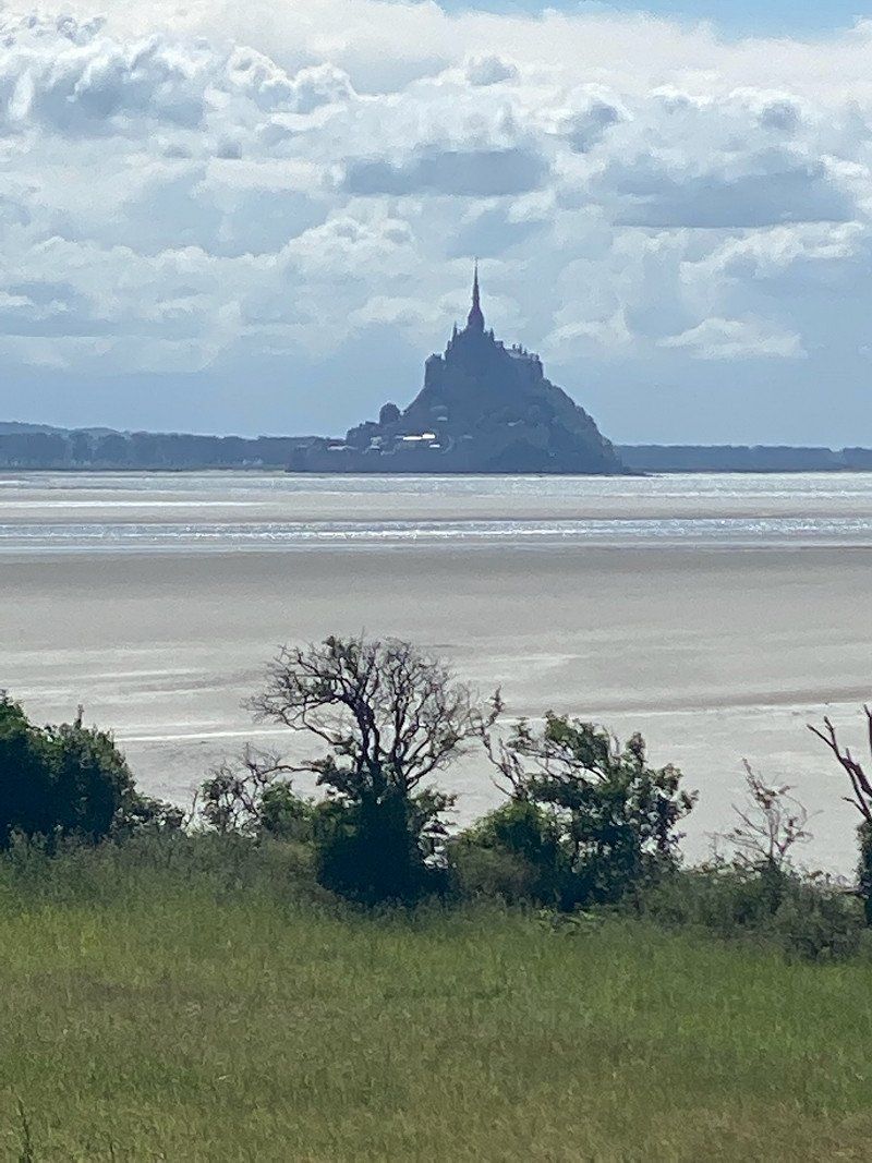
On the way to Mont St. Michel we drove to this parking lot, from which you have a great view of the mountain.
48° 41' 16.9" N 1° 29' 48.9" W
48.6880323 -1.4969259
• Head southeast on Chemin Montois. Go for 79 m.
• Continue on Route du Bec d'Andaine (D35 E1). Go for 1.4 km.
• Turn right onto Rue de l'Ortillon (D911). Go for 9.0 km.
• Take the 1st exit from roundabout onto Route de Granville (D973) toward Avranches/Le Mont-St Michel. Go for 610 m.
• Take the 2nd exit from roundabout onto N175 toward Rennes/St Malo/Fougères/St Hilaire du H./Dol de B. Go for 7.6 km.
• Take ramp onto N175 toward St Brieuc/St Malo/Le Mont-St Michel/Pontorson. Go for 2.1 km.
• Take ramp onto Lieu-dit La Chaussée (D43) toward Courtils. Go for 7.1 km.
• Continue on D275. Go for 4.2 km.
• Turn right onto Route de la Cote. Go for 149 m.
• Arrive at Route de la Cote. Your destination is on the right.
☍
32,2 km
( 28 min.)
38 La Jacotiére Ardevon, 50170 Pontorson, Frankreich
The absolute racer …..
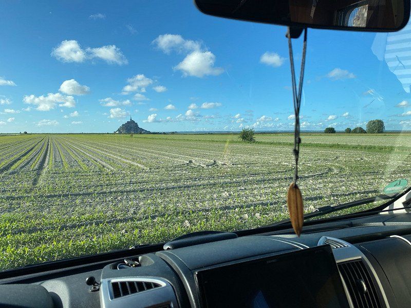
With a view of Mont St. Michel, this parking space at a farm shop is the absolute main prize. We stayed the night here for the purchase of a bottle of Calvados and a very tasty fish soup. Unfortunately there are only three parking spaces.
After a walk to the beginning of the connecting road to Mont St. Michel, we ended the day with a good meal, a bottle of wine and one or two Calvados with an unobstructed view of the mountain.
48° 36' 50.3" N 1° 30' 4.3" W
48.6139656 -1.5012008
• Head east on Route de la Cote. Go for 149 m.
• Turn right onto D275. Go for 410 m.
• Take the 2nd exit from roundabout onto D776. Go for 983 m.
• Turn right onto Route du Mont-Saint-Michel. Go for 256 m.
• Turn right. Go for 144 m.
• Turn left toward Lieu-dit Le Bas Pays. Go for 190 m.
• Turn left onto Lieu-dit Le Bas Pays. Go for 165 m.
• Turn right onto Route du Mont-Saint-Michel. Go for 195 m.
• Continue on Route du Mont-Saint-Michel. Go for 2.5 km.
• Turn left onto Montée aux Poulains. Go for 261 m.
• Arrive at Montée aux Poulains. Your destination is on the left.
☍
5,3 km
( 13 min.)
Day
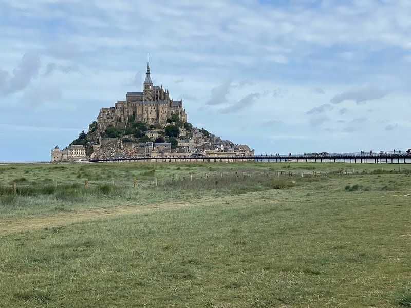
Mont Saint-Michel, Frankreich
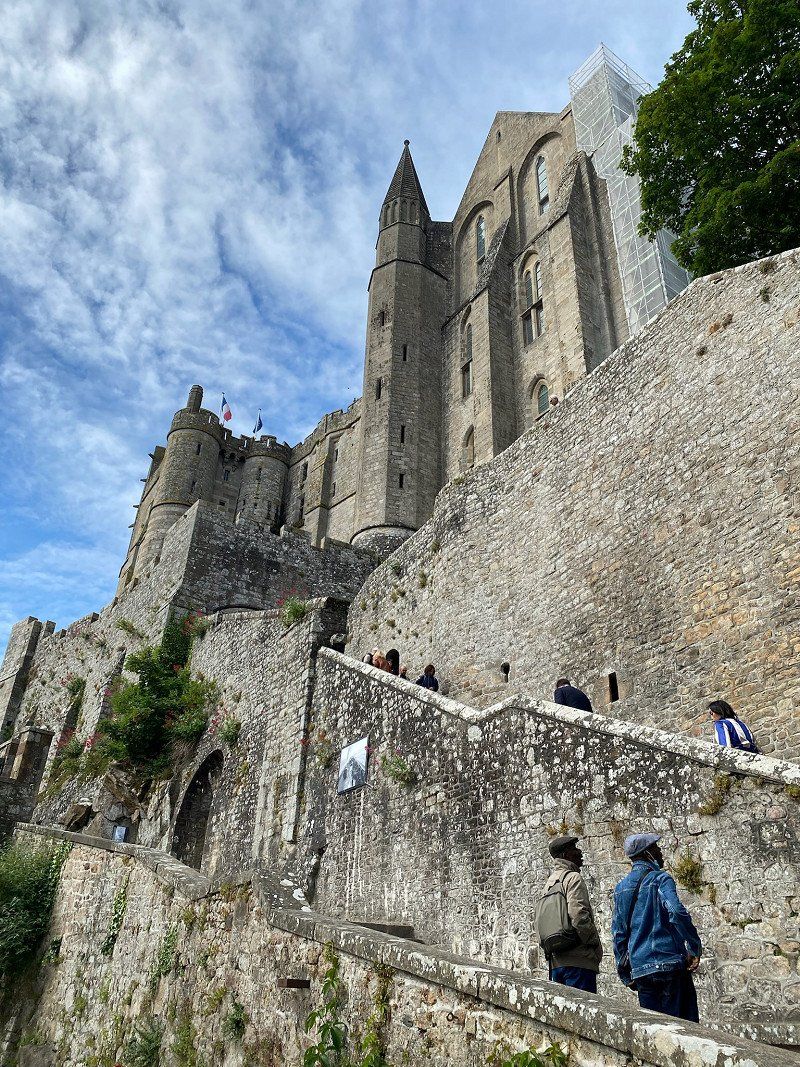
In the morning we went to visit the mountain - with the dog. We walked about 35 minutes. Next to the dam you can walk the dog very well. Since we were on the mountain around 9:30 a.m., the crowds were still manageable. When we started our way back after 2 hours, the streets were already getting narrow.
In any case, you should be with the 3.5 million visitors per year. Worth it.
After breakfast at the Womo, we then left to visit our friends in Normandy.
50170 Le Mont-Saint-Michel, Frankreich
48° 38' 9.8" N 1° 30' 41.2" W
48.6360630 -1.5114570
• Head west on Montée aux Poulains. Go for 261 m.
• Turn right toward Route du Mont-Saint-Michel. Go for 104 m.
• Continue on Route du Mont-Saint-Michel. Go for 2.6 km.
• Turn left onto Lieu-dit Le Bas Pays. Go for 178 m.
• Turn sharp right toward D776. Go for 443 m.
• Turn left onto D776. Go for 806 m.
• Take the 1st exit from roundabout onto D275. Go for 4.6 km.
• Continue on Rue du Mont Saint-Michel (D75). Go for 6.9 km.
• Take left ramp onto N175 toward Saint-Lô/Caen/Cherbourg/Avranches. Go for 1.8 km.
• Take ramp onto N175. Go for 11.3 km.
• Keep left onto A84 toward Cherbourg/Caen/Saint-Lô/Villedieu-les-Poêles. Go for 90.2 km.
• Take the exit toward Paris/Alençon/Flers/Caen-Centre onto N814 (Périphérique). Go for 5.1 km.
• Take ramp toward Suisse Normande/Flers/Laval/Thury-Harcourt/Condé S/ Noireau/Fleury S/ Orne. Go for 442 m.
• Take the 1st exit from roundabout onto Avenue d'Harcourt (D562) toward Flers/Laval/Thury-Harcourt/Condé S/Noireau. Go for 269 m.
• Take the 2nd exit from roundabout onto D562 toward Flers/Laval/Alençon/Le Mans/Thury-Harcourt/Condé S/Noireau. Go for 4.5 km.
• Keep left onto D562 B toward Alençon/Le Mans/Falaise. Go for 2.7 km.
• Continue on Route de Lorguichon (N158). Go for 25.5 km.
• Take ramp toward Condé S/ Noireau/Putanges-Pt-Écrepin/Pont d'Ouilly. Go for 261 m.
• Take the 5th exit from roundabout onto D511 toward Caen/Falaise/St Pierre S/Dives/Putanges Pt Écrepin/Bagnoles de l'Orne. Go for 344 m.
• Take the 1st exit from roundabout onto D658 A toward Alençon/Argentan/La Hoguette/Bagnoles de l'Orne/Putanges-Pont-Écrepin. Go for 1.1 km.
• Take the 2nd exit from roundabout onto D658 A. Go for 1.1 km.
• Take the 2nd exit from roundabout. Go for 122 m.
• Continue on Route de Tours. Go for 796 m.
• Continue on Rue Aristide Briand. Go for 253 m.
• Turn right onto Rue Notre-Dame (D63). Go for 833 m.
• Take the 2nd exit from roundabout onto Boulevard Jean Mantelet (D63). Go for 11.5 km.
• Continue on D13. Go for 5.7 km.
• Turn left onto Place Charles de Gaulle (D916). Go for 13.4 km.
• Turn left onto D703. Go for 860 m.
• Continue on Rue Marie Harel (D703). Go for 291 m.
• Turn left onto Rue de la Cavée (D703). Go for 617 m.
• Turn left onto Route des Coteaux. Go for 525 m.
• Turn right onto Route de la Testière. Go for 388 m.
• Turn left onto Route de la Testière. Go for 77 m.
• Arrive at Route de la Testière. Your destination is on the left.
☍
196,0 km
(2 hrs. 14 min.)
La Testière, Crouttes, Frankreich
In this small, very nice place we visited friends who have emigrated here. We spent 4 beautiful days here with visits to the surrounding area (including the town of Camembert) and good food and nice conversations.
La Testière, 61120 Crouttes, Frankreich
48° 55' 6.7" N 0° 7' 36.5" E
48.9185410 0.1268189
• Head north on Route de la Testière. Go for 77 m.
• Turn right onto Route de la Testière. Go for 388 m.
• Turn left onto Route des Coteaux. Go for 525 m.
• Turn right onto Rue de la Cavée (D703). Go for 908 m.
• Continue on D703. Go for 860 m.
• Turn left onto D916. Go for 4.3 km.
• Turn sharp right onto Rue de Fordingbridge (D16). Go for 814 m.
• Continue on D16. Go for 411 m.
• Continue on Lieu-dit La Dufourière (D16). Go for 91 m.
• Continue on D16. Go for 577 m.
• Turn left onto D26. Go for 864 m.
• Continue on Lieu-dit Le Vau-Benard (D26). Go for 51 m.
• Continue on D26. Go for 284 m.
• Continue on Lieu-dit La Noë (D26). Go for 120 m.
• Continue on D26. Go for 458 m.
• Continue on Lieu-dit Les Noëttes (D26). Go for 148 m.
• Continue on D26. Go for 1.4 km.
• Turn left onto Lieu-dit Le Fort Fresnay (D242). Go for 99 m.
• Continue on D242. Go for 393 m.
• Continue on Lieu-dit Le Bourg (D242). Go for 76 m.
• Turn right onto D702. Go for 161 m.
• Continue on Lieu-dit le moulin de Roiville (D702). Go for 134 m.
• Continue on D702. Go for 938 m.
• Continue on Lieu-dit Les Vassiaux (D702). Go for 81 m.
• Continue on D702. Go for 1.3 km.
• Turn right onto Lieu-dit Les Foutellees (D979). Go for 8.5 km.
• Continue on D722 AE toward Alençon/Centre Ville. Go for 388 m.
• Turn right onto Rue du Château (D722 C) toward Alençon/Sées/Mortagne. Go for 2.2 km.
• Take the 3rd exit from roundabout toward A28/Mortagne au P./Ste Gauburge/Échauffour/Orgères. Go for 373 m.
• Take the 2nd exit from roundabout onto A28 toward Le Mans/Alençon. Go for 89.0 km.
• Take the left exit toward Bordeaux/Paris/Tours onto A11 (L'Océane). Go for 9.1 km.
• Take the exit toward Orléans/Blois/Le Mans-Z.I. Sud/Bordeaux/Tours onto A28 (Échangeur Le Mans-Est). Go for 85.9 km.
• Take the exit toward E502/Bordeaux/Vierzon/Tours onto A10 (L'Aquitaine). Go for 19.6 km.
• Take the exit toward Lyon/Vierzon/Châteauroux onto A85. Go for 107 km.
• Take the left exit toward Lyon/Bourges/Vierzon onto A71. Go for 212 km.
• Continue on A71. Go for 4.6 km.
• Continue on A75 (La Méridienne). Go for 5.7 km.
• Take exit 4 toward Vic le Comte/La Roche-Bche/Le Cendre/Orcet. Go for 344 m.
• Take the 3rd exit from roundabout onto D978 toward Vic le Comte/Le Cendre/Orcet/Gergovie et Sites Arvernes. Go for 333 m.
• Take the 1st exit from roundabout onto D978 toward Vic le Comte/La Roche-Blche/Z.A. la Novialle-Gergovie. Go for 519 m.
• Take the 1st exit from roundabout onto D756. Go for 511 m.
• Turn left. Go for 81 m.
• Arrive at your destination.
☍
561,8 km
(4 hrs. 56 min.)
Day
Day
Day
La Pigné Sud, 63670 La Roche-Blanche, Frankreich
Pitch on the way to Toulon. Registration for the opening of the barrier tel. at the barrier. €9.20 incl. tourist tax. Supply and disposal possible. current limited.
From Crouttes to here, the route was sometimes very strenuous. The sat nav (Apple) has led us many small ways. In the end, you should still have the map to hand in order to possibly correct the route.
From Clermont Ferrand we took the A75 (toll-free) to Montpellier. We paid €14.20 for a bridge at Millout. On the coast we then enjoyed a shorter section of the motorway for €6.50. All in all, the second piece was easier to ride than the first.
La Pigné S, 63670 La Roche-Blanche, Frankreich
45° 42' 55.1" N 3° 8' 52" E
45.7152940 3.1477660
• Head north. Go for 81 m.
• Turn right onto D756. Go for 478 m.
• Take the 4th exit from roundabout onto D978. Go for 567 m.
• Take the 2nd exit from roundabout onto A75 (La Méridienne) toward Clermont-Fd. Go for 6.0 km.
• Take the exit toward A89/Lyon/St Étienne/Thiers onto A711. Go for 10.9 km.
• Continue on A89. Go for 77.1 km.
• Continue on A72 toward St Étienne/Feurs. Go for 53.7 km.
• Take the exit toward A47/Valence/Lyon/St Chamond onto N488. Go for 1.5 km.
• Continue on N88. Go for 5.8 km.
• Keep left onto A47 toward E70/St Chamond-Stelytec/Lyon/Valence. Go for 29.4 km.
• Take the exit toward Vienne/Valence/Marseille onto A7 (Autoroute du Soleil). Go for 256 km.
• Keep left onto A8 (Échangeur de la Croix de Coudoux) toward Nice/Toulon/Aix en Pce. Go for 30.3 km.
• Take the exit toward Toulon/Aubagne onto A52. Go for 20.5 km.
• Keep right onto A52 (Échangeur du Pont de l'Étoile) toward Toulon/Aubagne-les Passons/Z.I. les Paluds. Go for 5.0 km.
• Continue on A50. Go for 35.2 km.
• Take the exit. Go for 237 m.
• Take the 5th exit from roundabout onto Route de Sanary (D11) toward A50/Ollioules. Go for 219 m.
• Pass 2 roundabouts and continue on Route de Sanary (D11). Go for 936 m.
• Take the 3rd exit from Giratoire Marius Trotobas roundabout onto Route de Sanary (D11). Go for 841 m.
• Take the 2nd exit from Rond-Point Robert Schuman roundabout onto Avenue de la Résistance (D11). Go for 481 m.
• Pass 2 roundabouts and continue on Avenue de la Résistance (D11). Go for 663 m.
• Turn right onto Rue Philippe Leclerc de Hautecloque. Go for 75 m.
• Turn left onto Rue Philippe de Hautecloque de Leclerc. Go for 62 m.
• Turn right onto Pont du Faubourg. Go for 9 m.
• Continue on Avenue Georges Clemenceau. Go for 208 m.
• Continue on Chemin La Burlière. Go for 141 m.
• Turn left onto Route Nationale 8 (DN8). Go for 161 m.
• Arrive at Route des Gorges (DN8).
☍
536,4 km
(4 hrs. 53 min.)
Day
307-493 Route des Gorges, 83190 Ollioules, Frankreich
Very nice parking space in a nice place. Located directly on the main street. €9.83 including supply and disposal. Electricity only via a Franz plug.
About 15 minutes to the ferry port. Left at 5:30 am.
307 Rte des Gorges, 83190 Ollioules, Frankreich
43° 8' 15.6" N 5° 51' 1.9" E
43.1376801 5.8505292
• Head toward Impasse des Néfliers on Route des Gorges (DN8). Go for 546 m.
• Turn left onto Chemin de la Bonnefont. Go for 99 m.
• Turn right onto Avenue Barthélemy Dagnan (D11). Go for 221 m.
• Turn right onto Route des Gorges (DN8). Go for 1.6 km.
• Pass 4 roundabouts and continue on Route Nationale 8 (DN8). Go for 2.9 km.
• Continue on Jardin Descartes (DN8). Go for 1.2 km.
• Continue toward Rond-Point Bon-Rencontre. Go for 42 m.
• Take ramp onto Avenue Lieutenant Estienne d'Orves toward Toulon-Centre. Go for 991 m.
• Continue on Carrefour Villevieille. Go for 117 m.
• Keep right onto Carrefour Villevieille. Go for 24 m.
• Keep right onto Carrefour Villevieille toward Hyères/Nice/Le Port/Le Mourillon. Go for 170 m.
• Continue on Rue Robert Guillemard. Go for 412 m.
• Continue on Avenue Général Magnan. Go for 427 m.
• Continue on Avenue de la République. Go for 193 m.
• Turn right onto Quai Cronstadt. Go for 37 m.
• Arrive at Quai Cronstadt. Your destination is on the left.
☍
9,0 km
( 17 min.)
Day
Port de Toulon, Quai Cronstadt, Toulon, Frankreich
Ferry departs at 07:15, arrives at 14:15
Here's another tip for Corsica Ferry users. Be sure to turn off your cell phone completely, put it on flight mode or at least turn off wifi. We ignored an SMS from Vodafone and had to pay dearly for it. So, either switch off your cell phone or take an SMS from your provider into account accordingly.
Quai Cronstadt, 83000 Toulon, Frankreich
43° 7' 12.8" N 5° 55' 53.4" E
43.1202240 5.9315081
• Head toward Avenue de la République on Quai Cronstadt. Go for 37 m.
• Turn right onto Avenue de la République. Go for 364 m.
• Keep right onto Avenue de la République. Go for 18 m.
• Continue on Avenue Franklin Roosevelt. Go for 631 m.
• Turn right onto Carrefour Bir Hakeim (N1050). Go for 39 m.
• Continue on Avenue Alphonse Juin (N1050) toward Hyères/Nice. Go for 294 m.
• Keep left onto Avenue Alphonse Juin (N1050) toward Nice/Hyères/Toulon-Est/Hôpital Sainte Musse. Go for 774 m.
• Continue on A57. Go for 51.7 km.
• Take the exit toward Nice/Cannes/Fréjus/St Raphaël/Draguignan onto A8 (La Provençale). Go for 87.1 km.
• Take exit 50 toward Nice-Ouest onto M6202 (Boulevard Georges Pompidou). Go for 685 m.
• Keep right toward Boulevard René Cassin/M6007. Go for 123 m.
• Keep right onto Boulevard René Cassin (M6007) toward Nice. Go for 821 m.
• Turn slightly left onto N7 toward Monaco/Menton/Nice-Centre/Nice-Est. Go for 7.5 km.
• Keep right onto Esplanade Maréchal de Lattre de Tassigny. Go for 108 m.
• Continue on Rue Caissotti. Go for 51 m.
• Continue on Boulevard Général Louis Delfino. Go for 503 m.
• Turn right onto Rue Arson toward Monaco/Menton/Basse Corniche. Go for 647 m.
• Keep left onto Place Île de Beauté (M6098). Go for 37 m.
• Continue on Quai des 2 Emmanuel. Go for 179 m.
• Turn right toward Quai des Docks. Go for 16 m.
• Turn left onto Quai des Docks. Go for 177 m.
• Continue on Quai d'Entrecasteaux. Go for 74 m.
• Continue on Quai Riboty. Go for 43 m.
• Continue on Quai du Commerce. Go for 218 m.
• Turn right onto Rampe du Quai du Commerce. Go for 15 m.
• Take the Nice-L'Île-Rousse Ferry. Stay on for 179 km.
• Head northwest. Go for 136 m.
• Turn sharp left. Go for 76 m.
• Arrive at your destination on the left.
☍
331,8 km
(6 hrs. 46 min.)
Ile Rousse, L'Île-Rousse, Frankreich
The port is very clear and leaving the ferry and the port is done quickly. If you leave the city heading west, at the last roundabout there is a large Leclerc where you can shop very well.
Ile Rousse itself is a town worth seeing. We later had the opportunity to visit the city in detail. But first we went on to Calvi.
20220 L'Île-Rousse, Frankreich
42° 38' 29.5" N 8° 56' 13" E
42.6415142 8.9369551
• Head southeast. Go for 194 m.
• Turn left toward Route du Port/D81 A. Go for 90 m.
• Turn slightly left onto Route du Port (D81 A). Go for 643 m.
• Take the 1st exit from roundabout onto Boulevard Jean Lancon toward D513. Go for 314 m.
• Turn right onto Boulevard Pierre Pasquini (D513) toward Calvi. Go for 1.3 km.
• Take the 2nd exit from roundabout onto Route de Calvi (T30) toward Calvi/Lumio. Go for 3.0 km.
• Take the 3rd exit from roundabout onto Lieu-dit La Balanina (T30) toward Calvi/Lumio. Go for 2.8 km.
• Pass 4 roundabouts and continue on Avenue Christophe Colomb (T30). Go for 13.4 km.
• Turn right onto Avenue Christophe Colomb. Go for 366 m.
• Turn left. Go for 21 m.
• Arrive at your destination on the right.
☍
22,1 km
( 25 min.)
Camping La Pinede
Unfortunately, the space for the campers has been greatly reduced in favor of mobile homes and relocated directly to the main road, away from the beach. We only paid €14 with the ACSI card, but we didn't stay here for more than 3 days. It's about a 5 minute walk to the beach.
Route de La Pinède 0495651780, 20260, Calvi, Frankreich
42° 33' 10.2" N 8° 46' 13" E
42.5528200 8.7702700
• Head north. Go for 21 m.
• Turn right toward Avenue Christophe Colomb. Go for 205 m.
• Continue on Avenue Christophe Colomb. Go for 161 m.
• Turn left onto Avenue Christophe Colomb (T30). Go for 774 m.
• Pass 5 roundabouts and continue on Route de Calvi (T30). Go for 17.4 km.
• Turn left. Go for 76 m.
• Turn sharp left. Go for 392 m.
• Arrive at your destination on the right.
☍
19,1 km
( 19 min.)
Day
Day
Day
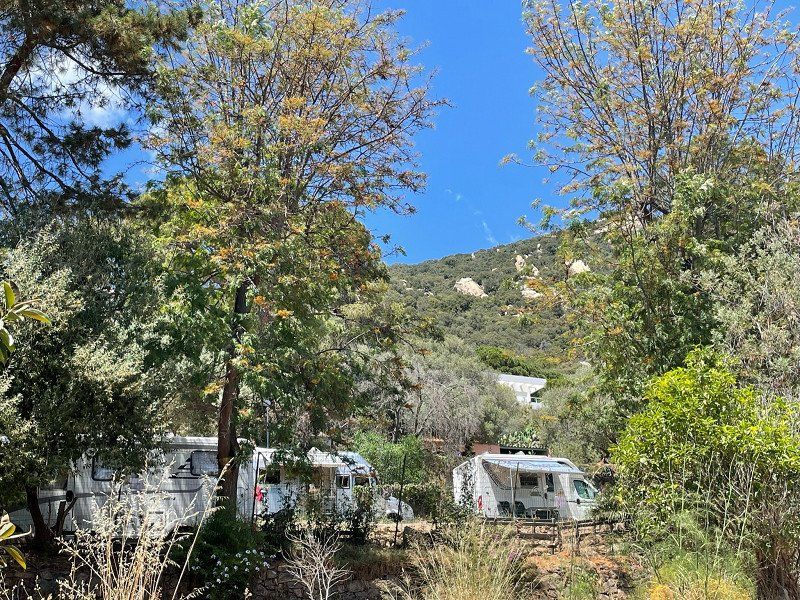
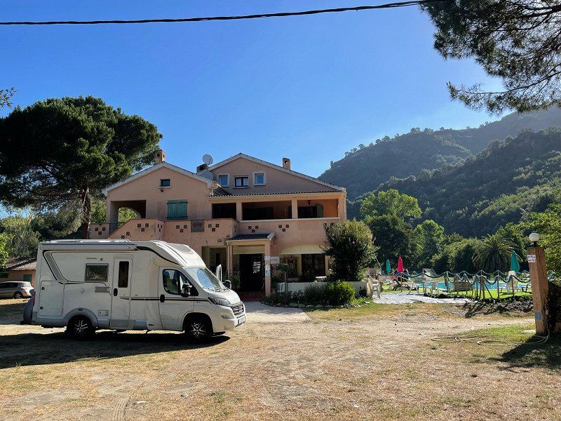
Camping Le Bodri, Corbara, Frankreich
Very nice CP with clearly divided pitches, €28/night, about 300m from the beach
Tours in the mountains are made from here, Corbara is a very nice mountain village
Altogether we stayed 3 days and also took a look at the city of Ile Rousse. As I said - it's worth it.
20256 Corbara, Frankreich
42° 37' 35.8" N 8° 54' 57.8" E
42.6266194 8.9160490
• Head south. Go for 392 m.
• Turn sharp right toward Route de Calvi/T30. Go for 76 m.
• Continue on Route de Calvi (T30). Go for 2.0 km.
• Take the 3rd exit from roundabout onto Lieu-dit La Balanina (T30) toward Calvi/Lumio. Go for 2.8 km.
• Pass 3 roundabouts and continue on Lieu-dit La Balanina (T30). Go for 12.5 km.
• Take the 2nd exit from roundabout onto Route de l'Aéroport (D81) toward Aéroport Ste Catherine/Galéria/Porto. Go for 7.1 km.
• Turn right onto Hameau de Suare (D81). Go for 137 m.
• Turn left onto Hameau de Suare. Go for 43 m.
• Arrive at Hameau de Suare. Your destination is on the right.
☍
25,1 km
( 23 min.)
Day
Day
Day
Suare, Calenzana, Frankreich
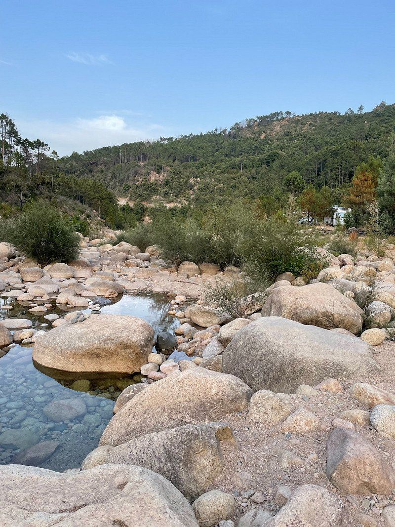
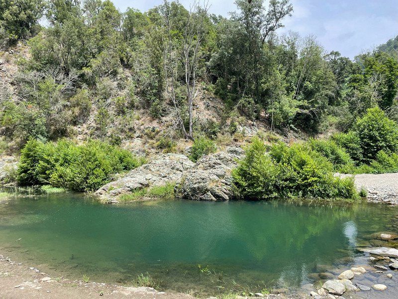
On the way to the first Gumpenbaden in Foret Bonifatio
Approximately 19km after the Suare junction from the D81 car park at Auberge de foret.
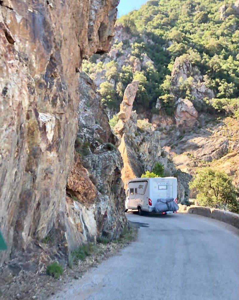
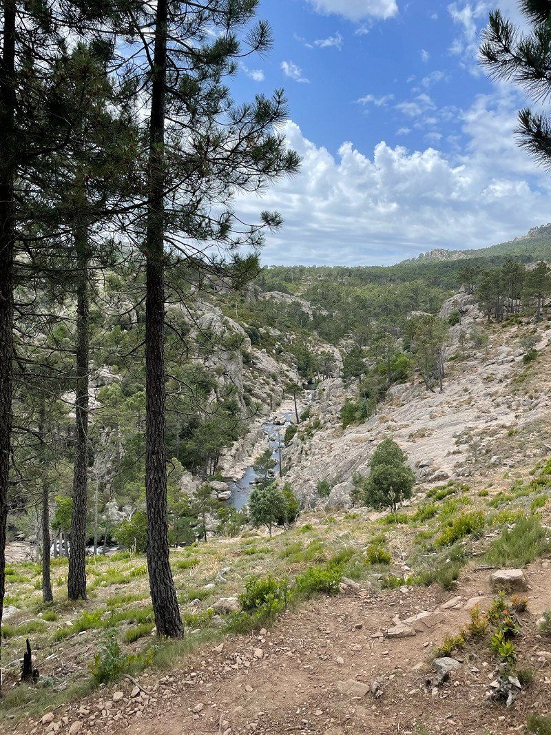
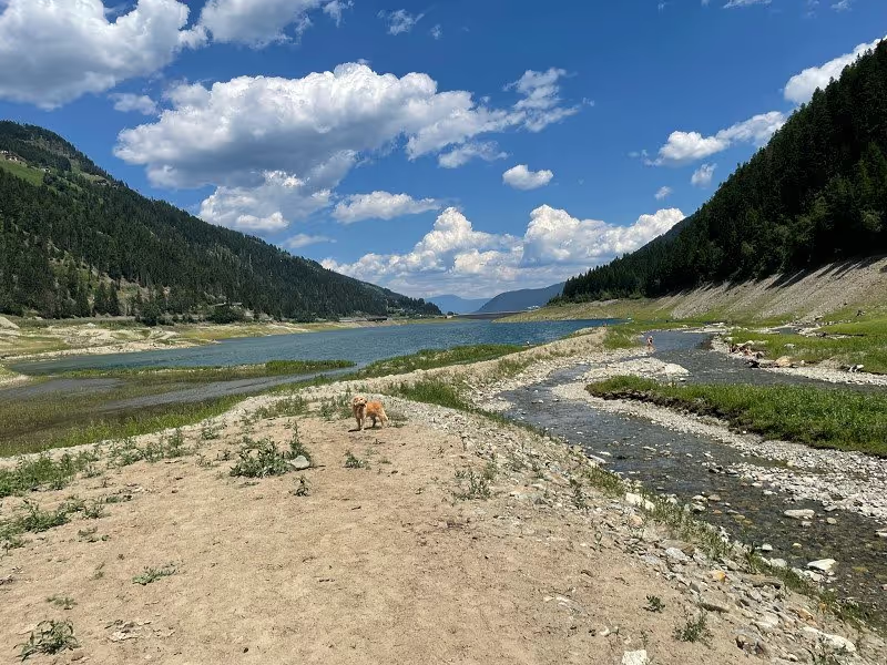
You should not necessarily drive this route with larger motorhomes. There are even more accessible river bathing spots in Corsica.
Suare, 20214 Calenzana, Frankreich
42° 29' 20.8" N 8° 47' 45.4" E
42.4891250 8.7959479
• Head southeast on Hameau de Suare. Go for 47 m.
• Turn right onto Hameau de Suare. Go for 218 m.
• Turn left onto D81. Go for 16.3 km.
• Turn left onto D81. Go for 539 m.
• Turn right onto D351. Go for 939 m.
• Turn right onto Lieu-dit Fontanaccia (D351). Go for 2.3 km.
• Keep right onto D351. Go for 354 m.
• Arrive at D351. Your destination is on the right.
☍
20,7 km
( 21 min.)
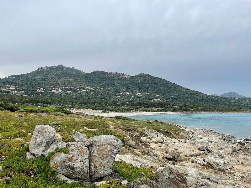
Free Paking Galeria, Galéria, Frankreich
Very nice parking space with a nice beach and a great sunset. In the evening a city official comes to collect money - 20€/N, just a parking space
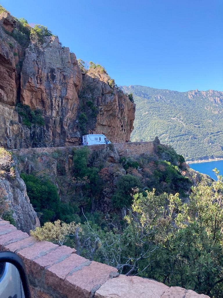
We left at 8:30 a.m. to get to the mountain route early. The route was easy to drive with our motorhome. However, everyone should decide for themselves whether they want to do the tour. It can get very tight and you should always be fully concentrated. Enjoying the beautiful landscape is the responsibility of the passenger.
20245 Galéria, Frankreich
42° 24' 46.8" N 8° 38' 49" E
42.4130083 8.6469506
• Head toward Route de la Mer on D351. Go for 354 m.
• Continue on Lieu-dit Fontanaccia (D351). Go for 2.3 km.
• Turn left onto D351. Go for 939 m.
• Continue on D81. Go for 45.5 km.
• Arrive at D81. Your destination is on the right.
☍
49,1 km
(1 hrs. 6 min.)
Day
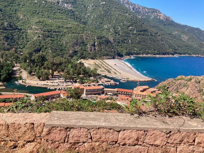
Porto, Ota, Frankreich
Camping municipal d'Ota Porto
Real mountain campsite with simple facilities, €22.50/night
At 9 a.m. we left for the onward journey. The day before we explored the route by bike until just before Piana. It seemed more demanding to us than from Galeria to Porto. In particular, the many groups of bikes riding close together pose a challenge when overtaking.
Porto, 20150 Ota, Frankreich
42° 15' 57.5" N 8° 42' 21.3" E
42.2659670 8.7059240
• Head southeast on D81. Go for 699 m.
• Turn right onto Lieu-dit Le Pont de Porto (D81). Go for 41.7 km.
• Take the 1st exit from roundabout onto D81. Go for 1.0 km.
• Take the 1st exit from roundabout onto D81. Go for 11.1 km.
• Turn right. Go for 249 m.
• Turn right. Go for 159 m.
• Keep right. Go for 210 m.
• Turn left. Go for 47 m.
• Turn left. Go for 31 m.
• Turn left. Go for 33 m.
• Arrive at your destination on the right.
☍
55,3 km
(1 hrs. 5 min.)
Day
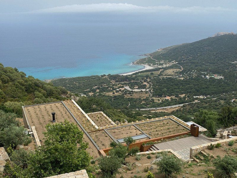
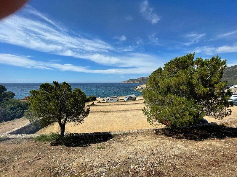
A Marina, Golfe de la Liscia, Calcatoggio, Frankreich
The route from Porto to Piana is very winding, but great rock formations and views.
For 28€/N without electricity, electricity should cost 4€/N
Strong wind, high waves
Golfe de la Liscia, 20111 Calcatoggio, Frankreich
42° 2' 52.3" N 8° 44' 56.9" E
42.0478605 8.7491298
• Head south. Go for 12 m.
• Turn right. Go for 56 m.
• Turn right. Go for 152 m.
• Turn right. Go for 369 m.
• Turn left toward D81. Go for 249 m.
• Turn right onto D81. Go for 11.7 km.
• Take the 3rd exit from roundabout onto D81. Go for 3.3 km.
• Pass 2 roundabouts and continue on D81. Go for 3.5 km.
• Take the 3rd exit from roundabout onto D31. Go for 614 m.
• Pass 3 roundabouts and continue on D31. Go for 1.8 km.
• Turn right toward D31. Go for 31 m.
• Take the 3rd exit from roundabout onto Boulevard Louis Campi. Go for 437 m.
• Continue on Boulevard Louis Campi. Go for 380 m.
• Take the 2nd exit from roundabout onto Boulevard Sebastianu Costa. Go for 356 m.
• Take the 3rd exit from Rond-Point du Finosello roundabout onto Boulevard Sebastianu Costa. Go for 448 m.
• Take the 3rd exit from roundabout onto Boulevard Abbé Recco. Go for 548 m.
• Take the 3rd exit from roundabout onto Chemin de la Croix d'Alexandre (D61). Go for 227 m.
• Continue on D61. Go for 11 m.
• Continue on Résidence Pauline Bonaparte (D61). Go for 66 m.
• Continue on Résidence Laetitia Ramolino (D61). Go for 26 m.
• Continue on Rue Colonel et Commandant Biancamaria (D61). Go for 174 m.
• Continue on Montée Saint-Jean (D61). Go for 308 m.
• Turn right onto Cours Napoléon (T21). Go for 1.4 km.
• Turn right onto Place du Général de Gaulle (D11). Go for 145 m.
• Continue on Place du Diamant (D11). Go for 70 m.
• Turn left onto Avenue du Docteur Ramaroni. Go for 105 m.
• Take the 1st exit from roundabout onto Boulevard Lantivy (D111). Go for 654 m.
• Continue on Boulevard Albert 1er (D111). Go for 444 m.
• Continue on Cours Lucien Bonaparte (D111). Go for 670 m.
• Continue on Boulevard Stéphanopoli de Comène (D111). Go for 764 m.
• Pass 2 roundabouts and continue on Boulevard Stéphanopoli de Comène (D111). Go for 1.8 km.
• Turn right onto Chemin des Lentisques. Go for 225 m.
• Turn left onto Chemin des Lentisques. Go for 260 m.
• Arrive at Chemin des Lentisques. Your destination is on the left.
☍
31,3 km
( 40 min.)
Day
Day
Chemin des Lentisques, 20000 Ajaccio, Frankreich
Camping le Barbicaja, a very nice terraced campsite about 5 km from the center of Ajaccio by the sea, €22.50 without electricity
You should definitely visit Ajaccio. A very lively and lively city that has its charm. Not least because one always has the feeling that Napoleon is about to turn the corner.
In 2019 we went into town by motorbike. This time with the bikes. Both are an experience.
Chem. des Lentisques, 20000 Ajaccio, Frankreich
41° 54' 38.1" N 8° 41' 7.3" E
41.9105889 8.6853542
• Head northeast on Chemin des Lentisques. Go for 260 m.
• Turn right onto Chemin des Lentisques. Go for 225 m.
• Turn left onto Route des Sanguinaires (D111). Go for 1.2 km.
• Pass 2 roundabouts and continue on Boulevard Stéphanopoli de Comène (D111). Go for 1.4 km.
• Continue on Cours Lucien Bonaparte (D111). Go for 670 m.
• Continue on Boulevard Albert 1er (D111). Go for 444 m.
• Continue on Boulevard Lantivy (D111). Go for 641 m.
• Take the 1st exit from roundabout onto Boulevard Lantivy (D111). Go for 215 m.
• Continue on Boulevard Pascal Rossini. Go for 206 m.
• Continue on Boulevard Danielle Casanova. Go for 350 m.
• Continue on Quai de la République. Go for 137 m.
• Continue on Square Elisa (D111 AE). Go for 248 m.
• Continue on Boulevard Sampiero (D111 AE). Go for 453 m.
• Take the 2nd exit from Place Pierre Colonna d'Istria roundabout onto Route du Bord de Mer toward N193/Calvi/Bastia/Bonifacio/Sartène/Aéroport Napoléon Bonaparte/Port Charles Ornano. Go for 1.5 km.
• Continue on Cours du Prince Impérial (T21). Go for 767 m.
• Take the 2nd exit from roundabout onto Route d'Aspretto (T21) toward Calvi/Bastia/Bonifacio/Sartène/Aéroport Napoléon Bonaparte/Z.I. du Vazzio. Go for 371 m.
• Pass 3 roundabouts and continue on T21. Go for 3.4 km.
• Keep left toward Bonifacio. Go for 487 m.
• Continue on T40. Go for 3.3 km.
• Take the 1st exit from roundabout onto T40 toward Bonifacio/Cauro/Porticcio. Go for 212 m.
• Take the 2nd exit from roundabout onto T40 toward Bonifacio/Sartène/Cauro. Go for 1.0 km.
• Turn right onto D302 toward Cognocoli/Monticchi/Pila Canali/Bisina/Filitosa. Go for 10.0 km.
• Turn right onto D255. Go for 3.8 km.
• Turn left onto D255. Go for 1.6 km.
• Continue on Lieu-dit Cilvarccio (D255). Go for 168 m.
• Continue on D255. Go for 504 m.
• Turn right onto D55. Go for 2.7 km.
• Continue on Lieu-dit Gradeddu (D55). Go for 218 m.
• Continue on D55. Go for 367 m.
• Turn left onto D355. Go for 5.9 km.
• Continue on Lieu-dit Furellu (D355). Go for 118 m.
• Continue on D355. Go for 540 m.
• Continue on Lieu-dit Colliciola (D355). Go for 96 m.
• Continue on D355. Go for 563 m.
• Continue on Lieu-dit Zivignola (D355). Go for 138 m.
• Continue on D355. Go for 1.8 km.
• Turn right onto D355. Go for 2.5 km.
• Continue on Lieu-dit Teghia (D355). Go for 86 m.
• Continue on D355. Go for 513 m.
• Turn right onto Lieu-dit Favaledda (D757). Go for 1.5 km.
• Continue on D757. Go for 450 m.
• Continue on Lieu-dit Arbarossa (D757). Go for 532 m.
• Continue on D757. Go for 1.1 km.
• Arrive at D757. Your destination is on the left.
☍
52,8 km
(1 hrs. 5 min.)
Day
Porto Pollo, Serra-di-Ferro, Frankreich
Camping Cyrnos, 28€/N without electricity, electricity 4€
Have been here in 2019, simple but great CP, right on the sea, kite and surfing area
Porto Pollo, 20140 Serra-di-Ferro, Frankreich
41° 42' 39.8" N 8° 47' 49" E
41.7110550 8.7969530
• Head east on D757. Go for 1.1 km.
• Continue on Lieu-dit Arbarossa (D757). Go for 532 m.
• Continue on D757. Go for 1.9 km.
• Turn left onto D355. Go for 513 m.
• Continue on Lieu-dit Teghia (D355). Go for 86 m.
• Continue on D355. Go for 2.5 km.
• Turn left onto D355. Go for 1.2 km.
• Turn left toward D155. Go for 222 m.
• Turn right onto D155. Go for 52 m.
• Turn left onto D155 A. Go for 2.3 km.
• Continue on Lieu-dit Cuppabia (D155 A). Go for 819 m.
• Turn right onto D155 A. Go for 43 m.
• Turn slightly left onto Lieu-dit Cuppabia (D155 A). Go for 9 m.
• Turn slightly right onto Lieu-dit Cuppabia. Go for 73 m.
• Arrive at Lieu-dit Cuppabia. Your destination is on the right.
☍
11,3 km
( 20 min.)
Day
Day
Day
Camping Cupabia
Super located CP right on the Caribbean beach. It is advertised as low-budget camping, but this refers to the equipment and not the price. 32 €/N without electricity for the three of us is a steep price, but the location excuses everything.
From here you can make great hikes and trips by SUP or boat. A coastal hike to a nearby Genoese tower is also an experience. But you can also just enjoy the beach!
Cupabia, 20140, Serra-Di-Ferro, Frankreich
41° 44' 14.6" N 8° 47' 3.8" E
41.7373900 8.7844000
• Head northwest on Lieu-dit Cuppabia. Go for 73 m.
• Turn right onto Lieu-dit Cuppabia (D155 A). Go for 845 m.
• Continue on D155 A. Go for 2.3 km.
• Turn right onto D155. Go for 52 m.
• Turn left toward D355. Go for 222 m.
• Turn right onto D355. Go for 1.2 km.
• Turn right onto D355. Go for 2.5 km.
• Continue on Lieu-dit Teghia (D355). Go for 86 m.
• Continue on D355. Go for 513 m.
• Turn right onto Lieu-dit Favaledda (D757). Go for 216 m.
• Turn left onto D157. Go for 4.1 km.
• Take the 1st exit from roundabout onto Lieu-dit Abbartello (D157). Go for 6.5 km.
• Turn right onto T40. Go for 3.1 km.
• Take the 2nd exit from roundabout onto T40 toward Sartène/Bonifacio/Aéroport Figari. Go for 2.5 km.
• Take the 2nd exit from roundabout onto T40 toward Bonifacio/Sartène/Aéroport Figari. Go for 10.4 km.
• Turn right onto Rue Joseph Tramoni toward T40/Bonifacio/Porto Vecchio. Go for 21 m.
• Turn right onto U Strittonu (C1) toward Bonifacio/Porto Vecchio. Go for 205 m.
• Turn right onto Rue du 1er Bataillon de Choc (T40) toward Bonifacio/Porto Vecchio. Go for 36.1 km.
• Turn left onto D859 toward Porto Vecchio/Aéroport Figari/Sotta. Go for 2.8 km.
• Take the 2nd exit from roundabout onto D322 toward Aéroport Figari/Poggiale. Go for 1.4 km.
• Take the 1st exit from roundabout onto D322 A. Go for 1.1 km.
• Take the 2nd exit from roundabout onto Route de Porto-Vecchio (D859). Go for 8.7 km.
• Pass 3 roundabouts and continue on D859. Go for 7.4 km.
• Take the 2nd exit from roundabout onto Route de Piccovaggia toward Palombaggia Par Piccovaggia. Go for 8.2 km.
• Continue on Route de Palombaggia. Go for 2.6 km.
• Arrive at Route de Palombaggia.
☍
102,9 km
(1 hrs. 50 min.)
Day
Day
Day
Day
I PINI, Plage de Palombaggia, Porto-Vecchio, Frankreich
Everything you need for 10€/N, cold shower, no electricity, camping under pine trees 100m from the beach, beach very touristy but beautiful
Plage de Palombaggia, 20137 Porto-Vecchio, Frankreich
41° 33' 34.9" N 9° 20' 8.1" E
41.5596807 9.3355817
• Head southwest on Route de Palombaggia. Go for 5.7 km.
• Continue on Lieu-dit Bocca di l'Oru. Go for 283 m.
• Turn left onto Lieu-dit Bocca di l'Oru. Go for 372 m.
• Continue toward T10. Go for 1.3 km.
• Take the 3rd exit from roundabout onto T10. Go for 19.6 km.
• Take the 3rd exit from roundabout onto Avenue Sylver Bohn (T40) toward Bonifacio/Centre-Ville. Go for 2.1 km.
• Arrive at Avenue Charles de Gaulle (T40). Your destination is on the left.
☍
29,3 km
( 33 min.)
Day
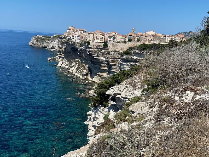
Bonifacio, Bonifacio, Frankreich
We then decided to visit Bonifacio and are the 25 km back. It was worth it! We parked for €12 in a parking lot in the direction of Capo Pertusato.
Korsika, 20169 Bonifacio, Frankreich
41° 23' 13.1" N 9° 9' 38.7" E
41.3869632 9.1607556
• Head east on Avenue Charles de Gaulle (T40). Go for 514 m.
• Turn right onto Rue Paul Nicolai (D58). Go for 185 m.
• Turn left toward Avenue Sylvère Bohn/T40. Go for 315 m.
• Turn right onto Avenue Sylvère Bohn (T40) toward Ajaccio/Bastia/Porto Vecchio. Go for 1.4 km.
• Take the 1st exit from roundabout onto T10 toward Porto Vecchio/Bastia. Go for 19.6 km.
• Pass 4 roundabouts and continue on T10. Go for 3.5 km.
• Take the 2nd exit from roundabout onto T10 toward Bastia/Calvi. Go for 598 m.
• Pass 5 roundabouts and continue on T10. Go for 3.6 km.
• Take the 3rd exit from roundabout onto Avenue de Bastia (T10) toward Bastia/Calvi/Solenzara. Go for 2.5 km.
• Take the 3rd exit from roundabout onto T10 toward Bastia/Calvi/Solenzara. Go for 5.9 km.
• Pass 3 roundabouts and continue on T10. Go for 32.1 km.
• Turn left onto D845 toward Solaro. Go for 122 m.
• Continue on Lieu-dit Pozzone (D845). Go for 85 m.
• Continue on D845. Go for 1.7 km.
• Continue on Lieu-dit Pianiccia (D845). Go for 145 m.
• Continue on D845. Go for 1.3 km.
• Continue on Lieu-dit Punta (D845). Go for 67 m.
• Continue on D845. Go for 3.2 km.
• Continue on Lieu-dit Arinella (D845). Go for 126 m.
• Continue on D845. Go for 535 m.
• Turn left toward Lieu-dit Tribbiu/D845. Go for 384 m.
• Turn left onto Lieu-dit Tribbiu (D845). Go for 337 m.
• Turn slightly right onto Lieu-dit Pianellu (D845). Go for 63 m.
• Continue on D845. Go for 709 m.
• Arrive at D845. Your destination is on the right.
☍
79,0 km
(1 hrs. 30 min.)
Solaro, Frankreich
Camping la Cote des Nacres, from Park for night, 30€ without electricity, beautifully situated right on the beach
20240 Solaro, Frankreich
41° 54' 17" N 9° 19' 36.5" E
41.9047310 9.3267940
• Head southeast on D845. Go for 709 m.
• Turn left onto Lieu-dit Pianellu (D845). Go for 63 m.
• Turn slightly left onto Lieu-dit Tribbiu (D845). Go for 337 m.
• Turn right toward D845. Go for 384 m.
• Turn right onto D845. Go for 535 m.
• Continue on Lieu-dit Arinella (D845). Go for 126 m.
• Continue on D845. Go for 3.2 km.
• Continue on Lieu-dit Punta (D845). Go for 67 m.
• Continue on D845. Go for 1.3 km.
• Continue on Lieu-dit Pianiccia (D845). Go for 145 m.
• Continue on D845. Go for 1.7 km.
• Continue on Lieu-dit Pozzone (D845). Go for 85 m.
• Continue on D845. Go for 117 m.
• Turn right onto T10. Go for 3.7 km.
• Take the 1st exit from roundabout onto D268 toward Col de Bavella/Zonza. Go for 9.8 km.
• Arrive at D268. Your destination is on the right.
☍
22,2 km
( 35 min.)
Day
Day
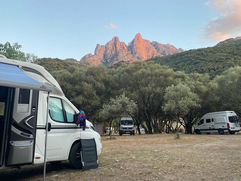
Camping U Ponte Grossu, Sari-Solenzara, Frankreich
Super beautifully located CP directly on the Solenzara river, 29 €/N without electricity, record flat rate electricity for 6 €
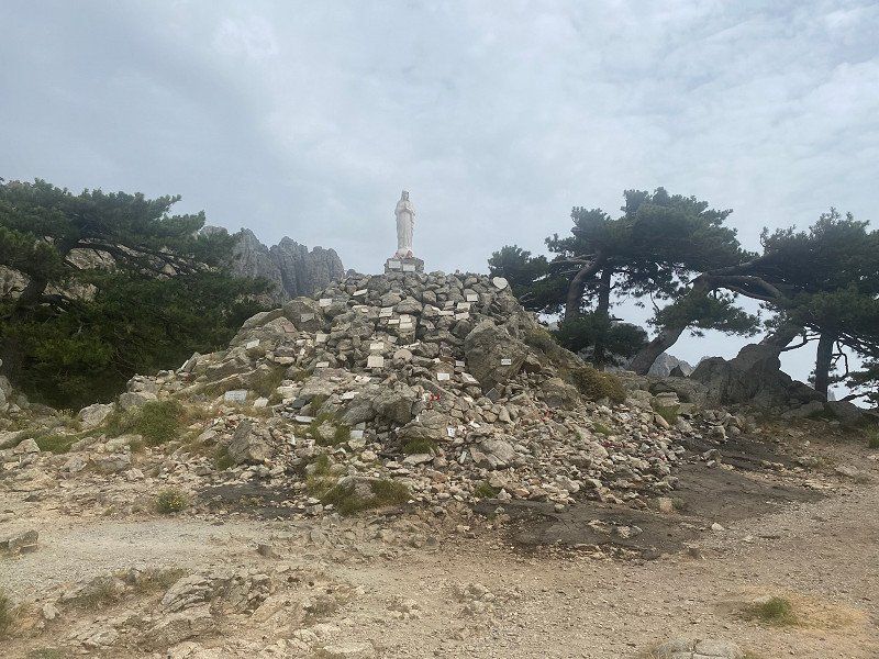
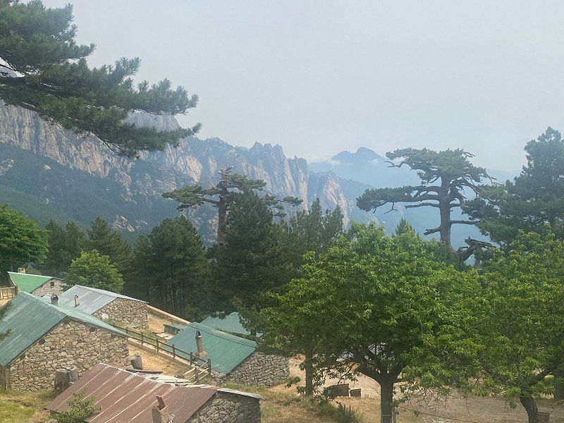
From here we climbed the COL de Bavella at 1280m by bike. We needed a little more than an hour for the 20 km, and the battery capacity of our bikes reached its limits. Nevertheless - a great but strenuous tour with beautiful views of the mountains.
Unfortunately, the stay on the CP was clouded by adjacent road construction work.
Route Bavella, 20145 Sari-Solenzara, Frankreich
41° 50' 4.6" N 9° 19' 20.5" E
41.8346070 9.3223530
• Head northwest on D268. Go for 28.4 km.
• Continue on D368. Go for 456 m.
• Turn left toward Lieu-dit Casanova. Go for 71 m.
• Turn left onto Lieu-dit Casanova. Go for 296 m.
• Arrive at Lieu-dit Casanova. Your destination is on the left.
☍
29,3 km
( 47 min.)
Day
Day
Zonza, Frankreich
Camping Bavella Vista, 500m from the center, for 20€/N incl. everything quite cheap
41° 44' 58.7" N 9° 10' 18.8" E
41.7496260 9.1718870
• Head toward Quartier Valdo on Lieu-dit Casanova. Go for 367 m.
• Turn left onto D368. Go for 12.9 km.
• Turn left. Go for 19 m.
• Turn right. Go for 29 m.
• Arrive at your destination on the left.
☍
13,3 km
( 17 min.)
Day
Day
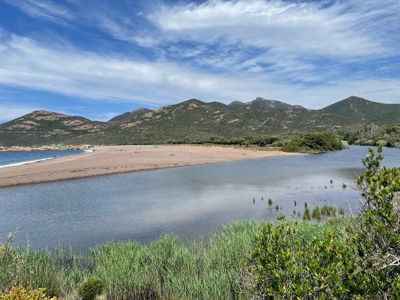
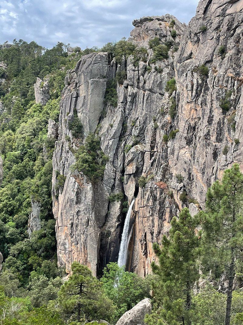
La cascade de piscia di gallu, San-Gavino-di-Carbini, Frankreich
Very nice hike to the pissing rooster, about 90 minutes there and back, parking lot €5, you could also spend the night here
20170 San-Gavino-di-Carbini, Frankreich
41° 41' 16.2" N 9° 12' 0.1" E
41.6878284 9.2000394
• Head northeast. Go for 29 m.
• Turn left toward D368. Go for 19 m.
• Turn left onto D368. Go for 23.4 km.
• Take the 3rd exit from roundabout onto T10 toward Bastia/Calvi/Solenzara. Go for 849 m.
• Take the 3rd exit from roundabout onto Avenue de Bastia (T10) toward Bastia/Calvi/Solenzara. Go for 2.5 km.
• Take the 1st exit from roundabout onto D468 toward St Cyprien/Cala Rossa. Go for 678 m.
• Continue on Route de Cala Rossa (D468). Go for 231 m.
• Continue on D468. Go for 80 m.
• Take the 2nd exit from roundabout onto Route du Stagnolu (D468). Go for 2.3 km.
• Continue on Route d'Alzetu (D468). Go for 503 m.
• Continue on D468. Go for 160 m.
• Take the 2nd exit from roundabout onto Résidence U Re d'Alzetu (D468). Go for 348 m.
• Continue on D468. Go for 472 m.
• Take the 2nd exit from roundabout onto D468. Go for 1.5 km.
• Continue on Lieu-dit Baca (D468). Go for 189 m.
• Continue on D468. Go for 238 m.
• Continue on Lieu-dit Ferrulajolo (D468). Go for 183 m.
• Continue on Lieu-dit Ferrulaghjolu (D468). Go for 158 m.
• Continue on D468. Go for 577 m.
• Continue on Lieu-dit Foce (D468). Go for 144 m.
• Continue on D468. Go for 168 m.
• Continue on Lieu-dit Pascialella (D468). Go for 97 m.
• Continue on D468. Go for 19 m.
• Continue on Lieu-dit Fiori (D468). Go for 208 m.
• Continue on D468. Go for 109 m.
• Continue on Lieu-dit Teghine (D468). Go for 169 m.
• Continue on D468. Go for 364 m.
• Continue on Lieu-dit Bacca (D468). Go for 515 m.
• Continue on D468. Go for 899 m.
• Continue on Lieu-dit Vitriccia (D468). Go for 80 m.
• Continue on D468. Go for 169 m.
• Turn right toward Lieu-dit California. Go for 1.6 km.
• Turn right onto Lieu-dit California. Go for 47 m.
• Arrive at Lieu-dit California. Your destination is on the right.
☍
39,0 km
( 52 min.)
Camping California, Zonza, Frankreich
Campsite for young families with small children, 32.40€/N complete, very clean and with a private beach
Capu di Fora Pinarello, 20144 Zonza, Frankreich
41° 39' 59.3" N 9° 22' 47.4" E
41.6664709 9.3798357
• Head northeast on Lieu-dit California. Go for 47 m.
• Turn left toward D468. Go for 1.6 km.
• Turn right onto D468. Go for 801 m.
• Turn left onto D168 A. Go for 3.0 km.
• Continue on Lieu-dit Grazzosu (D168 A). Go for 117 m.
• Continue on D168 A. Go for 429 m.
• Take the 2nd exit from roundabout onto D168 A. Go for 95 m.
• Turn right onto T10. Go for 23.9 km.
• Pass 11 roundabouts and continue on T10. Go for 72.0 km.
• Take the 3rd exit from roundabout onto Route d'Orezza (D506) toward La Porta/Piedicroce. Go for 6.5 km.
• Arrive at D506. Your destination is on the left.
☍
108,3 km
(1 hrs. 50 min.)
Day
Day
20213 Casette, Pruno, France
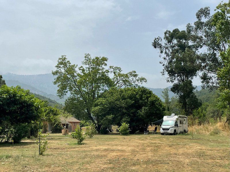
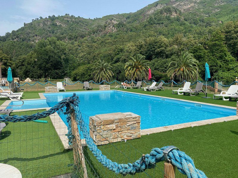
CP Cascades, super located, with pool and pool, for 21€/N without electricity.
The lady of the house offers Corsican food. For €25 we enjoyed a three-course meal with wine. Absolute top!
We have been warmly welcomed here. If you love a more personal atmosphere, this is the place for you.
Casette, 20213 Pruno, Frankreich
42° 26' 1.7" N 9° 26' 56.6" E
42.4337938 9.4490667
• Head toward Lieu-dit Casette on D506. Go for 6.4 km.
• Take the 3rd exit from roundabout onto T10 toward Bastia/Casamozza/Querciolo. Go for 3.4 km.
• Pass 2 roundabouts and continue on Lieu-dit Chiosu di a Croce (T10). Go for 4.1 km.
• Take the 2nd exit from roundabout onto T11 toward Vescovato-Arena/Bastia/Aéroport Poretta/La Mer. Go for 1.3 km.
• Pass 2 roundabouts and continue on T11. Go for 14.8 km.
• Take the 3rd exit from roundabout onto T11 toward Bastia. Go for 2.6 km.
• Turn left toward Avenue Sampiero Corso/T11. Go for 423 m.
• Continue on Avenue Sampiero Corso (T11). Go for 843 m.
• Keep right onto Avenue Sampiero Corso (T11). Go for 637 m.
• Keep right onto Avenue Sampiero Corso (T11) toward Le Port/Centre Ville. Go for 777 m.
• Keep left onto T11 toward Centre Ville/Le Port. Go for 3.2 km.
• Keep left toward Rue Chanoine Leschi. Go for 207 m.
• Continue on Rue Chanoine Leschi. Go for 230 m.
• Keep right. Go for 34 m.
• Arrive at your destination on the left.
☍
39,0 km
( 43 min.)
Day
Day
Day
Porto di Bastia, Quai Nouveau Port de Commerce, Bastia, Frankreich
It's time to say goodbye to Corsica. A great four weeks are behind us. We'll definitely be back.
Quai Nouveau Port de Commerce, 20200 Bastia, Frankreich
42° 42' 17.6" N 9° 27' 15.5" E
42.7048975 9.4543010
• Head north. Go for 195 m.
• Turn right. Go for 129 m.
• Turn right. Go for 230 m.
• Take the Bastia-Livorno Ferry. Stay on for 121 km.
• Head toward Piazza del Portuale on Calata Siena. Go for 135 m.
• Continue on Piazza del Portuale. Go for 174 m.
• Turn left onto Calata Carrara. Go for 23 m.
• Take the 1st exit from roundabout onto Via Andrea Costa. Go for 158 m.
• Take the 4th exit from roundabout onto Via Andrea Costa. Go for 208 m.
• Arrive at Via Andrea Costa.
☍
122,0 km
(3 hrs. 35 min.)
Livorno Imbarco Traghetti Moby Lines, Via Guido Donegani, Livorno, Italien
We're back on the mainland!
Via Guido Donegani, 57100 Livorno LI, Italien
43° 33' 20.4" N 10° 18' 10.7" E
43.5556712 10.3029840
• Head southwest on Via Andrea Costa. Go for 29 m.
• Take the 2nd exit from roundabout onto Via Andrea Costa. Go for 177 m.
• Take the 1st exit from roundabout onto Via Andrea Costa. Go for 345 m.
• Take the 1st exit from roundabout onto Via Guido Donegani toward Autostrada. Go for 646 m.
• Continue on Via Enrico Mattei toward Autostrada. Go for 1.1 km.
• Turn right onto Via Leonardo da Vinci (SP224) toward Varco Galvani/Autostrade/S.G.C. Go for 1.5 km.
• Keep left toward Darsena Toscana/Autostrada/A12/Pisa/SS1. Go for 393 m.
• Take ramp onto Strada di Grande Comunicazione Fi-Pi-Li toward Autostrade/A11/A12/S.G.C. Firenze/Pisa/SS1/Aurelia. Go for 76.9 km.
• Take ramp onto A1 (Viadotto Arno) toward E35/Bologna-Roma/E74/Pisa Nord/A11/E80/Genova-Livorno/A12/Bologna. Go for 25.8 km.
• Keep right onto A1var toward Bologna/Barberino. Go for 522 m.
• Take the exit toward Barberino. Go for 586 m.
• Take the 3rd exit from roundabout onto Strada Provinciale di Bilancino (SP131) toward Barberino M.Llo. Go for 2.0 km.
• Take ramp toward Cavallina. Go for 266 m.
• Continue on Viale Giacomo Matteotti (SP8). Go for 253 m.
• Take the 2nd exit from Viale Giacomo Matteotti roundabout onto Viale Giacomo Matteotti (SP8) toward Centro/Montecarelli/Montepiano/S. Quirico di Vernio. Go for 426 m.
• Take the 1st exit from roundabout onto Viale Antonio Gramsci. Go for 454 m.
• Arrive at Viale Antonio Gramsci. Your destination is on the right.
☍
111,4 km
(1 hrs. 16 min.)
Day
Via del Lago, 3, 50031 Barberino di Mugello, Florenz, Italien
Very nice and well-equipped pitch near a lake, 15€/N full service
Via del Lago, 3, 50031 Barberino di Mugello FI, Italien
43° 59' 21.6" N 11° 14' 25.3" E
43.9893258 11.2403580
• Head north on Viale Antonio Gramsci. Go for 423 m.
• Take the 2nd exit from roundabout onto Viale Giacomo Matteotti (SP8) toward Centro/S. Quirico di Vernio/Montecarelli/Montepiano. Go for 462 m.
• Take the 3rd exit from Viale Giacomo Matteotti roundabout onto Viale Giacomo Matteotti (SP8) toward Galliano/S.Piero a Sieve/Calenzano/Firenze/Autostrade. Go for 135 m.
• Take ramp onto Strada Provinciale di Bilancino (SP131) toward Fi-Bo/A1. Go for 1.9 km.
• Take the 1st exit from roundabout onto A1var toward Bologna. Go for 38.8 km.
• Continue on A1 (Autostrada del Sole). Go for 63.7 km.
• Take the exit toward Brennero onto A22 (Autostrada del Brennero). Go for 211 km.
• Take the exit toward Egna/Ora/Termeno/Neumarkt/Auer/Tramin. Go for 977 m.
• Take the 1st exit from roundabout onto Strada Provinciale Autostrada-Termeno (SP16) toward Trami/Termeno/Kurtatsch/Cortaccia/Kaltern/Caldaro/Industriegebiet am Bahnhof/Industriegebiet Obere Insel/Zona Industriale Isola di Sopra. Go for 1.4 km.
• Take the 1st exit from roundabout onto Strada Provinciale Autostrada-Termeno (SP16) toward Trami/Termeno/Kurtatsch/Cortaccia/Kaltern/Caldaro. Go for 1.0 km.
• Take the 1st exit from roundabout onto Strada Provinciale Caldaro-Roverè della Luna (SP14) toward Kaltern/Caldaro. Go for 2.5 km.
• Pass 2 roundabouts and continue on Strada Provinciale Caldaro-Roverè della Luna (SP14). Go for 3.6 km.
• Turn right onto Località San Giuseppe al Lago. Go for 24 m.
• Turn slightly left onto Località San Giuseppe al Lago. Go for 15 m.
• Continue on Località San Giuseppe al Lago. Go for 53 m.
• Continue on Via Spiegel. Go for 537 m.
• Continue on Località San Giuseppe al Lago. Go for 146 m.
• Turn right onto San Giuseppe al Lago. Go for 53 m.
• Arrive at San Giuseppe al Lago. Your destination is on the left.
☍
326,9 km
(2 hrs. 50 min.)
Day
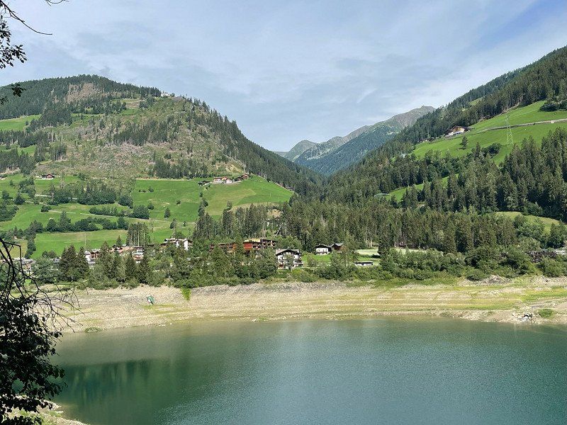
San Giuseppe al Lago, 19, 39052 San Giuseppe al Lago, Autonome Provinz Bozen - Südtirol, Italien
We actually wanted to go to Camping Gretl on Lake Caldaro. But the place was very crowded and dogs not allowed.
That's why we drove to the parking space above the campsite. This has a very good and new equipment. For €30/N without electricity, not exactly a snap, but ok for South Tyrol.
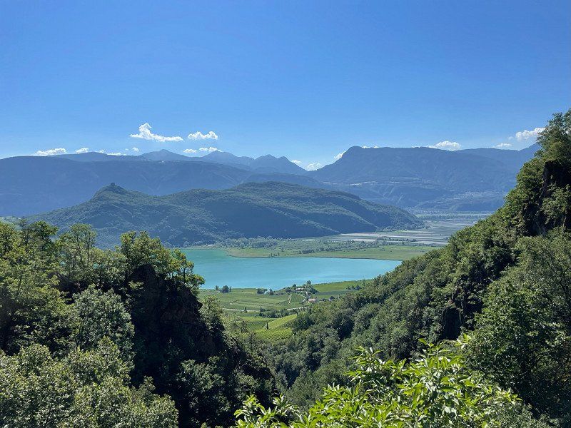
The area around Lake Caldaro is very touristy and there is no possibility to swim in the lake with the dog. In addition, the lake water was very warm and you had to pay an entrance fee everywhere to get to the lake.
We cycled the 7 km to Kaltern. The place is quite nice.
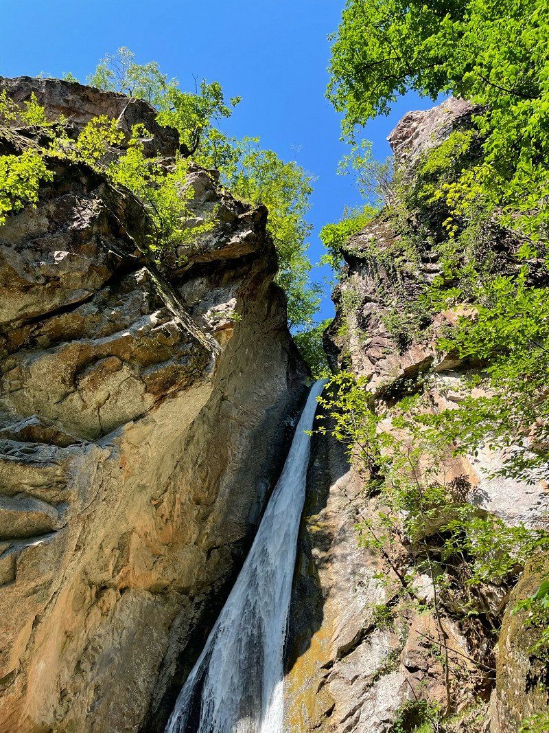
On the 2nd day we made a very nice hike to the Rastenbach Gorge. The tour takes about 2.5 hours. You will be rewarded with a very beautiful waterfall.
S. Giuseppe al Lago, 19, 39052 Seestrasse BZ, Italien
46° 22' 55.3" N 11° 15' 28.2" E
46.3820409 11.2578340
• Head west on San Giuseppe al Lago. Go for 53 m.
• Turn right onto Località San Giuseppe al Lago. Go for 161 m.
• Turn right onto Località San Giuseppe al Lago. Go for 184 m.
• Turn left onto Località San Giuseppe al Lago. Go for 216 m.
• Turn left onto Località San Giuseppe al Lago. Go for 109 m.
• Turn right onto Strada Provinciale Caldaro-Roverè della Luna (SP14). Go for 2.4 km.
• Pass 3 roundabouts and continue on Strada Provinciale Caldaro-Roverè della Luna (SP14). Go for 10.2 km.
• Turn left and take ramp onto MeBo (SS38) toward Terlan/Terlano/Meran/Merano. Go for 16.7 km.
• Take ramp toward Lana/Meran/Merano. Go for 269 m.
• Turn left onto Strada Provinciale Postal-Lana (SP69) toward Lana. Go for 645 m.
• Take the 2nd exit from roundabout onto Via Max Valier. Go for 285 m.
• Continue on Via Bolzano. Go for 1.1 km.
• Take the 1st exit from roundabout onto Via Andreas Hofer toward Centro/Meran/Merano. Go for 894 m.
• Turn right onto Via Madonna del Suffragio. Go for 247 m.
• Take the 1st exit from roundabout onto Via Madonna del Suffragio (SS238) toward Cermes/Merano/Bolzano/Tscherms/Meran/Bozen. Go for 333 m.
• Take the 2nd exit from roundabout onto Via Ultimo toward St. Pankraz/S.Pancrazio/St. Walburg/S. Valburga/Proveis/Proves/Laurein/Lauregno. Go for 11.3 km.
• Turn right onto Galleria Kofl. Go for 1.0 km.
• Continue on Via Oberpichl (SP9). Go for 2.8 km.
• Continue on Frazione Santa Valburga (SP9). Go for 3.0 km.
• Continue on Frazione Santa Valburga (SP9). Go for 569 m.
• Continue on Frazione Santa Valburga (SP9). Go for 80 m.
• Continue on Frazione Santa Valburga (SP9). Go for 203 m.
• Turn slightly left onto Frazione Santa Valburga (SP9). Go for 78 m.
• Continue on Frazione Santa Valburga (SP9). Go for 88 m.
• Continue on Strada Provinciale Val d'Ultimo (SP9). Go for 98 m.
• Continue on Frazione Santa Valburga (SP9). Go for 2.8 km.
• Arrive at Località Pracupola (SP9). Your destination is on the right.
☍
55,7 km
(1 hrs. )
Day
Day
Località Pracupola, 361, 39016 Ulten, Autonome Provinz Bozen - Südtirol, Italy
Stellplatz Adlerhorst, near the reservoir, 30 € / N complete, new and very well-kept facility. Super nice couple who have prepared the place well and are always happy to help with words and deeds.
Località Pracupola, 361, 39016 Ultimo BZ, Italien
46° 31' 54.3" N 10° 57' 47.1" E
46.5317420 10.9630829
• Head east on Località Pracupola (SP9). Go for 2.8 km.
• Continue on Strada Provinciale Val d'Ultimo (SP9). Go for 98 m.
• Continue on Frazione Santa Valburga (SP9). Go for 88 m.
• Continue on Frazione Santa Valburga (SP9). Go for 78 m.
• Turn slightly right onto Frazione Santa Valburga (SP9). Go for 852 m.
• Continue on Frazione Santa Valburga (SP9). Go for 144 m.
• Turn slightly right onto Frazione Santa Valburga (SP9). Go for 2.4 km.
• Continue on Frazione Santa Valburga (SP9). Go for 443 m.
• Continue on Frazione Santa Valburga (SP9). Go for 2.8 km.
• Turn left onto Galleria Kofl. Go for 1.0 km.
• Continue on Strada Provinciale Val d'Ultimo (SP9). Go for 11.2 km.
• Take the 2nd exit from roundabout onto Via Merano (SS238) toward Tscherms/Cermes/Marling/Marengo/Meran/Merano/Bozen/Bolzano. Go for 771 m.
• Take the 1st exit from roundabout onto Via Max Valier (SP101). Go for 1.6 km.
• Take the 1st exit from roundabout onto Via Max Valier (SP101). Go for 814 m.
• Continue on Industriezone Lana Landstraße (SP101). Go for 12 m.
• Turn left onto Industriezone Lana Landstraße (SP101). Go for 55 m.
• Turn left onto Industriezone Lana Landstraße (SP101). Go for 60 m.
• Turn right toward Marling/Marengo. Go for 4 m.
• Take ramp onto MeBo (SS38). Go for 16.3 km.
• Take the 2nd exit from roundabout. Go for 57 m.
• Continue on Strada Statale dello Stelvio (SS38). Go for 12.5 km.
• Pass 8 roundabouts and continue on Strada Statale del Passo Resia (SS40). Go for 42.9 km.
• Turn left onto Via della Chiesa. Go for 116 m.
• Arrive at Via della Chiesa. Your destination is on the left.
☍
97,1 km
(1 hrs. 36 min.)
Day
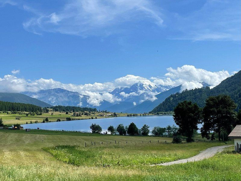
Via Chiesa, 25, 39027 San Valentino Alla Muta, Autonome Provinz Bozen - Südtirol, Italien
Camping at the lake, located at the Haidersee, 37€/N without electricity, very expensive, but great facilities, weather not so great, therefore only one night
Via Chiesa, 25, 39027 San Valentino Alla Muta BZ, Italien
46° 46' 0.9" N 10° 31' 55.5" E
46.7669130 10.5320880
• Head northeast on Via della Chiesa. Go for 46 m.
• Turn slightly right onto Via della Chiesa. Go for 70 m.
• Turn left onto Strada Statale del Passo Resia (SS40). Go for 10.4 km.
• Continue on Reschenpass (B180). Go for 46.6 km.
• Take ramp onto A12 (Inntal Autobahn) toward Innsbruck/Mils-Schönwies. Go for 8.6 km.
• Take exit 136 toward Mils/Bregenz/Imst/B171/Mils Schönwies. Go for 623 m.
• Take the 1st exit from roundabout onto Tiroler Bundesstraße (B171) toward Imst. Go for 4.5 km.
• Take the 4th exit from roundabout onto Mieminger Bundesstraße (B189) toward Reutte/Garmisch/Fernpass. Go for 1.6 km.
• Keep right toward Reutte/Garmisch. Go for 96 m.
• Continue on Mieminger Bundesstraße (B189). Go for 10.0 km.
• Take left ramp onto Fernpass Bundesstraße (B179). Go for 49.4 km.
• Continue on Grenztunnel Füssen (A7). Go for 18.0 km.
• Take exit 138 toward Nesselwang/Marktoberdorf/Seeg/Rückholz. Go for 286 m.
• Turn right onto OAL23 toward Seeg/Nesselwang. Go for 2.1 km.
• Take the 2nd exit from roundabout onto OAL23. Go for 1.3 km.
• Turn right onto Hauptstraße (St2520). Go for 960 m.
• Turn left onto Reichenbacher Straße (OAL1) toward Wertach/Bayerstetten/Reichenbach. Go for 388 m.
• Continue on OAL1. Go for 3.3 km.
• Continue on Grüntenseestraße (OA8). Go for 69 m.
• Arrive at Grüntenseestraße (OA8). Your destination is on the left.
☍
158,2 km
(2 hrs. 5 min.)
Day
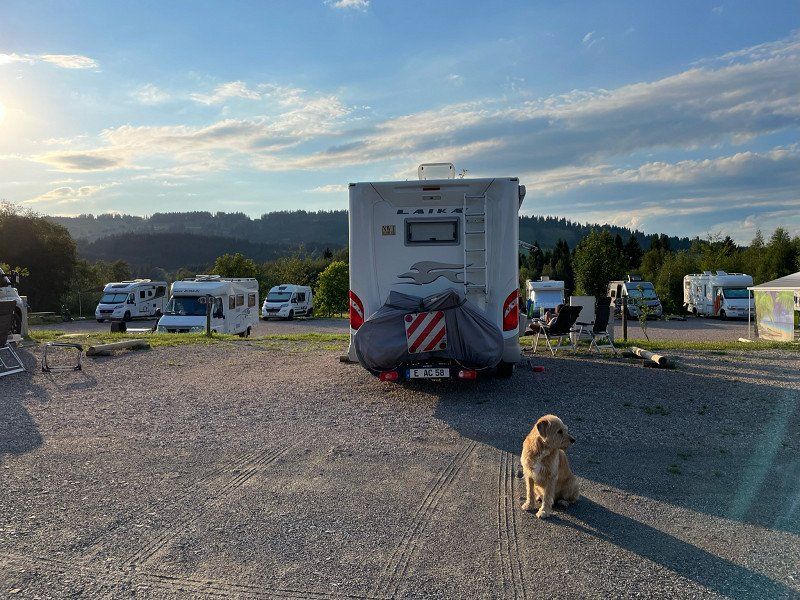
Grüntenseestraße 44, 87497 Wertach, Deutschland
Parking space at Grüntensee, 12 €/N without electricity
Hike around the lake, bike ride to Rotachsee
47° 36' 37.6" N 10° 26' 59.2" E
47.6104567 10.4497716
• Head northeast on Grüntenseestraße (OA8). Go for 69 m.
• Continue on OAL1. Go for 3.3 km.
• Continue on Reichenbacher Straße (OAL1). Go for 388 m.
• Turn left onto St2520. Go for 2.5 km.
• Take the 1st exit from roundabout onto B310 toward A7/Kempten. Go for 2.2 km.
• Turn right and take ramp onto A7. Go for 103 km.
• Take exit 120 toward Stuttgart/Ulm onto A8. Go for 101 km.
• Continue on A8 toward Karlsruhe/Basel/Leonberg-West. Go for 53.8 km.
• Take the exit toward Frankfurt a.M./Mannheim/Karlsruhe/Landau (Pfalz) onto A5 (Autobahndreieck Karlsruhe). Go for 105 km.
• Continue on E35 (Darmstädter Kreuz) toward Köln/Wiesbaden/Mainz/A67. Go for 948 m.
• Continue on A67. Go for 22.2 km.
• Take the left exit toward Köln/Wiesbaden onto A3. Go for 167 km.
• Continue on A3. Go for 47.1 km.
• Take exit 16 toward Essen onto A52. Go for 12.4 km.
• Take exit 28 toward Essen-Rüttenscheid/B224 onto L176 (Anschlussstelle Essen-Rüttenscheid). Go for 547 m.
• Keep left onto Norbertstraße toward Messe/Gruga. Go for 1.2 km.
• Turn left onto Alfredstraße (B224). Go for 1.6 km.
• Continue on Bismarckstraße (K15). Go for 1.1 km.
• Turn right onto Am Waldthausenpark toward Zentrum. Go for 120 m.
• Turn right onto Alfred-Herrhausen-Brücke. Go for 21 m.
• Continue on Am Waldthausenpark. Go for 138 m.
• Turn right onto II. Hagen. Go for 31 m.
• Turn left onto Theaterplatz. Go for 55 m.
• Turn left onto I. Hagen. Go for 80 m.
• Arrive at I. Hagen.
☍
625,6 km
(5 hrs. 41 min.)
Day
Day
Day
Essen, Deutschland
After 7 weeks our first no-limited tour comes to an end. It will definitely not be our last.
Of course, we have to say again that more time should have been spent on the individual regions. Normandy in particular is worth a separate trip. We had originally planned this as a "journey in the footsteps of Commissioner Dupin". But we will definitely do this again. Corsica hasn't seen the last of us either. And then there is also Sardinia ....
51° 27' 20.3" N 7° 0' 41.6" E
51.4556432 7.0115552