Unfortunately, we don't support your browser (Internet Explorer) anymore, some functionalities could not work. Click here to get information on how to upgrade your browser.
Öffentlich
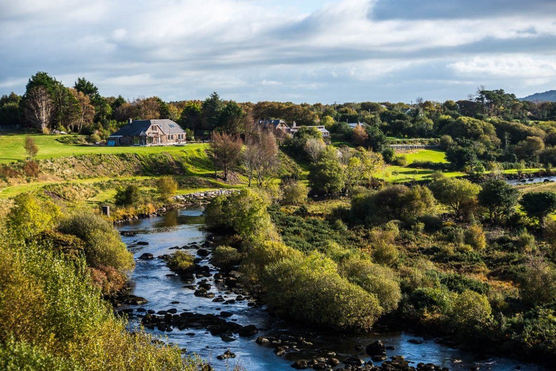
Ring of Kerry
Wegpunktliste zum Kopieren: Ring of Kerry Teilabschnitt des Wild Atlantic Ways in Irlands Westen. Empfehlung: Aufgrund der sehr engen Straßenverhältnisse wird dringend empfohlen, den Ring entgegen dem Uhrzeigersinn zu befahren. Hier geht´s zum dazugehörigen Erlebnisbericht: https://www.freeontour.com/articles/erlebnisberichte/roadtrip-westkuste-irland-landschaftsgenuss-am-wild-atlantic-way

freeontour
Routeninfo
173 Kilometer
0 Tage
12 Wegpunkte
Fahrzeuginformationen
Eigenes Fahrzeug hinzufügen
Kopiert die Route und ermöglicht das Hinterlegen eines eigenen Fahrzeuges
Reisebericht
Killarney National Park Visitor Centre, Muckross Road, Dromhale, Killarney, County Kerry, Irland
Killarney House and Gardens, Muckross Rd, Dromhale, Killarney, Co. Kerry, V93 HE3C, Irland
Zeige in Liste
Auf Karte anzeigen
Killarney National Park Visitor Centre, Muckross Road, Dromhale, Killarney, County Kerry, Irland
Killarney House and Gardens, Muckross Rd, Dromhale, Killarney, Co. Kerry, V93 HE3C, Irland
Killorglin, County Kerry, Irland
Dromavally, Killorglin, Co. Kerry, Irland
Zeige in Liste
Auf Karte anzeigen
Killorglin, County Kerry, Irland
Dromavally, Killorglin, Co. Kerry, Irland
Glenbeigh, County Kerry, Irland
Kilnabrack Upper, Glenbeigh, Co. Kerry, Irland
Zeige in Liste
Auf Karte anzeigen
Glenbeigh, County Kerry, Irland
Kilnabrack Upper, Glenbeigh, Co. Kerry, Irland
Cahersiveen, County Kerry, Irland
Carhan Lower, Caherciveen, Co. Kerry, Irland
Zeige in Liste
Auf Karte anzeigen
Cahersiveen, County Kerry, Irland
Carhan Lower, Caherciveen, Co. Kerry, Irland
Waterville, County Kerry, Irland
Waterville, An Coireán, Co. Kerry, Irland
Zeige in Liste
Auf Karte anzeigen
Waterville, County Kerry, Irland
Waterville, An Coireán, Co. Kerry, Irland
Caherdaniel, County Kerry, Irland
Ballycarnahan, Caherdaniel, Co. Kerry, Irland
Zeige in Liste
Auf Karte anzeigen
Caherdaniel, County Kerry, Irland
Ballycarnahan, Caherdaniel, Co. Kerry, Irland
Sneem, County Kerry, Irland
Inchinaleega East, Sneem, Co. Kerry, Irland
Zeige in Liste
Auf Karte anzeigen
Sneem, County Kerry, Irland
Inchinaleega East, Sneem, Co. Kerry, Irland
Kenmare, County Kerry, Irland
Kenmare, Co. Kerry, Irland
Unbekannt, Irland
R568, Eirk, Co. Kerry, Irland
Killarney, County Kerry, Irland
Killarney, Co. Kerry, Irland
Route
Neuestes zuerst
Killarney National Park Visitor Centre, Muckross Road, Dromhale, Killarney, County Kerry, Irland
- 52.0568 -9.5083
- 52° 3' 24.6" N 9° 30' 29.7" W
Killarney House and Gardens, Muckross Rd, Dromhale, Killarney, Co. Kerry, V93 HE3C, Irland
Auf Karte anzeigen
21,4 km
19 Min.
Killorglin, County Kerry, Irland
- 52.1064 -9.7843
- 52° 6' 22.9" N 9° 47' 3.6" W
Dromavally, Killorglin, Co. Kerry, Irland
Auf Karte anzeigen
12,6 km
11 Min.
Glenbeigh Village, KY, Ring of Kerry, Irland
Auf Karte anzeigen
0,6 km
Glenbeigh, County Kerry, Irland
- 52.0562 -9.9403
- 52° 3' 22.3" N 9° 56' 25.3" W
Kilnabrack Upper, Glenbeigh, Co. Kerry, Irland
Auf Karte anzeigen
26,9 km
23 Min.
Cahersiveen, County Kerry, Irland
- 51.9478 -10.2209
- 51° 56' 52.1" N 10° 13' 15.3" W
Carhan Lower, Caherciveen, Co. Kerry, Irland
Auf Karte anzeigen
2,1 km
3 Min.
Cahirciveen, KY, Ring of Kerry Coast, Irland
Auf Karte anzeigen
15,1 km
12 Min.
Waterville, County Kerry, Irland
- 51.8295 -10.1745
- 51° 49' 46.1" N 10° 10' 28.4" W
Waterville, An Coireán, Co. Kerry, Irland
Auf Karte anzeigen
13,8 km
14 Min.
Caherdaniel, County Kerry, Irland
- 51.769 -10.0995
- 51° 46' 8.4" N 10° 5' 58.3" W
Ballycarnahan, Caherdaniel, Co. Kerry, Irland
Auf Karte anzeigen
20,9 km
19 Min.
Sneem, County Kerry, Irland
- 51.8374 -9.8983
- 51° 50' 14.6" N 9° 53' 54" W
Inchinaleega East, Sneem, Co. Kerry, Irland
Auf Karte anzeigen
26,6 km
24 Min.
Kenmare, County Kerry, Irland
- 51.8801 -9.5835
- 51° 52' 48.4" N 9° 35' 0.7" W
Kenmare, Co. Kerry, Irland
Auf Karte anzeigen
9,9 km
10 Min.
Unbekannt, Irland
- 51.9385 -9.6576
- 51° 56' 18.7" N 9° 39' 27.4" W
R568, Eirk, Co. Kerry, Irland
Auf Karte anzeigen
22,9 km
27 Min.
Killarney, County Kerry, Irland
- 52.0599 -9.5044
- 52° 3' 35.8" N 9° 30' 15.9" W
Killarney, Co. Kerry, Irland
Auf Karte anzeigen
Reisebericht
Killarney National Park Visitor Centre, Muckross Road, Dromhale, Killarney, County Kerry, Irland
Killarney House and Gardens, Muckross Rd, Dromhale, Killarney, Co. Kerry, V93 HE3C, Irland
Zeige in Liste
Auf Karte anzeigen
Killarney National Park Visitor Centre, Muckross Road, Dromhale, Killarney, County Kerry, Irland
Killarney House and Gardens, Muckross Rd, Dromhale, Killarney, Co. Kerry, V93 HE3C, Irland
Killorglin, County Kerry, Irland
Dromavally, Killorglin, Co. Kerry, Irland
Zeige in Liste
Auf Karte anzeigen
Killorglin, County Kerry, Irland
Dromavally, Killorglin, Co. Kerry, Irland
Glenbeigh, County Kerry, Irland
Kilnabrack Upper, Glenbeigh, Co. Kerry, Irland
Zeige in Liste
Auf Karte anzeigen
Glenbeigh, County Kerry, Irland
Kilnabrack Upper, Glenbeigh, Co. Kerry, Irland
Cahersiveen, County Kerry, Irland
Carhan Lower, Caherciveen, Co. Kerry, Irland
Zeige in Liste
Auf Karte anzeigen
Cahersiveen, County Kerry, Irland
Carhan Lower, Caherciveen, Co. Kerry, Irland
Waterville, County Kerry, Irland
Waterville, An Coireán, Co. Kerry, Irland
Zeige in Liste
Auf Karte anzeigen
Waterville, County Kerry, Irland
Waterville, An Coireán, Co. Kerry, Irland
Caherdaniel, County Kerry, Irland
Ballycarnahan, Caherdaniel, Co. Kerry, Irland
Zeige in Liste
Auf Karte anzeigen
Caherdaniel, County Kerry, Irland
Ballycarnahan, Caherdaniel, Co. Kerry, Irland
Sneem, County Kerry, Irland
Inchinaleega East, Sneem, Co. Kerry, Irland
Zeige in Liste
Auf Karte anzeigen
Sneem, County Kerry, Irland
Inchinaleega East, Sneem, Co. Kerry, Irland
Kenmare, County Kerry, Irland
Kenmare, Co. Kerry, Irland
Unbekannt, Irland
R568, Eirk, Co. Kerry, Irland
Killarney, County Kerry, Irland
Killarney, Co. Kerry, Irland
Kommentare (0)
Kommentare von Freeontour-Usern